
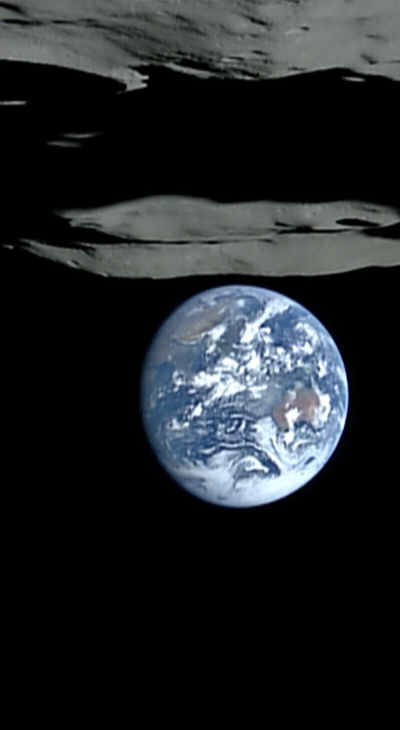
"Head's Up," for the earthbound, Kaguya's now-iconic earthset "over" Malapert Massif, permanently darkened Shoemaker and Shackleton Craters, with the Moon's south pole on its rim, one of many areas now better known because of Japan's first lunar orbiter. [JAXA/NHK/SELENE]
The Japan Aerospace Exploration Agency (JAXA) released data from the lunar explorer "KAGUYA" (SELENE) (L2 products) during the nominal operation phase (from December 21, 2007 to October 31, 2008) to the public through the Internet.
L2 products are calibrated/validated processed data from KAGUYA science mission instruments. By using the L2 products, researchers all over the world are expected to advance the scientific analysis and applicability investigation of the Moon.
"KAGUYA 3D Moon NAVI" services, which can show KAGUYA data using a three-dimension geographic information system (WebGIS) through the Internet, have also commenced. The developed software is based on NASA "World Wind" and the KAGUYA's images and data can be displayed using the 3D map projection function. It is necessary to download and install the free software. Please refer to the following homepage for details.
L2 products during the extended operational phase (until June 2009) are scheduled to be released after processing and calibration/validation are finished.
[ KAGUYA(SELENE) Data Archive ]
https://www.soac.selene.isas.jaxa.jp/archive/index.html.en
[ KAGUYA 3D Moon NAVI ]
http://wms.selene.jaxa.jp/3dmoon/index.html
Details HERE.
No comments:
Post a Comment