Showing posts with label Kaguya (Selene). Show all posts

Thursday, September 4, 2014

Secondary scatter over Haret C and the SPA interior

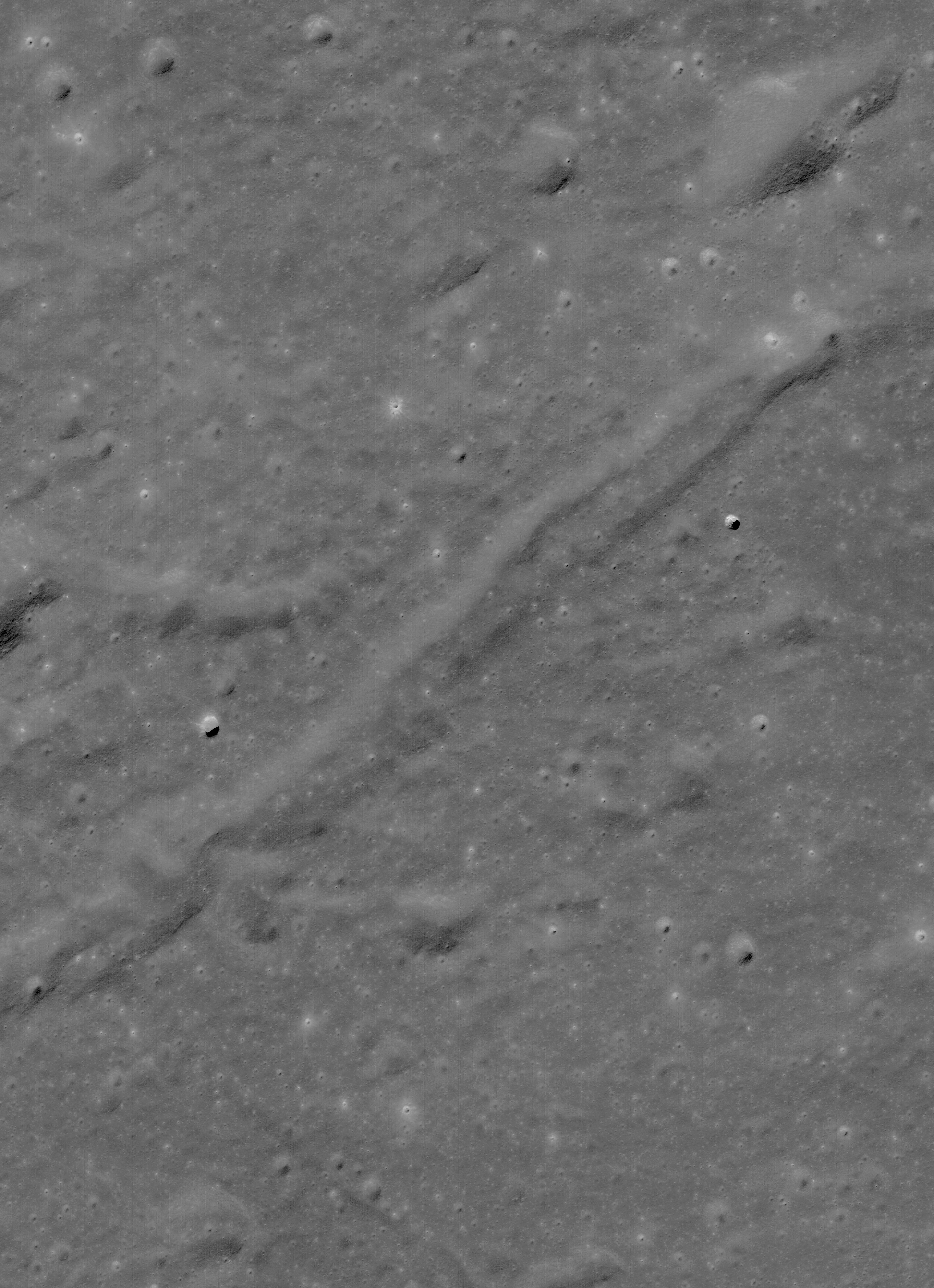
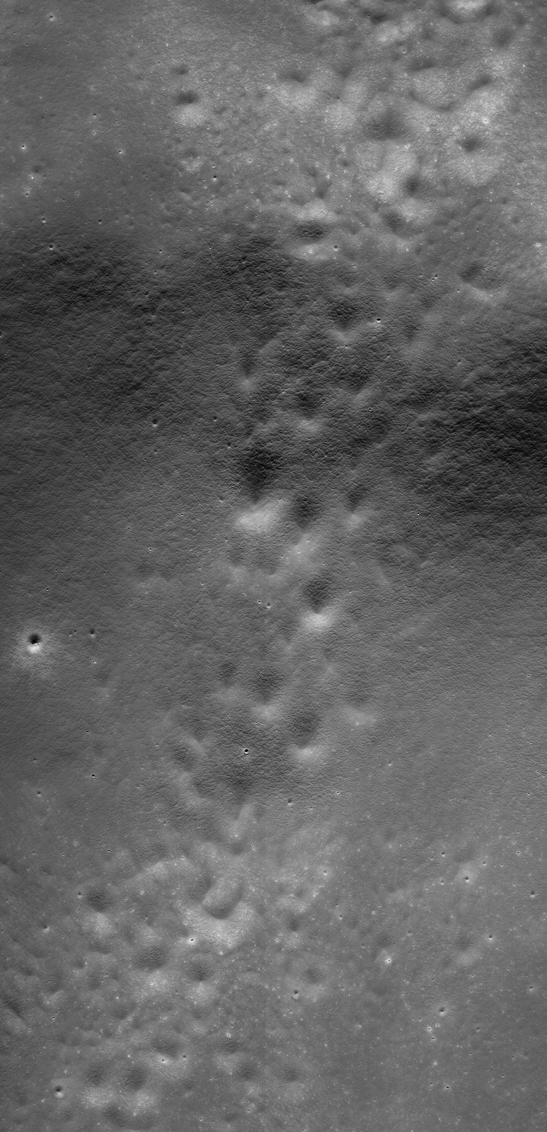
A stream of secondary craters crosses the rim of Haret C (28.47 km; 57.6°S, 186.3°E), stretching from the northeast exterior, southeast into the interior of the crater, deep within the South Pole-Aitken impact basin. 6.52 km-wide field of view from LROC NAC mosaic M1163623161LR, LRO orbit 23388, August 25, 2014; 56.75° incidence, resolution 68 cm from 63.63 km over 57.6°S, 185.26°E [NASA/GSFC/Arizona State University].
H. Meyer
LROC News System

Closely clustered or overlapping craters of similar size and morphology are likely secondary craters.

Secondary craters form when an impactor hits the surface (forming the primary crater) and throws out blocks of material that proceed to form their own craters (secondaries) as they hit the surface.

Sometimes, secondary craters can be difficult to identify if they do not occur in groups. Because craters are used to estimate the age of a surface (a process called crater counting), it is important that scientists are able to identify secondary craters.

Thankfully, in the case of Haret C, the secondary craters stand out from primary craters due to their proximity to each other. Random impacts typically do not form clusters like those draped over Haret C (28.47 km; 57.6°S, 186.3°E) .

A quick look at Haret C made possible by the international burst of lunar exploration briefly inspired by interest in the run-up to the Constellation program. The crater chain is easy enough to see in the medium resolution global albedo mosaic swept up from Chang'e-2. And the basics of the ranges and elevations of the region are displayed using the LROC Quickmap service.
Within high resolution images, smaller craters are used for crater counting. However, secondary craters become more common at smaller diameters introducing a problem for crater counters if the secondaries cannot be distinguished from primary craters. Secondaries counted as primaries result in higher crater counts per unit area, which in turn result in age estimates that are older than the true age of the surface.

Haret C does not dominate, but it is easy to pick out near the center of this HDTV still (larger view HERE) from Japan's lunar orbiter Kaguya (SELENE-1) in 2008. There are two other stills where Haret C and its crater chain are visible in context with central South Pole-Aitken basin and it's larger neighbors Bose (92.5 km; 53.95°S, 190.63°E) and Bhabha (70.52 km; 55.49°S, 194.69°E), HERE and HERE [JAXA/NHK/SELENE].
A key science goal is coming to a better understanding of the morphology or abundance of secondaries relative to primary craters so that more accurate age estimates can be made for smaller, younger terrains: especially important for panning at the scale of the NAC images for future missions to the Moon.

Seven minutes of video from GRAIL-A (Ebb) during orbit 1902 in 2012. Using the student-directed Forward MoonKAM video camera we can close in on the secondary crater chain at Haret C looking north from a perspective beginning at 30 km rising to 41 km over the surface at the end of the sequence. Starting in the polar latitudes of the southern farside the compressed view quickly passes up over the enigmatic interior of South Pole-Aitken basin, over Antoniadi (137.91 km; 69.3°S, 186.94°E, home of the Moon's lowest elevation) north 22° following the meridian that crater shares with Haret C [NASA/JPL/UCSD/SRSC].
Explore the full-width NAC mosaic HERE. Do you see any primary craters in the mix?

Related Posts:

Thursday, May 15, 2014

Earth rising

The vastness of space, and the inviting terra firma of Earth and Moon. LROC Featured Image, May 7, 2014. LROC WAC M1145896768C, LRO orbit 20898, February 1, 2014 [NASA/GSFC/Arizona State University].
Paul D. Spudis
The Once and Future Moon
Smithsonian Air & Space

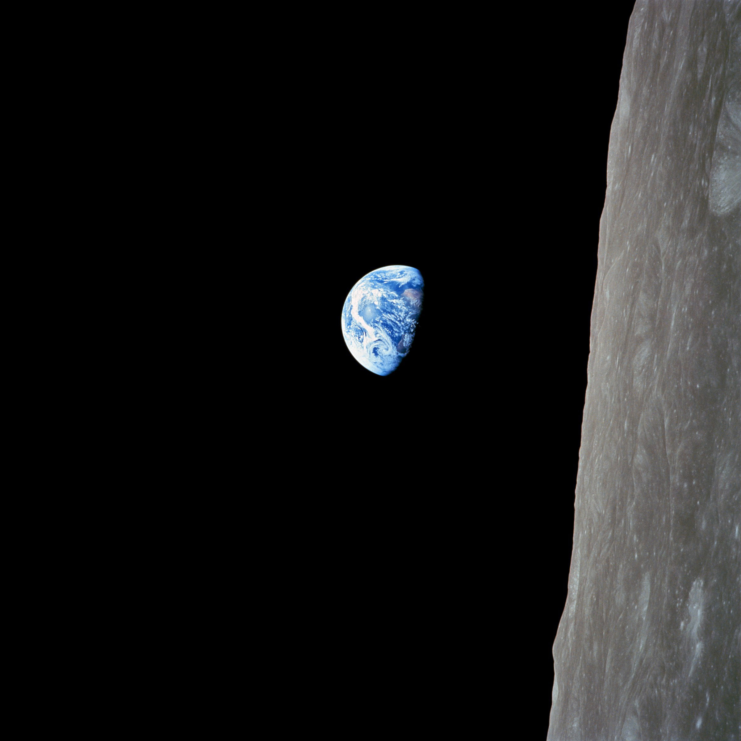
The LRO Camera Team recently released a newly obtained, beautiful image of the Earth above the north pole of the Moon.  In the history of lunar exploration, Earthrise photos have always been widely displayed and admired. Capturing the iconic image of a magnificent blue and white Earth hanging over the barren, gray surface of the Moon is one of the most memorable moments of man’s first flight to the Moon by Apollo 8 in December 1968.

This picture graced the covers of newspapers and magazines everywhere; it inspired a million words of prose and created the modern environmental movement as we know it. Few single images have had such pervasive and lasting power.

Apollo 8's overview effect: Iconic Earthrise image, AS08-14-2383, Bill Anders' serendipitous photograph of Earth as the first manned flight to the Moon swung around from the farside, December 24, 1968 [NASA/JSC].
The Apollo 11 crew landed on the lunar surface a few months after that Earthrise photo was circulated. During this and subsequent missions (all on the central near side of the Moon), it was reported by the media that Earth always appears stationary in the same part of the sky as seen from the Moon’s surface.

In November 1969, the Apollo 12 crew put up a large inverted umbrella antenna to improve communication data rates from the lunar surface; it had to be set-up and aligned, but once pointed at Earth, it remained pointed at it forever.

Simulated time-lapse view of Earth from the vicinity of the Moon's north pole, where the significance of the Moon's libration creates changes in a notional viewers perspective. Earth appears to swing through a Lissajous figure in the sky. Three lunar days are squeezed into 1:45 using Celesta.

Because the Moon orbits the Earth and is in synchronous rotation with its orbital period, we always see the same side.  Hence, there is a near side (the hemisphere we see from Earth) and a far side (the side we cannot see from Earth; it is often mistakenly called the “dark side”).

A consequence of this synchronous rotation is that from the Moon, the Earth appears stationary in the sky, just as the hub of a bicycle wheel remains stationary from the viewpoint of one of its spokes. Thus, while the Sun rises and sets according to the slow rotation rate of the Moon (one complete rotation every 708 hours, half day and half night), the Earth is always in the same spot in the sky. Of course, because it is illuminated by the Sun, it changes its phase on the same timescale as does the Moon as seen from Earth, although reversed (a full Moon on Earth is a new Earth from the Moon and vice versa.)  From the far side of the Moon, one does not see the Earth at all.

Are spectacular views of Earthrise only visible from spacecraft in orbit about the Moon? Not quite.

Two points about the Moon’s orbit make the story a bit more complicated. First, the Moon’s orbit around the Earth is not circular but elliptical, its distance ranging from 363,000 km up to 405,000 km from the Earth. Second, the plane of the Moon’s orbit is inclined about 5 degrees to the ecliptic (the plane of the Earth-Moon system’s orbit around the Sun). These two facts mean that the Moon librates, or “wobbles” both left and right (an effect of its elliptical orbit) and up and down (an effect of the inclination of its orbital plane). These librations are not overwhelmingly significant, but result in some interesting effects around the limb of the Moon – the great circle made up by the 90 degrees east and west longitude lines, including both poles.

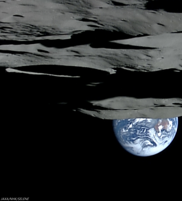
Earthset, from 1080p video captured from Japan's lunar orbiter SELENE-1 (Kaguya) October 31, 2007, as spacecraft and camera, in polar orbit, began its track north from the south pole (on the rim of Shackleton crater, center left) over the Moon's farside, leaving Earth to set behind Malapert massif, a nearside fragment of the rim of immense South Pole-Aitken impact basin [JAXA/NHK/SELENE].
The Earth as seen from the Moon is about 2 degrees in angular width (about 4 times the apparent diameter of the Moon and Sun as seen from Earth). Earth’s disk is roughly equivalent to the size of a quarter held out at arm’s length; the Moon’s apparent disk is pea-sized. Because of the Moon’s longitudinal libration, the “limb” areas near the 90 degree meridians are sometimes visible to Earth and other times not. Thus, the Earth will sometimes appear in the sky and sometimes be hidden below the Moon’s horizon – in other words, an observer along this line of longitude will see an Earthrise and an Earthset.

The longitudinal libration is about 8 degrees, so the observer on the lunar limb would see the Earth slowly rise above the horizon and clear it by its apparent diameter, then slowly sink below the horizon by the same amount. That Earthrise will be slow indeed – it will take a couple of days for the full disk of the Earth to rise above the horizon. This cycle would repeat on a monthly timescale, as the Moon completes one revolution around the Earth.

Similarly, one would also see the Earth rise and set at the poles of the Moon, although to a different magnitude. The polar view is almost completely dominated by the latitudinal libration, caused by the inclination of the Moon’s orbital plane. This variation is about 6.5 degrees (it includes the Moon’s spin axis obliquity of 1.5 degrees) and would vary on a similar monthly timescale. These variations will become important if future lunar inhabitants live at the poles, as I think likely. As the Earth will sometimes be out of direct view, it is likely that we will depend on relay satellites for continuous communication. Polar inhabitants will also see a “different” Sun from what they’re accustomed to on Earth – at the lunar poles, the sun rotates around the horizon, rather than rising and setting.

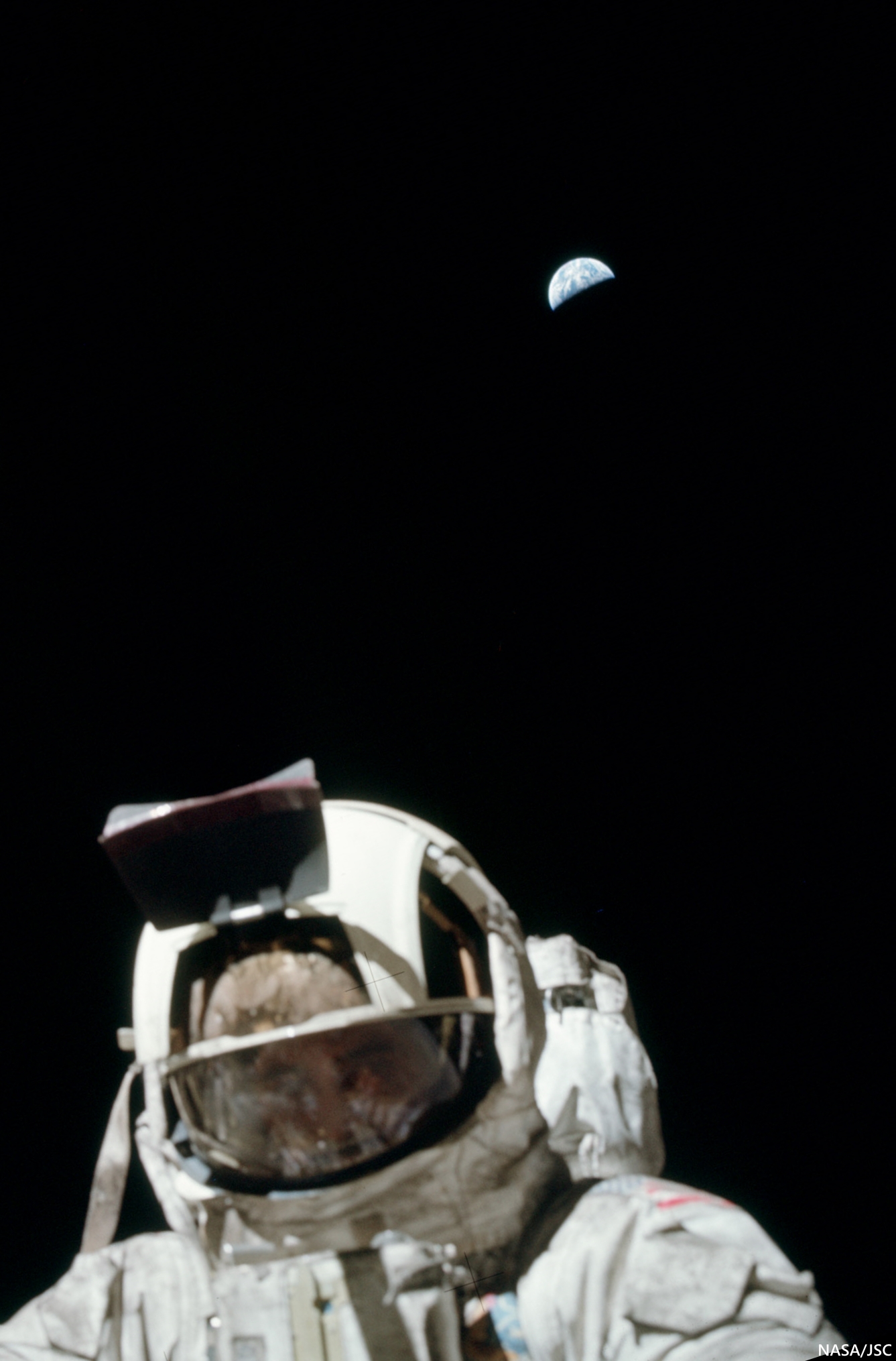
Cernan and Earth. At Taurus Littrow, Earth maintains its position. Ground controllers did occasionally admonished Apollo 17 Cmdr. Gene Cernan's partner Jack Schmidt for lifting his solar visor to get a better look at a rock, from time to time, during the last walks on the Moon. But at this point, however, as he traded poses with Schmidt using Earth as a backdrop, Cernan did briefly lift his visor halfway, allowing posterity an atypical view of an actual human face on the Moon in December 1972 (AS17-134-20471) [NASA/JSC].
Thus, there are places on the Moon from which we can stand and contemplate the sheer beauty and magnificence of a slowly rising Earth. Given the sea change in global perspective provided by the famous Earthrise picture taken by the Apollo 8 crew almost fifty years ago, what societal impacts will occur when a human being stands on the lunar surface and watches the Earth slowly rise above the horizon? I suspect that a similar shift in planetary perspective will occur. If history is any guide, such a shift will have profound psychological and political implications  – both positive and negative – in our reach for the stars.

Dr. Paul D. Spudis is a senior staff scientist at the Lunar and Planetary Institute in Houston. This column was originally published by Smithsonian Air & Space online, and his website can be found at www.spudislunarresources.com. The opinions he expressed here are his own, but these are better informed than most.

Sunday, July 7, 2013

Twin mare pit craters in the Lake of Death

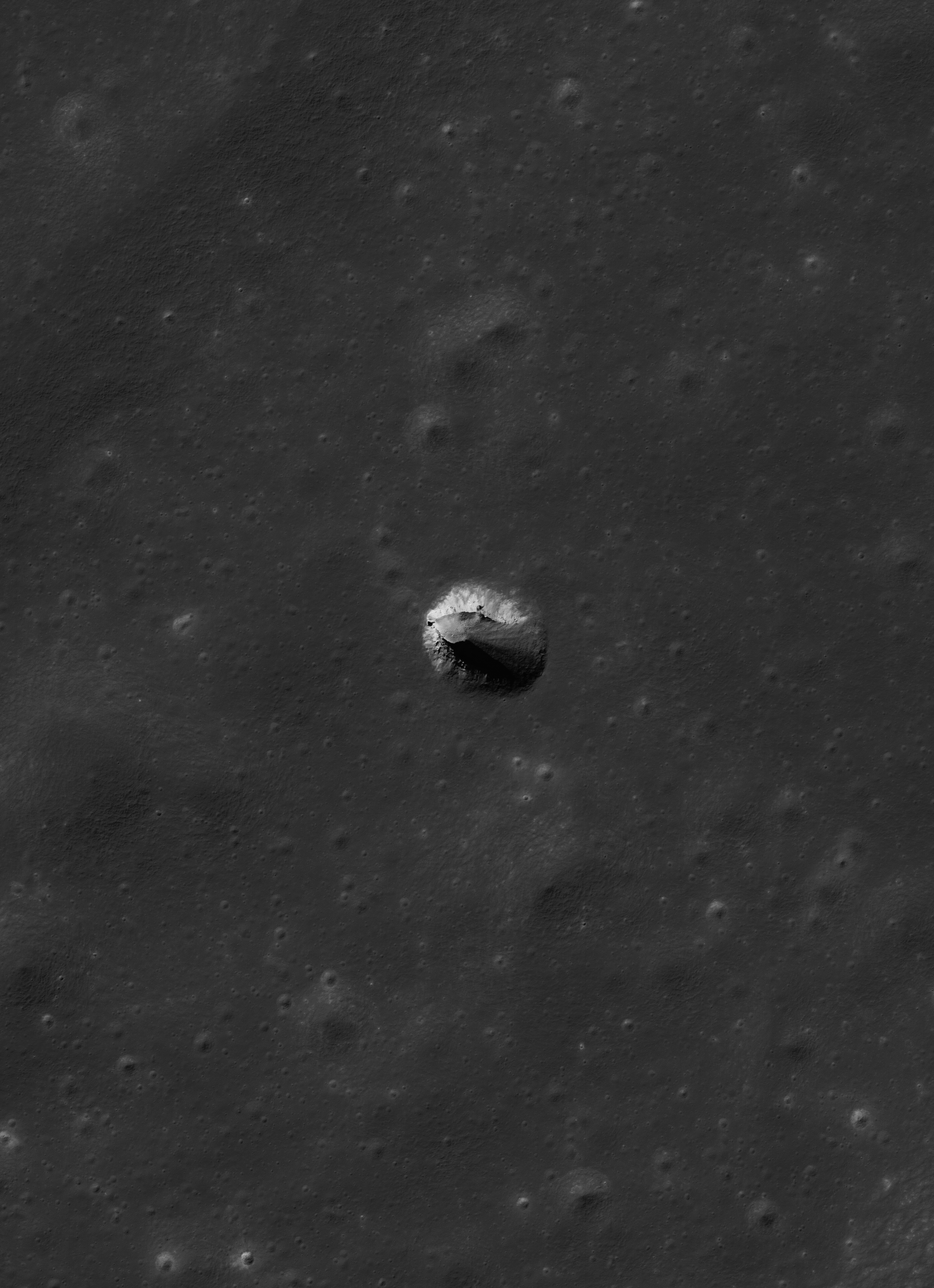
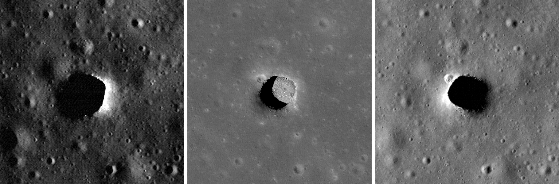
Layers of terrain, the foundation under the heavily gardened upper surface of Lacus Mortis, "the Lake of Death," hints this feature, averaging 228 meters across, was, or is, a "pit crater," closely related to similar structures (discovered in the 21st century) near the Marius Hills, in Mare Tranquillitatis, Mare Ingenii and elsewhere. Though the east wall collapsed there may yet be an opening below a ledge. LROC Narrow Angle Camera (NAC) observation M126759036L, orbit 3814, April 24, 2010; 49.4° angle of incidence, resolution 0.5 meters from 45.56 km [NASA/GSFC/Arizona State University].
Joel Raupe
Lunar Pioneer

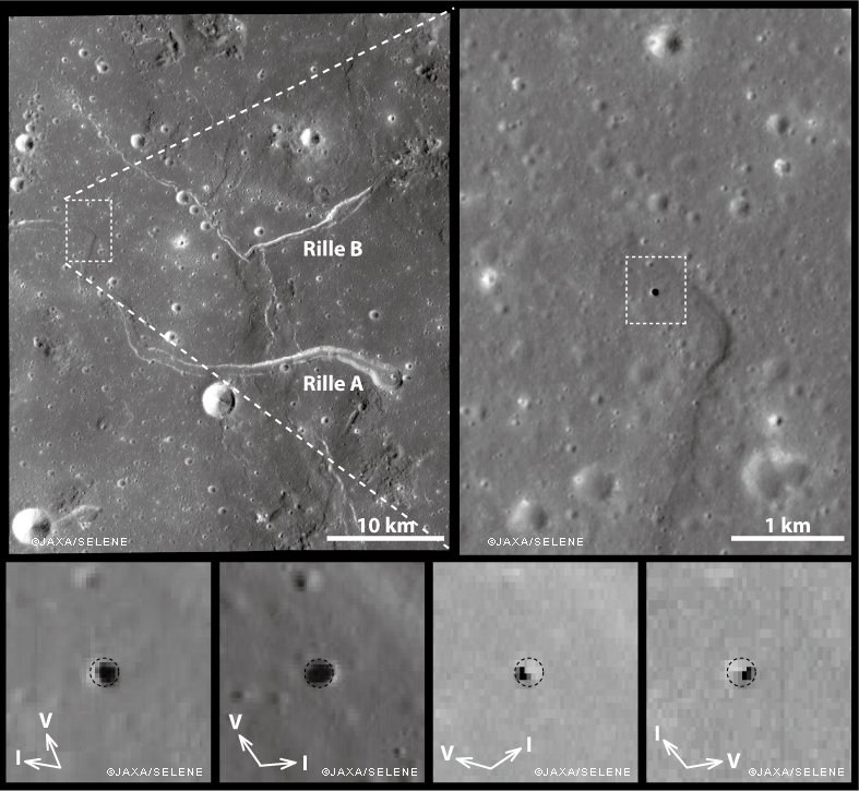
It was something of a sensation just a few years ago when Kaguya (SELENE-1) images unveiled a "pit crater," an honest to goodness opening into a sublunarean world.

Ant this new feature was found right in the middle of the long-observed and studied channel of the unofficially named "Sinuous Rille A," in the Marius Hills of Oceanus Procellarum. What a difference, many thought, high resolution photography would make of our knowledge of the lunar surface.

And they were not disappointed. Most of what we now know of the lunar surface is entirely a product of the 21st century, largely a pay off from "precursor" missions vital to the success of a now-scrubbed program ahead of a return to the surface of "extended human activity" later this decade.

Junichi Haruyama and his colleagues reported their findings in Geophysical Research Letters in 2009, having captured the Marius Hills Pit at resolutions as high as 6 meters per pixel using the Kaguya Terrain Camera and Multiband Imager, as discussed by LROC principle investigator Marc Robinson, March 1, 2010.

The same partially collapsed, or filled-in, pit crater in the Rimae Burg region of Lacus Mortis (44.96°N, 25.62°E), from an oblique LROC NAC mosiac M1105701957LR, with spacecraft slewed -41.94° off nadir, orbit 15246, October 24, 2012; 59.78° incidence angle, 2 meters resolution from 155.54 km over 44.92°N, 25.52°E. Explore a full-resolution version HERE [NASA/GSFC/Arizona State University].
Not many months after the controlled impact of Kaguya the Lunar Reconnaissance Orbiter began its long and productive tour in lunar orbit.

Early in that still-ongoing mission the LROC team at Arizona State University released their own high-resolution NAC images of the Marius Hills Pit, and under a variety of lighting angles, while announcing the discovery of two additional, even larger and more distinctive "pits" in the western interior of Mare Ingenii and the well-preserved example near Sinas J, not far from the vent structures at the west terminus of Rupes Cauchy, in the middle of Mare Tranquillitatis.

These new images left little doubt that significant underground areas existed on the Moon, though how far these sublunarean areas stretched beyond their exposed "skylights," the true scope of the Moon's near-surface underground world, must remain a mystery for some time to come.

M122041942LR-NSJ-0503-58b-1986x2739
For a while mare pit craters seemed to be solitary creatures, all alone where they have now been extensively photographed. But the partially filled examples in Lacus Mortis might be near "twins." The 250 meter-wide pit crater above is only 9.7 km southwest of its neighbor (in the first image above - a 13 km walk) from 44.80857°N, 25.21157°E. The view above is from a kilometer-wide field of view from LROC NAC mosaic M122041942LR, orbit 3119, March 1, 2010; 0.5 meters resolution from 46.11 km. (Download the very large original mosaic HERE) [NASA/GSFC/Arizona State University].

These features seemed to be rare and solitary. Rough treatment of the lunar surface, aeons of steady and sometimes heavy bombardment seemed to leave very few of these openings intact. Perhaps the same may be true of extended "lava tubes," and other tantalizing, hoped-for discoveries.

Planetary scientists and geologists have studied the interior walls of these structures. The LROC team has released a high volume of imagery of the Tranquillitatis pit crater, for example, and attempts have been made to map the history of lava inundations recorded in the exposed layers.

Following discovery of three, widely dispersed pit craters at Marius, Tranquillitatis and Ingenii, at least two more smaller and much less distinct examples have turned up Mare Fecunditatis and Mare Smythii.

The unique Natural Bridge feature of King Y is a nearly unique example of the much more widespread family of collapse and channel remnants common to impact melts, both inside and outside relatively "recent" impacts, like the northeast quadrant of the interior of Copernicus, for example, and deep inside Messier A. To distinguish these from the Marius-Tranquillitatis-Ingenii family of openings, the latter are now referred to as mare pit craters.

Far from being as widespread as melt channels and collapse pit, the Mare Pit Craters seemed to be solitary, perhaps one to a plain, if any at all. As seems common to all deep space discoveries, however, of course there had to be an exception.

M1105701957R-NSJ-0407-58b-4747x6548
"Twin" Mare Pit Craters, roughly 10 km apart (as the LM ascent stage flies) on opposite sides of the primary channel in the Rimae Burg region, west-central Lacus Mortis. This field of view is 15.72 km across, from LROC MAC mosaic M1105701957LR [NASA/GSFC/Arizona State University].
In the west central interior of the rugged Lacus Mortis plain are two near-quarter kilometer-wide pits, though both are either partially or completely filled in. They are intriguingly situated on opposite sides of a main channel north of its junction with a distinctive faulting in the Rimae Burg vicinity, northeast of the volcanoes highlighted in an LROC Featured Image (Volcanoes in the Lake of Death), August 11, 2010.

Lacus Mortis, from the LROC web-based PDS search tool, showing the prior image field of view outlined by a white rectangle. Note the concurrence with a junction zone of the fault and channel constituents of Rimae Burg [NASA/GSFC/Arizona State University].
The interior walls of the northeastern twin, shown in the first two images above, retains the kind of layering seen in the Tranquillitatis and Ingenii pits, evidence of periodic lava flooding in the remote past. This bedrock under Lacus Mortis makes for a tough roof, but over what? Have any of these mare pit craters yet been found over the deeper basins?

The east-southeast wall of the northeast pit seems to have filled in, like a forgotten entrance to a pharaoh's tomb, though the south interior stays in hard shadow at this latitude. But the north wall offers up a shadow ring where the sun's angle should be well placed for illumination, hinting at an unseen and deeper interior perhaps.

The perspective from Earth, the area of interest marked by a bright asterisk in west central Lacus Mortis, an eyebrow for the "Man in the Moon" (yellow rectangle in inset). From a First Quarter Moon montage captured April 21, 2010. Photo by Yuri Goryachko, Mikhail Abgarian, Konstantin Mororzov - ASTRONOMINSK, Minsk, Belarus.
Sadly, the southeastern twin, though apparently the "real deal," appears very degraded. Exterior regolith, heavily pounded by the steady bombardment of the micrometeorites gardening the upper three centimeters of the lunar surface every two million years, has spilled over filled the interior. Its south wall, in high latitude shadow, stays invisible in shadow, but with little visible component leading to an indication of any difference with the rest of its fine-grained interior fill.

Did these two examples of mare pit craters, perhaps the only such "twins" on the Moon, degrade more quickly because of a greater age than their more noted cousins at Tranquillitatis or Ingenii? Did the arrival of the impact that formed Burg cave them in? Is this area more prone to Moonquakes?

Related Posts:
Pit Crater in Fecunditatis (May 23, 2013)
Copernicus Collapse Pit (March 5, 2013)
Layering in Messier A (July 22, 2011)
Sublunarean Void (February 8, 2011)
New views of lunar pits (September 14, 2010)
Natural Bridge on the Moon (September 7, 2010)
Depths of Mare Ingenii (June 16, 2010)
How common are mare pit craters? (July 15, 2010)
Paul Spudis: Caves on the Moon (October 28, 2009)

Monday, April 8, 2013

The Mystery of Shackleton Crater

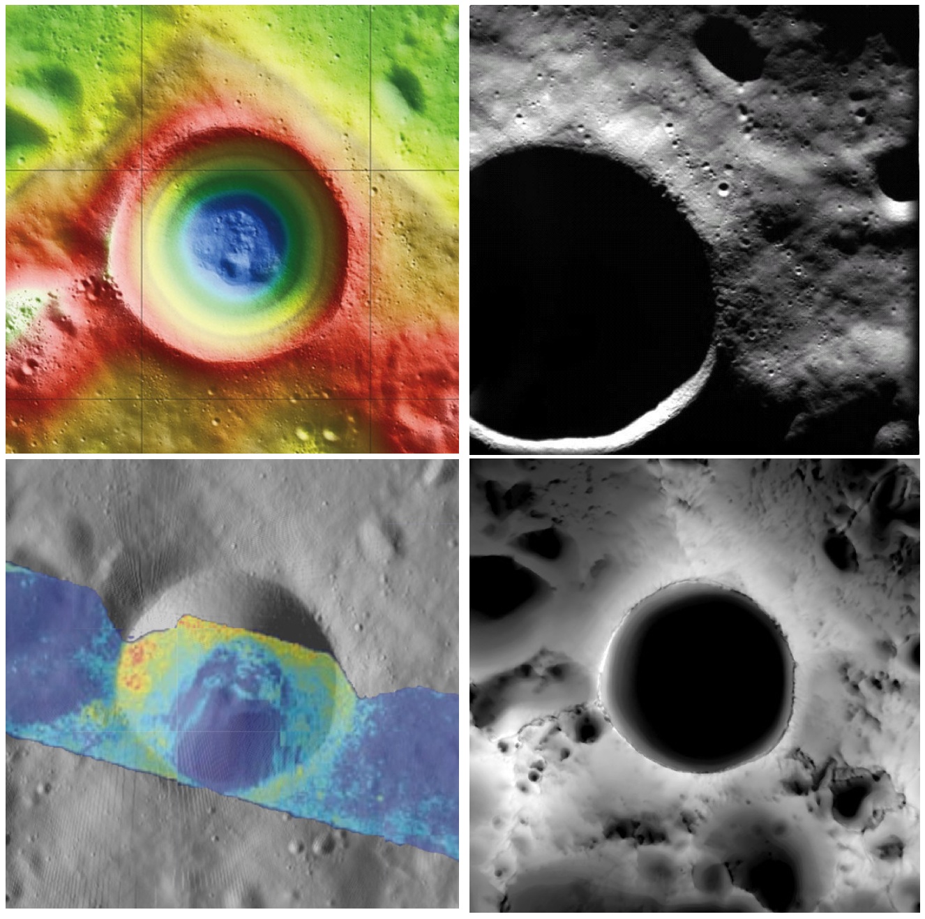
Shackleton crater, Earth's Moon. Clockwise from top left: topography from (LOLA) laser altimetry, photography from ESA SMART-1 mission, lighting map (relative isolation - brighter indicates longer periods of illumination) from LROC data, Mini-RF Circular Polarization Ratio (CPR) image draped over shaded relief. The crater is about 20 km across.
Paul D. Spudis
The Once and Future Moon
Smithsonian Air & Space


Though unremarkable in appearance compared to the roughly 4,000 craters on the Moon in its size range, the 20 km diameter crater Shackleton has been the source of relentless scientific controversy for the past 20 years.  Shackleton is located at the south pole of the Moon; indeed, its near side rim is the precise location of the geographic pole itself.   Its location makes observation by Earth-based telescopes difficult and it was not well photographed by the Lunar Orbiter series (our principal source of lunar images) of the 1960s.  That all changed in 1994 with the flight of the joint DoD-NASA mission to the Moon, Clementine.

Clementine carried cameras that globally imaged the Moon in eleven visible and near-infrared wavelengths.  In addition, it mapped the surface and lighting of the poles of the Moon at uniform resolution over the course of almost three lunar days (74 Earth days).  When the Science Team first saw the south polar mosaic, the extent of darkness in the map was striking.  Because the Moon’s spin axis is close to perpendicular to the ecliptic plane, the Sun is always at the horizon at the lunar poles.  Instead of rising and setting, the Sun circles around the poles at or near the horizon.  Because of this grazing incidence, an area in a topographic depression may be in permanent shadow.  And so it appeared for Shackleton crater in the Clementine data, setting off bells in the heads of the Science Team.

Intuitive selection from HDTV still frame captured by Japan's lunar orbiter SELENE-1 (Kaguya) in 2008 shows Shackleton, with the Moon's south pole on its rim (upper left) in relation to Earth and Malapert Massif, part of the nearside rim of the ancient South Pole-Aitken impact basin, along the line of sight. Shackleton's interior and the craters between it and Malapert, are permanently shadowed interiors (PSR), unmapped before the 21st century [JAXA/NHK/SELENE].
A key controversy of the post-Apollo era was whether the lunar poles might contain water or not.  Although the Apollo samples had been studied and found to be “bone-dry,” we had not been to the poles on any Apollo mission.  We knew that any shadowed areas had to be extremely cold as well as permanently dark.  As water-bearing debris in the form of asteroids and comets constantly strike the Moon, it was thought that some of that water might get into a polar “cold trap” and would be kept there (essentially) forever – billions of years of impacting cosmic “debris” can add up.

Clementine was not configured to measure the presence of water, but a cleverly improvised experiment used the spacecraft’s data transmitter to beam radio waves into the dark regions near the poles and listen to their reflected echoes on the enormous (70 m) dish antenna of NASA’s Deep Space Network.  Interestingly, the reflections indicated an enhancement of “same sense” polarization within the (very large) resolution cell that contained Shackleton crater.  A collect of data from a nearby sunlit area (taken as an experimental control) did not show this peak.  The Clementine team interpreted the RF peak as evidence for the presence of a few percent water ice within the dark, cold interior of Shackleton crater.  The media quickly spread the startling news about water on our “bone-dry” Moon.

Shackleton, as seen in a joint 70 mm radar experiment collected by radio telescopes at Greenbank and Arecebo during a favorable libration opportunity in 2006.
Such a controversial conclusion did not go unchallenged.  Some in the radar community argued that abundant wavelength-sized rocks on the surface were the source of the enhanced same sense reflection.  Since the lunar surface is indeed rocky, this interpretation could not be ruled out.

Then a few years later, the Lunar Prospector (LP) mission found an enhancement of hydrogen concentration at both poles of the Moon; as hydrogen is a major constituent of water, the idea ice exists in the dark areas gained credence and has lead to a decade-long scientific search (using a variety of techniques) for lunar polar ice.  Though many areas near the poles were studied in detail, attention continued to be drawn back to Shackleton and the area near the south pole.

From studying Clementine images, we discovered that part of the rim crest of Shackleton is one of the most sunlit areas on the Moon.  Now we had a double-attraction: constant sunlight with water ice nearby.  At a press briefing in 1996, I called this area of water and sunlight “the most valuable piece of real estate in the Solar System.” Nothing found subsequently has changed my mind on that judgment.

So what have we learned about Shackleton lately?  Many different, new sensors have flown to the Moon in the last few years, including radar, ultraviolet (UV) imaging, laser reflections, and low-light level imaging.  And yet again, Shackleton crater continues to confound us with contradictory evidence, both for and against the presence of water ice in its interior.

In 2009, the question regarding the presence of water ice somewhere near the lunar south pole was answered when the LCROSS impactor threw up a cloud of water vapor and ice particles during its collision with the floor of the nearby crater Cabaeus.  Spectral mapping instruments on three different spacecraft (Chandrayaan-1, Cassini, and EPOXI) documented the presence of adsorbed water on the lunar surface, increasing in concentration with latitude toward both poles.  A small impact probe flown by India (MIP) passed through a water vapor zone in the exosphere just above the lunar south pole.  And radar images from Mini-RF, our radar imaging experiment on both Chandrayaan-1 and Lunar Reconnaissance Orbiter (LRO), found evidence of high same sense reflections (just as Clementine had suggested in 1994) within the interior of Shackleton crater.

LRO Mini-RF instrument radar data indicate the walls of Shackleton crater may, indeed, hold ice, confirming exacting measurements of laser altimeter (LOLA) point brightness studies revealed in June. Actual observations (CPR) are compared to calculated radar values for 0.5% to 10% ice. Illustration to post "Mini-RF adds to evidence of ice on Shackleton walls," September 1, 2012 [NASA ].
These new lines of supporting evidence were countered by Japanese researchers, whose Kaguya spacecraft imaged the interior of the crater and found morphology similar to other lunar craters in the same size-class.  But no one had ever claimed that the interior of Shackleton was a skating rink of pure ice – the lunar polar ice is partly covered by waterless dust and mixed with an unknown amount of dry regolith.

Interpretation of the new data continues to vex us.  The LOLA (laser altimeter) team on LRO recently published a paper that documents the high reflectivity (at 1 micron wavelength) of the walls of Shackleton.  Although the team’s favored interpretation is that this is caused by a constant exposure of fresh material on a steep slope, they also note that it is consistent with the presence of water ice on the walls of the crater.

In addition, a team analyzing neutron spectrometer data from both LP and LRO found evidence in the fast neutron data (never before analyzed) that water in the interior of Shackleton is a possible explanation for its signal.  Detailed analysis of the Mini-RF data for Shackleton corrected for its steep wall slopes and found that the presence of 5-10 wt.% water there provides the best model fit to the observed data.  Newly obtained UV images from LRO show the existence of water frost in the interiors of the craters Haworth and Shackleton, and the neutron detector on LRO shows enhanced hydrogen within both Shoemaker and Shackleton craters.  The Japanese team from Kaguya continue to insist that the no-ice interpretation is the correct one.

So we are left with a mystery.  Some evidence is pro-ice and some is contra-ice.  I find it interesting that for most of the investigators, new data does not necessarily change any minds, but tends to be interpreted in a way most favorable to their previously published ideas.  This should not be terribly surprising; the people who have argued for some specific interpretation presumably did so for good reasons and desire hard and clear-cut evidence to the contrary before abandoning a previously held position, one no doubt reached after much thought and soul-searching.

Less so, but still-mysterious Shackleton, "twice as deep as the Grand Canyon," from "Tour of the Moon," a 2:30 video prepared by the Science Visualization Studio (SVS) at Goddard Space Flight Center in 2012 [NASA/GSFC/SVS].
The way to unravel the water-ice mystery is to go to the surface of the lunar south pole (or both poles) and measure the composition of the surfaces in question.  Getting a definitive answer about the nature of lunar water would be game changing.   Some say the bigger mystery is:  Why hasn’t the United States sent a rover to the south pole of the Moon to take a closer look?

Originally published April 8, 2013 at his Smithsonian Air & Space blog The Once and Future Moon, Dr. Spudis is a senior staff scientist at the Lunar and Planetary Institute. The opinions expressed are those of the author but are better informed than average.

Related Posts:
Mini-RF adds to evidence of ice on Shackleton walls (September 1, 2012)
Shackleton harbors ice after all (June 12, 2012)
1000 Day Anniversary of LROC Imaging (March 27, 2012)
Shackleton on a Summer's Day (March 26, 2012)
Shadowed fluffy lunar frost detected in starlight (January 14, 2012)
Shackleton: Out of the Shadows (September 17, 2009)

Wednesday, October 3, 2012

Oblique views of Moon's highest and lowest places

East rim of 21 km Engel'gardt crater (5.69°N, 200.29°E), north of Korolov, basin on the Moon's farside, host to the Moon's highest elevation above the global mean (10,761 meters). LROC Narrow Angle Camera (NAC) M176265113LR, orbit 11111, November 18, 2011; foreground resolution 4.6 meters. A spectacular oblique observation, from spacecraft and cameras slewed -76.3° off nadir. Beyond the high point, first identified by Japan's Kaguya (SELENE-1), the east wall of Engel'gardt descends more than 4000 meters to the crater floor (not visible). View full-size and other versions HERE [NASA/GSFC/Arizona State University].
Searching through the catalog of LROC Narrow Angle Camera observations, it's difficult to find many images outside it's optimal straight-down 'push broom' design range, and fewer not already released as LROC Featured Images.

On a dare, I accepted a colleague's small wager (and his pocket change) and quickly found oblique LROC NAC observations of both the Moon's highest and lowest places. That was the easy part, because just as we discovered when we pieced together the rudimentary image in Taurus Littrow Oblique (September 29, 2012), squeezing, stretching and stitching together a huge, incredibly detailed final product of this kind is best left to the better-equipped.

Be that as it may, here is a partial result of those clumsy efforts, presented primarily because of the stark beauty of this side glance at "Engel'gardt Heights," the Moon's 10.761 km highest point. After deciphering the width and height scales the result was surprising.

Clearly, I only thought I fully appreciated all there was to see of what seemed to be a pretty bland landmark. Once again, that's the way the Moon works. You stare at a familiar feature for years, and then one simple change in perspective makes you wonder whether you ever really "saw" it all.

It became necessary to briefly review why this feature escaped our notice until the 21st century.

Dynamics of the slewed early lunar morning, oblique LROC NAC observation of Engel'gardt, during the 11,111th orbit of LRO, November 18, 2011. The spacecraft was well over 100 km away and over 40 km in altitude, and these facts help to explain the scope of the resulting field of view. X marks the spot of the Moon's highest place, in the left frame of the twin NAC observation. The correcting ratio of pixel width to height can largely be corrected. The upper half of the image reproduced up above, however, is, literally, bounded by "infinity," the dark of Space. Many objects appear higher in altitude than the Moon's "summit," because, even at a distance, LRO is looking "down" on the entire foreshortened field of view. Mountains in the distance really loom only over local terrain [Virtual Moon Atlas].
A glance through the Related Posts below will demonstrate that identifying the Moon's highest and lowest points has been discussed at length here and elsewhere, in recent years, perhaps because the Moon's true diameter, and the range of certainty as to its true center, moment of inertia, and actual shape were not narrowed to within two kilometers until very recently.

The final three Apollo "J" missions mapped large swaths of the sun-lit lunar surface with cameras operating in their patiently orbiting service modules, much of that work underway as the lunar module was away on the surface below. Unfortunately, the demands for lower Sun at their three landing sites meant the area of the Moon's farside with the highest elevations were rotating through the long lunar night. The totality of photography from all lunar missions, even the earliest, first views by anyone of the farside (just a little more than five decades ago) allowed for a low-resolution understanding of the stark differences between the Moon's near and far sides. Early on, it was already generally known where the Moon's highest elevations were, but a detailed survey would wait until lunar exploration again, albeit briefly, became the public policy of nations following the loss of Space Shuttle Columbia in 2003.

The lunar map available in Google Earth, though impressive in many places, reflects an earlier understanding of the area on the northeast frontier of the SPA basin long known to contain the Moon's highest places. The blue rectangle is the footprint of the left frame of LROC NAC observation M176265113L, used to build the lower portion of the oblique mosaic of the Moon's highest spot, on the wide eastern rim of Engel'gardt crater. The right-hand frame, bordered in part by sky, lacks official scaling instructions [NASA/JAXA/DOD/USGS/ASU/Google].
The Google Earth representation of the Moon is impressive in many places, though large areas still depend on 100 meter resolution albedo photography gathered by Clementine (1994), a component of that mission dependent on a high Sun. Without the more recent comprehensive Wide Angle Camera maps, subtle differences in relief go missing. And that's a fair illustration of at least part of the reason the magnificent high east rim of Engel'gardt crater went missing, and is still missing from the Google Moon elevation model.

Laser altimetry began with Apollo, advanced without needed "granularity" with Clementine and became nominally 'comprehensive' with the LALT laser altimeter on-board Japan's Kaguya. As the first long-duration lunar orbiter, launched together with LCROSS in 2009, advanced photo-mapping from LRO's LROC systems continues to marched our understanding at a faster pace than has yet to be achieved through its steadily growing database of LOLA laser altimetry. As a total mission, the very economical LRO mission may finally advance our understanding of the Moon to a point that matches most presumptions.

Repeated over-flights of LRO and its LROC Wide Angle Camera through an unprecedented time in lunar orbit, together with precise calculations of solar angles and distances, allowed for the rapid identification of elevations, complimenting the simultaneous build up of laser data points by LRO's LOLA. Under a mid-day Sun, the east rim of Engel'gardt seemed flat, but above, on December 9, 2009, with the Sun 21° over the east-southeast, LRO passed 59 km overhead as a bulbous shadow betrays the presence of a great height, in profile. Confirmation of Japan's discovery, with an only slightly adjusted elevation in meters, was only one of many achievements of the on-going Lunar Reconnaissance Orbiter mission. LROC WAC monochrome (604nm) data [NASA/DLR/GSFC/Arizona State University].
In truth, though it hasn't made the news, in our time the scientific world is adding more to our knowledge of the Moon each year than was learned throughout the 20th century. And that pace is likely to continue long after LRO is added to the list of artifacts of human activity on the Moon that it was, in part, sent to survey.

And, in truth, the reason the Moon's highest and lowest places were not known until more recently is more simply put. The highest of the Moon's high places (like Everest, on Earth) is a high place among high places, and the Moon's lowest place is a low place among many low places. Our knowledge of the Moon wasn't so much lacking as it was lacking granularity.

Point of Highest Elevation
By now, however, the LROC team at Arizona State has made the "east rim of Engel'gardt crater" not merely part of its WAC-derived global elevation models, but also a part of it growing list of NAC-derived localities, places with elevations mapped in fractions of a meter. Not satisfied with mapping more than half the lunar surface at high-resolution, a mind-boggling 3D model is taking shape.

"The Point of Highest Elevation" can be explored at 50 centimeter resolution, at the link on the left, or explore nearly 100 other areas of interest, at the LROC NAC DTM Viewer, HERE.

According the LROC Planetary Data System interface, unlike the still- significant part of the lunar surface not yet photographed at high-resolution through the LROC NAC cameras, the east rim Engel'gardt crater has been imaged, in either the NAC  left, NAC right, or both frames simultaneously 23 times, beginning June 4, 2010 (or after nearly a year after the spacecraft's arrival in lunar orbit. That's not to imply any neglect of other targets. The resource can't really be measured that way. But it is reasonable to conclude there is more than just a passing scientific interest in "the Roof of the Moon."

Until the release of this latest oblique view of the eastern side of Engel'gardt crater and points beyond, I confess to little more than a passing interest in this target. It seemed to lack something as intangible as a certain aesthetic quality. It seemed rather dull. But in the almost unnatural tight shot, captured from 48.16 km above a point on the lunar surface more than 100 km away, more than 6 degrees of longitude east, we have found our aesthetic.

Because it was captured from an altitude, and over an airless body, the area in the field of view seems typical of what's seen through a telephoto lens, with objects in the foreground gathered together and as much in focus as the distant high places well beyond and invisible from anywhere near the actual crater. As already mentioned, the scaling for the right frame of the NAC montage is essentially infinite, so beyond an imaginary line running north-south transecting the target crater, "objects may be further away than they appear."
This unnamed, largest crater on the floor of 178 km-wide Antoniadi (69.2°S, 186.94°E) is the location of the Moon's lowest point, 9094 meters below the Moon's mean elevation.The crater within a crater is, itself, well inside the Moon's largest (2600 km), deepest and oldest known impact, the more than 4 billion year-old South Pole-Aitken basin. Mosaic of both left and right frames from LROC NAC observation M191636857, orbit 13277, May 14, 2012; slew angle 63.8° [NASA/GSFC/Arizona State University].
Bonus image, also in the field of view from the Antoniadi NAC mosaic, the nearly flooded and comparatively diminutive central peak of Antoniadi, which was heavily inundated by melt long after it formed, demonstrating the marked differences between Antoniadi and similarly-sized craters elsewhere on the Moon. Some theorize Antoniadi may have been flooded from underground, following the energetic and relatively recent Orientalis basin-forming impact [NASA/GSFC/Arizona State University].
Then there's Antoniadi, about which much has already been written, and the subject of another LROC NAC oblique observation. So far, we've been unable to satisfactorily scale the entire image, but we do discuss two interesting fields of view from those frames immediately above.

Related Posts:
DLR: Flying over the three-dimensional Moon (December 1, 2011)
LROC's new Global Lunar Topography (November 16, 2011)
LOLA's deep Antoniadi (April 16, 2011)
LRO's unprecedented topography of the Moon (December 17, 2010)
Highest point on the Moon (October 26, 2010)
The deepest spot on the Moon nearly wasn't (September 17, 2010)
Lunar superlatives from LROC WAC (September 6, 2010)
The Moon's lowest of the  low (November 24, 2009)
Accurate topographic map of the Moon (June 13, 2009)
Spectacular refinements to Kaguya laser altimetry (May 28, 2009)
Best lunar topography derived from Kaguya (February 12, 2009)

The Moon's highest and lowest places, in relation to one another, the whole Moon's average elevation (the lunar equivalent to Sea Level here on Earth) in this very much resampled whole hemisphere view of the Moon's farside. Near center, beyond the rim of South Pole Aitken basin, is Engel'gardt crater, and the Moon's highest elevation, and near bottom, well-within SPA, is the largest crater within 178 km crater Antoniadi, site of the Moon's lowest elevation. The sites, representative of two very different places on the Moon, are only 2300 km apart, less distance than the major axis of slightly oblong SPA. LROC WAC DTM [NASA/GSFC/Arizona State University].

Tuesday, July 17, 2012

JAXA announces SELENE-2 now slated for 2017

Japan's SELENE-2 follow-up to the versatile Kaguya (2007-2009) orbiter has remained essentially the same in design since originally proposed. Participation by Japan's experienced astronaut corp in any future manned mission to the Moon carried out by the United States government may now be some distance beyond 2017 [JAXA].
A representative of Japan's space agency JAXA announced Sunday in India that planning is definitely underway to launch the long-anticipated sequel mission to that nation's first lunar orbiter, "Kaguya" (SELENE-1) in 2017. Because budgeting for the mission has been "delayed" twice through Japan's own sovereign debt difficulties news that JAXA has not abandoned the mission design is encouraging.
Tatsuaki Okada, representing JAXA, made reiterated Japan's determination to carry out the SELENE-2 mission at the 39th Scientific Assembly of the Committee on Space Research (Cospar) now underway at Mysore, Karnataka State, in India. According to a report posted by Srinivas Laxman of AsianScientist "nearly 3,000 space scientists from 74 countries are participating in the meeting."

Originally anticipated for a launch in 2012, 2015, and then lost on the budgetary cutting room floor, Okada said Japan's plans for SELENE-2 still included an orbiter, lander and rover. 

“It is for developing and for the demonstration of key technologies for future human exploration," Okada said. "It is a multipurpose mission which is a precursor for human exploration,” he told a Cospar session on lunar sciences. Okada later told Asian Scientist Magazine a future manned lunar mission "will be in collaboration with NASA."

“While the rocket and the lunar lander will be from NASA," Okada said, according to Laxman, "the astronaut will be from Japan. There will be science exploration and moon utilization by the Japanese astronaut.”

Okada also, according to Laxman, "did not rule out SELENE-2 being delayed once again, because of budgetary constraints."

The SELENE-2 design calls an orbiter weighing 700 kg, a lander at 1,000 kg and a small 100 kg rover, though the lander, in line with earlier reports, may have additional capacity for an additional 100 kg payload.

Okada said eleven landing sites were under consideration, including the Fra Mauro region explored by Alan Shepard and Edgar Mitchell of Apollo 14 in 1971. The SELENE-2 lander is not being designed for long-duration stay on the lunar surface, requiring survival through a lunar night. The mission will begin with arrival at local sunrise and come to and end with the loss of solar power at sunset, 14 days later.

Saturday, July 14, 2012

Kaguya's digital elevation model as fine wall art

"Mare Orientale," is both title and subject of this 96.5 centimeter-wide, three-panel work carved in Sapele, a 'flesh-colored African wood.' Sirsalis is easy enough to pick out, at lower right, along with other highlights of west central Procellarum, and westward along the north east quadrant of Orientale. The work is said to have 'has an opalescent grain,' the highlights of which 'shimmer as the viewer passes by,' writes Craig Dorety, the artist who currently has this and similar works based on the Kaguya (SELENE-1) digital elevation model on exhibition until August 17 [Photographed by Susan Fowler].
Xeni Jardin
San Francisco-based artist Craig Dorety has a series of carvings that "represent segments of the moon's surface as found in the topograhical data from JAXA's Kayuga mission."

"Painstaking attention is paid to the relationship of crater groups in the composition of each carving," Craig explains. "Areas of special interest have a natural balance of crater to sea; rough to gentle in texture."

Read the full article, HERE.

Saturday, May 5, 2012

The new Kaguya Terrain Camera tours

Still from the 16:9 spectacular Kaguya terrain camera video tour of the Reiner Gamma albedo swirl in Oceanus Procellarum. The presentation does an excellent job showing the apparent link between the swirl and the morphology of the Marius Hill to its northwest [JAXA/SELENE].
Japan's space agency JAXA recently published a handful of spectacular, new highly realistic 3D tours from Terrain Camera data returned from SELENE-1 (Kaguya 2007-2009). Since Kaguya met its end in a guided impact visible from Earth in 2009, sporadic updates to the Kaguya Image Gallery, where mission science, presentations and a sampling of HDTV are available, have been few. 

The Japanese language side of the gallery is always updated first, so it took a little intuition for us to find the useful link to the new products. These are also comparatively large video files (20Mps MPEG, ~100 mg). Unable to view the best of these new presentations following the Flash linkage, the stand-alone files can download for viewing locally . It's worth the effort. A user can "right hand click" the links below to save the video files directly.


If you don't want to bother with all that and still want a renewed taste of Kaguya's still-unique and valuable contributions - not the least their addition to the aesthetics and appreciation for the beauty of Earth's Moon - don't neglect the Kaguya YouTube videos, starting with the famous Earthrise from 2008.

While in the neighborhood, a new and improved Kaguya terrain camera tour of the wider vicinity of the Marius pit, situated within a sinuous rille winding through the heart of the Marius Hills, is also worth the time.

Friday, February 17, 2012

LROC: Cracked mound at Anaxagoras

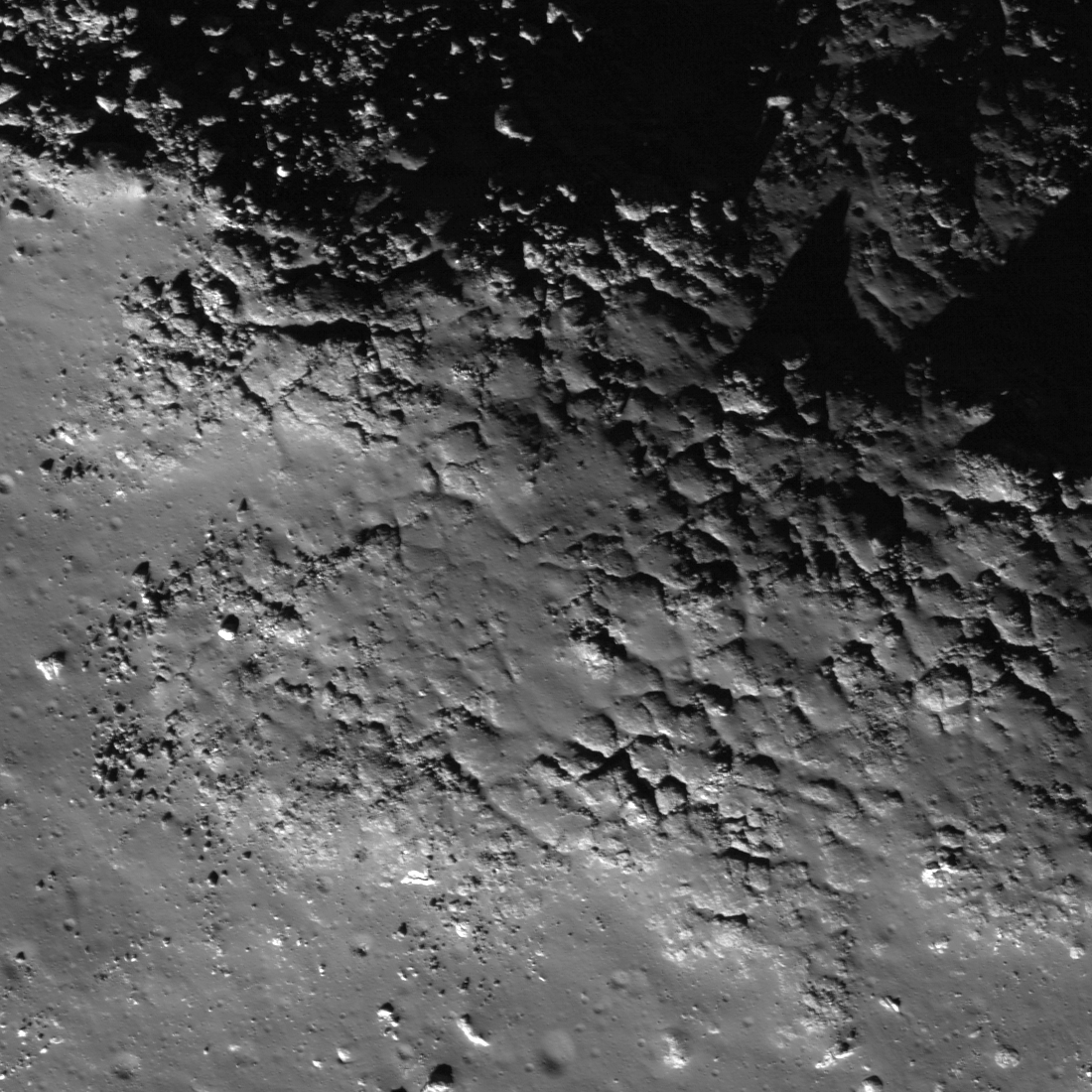
Top of a mound with fractured impact melt on the floor of Anaxagoras (75.46°N, 349.94°E). Image field of view 600 meters with sunlight from the south-by-southwest viewed at an incidence angle of 73.78° (nearly as high above the horizon as the Sun gets at such northerly latitudes. LROC Narrow Angle Camera (NAC) observation M122273232L, orbit 3153, March 3, 2010; resolution 0.49 meters per pixel from an altitude of 42.18 kilometers. View the larger (1100 x 1100) original LROC Featured Image HERE [NASA/GSFC/Arizona State University].
Hiroyuki Sato
LROC News System

The irregularly fractured surface in today's Featured Image is on top of a north-western oriented slightly elongated mound on the floor of crater Anaxagoras (image center is 73.748°N, 349.522°E). Anaxagoras (diameter ~ 50 km) is located about 700 km north of Mare Imbrium. The floor of Anaxagoras has an irregularly-shaped central peak. Other portions of the floor are filled with debris and impact melts.

The cracked surface covers only the top portion of the mound. The northern flank of this mound (see figure below) is almost completely covered by boulders, and southern flank is smooth with only a few boulders (as seen in the left hand image below). Why did the cracking happen only at the top of the mound?

One possibility is that the cracked portion is a splashed remnant of impact melt. A solid crust formed where the melt was thickest, and then later, as melt drained downslope, the cracks formed as the crust collapsed.

Context from the larger (LRO NAC M122273232L) frame showing the vicinity the Featured Image field of view (blue box).  A conventional stretch is above; below, the same image stretched to enhance details in the shadowed area. Each FOV width is slightly less than 2000 meters [NASA/GSFC/Arizona State University].
LROC WAC monochrome (604 nm) mosaic stitched from 10 sequential orbital passes March 21, 2011, showing a roughly 80 km-wide view of Anaxagoras an vicinity, situated on the rim of Goldschmidt on the east. Image center is 72.4°N, 350.0°E. The the location of the area detailed in the LROC Featured Image is indicated by the yellow arrow [NASA/GSFC/Arizona State University].
The interior of Anaxagoras crater was a Constellation program Region of Interest. With so many exciting features like this one, Anaxagoras crater is an excellent place for humans to explore!

Explore this irregularly cracked ridge and lots of other spectacular impact melt morphologies NAC frame HERE.

Related Posts:
Craggy Peak, Impact Melts
Splash and flow
Chaotic crater floor in Tycho
Polygonal fractures on Tycho ejecta deposits
Impact melt in Anaxagoras crater
Exposed Fractured Bedrock in the Central Peak of Anaxagoras Crater

This low-altitude (31 km) oblique view south from Japan's lunar orbiter SELENE-1 (Kaguya) is an excellent illustration of the difficulty in gauging scale in lunar photography. Anaxagoras could be a backyard brick barbeque pit in disrepair, or an astronaut's few foot steps away. Instead the crater is 50 kilometers wide and hundreds of kilometers away in this HDTV frame from 2009. View the release-size image HERE [JAXA/NHK/SELENE].