Sunday, September 30, 2012

Hit-and-Run Science

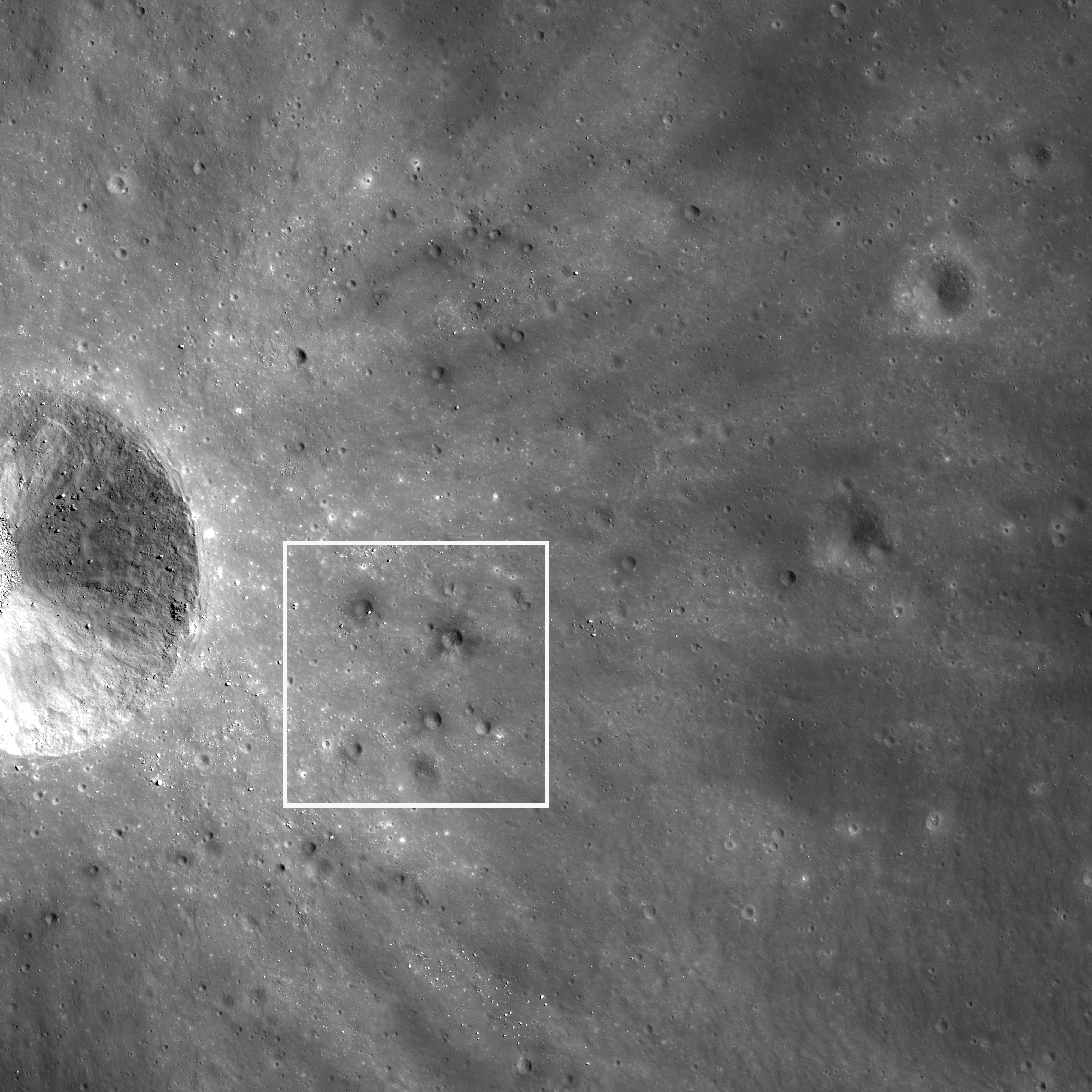
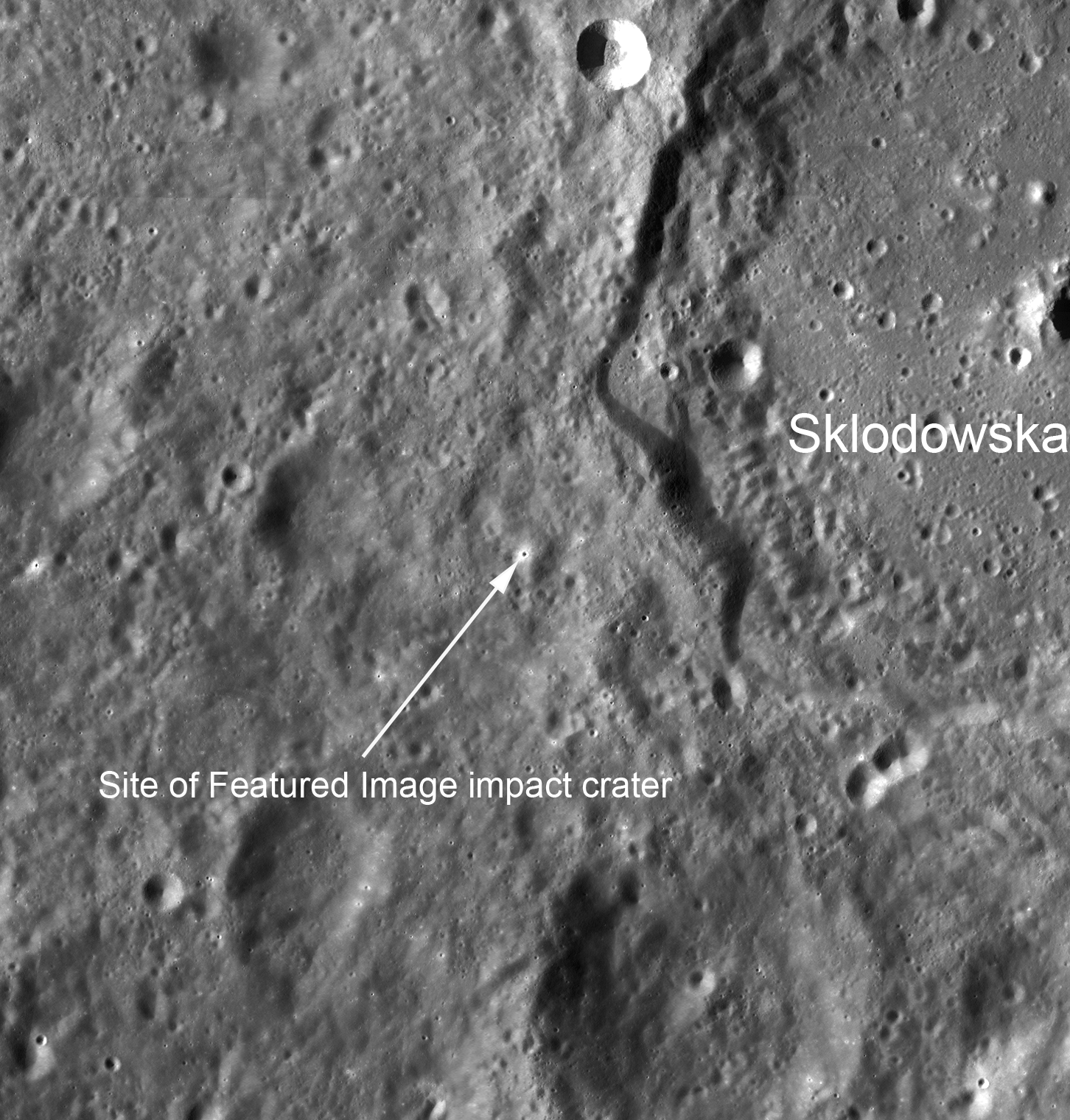
From 'A new hit and run Giant Impact scenario,' July 28, 2012;  Figure 1a: Five snapshots from the 30° impact angle and 1.30vesc impact velocity case (cC06) showing cuts through the impact plane. Colour coded is the type and origin of the material. Dark and light blue indicate target and impactor iron; Red and orange show corresponding silicate material. The far right shows the situation at the time of impact. At 0.52h, it can be seen how the impactor ploughs deep through the targets mantle and pushes considerable amount of target material into orbit. A spiral arm of material forms and gravitationally collapses into fragments. The outer portions of the arm mainly consist of impactor silicates and escapes due to having retained a velocity well above escape velocity. The silicate fragments further inward are stronger decelerated and enter eccentric orbits around the target. The impactor's iron core also looses much of its angular momentum to the outer parts of the spiral arm and re-impacts the proto-Earth. -  Figure 1b: The origin of the disk material highlighted, half a collisional timescale ( (Rimp + Rtar) / vimp ) after impact. In the grazing reference case (cA08), the majority of the proto-lunar disk originates from a spill-over of the impactor. In the head-on cases (cC01, fB06, iA10), much more material comes from the target mantle, being pushed out into orbit by the impactor core. Colours are identical to figure 1. Turquoise on the right shows water ice for the icy impactor case iA10. Reufer, et al. (2012) Icarus 221, 296
Paul Spudis
The Once & Future Moon
Smithsonian Air & Space

The origin of the Moon is a long-standing problem in planetary science.  Reconstructing complex events in the distant past is difficult and requires both knowledge and imagination.  The facts to be explained are relatively straightforward.  The Moon’s overall density (about 3.3 grams per cubic centimeter) and bulk chemical composition are about the same as that of the mantle of the Earth, suggesting a possible relationship between the two.  The idea that Earth and Moon are compositionally related is supported by the ratio of isotopes of oxygen in the lunar samples, which indicate that Earth and Moon are made from matter derived from the same region of the solar nebula (material that is compositionally distinct from that making up the various meteorite groups).  Finally, the Earth and Moon collectively have a very high angular momentum, mostly as a consequence of the high spin rate of Earth and the relatively large mass of our Moon compared to its primary planet.

Prior to the Apollo missions, three different models (capture, fission, binary accretion) vied for acceptance among the lunar science community.  The capture model proposed that the Moon formed elsewhere in the Solar System before a close, chance encounter resulted in the Earth capturing the Moon into orbit.  The fission model proposed that a large mass of molten material spun off a rapidly spinning early Earth, was thrown into orbit and over time, coalesced into the Moon.  The binary accretion model suggested that Earth and Moon assembled themselves independently as two distinct and separate bodies from the beginning.  None of these models seemed able to account for all the “constraints” mentioned above, but no one had any better ideas.

About 30 years ago, the problem of lunar origin was widely considered “solved” with the general acceptance of the Giant Impact model.  In this concept, four and a half billion years ago, the proto-Earth shared its orbit around the Sun with an object about the size of the planet Mars (dubbed Theia, in Greek mythology, the titan who gave birth to Selene, goddess of the Moon).  A chance encounter between these two planetoids resulted in their merging as the Earth-Moon system.  It was thought that a grazing (low angle) impact would serve to both spin up the Terra-Luna system, resulting in its relatively high angular momentum, and hurl vaporized mantle material from Theia into orbit around the Earth.  The disk of orbiting debris quickly coalesced into the Moon and this rapid accumulation resulted in the release of large amounts of heat, which proceeded to melt at least the outer few hundred kilometers of the Moon, creating an “ocean” of molten rock, or magma.

The Giant Impact model seemed to nicely account for most of the properties of the Moon.  But like many big ideas in science, the closer and longer we look at it, the more issues seem to arise.  It was long assumed that the Moon was made of material derived mostly from mantle of the impacting planet (Theia); in this view, the Giant Impact was really just a variant of the capture model.  As such, it did not explain either the chemical similarity of the Moon to the mantle of the Earth, nor their identical oxygen isotope compositions.  This objection was usually brushed away with the admonition that complications might be expected from planet-scale impacts.

A new set of computer models has looked at the consequences of a slightly more head-on planetary collision.  In contrast to the traditional oblique (few degrees) off-center Big Whack, researchers modeled the effects of an impact at about 30° incidence and relatively high velocity (about 1.3 times escape velocity, or roughly 14 km/sec).  They find that in this case, most of the material from which the Moon forms comes not from the impactor Theia, but from the mantle of the Earth.  This result might better explain the compositional attributes of the Earth-Moon system.  In fact, several models were run (slightly varying these conditions) and while none perfectly fit the chemical and dynamical constraints, this one matched them most closely.

While this modeling was underway, another group was analyzing the composition of isotopes of titanium in samples from the Earth, the Moon and meteorites.  The work has established that the chemical fingerprints that relate Earth and Moon are not merely close – they are virtually identical (to the best precision of the measurements).  The authors of this study claim that this result creates problems for the Giant Impact model, as that idea had called for most of the Moon to be derived from the mantle of the impacting planet Theia.  However, with the results of the new computer models of giant impacts discussed above demonstrating that the parameters of the collision can be adjusted to match the constraints on lunar origin, perhaps this is not such a problem for the Giant Impact model after all.

These developments should probably give lunar scientists pause.  After all, the Giant Impact model became popular because the earlier, traditional three models (capture, fission, binary accretion) were all inadequate and their boundaries and defining parameters had to be adjusted to permit their (barely acceptable) viability.  In other words, the models were stretched to fit any inconvenient facts or problem observations.  Now it appears that the same thing is happening to the new, “explains-it-all” Giant Impact model.  A scientific idea that can be stretched to fit any observable fact is not very useful as an explanatory principle – it is simply a glorified “Just So” story.  The late Karl Popper argued that often in science, an idea cannot be shown to be true, but it can always be shown to be wrong – that is, “falsified.”  If a hypothesis cannot be falsified, Popper argued, then it was not scientific. We need a mechanism in science to enable us to dismiss useless or irrelevant concepts and falsification is one way to do that.

So where does such philosophy leave the origin of the Moon?  Perhaps more knowledge and imagination is needed before we can pronounce lunar genesis a “solved problem.”

Originally published at his Smithsonian Air & Space blog The Once and Future Moon, Dr. Spudis is a senior staff scientist at the Lunar and Planetary Institute. The opinions expressed are those of the author and are better informed than average.

Related Posts:
A Sawtooth-like timeline for the first billion years of lunar bombardment (August 28, 2012)
A new 'hit and run' Giant Impact scenario (July 28, 2012)
"Our view of the Moon has turned upside down" (April 26, 2012)
Ti paternity test fingers Earth as Moon's parent (March 28, 2012)
NLSI team sheds light on 'late heavy bombardment' (February 28, 2012)
Spudis: Cataclysmic Conundrum (February 14, 2012)
'Significant change' in bombardment timing (January 6, 2012)
LOLA reveals distinct populations in bombardment record,
Diviner finds "no pristine lunar mantle" even within SPA
(September 16, 2010)
'The Grand Lunar Cataclysm and how LRO can help test it' (September 7, 2009)

Saturday, September 29, 2012

Taurus Littrow Oblique

An oblique perspective on the Taurus Littrow Valley and the landing site of Apollo 17 (20.1911°N, 30.7722°E) from more than 270 kilometers away. The granularity captured is remarkable testimony to the power of the LROC Narrow Angle Camera. LROC NAC frame M192703697R, orbit 13427, May 26, 2012; spacecraft and camera slewed 56.09° from nadir, resolution 2.79 meters, from a point 131.29 km over 20.01°N, 38.78°E [NASA/GSFC/Arizona State University].
Joel Raupe
Lunar Pioneer

The eleventh, and most recent, release of Lunar Reconnaissance Orbiter Camera (LROC) photography to the Planetary Data System (PDS) might have passed unnoticed. The spacecraft, after all, has been orbiting the Moon for more than three years, presently at more than 100 km, as it has since the beginning of 2012, and a year has passed since the spacecraft's dramatic 22 kilometer barnstorming passes over the surface in late 2011. 

The nominal mission orbiting altitude of 40 to 60 kilometers could not be sustained forever, though certainly none have come closer to mastering the Moon's 'lumpy' gravity well than LRO's flight directors.

Results from this mission-conserving, more apparently sedate higher-altitude phase in the LRO extended science mission would not very dramatic, still covering the same ground, over and over, presently from a greater distance. But, as all who regularly observe the Moon from Earth already know, the Moon never seems to present the same face twice, and it always seems to deliver up to patient, alert and modestly equipped observers a new face each and every time they pause to take a look. Remarkably, this axiom is proving as true for LRO in polar orbit as it is for Earth-bound observers 400,000 km away.

For the moment, 'barnstorming' has been left to the GRAIL twins. Together with LRO and the ingeniously recycled ARTEMIS probes, the feast of having five U.S. space vehicles in lunar orbit simultaneously cannot compete with Curiosity on Mars, or Dawn and its departure from Vesta for Ceres.  Even after four decades of near-neglect, as happened in the Apollo era, even hardened lunatic fanatic followers of LRO, quite naturally, have a more difficult time sustaining their sheer awe of the stunning, long overdue mission.

When properly scaled, the now-distinctive, albeit brief, trace of human activity on the floor of Taurus Littrow Valley is just barely visible at the center of this frame, pushed to 200 percent. Though the Apollo 17 lunar module descent stage cannot be seen, the darker material once just below the surface around that artifact, as well as the path to and from the ALSEP and LRV sites, turned over by the feet of Gene Cernan and Jack Schmitt nearly 40 years ago, is definitely a part of this landscape, photographed from an incredible distance last May [NASA/GSFC/Arizona State University].
Though the announcement of this eleventh PDS release seemed slightly delayed observations collected by LRO cameras from mid-March through mid-June was already available, right on time, through Arizona State University's LROC PDS interface. You had to have coordinates of a chose piece of the Moon's surface enumerated, longitude and latitude of its meets and bounds, unless patient or idle enough to scroll through sequential, lossy thumbnails.

Soon after the formal announcement, however, updated and detailed LROC NAC and WAC observation footprints became available to users of Google Earth, and as a layer on the web-based LROC QuickMap. The latter publication allowed the lay-public to experience something of the kind of serendipity only selected scientists experience when they comb through its latest pictures.

At around 30 percent full resolution, the breadth of Taurus Littrow can be seen, the rectangle tracing the outline of the narrow field of view shown at 100 percent resolution in the opening image, further above. Almost the entire area, the now-familiar landmarks, explored by Cernan and Schmitt can be seen. LROC NAC M192703697R [NASA/GSFC/Arizona State University].
Not long after these releases, every 90 days, someone who deserves a distinguished medal uploads to the Washington University (St. Louis) web-servers carefully updated Google Earth Keyhole Markup Language (KMZ) LRO-derived NAC and WAC footprint files. 

And though the lunar map available using Google Earth is increasingly outdated, after loading selected, updated KMZ files users can sift large areas of the lunar surface with LROC NAC and WAC observational fields of view embedded, and with an adjustable sliding time scale. It's a great way to get a quick look at areas available at high-resolution and during a particular phase of the mission, each with different illumination angles, especially any newly available observations of a particular area of personal interest.

Another demonstration of LROC NAC capabilities. The footprints, the 'fields of view.' of LROC NAC observations M192703697R and M192703697L, set up much as an imaginary passenger on board the Lunar Reconnaissance Orbiter might have seen the Target of Opportunity with the naked eye, in polar orbit 133 kilometers over a point on the Moon about 245 km east of the Apollo 17 landing site in Taurus Littrow Valley. Both field of view are well within the Apollo corridor, and the Apollo metric camera interferometry elevation model, integrated into the Google Earth virtual Moon [NASA/GSFC/USGS/JAXA/ASU].
It's also a way to allow the eye to "pick a crooked stick out from a pile of straight ones," because the occasional oblique observation shows up quite naturally as a highly elongated footprint that stands out sharply from the regular course of straight north-south footprints that follow the LRO polar orbit.

A highly-reduced copy of a 9240x7930 pixel mosaic of nearly the entirety of both the left and right frames of LROC NAC observation M192703697. Unfortunately, the original image file weighs in at around 66Mb, probably too hefty for most people's immediate resources. It's unfortunate because so very much spectacular detail and "knowledge to be gained," some of it important to our improving picture of lunar morphology, can be seen in the jaw-dropping original. You can, if you have the bandwidth, download the unofficial mosaic HERE [NASA/GSFC/Arizona State University].
Just a quick survey, one of many routes into the wealth of data that is still being swept-up by the LROC cameras, uncovered a new oblique observation of Taurus Littrow (sampled in this post).

Though the landing site of Apollo 17 has been explored at high-resolution by LRO many times, is readily identified through modest telescopes, and has even been surveyed by Hubble, even up close the Moon deliveres on a well-earned reputation for new glory with even simple changes in camera perspective, as most recently at even medium resolution from LRO last May.

Even the distinct trace of human activity, from December 1972, can be picked out, together with the enduring Sculptured Hills, the bright dusting of material blown off South Massif by the impact that formed distant Tycho, and so forth. But is this latest really a unique perspective, or the first time Taurus Littrow has been photographed from the east?

The full-resolution M192793697LR mosaic (warning: 66mg) may be available, HERE.

Certainly the last time Taurus Littrow was photographed from the east before the arrival of Apollo 17.  On December 11, 1972, after separating from Ron Evans and the Command Module America (visible at center), in their 12 orbit and just prior to final descent, Gene Cernan shot a short series of pictures of the destination from his left window of the lunar module Challenger. At full resolution, comparing AS17-147-22465 with the M192703697LR mosaic reveals how little the landscape has changed.
Not quite. But, though hand-held camera shots by Gene Cernan were captured from much closer and from lower altitude, the LROC NAC mosaic seen in miniature above, under similar lighting conditions, shows advances in photography in four decades, much of it a direct result of manned and unmanned space exploration.

In time, its possible that a small impact may have left behind a large enough trace to show when comparisons are made between the LROC NAC mosaic and frames from Apollo 17 Magazine 147. Its even possible, perhaps, that a change in perspective will eventually allow us to discover the final resting place of the Apollo 17 lunar module ascent stage itself, which was intentionally impacted near South Massif after being jettisoned, just before the last Apollo lunar mission broke orbit and returned to Earth.

Related Posts:
LRO LAMP sharpens Apollo surface helium data (July 17, 2012)
Toxicity of Lunar Dust (July 2, 2012)
39 Years (and counting) (December 14, 2011)
Just another crater? (December 13, 2011)
Apollo metric camera maps completed (November 21, 2011)
Too brief an expedition to a lobate scarp (August 24, 2010)
Moon geologically active, cooling and shrinking (August 19, 2010)
Return to Moon, Schmitt says, important for protection of liberty (June 17, 2010)
Dr. Jack Schmitt salutes LROC's Mark Robinson and the LRO
camera team at Arizona State
(November 10, 2009)
Apollo 17 from 50 kilometers (October 28, 2009)

Thursday, September 27, 2012

LROC: Nectaris Diversity

A variety of textures and reflectivities in the wall and floor of a recent crater within the ghost crater Daguerre in Mare Nectaris (11.9°S, 33.6°E). North is up; illumination is from the west, downslope is toward the top of the frame, field of view 425 meters, from LROC Narrow Angle Camera (NAC) frame M174665969R, spacecraft orbit 10874, October 31, 2011; incidence angle 39.33° at 0.65 meters resolution from 63.53 kilometers [NASA/GSFC/Arizona State University].
James Ashley
LROC News System

Today's Featured Image was chosen to showcase the extraordinary range in surface textures and albedo possible within a small area (half a kilometer square) on the Moon.

Prior to Narrow Angle Camera (NAC) imaging, the low-reflectance wedge along the southern rim was generally regarded to be an impact exclusion zone. Such a zone results when a bolide on a low-angle trajectory produces a heterogeneous energy distribution that unevenly deposits its excavated ejecta. The reason for assuming this can be seen in the Wide Angle Camera (WAC) mosaic image below (two frames down), where a prominent wedge shape is visible.

At the NAC scale, however, it is clear that low-albedo material has cascaded into the crater. This then became juxtaposed with blocky debris on the crater floor with patches of fine-grained deposits intermixed. Is the wedge-shaped ejecta truly the result of an uneven energy distribution, or was ejecta simply darker in the southern direction -- perhaps resulting from a buried layer of darker deposits exposed and ejected by the blast? What clues could help us resolve the question? A geologist explorer on the ground would be tempted to draft a map of these different deposits. Would such a map be useful for finalizing our conclusions?

The white square depicts the Featured Image field of view within a wider (2.17 km) context NAC image [NASA/GSFC/Arizona State University].
Also, before the Narrow Angle Camera captured these images, it was unknown whether the dark material was a dry debris flow or impact melt. What about the NAC image allowed us to solve this puzzle with confidence?

LROC Wide Angle Camera (WAC) global 100 meter mosaic on LOLA elevation model (NASA LMMP ILIADS application) shows the high-reflectivity of the ejecta pattern surrounding the impact and an intersecting ray that appears to have originated with the impact that formed Mädler crater, off toward the west-northwest [NASA/GSFC/LMMP/Arizona State University].
Click HERE to explore the full NAC image frame. Other examples of recent impacts can be found in Ejecta Starburst, Recent Impact in Oceanus Procellarum, and Rubble Pile on Fresh Crater Floor.

LRO Release 11 to the Planetary Data System

The 'Cobra's Head' of the unofficially designated Sinuous Rille of the western Marius Hills volcanic shield formation of Oceanus Procellarum, in high relief (incidence angle 75.29°); LROC Narrow Angle Camera mosaic of left and right frames M193325282LR, spacecraft orbit 13514, June 3, 2012, resolution 1.26 meters per pixel from 125.78 kilometers altitude [NASA/GSFC/Arizona State University].
Ernest Bowman-Cisneros
LROC News System

The 10th LROC Planetary Data System release includes images acquired between 2011-03-16 to 2012-06-14. This release contains 76,715 EDR images totaling 9.4 TB and 76,715 CDR images totaling 20 TB. An additional 10 LROC NAC DTM and 3 NAC Region of Interest (ROI) products were also added to the LROC RDR Dataset.

To date, the LROC Team has delivered 817,358 LROC images and over 8,556 derived (RDR) data products to the NASA Planetary Data System. The complete LROC PDS archive can be accessed via the URL http://lroc.sese.asu.edu/data or one can search for specific images or mosaics using the LROC WMS browser

Also be sure and try out Quickmap!

Wednesday, September 26, 2012

In the Wake of Giordano Bruno

Fresh ejecta patterns the landscape outside Giordano Bruno (37.99°N; 101.62°E). Illumination is from the east at a 74.28° incidence, resolution over this approximately 840 meter field of view is 1.12 meters from 54.25 km; LROC Narrow Angle Camera (NAC) frame M146308704R. LRO orbit 6695, December 6, 2010 [NASA/GSFC/Arizona State University].
James Ashley
LROC News System

The landscape surrounding the very young impact Giordano Bruno gives us a sense for how widespread the effects of even moderate-sized impacts can be on a planetary body. The young age (perhaps less than 10 million years) of Giordano Bruno offers a marvelous opportunity to inspect some of the more subtle morphologic changes that occur in the extended and discontinuous ejecta blanket during impacts of this size. Eventually, after 10's of millions of years, the action of micrometeorite impacts will rework or "garden" the lunar surface and obscure much of what we see here. Several examples of extended ejecta features are included in this post, all collected from the same Narrow Angle Camera (NAC) image (M146308704R).

Low areas like crater floors become "sinks" for migrating debris to become trapped within. Field of view is approximately 840 meter across [NASA/GSFC/Arizona State University].
The apparent flatness of these crater floors suggest that the debris was behaving very fluid-like when it was emplaced. Determining the difference between impact melt and granular debris flows can be challenging, however. What clues would you look for to find out if the crater floors are truly flat? How would you decide between melt and granular deposits? If impact melt, what does it suggest about the temperature of the liquid and its cooling rate to find it having such a low viscosity this far-removed from its source?

Coalescing blobs of melt have frozen together on this small crater floor (Another 840 meter FOV) [NASA/GSFC/Arizona State University].
As might be expected, at some point during cooling the viscosity of melt becomes high enough to cause sluggishness, and develop steep-sloped margins. Interesting shapes can then result.

A secondary crater cluster creates a hummocky Moonscape (840 meter FOV) [NASA/GSFC/Arizona State University].
Ejecta can create hummocky patterns when ballistically emplaced, as with these secondary craters. Some of the appearance may also be due to ground-hugging debris that piles up as it encounters resistance from friction with the ground.

The NAC frame is outlined on this LROC Wide Angle Camera (WAC) mosaic, together with its orientation to Giordano Bruno and vicinity (Field of view approximately 200 km across) [NASA/GSFC/Arizona State University].
How do we know that these features come from Giordano Bruno and not some other crater in the region? The full NAC image can be inspected HERE for clues. Other information on the Giordano Bruno impact itself can be found in several recent Featured Image posts, including Very Oblique View of Giordano Bruno, Sunset Over Giordano Bruno, and Giordano Bruno, The Big Picture.

Tuesday, September 25, 2012

A cluster of dark-haloed secondary craters

A collection of dark-haloed craters lines a sloping crater rim southwest of Sklodowska crater (19.21°S; 93.56°E). North is up; illumination is from the west-southwest, field of view image is about 625 meters. From LROC Narrow Angle Camera (NAC) observation M174665969R LRO orbit 10974, October 31, 2011; full resolution 0.65 meters from 63.53 km [NASA/GSFC/Arizona State University].
James Ashley
LROC News System

The explanation for the origin of dark-haloed craters on the Moon is usually straightforward: Low-reflectivity material (rock or regolith) is overlain by more reflective and more recent deposits (usually ejecta from a relatively fresh impact), and then the underlying deposit is exhumed by even more recent impacts.

This stratigraphy tends to present the darker material as ejecta overlying the lighter material in high contrast. Such is the case for the dark-haloed craters in today's Featured Image.Zooming out to the context frame below reveals their relationship to the crater responsible for the light ejecta.

But why do we see such a high number of these features here, and why do they seem to be grouped close to the rim of this small, unnamed crater located outside Sklodowska crater?

The wider NAC frame around the field of view selected for the LROC Featured Image (white square) in broader context. Field of view ~2.7 km [NASA/GSFC/Arizona State University].
The similarity in ejecta albedo suggests that the time between individual crater impacts was not great, and they are therefore likely to be secondary craters having a single larger impact as their source. The main question is whether the bolides that formed this group of craters arrived from an impact some distance away, or whether they are examples of so-called "self-secondaries." In the latter case, the blocks that created these features would have been ejected almost vertically during excavation of the large crater in the context image. They would have remained aloft long enough for the main ejecta blanket to be emplaced before returning to the surface and creating the pattern we see. Some recent studies are suggesting that more self-secondary craters are to be found closer to the main crater rim. This new finding can explain why there appear to be more of these dark-halo craters closer to the main crater rim, if they are indeed self-secondaries.

If, however, these secondary impacts originate with another, more-distant impact, then the clustering we think we see may be illusory. Perhaps this apparent grouping depends more on the location of the low-reflectance deposits than on the locations of the impacts. In that case many other craters in the region might also be related by formation time to these dark-haloed craters, but do not show dark haloes because they missed those deposits.

A wider view of the full LROC NAC frame with the local elevation, derived from LROC Wide Angle Camera (WAC) interferometry, puts the bright crater in context with the wide ejecta blanket outside Sklodowska, from 222 meters above to 132 meters below global mean elevation  [NASA/DLR/GSFC/Arizona State University].
The WAC mosaic context image shows few bright-rayed craters in the region; field of view 144 km, north is up [NASA/GSFC/Arizona State University].
The WAC mosaic reveals the broader context of the Featured location. What other craters can you find in this area that might be responsible for the secondary impacts? Why or why not? Which theory seems to have the most validity? Can you think of other scenarios that could account for today's Featured Image?

Click HERE to review the full NAC image. Additional examples of secondary features can be found in The Rays of Messier A, the Chain of Secondaries in Mare Orientale, and in Scouring Secondary Ejecta.

Simulated orbital view of the vicinity of southwest Sklodowska crater, from 37 km over a point 70 km from the bright unnamed crater (below center) outside the older crater rim. NASA ILIADS application, LMMP [NASA/GSFC/LMMP/Arizona State University].

Monday, September 24, 2012

NASA floats parking at Lagrange Point 2

One of many proposed configurations for the Gateway architecture, shown above the lunar farside "parked" at Lagrange Point 2 [NASA].
Mark K. Matthews
Orlando Sentinel

Top NASA officials have picked a leading candidate for the agency's next major mission: construction of a new outpost that would send astronauts farther from Earth than at any time in history.

The so-called "gateway spacecraft" would hover in orbit on the far side of the moon, support a small astronaut crew and function as a staging area for future missions to the moon and Mars.

At 277,000 miles from Earth, the outpost would be far more remote than the current space station, which orbits a little more than 200 miles above Earth. The distance raises complex questions of how to protect astronauts from the radiation of deep space — and rescue them if something goes wrong.

NASA Chief Charlie Bolden briefed the White House earlier this month on details of the proposal, but it's unclear whether it has the administration's support. Of critical importance is the price tag, which would certainly run into the billions of dollars.

Documents obtained by the Orlando Sentinel show that NASA wants to build a small outpost — likely with parts left over from the $100 billion International Space Station — at what's known as the Earth-Moon Lagrange Point 2, a spot about 38,000 miles from the moon and 277,000 miles from Earth.

At that location, the combined gravities of the Earth and moon reach equilibrium, making it possible to "stick" an outpost there with minimal power required to keep it in place.

To get there, NASA would use the massive rocket and space capsule that it is developing as a successor to the retired space shuttle. A first flight of that rocket is planned for 2017, and construction of the outpost would begin two years later, according to NASA planning documents.

Read the full article HERE.

Related Post:

Saturday, September 22, 2012

Documentary studies the 'moon-obsessed'

Dennis Hope, a Texan intent on living on Earth's Moon, the face of Scott Ennis' documentary "Lunarcy!" a publicity still from the 2012 Toronto International Film Festival [Scott Ennis/LUNARCY!].
Cassandra Szklarski
The Canadian Press

Toronto - Moon-obsessed dreamers provide the unlikely anchor for Simon Ennis’s comic documentary “Lunarcy!

Nevermind that its star is an eccentric young Texan determined to actually live on the moon — such fantasy is what drew Ennis to the project in the first place, says the affable 31-year-old.

“It’s about dreamers,” says the Toronto-bred Ennis, who is showcasing his first documentary at the Toronto International Film Festival.

“It’s about people who go for kind of like big, quixotic dreams — who kind of shoot for something much bigger than themselves.”

"Ennis says he originally planned a straight-ahead look at the moon and its place in science, religion, folklore and history. But as he met more and more people with intriguing lunar tales, his focus shifted to the heavenly body’s sometimes bizarre effect on people."

“I read about a guy in northern California that claimed ownership to the moon with the United Nations about 30 years ago,” Ennis says of his inspiration.

“He’s been selling one-acre moon lots for $20 a pop. He’s made almost $30 million and I thought, ‘Wow, this is the best idea I’ve ever heard in my life.’”

LUNARCY! (2012) 76 minutes, a Scott
Ennis film produced by Ron Mann &
Jones Bell Pasht [Sphinx Productions]
That man is Dennis Hope, who pops up as one of several interviewees that also include Christopher Carson, the young Texan intent on moving to outer space; Peter Kokh, editor of a long-running newsletter that imagines what life could be like if humans moved to the moon; and astronaut-turned-painter Alan Bean, who was the fourth man to walk on the moon.

Ennis says making the 80-minute “Lunarcy!” pushed him a bit further afield than he’s used to, noting that although he has three shorts and a comic feature under his belt he has never attempted non-fiction before.

“The main difference is not writing a script beforehand but in a way that’s really freeing, it’s really liberating,” says Ennis, who admits to dropping out of film school — twice.

“A movie is a movie and I’m trying to do the same thing, which is go out and find a story and make something that’s entertaining and funny and interesting for people.”

And with a cast of real-life lunar fanatics as unique as those in “Lunarcy!” it’s debatable whether such oddballs would even fly as fiction, he adds.

“The difference is if I wrote them nobody would believe it.”

Friday, September 21, 2012

Temporal Variability of Lunar Exospheric Helium During January 2012 from LRO/LAMP

Depicted here are atmospheric emission spectra (black) obtained by LAMP on two dates in late 2011, in units of Rayleighs per angstrom. Each panel’s black line is the spectrum obtained by LAMP when its spectrograph slit was placed 83 deg from the nadir, just above the lunar limb. The red line in each panel is the background spectrum obtained close in time by observing the same patch of sky when it is at the zenith, where any contribution from the lunar atmosphere is minimized. The blue line in each panel is the difference spectrum obtained by subtracting the background from the limb spectrum, revealing native lunar atmospheric emission from He I at 584 Å. 1-sigma error bars are depicted on each curve every 4th spectral point, for reference. From "First atmospheric helium detection by LRO LAMP," Stern, SWrI; et al, (2012).
Feldman, et al.
arXiv 1209.3274
Johns Hopkins, APL, SWrI, Central Arizona College

We report observations of the lunar helium exosphere made between December 29, 2011, and January 26, 2012, with the Lyman Alpha Mapping Project (LAMP) ultraviolet spectrograph on NASA’s Lunar Reconnaissance Orbiter Mission (LRO).

The observations were made of resonantly scattered He I l584 from illuminated atmosphere against the dark lunar surface on the dawn side of the terminator. We find little or no variation of the derived surface He density with latitude but day-to-day variations that likely reflect variations in the solar wind alpha flux. The 5-day passage of the Moon through the Earth’s magnetotail results in a factor of two decrease in surface density, which is well explained by model simulations.
Read the research, HERE

Thursday, September 20, 2012

Astrophysics by the Lunar University Network for Astrophysics Research (LUNAR) and the Center for Lunar Origins (CLOE)

Dark Ages Radio Explorer (DARE), utilizing the radio-quiet of the lunar farside to explore the earliest period on the cosmic time line, 200 million years between the primordial Big Bang and the emergence of the earliest luminous sources and the structure of the present universe. "The lunar Farside is potentially the only site in the inner solar system for high precision radio cosmology.” [NLSI].
The Moon is a unique platform from and on which to conduct astrophysical measurements. The Lunar University Network for Astrophysics Research (LUNAR) and the Center for Lunar Origins and Evolution (CLOE) teams within the NASA Lunar Science Institute (NLSI) are illustrating how the Moon can be used as a platform to advance important goals in astrophysics. Of relevance to Astrophysics and aligned with NASA strategic goals, all three of the primary research themes articulated by New Worlds, New Horizons in Astronomy & Astrophysics are being addressed by LUNAR and CLOE, namely Probing Cosmic Dawn, Understanding New Worlds, and Physics of the Universe

Read the full Executive Summary and Report, HERE.

Follow up to:The Moon as a platform for astrophysics (April 24, 2012)

Google Lunar X PRIZE 2012 Hardware Reel


Twenty-five teams from around the world are currently building robots, rockets, and lunar landers to win the $30 million Google Lunar X PRIZE. Every year, we collect hardware video clips from the teams and showcase their progress.

This year shows some impressive advancements in the rover designs, propulsion and avionics technology. Teams are stepping it up as the competition thickens and with all the recent headlining developments, the Moon does not seem so far away.

For more information about the teams and the competition, visit http://www.googlelunarxprize.org.

GRAIL twins uncover unexpectedly thin lunar crust

GRAIL gravity measurement schematic
Eugenie Samuel Reich
Nature

A sneak peek at the first results from a NASA mission to measure the Moon’s gravitational field hints at a lunar crust that is only half as thick as once thought.

There were a few gasps among scientists in the audience at a 13 September seminar at the Harvard-Smithsonian Center for Astrophysics in Cambridge, Massachusetts, as they took in the data revealed by Maria Zuber, principal investigator for NASA’s Gravity Recovery and Interior Laboratory (GRAIL) mission. Zuber, a planetary scientist at the Massachusetts Institute of Technology in Cambridge, showed a crisp, high-resolution gravitational map made with data collected by GRAIL’s twin spacecraft between March and June of this year.

“We are three to four times better in resolution compared to Kaguya and Lunar Prospector,” said Zuber, referring to two previous missions that mapped the Moon's gravitational field. GRAIL’s results have not yet been published or released publicly by NASA, and Zuber was not at liberty to give an interview.

Yet her talk, and the thrilled reactions from those present at the seminar and others interviewed by Nature, suggest that GRAIL is poised to have a profound effect on scientists’ understanding of the origins and early evolution of the Moon when its results are released in the coming weeks.

Read the full article HERE.

Related Posts:

Peek-a-blue Moon

Europe’s latest weather satellite got a glimpse of the Moon before our celestial neighbor disappeared from view behind Earth at 1130 UT on August 31, 2012. The MSG-3 spacecraft, reports ESA, "has been working well and is on its way to entering service" [ESA].
The image shows the second full Moon of the month – a ‘blue’ Moon – before disappearing from sight behind the southern hemisphere. Brazil’s eastern coast along the South Atlantic Ocean is also visible, with clouds forming over the water. The image was captured by the Spinning Enhanced Visible and Infrared Imager (SEVIRI). 

The imager scans Earth’s surface and atmosphere every 15 minutes in 12 different wavelengths to track cloud development and measure temperatures.

Launched on 5 July, the third Meteosat Second Generation satellite is in a six-month commissioning phase by Eumetsat, the European Organisation for Exploitation of Meteorological Satellites. This process includes checking that the imaging service works fully and delivers high-quality products for weather forecasting, sometimes, as has become a standard for new remote sensing missions, using the Moon as a well-understood baseline.

ESA developed the satellite in close cooperation with Eumetsat, and was responsible for initial operations after launch. It was then handed over to Eumetsat on 16 July. 

The first satellite in the series, MSG-1 – also known as Meteosat-8 – was launched in 2002. MSG-2 followed three years later. Both have continued the legacy of the operational meteorological satellites that started with Meteosat-1 in 1977.  The MSGs offer more spectral channels and are sensing Earth more frequently and at a higher resolution than their predecessors.

Top of the landslide at La Pérouse A

The precariously balanced lip of the landslide that, at the opposite end, has 'half-buried' the bright, relatively young crater La Pérouse A, shown in a morphed crop from a large mosaic of the left and right frames from LROC Narrow Angle Camera (NAC) observation M152383525, LRO orbit 7590, February 15, 2011; resolution 0.56 meters from 46.7 km [NASA/GSFC/Arizona State University].
Sarah Braden
LROC News System

When the La Pérouse A impact excavated material from the side of a hill of highland material (1.5 to 2 km taller than the plains to the west), the slope became unstable and collapsed into the crater La Pérouse A. The result is a crater with one rim 920 meters higher than the other.

The Featured Image shows the top of this landslide, now the new rim of La Pérouse A. The landslide material inside the rim is high reflectance, while the undisturbed section of the highland material is relatively darker.

Despite being the same composition, the landslide material is higher reflectance since it is fresh (recently uncovered). Faint lines along the outer edge of the rim are evidence of highland material slumping towards the crater. Collapse features on the Moon often display slump lines, which show where material has fractured and moved downwards, but not completely collapsed. Subsequent impacts or seismic shaking could cause further landslides inside the crater!

A closer look at a 470 meter-wide field of view of the northeast rim of La Pérouse A, LROC Featured Image released September 20, 2012, cropped from LROC NAC frame M152390311L, LRO orbit 7591, February 15, 2011; spacecraft and camera slewed from nadir -8.92° over an angle of incidence of 40.74° Resolution 51 cm per pixel, from 46.56 kilometers [NASA/GSFC/Arizona State University].
The red dashed line shows the crater rim, while the blue dashed line shows the new rim due to the landslide. Reduced scale NAC mosaic M152390311LR, field of view is approximately 4.5 km across [NASA/GSFC/Arizona State University].
Explore the entire NAC mosaic of the crater La Pérouse A, HERE.

Related Posts:

LRX: Radio astronomy from ESA Lunar Lander

LRX, a single tripole radio antenna to engage in baseline radio astronomy from the ESA Lunar Lander after 2017. Figure 6 from Radio astronomy with the Lunar Lander: opening up the last unexplored frequency regime, Wolf, et al (2012).
Wolt, Aminaei, Zarka, Schrader, Boonstra and Falcke
arXiv: 1209.3033 Sept. 17, 2012

The active broadband (1 kHz - 100 MHz) tripole antenna (LRX) on the European Lunar Lander, located at the Lunar South Pole, will allow for sensitive measurements of the lunar exosphere and ionosphere, and their interaction with the Earths magnetosphere, solar wind and coronal mass-ejections (CMEs). In addition, the LRX will allow studies of radio communication on the moon, essential for future exploration.

In addition, the lunar South pole provides an excellent opportunity for radio astronomy. Placing a single radio antenna in an behind a mountain near the Moon's south or north pole would provide "perfect shielding" from man-made radio interference (RFI), and, with an absence of ionospheric distortion with high-temperature and antenna gain stability, allow the detection of 21 cm wavelength emission from the primordial hydrogen that formed after the Big Bang into the era when the first stars formed.

MACS1149-JD, a galaxy of the Cosmic
Dark Ages, formed only 500 million
years
after the Big Bang [HST].
Detection of the 21 cm line from the Moon would allow, for the first time, clues on the distribution and evolution of mass in the early universe, between the Epoch of Recombination and Epoch of Reionization. Next to providing a cosmological breakthrough, a single lunar radio antenna would allow for studies of the effect of solar flares CMEs on the solar wind at distances close to earth (space weather) and open up the study of low frequency radio events (flares and pulses) from Jupiter and Saturn and the other planets, known to emit bright radio emission below 30 MHz (The Shortwave and Medium Wave bands, highly-attenuated by the ionosphere on Earth).

Finally, a single radio antenna on the ESA Lunar Lander would pave the way for a large lunar radio interferometry; demonstrating the long-anticipated possibilities of radio astronomy from the lunar surface while opening up "the last unexplored radio regime." Baseline studies of data collected by a simple experiment affected by its important location will also allow a determination of the limitations of lunar radio science by measuring the local radio background.

Read the full study, HERE.

Wednesday, September 19, 2012

Orion and SLS: Where Are They Now?

Amy Teitel
AmericaSpace.com

It’s been a little over a year since NASA announced its intention to build the Space Launch System or SLS, the rocket that will be bigger and more powerful than the Saturn V. Its payload is set to be the Orion Multi-Purpose Crew Vehicle, the Apollo-inspired capsule that is slated to take men to the Moon, Mars, and asteroids at some still-undefined point in the future. Last Wednesday, the Republican Subcommittee on Space and Aeronautics held a hearing to examine ongoing developments of Orion and SLS. The word from NASA is that both projects are moving forward. But schedules are starting to slip, and things will only get worse if the agency faces further budget cuts.

Testifying at the September 12 hearing were Cleon Lacefield, Vice President and Orion Program Manager from Lockheed Martin; Boeing Space Exploration Vice President and SLS Stages Program Manager Jim Chilton; NASA Deputy Associate Administrator for Exploration Systems Development Daniel L. Dumbacher; and Matt Mountain, Director of the Space Telescope Science Institute.

Read the full article, HERE.

La Pérouse A Impact Melt

Solidified impact melt flows outside the crater La Pérouse A. Another crop from LROC Narrow Angle Camera (NAC) frame M152390311R, spacecraft orbit 7591, February 15, 2011; 51 cm resolution from 46.56 km,  image width 705 meters [NASA/GSFC/Arizona State University].
Sarah Braden
LROC News System

Today's Featured Image shows impact melt flows near the outer rim of the crater La Pérouse A (4.08 km in diameter, 9.268°S, 74.705°E). Distinct channels and flow lobes are visible within this area. Small channels and levees are visible along the edges of some of the individual flows. As the melt moved farther away from the crater rim (the crater rim is toward the top of the image), the melt cooled. At the end of each flow lies a deposit of impact melt material. More impact melt may have been emplaced around the rim of the crater, but the landslide of highland material could have destroyed it.

The crater La Pérouse A is a very young satellite crater of the larger (80.4 km diameter) La Pérouse crater group, named after the French explorer Jean Francois de Galoup, known as Comte De La Pérouse. The Comte De La Pérouse sent his expedition journals and charts back to Europe shortly before he and his expedition disappeared. If he hadn't sent this information back, he probably wouldn't have a lunar crater named after him, since later on the shipwrecks of his two boats were found in Oceania.

For context, the impact melt field in the LROC Featured Image on the southern flank of La Pérouse A is shown in the full width of LROC NAC frame M152390311R [NASA/GSFC/Arizona State University].
The footprint of LROC NAC frame M152390311R rendered on the lunar framework of Google Earth as a demonstration of the bright and extensive albedo of La Pérouse A making the crater quite visible out of proportion with its relatively small size [Google/NASA/JAXA/GSFC/USGS/Arizona State University].
WAC context image (75 km across) of La Pérouse A and its high reflectance ejecta blanket, which indicates a relatively young age [NASA/GSFC/Arizona State University].

Explore the entire NAC frame, HERE.

Related Images:
River of Rock
Lichtenberg B Flow
Rootless impact melt flows
Lopsided La Pérouse A

Tuesday, September 18, 2012

LROC: Lopsided La Pérouse A

One side of the floor of La Pérouse A is covered by a landslide of highland material. 270 meter-wide field of view from LROC Narrow Angle Camera (NAC) frame M152390311L, LRO orbit 7591, February 15, 2011; spacecraft and camera slewed from nadir -8.92° over an angle of incidence of 40.74° Resolution 51 cm per pixel, from 46.56 kilometers altitude  [NASA/GSFC/Arizona State University].
Sarah Braden
LROC News System

La Pérouse A (4.08 km in diameter) is an impact crater located at 9.268°S, 74.705°E. Besides being a fresh, young crater with exquisitely impact melt forms, boulders, and high reflectance ejecta, La Pérouse A is interesting because over half of the crater interior is filled with a landslide of high reflectance material. What set of circumstances would cause a landslide that covers a majority of the crater?

The answer: La Pérouse A is actually lopsided. The impact crater occurred on a slope near the edge of some highland material (possibly old basin ejecta). The northeast rim of La Pérouse A is at an elevation of 1200 m, 920 meters higher than the southwest rim. The northeast rim is not the original rim of the crater, but rather the modified rim after the landslide of highland material into the crater floor. In the Featured Image you can see the edge where the landslide meets the impact melt in the floor of the crater. The landslide makes the final crater diameter larger, and the floor diameter smaller. The angle of the landslide slope ~32 degrees. This angle is the expected angle of repose for granular material.

Colorized LROC Wide Angle Camera digital terrain model (WAC DTM), with contour lines. La Pérouse A is in the center of the white box. Dotted contour lines indicate negative elevations. Area mapped is 75 km across (north is up) [NASA/GSFC/Arizona State University].
In the colorized topography figure above, La Pérouse A is in the center. The contour lines show the steepness of the slopes; the closer together the contour lines, the steeper the slope. Notice how the contour lines for La Pérouse A are much closer together on the northeast side of the crater than on the southwest side. In the WAC context image below, the same area is shown, but the topography is not as apparent. You can see the high reflectance landslide against the lower reflectance impact melt on the floor of La Pérouse A.

WAC context image (showing the same 75 km-wide topography as plotted above. The very high reflectance landslide covers more than half of the crater interior [NASA/GSFC/Arizona State University].
Explore the entire NAC frame, HERE.

Related Images:
Detour!
Lunar Landslides!
Rock avalanche in Robinson crater

One orbit priot to capturing the LROC Featured Image La Pérouse A crater was imaged, with LRO and LROC NAC more highly slewed from nadir. Mosaic of both left and right frames from LROC NAC observation M152383525LR, orbit 7590, February 15, 2011; resolution 0.56 meters from 46.7 km over the lunar surface, east of La Pérouse A [NASA/GSFC/Arizona State University].
From Earth, La Pérouse A sits in foreshortened glory close to the nearside's perpetual horizon (yellow arrow), a glory of the new, evening Crescent, or "thumbnail" Moon. This particular view from the evening of April 29, 2009, from a mosaic stack of 10 images through the Maksutov-Cassegrain Santel telescope (D=230mm F=3000mm) of Yuri Goryachko of Astronominsk, Minsk Belarus [ASTRONOMINSK].