Thursday, March 27, 2014

Distal Edges in the South Pole-Aitken basin

Blocky fences, like debris on a beach marking high water, border impact melt pools on the rim of an unnamed fresh crater on the vast floor of the ancient South Pole-Aitken impact basin, in jumbled terrain between Antoniadi and Schrödinger basin. 816 meter-wide field of view from LROC NAC observation M112884286R, LRO orbit 1759, November 15, 2009; resolution 66 cm per pixel, far south illumination incidence angle 75.9° from 63.93 km. The long axis of the large boulder at upper right is approximately 120 meters in length [NASA/GSFC/Arizona State University].
Hiroyuki Sato
LROC News System

Today's Featured Image highlights striking forms on the outside rim of an unnamed young crater (~11 km in diameter; image center 71.425°S, 161.88°E; incidence angle is 75.9°) located 140 km east of Schrödinger basin.

The western flank of this small crater is dappled with multiple impact melt ponds (now solidified into rock) inhabiting local topographic depressions.

The surfaces of the ponds show polygonal patterns of fractures that likely formed as the melt cooled and solidified (and thus shrank). The organized pattern of boulders (looking somewhat fence like) formed along a flow front.

Since these lines of boulders rest on top of impact melt rocks they show that melt was splashed out at least two times during the crater forming event.

Context view of the unnamed 11 km-wide crater and vicinity. LROC WAC 100 meter monochrome mosaic, centered on 71.36°S, 162.91°E; field of view roughly 45 km. LROC NAC M112884286R footprint outlined in blue, location of the area of interest shown at high resolution, in LROC Featured Image released March 27, 2014 marked by arrow NASA/GSFC/Arizona State University].
The later splashes barely made it out of the crater and flowed only a short distance. What caused this last splashing of melt? Perhaps a large landslide on the interior wall fell into a lake of melt at the bottom of the crater and caused a big splash.

Short melt flows are common around lunar craters -- they tell a tale of the incredible forces unleashed during cosmic collisions. These same events happen as often on the Earth as the Moon. But why do we see so few impact craters on the Earth? Earth has a lot of resurfacing (erosion, weathering, volcanism, plate tectonics), and weathering or resurfacing on the Moon is a lot slower. Thus, more craters and melt deposits are preserved on the Moon.

The unnamed fresh crater between the deep crater Antoniadi and the Moon's youngest impact basin Schrödinger (edge at extreme lower left), on the vast floor of South Pole-Aitken basin, features terraced pools of impact melt more typical of much better known and studied craters, like Tycho, in the mid-latitudes of the nearside [NASA/GSFC/Arizona State University].
Enjoy the fascinating impact melt features around this young crater in full NAC frame, HERE.

Related Posts:
Tycho's flash-frozen inferno
Breached Levee
Splash Mark
Scalelike Impact Melts
Impact Melt Lobes
Herigonius K Impact Melt Flow
Waves

Situated between Antoniadi, home to a crater with the lowest elevation on the Moon, and Schrödinger basin, the fresh crater of interest is of an age and size (like similarly-sized and situated Shackleton) is generally more typical of mid-latitudes, a feature of the Moon's history of bombardment (and, thus, of the the Solar System) that's evidence of diminishing size and frequency of impacts over time, and more originating from the direction of the ecliptic. Exploration of the crater may afford an opportunity to sample deeper history. Hemispheric projection of LROC WAC-DTM topography centered on the area of interest [NASA/GSFC/DLR/ASU].

Tuesday, March 25, 2014

Young Crater Walls (at the Schrödinger Antipode)

Northern rim of an unnamed young crater near 80°N, 278.9°E, north of Catena Sylvester, on the far north nearside and nested within crustal magnetism that may be related to the Moon's youngest impact basin (Schrödinger) on the direct opposite side of the Moon. 1243 meter-wide field of view, sampled from LROC Narrow Angle Camera observation M125130801R, LRO orbit 3574, April 5, 2010; 78.42° incidence, 1.09 meters resolution from 53 km [NASA/GSFC/Arizona State University].].
Hiroyuki Sato
LROC News System

After the unimaginably violent processes of excavation and ejecta emplacement, impact craters gradually change their shapes with time by various processes, such as the isostatic rebound, mass wasting, subsequent impacts, and space weathering.

Today's Featured Image highlights such a post-impact degradation process.

Full-width mosaic of the LROC NAC observation from orbit 3574. The full-sized (4581 x 6319) original can be viewed HERE. Though the high-angle of illumination at this high latitude favors outlines of topography over intrinsic brightness and color,  relatively darker and lighter materials radiate over great distances, aiding studies of how younger materials interact with anomalous local magnetism [NASA/GSFC/Arizona State University].
The lower half of this image (relatively high reflectance) is the crater wall, downslope is to the bottom. The bottom-left dark area is the shadow of southern crater rim. Upper half of the image with a low reflectance surface is the crater rim and the rim slope out of the cavity, mostly covered with impact melt. The low reflectance area at the image center just above the steep wall has multiple horizontal cracks showing where the hardened impact melt has cracked as the steep walls slowly fail and slide into the crater bit-by-bit. These slope failures continuously refresh the crater walls, removing the melt coatings and exposing subsurface materials.

Context image of the unnamed crater and the surrounding area in LROC WAC monochrome mosaic (100 m/pix). Image center is 79.97°N, 278.87°E; image width is about 66 km. The NAC footprint and the location of the opening image are illustrated [NASA/GSFC/Arizona State University].
Most of the fresh craters that we observe have suffered these slides, leaving the commonly observed rootless melt flow features on the rim slopes. Just after the impact occurred, much of the crater interior was covered by impact melt, but these rock veneers are quickly removed from steep slopes leaving fresh outcrops of the target (regolith and, in the case of mare, bedrock).

Arrow marks the young crater highlighted in the LROC Featured Image, released March 25, 2014, west of Poncelet C. The white circle is an approximate reflection of the parameters of the Schrödinger impact basin, the Moon's youngest, centered on a point on the diametrically opposite (antipodal) side of the Moon from the center of Schrödinger, in the far south. Grey lines outline nodes of anomalous crustal magnetism teased from Lunar Prospector (1998-99) data. Noted planetary scientists Lon Hood and Paul Spudis use the excavation caused by the smaller impact to aid in determining how local topography may have been disrupted, as they have suggested, by the force of the Schrödinger basin-forming impact. One challenge will be to determine how much the comparatively weak crustal magnetism interacts with migrating dust and fresh impact debris to create albedo swirl features [NASA/GSFC/Arizona State University]. 
Explore the resurfaced fresh crater walls in full NAC frame yourself, HERE.

Related Posts:
The Moon's antipodal magnetism mystery
Lunar swirl phenomena from LRO
Slope failure near Aratus crater
Sinuous Cracks
Slope Resurfacing
Stratified Ejecta Blocks
Dark Impact Melt Sheet
Thin Dark Layer

Friday, March 21, 2014

The promise of astronomy on the Moon

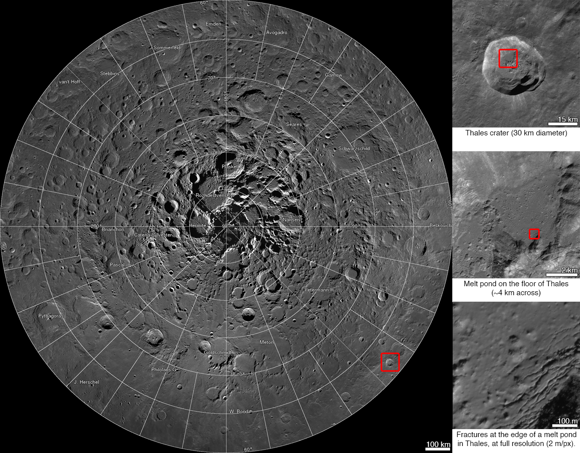
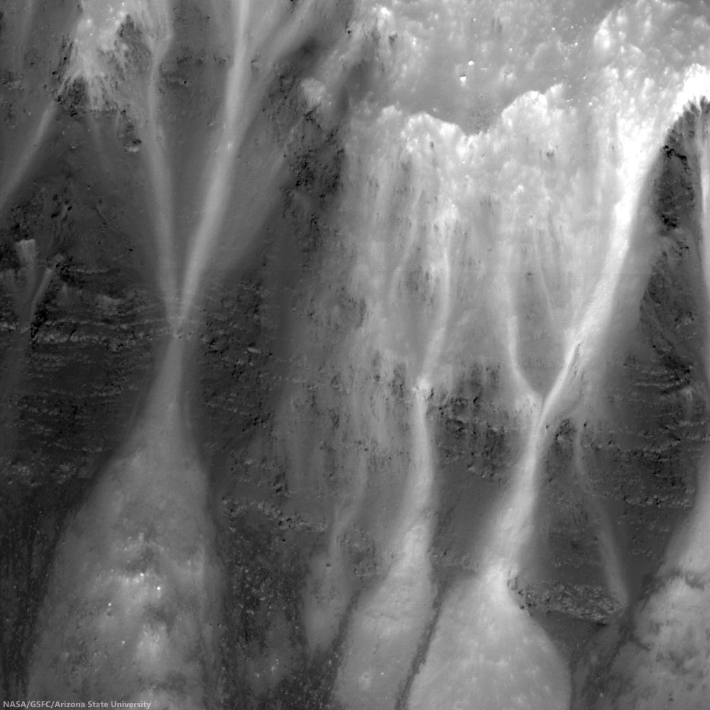
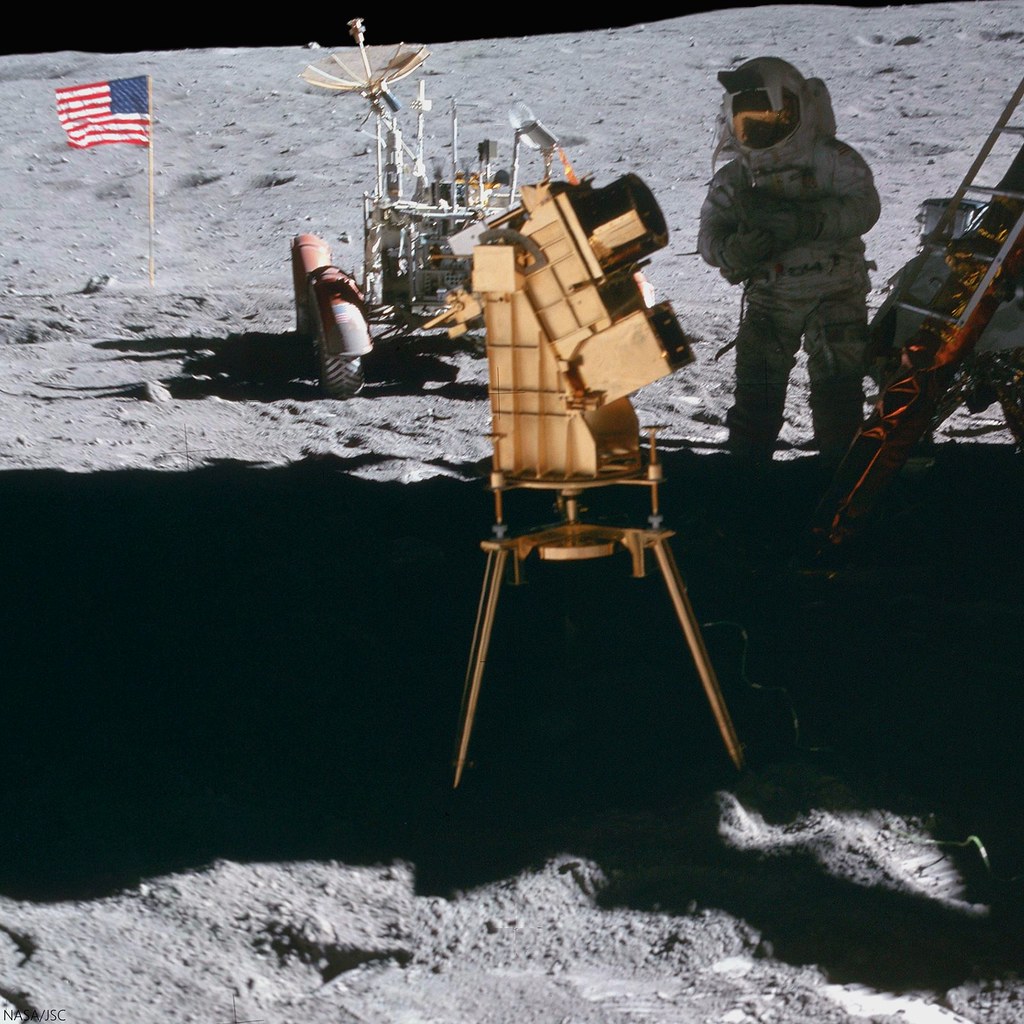
The Apollo 16 Ultraviolet Telescope. Charlie Duke on the starboard side of by Apollo 16 lunar module ladder, at the end of the first of three EVAs in the nearside southern highlands. AS16-114-18439 and 40, by John Young, April 21, 1972  [NASA/JSC].
Paul D. Spudis
The Once and Future Moon
Smithsonian Air & Space

Imagine that you are an astronomer. You want to gaze at the universe in crystal clarity. Yet you look at the heavens through a murky, partly opaque sky; you must deal with light pollution and the dynamic, wildly unstable platform of the Earth’s surface. It’s frustrating – you dream of the great views you know you could get from space. That’s the ticket! Plus, locating a stable, rock-solid base in space (where you could build extremely sensitive instruments) would be a huge bonus.

For years, the Moon was seen as the ideal place to build and operate sensitive telescopes. Its low gravity permits the building of giant telescopes with enormous seeing power. The stable, seismically quiet base of the lunar surface would allow for the operation of multiple telescopes in unison – arrays, effectively creating one giant telescope with an enormous aperture (a technique called interferometry). The cold, dark sky as seen from space – unimpeded by clouds, air or other meteorological phenomena – affords superb viewing conditions (as twenty years of fantastic Hubble Space Telescope images have documented). So with such considerations, one might conclude that conducting astronomy from the lunar surface would be one of the prime activities desired by the astronomical community. Right?

Well, not quite. Back in 1984, efforts to build a community of supporters for a base on the Moon included many astronomers who supported such efforts on the basis of the considerations listed above. Throughout the early days of the return to the Moon movement, astronomers such as Harlan Smith of the University of Texas and many others campaigned tirelessly for recognition of the value of lunar-based astronomy. These studies culminated in the seemingly outrageous idea for a telescope using a spinning disk of liquid with a reflective surface, lining the interior of one of the millions of bowl-shaped craters on the Moon. Such an instrument would extend for kilometers, making a gigantic “eye” to look at the universe. One might think such an idea is crazy, but liquid mirror telescopes already have been constructed on Earth.

Interestingly enough, the launch and success of the Hubble Space Telescope resulted in the loss of support for lunar astronomy. The biggest advantage of space-based astronomy is views of a dark, clear sky. Such views are available in free space just as easily as they are on the Moon. Moreover, the big advantage of a stable platform on the lunar surface for observations is partly negated by technical developments that permit the assembly of free-flying platforms in space. Such developments might mean that a short wavelength interferometer could be built and operated without the need to go into the (small) gravity well of the Moon. These and other technical innovations led to a general loss of support within the community for astronomical science on the lunar surface.

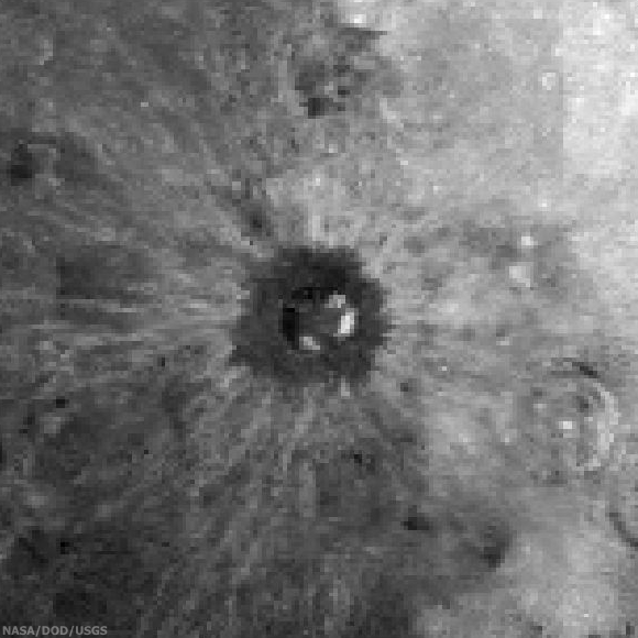
Image of the southern sky in the far UV, taken by the first astronomical telescope on the Moon, Apollo 16 mission, April, 1972 [NASA].
One might be forgiven for suspecting that a long-standing antipathy against human spaceflight might have had something to do with the attitude of many astronomers. They might possibly have feared that the advent of a new human spaceflight endeavor would divert funds from their lengthy wish list of robotic missions and automated observatories. However, the idea that the Moon is somehow useful to astronomers still holds an attraction.

Recent work has focused on the value of using the Moon’s unique environment to observe some parts of the electromagnetic spectrum that we cannot access from Earth or even near-Earth space. Very long wavelength emissions (meter- and multiple-meter-scales) cannot be seen from the Earth’s surface because the layer of charged particles surrounding the Earth in space (the ionosphere) blocks such radiation. Even in orbit, interference from the ionosphere prohibits observations because of this “noise.” However, the far side of the Moon is permanently shielded from Earth’s radio noise by over 3,600 km of solid rock. From such a truly unique vantage point, we will be able to listen to the whisper of radio noise generated in the aftermath of the origin of the universe.
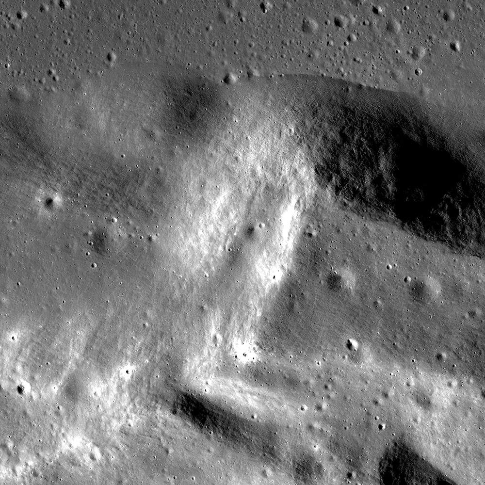
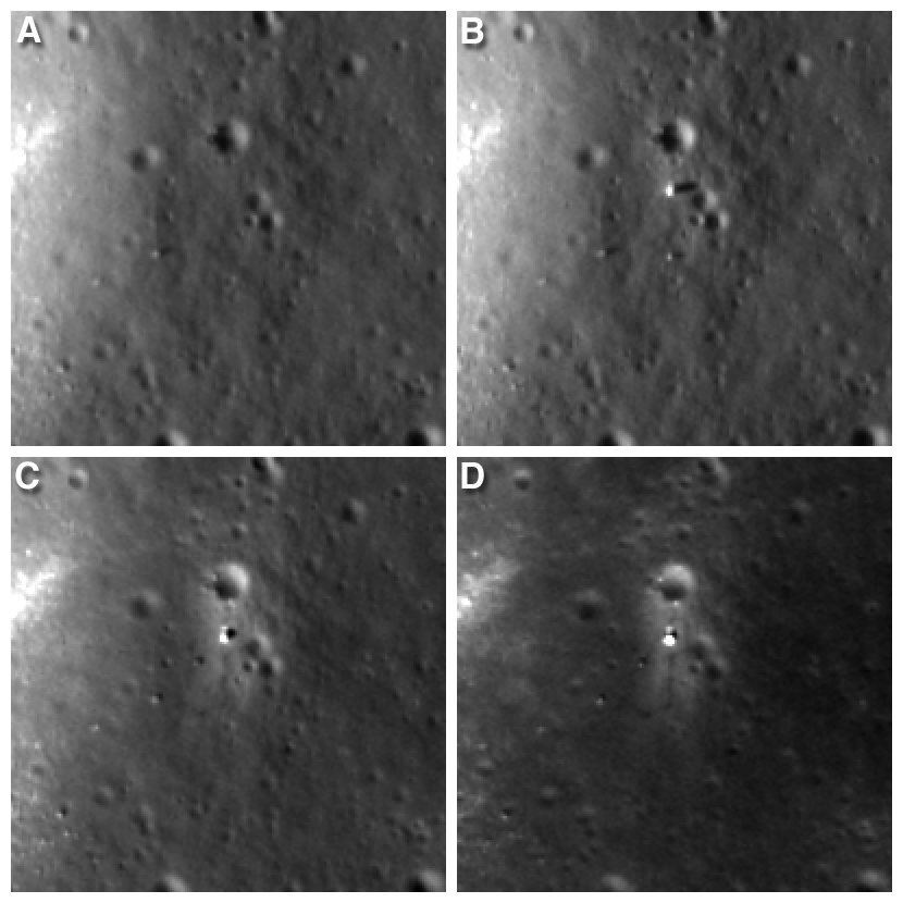
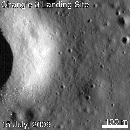
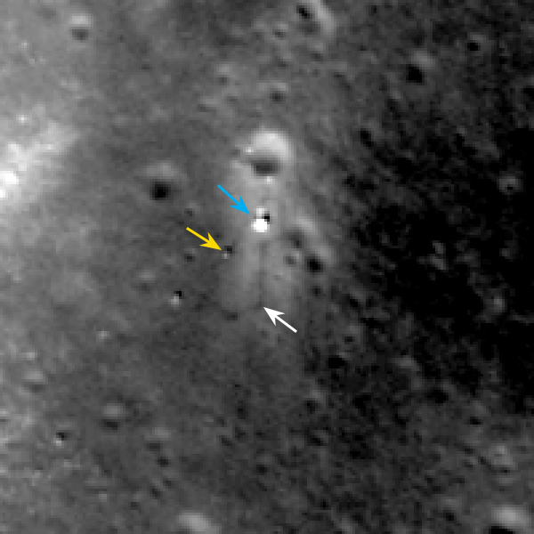
The Chang’E 3 lander carries a small telescope designed to look at the other end of the spectrum, the far ultraviolet (as the name implies, wavelengths shorter than visible light). The Chang’E telescope is producing data and although of small aperture, it can observe the sky at these wavelengths. Apollo 16 emplaced a UV telescope on the Moon back in 1972 and took ultraviolet photographs of the sky from the lunar surface, including the Earth and images of the southern sky (which includes two satellite galaxies to our own Milky Way galaxy – the Magellanic Clouds). These instruments documented the possible value of such observations from the surface of the Moon.

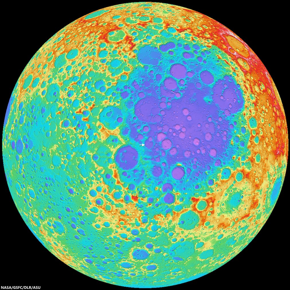
Other astronomers have looked in detail at how one might begin to utilize the unique environment of the far side to map the earliest stages of the history of the universe. One concept sends a teleoperated rover to the far side with a dual purpose. We could collect samples from the floor of the biggest, oldest basin on the Moon (South Pole-Aitken basin, an impact feature over 2,500 km in diameter) to test ideas about the early cratering history of the Earth-Moon system.  While we’re there, we could also lay out an antenna array designed to map the sky’s low frequency radio emissions.

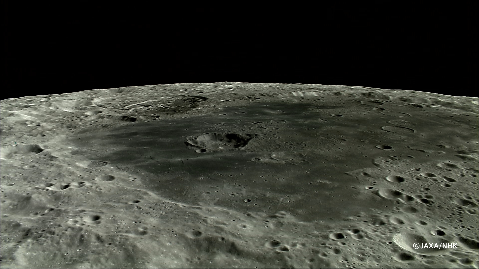
HDTV still of Tsiolkovskiy crater from Japan's lunar orbiter Kaguya (SELENE-1). The Naval Research Laboratory, MIT and others are refining work on a possible radio telescope array deployed on the floor of the conspicuous farside crater to utilize the radio quiet of the lunar farside to probe the Cosmic Dark Age [JAXA/NHK/SELENE].
The far side L-2 mission concept involves humans stationed 60,000 km above the Moon to operate the rovers and deploy the antennas. These antennas are quite simple. They consist of dipoles (i.e., linear wires) several tens of meters in length, all connected to a receiver capable of listening to those low frequency bands minus the static and noise of the terrestrial RF environment. Over the course of a year, as the Moon orbits the Earth (and both orbit the Sun), nearly the entire sky could be mapped from this robotically emplaced astronomical instrument.

Despite some starts and stops, the promise of conducting astronomy from the Moon continues to draw the attention of imaginative scientists. Using one of the forthcoming commercial lunar landers, a group of private enthusiasts plan to deploy a small telescope on the surface. When we some day stand on the Moon, we will not only look down to study the complex history preserved there, but we will also look outward, into an endless universe, just as many science fiction authors envisioned.

Dr. Paul D. Spudis is a senior staff scientist at the Lunar and Planetary Institute in Houston. This column was originally published by Smithsonian Air & Space, and his website can be found at www.spudislunarresources.com. The opinions he expressed here are his own, and these are better informed than most.

Related:
ILOA to study deep space from Chang'e-3 (September 11, 2012)
Remote-operated lunar deep space telescope concept demonstration (July 26, 2012)
Farside offers radio-quiet to probe cosmic Dark Age (July 2, 2012)
The Moon as a platform for Astrophysics (April 24, 2012)
MIT to lead development of new radio telescope
array on lunar farside
 (February 19, 2008)
Naval Research Laboratory to design Farside DALI (March 11, 2008)
What better view? (March 26, 2008)
New model of lunar motion from Apollo LLRR (December 27, 2008)
MacDonald LLR defunded by NSF (June 21, 2009)
The continued importance of lunar laser ranging (August 3, 2009)
Laser Ranging and the LRO (August 12, 2009)
A Fundamental Point on the Moon (April 13, 2010)

Lacus Autumni

Fresh and not-so-fresh craters on the basalt plain of Lacus Autumni, a pool of volcanic material solidified between the concentric rings of Orientale basin. Field of view from a mosaic of the left and right frames of LROC NAC observation M114498609, LRO orbit 2007, December 3, 2009; resolution 51 cm per pixel, incidence 62.57° from 48.44 km [NASA/GSFC/Arizona State University].
H. Meyer
LROC News System

This exquisite crater formed when an impactor crashed into the mare pond called Lacus Autumni. Angular blocks, which erode over time and gradually disappear, littering the terrain both within the crater and outside of it.

Though the margins of the crater are crisp and distinct, it has a lumpy appearance that is probably due to the coherence of the target material.

The ejecta of the crater has a slightly higher reflectance relative to the mare in which it is found. High-reflectance ejecta can represent recently exposed material that has not been affected by space weathering processes, called maturity rays, or material that is compositionally distinct from its surroundings, called compositional rays. Due to its crisp appearance and the predominance of blocks, we interpret this as a young, fresh crater, so the rays are likely maturity rays.

LROC WAC mosaic of Lacus Autumni, context for the LROC Featured Image. Red box outlines the the full LROC NAC field of view from LROC observation M114498609, orbit 2007, December 3, 2009. The white arrows points to the location of the fresh crater. Field of view above approximately 160 km across [NASA/GSFC/Arizona State University].
Lacus Autumni (or "Autumn Lake"), along with Lacus Veris and Mare Orientale, is a mare pond located in the northeast portion of the Orientale Basin. It lies between the Orientale inner ring (Montes Rook) and outer ring (Montes Cordillera). When craters form in thin mare sometimes high-reflectance highlands material is excavated from depth, which makes it difficult to differentiate between maturity rays and compositional rays. To resolve this issue, we can look at the composition of the material that was excavated, looking specifically at both iron and titanium maps.

Nestled in a valley between the inner and outer Orientale impact basin rings, Lacus Autumni is seen here at high relief of sunset shadows. Mosaic of LROC WAC observations from orbits 4786 through 4791, July 9, 2010; Uncropped field of view (very roughly) 205 km across, at an average resolution 68 meters, incidence 80° from 49 km. View the full-size original HERE [NASA/GSFC/Arizona State University].
If the rays are indistinguishable from the mare in which the crater formed, then we can conclude that they are highly reflective because they are young and unweathered. If the rays are composed of highlands material, the rays are likely compositional rays.

If the crater excavated highlands material from beneath the mare, then we can estimate the thickness of the mare deposit and determine just how much lava was extruded onto the surface when the mare formed. In the case of compositional rays, the morphology of the crater, such as a crisp rim or peak, is an indicator of the age of the crater.

The crater rays in this LROC Featured Image are indistinguishable from the mare in which they are found, so these are indeed maturity rays.

Explore more of Lacus Autumni, HERE.

Related Posts:
Fresh Bench Crater in Oceanus Procellarum
A Gathering in Lacus Mortis
Shield Volcanoes in Lacus Veris
Unnamed Fresh Crater Northeast of Arago (DTM)
New Crater!

A well-known composite color image of the Moon's western hemisphere centered just below Lacus Autumni, northeast of Mare Orientale, captured by the Galileo spacecraft while maneuvering out of the inner solar system on its way to Jupiter, at 1735 UT  December 9, 1990, from roughly 560,000 km away. The color composite was stacked from monochrome images taken through violet, red, and near-infrared filters. The Moon's nearside is to the right, the far side to the left [NASA/JPL].

Faulted Kipula

This striking mountain within Mare Imbrium was altered at its base by the formation of a lobate scarp. A wrinkle ridge runs into the base of the mountain (bottom right). Image width is approximately 4.5 km. LROC NAC image M1098943917R, spacecraft orbit 14300, August 7, 2012 [NASA/GSFC/Arizona State University].
H. Meyer
LROC News System

This beautiful mountain, called a kipuka, is located in northern Mare Imbrium on the nearside.

Kipukas are the high-standing remnants of a lava-flooded terrain and are quite common on the Moon. In this case, the kipukas are likely part of the inner ring of the Imbrium impact basin that was later flooded by mare basalts. The lobate scarp in the opening image formed due to contraction and the subsequent upward thrusting of the surface.

This scarp looks very familiar, a twin to the famous Lee-Lincoln scarp that the Apollo 17 astronauts explored in the Taurus Littrow Valley.

Wide Angle Camera mosaic showing the field of view of the LROC Featured Image. LROC WMS Image Browser [NASA/GSFC/Arizona State University].
LROC WAC context image of northern Mare Imbrium centered near 49.459°N, 348.136°E. The red box denotes the location of the NAC frame from which the LROC Featured Image released March 21, 2014 was derived. Landmark crater Plato is approximately 101 km across [NASA/GSFC/Arizona State University].
Another common feature in Mare Imbrium are wrinkle ridges like the one above.

Wrinkle ridges form when the surface undergoes compression due to sagging of the lithosphere below large mare deposits. Local tectonic conditions such as the thickness of the mare, direction of stress, and the strength of the basalt affect the final shape of a wrinkle ridge, yielding a variety of ribbon-like ridge forms.

Investigate this complex area for yourself, HERE.

Related Posts:
That's a Relief
Balcony Over Plato
Wrinkled, But How Old?
Wrinkle Ridge in Mare Crisium 
Remnants of the Imbrium impact

Tuesday, March 18, 2014

681 Gigapixel LROC mosaic

Spectacular LROC Northern Polar Mosaic (LNPM) allows exploration from 60°N up to the pole at the astounding pixel scale of 2 meters [NASA/GSFC/Arizona State University].
Mark Robinson
Principal Investigator
Lunar Reconnaissance Orbiter Camera
Arizona State University

The LROC team assembled 10,581 NAC images, collected over 4 years, into a spectacular northern polar mosaic. The LROC Northern Polar Mosaic (LNPM) is likely one of the world’s largest image mosaics in existence, or at least publicly available on the web, with over 680 gigapixels of valid image data covering a region (2.54 million km2, 0.98 million miles2) slightly larger than the combined area of Alaska (1.72 million km2) and Texas (0.70 million km2) -- at a resolution of 2 meters per pixel! To create the mosaic, each LROC NAC image was map projected on a 30 m/pixel Lunar Orbiter Laser Altimeter (LOLA) derived Digital Terrain Model (DTM) using a software package called the Integrated Software for Imagers and Spectrometers (ISIS).

Figure 1. LNPM superposed on map of the United States.
A polar stereographic projection was used in order to limit mapping distortions when creating the 2-D map. In addition, the LROC team used improved ephemeris provide by the LOLA and GRAIL teams and an improved camera pointing model to enable accurate projection of each image in the mosaic to within 20 meters. Almost exactly 3 years ago the LROC team released a Wide Angle Camera (WAC) mosaic of the same north polar region, the pixel scale was 100 meters.

The new NAC mosaic is 50x higher resolution!

LNPM with three levels of zoom down into Thales crater [NASA/GSFC/Arizona State University].
The LNPM was assembled from individual "collar" mosaics. Each collar mosaic was acquired by imaging the same latitude once every two-hour orbit for a month during which time the rotation of the Moon steadily brought every longitude into view. Each collar mosaic has very similar lighting from start to end and covers 1° to 3° of latitude.

Three collar mosaics illustrating how the images were acquired over time to build the LNPM [NASA/GSFC/Arizona State University].
The Moon does have subtle seasons and the LRO orbit cycles between noon-midnight and terminator orbits (measured as the angle between the spacecraft orbit plane and the sub-solar longitude; known as the beta angle). Lighting at the poles is best during northern summer and when the spacecraft is in noon-midnight orbits (low beta). There are a few gaps in the collar sequences due to spacecraft anomalies and special slewed observations that point the cameras off into space. These gaps were filled with images acquired at other times in the mission. These gap-filling images sometimes have the Sun from the opposite direction of the surrounding collar, resulting in noticeable boundaries.

Two types of orbit that LRO experiences through a six-month cycle. Images acquired during terminator orbits have long shadows from the equator to the pole. For noon-midnight orbits the Sun is overhead (no shadows) at the equator and shadows, though still large, are minimized at the poles.
The LNPM was originally assembled as 841 large tiles due to the sheer volume of data: if the mosaic was processed as a single file it would have been approximately 3.3 terabytes in size! Part of the large size is due to the incredible dynamic range of the NACs. The raw images are recorded as 12-bit data (4096 grey levels) then processed to normalized reflectance (a quantitative measure of the percentage of light reflected from each spot on the ground). To preserve the subtle shading gradations of the raw images during processing the NAC images are stored as 32-bit floating-point values (millions of grey levels). The 32-bit values are four times the disk size of the finalized 8-bit (255 grey levels) representation most computers use to display greyscale images. The conversion process from 32-bit to 8-bit pixels results in saturation (group of pixels all with the maximum value of 255) in the brightest areas.

Printed at 300dpi (a high-quality printing resolution that requires you to peer very closely to distinguish pixels), the LNPM would be larger than a football field.
Even with the conversion, the compressed JPEG images that make up the final product take up almost a terabyte of disk space. To create the zooming and panning Gigapan version, multiple versions of each large tile (32,768 pixels square) were made at varying pixel scales. Next, appropriate labels and grid lines were added for each zoom level in hopes of keeping the user oriented – no sense in getting lost on the Moon! Finally these larger tiles were split into 256-pixel square images, allowing a web browser on an average network to keep up with the amazing detail (only a few tens of kilobytes are needed to see any given location at full resolution). In total the LROC NAC northern polar mosaic required 17,641,035 small tiles to produce the final product.

Dive right in HERE, and explore each of the 681 Gigapixels.

LNPM by the numbers:

Square image: 931,070 pixels across and down
Total pixels: 866,891,344,900  (867 billion)
Pixels with image data: 680,808,991,627 (681 billion)
NAC images: 10,581
Image tiles (256x256): 17,641,035 (18 million)
Mass storage of tiles: 950 Gigabytes

Acknowledgments: The LOLA team provided the high resolution topography used to map project the NAC images and improved spacecraft ephemeris that allowed accurate placement of the images on the lunar latitude longitude grid. Gigapan provided mass storage and a web interface. The United States Geological Survey Astrogeology Science Center provided the ISIS image processing software. The NASA LRO project collected the data and funded the processing effort. The LROC imaging suite was developed and built by Malin Space Science Systems (MSSS).

Thursday, March 13, 2014

Stratification in a Tranquil Sea

Bright talus winds downslope through crags and crannies in the banded scarps exposed in the east wall of Dionysius crater. Horizontal lineations result from differential mass wasting of stratified rock in Mare Tranquillitatis; High (35.12°) incidence Narrow Angle Camera (NAC) mosaic, from both left and right frames, from LROC observation M137434784, orbit 5387, August 26, 2010; east is up in this 450 meter field of view, 49 cm per pixel resolution [NASA/GSFC/Arizona State University].
J. Stopar
LROC News System

Dionysius crater (2.766°N, 17.297°E) is situated on the western edge of Mare Tranquillitatis (the Sea of Tranquility) and excavates both highlands (bright, high reflectance) and mare (dark, low reflectance) materials. Dark banded layers of mare peek out of the eastern wall, where mare material was disturbed by the impact that formed Dionysius crater. Bright talus trails wind downslope through crags and crannies in the dark mare scarps.

Looking closely, the mare appears banded or striated, indicating a non-uniform material. In general, mare are thought to form from large volumes of fluid lavas, much like the Columbia River Basalts in the Pacific Northwest of North America. The stratifications in the lunar mare may represent a series of lava flows in the region.

Blocky overhangs indicate areas more resistant to mass wasting and are interpreted as more coherent basaltic (mare) materials. The thinner, more finely grained layers might represent boundaries between individual lava flows or they may indicate changes in physical properties within a single flow unit. Some of the fine grained layers may even consist of paleoregoliths, ancient regolith surfaces exposed to the vacuum of space in between volcanic eruptions.

LRO Wide Angle Camera (WAC) mosaic of Dionysius and vicinity at local sunrise (featured area, on east wall, remains in deep shadow). Embedded on the southeast 'shore' of Mare Tranquillitatis, the high angle illumination on the surface during this observation opportunity revealed local topography over material brightness, though dark rays, beyond the bright ejecta blanket, can already be seen superpositioned on higher elevations to the west and much lower elevations to the east. 604 nm wavelength view stitched from observations during three sequential orbital passes December 13, 2010; resolution ~60 meters per pixel from 44 km [NASA/GSFC/Arizona State University].
In any case, craters such as Dionysius provide windows into the subsurface structure of the lunar mare. With further study, the total thickness of the mare, as well as the structure and flow mechanics of individual mare flows may be intuited from this and other mare exposures in the walls of impact craters.

Explore the full NAC image, HERE.

Visit these other craters with layered mare exposures:
Lava Flows Exposed in Bessel Crater
Layering in Messier A
Layering in Euler Crater
Layers in Lucian Crater
Marius A
Galilaei's Layered Wall
Dawes
Dionysius Detour

Roughly 150 x 150 km sample of the lunar surface captured from the 1994 Clementine mission. Centered on Dionysius, the data is filtered for Iron Oxide (FeO), a bright constituent of the Mare Tranquillitatis southwest and considered an indication of titanium and a reliable proxy for helium-3, shows how the relatively recent impact that created Dionysius excavated and mixed the sea boundary highlands to the west and ancient basalt plain to the east. Both bright and dark materials radiate more than 100 km from the crater center and beyond the dark ejecta blanket, darker here (though bright in radar and optical data), that dark doughnut is likely a 'false negative' resulting from the spacecraft's low resolution, at this wavelength, of small and fine blocky materials. The bright talus of exposed and very ancient mare basalt layers sifting down the craters walls (particularly on the east) is prominent however, matching the the spectral data of the basin on the east. (Note how older craters, gardened by longer exposure to space weathering, are far more faded into the background [NASA/DOD/USGS].

Tuesday, March 11, 2014

Modified Craters of Moscoviense

Morning light beams over the walls and peaks of an irregularly shaped crater in Mare Moscoviense. This unnamed crater is approximately 17 km in diameter; portion of controlled NAC Mosaic MOSCOVNSLOA, downsampled for web browsing [NASA/GSFC/Arizona State University].
J. Stopar
LROC News System

This crater is one of several similarly shaped craters in Mare Moscoviense. These craters are pockmarked by craggy peaks and fractured floors. The dramatic illumination in the opening image, with the sun low on the horizon, exaggerates the crater's lumpy topography.

This crater, and others like it, represent one type of volcanically modified impact crater. The floor of the crater, shown in detail below, is not much below the surface of the surrounding volcanic plains, and looks nothing like a typical fresh impact crater, such as Giordano Bruno or simple bowl-shaped crater like this one on the farside. Sharp boundaries with flat-lying mare basalts around the crater rim (arrows) indicate where the crater was once surrounded (embayed) and nearly covered by large outpourings of lava. Only the upper part of the crater rim remains.

Unnamed 17km diameter crater in Mare Moscoviense, located at 146.391°E, 26.805°N. Arrows indicate extent of mare embayment. Click on the image for a higher resolution view of the crater floor [NASA/GSFC/Arizona State University].
How did this crater get so lumpy inside? Did volcanic materials push up from beneath the crater floor? Did molten lava intrude through fractures or low points in the crater rim and walls? Did the heat of nearby lava and magma deform the crater like hot plastic? The answer may be a combination of these processes, though most scientists think that the changes in crater shape occur mainly as a result of magma intruding from below.

HDTV still from Japan's lunar orbiter SELENE-1 (Kaguya) show the horizon to horizon extent of Mare Moscoviense, now known to be an unusually thin part of the Moon's crust in the farside lunar highlands. The view is from the north, from an altitude of about 100 km. The wallpaper-sized original can be viewed HERE [JAXA/NHK/SELENE].
Explore this crater and two more like it in entire NAC mosaic, HERE.

Re-visit these other volcanically modified impact craters:

Thursday, March 6, 2014

Squarish Lavoisier A of Oceanus Procellarum

Squarish Lavoisier A
The square corner along the north-most rim of Lavoisier A (28.5 km, 36.972°N, 286.74°E), evidence of pre-impact fracturing. LROC NAC observation M112759713L, spacecraft orbit 18324, July 4, 2014; field of view approximately 7 km, resolution 1.41 meters per pixel. LROC Featured Image, released March 6, 2014 [NASA/GSFC/Arizona State University].
Raquel Nuno
LROC News System

Why are most craters circular (even craters found on Earth)? By hurtling objects together at many miles per second in large laboratories, scientists have shown that only the most oblique impacts (less than 10° from the horizon) produce elliptical craters.

The kinetic energy of an impactor behaves much like the energy from a nuclear bomb. The energy is transferred to the target material by a shock wave, and shock waves produced by an impact, whether oblique or head-on, propagate hemispherically. This shape means that energy is being delivered equally in all directions; resulting in a hemispherical void and thus circular craters. However, conditions in nature do not always mirror the laboratory. In fact some craters are nearly square! A portion of the rim of Lavoisier A crater tells a story of the geology before impact. Lavoisier A is a squareish crater with a diameter of 28.5 km in the northwestern portion of Oceanus Procellarum.

Levoisier A from Chang'e-2
High-reflectance, low-angle illumination incidence view of 28.5 km-wide Lavoisier A from the Chang'e-2 global mosaic, with real color added from the Clementine survey (1994) [Virtual Moon Atlas 5].
Much of Lavoisier A's shape is thought to be due to preexisting joints or faults in the target rock. These discontinuities create zones of weakness, affecting how the shock wave travels through the material. We find square craters on other planetary bodies such as on the asteroid Eros and here on Earth. An example of a square crater that has been thoroughly studied is Meteor Crater in Arizona.

Levoisier A (Astronominsk)
Among the better views of Lavoisier A possible from Earth, situated as it is on the northwest limb of the Moon's nearside, in northwest Oceanus Procellarum, at the direct center of this image from a mosaic by Yuri Goryachko, Mikhail Abgarian and Konstantin Morozov, the Astronominsk team of Minsk, Belarus, sectioned from a full-disk observation photographed September 4, 2012 (below) [Astronominsk].
Levoisier A (Astronominsk)
Lavoisier A is marked with an arrow in the full-disk, 4300 by 4900 mosaic of the waning Moon, September 4, 2012 [Astronominsk].
This crater formed on layers of sedimentary rocks that have orthogonal vertical joints running below where the crater formed. The joints disrupted the shock wave flow in certain directions, preventing the formation of a circular crater. Another indication of weaknesses within the target layers is the appearance of the northeastern portion of the crater rim. It appears as if a layer of rock has been peeled back.

Can you find the evidence of pre-impact fracturing (square boundaries) in the full resolution NAC, HERE?

Related Posts:
Squished Crater
Four of a Kind in Catena Davy

Wednesday, March 5, 2014

New views of Chang'e-3 from LRO

Four views Chang'e 3 landing site
Four recent LROC Narrow Angle Camera (NAC) views of the Chang'e 3 landing site: A) before landing, June 30, 2013; B) after landing, December 25, 2013; C) January 21, 2014; D) February 17, 2014. Each image is enlarged by a factor of two, each field of view is 200 meters across. Follow Yutu's path clockwise around the lander in panel D [NASA/GSFC/Arizona State University].
Mark Robinson
Principal Investigator
Lunar Reconnaissance Orbiter Camera (LROC)
Arizona State University

Chang'e 3 landed on Mare Imbrium (Sea of Rains) on 14 December 2013. LROC has now imaged the lander and rover three times: 25 December 2013 (M1142582775R), 21 January 2014 (M1144936321L), and 17 February 2014 (M1147290066R). From month-to-month the solar incidence angle decreased steadily from 77° to 45° (incidence angle at sunset is 90°); due to the latitude of the site (44.1214°N, 340.4884°E, -2630 meters elevation) the incidence angle cannot get much smaller. Solar incidence angle is a measure of the Sun above the horizon; at noon on the equator the Sun is overhead and the incidence angle is 0°, at dawn or dusk the incidence angle is 90°.

Four views of the Chang'e 3 landing site from before the landing until Feb 2014 [NASA/GSFC/Arizona State University].
As the Sun gets higher above the horizon, topography appears subdued and reflectance differences become more apparent. In the case of the Chang'e 3 site, with the Sun higher in the sky one can now see Yutu's tracks (February image). In the opening image you can see Yutu about 30 meters south of the lander, then it moved to the northwest and parked 17 meters southwest of the lander. In the February image it is apparent that Yutu did not move appreciably from the January location.

LROC February Chang'e 3 Site Image
LROC February 2014 image of Chang'e 3 site. Blue arrow indicates Chang'e 3 lander, yellow arrow points to Yutu (rover), and white arrow marks the December location of Yutu. Yutu's tracks can be followed clockwise around the lander to its current location. Image enlarged 2x, width 200 meters [NASA/GSFC/Arizona State University].
Owing to the lower solar incidence angle the latest NAC image better shows Yutu's tracks and the lander engine blast zone (high reflectance) that runs north-to-south relative to the lander. Next month the solar incidence angle will again increase and subtle landforms will begin to dominate the landscape.

LROC NAC Oblique Chang'e 3
LRO slewed 54° to the East on February 16 to allow LROC to snap a dramatic oblique view of the Chang'e 3 site (arrow).  Crater in front of lander is 450 m diameter, image width 2900 meters at the center M1145007448LR [NASA/GSFC/Arizona State University].

Some Related Posts and LROC Featured Images:
Geologic Characteristics: Chang'e-3 exploration region
ESA on Yutu, as controllers wait for Feb. 9 sunrise
Chang'e 3 Lander and Rover From Above
Safe on the Surface of the Moon
Recent Impact
Coordinates of Robotic Spacecraft

Saturday, March 1, 2014

Down the Montes Carpatus

Northern slope of unnamed mountain in Montes Carpatus range
Northern slope (top) of an unnamed mountain in Montes Carpatus. LROC Narrow Angle Camera (NAC) observation M186077208R, LRO orbit 12500, March 11, 2012; angle of incidence 18.28° at 1.04 meters resolution, from 132.3 km over 17.73°N, 331.11°E [NASA/GSFC/Arizona State University].
Hiroyuki Sato
LROC News System

Montes Carpatus is a mountain range composed of multiple peaks and rises along the southern edge of Mare Imbrium.

The bases of several peaks were flooded and are now surrounded by the mare basalts that fill the Imbrium basin. The opening image highlights the northern slope of an unnamed mountain in the range. The mountain is about 14 km in diameter at its current base, and its height is about 1700 meters.

Northern slope of unnamed mountain in Montes Carpatus range
Context view of LROC NAC M186077208R [NASA/GSFC/Arizona State University].
These low reflectance materials, which cover the broad top of this mountain, have over time cascaded down the northern slope. Similar low reflectance materials are distributed at the top of neighboring mountains of Montes Carpatus, but their origin is not clear. This region, including the Carpatus Mountains, was blanketed by ejecta from the impact that formed Copernicus crater. The ejecta thrown here from Copernicus may have contained pyroclastic materials, the dark volcanic products of explosive eruptions, or impact melt now exposed on the mountain slopes. Alternatively, dark pyroclastic materials were originally deposited atop these mountains.

New NAC and WAC images continue to present more detailed views of the Moon's surface, allowing us to read the complicated geologic history of the lunar mare.

Northern slope of unnamed mountain in Montes Carpatus range
A mountain that is part of Montes Carpatus is shown in a LROC WAC monochrome mosaic with WAC stereo (GLD100) topography overlain (red represents higher elevations and blue represents lower elevations); image center at 17.27°N, 331.33°E; the footprint of the NAC frame (blue square) and the location of opening image (yellow arrow) are indicated [NASA/GSFC/Arizona State University].
Explore the dark materials flowing down the mountain in full NAC frame, HERE.

Related Posts:
Alphonsus crater mantled floor fracture
A Dark Cascade at Sulpicius Gallus
Dark streaks in Diophantus crater
Dark Material Flows
Downhill Creep or Flow?
Layer of Pyroclastics
Rima Marius Layering
Dark Splash?