Tuesday, November 19, 2013

More from CRaTER on radiation health hazards

CRaTER, in a fifth year in lunar orbit aboard LRO is providing a solid data set on the real health hazards, and possible mitigation, of high-energy radiation in deep space. Using proven technologies cosmic, not solar, radiation, is a significant block to long-term human spaceflight beyond the Moon [NASA/GSFC/UNH/SwRI].
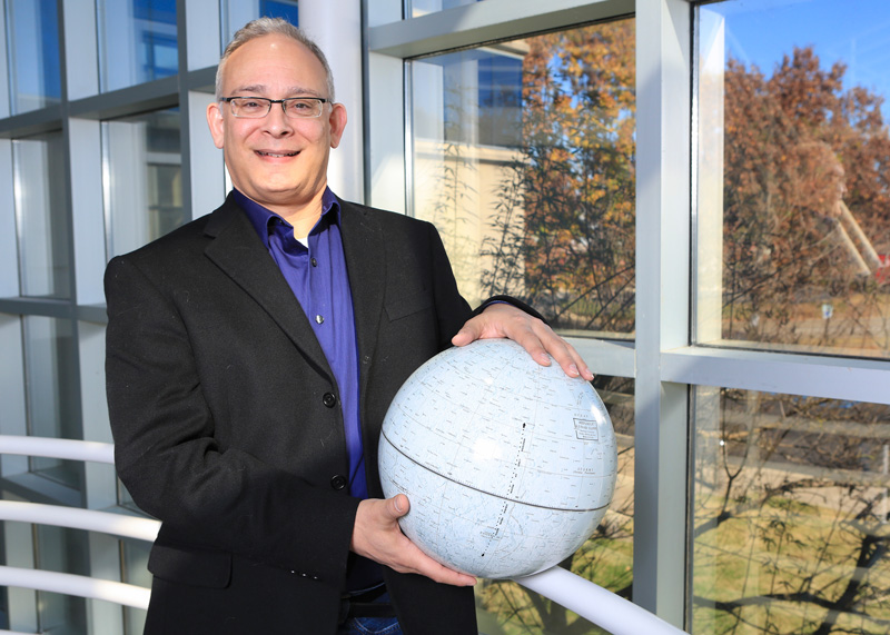
David Sims
University of New Hampshire
Institute for the Sutdy of Earth, Oceans and Space


Scientists from the University of New Hampshire and colleagues have published comprehensive findings on space-based radiation as measured by a UNH-led detector aboard NASA's Lunar Reconnaissance Orbiter (LRO). The data provide critical information on the radiation hazards that will be faced by astronauts on extended missions to deep space such as those to Mars.

The papers in a special issue of the journal Space Weather document and quantify measurements made since 2009 by the Cosmic Ray Telescope for the Effects of Radiation (CRaTER) radiation detector.

"These data are a fundamental reference for the radiation hazards in near Earth 'geospace' out to Mars and other regions of our sun's vast heliosphere," says CRaTER principal investigator Nathan Schwadron of the UNH Institute for the Study of Earth, Oceans, and Space (EOS).

The space environment poses significant risks to both humans and satellites due to harmful radiation from galactic cosmic rays and solar energetic particles that can easily penetrate typical shielding and damage electronics. When this radiation impacts biological cells, it can cause an increased risk of cancer.

Standard spacecraft shielding, integrated into hull design,
is strong protection from most solar radiation, but defeats
this purpose with high-energy cosmic rays it simply
splits into deadly showers of secondary particles
[NAS].
Before CRaTER's long-term radiation measurements were derived using a material called "tissue-equivalent plastic" - a stand-in for human muscle capable of gauging radiation dosage - those hazards were not sufficiently well characterized to determine if long missions outside low-Earth orbit can be accomplished with acceptable risk.

CRaTER's seminal measurements now provide quantified, radiation hazard data from lunar orbit and can be used to calculate radiation dosage from deep space down to airline altitudes.

The data will be crucial in developing techniques for shielding against space-based radiation dosage. The measurements have also played a vital role in UNH space scientists' efforts to develop both the first Web-based tool for predicting and forecasting the radiation environment in near-Earth, lunar, and Martian space environments and a space radiation detector that possesses unprecedented performance capabilities.

The near real-time prediction/forecasting tool known as PREDICCS integrates for the first time numerical models of space radiation and a host of real-time measurements being made by satellites currently in space. It provides updates of the radiation environment on an hourly basis and archives the data weekly, monthly, and yearly - an historical record that provides a clear picture of when a safe radiation dose limit is reached for skin or blood-forming organs, for example.

CRaTER offers an opportunity to test the capability of PREDICCS to accurately describe the lunar radiation environment. The Space Weather special issue provides comparisons between dose rates produced by PREDICCS with those measured by CRaTER during three major solar energetic particle events that occurred in 2012.

The detector developed at UNH, known as DoSEN, short for Dose Spectra from Energetic Particles and Neutrons, measures and calculates the absorbed dose in matter and tissue resulting from the exposure to indirect and direct ionizing radiation, which can change cells at the atomic level and lead to irreparable damage. Schwadron is lead scientist for both the PREDICCS and the DoSEN project.

"DoSEN is an innovative concept that will lead to a new generation of radiation detectors, or dosimeters, to aid in understanding the hazards posed by the radiation environment of space," says Schwadron. "The ability to accurately understand these hazards will be critical to protect astronauts sent beyond low-Earth orbit on extended space missions."

DoSEN combines two advanced, complementary radiation detection concepts that present fundamental advantages over traditional dosimetry. The dosimeter measures both the energy and the charge distribution of energetic particles that affect human and robotic health in a way not presently possible with current technology. Protons, heavy ions, and neutrons all contribute significantly to the radiation hazard.

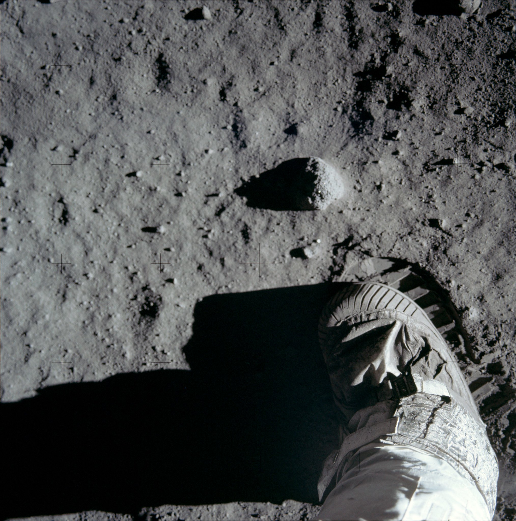
"Understanding how different particles such as neutrons and heavy ions pose hazards will be extremely important in completely characterizing the types of environments we will operate in," Schwadron says. "For example, on the Moon, there are additional hazards from neutrons that are created by high-energy radiation interacting in the lunar soil and radiating outward from the surface."

That 'backsplash" of protons, which was discovered by CRaTER and is known as the Moon's radiation "albedo," is caused by the partial reflection of galactic cosmic rays off the moon's surface. This creates a surprising one-two punch of deadly radiation and can also be used to peer below the lunar surface like a geological probe.

Says Harlan Spence, CRaTER deputy lead scientist and director of EOS, "Until now, people have not had the 'eyes' necessary to see this particular population of particles. With CRaTER, we just happen to have the right focus to make these discoveries."

UNH team members on the CRaTER instrument and co-authors on the Space Weather papers include Schwadron, Spence, Sonya Smith, Mike Golightly, Jody Wilson and Colin Joyce, Jason Legere, and Cary Zeitlin of the Southwest Research Institute Earth, Oceans, and Space Department at UNH. Coauthors from the UNH Space Science Center on the DoSEN project include James Ryan, Peter Bloser, and Chris Bancroft.
CRaTER-schematic
Figure 1. Wilson, et al, "First Albedo Proton Map of the Moon," Diagram of CRaTER instrument showing cross-sectional cutaway view of the stack of six detectors (D1–D6) and pieces of tissue equivalent plastic (TEP). Example particle trajectories are shown for a high-energy galactic cosmic ray from the zenith passing completely through the instrument (red line) and for an albedo proton (blue line) coming up from the lunar surface and passing through four detectors before being stopped in one of the blocks of TEP. (Adapted from Spence et al. [2010].)

Additional Background from NASA Goddard Space Flight Center:

Paul Gabrielsen
 
Radiation in deep space comes from cosmic rays, from the solar wind and from solar energetic particles emanated during a solar storm. Particles from these sources rocket through space. Many can pass right through matter, such as our bodies. So-called ionizing radiation knocks electrons off of atoms within our bodies, creating highly reactive ions. Within Earth's protective atmosphere and magnetic field, we receive low doses of background radiation every day. The radiation hazards astronauts face are serious, yet manageable thanks to research endeavors such as the CRaTER instrument.

CRaTER measures realistic human radiation doses at the moon using a unique material called tissue-equivalent plastic (TEP). Two pieces of this plastic, roughly 2 inches and 1 inch thick, respectively, are separated by silicon radiation detectors. The TEP-detector combo measures how much radiation may actually reach human organs, which may be less than the amount that reaches the spacecraft.

"Tissue-equivalent plastic gives us an idea of the self-shielding of the body," said Larry Townsend, of the University of Tennessee, Knoxville. "The radiation spectrum at the organs is not going to be the same as the radiation spectrum that's outside the spacecraft."

Townsend notes that CRaTER's observations have come at a time when solar activity, and hence the solar wind, has been unusually quiet. The solar wind disperses some galactic cosmic rays, but in the current solar lull, more of these rays are able to bombard the Earth and moon. CRaTER, which launched aboard LRO with six other instruments in 2009, has been able to monitor the lunar environment as solar activity has declined. Further mission extensions would allow additional detailed measurements as solar activity waxes and wanes.

"They're lower-level exposures," Townsend said, of galactic cosmic rays, "but they're damaging in the sense that the particles are highly charged and heavy, and they create a lot of damage when they're going through the body."

But lab tests suggested that materials rich in hydrogen, such as some plastics, may shield against these heavy particles, said Cary Zeitlin of the Southwest Research Institute, San Antonio, Texas. "The tissue-equivalent plastic in CRaTER has fairly high hydrogen content," he said, "so it lets us test this hypothesis using data from deep space. And it turns out that plastic really is a good shield against these particles, significantly better than aluminum."

LRO's unofficial motto states that "exploration enables science, and science enables exploration." The LRO spacecraft launched as an exploration mission, a forerunner for humanity's return to the moon. But after completing its primary mission in 2010, LRO has become a powerful instrument for lunar and planetary science. CRaTER is an active participant in this scientific study, discovering a previously unmeasured source of hazardous radiation emanating from the moon itself.

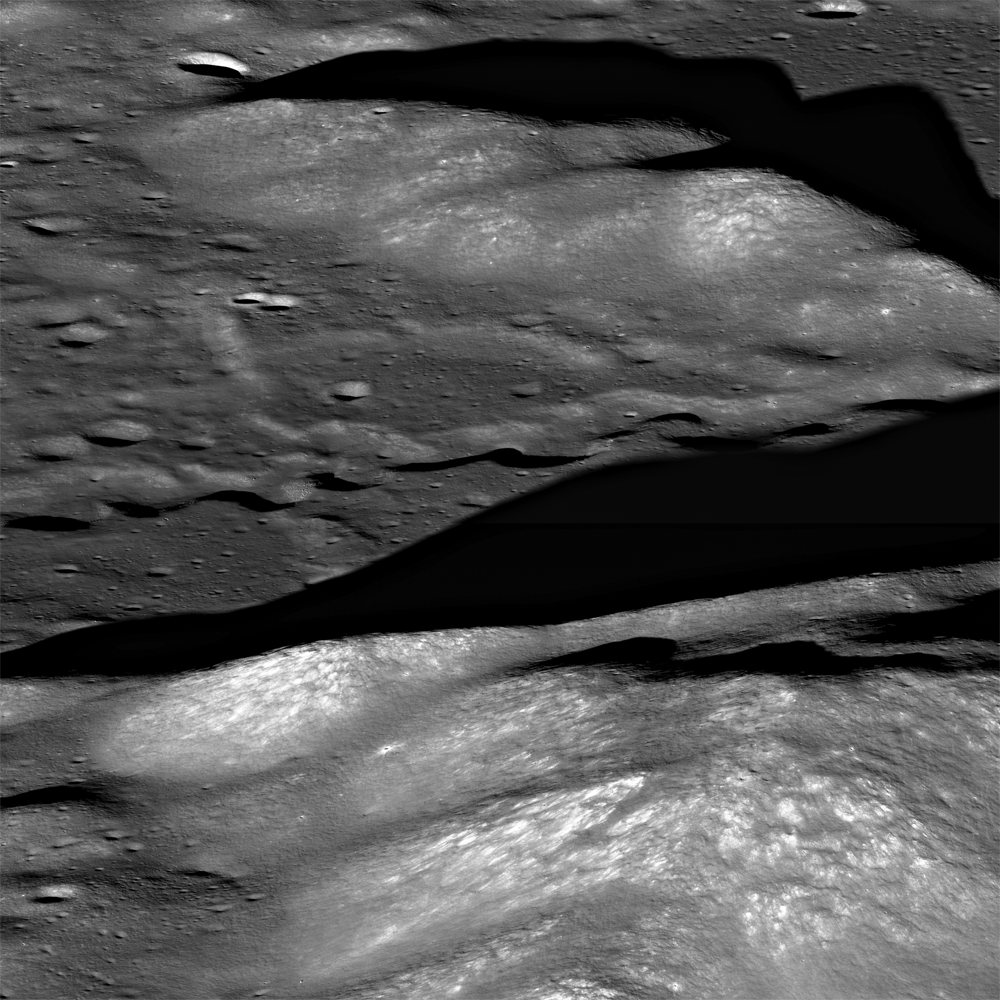
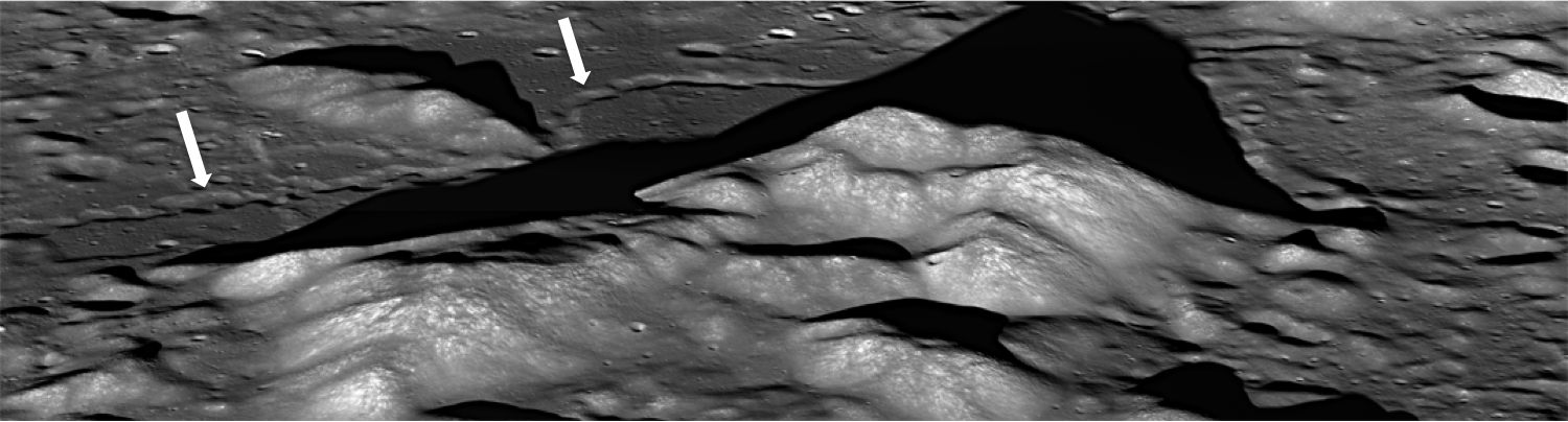
This radiation comes from the partial reflection, also called an albedo, of galactic cosmic rays off the moon's surface. Galactic cosmic ray protons penetrate as much as a meter (about 3.2 feet) into the lunar surface, bombarding the material within and creating a spray of secondary radiation and a mix of high-energy particles that flies back out into space. This galactic cosmic ray albedo, which may interact differently with various chemical structures, could provide another method to remotely map the minerals present at the moon's surface.

CRaTER directly measured the proton component of the moon's radiation albedo for the first time, said Harlan Spence, deputy principal investigator at the University of New Hampshire. The TEP radiation detector measures various components of radiation separately, which enables CRaTER to, in Spence's words, "unfold" the energy spectrum of the radiation albedo. This result, he said, illustrates the value of combining exploration and science in spaceflight. "If we had been on a different science-oriented mission, we probably would've developed a different instrument," Spence said. "In fact, we probably never would have flown TEP."

Looking toward future missions, Schwadron and his colleagues are developing a next-generation radiation dose detector, drawing on CRaTER's design. The detector, called Dose Spectra from Energetic particles and Neutrons (DoSEN) builds on CRaTER's ability to break radiation down into its components and assess the doses resulting from each part of the radiation spectrum. Human exploration will benefit, Schwadron said, from this "very specific information about the spectrum of radiation we need to shield against."

Spence, who served as the instrument's principal investigator through the primary mission said he's proud of his team's foresight to equip CRaTER with the capability to accomplish its mission and continue to pursue great science.

"We had hopes and aspirations," he said, "but we didn't think we would be able to reap as much from those data as we are. Exploration now is enabling science."

Related Posts:
Cosmic Ray threat to manned spaceflight tested on MSL (May 31, 2013)
The radiation environment and its effects on human spaceflight: A Lunar Mission (January 5, 2013)
Cosmic ray flux effects lunar ice (March 19, 2012)
"A Perfect Storm of Cosmic Rays" (September 29, 2009)
Cosmic rays and manned space travel (September 16, 2009)
Cosmic ray flux highest ever recorded (September 3, 2009)
Returning to the Moon (August 9, 2009)
Skeptical: LUNAR-TEX radiation blanket (May 11, 2009)
NASA cataract detection down to Earth (January 18, 2009)
NASA and Congress sacrifice radiation shielding flexibility
removing dry landing hardware
(May 17, 2008)

Managing Space Radiation Risk in the New Era of Space Exploration (2008)
Committee on the Evaluation of Radiation Shielding for Space Exploration
National Research Council

Lunar Laser Ranging: The Millimeter Challenge

Lunar Laser Range Reflector arrays
The five Lunar Laser Range Reflector (LLR or LLRR) arrays deployed on the lunar surface, one each at the landing sites of Apollo 11, 14 and 15, and also to the Soviet rovers Lunokhod 1 and 2. The sublime accuracy of the decades-long measurements are priceless to astrophysics. Nearside view from "Synthetic View of the Moon," LROC Featured Image released October 15, 2013 [NASA/GSFC/Arizona State University].
T. W. Murphy, Jr.
Center for Astrophysics and Space Sciences
University of California

Lunar laser ranging has provided many of the best tests of gravitation since the first Apollo astronauts landed on the Moon. The march to higher precision continues to this day, now entering the millimeter regime and promising continued improvement in scientific results. This review introduces key aspects of the technique, details the motivations, observables, and results for a variety of science objectives, summarizes the current state of the art, highlights new developments in the field, describes the modeling challenges and looks to the future of the enterprise.

Since 1969, lunar laser ranging (LLR) has provided high-precision measurements of the Earth-Moon distance, contributing to the foundations of our knowledge in gravitation and planetary physics. While being the most evident force of nature, gravity is in fact the weakest of the fundamental forces, and consequently the most poorly tested by modern experiments. Einstein's general relativity, currently our best description of gravity, is fundamentally incompatible with quantum mechanics and is likely to be replaced by a more complete theory in the future. A modified theory would, for example, predict small deviations in the solar system that, if seen, could have profound consequences for understanding the universe as a whole.

Utilizing reflectors placed on the lunar surface by American astronauts and Soviet rovers, LLR measures the round-trip travel time of short pulses of laser light directed to one reflector at a time. By mapping the shape of the lunar orbit, LLR is able to distinguish between competing theories of gravity. Range precision has improved from a few decimeters initially to a few millimeters recently, constituting a relative precision of 10-9 through 10-11. Leveraging the raw measurement across the Earth-Sun distance provides another two orders of magnitude for gauging relativistic effects in the Earth-Moon-Sun system.

The largest of the Apollo lunar laser range reflectors (LLRR) arrays, deployed at Hadley Rille by Scott and Irwin of the Apollo 15 surface expedition in February 1971. The instrument is still a regularly acquired critical part of on-going experimental astrophysics. AS15-85-11468 [NASA/JSC].
As LLR precision has improved over time, the technique has remained at the cutting edge of tests of gravitational phenomenology and probes of the lunar interior, and has informed our knowledge of Earth orientation, precession, and coordinate systems. LLR was last reviewed in this series in 1982; this update describes the key science drivers and findings of LLR, the apparatus and technologies involved, the requisite modeling techniques, and future prospects on all fronts.

Lunokhod 1 rover in its final parking place (38.315°N, 324.992°E) on the surface of Mare Imbrium. LROC Narrow Angle Camera (NAC) observation M175502049RE, orbit 10998, November 9, 2011, resolution 33 cm per pixel. View original Featured Image released March 14, 2012 (with enlarged inset) HERE [NASA/GSFC/Arizona State University].
LLR is expected to continue on its trajectory of improvement, maintaining a leading role in contributions to science. Other recent reviews by Merkowitz (2010) and by Muller, et al. (2012) complement the present one. The Merkowitz review, like this one, stresses gravitational tests of LLR, but with greater emphasis on associated range signals. Next-generation reflector and transponder technologies are more thoroughly covered. The Muller et al. review (for which this author is a co-author) covers a more complete history of LLR, has statistics on the LLR data set, and provides greater emphasis on geophysics, selenophysics, and coordinate systems.

This review is organized as follows: Section 1 provides an overview of the subject; Section 2 reviews the science delivered by LLR, with an emphasis on gravitation; Section 3 describes current LLR capabilities; Section 4 relates recent surprises from LLR, including the finding of the lost Lunokhod 1 reflector and evidence for dust accumulation on the reflectors; Section 5 treats the modeling challenges associated with millimeter-level LLR accuracy; and Section 6 covers possible future directions for the practice of LLR.

Friday, November 15, 2013

The Lunar Alps

Rille in the Montes Alps
A portion from LROC Narrow Angle Camera oblique mosaic M177602135LR, and a rille, seen in the center of this image, running northwest to southeast through the Montes Alpes northwest of Mare Imbrium. Field of view approximately 15 km (north to the right). Spacecraft orbit 11309, December 4, 2011; average resolution 3.12 meters per pixel from 41.6 km over 49.86°N, 4.3°E [NASA/GSFC/Arizona State University].
H. Meyer
LROC News System

Rilles are common on the Moon and are considered one of the most fascinating volcanic features due to their wide range of scales (100's of meters to over 100 kilometers in length) and morphologies they present (linear, arcuate, or sinuous).

Rilles commonly form when lava flows erode into the existing surface through melting of the substrate, mechanical stripping away of material, or a combination of both thermal and mechanical processes. However, some rilles may have been lava tubes that underwent roof collapse since their formation.

The Lunar Alps
An uncorrected full resolution stitch of LROC NAC mosaic M177602135LR, allowing a false perspective on the rille of interest, west of the spacecraft's orbital track [NASA/GSFC/Arizona State University].
M177602135LR-1500x400
A lower resolution, corrected view of the full LROC NAC oblique. The rille discussed in LROC Featured Image released November 15, 2013 indicated by white arrows [NASA/GSFC/Arizona State University].
In Today's Featured Image, lava carved into the surface between peaks of the Montes Alpes ("Alpine Mountains") and left behind a narrow, long depression resembling a meandering terrestrial river channel, complete with what appear to be cut-off meanders (called oxbows on Earth). In this case, the rille developed meanders as the lava flowed around topographic highs, which in this area are the Montes Alpes.

Vallis Alps, Montes Alps
LROC WAC image of Montes Alpes; field of view approximately 500 km across, centered at 49.397°N, 358.731°E. LROC Featured Image area outlined by the red rectangle [NASA/GSFC/Arizona State University].
Montes Alpes, named by the Polish astronomer Johannes Hevelius, is a mountain range formed by the Imbrium impact event, stretching from the crater Plato all the way to the Montes Caucasus. It forms part of the northeastern border between Mare Imbrium and Mare Frigoris. The Montes Alpes range is bisected by Vallis Alpes ("Alpine Valley"), a flat-bottomed valley with a rille running right down the center from Mare Imbrium to Mare Frigoris that can be seen in the WAC context image above. The Montes Alpes separate the two mare; however, Vallis Alpes breaches that boundary. What might that mean for the geologic history of this area?

Explore Montes Alpes and the rille for yourself HERE.

Related Posts:
Discontinuous Rilles
Old Man River (of Lava!)
Montes Pyrenaeus meets Mare Nectaris

"The Best of Times, the Worst of Times..."

Robert Bigelow explains his commercial lunar habitat, being readied to undergo a test deployment in the Nevada desert, last May. More recently he's proposed using of the NASA COTS model to explore cislunar space and establish 'extended human activity' on the Moon [Bigelow Aerospace].
Doug Messier
Parabolic Arc

All the promise, perils and contradictions of America’s human spaceflight effort were on display earlier this week in Washington, D.C.

Things were looking good for a day or so, but then the proverbial other shoe dropped to remind everyone of the deep trouble that lies ahead as NASA attempts to restore its human spaceflight capability and send astronauts beyond low Earth orbit.

As NASA struggles to execute a series of ambitious programs on increasingly tight budgets, the main beneficiary appears to be the bumbling, crisis prone Russian space agency Roscosmos, which has reaped a financial windfall as a result of America’s equally bumbling human spaceflight policy. And matters could get worse before they get better (for NASA, at least).

The events of the week played out as follows:

Read the full post, HERE.

Also:
Bigelow urges use of COTS model for cislunar transportation
Jeff Foust, New Space Journal, November 15, 2013 

Thursday, November 14, 2013

An update on the ARTEMIS twins

ARTEMIS P1 and P2
Following three years in lunar orbit ARTEMIS P1 and P2 are in excellent condition. Originally in Earth orbit, both spacecraft have been in lunar orbit since the summer of 2011 and in space since February 2007  [UC Berkeley].
Jasper Halekas
Acting Deputy Principal Investigator ARTEMIS
Space Physics Research Group

Space Sciences Lab
University of California at Berkeley

For those of you who aren't familiar with ARTEMIS, (the Acceleration, Reconnection, Turbulence, and Electrodynamics of the Moon's Interaction with the Sun mission) is an on-going "mission of opportunity," utilizing two of the original five-spacecraft heliophysics constellation THEMIS mission, "re-tasked" to study the interaction of the Moon and it's space plasma environment. 

The two ARTEMIS spacecraft have now been in elliptical equatorial orbits around the Moon since 2011 and continue to operate flawlessly. Both probes are in very stable orbits, and the health of the spacecrafts and all instruments remains very good.

ARTEMIS twins
A sample of the elaborate year-long transfer of the two "re-tasked" THEMIS probes from Earth orbit to lunar orbit. ARTEMIS P1 was the first spacecraft navigated to, and performing station-keeping operations around, the Earth-Moon L1 and L2 Lagrangian points [UC Berkeley].
Current ARTEMIS lunar investigations are focusing on measuring pickup ions from the exosphere, the electrostatic charging of the surface, the plasma wake, and the interaction of the solar wind with remanent crustal magnetic anomalies. ARTEMIS also uses lunar orbit as a platform to observe the solar wind and (around full Moon) the distant terrestrial magnetotail.

More details on recent studies can be found HERE.

With the LADEE mission about to enter its nominal science orbit, and LRO placing new emphasis on its own measurements of the lunar exosphere, ARTEMIS plays a key role by providing complementary measurements of the solar and terrestrial plasma that acts as both a source and sink for the lunar exosphere, affecting dust released from the lunar surface. Together, these three missions team together to measure the inputs, dynamics, and outputs of the coupled system formed by the Moon's surface, its dusty exosphere and the space environment.

All ARTEMIS data is publicly available on a few-day time scale, and we welcome participation from the community. More information on the mission, instrumentation, data (including summary plots), software, etc. is available from http://artemis.ssl.berkeley.edu, or by contacting the team directly.

Related Posts:
"Dead spacecraft walking" (October 28, 2010)

YouTube demonstration of the re-routing of the two retired THEMIS orbiters to their new bonus mission in lunar orbit.

Investigating the origin and location of the Moon's water

Map of energetic neutron absorption centered on the lunar South Pole on the rim of Shackleton crater and prepared by NASA (GSFC) using neutron absorption data collected by the Russian LEND experiment aboard LRO. The map shows areas where water ice is most likely to be become slowly trapped over aeons, areas of low solar incidence as well as places in permanent and near-permanent shadow.  Interestingly, not all the Moon's permanently shadowed regions (PSR's) show such an indication of volatile hydrogen while large areas receiving at least some sunlight apparently do. Note also the Moon's strongest signature at Cabeus, the LCROSS mission impact target in 2009. [NASA/GSFC/SVS/Roscosmos].
University of Alabama at Huntsville - One of the things Dr. Richard Miller thinks is coolest about working as part of a team investigating the origin and mapping of water on the lunar poles is that he can look up at night or when the Moon rises during the day and see the object of his research.

Making a visual connection with his subject is usually not an option for the professor at The University of Alabama in Huntsville (UAH), who specializes in high-energy astrophysics. Now, after having been part of the discovery of surface water at Shackleton Crater at the Moon's south pole, Dr. Miller finds himself on a team investigating questions that have been raised by that discovery.

"I remember as a little kid watching the Apollo missions to the Moon and the lunar landings," he said. "As a little kid, I watched and daydreamed about this, and then through a series of almost random events in life to find myself working as a part of the team on this is really pretty awesome."

Dr. Miller is associated with the work being done on lunar mapping by the Johns Hopkins University Applied Physics Lab, which leads the Volatiles, Regolith and Thermal Investigations Consortium for Exploration and Science (VORTICES) as part of NASA's Solar System Exploration Research Virtual Institute (SSERVI).

Dr. Richard Miller is leading a team applying new
data analysis techniques to improve understanding of
the nature of volatile hydrogen near the lunar poles
and map its distribution
[Michael Mercier/UAH].
"SSERVI is a NASA virtual research institute," said Dr. Miller, "composed of nine lead research teams from seven states based and managed at NASA's Ames Research Center in California," formally NASA's Lunar Sciences Institute.

VORTICES brings together scientific expertise across a broad range of disciplines. In addition to UAH, other collaborating institutions include NASA Goddard Space Flight Center, JPL, the Georgia Institute of Technology, the Lunar and Planetary Institute, Mount Holyoke College, Johns Hopkins University, the University of Alaska, University of Hawaii and University of Maine.

The five-year effort is focused on a deeper understanding of regolith, or soil, and volatiles - including water and hydroxide - on planetary bodies like the Moon, asteroids and other 'airless bodies' in the solar system.

"My particular component of the effort builds upon the previous work I've done identifying lunar water resources at the Moon's poles, including the first detection of lunar surface water within Shackleton Crater," Dr.Miller said. "I have received great support and encouragement from the entire Johns Hopkins team."

Some scientists think Shackleton's formations make a unique place for water collection from elsewhere, with high peaks around the rim that are exposed to near continual sunlight to invite volatile molecules and a deep and cold floor shrouded in darkness to hold and freeze them so they can't escape.

The crater lies very close to the moon's south pole and is approximately 20 kilometers in diameter and over 4 kilometers deep with steep sloping. Scientists are curious about whether Shackleton is truly special and unique in its endowment of surface water or if other craters may also hold volatiles.

Dr. Miller is leading a team effort to apply new techniques to data analyses from the past and to new data being collected currently, in order to better characterize the hydrogen at the lunar poles and map its spatial distribution. Hydrogen is a marker for water, though it can also be a marker for hydrogen compounds, like hydroxyl (OH). Both compounds, thought to originate from neutral hydrogen in the solar wind, have also been detected in full sunlight, close to the Moon's equator.

"That's what's exciting about this surface deposit at Shackleton Crater," said Dr. Miller. "It suggests there may be an easier way to get the material out" than to mine for it at depths of 1 meter or more, where other lunar water deposits have been found to reside.

"If you look at the water at the rest of the lunar poles, what makes this crater special? Is this really the only region that has water at the surface?" Dr. Miller asks.

Craters in permanent darkness rest between the rim of the enormous South Pole-Aitken basin and Shackleton crater. Now mapped in detail from LRO, local conditions or 'events' have led to an apparent build-up of frosts on parts of the floor of Shoemaker but far less on the floor of Haworth. LRO LOLA LDEM (40 meter per pixel resolution) [NASA/GSFC/LOLA Science Team].
Scientists are trying to understand how the water discovered so close to the surface at Shackleton Crater got there. Did it fly in on a comet or an asteroid? Could it have migrated there as part of a lunar water cycle? Or is there some other mechanism or combination of mechanisms involved?

"If most of the water broadly distributed across the lunar poles is buried, then what that says is that it may have been deposited episodically rather than continuously. Migration to the permanently shadowed regions at the poles from other areas of the moon may also play a role. Those craters at the lunar poles are so cold that once the water molecule dives into those craters, it freezes and doesn't leave," Dr. Miller said.

"We need to do more research to find out. Now we've moved beyond simple detection to ask, what is the lunar water cycle? We're bringing together all these data sets to determine what is going on at the poles of the Moon."

The detection and discovery of water on the Moon evolved in parallel with numerous other discoveries of water or hydrogen throughout the solar system, altering science's understanding and posing new questions: How and where do volatiles form in the solar system and how are they transported? How do they interact physically and chemically on solar system bodies? What are the formation and evolution processes for regoliths throughout the solar system? These are just some of the topics to be addressed by the VORTICES effort.

VORTICES will fill important knowledge gaps that will ultimately enable additional human exploration of the Moon, asteroids and elsewhere, identification of resources and a deeper scientific understanding of Earth's nearest cosmic neighbors. Lunar mapping work will include the abundance of water and some information on its depth distribution.

"My piece builds on the work my colleagues and I have done previously," Dr. Miller said. "I will be leveraging those discoveries to expand our understanding of the lunar water cycle, including the abundance, spatial and depth distributions of lunar hydrogen. The new detection and mapping techniques developed here will be extended to include new information such as elemental abundances via nuclear gamma-ray techniques, as well as topographical, temperature and albedo - optical, IR and UV reflection - measurements."

The analysis techniques and processes developed by the over 30 researchers on the VORTICES teams can be applied to water mapping on asteroids, other moons and planets. Work being done by all the SSERVI teams could also point scientists in new directions.

"All of the nine SSERVI teams selected are multi-institutional scientific collaborations," said Dr. Miller. "The work we do, or other teams do, may ultimately inform future space missions."

Related Posts:
GSFC releases LEND lunar water demonstration (June 3, 2013)
The Mystery of Shackleton Crater (April 8, 2013)
Water found in the Apollo 15 'Genesis Rock' (February 19, 2013)
Reflecting on the ice of Mercury and the Moon (December 3, 2012)
Water from the Sun (October 17, 2012)
Mini-RF adds to evidence of ice on Shackleton walls (September 1, 2012)
'A Resolve to Mine the Moon' (July 15, 2012)
Shackleton harbors ice, after all (June 12, 2012)
Who discovered water on the Moon? (June 1, 2012)
LRO LEND: "A Scientific Dispute" (March 27, 2012)
Shackleton on a Summer's Day (March 26, 2012)
Cosmic ray flux effects lunar ice (March 19, 2012)
Will LRO LEND prove effective? (February 21, 2012)
Shadowed fluffy lunar frost detected in starlight (January 14, 2012)
The Moon's metallic water (February 27, 2011)
Where are the wettest places on the Moon (October 23, 2010)
DLRE observes Moon's polar cold traps (October 26, 2010)
LRO analysis of LCROSS impact proves essential (October 21, 2010)
LRO DLRE (Diviner): Widespread Water on the Moon (October 21, 2010)
Shackleton: Out of the Shadows (September 17, 2009)

Wednesday, November 13, 2013

Debris flow down the wall of Dugan J

M1131216329LR_thumb-1000x1000
Southeast wall of Dugan J, where material flowed downward and came to rest at the base of the crater wall. Field of view is approximately 2 km across. From LROC Narrow Angle Camera (NAC) mosaic M1131216329LR, an oblique observation swept up during LRO orbit 18833, August 15, 2013; resolution roughly 3 km per pixel [NASA/GSFC/Arizona State University].
H. Meyer
LROC News System

The farside crater Dugan J (roughly 13 km in diameter, 61.458°N, 107.898°E) is located northeast of Compton crater and well east of the marginally near-side Mare Humboldtianum.

Dugan J is a fresh, simple crater, which is why it appears crisply bowl-shaped and with steeply sloping walls in the LROC NAC oblique image, further below.

In that mosaic, notice the subtle surface expression of a filled crater in the foreground of the oblique image. This nearly 23 km diameter crater is almost unrecognizable because it is filled to the brim with ejecta from nearby impacts, including Dugan J. That's a lot of ejecta!

M1131216329LR-1600x736
Dugan J - In an oblique, relatively low resolution LROC NAC mosaic [NASA/GSFC/Arizona State University].
In the opening image, low-albedo material rests on the southeast wall. Unlike flows of liquid impact melt in craters, the flow observed above is composed of fine-grained, granular debris originating from the crater walls that acted like a fluid as it was pulled downslope by gravity.

Granular debris flows are common in fresh craters, where the walls are steeply sloping, promoting downhill movement of eroded material from high up on the crater walls to the crater floor. Over time, the walls degrade and shallow out. When their slopes reach the angle of repose (for the Moon: near 30° from horizontal), it becomes more difficult to move material downslope. However, if the slopes are disturbed by forces in addition to gravity, such as seismic shaking from a nearby impact, material can still be mobilized.

WMS-Dugan_J-context-580x902
LROC Wide Angle Camera (GLD100-WAC) mosaic showing Dugan J in context. The field of view from which the LROC Featured Image was cropped is designated by the yellow, dotted quadrangle, and two filled near-ghost craters are circled by orange circles. The black ellipse denotes the location of the Compton-Belkovich (Th anomaly) volcanic complex. Compton crater is approximately 164 km in diameter [NASA/GSFC/Arizona State University].
The granular flow appears to have originated from near the rim of the crater, where low-albedo material can be seen streaking the high-albedo crater wall. There is also some wall material external to the flow in Today's Featured Image that has been degraded and has started to cover part of the floor with rubble. The floor of Dugan J is covered in impact melt and blocks that are being worn into boulders.

Check out the full resolution NAC oblique image, HERE.

Related Posts:
Clerke crater (September 5, 2013)
Love U, on the farside of the Moon (June 26, 2013)
Rim Slumping inside pre-Nectarian Gamov (April 12, 2013)
Debris Flows in Kepler crater (February 6, 2013)
Debris flow at Clavius E: How Recent? (October 18, 2012)
Lunar landslides (October 15, 2011)
Top of the landslide of La Pérouse A (September 20, 2012)
Giant flow of Tycho impact melt (August 14, 2012)
At the top of an avalanche in Langrenus (October 7, 2011)
Dry debris or liquid flow? (June 3, 2011)
Impact melt at Epigenes A (October 24, 2009)

M169772751RE-NSJ-04-1-580x800
From a Draft Set of LROC NAC Debris Flow Images, a spectacular fresh landslide of exceedingly fine "fines," down the west-southwestern wall of Copernican crater Fechner T (58.7°S, 122.76°E). LROC NAC mosaic M169772751LR, LRO orbit 10153, September 4, 2011; 60° angle of incidence, resolution less than a half meter per pixel from 55 km [NASA/GSFC/Arizona State University].

Saturday, November 9, 2013

Watch where you step on the Moon

Should those on Earth control and restrict the use of off-Earth real estate or should people use and profit from what they find in space? We have conducted reconnaissance and mapping of celestial bodies for centuries using telescopes, orbital and landing spacecraft, and (forty years ago) explored it with people. Earth’s scientists have studied the returned data and we’ve dreamed of returning to the Moon and to new places where humanity has never set foot. Entrepreneurs and social engineers see a time in the near future when we will make that next step and they each hold somewhat different views — some want to develop and capitalize on their investment, some want to preserve and permit only limited access.
AS11-40-5880HR
Soon after following Neil Armstrong down the descent stage ladder Apollo 11 lunar module pilot Buzz Aldrin snaps his own footprint. Left undisturbed, average levels of micrometeorite "gardening" will erase these first direct human contacts with the lunar surface in 2 million years. These individual first foot prints, however, were probably erased by subsequent steps minutes later. [NASA/JSC].
Paul D. Spudis
The Once and Future Moon
Smithsonian Air & Space


In a recent Popular Science article, Veronique Greenwood argues for having the Moon declared an “International Park – an off-World Heritage site.”  And not just the Apollo sites but all 14 million square miles of the lunar surface.  Greenwood likes the legal model of Antarctica, an entire continent that the nations of the world agreed to not develop but use solely for scientific study.  Understanding that profit motives will be behind the drive to the Moon, she allows there may be carve-outs for mining (after environmental impact studies) but legally, the Moon will be protected as a preserve for history and science, serving as the template for human expansion beyond the Moon.  She doesn’t want it “damaged.”

Greenwood’s concerns stem from her belief that humans (even when they’re careful) “tromp all over things” and that without government preservation and oversight, cultural artifacts on the Moon (such as the Apollo 11 crew’s “One Small Step” footprints and various “important craters”) are in danger of destruction.  She argues that “because the Moon was part of Earth until 4.5 billion years ago” (a proposition not yet established), the United Nations should have legal sovereignty over its use and disposition.  She notes that the 1979 Moon Treaty was never ratified (“flopped spectacularly”), a presumed “victim of the Cold War era.”  In fact, the treaty’s “flop” had nothing to do with the Cold War – a concerted lobbying effort by various space advocacy groups (such as the L-5 Society) was largely responsible for the Senate’s refusal to ratify it.  No nation that had space faring capability at that time ratified the Moon Treaty.

Her article illustrates that the “green” anti-development worldview has expanded to include opposition to unfettered space utilization.  Because we’re not dealing with anything green, I suggest that we dub the lunar environmentalists “Grays.”  Stemming from their belief that humans are harming the Earth, the Grays fear that it is not right to allow unrestricted access and development of the Moon.  Fifty years after those interloping Apollo astronauts tromped on, drove over and kicked up a lot of dust on the Moon, a more enlightened humanity will return to peacefully – and carefully – explore its surface and, in the words of the National Park Service, “Taking only photographs, leaving only footprints.”  If environmental impact studies allow it, some limited mining activity might be permitted, presumably to pay for these Luna Park overseers.

The analogy to Antarctica, beloved of academics, is of limited value in this instance.  The reason nations of the world do not bother to mine or drill for oil in Antarctica is that there are alternative and cheaper sources of oil and minerals that do not require the costly build up of infrastructure in that challenging environment.  Such is not true for the Moon; the alternative to using the resources of the Moon is to bring everything you need with you from the deep gravity well of the Earth.  With launch costs of thousands of dollars per pound (and unlikely to come down significantly for the foreseeable future), it makes good sense to look for and obtain as much of the required “dumb mass” (i.e., air, water, shielding and propellant) needed for extended presence from “local” sources – the extraterrestrial bodies themselves.  Launch from Earth should be reserved only for high information density items – high-technology equipment, instruments and people.  The raw materials of space will provision us – and we need to learn how to do it out there, starting with the Moon.  You cannot lock up new territory and then expect entrepreneurs to invest their capital in getting you there.
"There is no “ecology” to preserve on the Moon..."
While Greenwood uses Antarctica as a model for the Moon, in my mind, a better analogy is Alaska, a vast area (656,424 square miles) of great natural beauty and abundant resources.  Alaska serves a multitude of purposes, including mining, fishing, oil and gas production, tourism, recreation and settlement, as well as maintaining and protecting vast reserves of national and state wilderness.  No one could call Alaska a decimated paradise or an industrial wasteland – it is an immense landscape with room for every imagined activity, commercial and non-commercial.  It is a harsh place, yet one where self-reliant humans migrated for profit, play and its wide-open spaces.  It also has the virtue of being part of a self-governing republic, not an “administrative area” controlled by international bureaucrats.  And yet, even though the land has been developed and used, the people have conserved, protected and managed the landscape and resources of the state.  But Greenwood points to the Antarctica “peaceful and scientific use of” model, whereby the U.N. would own and control the Moon, thereby setting a precedent for the rest of the Solar System.  Talk about throwing cold water on pioneering outer space!  Greenwood’s suggestions certainly do that.

One of the best LROC NAC surveys of the artifacts of Apollo 11, observation M175124932R, from only 24 km overhead, November 5, 2011. From the LROC Featured Image Apollo 11 collection [NASA/GSFC/Arizona State University]..
Setting aside the obvious objection that the United Nations has not shown any particular management capability (nor does it possess the ability to oversee natural resources 250,000 miles from Earth), a more important objection to this proposal is the negative impact it will have on investment toward the development and support of commercial space activity.  If advocates of commercial spaceflight think dealing with the federal government is difficult, they haven’t seen anything until they start dealing with a U.N. authority.  Greenwood wants “important craters” protected from defacement by ATVs, but that begs the question as to who decides which craters are “important,” what needs to be protected, and who gets those limited mining rights?  Would she leave these environmental assessments and commercial allocation judgments in the hands of U.N. decision makers and arbitrators?

The basic problem with the attitude of the Grays is that it is misdirected.  There is no “ecology” to preserve on the Moon because there is no life there.  The only thing that can be preserved is the Moon’s pristine state – an ancient surface unsullied by the tread of endless footprints.  It would take tens of thousands of years, if then, (since few would live on the Moon) to put a footprint on every square meter of the lunar surface, an area greater than the continent of Africa.  Even the most rare and valuable terrains on the Moon – the water-containing areas near the poles – are enormous regions, hundreds of square kilometers in extent, containing tens of billions of tons of water ice and other valuable deposits.  As these materials are the most accessible and useful products in near Earth space, they are crucial to the creation of new space faring capability.

If the entire territory of the Moon is designated the property of Earth with U.N. oversight, we will handicap ourselves from becoming a space faring species.  We must learn how to use what we find in space to create new capabilities.  Even the most ardent developers would not object to preserving the historical sites of the first impacts of spacecraft on the Moon (Luna 2), the first soft-landers (Luna 9 and Surveyor 1), and of course, the site of the first human landing on another world (Apollo 11).  But the rest of the Moon should be open to exploration, development and use.  It is wrong to restrict the use and development of whole new worlds in order to assuage the overly emotional and misguided aesthetic sensibilities of the Grays, as opposed to opening up of a frontier that can be profitably used and enjoyed for the benefit of all humanity.

Originally published November 8, 2013 at his Smithsonian Air & Space blog The Once and Future Moon, Dr. Spudis is a senior staff scientist at the Lunar and Planetary Institute. The opinions expressed are those of the author but are better informed than average

GRAIL twins put a new face on the Moon

GRAIL-crustal thickness, Olivine & KREEP
This graphic depicting the crustal thickness of the moon was generated using gravity data from NASA's GRAIL mission and topography data from NASA's Lunar Reconnaissance Orbiter [NASA/JPL-Caltech/IPGP].
Scientists using data from the lunar-orbiting twins of NASA's Gravity Recovery and Interior Laboratory (GRAIL) mission are gaining new insight into how the face of the moon received its rugged good looks. A report on the asymmetric distribution of lunar impact basins is published in this week's edition of the journal Science.

"Since time immemorial, humanity has looked up and wondered what made the man in the moon," said Maria Zuber, GRAIL principal investigator from the Massachusetts Institute of Technology in Cambridge. "We know the dark splotches are large, lava-filled, impact basins that were created by asteroid impacts about four billion years ago. GRAIL data indicate that both the near side and the far side of the moon were bombarded by similarly large impactors, but they reacted to them much differently."

Understanding lunar impact basins has been hampered by the simple fact that there is a lack of consensus on their size. Most of the largest impact basins on the near side of the moon (the moon's face) have been filled with lava flows, which hide important clues about the shape of the land that could be used for determining their dimensions. The GRAIL mission measured the internal structure of the moon in unprecedented detail for nine months in 2012. With the data, GRAIL scientists have redefined the sizes of massive impact basins on the moon.

Maps of crustal thickness generated by GRAIL revealed more large impact basins on the near-side hemisphere of the moon than on the far side. How could this be if both hemispheres were, as widely believed, on the receiving end of the same number of impacts?

Maps of the thickness of the Moon's crust from GRAIL data reveal the sizes of the Moon's great basins with unprecedented detail. The differences between the Moon's near and far sides run deep [NASA/JPL/MIT].
Scientists have long known that the temperatures of the near-side hemisphere of the moon were higher than those on the far side: the abundances of the heat producing elements uranium and thorium are higher on the near side than the far side, and as a consequence, the vast majority of volcanic eruptions occurred on the moon's near-side hemisphere.

"Impact simulations indicate that impacts into a hot, thin crust representative of the early moon's near-side hemisphere would have produced basins with as much as twice the diameter as similar impacts into cooler crust, which is indicative of early conditions on the moon's far-side hemisphere," notes lead author Katarina Miljkovic of the Institut de Physique du Globe de Paris.

The new GRAIL research is also helping redefine the concept of the late heavy bombardment, a proposed spike in the rate of crater creation by impacts about 4 billion years ago. The late heavy bombardment is based largely on the ages of large near-side impact basins that are either within, or adjacent to the dark, lava-filled basins, or lunar maria, named Oceanus Procellarum and Mare Imbrium. However, the special composition of the material on and below the surface of the near side implies that the temperatures beneath this region were not representative of the moon as a whole at the time of the late heavy bombardment. The difference in the temperature profiles would have caused scientists to overestimate the magnitude of the basin-forming impact bombardment.
Work by GRAIL scientists supports the hypothesis that the size distribution of impact basins on the far-side hemisphere of the moon is a more accurate indicator of the impact history of the inner solar system than those on the near side.

Launched as GRAIL A and GRAIL B in September 2011, the probes, renamed Ebb and Flow by schoolchildren in Montana, operated in a nearly circular orbit near the poles of the moon at an altitude of about 34 miles (55 kilometers) until their mission ended in December 2012. The distance between the twin probes changed slightly as they flew over areas of greater and lesser gravity caused by visible features, such as mountains and craters, and by masses hidden beneath the lunar surface.

NASA/JPL-CalTech news release by D.C. Agle of JPL, Dwayne Brown at NASA HQ and Sarah McDonnell of MIT.

Related Posts:
Thin crust Moon (April 24, 2013)
GRAIL - Lunar Reconnaissance Orbiter Science Update (March 24, 2013)
LAMP detects hydrogen and Hg in GRAIL impact plumes (March 19, 2013)
Graves of the GRAIL twins (March 19, 2013)
Parting shots from "Ebb" and MoonKAM prior to impact (January 10, 2013)
Impact on Mons Sally Ride, Ebb & Flow finale (December 17, 2012)
The surface of the Moon: What lies beneath? (December 11, 2012)
GRAIL twins coax out Moon, Solar System's deeper history (December 8, 2012)
JPL releases most detailed map of anomalous lunar gravity (December 5, 2012)
GRAIL twins uncover unexpectedly thin lunar crust (September 20, 2012)
GRAIL extended science mission begins (September 1, 2012)
Ebb & Flow complete primary mission (May 30, 2012)
Zuber shares lunar morphology insights at Harvard (April 20, 2012)
Flying Formation - Around the Moon at 5,800 kph (March 27, 2012)
GRAIL twins begin science mission (March 7, 2012)
The thinking behind the GRAIL twins (September 11, 2011)
GRAIL twins on their way (September 10, 2011)

Friday, November 8, 2013

"Moonlight and Mortality" in the wild

Collared brown lemur (Eulemur fuvius collaris) [Luke Dollar/Astrobiology].
A new study explores effects of moonlight on nocturnal mammals, and the results could change the way scientists think about moonlight and predation. One study found that people in Africa were a lot more likely to get killed by lions on nights following the full moon..

Johnny Bontemps
Astrobiology

Say you're a small mammal that enjoys being out and about after dark--such as a kangaroo rat in the sandy grassland of California, or a brown lemur in the forests of Madagascar. What should you fear most: A bright full moon? Or a dark, moonless sky?

"Ecologists have long believed that moonlight increases predation risk for small prey species," says Laura Prugh, a wildlife biologist at the University of Alaska Fairbanks. In the dark, it's harder for lurking predators to spot them and turn them into midnight snacks.

But things may not be that simple. In a recent study published in the Journal of Animal Ecology, Prugh and colleague Christopher Golden of Harvard University, compiled the effects of moonlight for 58 nocturnal mammal species. "Contrary to common belief, the results were very variable," Prugh says.

Read the full article from Astrobiology Magazine, HERE.

Thursday, November 7, 2013

Ahead of Chang'e 3 landing attempt, 'government landing penalty' removed from Google Lunar XPRIZE terms

Alexandra Hall
Senior Director
Google Lunar XPRIZE

If all goes according to plan, the moon will soon have its first surface visitor after a three-decade lull. In August 1976, the Soviet unmanned spacecraft, Luna 24, touched down softly on a mission to retrieve some lunar rocks and soil. Since then, humans have only sent spacecraft to orbit or crash into the moon. This is set to change in December 2013, with the anticipated launch of Chang’e 3, China’s first lunar lander. Because of this latest development, those very familiar with the $30 million Google Lunar XPRIZE have started to ask about an original clause in the competition – the “government landing penalty.”
Read the post at the Google Lunar XPRIZE Staff Blog, HERE.

Ranger 7: Making an Impact on History

M153014430L-Ranger_7
Impact site of Ranger 7, a 14 meter-wide crater near the center of Mare Cognitum (10.634°S, 20.677°W). 487 meter-wide field of view from LROC Narrow Angle Camera (NAC) observation M153014430L, LRO orbit 7693, February 22, 2011; 33.97° angle of incidence, resolution 49 centimeters per pixel from 42.69 km [NASA/GSFC/Arizona State University].
J. Stopar
LROC News System

On 31 July 1964, Ranger 7 returned the first high resolution images of the Moon specifically collected in preparation for the Apollo lunar landings (1969-1972); the first definitive success of the Ranger program.

Rangers 1 and 2 were test missions in Earth orbit (1961), and Rangers 3 through 6 (1962-1964) were launched on an impact trajectory to the lunar surface. Rangers 3 through 6 were meant to return images of the lunar surface on approach to the Moon and up until the instant of impact, resulting in a suite of images with progressively higher and higher resolution of the lunar surface. However, only Rangers 4 and 6 met their intended target.

Despite this accomplishment, both the Rangers 4 and 6 spacecraft, due to technical problems, failed to collect or return any images leading up to their final destination. Finally, Ranger 7 (1964) was successful! It returned images of an extensively cratered terrain in Mare Cognitum, and this pioneering spacecraft paved the way to our current understanding of the composition and physical properties of the lunar surface. As a result of the images returned by Rangers 7 through 9 (1964-1965), scientists and engineers generally agreed that the lunar surface was safe for the then-upcoming Apollo missions.

RANGER replica
Replica of Ranger Block III (Rangers 6-9) spacecraft on display at the Smithsonian National Air and Space Museum. The replica spacecraft made of parts from Ranger test vehicles and is about 10 meters tall and 4.5 meters wide  [Smithsonian Air & Space].
Ranger 7 transmitted an image of its impact point in Mare Cognitum seconds before impacting at roughly 2.7 km/s. In 1972, the Apollo 16 orbital panoramic camera captured frame AS16-P-5430 that contained a view of the recently formed Ranger 7 impact crater. The figures below show a portion of this panoramic frame. The full resolution AS16-P-5430 frame can be viewed at the Apollo Image Archive. This panoramic frame allowed observation of Mare Cognitum several years after the Ranger 7 impact, revealing a new crater nearly 14 m in diameter at the exact location of the known Ranger 7 impact! This crater, along with impact craters formed by other early lunar spacecraft such as Ranger 9, are some of the earliest examples of confirmed change detections (the formation of a new feature) on the lunar surface. The details of the Ranger 7 and 9 impact craters were described by Moore in 1972 following analysis of images returned from Apollo 16.

Ranger 7 impact crater as seen in Apollo 16 panoramic camera frame AS16-P-5430 [NASA/JSC/Arizona State University].
Full width (downsampled) Apollo 16 panoramic camera frame AS16-P-5430. Yellow box shows location of Ranger 7 impact crater. North is to the right [NASA/JSC/Arizona State University].
The LROC NAC has now imaged the Ranger 7, 8, and 9 impact craters multiple times at various lighting conditions. These images can be explored in detail on our newly updated Featured Sites page.

Low sun images (below) display the degree to which the mare has been extensively cratered in this part of the Moon. Hartmann (1967) originally interpreted this dense cratering to imply that the mare in this area are more than several billion years old. On the other hand, high sun images (like today's Featured Image at the top of the page) bring out the high reflectance ejecta rays that extend many crater diameters from the impact. The darker rays to the west of the crater are downrange from the known impact direction (roughly 115° east of north). The distribution of rays and their composition provide clues about direction of impact, composition of the subsurface, as well as impactor properties.

Ranger 7 impact crater
The 14 meter-wide impact crater as seen through the high-resolution LRO (LROC) Narrow Angle Camera (NAC) under high-angle (sunset) illumination, the long shadows emphasizing topography over reflectance [NASA/GSFC/Arizona State University].
The Ranger spacecraft all formed small (approximately 15 meters in diameter), roughly circular impact craters. But depending on the impact shape, mass distribution, velocity, and angle of impact, the resulting crater size and morphology vary. For example, the Apollo Saturn V launch stages (S-IVBs) that were intentionally impacted into the lunar surface between 1970 and 1972 were more massive and cylindrical in shape than the Ranger spacecraft (but impacted at a similar velocity), resulting in larger and elongate craters. A new collection of LROC NAC images of the Apollo S-IVB impactors can also be explored on our updated Featured Sites page. A full list of known coordinates of robotic spacecraft, including those that impacted the lunar surface, was also recently updated by the LROC team and can be downloaded and viewed as a map.

Explore the full LROC NAC frame of the Ranger 7 impact site, HERE.

Related Posts:
LROC Coordinates of Robotic Spacecraft 2013 Update (September 25, 2013)
Surveyor Crater, Before and After (July 9, 2013)
Graves of the GRAIL twins (March 19, 2013)
48 years of memories of Alphonsus and Ranger 9 (January 24, 2013)
Ranger 8 impact on digitized LOIRP image (July 31, 2012)
The discarded extension of the Ranger program (April 30, 2012)
"Boy, that sure looks like Luna 9!" (December 3, 2011)
Apollo 13 S-IVB Impact in Apollo seismic recordings (March 22, 2010)
The LCROSS 'Smoking Gun' (November 13, 2009)
LCROSS confirms water on the Moon (November 13, 2009)
When bombing the Moon was a good idea (October 21, 2009)
Apollo 14 S-IVB Impact Crater (October 8, 2009)