Raquel Nuno
LROC News System
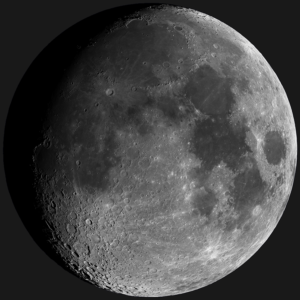
Today’s Featured Image is a simulated view of the Moon as seen from the Earth on Tuesday 15 October 2013 at 10 AM Mountain Standard Time (1700 UT, the time this blog post was released).
The Moon will not be in the sky over North America, but this is what the Moon will look like over Mumbai, India, where the local time in Tempe, Arizona will be 10:30 AM. This synthetic view was generated using a ray-tracing algorithm to place shadows and shading into the LROC WAC normalized reflectance map based on the topography portrayed by the WAC Global Lunar DTM (Digital Terrain Model) 100 m topographic model, or GLD100, and the LRO Lunar Orbiter Laser Altimeter (LOLA) topographic model of the lunar poles.
The normalized WAC reflectance map was generated from 110,000 WAC images, removing the effects of varying lighting geometries on the reflectance by calculating (or normalizing) reflectance at common illumination and viewing angles everywhere on the Moon (at the resolution of a 100 meter grid). For a detailed explanation of how the normalized map was generated check out this Featured Image post (and this spectacular rotation movie (100 plus mg .mov file) of the same map).
The second data product used to generate today’s synthetic view of the Moon was a global topographic map, that is a combination of two digital elevation models: the GLD100, and the LOLA topographic model of the lunar poles. We then combine the topography and the normalized images by draping the normalized reflectance map over the global topographic map; this step places the reflectance pixels in 3D space (latitude, longitude, radius). At this point the location and orientation of each pixel is known relative to the Sun such that shadows and shading can be accurately added to the reflectance map. A ray-tracing algorithm steps back from each pixel to the location of the Sun, and if it encounters another pixel along the way, the pixel is shadowed (see image below).
Finally, the relative reflectance is computed for each unshadowed pixel based on the calculated illumination and viewing angles. In a nutshell, we can generate a new view of the Moon at any lighting condition. Since the location of the Sun relative to the Moon is known through time, we can generate an image of how the Moon looked, or will look, on any date, like today's Featured Image!
So why bother making synthetic images of the Moon when we can take images? We can see what the lighting will be for a certain feature along LRO’s flight path, and the ideal lighting conditions can be chosen to observe it, allowing us to optimize NAC targeting.
Check out the full synthetic image HERE.
Related Posts:
A Unique View Of The Moon (July 17, 2013)
LROC's new Global Lunar Topography (November 16, 2011)
Farside! And all the way around (March 11, 2011)
LROC News System
Today’s Featured Image is a simulated view of the Moon as seen from the Earth on Tuesday 15 October 2013 at 10 AM Mountain Standard Time (1700 UT, the time this blog post was released).
The Moon will not be in the sky over North America, but this is what the Moon will look like over Mumbai, India, where the local time in Tempe, Arizona will be 10:30 AM. This synthetic view was generated using a ray-tracing algorithm to place shadows and shading into the LROC WAC normalized reflectance map based on the topography portrayed by the WAC Global Lunar DTM (Digital Terrain Model) 100 m topographic model, or GLD100, and the LRO Lunar Orbiter Laser Altimeter (LOLA) topographic model of the lunar poles.
The normalized WAC reflectance map was generated from 110,000 WAC images, removing the effects of varying lighting geometries on the reflectance by calculating (or normalizing) reflectance at common illumination and viewing angles everywhere on the Moon (at the resolution of a 100 meter grid). For a detailed explanation of how the normalized map was generated check out this Featured Image post (and this spectacular rotation movie (100 plus mg .mov file) of the same map).
The second data product used to generate today’s synthetic view of the Moon was a global topographic map, that is a combination of two digital elevation models: the GLD100, and the LOLA topographic model of the lunar poles. We then combine the topography and the normalized images by draping the normalized reflectance map over the global topographic map; this step places the reflectance pixels in 3D space (latitude, longitude, radius). At this point the location and orientation of each pixel is known relative to the Sun such that shadows and shading can be accurately added to the reflectance map. A ray-tracing algorithm steps back from each pixel to the location of the Sun, and if it encounters another pixel along the way, the pixel is shadowed (see image below).
Finally, the relative reflectance is computed for each unshadowed pixel based on the calculated illumination and viewing angles. In a nutshell, we can generate a new view of the Moon at any lighting condition. Since the location of the Sun relative to the Moon is known through time, we can generate an image of how the Moon looked, or will look, on any date, like today's Featured Image!
 |
| Visual representation of how the ray tracing algorithm determines if a pixel is or is not in shadow. [Hanger, et al., 2013]. |
So why bother making synthetic images of the Moon when we can take images? We can see what the lighting will be for a certain feature along LRO’s flight path, and the ideal lighting conditions can be chosen to observe it, allowing us to optimize NAC targeting.
Check out the full synthetic image HERE.
Related Posts:
A Unique View Of The Moon (July 17, 2013)
LROC's new Global Lunar Topography (November 16, 2011)
Farside! And all the way around (March 11, 2011)


No comments:
Post a Comment