
 |
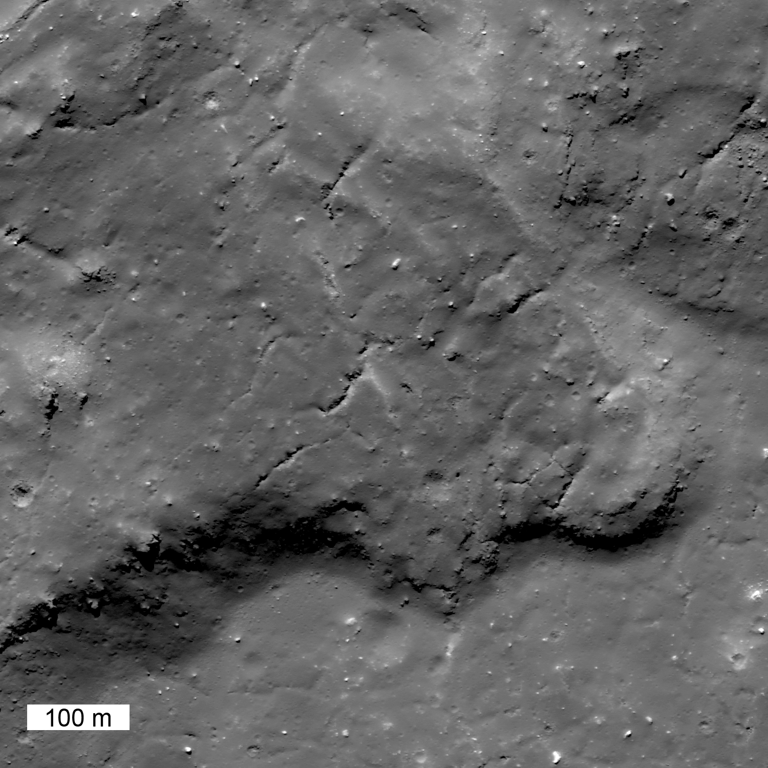
| This giant fossilized glacier of impact melt extends north from a much larger mass of impact melt of the north rim of Tycho. This single section of the flow is more than 10 kilometers long. LROC Narrow Angle Camera (NAC) observation M185954551R, LRO orbit 12482, March 9, 2012; resolution is 0.6 meter per pixel of a 43.53° angle of incidence, from 64.8 kilometers altitude. View the larger LROC Featured Image HERE [NASA/GSFC/Arizona State University]. |

Jeffrey Plescia
LROC News System
Impact melt is formed during the crater excavation process due to the intense heating of the target rocks. Some of the melt is ejected from the crater and deposited on the rim. In this case, on the north rim of Tycho, not far from the Surveyor 7 landing site, a large amount of melt was deposited, pooled and then flowed downslope away from the crater. This flow (41.162°S, 348.605°E) is about 21 km from the northern rim. Upslope, toward the rim, there are also numerous smaller pools of impact melt (now frozen to solid rock). Contrast this flow with the River of Rock on the southeast side of Tycho crater.
 |
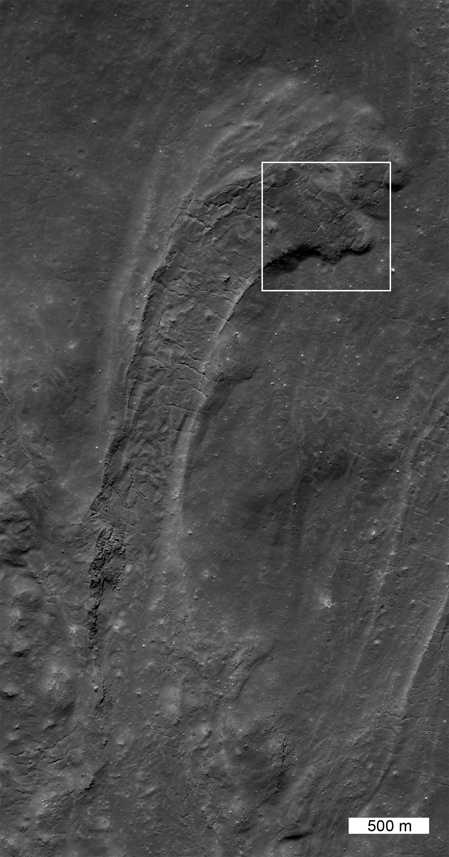
| From a half-sized reduction of the original LROC context image (HERE), this expanded view of the full LROC frame (NAC M185954551R) shows more of the flow anatomy, extending north from Tycho. The white box shows the field of view included in the featured image above [NASA/GSFC/Arizona State University]. |
 |
| Northern flank of Tycho, its wall, rim painted with flows and pools of ejecta; the arrows points to the flow highlighted above, the blue cross marks the landing site of America's last unmanned lunar lander Surveyor VII, highlighted below. LROC Wide Angle Camera (WAC) 604nm observation M152952485C, spacecraft orbit 7644, February 21, 2011; angle of incidence 57.41° at 63.7 meters resolution from 46.5 kilometers overhead [NASA/GSFC/Arizona State University]. |
Related Posts:
Tycho's flash-frozen inferno
Tycho's flash-frozen inferno
Ejecta on Tycho floor
 |
| The very successful and daring Surveyor 7 was successfully landed right in the middle of the complex Tycho impact melt fields, north of the crater, about 10 km away from the field of view included in the LROC Featured Image. Less than a kilometer, beyond view of the spacecraft's cameras, is s substantial melt pool, where Surveyor might easily have landed instead. LROC NAC M152952815R, LRO orbit 7674, February 21, 2011, resampled from the original resolution of 0.5 meters from 44.7 kilometers [NASA/GSFC/Arizona State University]. |
2 comments:
The melt pond was actually the target landing point. It was clearly visible in Lunar Orbiter V images, though not as clear as these fantastic LRO images.
Phil
Great, as always, to hear from you, Phil. I had no clue that the nearby pond was their intended target. Looks like they came very close. That would have been quite a view!
And thanks to the LROC team from having surveyed that landing site more than once.
We've been looking forward to Sam Lawrence updating the LROC artifact coordinate listing. My guess is you've amassed one of your own.
Post a Comment