Tuesday, May 31, 2011

Impact melt in Anaxagoras crater


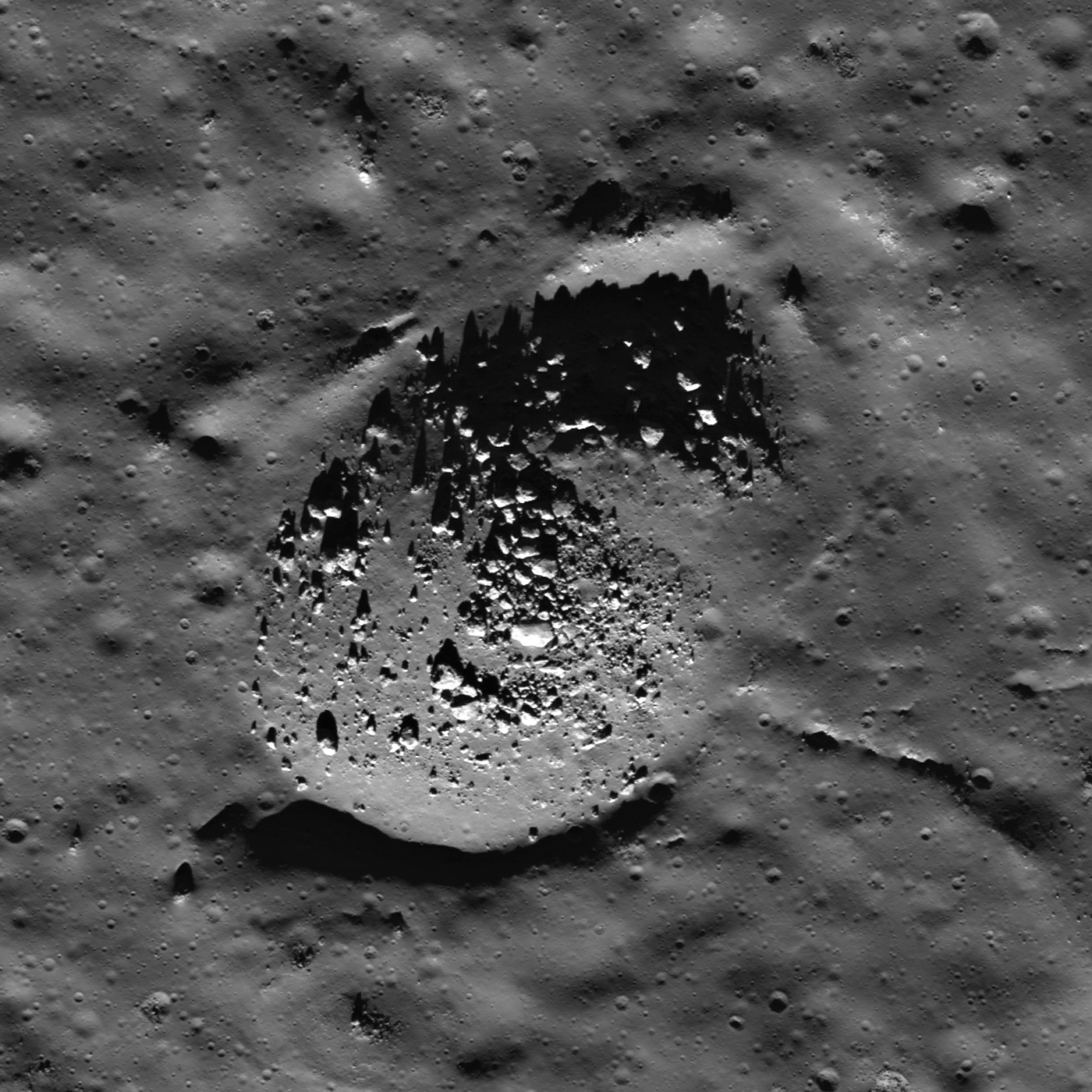
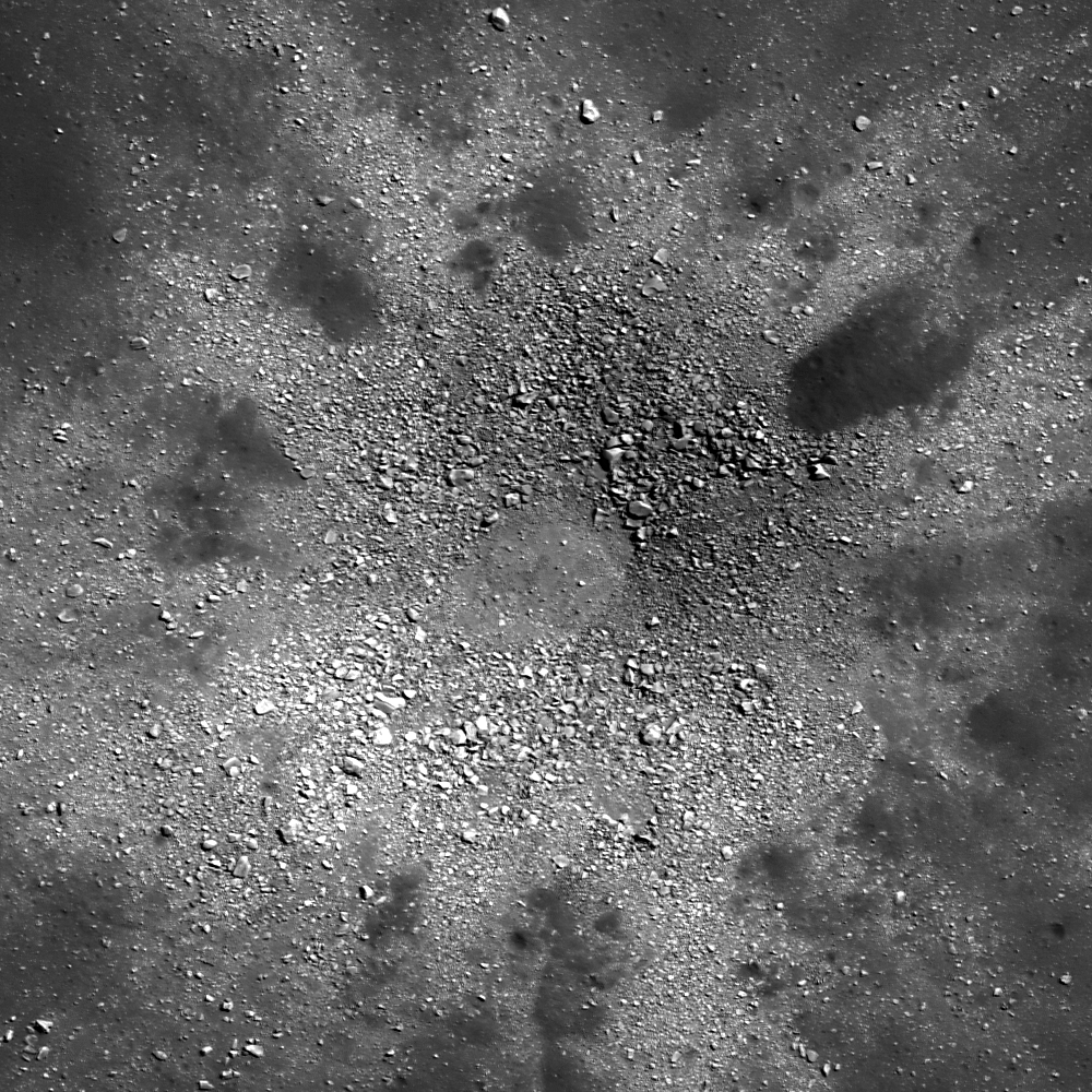
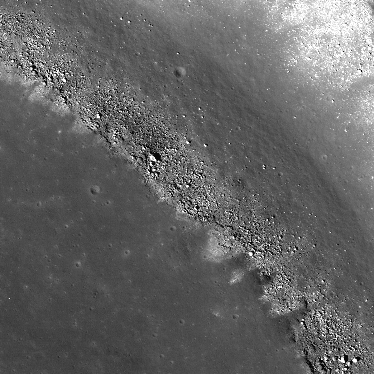
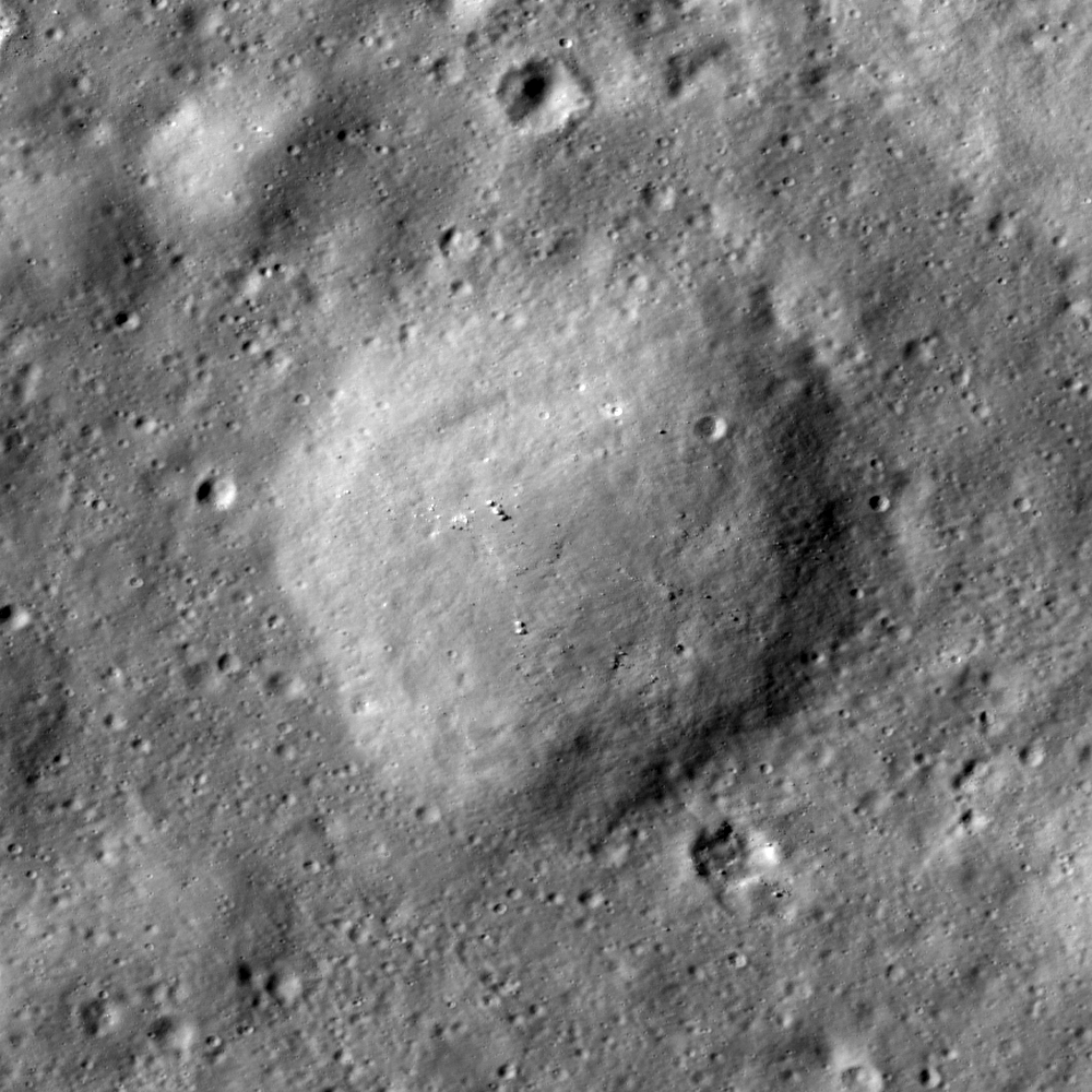
Boulders clustered on a positive relief bulge in an impact melt deposit on the floor of Anaxagoras crater (73.5°S, 349.7°E); most of the boulders are 10 - 30 meters across. LROC NAC M155309869R, LRO orbit 8022, March 21, 2011; image field of view is 800 meters (see the full-size LROC Featured Image HERE [NASA/GSFC/Arizona State University].

Lillian Ostrach
LROC News System

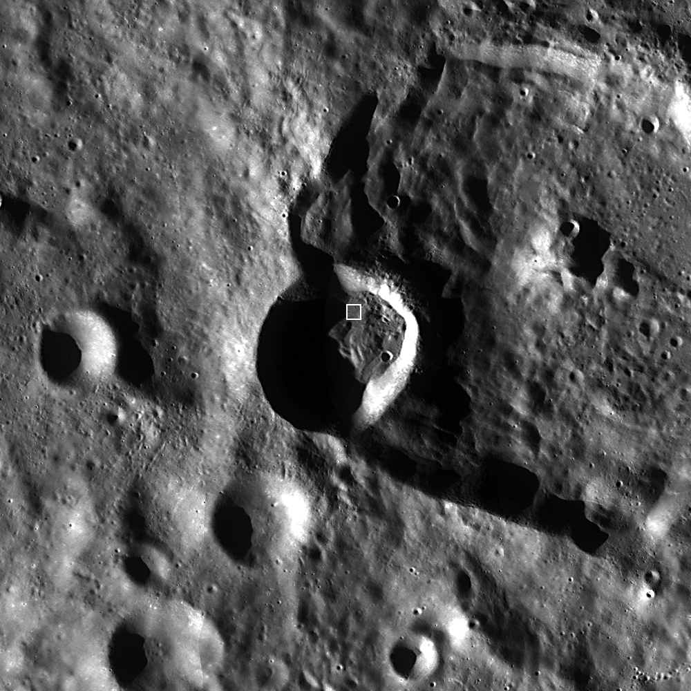
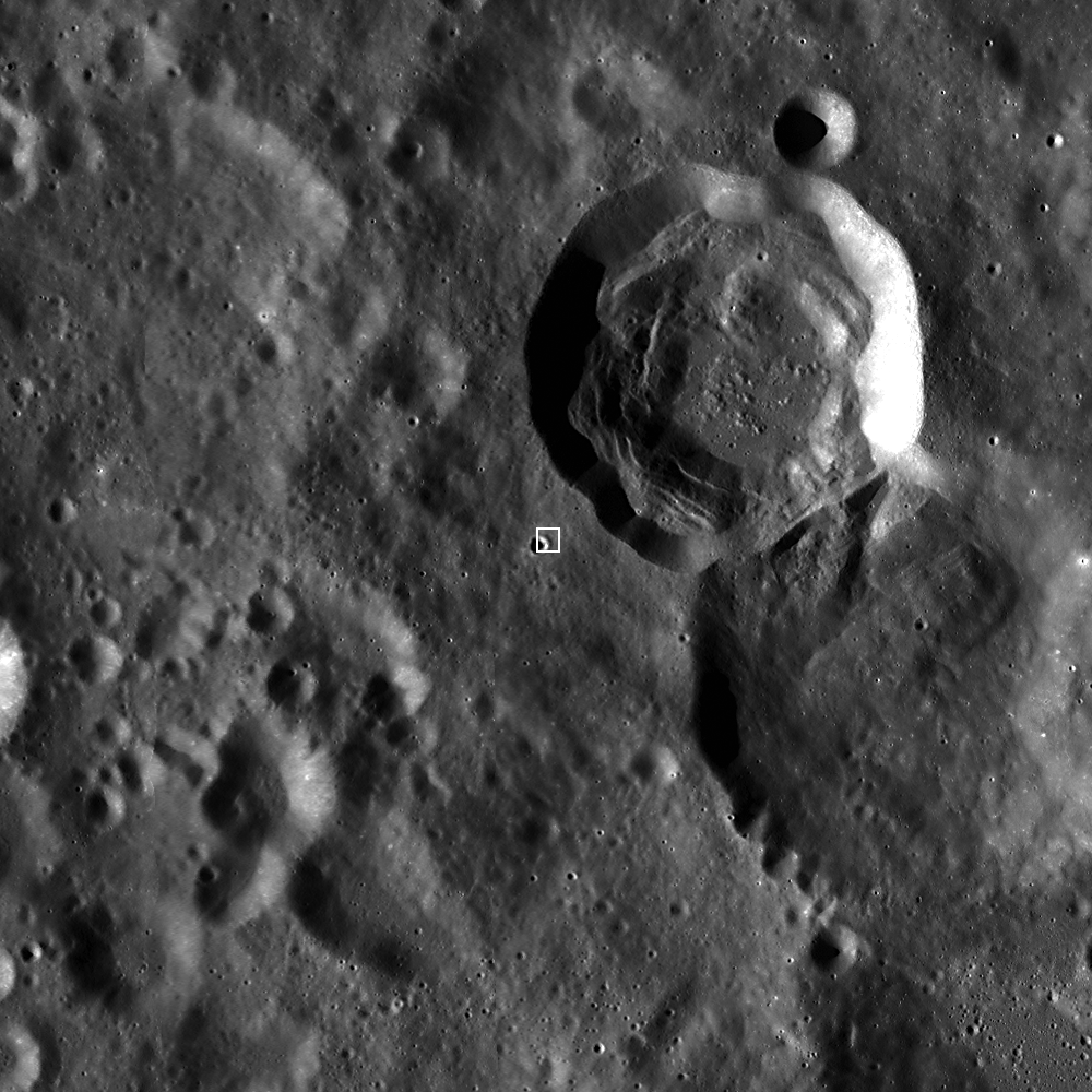
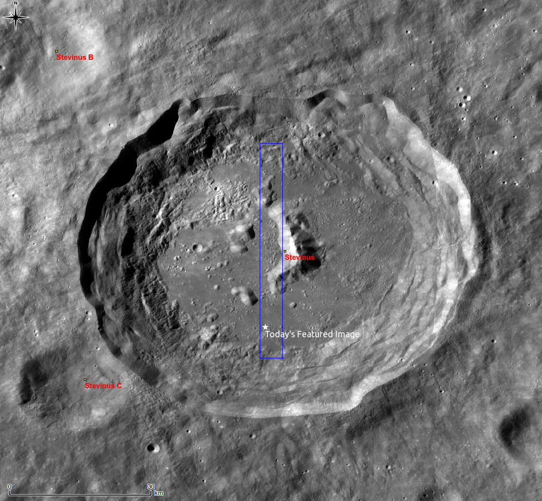
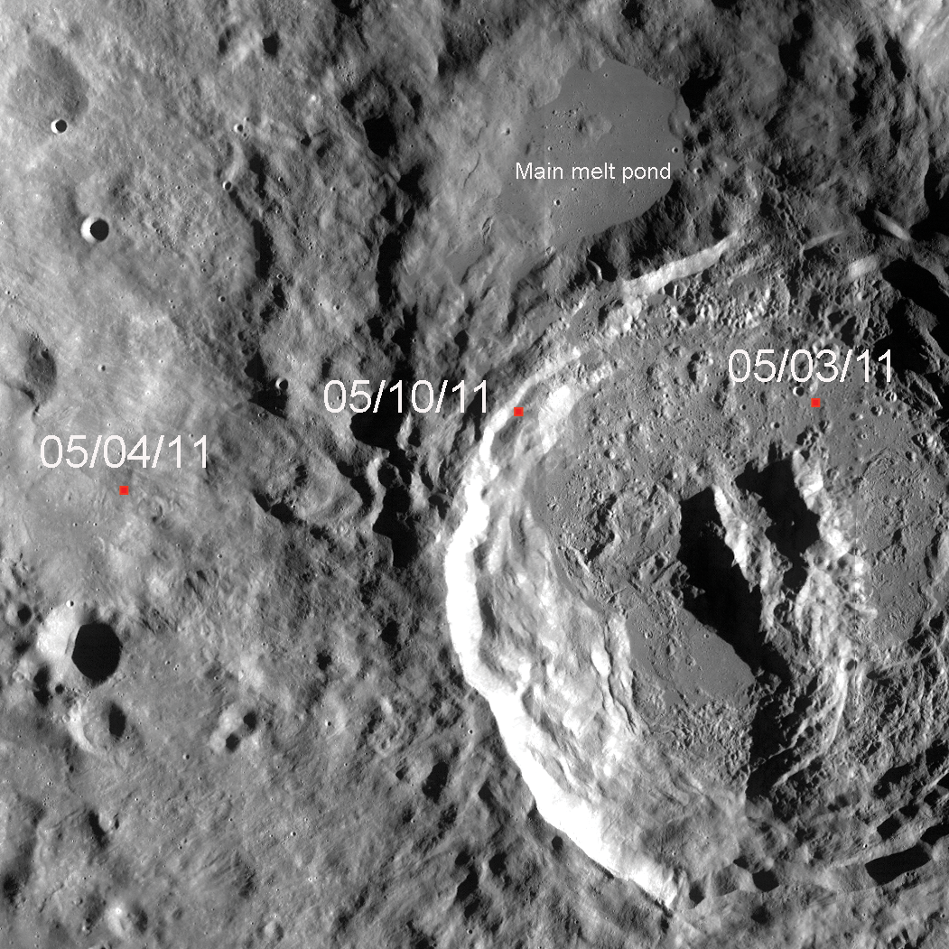
Anaxagoras, 50 km diameter, is a Copernican-aged crater located on the lunar far side.

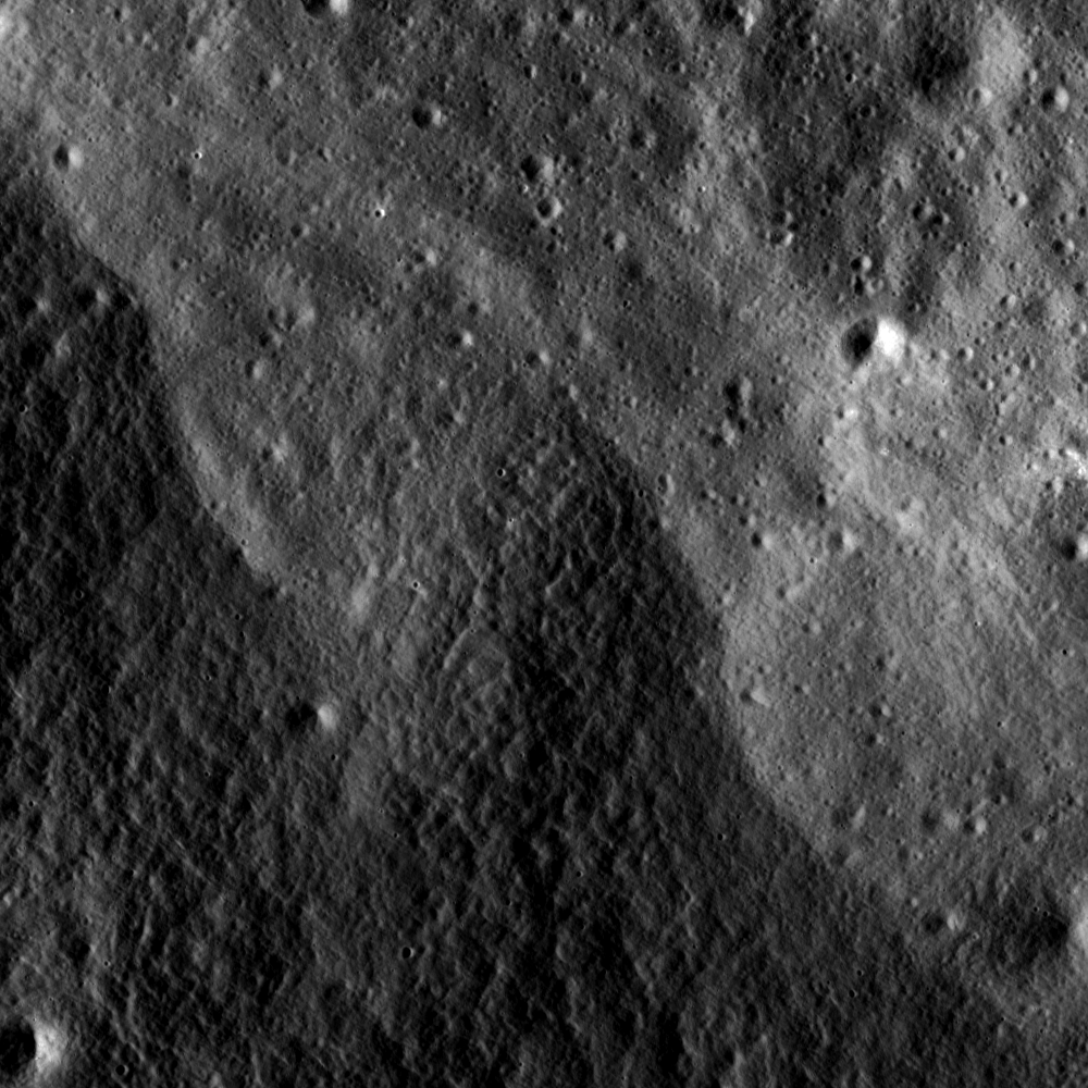
A previous post examined exposed bedrock in its central peak and mentioned the impact melt-covered floor. Impact melts are exciting to lunar geologists not just because the melt ponds and flows are beautiful, but because samples of impact melts can provide a specific and accurate age of crater formation through radiometric dating.


LROC WAC monochrome mosaic context of Anaxagoras crater. The floor of Anaxagoras is covered in impact melt that is riddled with cracks that probably formed during cooling [NASA/GSFC/Arizona State University].

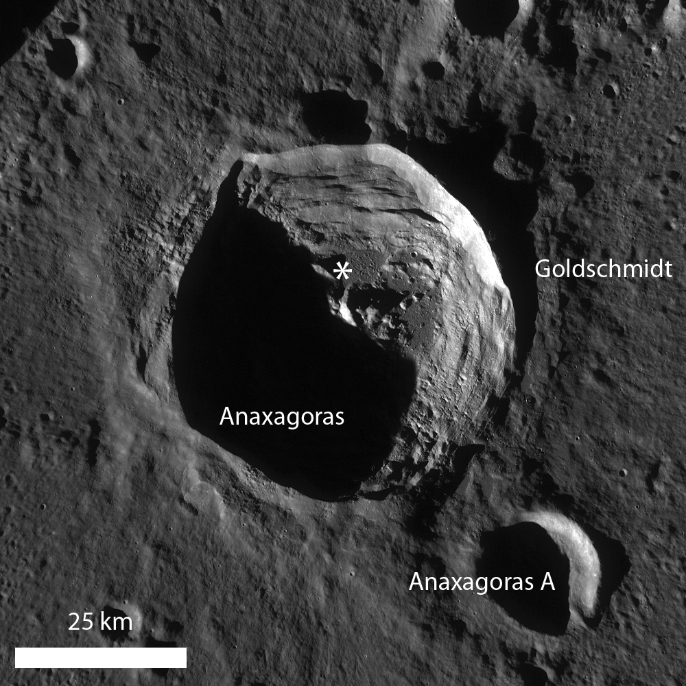
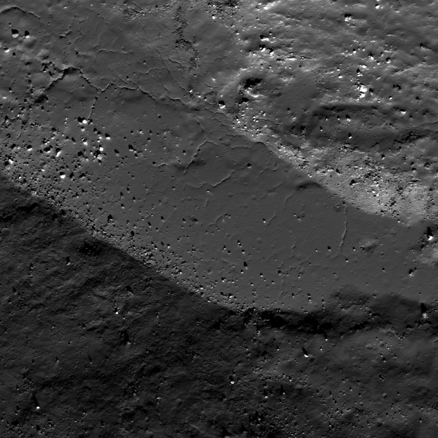
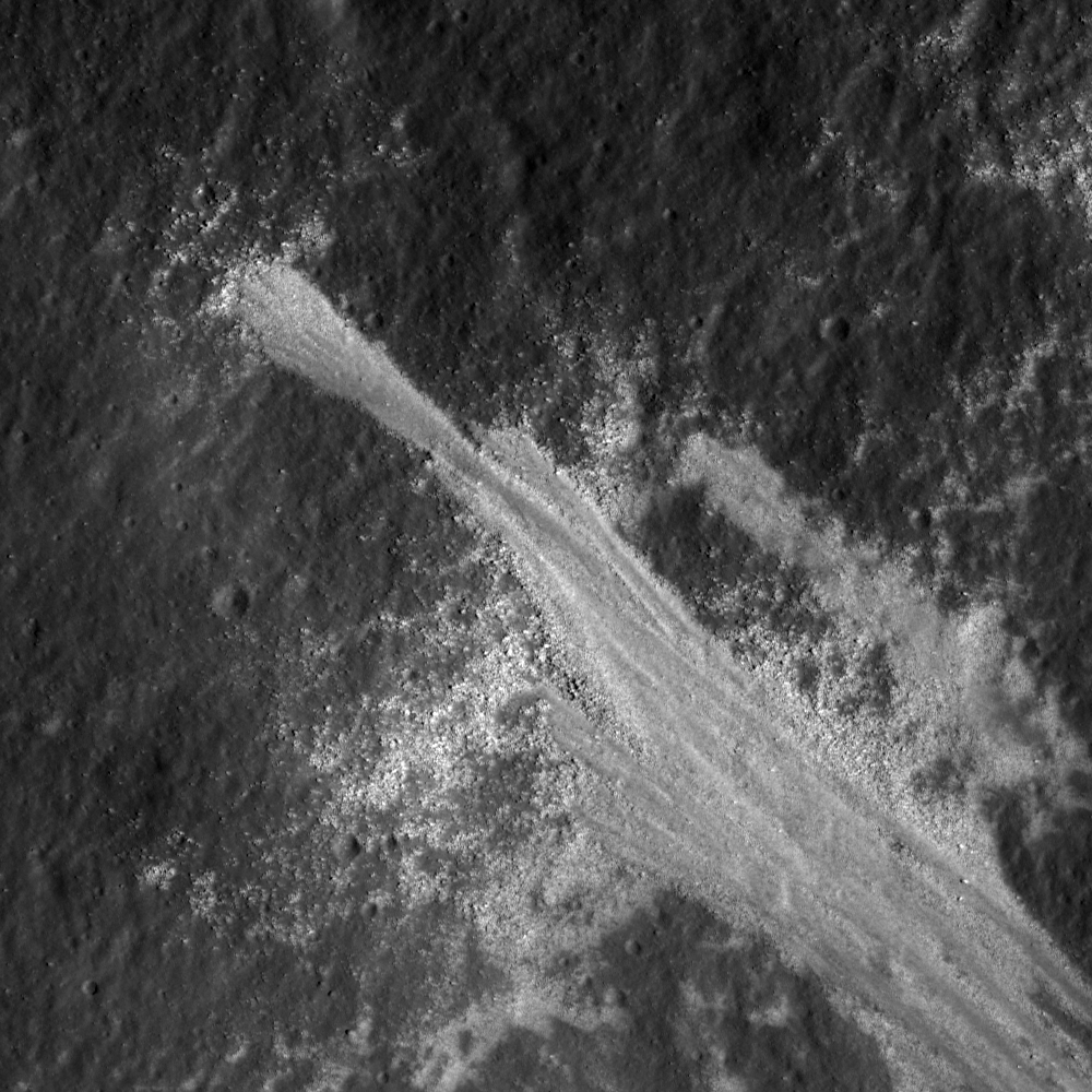
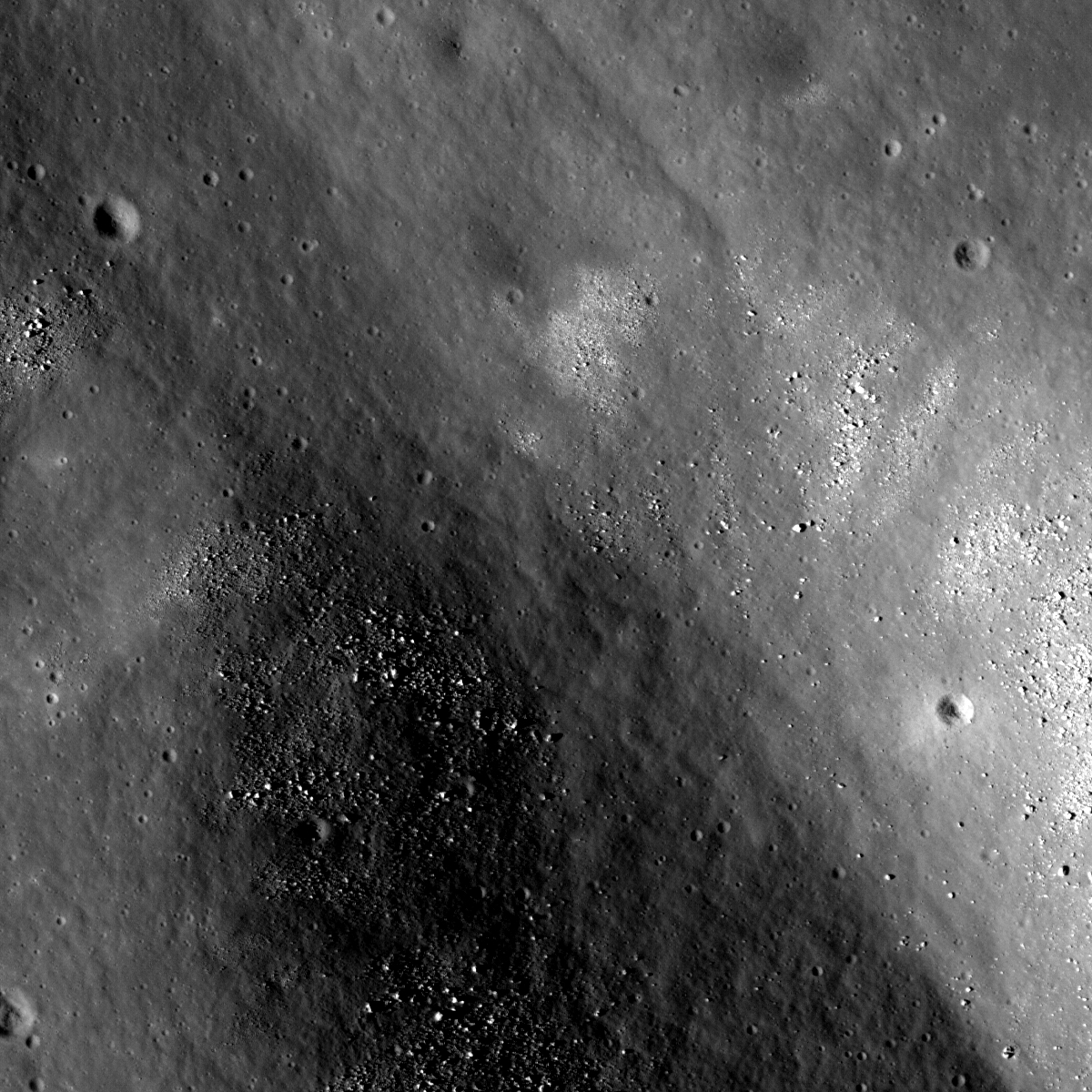
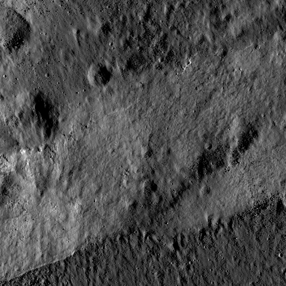
Much of the impact melt on the floor of Anaxagoras is smooth, but there are some places with cracks or negative-relief features. These cracks and pit-like features probably formed during cooling of the melt as the material fractured, similar to the way scientists think the natural bridge in the King crater melt sheet formed. We simply do not know for certain. Additionally, there are several hills and bulges that are covered with clusters of boulders. There are no impacts in the melt sheet that might account for the boulder clusters, thus a possible explanation is that the boulders are eroding out of the impact melt that covers these hills. These boulders look similar to boulder clusters eroding out of wrinkle ridges in the mare; are they the result of a similar process? This observation suggests that perhaps erosion proceeds preferentially on the steeper slopes of bulges in the melt sheet and ridge crests of wrinkle ridges to produce boulder clusters. But why are boulders only eroding from these bulges? There are other steep slopes nearby, but these slopes do not have boulders. There may be a simple explanation for the presence or absence of boulders in the Anaxagoras melt sheet and along wrinkle ridge crests, but further observations and analyses are required. Certainly, this is another mystery waiting for future lunar explorers!

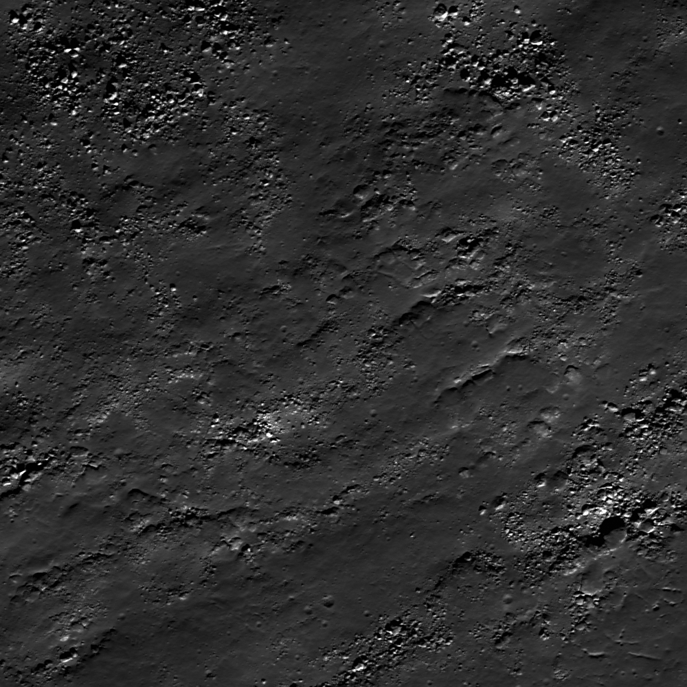
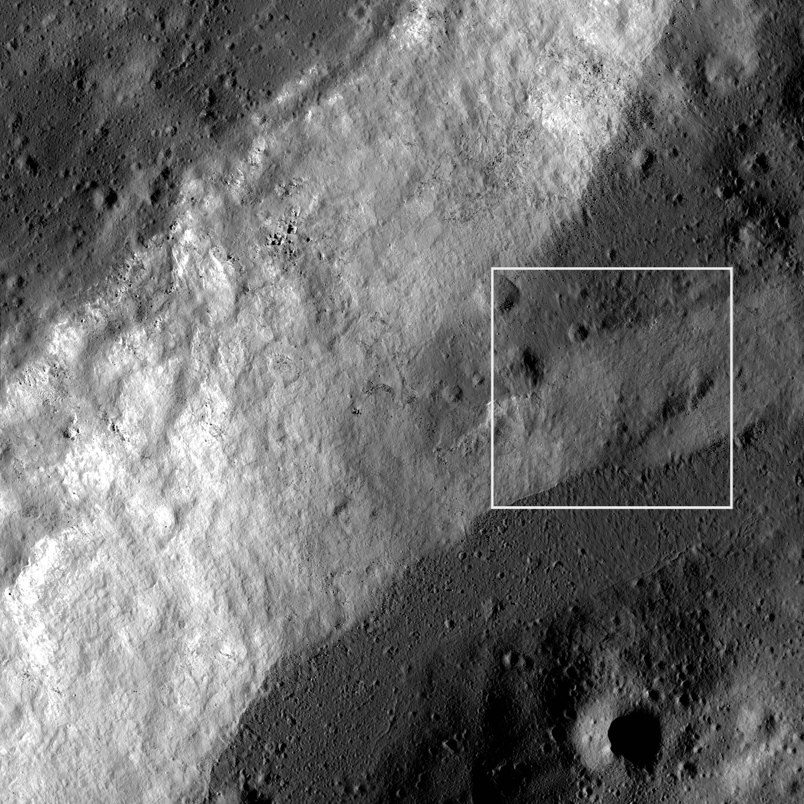
Discover the beauty of the Anaxagoras impact melt sheet for yourself in the full LROC NAC image!

Related Posts:
Anaxagoras A at Sunrise
Fragmented Impact Melt
Impact melt at Necho crater
A molten flood
More Impact Melt!
Fractured Impact Melt


Anaxagoras as viewed through the high-definition television camera on-board Japan's lunar orbiter SELENE-1 (Kaguya) in 2009 [JAXA/NHK/SELENE].

Friday, May 27, 2011

Fractured Impact Melt


Cracks in impact melt inside Thales crater. The smooth impact melt is fractured and then sprinkled with boulders from the neighboring slope. LROC NAC M157270357R, LRO orbit 8311, April 12, 2011; image scale is 0.53 meters/pixel, incidence angle is 62° View the full-sized LROC Featured Image HERE [NASA/GSFC/Arizona State University].

Sarah Braden
LROC News System

Thales (61.8°N, 50.3°E) is a young, 32 km diameter crater located at 61.8°N, 50.3°S. The interior of Thales has many different features including terraces formed by slumping and impact melt. Today's Featured Image illustrates the dynamic nature of Thales, with smooth impact melt implaced at the time of impact, which then fractured and was subsequently sprinkled with boulders from a neighboring slope.

Impact melt is instant lava, formed when lunar rock is melted when the tremendous energy of impact is released in a moment. After the initial impact, the melt can end up anywhere in the crater. It can pool in the bottom of the crater floor, pool on terraces, or flow down crater walls inside and outside of the rim. Sometimes melt is thrown out of the crater during the impact and lands outside the crater forming pools outside the rim.

The cracks in the impact melt probably formed as the melt cooled and solidified. With the cooling of the material comes a change in volume, which could open the cracks. Or, the cracks may have formed over time as the crater floor slowly changed shape and the impact melt material cracked to compensate.


LROC Wide Angle Camera (WAC) 100 m/px mosaic of Thales. The red box indicates the position of the LROC Featured NAC Image, May 26, 2011. The white arrow points to an area on the rim where slumping occurred, changing the crater's overall shape. The crater is 32 km in diameter. View the full-sized LROC WAC context image HERE [NASA/GSFC/Arizona State University].

Explore the LROC NAC for more exciting impact melt features inside Thales crater!

Related Images:
Fragmented Impact Melt
Impact melt at Necho crater
Forked Impact Melt Flows at Farside Crater
Out of the Shadows: Impact Melt Flow at Byrgius A Crater


LROC WAC Mosaic view of Thales under "ideal" illumination [NASA/GSFC/Arizona State University].

Schmitt: "Time to start over."


To the distress of Apollo 17 ground controllers watching the live television feed back on Earth, Dr. Harrison H. Schmitt - the only professional scientist and the last man to set foot on the Moon in 1972 briefly lifts his visor to get a better look at a surface sample he had just raked up from the Taurus-Littrow valley floor.

Terence P. Jeffrey
CNSNews

Harrison “Jack” Schmitt, a former U.S. senator who as a crew member of Apollo 17 was the last human being to step foot on the moon, says that the U.S. government should phase out NASA and create a new agency focused on exploring deep space and establishing American settlements on the moon and ultimately Mars.

“I think it is time to start over,” Schmitt told CNSNews.com while discussing the U.S. space program in an “Online With Terry Jeffrey” interview.

It was 50 years ago yesterday that President John F. Kennedy spoke to a joint session of Congress and called for the United States to send men to the moon and bring them back before the decade of the 1960s was over. Schmitt believes it is time to renew that vision of U.S. leadership in space, but that NASA is not the federal agency to do it.

“I think the various parts of NASA can be distributed in agencies that already exist, but that if you want the country to be dominant in deep-space exploration I think we are going to need a new agency for a number of reasons,” said Schmitt. “One is that we need to focus the national deep-space exploration effort in a single organization without a lot of other budgetary and managerial distractions. I propose the National Space Exploration Administration.

“That organization, hopefully, would be allowed by Congress to hire the best possible managers that we can find in the country as well as to hire the young engineers and scientists who are absolutely essential to the success of these complex types of programs,” said Schmitt.

Schmitt, who holds a doctorate in Geology from Harvard, was accepted into NASA’s Scientist-Astronaut program in 1965. In 1972, he served on the three-man crew of Apollo 17, the last U.S. mission to the moon. On Dec. 12 of that year, he and fellow astronaut Eugene Cernan landed in the lunar module in the moon’s Valley of Taurus-Littrow.

Read and listen to the full feature, HERE.

Improved spectography reveals 100 times more water in fire fountain samples


Spectrograph studies of the Orange Soil sampled by Harrison Schmitt on the rim of Shorty Crater more sensitive than was available four decades ago reveals more native water trapped in lunar magma than is entirely consistent with theories of the Moon's origins [NASA/AS17-137-20990].

Jason Palmer
BBC News

An analysis of sediments brought back by the Apollo 17 mission has shown that the Moon's interior holds far more water than previously thought.

The analysis, reported in Science, has looked at pockets of volcanic material locked within tiny glass beads.

It found 100 times more water in the beads than has been measured before, and suggests that the Moon once held a Caribbean Sea-sized volume of water.

The find also casts doubt on aspects of theories of how the Moon first formed.

A series of studies in recent years has only served to increase the amount of water thought to be on the Moon.

The predominant theory holds that much of the water seen on the lunar surface arrived via impacts by icy comets or watery meteorites.

But this recent find is shedding light on how much water is contained in the Moon's interior, which in turn gives hints as to how - and from what - it formed.

In 2008, a team of researchers from the Carnegie Institution and Brown and Case Western Reserve universities analyzed the water content found in samples of lunar magma returned by Apollo missions.

They wrote in a Nature paper that the samples contained about 10 times more water than they expected.

Read the article HERE.

Granular Flow


A dry flow of boulders down the slope of Riccioli CA's inner wall. Slope direction is from the bottom right hand corner to the upper left hand corner. LROC Narrow Angle Camera (NAC) M112074670R, LRO orbit 1650, November 5, 2009, image resolution is 0.5 meters/pixel, solar illumination incidence is 34° See the full-size LROC Featured Image HERE [NASA/GSFC/Arizona State University].

Sarah Braden
LROC News System

The stream of bright material is made up of blocks, boulders, and smaller sizes of rocks. This conglomeration of granular material slid down the wall of Riccioli CA towards the floor of the crater. The end of the flow, furthest toward the crater floor (upper left hand corner of the image), spreads out in a small fan, much like wet sediments at the end of an alluvial fan. It is amazing how the physics of wet material (Newtonian flow) in some cases applies to dry material! The Moon is dry and this slide was formed without the involvement of water.

The rock slide may have happened right after the impact that formed Riccioli CA or later in the crater's history. Over time the overall shape of the crater changes due to movements of rock such as slumping, rock slides, and ejecta thrown into the crater from other impacts. The occasional volcanic event can also dramatically change what a crater looks like (check out Archimedes the mare flooded crater).

Riccioli CA is 14 km in diameter, located at 0.58°S, 286.99°E just north of the crater Riccioli. Riccioli CA has the same name as the larger crater Riccioli because Riccioli CA is a satellite crater. Satellite craters are given the same name as a larger crater in the general area with a letter or letters after the main crater's name.

Explore the LROC NAC for more exciting features around the rim of Riccioli CA!

Related Images:
Rock avalanche in Robinson Crater
Moon or Abstract Expressionism?
Post-impact modification of Klute W

Wednesday, May 25, 2011

Some 50th Anniversary thoughts

President John F. Kennedy (1917-1963) addresses a Joint Session of Congress, May 25, 1961, outlining his proposed commitment for the U.S. "of landing a man on the Moon and returning him safely to the earth."

Paul D. Spudis
The Once & Future Moon
Smithsonian Air & Space

Tomorrow is the 50th anniversary of President John F. Kennedy’s special address to Congress – a request for supplemental appropriation for a variety of projects but most famously remembered for the announcement of his Man-Moon-Decade goal of Project Apollo. That event, cited by space advocates and excerpted in space and history documentaries, is remembered as the pinnacle of American leadership in space policy.

When President Kennedy announced his Moon landing goal for America, no world power was capable of accomplishing such a feat. By winning the “Moon race,” America would demonstrate to the non-aligned (and supposedly undecided) world that a free, democratic system could win against the Union of Soviet Socialist Republics’ repressive, communist regime. The Soviet’s then-advantage in rocketry did not give them a leg up on a manned race to the Moon as both countries would have to develop and build a new system to deliver men to the lunar surface. Congress and enthusiastic Americans accepted this audacious challenge, winning not only the race to the Moon (within the decade) but also developing a strong economy through technological and scientific breakthroughs.

The subsequent forty-year span since Apollo ended has seen space enthusiasts and policy makers searching for the “holy grail” of renewed greatness, believing (because of events following President Kennedy’s bold direction) that presidential statements can make it happen again. The most recent articulation of this belief comes from one of the most insightful students of the JFK decision, Prof. John Logsdon, whose new book (John F. Kennedy and the Race to the Moon) focuses on the Apollo decision and its subsequent impact on space policy. Logsdon places particular emphasis on a supposed change of heart by Kennedy after the Moon race was well underway. In citing two occasions where Kennedy publicly proposed to the Soviets that we go to the Moon together, Logsdon believes that had he lived, Kennedy would have retooled the race away from a nationalistic competition to joined hands with the Soviets in a cosmic Kumbaya reach for the Moon.

Though Logsdon recognizes that the unique aspect of Apollo came about as a manifestation of Cold War competition (something he believes does not prevail today), he sees JFK’s later comments regarding cooperation as providing us with the “holy grail” of continued space exploration going forward. “I kind of fall back on presidential leadership,” he said. “I doubt this is going to happen, but I would hope that on the 50th anniversary of Kennedy’s own speech, next Wednesday, President Obama has something positive to say about working together internationally to find a global strategy for exploration… I would not hold my breath on that happening, but something like that needs to be done.”

After years of reminding space students that the Apollo decision is not a good historical guide for setting a space agenda, Logsdon wants President Obama to resurrect space using the force of a Kennedyesque pronouncement – not as a national challenge, but as he believes Apollo would have developed had Kennedy lived to redirect it: an international project of cooperation that will financially support space exploration. By passing the JFK space leadership “torch” to President Obama, Logsdon envisions the Apollo presidential challenge resurrected and revitalized (this time to Mars, the long-held and sought after dream of many space advocates). But this vision rewrites history: Apollo wasn’t about space, it was about war, where presidential leadership is needed and required.

The problem with applying Logsdon’s reasoning to the current U.S. space policy morass is that, as with our endless debate about heavy lift vs. other launch vehicle options, it confuses means with ends. Whether we go into space with or without a bold presidential declaration is secondary to WHY we are doing it. Because we have not stated what we are trying to achieve, arguments about how we go about it, whether in terms of rockets, destinations, declarations or participants, leave us still sitting on the launch pad (soon, only on a Russian launch pad). Without an agreed upon national purpose, space has become a political toy, vulnerable to changes in direction with each new administration.

On the 50th anniversary of Kennedy’s rightly famous speech, the real question before us remains unaddressed and in some respects, unasked. I ask it now: What are we trying to accomplish with our national civil space program? By answering that question and establishing a realistic and reachable national goal, America will establish a lasting space industry and presence, one undeterred or hobbled by changing political winds.

I have my own answer to this question, which I have discussed here and elsewhere in detail. Space development is an essential, irreplaceable part of everyday life in 21st Century America; we have charted a course whereby we must learn the skills of creating more capability in space, including the building and maintenance of larger, more capable space assets (as well as protecting existing ones). To proceed, we need a reusable and extensible Earth-Moon space transportation system. I believe that one can be created through the production and use of the material and energy resources of the Moon.

Such a transportation system will extend human reach into the Solar System beyond low Earth orbit. By demonstrating the viability of resource extraction off planet, individual and joint investments will materialize in many forms and from many sectors, spurring on a new and burgeoning space industry. This template contrasts significantly with an elitist, academic exercise in scientific data collection wrapped in the worn out mantra of “exciting” the public. Our national interests will be best served through cislunar development and space resource utilization.

If these are desirable goals, then how we go about achieving it can be the subject of legitimate debate. Until we address the objective of a large-scale national expenditure for space, presidential announcements will never possess the power or the effect Kennedy’s words had in bringing about a great era of American productivity and pride. The United States is at a critical crossroads. Will we lead or will we be content to follow?

Tuesday, May 24, 2011

Fifty years on

A mere 18,260 days...

Saturday, May 21, 2011

Testing the GRAIL Twins


April 29, 2011: Technicians install lifting brackets prior to hoisting the 200-kilogram (440-pound) GRAIL-A spacecraft out of vacuum chamber after testing. Along with its twin GRAIL-B, the GRAIL-A spacecraft underwent an 11-day-long test at Lockheed Martin Space Systems in Denver that simulated many of the flight activities they will perform during the mission, all while being exposed to the vacuum and extreme hot and cold that simulate space.

The Gravity Recovery And Interior Laboratory (GRAIL) mission will create the most accurate gravitational map of the Moon to date, improving our knowledge of near-side gravity by 100 times and of far-side gravity by 1000 times.

Scheduled for launch later this year, GRAIL is a mission in NASA's Discovery Program, and will begin its work at the Moon in 2012 [NASA/JPL].

Crater in Mare Humorum


This crater, located in Mare Humorum, is relatively fresh and very bouldered. LROC Narrow Angle Camera (NAC) M157851844LE, LRO orbit 8396, April 19, 2011; field of view is 500 meters. See the full-size Featured Image HERE [NASA/GSFC/Arizona State University].

Drew Enns
LROC News System

Why is this crater so bouldered?

Bouldery craters are primarily the result of bolides impacting solid material. More cohesive materials produce larger boulders when they are impacted. Craters like these can give clues as to the thickness of the regolith. As craters increase in diameter, they excavate further into the surface. So if a crater has no boulders, it has probably excavated only regolith. This impact though has punched through the overlying regolith and fragmented the underlying mare basalt into large boulders.


An intermediate view of the subject crater belies the loss of granularity in what only appears to be the relatively smooth background of the basin floor in the LROC Wide Angle Camera (WAC) contextual view below. In high sun myriad far older craters of similar size are visible [NASA/GSFC/Arizona State University].


LROC WAC context image of the LROC Featured Image, May 20, 2011. It's field of view is the white square in this 100 km-square scene. See the full-size context image HERE [NASA/GSFC/Arizona State University].

Can you find the transition between unbouldered and bouldery craters in the full LROC NAC!

Related Posts:
Bouldery crater near Mare Australe
Fresh crater on Oceanus Procellarum
Buckland Boulders

Friday, May 20, 2011

Post 2500: LROC, "Steps in Slipher S."


Boulders on the floor of Slipher S . Some are covered with impact melt, while others are well exposed. The Sun angle is from the bottom right, and the crater floor is sloped downward toward top left. LROC Narrow Angle Camera (NAC) observation M156558063RE, LRO orbit 8206, April 4, 2011; image field of view is 650 meters. View the full-size LROC Featured Image HERE [NASA/GSFC/Arizona State University].

Drew Enns
LROC News System

Boulders are a common feature on the Moon, in and out of craters. These boulder steps occur within the crater floor of Slipher S (49.2°N, 158.7°E), an Eratosthenian crater.

Slipher S's floor is uneven and covered with impact melt. These boulders were likely created in the Slipher S impact event, while at the same time they were covered by impact melt. The uneven topography of the crater floor provides many sloped surfaces for the boulders to weather out of, and in this case has caused steps to form!


LROC context image of LROC Featured Image, May 19, 2011, framed within the white square. Image field of view is 100 kilometers. View the full-sized context image HERE [NASA/GSFC/Arizona State University].

Look for more boulders and impact melt in the full LROC NAC image!

Related Posts:
Bouncing, Bounding Boulders!
Exposed Boulders in Aitken Mare

Thursday, May 19, 2011

Dark landslide near van Gent


A landslide within a small crater near 43 kilometer, far side crater van Gent (15.4°N, 160.4 °E). The crater rim is at the and the crater floor is at bottom left. The landslide has exposed many boulder within the crater wall. LROC Narrow Angle Camera (NAC) observation M156550640RE, LRO orbit 8205, April 4, 2011; image field of view is 600 meters. See the full-size LROC Featured Image HERE [NASA/GSFC/Arizona State University].

Drew Enns
LROC News System

Landslides are a common form of mass wasting on both the Moon and on Earth. This process exposes fresh material, and results in high albedo features in planetary images. Impact craters perform a similar process, with fresh craters creating high albedo features on planets.

This landslide is lower albedo than the crater walls of the crater it occurs in, implying the landslide is more mature than the crater. How can this be? It is probably that the landslide surface is not exposing fresh material, but is instead mature highlands material that has fallen back into the crater.


Crop of the LROC Wide Angle Camera monochrome mosaic context image for the LROC Featured Image, May 18, 2011, situated in the white box. Field of view is 40 kilometers. See the full context image HERE [NASA/GSFC/Arizona State University].

Look for more landslides in the entire LROC NAC!

Related Posts:
Post impact modification of Klute W
Landslides in Marius Crater
Dark streaks in Diophantus

Tuesday, May 17, 2011

Dark surface materials surrounding Rima Marius


Dark surface materials on the plateau surrounding Rima Marius (17.63°N, 309.02°E). LROC Narrow Angle Camera (NAC) observation M137882287R, LRO orbit 5453, August 31, 2010; solar illumination incidence 35°, image field of view is 660 meters. View the spectacular full-resolution LROC Featured Image HERE [NASA/GSFC/Arizona State University].

Hiroyuki Sato
LROC News System

The Moon's surface is thought to be covered almost everywhere by a layer of regolith. Regolith is a term meaning soil produced by weathering of local rock. On the Moon weathering is mostly caused by impacts, both large and small. In fact the smaller impacts, micrometeorite impacts, produce most of the upper portion of the regolith. An abundance of super fine and unconsolidated grains are produced by the astounding number of micro-impacts that have occurred over the past 4 billion years. In addition to rocks breaking apart into finer and finer fractions, over time space weathering makes rocks darker and redder. This effect is especially noticeable around steep surfaces where unweathered material slides down and stands in high contrast with its surroundings.


Medium resolution view of the full field of view (2.2 kilometers) showing Rima Marius as seen in LROC NAC observation M137882287R [NASA/GSFC/Arizona State University].

Today's Featured Image focuses on a portion of southern bank of Rima Marius. Dark material, likely mature regolith, shows forked shapes at the edge of the mare. How were these irregular patterns formed? They could be remnants of collapsing plateau edges, which exposes fresh and bright slope surface in between the dark remnants. Or it might be flow marks of darker materials. If these dark fingers are flows how did they form? Perhaps small moonquakes destablized mature regolith, which then slid a bit down the slopes of the rille?


LROC Wide Angle Camera (WAC) 100 meter-per-pixel monochrome mosaic of the vicinity of Rima Marius. The blue box and while arrow indicate locations of full NAC frame and the LROC Featured Image released May 17, 2011. View full-sized WAC context frame HERE [NASA/GSFC/Arizona State University].

Explore the walls of this fascinating rille by viewing the full NAC frame!

Related posts:
Dark streaks in Diophantus crater
Erosional trough on crater wall
A Dark Cascade at Sulpicius Gallus
Alphonsus crater mantled floor fracture

Monday, May 16, 2011

Online: The Lunar Mapping and Modeling Project (LMMP)


No longer 'no man's land,' the Moon's south pole and vicinity unseen before the 21st century swept up by laser altimetry over multiple orbital passes of the LOLA instrument on-board the Lunar Reconnaissance Orbiter (LRO). Most of the lower elevations shown above are permanently shadowed. This false-color and hill-shade view of the LOLA Digital Elevation Model (DEM) is a small example of what can now be very easily accessed on-line by way of the Lunar Mapping and Modeling Project (LMMP), already a very thorough public resource under development by NASA.

Kimberly Newton
Marshall Space Flight Center

NASA has created a new interactive web-based tool that incorporates observations from past and current lunar missions creating one of the most comprehensive lunar research websites to date.

The Lunar Mapping and Modeling Project at NASA's Marshall Space Flight Center in Huntsville, Ala. has created an online set of capabilities and tools that will allow anyone with an Internet connection to search through, view, and analyze a vast number of lunar images and other digital products. The data and tools available through the project website will allow researchers to perform in-depth analyses to support mission planning and system design for lunar exploration and science missions. It will permit detailed scientific analysis and discovery and open additional educational and outreach opportunities.

The project website is a one-stop location for finding, retrieving, and analyzing data about the moon, including the most recent lunar surface imagery, altimetry, temperature, lighting and other data, as provided by the Lunar Reconnaissance Orbiter (LRO) and its seven onboard instruments.


A postage-stamp-sized reduction of the LMMP user interface as viewed through most browsers shows the LOLA color-coded and hillside shaded elevation of 75 degrees south layered over, in this example, the LROC Wide Angle Camera (WAC) monochrome mosaic [NASA].

The orbiter, launched by NASA in 2009, continues to gather information about the moon from its orbit some 31 miles (50 kilometers) above the lunar surface. LRO has provided a treasure trove of data -- more than all previous lunar and planetary missions combined.

The Lunar Mapping and Modeling Project website will also include data obtained from past lunar programs and missions including Apollo, Lunar Orbiter, Lunar Prospector, Clementine, Kaguya (Japan) and Chandrayaan-1 (India).

Read the full-story HERE.


On the other hand, some lunar features can only be seen to be appreciated. As previously demonstrated, the Reiner Gamma lunar swirl, a nearside landmark in Earth-side telescopes, is invisible in the LMMP LOLA DEM layer, but shows up instantly when, with a click of the mouse, the present LMMP base map Lunar Orbiter/Clementine hybrid photomap is brought to the surface.

Sunday, May 15, 2011

Discontiguous Rilles


Northwest end of a disconnected depression, possibly a collapsed or buried segment of Rima Marius (14.53°N, 311.43°E), northwest of Marius C and not far east from a similar phenomena investigated by India's Chandrayaan 1 orbiter west of the Marius Hills. LROC Narrow Angle Camera observation M135507533R, LRO orbit 5103, August 3, 2010; solar illumination incidence 58°, field of view 550 meters. View the full-size LROC Featured Image HERE [NASA/GSFC/Arizona State University].

Hiroyuki Sato
LROC News System

Sinuous rilles (like Hadley Rille, near the Apollo 15 landing site) are narrow, long depressions that meander across the lunar surface like a terrestrial river. Lunar geologists think that sinuous rilles formed either as erupting lavas carved their way through the surface, or by roof-collapse of lava tubes. A portion of the rille (named Rima Marius) in today's Featured Image is discontinuous, with a partially-closed depression that possibly marks the source region for this rille. Perhaps the "blockage" in the channel is a intact lava tube roof.

While there are no signs of any natural bridge structures or other openings in this region, it is possible that a small section of the lava tube might have simply had its entrance and exit blocked by collapse debris.


Jim Irwin captured this spectacular view of Hadley Rille during the second EVA of Apollo 15 in 1971. See the high-resolution image HERE [NASA/ASJ].


Full-width view of the LROC NAC strip shows the discontinuity in some context [NASA/GSFC/Arizona State University].


LROC Wide Angle Camera (WAC) 100 meter / pixel monochrome mosaic view of Rima Marius, with the discontinuity near its terminus, northwest of Marius C [NASA/GSFC/Arizona State University].

Sinuous rilles like Rima Marius are high priority targets for future human lunar exploration in part because they expose deeply buried mare units, meaning that human exploration of locations like Rima Marius will provide important new scientific insights into the duration and evolution of lunar volcanism.

Explore the entire NAC frame!

Related images:
Sinuous Chain of Depressions
Rilles as far as the eye can see in Prinz!
Rimae Posidonius
Rimae Prinz Region - Constellation ROI
Marius Hills Pit - Lava Tube Skylight?


A 3.5 kilometer discontiguous rille west of the Marius Hills that may have had origins in common with the sinuous rille system the winds through those hill's largest mounds, now thought to be one volcano. This image was composed from data collected by the Terrain Mapping Camera on-board India's Chandrayaan-1 [ISRO].

Thursday, May 12, 2011

Pancakes in a melt pond


Pancake-like mound in Stevinus crater (33.03°S, 54.07°E). LROC Narrow Angle Camera observation M104162457R, LRO orbit 512, August 6, 2009; solar incidence 62°, field of view about 870 meters [NASA/GSFC/Arizona StLinkate University].

Hiroyuki Sato
LROC News System

The central peak of Stevinus crater is surrounded by a very flat and smooth floor. Small hummocks, fractures, and wrinkled textures all suggest that the flat and smooth floor is a frozen impact melt pond. However, small details in the floor show that the impact melt is not perfectly smooth. Just after the impact event, molten rocks and fragmented breccias were mixed together within the forming crater cavity. Think of a huge frying pan with this mix of molten and solid materials sloshing about. Slowly the melt solidified by surface cooling. If you look carefully you will find numerous pancake-like mounds on the smooth floor. What are they? Pancake mounds were likely created during the impact event, but the actual process is unknown. Did half solid, half molten rock lumps fall into the pond? Perhaps magma moving under the crust tried to push up and out of the crust as the crater floor readjusted? Or what if the pancake-like mounds were formed by slumping caused by small impacts over time?


LROC Wide Angle Camera Global 100 meter resolution monochrome mosaic of 77 km Stevinus. The blue rectangle and star indicate the location of entire NAC frame and the LROC Featured Image released May 11, 2011, respectively. View the full-sized LROC WAC context image HERE [NASA/GSFC/Arizona State University].

Explore the boundary of mare basalts by viewing the full NAC frame!

Related posts:
Mounds in a melt pond
Impact melt features in Tycho crater's floor
Anomalous mounds on the King crater floor


Simulated view courtesy of Google Moon showing the view, looking north from near the location of the LROC Featured Image of the Pancake Mound, south of Stevinus central peak. The north inner wall beyond towers nearly 5 kilometers higher in elevation above the crater's floor, 50 kilometers away.

Wednesday, May 11, 2011

China plans lunar research base


An improved, if unoriginal, global map of Helium-3 distribution on the lunar surface, based on the distribution of ferrous titanium oxides observed by China's Chang'E lunar orbiters, released in 2010 [CNSA/CLEP].

People's Daily Online

Under China's three-phase lunar probe plans for orbiting the moon, landing on the moon and returning back to Earth, China is scheduled to launch the Chang'e-3 and softly land it on the moon, where it will release a moon rover to explore the lunar surface, by 2013.

China will carry out an unmanned lunar landing around 2017 before making manned lunar landings and building research bases on the moon, said Ouyang Ziyuan, chief scientist of China's lunar probe program, in Shanghai on May 9.

Ouyang made the remarks during the opening ceremony of the 2011 IEEE International Conference on Robotics and Automation.

He said that the Chang'e-2 has operated safely for 200 days as of May 1. During the operation of the Chang'e-2 in space, four tiny cameras on the satellite recorded clear photographs, marking China's first-ever aerospace application of CMOS imaging technologies, first space surveillance engineering application, first photograph captured at the moment of igniting the 490N engine and first photograph of the Earth taken by a camera on an orbiting lunar orbiter.

However, is the ultimate mission of the Chang'e-2 to test soft-landing technologies for the Chang'e-3 or to test Earth reentry technologies for follow-up Chang'e series satellites after their lunar landings? Ouyang said that the ultimate mission of the Chang'e-3 Satellite has yet to be determined. Whatever mission is selected, the Chang'e-2 will test key technologies for follow-up tasks of Chang'e series satellites before completing its lunar trip.

For instance, the Chang'e-2 can either make a "pilot" soft-landing in order to test technologies for the Chang'e-3 or return to Earth orbit under ground control and simulate the return of future Chang'e series satellites to earth after 2013.

Ouyang said that the Chang'e-3 will be equipped with a 70-kilogram lander and a 120-kilogram moon rover. The satellite will weigh about 500 kilograms and will have a designed life of three months. As the intelligent robotic technology develops, the rover will be able to determine its own routes, climb slopes, avoid obstacles and pick a good spot to perform science experiments with a collection of sensors. Furthermore, it will even be capable of collecting samples from the moon and sending them back to Earth for further studies.

Ouyang said that China plans to send recoverable rovers and humans to the moon at appropriate times. In addition, China is also considering building a research base on the moon and exploring Mars and other parts of outer space. To achieve its goal, the country is building a new satellite launch center and is making great efforts to develop more advanced rocket engines.

Fault scarp with impact melt at King crater


A fault scarp separates two zones of impact melt within the King Crater (5.0°N, 120.5°E) north interior wall. LROC Narrow Angle Camera (NAC) observation M115529715RE, LRO orbit 2159, December 15, 2009; solar illumination incidence 75° from the east, field of view approximately 900 meters (north is up). View the full-sized LROC Featured Image HERE [NASA/GSFC/Arizona State University].

James Ashley
LROC News System

Impact melt deposits ponded at two elevations (top and bottom darker grey zones) separated by a fault scarp (middle grey zone) on the WNW rim of King crater (76 km diameter). Here is a great example of a 'cross-cutting relationship.' Cross-cutting relationships provide a relative (which came first) timing of events. Knowing the order in which things happened is as important to reconstructing geologic history as knowing what happened. Accurate absolute dating of impact melt is also possible, but only with laboratory analysis of rock samples collected in the field!

See if you can tell what happened first here. Was it the faulting of the crater rim or the deposition of impact melt? Here's a clue: notice how cleanly the edge of the ponded melt material contacts the fault scarp at the bottom left of the Featured Image. Would you expect such a clean margin if 1) hard rock had been ripped apart by a faulting crust, or if 2) the fault happened first and the melt flowed in afterward? Also, notice the 'herringbone' pattern in the melt itself, showing the direction of a flow that started high and cascaded like a waterfall over the fault scarp. Based on this, the faulting may seem to have come first! These massive blocks of lunar crust were in motion minutes after the blast that excavated King crater, and the melt remained molten and mobile long afterward. Or did they happen at the same time? First, what caused the fault? The impact event that created King crater resulted in concentric faults along which large blocks of crust slid, and in some cases collapsed. The melt formed from energy released in the impact. The environment was very dynamic, impact melt was flowing while the crater interior was rebounding and adjusting to the sudden event. So the impact melt likely came to its final form as we see it today some time after most of the major faulting had ceased. However, we cannot be certain that there wasn't some major movement along this fault even after the melt had ponded, and was still molten.

What a great puzzle for a future lunar geologist to unravel!

The image below is a slight "zoom-out" to provide a bit more context, and to show how the Featured Image fault scarp is only a small part of another, branching fault scarp. Note also the third, higher level of impact melt deposits in this image (upper left corner).


Medium resolution context for Featured Image from the NAC original; area approximately 2.8 km across. View the full-sized context frame for the LROC Featured Image HERE [NASA/GSFC/Arizona State University].

Zooming out still further gives us the full picture: The image below shows most of the 77-kilometer diameter King crater, together with areas beyond the crater rim that were effected by King's formation, and the locations of Featured Images posted on May 3rd, 4th and today (small red squares, which are drawn to scale). Clearly visible is King crater's large impact melt pond to the NNW. If you look closely, you will notice smaller pools of melt just south of this main pond. Notice their relationship to King crater. The crater walls have faulted and slumped into a 'stair step' arrangement of large blocks, and melt flowed in and ponded (afterward or perhaps during). Compare the last three Featured Image posts and note the diversity in terrain represented by one region on the Moon!

Explore the full NAC image here.


A portion of the global LROC Wide Angle Camera (WAC) mosaic showing the King crater region and the locations of three NAC Featured Images; field of view is approximately 100 km across. View the full-sized WAC context image HERE [NASA/GSFC/Arizona State University].

Related Posts:
Slumping rim of Darwin C
Natural bridge in King crater main melt pond

Looking Up: Our Moon - so close yet so far


First Quarter - where the creeping sunrise shadow unveils startling detail, that changes hourly, along the terminator [Luc Viatour/Moberly Monitor].

Peter Becker
GateHouse News Service
Moberly Monitor


It’s just as well most of us don’t spend much time thinking how we look - at least from outer space. There’s plenty of attention giving down here on the ground about appearances, without wondering what can be seen from “out there.”

Read the article HERE.

Saturday, May 7, 2011

Morpheus lunar lander in tethered flight tests

Second Morpheus Test Firing, May 6, 2011 [NASA/Joe Bibby].

Brittany Sauser

Technology Review/MIT

Project Morpheus is making subtle, but noisy, progress at NASA. The experimental spacecraft is designed to carry cargo to the moon, an asteroid, or Mars, but the model shown here will never actually land on such surfaces. It is being used to test new technologies, such as propulsion, guidance, navigation, and control systems, and optical sensors that would allow for a safe descent and landing.

Morpheus recently conducted its first tethered flights at Johnson Space Center (JSC) in Houston (see the video below) and will be taking its first untethered flight this month, making it the first prototype spacecraft to fly at JSC since before man walked on the moon.

Morpheus is also testing a new, greener propellant, liquid oxygen and methane. The mixture is cheaper, lighter, and safer than than traditional spacecraft fuels. It can also be stored for longer periods of time in space, and the methane could perhaps even be made from ice on the moon or Mars.

Read the Article, HERE.

Friday, May 6, 2011

King crater ejecta deposits


Deceleration lobes in King crater ejecta. LROC Narrow Angle Camera (NAC) observation M103739394LE, LRO orbit 453, August 1, 2009; lighting incidence angle 61°, field of view approximately 1,200 meters across. View the dull-size LROC Featured Image HERE [NASA/GSFC/Arizona State University].

James Ashley
LROC News System

The lobate forms in this image look like lava flows, but they're something very different. These are 'deceleration lobes' in the extended ejecta blanket of King crater (5.0°N and 120.5°E), located approximately 50 km due west of the King crater rim. North is up, and sunlight shines from the west.

They resulted as ground-hugging debris flows, accelerated by the prodigious energy of the explosive King impact event, met with pre-existing topography and was ground (literally) to a halt - much in the way that avalanches can behave as they interact with the topography of a mountain slope. Sometimes such lobes will catch up to and override one another like shingles on a roof. These features were first studied in the early 1970's, when photographs taken of the region from the orbiting Apollo 16 Command Module where returned to Earth. Similar features can be found within many areas of the distal ejecta deposits associated with the King crater impact.

Imagine being witness to this event as the ancient planetesimal that struck the Moon and excavated King crater set these walls of rock and debris into motion. They forced their way across the lunar surface for tens of kilometers, smothering everything in their paths until they finally lost energy and stopped where we see them today. It would have been an astonishing and very dramatic thing to see!

Explore the rest of the full NAC image for more details.

Related posts:
Scouring ejecta
Giordano Bruno ejecta


Full width, lower resolution view of M103739394LE, showing the terrain, on the rolling farside highlands west of King in context [NASA/GSFC/Arizona State University].

LOLA: Drygalski of the Far South


LOLA Featured Image - It is only fitting that Drygalski Crater (diameter 149 km), located near the lunar south pole, is named for German polar scientist and geophysicist Eric Von Drygalski. LOLA data are used to examine complex craters such as Drygalski to better constrain the shape of lunar craters. High resolution topographic data from LOLA are also used to refine crater depth-to-diameter relationships for the Moon [1]. Different types of craters (simple craters, complex craters, and multi-ringed basins) have diagnostic depth-to-diameter ratios. The ratios vary for each planetary body in the Solar System due to a number of factors, including crustal density and structure as well as other characteristics of the crust.

[Get high-res version]


Traveling backward in available resolutions of Drygalski we don't lose much from the compiled LRO/LOLA laser altimetry to long polar shadow obscuring only some detail in this LROC monochrome mosaic. Note a difference in texture seen on a third of the ancient crater's floor, appearing on first glance to be an artifact of creating a mosaic of images swept up under differing sets of lighting conditions? Laser altimetry built up into the topography in the LOLA map reveals detail lost to shadow, particularly terraces within the north rim - but also that same division of landscapes on the crater floor. It's not any artifact of high latitude photography. Over the aeons, "things happened" close by and far away from Drygalski that left different traces on different parts of the crater. Note the lava pond on the south heights and the catena, a curved closely grouped chain of craters immediately to the north [NASA/GSFC/Arizona State University].


This mosaic of images in the ultraviolet (750 nm) was gathered by Clementine in 1994, swept up over a shorter period of time and from greater altitude than LRO travels today [NASA/DOD/ASU].


Priorities for the Lunar Orbiter series were scouting potential landing sites for the Apollo expeditions though the polar latitudes were photographed in unprecedented detail, providing what stood for decades as our best overhead surveys of Drygalski. Until well after the Apollo Era large areas of the Moon were undiscovered country [NASA/JPL/ASU].