Showing posts with label GSFC. Show all posts

Monday, February 2, 2015

LRO could remain in present orbit 7 or more years

Because the Moon is lumpy and uneven, it's possible nothing has ever been in close-orbit around our companion planet as long as the Lunar Reconnaissance Orbiter. Certainly nothing built by humans. Few deep space missions have delivered as much return on their investment. The sheer volume of data returned by LRO exceeds all deep space missions ever launched combined, several times over [NASA/GSFC/SVS].


THE SECOND EXTENDED SCIENCE MISSION
FOR THE LUNAR RECONNAISSANCE ORBITER:
STATUS, SCIENCE GOALS, AND DATA DELIVERIES

Noah E. Petro and John W. Keller
NASA Goddard Space Flight Center
Solar System Exploration Division

The Lunar Reconnaissance Orbiter (LRO) has been orbiting the Moon for over five years. In that time, data from the seven instruments onboard the spacecraft have made significant advances in our understanding of the Moon and its environment. In September 2014 LRO completed its first Extended Science Mission (ESM) and began a second ESM (ESM2). 

During the both ESM and ESM2, LRO has been in a quasi-stable, eccentric orbit of ~40 x 180 km with a periapse near the South Pole (Figure 1). This orbit enables high resolution measurements around the South Pole. 

The LRO Project is considering a maneuver in early 2015 to lower the periapse in order to further improve measurements over the South Pole, particularly by the LOLA instrument. Based on the current annual consumption of fuel, the spacecraft could remain in its current orbit for at least 7 more years.
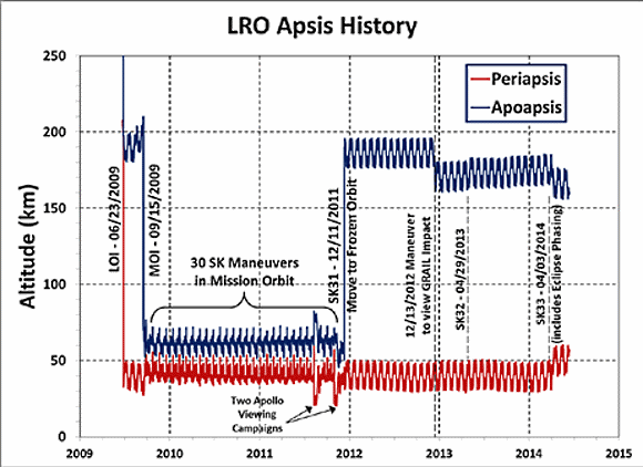
FIGURE 1. Orbital history of LRO since arriving at the Moon in 2009. LRO now employs yearly station keeping (SK) maneuvers in order to maintain its orbit. There are also periodic momentum unload burns that use small quantities of fuel.
LRO Operations: As part of the approval for continued operations, LRO was directed by NASA HQ to terminate operations of the Mini-RF instrument. All of LRO’s remaining six instruments are operating nominally, and have experienced no significant degradation since beginning the ESM over two years ago.

During extended operations the LRO spacecraft has performed exceptionally well, with 98.4% uptime during the life of the mission. LRO retains sufficient fuel quantities so that its current orbit could be maintained for at least 8 years, if not longer.

LRO Science In ESM2: An overarching theme of ESM2 for LRO is that of change. A number of measurements have shown changes to the lunar surface and to its environment. LRO will focus on the five following themes that each build on prior observations from LRO, LADEE, GRAIL, and the Moon Mineralogy Mapper. Each theme has numerous questions that are address, an example few are given here.
  1. Transport of Volatiles. How are volatile elements and compounds distributed, transported, and sequestered?
  2. Contemporary Surface Change. What causes changes in the flux and intensities of meteoroid impacts onto terrestrial planets.
  3. Regolith Evolution. Characterize planetary surfaces to understand how they are modified by geologic processes.
  4. Probing the Interior from Observations of the Surface. Characterize planetary interiors to understand how they differentiate and evolve from their initial state
  5. Interactions with the Space Environment.  How is surface material modified exogenically? How do exospheres form, evolve, and interact with the space environment?
LRO Data: The LRO instrument teams will continue to deliver data to the PDS every three months. As of the beginning of 2015 over 575 Tb of data have been placed into the PDS [1]. This data volume contains a range of products, including higher level maps, mosaics, and derived products. The PDS has made available the Lunar Orbital Data Explorer [2], a mapbased tool to search for finding and downloading PDS science data of LRO as well as other recent lunar missions.

In addition to the PDS holdings, several of the LRO instrument teams have additional products and tools available on their websites (Table 1).

Several global map products have recently been added to the PDS, here we highlight a few that are new in the last year. The Mini-RF team has assembled a global mosaic of their monostatic measurements [3].

For the first time we have global radar data for the Moon, data that clearly shows variations in rock abundance and surface texture over both the near and farside (Figure 2).

FIGURE 2. Mini-RF global mosaic of the Circular Polarization Ratio (CPR), one of the number of Mini-RF mosaic products now available online.
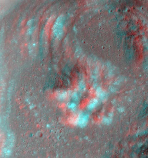
The LROC team regularly adds new products to the PDS via the team webpage (Table 1), including shapefiles, global mosaics, NAC-derived DEM’s, and NAC mosaics of selected targets. Recently the LROC team has made available a number of anaglyphs (Figure 3) showcasing the ability of the LRO spacecraft and the LROC team to precisely target the NACs.

FIGURE 3. Red-Blue anaglyph of the central peak of Euler crater.  The LROC team has made a number of anaglyphs available on their website (Table 1).
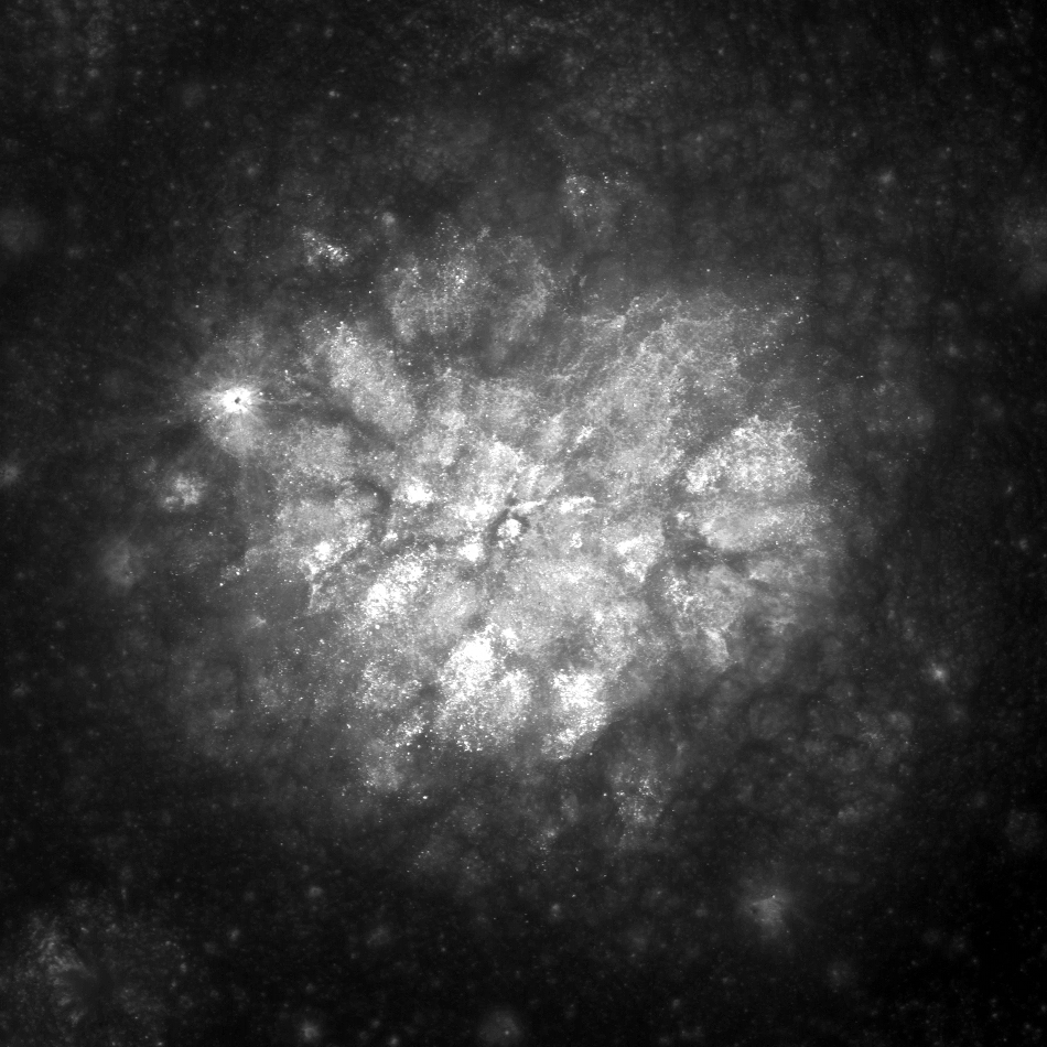
The LAMP team has a number of polar products available, including FUV ratio maps of both poles (Figure 4). These following maps are available at a resolution of 240 meters per pixel; Lyman-α (119.57–125.57 nm), Long (130–190 nm), On-band (130–155 nm), Off-band (155–190 nm), H2O Absorption Feature Depth Maps made by a Ratio map of on/off band.

FIGURE 4. LAMP Lyman-α map of the South Pole. LRO has focused on volatiles at the South Pole since arriving at the Moon 5+ years ago.
Table 1. LRO teams and their websites

LRO Project

Outreach

CRaTER

Diviner

LAMP

LEND

LOLA

LROC

Mini-RF

Use LRO Data!

The LRO Project has begun holding a series of data users workshops with the goal of helping the community work with the large volume of LRO data. Presentations given at the workshops are archived at the LRO website [4]. Questions regarding the access and use of LRO data can be directed to the authors of this abstract.

References:  [1] LRO PDS Archive, (http://pdsgeosciences.wustl.edu/missions/lro/).
[2] Lunar Orbital Data Explorer, (http://ode.rsl.wustl.edu/moon/).
[3] Cahill, J. T. S., et al., (2014) Icarus, 243, 173-190.
[4] LRO Data Resources, (http://lunar.gsfc.nasa.gov/resources.html).

Tuesday, December 9, 2014

Tuesday, November 18, 2014

Mottled mound at Firsov

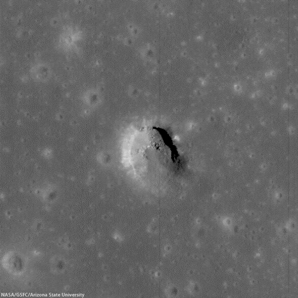
Low-angle incidence view of a curious mound on the floor of Firsov crater (51 km; 4.204°N, 112.697°E). 2.2 km field of view from LROC NAC observation M187506567R [NASA/GSFC/Arizona State University].
Hiroyuki Sato
LROC News System

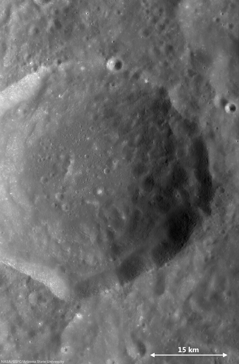
Firsov is a 51-km diameter crater located in the farside highlands, approximately 240 km east of King crater. The depth of Firsov's floor from the rim crest is an impressive 4.5 km (that’s 2.5 times the depth of the Grand Canyon in Arizona).

The bright (highly reflective) mound on the crater floor is about 200 meters in height, and 2.5 km in diameter, and really catches your eye. The central portion of the crater floor is relatively flat, suggesting that it at least partially consists of a long-solidified pool of impact-melt; the mound is located within this melt pond deposit.

46 km-wide field of view showing  the high-reflectance mound feature, near center of FriFirsovater, from LROC WAC monochrome (643 nm) observation M176892340CE, LRO orbit 11204, November 25, 2011; 62.51 incidence, resolution 58.62 meters from 43.41 km [NASA/GSFC/Arizona State University].
A number of previous Featured Image posts explored the origins of mounds occurring inside impact craters. Hypotheses include volcanic eruptions, impact debris, and the squeeze-ups of impact melt.

Today's Featured Image highlights the degradation of these mounds, instead of their origin. The low-incidence angle of the top image (~9°) highlights differences in albedo on the mound top, what causes these bright patches?

Perhaps, as the mound surface degrades over time, the high-reflectance materials are exposed unevenly, for example, due to a bumpy surface morphology, where local, topographically high portions are exposed faster and newly exposed material is immature (and thus brighter).

Alternatively, the mound may be constructed from non-uniform materials and/or compositions that exhibit a range of reflectivities. However, scientists believe that during impacts any compositional differences within the target are homogenized in melt deposits. This mound would be a great place to examine that hypothesis.

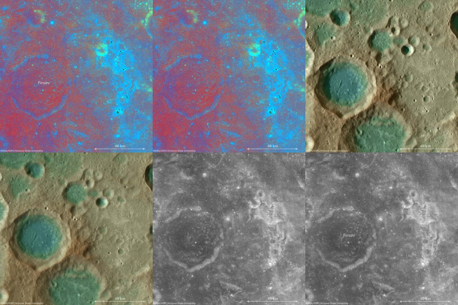
The bright mound southeast of center on the floor of Firsov is not the only albedo "anomaly" in the vicinity of Firsov crater. This cycle of overlapping fields of view, juxtapositioning data ranging from LROC WAC-derived elevation models to Clementine UV-VIS color ratio maps from 1994, brings into stark relief the unnamed Copernican era crater northeast of Firsov, and also the dramatic patch of albedo swirls coincident with a locally intense crustal magnetism, photographed from orbit by the crew of Apollo 10. It seems distant and detached, but still these swirls are likely associated with the widely-scattered swirl fields farther to the west at Mare Marginis, on the opposite side of the Moon from the energetic basin-forming impact that formed Mare Orientale 3.1 billion years ago [NASA/GSFC/Arizona State University].
View full-window, HERE.

Related Posts:
Shiny Mound
Kagami-mochi on the Moon!
Pancakes in a melt pond
Donut Holes
The Domes of Stevinus Crater
That's a Relief

Friday, November 7, 2014

Exploring the lunar subsurface

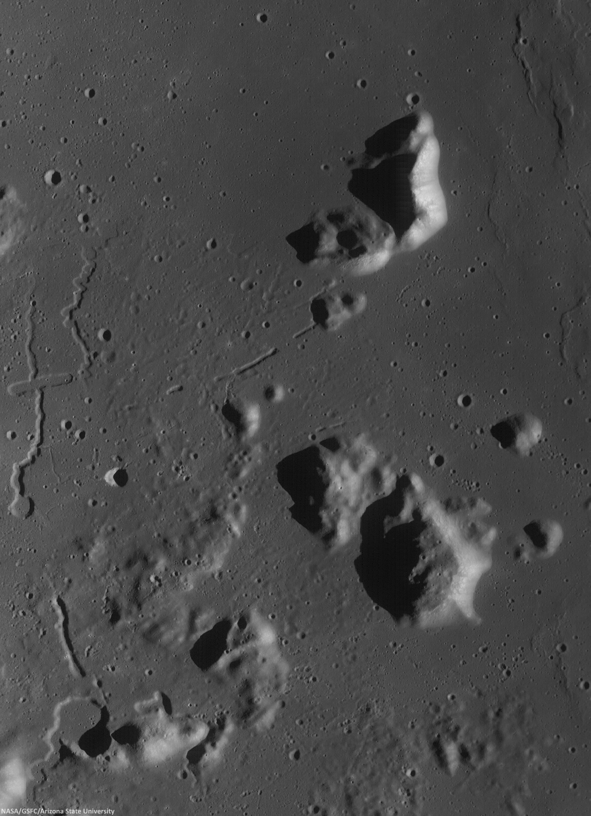
Two collapsed segments of a lava tube run from the southwest to the northeast, in the Rimae Prinz-Harbinger mountain region of Oceanus Procellarum (27.46°N, 318.33°E). These collapsed segments may provide access to the subsurface, which has never been directly sampled. The average width of the collapsed segments is ~650 meters. The lava tube is ~50 meters deep, seen in this 7 km-wide field of view from a mosaic of unreleased 2014 LROC NAC observation M1165080128 (L&R) [NASA/GSFC/Arizona State University].
H. Meyer
LROC News System

A lava tube is a volcanic conduit through which lava travels beneath the hardened crust of a lava flow. The presence of lava tubes on the Moon and beyond are inferred based on observations of terrestrial lava tubes, such as those found in Hawaii. Oftentimes, a rille suddenly disappears only to reappear a short distance away.

These are called discontinuous rilles and are thought to be areas where a lava tube collapsed. Collapsed lava tube segments may provide access to the subsurface, which is exciting as a possible site to collect rock samples that remain unaltered due to surface weathering (radiation, thermal cycling, micrometeorite bombardment).

Slightly differing, slightly lower resolution, 11.5 x 15.9 km field of view of the area of interest from a mosaic of LROC Narrow Angle Camera (NAC) observation M1152143995RL, LRO orbit 21776, April 14, 2014; resolution averages 1.33 meters per pixel, incidence angle 48.9° from 132.14 km over 26.86°N, 318.11°E. View the original 8706 x 12008 and an assortment of other sizes HERE [NASA/GSFC/Arizona State University].
Sunrise over Mons Harbinger. 65 km-wide field of view from mosaic of three LROC Wide Angle Camera (WAC) monochrome (604 nm) observations, swept up during three sequential orbital passes, December 7, 2011,  from 43 km; resolution 58 meters per pixel, incidence 77° [NASA/GSFC/Arizona State University].
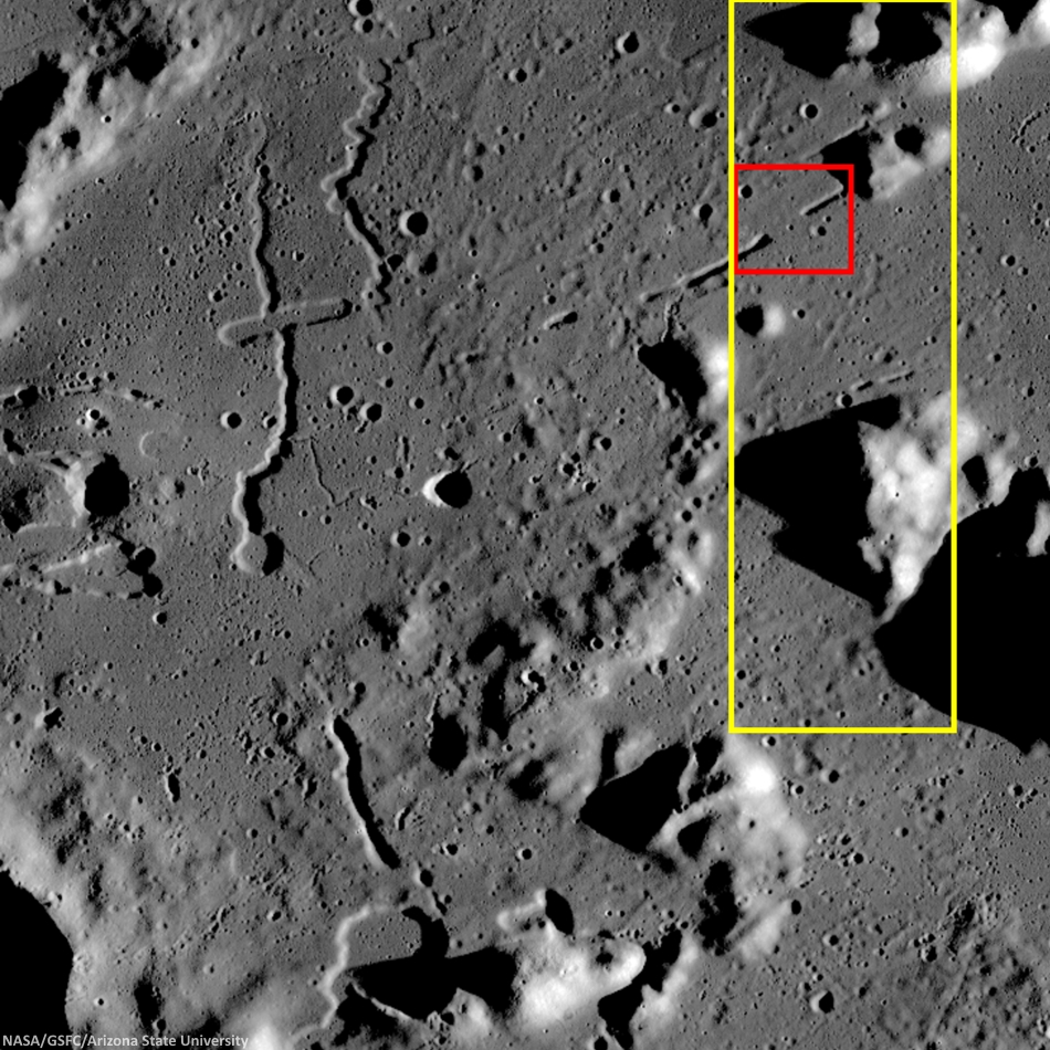
Context for LROC Featured Image released November 6, 2014, field of view in red, full field swept up in LROC NAC observations M1152143995R & L in yellow. LROC WAC mosaic [NASA/GSFC/Arizona State University].
The lava tube from the LROC Featured Image released November 5, 2014 is located to the west of Montes Harbinger, a large kipuka in Oceanus Procellarum, and to the east of the Rimae Prinz region.

The Rimae Prinz region displays exquisite sinuous rilles as well as other elongate depressions, indicating that there could be other lava tubes in the area.

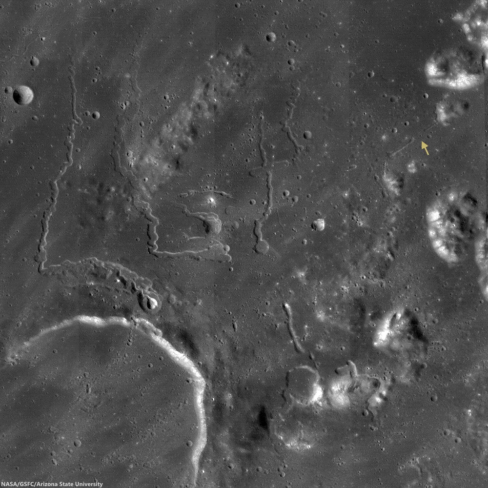
The Prinz, Rimae Prinz and Vera vent region, east of Aristarchus Plateau. The area of interest is marked with a yellow arrow, upper right in this roughly 120 km square field of view from the LROC WAC 100m global mosaic. the Vera vent 'cobra head' of Rima Prinz I rille (on the north-northeast rim of basalt-inundated Prinz crater, at lower left), is the subject of intense study (see HERE). [NASA/GSFC/Arizona State University].
The entire region, pictured above, is of interest for exploration for several reasons. The diversity of volcanic landforms in the area can tell scientists much about the volcanic history of the Moon. By collecting samples from the surface and subsurface in this region and by careful mapping on-site, scientists can better characterize the diverse basaltic lava flows in terms of both age and composition, which also helps us understand the timing and evolution of lunar volcanism and possible heterogeneities in the lunar mantle. Any time a sample is taken from a site on the Moon and age-dated, it can also be used to calibrate crater densities that are currently used to remotely age-date surfaces in the absence of direct sampling (both on the Moon and other planets).

Lava tubes are of particular interest in terms of human exploration because they are not only scientifically valuable, but they might also provide shielding from the radiation that poses a hazard to future explorers. Furthermore, the region surrounding the lava tube from this Featured Image also hosts large pyroclastic deposits, which are a potential in situ resource that will be critical to sustaining a human presence on the Moon.

Scientists and engineers are looking into the possibility of using the natural structure of the lava tube and associated resources (ISRU) to our advantage to construct habitats for explorers.

Explore the full NAC mosaic here! How many features of interest do you see?

Rimae Prinze Region - Constellation ROI
Discontiguous Rilles

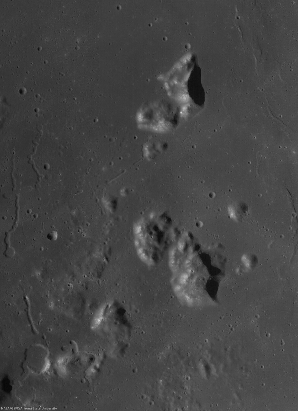
Addendum: Under mid to late afternoon sunlight, another LROC WAC mosaic, swept up under conditions remarkably similar in scale with the third image from above, from the same period of low altitude opportunities the LRO mission afforded during orbital maneuvers in the second half of 2011. Differing sun-moon-spacecraft phase angles allows for an excellent comparison. This particular mosaic was also assembled from LROC WAC observations, but five months earlier, and from three sequential orbital passes, at 43 km altitude. The resolution is 59 meters, incidence angle 64° [NASA/GSFC/Arizona State University].

Wednesday, October 29, 2014

LADEE impact crater found

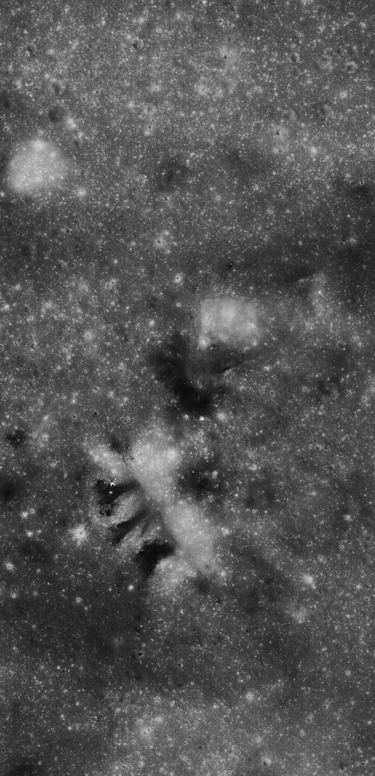
LADEE impact site on the eastern rim of Sundman V crater, the spacecraft was heading west when it impacted the surface. The image was created by ratioing two images, one taken before the impact and another after the impact. The bright area shows the impact point and the ejecta (things that have changed between the time of the two images). The ejecta form a V shaped pattern extending to the northwest from the impact point. Ratio constructed with LROC images M1163066820RE and M1101816767RE [NASA/GSFC/Arizona State University].
Mark Robinson
Principal Investigator
Lunar Reconnaissance Orbiter Camera (LROC)
Arizona State University

The Lunar Atmosphere and Dust Environment Explorer (LADEE) was launched from Wallops Island on 6 September 2013 at 11:27 EDT and was visible over much of the eastern coast of the United States. The spacecraft was 2.37 m (7.8 ft) high and 1.85 m (6.1 ft) wide with a mass of 383 kg (844 lb) including the fuel.

After expending most of its fuel during its successful exploration of the Moon the spacecraft had a mass of about only 248 kg (547 lb) when it impacted the surface.

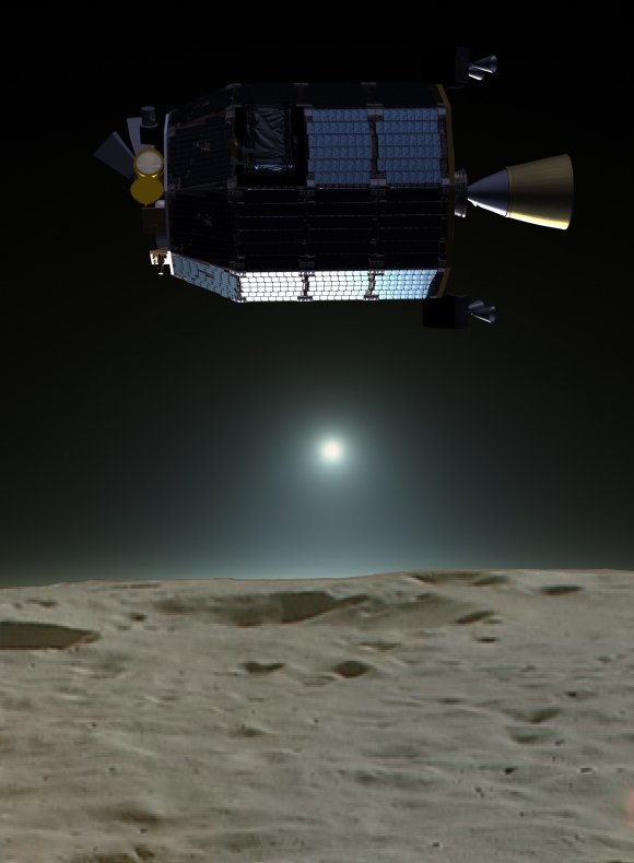
Artist's rendition of the LADEE spacecraft in orbit around the Moon [NASA/JAXA/LP].
Originally LADEE was placed into a retrograde, near-equatorial orbit to study the Moon's surface bound exosphere and dust environment. Since the Apollo era of exploration several conflicting ideas and observations concerning the existence (or not) of near-surface and high altitude dust were debated, and thus one of LADEE’s key science goals was to search for dust particles high above the surface (no dust was found).

LADEE's engines were fired on 11 April 2014 to adjust the orbit in such a way as to guarantee a farside impact if the spacecraft did not survive the 15 April 2014 eclipse. There was a small worry that if the spacecraft failed during the eclipse and was uncontrollable, it might impact near one of the Apollo sites. Over the subsequent 7 days, the low point in LADEE's orbit decreased resulting in an impact on 18 April 2014.

Before and after images of the LADEE impact site [NASA/GSFC/Arizona State University].
As it passed over the western limb as seen from the Earth, the spacecraft impacted the eastern rim of Sundman V crater (11.85°N, 266.75°E). The impact site (11.8494°N, 266.7507°E) is about 780 m from the crater rim with an altitude of about 2590 m, and was only about 295 meters north of its originally predicted location (based on tracking data).

Like the LADEE spacecraft, the impact crater is small, greater than 3 meters in diameter, barely resolvable by the LROC NAC. Based on impact models, a crater of only about 1.8 m (6 ft) diameter is expected. The crater is very small because, as impacts go, LADEE had a low mass and a low density (0.43 g / cm3 vs. larger than 3.0 g / cm3 for an ordinary chondrite meteorite), and was traveling at only a tenth the speed (1699 m/sec - 3800 mph) of an average asteroid.

LADEE impact crater (centered of image) has a distinctive hour-glass albedo pattern indicative of low angle impacts. Bright material extends to the northwest, while only a minor amount was ejected to the southeast; NAC M1163066820RE [NASA/GSFC/Arizona State University].
Because it is so small, the crater is hard to identify among the myriad of small fresh craters that dot the lunar surface. However, as images had been acquired of the impact region before the impact occurred, they could be compared with images acquired after the impact to identify the crater.

Since NAC images are so large (250 megapixels) and the new crater is so small the LROC team coregistered the before and after images (called a temporal pair) and then divided the after image by the before image. In this manner any changes to the surface stick out like a beacon! For the LADEE crater the ejecta forms a triangular pattern primarily downrange (to the west) extending more than 200 meters from the impact site. There is also a small triangular area of ejecta uprange but it extends only about 20-30 meters. The ejecta pattern is oriented WNW consistent with the direction the spacecraft was traveling when it impacted.

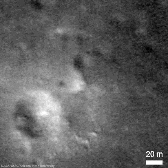
Zoomed-in view of the impact site, image is 200 m across, NAC M1163066820RE [NASA/GSFC/Arizona State University].
Explore the catalog of LROC close-ups of lunar spacecraft landing and impact sites, HERE.

Related LADEE Posts:
First Science from LADEE (45th LPSC, March 18 2014)
LADEE's (star tracker) images of the Moon (February 14, 2014)
LADEE economy adds 28 days to mission (February 5, 2014)
LROC captures LADEE from 9,000 meters (January 30, 2014)
Red Moon, Blue Moon Dwayne DayThe Space Review (December 3, 2013)
LADEE begins collecting data (November 22, 2013)
LADEE transitioning out of commissioning phase (November 6, 2013)
Apollo 12 ALSEP first to measure dust accumulation (November 21, 2013)
Chang'e-3 & LADEE: The Role of Serendipity (October 31, 2013)
LADEE LLCD sets new data record (October 25, 2013)
Measuring almost nothing, looking for the almost invisible (October 16, 2013)
LADEE legacies (September 7, 2013)
LADEE Prelaunch Mission Briefing (September 6, 2013)
ESA prepares for LADEE (July 31, 2013)
LADEE arrives at Wallops Island (June 5, 2013)
LADEE ready to baseline dusty lunar exosphere (June 5, 2013)
First laser comm system ready for launch on LADEE (March 16, 2013)
LADEE project manager update (February 6, 2013)
The Mona Lisa test for LADEE communications (January 21, 2013)
Toxicity of lunar dust (July 2, 2012)
Expectations for the LADEE LDEX (March 23, 2012)
The Dust Management Project (August 9, 2010)
LADEE architecture and mission design (July 6, 2010)
DesertRatS testing electrodynamic dust shield (July 5, 2010)
Dust transport and its importance in the origin of lunar swirls (February 21, 2010)
Dust accumulation on Apollo laser reflectors may indicate a surprisingly fast and
more dynamic lunar exosphere
 (February 16, 2010)
NASA applies low cost lessons to LADEE (January 18, 2010)
Nanotech advances in lunar dust mitigation (August 19, 2009)
Moon dust hazard influenced by Sun's elevation (April 17, 2009)
LADEE launch by Orbital from Wallops Island (April 14, 2009)
Understanding the activation and solution properties of lunar dust
for future lunar habitation
 (March 2, 2009)
Respiratory toxicity of lunar highland dust (January 19, 2009)
Toxicological effects of moon dust (June 25, 2008)
Moon dust and duct tape (April 22, 2008)

Monday, October 13, 2014

LRO: widespread evidence of young lunar volcanism

The feature called Maskelyne is one of many newly discovered young volcanic deposits on the Moon. Called irregular mare patches, these areas are thought to be remnants of small basaltic eruptions that occurred much later than the commonly accepted end of lunar volcanism, 1 to 1.5 billion years ago [NASA/GSFC/Arizona State University].
Dwayne Brown
NASA HQ

NASA’s Lunar Reconnaissance Orbiter (LRO) has provided researchers strong evidence the moon’s volcanic activity slowed gradually instead of stopping abruptly a billion years ago.

Scores of distinctive rock deposits observed by LRO are estimated to be less than 100 million years old. This time period corresponds to Earth’s Cretaceous period, the heyday of dinosaurs. Some areas may be less than 50 million years old. Details of the study are published online in Sunday’s edition of Nature Geoscience.

“This finding is the kind of science that is literally going to make geologists rewrite the textbooks about the moon,” said John Keller, LRO project scientist at NASA’s Goddard Space Flight Center in Greenbelt, Maryland.

The deposits are scattered across the moon’s dark volcanic plains and are characterized by a mixture of smooth, rounded, shallow mounds next to patches of rough, blocky terrain. Because of this combination of textures, the researchers refer to these unusual areas as irregular mare patches.

The features are too small to be seen from Earth, averaging less than a third of a mile (500 meters) across in their largest dimension. One of the largest, a well-studied area called Ina, was imaged from lunar orbit by Apollo 15 astronauts.

Ina appeared to be a one-of-a-kind feature until researchers from Arizona State University in Tempe and Westfälische Wilhelms-Universität Münster in Germany spotted many similar regions in high-resolution images taken by the two Narrow Angle Cameras that are part of the Lunar Reconnaissance Orbiter Camera, or LROC. The team identified a total of 70 irregular mare patches on the near side of the moon.

The large number of these features and their wide distribution strongly suggest that late-stage volcanic activity was not an anomaly but an important part of the moon's geologic history.

The numbers and sizes of the craters within these areas indicate the deposits are relatively recent. Based on a technique that links such crater measurements to the ages of Apollo and Luna samples, three of the irregular mare patches are thought to be less than 100 million years old, and perhaps less than 50 million years old in the case of Ina. The steep slopes leading down from the smooth rock layers to the rough terrain are consistent with the young age estimates.

In contrast, the volcanic plains surrounding these distinctive regions are attributed to volcanic activity that started about 3 1/2 billion years ago and ended roughly 1 billion years ago. At that point, all volcanic activity on the moon was thought to cease.

Several earlier studies suggested that Ina was quite young and might have formed due to localized volcanic activity. However, in the absence of other similar features, Ina was not considered an indication of widespread volcanism.

The findings have major implications for how warm the moon’s interior is thought to be.

An oblique, novel view of the Ina formation (3 km across, 18.65°N, 5.3°E) from the LROC narrow angle camera (resolution 2.5 meters per pixel [NASA/GSFC/Arizona State University].
“The existence and age of the irregular mare patches tell us that the lunar mantle had to remain hot enough to provide magma for the small-volume eruptions that created these unusual young features,” said Sarah Braden, a recent Arizona State University graduate and the lead author of the study.

The new information is hard to reconcile with what currently is thought about the temperature of the interior of the moon.

“These young volcanic features are prime targets for future exploration, both robotic and human,” said Mark Robinson, LROC principal investigator at Arizona State University.

LRO is managed by Goddard for NASA’s Science Mission Directorate at NASA Headquarters in Washington. LROC, a system of three cameras, was designed and built by Malin Space Science Systems and is operated by Arizona State University.

To access the complete collection of LROC images, visit http://lroc.sese.asu.edu/

For more information about LRO, visit http://www.nasa.gov/lro

Some Related Posts:
Hansteen α -   January 15, 2014
Small-scale volcanism on the lunar mare, July 13, 2013
Unassuming volcanic vent north of Aristarchus Plateau, April 1, 2013
New views of the hollows of Rimae Sosigenes, March 28, 2013
Inside Rima Hyginus, June 12, 2012
Ina of the Meniscus Hollows, March 21, 2012
LUNAR MENISCUS HOLLOWS. P. J. Stooke, Department of Geography and Centre for Planetary Science and Exploration, University of Western Ontario, London, Ontario, Canada; 43rd Lunar and Planetary Science Conference (2012), #1011.
Whale of a Hollow, March 20, 2012
It's a gas, man, Paul Spudis, Smithsonian Air & Space, October 6, 2011

Thursday, September 4, 2014

Secondary scatter over Haret C and the SPA interior

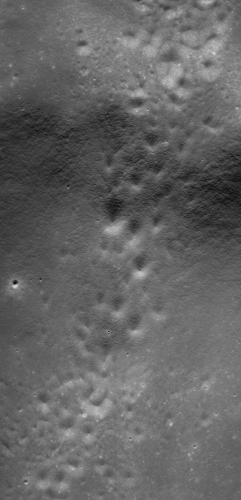
A stream of secondary craters crosses the rim of Haret C (28.47 km; 57.6°S, 186.3°E), stretching from the northeast exterior, southeast into the interior of the crater, deep within the South Pole-Aitken impact basin. 6.52 km-wide field of view from LROC NAC mosaic M1163623161LR, LRO orbit 23388, August 25, 2014; 56.75° incidence, resolution 68 cm from 63.63 km over 57.6°S, 185.26°E [NASA/GSFC/Arizona State University].
H. Meyer
LROC News System

Closely clustered or overlapping craters of similar size and morphology are likely secondary craters.

Secondary craters form when an impactor hits the surface (forming the primary crater) and throws out blocks of material that proceed to form their own craters (secondaries) as they hit the surface.

Sometimes, secondary craters can be difficult to identify if they do not occur in groups. Because craters are used to estimate the age of a surface (a process called crater counting), it is important that scientists are able to identify secondary craters.

Thankfully, in the case of Haret C, the secondary craters stand out from primary craters due to their proximity to each other. Random impacts typically do not form clusters like those draped over Haret C (28.47 km; 57.6°S, 186.3°E) .

A quick look at Haret C made possible by the international burst of lunar exploration briefly inspired by interest in the run-up to the Constellation program. The crater chain is easy enough to see in the medium resolution global albedo mosaic swept up from Chang'e-2. And the basics of the ranges and elevations of the region are displayed using the LROC Quickmap service.
Within high resolution images, smaller craters are used for crater counting. However, secondary craters become more common at smaller diameters introducing a problem for crater counters if the secondaries cannot be distinguished from primary craters. Secondaries counted as primaries result in higher crater counts per unit area, which in turn result in age estimates that are older than the true age of the surface.

Haret C does not dominate, but it is easy to pick out near the center of this HDTV still (larger view HERE) from Japan's lunar orbiter Kaguya (SELENE-1) in 2008. There are two other stills where Haret C and its crater chain are visible in context with central South Pole-Aitken basin and it's larger neighbors Bose (92.5 km; 53.95°S, 190.63°E) and Bhabha (70.52 km; 55.49°S, 194.69°E), HERE and HERE [JAXA/NHK/SELENE].
A key science goal is coming to a better understanding of the morphology or abundance of secondaries relative to primary craters so that more accurate age estimates can be made for smaller, younger terrains: especially important for panning at the scale of the NAC images for future missions to the Moon.

Seven minutes of video from GRAIL-A (Ebb) during orbit 1902 in 2012. Using the student-directed Forward MoonKAM video camera we can close in on the secondary crater chain at Haret C looking north from a perspective beginning at 30 km rising to 41 km over the surface at the end of the sequence. Starting in the polar latitudes of the southern farside the compressed view quickly passes up over the enigmatic interior of South Pole-Aitken basin, over Antoniadi (137.91 km; 69.3°S, 186.94°E, home of the Moon's lowest elevation) north 22° following the meridian that crater shares with Haret C [NASA/JPL/UCSD/SRSC].
Explore the full-width NAC mosaic HERE. Do you see any primary craters in the mix?

Related Posts:

Wednesday, August 27, 2014

Pit craters in NAC DTM topography

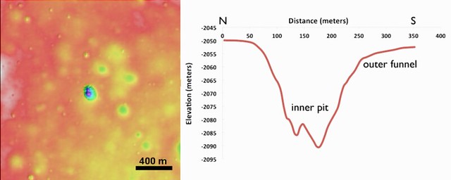
The crisp morphology of the central Mare Fecunditatis pit (white arrow) stands out in elevation data and suggests a relatively young age. This pit is about 200-m in length and 45 m deep. Image width is 5 km; north is up. Color shaded-relief created from NAC DTM FecundPit; higher elevations shown in red and lower elevations in blue and purple [NASA/GSFC/Arizona State University].
J. Stopar
LROC News System

Eight mare pits have been discovered so far on the Moon, five of which preserve void spaces (sublunarean voids) beneath overhanging mare layers. The pit featured above, located in central Mare Fecunditatis (0.917°S, 48.66°E), however, does not have an obvious void space. The pit is almost 200 m wide and about 45 m deep.

The central Mare Fecunditatis pit has a concave shape, with gentler slopes (outer funnel) near the upper mare surface, and a steeper-walled inner pit (see image below). Variations in wall slopes are consistent with a fine-grained, particulate layer (regolith) overlying more coherent mare layers. The steep inner pit suggests collapse into a small void space. The debris in the pit floor consists of both regolith and mare blocks from the upper layers.

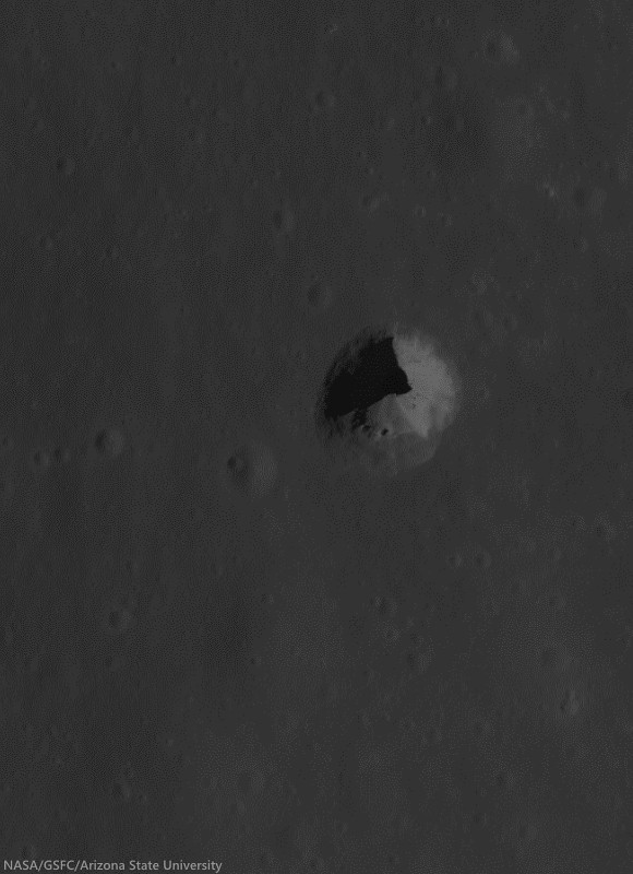
Pit crater (0.92°S, 48.66°E) near Messier B, now generally designated the Central Fecunditatis pit crater to distinguish it for a more recently discovered skylight in southwest Fecunditatis. LRO's longevity has enabled repeated narrow angle photography of selected areas on the Moon, allowing for the team at Arizona State University to build up very high-resolution, NAC-based digital terrain models. 540 meter field of view from LROC NAC observation M1105602888R, LRO orbit 15232, October 23, 2012; 35.18° incidence angle, resolution 93 cm from 108.28 km over 0.92°S, 49°E [NASA/GSFC/Arizona State University]
Left: color shaded-relief of NAC-derived elevation data. Reds are higher elevations, purple lower elevations. Right: elevation profile of a north-to-south cross-section through the pit. The inner pit has steep walls, while slopes near the mare surface (outer funnel) are more gentle [NASA/GSFC/Arizona State University].
The lack of raised rim or ejecta around the pit, indicates that it most likely formed through collapse, rather than as an impact event. While this pit is not located near any obvious tectonic features or volcanic constructs, the collapse may have occurred into part of an old lava tube. The crispness of the pit morphology, suggests that the collapse occurred relatively recently (geologically speaking, at least), perhaps much less than 1 billion years ago. Pits are among some of the youngest landforms on the Moon, and are similar in age to many fresh craters (such as Tycho, Copernicus, or Aristarchus).

More recently identified pit crater in southwest Mare Fecunditatis (6.752°S, 42.76°E), discovered during Wagner and Robinson survey. A 325 meter-wide field of view from LROC NAC M167926438R, LRO orbit 9881, August 14, 2011; 42.25° incidence angle, resolution 56 cm from 26.73 km over 6.71°S, 42.72°E [NASA/GSFC/Arizona State University].
Read More About Lunar Pits:  Lunar pits were recently featured in the news and the focus of a scientific publication ("Distribution, formation mechanisms, and significance of lunar pits," Robert V. Wagner and Mark S. Robinson, Icarus, July 2014; pg. 52-60).

The pits are of particular interest to lunar scientists because they could offer access to subsurface materials, making them important targets for further research and exploration.

Explore the pit in the full-resolution LROC NAC observation HERE.

More Pits:

Monday, August 25, 2014

Striped pyroclastic vent in Sinus Aestuum

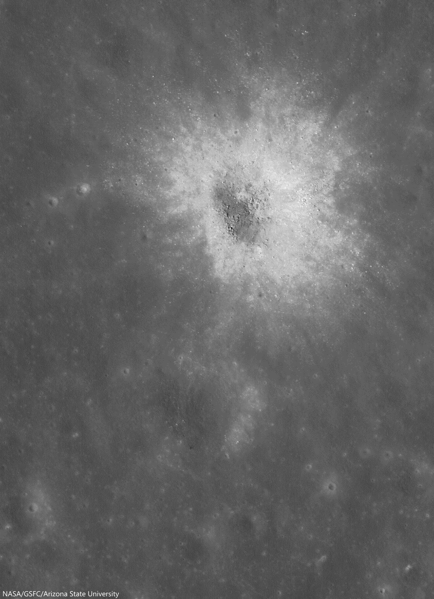
Dark mantle deposits decorate a crater wall. Slowly pulled downhill by gravity, the volcanic glasses that compose these stripes where formed during explosive volcanic eruptions on the Moon. 1130 meter-wide field of view from LROC NAC observation M1101259688L, LRO orbit 14524, September 2, 2012; low incidence 17.83° angle, 97 cm resolution from 117.17 km over 8.26°N 352.18°E [NASA/GSFC/Arizona State University].
Aaron Boyd
LROC News System

Today's Featured Image location is in southern Sinus Aestuum.

Low reflectance pyroclastic material flowed downslope (NE) due to mass wasting in this crater, and high reflectance fresh ray material from small young craters dot the streaks.

The high reflectance material from small craters on top of the pyroclastics indicate that the pyroclastic deposit is relatively thin, because the excavated material is from a maximum of about 0.2 crater radii below the surface.

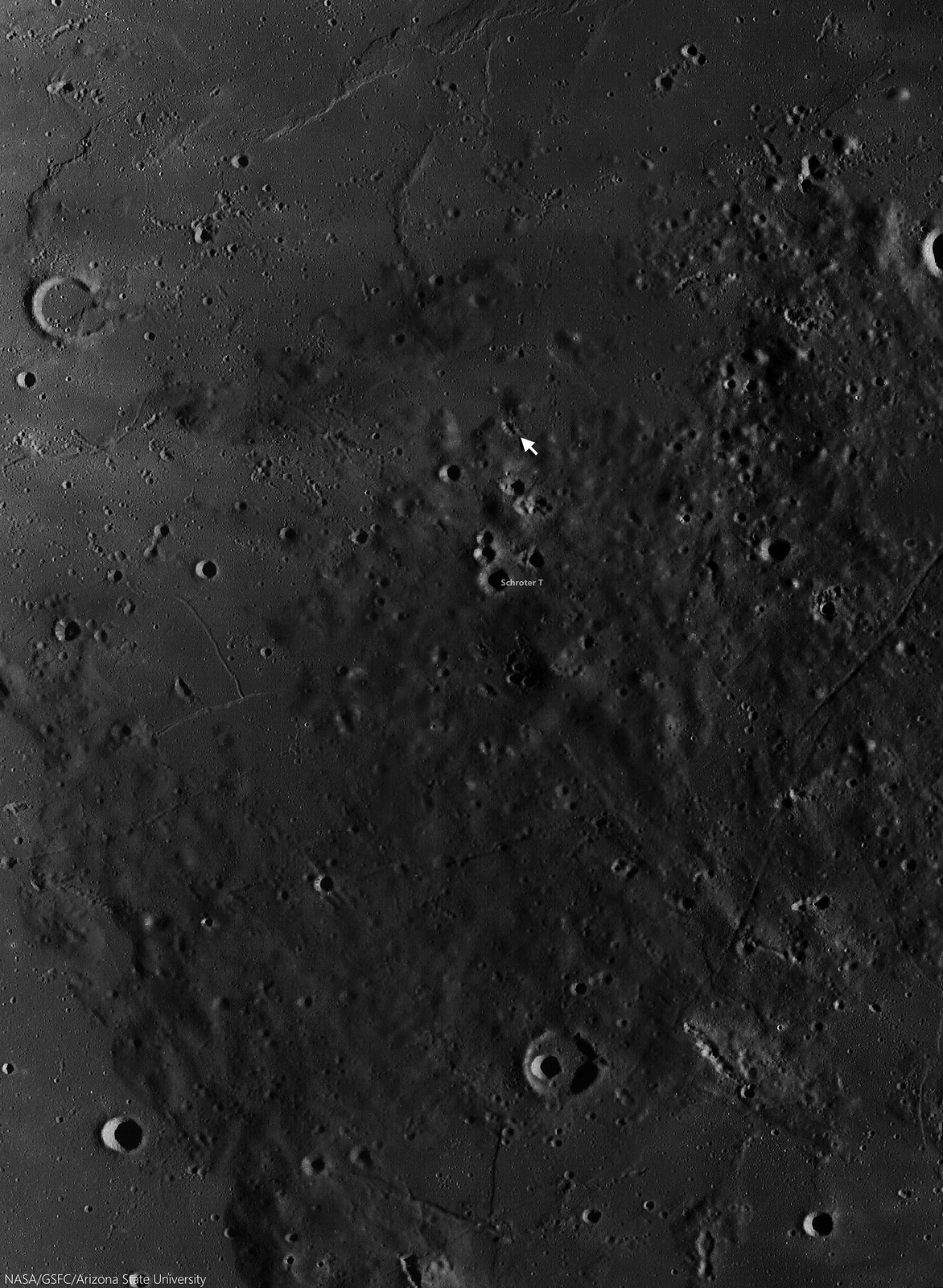
Striped slides of pyroclastic-sourced granular flow, darker material eroding back into its likely source, a "striped crater," a vent north of Schroter T in Sinus Aestuum, east of Copernicus. A 4675 meter-wide-wide field of view from LROC NAC observation M1101259688L, LRO orbit 14524, September 2, 2012; low incidence 17.83° angle, 97 cm resolution from 117.17 km over 8.26°N 352.18°E [NASA/GSFC/Arizona State University].
In addition to the thickness of the deposit, scientists can also tell that this deposit is most likely discontinuous by observing the streaks in the larger crater. If there was a continuous blanket of material on the surface, the dark mantle material would not form streaks, but a sheet of dark material as it is eroded away.

Schroter T (3.96 km; 7.03°N, 352°E) is the largest of the triplet craters in a "snowman" formation at lower center in this 37 km field of view centered near 7.72°N, 352°E. The energetic creation of Copernicus nearby left its mark on the pyroclastic material, Some high places seem to have been sheered off, leaving dark chevrons pointing away from that direction.  LROC Wide Angle Camera (WAC) monochrome (604 nm) observation M160003304CE, LRO orbit 9713, May 14, 2011; 48.97° incidence, 54.53 meters resolution from 38.89 km [NASA/GSFC/Arizona State University].
Dark mantle deposits (DMDs) on the Moon are composed of red, green, orange, and black glasses and crystals that were formed during strombolian or vulcanian eruptions. Sinus Aestuum is littered with dark mantle deposits, showing there were many different vents that were sending magma aloft.

The striped walls of the pyroclastic vent (arrow, 7.716°N, 352.062°E), in the dark terrains east-southeast of Copernicus, disappear into the long shadows of a complex topography, in the light of sunrise. A roughly 120 km-wide field of view from a distilled LROC WAC mosaic of sequential monochrome  (643 nm) observations swept up December 15, 2010; 77° incidence, resolution 63.3 meters from 45 km [NASA/GSFC/Arizona State University]. 
The crater in which we see the dark streaks in the Featured Image could have been the source for the streaks; a piece of evidence for the crater being a vent is its irregular shape, but without further surface investigation (perhaps by humans one day) that question can not be answered for certain.

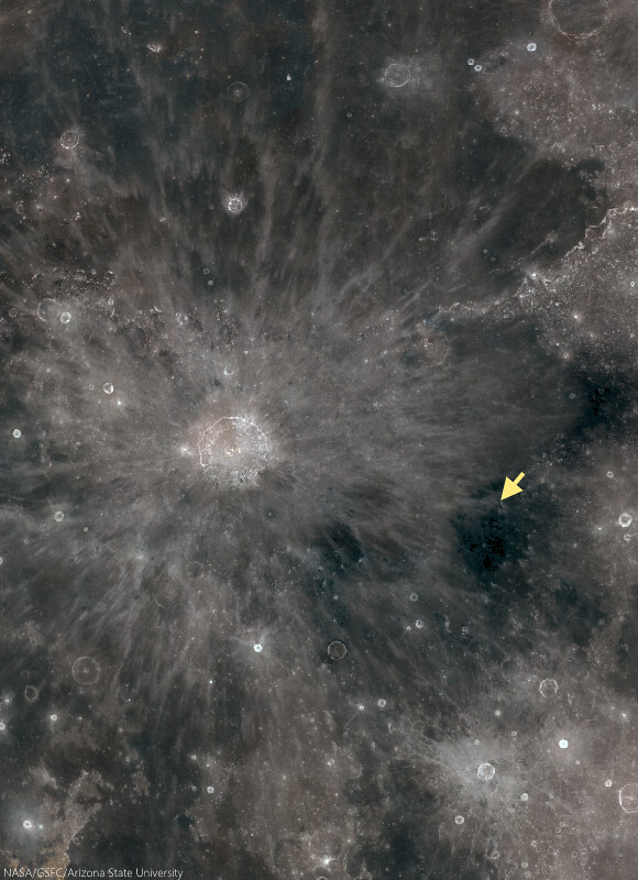
The small vent in Sinus Aestuum (arrow), 370 km east-southeast of the central peaks of Copernicus, is part of the pyroclastic fields highly visible even in modest binoculars, because of their relative low reflectivity. The area more to the southeast bear Gambart is the site of the Moon's highest concentration of radioactive isotopes, of thorium and less common uranium for example. A roughly 900 km-wide view from the LROC Lunaserv web-mapping program, Test RGB overlay (See "Resolved Hapke Parameter Maps") LROC WAC global mosaic [NASA/GSFC/Arizona State University].
See how many dark mantle deposits you can find in the full NAC frame HERE.

Related Posts:

Tuesday, August 12, 2014

Complimentary craters, south of Maclear

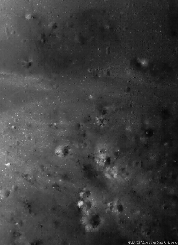
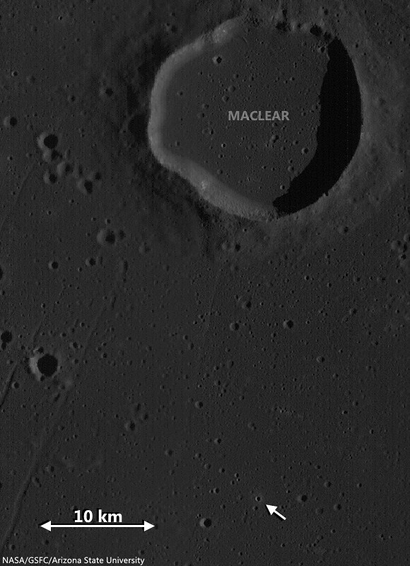
South of Maclear in northwest Mare Tranquillitatis, two complimentary craters of very similar location, size and origin, but additionally of widely different ages. The relentless bombardment of small debris "gardens" the lunar surface at an average rate of 3 mm every 2 million years. In addition to the nearly billion year long cycle of cosmic ray dark-reddening, "space weathering" ages, or "optically matures" the lunar surface at a predictable rate, adding to crater counts and super-positioning another useful tool to the craft of dating lunar features from a distance. LROC NAC observation M131515002R, LRO orbit 4515, June 18, 2010; 79.75° sunrise incidence angle, resolution 85 cm from 40.68 km over 9.09°N, 20.14°E [NASA/GSFC/Arizona State University].
Raquel Nuno
LROC News System

There are several distinguishing properties of craters that help lunar scientists determine their ages. As craters get older their appearance changes through exposure to solar wind bombardment and other impacts (collectively called space weathering), and even gravity has an effect.

Effects of the solar wind lower the reflectance of the surface; so regolith (soil) that was excavated by recent impacts has higher reflectance than the background surface, this is why small young craters have visible crater rays. New impacts pulverize rocks that were ejected during the formation of an older crater and disturb the shape by causing moonquakes. Also, gravity works to alter the shape of a crater by pulling material down its walls in a process called slumping, this causes craters to have a smoother appearance.

1.69 km field of view from LROC NAC Commissioning observation M106748283R, LRO orbit 873, September 5, 2009; 29.84 low-angle incidence, resolution 1.17 meters from 133.64 km over 9.82°N, 20.15°E [NASA/GSFC/Arizona State University].
Today's Featured Image showcases two similarly sized adjacent craters (each ~500 m in diameter) located in Mare Tranquillitatis (see WAC context image below) with very different appearances. The area surrounding the top crater is littered with boulders in all directions. Wheras the more southerly crater has only a few rocks near its rim. Where did the boulders come from in the first place? And did the lower crater originally have boulders?

Locating two co-located 500 meter "complimentary craters" (arrow) good for comparing rates of general space weathering, in west-northwest Mare Tranquillitatis. LROC Wide Angle Camera (WAC) monochrome (566 nm) observation M131514941C, captured simultaneous with the NAC observation opportunity shown in the Featured Image at the top of this post. LRO orbit 4515, June 18, 2010; 79.75° incidence, resolution 57.7 meters from 40.72 km over 10.17°N, 20.14°E [NASA/GSFC/Arizona State University].
Since the mare basalt formed from layers of lava that hardened into solid rock, it is likely the boulders are coherent fragments of those thick layers (a few to tens of meters thick) that were broken up and ejected during the impact event. Since these two craters are so close and both formed in the mare it is very likely that the lower crater also had a large grouping of boulders in its ejecta field. The dissimilarity between these two craters is most likely due to age difference. Over time (perhaps a couple of billion years) the original boulders around the lower crater were slowly ground down by micro-meteorite bombardment - think of this process as cosmic sand-blasting! The boulders around the younger crater (top) have not had time to be pulverized by other impacts, but stick around for a billion years and you can watch these boulders slowly disappear!

Explore the full resolution NAC HERE.

Related Posts: