Thursday, May 5, 2011

Who's short-sighted?


Dr. Neil Armstrong and Captain Eugene Cernan (USN, Ret.), first and the last men to visit the Moon, testify on American manned space policy in May 2010. [Stephen Crowley/NYT].

Paul D. Spudis
The Once & Future Moon
Smithsonian Air & Space

Apollo 17 Commander Eugene Cernan recently voiced his doubts and concerns over the future of the human spaceflight program, while former Lockheed-Martin CEO Norman Augustine reflected on the current state of our space “vision” and/or the possible lack thereof. I found these perspectives by two giants of our national space program remarkable not in terms of what they think, but rather in how those in the space blogosphere have reacted to their positions. Some “New Space” advocates accuse people who disagree with the new direction of being too stupid and stubborn to understand its benefits or too parochial and selfish (or a combination thereof) to realize that government sponsored spaceflight is simply political pork.

Many in the New Space media have disparaged Cernan’s comments about this administration’s direction in space. Following each article, most comments attribute various nefarious or personal reasons for the position he holds. In contrast, Augustine’s remarks are praised, mostly on the grounds that he has embraced the “new direction” of using “commercial” space entities to transport people and cargo to low Earth orbit. I note in this dichotomy a recurring theme in the national debate we are having on the direction and tactical implementation of our national civil space program. That theme has many dimensions, but can be summed up as follows: if you agree with the new path, you are a wise, thrifty visionary, but if you have doubts or reservations about this path, you are a short-sighted reactionary, stuck in the past, a lover of political pork and incapable of understanding the true brilliance of the new policy.

What did Cernan actually say? He has doubts about many of the claims made regarding “New Space,” specifically claims in the press about costs, schedule and capabilities. Cernan’s point is that it’s easy to design paper rockets and make hyperbolic claims about “new approaches” but in the business of space, things don’t always work as expected. Cernan also questions what markets will support commercial space (much of the focus is on NASA contracting with New Space companies to service the ISS with cargo and crew) and even questions the designation “commercial,” both on the grounds of the aforementioned non-existing markets and the reliance of some commercial space companies on NASA funding to develop their product.

What does Augustine have to say about this? He is much more sanguine about the possibilities of commercial space, saying that they are coming along “better than I expected,” an assessment that is somewhat vague on metrics. Augustine’s principal message is that NASA is not getting enough money. He claims that another $3 billion per year would make all the difference between a good program and an “unexecutable” one. He also took the time to take a couple of shots at one of his long-standing targets, the Moon as a destination, commenting that spending billions and 25 years to “go back to the Moon doesn’t inspire anybody.” He did note that a brief stop at the Moon might be allowable, if it were really necessary on our way to Mars.

New Space companies claim that they are commercial enterprises developing new space vehicles. If they are truly commercial, what markets do they serve? NASA is a government agency and has contracted for products and services from its beginning. A commercial company takes money from investors and sells a product or provides a service for profit. Commercial companies have access to NASA technology, so why do they also require and receive government subsidies?

I don’t see anything in Gene Cernan’s remarks that I would characterize as “short-sighted.” He is asking legitimate questions and expressing concerns about significant changes (and of the use of the term “commercial”) to an effort that he both deeply understands and to which he’s dedicated his life. New Space advocates tell us that vast new markets await the advent of new commercial launch services and that they’ll be launching multiple payloads frequently, at a fraction of current launch costs. If questioned further they dismissively wave off debate by saying NASA is simply a bloated federal agency and that the ticket to lower launch costs lies in putting those federal dollars into New Space hands.

In contrast, Augustine is pleased with the progress of commercial space companies. And despite being dubbed “the mission to nowhere,” NASA and the administration appear undeterred about keeping Flexible Path as their guiding direction. It is clear from this interview and some previous remarks that Augustine’s primary objective during the work of his committee was to eliminate the return to the Moon as an agency objective. He clearly views lunar return (as many in NASA’s leadership also choose to characterize it) as a re-boot of Apollo, with the same objectives and (more or less) the same architecture, a gap-filler on the way to Mars.

For the last two years, I have discussed and documented the purpose of the Moon in the Vision for Space Exploration and how the Constellation/Augustine perspective is wrong. The objective of going to the Moon is to learn how to live and work on another world using local resources to create new capabilities. What perplexes many is that the Augustine committee report states that the ultimate rationale for human spaceflight is understanding how people might someday live and work in space and then it went on to eliminate the one goal (living and working on the Moon) relevant to that objective.

Some honestly oppose this new direction because they see it as fundamentally flawed – a shell-game attempt to divert attention away from the ongoing, systematic dismantling of our national space faring capability. The exchange of a definitive goal (the Moon) for a “flexible” series of quasi-goals (an asteroid, martian moons) is a recipe for Brownian motion and nonproductive agency chaos. “Investment” in studies of “new and revolutionary technologies” is a euphemism for widget-making, mostly of devices with limited or questionable relevance to future spaceflight. And the transfer of responsibility for space launch and transportation to the “commercial” sector is simply government contracting by another name, only without the same product assurance. Statements (marketing?) suggesting that SpaceX will send a human mission to “Mars in 10-20 years” does not engender confidence in the Chief Designer’s understanding of the realities of space travel.

Many educated, thoughtful people, with years of experience in space business, are concerned about this new direction. They are speaking out not because they are old fuddy-duddies mired in past glories, but because they have serious issues about the claims being made and the irreparable harm being done to our national space capability. They also see the removal of a clear strategic direction as a serious problem, one that will leave the agency burning significant amounts of money to little benefit.

As for my “rose colored” glasses, suffice it to say that I think Gene Cernan is right to be concerned about the future of space and that Norm Augustine is wrong about the Moon. Some of us may have our heads in the sand, but that’s better than where the heads of some others are.

Wednesday, May 4, 2011

Anomalous Mounds on the floor of King


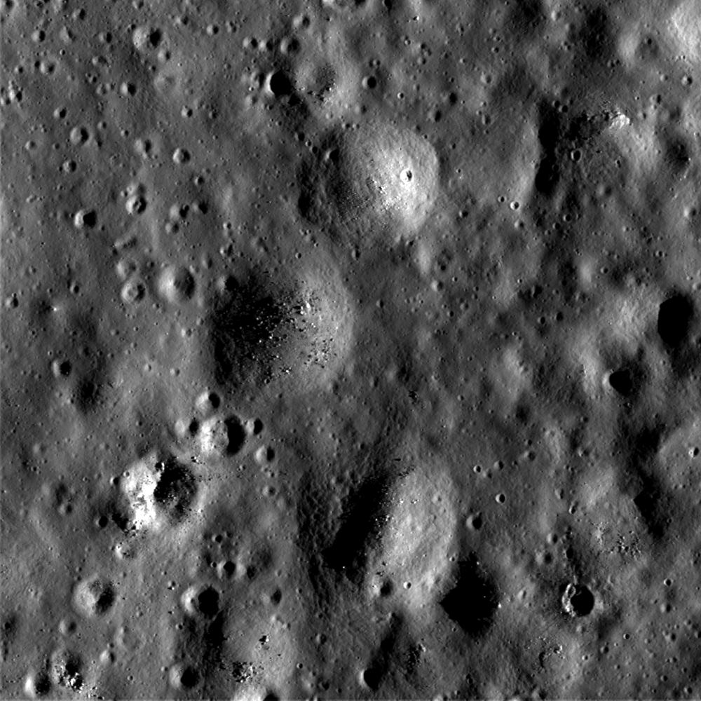
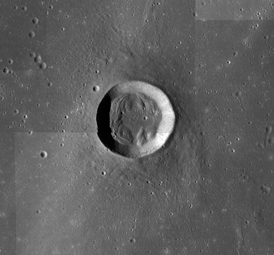
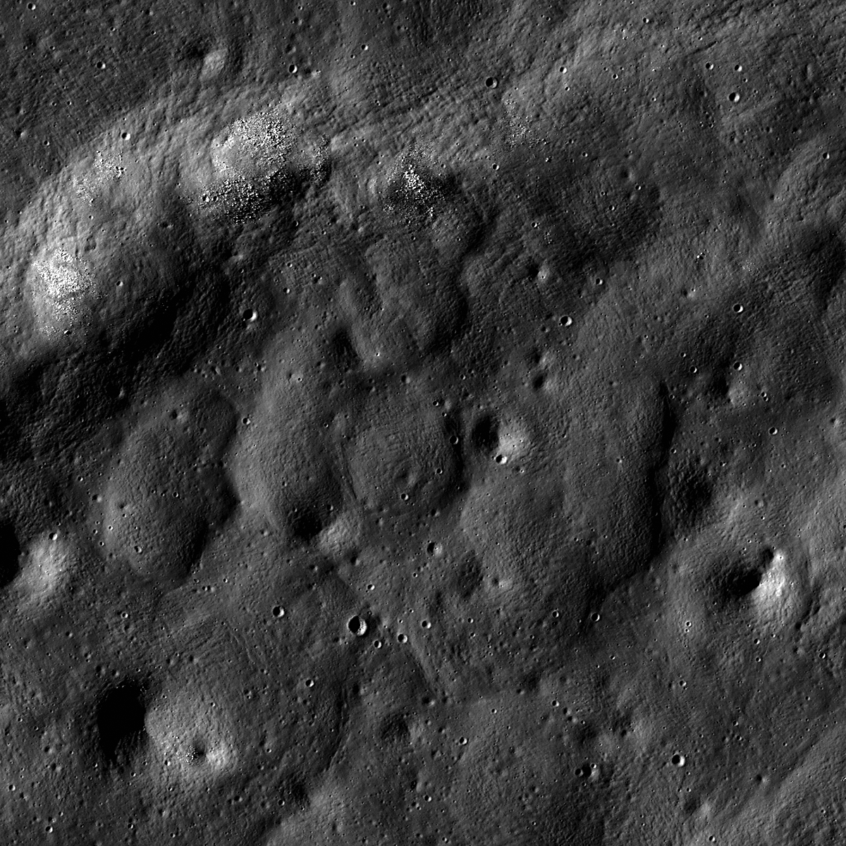
Odd-looking mounds on the floor of King crater. LROC Narrow Angle Camera (NAC) observation M115522928LE, LRO orbit 2158, December 15, 2009; incidence angle 75°; image is ~900 meters across. See the full width LROC Featured Image HERE [NASA/GSFC/Arizona State University]

James Ashley
LROC New System

What are these circular features?

These mounds are found within a large pool of now-solidified impact melt covering the floor of King crater (5.0°N, 120.5°E). North is up, and sunlight is coming from the east, which is how we can tell at a glance that these are positive-relief constructs, and not negative-relief impact craters (compare with some of the obvious craters in the image to convince yourself that this is true). There are many such mounds on the King crater floor. They are often circular, but occur in groups with irregular outlines as well.

One interpretation of the mounds is that the King impact melt remained hot long enough after accumulating as a pond, and partially crusting over during cooling, to still "ooze" here and there through holes or cracks in the fresh crust. The soft melt quickly cooled after reaching the surface and built itself up vertically while spreading out laterally at each point where this happened ... think of pressing a board with holes in it on a layer of wet mud or toothpaste.

While this explanation may sound similar in some ways to a volcanic process, this kind of "extrusion" differs from classic volcanism in a very fundamental way: The source in such a model is a shallow, surface emplacement of short-lived, molten material (the impact melt), as opposed to magma coming from the mantle or crustal magma chambers, which stay molten for much longer periods of time and tend to produce higher-pressure and more voluminous extrusions. Perhaps the weight of the cooling melt crust was enough to cause this (the board in our thought experiment). Perhaps another force assisted. Or perhaps the mounds formed in a way completely different from this scenario. Such are the problems of planetary science, and we can always rely on Nature to surprise us by presenting situations that do not lend themselves to easy interpretation or classification; hence the "anomalous" status for today's Featured Image.

A visit to King crater would help solve the mystery!

View the full LROC NAC frame HERE.


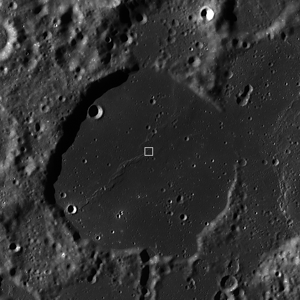
LROC WAC (Wide Angle Camera) monochrome mosaic Server zoom of the King crater region. 73 kilometer-wide King is a kind of splash pan. At some ancient moment, preserved here for billions of years, molten material was slung over the north rim, filling in the depression labeled King Y, and even as it cooled flowed back over the rim, carving a deep impression. King Y is also the location of a unique natural bridge, a discovery spotlighted by an LROC Featured Image in September 2010 [NASA/GSFC/Arizona State University].

Designed for the Moon, ready for Fukushima?


According to DigiInfo, Japan is considering sending in the Tri-Star IV into the plants. Originally developed to collect rock samples from the moon, the Tri-Star IV's light and simplistic design along with its sheet metal and canvas wheels would be more than capable of overcoming any rugged terrain. Follow the story HERE.

Tuesday, May 3, 2011

Wrinkled Planet


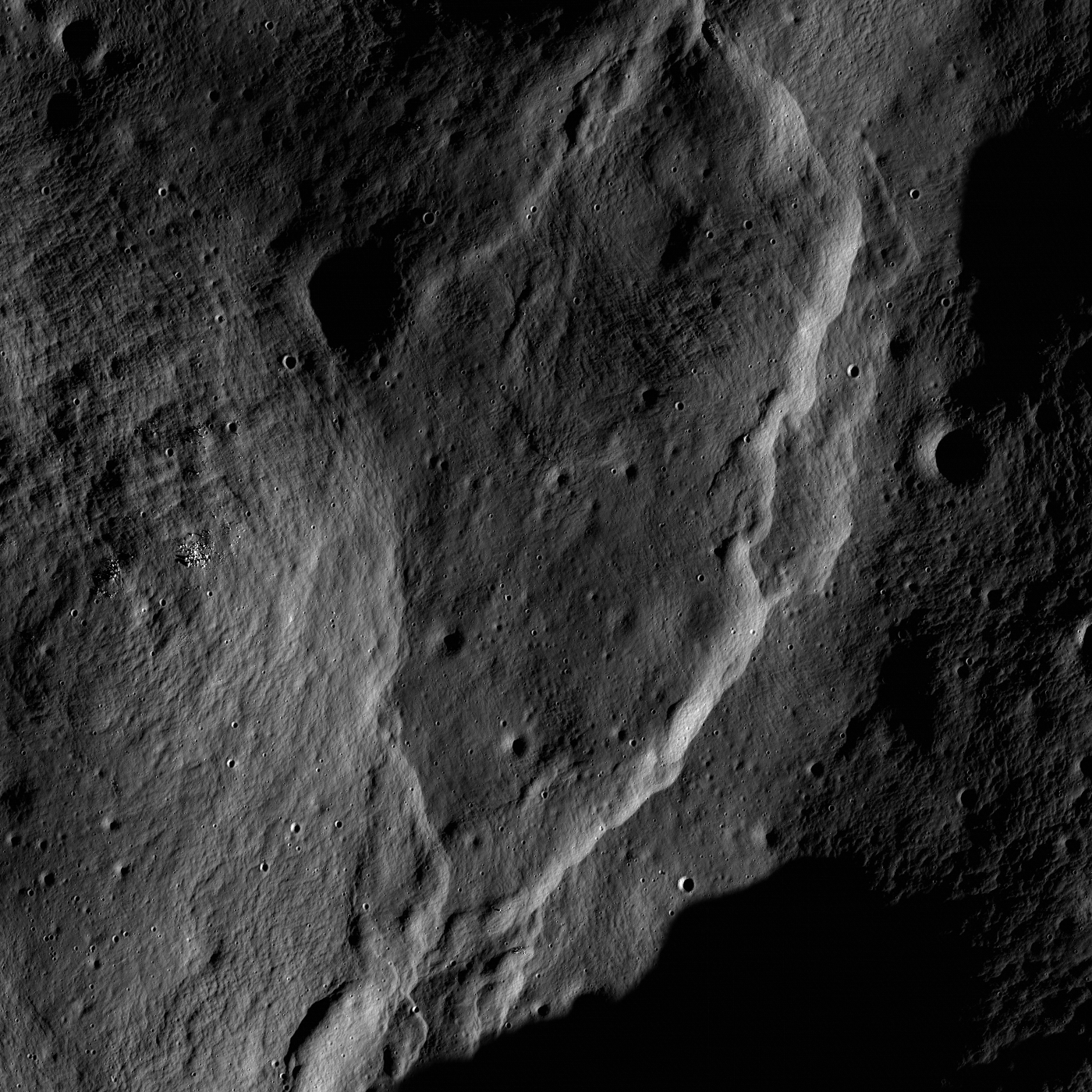
Intricate fault patterns enhanced by polar dawn lighting in Seares crater (Sun is shining from lower right). North is up, and the image field of view is 2800 meters; LROC Narrow Angle Camera (NAC) observation M130681684LR, LRO orbit 4392, June 9, 2009. View the spectacular full-sized LROC Featured Image HERE [NASA/GSFC/Arizona State University].

Mark Robinson
Principal Investigator
Lunar Reconnaissance Orbiter Camera
Arizona State University


Wow - the Moon is a beautiful place! Who ever said wrinkles are something to dread? In the Apollo days a few faults with scarps like the one above were discovered in the highlands. However, the coverage was small so it was not known if these lobate scarps were common over the whole Moon or not. From LROC NAC images we now know that the lobate scarps are common in the highlands and are also globally distributed.

This spectacular example is located far from the Apollo zone, towards the north pole (74.5°N, 146.8°E). The fact that these ridges are found all over the Moon tell us that the lunar crust is contracting. But how? We believe the Moon is shrinking as its once molten core cools and freezes. Liquid metal takes up more space than solid metal - so as the core freezes, it shrinks. As the core shrinks, the mantle and crust follow suit. Since the crust is brittle, it faults and buckles and lobate scarps pop up! The amazing resolution of the LROC Narrow Angle Cameras brings into view the smallest details.

What are those little patches of boulders doing sitting there on the ridge?


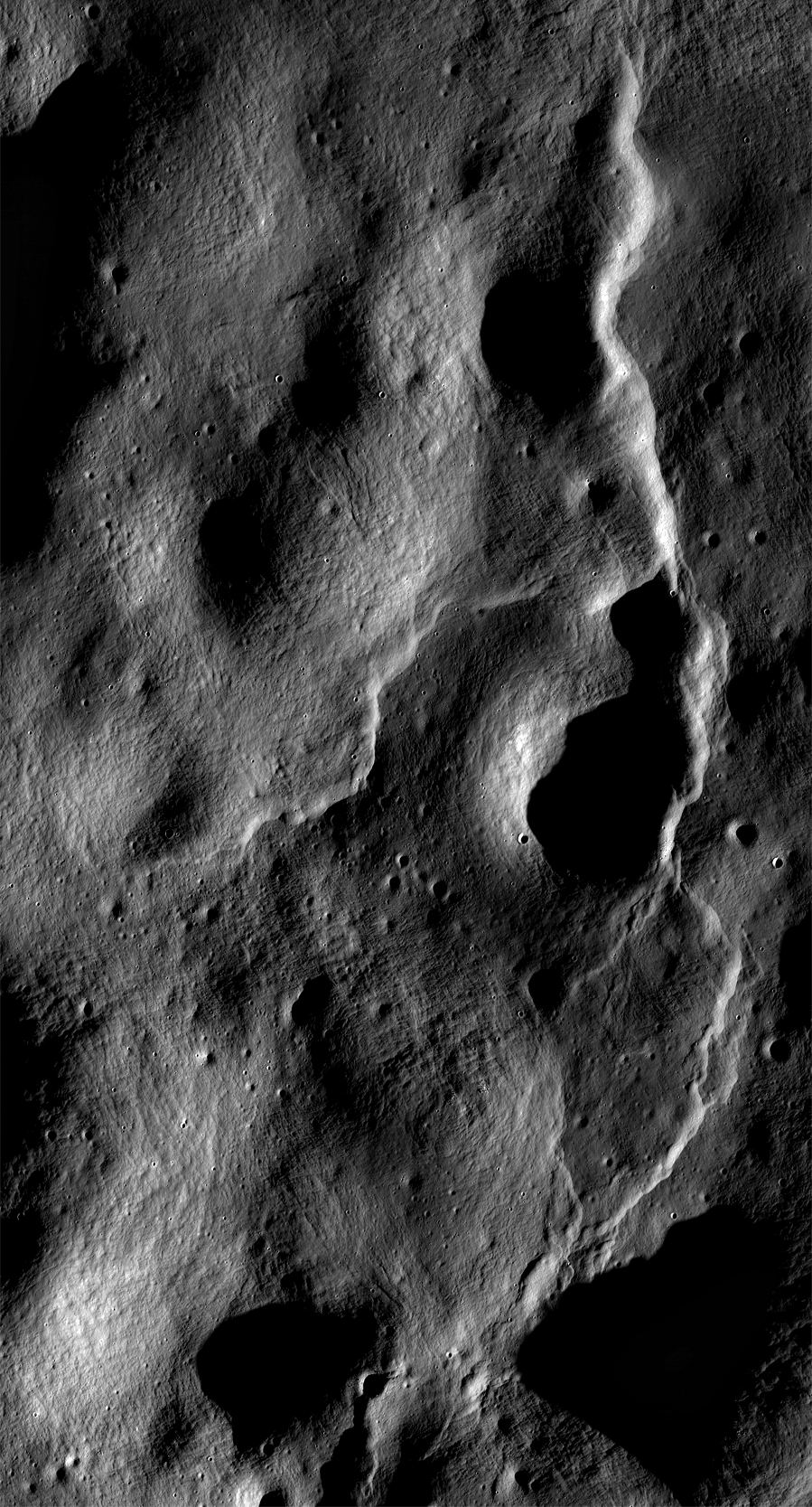
Larger area from same NAC mosaic sampled at 6 m/p, north is up, image width 5.4 km. View the full-sized image HERE [NASA/ GSFC/ Arizona State University].

Don't confuse lobate scarps with wrinkle ridges; they do look alike to the untrained eye. Though they are both formed by compression that results in faulting and thrusting, the underlying mechanisms are very different. Visit a previous LROC post detailing wrinkle ridges. Explore the entire NAC mosaic, and keep an eye out for more compressional features as well as those formed by extension!

Friday, April 29, 2011

Slumping rim of Darwin C

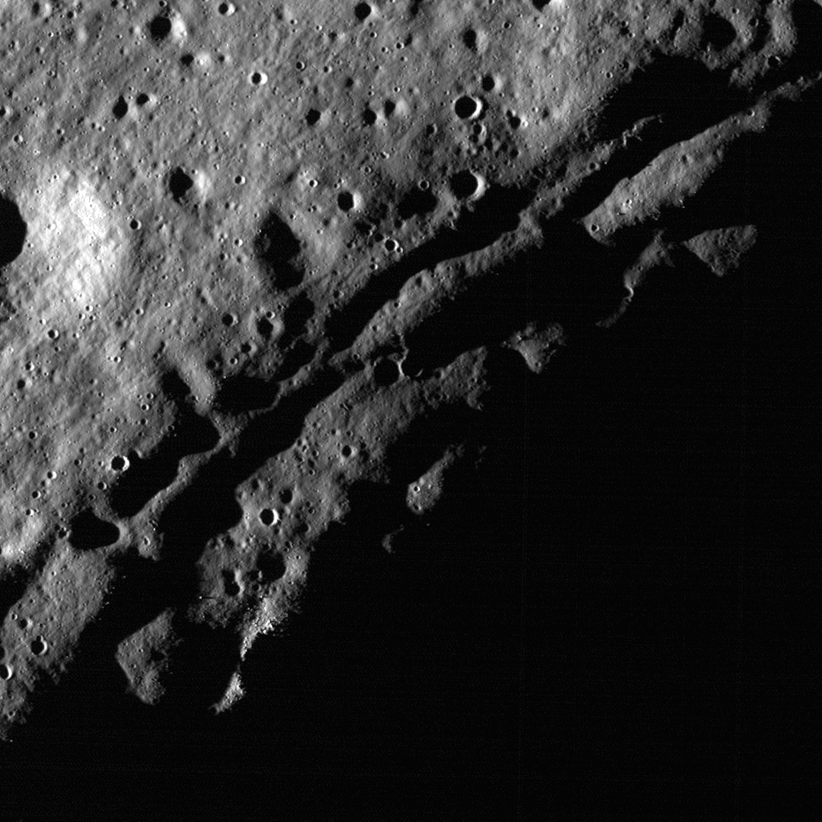
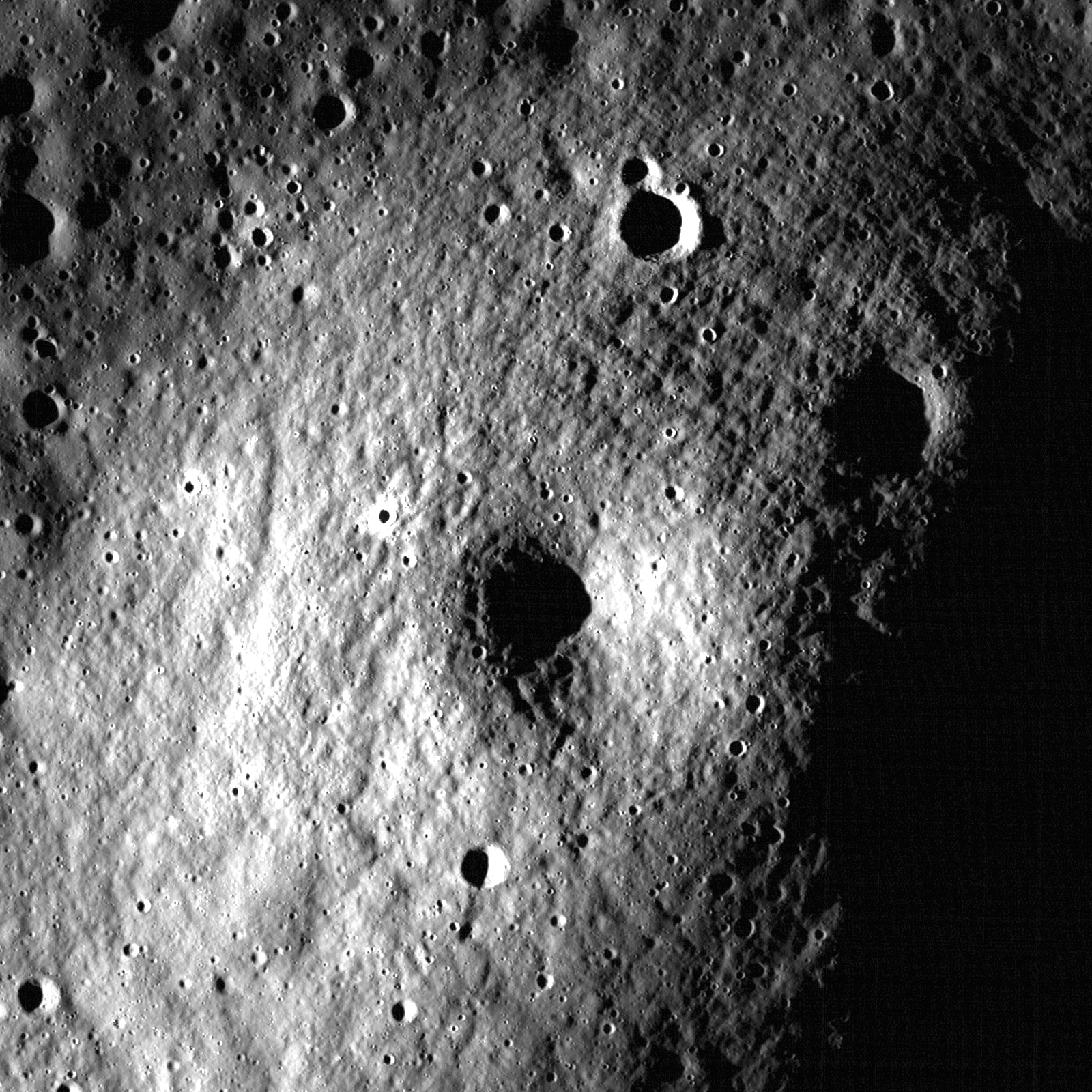
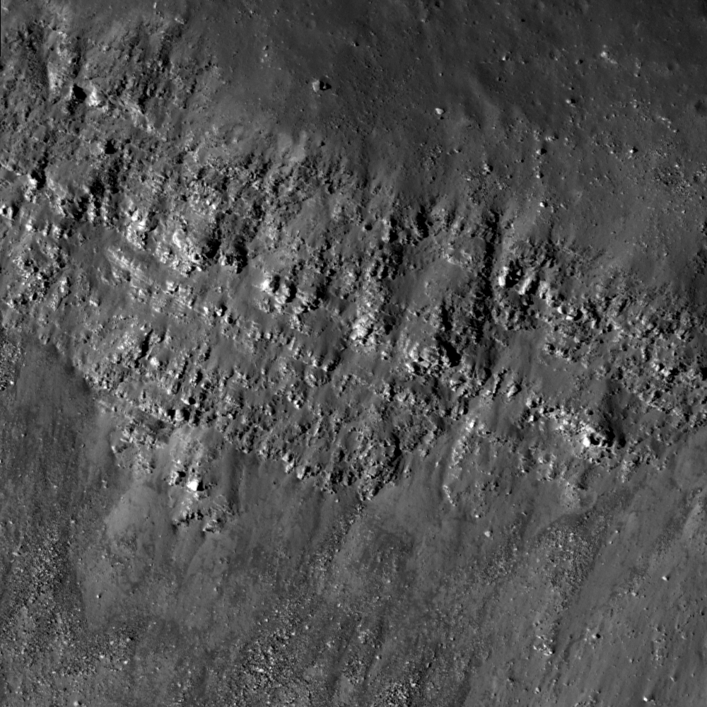
Illumination from a high angle of incidence (83°) accentuates the slumping rim of Darwin C. The parallel fractures along the crater rim are slump blocks pulling away from the rim toward the interior of the crater, in shadow at lower right. LROC Narrow Angle Camera (NAC) observation M148624404R; LRO orbit 7036, January 2, 2011. Frame field of view is 720 meters across. See the full-size LROC Featured Image HERE [NASA/GSFC/Arizona State University].

Lillian Ostrach
LROC News System

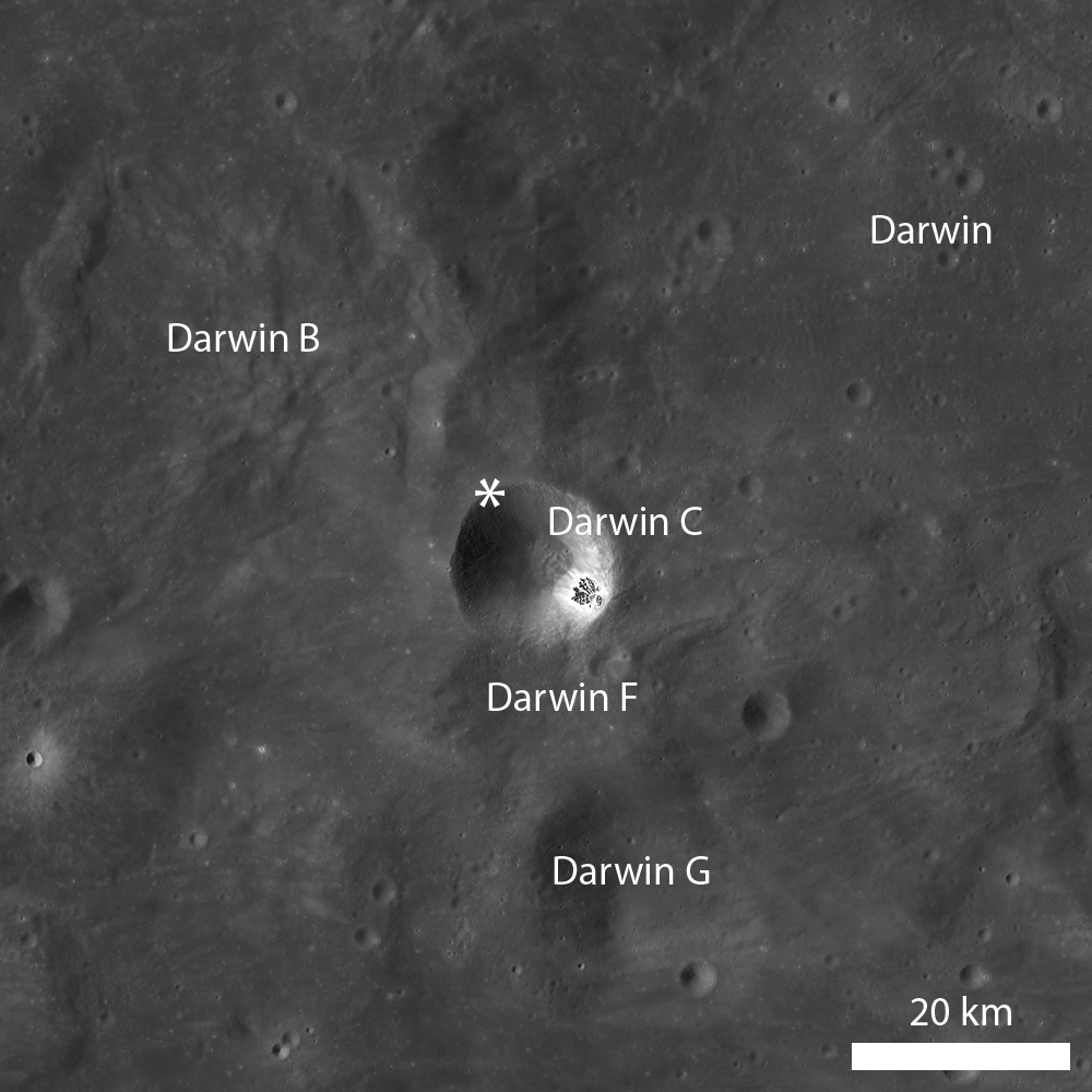
Darwin C (20.5°S, 288.9°E) is one of several satellite craters associated with the crater Darwin. Compared to its sister satellite craters, this one is less degraded. However, the rim of Darwin C provides an excellent example of post-impact modification of a crater rim. Previously, a Featured Image highlighting Klute W explored crater degradation, specifically focusing on the fracturing and slumping of the crater rim. Similar to Klute W, the rim of Darwin C has experienced slope retreat and slumping as observed in the opening image. However, based on the LROC WAC context image below, Darwin C has not experienced as much slumping as Klute W.

The Lunar Reconnaissance Orbiter has orbited the Moon since June 2009, long enough to catalog NAC views of many areas more than once, including overlapping observations of the area highlighted in the LROC Featured Image above. Six thousand orbits ago, on December 2, 2009, LRO captured the slumped rim of Darwin C under very different lighting conditions. While the earlier image does show us many of the details shadowed in the image above, the area in evening shadows provides topographic detail [NASA/GSFC/Arizona State University].

LROC Wide Angle Camera (WAC) monochrome mosaic of Darwin and associated satellite craters. The mosaic is centered on Darwin C and an asterisk marks location of opening image. See the full-size LROC WAC mosaic context image HERE [NASA/GSFC/Arizona State University].

The slumping and downslope movement of material from a crater rim increases the size of the crater. This type of post-impact modification is important to note because scientists use crater counting to determine the relative ages of different units, since older surfaces will have more craters than younger surfaces, in addition to figuring out where the unit belongs in the lunar timescale. In crater counting, the specific diameter of the craters is very important because complex mathematical equations rely on the crater size and density (how many craters of a certain size there are in a given area) to derive a model absolute age. In addition to having more craters, older surfaces have more large craters than younger surfaces. So, if crater diameters substantially increase due to post-impact modification, the model age derived from crater counts may be anomalously old.

Explore the slumping rim of Darwin C in the full LROC NAC image!

For more information on crater counting methods and the mathematical equations used to derive model absolute ages, please download the Neukum, et al. (2001) paper.

Related Posts:
Post-impact modification of Klute W
Fresh Rim of Slipher S
Farside northern highlands
Copernicus Crater and the Lunar Timescale

Thursday, April 28, 2011

Another small volcano?


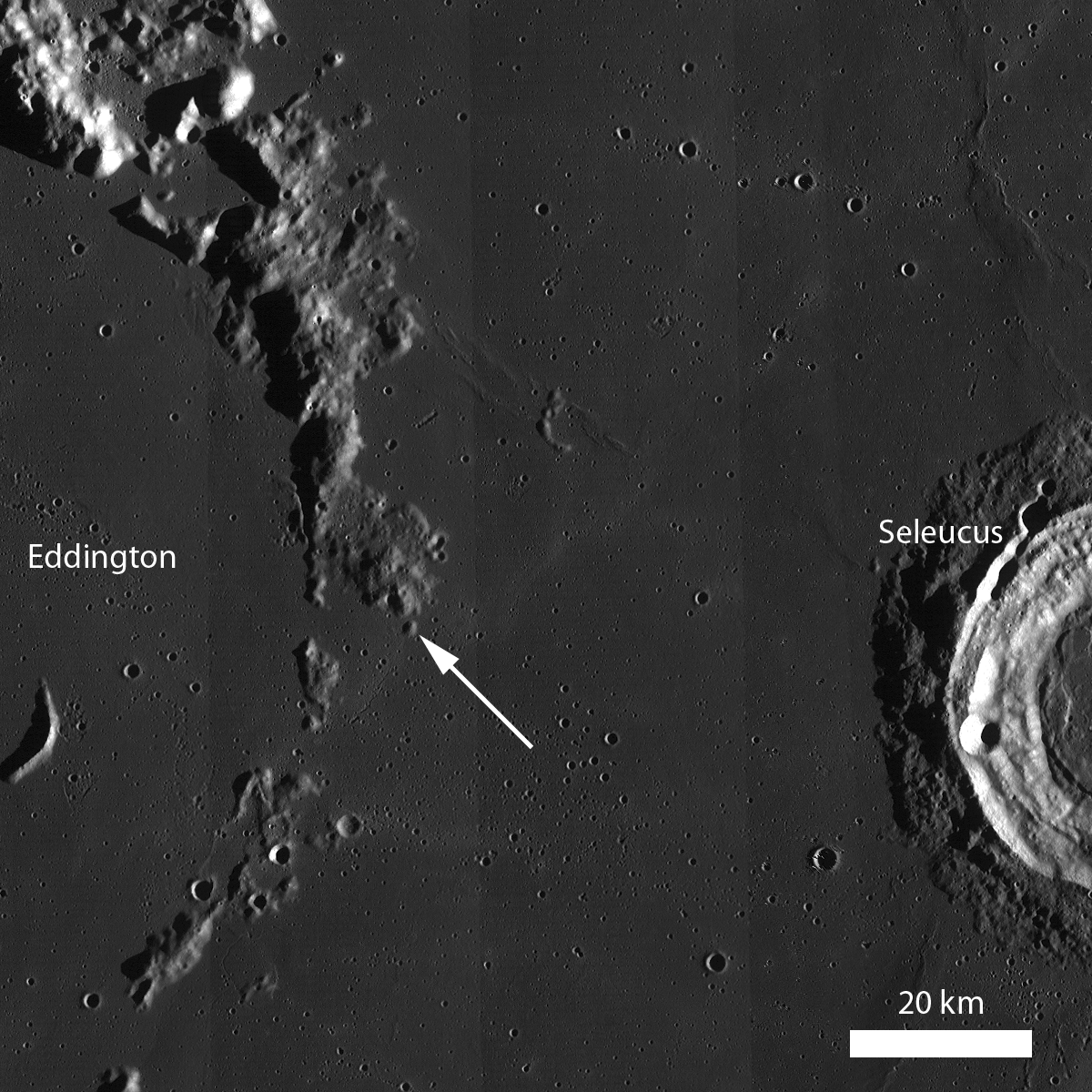
Along the embayed Eddington crater rim is an ~1.5 km dome that may be an ancient volcano with a summit pit crater. LROC Narrow Angle Camera (NAC) observation M148618400R, LROC orbit 7036, January 2, 2011; field of view 960 meters. View the full-sized LROC Featured Image HERE [NASA/GSFC/Arizona State University].

Lillian Ostrach
LROC News System

Volcanic features are observed all over the Moon, but sometimes it is difficult to tell whether an observed feature is of volcanic origin or the remnant of another geologic feature (e.g., basin ejecta or buried rim materials). Today's Featured Image is a prime example of a dome that may or may not be of volcanic origin. The dome is ~1.5 km wide and has a summit crater, but is the crater of impact or volcanic origin? The dome is geomorphologically similar to two volcanoes found in Lacus Mortis. These other domes are about the same size (~1.5 km wide) and have similar appearances, except that today's feature has many more small superposed impacts, suggesting that it is older than the Lacus Mortis volcanoes. Does it mean that this feature in western Oceanus Procellarum is a volcano just because it looks like one? The simple answer is no; but keep reading to find out why.


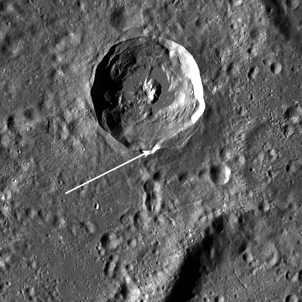
LROC Wide Angle Camera (WAC) monochrome mosaic featuring the rim of inundated Eddington crater, where the subject of the LROC Featured Image, released April 27, 2011, is located (arrow, 21.6°N, 290.5°E). Can you find any other similar-looking features along the Eddington crater rim? [NASA/GSFC/Arizona State University].

On Earth, many techniques are used to interpret the geologic history and origin of features in a landscape. Usually, analysis of remotely sensed data and field work are two techniques that scientists use together to unravel the geology for a region. But on the Moon, we can't travel to our favorite geologic feature and commence field mapping and measurements - at least not yet anyway! Instead, scientists need to get creative with the remotely sensed data they have.

LROC NAC stereo images can be used to study the topography of geologic features. Scientists have characterized the topography of larger volcanoes and domes on the Moon, and these data can be used in conjunction with LROC NAC stereo images to measure the dimensions and slopes of the volcano-like feature in today's Featured Image. If the dimensions, slopes, and texture, for example, of a volcano-like feature are consistent with the characterized landforms interpreted to be volcanoes, then it is possible that the volcano-like feature is a volcano. But be careful: just because a volcano-like feature has similar topographic measurements and morphology to other volcanoes does not mean that it is definitely a volcano. Similar to terrestrial field work, scientists studying lunar geology must make sure to look at the "big picture", or the context and regional surroundings, when interpreting remotely sensed images.


The full-width WAC context image, viewed HERE. provides a look at the regional, larger context of the feature imaged (above). LROC WAC color data can be used to map the variations in color caused by compositional variations. If the color of the volcanic-like feature is the same as that of the Eddington crater rim material, then the feature could be Eddington crater rim material and not a volcano. However, if the colors are different, then there is a possibility that the feature is volcanic in origin - but again, this analysis is not definitive. To reach a more definitive conclusion, you would need to look at the WAC color data for other identified volcanoes or domes and make a comparison. But, of course, sampling the volcano-like feature, in addition to the Eddington rim material and surrounding mare material, would be best!

Take a look at the embayed rim of Eddington crater and this dome and decide for yourself if it formed as a volcano.

Related Posts:
Volcanoes in Lacus Mortis
Hortensius Domes Constellation ROI
Gruithuisen Domes Constellation ROI
Marius Hills Constellation ROI

Wednesday, April 27, 2011

Forked wrinkle ridge


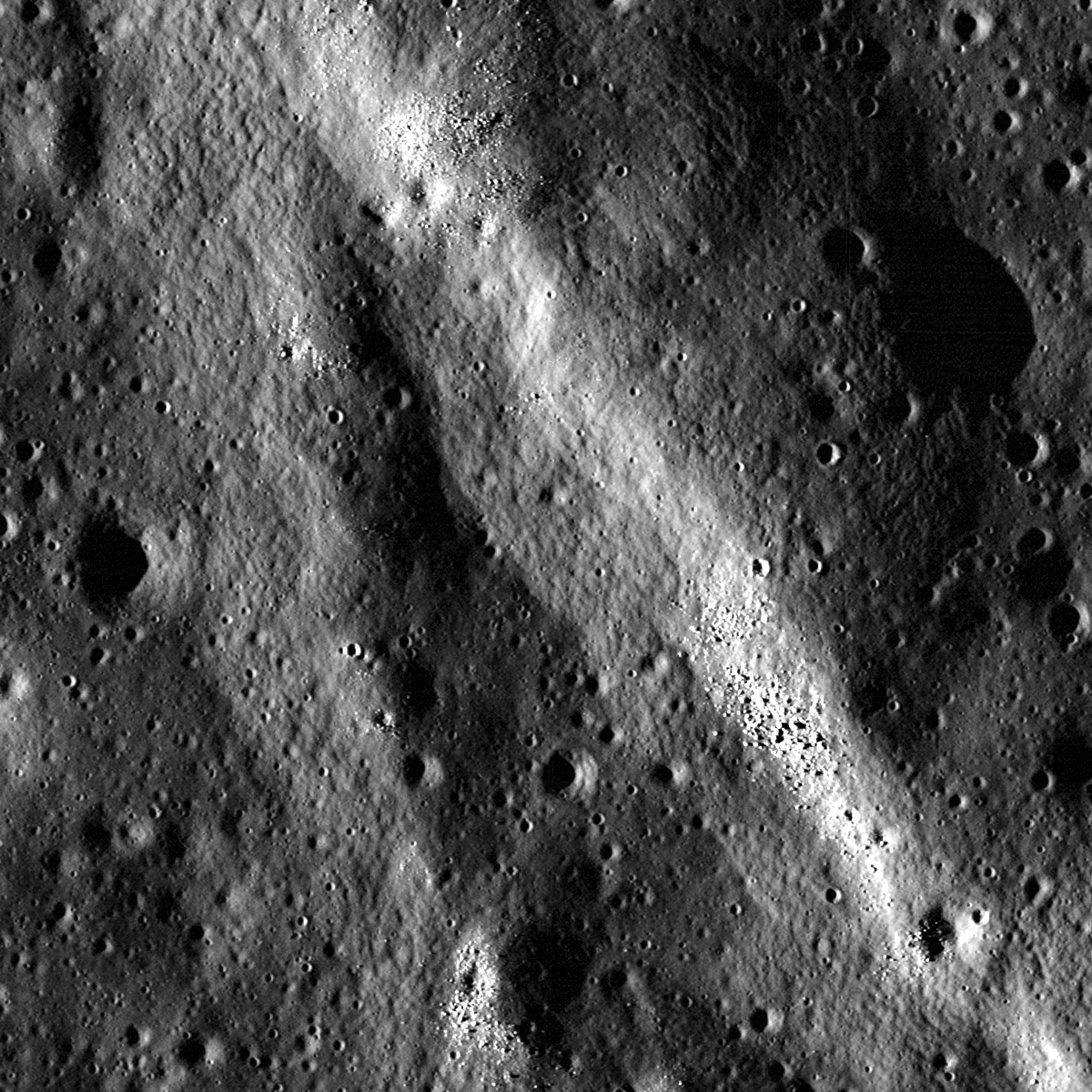
A wrinkle ridge in Oceanus Procellarum forks into two segments. Similar to many other wrinkle ridges, boulders are clustered on the ridge crest. LROC Narrow Angle Camera (NAC) observation M148536523L, LRO orbit 7023, January 1, 2011; field of view 720 meters. View the full-size LROC Featured Image, HERE [NASA/GSFC/Arizona State University].

Lillian Ostrach
LROC News System

Wrinkle ridges are fascinating tectonic features that are the surface manifestations of contraction and faulting. They are prevalent in the mare and have a distinct broad, low-relief arch with a more steeply-sloped ridge superposed on the arch. Many wrinkle ridges observed in LROC NAC images have boulders located somewhere along the ridge crest. In many cases (but not all!), the boulders are eroding out of the wrinkle ridge. How do we know this? Look at the opening image and the boulder clusters perched on the ridge crest. Do you see any fresh impact craters nearby from which the boulders might originate? In this section of the ridge, the answer is no - so the boulders most likely originate from wrinkle ridge erosion.


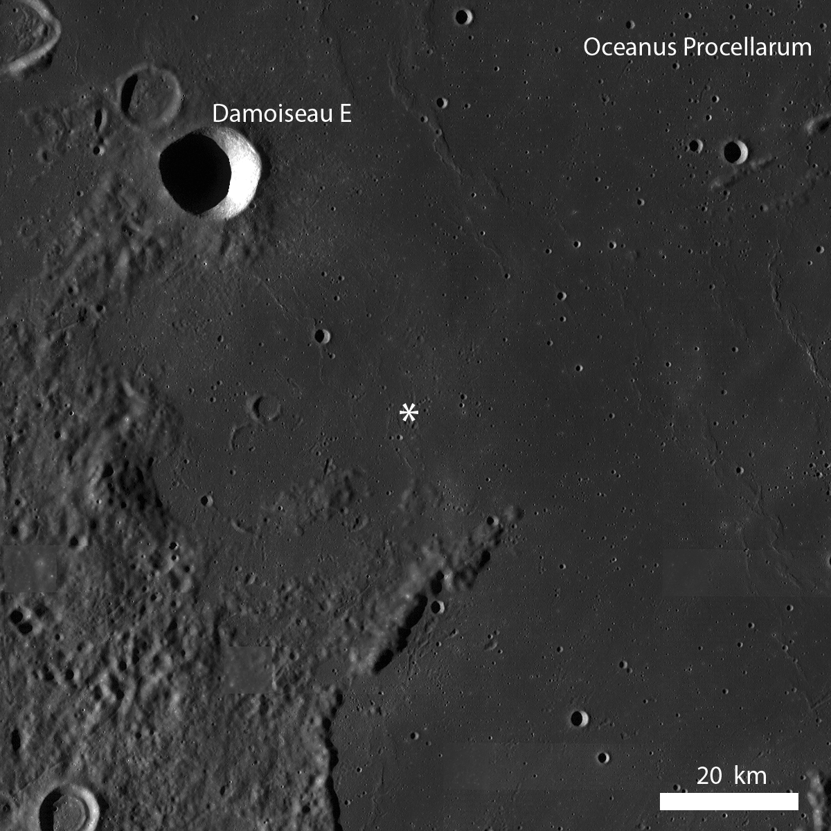
LROC Wide Angle Camera (WAC) monochrome mosaic of a portion of Oceanus Procellarum (6.4°S, 302.5°E) where many wrinkle ridges are found. The location of the LROC Featured Image posted April 26, 2011 is noted with an asterisk. View the full-size LROC WAC context image HERE [NASA/GSFC/Arizona State University].

Today's Featured Image highlights a bifurcation between two segments of a wrinkle ridge. The compressive stresses that produce faulting in the expansive lunar mare basalts are affected by both local, small-scale stresses (for example, a buried crater) and regional, large-scale stresses (for example, the effects of the weight of many meters of mare basalts extruded into one of the lunar basins). Such large-scale stresses probably influenced the wrinkle ridges observed in the LROC WAC context image (above), but the observation of a forked wrinkle ridge at the NAC scale probably means that smaller-scale stresses primarily influenced this wrinkle ridge. Perhaps there were pre-existing weaknesses in the local area where this ridge formed. Much less energy is needed to form a tectonic feature based around a pre-existing landform, like the rim of a buried crater mentioned above, and that could explain why wrinkle ridge splits into two (or joins, depending on how you look at it!). However, that is only one hypothesis explaining the forked wrinkle ridge - can you think of any other plausible hypotheses?

What do you think: is the wrinkle ridge splaying apart or are two separate wrinkle ridges joining together? Explore this feature in the full LROC NAC image!

Related Posts:
Wrinkle Ridges in Aitken crater!
Bright ridge near Mons Hansteen
Boulder clusters on a ridge crest
Right Angle


Full 1500 meter-wide sample of the LROC NAC frame [NASA/GSFC/Arizona State University].

Ambassador of Exploration Award award goes to Alan Shepard


Admiral Alan Shepard (1923-1998), the former Naval Aviator commands Apollo 14, his second spaceflight since becoming the first American in space during a 15 minute flight in 1961 [NASA/Apollo 14 Surface Journal].

Daniel Baxter
AvStop.com

NASA will posthumously honor Alan B. Shepard Jr., the first American astronaut in space and who later walked on the moon, with an Ambassador of Exploration Award for his contributions to the U.S. space program.

Shepard's family members will accept the award on his behalf during a ceremony at 5:30 p.m. EDT on Thursday, April 28, at the U.S. Naval Academy Museum, located at 74 Greenbury Point Road in Annapolis, Md.

His family will present the award to the museum for permanent display. NASA's Chief Historian Bill Barry will represent NASA at the event, which will include a video message from agency administrator Charles Bolden.

Shepard, a 1945 graduate of the Naval Academy, was one of NASA's original seven Mercury astronauts selected in April 1959. On May 5, 1961, he was launched from Cape Canaveral, Fla., aboard the Freedom 7 spacecraft on a suborbital flight that carried him to an altitude of 116 miles.

Shepard made his second spaceflight as the commander of Apollo 14 from Jan. 31 to Feb. 9, 1971. He was accompanied on the third lunar landing by astronauts Stuart Roosa and Edgar Mitchell.

Read the full story HERE.

Friday, April 22, 2011

LROC: Mare Undarum 'Action Shot'


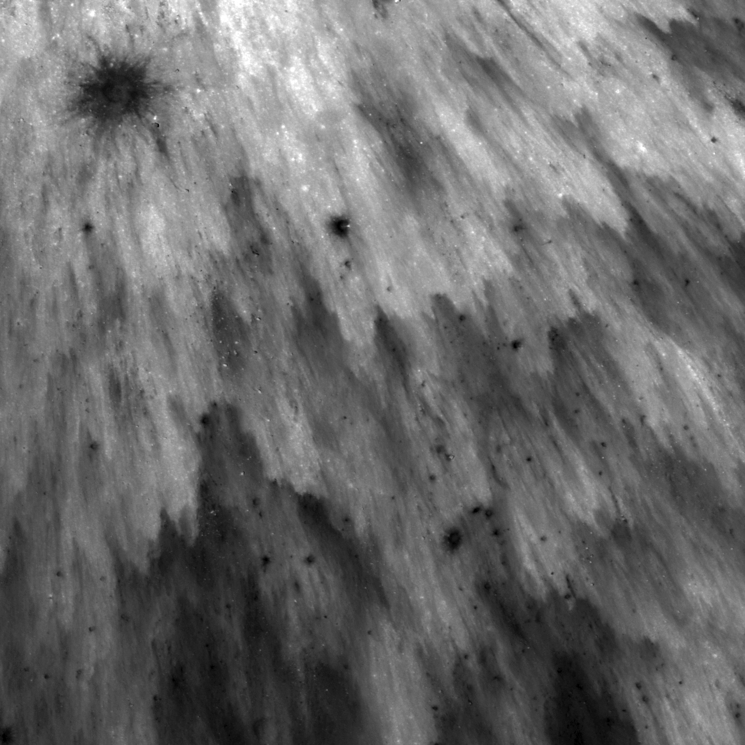
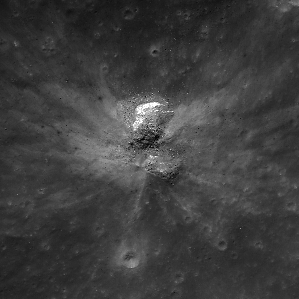
Fresh ejecta blanket of an unnamed 1 kilometer-in-diameter crater (near 7.77°N, 64.87°E, ~45 kilometers east of Firmicus C). LROC Narrow Angle Camera (NAC) observation M154813223R, LRO orbit 7949, March 15, 2011; solar incidence angle 13°, field of view 750 meters across. View the full-sized LROC Featured Image HERE [NASA/GSFC/Arizona State University].

Susan Braden
LROC News System

This small crater displays a beautiful ejecta pattern resembling a starburst. Looking at this image you can almost imagine the shower of ejecta falling to the ground.

The pattern formed out of high and low reflectance areas is due to the freshness of the ejecta. Notice in the second image that as you move away from the center of the crater, the overall reflectance of the ejecta gets lower (darker). This is because the ejecta is less continuous as you get further away from the crater.


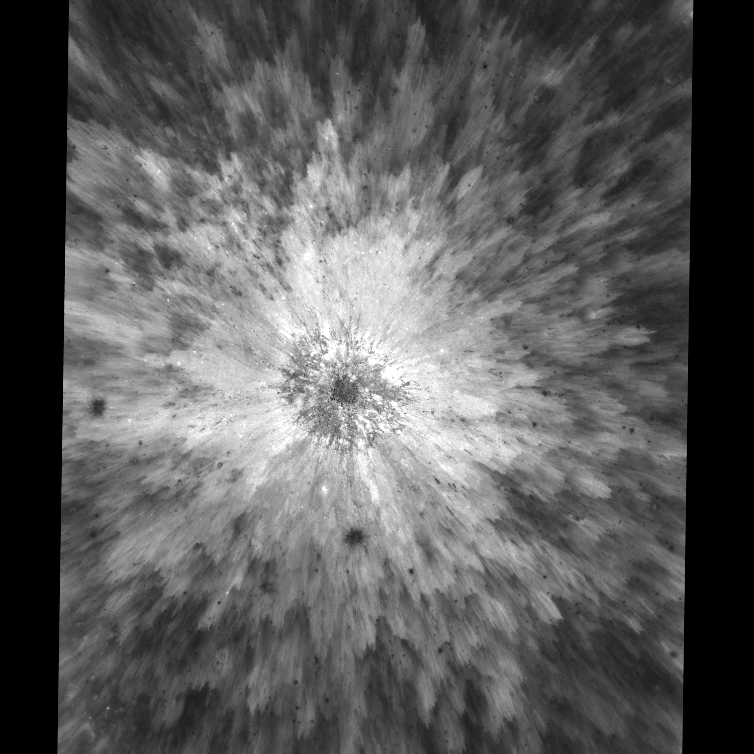
Same NAC frame but with a larger view to show context. Notice the bouldery center of this fresh crater (zoom in HERE) and the two low albedo spots that represent secondary impacts. This image field of view is 2.2 km across. See the Full-Sized context image HERE [NASA/GSFC/Arizona State University].

There are two low reflectance (darker) spots in the ejecta, one just south of the main crater and another just west of it. If you look closely, these spots are actually small craters with their own ejecta, probably secondaries from the primary impact. They excavated material from beneath the ejecta blanket and that material has a lower albedo compared to the ejecta.

Explore the entire NAC Frame!

Related Images:
Splendors of Mare Smythii
Ejecta sweeps the surface
Delicate patterns in Giordano Bruno ejecta


40 by 74 kilometer-wide LROC Wide Angle Camera (WAC) monochrome mosaic field of view puts the bright crater and its fan of ejecta (west of direct center) in rough perspective. LROC WAC Mosaic Viewer [NASA/GSFC/Arizona State University].


Zooming out with the LROC WAC Mosaic Viewer, in turn, immediately puts the northwest quadrant of Mare Undarum (bottom) in even less granular perspective, and the fresh crater disappears amidst the Firmicus and Condorcet crater groups. The largest crater visible, northeast of center is 77 km Condorcet. Seeing just the southeastern edge of Mare Crisium at upper left, with its mountainous outer rings of mountains between itself and Undarum gives a fair indication of how far east this scene is, in line-of-sight perspective of the Moon's nearside as seen from Earth [NASA/GSFC/Arizona State University].

Slice of Mare


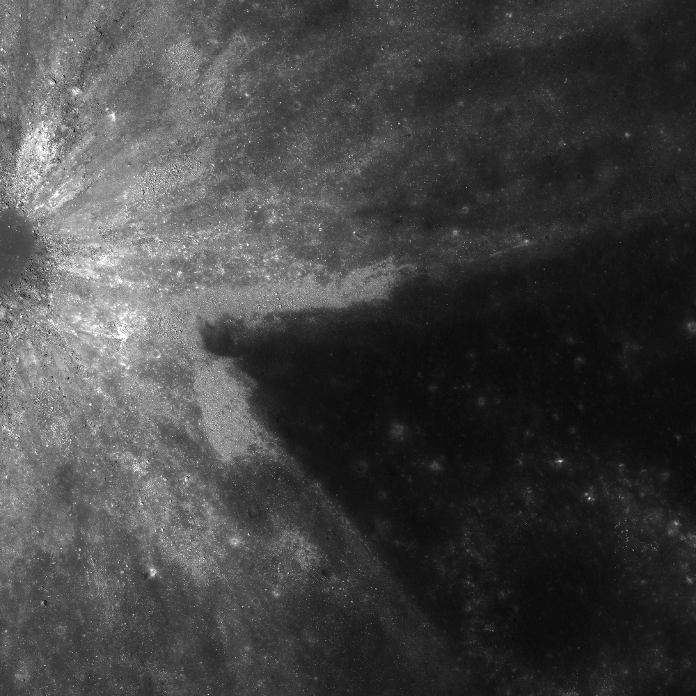
Wedge-shaped asymmetrical ejecta pattern surrounding a ~1 kilometer in diameter crater in Mare Undarum, southeast of Mare Crisium, at 6.55°N, 66.91°E. LROC Narrow Angle Camera (NAC) observation M154799629R (field of view is 2 kilometers at 50 centimeters per pixel resolution); LRO orbit 7947, March 15, 2011. View the full-sized Featured Image HERE [NASA/GSFC/Arizona State University].

Sarah Braden
LROC News System

The ejecta pattern of this unnamed crater left a slice of Mare Undarum (Sea of Waves) uncovered, east of the crater Firmicus. When an impact ejecta blanket is not uniform, the ejecta is defined as asymmetric. Craters with asymmetric ejecta are either caused by pre-impact differences in composition, unusual topography, or an oblique angle of impact. Asteroids hit the Moon at fantastically high speeds, greater than 16 km per second (or 35,000 miles per hour), and most of the craters left by these impacts are circular. However, the shape of the crater (or the distribution of the ejecta blanket) changes when the the angle between the asteroid path and the surface becomes small, 15° or less. In such a low angle impact, the ejecta has more momentum in the direction of travel of the impactor, which causes the asymmetric ray patterns. In this case the extent of ejecta extends to the north and south and a lack of ejecta to the east, probably indicating that the impactor probably came from the east. Another example of an oblique impact is Messier, where the shape of the crater is elliptical due to the angle of impact.


LROC WAC Mosaic Viewer 100 meter-per-pixel context image; white arrow designates the location of the crater in LROC's Featured Image released April 20, 2011 [NASA/GSFC/Arizona State University].

The ejecta rays are high reflectance relative to the surrounding mare terrain, but are these rays caused by maturity or composition? In most cases, a well-defined, high reflectance ray pattern suggests the relative youth of an impact crater. However, these rays may be compositional if the crater excavated material from beneath the mare layers. On the Moon and other bodies, craters which excavate material from depth (with compositional rays) can be used to estimate the thickness of the mare layer.

View the entire NAC image!

Related Images:
Small crater at the southern rim of Menelaus
Asymmetric Ejecta
How did I form?

"Embrace the end of human spaceflight..."


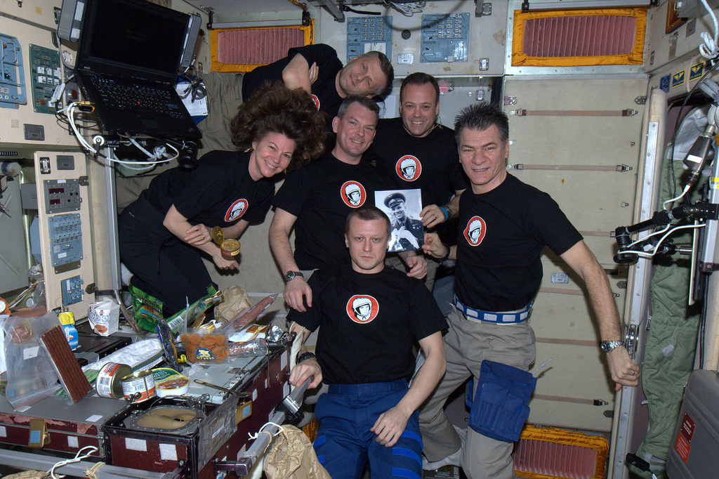
"Yuri's Night," April 12, 2011, the fiftieth anniversary of the flight of Col. Yuri Gagarin (1934-1968), the first human to orbit Earth, as celebrated in low-Earth orbit by cosmonauts and astronauts on-board the International Space Station. "Party on, Dudes," laments noted lunar and planetary scientist Paul D. Spudis.

Paul D. Spudis
The Once & Future Moon
Smithsonian Air & Space

“And nothing can we call our own but death, and that small model of the barren earth which serves as paste and cover to our bones. For God's sake, let us sit upon the ground and tell sad stories of the death of kings.” – Richard II, Act III, Scene 2

The nearly simultaneous 50th anniversary of the beginning of human spaceflight and the forthcoming end of the Space Shuttle program has philosophical members of the chattering classes making the rounds to thumb their noses or hawk their wares, waxing poetic over historical ironies, wasted opportunities and dollars, and damn near exhausting Roget’s Thesaurus searching for words to express their innermost profound thoughts about space exploration.

Case in point: in a vacuous piece at Salon.com, Michael Lind invites us to “embrace” the end of human spaceflight. It was all just a ghastly mistake, don’t you see? Anyway, robots can do all the science and there’s no need to extend humanity into space because if a global disaster occurs, we can take refuge in underground bunkers. Mr. President! We must not allow … a mine shaft gap!

As long as we’re marking this melancholy milestone, why do we (or rather, did we) have a human spaceflight program? Many have attempted to answer this question from a variety of viewpoints, including the geopolitical, public excitement, inspirational, or the “because it’s there” rationales. The recent Augustine committee report tackled this question and after paying homage to the usual obligatory rationales (e.g., international cooperation), came up with this answer: the ultimate rationale is to move humanity into the Solar System. In fact, they assert that all other rationales are mere subsets of this dominant, overriding one.

The argument for this motivation is simple – some day, some how, a global-scale catastrophe will make the surface of the Earth uninhabitable, possibly for hundreds of years (stock those bunkers well). Moreover, such a disaster could well strike with little or no warning. We’re warned about the dangers of near-Earth objects, though a killer impact could come from the outermost part of the Solar System. Such objects move in at such amazing speeds that there is little time to react even once one is recognized. We might not be able to intercept it; comets can pass through the inner Solar System at speeds exceeding 70 km per second. Finally, there is the problem of interdiction and deflection. We have only a vague notion of how to do this and by vague, I mean none.

The idea that people can live off Earth, either in space or on some other planetary surface, seems incredible, but no more so than living underwater or in some hostile, remote wasteland seemed to people in the past. If it is physically possible, someone will do it – some time and somewhere. People move where there is empty space; they always have and always will.

So an obituary for human spaceflight may be premature. The reaction to the idea of humans living somewhere other than on Earth is interesting and reflects a basic division within humanity. For any new frontier, there are always those who go and those who stay. Those who stay cannot imagine the motivations of those who go, often attributing irrationality – if not insanity – to their actions.
Space is a frontier not yet fully opened. Although we understand how to do it in principle, we do not yet have the practical knowledge to make it feasible. I have argued that if space is to become a future home for humanity, we must learn how to extract what we need in space from what we find there. Unless we desire future human space missions to be forever consigned to the current template of bringing everything with us, learning to live off the land is a requirement regardless of where we go or what we do.

Given this long-term requirement, what should be the role of our national civil space program? I believe that a small-scale demonstration of the viability of extracting useful products from space resources is a critical first step. This was to be our mission on the Moon and it still can be. Like any new skill, we should start with the easy stuff. Extracting water from lunar polar ice should be our first task for resource processing, albeit this relatively simple task is still difficult and fraught with unknowns. But if not to address and solve such seemingly intractable problems, what’s a space program for? With such goals we reap the bounty of new technology and economic wealth. Commercial will find a market for demonstrated potential.

Yet another recent article advances as “myth” the idea that robotic spaceflight prospers when human spaceflight prospers. I contend that in fact, this is no myth. However, advocates of purely robotic space programs disagree, believing that once our expensive human program melts away, all of their robotic space missions (queued up and waiting to fly) will be showered with copious funding – after all, science is the main reason for space exploration and science is done best by machines.

Well, we’re about to test this particular storyline because human spaceflight is going to be suspended at NASA – “officially” only for several years, but in reality, possibly permanently. The retirement of Shuttle leaves the United States with no national capability for human access to orbit and no real plans for a replacement. There are hopes for a burgeoning commercial market but their long-term viability remains uncertain. As of now, despite some unsettled issues with the language of the Congressional authorization for NASA, this is what remains of our once great U.S. human space program.

So how does robotic planetary exploration fare in this new organizational shake-up? At the recent Lunar and Planetary Science Conference, the long-awaited planetary exploration “Decade Study” was rolled out. Missions to Mars, Jupiter’s satellite Europa, Venus and the Moon were all described. However, just before this plan was made public, the “out year budget” proposed by the administration was released; funding for planetary exploration declines by almost a quarter over the next five years, making many of these potential missions questionable at best and non-starters at most. The new Decadal Study – almost two years of deliberation, analysis and debate by the planetary science community – may be D.O.A.

Welcome to the new Nirvana.

Wednesday, April 20, 2011

Lava Flows Exposed in Bessel Crater


Spectacular example of layering exposed just inside the rim of Bessel (21.8°N, 17.9°E), a familiar 17 kilometer-wide nearside crater in Mare Serenitatis. LROC Narrow Angle Camera (NAC) observation M135073175R, field of view above is 500 meters; LRO orbit 5029, July 29, 2010; solar incidence 13° See the Full-Size LROC Featured Image, HERE [NASA/GSFC/Arizona State University].

Sarah Braden
LROC News System

The outcrops exposed on the interior wall of Bessel crater (~16 km in diameter) are remarkable since they are most likely preserved layering of mare basalt. Today's Featured Image shows a portion of the northern wall, which contains multiple layers that probably represent discrete lava flow deposits in Mare Serenitatis. Over time, large, but relatively thin, lava flows spread across the extent of Mare Serenitatis.

Lunar pits imaged by LROC also give us a good look at basalt flow layers. Boulders broken off of the mare layers tumble down the wall toward the floor of the crater.

Bessel crater is named after Friedrich Bessel, the developer of Bessel functions. By measuring the thickness of layering found in Bessel and other craters, scientists can put constraints on the thickness of individual lava flows. What else can Bessel crater tell us about Mare Serenitatis?


The original LROC Wide Angle Camera (WAC) 100 meter/pixel monochrome mosaic context image is seen here draped over the high-resolution Digital Terrain Model of the Apollo science mission corridor, available to users of Google Earth. Over that the LROC NAC frame was added (along with the Featured Image, barely visible inside the northwest rim. Bessel's interior shows slumping of material from the walls onto the floor [NASA/GSFC/Arizona State University].

Explore the entire NAC frame!

Related images:
Linne Crater
Dark streaks in Diophantus crater
Kepler's Rim


The view from the northwest floor (actually standing on slumped material) gazing up more than a kilometer along the longitudinal length of LROC NAC frame M135073175R and the location of the LROC Featured Image, almost to the crater rim (beyond line of sight). The Apollo Corridor was photographed in detail during the final Apollo "J" science missions, allowing for an assembly of a detailed terrain model, a method now being applied to the entire Moon by the LROC, LOLA and other instrument teams operating the Lunar Reconnaissance Orbiter.


Hopping digitally up to the rim of Bessel for a view south to the opposite rim, from a vantage near the location of the Featured Image. Similar lava layers are exposed at the same height 16 kilometers away. The southern Mare Serenitatis spreads out beyond. Examining LROC photography in this way demonstrates the global potential of the vast data being still being collected by LRO science teams, already many times over more information than all previous deep space missions combined.

Tuesday, April 19, 2011

"How did I form?"


Small fresh crater inside the south lip of Palitzsch B (27.1°S, 68.45°E), with a shape and an ejecta pattern typical of an oblique impact. North is up, image field of view is 500 meters; LROC Narrow Angle Camera (NAC) observation M154785423R, LRO orbit 7944, March 16, 2011. See the full-sized Featured Image, HERE [NASA/GSFC/Arizona State University].

Drew Enns
LROC News System

Low angle, or oblique, impacts usually have asymmetric ejecta and form oblong craters. The typical "butterfly" ejecta pattern requires an angle of less than 15° from horizontal. This crater is quite unusual. Look closely to the south, do you see a positive relief feature? Again look north, up or down? Light is coming from the upper left, if you rotate the image 180° you might have an easier time seeing the topography correctly. Is this an oblique impact? Perhaps not, it appears an impact occurred between two boulders effecting the crater shape and ejecta pattern. This crater formed on the downhill slope of a large crater terrace. The two boulders are likely part of the slumped wall and served to deflect the ejecta mimicking the oblique impact butterfly pattern.


LROC WAC monochrome mosaic context image (LROC WAC Mosaic Viewer) of LROC News System's Featured Image, April 18, 2011. Arrow points to the oblique crater (see full-sized context image HERE); field of view ~50 kilometers [NASA/GSFC/Arizona State University].

The full NAC image provides a great view of the whole sloped wall.

Related Posts:
Asymmetric Ejecta
Bright Crater Rays and Boulders


Crop to 250 meters, full-size field of view from Lunar Reconnaissance Orbiter Camera Featured Image, April 18, 2011 [NASA/GSFC/Arizona State University].


Full-width of LROC NAC frame M154785423R [NASA/GSFC/Arizona State University].

Saturday, April 16, 2011

LROC Quick Map

Still a beta version, the LROC Team is asking for your comments, suggestions and feedback on the Lunar Reconnaissance Orbiter Camera LROC :: ACT-REACT Quick Map.


Interior of largest crater within Antoniadi, LROC Narrow Angle Camera observation accessed through Equidistant Cylindrical projection of the LROC Quick-Map; resolution 2 meters per meter, corrected for foreshortening.


Likely the same NAC image of crater interior, very near or at the Moon's lowest elevation (over 9 kilometers below global mean) using the LROC Quick-Map southern Polar orthographic projection; resolution 1 meter per pixel.

Joel Raupe
Lunar Pioneer, LLP

Among the many places on the Moon we're patiently waiting to see through the unprecedented array on-board LRO, including a high-resolution LROC Narrow Angle Camera (NAC) glance into the depths of the crater within Antoniadi now confidently believed to be the lowest point on the Moon (very near 70.38°S, 187.2°E), over 9,000 meters below global mean elevation.

In of itself we've never expected to see anything unremarkable at that location, and there are other sites we're hoping to see that are still not in the admittedly enormous amount of LROC data already cataloged and available online.

LROC principal investigator Mark Robinson and his team at Arizona State University has, however, recently given the world's planetary science enthusiasts another new tool.

Every three months, with the publishing of another the newest big volume of LROC photographs to the Planetary Data System, we a handful of sites, a few of them already well-surveyed, and many not given the attention we anticipate, to see what's new.

That job may become much easier with the Quick Map, which, like the Lunar Orbiter and Clementine imagery available through Map-A-Planet interface maintained by the Astrogeology section of the United States Geologic Survey (USGS), begins with a equidistant cylindrical map of the Moon. Clicking your way toward a feature, and seeing many NAC observation frames layered over the LROC WAC monochrome mosaic pulls the user in from far above the Moon to full resolution.

After the release of LRO's Lunar Orbital Laser Altimeter (LOLA) Featured Image of Antoniadi Crater, after already using the nearly-as-new LROC Global WAC Viewer to get a closer look at the obscure but still very discernible outlines of Mare Australe, we used that same Viewer also to examine close-up Antoniadi through the LROC WAC Mosaic Viewer, hoping to compare the detail with what had, not long ago, also been photographed by Japan's Kaguya, using that vehicle's instruments.

We weren't disappointed at all, and yet the really deep spot in Antoniadi is now reliably measured at the bottom of the unnamed largest crater (diameter 11.2 km) within Antoniadi we've long informally been referring to as "Antoniadi A."


Antoniadi - seen through the High-Definition Television camera on-board Japan's SELENE-1 orbiter "Kaguya" in 2007. The informally-named 11 kilometer-wide simple crater inside the southern interior is Antoniadi A, confirmed now as host of the deepest elevations on the lunar surface [JAXA/NHK/SELENE].

Unfortunately, the deepest parts of Antoniadi A's interior, usually stay in deep shade. Antoniadi is almost a southern circumpolar feature, where shadows are always long and enduring. It's a long way from any permanently shadowed region, which makes capturing its deep spots particularly difficult. LRO would have to be engaged in capturing "Targets of Opportunity" while flying over Antoniadi at local High Noon, and then, because of the low latitude, the north interior would still be in shadow.

Is this the bottom, or at least half the bottom interior of "Antoniadi A," the lowest place on the lunar surface? Other data seem to show, hardly unusual for lunar craters, that the very bottom of "Antoniadi A" is not evenly distributed. But it's certainly one of the lowest spots, if not "the lowest." Elephant Skin mottling in the distribution of dust that some think is indicative of "grades" as opposed to even elevation seems to come to a halt close to the ends of boulder trails.


Antoniadi in a monochrome image assembled from data collected using Kaguya's Terrain Camera. See the image at its original resolution, HERE [JAXA/SELENE].

The only improvement in this phenomenal Quick Map one might ask for, at this point, is a non-obtrusive lable naming the NAC observation, making it possible to cross-reference the particulars of the meets and bounds of the observation's fundamentals. But, no matter.

This new tool may not give you access to the entire catalog yet, but we're definitely not complaining. No one's gotten this close to the lunar surface since Cernan & Schmitt in 1972.

The first image was collected from the ACT-REACT Quick Map Equidistant Cylindrical projection, and is slightly corrected for the foreshortening; the second from the Orthographic Map of the South Pole region also available through what should be an "award-winning" new feature made available by the conscientious LROC team.

LOLA's Deep Antoniadi


LOLA Featured Image: Antoniadi Crater (69.7S, 188E); bounding (79S, 177-197E; 66S, 180-195E - 135 km), flanked by two smaller, older craters, Minnaert (l) and Numerov (r), is a transitional crater, exhibiting both a central peak characteristic of complex craters and inner ring characteristic of larger multi-ring basins. The deepest point on the Moon (-9.12 km) is measured inside Antoniadi. (Topographic data from LOLA is being used to measure the depth-to-diameter ratio of transitional craters like Antoniadi with higher precision than ever, in hope of better understanding the formation of different types of large impact structures [Sori & Zuber (2010). Preliminary Measurement of Depth-to-Diameter Ratios of Lunar Craters in the Transition Regime between Complex Craters and Multiringed Basins. 41st Lunar & Planetary Science Conference, #2202].


Antoniadi, prominent feature of the southern farside (69.7°S, 188°E), well to the interior of the ancient four billion-year-old South Pole-Aitken (SPA) impact, is host to the Moon's lowest elevations. The 11 km crater at lower center, without, as yet, any official name, formed the Moon's deepest point, measured by laser reflection from Japan's Kaguya orbiter at 9.06 km below the global mean elevation. Rewarding Challenge: find Antoniadi where we found this LROC Wide Angle Camera (WAC) monochrome mosaic, by zooming in on the southern polar stereographic projection using the LROC WAC Mosaic Viewer. (Hint: the view above is rotated, showing the farside with the north at top [NASA/GSFC/Arizona State University].

Brisbane Z's Australean wrinkle ridge


Straddling both the Moon's near and far sides (on the young Crescent Moon, visible at a high line-of-sight angle through modest binoculars about two days after a New Moon) is Pre-Nectarian (approximately 4.55 billion years old), 515 kilometer-wide Mare Australe. Aeons older than the more familiar basins clustered on the Moon's nearside, this is one of the Moon's features that quietly archives the earliest formative history of the Solar System (and Earth).

Drew Enns
and Arizona State University's Lunar Reconnaissance Orbiter Camera (LROC) team, focus this week on two far younger features of this very ancient impact. Above is take from the LROC Web Map Server Image Map, now layered with LROC Wide Angle Camera mosaic images and centered near 60 degrees south and 70 degrees east of the Moon's central meridian. At lower right is the more "recent" "borderline basin" Schrödinger, carved into the east southern polar regions but outside the vast interior of South Pole-Aitken (SPA) basin [NASA/GSFC/Arizona State University].


A beautiful wrinkle ridge within Brisbane Z crater in Mare Australe. Image width is 500 m and illumination is from the left; LROC Narrow Angle Camera observation M134714924L, LRO orbit 4986, July 25, 2010. See the full-sized LROC Featured Image HERE [NASA/GSFC/Arizona State University].

Drew Enns

LROC News System

This wrinkle ridge is located within the crater Brisbane Z (52.72°S, 73.13°E), a mare-flooded crater within Mare Australe. Wrinkle ridges are one of several styles of tectonic deformation present on the Moon, and occur primarily in the maria. Wrinkle ridges are the result of contractional forces, and in the maria, these forces are believed to be from the weight of the basalts extruded onto the surface. The same reasoning explains why wrinkle ridges are sometimes found in mare-flooded craters, where similar contractional forces are present at a smaller scale.


LROC Wide Angle Camera (WAC) monochrome context of Brisbane Z. View the full-sized WAC context image, HERE. LROC's Featured Image is framed by the marked box; image field of view is 100 kilometers [NASA/GSFC/Arizona State University].

The dramatic wrinkles and folds of this ridge give a sense of the strong forces that shaped this area, disrupting the once-smooth mare surface. In the context image above you can see that this is just the tail of a wrinkle ridge that spans tens of kilometers, crossing over half of Brisbane Z's floor.

Check out more of the wrinkle ridge in the full NAC image!

Related Posts:
Wrinkle ridge in Oceanus Procellarum
Wrinkle ridges of northwest Mare Imbrium
Bright ridge near Mons Hansteen