Showing posts with label ROI. Show all posts

Friday, December 20, 2013

Source Vent for Rima Prinz I

Source vent for Rima Prinz I
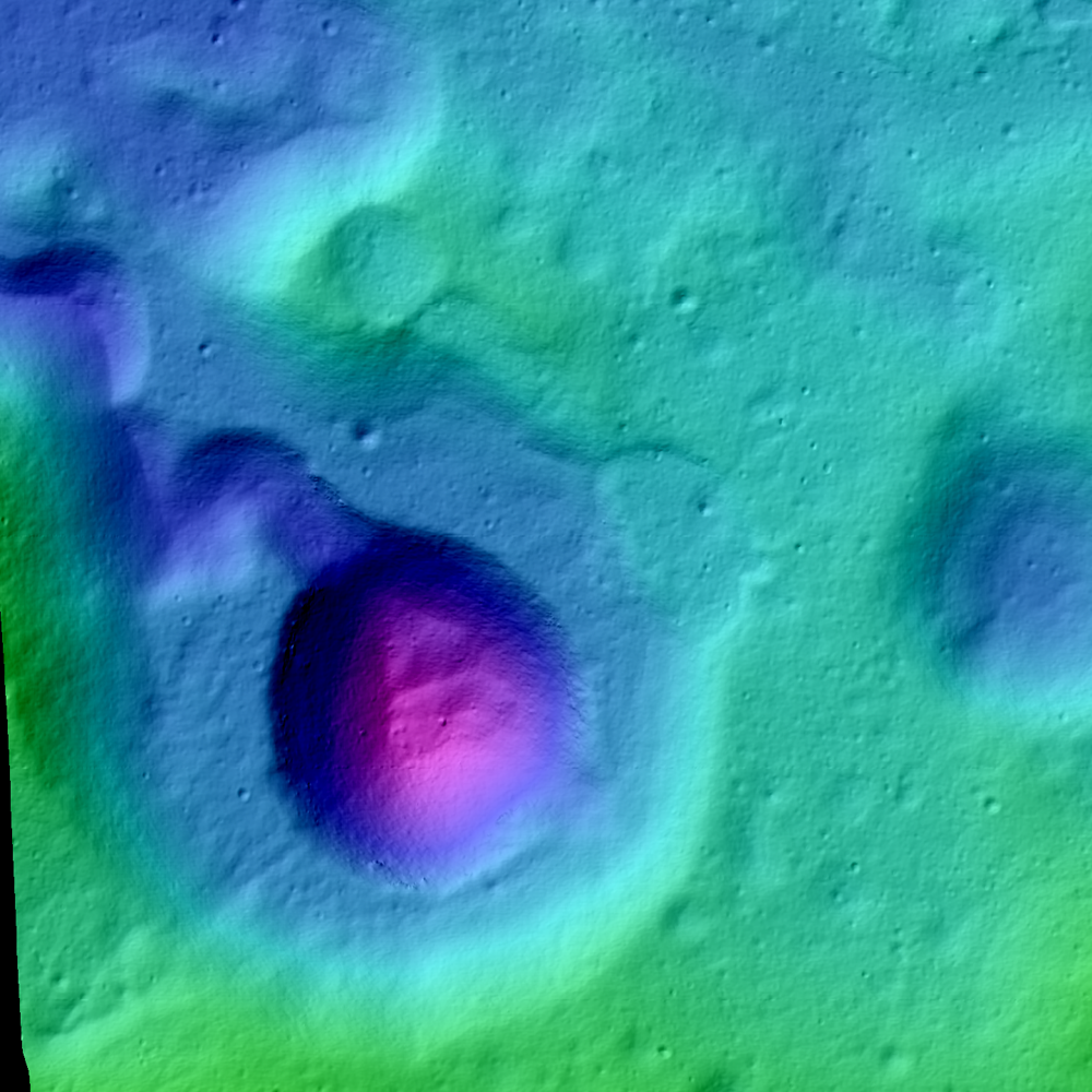
Newly released LROC Narrow Angle Camera (NAC) Digital Terrain Model (DTM) of Rima Prinz I where it meets source crater Vera (~2 km in diameter). Field of view approximately 7 km across [NASA/GSFC/Arizona State University].
H. Meyer
LROC News System

The Rimae Prinz Region displays a diverse array of features including sinuous rilles, massifs, and flooded craters. Today's Featured Image focuses on a Rima Prinz I, a sinuous rille just north of Prinz crater that originates from a cobra head-shaped depression named Vera.

This distinctive depression is probably the source for the mare materials extruded in Rima Prinz I. This particular rille likely formed during the emplacement of the mare that filled the crater Prinz and flowed around the rim of Prinz for approximately 25 km before taking a sharp turn to the north, perhaps occupying an existing topographic low.

Vera (Source Vent for Rima Prinz I)
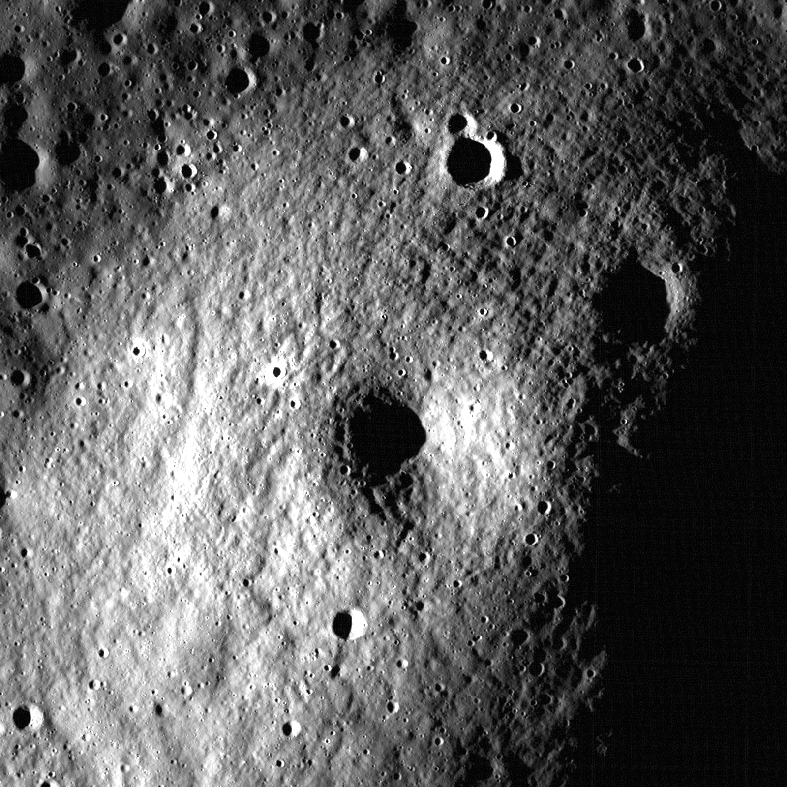
In mid to late 2011, LRO was maneuvered in such a way to allow heretofore unprecedented extreme close-ups of the lunar surface, some from within 20 km. The Vera vent crater (26.48°N, 316.34°E) was among these well-positioned areas. This 1880 meter-wide field of view was cropped from a mosaic of both left and right camera frames of LROC NAC observation M168488930LR, orbit 9964, August 20, 2011; 43.79° angle of incidence, resolution 41 centimeters per pixel from 25.43 km [NASA/GSFC/Arizona State University].
The rille then extended for another ~50 km before grading out into Oceanus Procellarum. In Today's Featured Image, it is easy to see Vera's step-like appearance. The higher step represents a an early eruption event that partially filled the vent and froze, creating the flat "ponded" surface. Later another eruption occurred and the center of the original pond collapsed as a new smaller vent opened.

Rima Prinz I, Prinz (ROI)
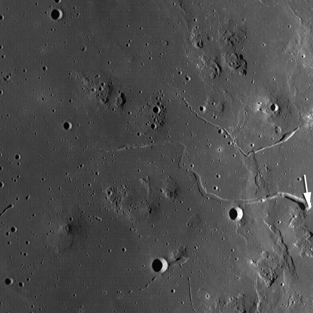
Vera and Rima Prinz I, apparently spill over the north rim and wall of mare-filled Prinz crater, in a 14 km-wide field of view from LROC NAC mosaic M104805368LR, spacecraft orbit 602, August 13, 2009; resolution 1.47 meters per pixel from 147 km [NASA/GSFC/Arizona State University].
WACcontext_FI_DTM2-580x800
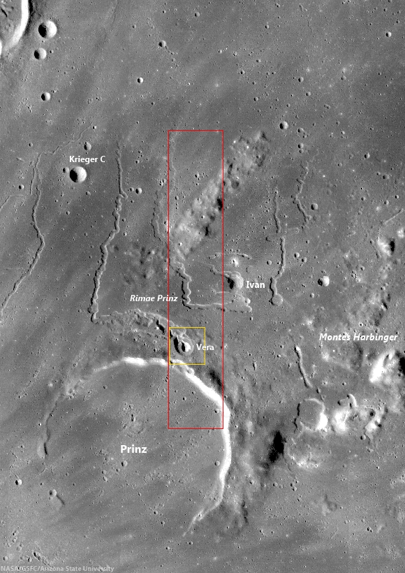
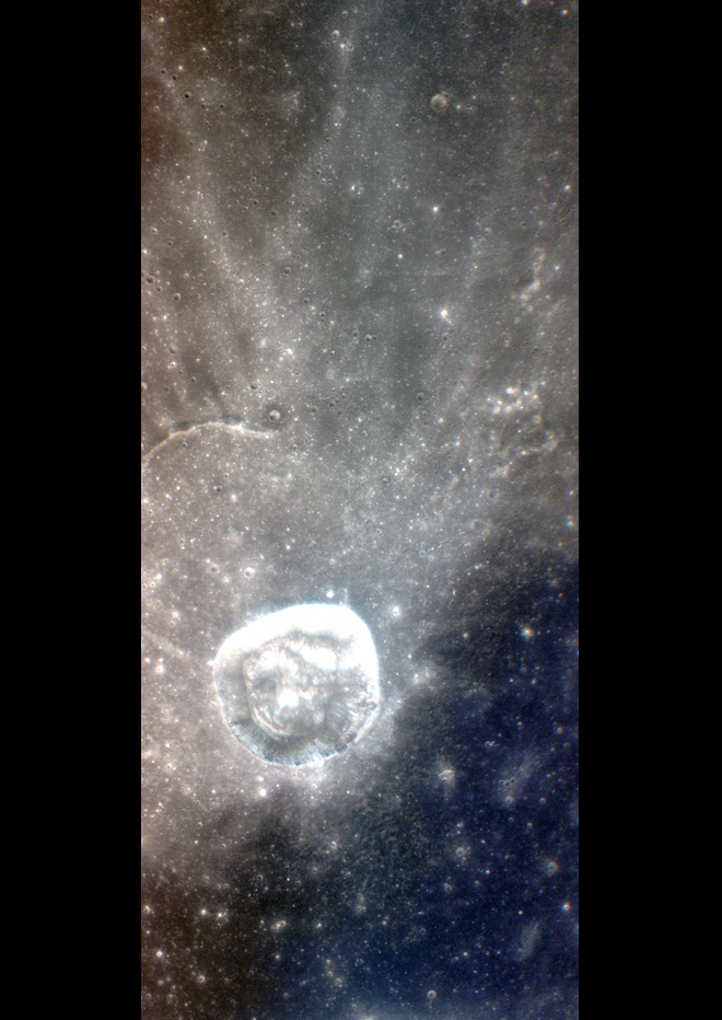
LROC Wide Angle Camera (WAC) context image of the Rima Prinz region, highlighting the highly reflective rays of nearby Aristarchus crater, and showing local features in relation to Prinz (46.13 km, 28.49°N, 315.86°E). Red rectangle denotes area in a newly released NAC DTM, from which the LROC Featured Image released December 19, 2013 was taken, and the yellow box outlines the topography in that Featured Image [NASA/GSFC/Arizona State University].
In the WAC context image above, we can see the concentration of sinuous rilles in the Rimae Prinz Region, these features are indicative of volcanic activity in this region. The rilles were formed over several episodes of volcanic activity, as evidenced by their varying states of degradation and stratigraphic relationships within and between the rilles, including cross-cutting relationships. For example, Rima Prinz I likely formed from at least two episodes of volcanic activity, because a small sinuous channel is carved from within the interior of the larger channel. The smaller inner channel extends much farther than the larger outer channel, a phenomenon also seen in Vallis Schröteri. As Rima Prinz I is connected to Vera, Vallis Schröteri's rilles are also connected to a source depression.

Explore the newly released NAC DTM, HERE.

Related Posts:
Partially flooded crater rim near Rimae Prinz (August 15, 2013)
An observation post on the rim of Posidonius (July 19, 2013)
A Truncated Rille (May 30, 2013)
Meanders in Posidonius (February 5, 2013)
Old Man River (Of Lava) (July 5, 2011)
Rilles as far as the eye can see at Prinz (December 3, 2010)
Rimae Posidonius (December 1, 2010)
Rimae Prinz - Constellation Region of Interest (April 16, 2010)

Thursday, April 28, 2011

Another small volcano?


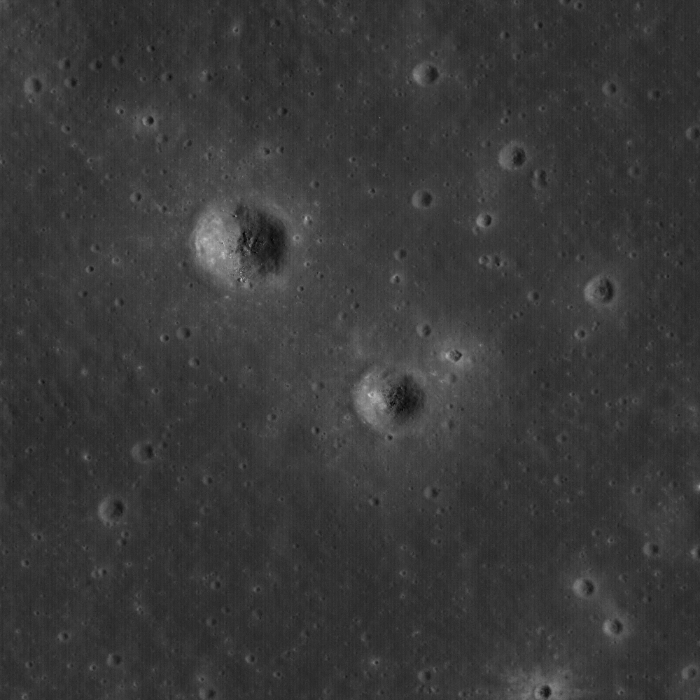
Along the embayed Eddington crater rim is an ~1.5 km dome that may be an ancient volcano with a summit pit crater. LROC Narrow Angle Camera (NAC) observation M148618400R, LROC orbit 7036, January 2, 2011; field of view 960 meters. View the full-sized LROC Featured Image HERE [NASA/GSFC/Arizona State University].

Lillian Ostrach
LROC News System

Volcanic features are observed all over the Moon, but sometimes it is difficult to tell whether an observed feature is of volcanic origin or the remnant of another geologic feature (e.g., basin ejecta or buried rim materials). Today's Featured Image is a prime example of a dome that may or may not be of volcanic origin. The dome is ~1.5 km wide and has a summit crater, but is the crater of impact or volcanic origin? The dome is geomorphologically similar to two volcanoes found in Lacus Mortis. These other domes are about the same size (~1.5 km wide) and have similar appearances, except that today's feature has many more small superposed impacts, suggesting that it is older than the Lacus Mortis volcanoes. Does it mean that this feature in western Oceanus Procellarum is a volcano just because it looks like one? The simple answer is no; but keep reading to find out why.


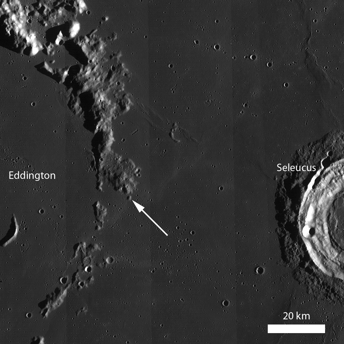
LROC Wide Angle Camera (WAC) monochrome mosaic featuring the rim of inundated Eddington crater, where the subject of the LROC Featured Image, released April 27, 2011, is located (arrow, 21.6°N, 290.5°E). Can you find any other similar-looking features along the Eddington crater rim? [NASA/GSFC/Arizona State University].

On Earth, many techniques are used to interpret the geologic history and origin of features in a landscape. Usually, analysis of remotely sensed data and field work are two techniques that scientists use together to unravel the geology for a region. But on the Moon, we can't travel to our favorite geologic feature and commence field mapping and measurements - at least not yet anyway! Instead, scientists need to get creative with the remotely sensed data they have.

LROC NAC stereo images can be used to study the topography of geologic features. Scientists have characterized the topography of larger volcanoes and domes on the Moon, and these data can be used in conjunction with LROC NAC stereo images to measure the dimensions and slopes of the volcano-like feature in today's Featured Image. If the dimensions, slopes, and texture, for example, of a volcano-like feature are consistent with the characterized landforms interpreted to be volcanoes, then it is possible that the volcano-like feature is a volcano. But be careful: just because a volcano-like feature has similar topographic measurements and morphology to other volcanoes does not mean that it is definitely a volcano. Similar to terrestrial field work, scientists studying lunar geology must make sure to look at the "big picture", or the context and regional surroundings, when interpreting remotely sensed images.


The full-width WAC context image, viewed HERE. provides a look at the regional, larger context of the feature imaged (above). LROC WAC color data can be used to map the variations in color caused by compositional variations. If the color of the volcanic-like feature is the same as that of the Eddington crater rim material, then the feature could be Eddington crater rim material and not a volcano. However, if the colors are different, then there is a possibility that the feature is volcanic in origin - but again, this analysis is not definitive. To reach a more definitive conclusion, you would need to look at the WAC color data for other identified volcanoes or domes and make a comparison. But, of course, sampling the volcano-like feature, in addition to the Eddington rim material and surrounding mare material, would be best!

Take a look at the embayed rim of Eddington crater and this dome and decide for yourself if it formed as a volcano.

Related Posts:
Volcanoes in Lacus Mortis
Hortensius Domes Constellation ROI
Gruithuisen Domes Constellation ROI
Marius Hills Constellation ROI

Tuesday, August 31, 2010

A review of all things Schrödinger

We end August with a long-running mystery: Why has the LRO LOLA "Image of the Week" not been updated since the middle of July? One answer may be that the LOLA topography of Schrödinger basin flagged on NASA center websites served as a reminder to complete the exacting new synergistic geological map of the far south, far side basin, released Monday, August 30:


Geologic map of Schrödinger basin, which formed when a huge object struck the moon, reveals a patchwork of lunar material, including the peak ring (inner brown ring), recent volcanic activity (red), cratering (yellow) and plains material (dark green and kelly green) [NASA/Scott Mest]." >Massive Image > Sensible Image

Elizabeth Zubritsky
NASA GSFC

Schrödinger is located near the moon's south pole, a region where pockets of permanent ice are thought to exist. The map will help researchers understand lunar geologic history and identify suitable landing sites for future exploration. Scott Mest, a research scientist with the Planetary Science Institute working at NASA's Goddard Space Flight Center in Greenbelt, Md., and his colleagues created this geologic map -- the most detailed one to date -- by combining topographic data from the Lunar Orbiter Laser Altimeter, a Goddard instrument aboard the 2009 Lunar Reconnaissance Orbiter, with images and spectral data from the earlier Clementine and Lunar Prospector missions.

From August 31, 2010 -
Detail from the Schrödinger basin geologic map released by NASA GSFC, August 31, 2010 highlighting the roughly 10 x 20 kilometer area of the eastern interior occupied by the intriguing pyroclastic formation. [NASA/GSFC/Scott Mest].

Schrödinger is an example of an intriguing type of basin called a peak-ring. Like the basin rim (brown outer ring), the smaller and more fragmented peak ring (brown inner ring) is a mountainous region of crust that rose up after a huge object, probably measuring 35-40 kilometers, or about 21-25 miles, smacked into the moon here. These areas of raised crust are the oldest rocks in the basin and just about the only material that wasn't melted by the heat from the object's impact. The melted material was spewed in all directions and formed the plains. Patches of plains material can have slightly different textures and albedo (indicated by dark green and kelly green), probably because they cooled at different times. Fractures (black lines) formed in the basin floor as the material cooled.


The Clementine image of the Schrödinger basin with geological map (2010). The three landing sites and corresponding 10 km EVA radius (20 km return trip) are outlined in white. The yellow numbers correspond to following scientific points of interest: 1 – Schrödinger’s melt sheet, 2 – Schrödinger’s inner ring, 3 – basaltic units, 4 – explosive volcanic unit, 5 – deep crustal fractures, 6 – ghost craters, 7 – secondary craters, 8 – ridged terrain. - From Kohout, O’Sullivan & Kring, et.al., Scientific Opportunities for Human Exploration of the Moon’s Schrödinger Basin [LPSC 2009 #1572] The Schrödinger Basin provides a diverse suite of scientific opportunities because of the superposition of several geologic processes and because of its relatively young age. Three possible landing sites were evaluated for human exploration.

Schrödinger Basin is one of the few areas near the moon's south pole with evidence of recent volcanic activity. This includes lava flows from volcanic activity on the surface (beige areas) as well as explosive eruptions from a vent inside the red area; this vent has brought up dark material that mantles the plains (red area, which is newer than the beige regions). Older volcanic material is spread over a wider range (gray and lime green). More recent cratering by smaller objects has scattered material (yellow areas) near the top of the basin. Next to that (very light green beside yellow) is a region with a knobby texture that suggests loose material that could have come from cratering outside the basin or from a landslide on the basin's rim.

From July 16, 2010 -
LOLA Image of the Week (since July 16, 2010) Schrödinger (centered -75.0˚, 132.4˚ E), "located on the lunar far side and within South Pole-Aitken Basin, is not visible from the Earth. Crater counts suggest that the basin is less than one billion years old, making it the second youngest impact basin on the Moon (the youngest being Orientale)."

From April 23, 2010 -
Mosaic of Clementine UVVIS images (750-nm band) of the Schrödinger Basin (312 km diameter). In addition to the prominent, dark, cone-shaped feature (white arrow), Schrödinger has an inner ring of mountains partially encircling the basin floor (a ‘peak ring complex’) and a network of radial and concentric fractures. The cone is a likely volcanic vent situated on a north- east trending floor fracture, and it has a 4.5 km x 8.6 km vent surrounded by dark, explosively emplaced or pyroclastic material and a low rim. The Schrödinger volcanic vent is one of the most distinctive single-vent cones observed on the Moon and resembles ‘dark halo craters’ like those on the floor of Alphonsus. (Projection is polar stereographic, centered on the basin at -75.0°S, 132.0°E) [NASA/DOD/USGS/ASU].

From April 23, 2010 -
LROC Narrow-Angle Camera (NAC) closeup of clustered craters on the lip of the Schrödinger pyroclastic cone, a Constellation Region of Interest (ROI). Although believed to be relatively young, these craters have a subdued appearance, a texture smoothed by micrometeor 'gardening' typical of older lunar surfaces) because they formed in loose pyroclastic material. LROC NAC Frame M108313384R, this view is 785 meters across [NASA/GSFC/Arizona State University].
"A particularly interesting and unusual feature was imaged by Mini-SAR almost by accident. Because of a timing error, we started a few mapping passes of the south pole early, before the scheduled start at 80° south latitude. Good thing we did! We covered the fresh, spectacular Schrödinger impact basin, on the lunar far side. Schrödinger shows an unusual, keyhole-shaped crater along a long fissure on the basin floor. This crater is surrounded by optically dark material, which has been interpreted as volcanic ash deposits. The new Mini-SAR image shows that this material is also dark in radar reflectivity, exactly what would be expected from a fine-grained, block-free deposit. Thus, our radar images confirm the geological interpretation first derived in 1994 from Clementine images."

- Paul Spudis
Smithsonian Air & Space
March 29, 2009
From February 21, 2008 -
Kaguya (SELENE-1) multi-band imager (MI) compositional and morphological study of the Schrödinger pyroclastic formation (75.3°S, 139.1°E) [JAXA/SELENE].


Clementine (1994) and Kaguya (2008-2009). Ultra-Violet & Visible light (750-nm) UVVIS image of Schrödinger basin. b) Schrödinger DMD image taken by SELENE MI 750 nm band. c) MI 1000 nm/1050 nm absorption depth ratio from 0.8 to 1.2. From Kobayashi & Ohtake, et.al., Estimating Composition of Dark Mantle Deposit in Schrödinger Basin Using SELENE Spectral Data [LPSC 2009 #1636] Dark Mantle Deposit (DMD) regions are considered to contain glassy or crystallized pyroclastic beads. We used the spectrum data acquired by SELENE Multi-band Imager to analyze a DMD in Schrödinger basin, and estimated the composition of the DMD.

From April 23, 2010 -
Moving north (top) in a polar orbit, Japan's Kaguya took extensive HDTV of the lunar far side, including this still showing the Schrödinger Basin interior. The low and relatively darker profile of the pyroclastic dome encircling the vent is right (east) of the image center [JAXA/SELENE].

From August 31, 2010 -
Earlier Kaguya (SELENE-1) image of the eastern interior of 312 km-wide Schrödinger. The subtle differences in geologic compositions are visible, in this very-close to true-color view from 2008, though in late morning illumination the darker Schrödinger pyroclastic formation (upper center right) is an unmistakable contrast with its surroundings, in color and cratering. [JAXA/NHK/SELENE].

Finally, with sincere appreciation for all the tireless efforts underway keeping the LRO mission working and healthy, in the words of the LROC team, we urge you not to hesitate to "explore the Schrödinger Constellation region of interest for yourself!"

Friday, July 23, 2010

A Dark Cascade at Sulpicius Gallus


LROC Narrow Angle Camera (NAC) close-up of the wall of a suspected volcanic vent within the regional pyroclastic deposit near Sulpicius Gallus (19.69°N, 10.27°E). From LROC NAC Observation M124505982R (LRO orbit 3482, March 29, 2010), view is approximately 2 km in width. [NASA/GSFC/Arizona State University].

Lisa Gaddis
LROC News System

Although there are hundreds of sites on the Moon where explosive volcanism has occurred, there are several regional deposits of pyroclastic material that are especially extensive. These regional pyroclastic deposits include sites at Rima Bode, Sinus Aestuum, Mare Vaporum, and Sulpicius Gallus, and are collectively called "dark spots" because of their very dark appearance in telescopic images.

All of the regional pyroclastic deposits have largely rock-free surfaces that are thought to have large concentrations of micron-sized glass and partially crystalline spheres, similar to the glassy materials sampled by Apollo 17 astronauts at Taurus-Littrow Valley. These deposits likely formed in explosive eruptions (or "fire fountains") involving magma and some kind of volatile component. Both carbon monoxide and water have been considered as the source of the gas that drives such explosive eruptions on the Moon.


LROC Wide Angle Camera (WAC) monochrome mosaic of the Sulpicius Gallus region along the southwestern interior of Mare Serenitatis. The suspected volcanic vent is at the center of the Constellation Region of Interest delineated by the white box. Rima Sulpicius Gallus cuts through the area immediately to the north and a number of domes are also visible. (NOTE: Charles Wood, curator of the invaluable Lunar Picture of the Day (LPOD) website, provides detailed and experienced insight into this latest LROC WAC image HERE.)[NASA/GSFC/Arizona State University].

Where are the volcanic vents that were the sources of these widespread pyroclastic deposits?

Source vents for many of the larger pyroclastic deposits are difficult to identify, partly because they may have been mantled during explosive eruptions and/or buried by later volcanic material. In some cases, fractures, oddly shaped craters, or irregular depressions have been suggested as possible source vents. Such is the case for at least some of the pyroclastic material in the Sulpicius Gallus region, a Constellation Region of Interest, where a 5.5-km long "kidney-shaped depression" is considered a prime candidate for a volcanic vent.

This irregular depression was first noted by the crew of Apollo 17 as they looked down at the Moon from orbit. The fact that it lacked the prototypical features of an impact crater (raised rim, bowl shape) and that its walls and surroundings had an orange/red color similar to the orange pyroclastic glasses that were sampled at the Apollo 17 landing site made it quite distinct from the typical impact crater.

The LROC Narrow Angle Camera view of the wall of this suspected volcanic vent is similar to what the Apollo 17 crew would have seen from in orbit, albeit at higher resolution and in black and white (we rely on the LROC Wide Angle Camera for color).

In this image, the dark pyroclastic mantle at the surface has mixed with rubble and soil from the mare surface to create a small landslide or debris flow (~60 m wide) that has flowed down the wall onto the floor below. Several smaller flows can been seen and more coherent rocky layers are also observed at intervals within the wall, probably representing buried mare basalt layers.

The pyroclastic beads at sites such as Sulpicius Gallus are of high interest to lunar scientists for several reasons. They contain trapped hydrogen and Helium-3 from the solar wind, and these materials could be of high value for future in-situ energy production on the Moon. Enrichment of volatile elements such as sulfur and fluorine also have been measured on the surfaces of many of the pyroclastic beads in the Apollo sample collection, suggesting that these beads could provide lunar inhabitants with sources for these relatively rare elements. Finally, the glassy deposits are also rich in iron and titanium, which are of immense economic and engineering value to future lunar explorers.

Scroll through the full-resolution NAC frame here!

Thursday, July 1, 2010

LROC PDS Release 2


A better view of the Constellation Region of Interest at Mare Crisium (10.8°N, 58.6°E), improved by the additional release to the Planetary Data System (PDS) of Lunar Reconnaissance Orbiter Camera (LROC) imagery through March 15, 2010. Stretching toward the southeast the prominent Dorsum Termier wrinkle ridge steadily (and very, very slowly) sheds boulders originally pushed up by the migration of unevenly cooled sheets of volcanic melt. The LROC spotlight was on the field of view at center foreground when a portion of LROC NAC M119469420LE was the LROC Featured Image, March 11, 2010. The Right-hand frame from that same session (M119469420RE), swept up January 30, 2010 (LRO orbit 2740), doubles that field along the original image east boundary. The texture of mountains in the distance, the inner ring along the southern edge of Crisium basin, is made possible with the addition of LROC Narrow-Angle Camera and Wide-Angle Camera images gathered under varying degrees of illumination. Full size view (1920 x 1110), HERE [NASA/GSFC/Arizona State University].

Mark Robinson
Principal Investigator
Lunar Reconnaissance Orbiter Camera

LROC News System

The LROC team released images acquired from January 1, 2010 through March 15, 2010. This release contains 51,070 LROC EDR products, which has a total volume of 6 TBytes and 50,972 CDR products totaling 11 TBytes.

For this release the NAC-R was mirrored (left-to-right) to match the orientation of the NAC-L (newly released data as well as all of the NAC-Rs of the prior release). This change was implemented for user convenience. Additionally the index file was modified for each product (EDR and CDR) adding new fields to aid in understanding NAC image orientation. A full description of the NAC-R to NAC-L orientation has been added to appendix (C) of the LROC SIS.

The second LROC PDS release, totaling 17 TBytes of data, is now posted on NASA’s Planetary Data System. Images are available from the LROC image gallery.

Wednesday, June 16, 2010

New surfaces near Lichtenberg Crater ROI

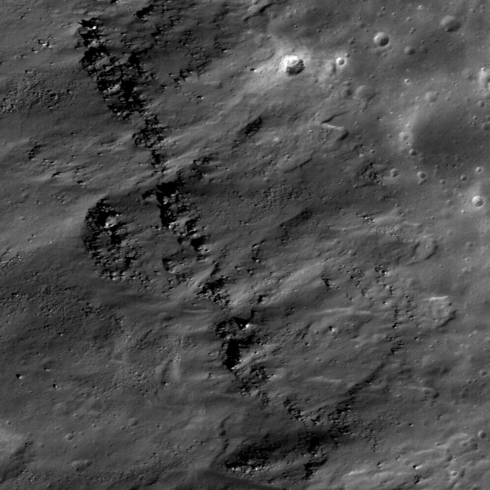
This close up image of the wall of Lichtenberg crater shows distinct layering of pre-impact mare deposits. LROC Narrow-Angle Camera frame M112040133L; scene is 530 m across, imaged November 5, 2009 in LRO Orbit 1645; altitude 47.72 km (phase angle - 59.63°) Full Sized LROC Featured Image [NASA/GSFC/Arizona State University].

Mike Zanetti

Lichtenberg crater is of Eratosthenian age, 20-km across and 1.2-km deep, located in western Oceanus Procellarum (31.8°N and 292.3°E). It is named after George C. Lichtenberg (1742-1799), a German professor of experimental physics, specializing in the study of static electricity.

Lichtenberg has an extensive ejecta blanket with highly reflective rays which extend to the North more than 100 kilometers from the crater rim. Within the detailed image shown above, distinct layering inside the crater wall can be seen. These layers are probably outcrops of the original surface lavas which were deposited before impact event.


Enhanced color Wide-Angle Camera view of Lichtenberg crater (~20 km in diameter). High reflectance rays of ejecta extend from the crater to the North (gray areas) while the rays in the south and east have been buried by basalts (dark blue areas). The 689, 566, and 415 nm filters are in red, green, and blue, respectively. LROC WAC image M122659235C [NASA/GSFC/Arizona State University].

Lichtenberg's high reflectance rays are caused by impact-related ejection of high albedo highland material from beneath the low albedo mare basalts that flooded the region before the crater formed. In the enhanced color wide angle camera (WAC) image above, the bright rays of ejecta can be seen extending away from the crater to the north. However, they are not visible to the south and east of the crater. This is because in this region, the ejecta blanket was later buried by mare basalt. The stratigraphic principle of superposition tells us that this basaltic flow must be younger than the Lichtenberg impact crater, and is thus one of the youngest volcanic deposits on the Moon! This young basalt flow is characterized by its dark, smooth, and homogeneous surface with a low crater frequency, compared to other areas around Lichtenberg crater.

This exciting region near the southeast rim of Lichtenberg is a Constellation Region of Interest.

Exploration of this ROI offers the opportunity to study one of the youngest surfaces on the Moon. Crater size-frequency distribution measurements suggest that Lichtenberg crater rays southeast of the rim are covered by basalts that are approximately 1.7 billion years old. However, this region has not yet been sampled directly during any lunar mission, so this age is only an estimate. Sending astronauts to the southeast rim of Lichtenberg will offer the opportunity to collect samples of these mare basalts and determine the age of this youngest lunar volcanism to better understand the geological evolution of the Moon.

Explore the Lichtenberg Crater Constellation Region of Interest yourself!


Looking east by northeast over the rim of Lichtenberg Crater shows the elevation differences and unusual morphology of the terrain excavated by this unique crater in the far northwestern Oceanus Procellarum. The LROC Featured Image is set within the Narrow-Angle Camera field from which it was taken, and its companion frame, both set upon the Wide-Angle Camera context shown above. 20 km- wide Lichtenberg, as a relatively recent formation with ejecta subsequently covered adds evidence to even more recent morphology. The elevations marked are at distinct points, Lichtenberg averages 500 meters less deep than the -4181 meter depth found at one location on it's floor [NASA/GSFC/Arizona State University].

From Lunar Pioneer 3

Friday, June 11, 2010

LROC: The Dewar Geochemical Anomaly


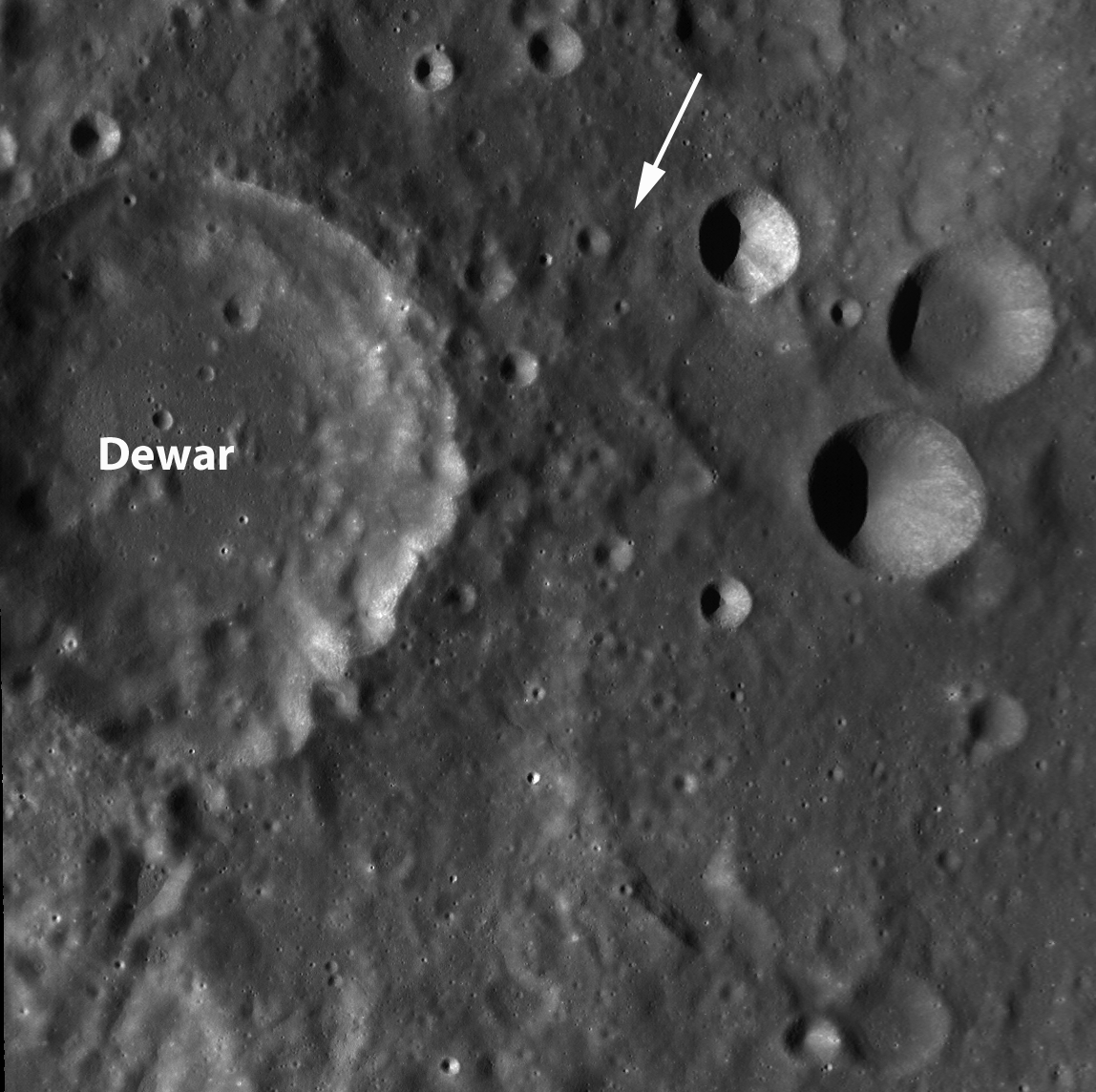
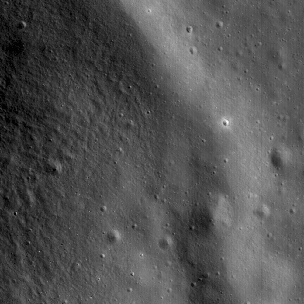
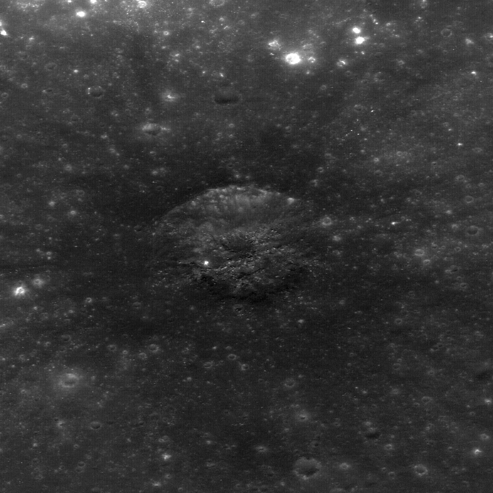
Ejecta from small craters reveal ancient buried mare to the northeast of Dewar crater, near the center of a Constellation region of interest. Image Field of View is 570 meters (Full-sized image, HERE) [NASA/GSFC/Arizona State University].

Samuel Lawrence
LROC News System

This area is the heart of the Dewar geochemical anomaly, one of only a handful of mare deposits on the far side of the Moon. Unlike many mare basalts, such as those that fill Mare Moscoviense, the Dewar deposit is not associated with a giant impact basin, but is instead an ancient and mostly buried mare deposit known as a "cryptomare." Apollo-era imaging of this location was extremely limited; although this region was visible as low-reflectance material in Lunar Orbiter images, the mare deposit was not definitively identified as such until 2008. This discovery came from detailed analysis of multi-spectral images from Clementine (1994) and geochemical information returned by the Lunar Prospector (1998-1999).

Results from these two missions revealed that the low-reflectance materials are spectrally similar to nearside mare basalts, have elevated levels of iron and titanium, and are enriched in the element thorium. So although the Dewar materials are geochemically anomalous in the context of the lunar far side highlands, they are surprisingly similar to nearside basalts.

The small craters that you see in today's Featured Image have excavated material from within the mare deposit. Astronauts visiting craters such as these would be able to unravel clues to the stratigraphy and age of the Dewar basalts.


LROC Wide Angle Camera context image (above-lower) of the Constellation Region of Interest northeast of Dewar. Note the low-reflectance deposit visible to the northeast of Dewar crater (apparent also in the close-up of the far lower resolution Clementine albedo image, above-upper. The dotted square on the Clementine image is roughly equivalent to the 90 km-wide field of view in LROC WAC image. The location of the Featured Image is highlighted with a tiny yellow square inside the LROC WAC field of view and the range of the LROC Narrow-Angle Camera image (M128196707L) from which it was taken is designated with the white arrow. [NASA/GSFC/Arizona State University].

Of particular interest is the fact that the Dewar deposits are enriched in thorium. Thorium is an incompatible element, which means that typically it does not get incorporated into magmas until the source is almost completely depleted (or, to put it another way, until there is nothing else left to erupt). Thorium is relatively easy to detect with remote sensing methods because it is radioactive, and when thorium is detected on the surface it is usually safe to assume that other incompatible elements, like the famous lunar KREEP component, are present along with it.


Distribution and abundance of surficial lunar thorium [LPI/Paul D. Spudis, Ph.D.].

These incompatible components are key to understanding the history and mechanics of lunar volcanism and the evolution of the lunar crust. On the near side, many of the mare basalts have high thorium concentrations compared to the typically low concentrations on the far side.

Surprisingly, the thorium abundances in the Dewar region (as well as Mare Moscoviense, which lies to the northwest) are even higher than near side basalts, which has some important implications for lunar geology. Instead of the thorium being concentrated only on the near side, the portions of the far side interior (including the mantle and the lower crust) that produced the magmas emplaced in Dewar and Moscoviense were also rich in thorium. Why are incompatibles concentrated on the near side? What do these small, high-thorium regions on the far side mean? How did the lunar interior evolve to produce this asymmetric distribution of incompatible elements on the Moon? Many important questions remain unanswered.

The geology of this region is complicated and intriguing, and until it is directly explored by astronauts, interpretations based solely on remote sensing data will be challenging. For this reason, this area is a Constellation Region of Interest. The presence of mare basalts also makes this area an in situ resource utilization candidate, since mare materials are so rare on the far side.


Side trips, in the 'Spaceship of the Imagination.' From a point-of-view 3 km over the Dewar ROI, looking toward the south-southwest in the direction indicated by the white arrow in the LROC WAC image further above, the LROC WAC, NAC & Featured Image thumbnail are placed on the Google Earth lunar globe, but perspective and scale are just as difficult to gauge as near the real Moon. On the horizon is the southeastern rim of 50 km-wide Dewar, a point 53 km away from the area within the Featured Image. The elevation there is 2.7 km above global average, towering 3.7 km over Dewar's interior, beyond view. The closest part of Dewar's rim is around 30 km away, with an elevation of 1.4 km; all well over the horizon for anyone standing in the area of the Featured Image, where the elevation at 1.79°S, 166.85°E is about 480 meters [NASA/GSFC/Arizona State University - Google/JAXA].

For more information about the Dewar cryptomare, be sure to check out Planetary Science Research Discoveries.

Plan your own adventure to Dewar crater here!


A second fanciful "side-trip" to that high elevation on the Dewar's rim, 53 km away from the area within the Featured Image. allows an opportunity to see the LROC WAC image super-imposed upon the Google Moon digital elevation model and how closely that image matches an improving but lower-resolution terrain model. The full-sized image made a surprisingly interesting desktop wallpaper [NASA/USGS/JAXA/SELENE/GSFC/Arizona State University].

Wednesday, June 9, 2010

LROC: Gruithuisen Domes Constellation ROI


Full width context of LROC NAC frame M104776541RE, showing the location of the Featured Image on the eastern slope of Mons Gruithuisen Gamma, a nonmare volcanic dome that is a Constellation program Tier One Region of Interest. Lower inset field width = 8.1 km [NASA/GSFC/Arizona State University].

Sarah Braden
LROC News System

A small rille hugging the contours at the base of Gruithuisen Gamma, at the contact between the dome and the surrounding mare. The Featured Image is 1.6 km wide, illumination is from the left, NAC frame M104776541R [NASA/GSFC/Arizona State University].

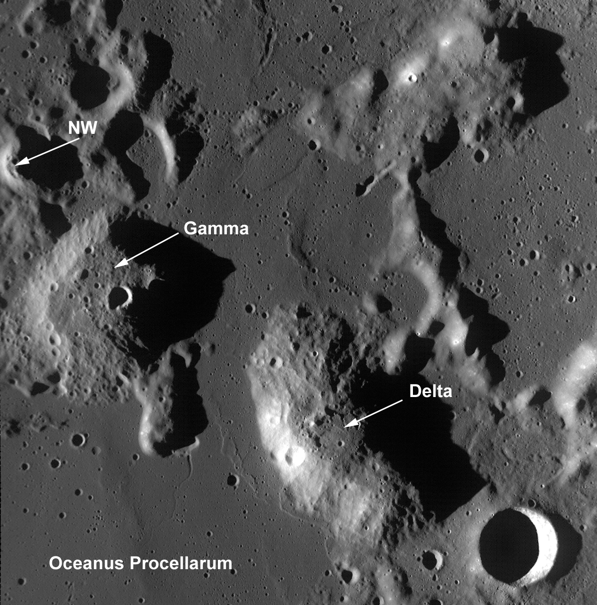
The Gruithuisen Domes, a Constellation program region of interest, are located on the northeast border of Oceanus Procellarum at the highlands-mare boundary. The three Gruithuisen domes are named for nearby Gruithuisen crater. The two largest domes have been unofficially referred to for many years as Gruithuisen Gamma and Gruithuisen Delta, with the smallest dome called NW (for "northwest").


Three of the Gruithuisen domes and surrounding terrain in LROC Wide-Angle Camera frame M117752970. Field of view width is 64 km and illumination is from the west-southwest (left). (The approximate location of the Featured Image is within the small white square enshrouded in the late afternoon shadow of Gruithuisen Gamma) [NASA/GSFC/Arizona State University].

The Gruithuisen domes are classified by lunar scientists as "nonmare" volcanic domes. This is because we know from Earth based telescopes, Lunar Prospector (1998-1999) gamma-ray spectroscopy data, and Clementine (1994) multispectral data that the domes are composed of materials different from either the mare or highlands.

The Gruithuisen Domes are characterized by a relatively high albedo and strong absorptions in the visible and ultraviolet, and the domes are low in iron and titanium compared to the volcanic deposits of the lunar mare. Previous studies of this region showed that Gruithuisen may represent a lunar analog to terrestrial rhyolites, dacites, or basaltic andesites, which are characterized by viscous lava and low extrusion rates. In comparison, mare volcanic domes (like the Marius Hills and Hortensius, also Constellation Regions of Interest) are similar to mare basalts in composition and are generally flatter, smaller, as well as more common on the lunar surface.


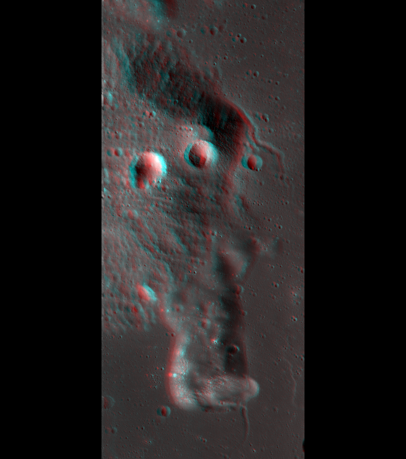
Take out your 3D glasses and view this amazing anaglyph of Gruithuisen Gamma created using NAC stereo pairs! Image features NAC frames M104776541 and M104783697 (Orbits 598 & 599, August 13, 2009). The rille on the northeast edge of Gruithuisen Gamma is featured in the opening image [NASA/GSFC/Arizona State University].

Due to the unique nature of the Gruithuisen Domes, they are a high-priority target for future human lunar exploration.

What geologic process created these domes here -- and when? How did the magmas that formed the Gruithuisen domes differ from the magmas that formed the highlands and the mare? Since significant scientific questions remain about the mechanics of lunar mare formation, understanding how the Gruithuisen Domes differ from typical mare basalts will enable us to answer these and other important questions about the formation and evolution of terrestrial planets.

Data from LROC and the other instruments aboard LRO, as well as data from other recent lunar missions, are helping us address these questions, although a true understanding of the region will only come when astronauts can explore it directly.

Plan your own adventure to the Gruithuisen Domes!

For more information on LROC's observation campaign for the Constellation program regions of interest read this Lunar and Planetary Science Conference abstract, and visit the LRO Science Targeting Meeting website (look for the baseball card summary sheets for each site: part 1, part 2).

Some additional context for the Constellation Region of Interest at Gruithuisen, the full length and width of LROC Narrow-Angle Camera frame M104776541RE is set within Wide-Angle Camera frame M104783713CE, imaged during the same opportunity in LRO orbit 598, August 13, 2009, encompassing a field of view roughly 100 km in width. Both are, in turn, set together withing the lunar digital elevation model (DEM) available in Google Earth (v.5). The red placemark is the proposed center to the Constellation ROI (36.03°N, 319.86°E). On distant horizon is Sinus Iridum, on the northwestern edge of Mare Imbrium. The full image, available here, shows the ROI is a border land on small scales and large, located at the "confluences" of Mare Imbrium and Oceanus Procellarum. The distance between 17 km-wide Gruithuisen crater, at bottom right, and Sinus Irudum is approximately 300 km.

Wednesday, June 2, 2010

LROC: Marius Hills ROI


Close-up on the rim of unofficially named "Sinuous Rille A," on the western edge of the Marius Hills Constellation Region of Interest, showing materials slumped into the bottom of the rille bed towards the northwest, and (possibly) an outcrop; prime location for fieldwork and sample collection. One of the several hundred volcanic features located in the Marius region. Exploration of this site will yield important insights into planetary volcanism. Full-sized portion of M111965782RE, HERE. Area of field highlighted above is 550 meters [NASA/GSFC/Arizona State University].

Backed off a bit from the field within the LROC Featured Image, the 'snake's head' feature of the unnamed feature unofficially designated "Sinuous Rille A" comes into better view [NASA/GSFC/Arizona State University].

Samuel Lawrence
LROC News System

This is the heart of the Constellation Region of Interest in the Marius Hills. You can see the rim and interior wall of the head of a large, unnamed sinuous rille directly adjacent to the ROI (13.58°N, 304.2°E).

Astronauts exploring this location will be able to learn about the geologic processes that form sinuous rilles and develop new insights about lunar and planetary volcanic processes.

One of the longest sinuous rilles on the Moon, the rille is one of 20 in the Marius Hills region. The incredible geologic diversity of the Marius region - where mare deposits, volcanic domes, sinuous rilles, and small localized pyroclastic deposits (including the Harayuma Skylight, the "Marius Hills Hole," identified from data returned by Japan's lunar orbiter Kaguya in 2009) are all in roving distance from one another - making the Marius Constellation site a geologist's paradise, a prime candidate for a human lunar sorties.

Viewable through terrestrial telescopes, the Marius Hills region of the Moon has been a high-priority target for human lunar exploration for almost 50 years. In fact, the Marius Hills region was one of the top candidates for an Apollo landing site (and, as memorably recounted by Don Wilhelms in To a Rocky Moon, was very nearly the choice for the Apollo 15 landing site).

Had the Apollo landings not come to a premature end, it is likely that Americans would have explored the region during the early 1970s.

The geology of the Marius Hills region is very complicated. Located in southwest Oceanus Procellarum west of Marius crater (lending the region its name) and northeast of the famous Reiner Gamma formation, the Marius Hills complex represents the largest concentration of volcanic features on the Moon.

Over 250 volcanic domes are found here, along with sinuous rilles, as well as some steeper-sided, roughly cone-shaped positive relief features that previous scientific investigations of the region have suggested are composed of pyroclastic materials. Unlike the domes created by non-mare volcanic processes (such as the Gruithuisen Domes, also a Constellation Region of Interest) which occur in the lunar highlands near mare-highlands boundaries, the Marius Hills complex is located on a plateau completely surrounded by Oceanus Procellarum.

Multispectral data from the Clementine mission (1994) indicates the composition of the Marius Hills domes and cones are very similar to the surrounding mare basalts.


LROC Wide Angle Camera regional context image for the LROC Featured Image of the Marius Hills region (M117867923M). The approximate position the 550 meter-wide area within the image is highlighted by the small white arrow. Numerous volcanic features are visible within the confines of this image. The full-sized image is HERE. Field width within the image above is 58.5 km [NASA/GSFC/Arizona State University].

So, what geologic process concentrated all of these volcanic features in this region? We simply don't (yet) know the answer to that question, although based on the available data we can make a reasonable hypothesis: that the Marius Hills domes were produced billions of years ago by episodic eruptions of low effusion rate, low-temperature, viscous, high crystal content mare lavas contemporaneously with emplacement of the surrounding mare basalts. That model would require some sort of long-lived, shallow, and occasionally replenished source reservoir for the dome-forming lavas, with the sinuous rilles being formed later by subsequent eruptions of higher-effusion rate, less viscous mare materials that didn't form domes.

We need further exploration to ascertain whether this model is accurate. Important contributions to understanding the geology of the Marius Hills will be made with long-lived teleoperated surface mobility systems that can survey and explore the many geologic features in the area, but we won't know for certain until human explorers reach the site to do the fieldwork, collecting samples needed to answer key scientific questions.

Check out the full-resolution Narrow-Angle Camera frame, and plan your own adventure in the Marius Hills!

From Lunar Pioneer
Album 3
For more information, see: D. J. Heather, S. K. Dunkin, and L. Wilson (2003) Volcanism on the Marius Hills plateau: Observational analyses using Clementine multispectral data, Journal of Geophysical Research, Vol. 108, NO. E3, 5017.

Friday, May 28, 2010

LROC: Constellation ROI at Hertzsprung Basin


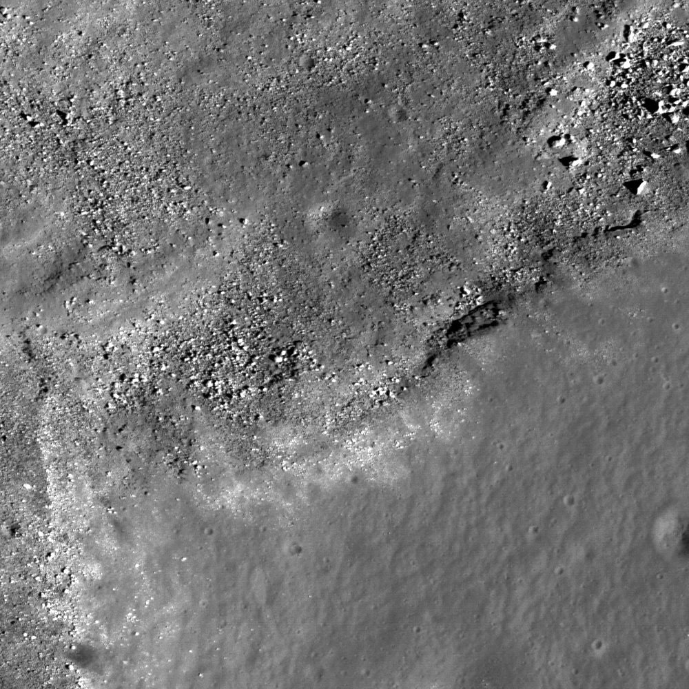
Portion of LROC NAC image M112421089RE showing fresh boulders on the inner ring of lunar far side Hertzsprung Basin, thought to be nearly pure anorthosite. Image is approximately 690 meters across and the Sun is from the right of the frame (east) [NASA/GSFC/Arizona State University].
Ross Beyer
LROC News System

Lunar Reconnaissance Orbiter (LROC) narrow angle camera (NAC) Featured Image focuses in on the Hertzsprung Constellation Tier One Region of Interest, detailing an area of the 270 kilometer diameter Inner Ring of the Hertzsprung Basin (570 km diameter) on the lunar far side. This basin is of the early Moon's Nectarian period (> 3.8 billion years) and is intermediate in size between two-ring basins (e.g., Schrodinger) and larger, multi-ring basins (e.g., Orientale). As such, it excavates material from an intermediate depth that helps us better understand the composition and structure of different zones of the lunar crust.


WAC context view of the inner ring of Hertzsprung basin and the 40x40 km Constellation region of interest. Arrow indicates the approximate location of NAC detail above. Image M118315549ME [NASA/GSFC/Arizona State University].


This site is a great exploration target because it provides access to the inner portion of the basin and the inner ring, which is thought to be nearly pure anorthosite. Explorers based in Hertzprung can investigate basin formation, highlands regolith, and these unique deep crustal rocks from far below the surface. The fresh boulders make perfect samples, and are just waiting for someone to come and pick them up! Nature has provided a natural drill hole to the lower portions of the crust - just the place to determine how the crust formed in the first place.

Browse the entire NAC frame of the Hertzsprung site !

Wednesday, May 19, 2010

LROC: Rima Bode Constellation ROI


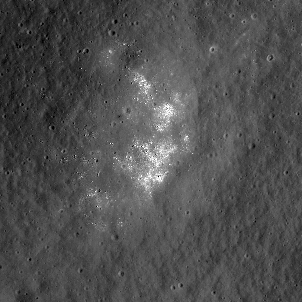
LROC Narrow-Angle Camera closeup of a small fresh crater (230 m across) with very dark ejecta within the regional pyroclastic deposit in the highlands near Rima Bode II. This site is near a NASA Constellation region of interest. This crater has excavated fresh pyroclastic material but has not penetrated through the deposit, which may be more than 100 meters thick in this area. LROC NAC image M124593116L. View is 478 meters across [NASA/GSFC/Arizona State University].

Lisa Gaddis
LROC News System

The Moon is an ancient body.

Its surface is dominated by the ancient highland crust peppered with huge basins, some of which are filled by mare deposits. These mare basalt deposits range in age from 2-4 billion years old. Many millions of years of bombardment by planetary bodies of all sizes have created a thick soil layer (called the "regolith" by lunar scientists) that has been broken up, churned, and homogenized vertically all across the lunar surface. To get past this material and see what’s underneath, you have to look for a 'fresh’ surface on the Moon---perhaps a steep slope or a spot that has been uncovered by a relatively recent impact crater formation event. Such fresh material may hold the best answers to fundamental questions about the geology of the Moon. What are the compositions and distribution of underlying rocks, how old are they, how did they form, and what can they tell us about internal processes of the Moon such as volcanism and tectonism? These questions aren't just important to understanding the Moon, but are also pivotal for understanding all of the terrestrial planets, including the Earth.


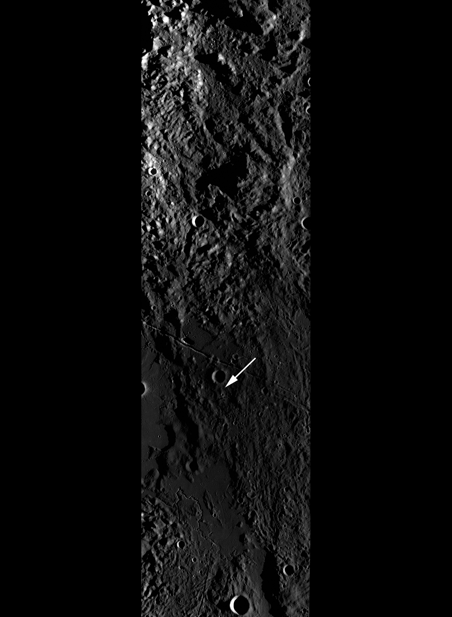
Uncontrolled LROC Wide Angle Camera monochrome context image showing the Rima Bode region and southern Montes Appeninus. Approximate position of today's LROC Featured Image is highlighted by a white arrow. Original Context for LROC Featured Image width is 90 km [NASA/GSFC/Arizona State University].


To look for answers to these questions, scientists study ‘fresh’ craters -- those with a crisp rim and an obvious ejecta deposit -- such as the one shown in NAC image, situated within the thick, dark, pyroclastic blanket near the Rima Bode II rille. With the sun nearly directly overhead in this view (solar incidence is ~11 degrees, where 0 degrees is ‘noon’), shadows are few. This crater, which is 230 meters across, and excavated from 10 to 20 m down, has not penetrated through the pyroclastic deposit, so the pyroclastic materials are at least 10 m (or more) thick in this area. The rubble and boulders visible in the crater floor suggest that the crater has excavated a solid, rocky surface beneath the mantle. The presence of a very small (~1 m across), bright crater in the floor may indicate that the underlying highlands material is not far below the floor of this crater.

The Rima Bode region (13° N, 356° E) is (in part) a Constellation program region of interest because of the presence of this thick layer of extremely dark volcanic material. Known as the Rima Bode pyroclastic deposit, it overlies and mantles an extensive portion of the highlands between the mare basalts in Sinus Aestuum and Mare Vaporum, south of the Apollo 15 landing site. As noted by scientists shortly after the Apollo missions prematurely ended, there are several such ‘black spots’ on the Moon, including the material sampled by the Apollo 17 astronauts during their adventure in the Taurus-Littrow Valley. These extremely dark volcanic deposits were thought to be young (possibly within the last several hundred millions of years) prior to the Apollo 17 mission based on photogeologic mapping. However, photogeology can only get you so far. Eventually, you need to send human explorers to fully understand these sorts of problems. Subsequent radiometric age dating of the returned Apollo 17 pyroclastic samples indicated a far more ancient age of ~3.5 billion years. The ‘black spot’ deposits all have rock-free surfaces with remarkably similar properties and are believed to contain the same kind of orange glass and black crystallized spheres as those sampled by the Apollo 17 crew. These particles are the lunar version of ash or cinder, and they are thought to be explosively emplaced on the Moon just as they are on Earth. Rather than forming cinder cones, the lower gravity and near-vacuum of the Moon's environment allows the particles to travel farther up and out from a vent, depositing an extensive blanket of glassy material. The beads have trapped hydrogen and Helium-3 from the solar wind, and enrichments of volatile elements such as sulfur and fluorine have been measured on their surfaces. The pyroclastic materials are also rich in iron and titanium, making them an immensely important as resources for future lunar explorers.

Explore the full resolution NAC image!

For more information, read: Pieters, C.M., T. B. McCord, S. Zisk and J.B. Adams, 1973, Lunar black spots and nature of the Apollo 17 landing area, J. Geophys. Research, 78:26, 5867-5875.


Coregistered Lunar Orbiter mosaic (LO-IV 109H2) and Clementine color-ratio (R=750/415, G=750/950, B=415/750) mosaics of the Rima Bode region of the Moon. The pyroclastic deposit at Rima Bode is the bluish purple unit that covers the highlands. The white arrows marks the location of the small crater shown in the portion of NAC frame M124593116L. Crater Bode A at lower right is 12 km in diameter. The projection is Simple Cylindrical, north is toward the top.