Showing posts with label King. Show all posts

Tuesday, July 29, 2014

Making a splash at King crater

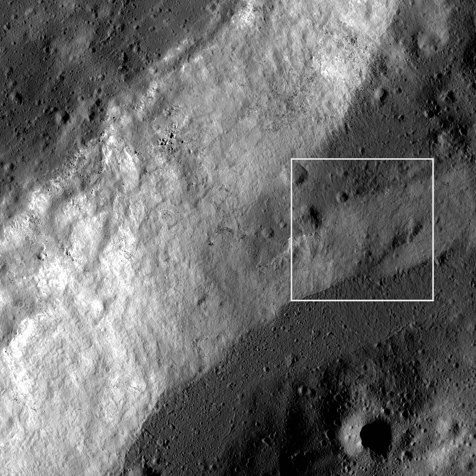
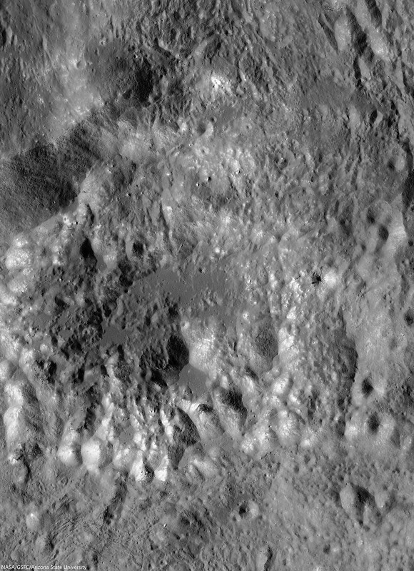
Impact melt ponds adorn the lumpy terraces of King crater. If you look carefully, you can see small fractures in some of the these ponds. 10.9 km field of view from LROC NAC mosaic M1159315479LR, LROC orbit 22783, July 6, 2014; 53.77° incidence angle, resolution 1.16 meters from 114.15 km over 6.41°N, 120.37°E [NASA/GSFC/Arizona State University].
H. Meyer
LROC News System

In the image above, impact melt pooled among the terraces in the walls of King crater, a complex Copernican crater on the lunar farside.

Impact melt is generated when kinetic energy associated with an impact is transferred to the target rock. Shock waves cause the rock to melt nearly instantaneously. The impact melt is flung all over the interior of the crater and some even makes it out of the crater.

Melt splashed on the crater walls tends to drain back down pooling on ledges. This downward flow resulted in a coating of impact melt called a veneer, visible in this region, along with other features like fractures.
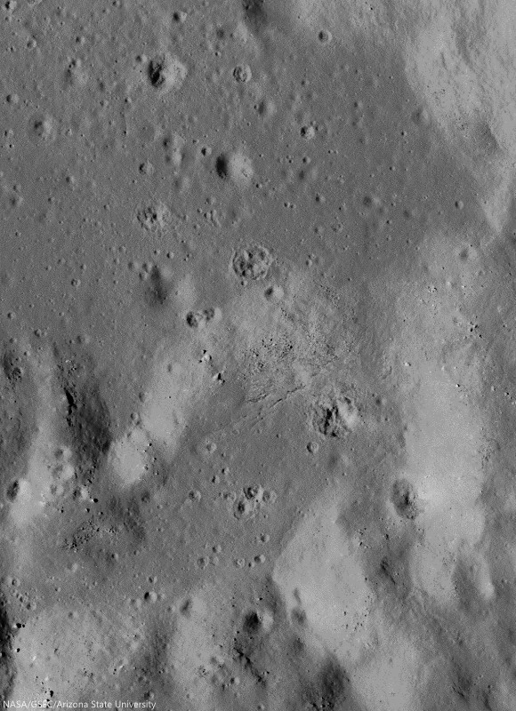
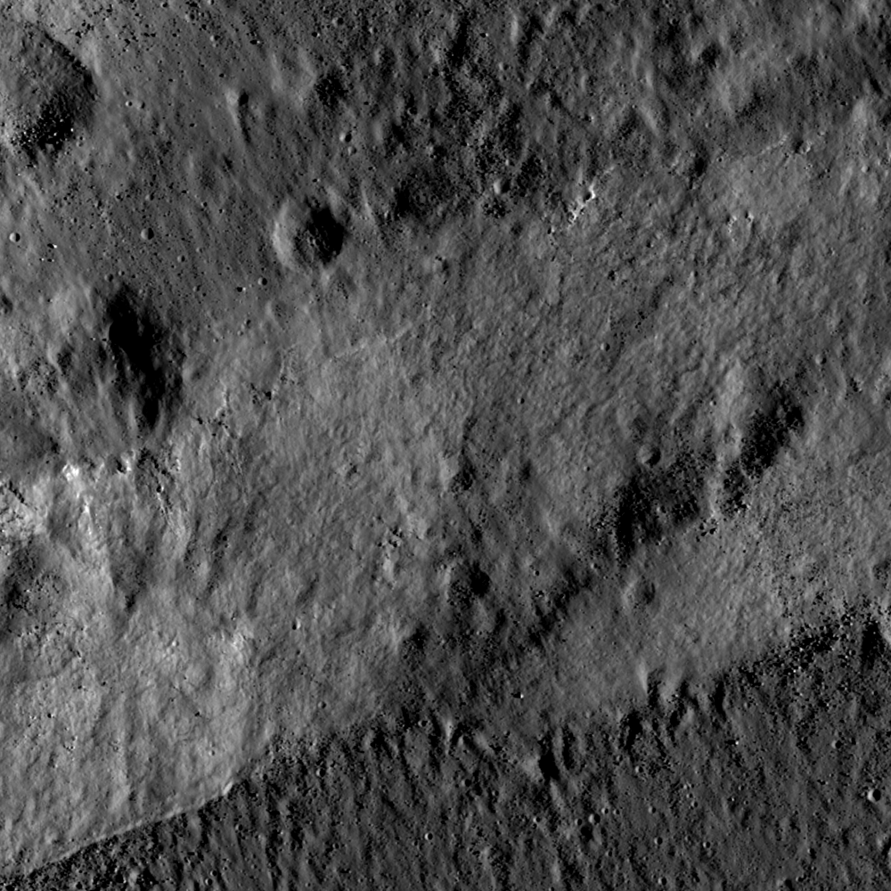
Upon closer inspection, these impact melt ponds display the fractures and oddly shaped craters typical of the transitory impact melt ponding at King crater. 1.34 km field of view from LROC NAC mosaic M1159315479LR [NASA/GSFC/Arizona State University].
Fractures in impact melt rocks can be the result of tectonic stresses and cooling and contracting of the impact melt. Sometimes craters also form before the impact melt has fully solidified, resulting in oddly shaped craters that resemble craters that form when pebbles are thrown into mud.

Aside from its rather peculiar central peak, King is rather unique in that the impact melt is not evenly distributed around crater, but rather accumulated in the north-northwest region outside the crater rim. This may be the result of an oblique impact. In the case of an oblique impact, impact melt is concentrated downrange of the incoming projectile.
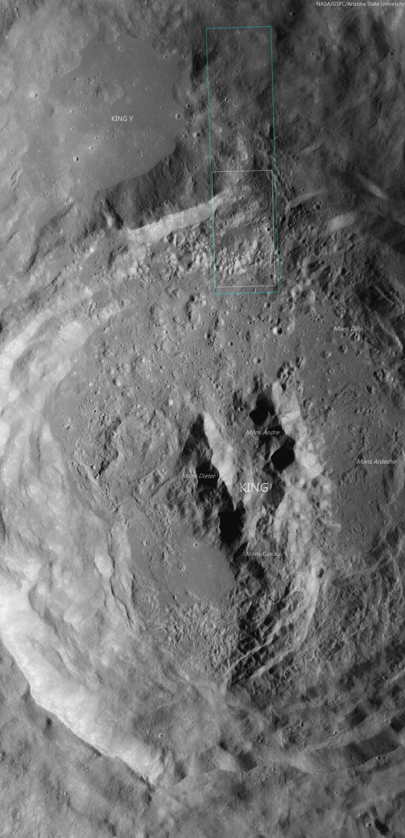
Contextual view of farside Copernican Age crater King (76.2 km; 4.96°N, 120.49°E), with footprint of LROC NAC mosaic M1159315479LR (orbit 22783, July 6, 2014) and LROC Featured Image field of view. 50 km-plus field of view from LROC Wide Angle Camera (WAC) monochrome (643 nm) observation M176845114CE, LRO orbit 11197, November 25, 2011; 61.87° incidence angle, resolution 57.8 meters from 42.52 km [NASA/GSFC/Arizona State University].
Impact melt forms many exquisite features on the lunar surface such as flows, lobes, pits, fractures, channels, polygonal patterns, and more. Explore the impact melt features of this region in the full NAC mosaic HERE.

Related Posts:

Tuesday, April 3, 2012

An Impact Melt Veneer in the Highlands

Fractured impact melt partially covered with regolith. Image field of view 880 m, LROC Narrow Angle Camera (NAC) frame M159650657L, orbit 8661, May 10, 2011; incidence 45.26° resolution 0.47 meters from 40.0 kilometers. View the full size LROC Featured Image HERE [NASA/GSFC/Arizona State University].
James Ashley
LROC News System

How did the complex terrain seen in this image form? The region is located on the lunar farside near King crater, a 77 km diameter impact crater characterized by several unusual features, including a large deposit of impact melt ponded in nearby Al-Tusi crater (see the WAC context image at the bottom of this post for the melt pond location). Elsewhere around the crater are vast areas that scientists hypothesize are coated with a veneer of impact melt. This material drapes the pre-impact terrain like a lumpy blanket -- varying in apparent thickness, ponding in small depressions here and there, and displaying fractures in many places.

Based on the geologic interpretation of landforms throughout the region, changes to this landscape from pre-impact to post-impact unfolded in a dramatic and complex sequence of events: the violent excavation of the King crater cavity was followed by the fall of ejecta, surging debris flows, large blocks of crust faulting and shifting in the crater walls, and super-heated impact melt flowing over the surface in sheets, rivulets, and cascades. It would have been an altogether disconcerting, but still very exciting, incident to behold first hand!

A larger field-of-view gives context for the scoured lunar surface near the Al-Tusi impact melt deposit. Image field of view around 2.9 kilometers. View the full size LROC context image HERE [NASA/GSFC/Arizona State University].
The wider-field WAC mosaic above gives a more comprehensive impression of the way this melt migrated across the surface before "freezing" (solidifying). With shadows giving a sense for topography, the more obviously fractured areas appear to occupy the higher ground of the region. The Featured Image is centered on an area of fractured melt where roughly one billion years of regolith development (perhaps 1 meter thick) from micrometeorite impacts has partially filled them, softening their appearance.

The Featured Image location juxtaposed with the 77 kilometer King crater and Al-Tusi melt pond. ILIADS (LMMP) application 3D image showing 170 kilometers wide regional perspective from a point 102 kilometers above the south. [NASA/LMMP/GSFC/Arizona State University].
Wide Angle Camera Digital Elevation Model; blues and purples are topographically lows while orange-yellow is high terrain. The vertical relief from highest to lowest in the image is approximately 5 kilometers. View the full size image HERE [NASA/DLR/GSFC/Arizona State University]!

Click HERE to see the full NAC image. Additional features in the King crater region can be found in the following Featured Image posts: Fault scarp with impact melt in King crater, Natural Bridge on the Moon!, and King crater ejecta deposits.

Wednesday, May 11, 2011

Fault scarp with impact melt at King crater


A fault scarp separates two zones of impact melt within the King Crater (5.0°N, 120.5°E) north interior wall. LROC Narrow Angle Camera (NAC) observation M115529715RE, LRO orbit 2159, December 15, 2009; solar illumination incidence 75° from the east, field of view approximately 900 meters (north is up). View the full-sized LROC Featured Image HERE [NASA/GSFC/Arizona State University].

James Ashley
LROC News System

Impact melt deposits ponded at two elevations (top and bottom darker grey zones) separated by a fault scarp (middle grey zone) on the WNW rim of King crater (76 km diameter). Here is a great example of a 'cross-cutting relationship.' Cross-cutting relationships provide a relative (which came first) timing of events. Knowing the order in which things happened is as important to reconstructing geologic history as knowing what happened. Accurate absolute dating of impact melt is also possible, but only with laboratory analysis of rock samples collected in the field!

See if you can tell what happened first here. Was it the faulting of the crater rim or the deposition of impact melt? Here's a clue: notice how cleanly the edge of the ponded melt material contacts the fault scarp at the bottom left of the Featured Image. Would you expect such a clean margin if 1) hard rock had been ripped apart by a faulting crust, or if 2) the fault happened first and the melt flowed in afterward? Also, notice the 'herringbone' pattern in the melt itself, showing the direction of a flow that started high and cascaded like a waterfall over the fault scarp. Based on this, the faulting may seem to have come first! These massive blocks of lunar crust were in motion minutes after the blast that excavated King crater, and the melt remained molten and mobile long afterward. Or did they happen at the same time? First, what caused the fault? The impact event that created King crater resulted in concentric faults along which large blocks of crust slid, and in some cases collapsed. The melt formed from energy released in the impact. The environment was very dynamic, impact melt was flowing while the crater interior was rebounding and adjusting to the sudden event. So the impact melt likely came to its final form as we see it today some time after most of the major faulting had ceased. However, we cannot be certain that there wasn't some major movement along this fault even after the melt had ponded, and was still molten.

What a great puzzle for a future lunar geologist to unravel!

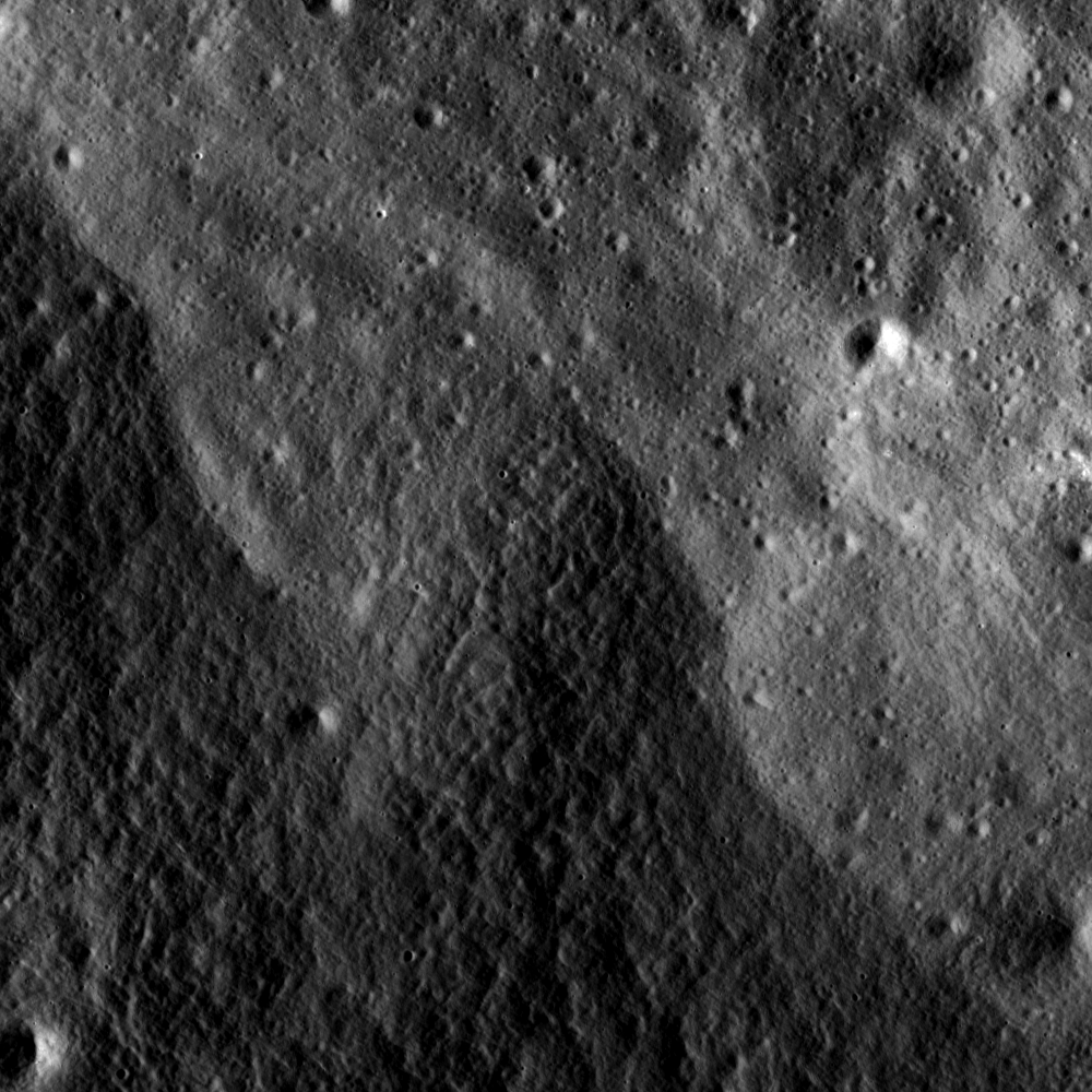
The image below is a slight "zoom-out" to provide a bit more context, and to show how the Featured Image fault scarp is only a small part of another, branching fault scarp. Note also the third, higher level of impact melt deposits in this image (upper left corner).


Medium resolution context for Featured Image from the NAC original; area approximately 2.8 km across. View the full-sized context frame for the LROC Featured Image HERE [NASA/GSFC/Arizona State University].

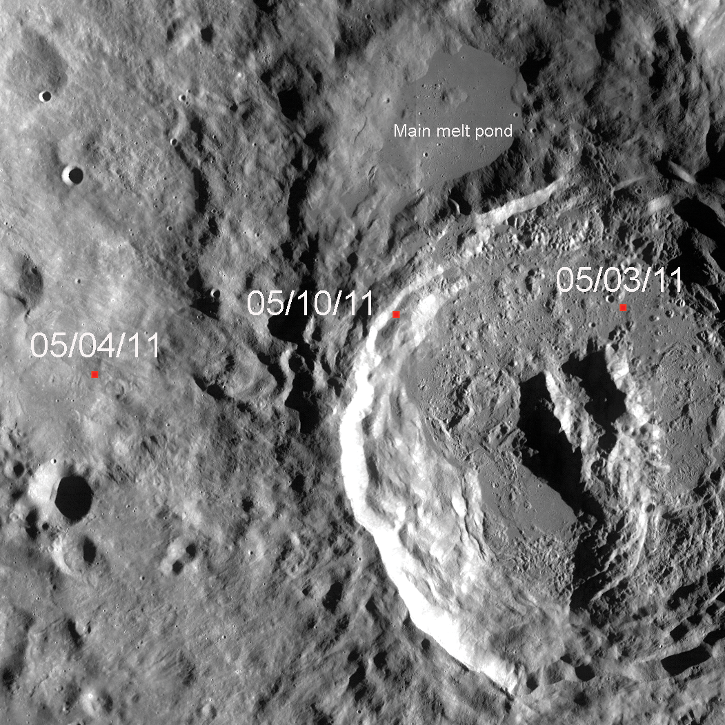
Zooming out still further gives us the full picture: The image below shows most of the 77-kilometer diameter King crater, together with areas beyond the crater rim that were effected by King's formation, and the locations of Featured Images posted on May 3rd, 4th and today (small red squares, which are drawn to scale). Clearly visible is King crater's large impact melt pond to the NNW. If you look closely, you will notice smaller pools of melt just south of this main pond. Notice their relationship to King crater. The crater walls have faulted and slumped into a 'stair step' arrangement of large blocks, and melt flowed in and ponded (afterward or perhaps during). Compare the last three Featured Image posts and note the diversity in terrain represented by one region on the Moon!

Explore the full NAC image here.


A portion of the global LROC Wide Angle Camera (WAC) mosaic showing the King crater region and the locations of three NAC Featured Images; field of view is approximately 100 km across. View the full-sized WAC context image HERE [NASA/GSFC/Arizona State University].

Related Posts:
Slumping rim of Darwin C
Natural bridge in King crater main melt pond

Friday, May 6, 2011

King crater ejecta deposits


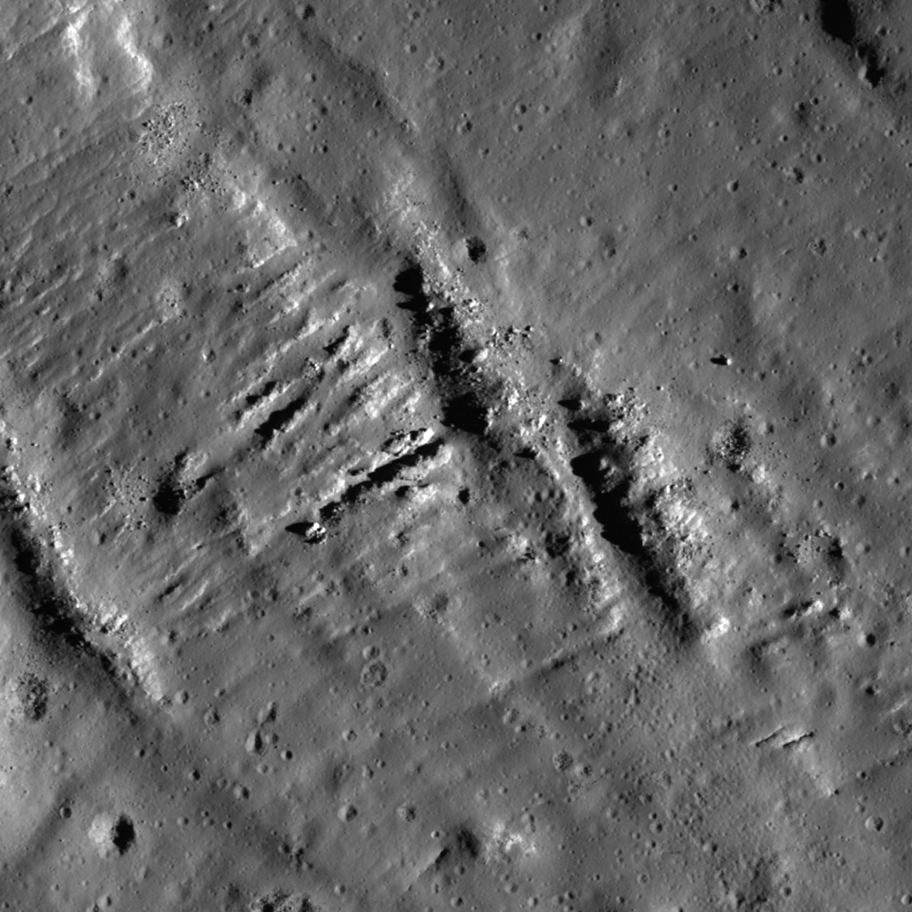
Deceleration lobes in King crater ejecta. LROC Narrow Angle Camera (NAC) observation M103739394LE, LRO orbit 453, August 1, 2009; lighting incidence angle 61°, field of view approximately 1,200 meters across. View the dull-size LROC Featured Image HERE [NASA/GSFC/Arizona State University].

James Ashley
LROC News System

The lobate forms in this image look like lava flows, but they're something very different. These are 'deceleration lobes' in the extended ejecta blanket of King crater (5.0°N and 120.5°E), located approximately 50 km due west of the King crater rim. North is up, and sunlight shines from the west.

They resulted as ground-hugging debris flows, accelerated by the prodigious energy of the explosive King impact event, met with pre-existing topography and was ground (literally) to a halt - much in the way that avalanches can behave as they interact with the topography of a mountain slope. Sometimes such lobes will catch up to and override one another like shingles on a roof. These features were first studied in the early 1970's, when photographs taken of the region from the orbiting Apollo 16 Command Module where returned to Earth. Similar features can be found within many areas of the distal ejecta deposits associated with the King crater impact.

Imagine being witness to this event as the ancient planetesimal that struck the Moon and excavated King crater set these walls of rock and debris into motion. They forced their way across the lunar surface for tens of kilometers, smothering everything in their paths until they finally lost energy and stopped where we see them today. It would have been an astonishing and very dramatic thing to see!

Explore the rest of the full NAC image for more details.

Related posts:
Scouring ejecta
Giordano Bruno ejecta


Full width, lower resolution view of M103739394LE, showing the terrain, on the rolling farside highlands west of King in context [NASA/GSFC/Arizona State University].

Wednesday, May 4, 2011

Anomalous Mounds on the floor of King


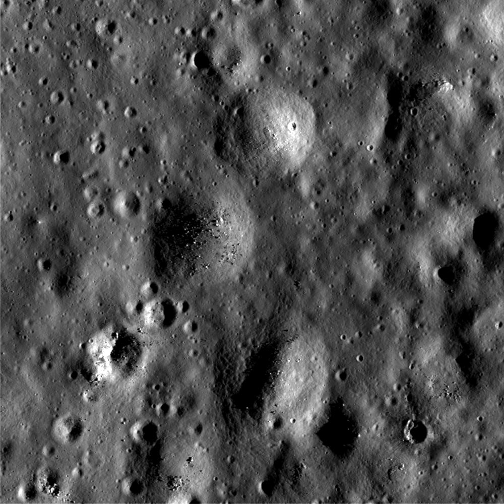
Odd-looking mounds on the floor of King crater. LROC Narrow Angle Camera (NAC) observation M115522928LE, LRO orbit 2158, December 15, 2009; incidence angle 75°; image is ~900 meters across. See the full width LROC Featured Image HERE [NASA/GSFC/Arizona State University]

James Ashley
LROC New System

What are these circular features?

These mounds are found within a large pool of now-solidified impact melt covering the floor of King crater (5.0°N, 120.5°E). North is up, and sunlight is coming from the east, which is how we can tell at a glance that these are positive-relief constructs, and not negative-relief impact craters (compare with some of the obvious craters in the image to convince yourself that this is true). There are many such mounds on the King crater floor. They are often circular, but occur in groups with irregular outlines as well.

One interpretation of the mounds is that the King impact melt remained hot long enough after accumulating as a pond, and partially crusting over during cooling, to still "ooze" here and there through holes or cracks in the fresh crust. The soft melt quickly cooled after reaching the surface and built itself up vertically while spreading out laterally at each point where this happened ... think of pressing a board with holes in it on a layer of wet mud or toothpaste.

While this explanation may sound similar in some ways to a volcanic process, this kind of "extrusion" differs from classic volcanism in a very fundamental way: The source in such a model is a shallow, surface emplacement of short-lived, molten material (the impact melt), as opposed to magma coming from the mantle or crustal magma chambers, which stay molten for much longer periods of time and tend to produce higher-pressure and more voluminous extrusions. Perhaps the weight of the cooling melt crust was enough to cause this (the board in our thought experiment). Perhaps another force assisted. Or perhaps the mounds formed in a way completely different from this scenario. Such are the problems of planetary science, and we can always rely on Nature to surprise us by presenting situations that do not lend themselves to easy interpretation or classification; hence the "anomalous" status for today's Featured Image.

A visit to King crater would help solve the mystery!

View the full LROC NAC frame HERE.


LROC WAC (Wide Angle Camera) monochrome mosaic Server zoom of the King crater region. 73 kilometer-wide King is a kind of splash pan. At some ancient moment, preserved here for billions of years, molten material was slung over the north rim, filling in the depression labeled King Y, and even as it cooled flowed back over the rim, carving a deep impression. King Y is also the location of a unique natural bridge, a discovery spotlighted by an LROC Featured Image in September 2010 [NASA/GSFC/Arizona State University].