Showing posts with label Lacus Mortis. Show all posts

Sunday, July 7, 2013

Twin mare pit craters in the Lake of Death

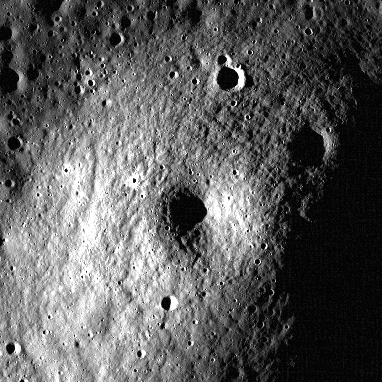
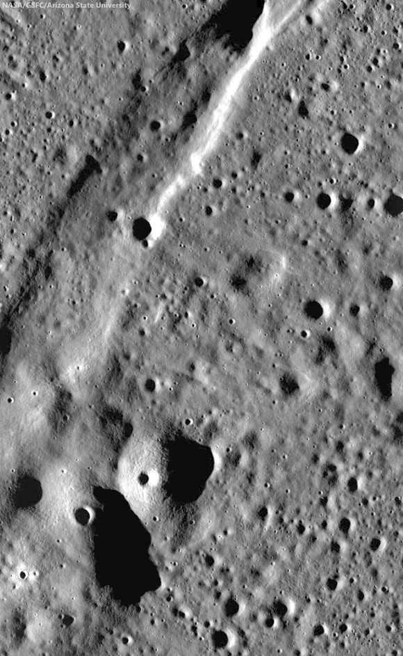
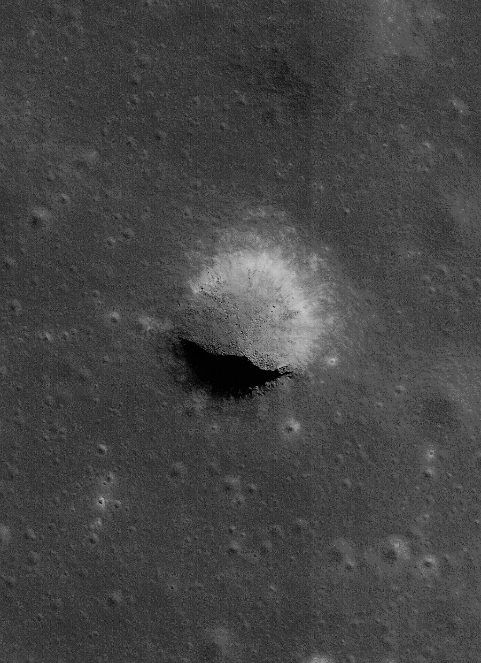
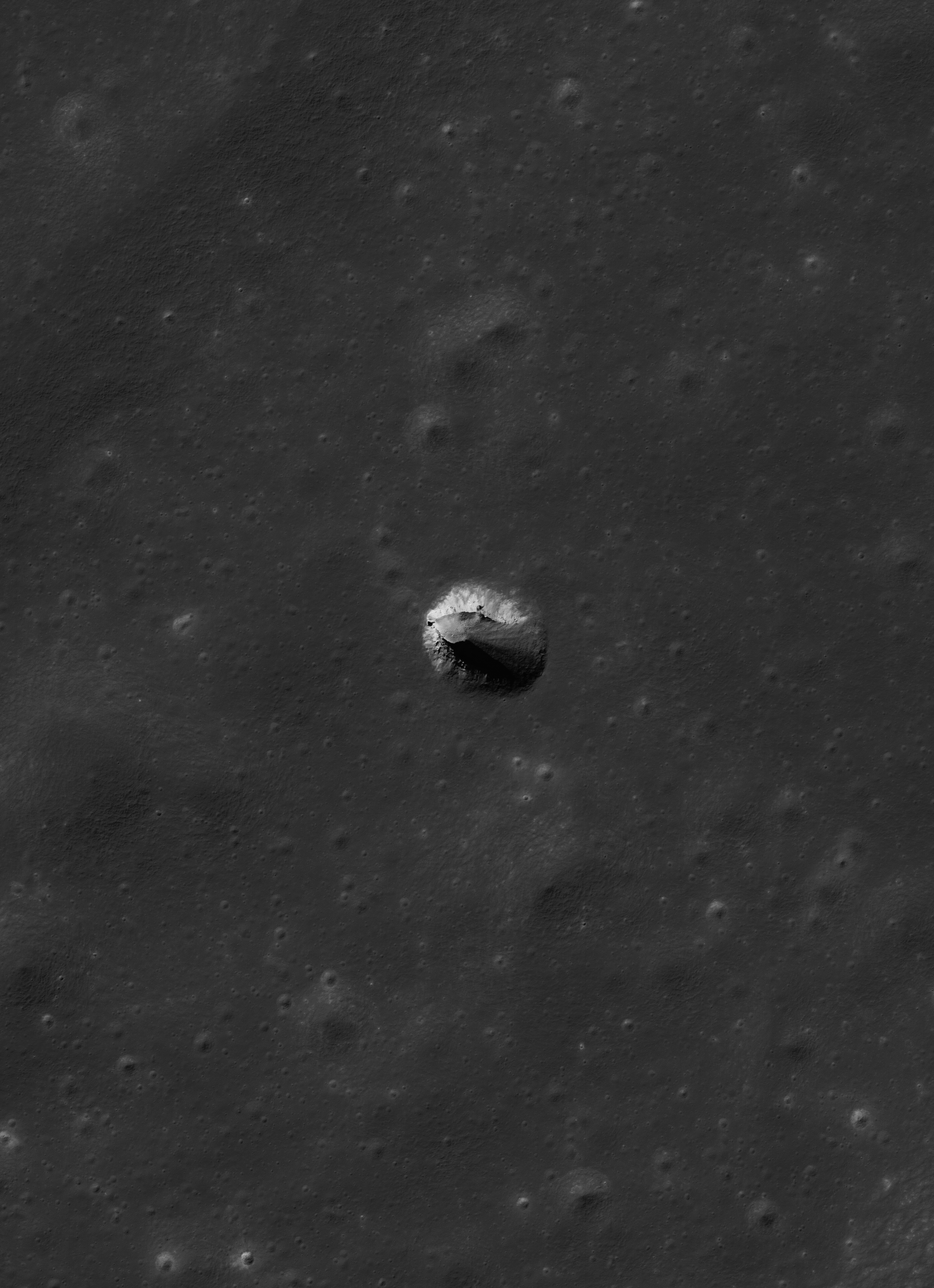
Layers of terrain, the foundation under the heavily gardened upper surface of Lacus Mortis, "the Lake of Death," hints this feature, averaging 228 meters across, was, or is, a "pit crater," closely related to similar structures (discovered in the 21st century) near the Marius Hills, in Mare Tranquillitatis, Mare Ingenii and elsewhere. Though the east wall collapsed there may yet be an opening below a ledge. LROC Narrow Angle Camera (NAC) observation M126759036L, orbit 3814, April 24, 2010; 49.4° angle of incidence, resolution 0.5 meters from 45.56 km [NASA/GSFC/Arizona State University].
Joel Raupe
Lunar Pioneer

It was something of a sensation just a few years ago when Kaguya (SELENE-1) images unveiled a "pit crater," an honest to goodness opening into a sublunarean world.

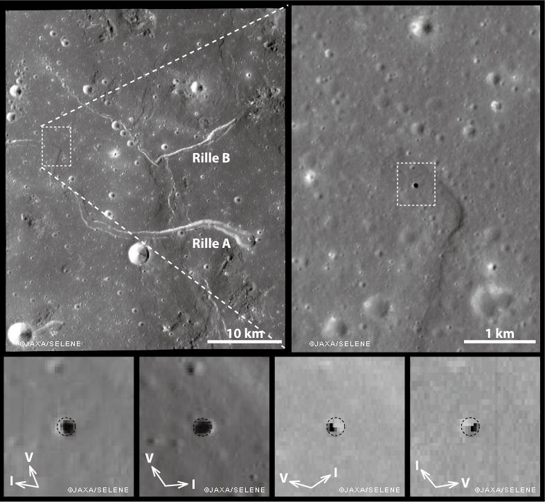
Ant this new feature was found right in the middle of the long-observed and studied channel of the unofficially named "Sinuous Rille A," in the Marius Hills of Oceanus Procellarum. What a difference, many thought, high resolution photography would make of our knowledge of the lunar surface.

And they were not disappointed. Most of what we now know of the lunar surface is entirely a product of the 21st century, largely a pay off from "precursor" missions vital to the success of a now-scrubbed program ahead of a return to the surface of "extended human activity" later this decade.

Junichi Haruyama and his colleagues reported their findings in Geophysical Research Letters in 2009, having captured the Marius Hills Pit at resolutions as high as 6 meters per pixel using the Kaguya Terrain Camera and Multiband Imager, as discussed by LROC principle investigator Marc Robinson, March 1, 2010.
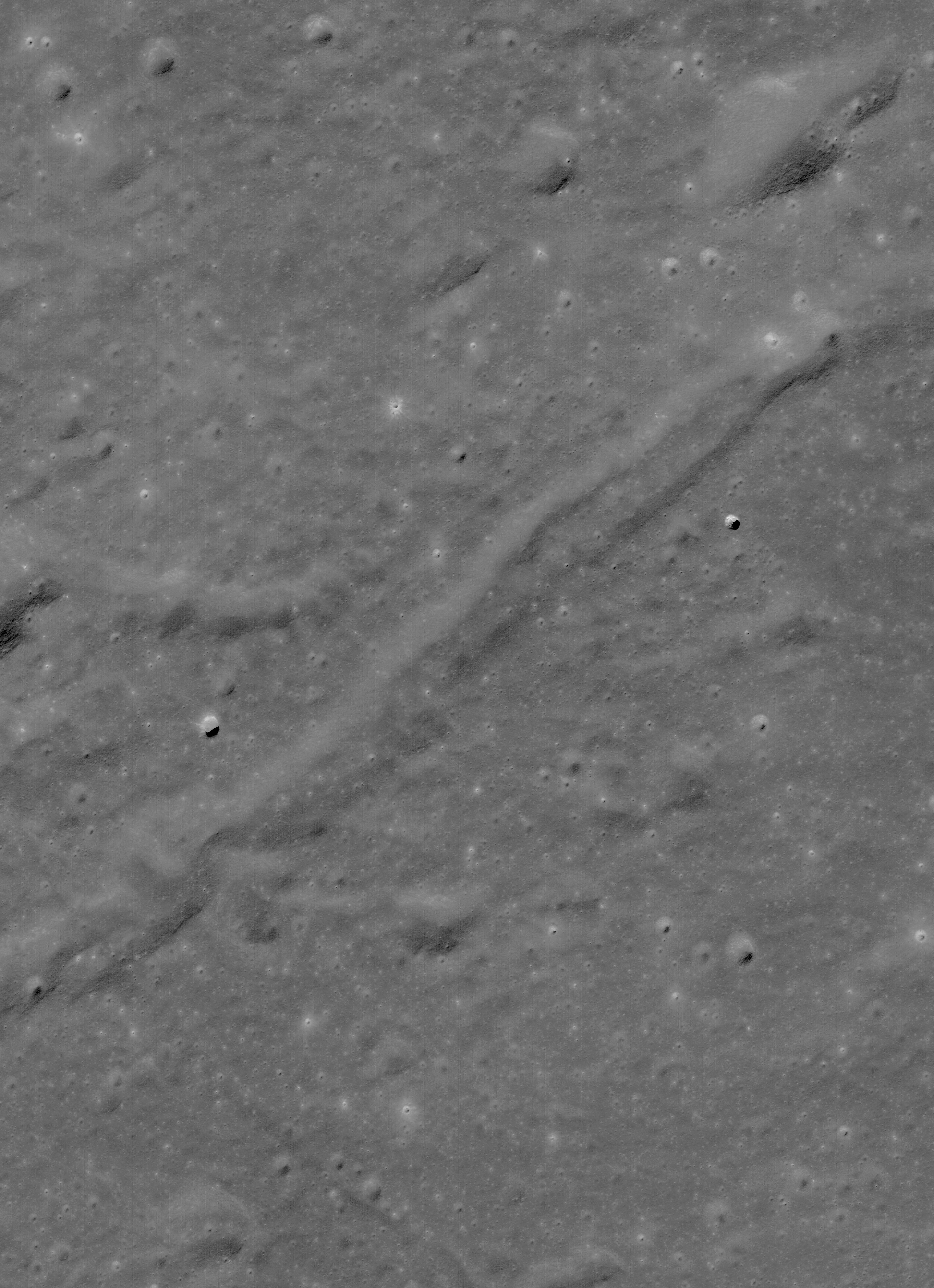
The same partially collapsed, or filled-in, pit crater in the Rimae Burg region of Lacus Mortis (44.96°N, 25.62°E), from an oblique LROC NAC mosiac M1105701957LR, with spacecraft slewed -41.94° off nadir, orbit 15246, October 24, 2012; 59.78° incidence angle, 2 meters resolution from 155.54 km over 44.92°N, 25.52°E. Explore a full-resolution version HERE [NASA/GSFC/Arizona State University].
Not many months after the controlled impact of Kaguya the Lunar Reconnaissance Orbiter began its long and productive tour in lunar orbit.

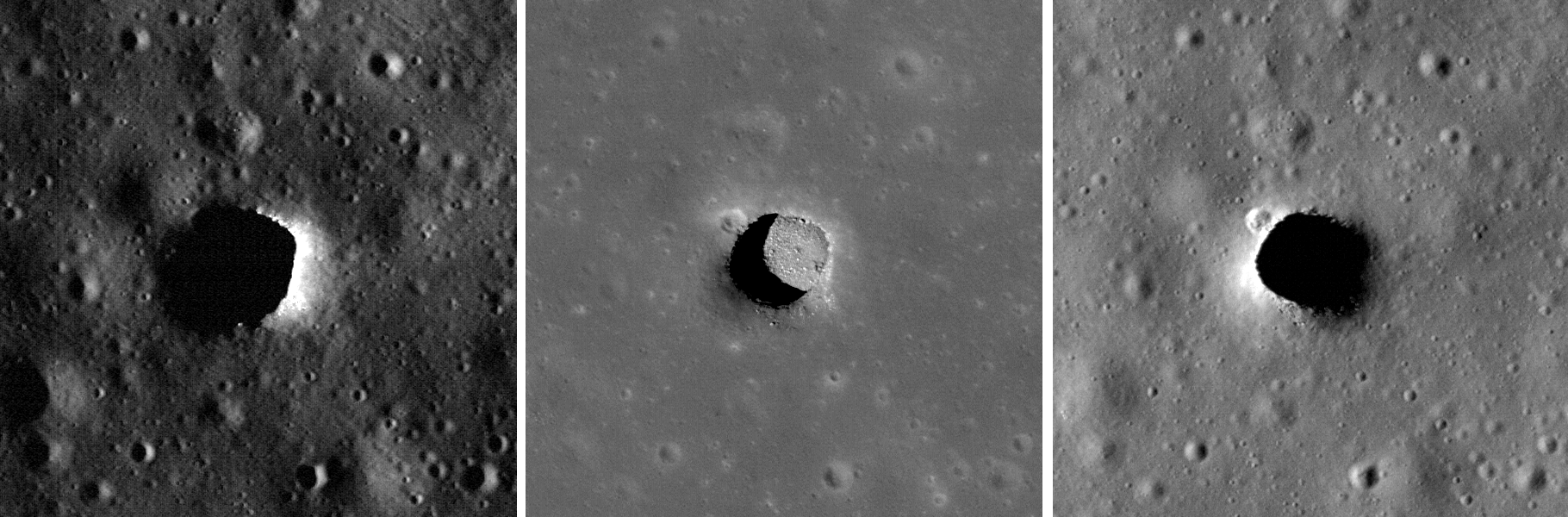
Early in that still-ongoing mission the LROC team at Arizona State University released their own high-resolution NAC images of the Marius Hills Pit, and under a variety of lighting angles, while announcing the discovery of two additional, even larger and more distinctive "pits" in the western interior of Mare Ingenii and the well-preserved example near Sinas J, not far from the vent structures at the west terminus of Rupes Cauchy, in the middle of Mare Tranquillitatis.

These new images left little doubt that significant underground areas existed on the Moon, though how far these sublunarean areas stretched beyond their exposed "skylights," the true scope of the Moon's near-surface underground world, must remain a mystery for some time to come.

M122041942LR-NSJ-0503-58b-1986x2739
For a while mare pit craters seemed to be solitary creatures, all alone where they have now been extensively photographed. But the partially filled examples in Lacus Mortis might be near "twins." The 250 meter-wide pit crater above is only 9.7 km southwest of its neighbor (in the first image above - a 13 km walk) from 44.80857°N, 25.21157°E. The view above is from a kilometer-wide field of view from LROC NAC mosaic M122041942LR, orbit 3119, March 1, 2010; 0.5 meters resolution from 46.11 km. (Download the very large original mosaic HERE) [NASA/GSFC/Arizona State University].

These features seemed to be rare and solitary. Rough treatment of the lunar surface, aeons of steady and sometimes heavy bombardment seemed to leave very few of these openings intact. Perhaps the same may be true of extended "lava tubes," and other tantalizing, hoped-for discoveries.

Planetary scientists and geologists have studied the interior walls of these structures. The LROC team has released a high volume of imagery of the Tranquillitatis pit crater, for example, and attempts have been made to map the history of lava inundations recorded in the exposed layers.

Following discovery of three, widely dispersed pit craters at Marius, Tranquillitatis and Ingenii, at least two more smaller and much less distinct examples have turned up Mare Fecunditatis and Mare Smythii.

The unique Natural Bridge feature of King Y is a nearly unique example of the much more widespread family of collapse and channel remnants common to impact melts, both inside and outside relatively "recent" impacts, like the northeast quadrant of the interior of Copernicus, for example, and deep inside Messier A. To distinguish these from the Marius-Tranquillitatis-Ingenii family of openings, the latter are now referred to as mare pit craters.

Far from being as widespread as melt channels and collapse pit, the Mare Pit Craters seemed to be solitary, perhaps one to a plain, if any at all. As seems common to all deep space discoveries, however, of course there had to be an exception.

M1105701957R-NSJ-0407-58b-4747x6548
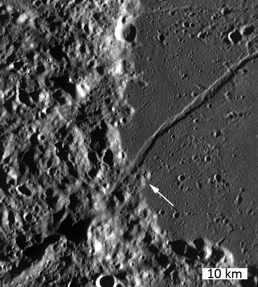
"Twin" Mare Pit Craters, roughly 10 km apart (as the LM ascent stage flies) on opposite sides of the primary channel in the Rimae Burg region, west-central Lacus Mortis. This field of view is 15.72 km across, from LROC MAC mosaic M1105701957LR [NASA/GSFC/Arizona State University].
In the west central interior of the rugged Lacus Mortis plain are two near-quarter kilometer-wide pits, though both are either partially or completely filled in. They are intriguingly situated on opposite sides of a main channel north of its junction with a distinctive faulting in the Rimae Burg vicinity, northeast of the volcanoes highlighted in an LROC Featured Image (Volcanoes in the Lake of Death), August 11, 2010.

Lacus Mortis, from the LROC web-based PDS search tool, showing the prior image field of view outlined by a white rectangle. Note the concurrence with a junction zone of the fault and channel constituents of Rimae Burg [NASA/GSFC/Arizona State University].
The interior walls of the northeastern twin, shown in the first two images above, retains the kind of layering seen in the Tranquillitatis and Ingenii pits, evidence of periodic lava flooding in the remote past. This bedrock under Lacus Mortis makes for a tough roof, but over what? Have any of these mare pit craters yet been found over the deeper basins?

The east-southeast wall of the northeast pit seems to have filled in, like a forgotten entrance to a pharaoh's tomb, though the south interior stays in hard shadow at this latitude. But the north wall offers up a shadow ring where the sun's angle should be well placed for illumination, hinting at an unseen and deeper interior perhaps.

The perspective from Earth, the area of interest marked by a bright asterisk in west central Lacus Mortis, an eyebrow for the "Man in the Moon" (yellow rectangle in inset). From a First Quarter Moon montage captured April 21, 2010. Photo by Yuri Goryachko, Mikhail Abgarian, Konstantin Mororzov - ASTRONOMINSK, Minsk, Belarus.
Sadly, the southeastern twin, though apparently the "real deal," appears very degraded. Exterior regolith, heavily pounded by the steady bombardment of the micrometeorites gardening the upper three centimeters of the lunar surface every two million years, has spilled over filled the interior. Its south wall, in high latitude shadow, stays invisible in shadow, but with little visible component leading to an indication of any difference with the rest of its fine-grained interior fill.

Did these two examples of mare pit craters, perhaps the only such "twins" on the Moon, degrade more quickly because of a greater age than their more noted cousins at Tranquillitatis or Ingenii? Did the arrival of the impact that formed Burg cave them in? Is this area more prone to Moonquakes?

Related Posts:
Pit Crater in Fecunditatis (May 23, 2013)
Copernicus Collapse Pit (March 5, 2013)
Layering in Messier A (July 22, 2011)
Sublunarean Void (February 8, 2011)
New views of lunar pits (September 14, 2010)
Natural Bridge on the Moon (September 7, 2010)
Depths of Mare Ingenii (June 16, 2010)
How common are mare pit craters? (July 15, 2010)
Paul Spudis: Caves on the Moon (October 28, 2009)

Friday, September 23, 2011

LROC: A Gathering in Lacus Mortis


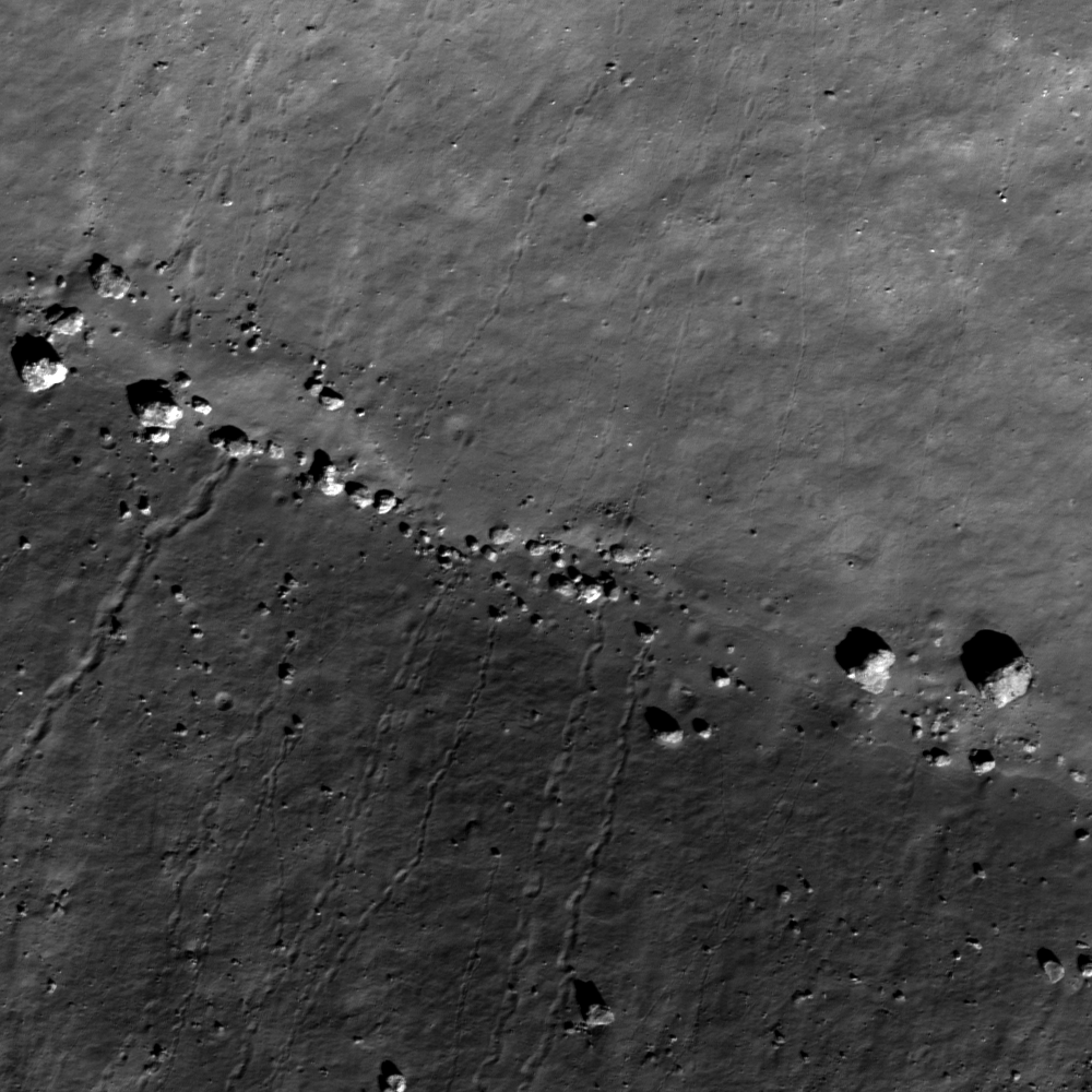
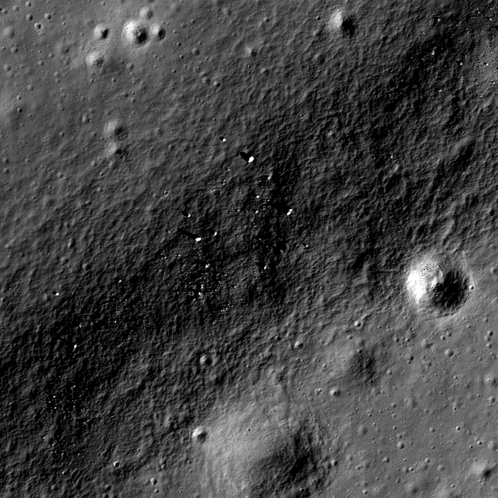
Boulders meet in a valley amidst central peaks of Bürg crater (45.0°N, 27.2°E). LROC Narrow Angle Camera (NAC) observation M111415328L, LRO orbit 1553, October 29, 2009; incidence angle 51.7°. Sun is from the south-southeast, north is right, image resolution 49 cm per pixel. View the full size LROC Featured Image HERE [NASA/GSFC/Arizona State University].

James Ashley
LROC News System

Clear impressions in the lunar soil show paths that boulders followed as they rolled downhill in the mountains surrounded by Lacus Mortis (the Lake of Death). If you look closely, you can see trails from both the top and bottom of this image. Also the trails are in some cases jagged -- not orderly, straight lines. What caused such striking patterns?

As is often the case, close inspection of a broader area reveals what we are seeing. Knowledge of the local topography and an understanding of the effects of gravity provide the explanation: The boulders rest in a valley present within the double central peak of Bürg crater. They rolled down from the bouldery summits of opposing slopes and accumulated along the valley floor. The largest block is approximately 23 meters in long diameter!

Note the tortuous paths of some of these boulders. These paths are the results of slow movement combined with irregular shapes (have you ever tried to roll a football in a straight line?). The straighter paths probably represent more rapid movement because the momentum of a faster-moving body helps it maintain its path of travel. Notice that at least one of them bounced along the slope, making impressions only when it touched the surface. Other boulders never made it all the way to the bottom of the slope. Still others don't seem to have clear traces in the regolith up-slope from their location. How could this be? Is it safe to say that some of these arrived more recently than others? Why or why not? Hint: How rapidly does the lunar regolith get reworked by micrometeorite impacts, and how quickly should such gardening erase traces like these?

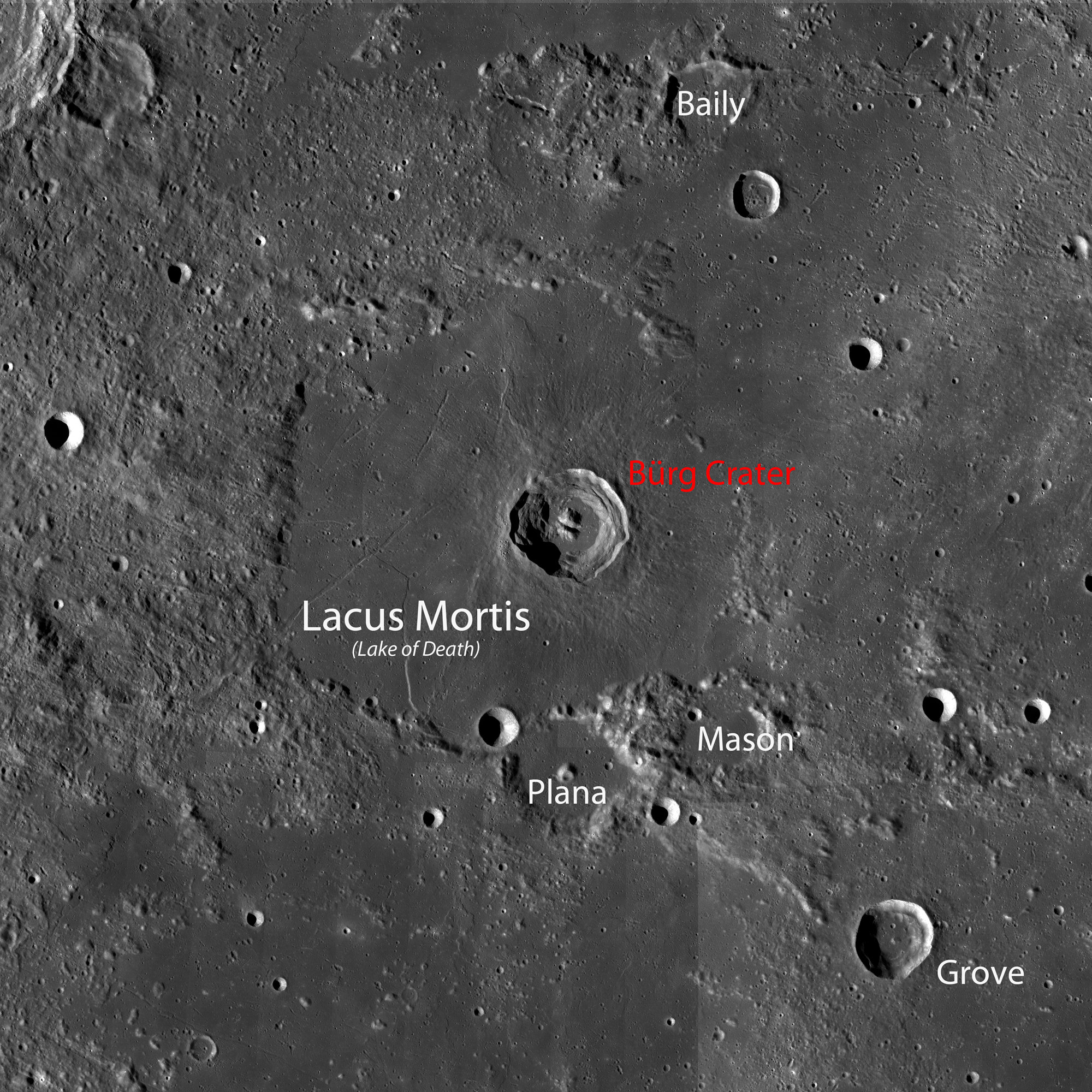
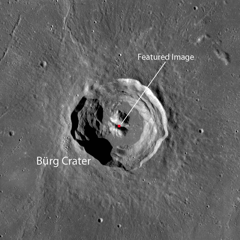
The 6700 meter high rims and terraced interior walls of 41 km-wide Bürg (45.0°N, 28.2°E), from a 100 m/p resolution LROC Wide Angle Camera (WAC) mosaic, shows the Featured Image location between the central peaks. See the full size context image HERE [NASA/GSFC/Arizona State University].

Lacus Mortis is shown in the WAC mosaic (below), this area is visible through the eyepiece of a small, backyard telescope beginning with the late waxing crescent phase, about 6 days past new Moon (See the last image in this post for the telescopic view from Earth during a favorable libration in April 2010). If you can find Bürg crater, then you'll see where the Featured Image is located, even though the details of the crater will be far too small to see.


WAC mosaic (from the Web Map Server LROC image search) of Lacus Mortis and environs. See the original, more detailed LROC context image HERE [NASA/GSFC/Arizona State University].

Explore the full NAC frame here. Another post featuring the complexities of Bürg crater can be found here. Related Featured Image posts also include Sampling Schrödinger; Tycho Central Peak Spectacular; and Boulder in Recht crater.

Explore the full NAC frame HERE. Another post featuring the complexities of Bürg crater can be found HERE. Related Featured Image posts also include Sampling Schrödinger; Tycho Central Peak Spectacular; and Boulder in Recht crater.

Lacus Mortis is a familiar Nearside landmark, between Mares Serenitatis and Frigoris, well situated for locating nearby large craters and vice versa. It is less spectacular but just as unusual in this false-color image from LOLA altimetry, a continuum of most of the Nearside's below-lunar mean elevations. It is a place now confirmed that hosts deep faults and volcanism  [NASA/GSFC/MSFC/LOLA/LMMP].


The View from Earth: This small section from an global lunar mosaic by Astronominsk demonstrates Lacus Mortis is easier to see during a libration favorable enough to swing Mare Humboldtanium into view. A small host of quick-study neighborhood landmarks are all easy to locate in a small telescope [Astonominsk].

Still more related posts:
Rimae Bürg
Not your average complex crater
Lunar morphology in the lake of death
Blogger's Best for the Best
Terraced Wall of Bürg

Thursday, April 28, 2011

Another small volcano?


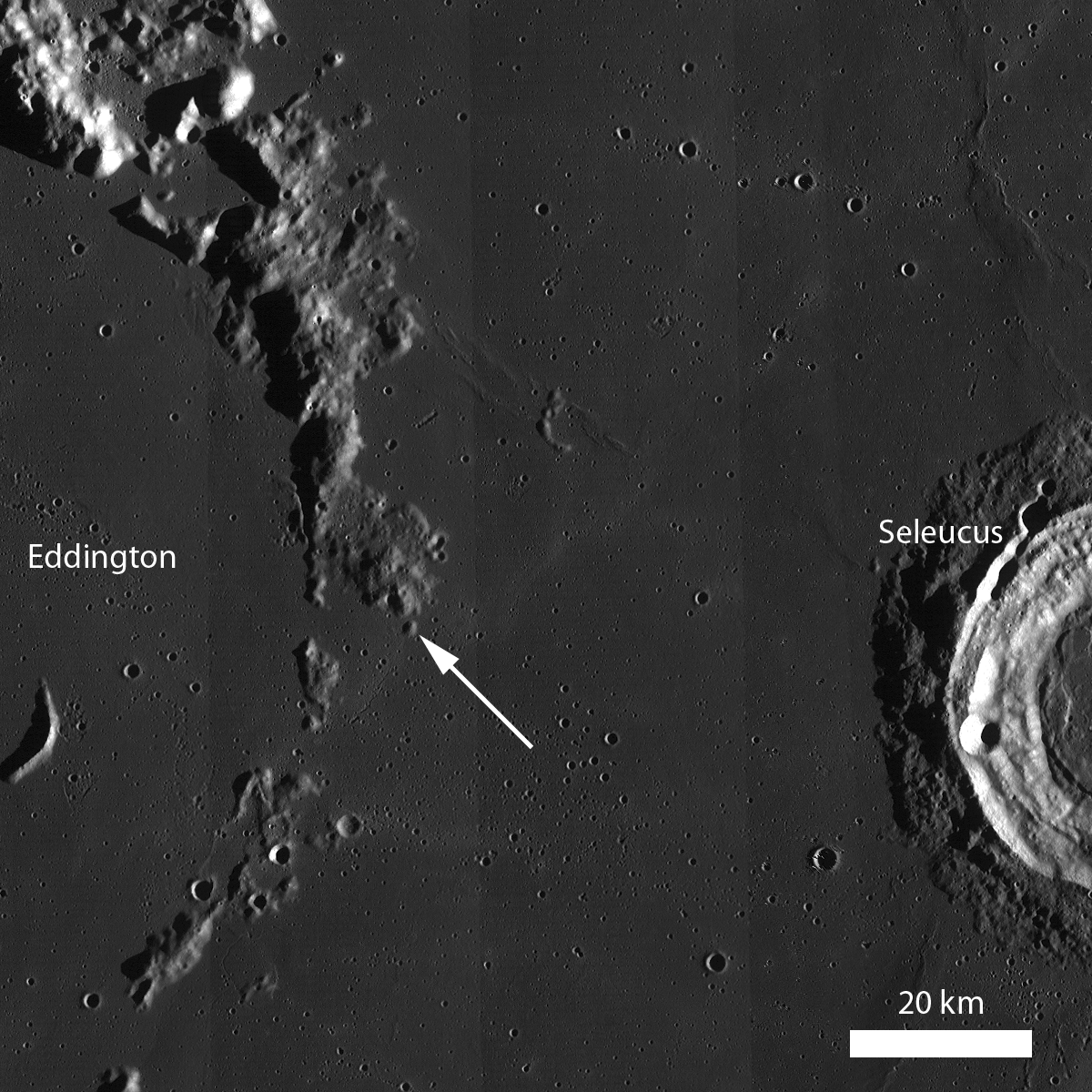
Along the embayed Eddington crater rim is an ~1.5 km dome that may be an ancient volcano with a summit pit crater. LROC Narrow Angle Camera (NAC) observation M148618400R, LROC orbit 7036, January 2, 2011; field of view 960 meters. View the full-sized LROC Featured Image HERE [NASA/GSFC/Arizona State University].

Lillian Ostrach
LROC News System

Volcanic features are observed all over the Moon, but sometimes it is difficult to tell whether an observed feature is of volcanic origin or the remnant of another geologic feature (e.g., basin ejecta or buried rim materials). Today's Featured Image is a prime example of a dome that may or may not be of volcanic origin. The dome is ~1.5 km wide and has a summit crater, but is the crater of impact or volcanic origin? The dome is geomorphologically similar to two volcanoes found in Lacus Mortis. These other domes are about the same size (~1.5 km wide) and have similar appearances, except that today's feature has many more small superposed impacts, suggesting that it is older than the Lacus Mortis volcanoes. Does it mean that this feature in western Oceanus Procellarum is a volcano just because it looks like one? The simple answer is no; but keep reading to find out why.


LROC Wide Angle Camera (WAC) monochrome mosaic featuring the rim of inundated Eddington crater, where the subject of the LROC Featured Image, released April 27, 2011, is located (arrow, 21.6°N, 290.5°E). Can you find any other similar-looking features along the Eddington crater rim? [NASA/GSFC/Arizona State University].

On Earth, many techniques are used to interpret the geologic history and origin of features in a landscape. Usually, analysis of remotely sensed data and field work are two techniques that scientists use together to unravel the geology for a region. But on the Moon, we can't travel to our favorite geologic feature and commence field mapping and measurements - at least not yet anyway! Instead, scientists need to get creative with the remotely sensed data they have.

LROC NAC stereo images can be used to study the topography of geologic features. Scientists have characterized the topography of larger volcanoes and domes on the Moon, and these data can be used in conjunction with LROC NAC stereo images to measure the dimensions and slopes of the volcano-like feature in today's Featured Image. If the dimensions, slopes, and texture, for example, of a volcano-like feature are consistent with the characterized landforms interpreted to be volcanoes, then it is possible that the volcano-like feature is a volcano. But be careful: just because a volcano-like feature has similar topographic measurements and morphology to other volcanoes does not mean that it is definitely a volcano. Similar to terrestrial field work, scientists studying lunar geology must make sure to look at the "big picture", or the context and regional surroundings, when interpreting remotely sensed images.


The full-width WAC context image, viewed HERE. provides a look at the regional, larger context of the feature imaged (above). LROC WAC color data can be used to map the variations in color caused by compositional variations. If the color of the volcanic-like feature is the same as that of the Eddington crater rim material, then the feature could be Eddington crater rim material and not a volcano. However, if the colors are different, then there is a possibility that the feature is volcanic in origin - but again, this analysis is not definitive. To reach a more definitive conclusion, you would need to look at the WAC color data for other identified volcanoes or domes and make a comparison. But, of course, sampling the volcano-like feature, in addition to the Eddington rim material and surrounding mare material, would be best!

Take a look at the embayed rim of Eddington crater and this dome and decide for yourself if it formed as a volcano.

Related Posts:
Volcanoes in Lacus Mortis
Hortensius Domes Constellation ROI
Gruithuisen Domes Constellation ROI
Marius Hills Constellation ROI

Friday, February 11, 2011

LROC Rimae Bürg


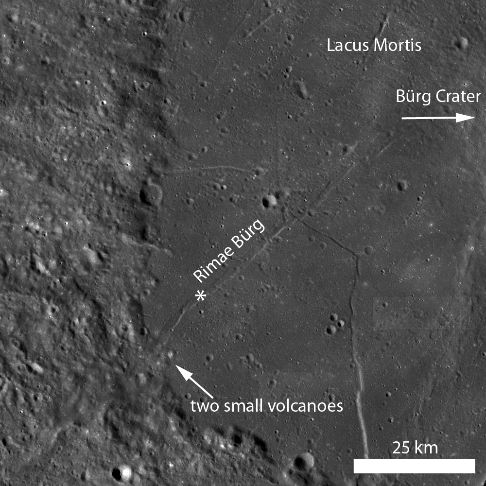
Rimae Bürg is a linear rille with an average width of 2 kilometers. The feature runs more than 60 kilometers through Lacus Mortis, "the lake of death," and continues into the highland terrain where it becomes obscured and reappears as a ridge. Illumination is from the west, and the star designates the location of the LROC Narrow Angle Camera highlighted as the LROC Featured Image, February 12, 2011. View the full-sized annotated mosaic, HERE [NASA/GSFC/Arizona State University].


A portion of the shadowed, southern wall of Rimae Bürg is visible a subset of LROC Narrow Angle Camera observation M129127265R (LRO orbit 4163, May 22, 2010). The rille floor (upper left) is flat, attesting to the horst-graben normal faulting invoked by many as an underlying cause of the formation of many linear rilles on the Moon. Image field of view is 500 meters; illumination is from the west. View the full-sized frame HERE [NASA/GSFC/Arizona State University].

Lillian Ostrach
LROC News System

Traverse the length of Rimae Bürg in the LROC Wide Angle Camera (WAC) monochrome mosaic or explore the rille floor in the LROC the Narrow Angle Camera (NAC) image!


Most of the craters on the Moon formed through impact processes. However, some craters, like the one visible in this portion of LROC NAC frame M131488521R (LRO orbit 4511, June 18, 2010), may be a volcano summit pit crater. Crater diameter is ~400 meters and the image field of view is 923 meters; illumination is from the east [NASA/GSFC/Arizona State University].


A Commissioning Phase Narrow Angle Camera observation from 162.4 kilometers (resolution 1.61 m/p) of the pyroclastic formation where Rimae Bürg crosses up from Lacus Mortis mare material and continues southeast through highland terrain - evidence the surface feature is a manifestation of a deeper rift. LROC NAC frame M102006420R, LRO orbit 512, July 12, 2009 [NASA/GSFC/Arizona State University].


LROC Wide Angle Camera monochrome (689nm) mosaic showing 41km Bürg crater lording over central Lacus Mortis in a relatively high sun; swept up in LRO orbits 1208-1211 on October 1, 2009. Rimae Bürg transects the western shield and the two older worn craters familiar to Earth-bound telescopic observers that accompany "the lake of death" lie outside it's southern and southeastern edge, 46km Playa and pummeled into poor definition 44km Mason (r). View a larger version HERE [NASA/GSFC/Arizona State University].


The "Elephant Skin" phenomena, a nearly ubiquitous dusty cross-hatch pattern on lunar slopes, may be a very appropriate term for a feature on the Moon after all. This montage of 19 LROC NAC and WAC frames, fixed to a Clementine albedo image of west Lacus Mortis, shows any single close-up of the Moon is like "the blind men and the elephant" revealing only a single set of features, and these only as they are seen under one state of illumination and conditions. A great many observations are needed to obtain a comprehensive picture of our dynamic "inconstant Moon" [NASA/DOD/GSFC/Arizona State University].


Close-up on Lacus Mortis from of one of the really outstanding full lunar disk mosaics by Yuri Goryachko, Mikhail Abgarian & Konstantin Morozov of Astonominsk in Minsk, Belarus (Mosaic of 12 images, April 21, 2010) [Astronominsk].

Related Posts:
Linear Graben
Volcanoes in Lacus Mortis
Rupes Recta
Rimae Bradley

Older Posts:
Not your average complex crater
Lunar morphology in the lake of death
Blogger's Best for the Best
Terraced Wall of Bürg

Wednesday, August 11, 2010

Volcanos in the Lake of Death

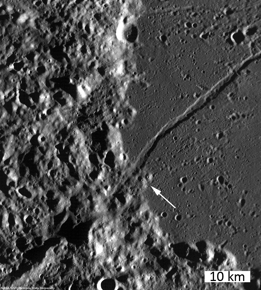
Most of the craters on the Moon formed through impact processes. However, some craters, like the one visible in this portion of the LROC Featured Image "Volcanoes in the Lake of Death," August 11, 2010, may be a volcano summit pit crater. A 923 meter-wide field f view from LROC NAC observation M131488521R, LRO orbit 4511, June 18, 2010; resolution 93 cm per pixel, incidence angle 82.28° from 44.79 km over 44.11°N, 23.94°E [NASA/GSFC/Arizona State University].
Lillian Ostrach
LROC News System

When most people think about volcanism on the Moon, they usually consider the vast mare basalts located primarily on the lunar near side.

However, there are many different volcanic features on the Moon! Sinuous rilles, mare domes, non-mare domes, and pyroclastic deposits are several volcanic features that the LROC NAC studies at 0.50 m/pixel. The opening image in today's Featured Image is an exciting view of what may be the pit crater at the summit of a small volcano. These features which may be similar to terrestrial cinder or scoria cones.

In contrast to lunar volcanoes, such as mare domes, this pair of volcanoes is much smaller - they are only ~1.5 km across the widest portion of their bases (very small by lunar standards!).

From "Lunar Morphology in the Lake of Death," Dec. 17, 2009: Close up on southwestern Lacus Mortis and a 700 meter wide section of 104 km-long graben Rimae Bürg near where it translates from the mare-filled "lake" into the highlands beyond its shore. LRO orbit 211, July 12, 2009; alt. 162.49 km, native res = 1.6 m [NASA/GSFC/Arizona State University].
Investigators during the Apollo years suggested that volcanic features like domes could be present in this region; with the tremendous capability of the LROC instruments, we can now take a closer look and begin to ascertain if this is indeed the case. Located at the highlands-mare boundary, these two features appear to be volcanic in origin and also isolated from other volcanic features (besides the mare) - other regions with prominent volcanoes exhibit several domes within close proximity to one another. So, why are there only two features here, which we interpret to be volcanic in origin? We can't really answer that question with just a single LROC NAC image pair and an LROC WAC monochrome context image of the immediate area. Instead, we need an LROC WAC mosaic that provides a regional view of Lacus Mortis so that any other volcanic or dome-like features can be observed.

Portion of LROC WAC mosaic, centered on the highlands-Lacus Mortis mare contact; arrow points to two probable volcanic features, each of which are roughly 1.5 km across at their widest. Northward of these features is a linear rille that can be traced into the highlands where it appears to transform into a ridge [NASA/GSFC/Arizona State University].
Additionally, when the LROC team discovers new features we can target a stereo observation and make detailed topographic maps to help scientists better understand a features origin. Once a detailed study of the presence, locations, sizes, and forms of any other similar volcanic features are identified in Lacus Mortis, we can begin to assess these geologic features and hypothesize to their origins. For example, in the immediate vicinity shown in the LROC WAC monochrome context image, there is a linear rille (or graben) cutting through the mare, transitioning into a ridge in the highlands. Maybe this tectonic feature has something to do with the volcanic feature?

The Lunar Reconnaissance Orbiter is gradually adding granularity to long-familiar lunar features, like Lacus Mortis. Above, a sampling of LROC NAC observations in southwest Lacus Mortis show how differing illumination angles and altitudes compliment each other to build up what may soon be a first, truly complete view of the lunar surface.

From the LROC WAC frame we cannot distinguish relative ages between the volcanic features and rille, so determining the relationship between these features (if any) remains a mystery (at this time). Clearly, the geology of this immediate area is complex and is a worthwhile candidate for future lunar exploration!

Explore the landscape of Lacus Mortis for yourself, HERE.

Some Relate Posts:
Not your average complex crater, July 28, 2010
Lunar Morphology in the Lake of DeathDecember 17, 2009
Blogger's Best for the Best, December 6, 2009
Terraced Wall of Bürg, July 31, 2009

Wednesday, July 28, 2010

Not your average complex crater


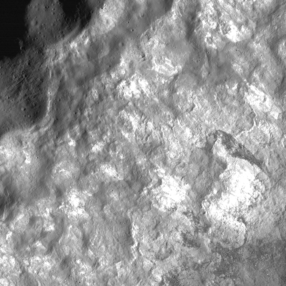
The small, irregular terraces on the walls of Bürg Crater and the debris piles and outcropping wall material, with strong variations in reflectance, only hint at the geologic diversity of this complex crater. Bürg's rim is on the upper left, with downslope direction toward the lower right. Illumination is from the right, Full-sized image HERE, field of view = 870 meters (LROC NAC M116139887R, LRO orbit 2249, December 22, 2009; Altitude 41.33 km, resolution 0.65) [NASA/GSFC/Arizona State University].

Lillian Ostrach
LROC News System

Bürg crater, ~40 km in diameter, is located in Lacus Mortis and represents a fine example of a complex crater.

On the Moon, complex craters form above diameters of about 15 to 20 km. Unlike most simple craters (diameters less than 15 km), complex craters often show a wide range of morphologies and geologic features.

Overall, complex craters exhibit terraced walls, flat floors, and central peaks. However many factors, including bolide composition, bolide velocity, and target composition, influence the complex crater morphology - which is why we observe so many different complex crater varieties.

Subset of a map-projected LROC WAC monochrome context image of Bürg crater. Notice the terraced crater walls, the smooth crater floor, and the well-developed central peaks. The arrow points to the location of the area highlighted in the opening LROC NAC image [NASA/GSFC/Arizona State University].

Bürg crater is unique from many other complex craters because instead of having a broadly circular rim, the crater's rim is scalloped and wavy. Sometimes, pre-existing geologic structures or features help shape a crater during crater formation.

Meteor Crater on Earth has a slightly polygonal shape because of the joints and fractures that pervade the target sedimentary rocks. Could pre-existing joints in the mare basalts filling Lacus Mortis explain the scalloped nature of Bürg's rim? Possibly, but because the overall shape of the crater itself is circular and resembles other complex craters on the Moon, structural influences may have only affected portions of the crater rim, causing differential collapse and terrace formation.

Looking closely at the portion of the LROC WAC image above, there seems to be greater terracing and wall-slumping on the western side of the crater, which also happens to be less circular than the eastern rim. However, before we use this observation to interpret the origin for the scalloped crater rim, we need to look at additional LROC NAC images and the LROC WAC image in detail to substantiate this hypothesis.

Explore Bürg's rim for yourself to see what geologic clues you can find that provide insight into the geologic features of this beautiful complex crater!


Friday, July 31, 2009

Terraced Wall of Bürg

Under control of Arizona State University, the Narrow Angle Camera of the Lunar Reconnaissance Orbiter has not been idle this lunation. Above, our 400 px wide inset cannot begin to give proper context to this latest release, showing astounding detail of a favorite telescopic target of the Near Side's northern hemisphere, Bürg Crater, surrounded by the warped Lacus Mortis, not far from Atlas and Hercules. Follow the ray that bisects Mare Serenitatus through south central Bessel (does that ray only seem to originate with Tycho?). It will lead you to a squarish plateau, where Bürg sits almost directly in the middle. The sides of the apparent plateau are sliced by rilles, some of which pose questions only LRO seems well equipped to answer.

The news release and a links to the image HERE.