Showing posts with label melt. Show all posts

Tuesday, October 22, 2013

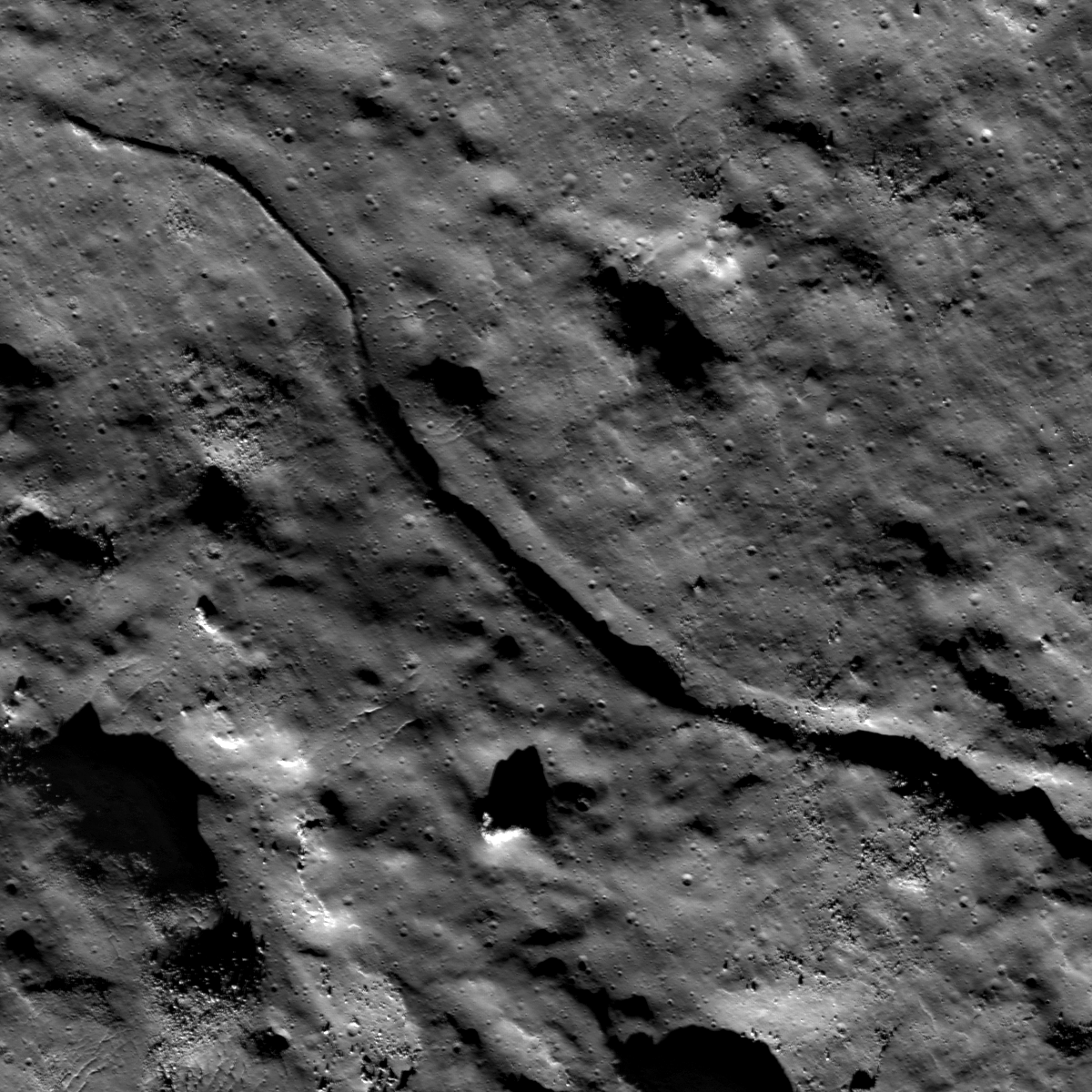
Fractured melt rock on Jackson's terraced wall

M182253065R_1500
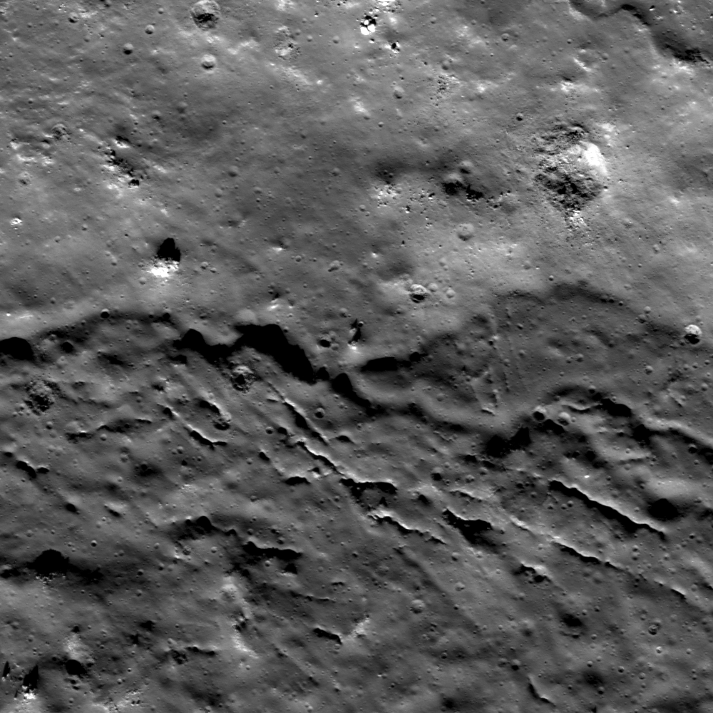
Close-up on fractured impact melt  ponding high on the west wall of Jackson crater. LROC LROC Narrow Angle Camera (NAC) M182253065R, LRO orbit 11965, January 26, 2012. Image 2130 meter-wide field of view centered on 22.534°N, 195.59°E, incidence angle is 57° at 1.47 meters per pixel resolution in the original [NASA/GSFC/Arizona State University].
Hiroyuki Sato
LROC News System

The opening image highlights a fractured pond of impact melt rock inside Jackson crater (72 km diameter). This prominent farside crater is known by its prominent ray system and large amount of impact deposits. Melt pooled not only at the bottom of the crater floor, but also on terraces of the interior wall.

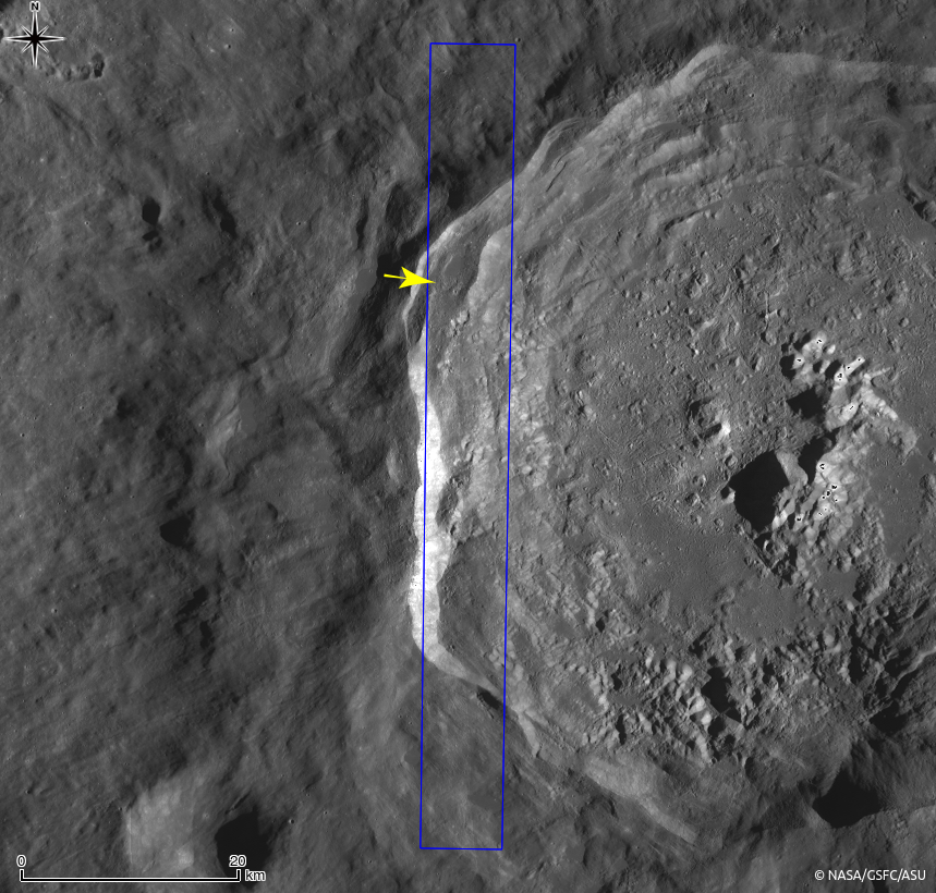
The fractured melt sheet in the opening image is found amongst a grouping of melt lakes on a western crater wall terrace (see WAC context image below).

M182253065R_context
Western part of Jackson crater and surrounding areas in LROC WAC monochrome mosaic (100 m/pix). The NAC footprint (blue box) and the location of opening image (yellow arrow) are indicated [NASA/GSFC/Arizona State University].
Detached fragments from the main body of melt sheet look like a jigsaw puzzle (upper smooth surfaced portion of the image). These fragments give an impression of the thin and brittle nature of solidified impact melt. Shadow lengths show these fractured pieces to be 5 to 8 meters thick. What caused the once level and smooth ponded surface to fracture? We don't know for sure, but by looking at the whole area a plausible story can be imagined. The south part of the melt lake with the fractured plates is connected to another melt lake at a lower elevation. Perhaps drainage of subsurface unsolidified melt might have dragged a crust toward the south and broken the it into many blocky pieces. Tectonic deformation of the crater wall, perhaps consisting of whole terraces deforming, also might have occurred which could deform the brittle crust of melt ponds.

Jackson crater from Kaguya
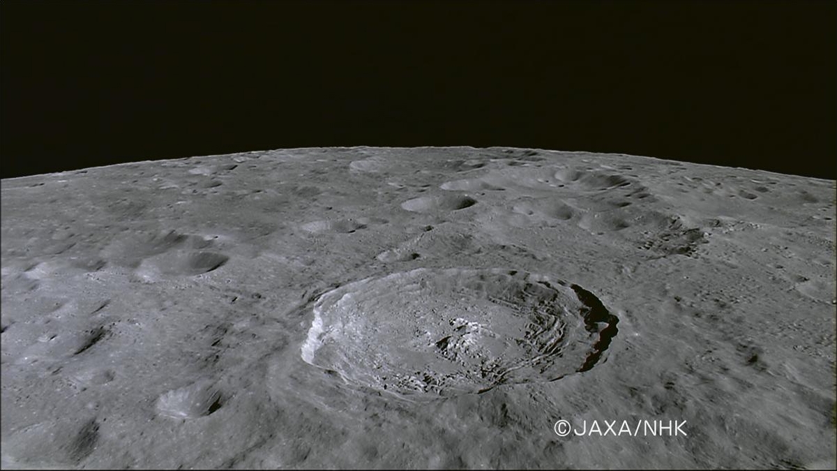
Farside Copernican age landmark crater Jackson viewed through NHK's HDTV camera aboard Japan's lunar orbiter SELENE-1 (Kaguya) in late 2007. View the 1200 pixel-wide press release image HERE [JAXA/NHK/SELENE].
Explore this mosaic of fractured melt rock and surroundings to help unravel the complex history of Jackson crater in the full NAC frame HERE.

Related Posts:
Cracked mound (February 16, 2012)
Melt Fractures in Jackson Crater (January 20, 2012)
Tycho's flash-frozen inferno (November 2, 2011)
Waves (August 10, 2011)
Polygonal fractures on Tycho ejecta deposits (June 14, 2011)
Fragmented Impact Melt (February 25, 2011)
LOLA's Jackson crater (July 11, 2010)

Moore F Impact Melt (October 30, 2009)

Wednesday, July 31, 2013

Melted Moon

Click for full resolution LROC mosaic
The fresh lunar crater Giordano Bruno -a wealth of fascinating landforms to study. (click image for full resolution view, or HERE for a wider, medium resolution field of view showing the entire crater) [NASA/GSFC/Arizona State University].
Paul D. Spudis
The Once and Future Moon
Smithsonian Air & Space


Prior to the Space Age, one of the longest running controversies in lunar science was over the origin of the Moon’s craters.  Two camps emerged, one favoring an internal (volcanic) origin and the other an external (impact by solid bodies) origin.  Although this debate was finally resolved in favor of impact, the argument was long and vehement, reigniting at one point during the flight of the last of the robotic precursor probes to the Moon, prior to the Apollo landings.  Although the basic physics of impact were well understood by the mid-1960s, this newest argument centered around high-resolution pictures obtained by Lunar Orbiter 5 (1967) of the fresh (and therefore young) crater Tycho.  These spectacular images showed a multitude of flows, smooth ponds, and fluid rock, seemingly draped over hills and hummocks (like a chocolate shell coating over a scoop of ice cream).

An asteroid possesses an enormous amount of kinetic energy when it strikes a planetary body at very high speeds.  On contact, the asteroid vaporizes and the surface target rocks are intensely compressed.   After the shock wave has passed, these rocks decompress and the release of this energy totally melts part of the crustal target.  This material is said to be shock melted, with the resulting liquid called impact melt.  Impact melt was first described from craters on the Earth, particularly some of the very large impact craters found on the ancient Canadian Shield.  These rocks superficially resemble some volcanic rocks, having both fine-grained textures and partly melted inclusions.  But unlike volcanic rocks, they have high concentrations of siderophile (“iron-loving”) elements, such as iridium.  These elements are extremely rare in the Earth’s crust, but are more abundant in meteorites and asteroids.  It is thought that they are added to the melt from the incoming projectile.

The newest chapter in the argument about the origin of craters came about because some landforms around Tycho look similar to small-scale volcanic features on Earth.  The idea proposed was that the craters had been formed by impact, with those collisions triggering volcanic activity and producing multiple episodes of eruption at Tycho and other craters.  At first glance, such a scenario seems plausible.  After all, impact is a catastrophic event and one can imagine churning seas of subsurface liquid rock, released suddenly through the creation of fractures deep in the crust.  But the Moon’s interior is relatively cool.  If interior melt exists, it is at a level much too deep for any reasonably sized impact to tap.  But these amazing landforms needed to be explained.  What might they represent?

We found abundant physical and chemical evidence for impact (including shock-melted rocks) by studying the Apollo samples.  They appear similar to volcanic lava, with inclusions, melt textures and even vesicles (holes), comparable to the ones produced by magmatic volatiles coming out of solution in basaltic lavas on Earth.  Although it took a bit of study (and many more arguments) to establish their origin, shock melting became recognized as an important lunar (and Earth) impact process.

M160029952LR-109-1160x1600
Breech in the northwest rim of Tycho connects to the spectacular melt ponds inside out outside of the 109 million year old landmark crater. Illustration originally from "Landing Site at Tycho North," March 20, 2013 [NASA/GSFC/Arizona State University].
The images of the flows and ponds seen around Tycho and other fresh lunar craters led to a better understanding of how these rocks formed.  Although we knew about impact melting from the study of Earth’s craters (and had found evidence of the same in lunar samples), some researchers still weren’t convinced that we were seeing flows of liquid impact melt on the Moon.  The leading non-volcanic alternative was that these features were flows of dry, fine-grained granular debris.  In part, this interpretation proceeded from the observation that the thermal signatures of some of these melt-like flows suggested the presence of fine debris rather than bare, jagged rock.  Yet other data, such as radar backscatter, suggested that rough surfaces were common, while extremely high-resolution images showed abundant blocky craters on the surfaces of the flows, suggesting they were composed of solidified rock.

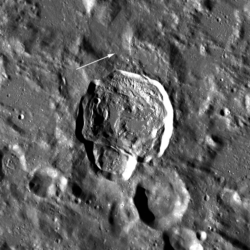
Landing site of Surveyor 7 (arrow) in relation to it's hoped for target, the kilometer-sized impact melt pond immediately to the northeast, part of the spectacular melt throughout the vicinity of Tycho [NASA/GSFC/Arizona State University].
Images from the robotic Surveyor 7 (1968) spacecraft, which landed on the rim of Tycho, revealed the thinnest regolith (soil) covering of any site on the Moon.  Visible in the surface panoramas were flow features covering the distant hills.  It took a great deal of painstaking, detailed work to establish that these flows and ponds were composed of liquid rock, created simultaneously with their host crater and likely originated by impact melting and subsequent solidification.

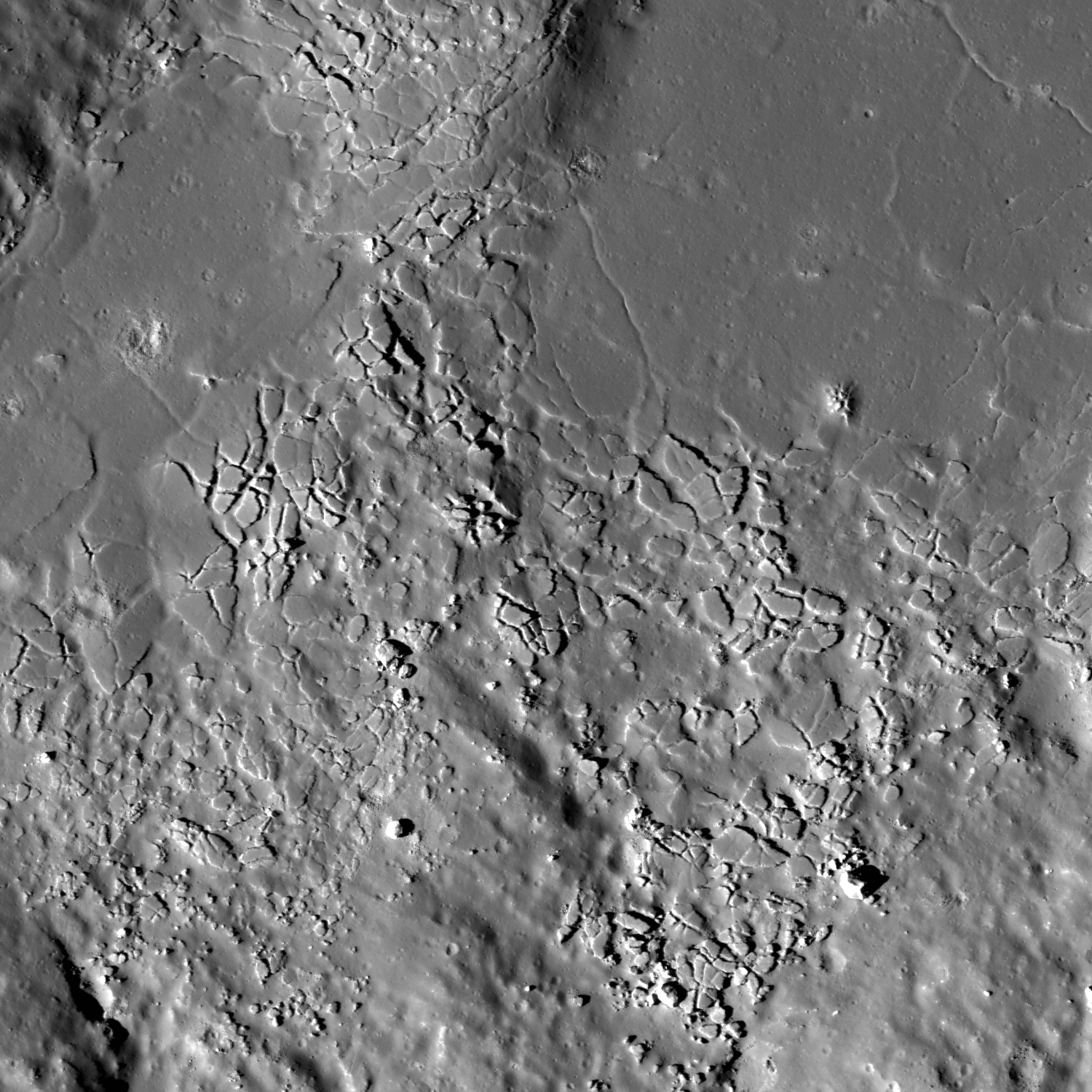
For the last several years, NASA’s Lunar Reconnaissance Orbiter (LRO) has been sending us new and astonishing views of the Moon’s impact melt flows.  Whereas fresh craters like Tycho, Aristarchus and Copernicus were well known from previous Lunar Orbiter frames, far side craters like the spectacular Giordano Bruno can now be seen with incredible clarity.  G. Bruno is one of the very youngest craters on the Moon.  A low density of craters overlying G. Bruno suggests an age of less than a couple million years (extremely young on a planet where most features count years in the billions).  It is an astonishing spectacle of melt shapes and deposits (cracked floors, pools, flow festoons and lobes); the crater floor has an amazing whirlpool of solidified melt. All these features indicate that after the crater formed, the impact melt was mobile, flowing and collecting, and ponding in low areas.

Impact melt forms a swirled feature in Giordano Bruno crater. Field of view 1 kilometer. From LROC Narrow Angle Camera (NAC) observation M143947267L LRO orbit 6347, November 9, 2010; 53.08° angle of incidence, 57 centimeters per pixel resolution from 54.50 km. Illustration from "Giordano Bruno Whorl," June 8, 2013 [NASA/GSFC/Arizona State University].
Impact melts are of great interest to geologists.  Unlike other crater ejecta, the radiometric clocks of impact melts are completely re-set by the melting.  Thus, if a sample can be obtained first-hand, directly from an observed flow or pool of melt around a host crater, the age of that rock specifically and unambiguously dates the impact event.  Unfortunately, we did not visit such deposits during the Apollo explorations.  What we do have are loose samples of lunar impact melt but not their scientifically important corresponding geological context.  It is for this reason that the age and sequence of early lunar history is so contentious – we must make educated guesses about where certain melt rocks come from.  If we get the context wrong, then our conclusions about the history of the Moon are incorrect.

Increased understanding of the generation and deposition of impact melt comes from the new images obtained by the LRO camera of the geologic setting of impact melts.  Future sample return missions to the Moon can be directed to landing sites that will provide us with samples of clear geological context (that they were from that area and not just flung there by an impact occurring elsewhere on the lunar surface).  As features age on the Moon, subsequent geologic events (such as superposition of new units) bury or erase the original event making the context less clear.  This problem is particularly acute for the oldest features on the Moon (multi-ring impact basins).  By studying the geology of the freshest lunar features (such as Tycho and other fresh craters), we understand how the older impact features looked immediately after their formation.  Thus, they serve as a guide to the interpretation of the older features.  On the Moon, as on the Earth, as Charles Lyell, the 19th century author of the classic Principles of Geology aptly put it:  The present is the key to the past.

Collection of spectacular impact melt features from LRO:
Giordano Bruno high-resolution full view
G. Bruno sunset
G. Bruno flows
G. Bruno cracked melts
Tycho oblique
Tycho floor
Tycho river of rock

Originally published July 31, 2013 at his Smithsonian Air & Space blog The Once and Future Moon, Dr. Spudis is a senior staff scientist at the Lunar and Planetary Institute. The opinions expressed are those of the author but are better informed than average

Wednesday, January 16, 2013

Melt overlap at Anaxagoras

Two lobes of impact melt marking the boundary of the floor of Anaxagoras crater overlapped before solidifying against the crater wall. LROC Narrow Angle Camera (NAC) observation M185964003L, LRO orbit 12484, March 9, 2012; image field of view near 1.8 km, angle of incidence at this high latitude 73.06° with a resolution of 1.76 meters from 179.53 km [NASA/GSFC/Arizona State University].
Lillian Ostrach
LROC News System

Although impact crater formation is a nearly instantaneous event, impact melt cooling is not. For large craters such as Tycho, Copernicus, and Anaxagoras, so much impact melt was created during the impact process that the crater floors were, in effect, flooded by molten seas of melt. The melt pooled in topographic lows, flowed around the central peaks, and became mixed with loose ejecta blocks to create a hummocky texture on the crater floor.

Cooling cracks and collapse pits are prevalent; subparallel groupings of cracks are common near melt boundaries and in regions with entrained blocks.

LROC WAC monochrome mosaic of Anaxagoras crater (73.458°N, 349.934°E, 52 km diameter). Location of the field of view shown at high resolution in the LROC Featured Image released January 16, 2013 noted by arrow [NASA/GSFC/Arizona State University].
Like volcanic lava, impact melt may remain molten for an appreciable amount of time - days, weeks, and years in some cases. The floor melt pond in Anaxagoras was molten for a while, and mobile enough to splash onto the crater walls to form "bathtub rings" (upper right corner in the opening image, also beautifully visible in more detail in the full NAC image). The splashing probably occurred as large blocks of wall material slumped into the ponded melt causing a tsunami of melt!

Today's Featured Image focuses on the boundary of the floor melt pond with the northern crater wall where two lobes of melt overlapped (73.830°N, 350.368°E). Looking to the left of the image, you can trace the melt contact with the crater wall and follow it toward the right side of the image. A moat-like boundary at the edge of the flow of this top layer of melt distinguishes it from the layer beneath. The stratigraphically lower layer of melt is first visible in the center of the image and extends toward the image right.

What may have happened was that this section of the melt splashed up the crater wall to form the first bathtub ring (barely visible in the opening image top right) and flowed back down the wall. Then the melt flowed up the wall again where some melt stuck to the wall because it had sufficiently cooled and a crust had formed, and the melt stuck up on the wall (lobe on the right side of the opening image). Perhaps the melt near the center of this sub-pond remained quite warm and mobile and the melt flowed again toward the wall. The melt then onlapped and superposed the cooled, frozen section of melt near the wall but the melt boundary with the wall cooled sufficiently to stick and totally freeze, thus preserving multiple splashes and slurps of melt on the crater wall. But that is only one possible story - topographic data, melt cooling models, and observations at other craters would be helpful in discovering the history of melt cooling at Anaxagoras.

Check it out! Take a look at the full LROC NAC image HERE - how many impact melt "bathtub rings" and overlapping melt lobes can you find?

Related Posts:
Impact melt in Anaxagoras crater
More Impact Melt!

UPDATE: There are LROC NAC observations of the interior melt overlap at Anaxagoras at higher resolution, more than there are of equatorial targets on average, for example, LRO revolves around the Moon in a polar orbit, and, like lines of longitude, the vehicle’s orbital path traced out on the surface below converge at the poles. Targets like Anaxagora, at relatively high latitude, have, thus far, received overlapping attention.

The Copernican age crater get more attention because its relatively new, as well, less beaten down and gardened by space weather and micrometeorites. It takes up a considerable volume of the interior of the larger, and considerably older Goldschmidt crater, where the Cassini spacecraft, on its way to Saturn, appears to have detected water or hydroxyl molecules in broad daylight.

One particularly close observation in addition to the one at the top of this post is highlighted below, showing three distinctive “bathtub rings,” a steady surf that came to a halt before the energy that created it played out. In fact, that same energy is still present. Can these observations allow scientists to measure the time between the melt formation and its frozen state? 

A 2460 meter-wide field of view overlapping the same area shown in the LROC Featured Image, released January 16, 2013, with the three areas shown at full resolution in the images that follow outlined in rectangles. LROC NAC observation M124628200R, spacecraft orbit 3500, March 30, 2010; angle of incidence 72.08° at an original resolution of 49 cm per pixel from 43.61 km [NASA/GSFC/Arizona State University].
The highest, northern most ‘slosh’ in the field of view appears to have been energetic or directed enough, or both, to have moved a considerable amount of debris [NASA/GSFC/Arizona State University].
This slosh appears to have been retreating, even as the a wave further south was gaining and over lapping it, leaving debris like sea shells in a scene witnessed in motion by anyone who has walked along a terrestrial beach [NASA/GSFC/Arizona State University].
Was this later wave really of a greater magnitude than the others? Did the surface lose its viscosity suddenly? Did material heap up behind or below? Was this process really slow or sudden? [NASA/GSFC/Arizona State University].

Wednesday, October 31, 2012

Ghosts of Fecunditatis

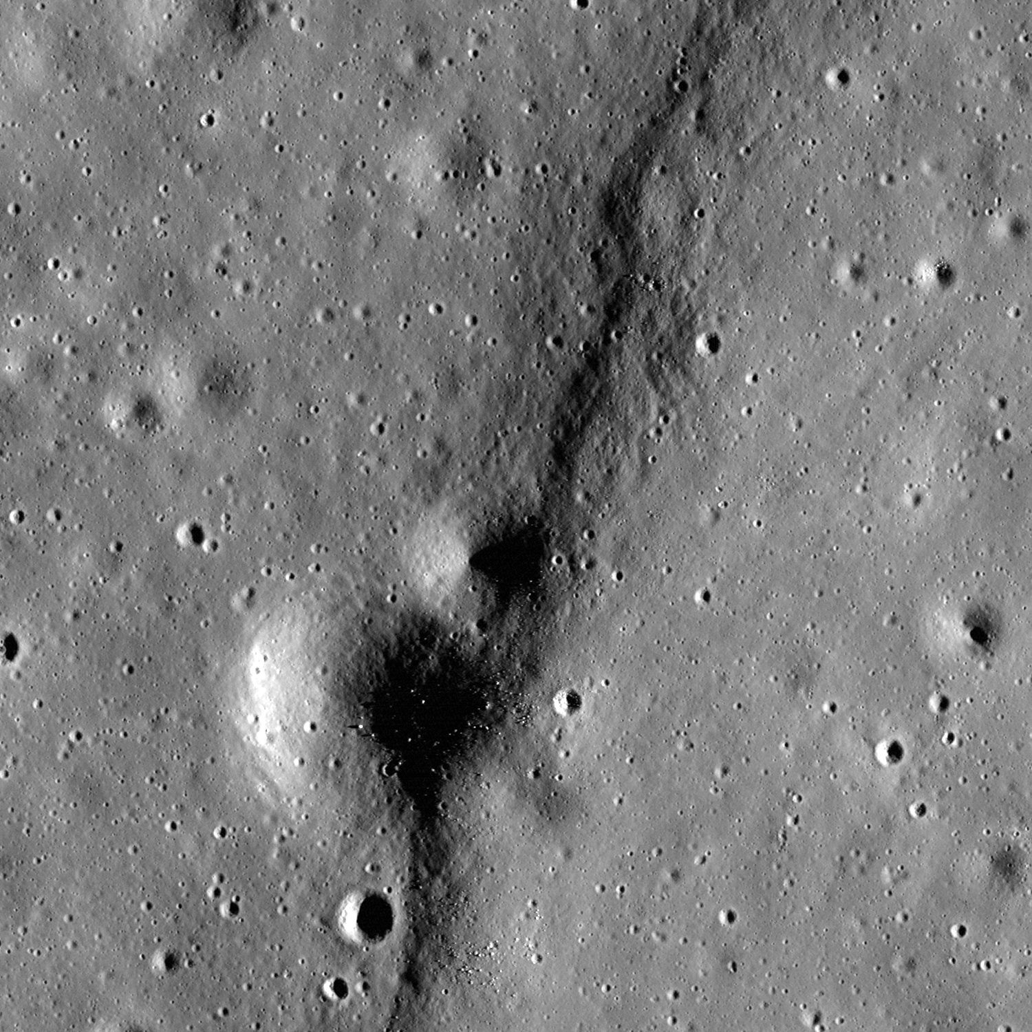
A gentle but distinctive topographic high designates the location of an ancient crater rim, nearly covered by basin flooding by volcanism, inside the boundaries of Mare Fecunditatis. LROC Narrow Angle Camera (NAC) frame M146662326L, illumination is from the east, angle of incidence 72.34° ; an approximately 1 kilometers-wide wide field of view at 0.98 meters resolution (in the original) from 47 kilometers altitude [NASA/GSFC/Arizona State University].
James Ashley
LROC News System

Today's Featured Image focuses on ancient craters that predate mare basin flooding, and which are often recognized by subdued, sometimes discontinuous circular patterns best seen near local lunar sunrise and sunset (high solar incidence as measured from the surface normal). These circles mark the locations of once majestic excavations in the lunar crust. However the emplacement of volcanic deposits filling, surrounding, and overtopping the rims have buried these ancient craters in many instances. The presence of the near-surface rims produce local stresses in the deposits, which in turn deform the mare layers. The result is a wrinkle ridge-like topography with a circular pattern. They are thus often referred to as "ghost" craters, and can be found haunting many large, basin-filling mare deposits.

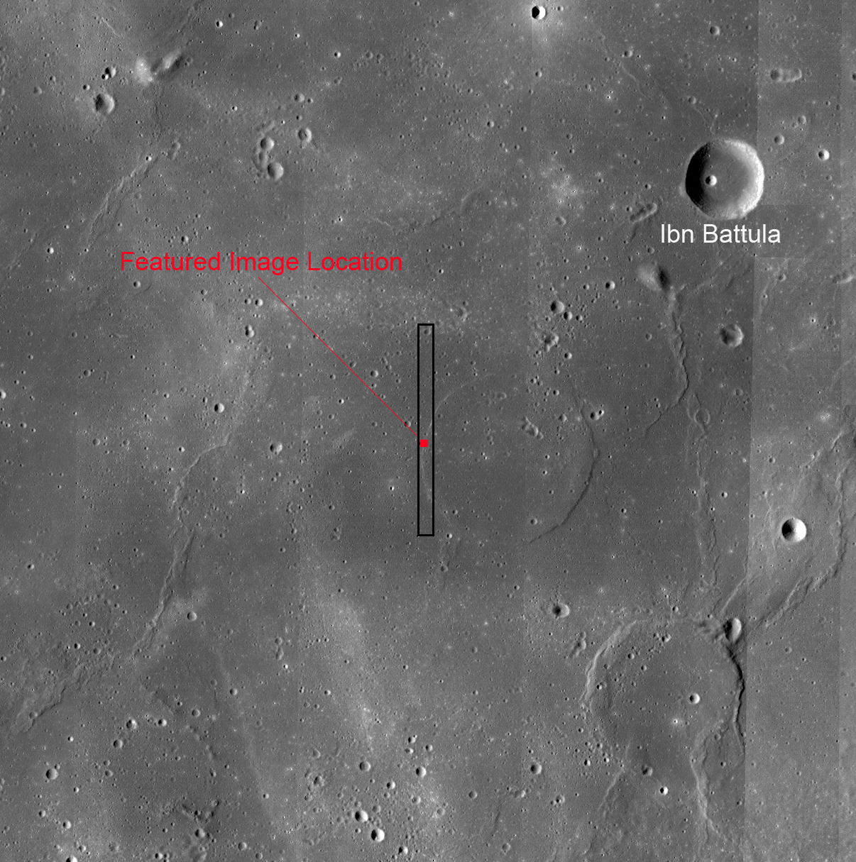
LROC Wide Angle Camera (WAC) mosaic centered on the Featured Image field of view. Note a second and more prominent ghost crater (Goclenius U) in the southeast corner of this approximately 120 km-wide frame [NASA/GSFC/Arizona State University.

At least two large ghost craters can be found here in the Mare Fecunditatis basin just south and southwest of the crater Ibn Battula. Some portions are simply unrecognizable as former crater rims without the large scale mosaic for context (see example below).

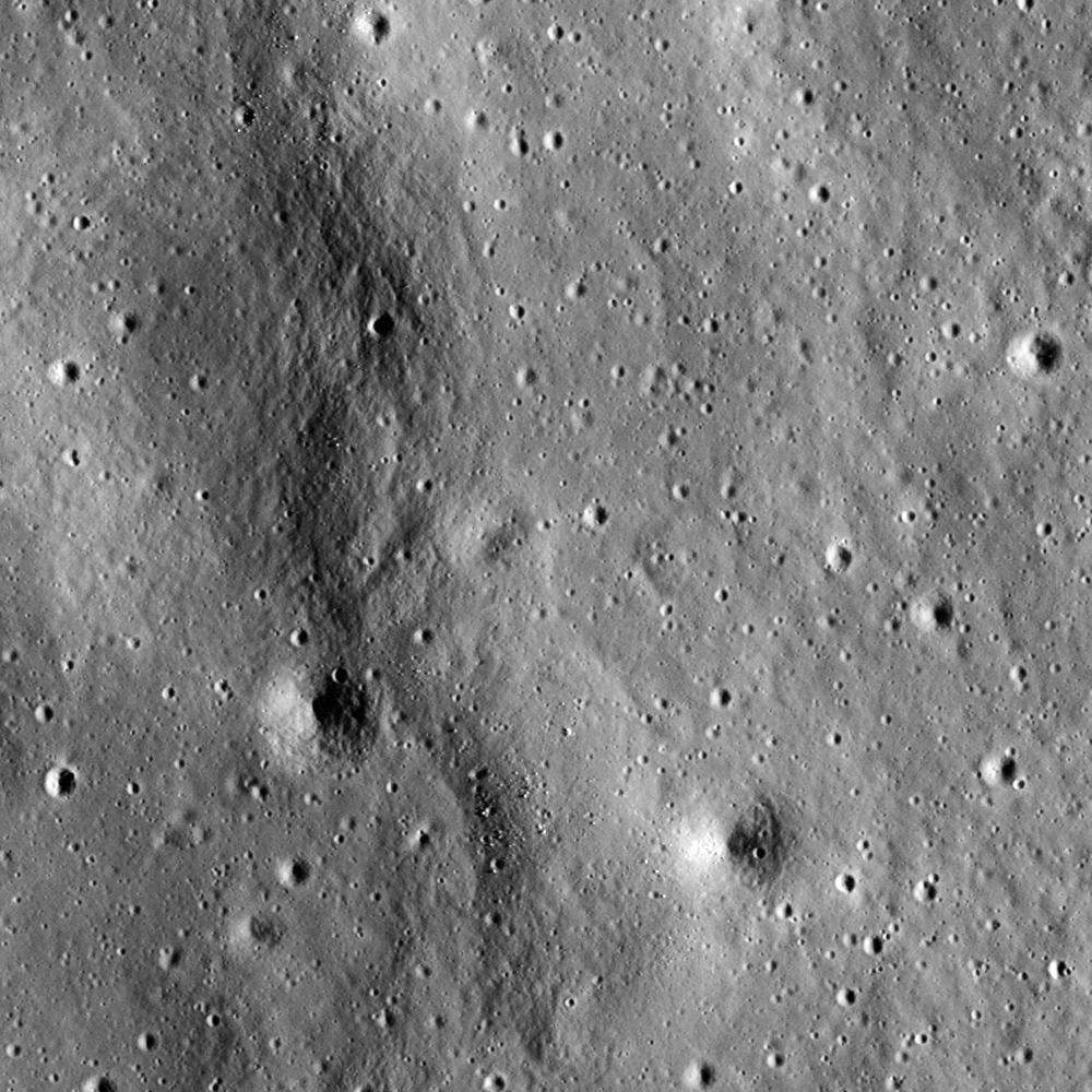
Another portion of the crater rim gives a muted appearance like that of a snow-covered park bench. Field of view width is ~700 meters.

Examine the full NAC frame (HERE) to see a greater length of ghost crater rim. Another example of a ghost crater is presented in the Ghost Crater in Southern Mare Crisium, a Tier 2 Constellation program Region of Interest. Contrast the appearance of a ghost crater to that of a flooded crater (e.g., as in Balcony Over Plato).

Wednesday, October 17, 2012

A Beautiful Bench Crater

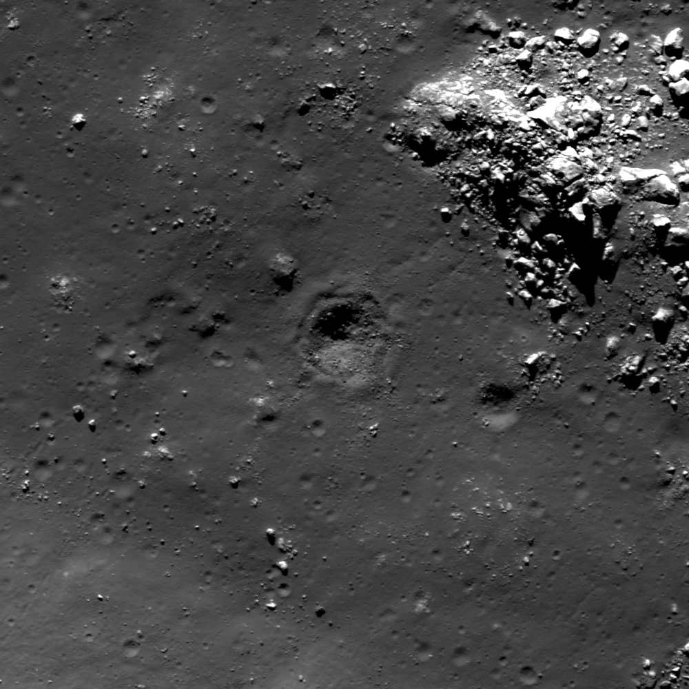
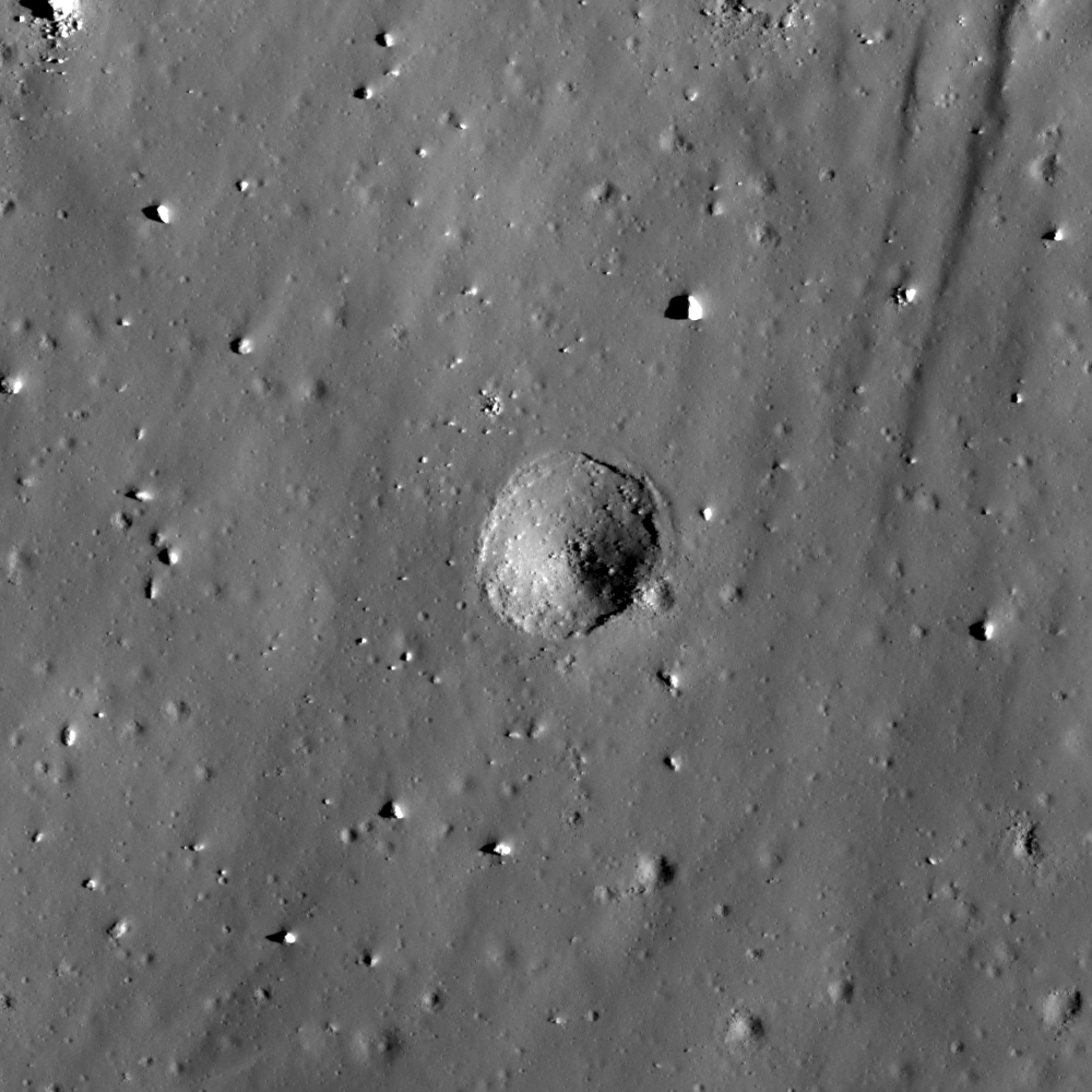
A beautiful bench crater, formed in melt trapped on a western wall terrace of Rutherfurd crater, south of Clavius on the lunar near side. A 300 meter-wide field of view from LROC Narrow Angle Camera (NAC) observation M185961318R, spacecraft orbit 12483, March 9, 2012; resolution 0.52 meters from 51.29 km [NASA/GSFC/Arizona State University].
Lillian Ostrach
LROC News System

Regolith covers the lunar surface, and the thickness of regolith on the surface is related to the age of the surface. Older surfaces have thicker regolith layers than younger surfaces, and observations of crater morphologies are used to learn about the regolith for a specific area. Bench craters form in layered targets when there are variations in strength between the layers because different strength targets require different amounts of energy during the excavation phase of impact cratering. On the Moon, bench crater formation is usually interpreted to result when a bolide punches through an unconsolidated regolith layer to excavate a more cohesive layer such as mare basalt bedrock. The 75 m diameter bench crater in the opening image (61.504°S, 346.728°E) is a prime example of a bench crater that formed in an impact melt pond that is covered by a thin layer of regolith. However, observations of LROC NAC images show some bench craters like the one above to be self secondary craters, formed during the last stages of the impact process. It may be that the bench crater above was one of the last secondary craters formed during the Rutherfurd impact event, soon after the melt was emplaced, but without further study, we cannot be certain.

LROC WAC monochrome 64 meter resolution mosaic of Rutherfurd crater (61.186°S, 347.683°E, ~47 km diameter), from LROC QuickMap. Featured Image field of view noted by plot point on the southwestern crater wall [NASA/GSFC/Arizona State University].

The smoothed, softened texture of the pond surface, absence of cracks and fractures in the melt, and presence of superposed impact craters of various sizes and degradational states provide evidence of a layer of regolith in this area. If the 75 m diameter bench crater is not a self secondary crater, the projectile that formed the crater likely excavated roughly 7-8 m into the melt rock. Meter-sized boulders distributed within and around the eastern portion of the bench crater support an impact into a consolidated target and the formation of these boulders during excavation of the crater. Besides confirming the results of experiments conducted in the 1960s with layered targets, today's bench crater might be used to help constrain the depth of the impact melt pond. If there are other craters of similar degradational state in the pond, the morphology of these craters could be studied to help constrain not only the regolith thickness but also perhaps the thickness of the melt pond in this region. Unfortunately, it looks like the ~40 m diameter crater to the right of the bench crater may too degraded or affected by the boulders outcropping toward the upper right of the image. Additionally, finding these craters may prove difficult because the Featured Image may be the location of the only small melt pond with a bench crater in this portion of the Rutherfurd crater wall and any bench craters occurring elsewhere may reflect the strength contrast between the impact melt veneer on Rutherfurd's wall and the crater wall material.

How many bench craters can you find in the full LROC NAC frame? Are the bench craters located in small melt ponds or in the impact melt veneer on Rutherfurd's wall? If you find bench craters in the melt veneer, what two layers do you think might be responsible for forming the bench (hint: think about what the melt veneer covered) if the craters are not self secondaries?

Related Posts:
Not so Simple!
Fresh Bench Crater in Oceanus Procellarum
Bench Crater in Plato

Tuesday, October 16, 2012

Winding Channel of Melt

Impact melt channel winding its way down Anaxagoras crater wall, on its descent to the floor. LROC Narrow Angle Camera (NAC) frame M185956855L, LRO orbit 12484, March 9, 2012' image field of view 2.2 km (downslope to upper left), angle of incidence 73.06° at 1.76 meters resolution, from 179.79 kilometers [NASA/GSFC/Arizona State University].
Lillian Ostrach
LROC News System

Anaxagoras crater (73.458°N, 349.934°E, ~52 km diameter) is a complex crater with terraced walls, central peak, and substantial impact melt deposits. After impact melt is created during the impact event, significant portions are often ejected from the crater in much the same way as the unconsolidated excavated rock that forms the typical ejecta blanket. However, most melt does not contain sufficient energy to escape the crater interior and is instead splashed onto the crater walls. If the melt remains hot enough, the splashes and globs of melt on the walls may coalesce and descend toward the crater floor under the influence of gravity.

Sometimes, the flowing impact melt creates channels by eroding the substrate or building up levees. In today's Featured Image, an impact melt channel formed in the lower section of crater wall terraces, near the last major break in slope close to the crater floor (73.286°N, 351.500°E). Many small, channel-like features occur in this area of the crater wall, and the channel origin is difficult to discern and may actually be located upslope to the lower left, outside the view of the Featured Image. Often, channels form in a path of least resistance, that is, where preexisting fractures and weakness occur - and crater wall terraces are prime locations for heavily fractured target rock. This channel ranges from ~95 m to 160 m across and has clearly defined walls until the upper right of the image, when part of the channel disappears. Why the disappearing act?


LROC WAC monochrome (604nm) mosaic of Anaxagoras stitched from 10 passes March 21, 2011, or a bit less than a full year prior to the opening NAC observation. The arrow indicates the location of NAC Featured Image field of view [NASA/GSFC/Arizona State University].
Flowing impact melt has a specific lifetime and when the melt cools enough, it stops flowing. There are a couple of plausible explanations for the disappearance of one of the channel walls. First, some melt may have traveled down the channel until it cooled enough solidify near the tail end of the channel, thus clogging the channel pipeline. Alternatively, a relatively thick veneer of melt may have been splashed onto the wall at a late stage, thus obscuring and erasing the channel wall. Another possibility is that there is a change in slope that influenced the melt to breach the channel wall and instead flow toward the top of the image, an explanation perhaps supported by the change in concavity in the channel from concave up (somewhat U-shape) to concave down (upside-down U-shape). However, additional observations, including the use of a NAC derived topographic maps, are crucial to determine which hypothesis (or another!) is the best explanation.

How many impact melt channels can you find in the full LROC NAC image, HERE.

Related Posts:
Anaxagoras Exterior Melt
On the Floor of Thales
Lichtenberg B Flow
Impact melt channel

Thursday, October 11, 2012

Hole on A Melt Sheet

A portion of the impact melt sheet on the floor of crater Korolev X. Image centered on 0.699°N, 200.594°E, field of view is 638 meters, illumination from the right, or east. From LROC Narrow Angle Camera (NAC) observation M145664820R, LRO orbit 6600, November 29, 2010; angle of incidence 61.4° at 0.64 meters resolution, from 61.62 kilometers  [NASA/GSFC/Arizona State University].
Hiroyuki Sato
LROC News System

Korolev X is a 25-km crater located at 0.54°N, 200.59°E. As seen in the bottom image, the northern rim of this crater was destroyed by a younger crater about 16 km in diameter. The heat from the impact that formed this younger crater melted a large volume of rock, which flowed down onto the floor of Korolev X, creating a sheet of solidified melt 14 x 5 km across. The opening image highlights a dent in the surface of this melt sheet.

This dent is about 105 meters in diameter. Considering the existence of multiple, similarly-sized (around 100 m in diameter) craters on this melt sheet, this dent is most likely an impact crater even though neither an ejecta blanket nor a raised rim can be clearly recognized. Along the top of the crater wall there appears to be a thin layer of the melt sheet that is exposed and highlighted by the angle of the sun. Below this surface layer no clear layering is observed, implying a rather homogeneous structure. Small craters like this are often observed in impact melt sheets, and why they lack typical features of impact craters (a well-defined raised rim, a thick ejecta blanket) is still not well known. Could these craters have formed when the impact melt was still partially molten?

Korolev X and surroundings from an LROC WAC monochrome mosaic (100 m/pixel) centered near 0.52°N, 200.57°E. The blue box indicates the footprint of LROC NAC observation M145664820R with their Featured Image field of view designated by the yellow arrow [NASA/GSFC/Arizona State University].

Explore various strangely shaped craters on this melt sheet in full NAC frame yourself, HERE.

Related Posts:
Necho Crater
Scalelike Impact Melts
Impacts on the Melts
Impact Melt Deposits On A Crater Rim

More detail, at small scale, shows the elevation range north and south of Korolev X, near the rim of mighty Korolev basin. Less than 200 km to the north of the area of interest is the Moon's highest elevation. Though all of Korolev range as high as 10.2 km lower than the east rim of Engel'gardt (and unlike the familiar nearside basins), nowhere in Korolev falls below the Moon's global mean. The farside of the Moon is very different than the nearside [NASA/GSFC/Arizona State University/DLR].

Thursday, October 4, 2012

Byrgius A ejecta

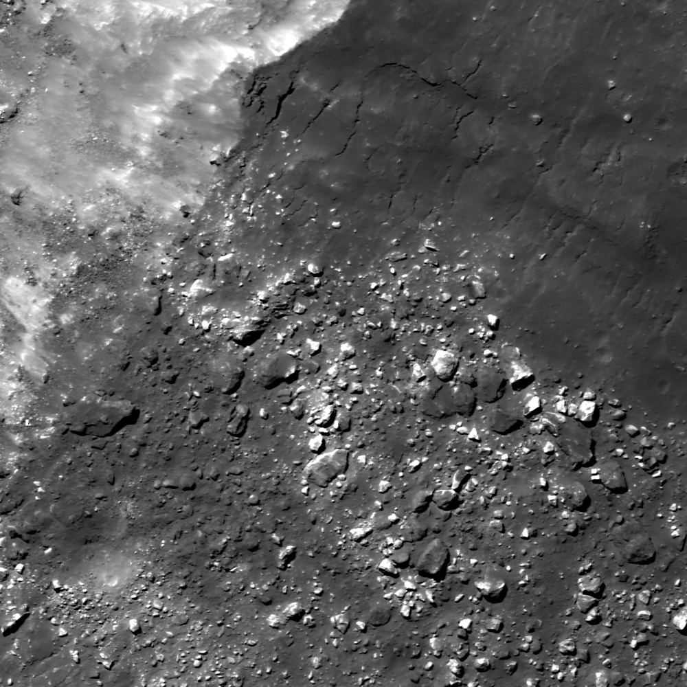
A mix of boulders and impact melt lie just beyond the rim of Byrgius A. 1000 meter wide field of view from LROC Narrow Angle Camera (NAC) observation M1101631740LE, LRO orbit 14676, September 7, 2012 [NASA/GSFC/Arizona State University].
Drew Enns
LROC News System

We have featured the impact melt flows of Byrgius A before, but today we are focusing on the ejecta. 

Above we can see that the ejecta blocks have a mixture of two reflectance levels. Maybe the impact is excavating two separate geologic units: one with low reflectance, and the other with high reflectance. 

Or, perhaps the bright, high reflectance ejecta blocks were covered by darker, lower reflectance impact melt. 

Can we figure out which hypothesis is correct?

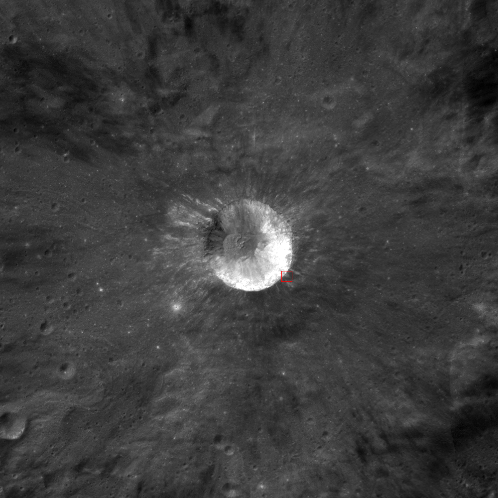
Outstanding LROC Wide Angle Camera (WAC) context image of Byrgius A (24.577°, 296.198° E). The subject of the LROC Featured Image, released October 4, 2012 is marked by the red box. Discontinuous bright streaks radiating from Byrgius A are boulder fields similar to the scene with that Featured Image. [NASA/GSFC/Arizona State University].
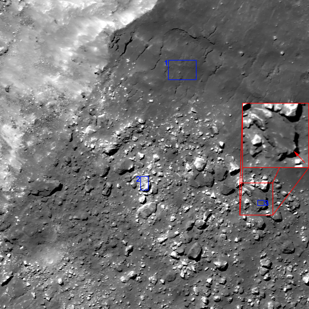
If the crater is excavating two different units, then we should expect to see nearby craters exposing the same. We don't see this in the context image. Several lines of evidence argue instead that impact melt covers some boulders: [1] the darker boulders have a similar reflectance to the impact melt, and [2] the dark boulders have pools of material.

A more detailed view of the latest LROC Featured Image. Boxes show areas where reflectance was measured for: [1] impact melt, [2] a bright boulder, and [3] a dark boulder. The red box zooms in on a boulder covered by ponded dark material [NASA/GSFC/Arizona State University].
Nearby melt on the rim has formed a veneer over the original surface, and we can see the melt fracturing parallel to the crater rim. This veneer unit has a reflectance of 0.14, close to the dark boulders with a reflectance of 0.155. The bright boulders have a reflectance of 0.25. The dark boulders also have small ponds of material. Larger melt ponds develop in depressions exterior to their parent crater, and this is likely the same process operating on a small scale.

Can you test the hypotheses further with the full LROC NAC, HERE?

Related Posts:

Brygius A is often cited by naked eye observers, it's wide, bright ejecta field overpowering the southwestern limb from when the Moon is full through its later waning phases. From a spectacular mosaic of 20 images swept up by by ASTRONOMINSK, 2300 UT, September 3, 2012.

Wednesday, September 19, 2012

La Pérouse A Impact Melt

Solidified impact melt flows outside the crater La Pérouse A. Another crop from LROC Narrow Angle Camera (NAC) frame M152390311R, spacecraft orbit 7591, February 15, 2011; 51 cm resolution from 46.56 km,  image width 705 meters [NASA/GSFC/Arizona State University].
Sarah Braden
LROC News System

Today's Featured Image shows impact melt flows near the outer rim of the crater La Pérouse A (4.08 km in diameter, 9.268°S, 74.705°E). Distinct channels and flow lobes are visible within this area. Small channels and levees are visible along the edges of some of the individual flows. As the melt moved farther away from the crater rim (the crater rim is toward the top of the image), the melt cooled. At the end of each flow lies a deposit of impact melt material. More impact melt may have been emplaced around the rim of the crater, but the landslide of highland material could have destroyed it.

The crater La Pérouse A is a very young satellite crater of the larger (80.4 km diameter) La Pérouse crater group, named after the French explorer Jean Francois de Galoup, known as Comte De La Pérouse. The Comte De La Pérouse sent his expedition journals and charts back to Europe shortly before he and his expedition disappeared. If he hadn't sent this information back, he probably wouldn't have a lunar crater named after him, since later on the shipwrecks of his two boats were found in Oceania.

For context, the impact melt field in the LROC Featured Image on the southern flank of La Pérouse A is shown in the full width of LROC NAC frame M152390311R [NASA/GSFC/Arizona State University].
The footprint of LROC NAC frame M152390311R rendered on the lunar framework of Google Earth as a demonstration of the bright and extensive albedo of La Pérouse A making the crater quite visible out of proportion with its relatively small size [Google/NASA/JAXA/GSFC/USGS/Arizona State University].
WAC context image (75 km across) of La Pérouse A and its high reflectance ejecta blanket, which indicates a relatively young age [NASA/GSFC/Arizona State University].

Explore the entire NAC frame, HERE.

Related Images:
River of Rock
Lichtenberg B Flow
Rootless impact melt flows
Lopsided La Pérouse A

Friday, September 14, 2012

LROC: Veneer of Melt

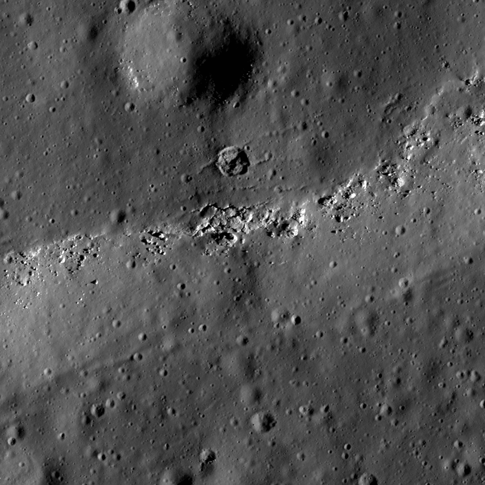
A veneer of impact melt rock erodes away the surface just north of Newcomb crater in the lunar highlands. A 406 meter-wide field of view from LROC Narrow Angle Camera (NAC) frame M162026367LE, LRO orbit 9012, June 6, 2012; angle of incidence 73.95° over 0.91 meter per pixel resolution, from 43.88 kilometers. (View the 700 meter-wide field of view shown in the LROC Featured Image, released September 14, 2012, HERE.) [NASA/GSFC/Arizona State University].
Drew Enns
LROC News System

Impact melt forms in most impacts on the Moon. The melt shown here was emplaced during the impact event that produced Newcomb crater (29.76° N, 43.67° E). Rather than producing a melt pond or flow in this location, the melt here formed a thin veneer that cooled and formed a rigid crust. The melt veneer is now identifiable thanks to a thin scarp along its margin with boulders breaking from it. Two cracks split a small crater on the melt veneer, indicating the crater formed after the melt solidified.

A larger crater is less pronounced, so perhaps it was covered by the melt as it was deposited. But how was this thin deposit of melt originally emplaced?

Newcomb crater is in center in this context image. The arrow points to the area shown at high-resolution in the LROC Featured Image, a veneer of melt located on Newcomb's northern ejecta blanket. Note the large smooth surfaces on the crater's floor. LROC Wide Angle Camera (WAC) 100 meter resolution Global monochrome mosaic, field of view 100 kilometers across. [NASA/GSFC/Arizona State University].
Most impact melt normally stays inside a crater, forming flows and ponds on terraces, and resulting in flat floors. Often, a small portion of the melt is sloshed out of the crater and forms spectacular forms on the ejecta blanket. Some of the ejected melt flows down the flanks until it finds a depression and pond. But not all of the melt makes it to the depression as some melt solidifies on the slope. The result is a thin film of impact melt covering the shallow slopes of the crater flank, like we see in the today's Featured Image!

Explore more impact melt, inside and outside Newcomb, crater in the full LROC NAC frame, HERE.

Related Posts:
Boulder on the Edge
Splish Splash
An Impact Melt Veneer in the Highlands
King crater's unusual melt pond

Simulated view of the same WAC mosaic above draped over LOLA 128 point-per-degree elevation model (v.2) from a perspective 10 km over the eastern side of Newcomb, looking northwest. ILIADS application, NASA LMMP.
A more recent look, from a higher altitude (147.13 km), shows the erosion of melt in context with local topography, especially three distinct melt ponds north of Newcomb. LROC NAC frame M180887966R, spacecraft orbit 11774, January 11, 2012; incidence angle 72.63° at 1.46 meters resolution [NASA/GSFC/Arizona State University]/