Showing posts with label Sarah Braden. Show all posts

Tuesday, December 3, 2013

Smattering of Self-Secondaries

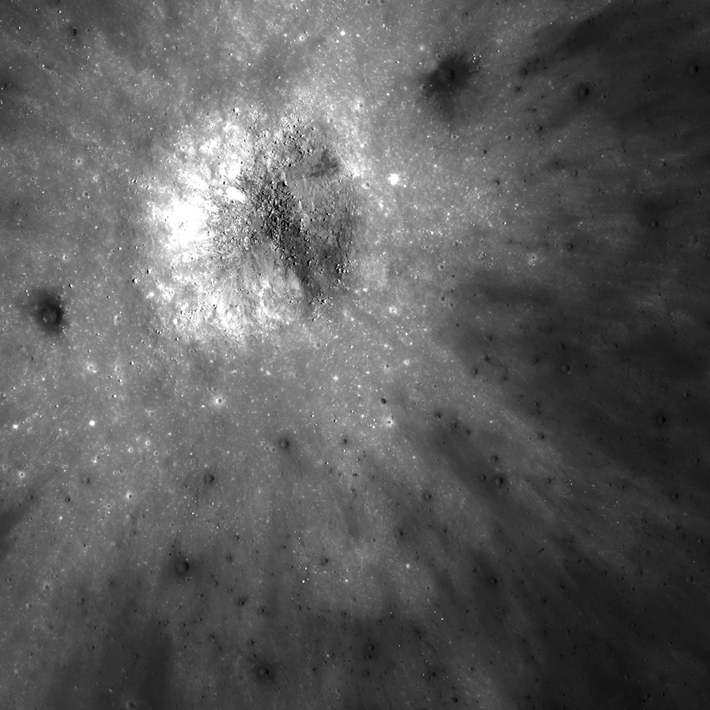
Self-secondary craters in ejecta
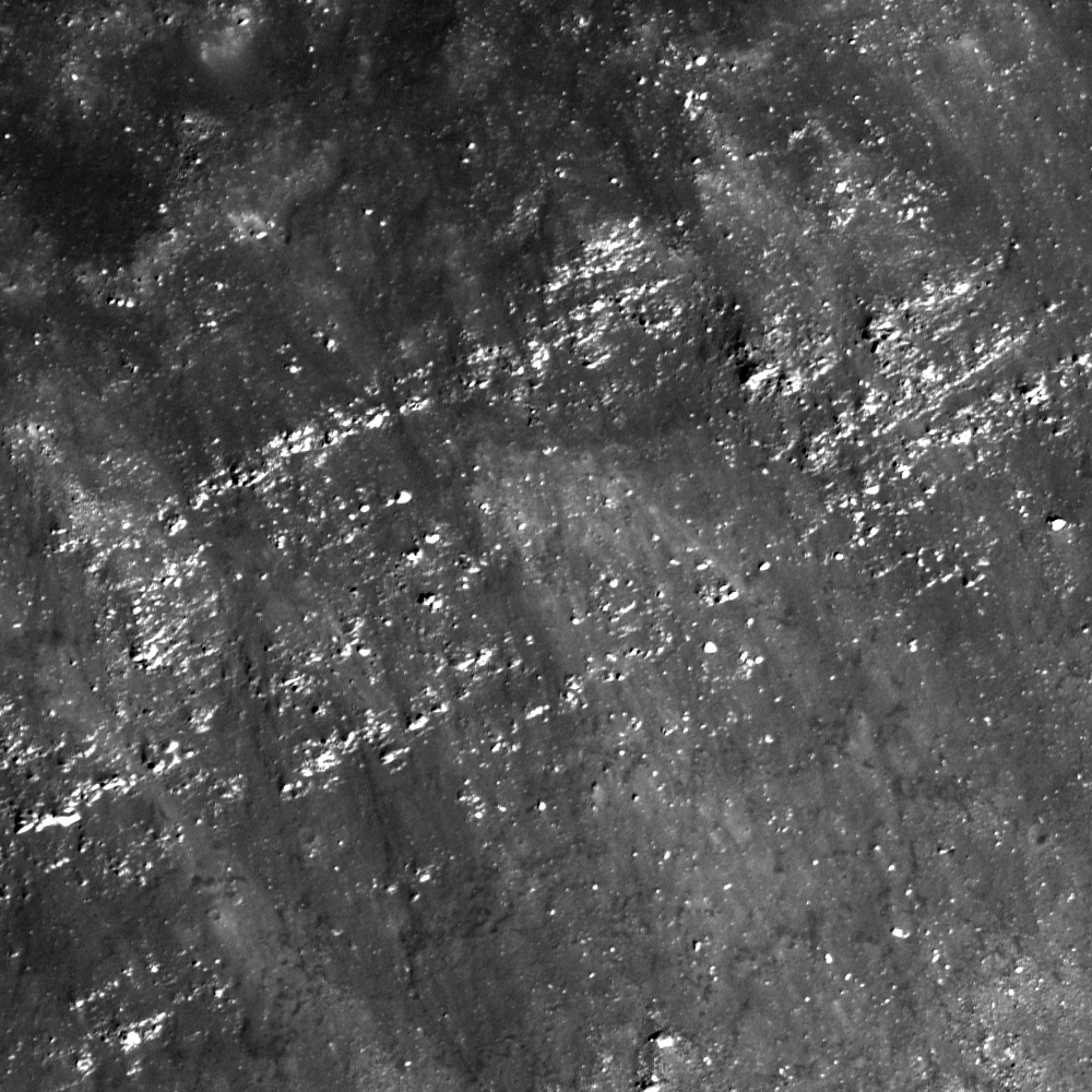
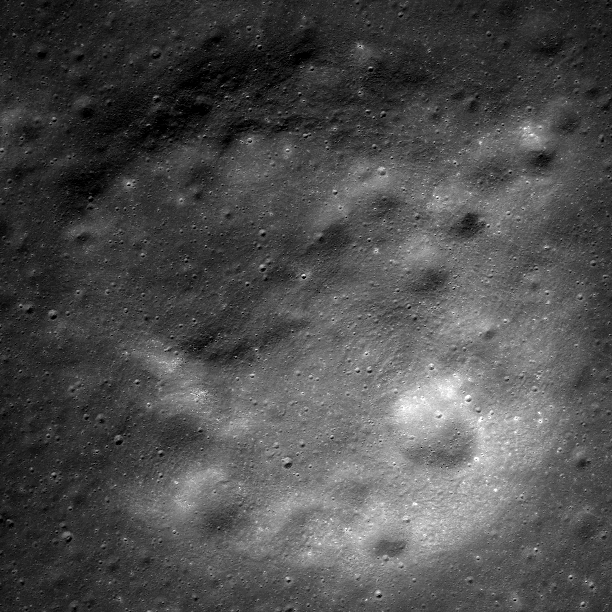
Self-secondaries within the ejecta blanket of a fresh crater. A roughly 2500 meter-wide field of view from LROC Narrow Angle Camera (NAC) observation M1120683999L, LRO orbit 17351, angle of incidence 34.85° at 0.88 meters per pixel resolution from 97 km over 2.21°S, 84.85°E, central Mare Smythii [NASA/GSFC/Arizona State University].
Sarah Braden
LROC News System

Today's Featured Image highlights a small (830 meter) fresh impact crater (located at 2.017°S, 84.948°E) with an ejecta blanket peppered with smaller impact craters. Two of the largest superposed impact craters excavated lower reflectance material (darker) from beneath the main ejecta blanket. This low reflectance material is more mature than the primary crater ejecta. The ejecta from the primary impact is higher reflectance since it is immature material that has not been darkened by space weathering processes. Some of the small impacts have higher reflectance ejecta, which means they did not puncture through the fresh primary crater ejecta blanket.

The craters seen in the Featured Image are a mix of self-secondary and small primary impacts. The term secondary crater describes impact craters formed by ejecta materials from larger impacts. Self-secondary craters form as late stage ejecta is superposed on early ejecta material from the same impact event and are for the most part found near the primary impact crater. The velocity of ejected material increases with distance from the primary crater; therefore, most self-secondary craters are created by low-velocity impacts. Secondary craters formed furthest from the primary crater result from higher velocity ejecta, which makes those secondary craters harder to discern from small primary craters. Secondary craters on the Moon are estimated to have a maximum size of ~4% of the primary crater diameter.

Planetary scientists use the density of craters on impact ejecta as an indicator of age of the impact, based on our understanding of the flux of primary impacts over time. Self-secondaries on crater ejecta are not primary impact craters and inclusion of self-secondary impacts in a measurement will give a higher crater density, and thus result in an older age estimate for that particular surface. The age estimate for the impact crater Giordano Bruno is an example where self-secondaries complicate our understanding of the relationship between surface age and crater density.  
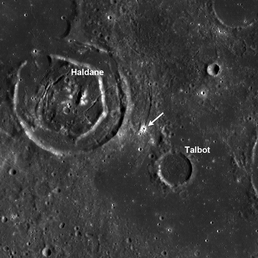
LROC WAC Haldane and Talbot (Context)
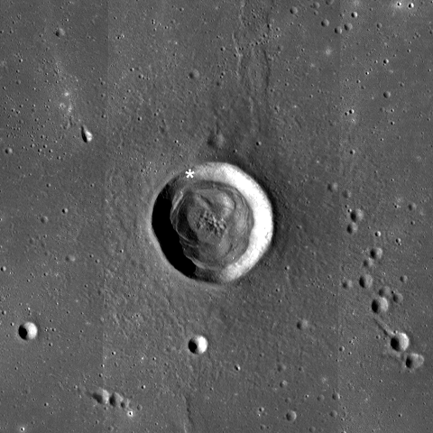
LROC WAC 643 nm reflectance mosaic of the area surrounding the fresh crater in the Featured Image (white arrow) [NASA/GSFC/Arizona State University].
The fresh impact crater in today's Featured Image is between two relatively older craters: Haldane (40 km diameter) and Talbot (12.4 km diameter). The crater Talbot has a visible rim, but the ejecta blanket was embayed by mare basalt. Talbot's floor is flooded with mare basalt as well. Haldane is also as old or older than Talbot since sections of Haldane's rim are completely destroyed.

Explore the full NAC image, HERE.

Related LROC Featured Images:
Polka-dot Ejecta
Action Shot
Impact Art
Ejecta sweeps the surface

HDTV-Mare-Smythii
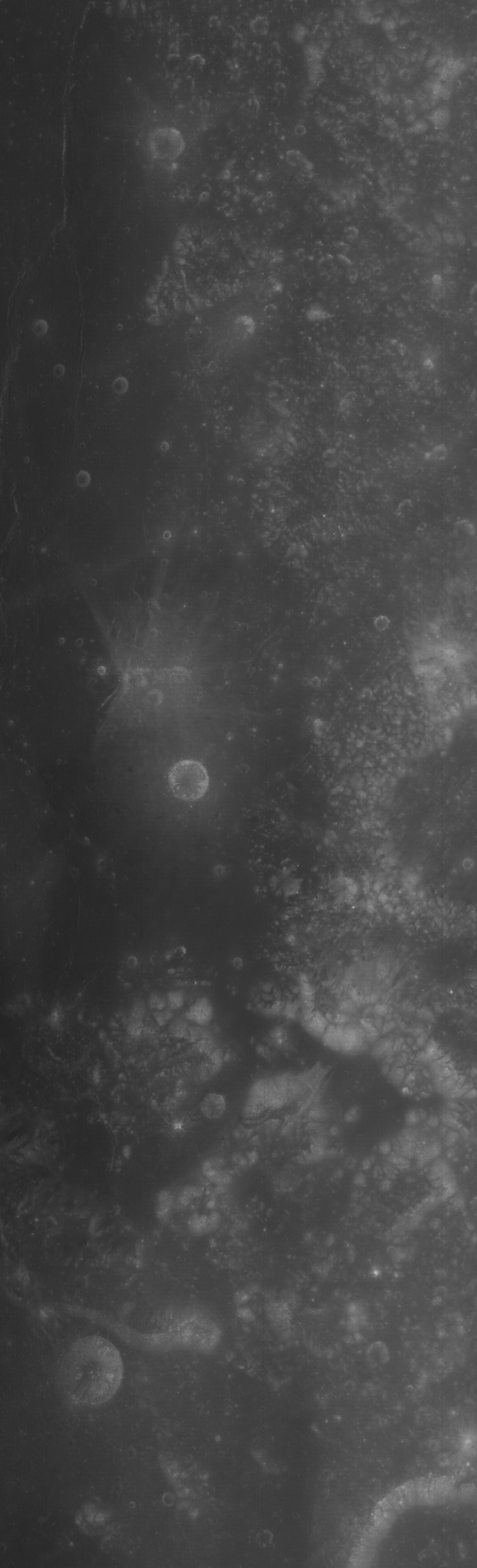
HDTV still from Japan's lunar orbiter SELENE-1 (Kaguya, 2007) captured the western interior of Mare Smythii, straddling the libration zone between the Moon's near and far sides. The small, fresh crater of interest (east-southeast of Haldane, on the lower far right) is not as readily visible at high (sunrise) solar illumination angles. From Earth, the Moon was a thin, early evening crescent [JAXA/NHK/SELENE].

Thursday, September 5, 2013

Clerke

Granular fine falls on the wall of Clerke crater
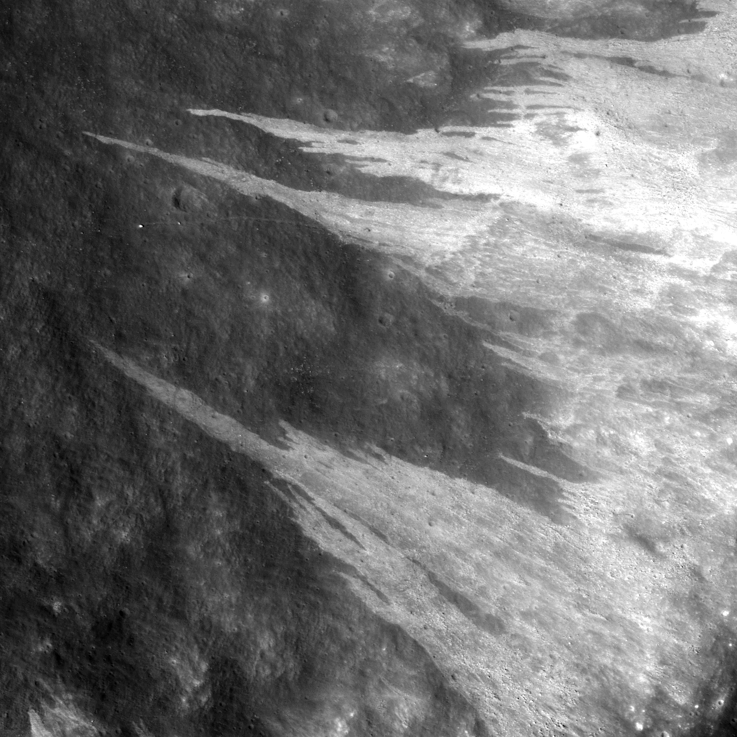
Granular debris flows along the interior wall of Clerke crater, marking a stark contrast in surface reflectance. The crater floor is upper left of this approximately 2 km-wide field of view from LROC Narrow Angle Camera (NAC) observation M183332397R, LRO orbit 12116, February 8, 2012, incidence angle 43.96° full resolution 1.32 meters per pixel from 132.84 km over 20.63°N, 29.76°E [NASA/GSFC/Arizona State University].
Sarah Braden
LROC News System

The interior wall of the Clerke crater has many distinct flows of granular material which narrow as they reach towards the floor of the crater. The source material originates from the crater rim. The debris appear higher in reflectance compared to the rest of the crater wall, likely due to differences in maturity and perhaps grain size of the material.

The debris flows may be younger than the crater floor and walls if the flow was instigated by seismic shaking or a nearby impact crater. The flow may contain more boulders, which may cause the higher reflectance.

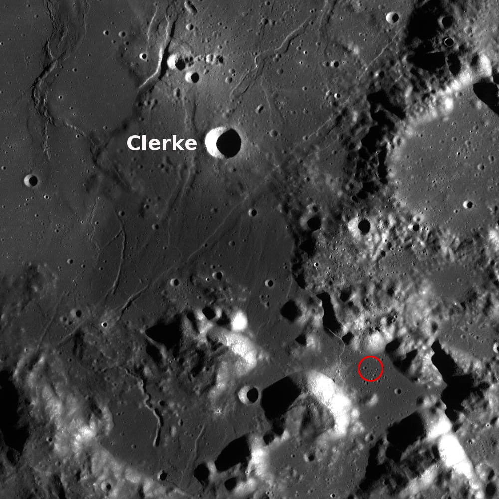
The crater is 7 km in diameter, located at 21.7°N, 29.8°E near the Taurus Littrow Valley where Apollo 17 landed on December 11, 1972 and is named after Agnes Mary Clerke.

M170361778-8558CE_566nm-Clerke
Clerke under a high Sun, a low illumination angle of incidence (25°), resulting in an image emphasizing surface reflectance over topographic variation. From an LROC Wide Angle Camera (WAC) monochrome (566 nm) mosaic of two sequential orbital observations captured September 11, 2011; average resolution 60 meters per pixel from 41 km [NASA/GSFC/Arizona State University].
Agnes Mary Clerke was key in increasing public interest in astronomy and astrophysics. She wrote the book A Popular History of Astronomy During the Nineteenth Century (published in 1885), which was written for the non-astronomer. This publication brought her recognition from the astronomy community. Later she wrote Problems in Astrophysics which described her ideas on the direction for future research involving the Sun, stars, and nebulae. Ms. Clerke possessed a great ability to synthesize research results, look at the "big picture" of science, and communicate those ideas to the public as well as scientists. She was elected an honorary member of the Royal Astronomical Society, and an award given (at the time) to only three other women: Caroline Herschel, Mary Somerville, and Margaret Lindsay Huggins.

Sunrise topography of Clerke
Alternately, Clerke under a low Sun, and thus a high illumination angle of incidence, resulted in this view of the crater and vicinity in an image greatly emphasizing topographic variation over surface reflectance. LROC GLD100 meter per pixel mosaic, an LROC WAC context showing the proximity of Clerke to the Apollo 17 landing site (red circle) in the Taurus Littrow valley [NASA/GSFC/Arizona State University].
Explore the rest of Clerke crater and the surrounding area in the full NAC, HERE.

Related Images:
Caroline Herschel Crater
How Recent?
Dawes
Dichotomy
Diversity

Tuesday, September 3, 2013

Excavating Dark Deposits

M185955372RE_thumb-580
An approximately 250 meter crater has excavated low reflectance material from beneath the lunar surface, west of Sommering P crater, southeast of Copernicus. LROC Narrow Angle Camera (NAC) frame M185955372R; LRO orbit 12483, March 9, 2012; 9.56° angle of incidence, native resolution 1.11 meters per pixel, from 110.79 km over 1.53°N, 249.3°E, field of view 1.8 kilometers [NASA/GSFC/Arizona State University].
Sarah Braden
LROC News System

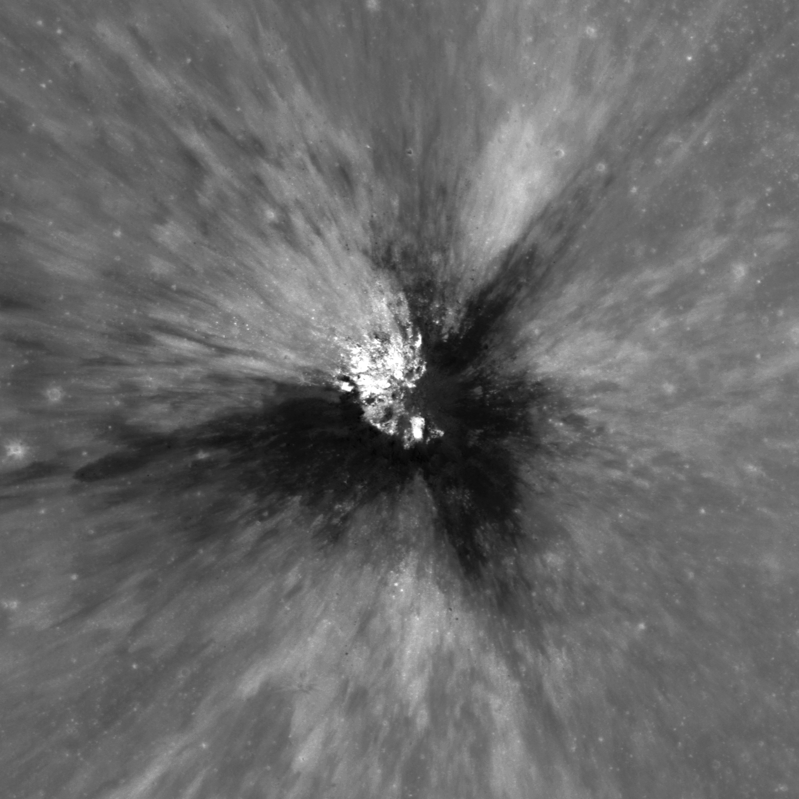
Amazing ejecta patterns from small, young craters are always something to look at on the lunar surface. Today's Featured Image displays compositional diversity in fresh ejecta. The broad, low-reflectance streaks of material are likely excavated pyroclastic materials. This approximately 250 m diameter crater is located at 2.162°N, 349.401°E, west of the crater Sommering P.

This low-reflectance material is part of a larger area called a Dark Mantle Deposit (DMD). Dark mantle deposits have lower reflectance compared to surrounding mare basalt areas and are also spectrally distinct from mare basalt. In this case, the dark mantle deposit was likely covered by a thin layer of crater ejecta.

Context with Sommering P
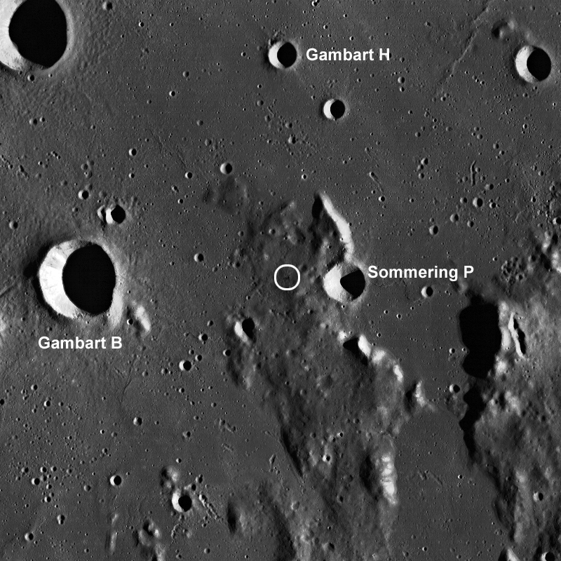
The small crater's location marked with a white circle in an LROC Wide Angle Camera (WAC) context image of a field of view 80 km across [NASA/GSFC/Arizona State University].
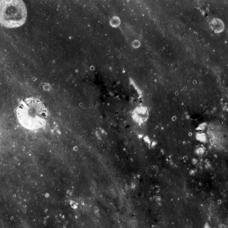
The opening image has a low incidence angle of 10° which means the Sun is high in the sky (near local noon). High-sun images are good for revealing differences in the reflectance properties of the surface. Low-sun (large incidence angle) images are better at emphasizing morphology due to topographic shading and shadowing. Incidence angle is the angle between the vector of sunlight and the vector normal to the surface. The WAC context image above has a large incidence angle (taken in early morning) which makes visible the topographic high where the crater was formed. This topographic high is a remnant of highland terrain (kipuka) surrounded by younger mare basalt deposits (smooth, flat areas). There are many other craters on the topographic high that excavate low-reflectance material, which suggests that the whole area is different from the surrounding mare basalt deposits. The high-sun WAC mosaic (below) of the same area shows the locations where the dark mantle deposit is visible. You can learn more about dark mantle deposits here!

643nm high sun, high-reflectance WAC context
LROC WAC monochrome (643 nm) high sun, high reflectance view of the same area as seen in the WAC mosaic immediately above, resolution roughly 100 meters per pixel. Note darker material around the area of the topographic high place [NASA/GSFC/Arizona State University].
Explore the full NAC image HERE to see the other craters excavating low-reflectance material.

Related Images:
Hyginus Crater and Pyroclastics
Dark Wisps in Copernicus
Polka-Dot Ejecta
Pyroclastic Excavation

Thursday, June 27, 2013

Rima Marius Layering

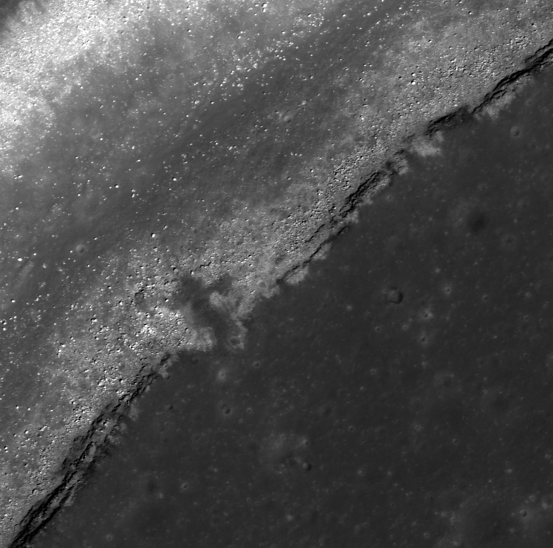
Basalt layering, a slice through the floor of Oceanus Procellarum, is visible along the wall of this section of Rima Marius. LROC Narrow Angle Camera (NAC) Extended Science Mission observation M1103881010R, LRO orbit 14991, October 3, 2012; 21.88° angle of incidence over a 1.3 km-wide field of view, resolution 0.99 meters from 121.1 km  [NASA/GSFC/Arizona State University].
Sarah Braden
LROC News System

Mare basalt layering is visible in the walls of a number of impact craters such as Caroline Herschel Crater and Pytheas Crater. Layers were seen in the wall of Hadley Rille near the Apollo 15 landing site and Today's Featured Image shows a few layers of mare basalt along the top edge of the wall of Rima Marius.

Look closely at the Featured Image to see the individual layers.

Rima Marius is about 280 km long, sinuously slicing through large extents of mare basalt. The are seen in the Featured Image is centered at 14.986°N, 311.565°E.

LROC Wide Angle Camera context view of the southern leg of winding Rima Marius. The arrow marks the location of the field of view shown at high resolution in the LROC Featured Image. LROC WAC M166161047CE (604 nm) spacecraft orbit 9621, July 2, 2011, 63.53° angle of incidence, 58.9 meters resolution from 42.35 km [NASA/GSFC/Arizona State University].
Rilles form when large volumes of low viscosity magma erupt and flow turbulently. The erosive force of the turbulent flow carves a channel into the lunar surface and then drains away, leaving behind an empty groove in the Moon. Studying the thickness of mare basalt layers using areas like the Feature Image help scientists model the viscosity and eruption volume of single eruption events.

The 280 km length of Rima Marius and the LROC Featured Image field of view (arrow) as seen from Earth is more easily seen through telescopes from Earth with the lengthening shadows of local late afternoon illumination, a few days after a Full Moon. In this crop, from a high-resolution lunar mosaic captured by Yuri Goryachko and colleagues at Astronominsk in Belarus, September 25, 2008, shows vast context for Rima Marius within central Oceanus Procellarum, from the Aristarchus Plateau in the North to the Marius Hills, Marius crater and Reiner Gamma swirl albedo to the south [Astronominsk].
Explore the entire LROC NAC for more Rima Marius, HERE.

Related Images:
Dark surface materials surrounding Rima Marius
Discontinuous rilles
Hadley Rille and the Mountains of the Moon
Layers near Apollo 15 landing site

Wednesday, June 26, 2013

Love U, on the farside of the Moon

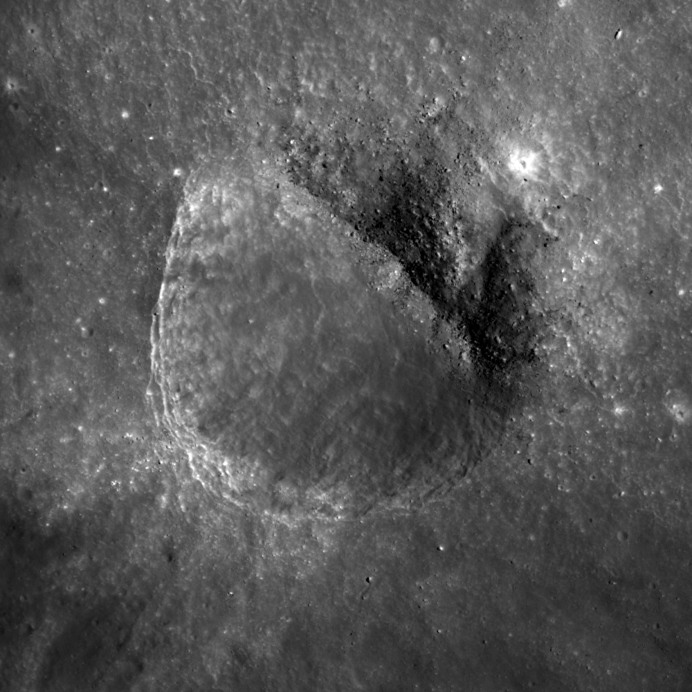
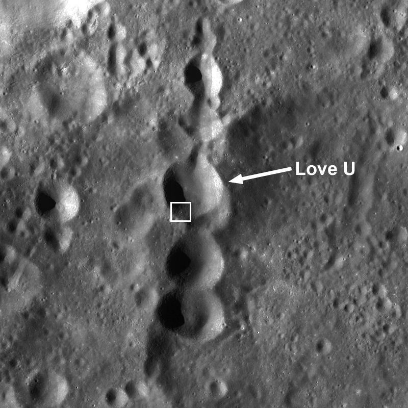
A small crater on the inner rim of the farside highlands crater Love U (5.535°S, 128.024°E). LROC NAC M159114365R, LRO orbit 8582, May 4, 2011; 39.5° angle of incidence image, 61 cm resolution from 59.82 km [NASA/GSFC/Arizona State University].
Sarah Braden
LROC News System

The 320 meter diameter crater in today's Featured Image is located inside the larger Love U crater (12 km, 5.535°S, 128.024°E).

Why does this fresh crater look "squished" on one side? The inner wall of Love U slopes downwards from the lower left to the upper right. The lower left hand portion of the crater rim is crisp and unmodified, because it is the upslope part of the crater.

The upper right hand half of the crater rim is not circular and is very modified by debris that fell downslope.

Asymmetric craters are sometimes due to the trajectory of the impacting bolide being less than 15° from the surface (oblique impact). The ~26° slope of Love U's inner wall dominates the morphology of the crater in the Featured Image. The rays of the crater are also asymmetric; longer rays extend downslope into Love U crater.

LROC image-derived Digital Terrain Model (DTM) of Love U crater and surroundings, generated on the fly using the latest generation of their versatile Quick Map application. The crater of interest is seen "on edge" (arrow) from this perspective [NASA/DLR/GSFC/Arizona State University].
For more love on the Moon, remember this lunar valentine HERE?

LROC Wide Angle Camera (WAC) context view (with false-color relative elevation) of Love U; white box outlines the field of view shown in detail in the LROC Featured Image [NASA/GSFC/Arizona State University].
The WAC image above shows that Love U is part of a crater chain. Some of the craters in the chain are oval or elongated, which indicates that they are probably secondaries from a large impact. Crater chains can be formed by secondary craters, volcanic collapse in association with graben, or primary impacts from a string of smaller bolides. Planetary scientists use morphologic and contextual clues to determine how a crater chain formed.

Love U is a satellite crater of the main crater Love, a 90 km diameter, highly degraded crater on the far side of the Moon. The namesake of Love crater is Augustus Edward Hough Love, a mathematician who is well known for Love waves and Love numbers.

Explore the entire NAC image, HERE.

Related Images:
Lopsided La Perouse A
Top of the Landslide
Oval Crater

Tuesday, June 25, 2013

Farside Boulders, Curve Northeastward

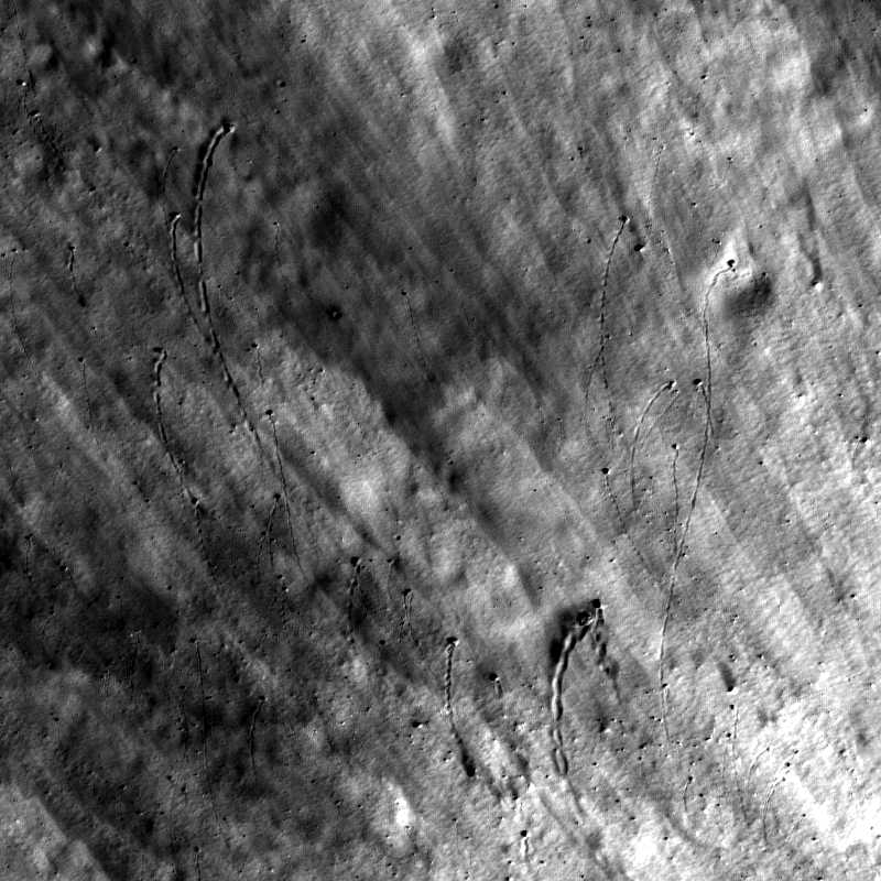
Curved boulder tracks outside the rim of a fresh crater on the farside highland terrain southeast of Mare Moscoviense. LROC Narr wo Angle Camera (NAC) observation M143594908L, spacecraft orbit 6295, November 10, 2010; field of view 320 meters across, 39.27° angle of incidence, resolution 58 cm per pixel from 55.36 km [NASA/GSFC/Arizona State University].
Sarah Braden
LROC News System

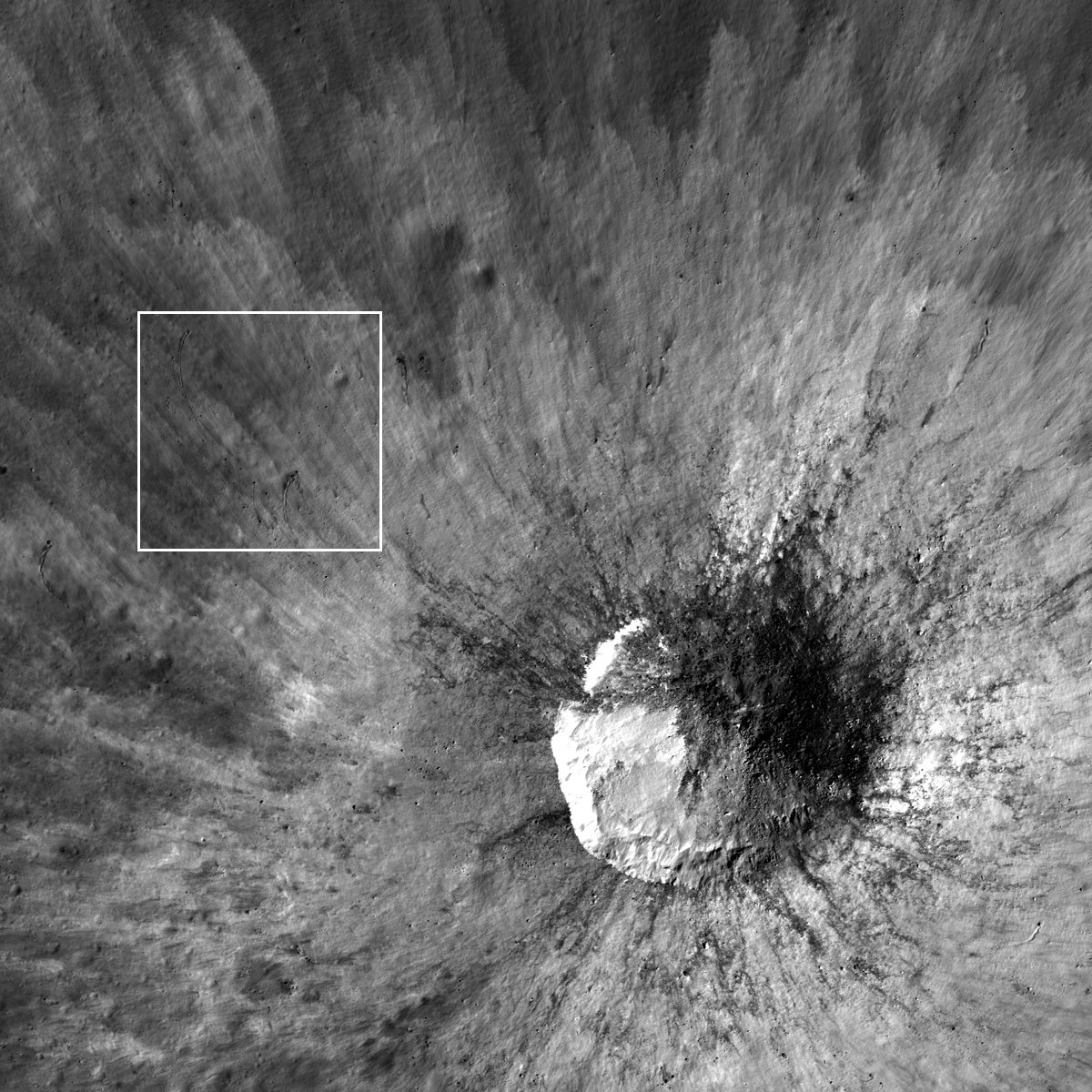
The boulders in the Featured Image all curve to the northeast, carving dark paths across the fresh rays from a small 525-meter crater on the lunar farside northeast of Van Gent U, 17.233°N, 157.367°E.

The boulders originated from the impact crater itself, being ejected during the impact event with a velocity radial to the crater rim.

As the boulders bounced and rolled along the surface they lost speed (kinetic energy) and slowed, creating gently curving paths until they came to a stop.

Wider field of view from LROC NAC M143594908L, context showing the location of the boulders with respect to their source crater in a field of view 1.9 km across [NASA/GSFC/Arizona State University].
The curved paths are likely caused by the preexisting slope of the topography, which is slightly downward sloping to the northeast (~10°). The linear striations of the fresh ejecta define the radial direction away from the crater and provide a beautiful contrast for the curved boulder paths.

Using the latest LROC QuickMap, a 2.09 by 2.09 km wedge of terrain is shown in 3D, and turned 90° counter-clockwise to show the wider slope where the crater of origin and boulder field are nested in the LROC WAC-derived digital terrain model. The local elevation, from south to north ranges approximately 240 to over 900 meters above global mean [NASA/GSFC/Arizona State University]/
Overall, the fresh material was ejected at higher velocities than the boulders so it is not influenced by the topography and remains on a trajectory radial to the crater.

Explore the entire fresh crater with the LROC NAC, HERE.

Related LROC Featured Images:
Hole in One!
Bounce, Roll, and Stop
Weaving Boulder Trails on the Moon
Rolling Rolling Rolling
Sampling Schrödinger
Central Peak/Mare Boundary

Saturday, June 8, 2013

Giordano Bruno Whorl

Impact melt forms a swirled feature in Giordano Bruno crater. Field of view 1 kilometer. From LROC Narrow Angle Camera (NAC) observation M143947267L LRO orbit 6347, November 9, 2010; 53.08° angle of incidence, 57 centimeters per pixel resolution from 54.50 km [NASA/GSFC/Arizona State University].
Sarah Braden
LROC News System

The crater Giordano Bruno (22 km, 35.97°N, 102.89°E) is a favorite of lunar scientists due to its relatively young age and the amazing impact melt features found within and without the crater walls.

Previously, the LROC Featured Image gave a birds eye view of the whole crater in "Giordano Bruno, The Big Picture."

Today's Featured Image uses a 57 cm per pixel NAC frame to highlight the details of a giant swirl (or whorl) of impact melt within one of the larger impact melt pools inside Giordano Bruno.

M1102880536LR-NSJ-0110-58b-9587x13223
Under a much higher Sun, a lower angle of incidence, the 'whorl' (left of center, at the contact between the west crater wall and floor) can also be seen in this mosaic showing nearly the entire complex melt flows and interior of Giordano Bruno. View the full resolution (9587x13223) mosaic, HERE. LROC NAC mosaic M1102880536LR, orbit 14851, September 21, 2012; 37.55° angle of incidence, resolution 1.52 meters from 152.11 km [NASA/GSFC/Arizona State University].
The whorl formed in a clockwise direction and is about 1 kilometer in diameter. This spiral-shaped feature may have formed due to shear stress created when molten impact melt flowed at different speeds (probably caused by drag from the pool floor or an obstacle within the pool). This shear would modify flow directions in ways that could ultimately produce such a swirling pattern. Slumping material may have set the melt into motion within an otherwise calm impact melt pool.

hdtv_008_5_l
Giordano Bruno from south, looking ahead from Japan's Kaguya (SELENE-1) in polar orbit (2008), from roughly 100 km over the 102nd meridian. The crater is closely studied because it is strikingly fresh, perhaps less than 10 million years old and far less affected by the steady gardening of micrometeorites and the steady rain of energetic cosmic rays that turn over the top 3 mm of the Moon's surface every 2 million years [JAXA/NHK/SELENE]. View the full 1920x1200 original, HERE.
The more information lunar scientists can gather about how quickly impact melt cools, the more we will know about how this structure formed!

Explore the entire NAC frame for more amazing views of Giordano Bruno, HERE.

Related Images:
Very Oblique View of Giordano Bruno
Sunset Over Giordano Bruno
Outside of Giordano Bruno
Fragmented Impact Melt
Impact Melt Flows on Giordano Bruno

Thursday, May 23, 2013

Layers of Imbrium excavated by Caroline Herschel Crater

Exposed mare basalt layering in the wall of Caroline Herschel crater (34.48°N, 328.71°E). LROC Narrow Angle Camera (NAC) observation M175475137R, spacecraft orbit 10994, November 9, 2011; field of view 350 meters at 45 cm per pixel resolution; angle of incidence 55.93° from 30.15 km [NASA/GSFC/Arizona State University].
Sarah Braden
LROC News System

Outcrops of layered mare basalt are visible in the interior wall of Caroline Herschel crater (located at 34.48°N, 328.71°E, in western Mare Imbrium).

The mare basalt layers were exposed during the excavation phase of the impact which created this 13.7 km diameter crater. Some debris from the crater rim and the wall have fallen over the layers but the structure of the outcrop is still preserved.

The crater is superposed on a north-south trending wrinkle ridge which is visible in the LROC WAC context image below. This crater is named after Caroline Herschel, an astronomer and half of the sister/brother science team with astronomer Sir William Herschel.

Wider angle view of the northwestern rim, wall and interior of C. Herschel. LROC NAC M1106123678L, orbit 15305, October 29,  2012; resolution 1.5 meters per pixel, angle of incidence 53.18° from 150.4 km [NASA/GSFC/Arizona State University].
Caroline discovered several comets, and in 1828 the Royal Astronomical Society awarded her their Gold Medal for her work. She made observations, kept detailed records, performed complex mathematical calculations, and polished her own telescope mirrors. Caroline has multiple comets named after her as well as the lovely lunar crater in today's Featured Image.

LROC Wide Angle Camera (WAC) context for Caroline Hershel. The white asterisk marks the area of basalt layering in the Featured Image. Field of view is 48 kilometers [NASA/GSFC/Arizona State University].
Explore the entire NAC frame to see the beauty of the Moon, HERE.

Related Images:
Galilaei's Layered Wall
Pytheas
Dawes
Lava Flows Exposed in Bessel Crater

Wednesday, May 22, 2013

Concentricity in Apollo Basin

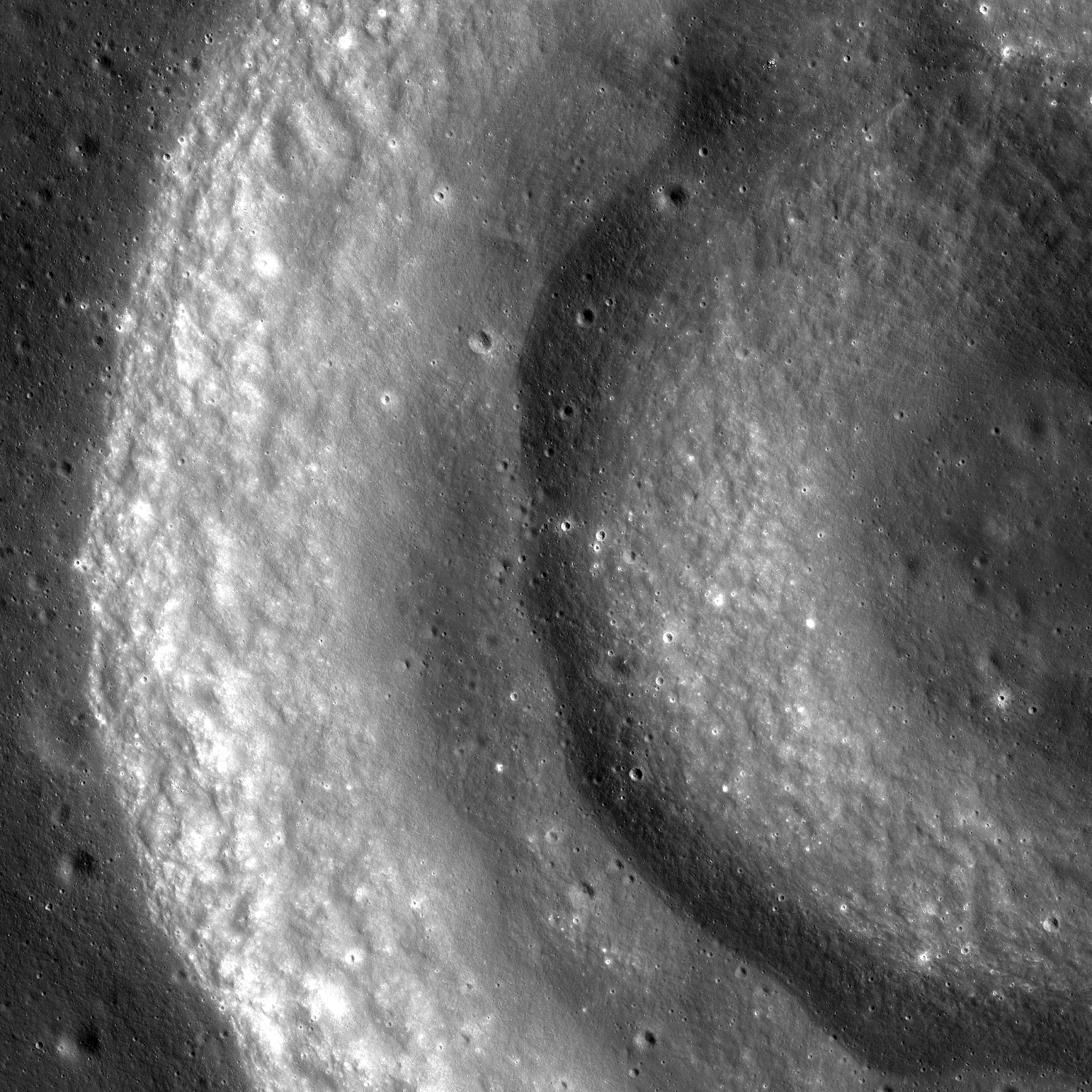
Portion of an unnamed concentric crater in Apollo Basin. Sun is incident from the right to the left. LROC Narrow Angle Camera (NAC) mosaic M1122245918LR, orbit 17571, May 3, 2013; image field of view is 6.3 km [NASA/GSFC/Arizona State University].
Sarah Braden
LROC News System

The double-arch shape in the Featured Image is a portion of an unnamed concentric crater located in the northwestern extent of Apollo Basin (basin center at 35.687°S, 208.232°E).

The concentric crater has an inner ring, centered on 30.757°S, 205.931°E, a middle ring, and then the crater rim.

The crater formed within the mare basalt that fills Apollo Basin. The formation mechanism for concentric craters like this one is not entirely clear. One theory is that the target material is made of multiple stratigraphic layers with different strengths. If the difference between the strengths of the layers is great enough, the impact may form concentric rings.

Bench craters also form when target layer strengths are different.

Oblique NAC view of the unusual crater morphology in Apollo basin. LROC NAC mosaic M109753923LR, orbit 14102, July 21, 2012; camera and spacecraft slew off nadir 57.74° resolution roughly 2 meters per pixel from 76.2 km over 31°S, 200.62°E [NASA/GSFC/Arizona State University].
In the late 1960s laboratory experiments replicated the concentric shape of craters using targets with loose, granular material over stronger, more cohesive layers. The laboratory experiments use different materials and are at smaller scales than their lunar counterparts. Still, experiments like these are important for comparing what we see on the lunar surface to basic physical principles. What if an impact occurs in an area with highland material as one layer and then mare basalt as a second layer? What crater shape is produced if you introduce a regolith layer? These are the questions that lunar geologists use to design their experiments.

LROC WMS Wide Angle Camera mosaic of the concentric crater in context with north and northwestern Apollo basin, The crater of interest is 11.5 km across [NASA/GSFC/Arizona State University].
Explore the entire LROC NAC mosaic, HERE

Related Images:
Concentric Crater (Gruithuisen K)
Apollo Basin: Mare in a Sea of Highlands
Small Pond
LOLA's Apollo Basin
Biggest, deepest crater - an excavation of the hidden, ancient Moon

Thursday, April 18, 2013

New views of the lava terraces of Bowditch

A lava terrace rings the floor of farside crater Bowditch. LROC Narrow Angle Camera (NAC) observation M180493674L, LRO orbit 11718, January 12, 2012; a roughly 4 km-wide field of view at 1.74 meters per pixel resolution, angle of incidence 75.91° from 85.27 km [NASA/GSFC/Arizona State University].
Sarah Braden
LROC News System

Bowditch is a highly irregularly shaped farside crater partially filled with a mare basalt (25.0°S, 103.2°E).

Today's Featured Image is located along the inner wall of the crater, where the mare deposit meets the wall (24.935°S, 102.705°E). A section of the crater wall is visible in the upper left hand corner of the image, there is a step down in topography from left to right.

All along the inner wall of Bowditch there is a higher elevation ring, or terrace.

LROC WAC context image of mare-filled Bowditch crater. The yellow box outlines the field of view captured at high resolution in the LROC Featured Image released April 18, 2013. Field of view above roughly 38.3 km-wide. The LROC WAC context image accompanying the Featured Image released shows greater topographic relief at smaller scale HERE [NASA/GSFC/Arizona State University].
It is thought that this terrace is a marker of the highest level of liquid lava within the crater. As the lava cooled and solidified within the Bowditch depression it subsided into the center of the depression, causing a lower final elevation of mare basalt towards the center of the crater. Lava terraces such as this one provide important clues about the thickness, viscosity, composition, and cooling rate of lunar lavas and will help us better understand volcanism on the Moon.

View the entire LROC NAC frame to explore more of the Bowditch mare basalt deposit, HERE.

Related Images:
Bowditch Lava Terraces
A Lunar Dichotomy
The Mare-highlands Boundary in Tsiolkovskiy!

Wednesday, April 17, 2013

The Fourth Marian Dome

A volcanic dome in northeastern Oceanus Procellarum., west of Rima Sharp. LROC Narrow Angle Camera (NAC) observation M1119207667R, spacecraft orbit 17144, March 29, 2013, resolution 1.5 meters over a field of view 3.1 km across [NASA/GSFC/Arizona State University].
Sarah Braden
LROC News System

The volcanic dome in the Featured Image (located at 43.673°N, 310.145°E) rises above the mare basalt of Oceanus Procellarum. This dome is another example of silicic volcanism on the Moon, much like the nearby Mairan Domes, the Gruithuisen Domes, and the Lassell Massif.

Each of these features were originally identified as "red-spots," meaning they are spectrally anomalous compared to surrounding mare and highlands material, with strong ultraviolet absorptions that are responsible for their red color.

New data from the Diviner Lunar Radiometer Experiment instrument on the LRO spacecraft confirmed that all four domes (see the WAC context image below) are highly silicic compared to mare and highlands compositions. The Diviner team's work included this fourth dome as part of the Mairan Domes and dubbed it Mairan "northwest." In terms of size and shape, Mairan "northwest" has the most in common with the smallest Mairan dome, Mairan "south." Mairan "northwest" is ~3.2 km in diameter, just slightly smaller than Mairan "south" at ~4.2 km in diameter. However, Mairan "south" is about 400 meters in height (relative to the surrounding mare) while the structure in the Featured Image has a height of only ~180 meters (measurements taken from the WACGLD100 DTM). Regardless of their height relative to the mare, both domes may be greater in size that their surface expressions due to embayment by mare basalt.

LROC Wide Angle Camera (WAC) context image of northeastern Oceanus Procellarum shows the location of the area surrounding the LROC Featured Image field of view (white box) in relation to the more prominent named Mairan Domes. Field of view is about 120 km across [NASA/GSFC/Arizona State University].
The dome of interest (lower right) and its relation to points north and a lengthy segment of Rima Sharp. LROC WAC monochrome (643 nm) observation M117827780ME, orbit 2498, January 11, 2010; spacecraft and camera slew -11.15° resolution 59 meters per pixel from 40.72 km [NASA/GSFC/Arizona State University].
Oblique view south over Rima Sharp from the JAXA planetary camera on-board SELENE-1 (Kaguya) in 2007. The small dome of interest can be seen as small white blur, between the horizon and the bend region of Rima Sharp at lower center. The named Marian Domes and the crater Marian G are visible half way between the horizon and the small dome of interest [JAXA/SELENE].
The dome of interest (yellow arrow) as seen from Earth, photographed by Lunar Picture of the Day (LPOD) contributor Stephan Lammel, June 11, 2003. The massive Mons Rümker effusive dome is visible at high relief at left. The largest crater in the highlands at right is Marian, 40 km across.
Examples of extrusive silicic materials are rare in the collection of Apollo samples and the origins of these materials are not known. However, it is thought that silicic domes like the Mairan domes may be the source locations. Studies of the Compton-Belkovich region have shown that highly silicic lunar rocks are more volumetrically important in the lunar crust than would be implied by their near absence in the Apollo samples. A sample return mission to the region of today's Featured Image would finally answer questions about the origin of these highly silicic rocks - how they were created as part of the Moon's late stage magmatic evolution.

Explore the entire NAC frame, HERE.

Related Images:
New Views of the Gruithuisen Domes
Gruithuisen Domes Constellation Region of Interest
Marius Hills Constellation Region of Interest
Compton-Belkovich: Farside Highlands Volcanism!

Tuesday, April 16, 2013

Crater chain near Rima T Mayer

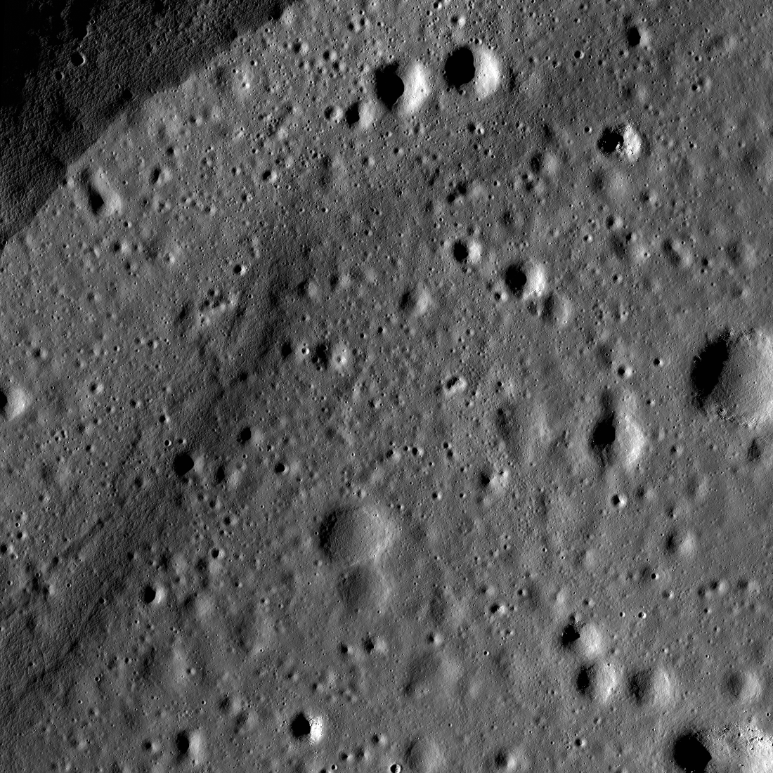
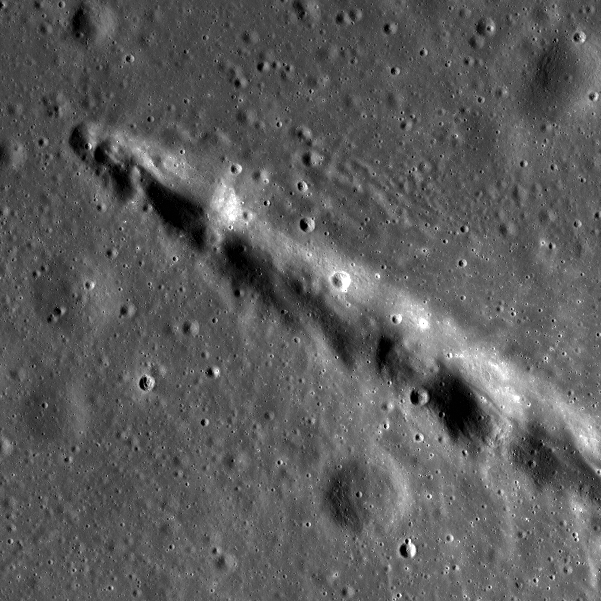
A small, rather unique crater chain, or catena, near Rima T Mayer, a geologically and observationally interesting region northwest of the central near side, between Copernicus and Kepler. LROC Narrow Angle Camera (NAC) M181373663R, a 2.6 km field of view captured at 1.29 meters per pixel resolution from 128.61 kilometers in spacecraft orbit 11842, January 16, 2012; angle of incidence 64.29° [NASA/GSFC/Arizona State University].
Sarah Braden
LROC News System

What sound do impacts make when they hit the lunar surface? If you were an astronaut standing on the lunar surface, you probably would not hear anything even if you were nearby since the lunar surface is a near-vacuum! However, you might feel the rumble of the impact through your boots perhaps giving you enough time to duck behind a nearby boulder. Today's Featured Image shows part of a ~3 km long crater chain, located at 13.360°N, 328.807°E.

The irregular shape of the crater rims and tapered appearance suggests that these are not primary but rather secondary craters, formed from material ejected from a larger primary impact.

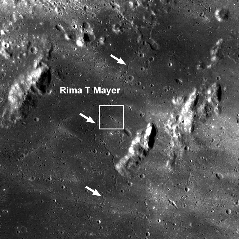
LROC Wide Angle Camera (WAC) context image of the area surrounding the crater chain (located inside the white box). The sinuous rille Rima T Mayer winds its way through the region (denoted by white arrows). Image field of view 58 km across [NASA/GSFC/Arizona State University].
Secondary craters form many of the crater chains on the Moon, but not all. The term crater chain, or catena, describes any set of craters in a linear array. Crater chains can be formed not only by secondary craters but also by volcanic collapse (associated with graben) or primary impacts from a string of smaller objects which was observed during the Comet Shoemaker-Levy 9 impact with Jupiter.

A slightly closer look at the same region in "pushed" LROC WAC photography shows the catena bisects a contact zone between an effusive dome structure and the mare material of the surrounding area. Illustration from "New Pyroclasts identified using LROC data," February 18, 2011. LROC WAC observation M117691527ME (689 nm), orbit 2478, January 9, 2010 [NASA/GSFC/Arizona State University].
Can you find other areas with evidence of secondary crater ejecta in the full LROC NAC, HERE?

Related Images:
Tres Amicis
Four of a Kind in Catena Davy
Stream of Secondary Craters
Chain of Secondary Craters in Mare Orientale
New Pyroclasts identified using LROC data

Friday, March 8, 2013

Impact melt on the floor of Rümker E

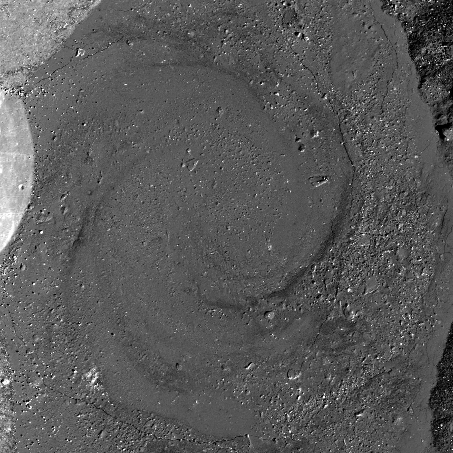
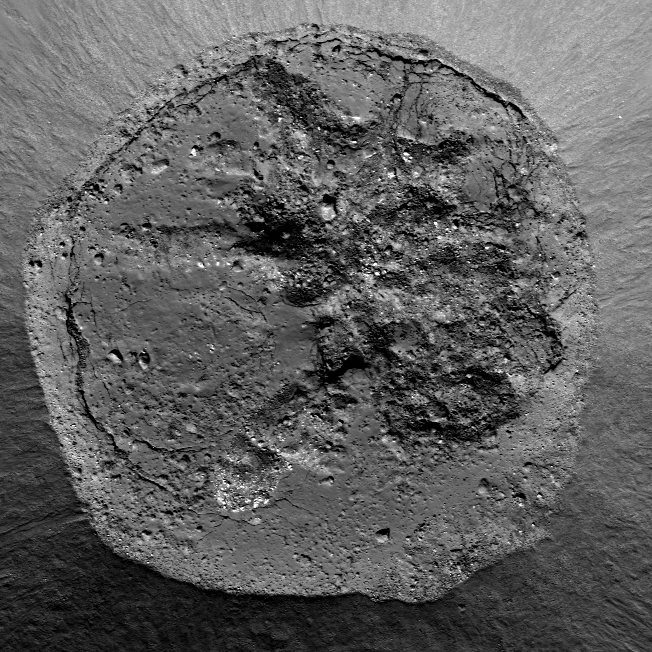
Contact between wall, with debris flows, and the impact melt lens inundating the floor of Rümker E, immediately southeast of the landmark Mons Rümker ridge extrusion mound in north Oceanus Procellarum. Area detail covered in the LROC Featured Image released March 8, 2013. LROC Narrow Angle Camera (NAC) observation M122591558L, spacecraft orbit 3200, March 7, 2010; angle of incidence 42.68° at 0.5 meters resolution from 40.63 km [NASA/GSFC/Arizona State University].
LROC Featured Image, March 8, 2013: Close up on the full width of the impact melt deposit on the floor of Rümker E, in an approximately 2 km wide field of view from LROC NAC M1101573334L, LRO orbit 14668, September 6, 2012; angle of incidence 41.16° at 1.13 meters resolution, from 152.92 km  [NASA/GSFC/Arizona State University].
Sarah Braden
LROC News System

Imagine a quiet afternoon on the lunar surface about 1 billion years ago. Suddenly, the ground shakes due to the shock wave from a nearby impact.

You see rock and dust burst away from the ground on ballistic trajectories, and some large chunks of material contain so much energy from the impact, they are glowing with heat.

Some of the molten rock splashes outside the rim, but most remains on the floor of the newly formed crater, creating an impact melt deposit.

The crater Rümker E (38.620°N, 302.881°E) is a simple Copernican-aged crater with a diameter of 6.96 km.

Two LROC Wide Angle Camera (WAC) mosaics show different sun angles. Above, the sun angle is higher, so the high reflectance rays of the crater are more visible, and below the sun angle is lower, emphasizing the morphology of the surface [NASA/GSFC/Arizona State University].
Impact melt in the crater floor is fresh with common features such as fractures, boulders, and mounds. The fractures are mostly located around the edges of the impact melt deposit and formed either as the impact melt cooled, or after cooling during the stage of crater modification due to stresses in the crater floor. Over time the granular material falling down the crater walls will slowly cover more and more of the impact melt deposit, decreasing its diameter. Compositionally, the impact melt is a combination of the rocks present in the target material. In this case, the target material is mostly mare basalt.

Rümker E in relation to Mons Rümker, a wide volcanic shield mound showing sighs of long-term episodic, if not particularly violent, periods of activity; a extraordinary formation easily seen at high angles along the telescopic line of sight from Earth. LROC WAC monochrome (643nm) mosaic [NASA/GSFC/Arizona State University].
Explore the entire NAC frame, HERE.

Check out these previous posts for more examples of beautiful impact melt features:
Lineations on the Melt
Dynamics of Molten Rocks
Sunny Side Up

The wrinkled morphology and ridges of north Oceanus Procellarum, including compositional differences between the mare terrain and Mons Rümker (above left from center), are more difficult to detect when the Sun is high, but when the terminator passes and the Sun is low, the anatomy is stark. from HDTV still captured by Japan's lunar orbiter SELENE-1 (Kaguya) in 2008 [NASA/GSFC/Arizona State University].