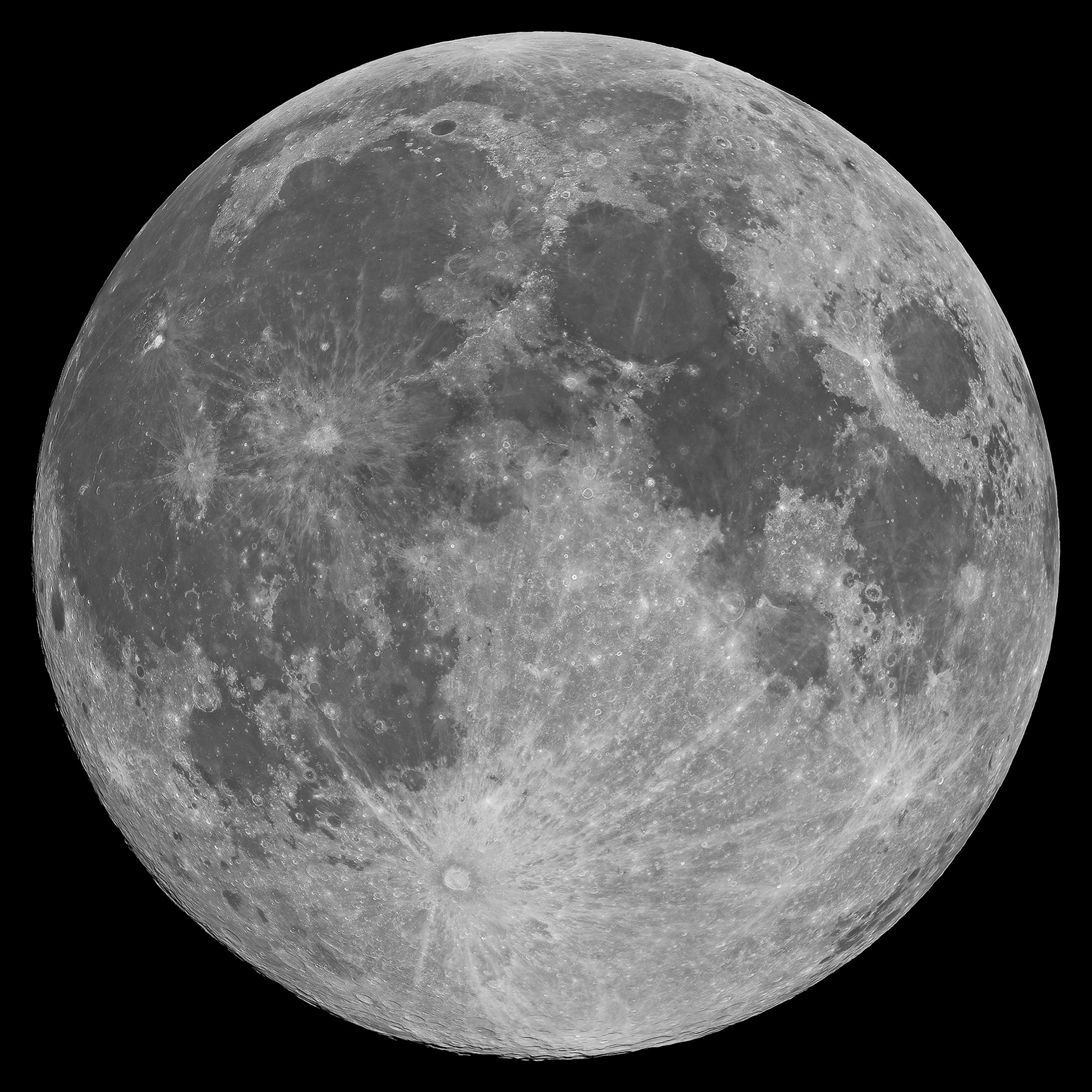
Showing posts with label Volcanism. Show all posts

Friday, November 7, 2014

Exploring the lunar subsurface

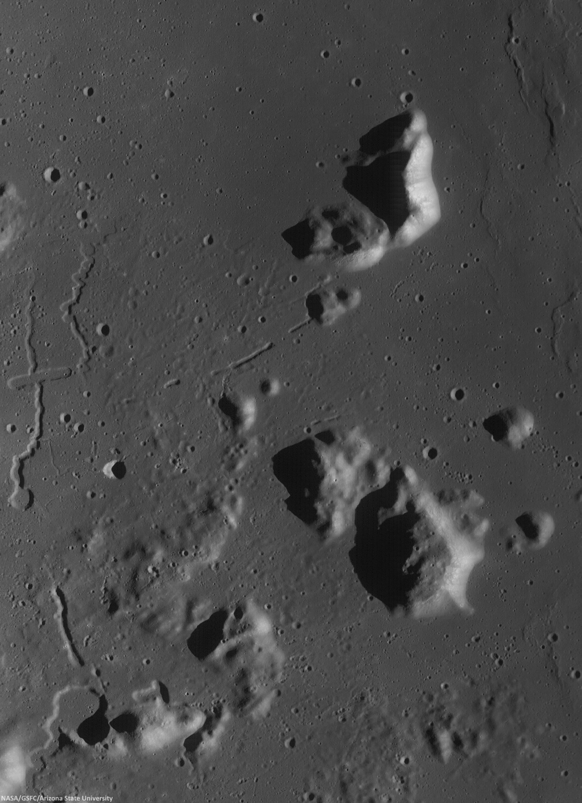
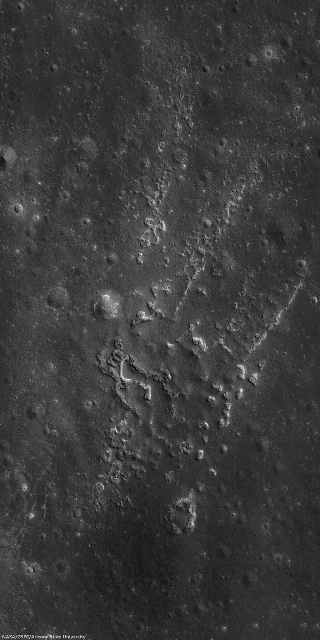
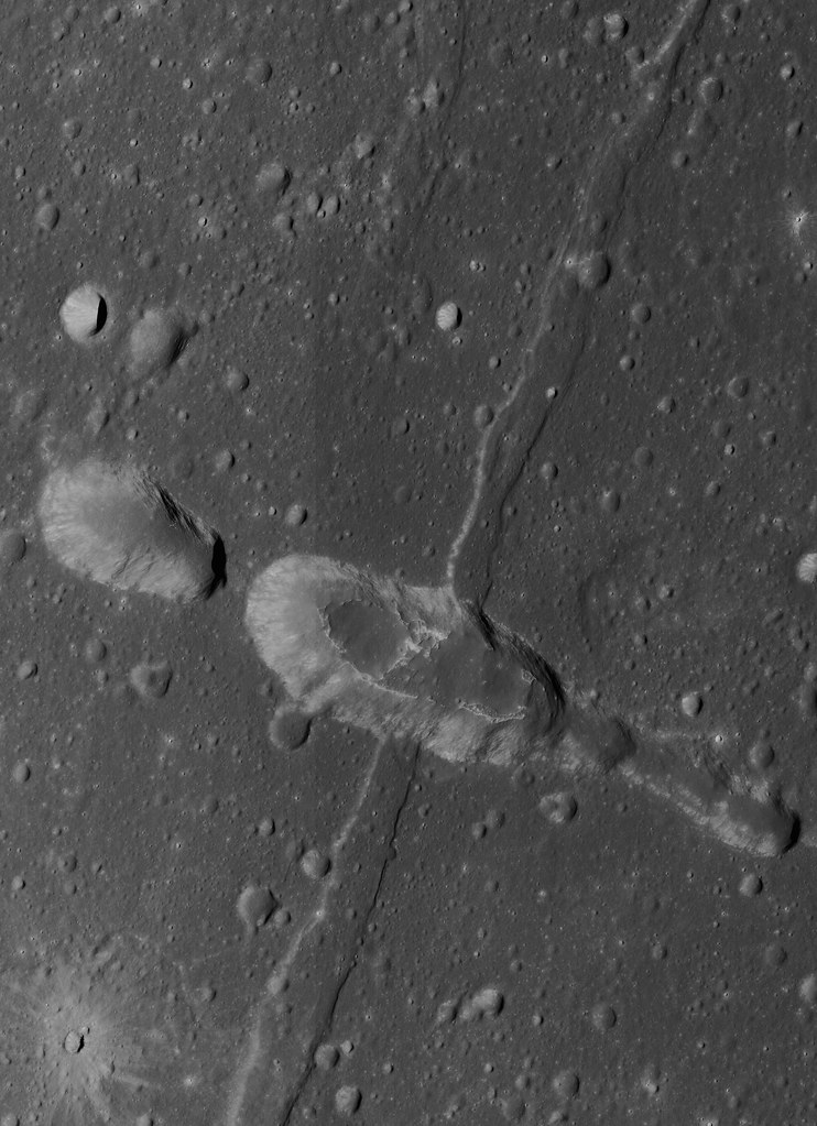
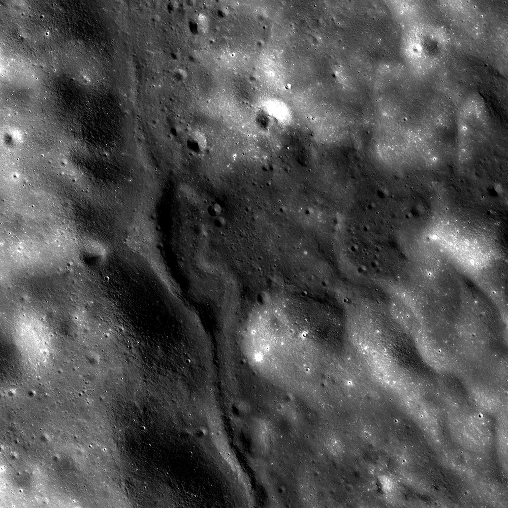
Two collapsed segments of a lava tube run from the southwest to the northeast, in the Rimae Prinz-Harbinger mountain region of Oceanus Procellarum (27.46°N, 318.33°E). These collapsed segments may provide access to the subsurface, which has never been directly sampled. The average width of the collapsed segments is ~650 meters. The lava tube is ~50 meters deep, seen in this 7 km-wide field of view from a mosaic of unreleased 2014 LROC NAC observation M1165080128 (L&R) [NASA/GSFC/Arizona State University].
H. Meyer
LROC News System

A lava tube is a volcanic conduit through which lava travels beneath the hardened crust of a lava flow. The presence of lava tubes on the Moon and beyond are inferred based on observations of terrestrial lava tubes, such as those found in Hawaii. Oftentimes, a rille suddenly disappears only to reappear a short distance away.

These are called discontinuous rilles and are thought to be areas where a lava tube collapsed. Collapsed lava tube segments may provide access to the subsurface, which is exciting as a possible site to collect rock samples that remain unaltered due to surface weathering (radiation, thermal cycling, micrometeorite bombardment).

Slightly differing, slightly lower resolution, 11.5 x 15.9 km field of view of the area of interest from a mosaic of LROC Narrow Angle Camera (NAC) observation M1152143995RL, LRO orbit 21776, April 14, 2014; resolution averages 1.33 meters per pixel, incidence angle 48.9° from 132.14 km over 26.86°N, 318.11°E. View the original 8706 x 12008 and an assortment of other sizes HERE [NASA/GSFC/Arizona State University].
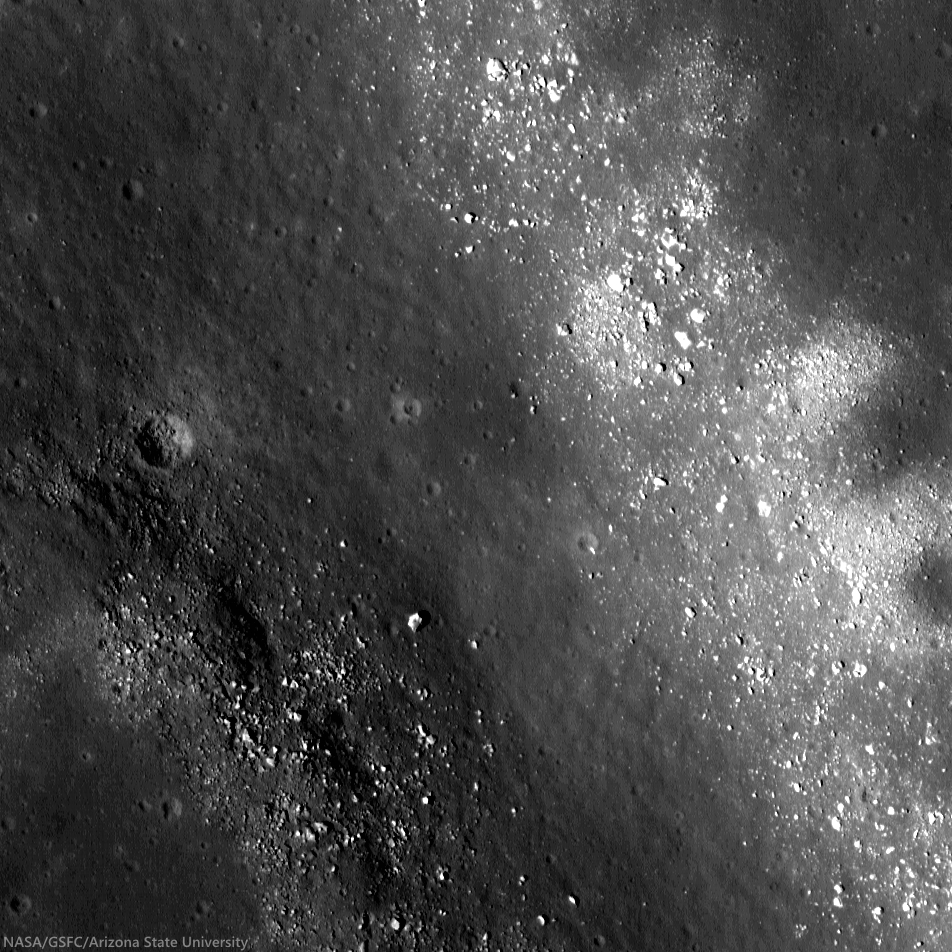
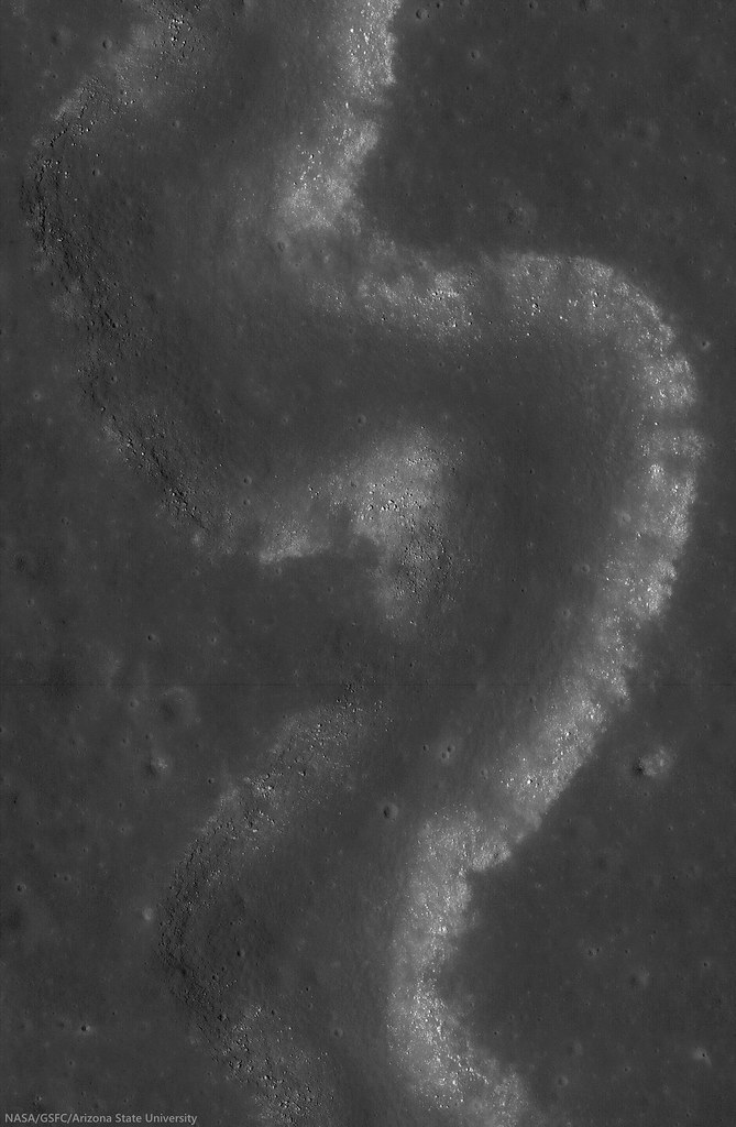
Sunrise over Mons Harbinger. 65 km-wide field of view from mosaic of three LROC Wide Angle Camera (WAC) monochrome (604 nm) observations, swept up during three sequential orbital passes, December 7, 2011,  from 43 km; resolution 58 meters per pixel, incidence 77° [NASA/GSFC/Arizona State University].
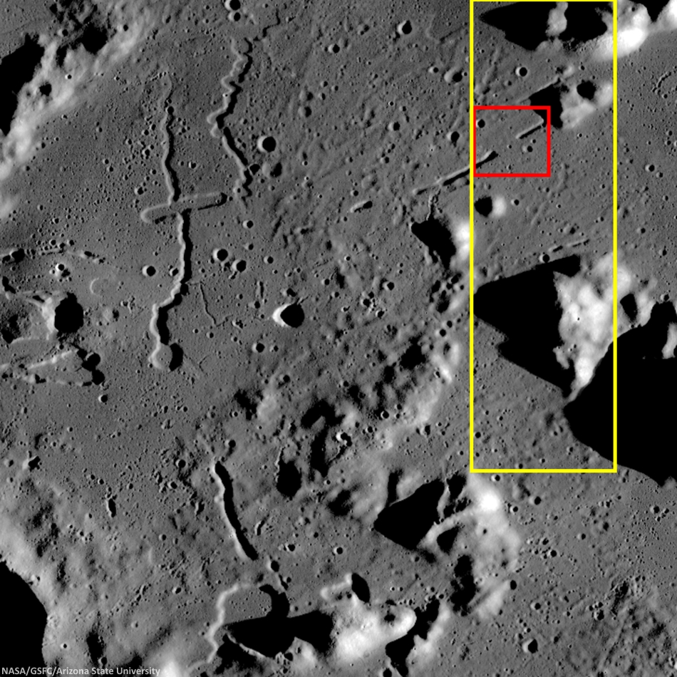
Context for LROC Featured Image released November 6, 2014, field of view in red, full field swept up in LROC NAC observations M1152143995R & L in yellow. LROC WAC mosaic [NASA/GSFC/Arizona State University].
The lava tube from the LROC Featured Image released November 5, 2014 is located to the west of Montes Harbinger, a large kipuka in Oceanus Procellarum, and to the east of the Rimae Prinz region.

The Rimae Prinz region displays exquisite sinuous rilles as well as other elongate depressions, indicating that there could be other lava tubes in the area.
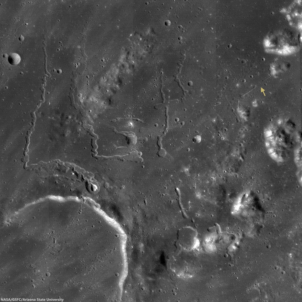
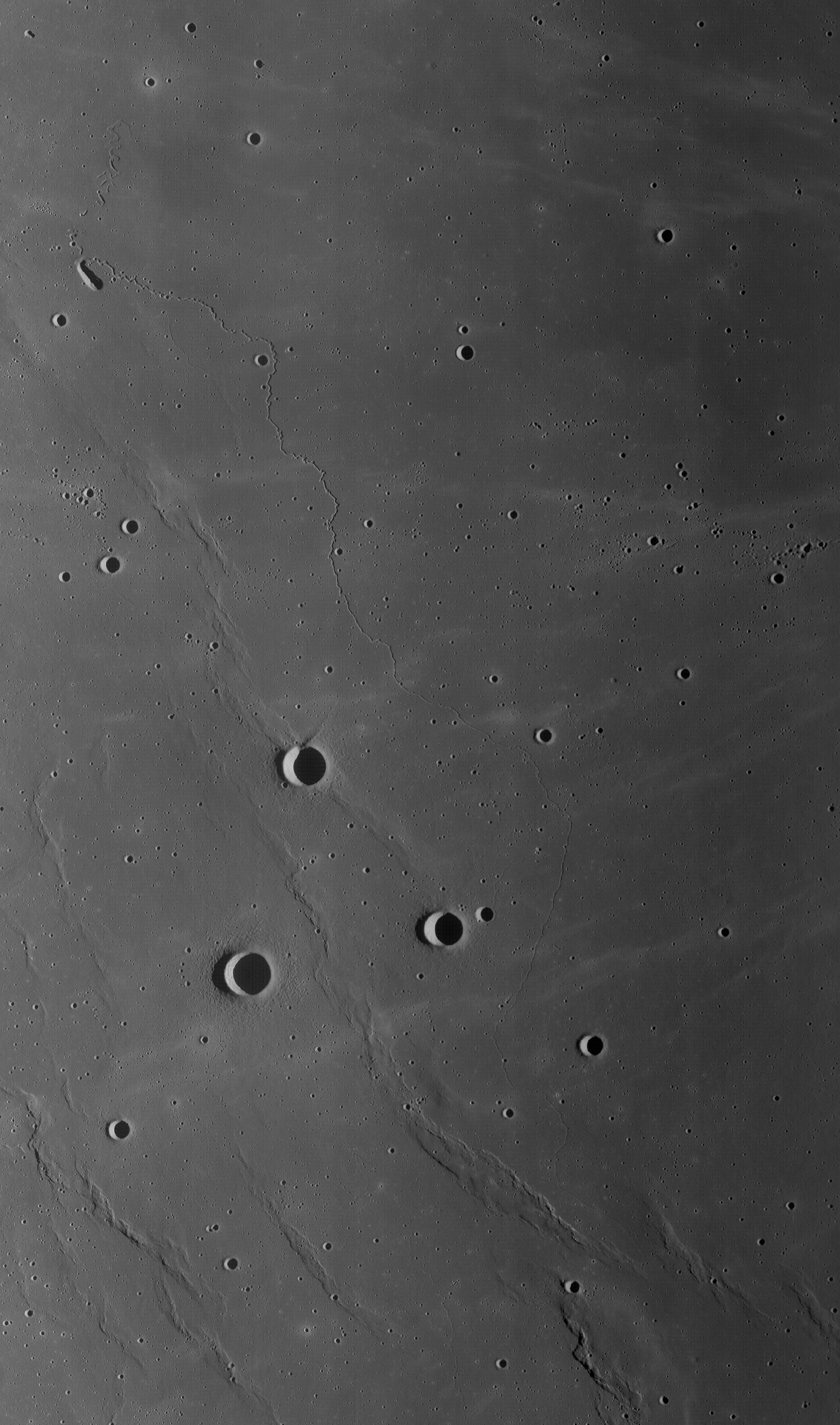
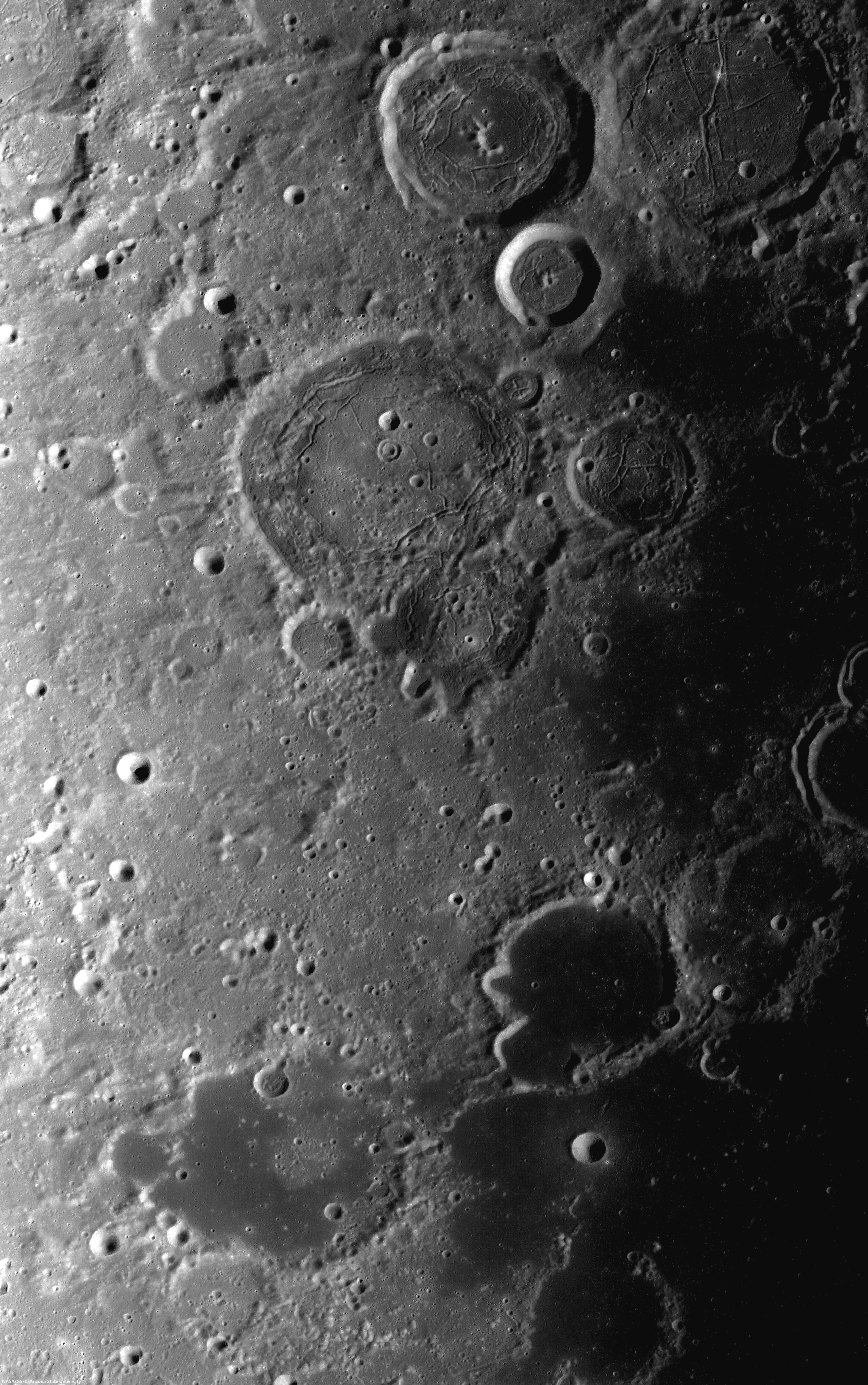
The Prinz, Rimae Prinz and Vera vent region, east of Aristarchus Plateau. The area of interest is marked with a yellow arrow, upper right in this roughly 120 km square field of view from the LROC WAC 100m global mosaic. the Vera vent 'cobra head' of Rima Prinz I rille (on the north-northeast rim of basalt-inundated Prinz crater, at lower left), is the subject of intense study (see HERE). [NASA/GSFC/Arizona State University].
The entire region, pictured above, is of interest for exploration for several reasons. The diversity of volcanic landforms in the area can tell scientists much about the volcanic history of the Moon. By collecting samples from the surface and subsurface in this region and by careful mapping on-site, scientists can better characterize the diverse basaltic lava flows in terms of both age and composition, which also helps us understand the timing and evolution of lunar volcanism and possible heterogeneities in the lunar mantle. Any time a sample is taken from a site on the Moon and age-dated, it can also be used to calibrate crater densities that are currently used to remotely age-date surfaces in the absence of direct sampling (both on the Moon and other planets).

Lava tubes are of particular interest in terms of human exploration because they are not only scientifically valuable, but they might also provide shielding from the radiation that poses a hazard to future explorers. Furthermore, the region surrounding the lava tube from this Featured Image also hosts large pyroclastic deposits, which are a potential in situ resource that will be critical to sustaining a human presence on the Moon.

Scientists and engineers are looking into the possibility of using the natural structure of the lava tube and associated resources (ISRU) to our advantage to construct habitats for explorers.

Explore the full NAC mosaic here! How many features of interest do you see?

Rimae Prinze Region - Constellation ROI
Discontiguous Rilles
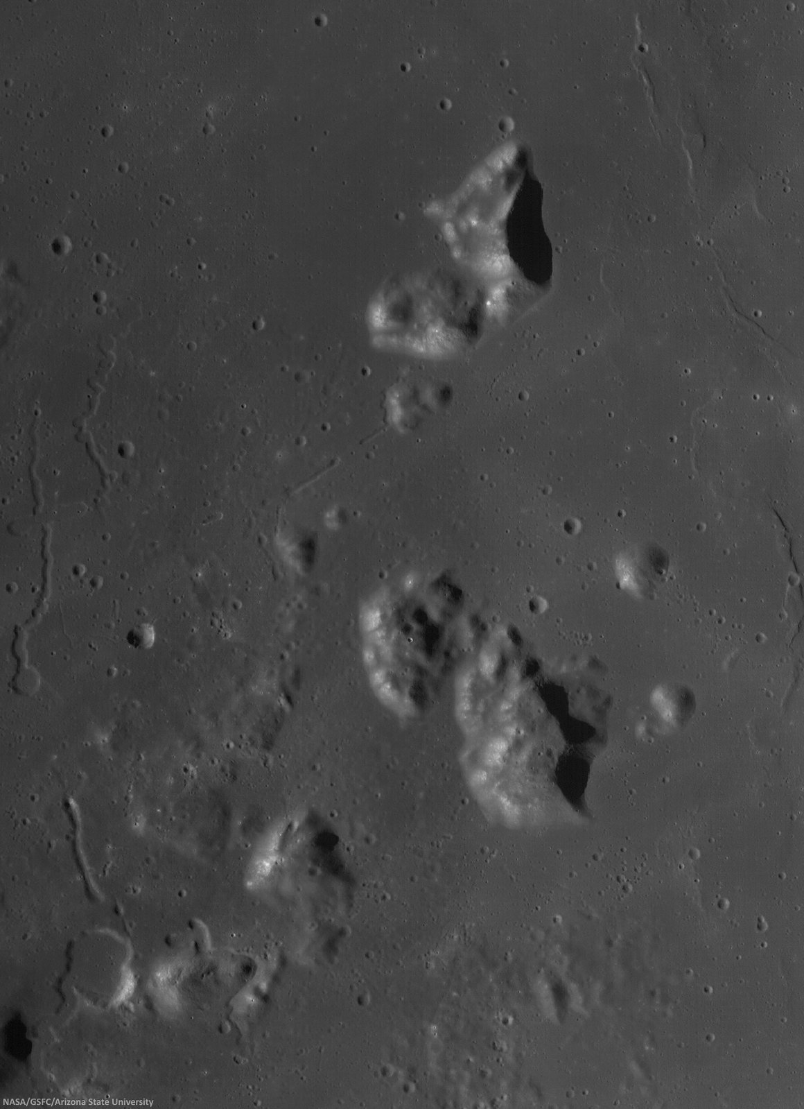
Addendum: Under mid to late afternoon sunlight, another LROC WAC mosaic, swept up under conditions remarkably similar in scale with the third image from above, from the same period of low altitude opportunities the LRO mission afforded during orbital maneuvers in the second half of 2011. Differing sun-moon-spacecraft phase angles allows for an excellent comparison. This particular mosaic was also assembled from LROC WAC observations, but five months earlier, and from three sequential orbital passes, at 43 km altitude. The resolution is 59 meters, incidence angle 64° [NASA/GSFC/Arizona State University].

Monday, October 13, 2014

LRO: widespread evidence of young lunar volcanism

The feature called Maskelyne is one of many newly discovered young volcanic deposits on the Moon. Called irregular mare patches, these areas are thought to be remnants of small basaltic eruptions that occurred much later than the commonly accepted end of lunar volcanism, 1 to 1.5 billion years ago [NASA/GSFC/Arizona State University].
Dwayne Brown
NASA HQ

NASA’s Lunar Reconnaissance Orbiter (LRO) has provided researchers strong evidence the moon’s volcanic activity slowed gradually instead of stopping abruptly a billion years ago.

Scores of distinctive rock deposits observed by LRO are estimated to be less than 100 million years old. This time period corresponds to Earth’s Cretaceous period, the heyday of dinosaurs. Some areas may be less than 50 million years old. Details of the study are published online in Sunday’s edition of Nature Geoscience.

“This finding is the kind of science that is literally going to make geologists rewrite the textbooks about the moon,” said John Keller, LRO project scientist at NASA’s Goddard Space Flight Center in Greenbelt, Maryland.

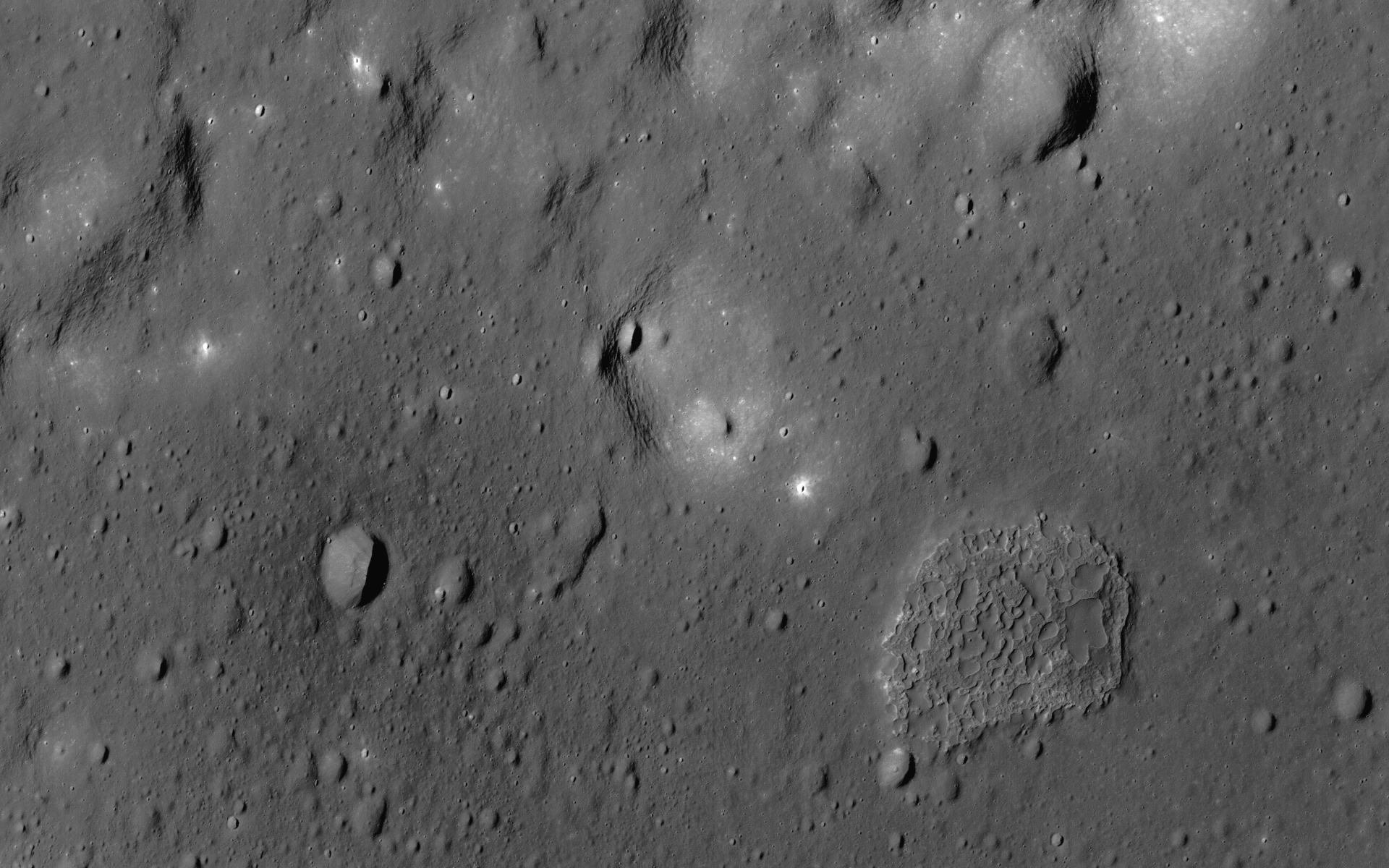
The deposits are scattered across the moon’s dark volcanic plains and are characterized by a mixture of smooth, rounded, shallow mounds next to patches of rough, blocky terrain. Because of this combination of textures, the researchers refer to these unusual areas as irregular mare patches.

The features are too small to be seen from Earth, averaging less than a third of a mile (500 meters) across in their largest dimension. One of the largest, a well-studied area called Ina, was imaged from lunar orbit by Apollo 15 astronauts.

Ina appeared to be a one-of-a-kind feature until researchers from Arizona State University in Tempe and Westfälische Wilhelms-Universität Münster in Germany spotted many similar regions in high-resolution images taken by the two Narrow Angle Cameras that are part of the Lunar Reconnaissance Orbiter Camera, or LROC. The team identified a total of 70 irregular mare patches on the near side of the moon.

The large number of these features and their wide distribution strongly suggest that late-stage volcanic activity was not an anomaly but an important part of the moon's geologic history.

The numbers and sizes of the craters within these areas indicate the deposits are relatively recent. Based on a technique that links such crater measurements to the ages of Apollo and Luna samples, three of the irregular mare patches are thought to be less than 100 million years old, and perhaps less than 50 million years old in the case of Ina. The steep slopes leading down from the smooth rock layers to the rough terrain are consistent with the young age estimates.

In contrast, the volcanic plains surrounding these distinctive regions are attributed to volcanic activity that started about 3 1/2 billion years ago and ended roughly 1 billion years ago. At that point, all volcanic activity on the moon was thought to cease.

Several earlier studies suggested that Ina was quite young and might have formed due to localized volcanic activity. However, in the absence of other similar features, Ina was not considered an indication of widespread volcanism.

The findings have major implications for how warm the moon’s interior is thought to be.

An oblique, novel view of the Ina formation (3 km across, 18.65°N, 5.3°E) from the LROC narrow angle camera (resolution 2.5 meters per pixel [NASA/GSFC/Arizona State University].
“The existence and age of the irregular mare patches tell us that the lunar mantle had to remain hot enough to provide magma for the small-volume eruptions that created these unusual young features,” said Sarah Braden, a recent Arizona State University graduate and the lead author of the study.

The new information is hard to reconcile with what currently is thought about the temperature of the interior of the moon.

“These young volcanic features are prime targets for future exploration, both robotic and human,” said Mark Robinson, LROC principal investigator at Arizona State University.

LRO is managed by Goddard for NASA’s Science Mission Directorate at NASA Headquarters in Washington. LROC, a system of three cameras, was designed and built by Malin Space Science Systems and is operated by Arizona State University.

To access the complete collection of LROC images, visit http://lroc.sese.asu.edu/

For more information about LRO, visit http://www.nasa.gov/lro

Some Related Posts:
Hansteen α -   January 15, 2014
Small-scale volcanism on the lunar mare, July 13, 2013
Unassuming volcanic vent north of Aristarchus Plateau, April 1, 2013
New views of the hollows of Rimae Sosigenes, March 28, 2013
Inside Rima Hyginus, June 12, 2012
Ina of the Meniscus Hollows, March 21, 2012
LUNAR MENISCUS HOLLOWS. P. J. Stooke, Department of Geography and Centre for Planetary Science and Exploration, University of Western Ontario, London, Ontario, Canada; 43rd Lunar and Planetary Science Conference (2012), #1011.
Whale of a Hollow, March 20, 2012
It's a gas, man, Paul Spudis, Smithsonian Air & Space, October 6, 2011

Sunday, October 12, 2014

New evidence for young lunar volcanism

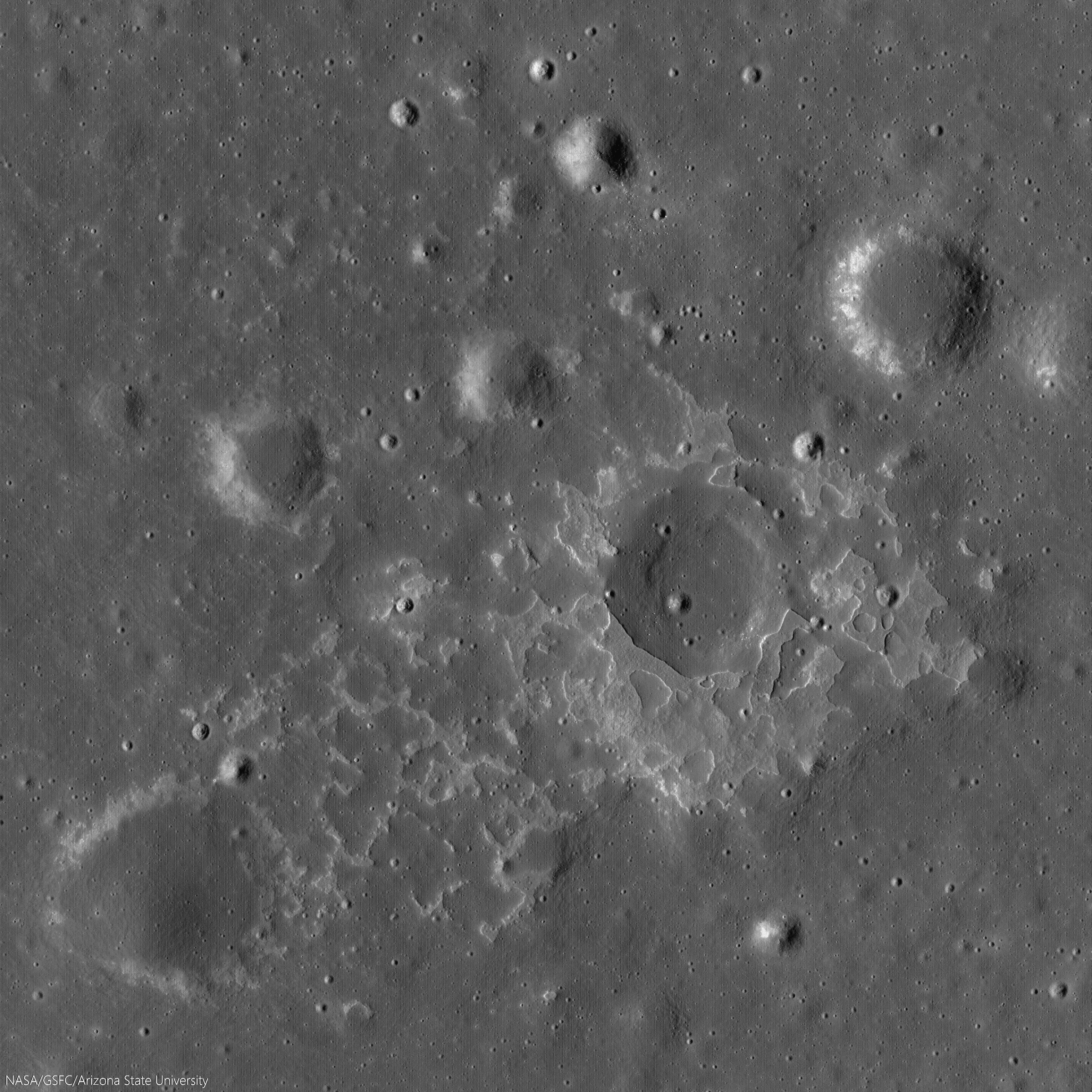
One of many newly-discovered young volcanic deposits on the Moon (4.330°N, 33.750°E), this example is near the crater Maskelyne, in south central Mare Tranquillitatis. Illustration from from "New evidence for young lunar volcanism," Mark Robinson, Oct. 12, 2014. LROC NAC observation M1123340138R, LRO orbit 17730, May 16, 2013; slew 3° from orbital nadir, incidence 66.55° resolution 1.04 meters from 102.5 km over 4.26°N, 33.97°E [NASA/GSFC/Arizona State University].
Mark Robinson
Principal Investigator
Lunar Reconnaissance Orbiter Camera (LROC)
Arizona State University

Many young volcanic deposits were recently identified in LROC NAC images. Their sharp nature and general lack of superposed impact craters greater than 20 meters in diameter indicate these deposits probably formed in the last 100 million years, perhaps even more recently than 50 million years ago. An amazing result!

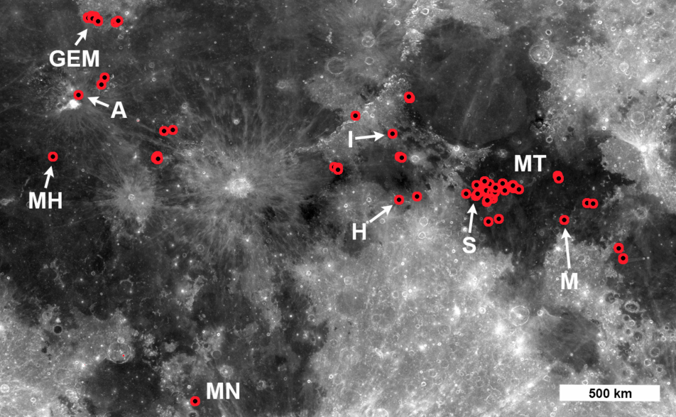
A new paper, (Evidence for basaltic volcanism on the Moon within the past 100 million years, Nature Geoscience 7, 787-791; 2014) presents 70 topographic anomalies, informally called Irregular Mare Patches, or IMPs, most of these occurrences were previously undocumented. The IMPs are thought to be remnants of small basaltic eruptions that formed significantly after the commonly accepted end of lunar volcanism (1 to 1.5 billion years ago).

Locations of IMPs. Red circles indicate either a single IMP greater than 100 meters in diameter, or a cluster of smaller IMPs. The area extends from 28.0° N to 40.6° N latitude and 58.0 ° E to 50.3° E longitude, LROC WAC 643nm mosaic. IMP labels: Aristarchus (A), Gruithuisen E-M region (GEM), Hyginus (H), Ina (I), Mare Nubium (MN),  Mare Tranquillitatis (MT), Marius Hills (MH), Maskelyne (M), Sosigenes (S) [NASA/GSFC/Arizona State University].
Pursuing a Decades-old Puzzle

The best-known IMP, called Ina (or Ina-D), was originally spotted in Apollo 15 orbital photography, and was unlike anything else previously discovered on the lunar surface. Beginning with Apollo era investigations, Ina was interpreted as a collapsed caldera at the summit of a low-shield volcano. Previous interpretations of impact crater densities within and around Ina suggested that this enigmatic landform was much younger than the surrounding mare basalt unit in Lacus Felicitatis (Lake of Happiness).

Not only does the NAC provide excellent resolution, but after 5 years of operation has covered well over 75% of the surface. This combination led to the discovery of many new IMPs in locations across the nearside of the Moon. Ina is not simply a one-off oddity – but rather a signature of volcanic processes that actually occurred in multiple places across the nearside.

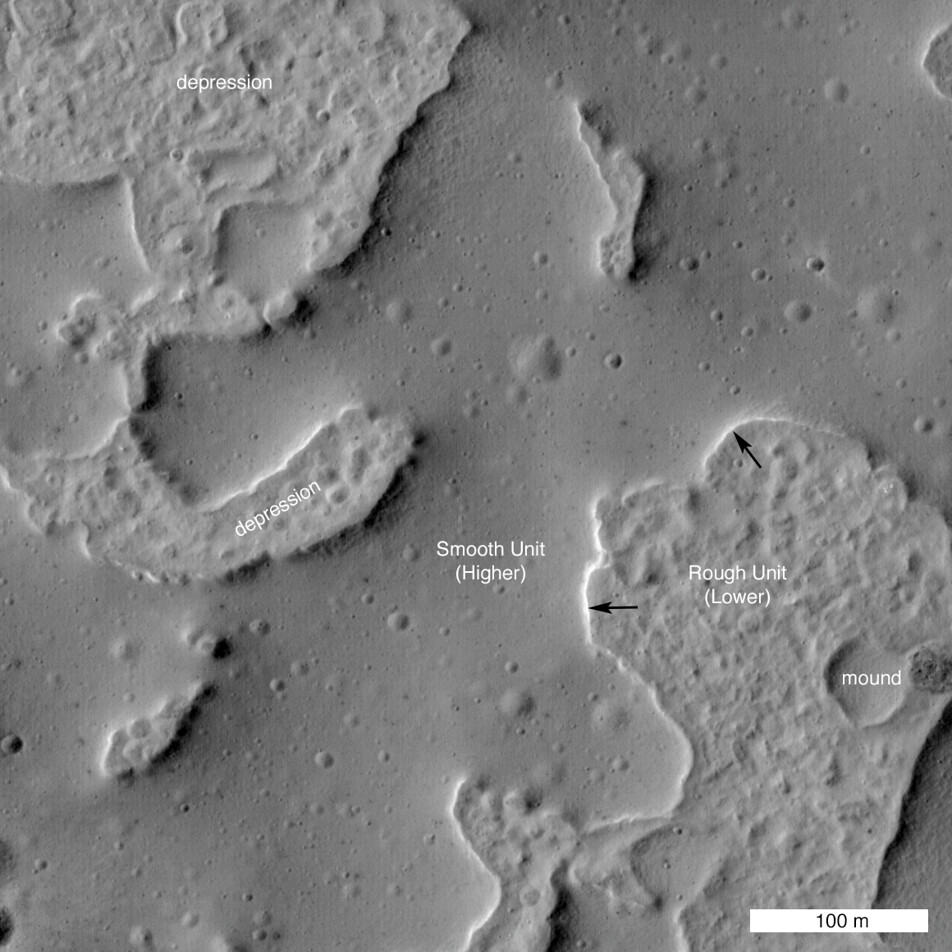
Close up of a small 464 meter wide section of the "IMP" familiarly known as Ina. This area is a great example of the difference between the rough and smooth units that make up the new family of IMP structures. The smooth unit is composed of mounds over the rougher units. The Sun is from the East, the black arrows show a Sun-facing cliff of one of the mounds. LROC NAC M175246029LR, LRO orbit 10960, November 6, 2011; 45.6° incidence, resolution 44 cm from 24.54 km over 18.91°N, 4.76°E [NASA/GSFC/Arizona State University].
New Discoveries

All of the lunar landforms identified as IMPs exhibit two distinct morphologies: smooth deposits, which are sometimes connected to the surrounding mare basalt, and uneven deposits (rough-looking) which usually end abruptly at the steep edges of the smooth deposit; it is likely that the smooth materials are covering portions of the rough material.

To estimate the age of IMPs the LROC team measured the sizes and numbers of impact craters on the smooth deposit surfaces (geologists use the crater size-frequency distribution (CSFD) as a metric for estimating the age of a surface). The resulting crater distributions from the three largest irregular mare patches imply ages younger than 100 million years. Indeed, the new crater counts confirmed that Ina is very young, perhaps as young as 33 million years.

IMP north of Aristarchus crater (25.044°N, 313.233°E). Compelling evidence of the youth of this feature and its apparent origination from active processes within the Moon. As a matter of stratigraphy, the phenomena that caused this occurred after the formation of Aristarchus crater, a late Copernican age crater itself superposed on some of the Moon's youngest basaltic volcanic plains. 650 meter-wide field of view from LROC NAC observation M168509312R, LRO orbit 9967, August 20, 2011; incidence 42.67° at 40 cm resolution from 25.59 km over 24.7°N, 313.21°E [NASA/GSFC/Arizona State University].
Another key set of observations came from digital topographic maps derived from NAC stereo pairs that enabled quantitative relief and slope measurements of six larger IMPs. Measurements of the smooth deposit relief compared to the underlying uneven deposit revealed that the thickness of the smooth deposits (on average 8 meters, with a range of 2-20 meters) is consistent with the previously established thickness of lunar basalt flows.

Topographic slopes were measured at the edges of the smooth deposits where they contact the uneven deposits. Slopes that exceed the angle of repose, which is 30-35°, are evidence of relatively young surface features, because over time impacts and moonquakes will smooth over steep cliffs. Slopes on the edges of many of the smooth deposits exceed the angle of repose, providing more evidence for very young surfaces.

Changing the Way We Think About the Moon

Not only are the IMPs striking landscapes, they also tell us something very important about the thermal evolution of the Moon. The nearside has extensive mare basalt flows covering much of its surface, however we know from analysis of Apollo samples and crater counts that the bulk of lunar volcanism occurred from 3.9 to 3.1 billion years ago, and shut-off sometime around 1 billion years ago. However the IMPs seemed to have formed significantly after the canonical cessation of lunar mare basalt volcanism indicating the interior of the Moon is perhaps hotter than previously thought.

The contrast between the smooth and rough units stands out in this oblique view of Ina. The floor of the depression is about 50 m below the surrounding plains and is about 2 km wide. LRO oblique mosaic M1108203502LR, LRO orbit 15596, November 22, 2012; 52.18° slew from orbital nadir, resolution 3.75 meters from 127.29 km over 18.77°N, 11.64°E [NASA/GSFC/Arizona State University].
Full-width reduction of LRO oblique mosaic M1108203502LR, showing the interesting contextual features, some related, others likely not, subject of decades of speculation [NASA/GSFC/Arizona State University].
The new study of IMPs extends our knowledge of the extent of these fascinating deposits as well as their young age. What does it all mean? The young, small-volume extrusions of mare basalt imply a thermal history of the Moon where volcanism did not end abruptly, but rather decreased gradually over time (and may not be done!). With these newly discovered young volcanic features, scientists must consider that the Moon has a bit more heat in it that previously thought, an important new constraint for future models of the Moon's thermal evolution. Perhaps the abundance of radioactive elements (which provide heat as they decay) is higher -- important knowledge when figuring out how the Moon formed and evolved over time.

A provocative side note to the new thermal constraints — perhaps the Apollo heat flow measurements were spot on? Astronauts buried thermometers in the regolith during the Apollo 15 and 17 missions. The temperatures recorded were a bit higher than models predicted. At the time, scientists proposed that perhaps the two landing sites were in areas with higher heat flow than the average Moon, or perhaps there was an instrumental effect. The discovery of IMPs and their young age is certainly consistent with the higher temperatures measured by the Apollo crews.

Apollo 15 cmdr. Dave Scott working at the west Heat Flow hole (with St. George crater in the background). The drill is sitting on the ground next to the hole. Increased understanding of IMP phenomena increases the likelihood readings taken using the Apollo Heat Flow Experiments (HFE) during the Apollo 15 and 17 surface expeditions were not, afterall, anomalous. Apollo 15 EVA-2 AS15-92-12408 [NASA/JSC].
The IMPs are a fascinating part of the story of lunar volcanism over time, and now they must be considered high priority targets for future exploration. A sample return mission from one of these enigmatic deposits would tell us so much about the Moon as a whole. When did these lavas erupt? Is their chemistry different than the basalts returned by the Apollo astronauts? Is it likely that volcanic eruptions may occur at some point in the future?  A highly accurate age date for the IMPs would also serve as a much needed calibration point for the lunar cratering chronology; a crucial improvement not only for lunar studies but also for Mars and Mercury investigations.

Closer look at the IMP at Rimae Sosigenes - image follows below - Demonstrations Supplementary to "Evidence for basaltic volcanism on the Moon within the past 100 million years," Nature Geoscience 7, 787-791; 2014

Fig. 7 (top) Profile across a contact between smooth and uneven deposits, southeast feature. The relief of the smooth deposit is measured as the difference in elevation between the average flat surface of the smooth deposit (-1504 meters below global mean elevation; Sosigenes Graben NAC-DTM) and the base of the uneven deposit at the contact (-1514 meters). For this particular profile the smooth deposit is 10 meters thick. Note the lobate margin of the smooth deposit at the contact.

Fig. 5 (bottom) Craters on the smooth deposit of the Sosigenes IMP. The red circles are impact craters superposed on the smooth deposit of the Sosigenes IMP, delineated by the blue line; field of view roughly 5 km [NASA/GSFC/Arizona State University].
Spectacular oblique mosaic of the Sosigenes graben with it's large collapse pit, 2800 meters long and 300 meters deep, and floored with an IMP.  LROC NAC oblique observation M1108117962LR, LRO orbit 15584, November 21, 2012; 70.37° incidence, spacecraft and camera slew 55° resolution 2.5 meters from 114.87 km over 8.63°N, 24.9°E [NASA/GSFC/Arizona State University].
View full-window: Spectacular oblique NAC mosaic of the Sosignes graben with a large collapse pit (2800 meters wide, left-to-right; 300 meters deep) floored with an IMP.

Wider field of view from a spectacular oblique LROC NAC mosaic M152750200LR, LRO orbit 15584, November 21, 2012; 70.37° incidence, spacecraft and camera slew 55° resolution 2.5 meters from 114.87 km over 8.63°N, 24.9°E [NASA/GSFC/Arizona State University].
Inspect a variety IMPs using the LROC Quickmap: Cauchy-5, Nubium, GEM-30, Aristarchus North

Related Posts:
Inside Rima Hyginus (June 12, 2012)
Ina of the Meniscus Hollows (March 21, 2012)
Spectral properties of Ina (February 7, 2011)

Thursday, June 5, 2014

Rima Seuss, rough around the edges

With peppered flanks, Rima Suess wanders over 150 km through Oceanus Procellarum. The rocks that rest on the walls of this sinuous rille are perhaps remnants of much larger boulders that have eroded down to meter sized rocks due to relentless micro and macro meteorite bombardment, "gardening" 3 centimeters into lunar dust every 2 million years or so. The pyroclastic flow that carved through the terrain was remarkably fast, considering the long scar left behind has lasted perhaps 3 billion years. From the extraordinary low altitude of only 23 km (see below), the 400 meter field of view above is cropped from LROC NAC observation M168516400R  [NASA/GSFC/Arizona State University].
Raquel Nuno
LROC News System

Rima Suess (7.81°N, 312.41°E), located in Oceanus Procellarum, is a long, meandering narrow depression called a sinuous rille.

Sinuous rilles, most commonly found in mare surfaces, are thought to have been carved by fast rivers of lava, which thermally and mechanically eroded the channels we see today.

About 3.1 billion years ago the Moon was much more volcanically active, pouring vast amounts of lava onto the surface. The large dark mare regions of the Moon were formed by massive eruptions of iron-rich basaltic lava during this time.

Very close-up on Rima Suess, the LROC NAC observation from which this and the LROC Featured Image were processed was from among one of the closest passes of the Lunar Reconnaissance Orbiter (LRO) over the Moon, during low-periapsis maneuvers in 2011. (Full resolution original image HERE.)  LROC NAC observation M168516400R, LRO orbit 9968, August 12, 2011; 36.11° incidence angle, resolution 39 cm from 22.92 km over 8.07°N, 312.38° [NASA/GSFC/Arizona State University].
The boulders along the walls of the rille probably were a coherent mass when the lava flows cooled, breaking up over billions of years of impacts into the boulders we see today. Gravity then pulled this material down the slope of the rille; this process is known as mass wasting. We see rock outcrops over the entire path of Rima Suess in the LROC NAC image M168516400R.

The very narrow, actually a 200 km-plus-long sinuous rille, apparently traced remarkably fast south from the Marius Hills "Yulu" double-volcano source nearly to Flamsteed P crater, through the bleak center of Oceanus Procellarum. Nearby Kepler crater (outside this view, to the right and east) added the bright ejecta rays. This view is distilled from a mosaic of LROC Wide Angle Camera (WAC) observations swept up over five sequential orbits during local early local morning, allowing long shadows to add some relief to this remarkably flat area of the lunar surface, all of it averaging below 2000 meters in elevation. LROC WAC mosaic from LRO orbits 6838 through 6842, December 18, 2010; 79° incidence angle, resolution 58 meters from 41.5 km [NASA/GSFC/Arizona State University].
Lunar rilles are exciting places for lunar scientists because they may cut through and expose the different layers of lava flows in the maria.  This gives scientists insight into the volcanic processes present during mare formation, and how they evolved with time.

Explore the winding path of this portion of Rima Seuss in the full resolution LROC NAC HERE.

Related Posts:
Rilles as far as the eye can see in Prinz!
Rille within a rille!
Collapsing Tube

Friday, May 16, 2014

The complex case at Lassell K

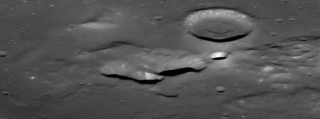
An early morning view looking east-to-west from an altitude of 86 km across the southern portion of the Lassell Massif, an irregularly shaped series of hills and steep-walled depressions. North is to the right in this LROC NAC oblique mosaic M1108311369LR, LRO orbit 15611, November 23, 2012; 71.73° incidence angle, spacecraft and camera slew 56.64° from orbital nadir, resolution above 2 meters from 85.65 km over 14.63°S, 355.69°E [NASA/GSFC/Arizona State University].
J. Stopar
LROC News System

The Lassell Massif is a complex area of rugged terrain located in northeastern Mare Nubium (14.7°S, 351.0°E). This undulating terrain of hills and steep-walled depressions is 45 km across from north to south and 25 km across from east to west.

The southern portion of the massif comprises several prominent elongate depressions (like Lassell K and Lassell G, seen below) that are clustered together.

The Lassell Massif in Mare Nubium; north is to the right. Prominent features of the Lassell Massif region include Lassell C, K, and G [NASA/GSFC/Arizona State University].
The clustering and irregular shape of these negative-relief features is reminiscent of volcanic calderas on Earth and other terrestrial planets, including Mars. Calderas generally form through collapse as magma retreats from the vent area. Overlapping collapse features suggest multiple episodes of magma advance and retreat over time. Lassell K and G may be part of a volcanic caldera!

Lassell K and G could, however, instead represent a series of clustered impact craters, which are relatively common on the Moon.

Remote sensing data displayed in eight diverse views of the 1000 meter-high profile of Lassell massif, collected by four spacecraft (all of them post-Apollo) presented in an overlapping 40.2 km-wide field of view, visible throughout both day and night. The largest crater at center-left is Lassell C (8.74 km; 14.67°S, 350.64°E) [Clementine, LRO, Chandrayaan-1 and Chang'e-2].
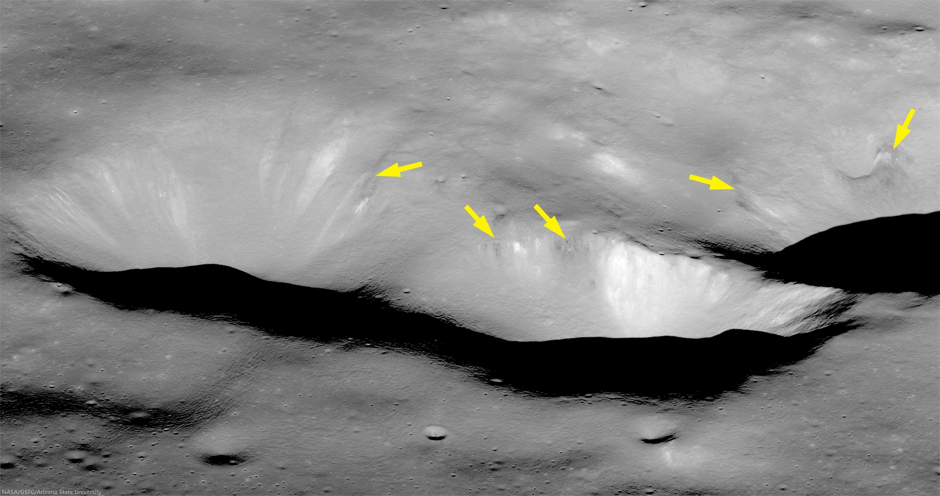
Lassell K (left) and portion of Lassell G (right). The upper walls of these steep-walled depressions have dark, low-reflectance, boulders and downslope streamers (arrows), where a thin layer of dark material, possibly pyroclastic, has eroded out of the wall [NASA/GSFC/Arizona State University].
Looking closely at this region, we see other features that are typical of volcanic eruptions including: dark mantling layers interpreted as possible pyroclastics, a subdued or mantled terrain, and even a possible volcanic cone.

Taken together, these features suggest a complex volcanic history for this region. If the Lassell Massif is constructed from a series of volcanic extrusions, it may represent an unusual type of silicic volcanism on the Moon (perhaps similar in composition to rhyolite).

Read more about the Lassell massif and its unusual style of volcanism in a study presented by members of the Lunar Reconnaissance Orbiter Camera team and colleagues to the 44th Lunar and Planetary Science Conference (2013): "The Lassell Massif, Evidence for Complex Volcanism on the Moon," #2504.

The full oblique image (below) along with other images and compositional data sets may reveal more clues to the timing and nature of volcanism in the Lassell region. However, returning rock samples to Earth and exploring the slopes of this structure from the surface may be the only way to confirm its origins.

View assorted sizes of an unlabeled sample of a mosaic from the LROC observation above, HERE.
View oblique in full-window, HERE.

Related LROC Featured Images:

Tuesday, April 1, 2014

Lavoisier pyroclastics

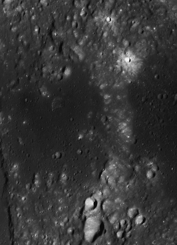
Irregular "peanut-shaped" depression, perhaps a former fire-fountain vent, at the head of a floor fracture skirting the western floor of Lavoisier crater, on the west-northwest frontier of Oceanus Procellarum. Low reflectance material, thought to be pyroclastics, appears to have flowed and pooled, eastward and throughout the ancient crater floor. 15 km-wide field of view from a mosaic of LROC NAC observations M105055584L & R, from early in the LRO mission, spacecraft orbit 637, August 16, 2009; resolution 1.6 meters per pixel, incidence angle 57.3° from 162.45 km above 38.32°N, 231.59°E  [NASA/GSFC/Arizona State University].
Raquel Nuno
LROC News System

Lavoisier crater has many geologic forms that give insight into its history. On the floor are concentric craters, which exhibit an inner and outer rim; these strange craters are thought to have formed as a subsurface discontinuity, such as a strong rock layer below loose regolith, which interfered with the passage of the impact shock wave.

Fractures, which are caused by uplift of brittle material, are also abundant and point to subsurface magmatic intrusions or viscous relaxation as possible formation mechanisms.

The peanut-shaped irregular formation, just within the west wall of Lavoisier crater (71 km, 38.17°N, 278.75°E), in an image of the entire crater. Pyroclastic deposits encircle the crater floor, visible as areas of slightly darker appearance in this LROC WAC mosaic stacked from seven sequential monochrome (643 nm) observations by LROC Wide Angle Camera captured after local sunrise November 23, 2010; average resolution 65 meters from 49.5 km [NASA/GSFC/Arizona State University].
Today's Featured Image, found on the western edge of the floor of Lavoisier crater, shows low reflectance material that appears to have flowed from the head of one of these fractures. These flow fronts have been identified by lunar scientists as being the remnants of pyroclastic deposits. The irregular depression is not just another fracture, but a source vent for the eruption that created these deposits!

Context for the context. The west by northwest extremes of Oceanus Procellarum hosts several deposit remnants of fire-fountain pyroclastic volcanism. On the edge of the vast plains to the east and farside highlands to the west, dykes of volcanic faulting offer clues to the long-sought definitive origin for the Procellarum basin that, like Mare Tranquillitatis, does not seem to have formed from a single basin-forming impact. Breakthrough data was collected by the sensitive GRAIL A and B probes. Image stacked from from seven sequential orbital monochrome (643 nm) observations by LRO LROC Wide Angle Cameras of the region, soon after local sunrise, November 23, 2010; average resolution 65 meters, from 49.5 km [NASA/GSFC/Arizona State University].
The eruption (or eruptions) that threw these pyroclastic deposits out onto the surface are thought to be an energetic style of volcanic eruption called fire fountains. Eruptions like this are more chaotic due to the presence of volatile elements in the magma. Since magma source regions are hundreds of kilometers below the surface, pyroclastics are of interest to scientists because they provide information about the deep interior at the time of eruption. Understanding the distribution and composition of these deposits provide a path to deciphering the evolution of the interior conditions of the Moon through time. The Lavoisier pyroclastics and many other similar deposits are key sites for future robotic and human exploration.

Investigate the mantling of pyroclastics over the crater floor up close with the full resolution NAC mosaic, HERE.

Related Posts:
Lavoisier Crater
Pyroclastic Excavation
Layer of Pyroclastics
Pyroclastics and Vent
Hyginus Crater and Pyroclastics

Wednesday, January 15, 2014

Hansteen α

Hansteen α (LROC NAC)
Close up on the heights (-923.8 elev.) of Hansteen α (AKA, "Mons Hansteen" and "the Arrowhead"), a triangular berg, 25 km long on its three margins, composed of intrinsically bright material and rising here 1030 meters above its neighborhood in south Oceanus Procellarum.  LROC Narrow Angle Camera (NAC) periapsis observation M166175569LR, spacecraft orbit 9623, July 24, 2011; 61.74° incidence, slew 16.45° west, resolution 0.5 meters from 41.05 km (Enlarged image HERE.) [NASA/GSFC/Arizona State University].
Mons Hansteen (12.2°S, 50.21°W) is a familiar nearside landmark, when viewing a Moon that's almost Full through a modest telescope. As the reader can see in the picture of the Full Moon at the end of this post, it stands out from its surroundings in the far south Oceanus Procellarum.

It's nicknamed "the arrowhead" because it looks like one, like, long-ago, it was knapped to a point by the patient hand of a hunter and now rests half buried in the darker mud of a trail, perhaps uncovered by a recent downpour.

Close investigations of the Moon over the past half century reveal what investigators call "Hansteen Alpha," or Hansteen α, stands out geologically and in other ways. The small mountain is made of different stuff than most of what is found on the lunar surface and the volcanism that flooded and re-flooded the Moon's basins. It's optical brightness is complimented by differences at other wavelengths as well, presenting a spectral profile found in only a few other locations on the Moon. 

Hansteen α is one of the Moon's red spots, bright with an albedo similar to the lunar highlands but spectrally red, brighter in shorter wavelengths and characterized by absorption in the ultra-violet (UV). 

Moreover, it must be a younger feature than it might seem on first glance, younger than certain of the larger craters nearby and other features in its neighborhood that were clearly overrun repeatedly by the darker basaltic lavas that periodically flooded and re-flooded the lower elevations over a period nearly three billion years long.

Hansteen α (LROC NAC)
The heights in the first image are at lower right in this 3.94 km-wide field of view, the full width of the area captured from LRO in LROC NAC M166175569LR, and showing a cross-section of Hansteen α from that central area north to more lower elevations, nearer the mountain's northwestern margin. (View larger sizes HERE.) [NASA/GSFC/Arizona State University].
Hansteen a (LROC WAC 250m)
Hansteen α is younger than craters Billy (45.57 km across and 3.88 billion years old, to the south) and Hansteen (45 km across and 3.87 billion years old, to the west), because both are less than one and a half times their respective diameters in distance, and the impacts that excavated these features should have at least partially covered the bright mountain. Instead, no evidence of such a direct effect has been found, only peppering of more recent impacts. LROC Quickmap at 250 meters resolution [NASA/GSFC/Arizona State University].
Hansteen α resembles the Moon's highlands but, beginning early in the post-Apollo era, investigators noted differences in texture, color and measured albedo. In the close-ups at the beginning of this post, showing some of the highest elevations of Hansteen α, depressions can be seen clustered on terraces. These seem to have once been volcanic vents.  Volcanic vents are not particularly rare on the Moon, but the kind of material that emerged from these is clearly not the same stuff that flooded its surroundings.

LROCQM064-H-a-580x746
A closer look at Hansteen α elevations, with locations marked of areas shown in LROC NAC observations posted here, the highest elevations and, further along along, some solidified flows on the steep southeastern margin, included below. LROC Quickmap at 64 meters resolution, together with the LROC WAC-derived digital terrain model [NASA/GSFC/Arizona State University].
Using an experimental 3D visualization tool, accessed through the LROC Quickmap. a 152 square km area, centered on Hansteen α, animated between 0 and 10 X vertical exaggeration, further illustrating highest elevations, southwest of the formation's center; something more difficult to measure using 2D overhead photography [NASA/GSFC/Arizona State University].
The margins of Hansteen α seem abrupt, with steeper slopes than is found around the edges of the more common basaltic domes. This might be in keeping with suggestions that the kind of lava emerging into and out of this feature was thicker, related to its composition and the heat necessary for melting and transport. It also provides geologists with clues about its age relative to the volcanism that flooded Procellarum in this region.  

The Hansteen α might have formed from a "secondary," and "more evolved" volcanism, something certainly less common than the basaltic lavas that flowed out into the Moon's broad basins, not once but repeatedly, over a 2.7 billion year period, from the Nectarian age, when the Moon and Earth were only 600 million years old, until just prior to the Copernican period 1.2 billion years ago.

These more recent high-resolution images from LRO show groupings of blocky boulders, mostly related to mass wasting along slopes though some of these clusters are found on level areas and don't appear to be the result of impacts.

Intrusive volcanism Hansteen Alpha
An intrusive flow, clearly visible on the abrupt southeastern margin of Hansteen alpha,  right where it solidified, This is a 3.93 km square field of view from LROC NAC observation M1129816872R, orbit 18636, July 30, 2013; 42.35° incidence, 80 cm per pixel resolution from 80.7 km over 12.2°S, 310.14°E  [NASA/GSFC/Arizona State University].
Intrusive volcanism Hansteen Alpha
Contextual view of the full 7.8 km-wide field of view swept up in the same LROC NAC  observation, showing a wider view of southeast margin of Hansteen α. Such close-ups reveal that the margin here is more abrupt than it seems at a distance. (Enlarged views and various other sizes available HERE.) [NASA/GSFC/Arizona State University].
So, just what is Hansteen alpha? In two papers presented in 2011 and 2012 to the Lunar and Planetary Science Conference, Hawke, et.al., representing some of the more noted investigators working with data returned from LRO (the more recent of these being  "The Geology and Composition of Hansteen Alpha," 43rd Lunar and Planetary Science Conference (2012), #1754), wrote, "Non-mare volcanism is the only viable process for the formation of Hansteen α."

That paper, along with others those investigators cite, along with still others cited as references below, present truly fascinating discussion of how instruments on-board Clementine (1994), Lunar Prospector (1998-99) and both the LROC cameras and the Diviner instrument, flying on LRO since 2009, are actively being used to weed out the history of this unique feature and how it relates to the complicated volcanic stratigraphy of the Procellarum basin.

Finding Hansteen alpha (Mons Hansteen)
Finding Hansteen α through a modest telescope is relatively easy, from about four days after First Quarter through three days after Last Quarter, on the south edge of Oceanus Procellarum, as shown in this well-crafted mosaic by Stephan Lammel. Look for it left of center in the inset and in the Full Moon, above.
References:

Related ASU LROC Posts:
The Fourth Marian Dome (April 17, 2013)
Aristarchus Spectacular! (December 26, 2011)
Silicic volcanism on the Moon (February 14, 2011)

Tuesday, July 23, 2013

Small-Scale Volcanism on the Lunar Mare

LROCWAC-small-shield-volcanism-1314
"Small Shield Volcanism on the Lunar Mare," (figure 1.) EPSC 2013-875 Plescia, Robinson & Joliff. Constructs in Mare Tranquillitatis. a: low-relief, low-slope with central crater; b "pancake-shaped"; c and d': hummocky, steep-sided , gc: ghost crater. LROC Wide Angle Camera high-angle incident mosaic, centered near 7.5°N, 37.5°E [NASA/GSFC/Arizona State University] .
Plescia, Robinson & Jolliff
Johns Hopkins APL
Arizona State University
Washington University of St. Louis


"Small shield volcanoes having low relief and gentle slopes are scattered across the lunar mare. These features represent the terminal phases of mare volcanism and are formed by short-duration, low-volume eruptions. Composition and eruption dynamics may have varied as the morphology and color of the shields vary. There appears to be regional correlations of morphometric properties indicating larger-scale organization of the eruptions.

"Data from LRO and other missions now provide the ability to characterize each dome in terms of areal extent, topography, morphology, and color properties in unprecedented detail allowing for an analysis of their origin.


"Here, a subset of the domes are interpreted to represent a volcanic style characterized by small volume eruptions that built low-relief constructs (Fig. 1). This style of volcanism has been termed plains volcanism [14] and is common in the Tharsis region."

Small Shield Volcanism on the Lunar Mare, European Planetary Science Conference 2013, Vol. 8, #875; J.B. Plescia, Johns Hopkins University Applied Science Laboratory; M.S. Robinson, Arizona State University; B. Jolliff, Washington University, St. Louis

M190351657L-NSJ-0503-6509x8978
Small-scale shield volcanic vent structure ("d." in WAC mosaic above) south of Rupes Cauchy in Mare Tranquillitatis, near 7.5°N, 37.5°E; Vent strongly presents features resembling those of the Ina structure. 6.2 km-wide field of view from LROC NAC mosaic M190351657LR, LRO orbit 13098, April 29, 2012; 41.95° angle of incidence, resolution 0.95 meters per pixel from 113.33 km. Full-size versions HERE [NASA/GSFC/Arizona State University].