Showing posts with label Lillian Ostrach. Show all posts

Thursday, June 20, 2013

An Oval Crater on Harvey's Wall

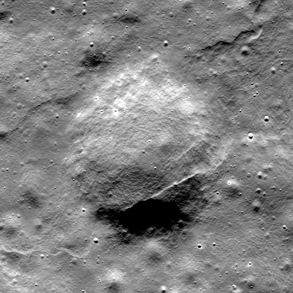
A bolide impacting into the sloping south wall of Harvey crater formed an oval rather than circular crater. A 1.32 km-wide field of view cropped from LROC Narrow Angle Camera (NAC) observation M191567120R, LRO orbit 13268, May 13, 2012; 56.78° angle of incidence, resolution 1.36 meters from 136.22 km [NASA/GSFC/Arizona State University].
Lillian Ostrach
LROC News System

Non-circular (oval or elliptical) impact craters can form when the impacting bolide trajectory to the surface is less than 15° from horizontal or when the bolide impacts a sloped region on the (or some combination of both factors). 

This young crater (18.855°N, 213.180°E) formed on the sloping southern wall of Harvey crater, which is very degraded, and may be an example in which target surface slope controlled final crater shape (as opposed to impact angle). The crater is oval-shaped, measuring ~735 m across and ~780 m in the north-south direction.

A closer look, under a higher sun, allows a detailed view of the bright ejecta of the crater of interest. Full 3 km-width field of view from LROC NAC M138504456L, orbit 5545, September 7, 2010; 29.65° angle of incidence, resolution 66 cm from 63.83 km [NASA/GSFC/Arizona State University].
A closer look, under a higher sun, allows a detailed view of the bright ejecta of the crater of interest. (View the very large, full-sized mosaic HERE.) Full 3 km-width field of view from LROC NAC M138506456L, orbit 5545, September 7, 2010; 29.65° angle of incidence, resolution 66 cm from 63.83 km [NASA/GSFC/Arizona State University].
The southern half of the crater has a well-defined, sharp rim with some concentric fractures (particularly visible on the southwestern rim area) while the northern rim is ill-defined.

LROC Wide Angle Camera (WAC) monochrome mosaic of Harvey crater (19.35°N, 213.49°E, ~60 km diameter). The fresh, oblique impact shown in the LROC Featured Image is on the crater wall, "like flour dropped on the floor," is below left center [NASA/GSFC/Arizona State University].
The poorly-developed northern rim indicates that the impact trajectory probably traveled from the south/southwest toward the north/northeast. In a lower incidence angle image (Sun approaches "noon" position overhead), the albedo variations emphasize the high-reflectance ejecta blanket (observed in the WAC mosaic below) and observations of the ejecta blanket, including the zone of avoidance, help confirm the bolide trajectory.

Harvey, in strategraphic context, itself nested on the northeastern rim of Mach. An arch rim of of an older crater can be seen to the north. The region is further effected by secondary craters from the Mare Orientale impact and elsewhere. LROC WAC-derived digital terrain model [NASA/GSFC/Arizona State University].
LROC NAC images reveal the presence of unexpected ponds of impact melt in small lunar craters. Taking a look at the northern portion of this small crater, there is a smooth deposit with slightly lower reflectance than the surrounding materials. This smooth material is probably a small pond of impact melt, generated during impact. Impact melt is likely distributed elsewhere within the crater as thin veneers, perhaps on the southern wall where there are lower-reflectance smooth streaks, and probably mixed in with the fragmented debris that were not ejected from the crater.

Explore this oval crater for yourself in the full LROC NAC image, HERE.

Related Posts
Tres Amicis
Clamshell
A Tiny, Glancing Blow

Wednesday, June 19, 2013

Complicated Crater

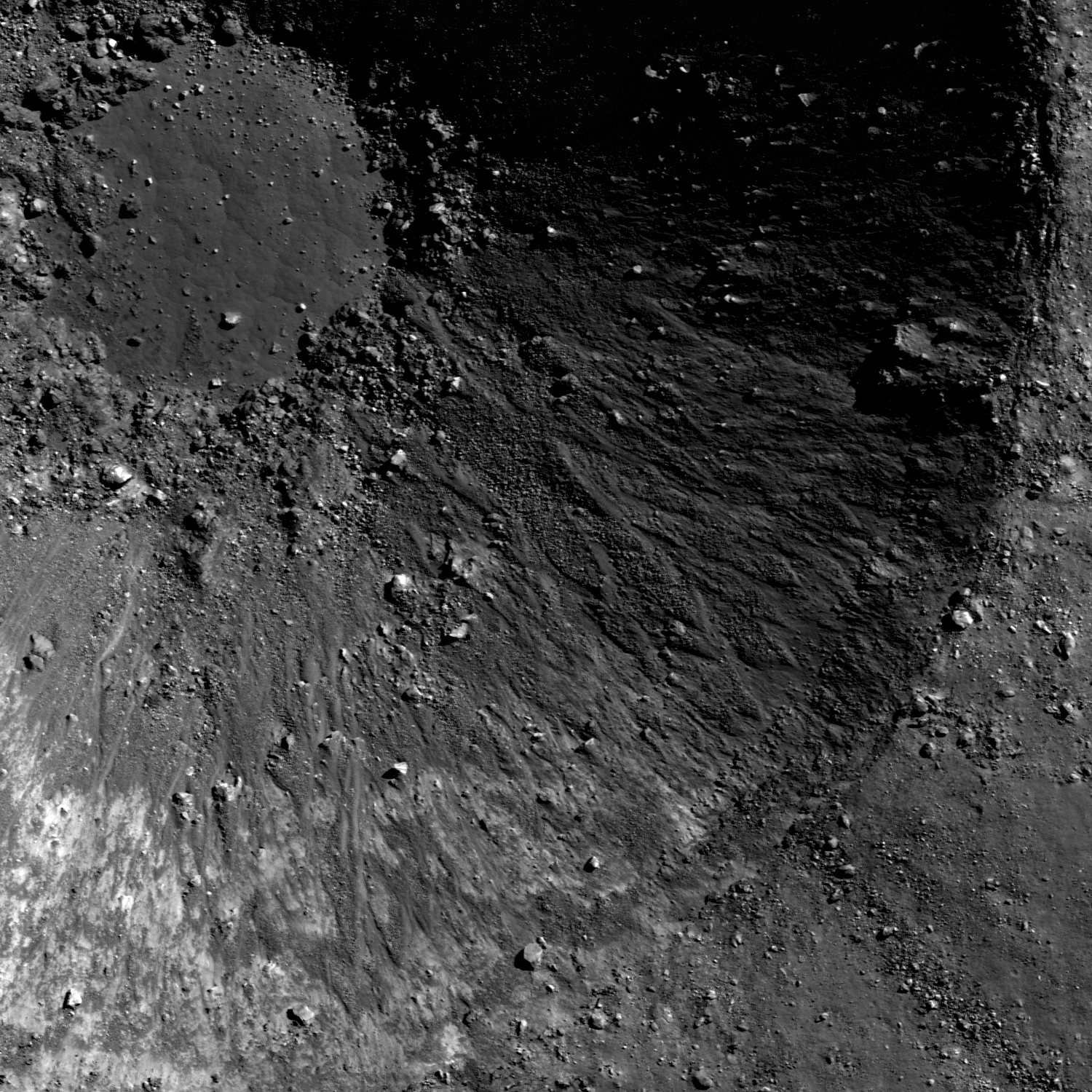
Impact melt, boulders, and mass wasting - oh my! Close-up on the interior of a "complicated," relatively fresh small crater on the floor of Mare Australe. LROC Narrow Angle Camera (NAC) observation M190007628LR, field of view 1 km, resolution 67 cm per pixel from 64.11 km [NASA/GSFC/Arizona State University].
Lillian Ostrach
LROC News System

Relatively fresh, undegraded craters are visually stunning. Today's Featured Image of the interior of a 1.7 km diameter crater (38.728°S, 88.697°E) exhibits just how geologically complicated craters can be! The crater rim is well-formed and relatively distinct, with ejected blocks nearby (some blocks might even fall inside the crater).

Portions of the upper crater walls have jagged, fractured material that may serve as the source for some of the mass-wasting observed lower on the crater walls. There is an approximately 350 meter diameter impact melt deposit on the crater floor. This smooth deposit exhibits polygonal cracks, possibly due to contraction as the melt cooled and hardened. Surrounding the impact melt pond are jumbled piles of blocks, some of which show evidence of impact melt veneer while other boulders landed after the impact melt pond cooled (but "how much later?" is a question we cannot answer easily).

M154649439LR
Slightly closer viewing opportunity. LROC NAC mosaic M154649439LR, orbit 7964, 41.98° angle of incidence, 52 cm per pixel resolution, from 49.26 km. View the very large full resolution crop HERE [NASA/GSFC/Arizona State University].

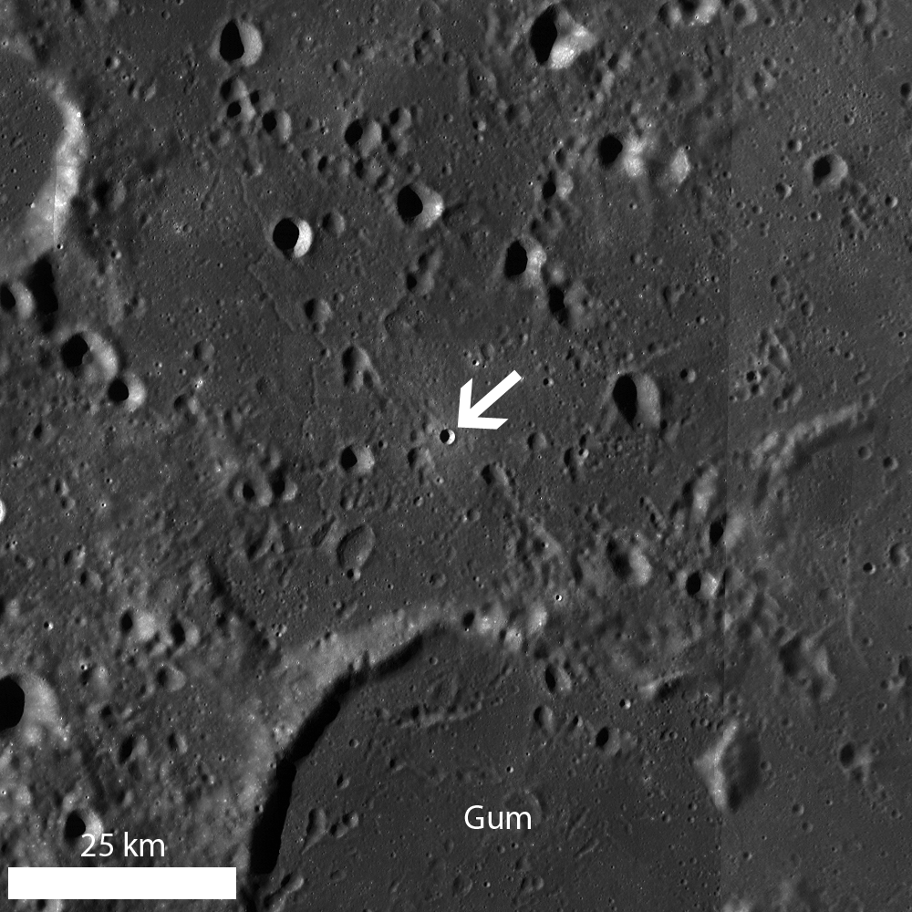
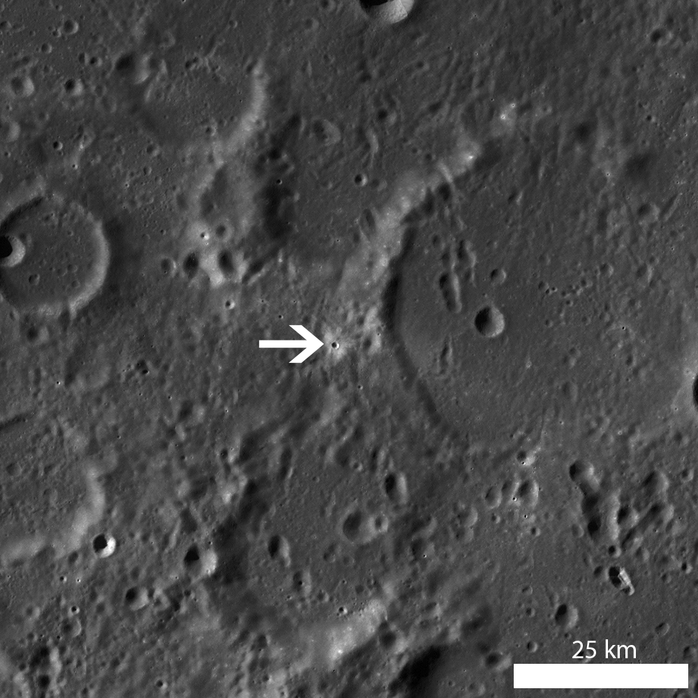
The wide range and contrast of the small crater's fan of ejecta, against the ancient floor of Mare Australe, may be easier to see in this medium resolution crop from the Global Mosaic stitched together from observations swept up by China's Chang'E-2 orbiter. The coloring reflects data collected by the Clementine orbiter in 1994.
LROC WAC monochrome mosaic of the fresh crater north, north of Gum (arrow) [NASA/GSFC/Arizona State University].
Although there are no deep gullies in the upper crater walls, the inter-weaved channels running down the crater walls suggest a complex relationship between impact melt and dry debris flows. The finger-like flow morphology, especially close to the floor melt pond, is similar to impact melt flows elsewhere. However, observations of dry debris flows in other lunar craters are sometimes difficult to distinguish from impact melt. Careful study of stratigraphic relationships is required in cases such as this one to distinguish which material may be melt or dry debris.
Observe the crater wall complexities for yourself in the full LROC NAC image, HERE.

Related Posts:
Farside impact!
Crater in 3D!
Symmetric Ejecta

Tuesday, June 18, 2013

"Ka Pow!" on Joliot's central peaks

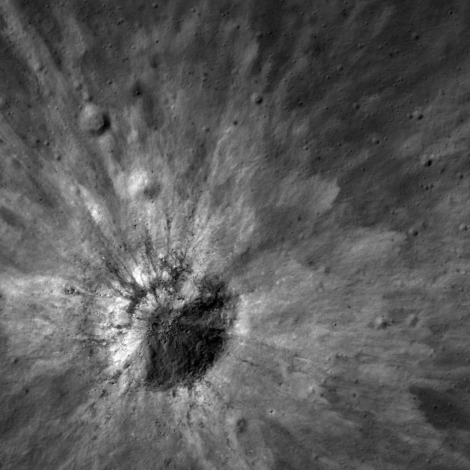
High-reflectance ejecta and low-reflectance impact melt streamers surround this fresh impact crater on the slopes of the central peak formation of Joliot crater. LROC Narrow Angle Camera (NAC) mosaic M189994606R, LRO orbit 13048, April 25, 2012; field of view 2.25 km, 43.12° angle of incidence at 1.11 meters per pixel resolution, from 147.53 km [NASA/GSFC/Arizona State University].
Lillian Ostrach
LROC News System

High-reflectance ejecta blankets the terrain surrounding a 650 meter diameter crater (26.525°N, 93.518°E).

From samples collected during the Apollo missions we know that high-reflectance ejecta represents recently exposed material that has not yet been affected by space weathering processes (maturity rays) or material exposed that is a different composition than the surrounding area (compositional rays).

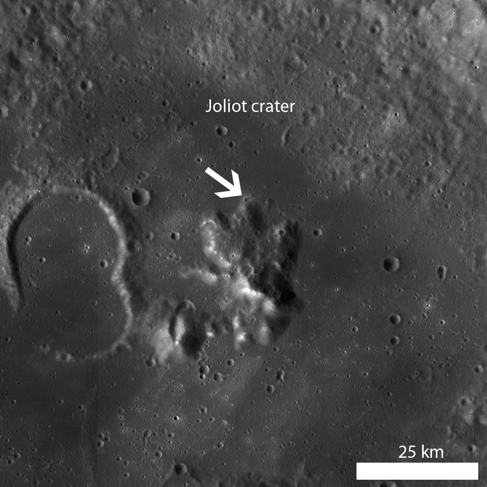
The impact crater in the opening image formed near the base of the central peak of Joliot crater (172.79 km in diameter, 25.79°N, 93.39°E), the floor of which was partially flooded with volcanic material. What type of ejecta rays are observed in today's Featured Image - compositional or maturity?

LROC WAC monochrome mosaic of the central interior of Joliot crater, with a fresh impact (arrow) at the base of the central peak complex [NASA/GSFC/Arizona State University].
The crater formed on the base of the central peak which is likely highlands material. The rays extend outward more than two crater diameters onto the mare material. Thus we have an example that is both a maturity ray and compositional ray. Over time as the ejecta matures, the portion on the highlands material will be indistinguishable, while the portion on the mare will still be visible. The much larger crater Tycho (93 km diameter) shows the same combination maturity-compositional rays.

Explore the full LROC NAC image for yourself; HERE. Do you see evidence for impact melt and if so, what do you see (ponds, streamers, flows)?

Related Posts:
Polka-dot Ejecta
Ejecta Starburst
Symmetric Ejecta
Ejecta Sweeps The Surface
Minty Fresh

Thursday, May 9, 2013

Messy Crater in Mare Australe

Fresh impact crater morphology can be messy! Deep interior of relatively small, unnamed fresh impact crater in Mare Australe. 708 meter wide field of view cropped from LROC Narrow Angle Camera (NAC) mosaic M189978900LR, LRO orbit 13045, April 25, 2012; resolution 60 cm per pixel, angle of incidence 57.76° from 58 km [NASA/GSFC/Arizona State University].
Lillian Ostrach
LROC News System

Cartoons illustrating the three stages of impact cratering (contact/compression, excavation, and post-impact modification) usually show the formation of a beautiful, bowl-shaped simple crater.

LROC NAC images reveal that while there are many bowl-shaped craters, there are also many craters that are not bowl-shaped or even very circular.

Today's Featured Image is an approximately 1 kilometer in diameter crater (45.661°S, 93.016°E) with a very irregular interior morphology. This crater exhibits a defined rim for all but a small portion of the crater (shown in the opening image). In this region, the crater wall is a jumbled mass of material that looks more similar to wall collapse than crater cavity excavation. The surrounding crater walls are covered with jagged blocks and impact melt veneer, and a 100 m wide melt pond with polygonal fracturing is located on the crater floor.

Near same width view of the 7.8 km wide LROC NAC mosaic M189978900LR [NASA/GSFC/Arizona State University].
Irregular crater morphology can be attributed to several factors. The impact process involves vast amounts of kinetic energy that may not be uniformly distributed throughout the target during impact. For example, a non-uniform energy distribution may be the result of an oblique impact, a steeply sloped target surface, or perhaps a low velocity secondary impact. Similarly, target properties, such as re-existing weakness or strength variations in the target rocks, may influence crater shape. Because the impact process is complex, it is often difficult to determine which factors dominate when studying craters with irregular morphologies. However, for today's crater, it is likely that some of the crater morphology irregularity is associated with the target slope; the impact occurred on the outer wall/rim slope of a degraded crater.


LROC Wide Angle Camera monochrome mosaic centered on the recent impact highlighted in the opening image [NASA/GSFC/Arizona State University].
Take a look at the full LROC NAC image, HERE, and explore the morphology of the young crater for yourself.

Related Posts:
Ejecta Starburst
Farside impact!
Komarov

Hemispheric view over the southern east limb of the Moon, centered on the location of the small impact crater on the 93rd meridian east. LROC WAC 100 meter Global Mosaic, LROC PDS image search tool [NASA/GSFC/Arizona State University].

Wednesday, May 8, 2013

Boulder Origin?

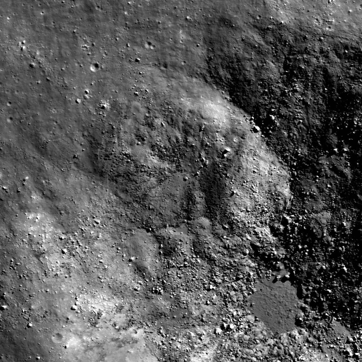
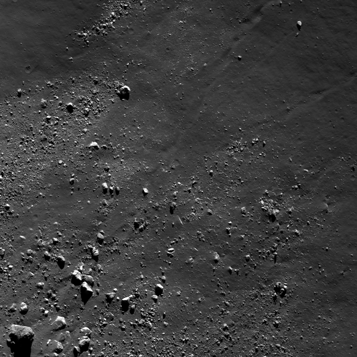
Blocks litter the interior floor of an impact crater in the north farside highlands terrain. LROC Narrow Angle Camera (NAC) frame M187357438LR, LRO orbit 12679, March 25, 2012; angle of incidence 52.19° - resolution 1.76 meters per pixel, field of view 1.81 kilometers from 180.37 km [NASA/GSFC/Arizona State University].
Lillian Ostrach
LROC News System

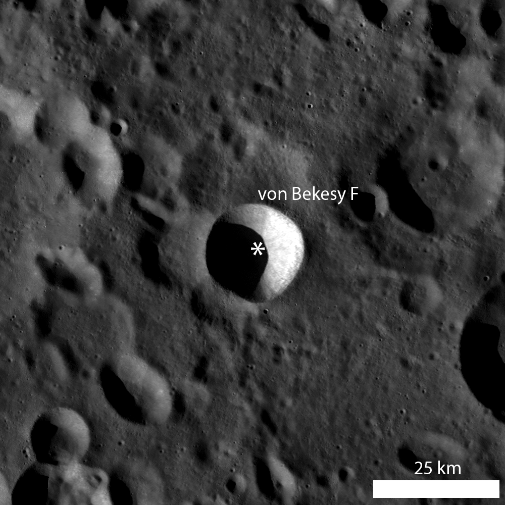
Blocks littering the floors of impact craters are evidence that erosive processes continue to act on the Moon. Blocks are distributed along the boundary between the crater walls and the floor of von Bekesy F (52.8°N, 137.04°E, 20 km diameter) and also surrounding mounds located on the crater floor. 

Today's Featured Image highlights boulders approximately 1 meter across eroding out of a floor mound and boulders that fell from somewhere along the crater wall or rim (52.86°N, 137.094°E). Observations of geologic relations between features are integral to developing a geologic story for an area, so it is important to make careful study of the different features. If we were to tell a story about the different boulders observed in the opening image, where should we start?

Interior view of von Bekesey F from 180 km, cropped from the full LROC NAC mosaic image [NASA/GSFC/Arizona State University].
There are clusters of blocky, fragmented material located on and surrounding the mound in the lower left of the opening image, and the boulders range from around 10 to 15 meters across. Observations of partially covered blocks on the mound support a mound origin. 

Similarly, the distribution of roughly 10 meters wide boulders at the contact between crater wall and floor suggests that these boulders probably fell from higher up on the crater wall. But what about the boulders in between the mound and the floor-wall contact? At least one boulder is located at the terminus of a trail that can be traced back to the crater wall, but there are no other apparent relationships linking boulder to their origin. 

LROC WAC monochrome mosaic centered on von Bekesy F crater, and asterisk notes location of opening image [NASA/GSFC/Arizona State University].
However, it may be possible that most of the boulders located in between the "boulder-rich" zones of the opening image originate from the crater wall side, simply because boulders falling from higher elevation will have a higher velocity component and will probably continue moving until the velocity and inertia components are lost (after the boulders hit the crater floor and begin to roll).

What do you think? Can you find evidence for boulder origin elsewhere in von Bekesy F in the full LROC NAC image, HERE?

Related Posts:
Perched boulders
Melt Boundary
Physics is Fun!

Tuesday, May 7, 2013

Boulder Tails

Boulders greater than 1 meter across, and a few trails, surround the base of a mountain in the Schrödinger central peak ring. Boulder in lower left is around 55 meters across; mountain base is beyond the frame to the lower left. LROC Narrow Angle Camera (NAC) observation M187340587LR, image field of view 732 meters, resolution 0.77 meters per pixel, angle of incidence 79.15° from 36.56 km  [NASA/GSFC/Arizona State University].
Lillian Ostrach
LROC News System

The Schrödinger impact basin is a geologically fascinating location, especially because of the variety of geologic features available for future exploration and it is the second youngest large basin on the Moon (just behind Orientale).

Discussed at length in several other Featured Image posts, blocky material, including boulders greater than 1 meter in diameter, can be used to help unravel geologic stories for an area.

In the case of boulders in Schrödinger, often the boulders originate from regions not easily accessible by robotic equipment or humans. Today's Featured Image highlights a distribution of boulders near the base of a part of the central peak ring (77.196°S, 133.178°E).

Context for the LROC Featured Image released May 8, 2013 - LROC Wide Angle Camera (WAC) monochrome (604nm) mosaic from 15 orbital passes, just after LRO completed its 10,000th orbit, September 3, 2011. Field of view (see section from mosaic below) roughly 50 km across [NASA/GSFC/Arizona State University].
LROC WAC mosaic covering a quarter of Schrödinger basin, show the 1400 meter high mountains rising over the mare-flooded interior contiguous with the greater peak ring structure [NASA/GSFC/Arizona State University].
Displaced fragmented blocks, such as those observed in the opening image, represent the movement of material from higher elevation to lower elevation. Most of the boulders range in size from ~15 to 25 m across, although the boulder in the lower left of the opening image is about 55 m across.

Today's boulders are derived from the higher elevations of a massif that is part of the Schrödinger central peak ring. Why is this fact geologically interesting? Because central peak rings form during the impact process; as the target is deformed and displaced during impact, material from depth is pushed toward the surface. Central peaks are usually formed in complex craters with diameters ranging from roughly 15 km to 200 km, but when the impact crater is larger than 200 km, central peak rings begin to form.

So, boulders originating from a central peak or central peak ring sample rocks from far beneath the lunar surface. How far? Scientists are not exactly certain, but there are several hypotheses and models undergoing testing with the help of LROC data.

HDTV still image captured from Japan's lunar orbiter SELENE-1 (Kaguya) in 2008. This oblique view was imaged as the vehicle orbited north, up over the Moon's farside from the far south [JAXA/NHK/SELENE].
Looking carefully, there is a boulder trail present (diagonally from lower left to upper right), and the boulder trail width is ~25 m near the upper right of the image. The irregular shape of the trail suggests that the boulder responsible for the trail was probably irregularly shaped. Additionally, the boulder trail is not discontinuous or "dashed", so it may be that the boulder responsible for the trail had a relatively low velocity. Similarly, there may be local slope variations in this area that promoted boulder rolling as opposed to boulder skipping.

Can you find a boulder that may be responsible for creating the observed boulder trail in the full LROC NAC image, HERE?

Related Posts:
A review of all things Schrödinger  
Craters on the Schrödinger pyroclastic cone
New 3D CLSE flyover video: Schrödinger basin
Sampling Schrödinger
Sampling a Central Peak
Perched boulders
Scarps in Schrödinger
LOLA: Schrödinger Basin

Friday, April 12, 2013

Crater on Crater Debris

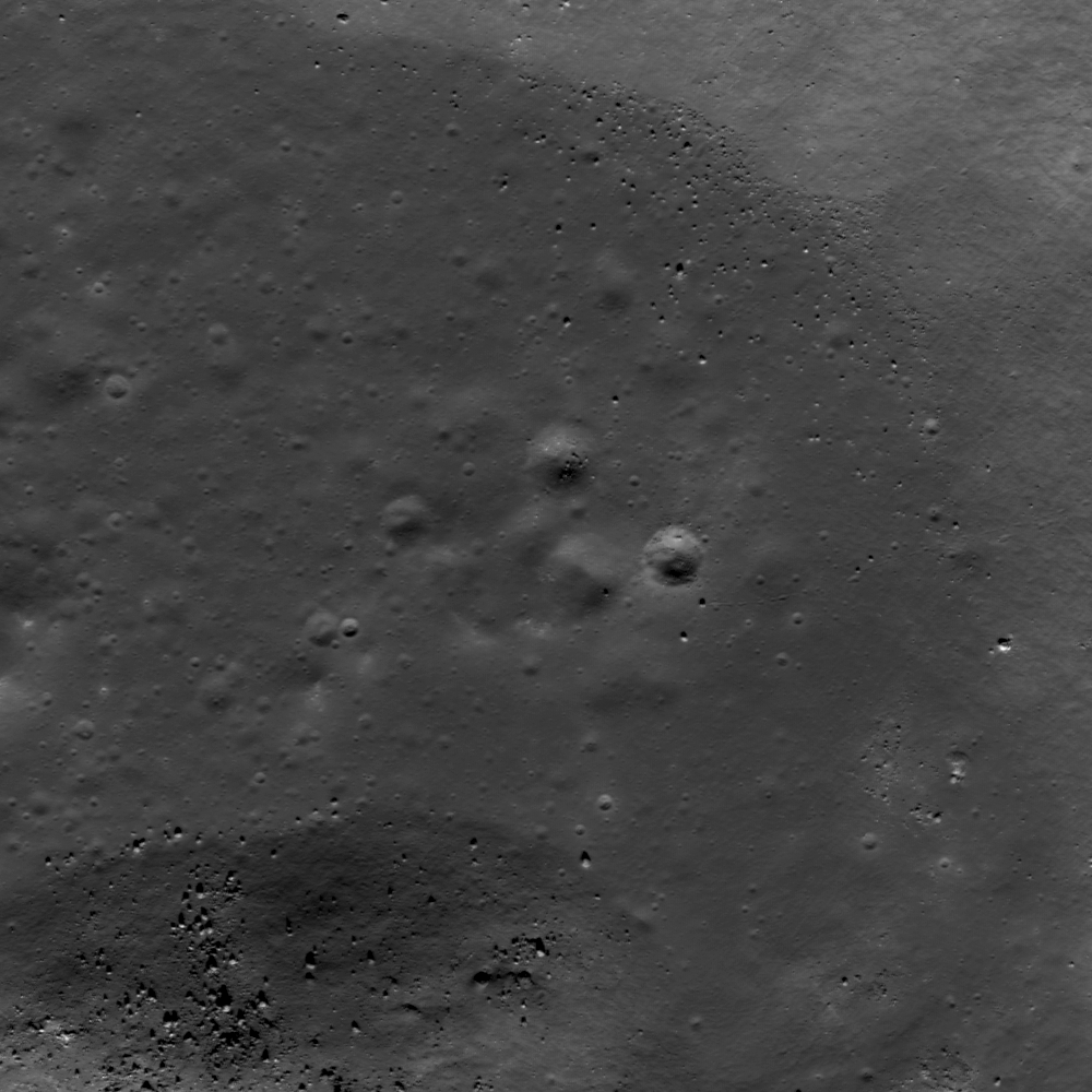
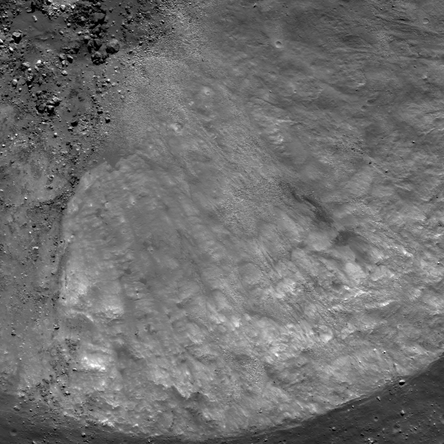
Evidence of erosion and mass-wasting abound in lunar craters. Boulders and a variety of aggregate debris  intrude on the melt pool on the floor of a small crater which, in turn, is neatly nested on the rim of a larger and older crater in the Planck crater group on the southern far side (53.821°S, 139.639°E). Detail from LROC Featured Image released April 12, 2013. [NASA/GSFC/Arizona State University].
Mass-wasting abounds in lunar craters. LROC Featured Image, April 12, 2013; rescaled from LROC Narrow Angle Camera (NAC) mosaic  M18731958LR, LRO orbit 12673, March 25, 2012; original resolution 53 cm per pixel, angle of incidence 55.75° over a field of view approximately 810 meters across, from 51.01 kilometers [NASA/GSFC/Arizona State University].
Lillian Ostrach
LROC News System

The high resolution and stunning detail of LROC NAC images reveal evidence of recent erosion on the Moon, particularly within crater interiors. How do we know that the erosion is recent?

Boulder trails are one reason; micrometeorite bombardment of the lunar surface creates and churns up the regolith over millions of years resulting in erasure of surficial features. Absence of many superposed impact craters is another reason; over geologic time, craters accumulate on lunar surfaces and the absence of many superposed craters suggests that mass-wasting landslides in craters are young. Today's Featured Image highlights the southeastern portion of an unnamed 1.5 km diameter crater (53.819°S, 139.652°E) that shows evidence of mass-wasting.

Full 6.1 kilometers field of view covered by the footprint of the LROC NAC mosaic, source of the LROC Featured Image. From the full image browser exploration tool [NASA/GSFC/Arizona State University].
Just as on Earth, gravity promotes downhill movement and thus erosion of landforms. The crater floor (opening image, upper left) is a mix of pooled impact melt, fragmented blocks coated in melt, and boulders (>1 m diameter) that migrated downhill after the melt solidified. Piles of material (often called talus on Earth) are located at the change in slope between crater walls and floor. The piles of material have boulders of various sizes with smoother material in between. One might call this smoother material "fine-grained", but we are unable to quantitatively characterize the size distribution of the debris below the pixel size of the NAC images, here about 50 cm. Indeed, the term "fine-grained" is particular to a grouping of particle sizes when used in Earth-based sedimentary geology (1/16 to 1/256 mm).

LROC WAC monochrome mosaic centered on an unnamed crater on the farside that formed on the outside rim of another crater. Asterisk notes location of the crater in opening image [NASA/GSFC/Arizona State University].
Generally speaking, an object on a planetary surface is "detectable" when considering two or more pixels in a remotely sensed image. In today's NAC, two pixels represent 1.1 m on the lunar surface. However, simply because an object occupies two pixels does not mean that the object is "resolvable" so that scientists can confidentally determine the type of feature (is it a car or a boulder?). Thus, a good rule of thumb is to use at least three to five pixels when determining the true nature of a feature in an image. So, it is possible that the "fine-grained" material is not so "fine-grained" at all, and the material looks smooth because the individual particles are smaller than both a detectable and resolvable "grain".

The deepest material excavated by an impact crater usually ends up on its rim, which is also its highest elevation. Thus, as we see in this LROC Global Wide Angle Camera mosaic, the relatively fresh small crater (yellow arrow) is nested on the rim of a larger unnamed crater that is, itself in proximity to the rim of the ancient Planck impact and the rim of Planck C. It might be a good place to look for samples of the Moon originally excavated by Planck, if such samples are not shocked beyond usefulness. LROC Lunaserv tool [NASA/GSFC, Arizona State University].
Explore the erosive products in this crater for yourself in the full LROC NAC image, HERE.

Related Posts:
Physics is Fun!
Weaving boulder trails on the Moon
Sampling a Central Peak

Thursday, April 11, 2013

Squished Crater

A lobate scarp cuts across and deforms an ancient impact scar on the floor of Seares crater in the far north of the farside highlands terrain. From a mosaic of LROC Narrow Angle Camera (NAC) frame M187315000L an R, field of view 1.95 km, angle of incidence 81.38° at 2.95 meters resolution from 143.54 kilometers [NASA/GSFC/Arizona State University].
Lillian Ostrach
LROC News System

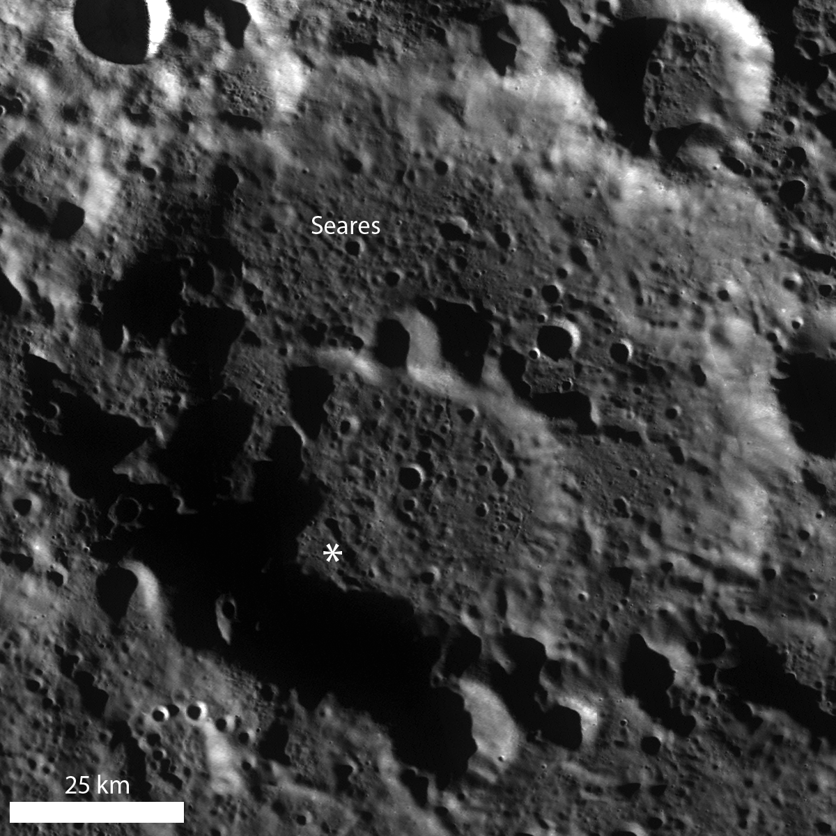
Lobate scarps, found almost only in the highlands, represent the surface expression of thrust faulting within the lunar crust. In the opening image, several segments of a lobate scarp deformed the Seares crater (75.529°N, 146.385°E, approximately 105 kilometers in diameter) floor material, including an unnamed 1.1 km crater (72.964°N, 144.897°E).

Based on the northeast/southwest trend of the lobate scarp segments, this area was probably under compression in the approximate northwest to southeast direction (squeezed from top left toward bottom right), creating bulges on the surface and squishing the crater.

LROC WAC monochrome mosaic of Seares crater. An asterisk notes the location of the opening image's field of view [NASA/GSFC/Arizona State University].
The squished crater is degraded, without a well-defined sharp rim, and it is difficult to determine with a quick glance just how much deformation occurred. Drawing a best-fit circle around the probable rim of the crater to use as a guide for many measurements of crater diameter is one way to estimate the amount of crater deformation. Using this method, the crater diameter is ~1.06 km if the measurement is based on a circle fitting the rim in the east-west direction, while a fit based on the north-south direction provides a diameter of ~1.13 km. Furthermore, the crater shape is somewhat square, which may indicate that this region was affected by ancient episodes of faulting - perhaps resulting from the Seares crater impact formation - that affected today's crater formation, similar to the structural influences that influenced the formation of Meteor Crater.

Put your eyes to the test! Can you find other cross cutting relationships involving the lobate scarp segments in the full NAC image, HERE?

Related Posts:
Scarps in Schrödinger
Relative age relationships
Simpelius Scarp
Offset Crater, Active Moon

Wednesday, April 10, 2013

Rim Slumping inside pre-Nectarian Gamov

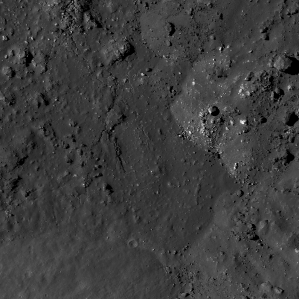
Faulting of a crater rim. Downhill to lower right, LROC Narrow Angle Camera (NAC) M187307653L & R, LRO orbit 12672, March 25, 2012; field of view approximately 1.9 km across, resolution 1.79 meters per pixel from 189.55 km [NASA/GSFC/Arizona State University].
Lillian Ostrach
LROC News System

Post-impact modification is frequently observed in LROC NAC images, because post-impact modification begins as soon as the impact crater has formed and ejecta emplaced. Impact crater formation is a violent process, so it should be no surprise that the target rock surrounding the impact site may be fractured and faulted, especially near the crater rim.

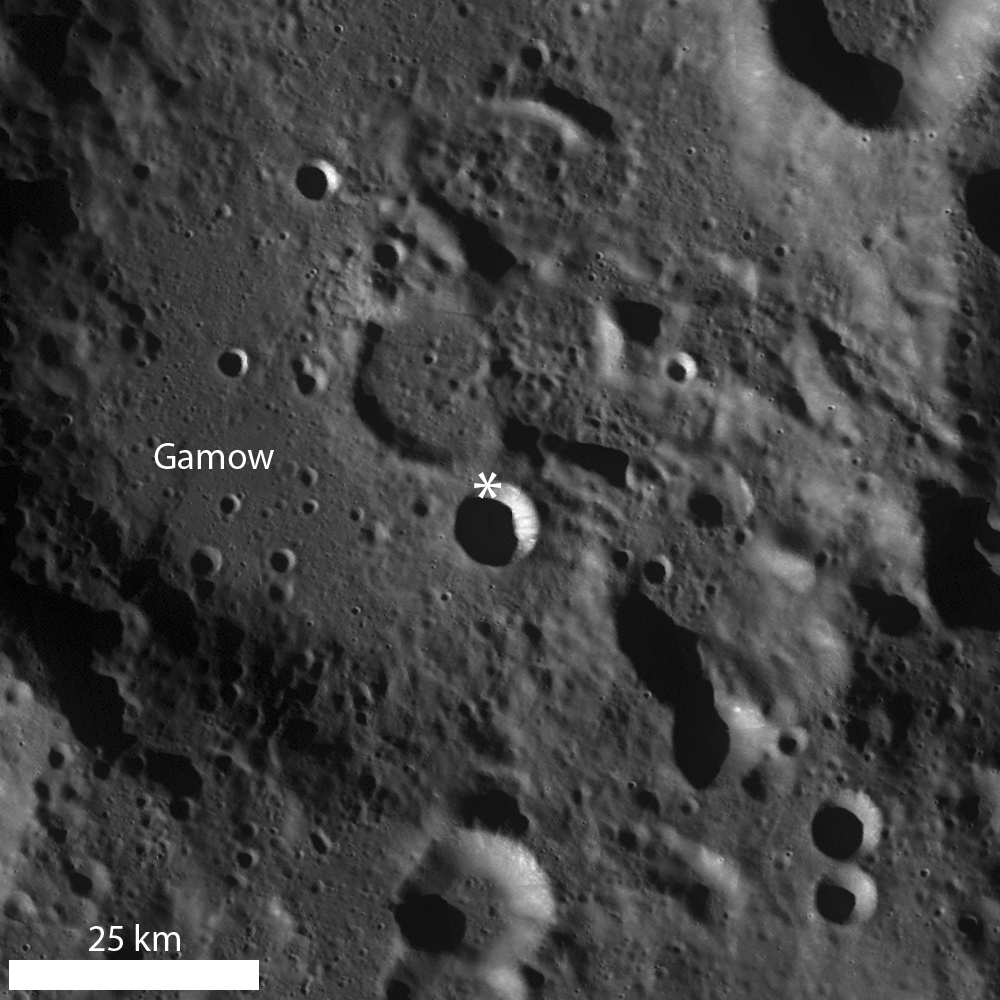
Today's Featured Image of the northern rim of an unnamed about 8.5 km diameter crater (64.754°N, 145.546°E) focuses on the faulted nature of the crater rim and evidence for mass wasting.

12.2 km wide field of view from the LROC NAC mosaic showing the entirety of the left and right frames of observation M187307653. The area highlighted in the LROC Featured Image further up is outlined by the white square [NASA/GSFC/Arizona State University].
The upper portion of the opening image is the outer flank of the crater, the fractures represent the crater rim "edge" (the lower portion of the image is the steep interior wall). As time passes and materials (blocks, fine-grained material) are dislodged from the rim and crater wall, the crater rim erodes and degrades, expanding outward (the diameter of the crater actually increases, while its depth decreases).

LROC Wide Angle Camera (WAC) monochrome mosaic highlighting a bowl-shaped crater superposed in pre-Nectarian Gamow crater. An asterisk denotes location of the area seen at high resolution in opening image [NASA/GSFC/Arizona State University].
Some examples of this "slope retreat" of the crater rim are very obvious, whereas others, like today's example, are less so. Today's example shows small-scale slumping of the crater wall as opposed to larger-scale slumping of massive portions of rim material. Perhaps the smaller size of this crater compared to other examples is the reason the slope retreat does not appear well-developed, or maybe the failure of rim faults is less pronounced due to pre-existing target properties (e.g., highly fractured nature of the highlands, impact into floor material of a larger crater, etc.).

Explore this farside simple crater for yourself in the full LROC NAC image, HERE.

Related Posts:
Top of the Landslide
On the Edge
Posidonius Y

Thursday, January 31, 2013

Messy melt in the Lodygin crater group

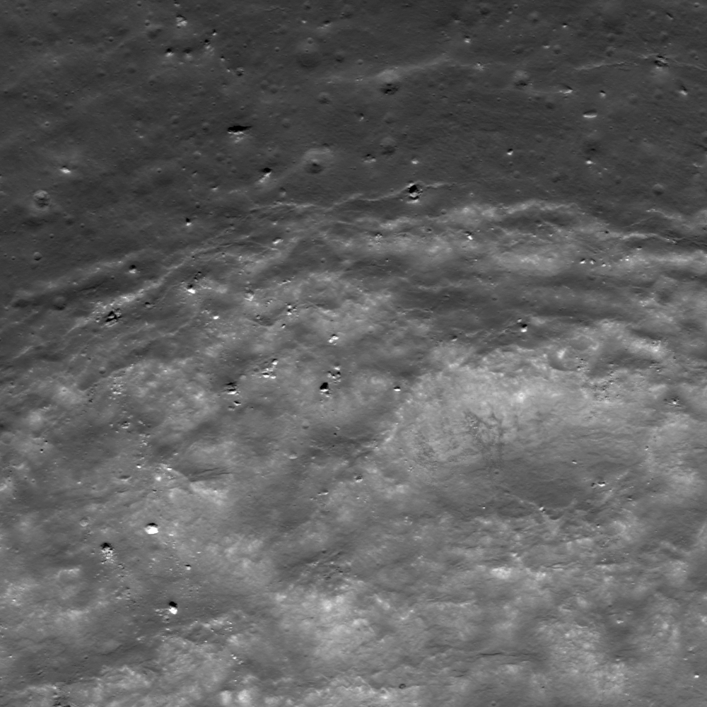
Unlike some melt ponds, this melt pond does not look very smooth! LROC Narrow Angle Camera (NAC) observation M182116507LR, spacecraft orbit 11945, January 25, 2012; field of view 910 meters at 0.96 meters resolution (incidence angle 57.43°) from 94.9 km [NASA/GSFC/Arizona State University].
Lillian Ostrach
LROC News System

Impact melt forms during crater formation when part of the impact-generated shock wave energy released during the impact event is released as heat. As the shock wave passes through the target, the amount of melting is related to the shock pressures reached during impact (for more information, see Chapter 6 in Traces of Catastrophe, by Bevan French). 

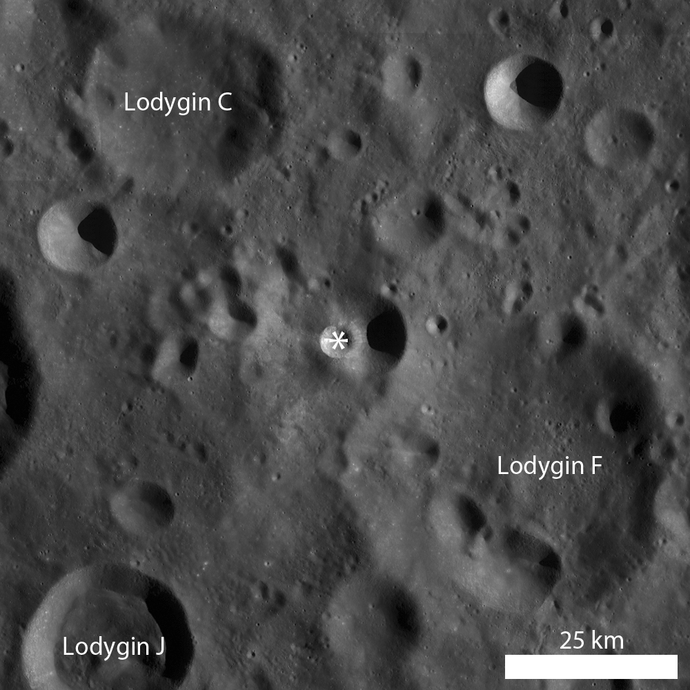
Often, impact melt appears visually smooth in LROC images, particularly at the WAC scale and in large craters like Tycho. However, Narrow Angle Camera (NAC) observations like today's Featured Image show that impact melt does not always have a flat "ponded" surface. In this case, the melt ponds inside an ~5 km diameter crater (17.121°S, 215.646°E) are far from smooth. 

Why might this be the case?

Full 9.9 km-wide mosaic of both left and right frames of LROC NAC observation M182116507 [NASA/GSFC/Arizona State University].
LROC WAC monochrome mosaic of the unnamed crater in the midst of the Lodygin crater group, in the farside highlands terrain north of the Apollo basin. (Asterisk notes location of the field of view shown at high-resolution in the LROC Featured Image released January 31, 2013 [NASA/GSFC/Arizona State University].
Sometimes impact melt appears visually smooth because there is enough melt that pools to cover up the fragmented floor of the crater or wall terrace. When there is less melt, the melt may pool in localized depressions to create smoothed surfaces as well as cover the surrounding fragmented, jumbled rocks pulverized during impact. Another possibility is that as the melt formed and began to cool on the crater floor, fragmented material fell from the crater walls and rim into the crater cavity to become mixed and entrained within the melt, helping to form a rugged melt-covered crater floor.

Examine the full LROC NAC image, HERE, to see if you can discern material that was entrained before the melt cooled and blocks that may have fallen to the crater floor at a later date!

Related Posts:
Anaxagoras Exterior Melt
Rim on a Rim
Louville D

Wednesday, January 30, 2013

Boulder Fields

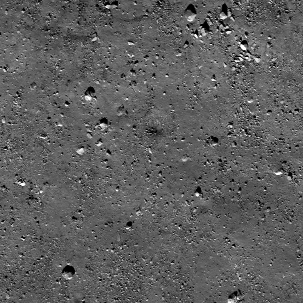
Boulders of various sizes (a few meters up to around 20 meters) scattered across the lunar surface. Where do these boulders originate? LROC Narrow Angle Camera (NAC) observation M170605553LR, LRO orbit 10276, September 14, 2011; resolution 51 cm per pixel over a field of view 510 meters across, viewed from 47 km [NASA/GSFC/Arizona State University].
Lillian Ostrach
LROC News System

Featured Images occasionally highlight lunar boulders larger than a few meters. Observed on crater floors, near crater rims, and clustered atop wrinkle ridge crests, boulders provide excellent sampling opportunities for exploration (think: Station 6 Boulder samples from Apollo 17 helped scientists understand local and regional geology). However, like any terrestrial field location, context is crucial to developing a plan for fieldwork and sampling, and even though planetary scientists frequently rely on remotely sensed data, these scientists cannot test hypotheses unless they know where and what they are observing! So, looking at the image above, where is this boulder field located (crater floor? crater rim? wrinkle ridge? elsewhere?) and from where did these boulders originate?


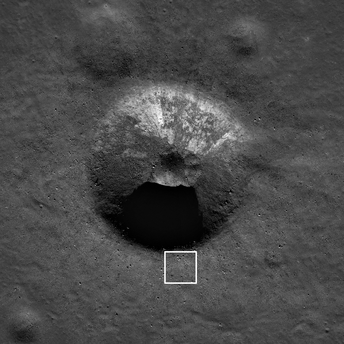
Reduced resolution view of the crater in the opening image. White box is approximate location of opening image field of view, LROC NAC M170605553LR, image width 2.5 km [NASA/GSFC/Arizona State University].
Taking a look at the zoomed out view in a reduced resolution NAC image, it becomes apparent that the opening image is located immediately exterior to the southern crater rim of an unnamed, 1.8 km diameter crater (located at 58.408°N, 351.859°E in Mare Frigoris). With this context, the location of the boulder field is revealed to be outside a mare crater. Furthermore, the origin of the boulder field is ejected material from the impact crater formation. Going back to the exploration thought - why would these boulders be advantageous to sample?

LROC WAC monochrome mosaic centered on the unnamed crater in Mare Frigoris, north-northeast of the Plato crater group; arrow notes the location shown at high resolution in the LROC Featured Image released January 30, 2013. Buried deep under this region is the antipodes, the opposing side of the Moon, of the primeval impact that formed South Pole-Aitken basin [NASA/GSFC/Arizona State University].
Sampling boulders close to the crater rim provides explorers the opportunity to collect rocks in a "radial traverse". The material right on the rim is mostly from deep within the crater and material further from the rim is from shallower within the crater. So as you approach a crater rim, the ejecta is progressively from deeper within the crater. This technique was employed by the Apollo 14 astronauts at Cone crater.

In the case of today's crater, the rocks sitting on the rim are from about 150 m below the surface even though the crater depth is about 360 m. During impact, part of the crater formation results from compression of the target and excavation flow (sideways movement of material), and for simple craters (less than 15 km diameter) an estimate of excavation depth is Hexc=0.1Dt, where Hexc is depth of excavation and Dt is transient crater diameter (diameter of the crater cavity at the conclusion of the excavation stage, before post-impact modification begins). The transient crater diameter can be estimated from the observed rim-to-rim diameter (what we measure today) using the relationship Dt=0.84D, where D is observed crater diameter. These relationships are explained in detail in Impact Cratering: A Geologic Process, by H. J. Melosh (1989).

Explore this 1.8 km impact crater in a virtual traverse using the full LROC NAC image, HERE.

Related Posts:
Sampling Schrödinger
Boulder trails in Menelaus crater
Physics is Fun!

Tuesday, January 29, 2013

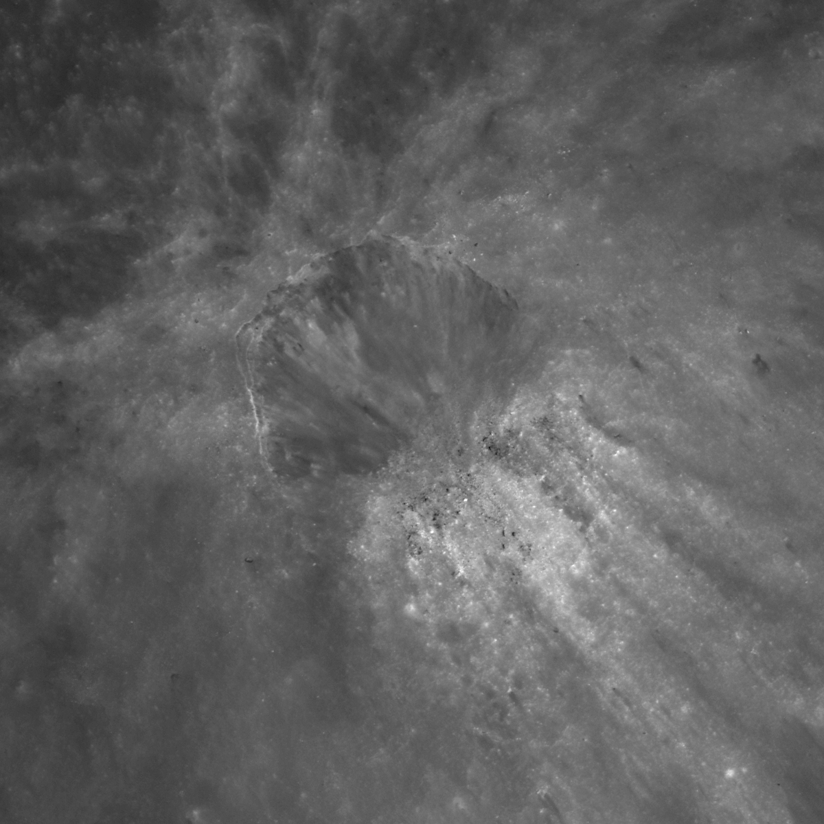
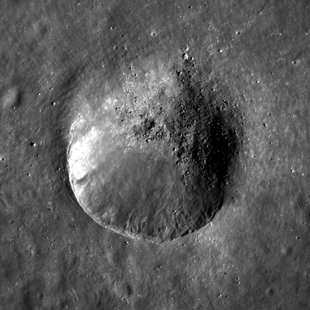
Clam Shell on the wall of Lalande C

An oblique impact crater on the wall of Lalande C crater. LROC Narrow Angle Camera (NAC) M170606751LR, LRO orbit 10276, September 14, 2011; incidence angle 11.82° at 49 cm per pixel resolution revealing a field of view 600 meters across, viewed from 44.83 km [NASA/GSFC/Arizona State University].
Lillian Ostrach
LROC News System

Oblique impact craters can form when the angle of impact is less than 15° from the horizontal or from impact into sloped terrain.

Oblique impact craters typically exhibit specific morphologies: asymmetric ejecta and non-circular (more elliptical) crater shapes. The approximately 220 meter impact crater in today's Featured Image (5.668°S, 353.148°E) formed on the interior crater wall of Lalande C and is a nice example of a small, oblique impact crater that formed due to target slope as opposed to impact angle.

The oblique crater in Lalande C does have an asymmetric ejecta blanket (see the full NAC image) and a poorly defined zone of avoidance. The crater shape is not circular; instead, the irregular crater shape is reminiscent of a clam shell. There is also a blocky jumble of mostly high-reflectance material collected downslope of the crater, where the rim would be. What could explain the presence of this material?

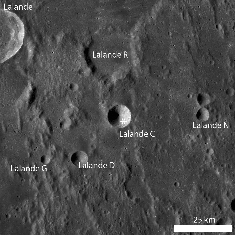
LROC WAC monochrome mosaic centered on Lalande C crater (10.5 km diameter, 5.596°S, 353.041°E), where the asterisk marks the location of the field of view shown at high resolution in the LROC Featured Image released January 29, 2013 [NASA/GSFC/Arizona State University].
Circular, or bowl-shaped, craters form when impact occurs greater than 15° from the horizontal (the most probable angle of impact is 45°), and material from within the crater is ejected ballistically to form an expansive, symmetric ejecta blanket. However, because the bolide impacted into the sloped crater wall, the material ejected from the crater in today's Featured Image did not form a symmetric ejecta blanket. What this means is that the jumble of high-reflectance material is probably excavated material that was ejected at low velocity from the crater during crater formation. LROC NAC images of oblique craters such as this one show similar features and certainly require additional study!

Take a look for yourself in the full LROC NAC image! Can you identify the extent of asymmetric ejecta superposed on the wall of Lalande C?

Related Posts:
Rim on a Rim
Rim Impact
Slice of Mare