Showing posts with label terrace. Show all posts

Tuesday, October 22, 2013

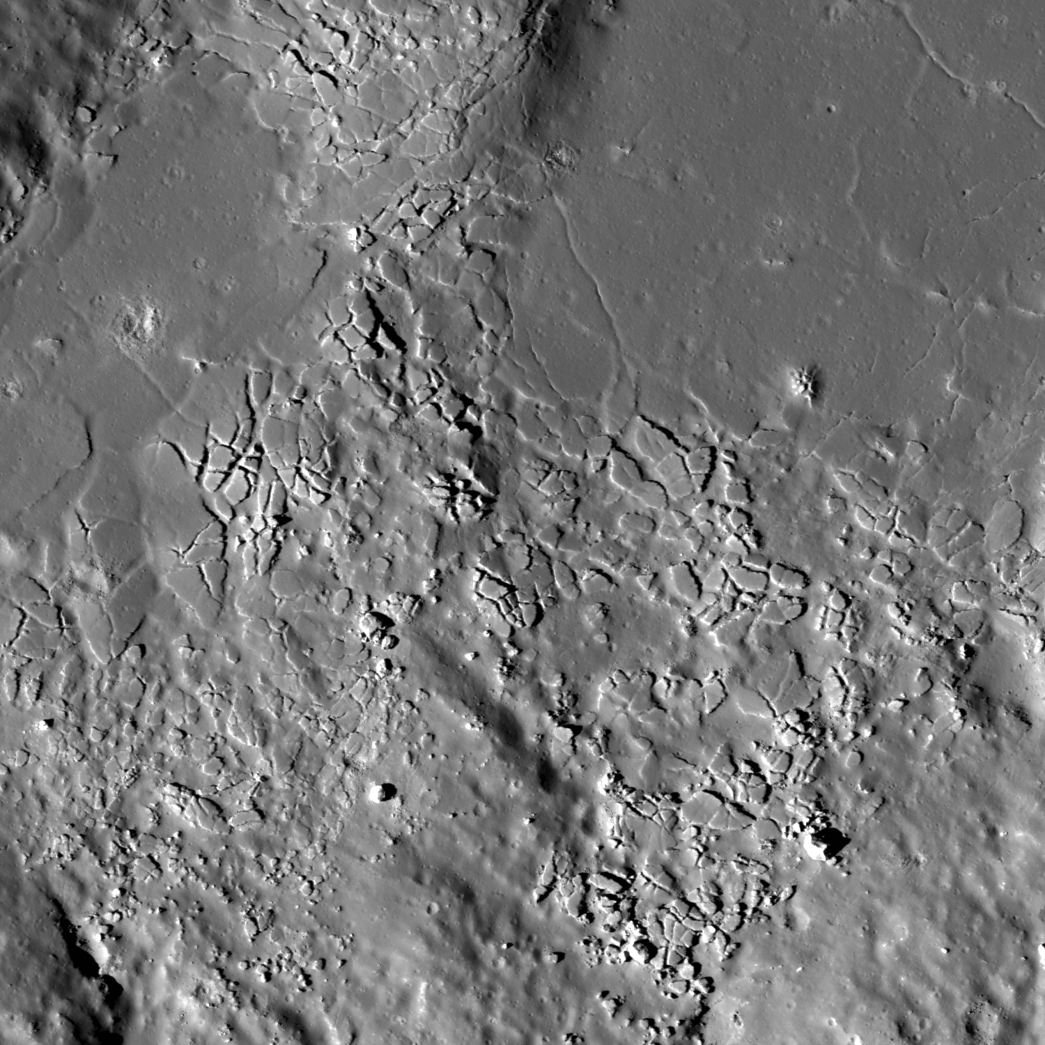
Fractured melt rock on Jackson's terraced wall

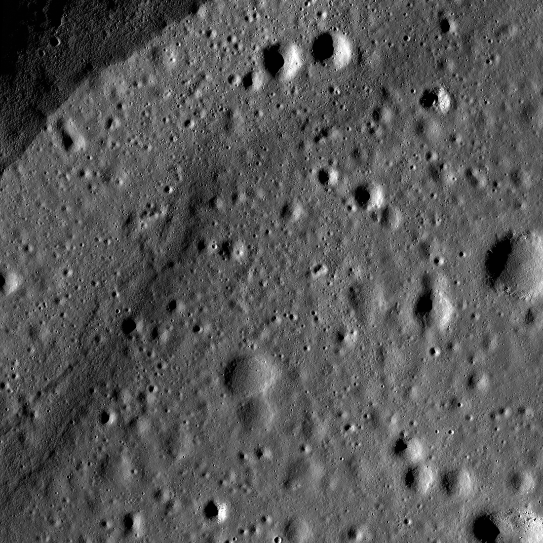
M182253065R_1500
Close-up on fractured impact melt  ponding high on the west wall of Jackson crater. LROC LROC Narrow Angle Camera (NAC) M182253065R, LRO orbit 11965, January 26, 2012. Image 2130 meter-wide field of view centered on 22.534°N, 195.59°E, incidence angle is 57° at 1.47 meters per pixel resolution in the original [NASA/GSFC/Arizona State University].
Hiroyuki Sato
LROC News System

The opening image highlights a fractured pond of impact melt rock inside Jackson crater (72 km diameter). This prominent farside crater is known by its prominent ray system and large amount of impact deposits. Melt pooled not only at the bottom of the crater floor, but also on terraces of the interior wall.

The fractured melt sheet in the opening image is found amongst a grouping of melt lakes on a western crater wall terrace (see WAC context image below).
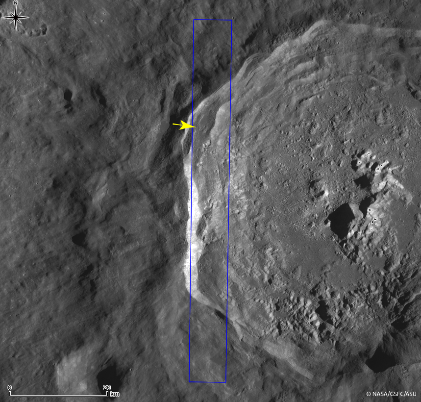
M182253065R_context
Western part of Jackson crater and surrounding areas in LROC WAC monochrome mosaic (100 m/pix). The NAC footprint (blue box) and the location of opening image (yellow arrow) are indicated [NASA/GSFC/Arizona State University].
Detached fragments from the main body of melt sheet look like a jigsaw puzzle (upper smooth surfaced portion of the image). These fragments give an impression of the thin and brittle nature of solidified impact melt. Shadow lengths show these fractured pieces to be 5 to 8 meters thick. What caused the once level and smooth ponded surface to fracture? We don't know for sure, but by looking at the whole area a plausible story can be imagined. The south part of the melt lake with the fractured plates is connected to another melt lake at a lower elevation. Perhaps drainage of subsurface unsolidified melt might have dragged a crust toward the south and broken the it into many blocky pieces. Tectonic deformation of the crater wall, perhaps consisting of whole terraces deforming, also might have occurred which could deform the brittle crust of melt ponds.

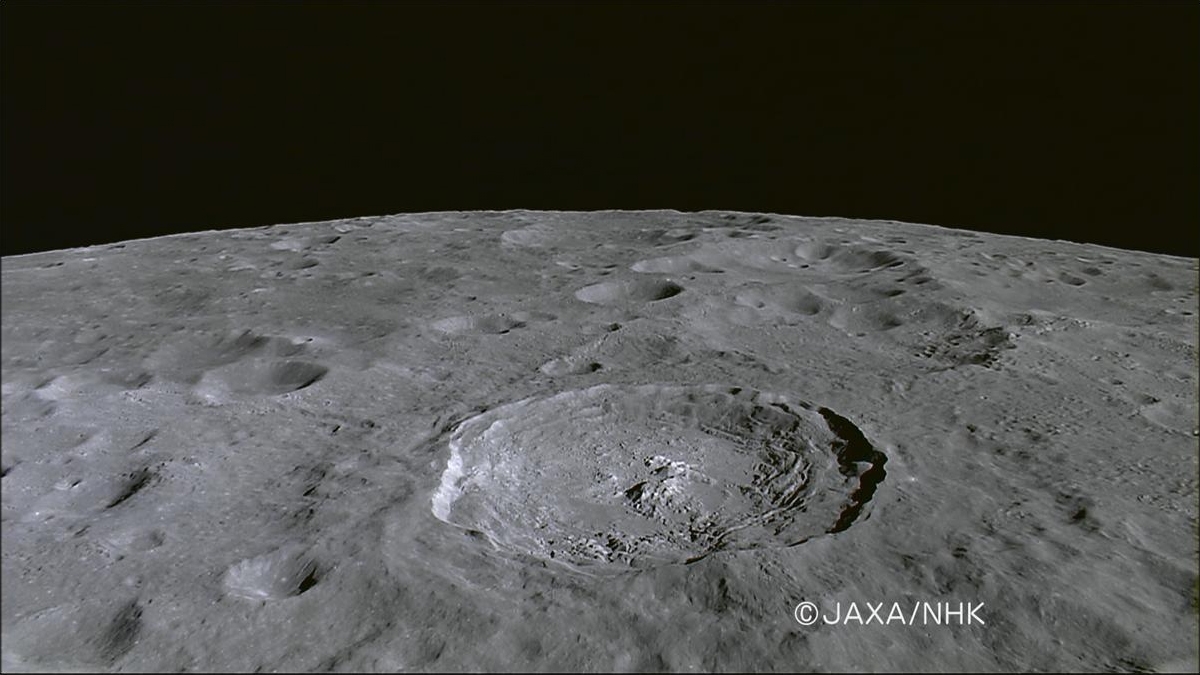
Jackson crater from Kaguya
Farside Copernican age landmark crater Jackson viewed through NHK's HDTV camera aboard Japan's lunar orbiter SELENE-1 (Kaguya) in late 2007. View the 1200 pixel-wide press release image HERE [JAXA/NHK/SELENE].
Explore this mosaic of fractured melt rock and surroundings to help unravel the complex history of Jackson crater in the full NAC frame HERE.

Related Posts:
Cracked mound (February 16, 2012)
Melt Fractures in Jackson Crater (January 20, 2012)
Tycho's flash-frozen inferno (November 2, 2011)
Waves (August 10, 2011)
Polygonal fractures on Tycho ejecta deposits (June 14, 2011)
Fragmented Impact Melt (February 25, 2011)
LOLA's Jackson crater (July 11, 2010)

Moore F Impact Melt (October 30, 2009)

Wednesday, April 24, 2013

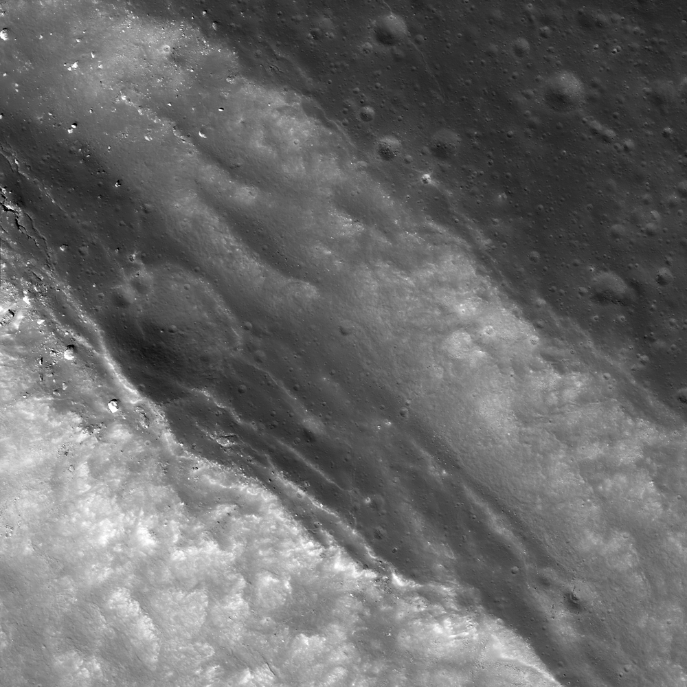
Getting Cracked at Weiner F

An impact crater is caught in the process of disintegration, barely visible today on the complex terrace of Weiner F crater (40.881°N; 150.608°E). LROC Narrow Angle Camera (NAC) frame M169574198L, spacecraft orbit 10124, September 2, 2011. Illumination angle of incidence 46.95° from the southwest, resolution reduced from the original 43 cm per pixel from 30.02 km [NASA/GSFC/Arizona State University].
James Ashley
LROC News System

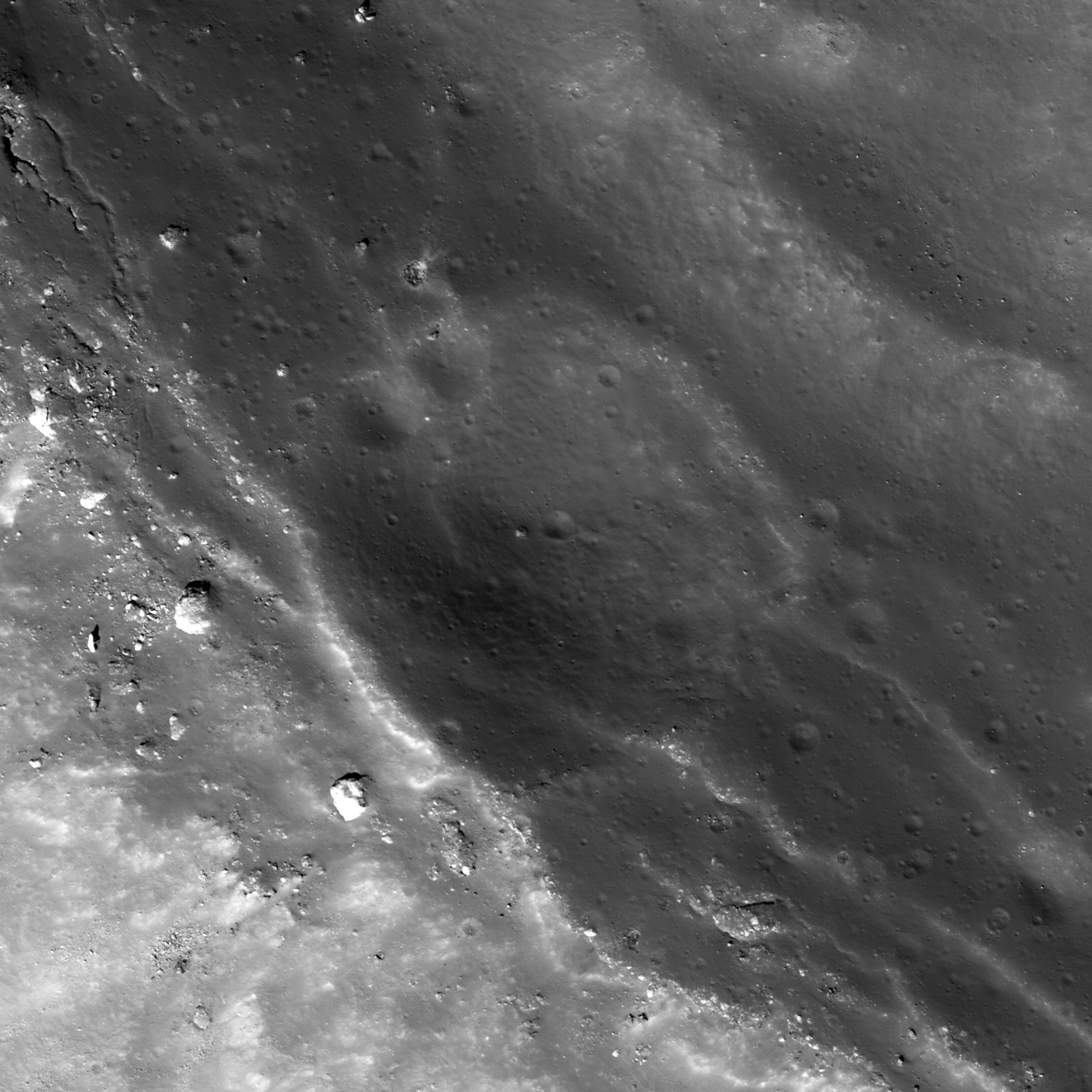
This small impact crater happened to form just a little too close to the widening edge of the Wiener F crater. Fault-slumping of the upper wall of Wiener F has cracked it along a series of linear, subparallel fractures, and the whole area appears to be in the process of down-slope migration. Eventually, if the process were to continue, the disintegration would be complete and the small superposed crater would no longer be recognizable.

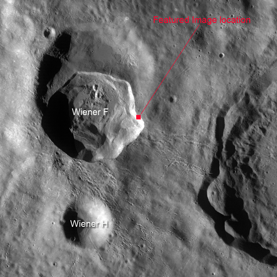
The context images above and below show the location of this feature -- nestled within the slumping and fault-bounded eastern crater wall that has produced an irregular protrusion into the surrounding highland terrain. The occurrence of Wiener F within a former, older and larger crater is a coincidence of nature. Who says impacts cannot occur in the same place twice? Here we see three nested craters!

Context image from NAC frame, 1.3 km across; downslope to lower left [NASA/GSFC/Arizona State University].
The WAC global mosaic context image field of view approximately 48 km from west to east [NASA/GSFC/Arizona State University].
Click HERE to examine the full NAC frame. Other examples of fault-terraced crater walls can be found with Top of the Landslide, Aristarchus Spectacular!, and Post-impact Modification of Klute W.

Center crop from HDTV still centered on Weiner F, view toward the south over the farside anorthositic highland terrain from an estimated 100 km altitude in 2007. From Japan's lunar orbiter SELENE-1 (Kaguya) [JAXA/NHK/SELENE].
Other related posts:
Impact melt outside Weiner F (October 27, 2012)
Secondary melt on the rim of Weiner F (October 2, 2012)

Thursday, April 18, 2013

New views of the lava terraces of Bowditch

A lava terrace rings the floor of farside crater Bowditch. LROC Narrow Angle Camera (NAC) observation M180493674L, LRO orbit 11718, January 12, 2012; a roughly 4 km-wide field of view at 1.74 meters per pixel resolution, angle of incidence 75.91° from 85.27 km [NASA/GSFC/Arizona State University].
Sarah Braden
LROC News System

Bowditch is a highly irregularly shaped farside crater partially filled with a mare basalt (25.0°S, 103.2°E).

Today's Featured Image is located along the inner wall of the crater, where the mare deposit meets the wall (24.935°S, 102.705°E). A section of the crater wall is visible in the upper left hand corner of the image, there is a step down in topography from left to right.

All along the inner wall of Bowditch there is a higher elevation ring, or terrace.

LROC WAC context image of mare-filled Bowditch crater. The yellow box outlines the field of view captured at high resolution in the LROC Featured Image released April 18, 2013. Field of view above roughly 38.3 km-wide. The LROC WAC context image accompanying the Featured Image released shows greater topographic relief at smaller scale HERE [NASA/GSFC/Arizona State University].
It is thought that this terrace is a marker of the highest level of liquid lava within the crater. As the lava cooled and solidified within the Bowditch depression it subsided into the center of the depression, causing a lower final elevation of mare basalt towards the center of the crater. Lava terraces such as this one provide important clues about the thickness, viscosity, composition, and cooling rate of lunar lavas and will help us better understand volcanism on the Moon.

View the entire LROC NAC frame to explore more of the Bowditch mare basalt deposit, HERE.

Related Images:
Bowditch Lava Terraces
A Lunar Dichotomy
The Mare-highlands Boundary in Tsiolkovskiy!

Thursday, February 7, 2013

Archimedes Rock Garden

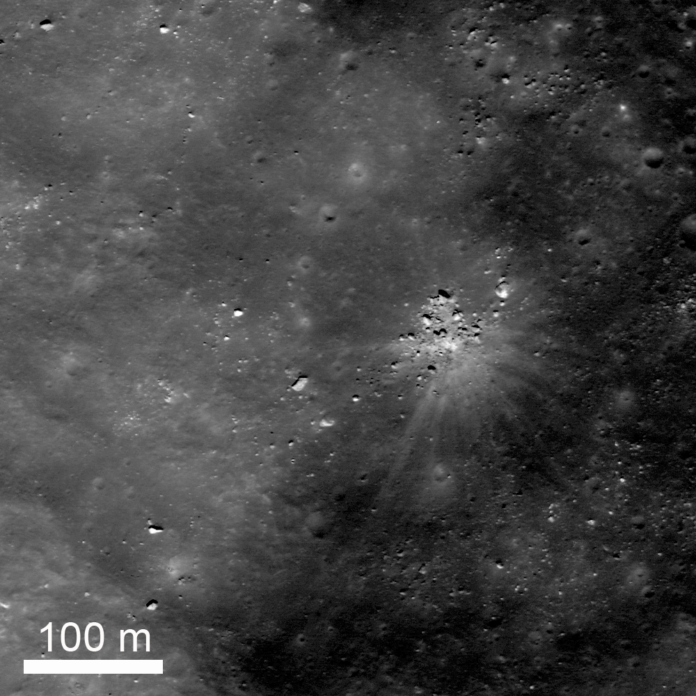
A group of rocks, a small shallow crater, and rays of ejecta occur together up on one of the fault terraces of the crater nearside landmark crater Archimedes. Cropped from LROC Featured Image released February 7. 2012 - LRO Narrow Angle Camera (NAC) M109256375R, spacecraft orbit 1235, October 4, 2009; resolution 52 cm per pixel, 31.95° angle of incidence, from 52.35 km [NASA/GSFC/Arizona State University].
Jeffrey Plescia
LROC News System

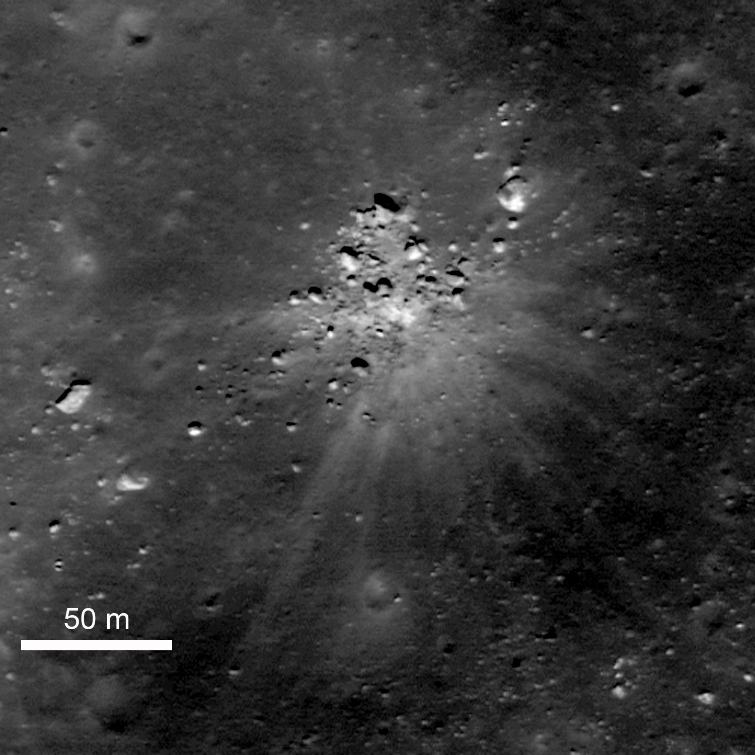
A collection of rocks up to about 8 m across surround a small shallow crater, also about 8 m in diameter. A series of bright ejecta rays surround the area. The site lies on the edge of one of the northeast faulted terraces of Archimedes crater (83 km) at 30.154°N, 357.141°E.

Understanding the origin of this distinctive scene is not necessarily straight forward. At the center is a shallow crater about 8 m in diameter, and a series of bright rays extend away from the crater out to distances of about 150 m. Note that some of the blocks seem to block the rays. On the southwest side there is a large rock about 6 m across, bright lanes of ejecta extend past it on both sides but not behind the rock. To the north, a collection of rocks forms a semicircle; within that semicircle is bright ejecta, but not much beyond.

Zoomed in view of the area shown in the Featured Image. The rocks immediately around the impact site are on the surface. The large bright rock to the northeast and several of those to the southwest are buried by older regolith. LRO NAC M109256375R [NASA/GSFC/Arizona State University].
Not all of the rocks in the scene are related to this event. To the northeast there is a bright, partly buried rock about 12 m across, and the west-southwest an elongate rock 7 x 14 m rests of the surface.

The question is, what happened?

One possibility is that there was already a collection of rocks on the surface and a small meteor happened to hit in a small open area among them; then as the ejecta spread out, it was blocked by the rocks.

Another possibility is that there was a giant boulder at this location that just happened to get hit by a small meteor, shattering the boulder into the pieces that now surround the crater.

The third possibility is that a large boulder ejected during the impact of Archimedes (or from some other nearby impact) landed here and shattered upon impact making a small crater. If the boulder was from the Archimedes impact, it must have been launched into a high trajectory such that it hit the surface only after most the impact activity had ended.

An earlier LROC NAC survey of the terraces and northeast floor of Archimedes. The 'rock garden' is designated with the yellow arrow. A 1.29 meter resolution frame considerably resampled to view the full-width of a 6.46 km-wide field of view. LROC NAC M106898464R, orbit 894, September 6, 2009; 39.9° angle of incidence, from 160 km [NASA/GSFC/Arizona State University].
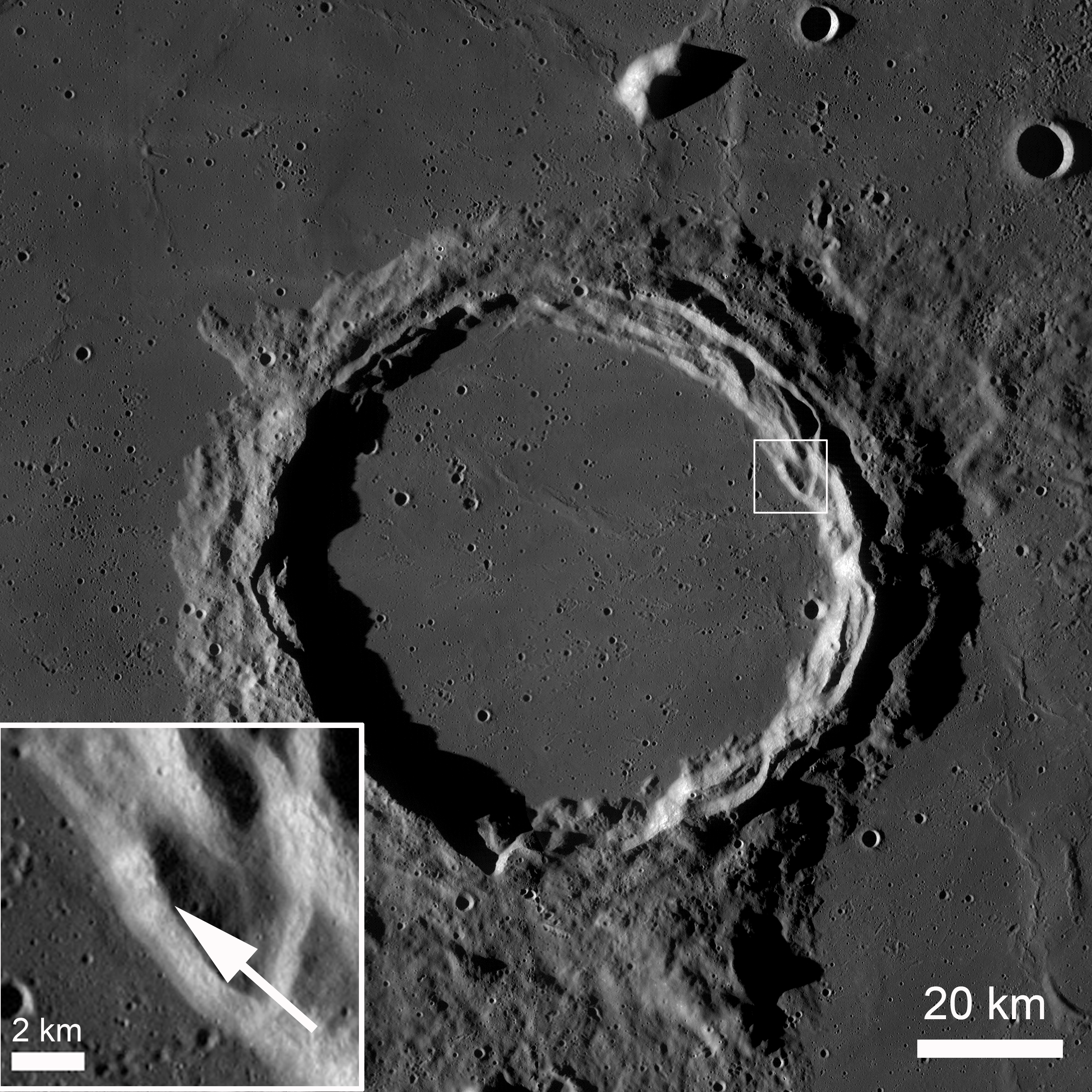
Archimedes under afternoon illumination. The small box on the northeast edge of the terraces in shown as an enlarged inset in the lower left, denoting the location of the rock garden and adding some context also to the image immediately preceding this one. LRO Wide Angle Camera (WAC) mosaic. [NASA/GSFC/Arizona State University].
The area of the rock garden lies on the edge of the Archimedes terraces.  Archimedes is 83 km diameter and lies on the eastern edge of Mare Imbrium.  It is filled with and surrounded by mare basalts on most sides. The crater floor lies a couple hundred meters below the surrounding mare.

Explore more of Archimedes in the full LROC NAC, HERE.

Related Posts:
Archimedes - Mare Flooded Crater!
Sunset Over Giordano Bruno
Necho's Terraces

Archimedes as viewed from the northest, high over Mare Imbrium through the HDTV camera of Japan's SELENE-1 (Kaguya). Further south are the Montes Archimedes and on the left, at the foot of the Appenines (arcing south beyond the horizon), is Palus Putredinus and Hadley Rille, landing site of Apollo 15 in 1971 [JAXA/NHK/SELENE].

Wednesday, February 22, 2012

LROC: Not so simple Procellarum crater

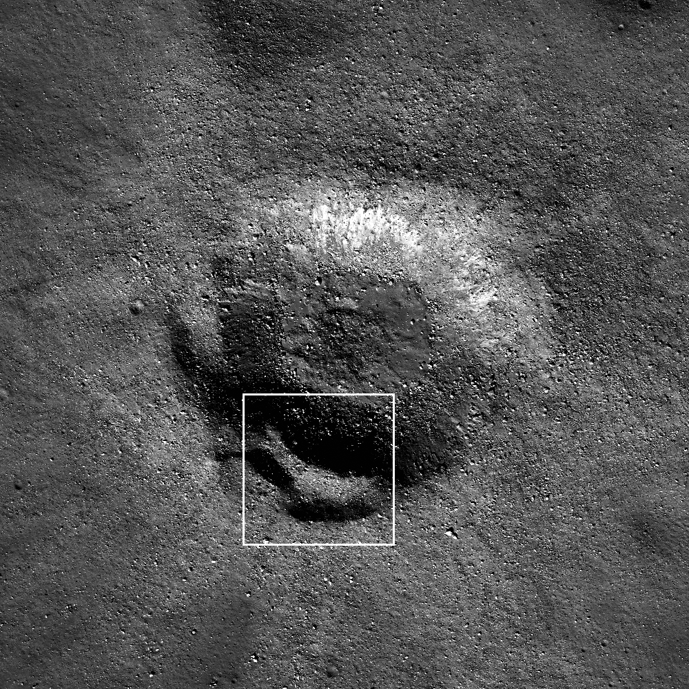
A step is situated here, in between a small crater's floor and rim. The crater also displays a high density of boulders on its surface. LROC Narrow Angle Camera (NAC) observation M122700360L, orbit 3216, March 8, 2010; incidence angle 56.8° over a field of view 330 meters across, resolution 0.48 meters from 40.6 km. View the larger LROC Featured Image HERE [NASA/GSFC/Arizona State University].
Drew Enns
LROC News System

Today's Featured Image focuses on an 800 meter crater in northern Oceanus Procellarum, at 48.527°N, 285.939°E.

A crater this small is normally considered a simple crater, but this crater has what looks like a terrace! Terraces are normally found in complex craters, but some simple craters do form benches.

Strength differences in buried rock layers encountered during the impact are probably the cause of such benches. Zooming out and looking at the crater in context may give us a better understanding of whether this is a bench or terrace.

Context image of the Featured Image, FOV within the box.  The image above has been subsampled to 1.5 m/p and the larger image FOV is 1500 meters; LROC NAC M122700360L. View the larger, original context image HERE [NASA/GSFC/Arizona State University].

The context image reveals that the terrace doesn't circle the entire crater, similar to how complex craters contain multiple unconnected terraces. But the crater is also very blocky, it probably hit a cohesive layer of basalt hidden under a layer of regolith, so maybe it is a bench. Whichever hypothesis is correct, the Moon is definitely not so simple!

Further context from the NASA ILIADS (LMMP) application. Even as vast an expanse as Oceanus Procellarum has an end, in this case a 2500 meter high boundary between highlands and the Procellarum basin's northwest. The small crater, spotlighted in the LROC Featured Image and designated with a yellow arrow, is situated on mare-inundated terrain roughly 2200 meters below the Moon's mean elevation. Beyond the high mountains (at heights near or only slightly above mean elevation) is the complex heart of the Repsold and Rimae Repsold formation. The floor of Repsold is 500 meters higher than the Procellarum basin floor. LROC Global 100 meter monochrome Wide Angle Camera mosaic overlaid upon LOLA laser altimetry at 128 points per degree (v.2) [NASA/ILIADS/LMMP/GSFC/Arizona State University].
Explore more of the Moon in the full NAC frame!

Related Posts:
Maunder's Terrace
Terraced Wall in Bürg Crater
Fresh Bench Crater in Oceanus Procellarum