
 |
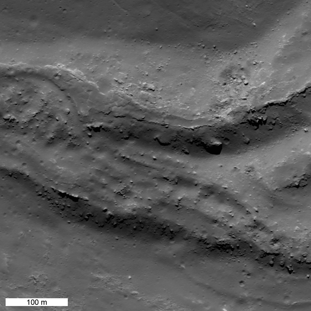
| A small section of an enormous, now frozen, river of impact melt that flowed down the southeastern flank of Tycho crater some 108 million years ago. LROC Narrow Angle Camera (NAC) observation M185940195RE, LRO orbit 12480, March 9, 2012; angle of incidence 46.55° at 0.64 meters resolution from 61.72 kilometers. View the full-size 1000 x 1000px LROC Featured Image HERE [NASA/GSFC/Arizona State University]. |

LROC News System
Impact melt is one of most spectacular products of impact cratering events. A comet or asteroid impacts the Moon at 10-60 km/sec, and releases so much energy that it melts a significant amount of the target rock. The larger the projectile, the bigger the crater, and the more melt that is produced. While much of the Tycho impact melt pooled on crater floor, some of it was thrown out of the crater onto the rim. A large mass of impact melt landed on the southeastern rim and flowed down the rim filling low areas and then spilling over and continuing downhill. Between pools, the melt formed narrow flows whose width was controlled by the topography.
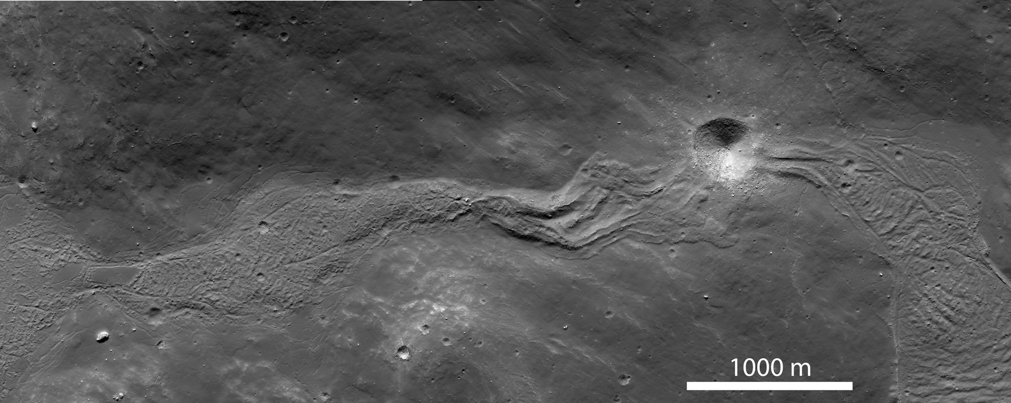
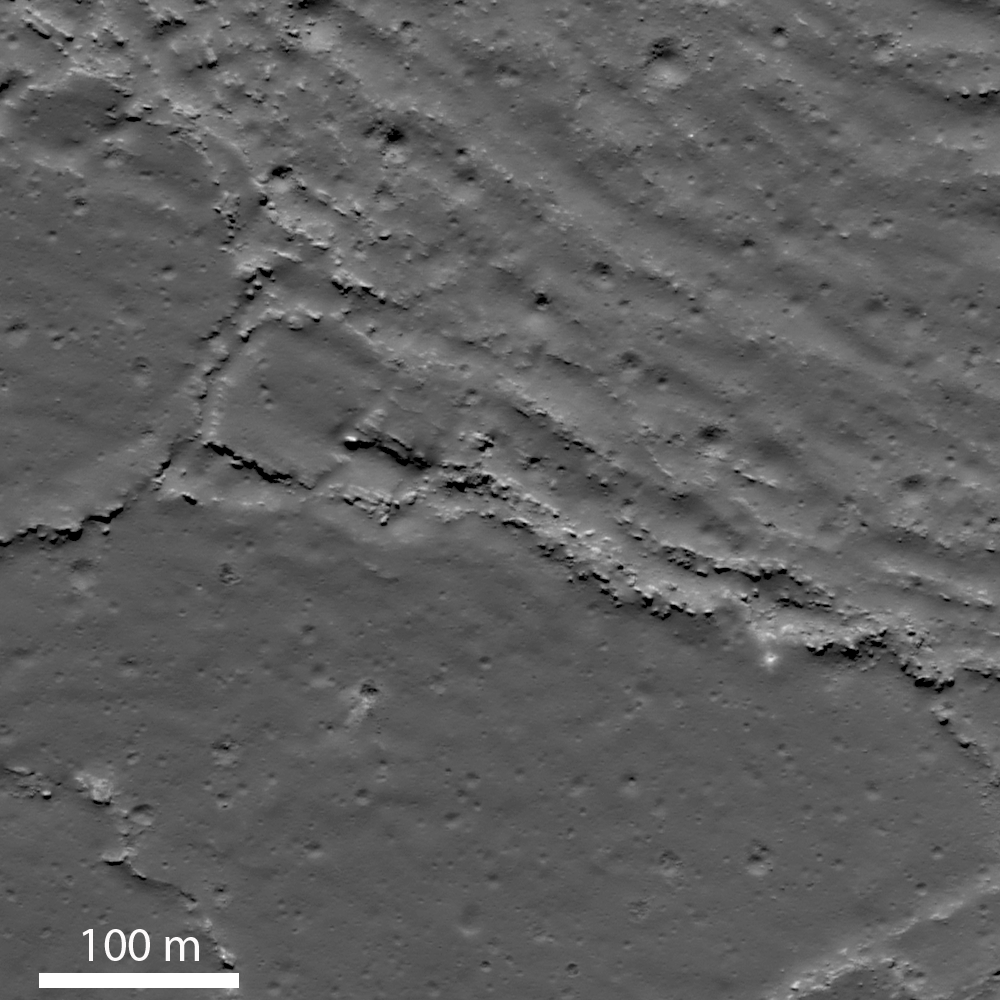
The context image (sub-sampled NAC mosaic) below shows a wider view of the impact melt deposit extending down slope from a high pool (on the left side of the image) at an elevation of about -310 m to a lower pool on the (on the right side of the image) that lies more than 600 m downslope (elevation -950 m). The flow is about 5000 m long; its width ranges from 300 to 700 m and is controlled by the topography of the surrounding hills. The texture of the flow surface and the formation of channels on its eastern end (above and below the crater) is a function of the slope of the underlying surface, and the changes in viscosity of the melt as it cools.
 |
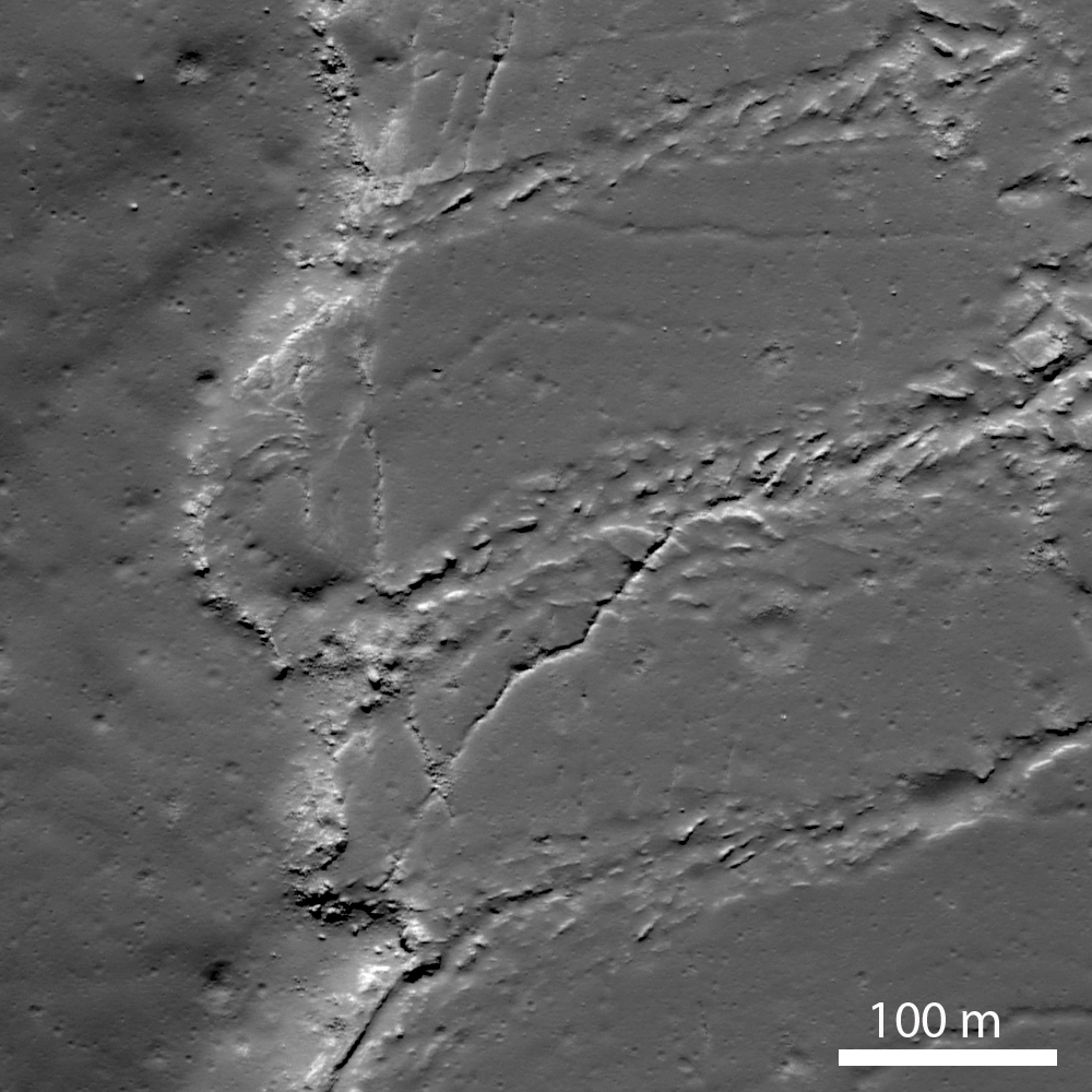
| This contextual montage of the corresponding left and right frames of LROC NAC observation M185940195 allows this view of spectacular river of impact melt, now frozen, that briefly flowed down the southeastern flank of Tycho crater. View the spectacular full-size (2000 x 800px) context view HERE [NASA/GSFC/Arizona State University]. |
 |
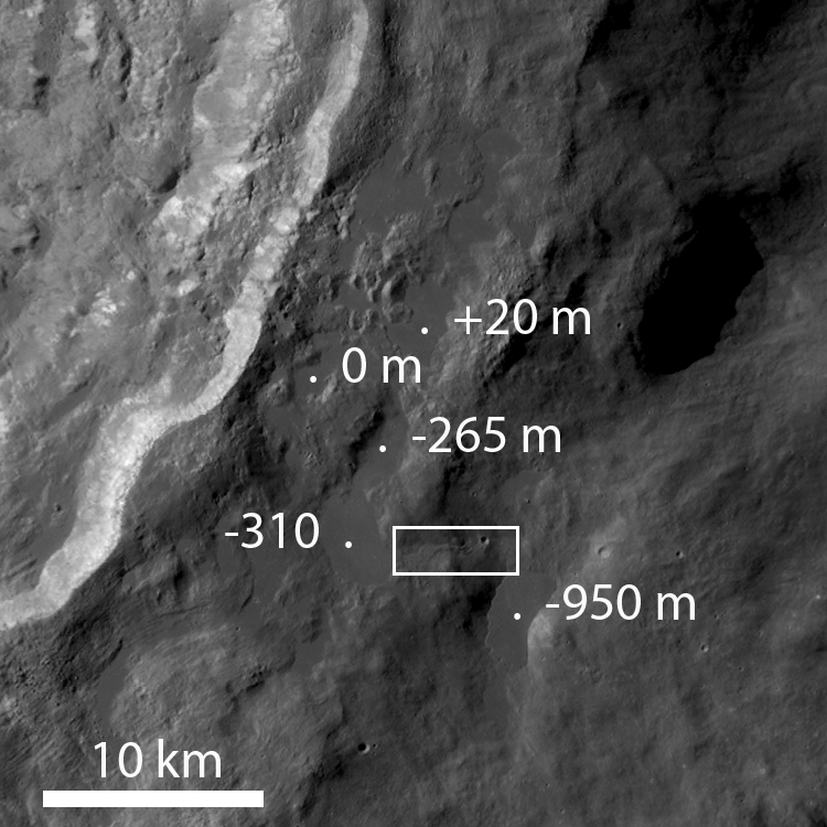
| Contextual LROC Wide Angle Camera (WAC) image of the various pools and their elevations. Over distances of 10-20 km, the melt flowed down almost a kilometer in elevation. The white box roughly outlines the field of view shown in detail immediately above. LROC WAC observation M177698611C (604nm), orbit 11323, December 5, 2011, illumination from the northeast (upper right) at an 80.34° angle of incidence; 59.83 meters resolution, from 43.7 kilometers. View the original annotated context image HERE [NASA/GSFC/Arizona State University]. |
 |
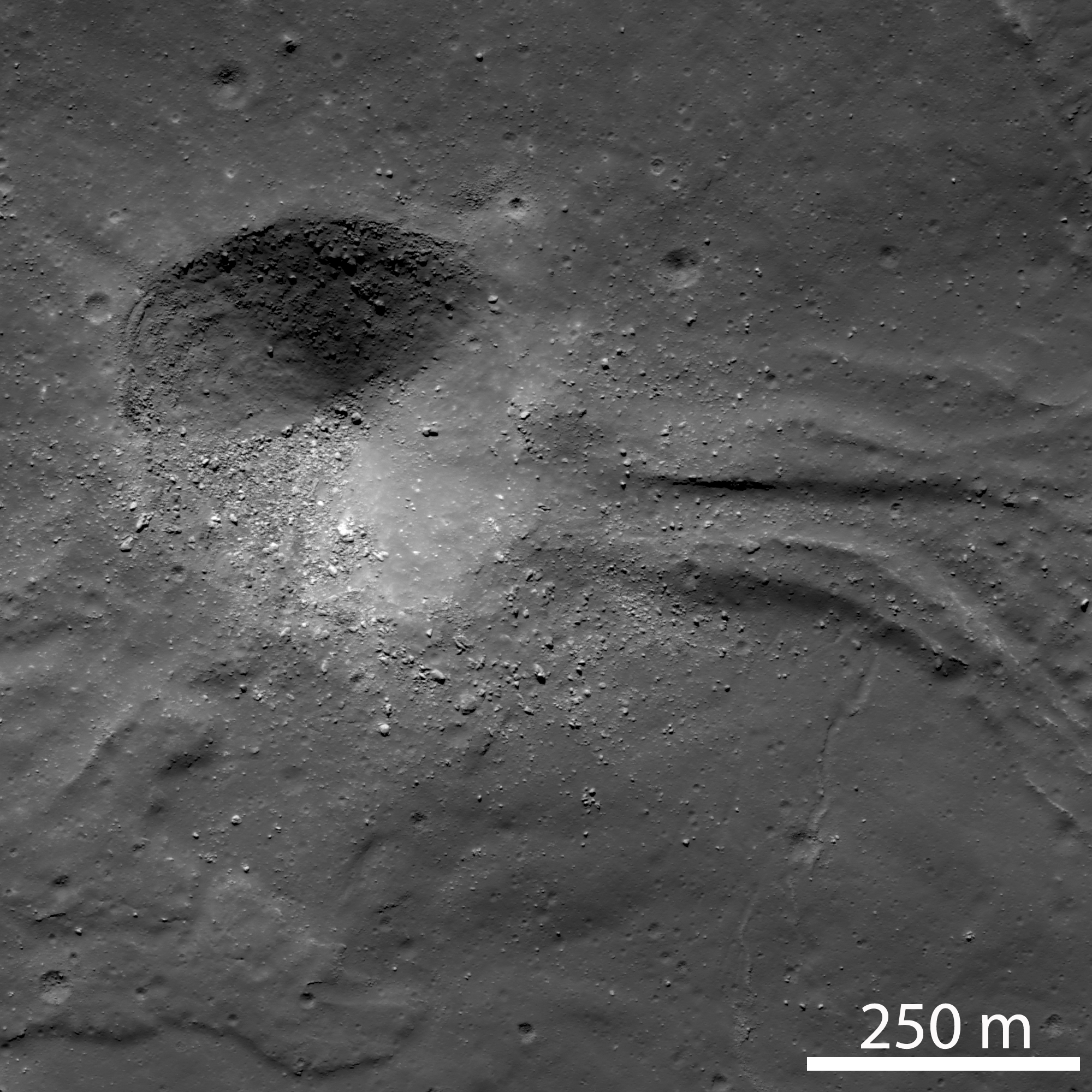
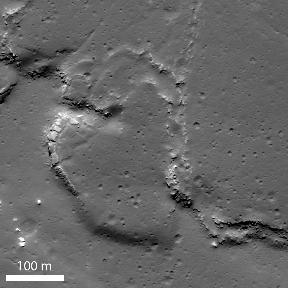
| Context image of the lowest pool of impact melt, showing the locations of higher resolution images below. Cropped with depth distortion from the full size context image accompanying the LROC Featured Image, released June 20, 2012. From a montage of the corresponding left and right frames from LROC NAC observation M181222542LR, orbit 11820, January 14, 2012; resolution 1.3 meters from 62.98 kilometers, angle of incidence 72.72° [NASA/GSFC/Arizona State University]. |
 |
| (A) A 400 meter impact crater obliterated the flow. View the original 2000 x 2000px detail, HERE [NASA/GSFC/Arizona State University]. |
 |
| (B) Wrinkled and platy lava flow surface. View the 1000 x 1000px detail image, HERE [NASA/GSFC/Arizona State University]. |
 |
| (C) Shearing along the western margin of the pool. View the 1000 x 1000px detail image, HERE [NASA/GSFC/Arizona State University]. |
 |
| (D) Lobate terminus of impact melt pool. View the 1000 x 1000px detail image, HERE [NASA/GSFC/Arizona State University]. |
Directly Related:
"Tycho's flash-frozen inferno," November 2, 2011
Related LROC Posts:
View From The Other Side
Tycho Central Peak Spectacular
Chaotic Crater Floor in Tycho
Polygonal Fractures On Tycho Ejecta
View From The Other Side
Tycho Central Peak Spectacular
Chaotic Crater Floor in Tycho
Polygonal Fractures On Tycho Ejecta
 |
| Simulated oblique view of the southeastern flank of Tycho, from "Tycho's flash-frozen inferno," a discussion of the stream of impact melt and its cascade down the rim of the 109 million year old relatively recent impact, posted here last November. Jeff Plescia of Arizona State University's Lunar Reconnaissance Orbiter Camera (LROC) science team covers the topic in more recent images and greater detail below [NASA/GSFC/USGS/Arizona State University/Google Earth] |
No comments:
Post a Comment