Showing posts with label James Ashley. Show all posts

Thursday, October 10, 2013

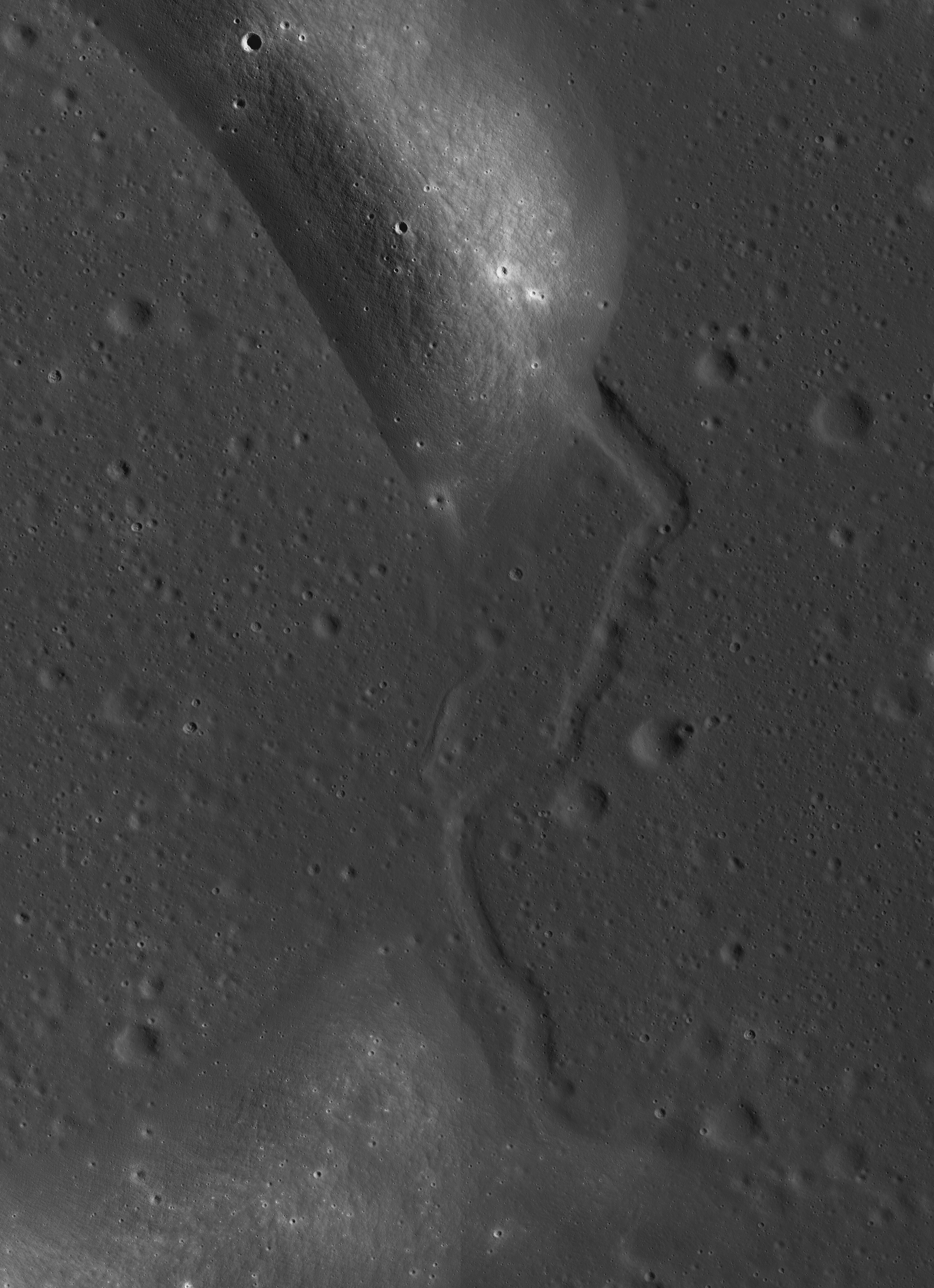
Wrinkles in Mare Frigoris

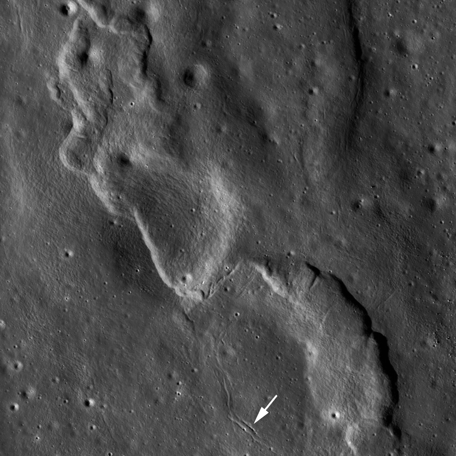
M181102837R LROC Featured Image, October 10, 2013
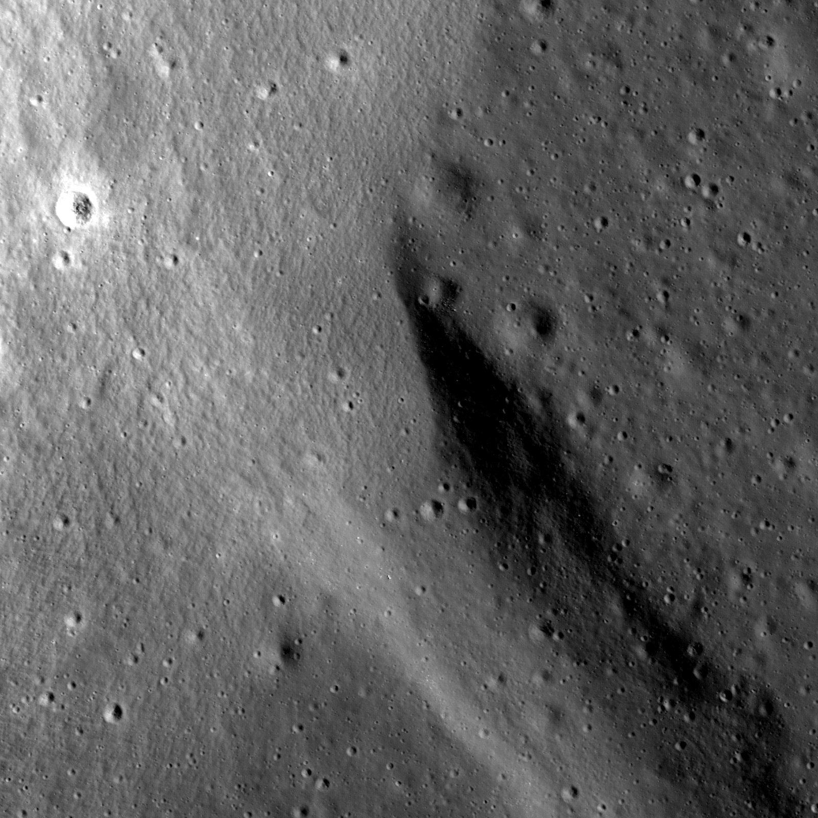
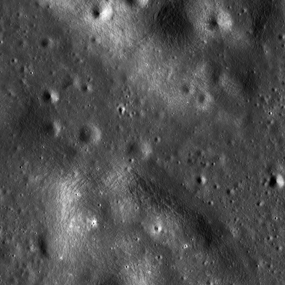
A complex wrinkle ridge deforms Mare Frigoris (52.935°N; 11.131°E) Two kilometer-wide field of view from LROC NAC observation M181102837R, LRO orbit 11804, January 13, 2013; 76.04°evening illumination angle of incidence from the west (left), resolution 1.65 meters per pixel from 168.24 km [NASA/GSFC/Arizona State University].
James Ashley
LROC News System

Lunar mare present many excellent examples of wrinkle ridges, where tectonic activity caused the foreshortening of near-surface rocks. The loading of large basins by dense mare basalts is thought to have resulted in isostatic adjustment of the underlying anorthositic crust, leading to buckling and overriding of surface rock units one atop another as compression occurred. The same stresses may also produce extensional (rather than compressional) deformation in adjacent areas. A variety of complex landforms can thus result.

M146911901CN_604nm-580x800
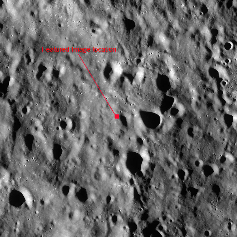
Area shown at high resolution in the LROC Featured Image is designated with a small arrow in this 34.4 km-wide field of view from LROC Wide Angle Camera (WAC) monochrome (604 nm)observation M146911901CE, LRO orbit 6784, December 13, 2010; early morning 78.67° angle of incidence, resolution 59.3 meters per pixel from 43 km. The area of interest is in south central Mare Frigoris. [NASA/GSFC/Arizona State University].
Most of the ridges we see in today's Featured Image are produced by thrust faulting in Mare Frigoris. Just below center in the Featured Image frame, however, is a left-lateral strike-slip fault (also called a sinistral fault). Wrinkle ridges can be lumpy and ropey-looking, not exactly what comes to mind when one thinks of a textbook compressional fault. But in cross section the faulting would be readily apparent (refer again to the links above). Just south of the strike-slip fault are zones of extension where tension cracks have formed (small white arrow in Featured Image).

M146898354CN_604nm_stitch-58b-1782x2458
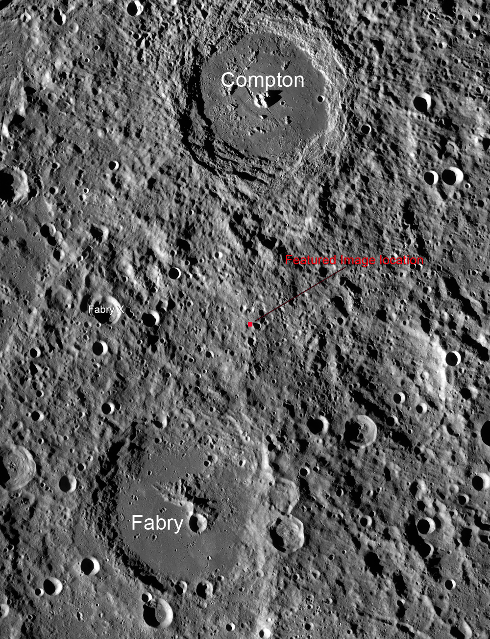
Further context for the wrinkle ridge in this field of view 107 km wide south central Mare Frigoris, scared by secondary crater streams from Aristoteles crater to the southeast. LROC WAC monochrome mosaic (604 nm) from five sequential orbits captured under local sunrise (emphasizing topography over albedo), LRO orbits 6782-6786, December 14, 2010 averaging a 77° angle of incidence from 43 km [NASA/GSFC/Arizona State University].
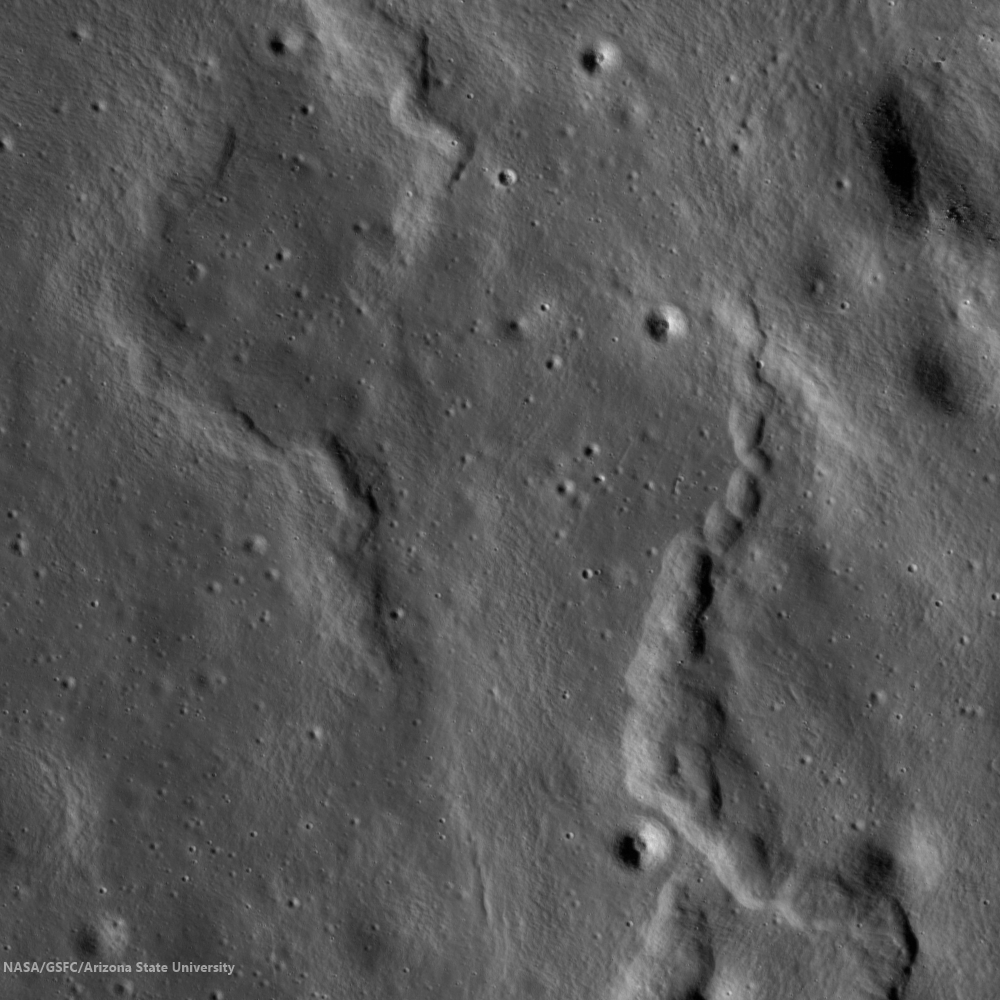
Morphologic nuances can be explored elsewhere in the NAC frame. Note the ropey appearance of some of these ridges, again showing that motions within the rock were complex indeed. Other examples of strike-slip faults have been found in association with lobate scarps on the Moon. Recent evidence suggests that shrinkage of the Moon from deeply seated internal cooling may have contributed to the occurrence of some lobate scarps and wrinkle ridges.

M181102837R
More examples of wrinkle ridges from NAC frame M181102837R [NASA/GSFC/Arizona State University].
Explore the full NAC frame HERE.

Additional examples of wrinkle ridges can be found in LROC Featured Image posts, "Really Wrinkled," "Wrinkle Ridge in Mare Crisium," and "Bulging Wrinkle."

Thursday, August 8, 2013

Convergence

Debris flows converge at the bottom of a youthful crater on the northern frontier of the Moscoviense basin (32.660°S; 143.668°E). LROC Narrow Angle Camera (NAC) frame M1107331321R, spacecraft orbit 15474, November 12, 2012; 62.63° incidence, 1.45 meters resolution from 145.44 km. Field of view approximately 1.4 km across [NASA/GSFC/Arizona State University].
James Ashley
LROC News System

Small crater floors are places where slopes facing different compass directions (azimuths) naturally approach each other.

Steep, recently formed slopes will often produce debris flows that migrate part way or completely to the floor.

The resulting zones of debris convergence can present interesting juxtapositions of coarse and fine deposits with variable light and shadow effects. On an airless body like the Moon, the patterns are frequently striking, and make for studies in artistic composition. The play of sunlight on these surfaces often create some surprising textural patterns and relationships.

Context for the LROC Featured Image within a 7 km field of view [NASA/GSFC/Arizona State University].
This small, unnamed farside crater in the lunar highlands presents a nice example. High-reflectance ejecta in the WAC context image shows it to be the result of a relatively recent impact. Mass wasting events have generated debris flows that have different textures by the time they come to rest at or near the crater floor. Their different slopes produce different angles of illumination and different intensities of reflection.

M187306990RL-NASA/GSFC/Arizona State University
Roughly 9.2 km-wide field of view from LROC NAC mosaic M187306990LR, LRO orbit 12672, March 25, 2012; 31.65° angle of incidence, resolution 105 cm per pixel from 161.18 km over 32.67°E, 143.77°E [NASA/GSFC/Arizona State University].
 Slightly less than 40 km-wide field of view from LROC Wide Angle Camera frame M167260236CE, orbit 9783, 56.55° angle of incidence, 67.4 meters per pixel resolution from 50.4 km [NASA/GSFC/Arizona State University].
There are also examples of impact melt visible in the debris, best seen in the full NAC frame just south of the Featured Image boundary. What clues would you look for to help distinguish impact melt from fine-grained debris flows?

The bright ejecta from the small crater (arrow) contrasts sharply from its far more 'optically mature' surroundings, allowing the eye to easily pick area of interest in small scale albedo maps and this segment of the LROC GLD100 mosaic showing the crater's location with respect to Mare Moscoviense [NASA/GSFC/Arizona State University].
Explore additional details in the full NAC frame HERE.

Similar Featured Image posts have been presented as "Diversity," "Complicated Crater," and "Rubble Pile on Fresh Crater Floor."

Tuesday, August 6, 2013

Symmetry in Asymmetry

A beautiful example of an asymmetric impact feature (27.674°S; 125.465°E). LROC Narrow Angle Camera (NAC) frame M110771566R, LRO orbit 1458, October 21, 2009; illumination angle of incidence 31.51° from the northeast, image field of view roughly 1.2 km across, resolution 63 cm per pixel from 60.63 km [NASA/GSFC/Arizona State University].
James Ashley
LROC News System

While the total energy of an impact depends on the projectile velocity and mass, low-angle (oblique) impacts can distribute this energy in ways that differ from that of a higher angle trajectory.

By definition oblique impacts strike at an angle of 15° or less, producing something more akin to a 'glancing blow' rather than a 'hard smack,' and often result in asymmetrical 'wing-shaped' ejecta patterns.

Based on the ejecta surrounding this small feature in Neujmin crater in the lunar farside highlands, a case can be made for a southwestern approach from the impacting object. Debris was tossed in the down-track direction and splayed at right angles to the flight path on either side. The ejecta is actually quite symmetrical with respect to this flight axis (axial symmetry). The notion of asymmetry really applies to rotational symmetry in the case of many oblique impacts.

One of three dark halo craters (DHC) on the floor of Deutsch crater and recently proposed as one of many newly surveyed potential landing sites picked to fulfill high-priority science goals. A 4-km-wide field of view from LROC NAC observation M185169501R,  spacecraft orbit 12373, February 29, 2012; angle of incidence 29.7° resolution 1.46 meters per pixel from 148.15 km [NASA/GSFC/Arizona State University].
Smaller impacts created markings on the ejecta blanket, and these events excavated through the high-reflectance ejecta bringing up lower reflectance, mature materials -- producing dark-haloed craters. These small dark halo craters likely formed seconds after the high reflectance material was emplaced as slower, larger pieces of ejecta landed.

LROC Wide Angle Camera (WAC) GLD100 mosaic of the ancient, possibly highly "disrupted" terrain in and around Neujmin crater, southeast of the more distinctive farside landmark Tsiolkovskiy crater, presented as context for the 'winged' crater in the LROC Featured Image, released August 6, 2013. It's location is marked by the arrow [NASA/GSFC/Arizona State University].

The full NAC frame can be explored HERE.

Additional examples of oblique impacts are available in the Featured Image browse gallery, including "Not Your Average Crater," "A Tiny, Glancing Blow," and "Crash or Coincidence?"

Thursday, May 30, 2013

Truncated Rille in Jules Verne

A lunar rille comes to an abrupt termination at a crater rim (34.342°S, 145.430°E). LROC Narrow Angle Camera (NAC) frame M1122636898R, LRO orbit 17626, May 8, 2013; illumination from east-northeast, an approximate 1 km wide field of view at 0.74 meters resolution [NASA/GSFC/Arizona State University].
James Ashley
LROC News System

We invite you to take a close look at this sinuous rille in Jules Verne crater on the lunar farside.

Why do we see it approach this portion of an ancient, mare-flooded crater rim and suddenly terminate?

Any flowing river of molten rock (the process responsible for most sinuous rilles) would skirt the base of such a positive-relief structure once encountered ... unless the crater rim formed after the rille. But if the crater is flooded by mare basalts (see context image below) the crater must have formed before the rille, which established itself during mare emplacement.

M192002047LR-NSJ-58b-40p-3910x5393
Simple contextual seven kilometers wide field of view shows a wide distribution of debris aprons bordering nearly every contact zone in the vicinity of this ghost crater on the floor of Jules Verne. View a much larger rendition HERE. LROC NAC mosaic M192002047LR, orbit 13328, May 18, 2012; 66.47° angle of incidence, resolution 0.72 meters per pixel from 70.65 km [NASA/GSFC/Arizona State University].
LROC Wide Angle Camera (WAC) mosaic covering a 100 km wide field of view, including the western interior of Jules Verne [NASA/GSFC/Arizona State University].
A clue may be present within the rille itself. Note the sloping wall of debris entering the rille at the point where it encounters the crater wall near the center of the Featured Image. This is accumulated debris, which has been shed from the crater rim. If you look closely at the full NAC frame, HERE, you can also see a subtle break in slope around the perimeter of the crater wall that betrays the presence of a debris apron or pediment.

This eroded material may have buried other portions of rille that might indeed have skirted the original rim, giving the visible portion an appearance of protruding out of the rim at a sharp angle. Can you find any additional clues that would help solve the puzzle?

Other examples of rilles are highlighted in the LROC Featured Image posts "Meanders in Posidonius," "The Old and the Young in Tsiolkovskiy," and "Rimae Prinz Region - Constellation Region of Interest."

Wednesday, May 29, 2013

"Star light, star bright"

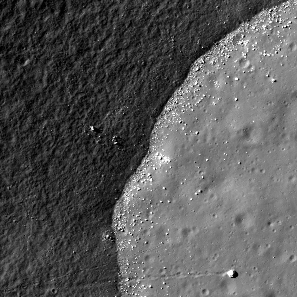
A sharp reflectance contrast is found in an unnamed crater on the east floor of Humboldt (26.593°S; 83.764°E). NAC frame M182974061L, illumination is from the west, north is up, image is ~850m wide [NASA/GSFC/Arizona State University].
James Ashley
LROC News System

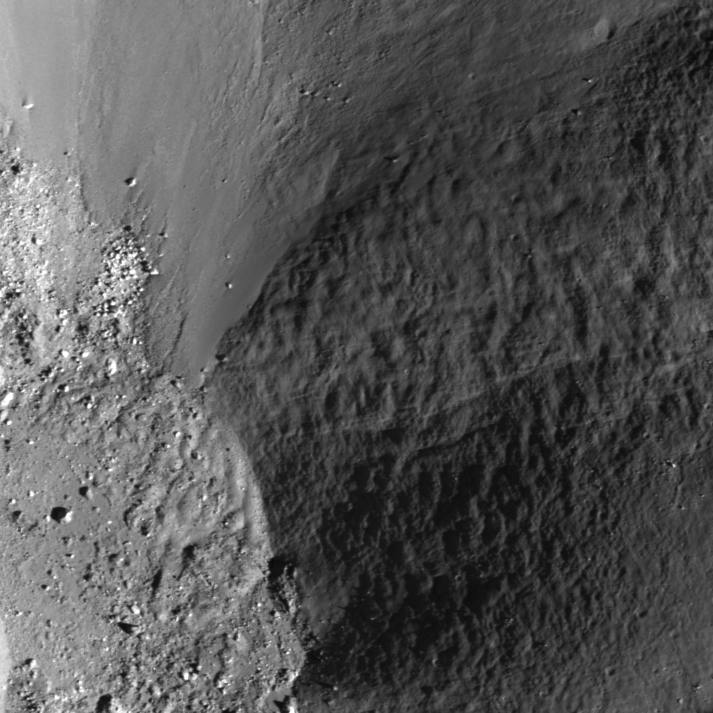
Why do we see such a sharp contrast in reflectance in the above Featured Image between the crater wall on the left and the crater floor on the right? This is the floor and wall of an ~8.5-km diameter, unnamed impact crater within the much larger Humboldt crater on the lunar farside.

The reason for the striking dichotomy in terrain appearance is not a mystery -- it has to do with solar illumination angle.

Our star, the Sun is shining from the west at an elevation above the lunar horizon (~25°) that is close to the slope of the western crater wall. Thus much of the wall on this side is receiving low-angle sunlight and appears relatively dark compared to the crater floor surface, which is more directly illuminated. The floor makes a clean contact with the crater walls, and becomes a zone of deposition for boulders rolling down the slope, including one larger and prominent boulder at the southern end of the frame.

Contextual view of the unnamed crater of interest (center) on the far east floor of Humboldt, its interior and floor highly illuminated by a comparatively low angle of solar illumination (a high Sun). From the global albedo lunar photograph mosaic swept up over the mission of China's lunar orbiter Chang'E-2 [CNSA/CLEP]..
For reasons like this, planetary scientists need to be careful when making interpretations of surface features, and must often use several images collected under a variety of lighting geometries to understand the geomorphology.

The entirety of Humboldt crater, from the early LROC GLD100 Wide Angle Camera (WAC) global mosaic. The unnamed crater of interest is designated [NASA/GSFC/Arizona State University].
The WAC mosaic presents the exotic landscape of Humboldt crater for context. Click HERE to see the full NAC frame.

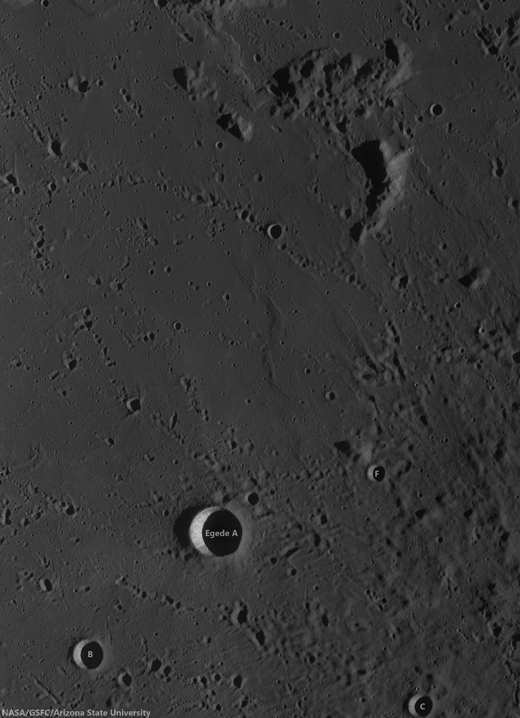
Other examples of lighting effects can be found at the earlier LROC Featured Image posts, Shadows in Egede A, Boulder or Crater?, and Sunset Boulder.

Tuesday, May 28, 2013

Coalescing Secondaries

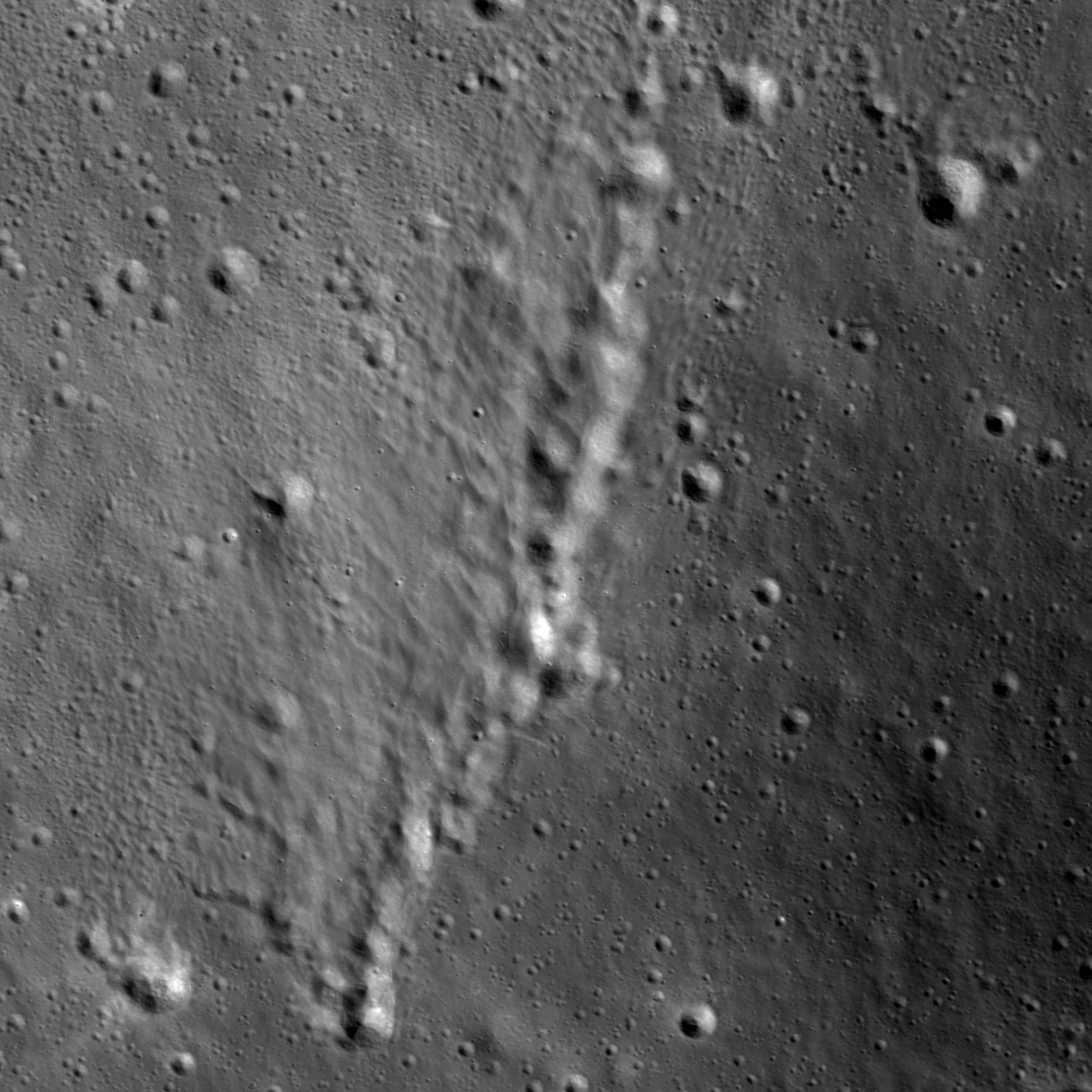
A chain of impact features provides a picturesque tableau (48.659°N; 103.299°E). LROC Narrow Angle Camera (NAC) frame M18286833R, LRO orbit 12051, February 3, 2012; illumination is from the southwest (angle of incidence 63.07°), north is up, image field of view approximately 2 km across [NASA/GSFC/Arizona State University].
James Ashley
LROC News System

Today's Feature Image exhibits a chain of impact features that are so closely spaced as to lose their distinction as separate landforms, producing one continuous feature instead.

An asymmetry in the ejecta pattern can also be seen in the form of filamentary tendrils extending to the north.

Based on this ejecta distribution, the secondary bolides likely came from a southerly or southeasterly direction.

Another, earlier look at the same field of view, at slightly higher resolution. LROC NAC M123901314R, orbit 3393, March 22, 2010; angle of incidence 47.54° at 0.56 meters resolution from 53.96 km [NASA/GSFC/Arizona State University].
The WAC mosaic context image is approximately 83 km wide [NASA/GSFC/Arizona State University].
Zooming out to learn what this source might have been produces no obvious candidates, however. None of the medium-sized craters within 40 km of the featured crater chain appear to be particularly young -- a condition required to explain the chain's fresh appearance. Not until we expand our view even further do likely candidates crop up.

This larger scale WAC mosaic context image is just about 470 km wide [NASA/GSFC/Arizona State University].
But even here nothing unambiguous catches the eye. The secondary impacts could have resulted from one of any number of craters, or perhaps from an impact located even further away. A detailed surface study would be necessary before a definitive link could be made tying this ejecta with its crater of origin. Explore the full NAC frame HERE.

Other examples of ejecta interactions with the lunar surface can be found in Crater Chain near Rima T Mayer, Four of a Kind in Catena Davy, and Four Leaf Clover.

Bonus Context: The location of the field of view shown at high resolution in the LROC Featured Image, released May 29, 2013 in the north farside highlands. The terrain is representative of one of the four recognized lunar material groups, the farside anorthositic highland terrain, or FaHT [NASA/GSFC/SVS].

Thursday, April 25, 2013

The Monadnocks of Sinus Honoris

A northwest-southwest oriented groove between two inselbergs in Sinus Honoris (12.276°S; 18.712°E), an embayment near the northwest extreme of Mare Tranquillitatis. LROC Narrow Angle Camere (NAC) frame M181944849L, LRO orbit 11796, January 12, 2012. Illumination angle of incidence 67.94°from the west, field of view roughly 5.8 km across, resolution in the original 1.21 meters per pixel from 122.13  km [NASA/GSFC/Arizona State University].
James Ashley
LROC News System

Most of the physical sciences are instructive in the art of piecing together observations made at vastly different scales. Note, for example, how climatologists look at pollen in soil samples to assess climate change through time on a global scale. Geologists use microscopes to examine mm-scale crystals in order to understand magma chambers many cubic miles in volume.

Astronomers attempt to make sense of subatomic particles in the context of the entire visible Universe. With this in mind, try to explain the sculpted mountains in today's Featured Image, located at the northwestern margin of Mare Tranquillitatis.

Field of view shown at high-resolution in the LROC Featured Image released April 25, 2013 is outlined in yellow in this Wide Angle Camera (WAC) monochrome (566 nm) observation M165726769C, swept up in orbit 9557, July 19, 2011. Field of view 45.8 km, resolution 58 meters per pixel from 40.97 km [NASA/GSFC/Arizona State University].
You may find that adjusting the scale is necessary. Indeed; we will have to zoom out until we can see a good deal of the lunar nearside before the features have the context they need to be understood. (Examine the image above and below to pull back for increasingly smaller-scale, wider-field of view LROC WAC context images.)

A mosaic of the LROC WAC image immediately above, stitched together to observations of the same latitude from one orbit prior and after, July 19, 2011. Field of view roughly 145 km [NASA/GSFC/Arizona State University].
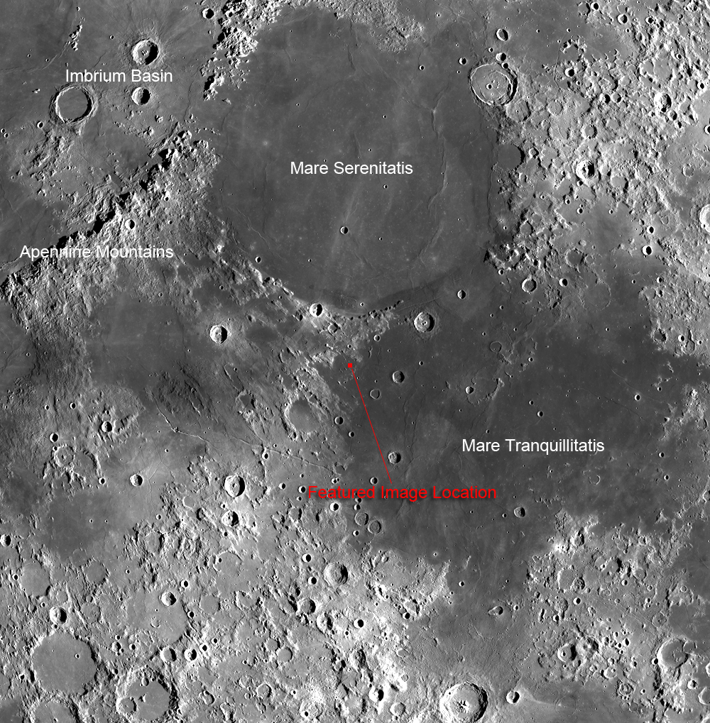
The WAC mosaic context image released with the LROC NAC Featured Image covers a more familiar 1,500 km wide field of view (one that happens also to include four of six successful Apollo landing sites; Apollo 11, 15, 16 and 17) [NASA/GSFC/Arizona State University].
These mountains are members of a group of mare-surrounded highland structures nestled between Mare Tranquillitatis and Mare Serenitatis. Examination of the region will quickly reveal a strong northwest to southeast trending orientation to most of the upland features that points directly back to the Apennine Mountains, which form the southeastern rim of the Imbrium basin. Now we can see that this whole region was sculpted by ground-hugging forces unleashed in the terrible cataclysm that formed that basin. Imagine witnessing this awesome event from the Earth over 3 billion years ago; it would have been clearly visible to the unaided eye!

Isolated mountains like these, which rise from a surrounding plain, are often referred to by geologists as monadnocks or inselbergs ("island mountains," or "sky islands"). On Earth such features might be erosional remnants, but here in the Bay of Honor (Sinus Honoris) we know them to be isolated by surrounding mare deposits.

Click HERE to see the full NAC frame. Additional examples of large-scale features on the Moon can be explored with Four of a Kind in Catena Davy, Nearside Spectacular!, and A Scar in the Highlands.

Wednesday, April 24, 2013

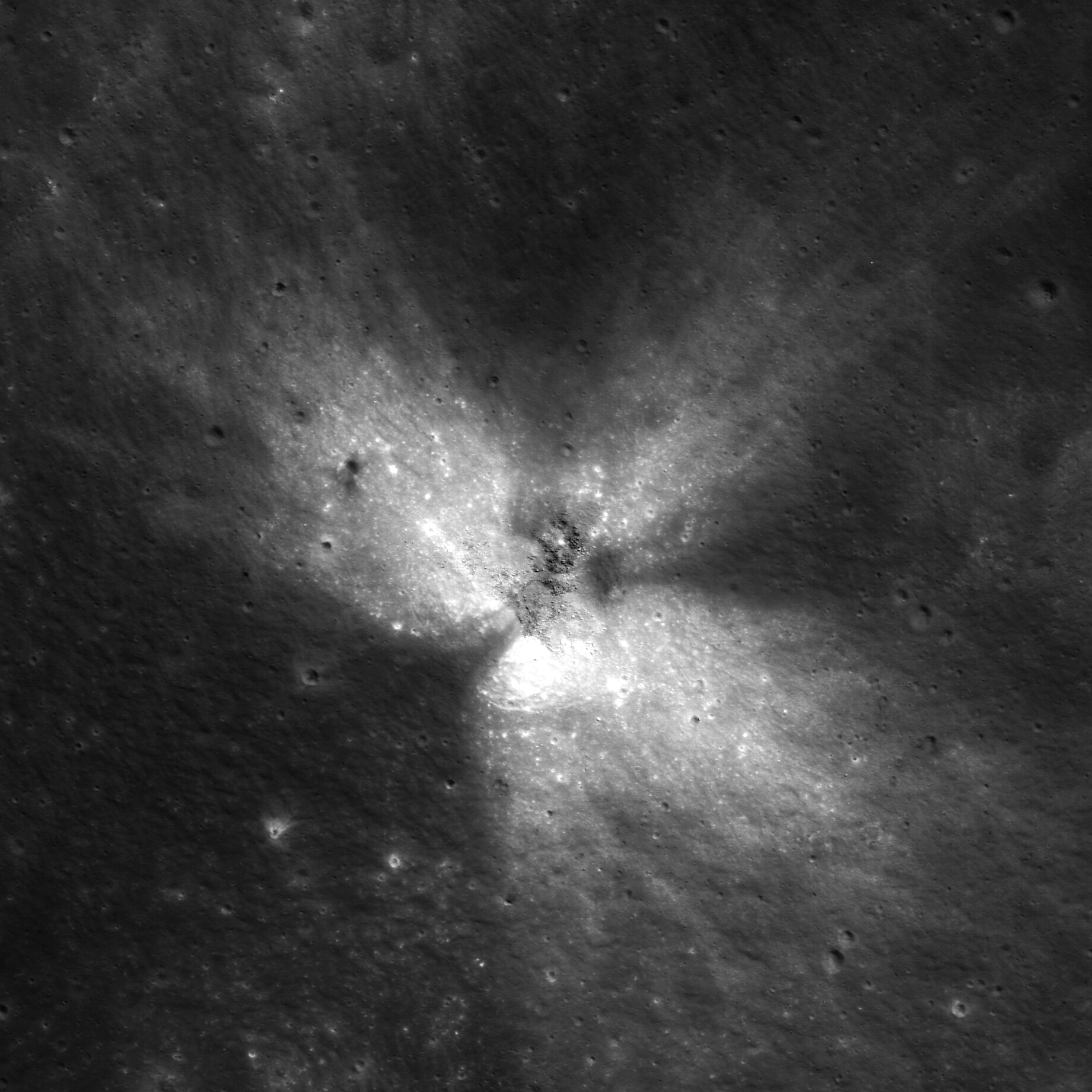
Getting Cracked at Weiner F

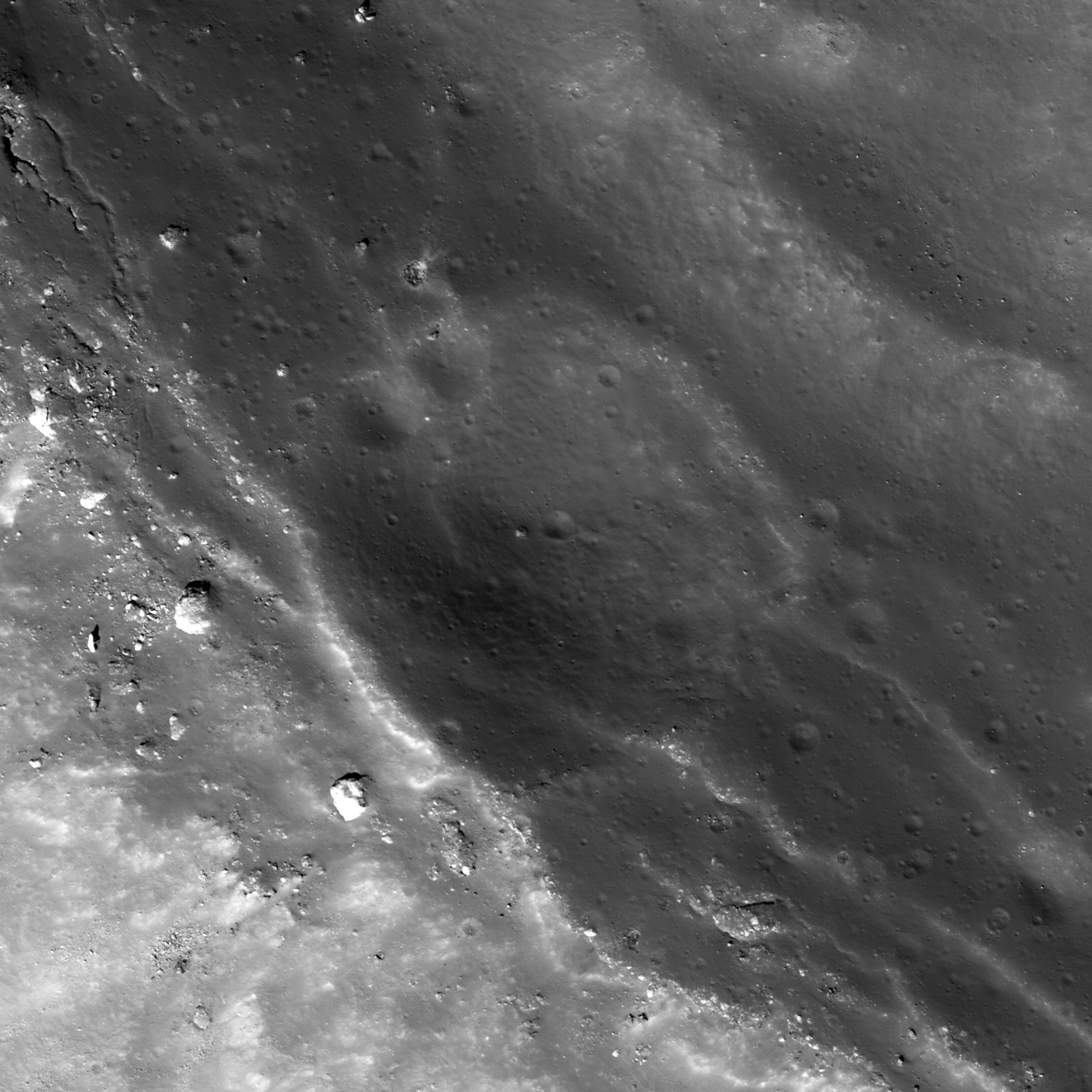
An impact crater is caught in the process of disintegration, barely visible today on the complex terrace of Weiner F crater (40.881°N; 150.608°E). LROC Narrow Angle Camera (NAC) frame M169574198L, spacecraft orbit 10124, September 2, 2011. Illumination angle of incidence 46.95° from the southwest, resolution reduced from the original 43 cm per pixel from 30.02 km [NASA/GSFC/Arizona State University].
James Ashley
LROC News System

This small impact crater happened to form just a little too close to the widening edge of the Wiener F crater. Fault-slumping of the upper wall of Wiener F has cracked it along a series of linear, subparallel fractures, and the whole area appears to be in the process of down-slope migration. Eventually, if the process were to continue, the disintegration would be complete and the small superposed crater would no longer be recognizable.

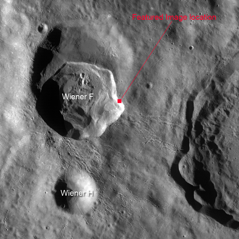
The context images above and below show the location of this feature -- nestled within the slumping and fault-bounded eastern crater wall that has produced an irregular protrusion into the surrounding highland terrain. The occurrence of Wiener F within a former, older and larger crater is a coincidence of nature. Who says impacts cannot occur in the same place twice? Here we see three nested craters!

Context image from NAC frame, 1.3 km across; downslope to lower left [NASA/GSFC/Arizona State University].
The WAC global mosaic context image field of view approximately 48 km from west to east [NASA/GSFC/Arizona State University].
Click HERE to examine the full NAC frame. Other examples of fault-terraced crater walls can be found with Top of the Landslide, Aristarchus Spectacular!, and Post-impact Modification of Klute W.

Center crop from HDTV still centered on Weiner F, view toward the south over the farside anorthositic highland terrain from an estimated 100 km altitude in 2007. From Japan's lunar orbiter SELENE-1 (Kaguya) [JAXA/NHK/SELENE].
Other related posts:
Impact melt outside Weiner F (October 27, 2012)
Secondary melt on the rim of Weiner F (October 2, 2012)

Tuesday, April 23, 2013

The peculiar domes of Stevinus

A distinctive positive-relief feature on the floor of Stevinus crater (32.760°S; 53.739°E). LROC Narrow Angle Camera (NAC) frame M113603383L, spacecraft orbit 1875, illumination is from the east, angle of incidence 57.67° field of view 1.9 km at 58 cm resolution from 55.68 km [NASA/GSFC/Arizona State University].

James Ashley
LROC News System

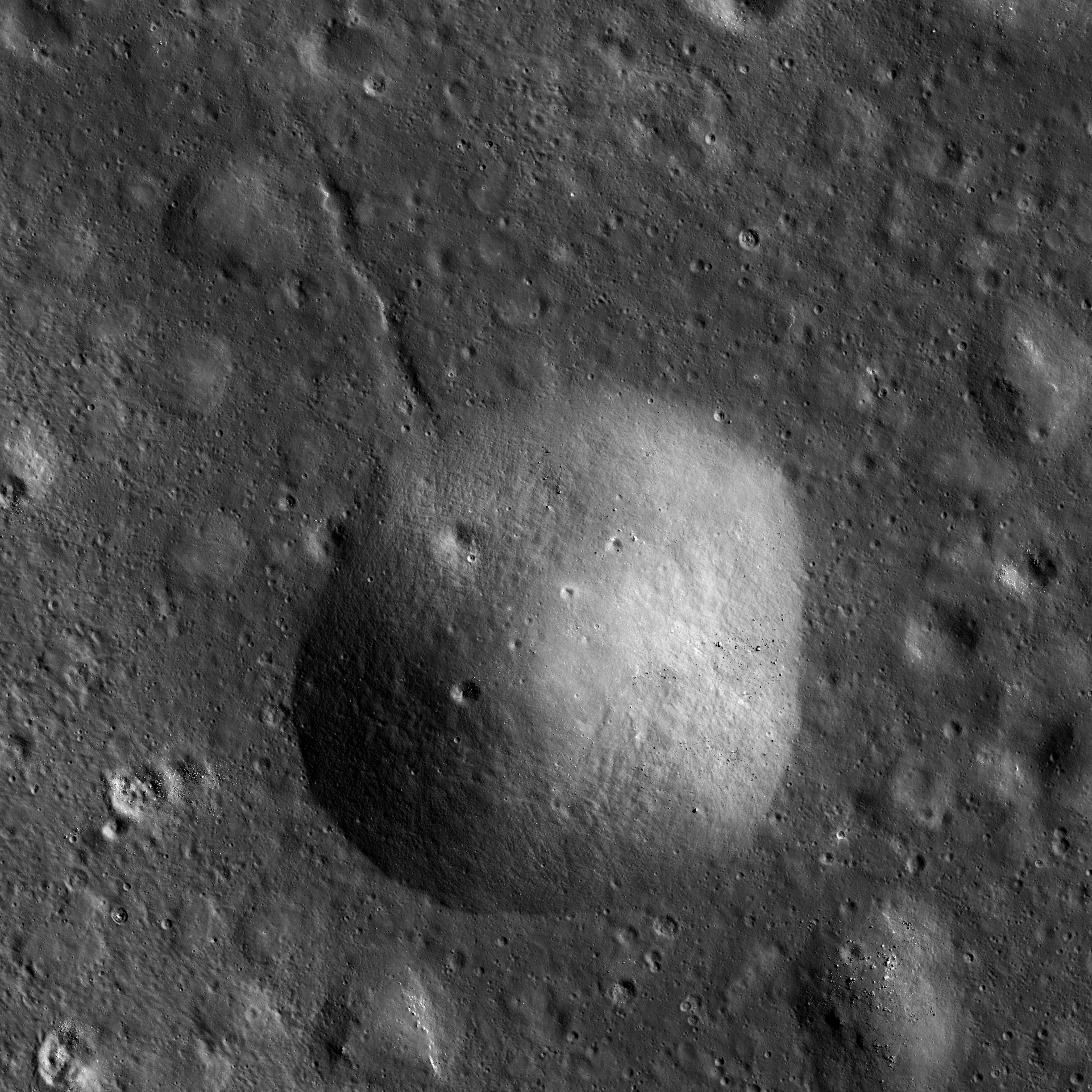
Today's image explores a portion of the Stevinus crater floor (southern hemisphere, nearside highlands). Here we see a topographic feature that can be found by the dozens throughout the area in many shapes and sizes. These mounded forms show positive relief upon a flat surface of ponded impact melt deposits (now solid).

Some are circular, while others show more irregular outlines. Some occur in clusters that appear to have coalesced, and others superpose one another. Some have smooth upper surfaces and others appear deflated with depressed central portions. The featured dome likely superposes an extension crack, indicating that it occurred after the crack formed.

What caused these peculiar mounds on the floor of Stevinus crater?

Some perspective on the peculiar dome of interest near center of this LROC Wide Angle Camera (WAC) monochrome (643nm) mosaic of three observations gathered in sequential orbits, November 20, 2011. Field of view roughly 40 km across. Angle of incidence 69.83° at 70 meters resolution from 50.66 km [NASA/GSFC/Arizona State University].
While not entirely clear without a better understanding of melt pond dynamics for still-molten deposits, we note that moderately viscous materials can behave in odd ways. The isolated occurrence of individual domes suggests molten behavior with each dome forming in-situ from a local source just beneath its position. Since the phenomenon is occurring in impact melt, we would be wrong to call this behavior volcanic. But something similar to volcanism in the sense that molten rock is locally "erupting" from an accumulated, still-hot deposit, might be appropriate for conceptual purposes. Perhaps isostatic readjustment of the crater floor "squeezes up" these blobs through holes or cracks in crust as the melt mass cools and thickens. This mechanism might explain why today's mound is centered over a fracture.

Reduced view of the LROC WAC mosaic from which the image immediately above it was taken shows the entirety of 71 km-wide Stevinus [NAXA/GSFC/Arizona State University].
Perhaps experiments with analog melts would be a good way to study impact melt behavior. Of course collecting samples is always recommended for any geologic study. What kinds of samples would be helpful for determining the solution to this mystery? Where should they be collected from and why?

Click HERE to see the full NAC frame. Other examples of odd features in impact melt deposits can be found with the Melt Fractures in Jackson Crater, Rippled Pond, and Anomalous Mounds on the King Crater Floor LROC Featured Image posts.

Thursday, March 14, 2013

Low reflectance deposits on Lassell Massif

Low reflectance deposits are seen along the margins of the double 'vent-like' depressions Lassell G and Lassell K (14.918°S; 351.065°E) in Mare Nubium. LROC Narrow Angle Camera (NAC) observation M1116585481R, LRO orbit 16774, February 27, 2013; Sun is overhead, north is up, field of view roughly 1.8 km across at 0.88 meters resolution [NASA/GSFC/Arizona State University].
James Ashley
LROC News System

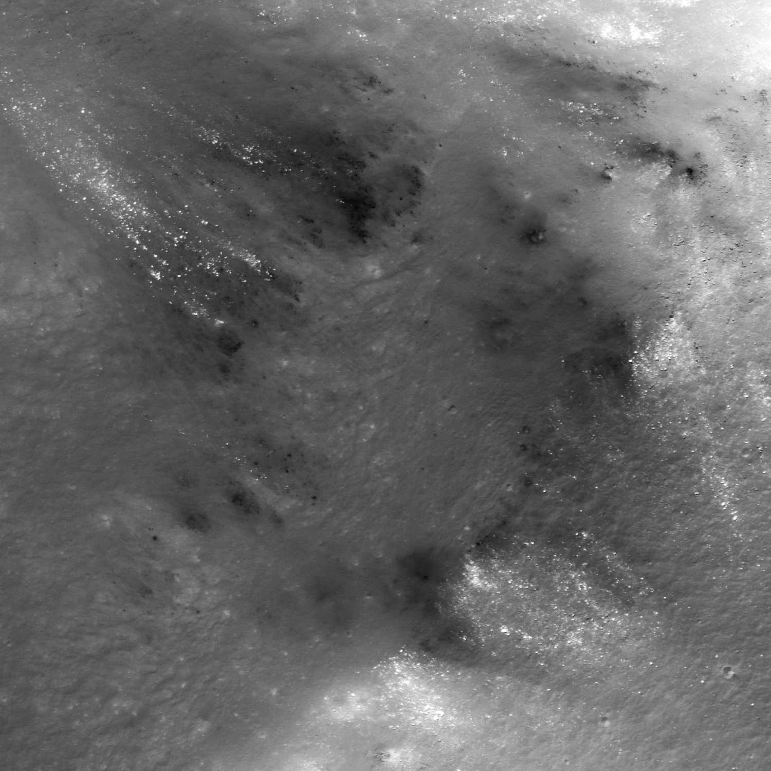
Today's Featured Image follows up on the two previous posts with another look at the Lassell Massif region of Mare Nubium. These prominent low reflectance deposits line the rims of the Lassell G and Lassell K pit features (see context image below). Their occurrence along the pit rims suggest a dark layer may be present just beneath the regolith surface, whose exposure has been encouraged by mass wasting in the pit walls. What caused such steep walled pits, and what are these low reflectance materials?

Our geologic train of thought continues from yesterday's post. We were discussing the geochemical differences between iron-rich, silica-poor (basaltic) and iron-poor, silica-rich (rhyolitic) magmas in the inner Solar System. But why should this matter, and what does it have to do with our images this week? The short answer is that basaltic lavas (and basaltic impact melts) have low viscosity, where rhyolitic lavas have relatively high viscosity. Basaltic extrusions filled mare basins like lakes, cascaded over fault blocks like waterfalls, and flowed like molten rivers on the Moon. On Earth and Mars they form flood basalt deposits and low-topography shield volcanoes. By contrast, rhyolitic lavas can be visualized as having a pasty or sticky consistency. They form steeper slopes, flow more sluggishly, develop high constructs, and can erupt explosively.

Mt. St. Helens and other Cascade volcanoes are good examples for Earth.

Another portion of NAC frame M1116585481R shows fragmented dark deposits [NASA/GSFC/Arizona State University].
A story of complex volcanism is emerging for the Lassell Massif region. The dark deposits may be pyroclastic in origin, and may have come from the massif source magmas themselves, or from adjacent volcanic fountaining (the floor of Lassell crater out of frame to the lower right of the context image is suspected to contain pyroclastic deposits). Based on LRO Diviner data the massif itself is silica-rich, which accounts for its topography, and suggests that Lassell G and Lassell K may be collapse calderas. They have very steep slopes and V-shaped profiles, in contrast to impact features.

LROC Wide Angle Camera (WAC) mosaic context image, outlining the areas spotlighted in this and two other LROC Featured Images, released the week of March 11, 2013 . The light yellow square encloses the area in today's Featured Image [NASA/GSFC/Arizona State University].
Another look, from another angle, at the south Lassell complex, allowing some perspective of the topography - steep drops on either side of a shared wall - of the area highlighted in the Featured Image - from the newly-released LROC NAC oblique mosaic M1108311369LR, linked HERE [NASA/GSFC/Arizona State University].
Explore the full NAC frame HERE. Other examples of silica-rich, so-called 'intrusive' lunar volcanism may include the Gruithuisen Domes, features in Compton-Belkovich and the Hortensius Domes.

Tuesday, March 12, 2013

Not your average crater

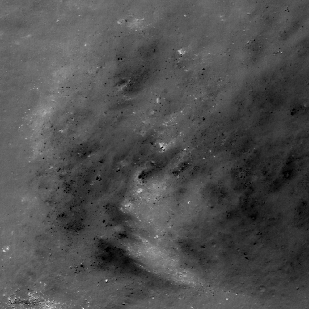
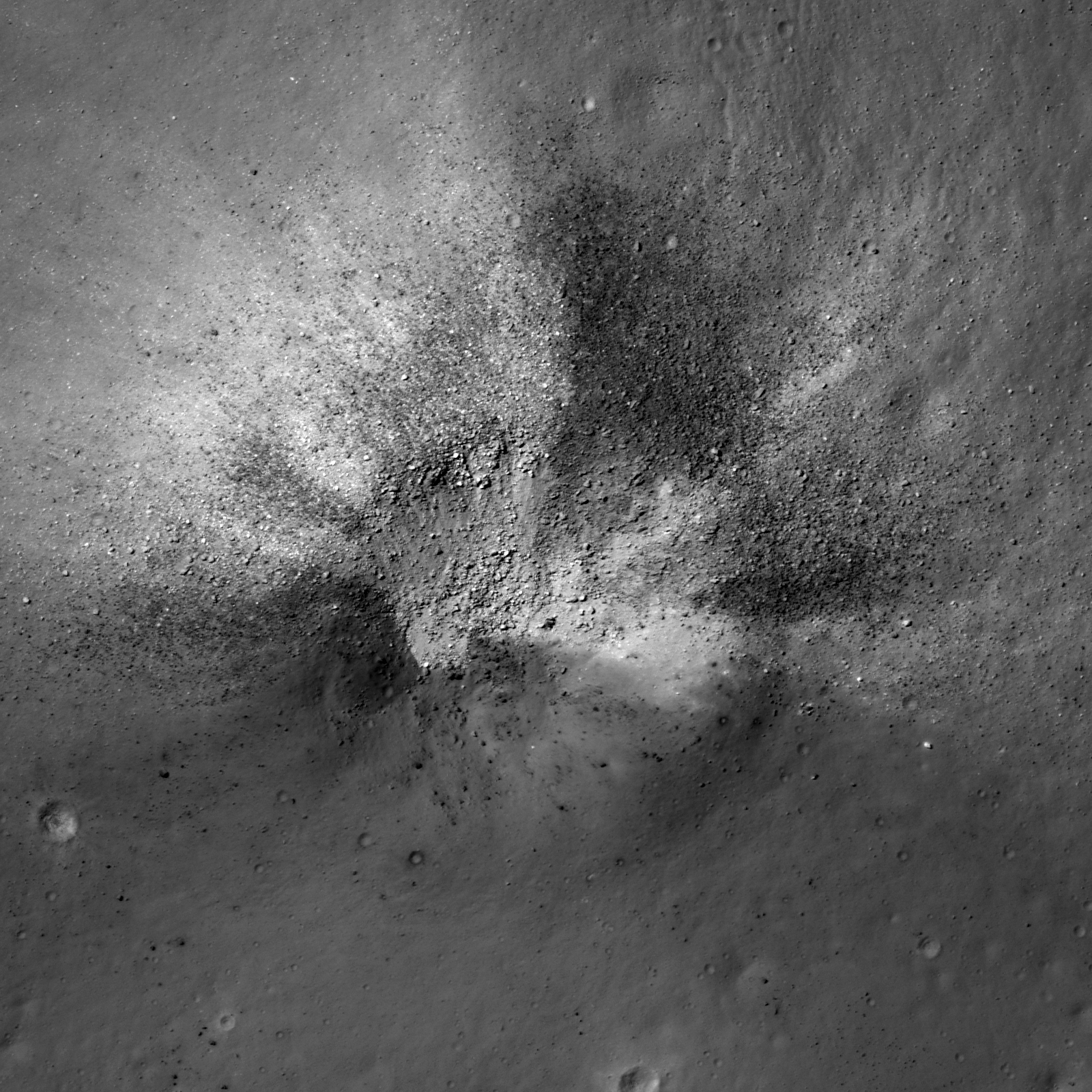
An asymmetric impact crater (14.349°S, 350.977°E) on the Lassell Massif revealing low reflectance material. NAC frame M152939732L, LRO orbit 7672, February 21, 2011; incidence angle 17.58° from the northwest, resolution 0.49 meters per pixel over a field of view approximately 820 meters across, from 39.65 km [NASA/GSFC/Arizona State University].
James Ashley
LROC News System

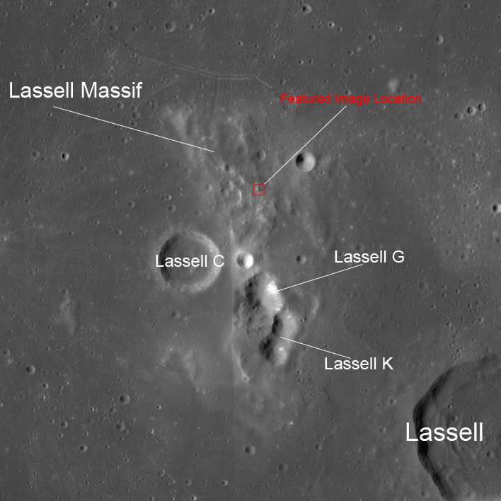
This week's Featured Images focus collectively on a region of the Moon known to present a ruddy discoloration through the eyepiece of ground-based telescopes (and also directly to the eyes of Apollo Command Module pilots). Known colloquially as "lunar red spots," such areas include the Gruithuisen Domes, Mons Hansteen, and the Helmet region. The red spot under observation this week is the Lassell Massif. This fascinating feature is a highstanding region of the Lassell Complex, located within the Alphonsus A basin in northeastern Mare Nubium, and consists of a rugged (though somewhat muted), hilly terrain, and several large, steep-walled depressions.

Today's Featured Image shows a striking impact crater in the northern hills of the massif. The crater exhibits an asymmetrical ejecta pattern, suggesting it to be the result of an oblique impact. The crater outline and ejecta distribution may also have been influenced by the uneven local topography. More geologically intriguing than this crater's shape, however, are the intermixed high and low reflectance materials excavated by the impact.

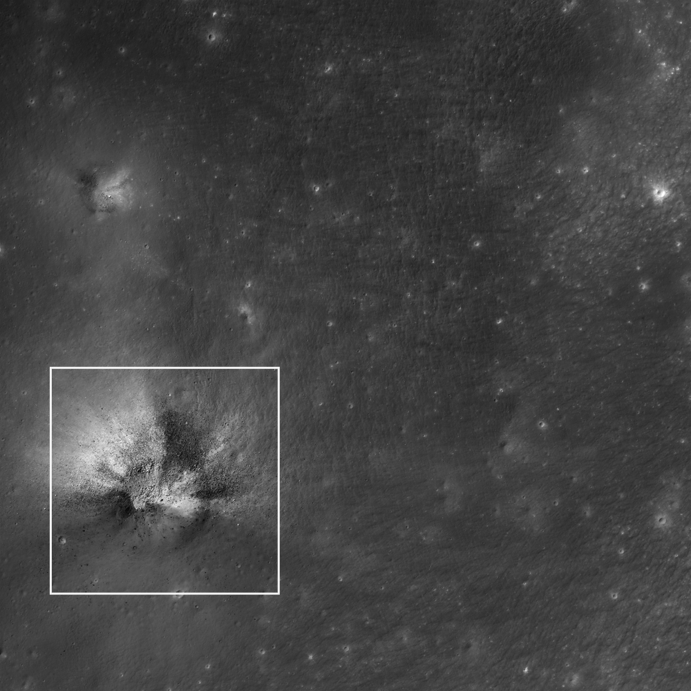
This wider field image from the same NAC frame shows an adjacent impact (northwest quadrant) to have excavated similar dark materials in the region; white square is the Featured Image location. Image is ~2.2 km wide [NASA/GSFC/Arizona State University].
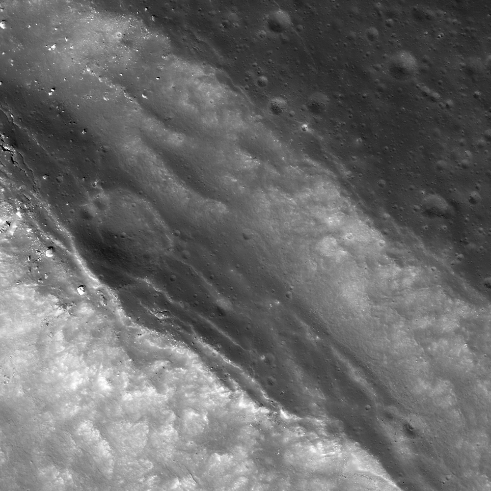
The low reflectance materials (here seen as blocky) are suspected to be pyroclastic in origin, which speaks to the volcanic history of the Moon. Lassell crater itself (lower right in context image above) was described as being a source of pyroclastic materials since telescopic mapping efforts of the 1960s and '70s. The Lassell Massif is arguably close enough to this (and potentially other mare sources) to have received a share of these materials on the summits of its hills. Alternatively the central depressions on the massif may themselves be volcanic vents.

WAC mosaic context image. The white box outlines the area shown in the second image following above, field of view roughly 67 kilometers across [NASA/GSFC/Arizona State University].
While most lunar volcanism produced basaltic rocks, recent evidence is suggesting that Lassell Massif and other red spot areas are silica-rich, iron-poor volcanic deposits -- perhaps similar to the kind of volcanism we see with the Long Valley Caldera on Earth. While darker deposits tend to indicate an iron-rich material, their presence among silica-rich materials (which might seem like a geologic contradiction) may actually be suggestive of complex volcanism, where a variety of volcanic deposits are possible, and for which the Long Valley volcanics remain a good example.

What are the high reflectance materials seen distributed outward from the crater? Likely we are seeing ancient highland anorthositic material excavated from beneath an overlying volcanic deposit(s). What a fascinating spot for a future explorer!

From a 2010 demonstration, animation of separate LROC WAC observations of the geologically interesting Lassell Massif and crater group east of Lassell D, showing the latter's fresh ray system intruding from the west. This is more easily discerned under a high Sun while topography is easier to view under a mid-morning Sun in the east-northeast. The bright, widespread ejecta streamers from Lassell D alternates with a visible chevron affect by the Lassell D pressure front [NASA/GSFC/Arizona State University].
The next two Featured Image posts will include a brief discussion of this type of volcanism on the Moon, and explore some of the clues scientists are using to probe the Lassell Massif area. See the full NAC frame HERE. Other examples of pyroclastic deposits include DMD Excavations, Pyroclastic Trails, and Pyroclastic Excavation.