Showing posts with label melt fractures. Show all posts

Tuesday, August 5, 2014

Fractures and boulders on the floor of De Forest

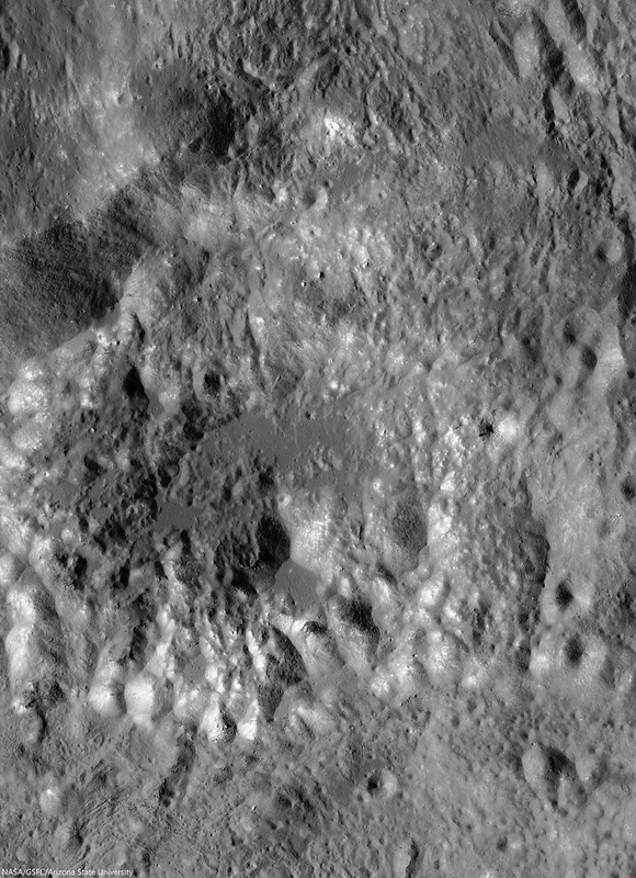
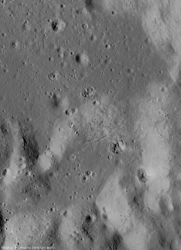
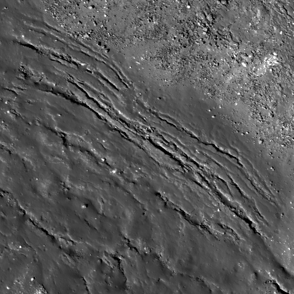
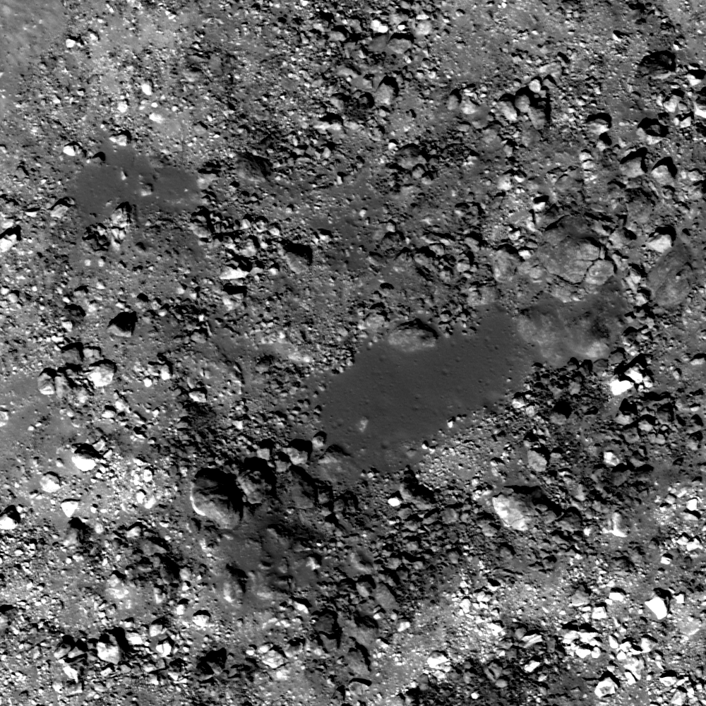
Fractured impact melt left the interior of De Forest crater (56.25 km; 76.94°S, 196.67°E) lined with boulders. 665 meter-wide field of view from LROC NAC observation M125650563L, 665 meter-wide field of view from LRO orbit 3650, April 11, 2010; 78.87° incidence angle, resolution 57 cm from 55.16 km over 77.1°S, 197.94°E [NASA/GSFC/Arizona State University].
Hiroyuki Sato
LROC News System

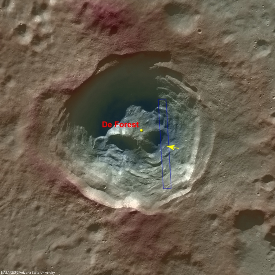
Today's Featured Image highlights a portion of the interior of De Forest crater (56.25 km; 76.94°S, 196.67°E), which is located inside the South Pole–Aitken basin.

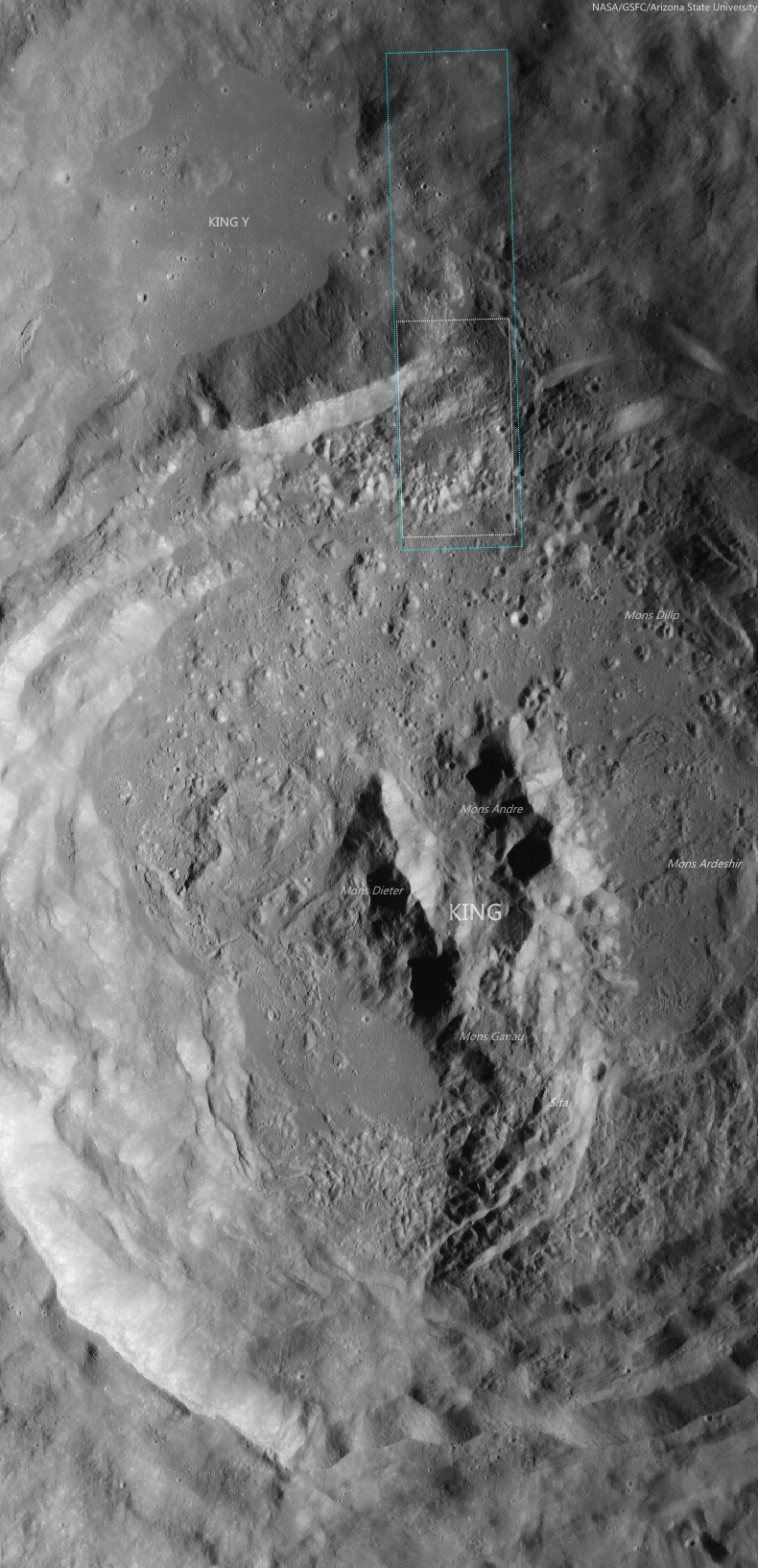
The cavity of De Forest crater exhibits prominent terraces of collapsed materials surrounding the central peak (see context imagery following).

The topographic low, east of the central peak, was largely coated with hot impact melt which formed a hard crust as it cooled; a portion of this melt is seen in the opening image. 

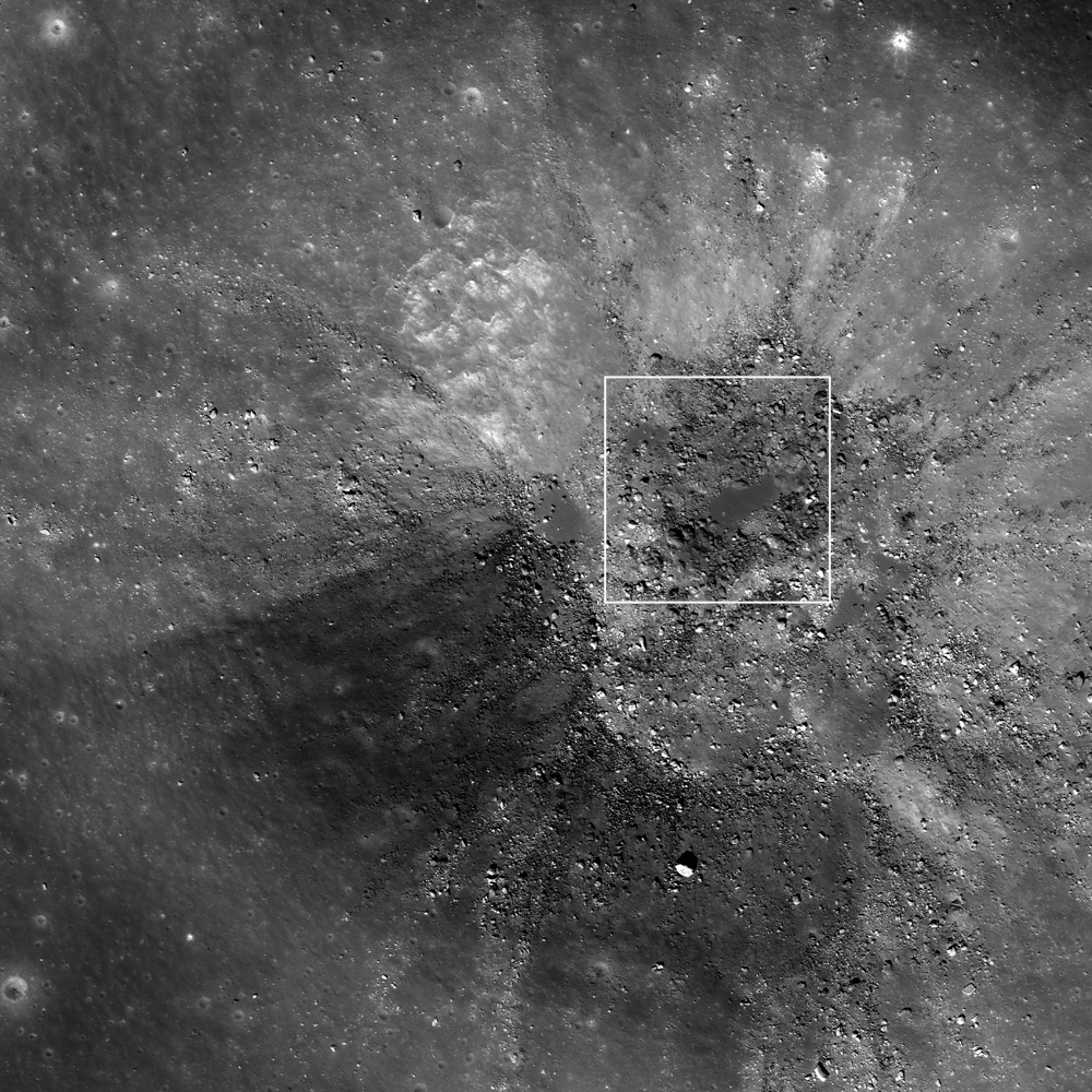
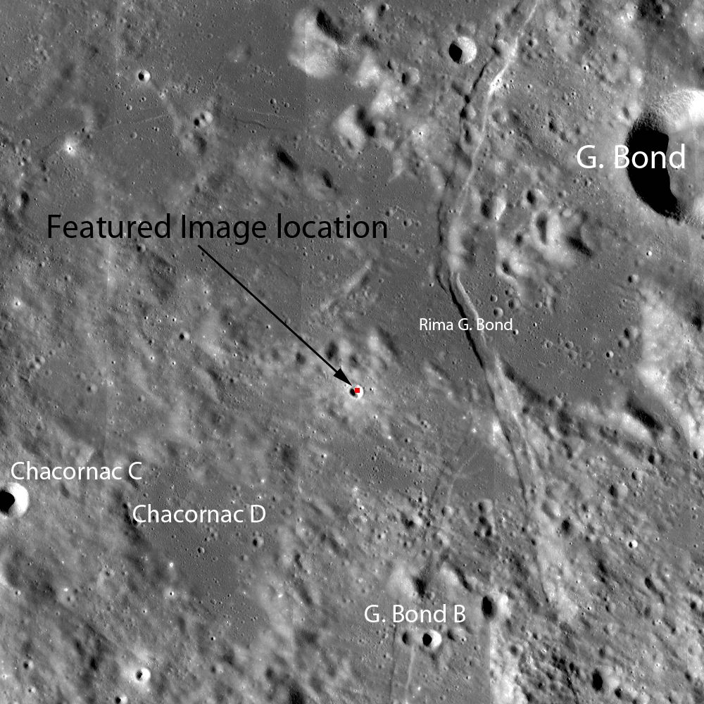
Context view of De Forest crater (56.25 km; 76.94°S, 196.67°E) consisting of LROC WAC monochrome mosaic (100 m/pix) overlain with colorized WAC stereo DTM (GLD100, Scholten et al., 2012). View centered on 76.92°S, 197.51°E. Footprint of LROC NAC observation M125650563L, April 11, 2010, outlined in blue, source of high-resolution view of the area designated with a yellow arrow (LROC Featured Image released August 5, 2014) [NASA/GSFC/Arizona State University]. 
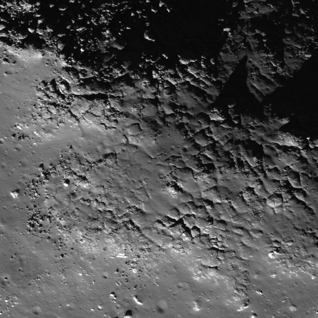
Much of the area of the opening image is covered by numerous boulders, some of which are up to approximately 15 meters across.

The smooth surface extending in lower-left to upper-right is impact melt that cooled to form solid rock, and is now fractured in regular patterns along the edge. Impact melt that was splashed on the crater's walls and its central peak formed a coating that quickly cooled to solid rock.

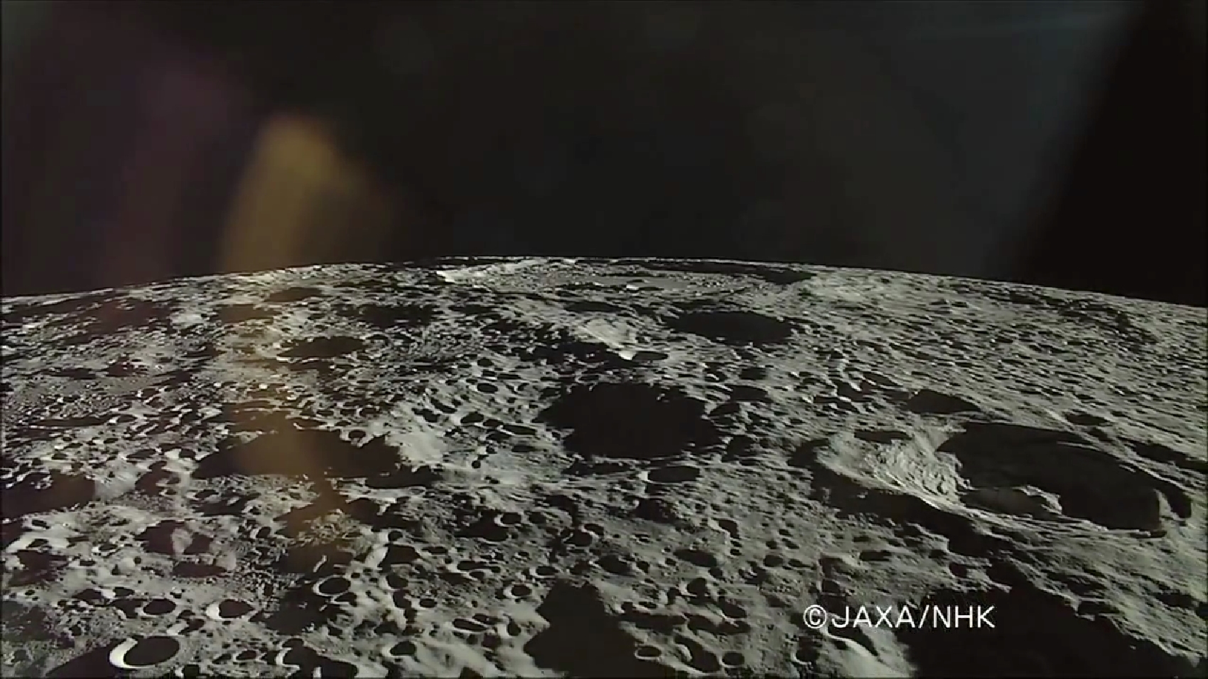
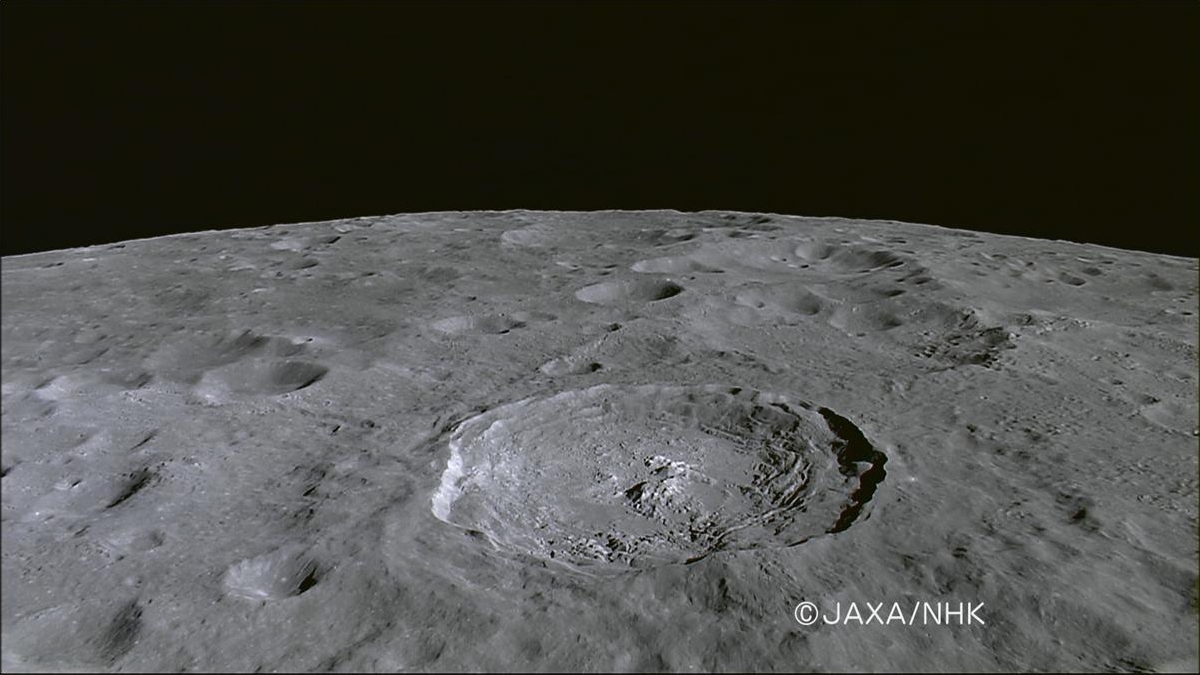
On the true "backside" of the Moon, De Forest (right) is situated well inside South Pole-Aitken impact basin, between Antoniadi (upper left, near horizon), host of the Moon's lowest elevation (-9094 meters) and Shackleton (not pictured), host of the Moon's south pole. HDTV still from Japan's lunar orbiter Kaguya (SELENE-1) in 2008 [JAXA/NHK/SELENE].
Later, it is likely that nearby moonquakes caused these brittle rock coatings to fracture, providing the source of boulders we now see on the lower reaches of the crater floor.

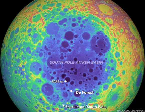
De Forest's position in the far south Farside is an area hosting Permanently Shadowed Regions (PSR's). The neutron detection experiment on-board LRO (LEND) has built up signatures consistent with cold-trapped volatiles, like water ice, in the vicinity. Image from Science Visualization Studio tour of SPA, larger image HERE [NASA/GSFC/Arizona State University/DLR/SVS]. 
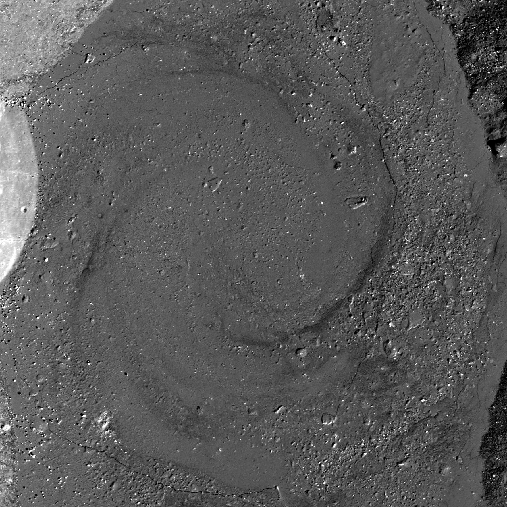
As you can see in the following full NAC frame, an enormous number of similar boulders are found along the smooth melt deposits on the floor of De Forest crater. 

Explore this boulder-rich crater in the full NAC frame, HERE.

Related Posts:

Tuesday, July 29, 2014

Making a splash at King crater

Impact melt ponds adorn the lumpy terraces of King crater. If you look carefully, you can see small fractures in some of the these ponds. 10.9 km field of view from LROC NAC mosaic M1159315479LR, LROC orbit 22783, July 6, 2014; 53.77° incidence angle, resolution 1.16 meters from 114.15 km over 6.41°N, 120.37°E [NASA/GSFC/Arizona State University].
H. Meyer
LROC News System

In the image above, impact melt pooled among the terraces in the walls of King crater, a complex Copernican crater on the lunar farside.

Impact melt is generated when kinetic energy associated with an impact is transferred to the target rock. Shock waves cause the rock to melt nearly instantaneously. The impact melt is flung all over the interior of the crater and some even makes it out of the crater.

Melt splashed on the crater walls tends to drain back down pooling on ledges. This downward flow resulted in a coating of impact melt called a veneer, visible in this region, along with other features like fractures.

Upon closer inspection, these impact melt ponds display the fractures and oddly shaped craters typical of the transitory impact melt ponding at King crater. 1.34 km field of view from LROC NAC mosaic M1159315479LR [NASA/GSFC/Arizona State University].
Fractures in impact melt rocks can be the result of tectonic stresses and cooling and contracting of the impact melt. Sometimes craters also form before the impact melt has fully solidified, resulting in oddly shaped craters that resemble craters that form when pebbles are thrown into mud.

Aside from its rather peculiar central peak, King is rather unique in that the impact melt is not evenly distributed around crater, but rather accumulated in the north-northwest region outside the crater rim. This may be the result of an oblique impact. In the case of an oblique impact, impact melt is concentrated downrange of the incoming projectile.

Contextual view of farside Copernican Age crater King (76.2 km; 4.96°N, 120.49°E), with footprint of LROC NAC mosaic M1159315479LR (orbit 22783, July 6, 2014) and LROC Featured Image field of view. 50 km-plus field of view from LROC Wide Angle Camera (WAC) monochrome (643 nm) observation M176845114CE, LRO orbit 11197, November 25, 2011; 61.87° incidence angle, resolution 57.8 meters from 42.52 km [NASA/GSFC/Arizona State University].
Impact melt forms many exquisite features on the lunar surface such as flows, lobes, pits, fractures, channels, polygonal patterns, and more. Explore the impact melt features of this region in the full NAC mosaic HERE.

Related Posts:

Thursday, January 23, 2014

A colorful history of floor-fractured Komarov

Small fresh crater in Komarov
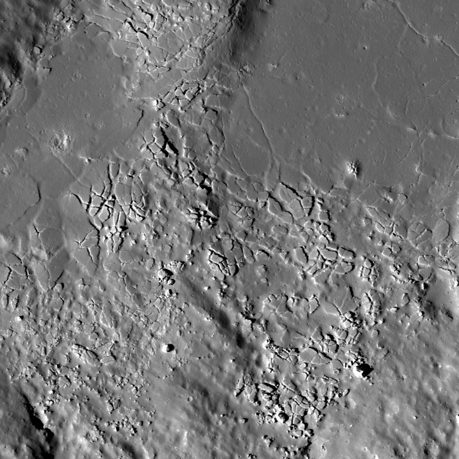
A small, fresh crater dots the wall of a fracture in the floor of Komarov crater. An approximately 2.5 km-wide field of view from LROC NAC frame M130653607, LRO orbit 4388, June 8, 2010; incidence angle 71.7° at 63 cm per pixel resolution from 60.73 km [NASA/GSFC/Arizona State University].
H. Meyer
LROC News System

A small, fresh crater can be seen on the right side of Today's Featured Image on the floor of Komarov crater. The crater was formed when an impactor smashed into the wall of one of the fractures (or graben) in the crater floor. Some of the ejecta from the impact can be seen draping the wall of the graben. This graben is one of many in the floor of Komarov.

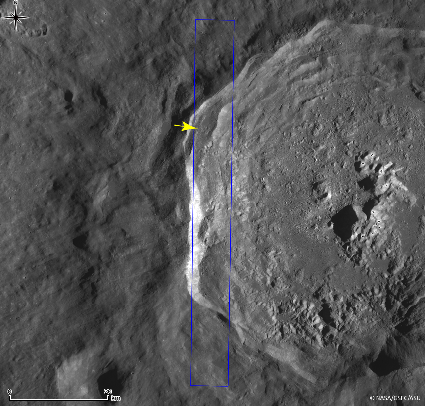
Komarov, best seen in the context image below, is known as a floor-fractured crater whose fractures likely formed through intrusive magmatic activity. The western portion of Komarov crater has been modified by the deposition of smooth, low albedo material and the formation of floor fractures. Is this the same low albedo mare basalts that filled nearby Mare Moscoviense?

Virtual view from an imaginary point 93 km over the lunar farside, south of Komarov. The LROC 302 ppd WAC mosaic draped over LOLA 128 laser ppd topography shows how pyroclastic flow overran the mare-filled Moscoviense floor. Both the famous long floor and Komarov are each well inside the larger, circular and less obvious Moscoviense basin [NASA/GSFC/LMMP/Arizona State University].

Komarov (context)
LROC Wide Angle Camera (WAC) context image of the western interior, wall and rim of floor-fractured Komarov, outlining the LROC Featured Image field of view (yellow), released January 22, 2014, with the frame of the LROC NAC observation from which it was derived outlined in red [NASA/GSFC/Arizona State University].
WAC2_Moscoviense-1560x1125
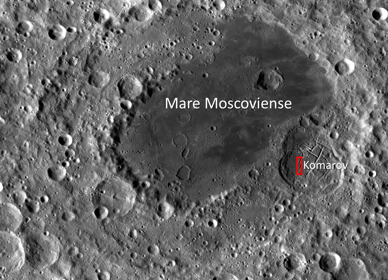
LROC WAC context image of Komarov crater (~80 km in diameter) relative to Mare Moscoviense (centered at 27.282°N, 148.122°E). The red box denotes the full NAC frame from which Today's Featured Image was taken. Image field of view is approximately 450 km wide [NASA/GSFC/Arizona State University].
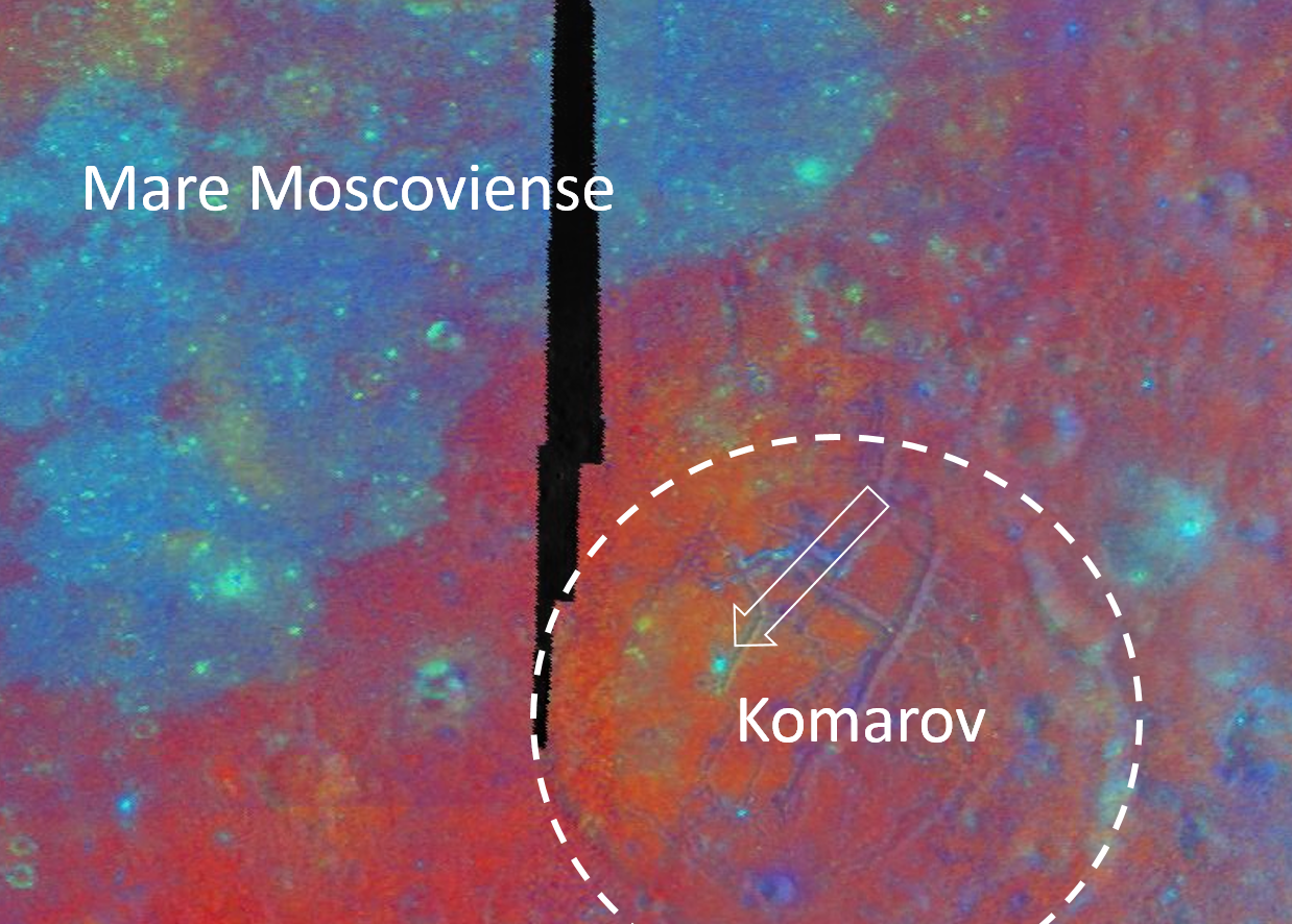
Though Komarov is located on the edge of Mare Moscoviense, it is not covered in the same smooth, low albedo mare basalts that are seen in the Moscoviense basin today (See WAC context image above and Clementine false-color image below). Compositional differences in and around Mare Moscoviense indicate multiple episodes of volcanic activity. Three bands (415 nm, 750 nm, and 1000 nm) from the Clementine UVVIS camera were used to create the false-color image below. The three bands were ratioed to control the colors of the false-color image. The 750/415 ratio controls the red component, which is an indication of low titanium or high glass content as found in mature lunar regolith and to a greater degree pyroclastic deposits. The 750/1000 ratio controls the green component and is an indicator of the amount of iron on the surface. The 415/750 ratio controls the blue component and indicates high titanium or bright slopes and albedos.

Clementine-1994-multispec-Komarov-1238x886
Clementine false-color multi-spectral mosaic of Komarov and Mare Moscoviense. The dashed circle denotes the rim of Komarov and the white arrow points to a fresh crater from the full NAC frame. Field of view approximately 180 km across [NASA/DOD/USGS/Arizona State University].
Notice in the false-color image above that Mare Moscoviense appears blue (higher in titanium since we know Mare Moscoviense is a low albedo feature), whereas Komarov appears red. Even within Komarov, the western side is more red (likely pyroclastics or low-titanium basalts) than the eastern side, which is comparable to deep red of the surrounding highlands (mature regolith). A crater in the NAC frame from which Today's Featured Image was taken appears bright blue and stands out from the rest of Komarov's floor. This bright blue color is likely due to the fact that this crater is fresh and has brought up unweathered (fresh) higher albedo material from depth. The fresh crater from the opening image is too small to be seen in the Clementine false-color image.

Investigate this complex region for yourself, HERE.

Related Posts:
Fresh crater in Komarov's fractured floor
Bah Humboldt!
Gassendi's Fractures
Atlas
Karpinskiy Floor Fractures

Thursday, January 2, 2014

The eroding fractured floor of Humboldt crater

Mass wasting on fractured floor of Humboldt crater
An approximately 1 km-wide field of view showing boulders strewn across the wall and floor fracture in Humboldt crater. LROC Narrow Angle Camera (NAC) observation M146466012R, LRO orbit 6718, December 8, 2010; angle of incidence 71.68° at 94 cm per pixel resolution from 45.14 km over 24.87°S, 79.03°E.  [NASA/GSFC/Arizona State University].
H. Meyer
LROC News System

Many lunar craters contain floor fractures and evidence for volcanic activity. In the case of (the LROC) Featured Image (released December 23, 2013), the fracture seen eroding to boulders formed in the large impact crater Humboldt, whose floor has been partially covered by dark mantle material (possibly pyroclastic in origin) and lava flows.

There are a few possibilities for the formation of these floor fractures. The two most common are viscous relaxation and intrusive magmatic activity, though intrusive magmatic activity is currently the favored model.

Context for LROC Featured Image (NAC M146466012R)
Roughly 39 km-wide field of view as context for the more detailed view of erosion and floor fractures on the northwest floor of Humboldt crater (199 km, 27.02°S, 80.96°E). Red rectangle outlines field of view swept up in LROC NAC M146466012RE and the yellow box designates the area withing the LROC Featured Image released December 23, 2013, LROC monochrome (604 nm) Wide Angle Camera (WAC) observation M161787569CE, LRO orbit 8976, November 6, 2011; angle of incidence 70.87° at 67.16 meters per pixel resolution from 47.6 km [NASA/GSFC/Arizona State University].
Western Humboldt (Stitch of three LROC WAC passes)
Further context of western Humboldt crater, a 103 km-wide area, from a stitching together of three LROC WAC observations, including LROC WAC observations swept up in orbits immediately before and after on November 6, 2011. View the full-sized original mosaic HERE. [NASA/GSFC/Arizona State University].
LROC WAC mosaic, showing Humboldt crater and its immediate vicinity, with a false-color overlay representing the LROC photography-based digital terrain model (DTM) at 250 meter resolution through the LROC QuickMap web-based application [NASA/GSFC/Arizona State University].
The lava flows, some of which can be seen in the WAC context images above, are limited to only a few small areas within Humboldt and only partially fill some fractures, so they were probably not extruded during the formation of the fractures. If they had been emplaced during the formation of the fractures, then we would expect to see lava flows everywhere there are fractures, which is not the case. However, the intrusion of the magma into the subsurface of the crater floor (that eventually erupted onto the surface) could have contributed to the formation of the fractures by causing the floor to dome up.

View the full processed LROC NAC observation, HERE.

Related LROC Posts:
Karpinskiy Floor Fractures (August 22, 2013)
"Star light, star bright" (May 29, 2013)
Numerov's Graben (February 14, 2013)
A small crater's disappearing floor (November 4, 2011)
Last Portion of the Original Floor (November 3, 2011)
Pull Apart Grabens (December 16, 2009)

Tuesday, October 22, 2013

Fractured melt rock on Jackson's terraced wall

M182253065R_1500
Close-up on fractured impact melt  ponding high on the west wall of Jackson crater. LROC LROC Narrow Angle Camera (NAC) M182253065R, LRO orbit 11965, January 26, 2012. Image 2130 meter-wide field of view centered on 22.534°N, 195.59°E, incidence angle is 57° at 1.47 meters per pixel resolution in the original [NASA/GSFC/Arizona State University].
Hiroyuki Sato
LROC News System

The opening image highlights a fractured pond of impact melt rock inside Jackson crater (72 km diameter). This prominent farside crater is known by its prominent ray system and large amount of impact deposits. Melt pooled not only at the bottom of the crater floor, but also on terraces of the interior wall.

The fractured melt sheet in the opening image is found amongst a grouping of melt lakes on a western crater wall terrace (see WAC context image below).

M182253065R_context
Western part of Jackson crater and surrounding areas in LROC WAC monochrome mosaic (100 m/pix). The NAC footprint (blue box) and the location of opening image (yellow arrow) are indicated [NASA/GSFC/Arizona State University].
Detached fragments from the main body of melt sheet look like a jigsaw puzzle (upper smooth surfaced portion of the image). These fragments give an impression of the thin and brittle nature of solidified impact melt. Shadow lengths show these fractured pieces to be 5 to 8 meters thick. What caused the once level and smooth ponded surface to fracture? We don't know for sure, but by looking at the whole area a plausible story can be imagined. The south part of the melt lake with the fractured plates is connected to another melt lake at a lower elevation. Perhaps drainage of subsurface unsolidified melt might have dragged a crust toward the south and broken the it into many blocky pieces. Tectonic deformation of the crater wall, perhaps consisting of whole terraces deforming, also might have occurred which could deform the brittle crust of melt ponds.

Jackson crater from Kaguya
Farside Copernican age landmark crater Jackson viewed through NHK's HDTV camera aboard Japan's lunar orbiter SELENE-1 (Kaguya) in late 2007. View the 1200 pixel-wide press release image HERE [JAXA/NHK/SELENE].
Explore this mosaic of fractured melt rock and surroundings to help unravel the complex history of Jackson crater in the full NAC frame HERE.

Related Posts:
Cracked mound (February 16, 2012)
Melt Fractures in Jackson Crater (January 20, 2012)
Tycho's flash-frozen inferno (November 2, 2011)
Waves (August 10, 2011)
Polygonal fractures on Tycho ejecta deposits (June 14, 2011)
Fragmented Impact Melt (February 25, 2011)
LOLA's Jackson crater (July 11, 2010)

Moore F Impact Melt (October 30, 2009)

Wednesday, July 31, 2013

Melted Moon

Click for full resolution LROC mosaic
The fresh lunar crater Giordano Bruno -a wealth of fascinating landforms to study. (click image for full resolution view, or HERE for a wider, medium resolution field of view showing the entire crater) [NASA/GSFC/Arizona State University].
Paul D. Spudis
The Once and Future Moon
Smithsonian Air & Space


Prior to the Space Age, one of the longest running controversies in lunar science was over the origin of the Moon’s craters.  Two camps emerged, one favoring an internal (volcanic) origin and the other an external (impact by solid bodies) origin.  Although this debate was finally resolved in favor of impact, the argument was long and vehement, reigniting at one point during the flight of the last of the robotic precursor probes to the Moon, prior to the Apollo landings.  Although the basic physics of impact were well understood by the mid-1960s, this newest argument centered around high-resolution pictures obtained by Lunar Orbiter 5 (1967) of the fresh (and therefore young) crater Tycho.  These spectacular images showed a multitude of flows, smooth ponds, and fluid rock, seemingly draped over hills and hummocks (like a chocolate shell coating over a scoop of ice cream).

An asteroid possesses an enormous amount of kinetic energy when it strikes a planetary body at very high speeds.  On contact, the asteroid vaporizes and the surface target rocks are intensely compressed.   After the shock wave has passed, these rocks decompress and the release of this energy totally melts part of the crustal target.  This material is said to be shock melted, with the resulting liquid called impact melt.  Impact melt was first described from craters on the Earth, particularly some of the very large impact craters found on the ancient Canadian Shield.  These rocks superficially resemble some volcanic rocks, having both fine-grained textures and partly melted inclusions.  But unlike volcanic rocks, they have high concentrations of siderophile (“iron-loving”) elements, such as iridium.  These elements are extremely rare in the Earth’s crust, but are more abundant in meteorites and asteroids.  It is thought that they are added to the melt from the incoming projectile.

The newest chapter in the argument about the origin of craters came about because some landforms around Tycho look similar to small-scale volcanic features on Earth.  The idea proposed was that the craters had been formed by impact, with those collisions triggering volcanic activity and producing multiple episodes of eruption at Tycho and other craters.  At first glance, such a scenario seems plausible.  After all, impact is a catastrophic event and one can imagine churning seas of subsurface liquid rock, released suddenly through the creation of fractures deep in the crust.  But the Moon’s interior is relatively cool.  If interior melt exists, it is at a level much too deep for any reasonably sized impact to tap.  But these amazing landforms needed to be explained.  What might they represent?

We found abundant physical and chemical evidence for impact (including shock-melted rocks) by studying the Apollo samples.  They appear similar to volcanic lava, with inclusions, melt textures and even vesicles (holes), comparable to the ones produced by magmatic volatiles coming out of solution in basaltic lavas on Earth.  Although it took a bit of study (and many more arguments) to establish their origin, shock melting became recognized as an important lunar (and Earth) impact process.

M160029952LR-109-1160x1600
Breech in the northwest rim of Tycho connects to the spectacular melt ponds inside out outside of the 109 million year old landmark crater. Illustration originally from "Landing Site at Tycho North," March 20, 2013 [NASA/GSFC/Arizona State University].
The images of the flows and ponds seen around Tycho and other fresh lunar craters led to a better understanding of how these rocks formed.  Although we knew about impact melting from the study of Earth’s craters (and had found evidence of the same in lunar samples), some researchers still weren’t convinced that we were seeing flows of liquid impact melt on the Moon.  The leading non-volcanic alternative was that these features were flows of dry, fine-grained granular debris.  In part, this interpretation proceeded from the observation that the thermal signatures of some of these melt-like flows suggested the presence of fine debris rather than bare, jagged rock.  Yet other data, such as radar backscatter, suggested that rough surfaces were common, while extremely high-resolution images showed abundant blocky craters on the surfaces of the flows, suggesting they were composed of solidified rock.

Landing site of Surveyor 7 (arrow) in relation to it's hoped for target, the kilometer-sized impact melt pond immediately to the northeast, part of the spectacular melt throughout the vicinity of Tycho [NASA/GSFC/Arizona State University].
Images from the robotic Surveyor 7 (1968) spacecraft, which landed on the rim of Tycho, revealed the thinnest regolith (soil) covering of any site on the Moon.  Visible in the surface panoramas were flow features covering the distant hills.  It took a great deal of painstaking, detailed work to establish that these flows and ponds were composed of liquid rock, created simultaneously with their host crater and likely originated by impact melting and subsequent solidification.

For the last several years, NASA’s Lunar Reconnaissance Orbiter (LRO) has been sending us new and astonishing views of the Moon’s impact melt flows.  Whereas fresh craters like Tycho, Aristarchus and Copernicus were well known from previous Lunar Orbiter frames, far side craters like the spectacular Giordano Bruno can now be seen with incredible clarity.  G. Bruno is one of the very youngest craters on the Moon.  A low density of craters overlying G. Bruno suggests an age of less than a couple million years (extremely young on a planet where most features count years in the billions).  It is an astonishing spectacle of melt shapes and deposits (cracked floors, pools, flow festoons and lobes); the crater floor has an amazing whirlpool of solidified melt. All these features indicate that after the crater formed, the impact melt was mobile, flowing and collecting, and ponding in low areas.

Impact melt forms a swirled feature in Giordano Bruno crater. Field of view 1 kilometer. From LROC Narrow Angle Camera (NAC) observation M143947267L LRO orbit 6347, November 9, 2010; 53.08° angle of incidence, 57 centimeters per pixel resolution from 54.50 km. Illustration from "Giordano Bruno Whorl," June 8, 2013 [NASA/GSFC/Arizona State University].
Impact melts are of great interest to geologists.  Unlike other crater ejecta, the radiometric clocks of impact melts are completely re-set by the melting.  Thus, if a sample can be obtained first-hand, directly from an observed flow or pool of melt around a host crater, the age of that rock specifically and unambiguously dates the impact event.  Unfortunately, we did not visit such deposits during the Apollo explorations.  What we do have are loose samples of lunar impact melt but not their scientifically important corresponding geological context.  It is for this reason that the age and sequence of early lunar history is so contentious – we must make educated guesses about where certain melt rocks come from.  If we get the context wrong, then our conclusions about the history of the Moon are incorrect.

Increased understanding of the generation and deposition of impact melt comes from the new images obtained by the LRO camera of the geologic setting of impact melts.  Future sample return missions to the Moon can be directed to landing sites that will provide us with samples of clear geological context (that they were from that area and not just flung there by an impact occurring elsewhere on the lunar surface).  As features age on the Moon, subsequent geologic events (such as superposition of new units) bury or erase the original event making the context less clear.  This problem is particularly acute for the oldest features on the Moon (multi-ring impact basins).  By studying the geology of the freshest lunar features (such as Tycho and other fresh craters), we understand how the older impact features looked immediately after their formation.  Thus, they serve as a guide to the interpretation of the older features.  On the Moon, as on the Earth, as Charles Lyell, the 19th century author of the classic Principles of Geology aptly put it:  The present is the key to the past.

Collection of spectacular impact melt features from LRO:
Giordano Bruno high-resolution full view
G. Bruno sunset
G. Bruno flows
G. Bruno cracked melts
Tycho oblique
Tycho floor
Tycho river of rock

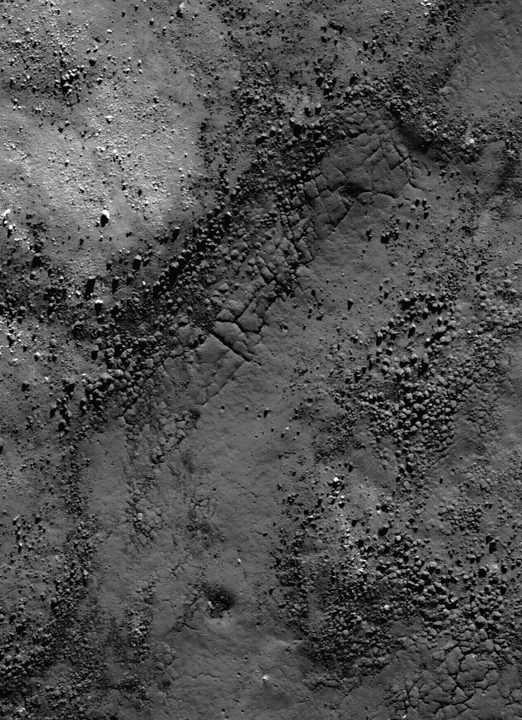
Originally published July 31, 2013 at his Smithsonian Air & Space blog The Once and Future Moon, Dr. Spudis is a senior staff scientist at the Lunar and Planetary Institute. The opinions expressed are those of the author but are better informed than average. 

Tuesday, January 1, 2013

Sinuous Cracks

Northwestern rim of an unnamed crater located on southwest edge of Orientale basin; 870 meter field of view centered on 22.110°S, 258.014°E, southeastern downslope to the lower-right. LROC Narrow Angle Camera (NAC) observation M184189330L, LRO orbit 12235, February 18, 2012; resolution 87 cm from 85.03 km, angle of incidence 37.04° [NASA/GSFC/Arizona State University].
Hiroyuki Sato
LROC News System

Today's Featured Image (Dec. 31, 2012) highlights an upper portion of the crater wall of an unnamed crater (10.7 km diameter), located in the southwest portion of the Orientale basin. The rim crest is at upper-left in this image. The biggest crater at the left side is actually on the rim crest.

The distinctive crack extending from the lower-left to upper-right cuts across a rough fractured slope. Most likely this surface corresponds to smoother terrain just outside the crater (upper left). Likely both surfaces formed as impact melt cooled. The portion on the steeper surface later fractured as gravity-driven slides slowly broke this crust.

Context view from 100 meter per pixel LROC WAC global monochrome mosaic, centered on 21.95°S, 258.05°E, field of view is about 86 km. The blue box and the yellow arrow indicate the locations of NAC footprint and the specific location highlighted in the LROC Featured Image, respectively [NASA/GSFC/Arizona State University].
A wee bit more context (from the spectacularly upgraded LROC WMS Browser) reveals the sparse Fryxell crater group as nested in one of the more dramatic lunar landscapes, and the unnamed "crater of interest" itself (arrow) apparently directly atop one a buried portion of a Mare Orientale peak ring [NASA/GSFC/Arizona State University].
Why not go all the way, perhaps an arriving astronaut's point of view less than a day before insertion into an equatorial orbit behind a New Moon. Here the crater of interest (arrow) is shown to have perhaps excavated into some of the deeper material originally excavated by the basin-forming-impact that formed Orientale [NASA/GSFC/SVS/Arizona State University].
Impact melts are recognized as common features on the Moon, the LROC NAC has imaged many spectacular occurrences (see links below). Impact melt deposits are of special interest to geologists as they hold a record of when an impact event occurred. A rocks radiometric clock starts ticking when it cools and hardens. If you can connect a particular impact melt rock to a crater, you can determine the exact time when the crater was formed.

Explore the sinuous cracks in the full NAC frame yourself, HERE.

Related Posts:
Steps in Slipher S
Veneer of Melt
Melt on a Rim
Impact melt outside Wiener F
Craggy Peak, Impact Melts
Slope failure near Aratus crater

Wednesday, February 29, 2012

LROC: Dense Fractures

Fractures at the edge of an impact melt pool within the crater Larmor Q. Field of view 312 meters across from the LROC Featured Image, February 29, 2012 (540 meters), LROC Narrow Angle Camera (NAC) observation M151726155R, orbit 7494, February 7, 2011; 0.57 meters per pixel from 54.8 kilometers altitude [NASA/GSFC/Arizona State University].
Sarah Braden
LROC News System

The crater Larmor Q, located at 28.630°N, 176.240°E, is 18.3 km in diameter, has slumped walls, and impact melt in its floor. The Featured Image show fractures within this impact melt at the boundary of boulder-rich slumped material and the impact melt pool itself. The fractures may have formed two ways: from post-impact modification of the crater floor, or from a volume change associated with the cooling of the impact melt. Post-impact modification means that the shape of the crater changed, due to slumping walls, or changes in the crater floor topography caused by strain due to the redistribution of material during the impact itself.

The fractures are closer together (denser) near the edge of the impact melt. This may be where the impact melt is the thinnest, depending on the topography of the crater floor. Imagine an empty bowl (the crater) and then fill the bottom 5% of the bowl with ketchup (impact melt). The ketchup will be shallowest closest to the sides of the bowl. Often impact melt pools are not of uniform thickness due to variations in the shape of the crater's floor. Also, within the same crater there may be multiple impact melt pools of different overall depths since the emplacement of melt is not symmetric with respect to the crater.

When a lava (or impact melt) cools, it reduces in volume, which may have formed these cracks. Or, the thinnest part of the impact melt might be expected fracture more in the case of changes in the floor topography. Lunar scientists will have to study fractures in impact melt pools to determine which of these answers is correct. Perhaps it is a combination of the two causes of fractures, or something not yet considered.

LROC Wide Angle Camera (WAC) image of the 18.3 km diameter crater Larmor Q. Slumping of the crater walls has not yet covered all the impact melt on its floor. From LROC WAC observation M136389155 (604nm), orbit 5233, August 14, 2010; angle of incidence 54.83° with a resolution 82.1 meters per pixel from 58.4 kilometers  [NASA/GSFC/Arizona State University].

Find other areas in Larmor Q where fractures are denser towards the edge of the impact melt in the full NAC frame!

Related Posts:
More Impact Melt!
Fractured Impact Melt
Melt Fractures in Jackson Crater
Fractures in Ohm's Melt

Friday, February 17, 2012

LROC: Cracked mound at Anaxagoras

Top of a mound with fractured impact melt on the floor of Anaxagoras (75.46°N, 349.94°E). Image field of view 600 meters with sunlight from the south-by-southwest viewed at an incidence angle of 73.78° (nearly as high above the horizon as the Sun gets at such northerly latitudes. LROC Narrow Angle Camera (NAC) observation M122273232L, orbit 3153, March 3, 2010; resolution 0.49 meters per pixel from an altitude of 42.18 kilometers. View the larger (1100 x 1100) original LROC Featured Image HERE [NASA/GSFC/Arizona State University].
Hiroyuki Sato
LROC News System

The irregularly fractured surface in today's Featured Image is on top of a north-western oriented slightly elongated mound on the floor of crater Anaxagoras (image center is 73.748°N, 349.522°E). Anaxagoras (diameter ~ 50 km) is located about 700 km north of Mare Imbrium. The floor of Anaxagoras has an irregularly-shaped central peak. Other portions of the floor are filled with debris and impact melts.

The cracked surface covers only the top portion of the mound. The northern flank of this mound (see figure below) is almost completely covered by boulders, and southern flank is smooth with only a few boulders (as seen in the left hand image below). Why did the cracking happen only at the top of the mound?

One possibility is that the cracked portion is a splashed remnant of impact melt. A solid crust formed where the melt was thickest, and then later, as melt drained downslope, the cracks formed as the crust collapsed.

Context from the larger (LRO NAC M122273232L) frame showing the vicinity the Featured Image field of view (blue box).  A conventional stretch is above; below, the same image stretched to enhance details in the shadowed area. Each FOV width is slightly less than 2000 meters [NASA/GSFC/Arizona State University].
LROC WAC monochrome (604 nm) mosaic stitched from 10 sequential orbital passes March 21, 2011, showing a roughly 80 km-wide view of Anaxagoras an vicinity, situated on the rim of Goldschmidt on the east. Image center is 72.4°N, 350.0°E. The the location of the area detailed in the LROC Featured Image is indicated by the yellow arrow [NASA/GSFC/Arizona State University].
The interior of Anaxagoras crater was a Constellation program Region of Interest. With so many exciting features like this one, Anaxagoras crater is an excellent place for humans to explore!

Explore this irregularly cracked ridge and lots of other spectacular impact melt morphologies NAC frame HERE.

Related Posts:
Craggy Peak, Impact Melts
Splash and flow
Chaotic crater floor in Tycho
Polygonal fractures on Tycho ejecta deposits
Impact melt in Anaxagoras crater
Exposed Fractured Bedrock in the Central Peak of Anaxagoras Crater

This low-altitude (31 km) oblique view south from Japan's lunar orbiter SELENE-1 (Kaguya) is an excellent illustration of the difficulty in gauging scale in lunar photography. Anaxagoras could be a backyard brick barbeque pit in disrepair, or an astronaut's few foot steps away. Instead the crater is 50 kilometers wide and hundreds of kilometers away in this HDTV frame from 2009. View the release-size image HERE [JAXA/NHK/SELENE].

Friday, February 10, 2012

LROC Shattering Consequences

Debris of variable reflectivity and size litters the floor of a small crater in the nearside lunar highlands (31.3°N, 34.45°E). Illumination is from the south, image field of view is approximately 410 meter across; from LROC Narrow Angle Camera (NAC) observation M170334512L, orbit 10236, September 10, 2011, native resolution 0.47 meters per pixel from 38.77 kilometers. View the full size (1000 x1000) LROC Featured Image HERE [NASA/GSFC/Arizona State University].
James Ashley
LROC News System

What causes such an astonishing range in textures and tones as we find in this image? Here we see a jumbled mixture of light and dark, blocky boulders (many the size of small buildings), finer deposits between and around the boulders, and dark (low albedo), flat zones that are almost completely free of boulders. A landscape formed in an instant - ground zero for one of the most violent processes found in planetary studies.

The tremendous energy released when an asteroid or comet slams into the Moon results in compression, shattering, accelerating, melting, and even vaporizing of target and impactor. Why so much energy? Hypervelocity is the answer - the bolide (comet or asteroid) is typically traveling greater than 15 km/second; scientists estimate the energy of impact in terms of megatons equivalent of TNT because the interaction is truly explosive. Hyperveolcity is different from a low-velocity impact, which might displace some rock and make a thud, but will not produce an explosion and larger crater. Hypervelocity craters are many 10s of times the diameter of the bolide that creates them.

A wider view across the width of the LROC NAC frame provides context for the featured area deeper within the impact crater (image field of view roughly 1800 meters across. View the larger (1000 x 1000) context image release HERE [NASA/GSFC/Arizona State University].

Following an impact, some material falls back into the cavity, either as mass wasting off the crater walls or as direct in-fall from the ejecta plume. Depending on the velocity of the impactor, the impact angle, the size of the impactor, and gravity, the amount of material that is ejected or stays within the crater varies widely. Impact melt, which tends to be a darker deposit than many types of bedrock because of its glass content, will flow and pool in low-lying areas and also coat some of the boulders in encounters on its way. This accounts for the range in reflectivity and the smooth, flat areas on the crater floor in this Featured Image. This crater also has a high-reflectance ejecta blanket that can be seen in the regional WAC mosaic, provided below. Exploration of craters like this provide subsurface samples to future explorers, which in turn provide insights into the local three dimensional geology and the impact process that formed the crater.

WAC monochrome (604 nm) mosaic from four sequential orbital observation opportunities (LRO orbits7281-7284) January 21, 2011 reduced from an original resolution averaging 60 meters per pixel from 43.5 kilometers. The image shows some of the complex region in the vicinity of the small crater. A light ejecta blanket surrounding the impact is easier to see in the original context image accompanying the LROC Featured Image HERE. (FOV above is approximately 110 kilometers across [NASA/GSFC/Arizona State University].

Examine the full NAC image for additional occurrences of impact melt and other features. More examples of small, young craters can be found in Featured Image postings Brayley G, Recent Impact in Oceanus Procellarum, and Farside Impact!

Wednesday, February 1, 2012

LROC Fractures in Ohm's Melt Pond

A thin layer of regolith covers fractures around 18 meters wide in the Ohm crater impact melt pond. LROC Narrow Angle Camera (NAC) observation M166582212R, orbit 9683, July 29, 2011; incidence angle 58.41° at a resolution of 0.63 meters per pixel from 58.48 km, image field of view is 793 meters across. View the full size LROC Featured Image HERE [NASA/GSFC/Arizona State University].
Lillian Ostrach
LROC News System
Impact melt deposits are some of the most distinctive geologic features on the Moon, probably because no two impact melt deposit morphologies are alike! Studying the morphology of an impact melt pond can reveal much. For example, if the melt deposits are thick enough to cover ejecta blocks on the crater floor, the surface will most likely be quite smooth. However, in many cases on the Moon, the impact melt pond is not of uniform thickness, nor is it uniformly distributed within the crater. The surface features of the impact melt reflect whether the distribution of melt is uneven in a crater or not thick enough to cover the blocks and boulders on the crater floor. If this is the case, the impact melt may appear hummocky, have mounds exposed, and may even be extensively fractured. 

Such is the case in today's Featured Image, highlighting a portion of the impact melt solidified within Ohm crater (18.309°N, 246.265°E), near the crater's eastern wall.

Field of view in LROC Featured Image (yellow box) in context of nearly the full width of the M166582212R LROC NAC frame. Tour the variety of features in the high resolution image linked at the end of this article [NASA/GSFC/Arizona State University].
LROC Wide Angle Camera (WAC) monochrome mosaic of Ohm crater (18.309°N, 246.265°E, ~63 km diameter). Ohm's impact melt pond is not evenly distributed about the crater floor, appearing thicker in some areas (western portion of the crater) than other, more hummocky (eastern). Asterisk notes the location of the opening image [NASA/GSFC/Arizona State University].
Although difficult to discern in the LROC NAC opening image (but observed in the full frame), there is a topographic bulge in the lower-left, flattening out toward the upper right. This slight difference in topography, probably caused by the proximity to the crater wall, was responsible for the different fracture patterns. As the melt cooled, it experienced stress that promoted crack formation. Cracks, and other types of structural failure, follow the local stress fields and the path of least resistance, which explains why there are at least two different orientations of cracks visible in the opening image. The melt on top of the bulge cracked to relieve the stress of the cooling melt as it stretched over the mound to form in a southeast-northwest direction. The second set of cracks formed in a northeast-southwest direction perpendicular to the first set and most likely result from the stress of cooling so near to the crater wall. However, additional observations and mapping may help better determine the stress fields interacting to create the complicated sets of fractures within this melt pond.

Ohm resides in the wide transitional zone between the below global mean elevations characterizing the Moon's nearside and the disproportionate heights of the farside, north-northeast of South Pole Aitken basin. In this simulated low orbit view from the NASA ILIADS application Ohm is seen from the south (LROC WAC 100 meter Global Mosaic on LOLA laser altimetry digital elevation model, v.2). The decline in elevation along the horizon, from west to east, is authentic [NASA/GSFC/ILIADS/Arizona State University].
How many orientations of cracks can you find in the full LROC NAC frame? Do you see mounds or obstacles that may influence the formation of these cracks in the melt?


Related Posts:
Waves
Melt and more melt
Impact melt tongue
A Definite Sail Rock
Big Ohm Boulder
Farside Delights