Showing posts with label LMMP. Show all posts

Thursday, November 15, 2012

Layers of Imbrium floor excavated at Piton B

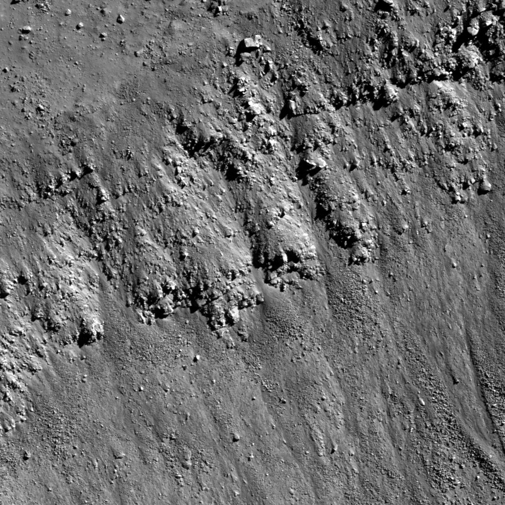
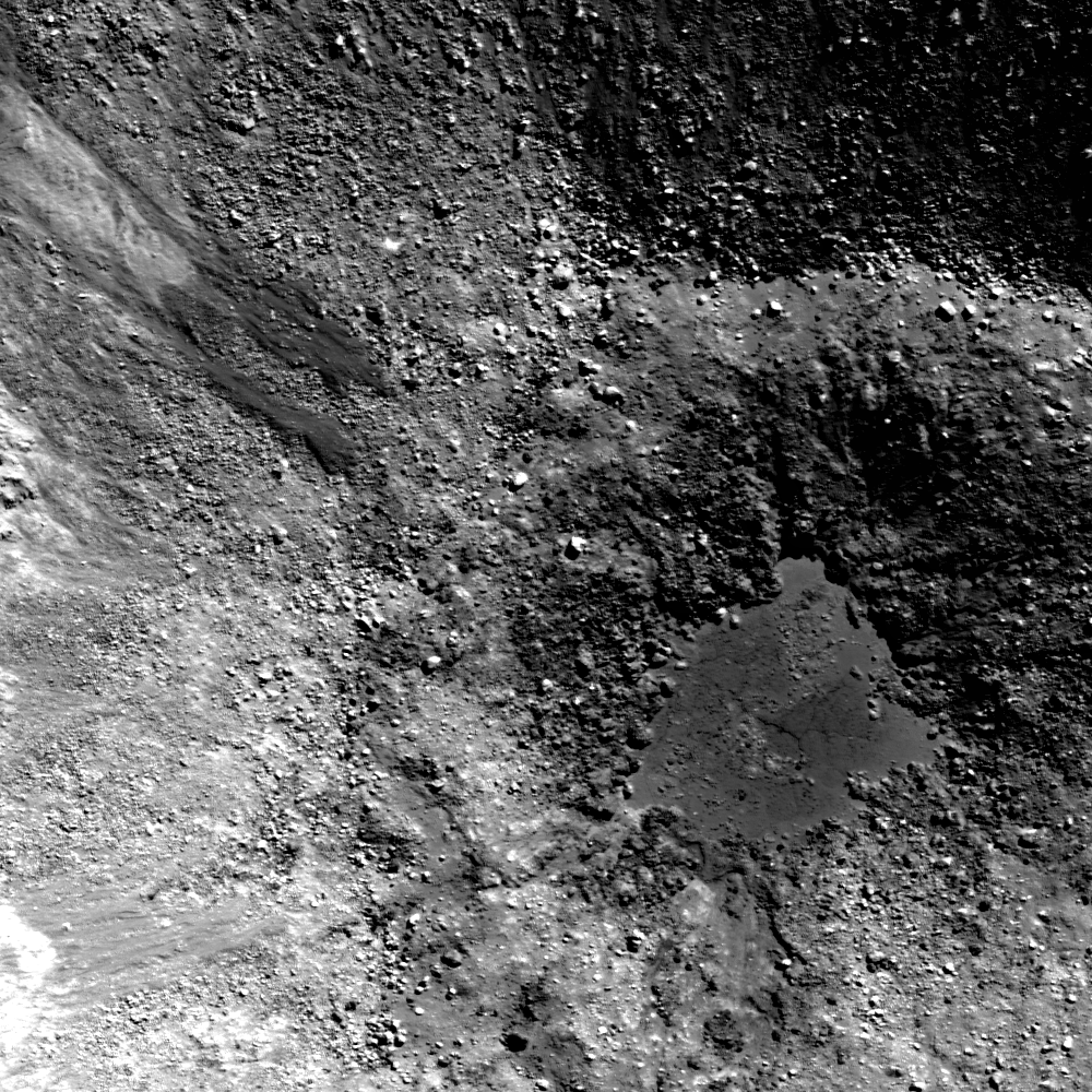
Southern contact of Piton B crater wall and rim. From LROC Narrow Angle Camera (NAC) observation M168203756R, orbit 9922, August 17, 2011; 290 meter-wide field of view captured from a mere 28.75 kilometers, resolution 42 centimeters per pixel, centered near 39.292°N, 359.883°E. North is up [NASA/GSFC/Arizona State University].
Hiroyuki Sato
LROC News System

Piton B is a young, fresh crater (about 4.5 km diameter) located in northeast Mare Imbrium. Along the upper part of this young crater wall, you can find clear layering similar as seen in Meteor Crater at east of Flagstaff, Arizona. The opening image highlights such layerings observed at the southern crater wall of Piton B.

In the lower right corner of this image is a portion of the crater rim, downslope is toward the top. The relatively resistant layers discontinuously outline their horizontal expanses. Among them, the blocky outcrop at the center of this image shows the clearest bedding plane. 

The thinnest layers are roughly 3 to 4 meters thick, assuming a slope angle about 30°.

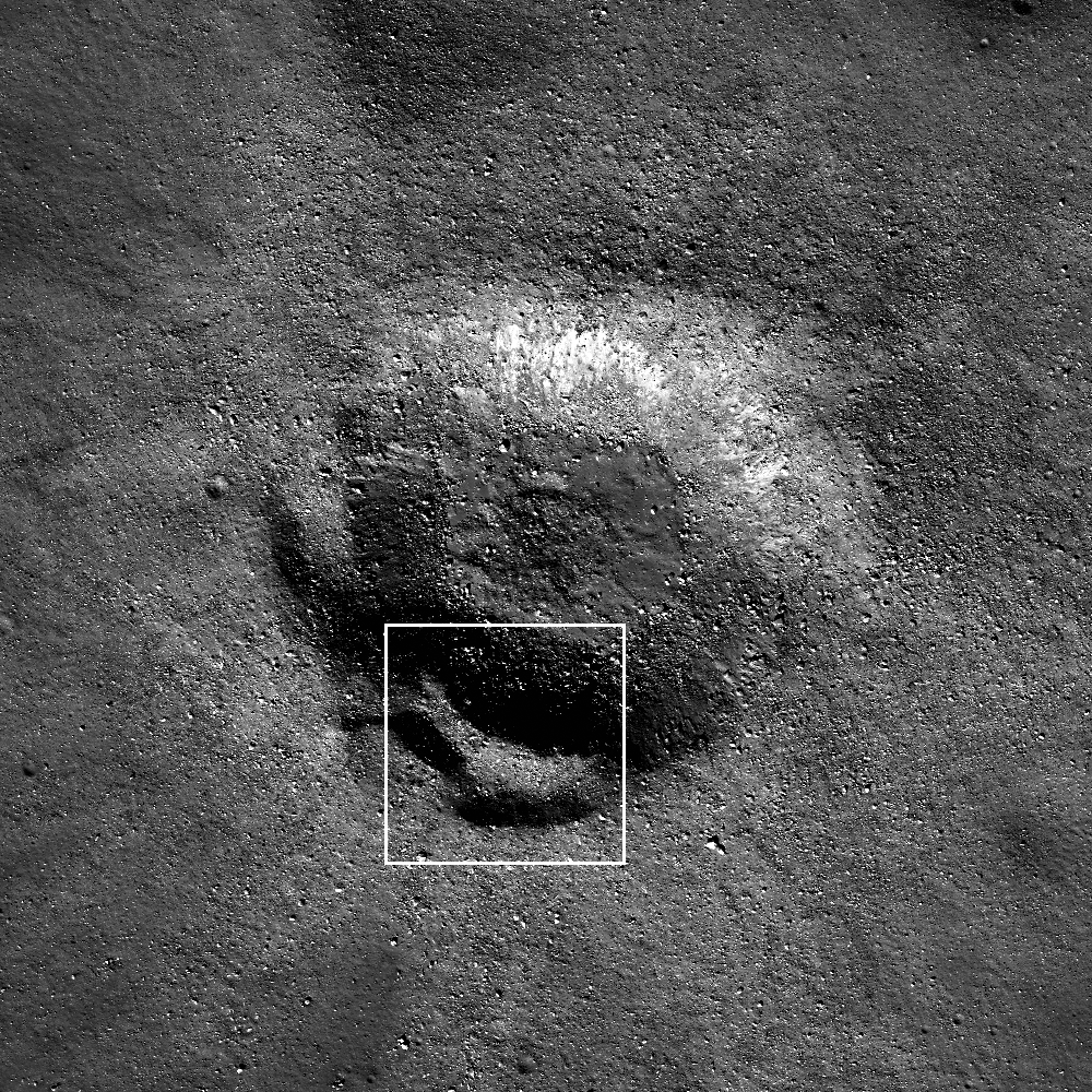
Context for the Featured Image field of view (white rectangle) in the full width of the left and right frame of LROC NAC observation M168203756 [NASA/GSFC/Arizona State University].
Layer thickness estimates from orbital views are not as accurate as geologists would make standing on the outcrop, but many measurements at multiple craters give a great estimate of the general layer thicknesses of the original lava flows. Knowing thickness of flows helps us understand the viscosity and flow rates of ancient mare volcanism.

Piton B (below center) in LROC Wide Angle Camera 100 meter resolution mosaic on LOLA laser altimetry based topography from a simulated perspective 14 km over the vast Imbrium floor. Beyond are Piton A and their namesake Piton Mons [NASA/GSFC/Arizona State University].
Explore the fresh crater wall of Piton B in full NAC frame yourself, HERE.

Related Posts:

Wednesday, November 14, 2012

Craters, Old and New

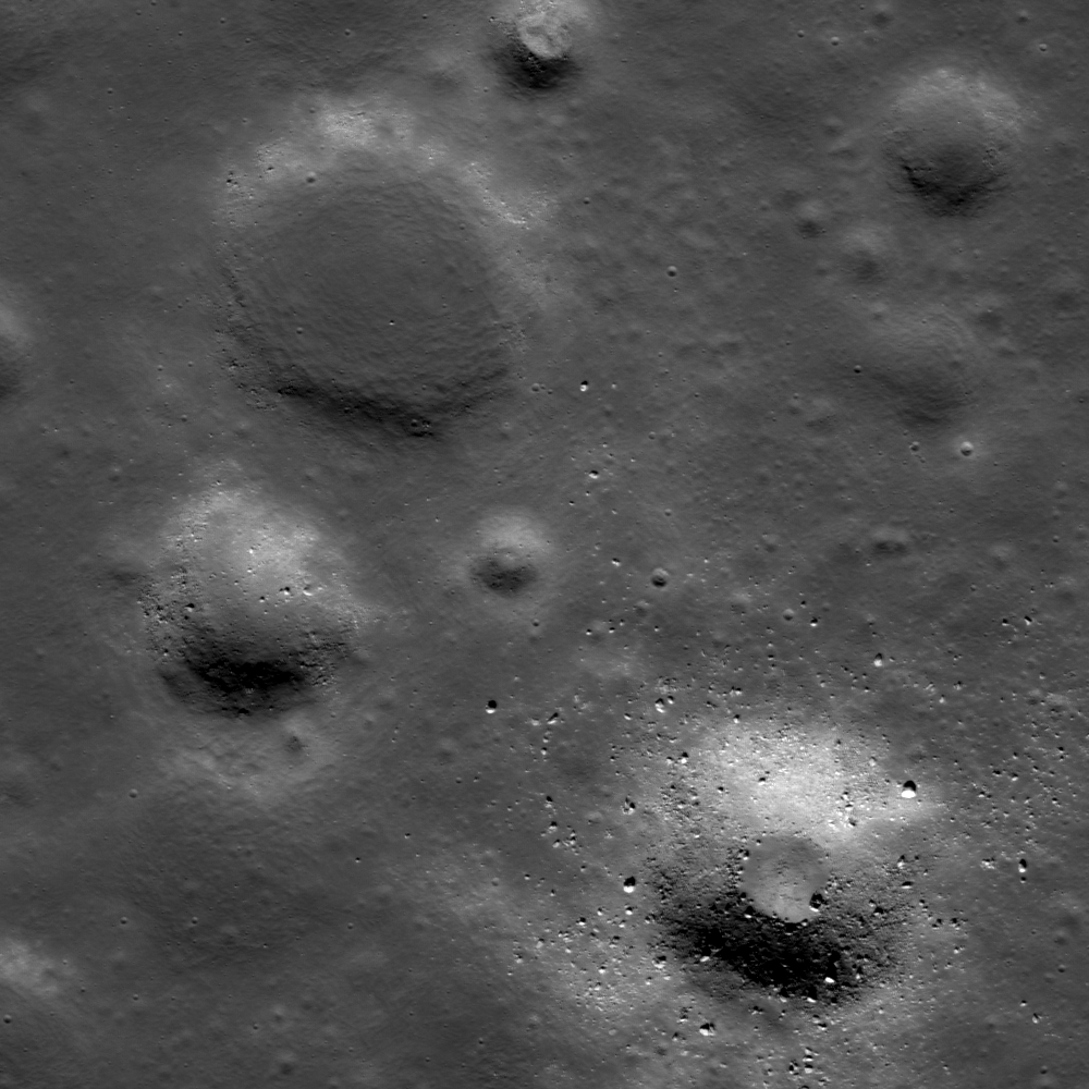
Unnamed craters on the western edge of Mare Frigoris. 1.65 kilometer-wide field of view from LROC Narrow Angle Camera (NAC) frame M186056576L, centered on 56.579°N, 334.890°E. Captured during LRO orbit 12497, March 10, 2012, resolution 1.66 meters per pixel from 168.15 kilometers [NASA/GSFC/Arizona State University].
Hiroyuki Sato
LROC News System

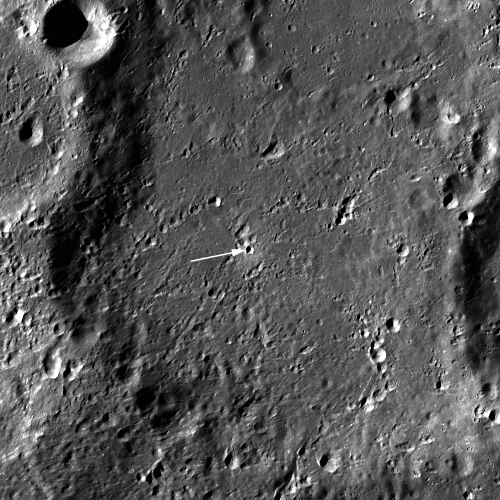
Today's (Tuesday, November 13, 2012 - LROC) Featured Image highlights contrasting features of a young (lower right) and old (upper left) crater with nearly the same diameters (about 450 meters). These two craters are found in the western portion of Mare Frigoris, 23 kilometers south of La Condamine S.

The walls of of the younger crater are steeper with a small, nearly flat floor, probably from pooled impact melt. The older crater appears much shallower and flatter due to an extensive amount of infilling. This type of degraded flat-floored crater is common on the maria.

Many of the craters in this area appear to have roughly the same amount of infilling. Why? Perhaps a local resurfacing event occurred, meaning the infill could either be a product of volcanic activity or impact ejecta. If we visit one of these infilled craters and dig a trench or two we could determine whether this infilling material is volcanic or impact ejecta.

Surrounding areas of La Condamine S crater in LROC WAC 100 meter/pixel mosaic on LOLA laser altimetry using NASA Lunar Modeling and Mapping Project (LMMP) application ILIADS. The long footprint of the entire LROC NAC observation from March 2012 is shown along with the much smaller field of view at high-resolution at the beginning of this post [NASA/GSFC/Arizona State University].

Explore the contrasting young/old craters and surrounding area in the full NAC frame HERE.

Related Posts:
Where Moscoviense meets the Highlands
Wrinkle Ridge Near Montes Teneriffe
Aitken Crater Constellation Program Region of Interest
Montes Pyrenaeus meets Mare Nectaris
Ghost crater in Mare Imbrium

Wednesday, October 24, 2012

Boulders bounce, roll and stop

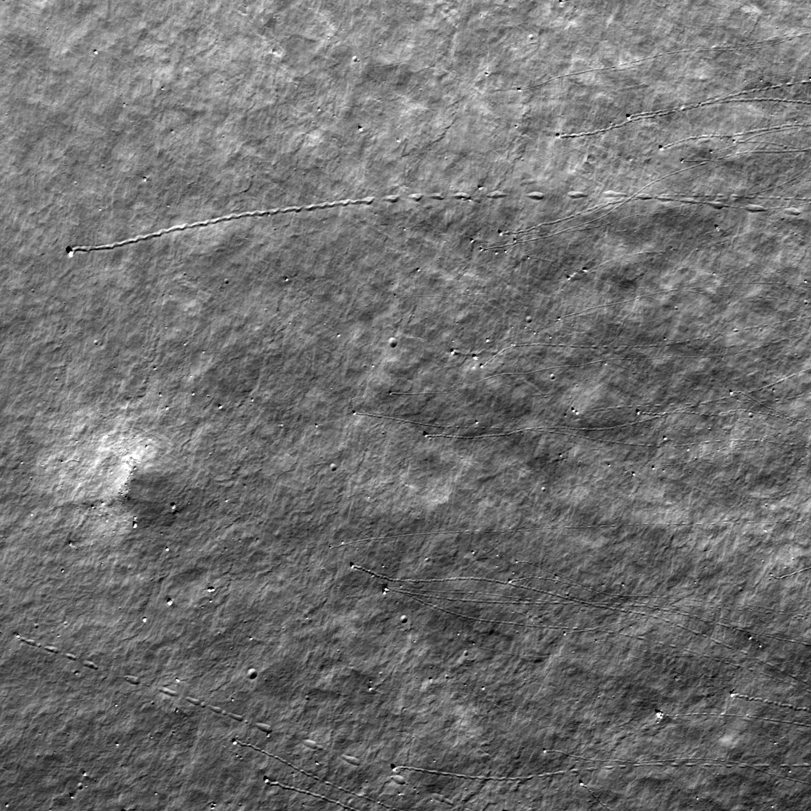
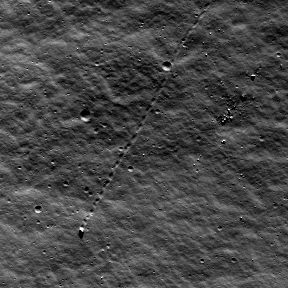
Boulders bounced and rolled down the interior wall of the crater Shuckburgh E leaving a diagnostic trail. 655 meter-wide field of view  from LROC Narrow Angle Camera (NAC) frame M141885094R, spacecraft orbit 6043, October 16, 2010; angle of incidence 47.98° resolution 47 cm, from 39.84 kilometers [NASA/GSFC/Arizona State University].
Sarah Braden
LROC News System

Boulders of different sizes zipped down the interior slopes of Shuckburgh E, a 9.22 km diameter crater located at 44.042°N, 57.018°E. As the boulders bounced and rolled down the wall, they carved trails through the regolith. Click on the Featured Image above to take a closer look at more boulder trails. If the trail is discontinuous, like a dashed line, then the boulder was bouncing. If the trail is continuous, then the boulder was rolling. As they lose momentum the boulders stop bouncing and instead plow through the regolith until they come to a standstill. The largest boulder track in today's Featured Image is about 5-7 meters across! To put this into perspective, 5.5 meters is about the height of an adult giraffe.

Boulder trails are not only pretty, but in some cases they could help human or robotic explorers sample material that is otherwise hard to reach. For example, in Schrödinger basin, a rover could land on the relatively safe, smooth floor and sample boulders that fell from peaks and rims. Material at the top of peaks and rims is scientifically interesting since it is excavated from deeper in the lunar crust. Boulder trails help trace back to the original location of the boulder, making it possible to locate boulders that originated from different points on a peak. Boulder trails were used during Apollo 17 to determine the location of the Station 6 boulder!

LROC Wide Angle Camera (WAC) 100 meter resolution global monochrome mosaic draped over LOLA digital elevation model simulates the view 50 km over Shuckburgh E and Lacus Temporis to the northeast. NASA ILIADS application, Lunar Mapping and Modeling Project (LMMP) [NASA/GSFC/Arizona State University].

Explore the entire NAC frame, HERE.

Related Posts:
Sampling Schrödinger
Hole in One!
Rolling Rolling Rolling
Boulder trails in Menelaus crater

Thursday, August 23, 2012

Twin pools in small Southern Highlands crater

Two small melt flows solidified on the wall of a young crater, and melt pooled in its center. situated on the broad floor of the crater Orontius, in the bright southern highlands immediately east of Tycho. LROC Narrow Angle Camera (NAC) M188270580RE, LRO orbit 12806, April 5, 2012. Image field of view is 700 meters. See the larger original LROC Featured Image HERE [NASA/GSFC/Arizona State University].
Drew Enns
LROC News System

Impact melt commonly forms during impact events on the Moon due to the tremendous energy released during such events.

Melt often forms ponds on crater floors or in nearby exterior depressions, and forms flows as it travels downslope. Today's Featured Image of a young crater in the lunar highlands, at 40.875°S, 355.277°E, appears to have beautifully preserved examples of both forms!

Can we be sure the flows pointed out here are actually frozen impact melt and not debris flows?

LROC Wide Angle Camera (WAC) global mosaic overlaying LOLA topography shows the small bright crater, surrounded by a very bright landscape in the vicinity of Tycho, inside the west wall of Orontius at lower center. View the original LROC WAC context image accompanying the LROC Featured Image released August 21, 2012 HERE [NASA/LMMP/GSFC/Arizona State University].
One clue is that the flows are not very blocky when most of the crater wall is. Instead the flows appear to have entrained rocks when traveling over blocky sections of the crater. But debris flows can also pick up boulders along the way! Unlike the melt pond the flows do not have a cracked surface, perhaps indicating that formed as flows of granular material? On the other hand the flows have lower reflectance, typically of glasses that form on the surface of impact melt. It is difficult to say which hypothesis is correct without more information!

Can you find more evidence to argue for impact melt or debris flow in the full LROC NAC frame HERE?

Related Posts:
Dichotomy
River of Rock
Crater in 3D!

Wednesday, February 22, 2012

LROC: Not so simple Procellarum crater

A step is situated here, in between a small crater's floor and rim. The crater also displays a high density of boulders on its surface. LROC Narrow Angle Camera (NAC) observation M122700360L, orbit 3216, March 8, 2010; incidence angle 56.8° over a field of view 330 meters across, resolution 0.48 meters from 40.6 km. View the larger LROC Featured Image HERE [NASA/GSFC/Arizona State University].
Drew Enns
LROC News System

Today's Featured Image focuses on an 800 meter crater in northern Oceanus Procellarum, at 48.527°N, 285.939°E.

A crater this small is normally considered a simple crater, but this crater has what looks like a terrace! Terraces are normally found in complex craters, but some simple craters do form benches.

Strength differences in buried rock layers encountered during the impact are probably the cause of such benches. Zooming out and looking at the crater in context may give us a better understanding of whether this is a bench or terrace.

Context image of the Featured Image, FOV within the box.  The image above has been subsampled to 1.5 m/p and the larger image FOV is 1500 meters; LROC NAC M122700360L. View the larger, original context image HERE [NASA/GSFC/Arizona State University].

The context image reveals that the terrace doesn't circle the entire crater, similar to how complex craters contain multiple unconnected terraces. But the crater is also very blocky, it probably hit a cohesive layer of basalt hidden under a layer of regolith, so maybe it is a bench. Whichever hypothesis is correct, the Moon is definitely not so simple!

Further context from the NASA ILIADS (LMMP) application. Even as vast an expanse as Oceanus Procellarum has an end, in this case a 2500 meter high boundary between highlands and the Procellarum basin's northwest. The small crater, spotlighted in the LROC Featured Image and designated with a yellow arrow, is situated on mare-inundated terrain roughly 2200 meters below the Moon's mean elevation. Beyond the high mountains (at heights near or only slightly above mean elevation) is the complex heart of the Repsold and Rimae Repsold formation. The floor of Repsold is 500 meters higher than the Procellarum basin floor. LROC Global 100 meter monochrome Wide Angle Camera mosaic overlaid upon LOLA laser altimetry at 128 points per degree (v.2) [NASA/ILIADS/LMMP/GSFC/Arizona State University].
Explore more of the Moon in the full NAC frame!

Related Posts:
Maunder's Terrace
Terraced Wall in Bürg Crater
Fresh Bench Crater in Oceanus Procellarum

Tuesday, February 7, 2012

LROC: A Recent Journey

A large boulder stopped on its way down a sloping wall in the central peak complex of Schiller crater (51.8°S, 320.0°E). Illumination from the north, image is ~500 m across, LROC Narrow Angle Camera (NAC) observation M109502471L LRO orbit 1271, October 6, 2009. See the more detailed full size LROC Featured Image HERE  [NASA/GSFC/Arizona State University].
James Ashley
LROC News System

The lonely journey of this large boulder is apparent from its track in a sloping regolith surface. A casual glance might suggest that it happened last week, or even that its rolling might resume at any moment. However, closer inspection will detect a few craters that clearly superpose and therefore post-date the track, showing that this 9-meter diameter boulder stopped rolling some time ago. Impacts are used in this way to provide a relative sense for the timing of events on planetary surfaces across the solar system. The procedure assumes a steady flux of impacting bodies in each size range, with smaller impacts being much more frequent than large impacts.

Though long ago to humans, however, this boulder's journey was made in geologically recent times. Studies suggest that regolith development from micrometeorite impacts will erase tracks like these over time intervals of tens of millions of years. If rate estimates are accurate, this boulder track might not be older than 50-100 million years. Eventually its track will be erased completely. What might have caused the rock to roll so recently? Perhaps this boulder was sent on its way by ground-shaking caused by the violence of a nearby impact. Perhaps a direct hit by a small meteoroid did the job.

Wide Angle Camera (WAC) mosaic image covering a portion of Schiller crater, north is up, image is ~80 km across [NASA/GSFC/Arizona State University].
The LROC WAC Global 100 meter mosaic draped over the laser altimetry (LOLA) digital elevation model as seen from an imaginary point 65 kilometers over the elongated crater's southeast. ILIADS application from NASA Lunar Mapping and Modeling Project (LMMP). South-southeast of center darker surface indicates the location of a localized pyroclastic volcanic dome, with a very low profile. The unusual Schiller crater formation may indicate the formation's progenitor was a highly oblique impact, perhaps along the northern inner rim of an older, much larger impact basin further southwest. Schiller is roughly 108 km wide and 184 km long [NASA/GSFC/Arizona State University].
The WAC-derived GLD100 Digital Elevation Model (DEM) of the area, shown in the inset below, offers a sense for topographic relief unavailable in the WAC mosaic alone. We can see that the location of today's Featured Image is in a zone of relatively gradual slope, just beyond the steeper slopes of the Schiller central peak complex. Thus, it is unlikely that our boulder will continue rolling anytime soon. It's arrived in an area with too gentle a slope.

Color LOLA DEM of Schiller environs, with an inset showing the central peak complex region in three dimensions. The yellow arrow designates the Featured Image location [NASA/GSFC/Arizona State University]

Look for other boulder tracks in the full NAC image.

Additional examples of boulder behavior can be seen in A Gathering in Lacus Mortis, Sampling Schrödinger, and Frozen in Time.

Monday, November 21, 2011

Apollo Metric Camera maps completed

The final three Apollo "J" missions as planned were devoted to science, and each of their Service Modules were equipped with an array of equipment that remained in orbit as their surface expeditions were carried out. Mapping Metric and Panorama Cameras operated over the sunlit surface over multiple orbits as part of the Apollo 15, 16 and 17 missions. Film canisters for these cameras were retrieved in spacewalks during the long cruise home. Until recently, the orbital corridors under the orbital plain of these last missions were the most well-understood detailed portions of the lunar surface [NASA/Google Earth].
Dr. Terry Fong
Director, Intelligent Robotics Group
NASA Ames Research Center

It gives me great pleasure to announce the release of the "Apollo Zone" Digital Image Mosaic (DIM) and Digital Elevation Model (DEM). These maps cover approx. 18% of the Lunar surface at a resolution of 1024 pixels per degree (approx 30 m/pixel). The maps are the result of 3 years worth of work by the NASA Ames Intelligent Robotics Group (IRG) to align and process more than 4,000 images from the Apollo Metric Camera (AMC), which flew aboard Apollo 15, 16, and 17. The AMC images were provided by the Apollo Image Archive at Arizona State University.

To preview the "Apollo Zone" maps, download the following "KML" file for viewing in Google Earth:

http://byss.ndc.nasa.gov/stereopipeline/dataviz/apollo_metric.kml

Once you open that file in Google Earth you will have options to view these "Apollo Zone" maps overlaid on Google Earth's "Moon mode". The full maps (in GeoTIFF format with complete metadata) have also been uploaded to the Lunar Mapping and Modeling Project (LMMP) portal (http://lmmp.nasa.gov) and will soon be available for visualization and download via that site.

The "Apollo Zone" maps cover the following sites of interest: Apollo 15, Apollo 16, Alphonsus Crater, Rima Prinz, Aristarchus Plateau-2, Ina D Caldera, Sulpicius Gallus, Mare Crisium, Mare Smythii, King Crater, Tsiolkovskiy Crater, Aitken Crater, and half of Van de Graaf Crater.

The terrain model has an average vertical accuracy of 40 m/pixel and standard deviation of 37 m (compared to LOLA laser altimetry tracks). Over 46% of the covered surface has vertical errors lower than 25 m.

The "Apollo Zone" maps (image, elevation, hillside, colorshade, confidence and precision) were automatically generated using new computer vision algorithms developed by IRG:

 - robust statistical sub-pixel stereo correspondence
 - robust bundle adjustment and radiometric corrections for large-scale
   image mosaics
 - orbital camera position/orientation estimation using interest point
   extraction
 - photometric correction of exposure time, shadow removal and generation of
   seamless large-scale image mosaics.
 - photometric method for reconstructing lunar albedo
 - photoclinometric terrain reconstruction method that improves lunar
   DTM precision
 - statistical method for multiple stereo digital terrain model mosaicking
 - multi-view 3D terrain reconstruction
 - DTM / LOLA alignment and lidar / image matching

These algorithms have been released as NASA open-source (Ames Stereo Pipeline, Neo-Geography Toolkit, and NASA Vision Workbench). Map processing was performed using the NASA Pleiades supercomputer. In addition to the Apollo Metric Camera images, the fully automatic map processing pipeline has also been used with data from the Lunar Reconnaissance Orbiter Camera (LROC) and by several planetary science groups.

This work was funded by the Lunar Mapping and Modeling Project (LMMP). We gratefully acknowledge the support of our collaborators at NASA MSFC, NASA GSFC, JPL and USGS. We sincerely thank Mark Robinson and the Apollo Image Archive at ASU for restoring and bringing the AMC data to "digital life". Our special thanks go to Ray French and Mark Nall for their support and leadership of LMMP.

If you have any questions, or would like more information, please let me know.

Cheers,

Terry Fong

Friday, November 4, 2011

LROC: A small crater's disappearing floor

Floor of unnamed crater inside the western rim of the Humboldt 'walled plain.' LROC Narrow Angle Camera (NAC) observation M113440414L, LRO Orbit 1851, November 21, 2009; resolution 51 cm per pixel, incidence angle 54° from 46.93 km. Field of view 296 meters across. View the wider full size LROC Featured Image HERE [NASA/GSFC/Arizona State University].
Hiroyuki Sato
LROC News System

Humboldt crater is a large (207 kilometers) floor-fractured crater on the eastern limb, as seen from the Earth, just before the 80° east meridian (in the Zone of Libration), about 760 km south of Mare Smythii. The edges of its fractured-floor are partially covered by dark mantle deposits, which are suspected to be pyroclastic in origin.

Today's Featured Image is the bottom of an unnamed 5.7 km crater near the western edge of the Humboldt crater floor (26.25°S, 78.41°E). The boomerang-shaped flat area in the center of this image is the original floor, surrounded by continuous slopes from the crater rim.

LROC Wide Angle Camera 100 m Global Mosaic fixed to an initial LOLA laser altimetry-based digital terrain model in a scene built up through the NASA ILIADS platform, where a variety of lunar probe data bases from multiple NASA centers are made available to the public.The asterisk marks the location of the field of view within the LROC Featured Image and the yellow rectangle indicates the LROC NAC image footprint from which it was taken [NASA/ILIADS].

The initial shape just after the impact event is generally thought to be a symmetric bowl-shape, with mass wasting gradually modifying the crater cavity. Especially for the small craters on the Moon, bowl-shaped cavities are transformed by this process into inverted cone shapes. This unnamed crater in Humboldt may be undergoing such a process now to become a complete cone shape at some point in the future. If so, we are fortunate to observe its original floor before complete burial obscures it from view.

A second, more recent LROC WAC monochrome (604 nm) mosaic of the western interior of the Humboldt plain, for comparison with the afternoon illumination further up it shows the unnamed crater in a field of view approximately 45 kilometers wide under early morning illumination. LROC WAC observations M161801162C, M161794365CE & M161787569CE in LRO orbits 8976-8978, June 4, 2011; average resolution 66.75 meters, incidence angle 70.8° from 47.45 kilometers [NASA/GSFC/Arizona State University].
LROC WAC monochrome mosaic around Humboldt, with a false-color overlay representing the LROC photography-based digital terrain model (DTM), at (default) 30% opacity and 250 meter resolution, as viewed through the LROC QuickMap web-based application. The unnamed crater and its surroundings are seen in the wider context of Greater Humboldt on the western edge of the larger crater floor, with its high walls and radial fractures. View the full size original LROC WAC context image HERE [NASA/GSFC/Arizona State University].

Explore the last portion of this unnamed crater floor in the full NAC frame yourself!

Related posts:
Craters on the Schrodinger pyroclastic cone
Melt and more melt
Small crater in Oceanus Procellarum

Friday, September 23, 2011

LROC: A Gathering in Lacus Mortis


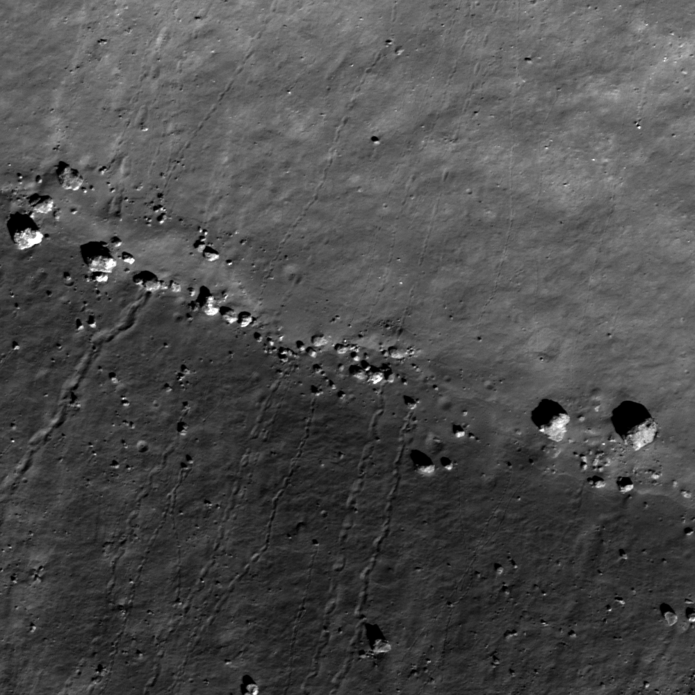
Boulders meet in a valley amidst central peaks of Bürg crater (45.0°N, 27.2°E). LROC Narrow Angle Camera (NAC) observation M111415328L, LRO orbit 1553, October 29, 2009; incidence angle 51.7°. Sun is from the south-southeast, north is right, image resolution 49 cm per pixel. View the full size LROC Featured Image HERE [NASA/GSFC/Arizona State University].

James Ashley
LROC News System

Clear impressions in the lunar soil show paths that boulders followed as they rolled downhill in the mountains surrounded by Lacus Mortis (the Lake of Death). If you look closely, you can see trails from both the top and bottom of this image. Also the trails are in some cases jagged -- not orderly, straight lines. What caused such striking patterns?

As is often the case, close inspection of a broader area reveals what we are seeing. Knowledge of the local topography and an understanding of the effects of gravity provide the explanation: The boulders rest in a valley present within the double central peak of Bürg crater. They rolled down from the bouldery summits of opposing slopes and accumulated along the valley floor. The largest block is approximately 23 meters in long diameter!
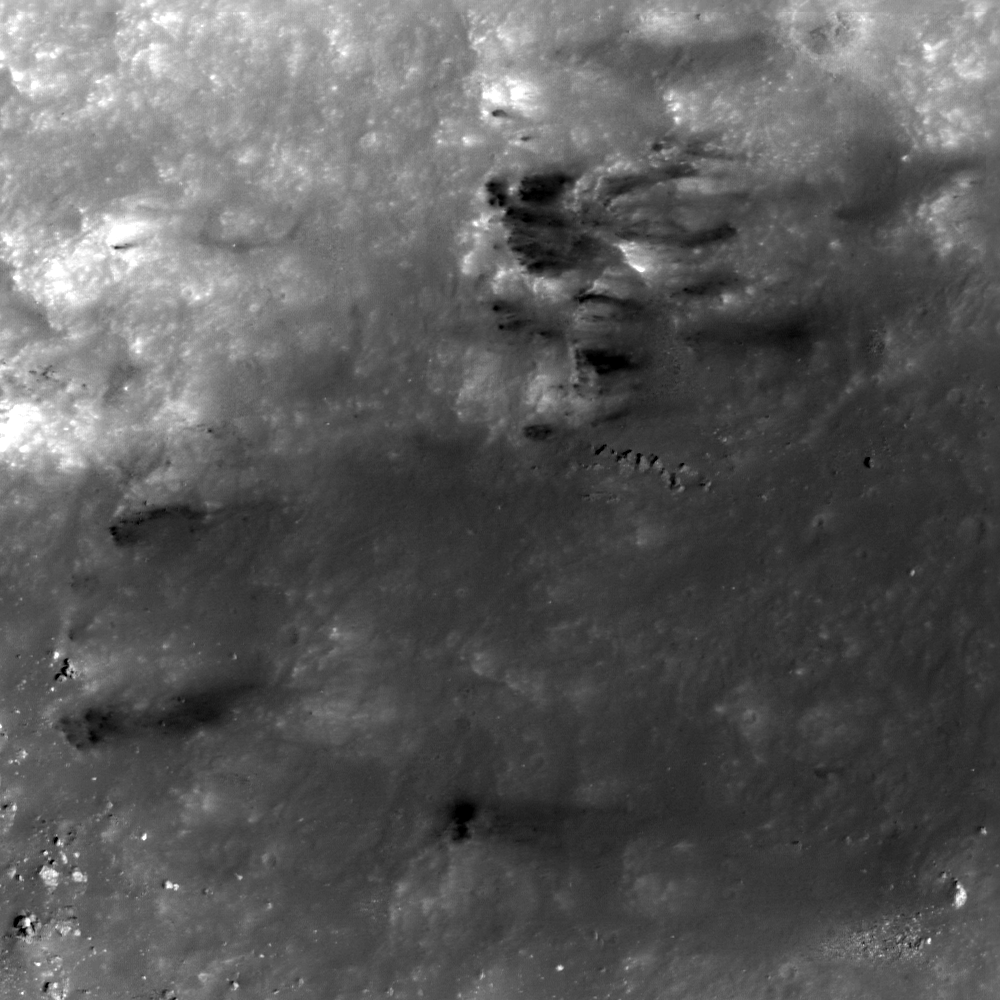
Note the tortuous paths of some of these boulders. These paths are the results of slow movement combined with irregular shapes (have you ever tried to roll a football in a straight line?). The straighter paths probably represent more rapid movement because the momentum of a faster-moving body helps it maintain its path of travel. Notice that at least one of them bounced along the slope, making impressions only when it touched the surface. Other boulders never made it all the way to the bottom of the slope. Still others don't seem to have clear traces in the regolith up-slope from their location. How could this be? Is it safe to say that some of these arrived more recently than others? Why or why not? Hint: How rapidly does the lunar regolith get reworked by micrometeorite impacts, and how quickly should such gardening erase traces like these?
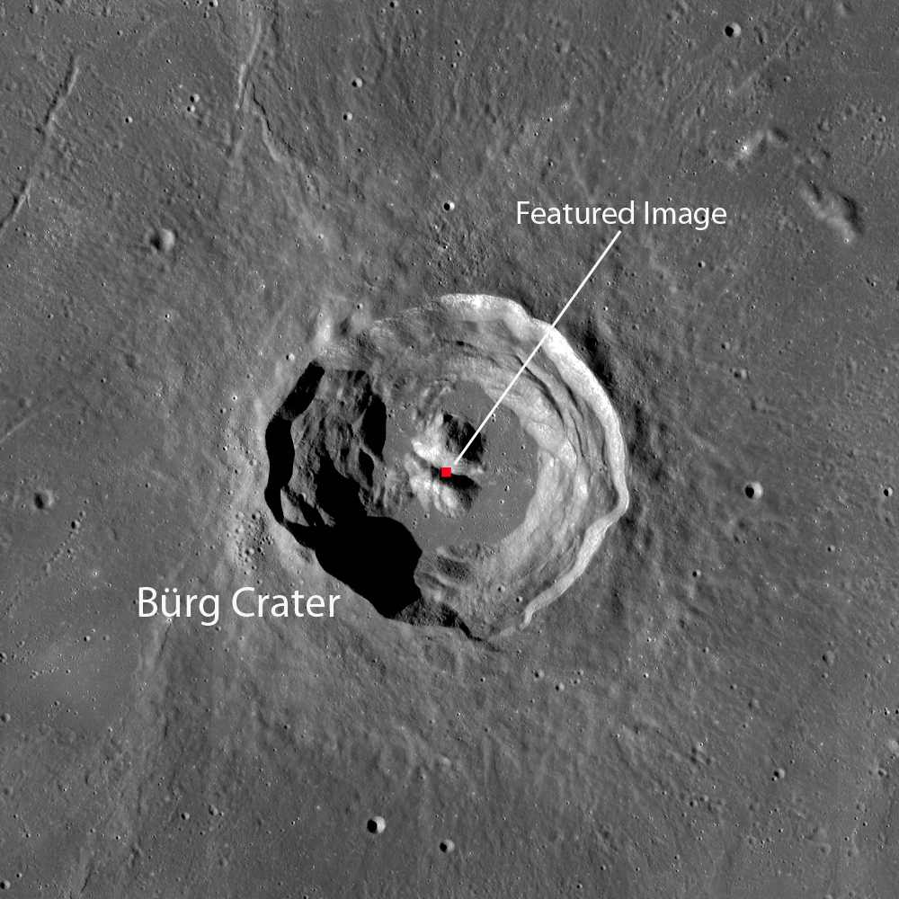
The 6700 meter high rims and terraced interior walls of 41 km-wide Bürg (45.0°N, 28.2°E), from a 100 m/p resolution LROC Wide Angle Camera (WAC) mosaic, shows the Featured Image location between the central peaks. See the full size context image HERE [NASA/GSFC/Arizona State University].

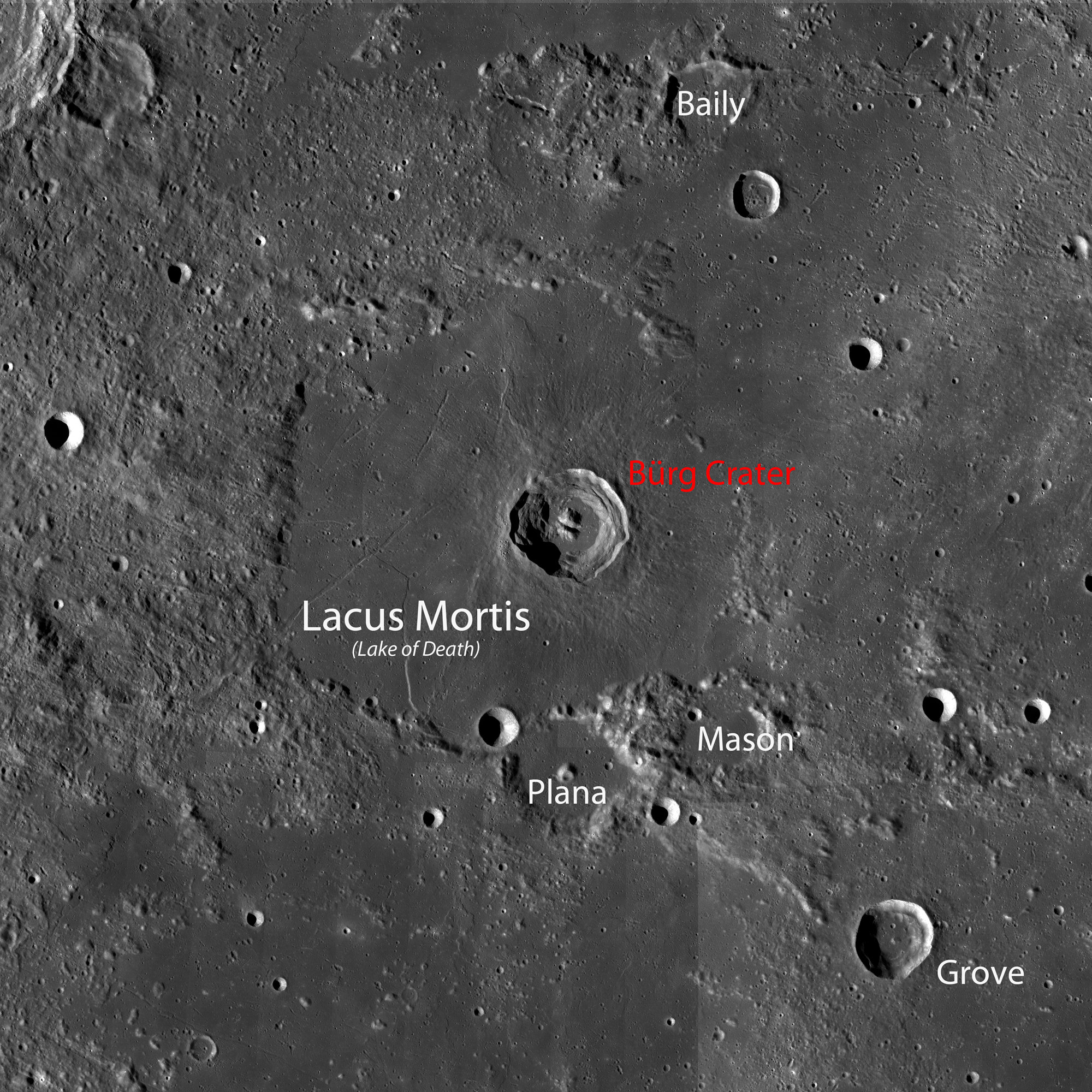
Lacus Mortis is shown in the WAC mosaic (below), this area is visible through the eyepiece of a small, backyard telescope beginning with the late waxing crescent phase, about 6 days past new Moon (See the last image in this post for the telescopic view from Earth during a favorable libration in April 2010). If you can find Bürg crater, then you'll see where the Featured Image is located, even though the details of the crater will be far too small to see.


WAC mosaic (from the Web Map Server LROC image search) of Lacus Mortis and environs. See the original, more detailed LROC context image HERE [NASA/GSFC/Arizona State University].

Explore the full NAC frame here. Another post featuring the complexities of Bürg crater can be found here. Related Featured Image posts also include Sampling Schrödinger; Tycho Central Peak Spectacular; and Boulder in Recht crater.

Explore the full NAC frame HERE. Another post featuring the complexities of Bürg crater can be found HERE. Related Featured Image posts also include Sampling Schrödinger; Tycho Central Peak Spectacular; and Boulder in Recht crater.

Lacus Mortis is a familiar Nearside landmark, between Mares Serenitatis and Frigoris, well situated for locating nearby large craters and vice versa. It is less spectacular but just as unusual in this false-color image from LOLA altimetry, a continuum of most of the Nearside's below-lunar mean elevations. It is a place now confirmed that hosts deep faults and volcanism  [NASA/GSFC/MSFC/LOLA/LMMP].


The View from Earth: This small section from an global lunar mosaic by Astronominsk demonstrates Lacus Mortis is easier to see during a libration favorable enough to swing Mare Humboldtanium into view. A small host of quick-study neighborhood landmarks are all easy to locate in a small telescope [Astonominsk].

Still more related posts:
Rimae Bürg
Not your average complex crater
Lunar morphology in the lake of death
Blogger's Best for the Best
Terraced Wall of Bürg

Tuesday, September 20, 2011

LROC: Dark wisps along the rim of Copernicus


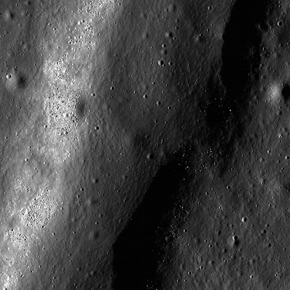
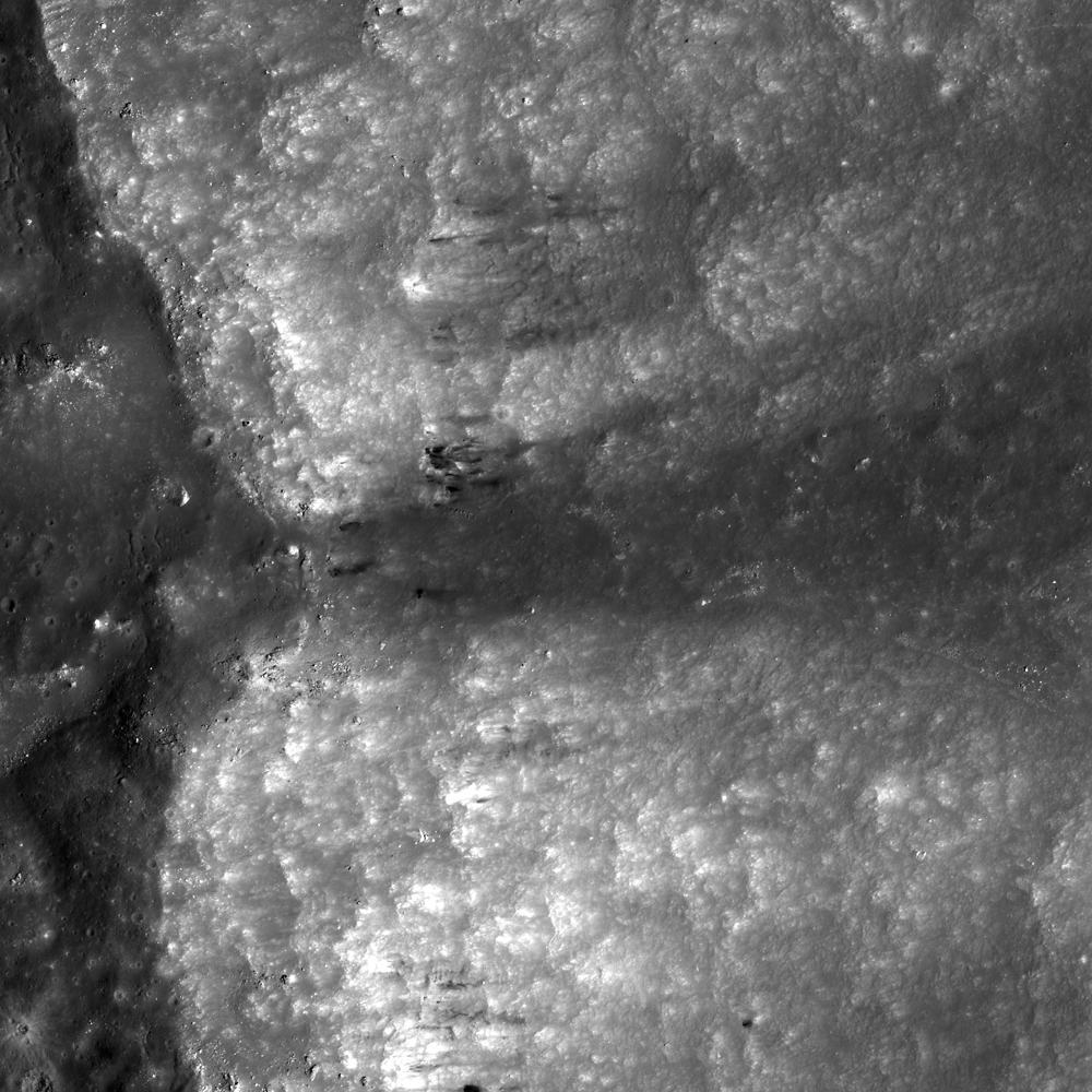
Dark streaks ornament a slope along the Copernicus crater rim (9.3°N, 21.5°W). Down-slope is to the right. LROC Narrow Angle Camera (NAC) observation M11735067L, LRO orbit 1600, November 1, 2009; incidence angle 32°, Sun is from the east, north is up, field of view is roughly 400 meters across. View the full size LROC Featured Image HERE [NASA/GSFC/Arizona State University].

James Ashley
LROC News System

What are these low-reflectance (dark), wispy streaks? The differences in color among lunar deposits is often understood in terms of composition and/or intensity of space weathering (which can discolor soils over time). When they become mixed (often from cratering events), they can produce areas of high color contrast. Most of them seem to have the lowest reflectance at the points highest in elevation on the crater wall (to the left), and become more reflective down-slope (to the right). The features in this image seem to cluster near a promontory that has its own streak of material, emanating as a fan-shaped curtain (see context image below).


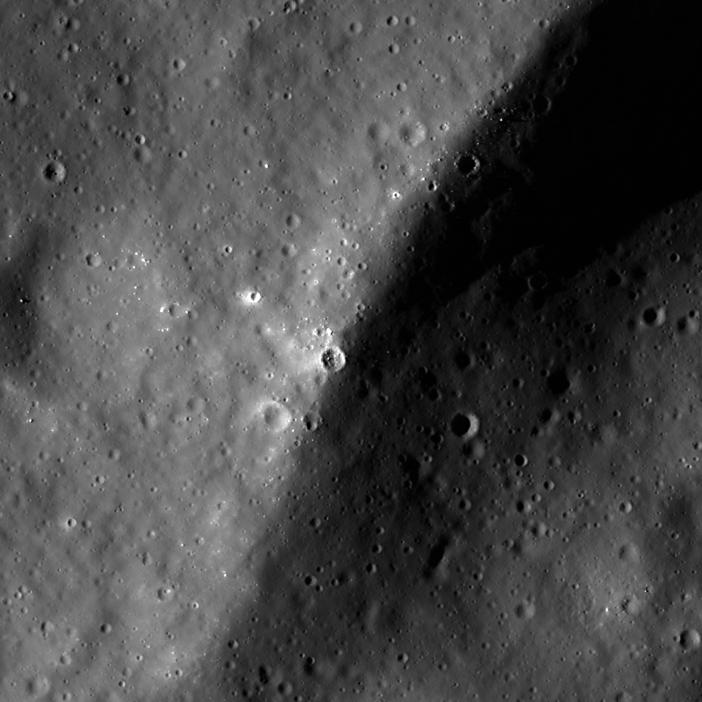
From a wider view of LROC NAC M11735067L, showing the association of a promontory's location with the occurrence of the dark deposits (See next image). Field of view roughly 2.2 km across (downsampled from 50 cm/pixel to approximately 2.3 meters/pixel. View the full size LROC context image HERE [NASA/GSFC/Arizona State University].


An artificial perspective of the massive slumped inner slope of the east rim of Copernicus made possible by NASA's ILIADS program. The topography represents laser altimetry collected by LOLA overlaid with morning Terrain Camera imagery from Japan's lunar orbiter Kaguya. (The LROC Featured Image is a close up from overhead of the slot in the crater rim, left of upper center.) View a HDTV orbital still showing Copernicus HERE [NASA/GSFC/MSFC/JAXA/SELENE].

There are several possible explanations for how the smaller, low-reflectance features formed. For example, these dark patches may represent mare basalts that were buried and re-exposed by the formation of Copernicus and subsequent mass wasting. Another possibility is that the low-reflectance materials are dikes or sills (intrusive igneous bodies) that pre-date the Copernicus impact and are now weathering out. Still a third possibility is that mare basalt debris were ejected by a nearby impact and deposited here, perhaps encouraging the erosion of the promontory in the process - or landing near the promontory by coincidence. In this later scenario, each block of ejecta might then have fragmented upon impact and migrated down-slope as individual debris aprons. There are several nearby, relatively recent craters outside of the Copernicus rim that could be responsible for this type of deposition. Are there any additional clues that could be looked for to further solve this mystery?


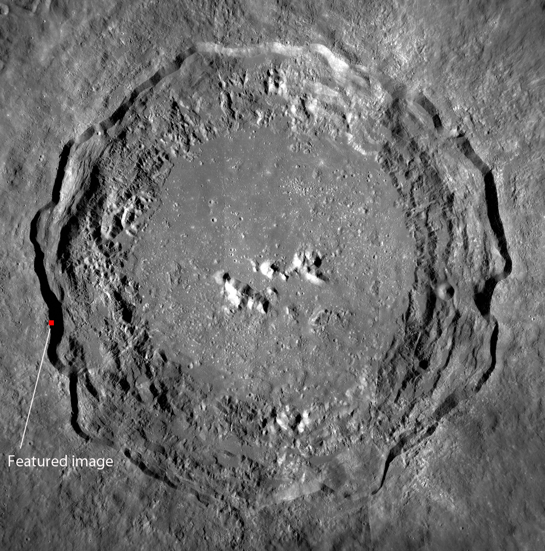
A 54.6 meter per pixel LROC Wide Angle Camera (WAC) perspective centered on the area of interest, on the west-southwestern rim of Copernicus. LROC WAC M131793087C (604 nm), LRO orbit 4556, June 21, 2010; little more than a day after local sunrise, incidence angle 82.2° [NASA/GSFC/Arizona State University].


Above, the LROC WAC context image showing the expanse of Copernicus provides a sense for how steep the outermost walls of the 95 km-wide crater are, and the location of area highlighted in the Featured Image released September 20, 2011. View the full size LROC WAC context image HERE [NASA/GSFC/Arizona State University].

Review the full NAC image HERE to look for more examples.

Related posts:
Dark streaks in Diophantus crater
Dichotomy

Friday, September 16, 2011

It's the Moon's fault


Linear rille in Mare Tranquillitatis, the result of extensional stresses. What caused the offset in the rille on the east wall? LROC Narrow Angle Camera (NAC) observation M146858595LE, LRO orbit 6776, December 13, 2010, field of view 700 meters. See the full size LROC Featured Image HERE [NASA/GSFC/Arizona State University].

Drew Enns
LROC News System

Linear rilles are so named because of their nearly-straight morphology and surface expression. Unlike sinuous rilles, which are volcanic, linear rilles are tectonic in nature. Similar features on Earth are termed graben, and are created when two normal faults border a block of rock which has been depressed, producing a valley.

Since normal faults are understood to be the products of extensional stresses (see yesterday's Featured Image post), we can assume this region of the Moon was "pulled apart" - creating these normal faults, dropping the middle blocks, and producing the linear rilles. So a linear rille is the lunar analog of a graben on Earth!


Full two kilometer width segment of LROC NAC frame M146858595LE, showing the approximate location of the LROC Featured Image, September 15, 2011 [NASA/GSFC/Arizona State University].


LROC Wide Angle Camera (WAC) context images of the Rimae Sosigenes extensional linear rille system in the northeast Mare Tranquillitatis, between the Arago domes (out of view, to the south and east) and the craters Sosigenes and its smaller namesake Sosigenes A. one rille is cross-cut with a close-grouped and prominent secondary crater chain, well-known to well-equipped telescopic observers when the morning terminator passes over five days following a New Moon. WAC monochrome (566 nm) mosaic from orbits 4515-4517, June 18, 2010. See the original LROC WAC context image HERE [NASA/GSFC/Arizona State University].

In today's featured image, two normal faults appear to be offset.

What are we seeing here?


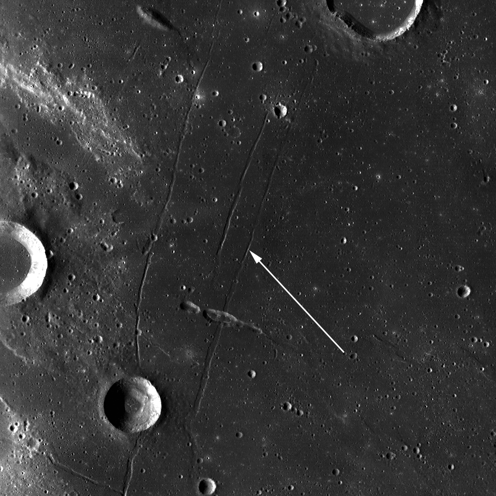
Is Mare Tranquillitatis really an impact basin? Looks can be deceiving, when comparing two familiar and neighboring basins, each flooded multiple times with volcanic flows. Dark and optically-mature regolith covers both Mare Serenitatis (top center) and Tranquillitatis (below - the area of interest is indicated with the yellow area), though the differences in color of each are obvious even in black and white photographs. But In this false-color LOLA elevation map, the nature of Mare Tranquillitatis is less obvious, until one examines more closely and sees how the weight of material infilling the Tranquillitatis plain may have led to finer features like wrinkle ridges and extensional rilles [NASA/GSFC/LOLA/MSFC/LMMP].

It is probably an en echelon step between the two normal faults making up the east wall of the rille. When two faults are near to each other, they can interact and create an en echelon step that helps to even out the displacement and forces that created the faults. En echelon steps are common, and are seen in other tectonic features on the Moon.

Can you find any more faults in the full NAC frame?

Related Posts:
Rima Bürg
Rima Ariadaeus - A Linear Rille

Tuesday, September 13, 2011

Maunder's Terrace


Detail of a terrace edge inside the slumped southeast inner rim of 55 km Maunder crater in Mare Orientale shown slowly being engulfed in evening shadow as the Sun sets on the Moon. LROC Narrow Angle Camera (NAC) observation M133445371RE, LRO orbit 4799, July 10, 2010; field of view 800 meters. View the full size LROC Featured Image HERE [NASA/GSFC/Arizona State University]. 

Drew Enns 
LROC News System

Crater terraces are a common occurrence in many craters on the Moon, and along with central peaks and flat floors, terraces are a geomorphic requirement for a crater to be labeled as complex. 

These forms are key to distinguishing between simple craters and complex craters. But how do these distinctive terraces form?


LROC Wide Angle Camera (WAC) observation swept up at roughly the same time as the LROC Featured Image released September 13, 2011 (area marked by yellow arrow). Resolution 71.5 meters per pixel, incidence angle 79° [NASA/GSFC/Arizona State University].


Maunder with it's slumped inner rim terraces and outer rim ejecta blanket on the north floor of Mare Orientale, from LROC WAC monochrome (643nm) mosaic swept up a little earlier in the local evening, over the course of four orbital passes, January 14, 2010. Resolution 87 meters per pixel, north is up, east-west field of view 85 km [NASA/GSFC/Arizona State University]. 

During the excavation stage of crater formation, complex craters experience uplift of the central portion of the crater. This results in one of the most distinctive features of complex craters, their central peaks. But while the uplift creates a central peak, it also causes collapse of the crater rim. This collapse occurs along faults that form as large blocks of rock start to slump inward, increasing the final diameter of the crater. Amazingly, most of this process is finished minutes after the impact! 

Can you find more terraces in the full NAC frame

Related Posts:
Necho's Terraces
Slumping Rim of Darwin C
Terraced Wall of Bürg Crater


False color view from high over the southwestern lunar hemisphere showing laser altimetry measurements collected by the LOLA instrument on-board LRO through March 2011. This hill-shade view brings into stark relief the multi-ring, wide-ranging effect of the Orientale impact on the Moon's west limb, straddling the Moon's near and farsides. Four km deep Maunder is the most prominent crater on the north end of the basin floor [NASA/GSFC/MSFC/LMMP].