Showing posts with label boulder. Show all posts

Monday, July 21, 2014

Ballistic boulder at Hecataeus N

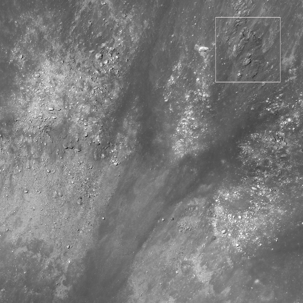
A house-sized boulder left a clear impression, immediately beyond the east rim of a young 1.6-km crater (rim crest to the left), all in a full-sized reproduction, 988 meter-wide field of view from LROC NAC observation M182995612R, LRO orbit 12068, February 4, 2012; 48.59° incidence, resolution 85 cm from 83.56 km over 20.98°S, 80.74°E [NASA/GSFC/Arizona State University].
J. Stopar
LROC News System

The boulder above (21.085°S, 80.777°E) in the opening image is likely debris ejected during the violent excavation of the 1.6-km diameter crater immediately to the west (left).

The boulder was deposited ballistically; the distance it travelled and its time of flight are related to its ejection angle and velocity.

For the boulder, was this flight a "small step" or a "giant leap?"

Looking at the image above, we can deduce that the boulder was deposited with enough force to make a noticeable impression in the ground. However, a more forceful landing would have highly fragmented the boulder.

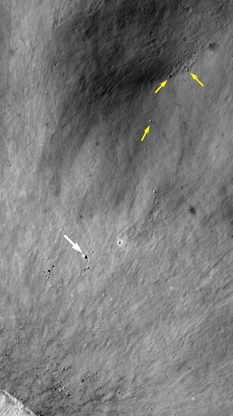
More examples of surface impressions formed by ballistic boulders from the fresh impact near Hecataeus N. Spotty trails mark where boulders rolled into a pre-existing crater (small yellow arrows). Another larger, boulder (25 meters in diameter, large white arrow) was thrown out of the crater to the southwest and carved a furrow in the ejecta blanket, coming to rest when it intersected a pre-existing crater rim (topographic high) [NASA/GSFC/Arizona State University].
The boulder is located about 500 meters east of the crater rim crest, which is only about a third of the crater diameter. Thus, this boulder did not travel very far or very fast.

Explore the entire crater and its ejecta below:

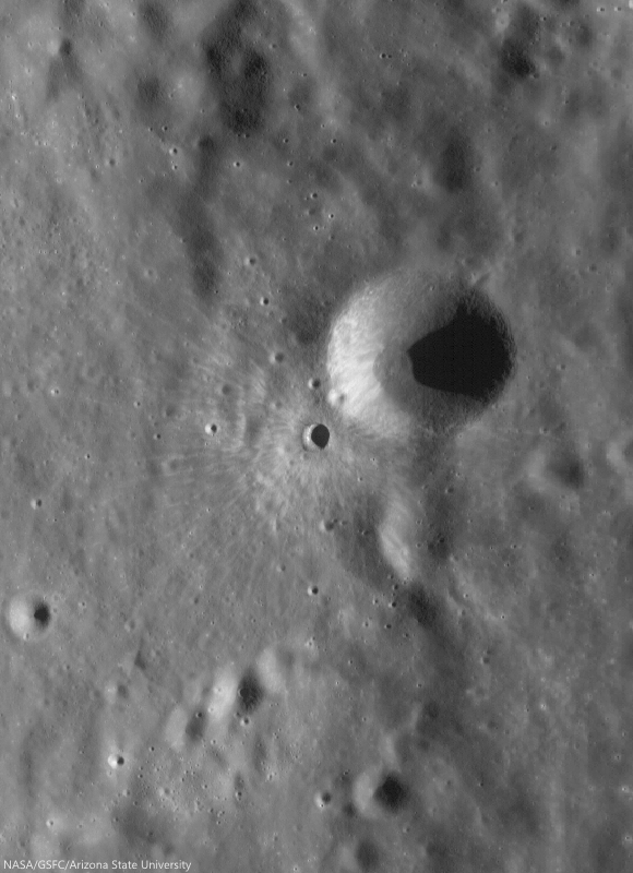
Fresh impact on the west flank of Hecataeus N 4.3 km field of view from LROC NAC mosaic M182995612LR, LRO orbit 12068, February 4, 2012; 48.59° incidence, resolution 85 cm from 83.56 km over 20.98°S, 80.74°E [NASA/GSFC/Arizona State University].
View full-window HERE.

The house-sized boulder (yellow arrow), which left its impression just beyond the east rim of the unnamed young 1.6-km crater that, in turn, sits on the west flank of Hecataeus N, shown in the context of a 7.86 km-wide field of view from LROC NAC mosaic M182995612LR, LRO orbit 12068, February 4, 2012; 48.59° incidence, resolution 85 cm from 83.56 km over 20.98°S, 80.74°E [NASA/GSFC/Arizona State University].
The fresh crater (center) on the southwest slope of Hecataeus N (10.82 km; 20.91°S, 80.944°E) excavates the deepest material originally turned up by "N" while both, in turn, sampled the very ancient Hecataeus interior (southwestern half of this 40-km wide field of view) and, even further, material turned out by Humboldt, to the south (see below), a powerful impact that significantly filled in and covered over the floor of Hecataeus. This is an example of something planners look when making good landing site choices, ones likely to efficiently utilize precious resources. LROC WAC observation M177109146C (604 nm), LRO orbit 11236, November 28, 2011; 68.1° incidence, resolution 58.91 meters from 43.76 km [NASA/GSFC/Arizona State University].
A general schematic map of geological types, representing the relative stratigraphy of the lunar surface affected by Hecataeus and Humboldt, in the south equatorial latitudes of the far eastern hemisphere, where the farside highlands begin, The fresh crater on the west flank of Hecataeus N is marked by an arrow.
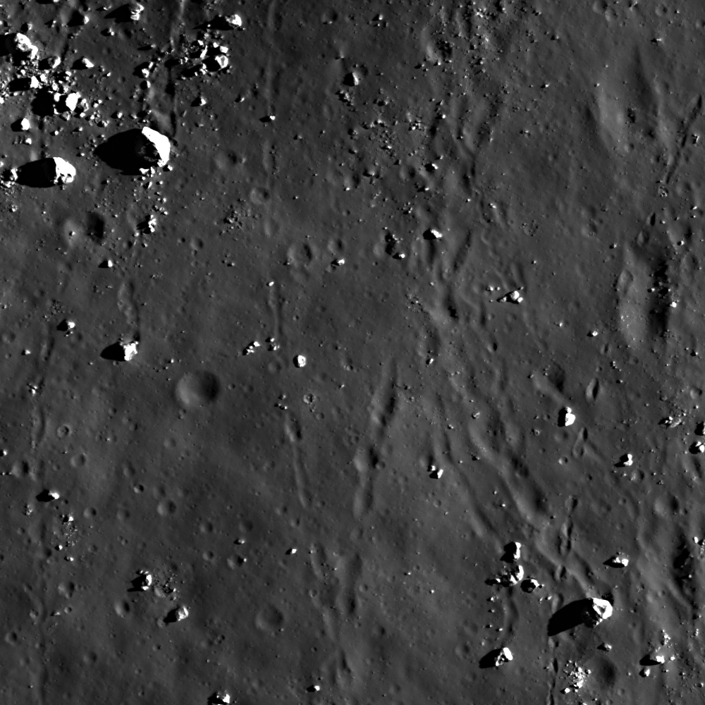
The grooves carved by boulders ejected at relatively low velocities are in many ways similar to the spotty tracks etched by boulders sliding, rolling, and bouncing down steep slopes. Also, boulder tracks (like these) often resemble the astronauts' footprints on the lunar surface, since both have relatively recently disturbed the soil in narrow paths. 

In honor of the 45th anniversary of the Apollo 11 lunar landing (July 20, 1969), revisit some of our previous posts about large boulders visited by astronauts:


Finally, revisit some of the best LROC images of the Apollo 11 landing site and see if you can find any large boulders. You should find very few large boulders, as the mission planners sought a low-risk site for the first Moon landing:

Monday, September 10, 2012

LROC: Boulder or Crater?

A roughly circular feature near Albufeda E, in the Moon's nearside southern highlands. A 140 meter-wide field of view from LROC Narrow Angle Camera (NAC) observation M175212953R, LRO orbit 10955, November 6, 2011; angle of incidence 44.11° at 40 cm per pixel resolution from 24.26 km overhead [NASA/GSFC/Arizona State University].
Sarah Braden
LROC News System

At first glance, the object in the center of today's Featured Image may look like a crater. The direction of illumination is from the right-to-left. What may look like a crater is actually a boulder about 29 meters across, which is just one meter shy of the length of a blue whale!

The lighting in the image and the circular appearance of the boulder may initially fool the human eye into interpreting this feature as a crater. However, there are several important clues in the image which clearly indicate that we are indeed looking at a boulder. Click on the image for a full resolution version. First, notice the other smaller boulders in the image. These are identified as boulders because they are irregular in shape, and relatively higher reflectance compared to the surrounding impact melt. Next, look at the direction of the shadows of the boulders. The boulders are all positive topographic features and cast shadows in the same direction. In contrast, a crater is a negative topographic feature. Looking at the full resolution version of the Featured Image shows many small craters in the surrounding impact melt. Look at these craters and compare them to the boulders until your eyes interpret the boulders as topographic highs and the craters as lows. If you still have difficulty, pick up your laptop and rotate the image 180 degrees (rotating your head might be more convenient).

NASA LMMP ILIADS simulated perspective of the area of interest projected from a point 40 km over the Moon and 100 km east. LROC Wide Angle Camera WAC Global Mosaic (100m) draped over LOLA digital elevation model shows Abulfeda E and its larger neighbor Abulfeda A. The red asterisk marks the location of the area seen at exceptionally high resolution in the LROC Featured Image released September 9, 2012 [NASA/GSFC/Arizona State University].
This field of boulders is located on the eastern side of the crater Abulfeda E, a Copernican-aged crater in the highlands, located at 16.769°S, 10.141°E and is 5.6 km in diameter. Many other large boulders are scattered around in the impact melt deposits surrounding the crater. Some of the boulders are partially buried by impact melt and debris.

Explore the entire NAC image HERE.

Related Posts:
"Boulder 668" at Descartes C
If you were an Astronaut, would you land here?
Weaving boulder trails on the Moon
Boulder on the Edge
Sunset Boulder
LROC QuickMap WAC-NAC mosaic of Albefuda E sampled at 8 meters resolution. From the WAC-derived and laser altimetry (LOLA)-derived DEM it appears the northeastern rim of Albefula E where the large boulder feature is situated (arrow), does not rise above the landscape, unlike an area further south, on the eastern slope,  where a large boulder field has accumulated [NASA/GSFC/Arizona State University].

Thursday, August 9, 2012

LROC: Sampling a Central Peak

Boulders originating from the central peak of Moretus crater litter the contact zone between peak and  crater floor. LROC Narrow Angle Camera (NAC) observation M185904952R, LRO orbit 12475, March 9, 2012; angle of incidence 72.71° at 0.95 meters resolution 45.42 kilometers over a field of view about 852 meters wide. See the larger LROC Featured Image HERE [NASA/GSFC/Arizona State University].
Lillian Ostrach
LROC News System

Groupings of boulders are commonly observed at the boundary between crater wall and floor, and tracing boulder trails through LROC images is always a fun pastime. However, the importance of identifying boulders with trails traceable to the boulder origin cannot be emphasized enough when considering future lunar exploration. Previous posts have mentioned the importance of the Station 6 boulder to the Apollo 17 mission because the remote sensing images coupled with the surface samples of the boulder allowed scientists to learn about the local and regional geology of the Taurus-Littrow landing site. The boulders in the opening image would tell a similar story, allowing future human explorers to sample lunar rocks that are otherwise very difficult to obtain.

"Tracy's Rock," the boulder visited at Station 6, near the third and final EVA of Apollo 17, December 13, 1972. Pictures taken by mission commander Gene Cernan of Harrison Schmitt, with a panorama of Taurus Littrow valley in the background, are among the more memorable from the program. LROC NAC observation M165645700RE, orbit 9545, July 18, 2011; resolution 47.7 cm per pixel from 40.6 kilometers [NASA/GSFC/Arizona State University].
Both left and right frames of NAC observation M184903952 are draped over the GLD100 digital terrain model and resampled at 8 meters per pixel resolution, using the LROC QuickMap web-based application, to allow a quick analysis of the boulders in the Featured Image in context with their 3800 meter trails, from the top of the central peak of Moretus to the 114 km-wide crater's floor [NASA/GSFC/DLR/Arizona State University].
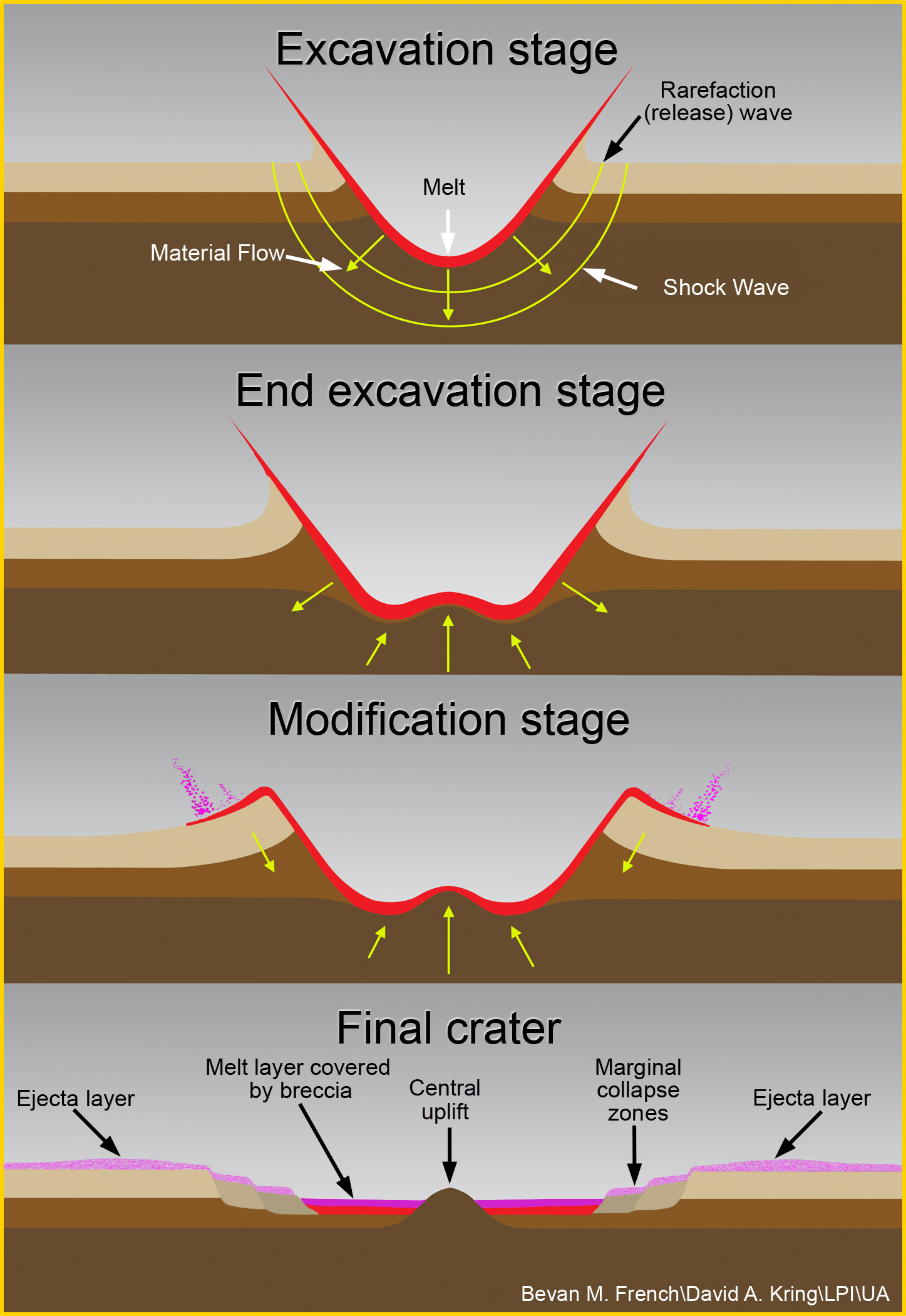
Moretus crater (70.631°S, 353.977°E, ~114 km diameter) is a complex impact crater found on the southern nearside. A beautiful central peak formed during the impact process, and over geologic time, the central peak was eroded by small impact events. As the rock in the central peak fractures and breaks, pieces travel downhill. Some boulders only made it partway down the central peak slope, while others descended all the way to the crater floor. As you can see by looking at the opening image (70.541°S, 354.221°E), the boulders that made it all the way to the crater floor range in size from about 10 m to 40 m in diameter and have different shapes. Where a boulder rests is dependent on many factors that include the size and shape as well as how the boulder was perturbed in the first place - maybe a small meteorite impacted the peak at just the right angle and velocity to dislodge the boulder or maybe a nearby impact created shock waves that jiggled the boulder loose. However, because gravity is ever-present, it is probable that at some point in the future, all the boulders on the central peak slope will fall.

LROC WAC monochrome mosaic centered on Moretus crater (70.631°S, 353.977°E, ~114 km diameter). Opening image noted by asterisk [NASA/GSFC/Arizona State University].
Boulders such as these are incredibly valuable for future exploration because they represent material from the central peak (pushed up from depth during crater formation) and their origin can be determined by tracing the trails uphill. Of course, it would be a mighty feat to ascend to the summit of the central peak of a crater like Moretus, Tycho, or Copernicus; however, lunar scientists would all probably agree that obtaining samples from a wide range of geologic units and regions on the Moon holds high scientific interest and merit and is absolutely necessary.

Put yourself in a future astronaut's shoes and traverse the full LROC NAC image, HERE. Which boulder (or boulders) would you want to sample and why?

Tuesday, July 17, 2012

"Boulder 668" at Descartes C

Fig. 1. A mere dimple in Apollo-era orbital surveys, this cracked, relatively large (around 53 meters on its long axis) boulder is nested on the north rim of Descartes C crater, lording over steep walls and an interesting strategraphy of the crater's frozen "over spray" of impact melt. It was tossed up from a depth and now sits high over the 4.3 km-wide, 900 meter deep hole from wince it came. LROC Narrow Angle Camera (NAC) observation M175172374R, LRO orbit 10,949, November 4, 2011; angle of incidence 42.42° from the east-northeast, at 40 centimeters resolution and from an altitude of only 23.9 kilometers [NASA/GSFC/Arizona State University].
Fig. 2. Earth's Moon, Waxing Full, April 1, 2012.
The area in yellow is shown at full resolution below,
in Fig. 3; and the full mosaic, by Yuri Goryachko,
Mikhail Abgarian & Konstantin Morozov of Belarus
can be viewed HERE. [Astronominsk].
Joel Raupe
Lunar Pioneer
 
A boulder that seems precariously balanced on the rim of 4.3 kilometer crater Descartes C (11.028°S, 16.273°E) was photographed by the Lunar Reconnaissance Orbiter Camera (LROC) Narrow Angle Camera (NAC), last year, as LRO happened to be maneuvering through a cycle of exceptionally low orbital passes. It was a fortunate happenstance for Larry F. Scott and myself, because we once suggested a spot only a few meters away for a notional unmanned landing target. Though our area of interest in 2008, the Descartes Formation, so far, appears only sporadically in the released LROC NAC catalog, the team at Arizona State, headed by Mark Robinson, could not have picked a better target for us when LRO was "skimming the Moon," last year.

In 2011, after maintaining the LRO primarily in a low,  near-circular polar orbit, between 35 and 65 km high, for nearly three years flight directors began a change-over to their preferred method for extending the record-breaking mission into 2015, to raise LRO's orbit above 100 kilometers, which they accomplished very early in January.

Their plan reduces, but does not eliminate, the demands on LRO's limited supply of propellant needed to maintain a minimally useful near-circular polar orbit. (See, "Skimming the Moon," September 6 2011.)

The Moon is anisotropic, or "lumpy," as Dr. Robinson reminded us, and its notorious mascons and mass-voids put an uneven drag on LRO's baseline altitude, and this requires well-planned periodic maneuvers to prevent the vehicle from crashing after only seventy days or so. But before raising LRO's orbit, twice in 2011 the spacecraft was maneuvered through brief periods when the low point in its orbit brought the spacecraft down to within 25 kilometers from the surface, and this allowed for some really spectacular and detailed surveys, including even more extraordinarily detailed examinations of the Apollo landing sites.

These close passes also presented opportunities to gather other NAC observations to within 40 cm per pixel, and among the smaller NAC footprints delivered up in March was a nearly complete cross section of Descartes C, a typical small crater situated in a familiar, though unusual, location in the Southern Highlands.
Fig. 3. At full resolution, a 550 km field of view marked off with by a yellow rectangle in Fig. 1, up above, directly centered on the bright Descartes albedo 'swirl;' viewed through a better-than-average telescope. Slightly above and to the left (northwest) of the swirl both North and South Ray craters can be seen, making the Apollo 16 landing site one of the easiest to "pick out" with the mind's eye, even with a telescope back on Earth. Again, the really breathtaking full mosaic by Yuri Goryachko, Mikhail Abgarian & Konstantin Morozov of Belarus, can be viewed HERE. [Astronominsk].
Descartes C marks one indefinite extent of the Descartes formation, a small field of furrows and segmented hills stretching to the crater's northwest, topped with a distinct and bright, but small and amorphous "swirl" resembling a fresh snowfall. This 400 sq. km. patch of optically immature surface, nested inside a remarkably intense local magnetic field, rates higher than average scientific interest.

Our 2008 proposal included a teleoperated robotic ground survey beginning at Descartes C, lengthwise, through the heart of the unusual terrain and swirl, and its lunar magnetic anomaly, perhaps eventually emerging near the landing site of Apollo 16. Today we have an additional stop on that 'fantasy tour' a short distance from our originally proposed landing site. 

Fig. 4. LROC QuickMap (250 meter resolution) view, also centered on the 'anomalous' albedo and the Descartes Formation, seen here mixed with the false color of the LROC Wide Angle Camera (WAC)-derived topography. Again, a yellow rectangle marks off the field of view visible in Fig. 7, below. Note the "centipede" chain of half-kilometer long hills, training to the northeast from Descartes C. That feature is the most obvious distinction setting the formation apart from nearly every other spot on the Moon's surface. The age and wear of Descartes crater becomes more obvious as one closes in on the area [NASA/GSFC/DLR/Arizona State University].
Fig. 5. Simulated slightly oblique view over Descartes (29 km), from the Cayley Formation plains explored by Apollo 16 in the northwest, 80-plus kms southeast over the Descartes Formation and its swirl albedo to the highly-eroded main Descartes crater in the south. LROC WAC mosaic, from observations collected in three sequential orbital passes December 3, 2011, averaging 52 meters resolution, from 38 km, 70° angle of incidence [NASA/GSFC/Arizona State University].
Fig. 6. "Figure 2" from "Correlation of a strong lunar magnetic
anomaly with a high-albedo region of the Descartes mountains
,"
by Richmond, Hood & Halekas, et al. (GFL, V. 30, # 7, 2003)
"Contour map of the two-dimensionally filtered magnetic field
magnitude (in nano-Teslas, or nT) at an altitude of 18.6 km in the
vicinity of the Apollo 16 landing site (boxed cross). The photo-
graph is a portion of Apollo 16 mapping camera frame 0161
(AS16-M-0161). Several exposures of the Cayley formation (CF)
and the adjacent Descartes mountains (DM) are indicated"
[Lunar Prospector Magnetometer data, 1999].
Our paper broadly outlined a very notional multipurpose robotic lander-rover mission in support of the proposed International Lunar Network (ILN). We advocated discovery of ground truth about one lunar magnetic anomaly in particular, and its well-known relationship with a bright surface swirl marking. Also, we wanted to add our small voices to the chorus recommending a cautious approach to the scientifically valuable (and remarkably fragile) artifacts of Apollo, "from the ground, and from a distance." Of course, since then, a growing chorus has out-grown much need for small voices. The NASA Human Exploration and Operations Directorate's recommendation "to space-faring entities," released in July 2011 explicitly spells out the agency's similar concern.

Interest in lunar swirl "patterns" appears as strong as ever, and may be growing. It's become difficult to remember that little more than a decade ago the anomalous albedo 'swirls' today associated with features near Descartes and nearby Airy craters (both easily visible from Earth) were still little recognized.

Because the more famous, more aesthetically pleasing swirl fields at Reiner Gamma, Mare Ingenii and Mare Marginis have been properly associated with local crustal magnetism the recognition of anomalous optically immature regolith elsewhere on the Moon was "reverse engineered."

In the case of smaller 'smudges' near both Airy and Descartes craters, for example, acknowledgement as true swirls has depended on the fleeting detection of magnetic fields at both locations late in the Lunar Prospector mission, not long prior to its eventual crash landing in Shoemaker crater, near the Moon's south pole, in 1999.

For many years after the demise of that small spacecraft researchers continued to tease more and more data from a telemetry stream that today seems remarkably sparse when compared with oceans of data continuously relayed back from LRO. Magnetometer readings from only two low altitude fly-over encounters by Lunar Prospector with the Descartes Formation delivered sufficient evidence to demonstrate a tightly wound mini-magnetosphere existed over the bright albedo swirl, upon on the unusual hills between Descartes crater and the landing site of Apollo 16. The relatively small magnetic anomaly may be the most intense crustal magnetism on the Moon (See Fig. 6).

Fig. 7. The swirl painted on the unique contours of the Descartes formation, just beyond the eroded northern rim of the main crater, is not as striking a in photographs taken from orbit, such as the picture taken from Apollo 14 and 16, or the LROC Wide Angle Camera images from close orbit. The estimated strength of the very localized magnetic field, as measured from Lunar Prospector from an altitude of 18.3 km in 1999, is indicated in nano-Teslas (nT).  LROC WAC observation M177535094C (604nm), LRO orbit 11299, December 3, 2011; angle of incidence 69.57° at 52.3 meters resolution from 38.27 km [NASA/GSFC/Arizona State University].
It's difficult to recall any controversy over the origin (and natural sustaining) of optically immature regolith, at Reiner Gamma, for example. Nevertheless, some very respectable researchers still insist the swirl albedo patterns are the result of scant, recent encounters with comets. The most detailed crater counting methods have all but ruled out any swarming impact origin to the Reiner Gamma swirl. The magnetic field strengths associated with many of these fields are, in some cases (e.g., Descartes and Gerasimovich), sufficiently intense to refract solar wind, but these fields are too small in scale to refract their less frequent but cumulative encounters with the most energetic and heaviest cosmic radiation.

Remote sensing of the Descartes swirl indicates the presence, in abundance, of nanophase iron in the surface grains, thought to be at least one of the ingredients of optical maturity, and a strong indicator of the transparency of the local magnetic field to iron nucleons, a big part of the cosmic ray mix. (Unless, of course, lunar micro-grains implanted with nanophase iron arrived at the site by another mechanism.)

Swirl fields and their associated magnetic fields along the north rim of 4 billion year-old South Pole-Aitken basin are each individually, very closely associated with the antipodes of the most easily-recognized nearside impact basins. The lovely swirls of Mare Ingenii, for example, are nearly on the direct opposite side of the Moon from Mare Imbrium, and the jumble of swirls in and around Goddard crater and Mare Marginis are similarly on the opposite side of the Moon from Mare Orientale.

Because these basins are still believed to be between 3.85 and 3.1 billion years old, respectively, the ages of the magnetic fields clustered at their antipodal foci are thought to be at least as old as those impacts. (But, it should be noted here that no basin-forming impact has yet been associated with the antipodes of smaller nearside swirl patches near Airy or Descartes craters, nor, for that matter, with the unique and much more widespread Reiner Gamma swirl within Oceanus Procellarum.)

The persistent mystery of lunar swirl patterns is still the longevity of "optical immaturity," brightness at the lunar surface that constitutes the swirls themselves. As soon as these "patterns" were associated with local crustal magnetism it was quickly suggested that some refraction, even reversal, of the relentless solar wind kept the surface under their influence from being "darkened." Experiments with high-energy radiation bombardment under laboratory conditions, the energetic variety of cosmic rays that can't be steered away by these fields, appears to indicate that, eventually, any lunar regolith will mature, after only 900 million years or so. As the upper few centimeters of the lunar surface is eventually pulverized into abrasive powder, the process of maturation by hard radiation gets underway.

So how is the optically immature regolith of these swirls kept fresh?

It was our suggestion in 2008 that the answer rests in the very slow migration of lunar dust. The supply of fresh, optically immature dust is continuously supplied by the gardening of impacts, both large and very, very small. And then, at the beginning and end of a daily cycle of charging and discharging of these smallest grains, these nested magnetic fields (which are likely to have more than one kind of origin) preferentially lose and accumulate both mature and immature dust, dividing up both the levitation and fallout along opposing polarities, in a very slow process that still manages to out pace the relentless process of "reddening" or "darkening" by hard radiation, admittedly a less frequent kind of radiation than the bulk of solar wind, but just as relentless.

Which brings us to "Boulder 668," on the north rim of Descartes C, a crater that is itself nested on the north rim of a far more ancient crater, Descartes. The number "668," by the way, marks the boulder's elevation, according to a rough reading of the LROC QuickMap website and its WAC-derived digital elevation model. Obviously there's nothing official about the name.

The boulder reminds us of "House Rock," as well, its smaller cousin ejected out from the North Ray crater impact, and at one time closely examined and sampled directly by John Young and Charles Duke in 1972 (and only about 80 km away from Boulder 668 and Descartes C).

Charlie Duke samples a shatter cone formation in Outhouse Rock, a large fragment shed off the southern end of House Rock, at North Ray crater during the third and final EVA of Apollo 16.  AS16-116-18649 [John Young/NASA/JSC/ALSJ].
The choice for the Apollo 16 landing site, the only manned visit to the lunar highlands, and a landing site referred to as "Descartes," was made in the sincere belief that the apparently unique topography of the Descartes Formation strongly indicated the area to be volcanic in origin. Mission planners were disappointed to discover, almost immediately after Apollo 16 landed, however, no obvious sign of volcanism.

On their second EVA, Young and Duke drove up the slopes of "Stone Mountain," the northwest extreme of the Formation, and looked high and low for a sample uncontaminated by ejecta from nearby South Ray crater.

On their departure from the Moon Captain Young remarked about "still mysterious Descartes," unaware then of the tantalizing evidence they had almost inadvertently uncovered. Their haul of samples proved every bit as valuable as any from the Apollo missions to the overall body of lunar research in the decades following Apollo.

Almost as a footnote, their magnetometer readings proved to be the strongest ever detected on the lunar surface.

In the years since Apollo it's become generally accepted that the unique topography of the Descartes Formation, completely apart from its swirl albedo and magnetic personality, "probably" originated with the impact that formed Mare Imbrium, whose influence is so clearly etched into the landscape of the region, so obviously radiant from the center of that basin. Others say the Nectaris impact, before Imbrium and closer by, tossed up what may turn out to have been a very large, semi-coagulated chuck of impact melt that quickly fell back to the Moon more or less intact, immediately settling in and around existing crater remnants.

Also generally recognized as perhaps the oldest, remarkably intact feature of area is old Descartes itself, an apparently very worn and "tortured" crater differs in many ways from worn craters of apparently the same age elsewhere on the Moon. As worn as it is, it's concentric rings have, for the most part, not been erased (again, remarkably) appear more like a sand castle after the first wave of an incoming tide, without the notched rims characteristic of many largely intact older craters. Descartes seems over washed, with an infill of material around it which consists of more than just the convoluted terrain of the Descartes Formation plateau to its north.

In any case, Descartes, by all appearances, hollowed out a place in the ancient Southern Highlands, perhaps prior the supposed late heavy bombardment.

Though Descartes is now mostly "back-filled," today, more likely from a steady bombardment that erased many of its nearby contemporaries, the impact that formed the old crater tossed up its deepest excavated material and deposited this around its smoothed rim. Some time after this, apparently not from volcanic vent, the half-kilometer-scale chains of hills and furrows of the Descartes Formation arrived on the crater's north exterior, forming or deforming a plateau. Under that material, or, more likely, within the material itself is a very intense, very local crustal magnetic field. That field has since interacted with the slow process of lunar dust charging, discharging, preferential accumulation and levitation, dust migration and the forces driving optical maturity, to form the bright swirl within the magnetism's exceptionally strong influence.

Eons pass, and along came the progenitor that excavated Descartes C crater at the crossroads of all this ancient history. In its formation there was tossed up along its rim the long-buried material once tossed up from an even greater depth by Descartes. "Boulder 668" may represent a bulk of older material less shock metamorphosed than the melt splashed over its rim and pooled on its small floor. The boulder poses questions more, perhaps, than it answers.

In 2008 we fancifully suggested approaching the artifacts of Apollo 16 from the ground, and from a distance of 80 kilometers, all starting with a landing less than 100 meters from the north edge of Descartes C and "Boulder 668." Showing great faith in the future of robust teleoperated robotics we suggested being driven to reconnoiter the Descartes Formation to closely examine "still mysterious Descartes," its magnetic field and albedo. Now, thanks to this remarkably close examination of our proposed landing site we have our fantasy rover's first stop picked out for us for us to examine, and a reason to linger around the perimeter of Descartes and Descartes C a little longer than originally planned.

Fig. 8. Descartes C (4.32 kilometers, centered near 11.028°S, 16.273°E), nested on the deeply eroded rim of Descartes proper, has gradually been seen in increasing detail following multiple LROC Narrow Angle Camera (NAC) observations over LRO's three years in lunar orbit. No longer just a bright crater in a bright region, having excavated an unusually complex area, Descartes C is itself richly complex, with impact melt on steep walls and debris flows into a small kilometer-wide melt-flooded floor. The boulder at 668 meters elevation, high on its rim, was excavated from below the melt pond 750 meters below [NASA/GSFC/Arizona State University]

Wednesday, July 11, 2012

LROC: Weaving boulder trails on the Moon

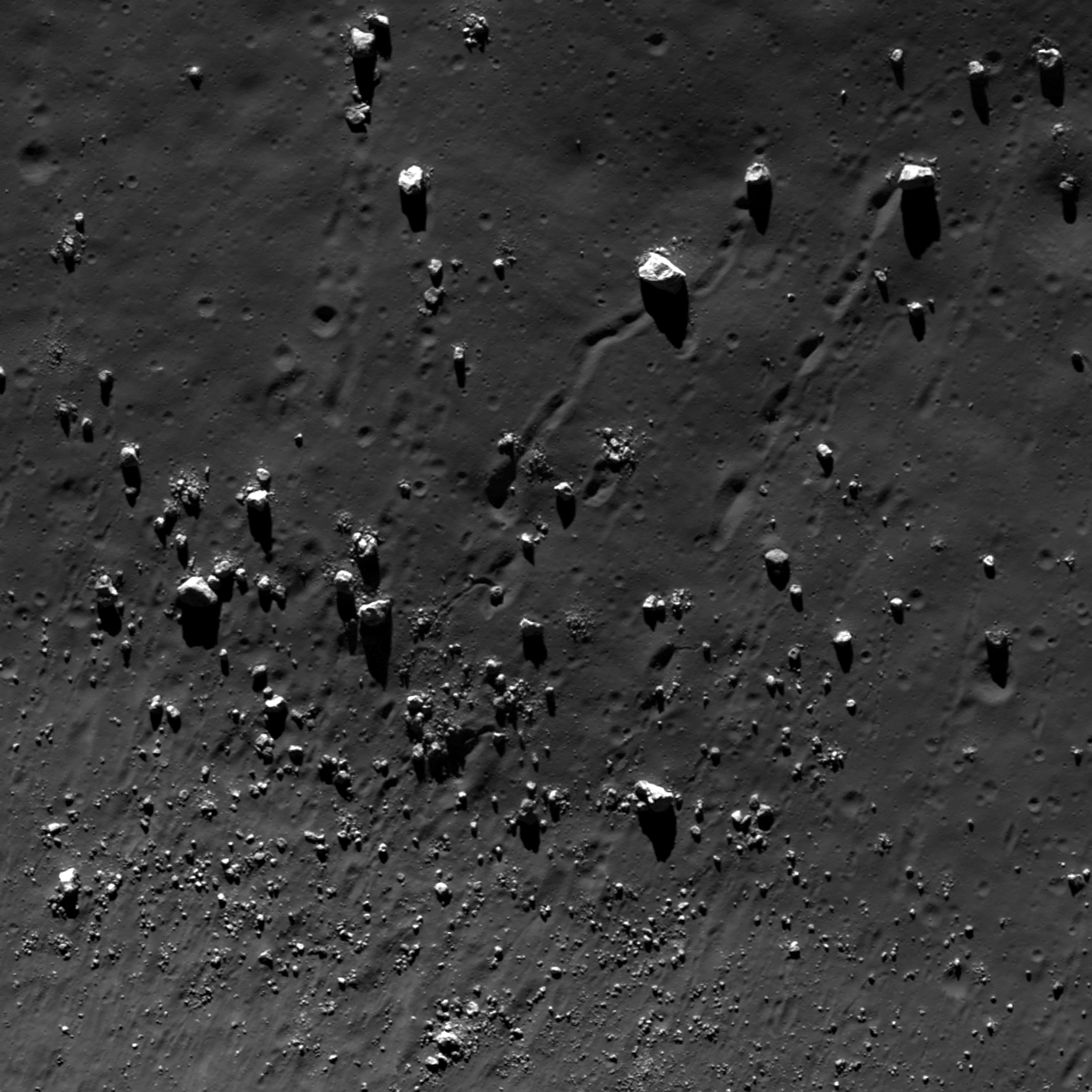
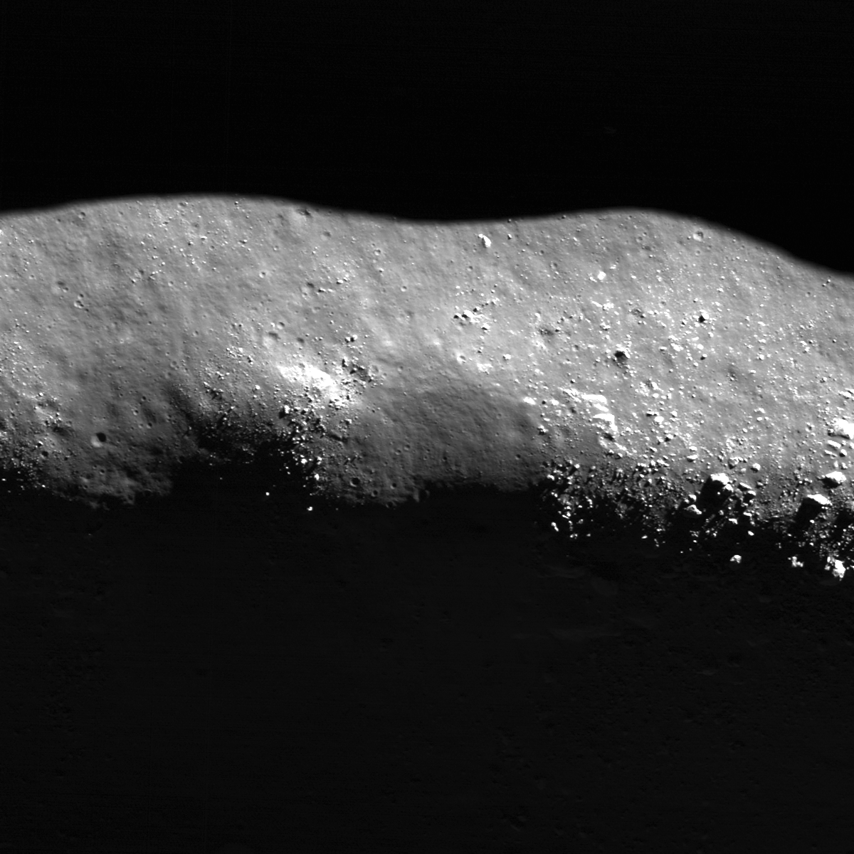
Boulders have rolled downslope from the central peaks of Tsiolkovskiy crater, leaving a wide variety of trails in their wake.  Some boulders have come to a stop and several trails curve beyond the field of view further downslope. A 500 meter field of view taken from LROC Narrow Angle Camera (NAC) observation M176791784R, LRO orbit 11189, November 24, 2011; angle of incidence 62.6° at 0.5 meters resolution, form an altitude of 42.12 km. View the larger LROC Featured Image HERE [NASA/GSFC/Arizona State University].
Drew Enns
LROC News System
 

A variety of geologic processes form boulders on the Moon. Some boulders are thrown out as ejecta during the impact process. Other boulders are found at the top of wrinkle ridges; members of the LROC Science Team have identified boulder populations atop lava flows and other lunar volcanic landforms; still other boulder fields are found on the floors of craters after eroding out of outcrops on the walls or central peak. Of course, when we say “erosion” in the context of lunar geology, we don't mean erosion the way one would use it for terrestrial geology. The Moon has no atmosphere, no rain, and no weather, so the main processes that would cause this sort of erosion on the Moon are the constant flux of bolide impacts, and to a lesser extent, seismic activity. So which of these processes produced the boulders in today's Featured Image? Looking at a context image helps.

Interior of 184 km-wide Tsiolkovskiy crater, from the Global LROC Wide Angle Camera (WAC) 100 meter monochrome mosaic, context with the location of the field of view taken from LROC NAC frame M176791784R (designated by the yellow arrow) on the south terraces and slopes of the central peak complex highlighted in the LROC Featured Image released July 11, 2012 [NASA/GSFC/Arizona State University].
The Featured Image shows an area near base of Tsiolkovskiy crater's central peak. Tsiolkovskiy crater, located at 20.38°S, 128.97°E, is filled with mare basalts and has a prominent central peak. The boulders have rolled downhill from outcrops of rock at higher elevations, closer to the summit of the central peak. Central peaks are thought to be made up of the deepest materials exposed during an impact. So, these boulders present an excellent opportunity to enable future astronauts to sample materials from the deep lunar crust.

Under a higher sun (angle of incidence 46°) the area on the south central peak of Tsiolkovskiy comes out of the shadows, also at a slightly higher resolution (89.3 meters), from a monochrome (604nm) mosaic stitched from a series of sequential orbital passes averaging 60 km in altitude, August 17, 2010 [NASA/GSFC/Arizona State University].
But Tsiolkovskiy crater is not just interesting because of its large central peak. Tsiolkovskiy is also partially filled with mare basalt material, a relatively rare occurrence on the farside of the Moon. The combination of accessible deep crustal materials and mare basalts within traverse distance of each other make Tsiolkovskiy crater a high-priority target for future human and robotic lunar exploration.

Explore more of Tsiolkovskiy's central peak and find the source of the boulders in the full LROC NAC frame, HERE.

Some Related Posts:
Frozen in Time (June 9, 2011)
Rolling, Rolling, Rolling (May 1, 2012)
A Recent Journey (February 7, 2012)
Sampling Schrödinger (August 17, 2011)
Archimedes - Mare Flooded Crater! (March 2, 2011)

Thursday, March 1, 2012

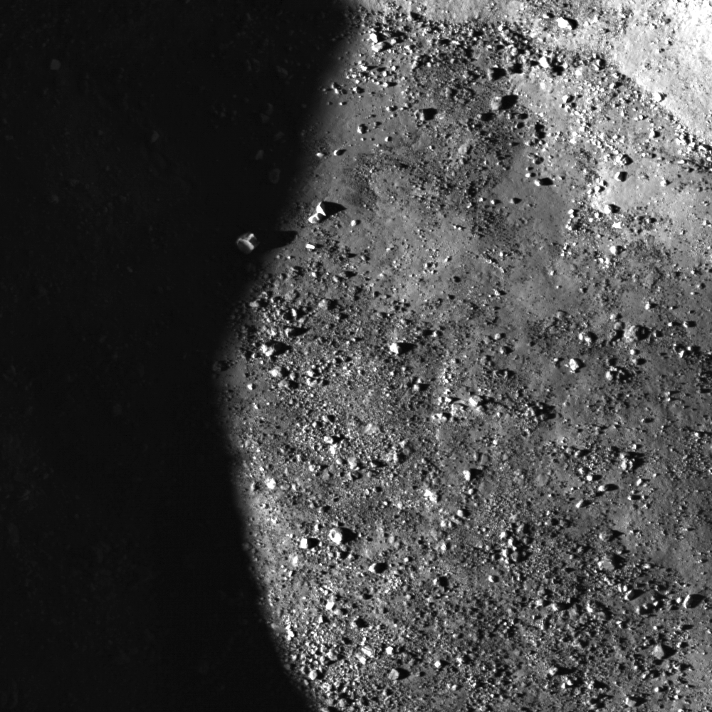
LROC: Sunset Boulder

A tall boulder on the floor of a crater catches a few last rays of light at sunset. Image width is 356 meters, LROC Narrow Angle Camera (NAC) observation M134442210R, orbit 4946, July 22, 2010; angle of incidence 68.31° with a resolution of 0.61 meters per pixel from 59.43 kilometers altitude. View the field of view in the LROC Featured Image, HERE [NASA/GSFC/Arizona State University].

Sarah Braden
LROC News System

The floor of this 3.5 km diameter crater (located at 9.900°N, 113.574°E) is covered with impact melt and boulders. At the time the LROC NAC took this image, the Sun was setting. One of the tallest boulders in the Featured Image was able to catch light from the setting Sun, although the rest of the surrounding terrain was already completely in shadow.

Look closely at the shadowed area on the left side of the image. Can you see the boulders on the shadowed side of the image? The Moon has no atmosphere to scatter light, so a shadowed area on the Moon is as dark as night. However, the LROC NAC is sensitive enough to detect the low light levels being reflected and scattered by other sunlit rocks in the crater floor. That little bit of light makes the shadow not completely dark, and therefore you can still see boulders in the shadowed area!

Why are shadows on the Moon so dark? Think about the case on Earth, where there is an atmosphere. Go outside on a sunny day and look into a shadowed area. Maybe it's the shadow of a large building, or maybe your own shadow! Is your shadow completely dark (like middle of the night with no Moon dark)? No, because our atmosphere scatters light into the shadow. However, if you were an astronaut on the Moon, your shadow would be as dark as night since there is no atmosphere. Aren't atmospheres great?

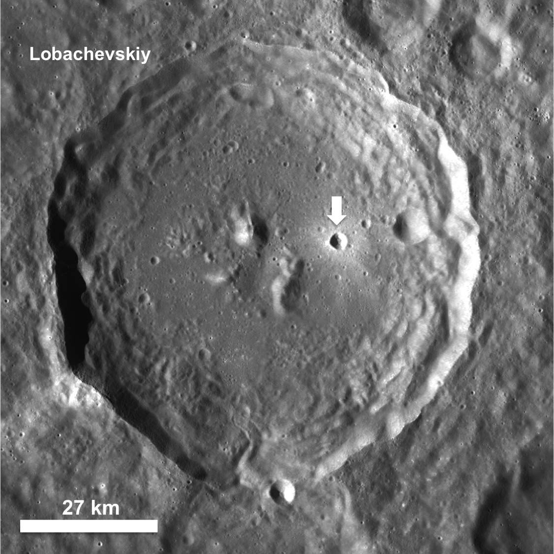
LROC Wide Angle Camera (WAC) context mosaic draped over LRO LOLA laser altimetry data, viewed through the NASA (LMMP) ILIADS application, simulates an oblique view of the farside highlands crater Lobachevskiy from 50 kilometers altitude over the lunar equator. The yellow arrow points to a bright younger crater within which is the field of view shown in the the LROC Featured Image released March 1, 2012. The context image accompanying that release can be viewed HERE [NASA/GSFC/Arizona State University].
This small, fresh crater is located in the eastern half of the floor of the crater Lobachevskiy. Lobachevskiy is an 84 km diameter crater located on the farside of the Moon at 9.9°N, 112.6°E. Explore the entire NAC frame to see more of the floor of Lobachevskiy.

Related Posts:
Perched Boulders
South Pole Illumination Map
Bhabha sinks into the shadows
Lunar South Pole: Out of the Shadows

Wednesday, October 26, 2011

LROC: Posidonius Y marks the spot

A boulder perched on the north rim of a Copernican Age crater situated directly atop the Dorsa Smirnov wrinkle ridge in Mare Serenitatis. LROC Narrow Angle Camera (NAC) observation M168041107L, LRO Orbit 9898, August 15, 2011; resolution 0.25 meters per pixel, width of the field of view is only 145 meters [NASA/GSFC/Arizona State University].

Sarah Braden
LROC News System

Posidonius Y is a 2 km diameter Copernican Age crater located at 30.04°N, 29.4°E, in the upper northeast section of Mare Serenitatis. The crater is remarkably bouldery, which is a indication of a relatively young age. The boulder seen on the rim in today's Feature Image is about 25 meters long from stem to stern (about half the length of an Olympic sized swimming pool).

Since Posidonius Y is superposed on the wrinkle ridge system known as Dorsa Smirnov, the crater is also relatively younger than these tectonic features. The WAC context image below shows the beautiful combination of mare basalt volcanism, tectonics, and impact cratering that shape the lunar surface.

Reduction from a 60 meter per pixel 604 nm mosaic from LROC Wide Angle Camera (WAC) observations in LRO Orbits 4502 - 4512, June 17 - 18, 2010. Posidonius Y is aptly named,  at a "Y" shaped intersection of the Dorsa Smirnov wrinkle ridge system in northeast Mare Serenitatis[NASA/GSFC/Arizona State University].

The bright crater is not quite visible, though the Y in Dorsa Smirnov at lower center, in northeast Mare Serenitatis where it's perched (just west of its complex namesake, this is a typical amateur telescopic view of the Moon six and a half days after a New Moon. This is the first of two opportunities to view the ridge system, in the long shadows of local morning and evening. Between, under a higher Sun, the bright ejecta field stands out as the subtle ridge system fades into the background.

Explore the entire NAC frame!

Related Images:
Layers in Lucian Crater
Farside Impact!
Recent Impact in Oceanus Procellarum

Wednesday, October 12, 2011

LROC: Perched Boulders

The crest of a linear floor fracture wall is intermittently covered by boulders and smoothed terrain. The largest boulders (lower part of image) are around 30 meters across. LROC Narrow Angle Camera (NAC) M159065590R, LRO orbit 8575, May 3, 2011; from top to bottom (north is to the right) field of view is 960 meters. See the full size LROC Featured Image HERE [NASA/GSFC/Arizona State University].

Lillian Ostrach
LROC News System

Boulders are found nearly everywhere on the Moon, and LROC NAC images allow scientists to study boulder populations. Why would anyone want to spend their time looking for boulders? Boulders represent erosional products on the Moon and can be used to help interpret geologic features and derive a geologic history for a region. Presently, erosion on the Moon largely occurs as a result of micrometeorite bombardment (for a short discussion, check out the Relative Age Relationships Featured Image). For example, the presence of boulders surrounding a 100 meter diameter crater in the mare suggests that when the crater formed, the impactor punched through the layer of regolith and excavated bedrock. Similarly, the boulders perched on wrinkle ridge crests and on the walls of sinuous rilles represent bedrock that is eroding out of these features over time. Perhaps the density or frequency of boulders on wrinkle ridge crests may be used to determine relative ages between features within a region. However, because erosion can be controlled by rock type and how fractured or deformed the rocks are, scientists need to carefully interpret their observations of boulder populations.

Today's Featured Image highlights boulders perched on the crest of a linear floor fracture wall within the central peak ring of Schrödinger basin (73.22°S, 133.82°E).Many of the boulders are around 5 to 10 meters across (although some are smaller), but near the lower edge of the image above the boulders are much larger, around 20to- 30 meters across. There are also more large boulders exposed downslope of the 20 - 30 m boulders compared to other boulder clusters. Why is there an apparent discrepancy?

To answer, we should consider several things. First, we must determine whether the boulders originate from the crest (in-situ) or are impact-derived (that is, they deposited by a nearby impact). Taking a look in the full Narrow Angle Camera frame, there is an approximately 7 kilometer in diameter Eratosthenian-Age crater about 30 kilometers north of the fractures. However, while there are boulders around 30 meters in size located in clusters surrounding the crater the continuous ejecta blanket (for a crater generally) is confined to one crater diameter. Since the fractures are much farther than 7 km from the crater the boulders on the fracture wall crest are probably not derived from that crater.

What about other nearby craters? While there are several craters nearby (check out the LROC WAC context below), none of them are particularly fresh nor bouldery. Based on these observations, the boulders probably orignated in-situ as a result of erosion. Thus, the apparent discrepancy in boulder sizes along the crest may be related to the deformation of the rock during fracture formation and mare flooding of Schrödinger. Right now, though, we do not have a definitive answer; however, to examine this topic further, we would need to complete a survey of boulder sizes and distributions along the length of the fractures. Even then, we may not be able to explain why some boulder groupings contain larger sized boulders.

LROC Wide Angle Camera (WAC) monochrome mosaic showing and area located slightly north of the center of Schrödinger basin with the northern portion of the central peak ring near the top of the image. (Asterisk notes the location of today's Featured Image image.) View the full size LROC WAC context mosaic showing the deep interior of Schrödinger basin HERE [NASA/GSFC/Arizona State University].
Now that we found evidence to suggest that the boulders are probably related to the erosion of the crest of the fracture wall we need to try to explain the smoothed portions of the crest.

In the opening image, there are boulder clusters separated by smoothed areas. What is this smooth stuff? Regolith, the lunar soil, is generated by impacts - big and small - and over time accumulates on the lunar surface. When a surface is covered entirely by regolith, it looks smooth and sometimes has a textured appearance. So, these smooth regions are accumulations of regolith on the wall crest and also along the fracture walls. But then why isn't the crest all smooth, or all bouldery? The illumination and where the shadows lie across the ridge crest may be a clue; these smooth areas have shadows that are not in-line with the bouldery portions of the crest and look like they may be lower topographically than the bouldery parts or may be less steeply sloped than the parts of the crest where boulders are. Again, taking a look at the full NAC frame may help, too, because in the full image there are other smooth regions that are associated with obvious changes in topography and slope along the crest. If we then assume that the smoother regions have a shallower slope at the crest, we may have an answer: boulders are more likely to form along steep slopes of crests where the slope break is steepest (here along the fracture wall crest, or along wrinkle ridges). This is only one explanation based on visual explanation, but we really should take some time to measure slopes in a NAC-derived Digital Terrain Model (DTM) to be certain that we are on the right track.

Friday, October 7, 2011

LROC: At the top of an avalanche in Langrenus

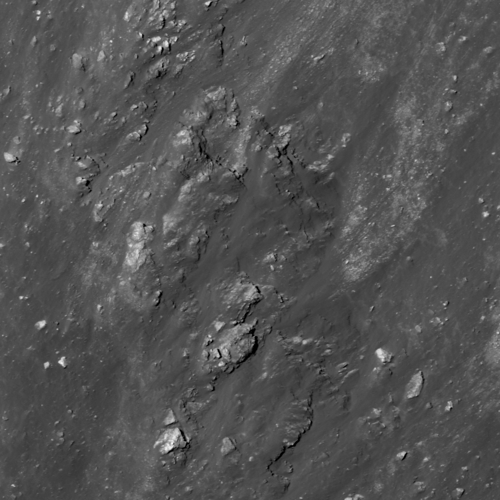
Bedrock benches near the top of an avalanche on the central peak of Langrenus (8.79°S, 61.22°E). LROC Narrow Angle Camera (NAC) observation M139504224L, LRO orbit 5692, September 19, 2010; downslope is to lower left, image field of view is ~302 meter. From the full size LROC Featured Image HERE [NASA/GSFC/Arizona State University].

James Ashley
LROC News System

Do these "stair steps" represent true rock layers that somehow survived the compression and uplift which accompanied the formation of this central peak, or are they expressions of jointing in the fractured bedrock? Many examples of lava flow layering have been identified within mare deposits across the Moon (see related Featured Image post links below), but these have been as exposures in crater walls or the sides of vertical pits within the mare. Rock layering in a central peak may be more difficult to see.

The physics of impact cratering describes the way a rock may respond to high-energy shockwave formation and decay. The central peak of a complex crater represents material that had once been deep beneath the lunar surface, but was later exposed by the rebound that followed compression during the impact event. The phenomenon of central peak formation in rock targets is often likened to the way a droplet of liquid creates a splash in a saucer. It represents a kind of snapshot of the splash phenomenon that results from impact into a target with an appreciable gravity field.

While considerable deformation of target layers is expected, vestiges of that layering can survive impact and become preserved in the central peak. The features in today's image are exposed by erosion caused by landslide activity, and reveal the bedrock that once lay underneath (see context image below).

The wider view of the NAC frame shows granular material which flowed down (toward the lower left) the steep central peak wall and away from the featured bedrock in Langrenus. From the full width of LROC NAC M139504224L, image field of view is ~2.0 kilometers wide. View the full size LROC context image HERE [NASA/GSFC/Arizona State University].
The central peak of Langrenus and surrounding crater floor shows the location of the ridge and slope highlighted in the LROC Featured Image. From LROC Wide Angle Camera (WAC) observation M131249971CE (566 nm Band), LRO orbit 4475, June 15, 2010; from an altitude of 38 km, resolution 55 meters per pixel, illumination from the east with an incidence angle of 76.63° [NASA/GSFC/Arizona State University].
From an early local morning illumination to late afternoon brings the highlighted slope out of shadows though unfortunately from an orbital pass at higher altitude. LROC WAC observation M134788704CE (566 nm Band), LRO orbit 4996, July 26, 2010; from an altitude of 50 kms with a resolution of 70 meters per pixel, illumination from the west with an incidence angle of 64.48° [NASA/GSFC/Arizona State University].
On the Moon, rock jointing can be caused by tidal stresses working over time to weaken the rocks. Once jointed, the fragments are more easily eroded, and tend to break away in blocks - which may or may not give the appearance of true stratigraphic layering. Because the energy of impact is expected to at least partially destroy whatever fine structure might have been in pristine layers, it may be difficult to differentiate the two types of stair step benches in an outcrop. The WAC mosaic shows the central peak and Langrenus crater, with the Featured Image location indicated as the red square.

From the LROC Quickmap WAC mosaic shows Langrenus crater with its greater anatomy, field of view is roughly 180 km [NASA/GSFC/Arizona State University].
Langrenus at its best when seen through an earth-bound telescope, in this case a Celestron C14 XLT under the steady guidance of Mario Wegand (www.SkyTrip.de), who swept up this view January 12, 2009 (Central European Time) from Offenbach am Main, Germany.
Take a look at the full NAC image.

There are many details visible in the Langrenus crater floor deposits that warrant further scrutiny. What other clues might aid in determining whether this apparent laying is the result of lava flows or of rock jointing? Related Featured Image posts include Layering in Euler Crater, Layering in Messier A, and Rock Avalanche in Robinson Crater.

Langrenus stands out at the center of the bow, half way between limb and terminator, in this three-and-a-half-day-old Crescent Moon. From a 5000 pixel deep mosaic assembled by Mario Weigand, captured the early evening of January 29, 2009.