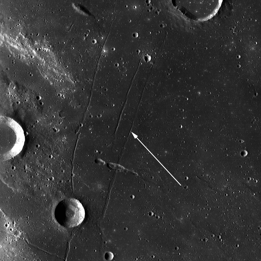
Showing posts with label Rilles. Show all posts

Thursday, June 5, 2014

Rima Seuss, rough around the edges

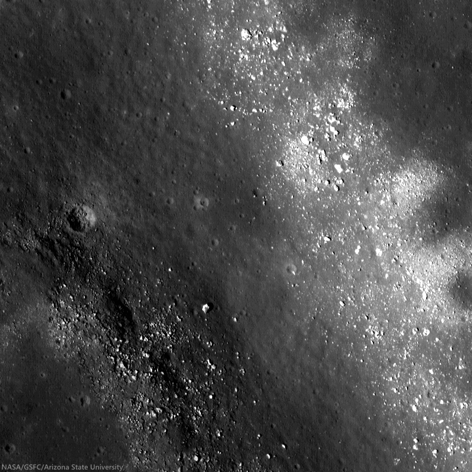
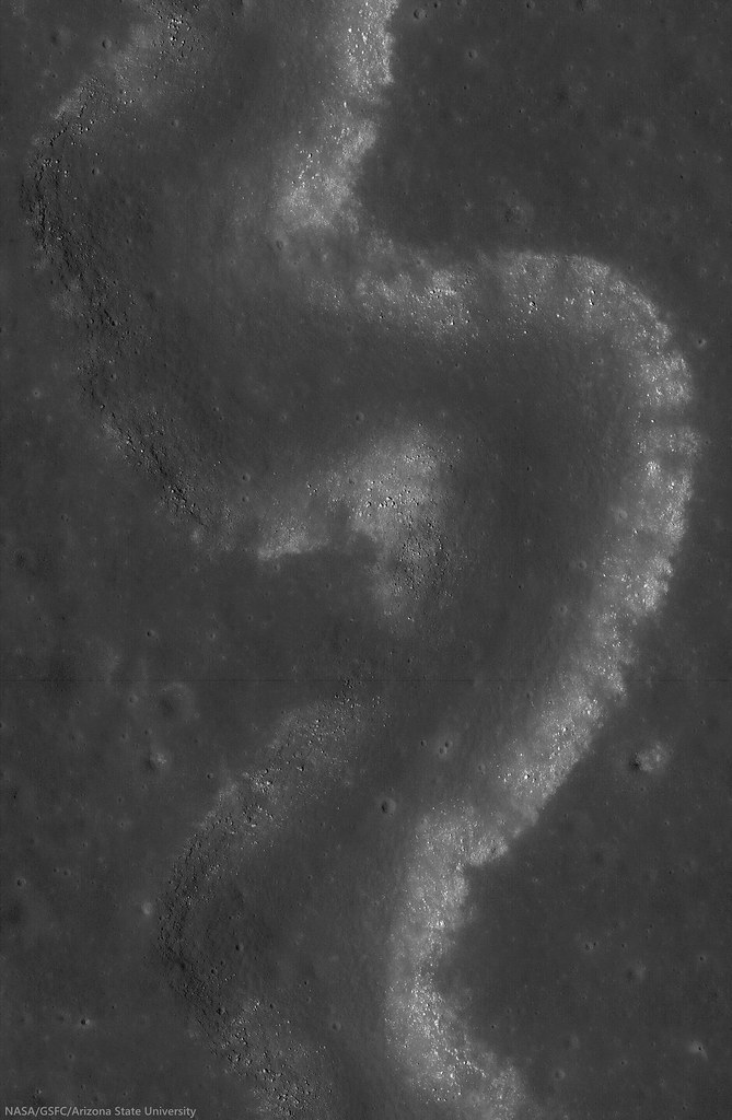
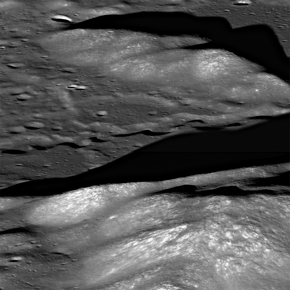
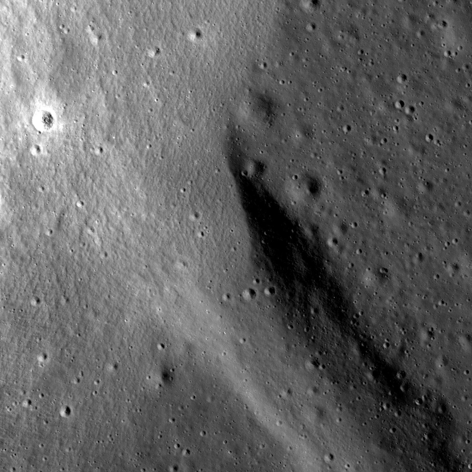
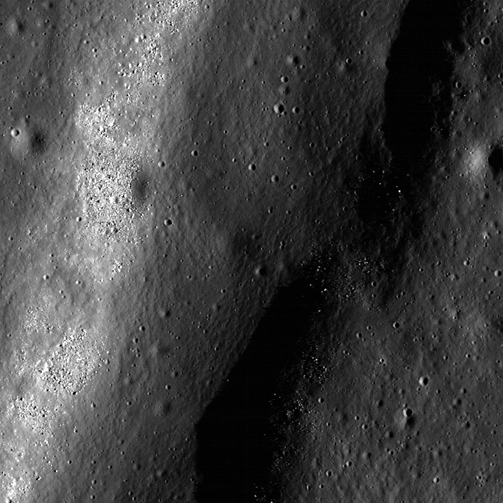
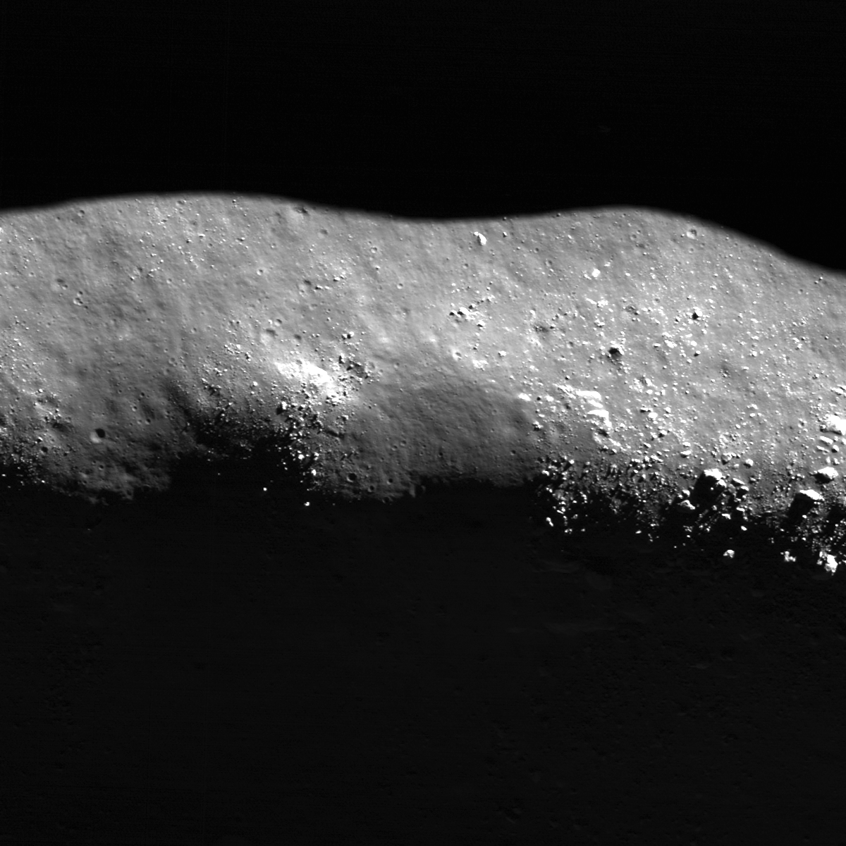
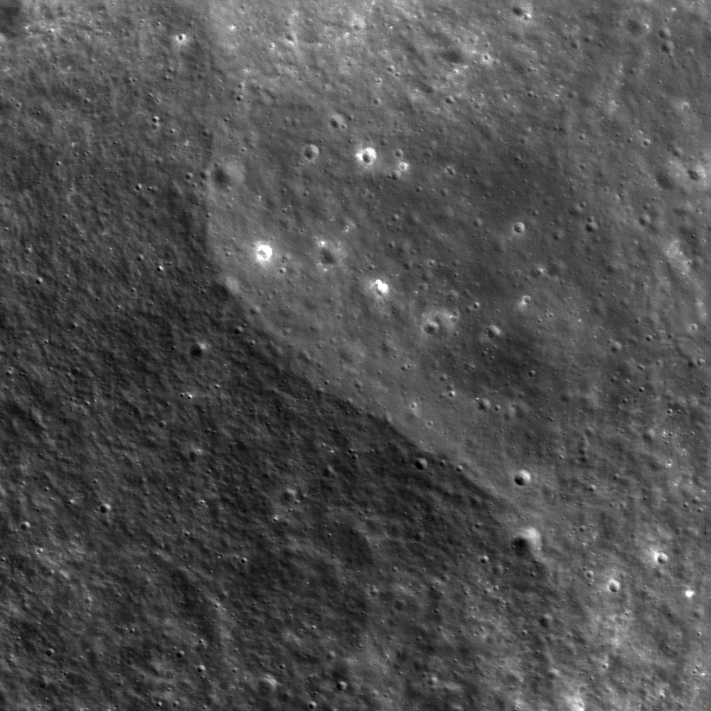
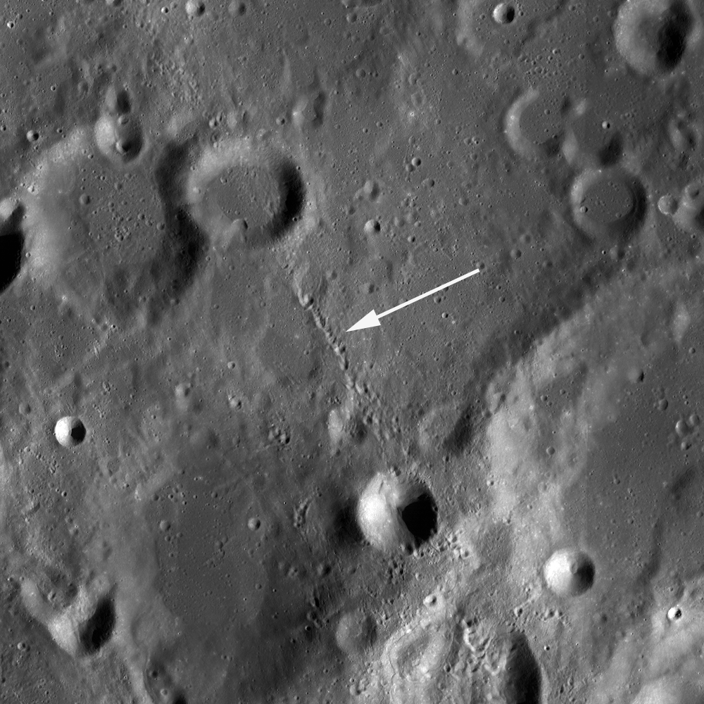
With peppered flanks, Rima Suess wanders over 150 km through Oceanus Procellarum. The rocks that rest on the walls of this sinuous rille are perhaps remnants of much larger boulders that have eroded down to meter sized rocks due to relentless micro and macro meteorite bombardment, "gardening" 3 centimeters into lunar dust every 2 million years or so. The pyroclastic flow that carved through the terrain was remarkably fast, considering the long scar left behind has lasted perhaps 3 billion years. From the extraordinary low altitude of only 23 km (see below), the 400 meter field of view above is cropped from LROC NAC observation M168516400R  [NASA/GSFC/Arizona State University].
Raquel Nuno
LROC News System

Rima Suess (7.81°N, 312.41°E), located in Oceanus Procellarum, is a long, meandering narrow depression called a sinuous rille.

Sinuous rilles, most commonly found in mare surfaces, are thought to have been carved by fast rivers of lava, which thermally and mechanically eroded the channels we see today.

About 3.1 billion years ago the Moon was much more volcanically active, pouring vast amounts of lava onto the surface. The large dark mare regions of the Moon were formed by massive eruptions of iron-rich basaltic lava during this time.

Very close-up on Rima Suess, the LROC NAC observation from which this and the LROC Featured Image were processed was from among one of the closest passes of the Lunar Reconnaissance Orbiter (LRO) over the Moon, during low-periapsis maneuvers in 2011. (Full resolution original image HERE.)  LROC NAC observation M168516400R, LRO orbit 9968, August 12, 2011; 36.11° incidence angle, resolution 39 cm from 22.92 km over 8.07°N, 312.38° [NASA/GSFC/Arizona State University].
The boulders along the walls of the rille probably were a coherent mass when the lava flows cooled, breaking up over billions of years of impacts into the boulders we see today. Gravity then pulled this material down the slope of the rille; this process is known as mass wasting. We see rock outcrops over the entire path of Rima Suess in the LROC NAC image M168516400R.

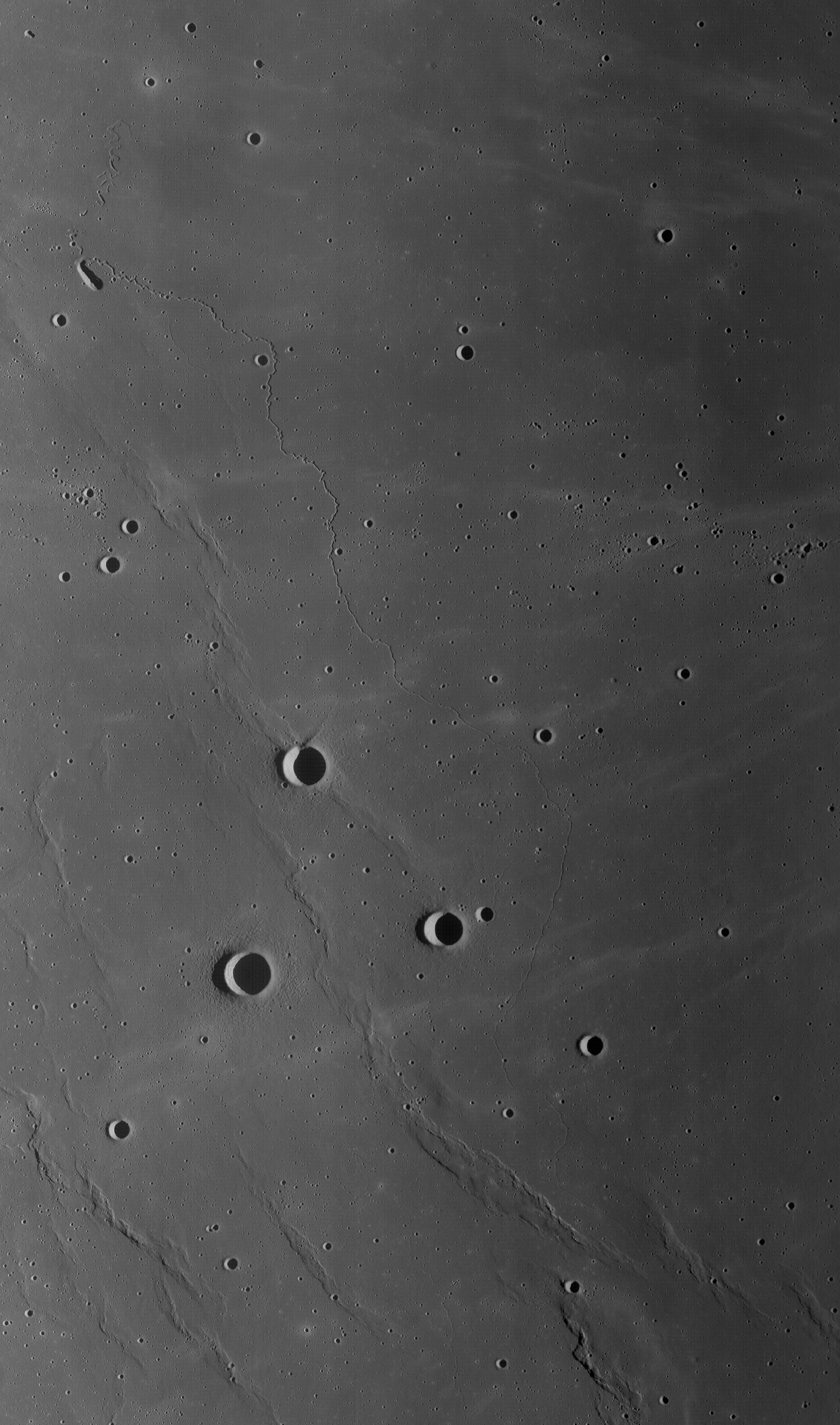
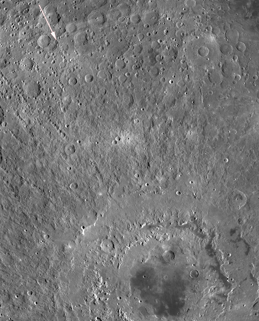
The very narrow, actually a 200 km-plus-long sinuous rille, apparently traced remarkably fast south from the Marius Hills "Yulu" double-volcano source nearly to Flamsteed P crater, through the bleak center of Oceanus Procellarum. Nearby Kepler crater (outside this view, to the right and east) added the bright ejecta rays. This view is distilled from a mosaic of LROC Wide Angle Camera (WAC) observations swept up over five sequential orbits during local early local morning, allowing long shadows to add some relief to this remarkably flat area of the lunar surface, all of it averaging below 2000 meters in elevation. LROC WAC mosaic from LRO orbits 6838 through 6842, December 18, 2010; 79° incidence angle, resolution 58 meters from 41.5 km [NASA/GSFC/Arizona State University].
Lunar rilles are exciting places for lunar scientists because they may cut through and expose the different layers of lava flows in the maria.  This gives scientists insight into the volcanic processes present during mare formation, and how they evolved with time.

Explore the winding path of this portion of Rima Seuss in the full resolution LROC NAC HERE.

Related Posts:
Rilles as far as the eye can see in Prinz!
Rille within a rille!
Collapsing Tube

Thursday, May 22, 2014

Kink in Rima Krieger

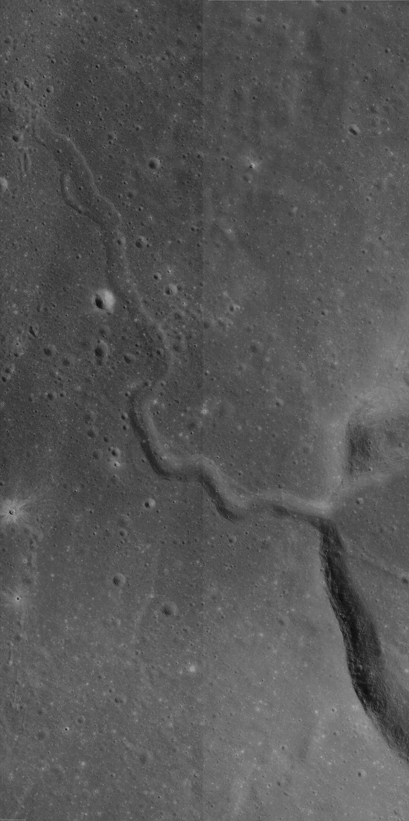
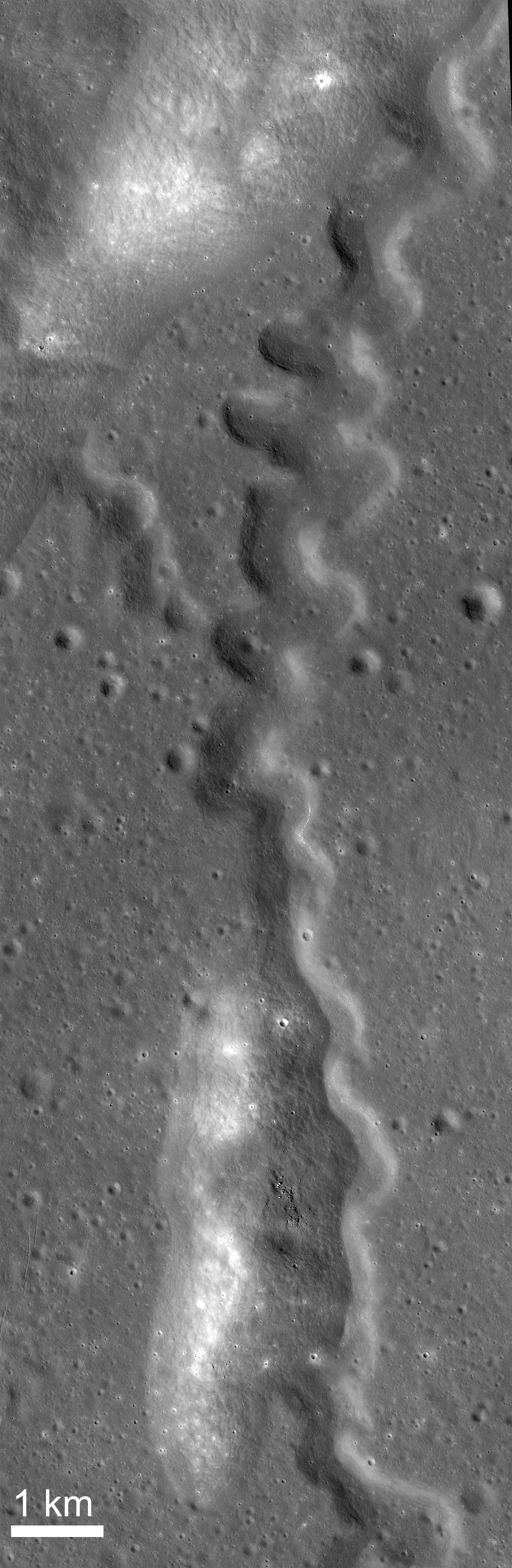
Rima Krieger winds its way through Oceanus Procellarum. Image width is ~ 3.5 km. Taken from LROC NAC observation M1152172510R, LRO orbit 21780, 50.29° incidence angle, resolution 1.35 meters, from 134.64 km over 29.19°N, 313.9°E [NASA/GSFC/Arizona State University].
H. Meyer
LROC News System

Rima Krieger is located in central eastern Oceanus Procellarum. "Rima", which means "fissure", refers to lunar rilles, a common feature on the lunar surface.

Rilles located in mare deposits can form by two mechanisms, channelized lava flow or lava tube collapse, often combined with tectonic stresses. They display three major morphologies: linear, arcuate, and sinuous.

Rima Krieger is a sinuous rille, meaning that its twists and turns resemble meandering rivers on Earth.  Sinuous rilles are thought to have formed as lava became channelized on top of a thick lava flow, as seen at Vallis Schröteri, or as lava flowed across the surface and carved into the substrate.

A roll through four modern orthographic perspectives of Krieger (with 10 km Van Bisbroeck crater superpositioned on its south rim) and the narrow pass through the crater's west wall, where Rima Krieger begins. The region is dominated by its proximity to young Aristarchus crater to the southwest. A 42 km field of view with data contributed by the Lunar Orbiter series, Clementine and LRO [NASA/GSFC/Arizona State University].
In the case of Rima Krieger, some of the meanders occur at nearly right angles, suggesting that the flow was controlled to some degree by underlying structure. These sharp turns appear just outside the rim of Krieger. It's possible that the lava flow was diverted by structure resulting from the impact itself.

LROC NAC mosaic M1145106645R, LRO orbit 20787, January 23, 2014; 48.1° incidence, resolution 1.34 meters from 134.41 km over 29.9°N, 313.87°E. The original, full-size reproduction of this mosaic can be viewed HERE [NASA/GSFC/Arizona State University].
The rille and impact in Today's Featured Image are only a few of the fascinating formations in this region. Rima Krieger is located in one of the most geologically diverse regions of the Moon. To its west, the Aristarchus Plateau stands above the surrounding mare. On the Aristarchus Plateau, we see mare basalts juxtaposed with anorthositic materials excavated by the Aristarchus impact and a dark mantle of pyroclastics over much of the plateau.

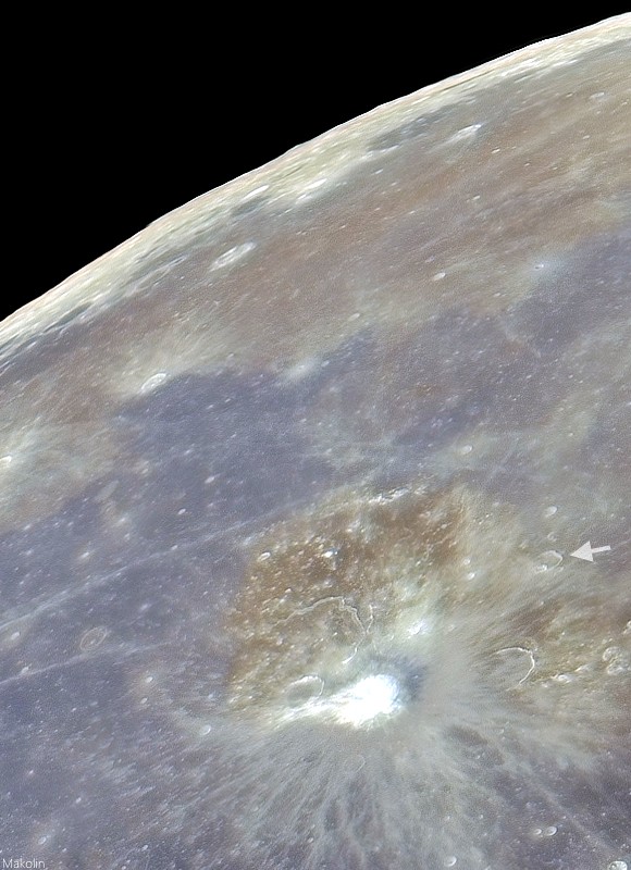
Telescopic mosaic from Earth at full Moon, stretched for color contrast, shows some of the wide variety of basalt in north Procellarum, and just how Krieger (arrow) overpowered by its young neighbor, bright Copernican age Aristarchus and its excavation of Aristarchus plateau.
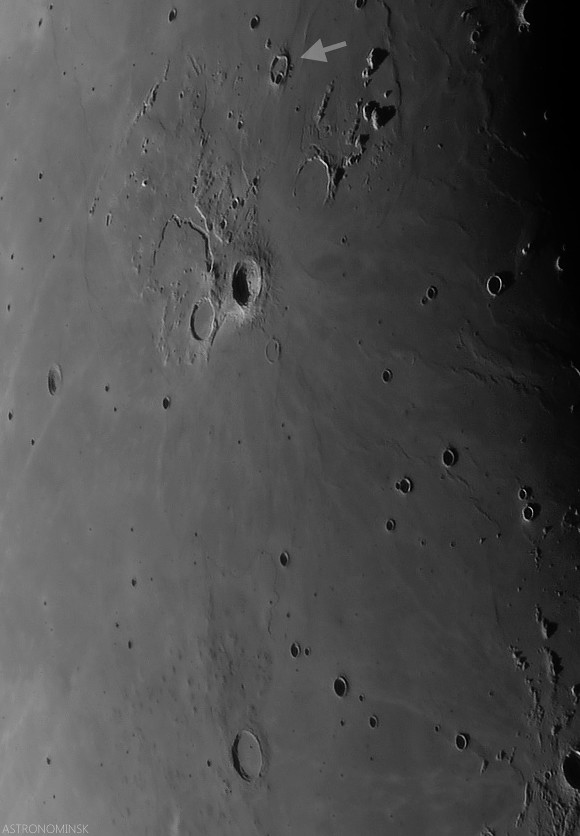
Local evening view de-emphasizes albedo and emphasizes terrain relief in this telescopic look at a 630 km field of view from Krieger (arrow, north) and Marius. (note the Marius Hills as their low profiles come into view on their namesake's north-northwest. Even the long Marius sinuous rille can be seen winding through the plain just north of those Hills. Krieger's morphology is still dominated by Aristarchus. Late crescent Moon mosaic by Astronominsk, September 25, 2008.
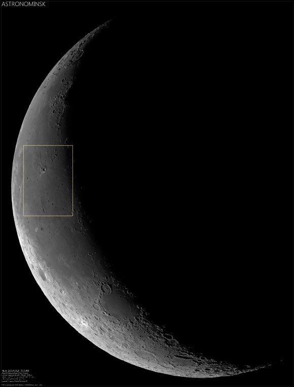
Very reduced view of the full-size ASTRONOMINSK late crescent Moon mosaic of 22 images, showing the field of view immediately above in context (inset). Note the differing perspectives on the Aristarchus Plateau, seen from Earth under a high and low Sun due to libration. The full mosaic can be viewed at the ASTRONOMINSK website, HERE.
To the east of Rima Krieger, we cross the contact between Oceanus Procellarum and Mare Imbrium (passing many kipukas along the way) and run northeast into the Gruithuisen Domes. To the south, the Rimae Prinze Region displays its many sinuous rilles, flooded craters, and massifs. To explore the entire region in more detail, check it out through the LROC QuickMap, HERE.

Related Posts:

Friday, November 15, 2013

The Lunar Alps

Rille in the Montes Alps
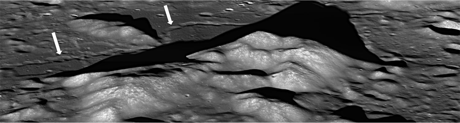
A portion from LROC Narrow Angle Camera oblique mosaic M177602135LR, and a rille, seen in the center of this image, running northwest to southeast through the Montes Alpes northwest of Mare Imbrium. Field of view approximately 15 km (north to the right). Spacecraft orbit 11309, December 4, 2011; average resolution 3.12 meters per pixel from 41.6 km over 49.86°N, 4.3°E [NASA/GSFC/Arizona State University].
H. Meyer
LROC News System

Rilles are common on the Moon and are considered one of the most fascinating volcanic features due to their wide range of scales (100's of meters to over 100 kilometers in length) and morphologies they present (linear, arcuate, or sinuous).

Rilles commonly form when lava flows erode into the existing surface through melting of the substrate, mechanical stripping away of material, or a combination of both thermal and mechanical processes. However, some rilles may have been lava tubes that underwent roof collapse since their formation.

The Lunar Alps
An uncorrected full resolution stitch of LROC NAC mosaic M177602135LR, allowing a false perspective on the rille of interest, west of the spacecraft's orbital track [NASA/GSFC/Arizona State University].
M177602135LR-1500x400
A lower resolution, corrected view of the full LROC NAC oblique. The rille discussed in LROC Featured Image released November 15, 2013 indicated by white arrows [NASA/GSFC/Arizona State University].
In Today's Featured Image, lava carved into the surface between peaks of the Montes Alpes ("Alpine Mountains") and left behind a narrow, long depression resembling a meandering terrestrial river channel, complete with what appear to be cut-off meanders (called oxbows on Earth). In this case, the rille developed meanders as the lava flowed around topographic highs, which in this area are the Montes Alpes.

Vallis Alps, Montes Alps
LROC WAC image of Montes Alpes; field of view approximately 500 km across, centered at 49.397°N, 358.731°E. LROC Featured Image area outlined by the red rectangle [NASA/GSFC/Arizona State University].
Montes Alpes, named by the Polish astronomer Johannes Hevelius, is a mountain range formed by the Imbrium impact event, stretching from the crater Plato all the way to the Montes Caucasus. It forms part of the northeastern border between Mare Imbrium and Mare Frigoris. The Montes Alpes range is bisected by Vallis Alpes ("Alpine Valley"), a flat-bottomed valley with a rille running right down the center from Mare Imbrium to Mare Frigoris that can be seen in the WAC context image above. The Montes Alpes separate the two mare; however, Vallis Alpes breaches that boundary. What might that mean for the geologic history of this area?

Explore Montes Alpes and the rille for yourself HERE.

Related Posts:
Discontinuous Rilles
Old Man River (of Lava!)
Montes Pyrenaeus meets Mare Nectaris

Thursday, May 30, 2013

Truncated Rille in Jules Verne

A lunar rille comes to an abrupt termination at a crater rim (34.342°S, 145.430°E). LROC Narrow Angle Camera (NAC) frame M1122636898R, LRO orbit 17626, May 8, 2013; illumination from east-northeast, an approximate 1 km wide field of view at 0.74 meters resolution [NASA/GSFC/Arizona State University].
James Ashley
LROC News System

We invite you to take a close look at this sinuous rille in Jules Verne crater on the lunar farside.

Why do we see it approach this portion of an ancient, mare-flooded crater rim and suddenly terminate?

Any flowing river of molten rock (the process responsible for most sinuous rilles) would skirt the base of such a positive-relief structure once encountered ... unless the crater rim formed after the rille. But if the crater is flooded by mare basalts (see context image below) the crater must have formed before the rille, which established itself during mare emplacement.

M192002047LR-NSJ-58b-40p-3910x5393
Simple contextual seven kilometers wide field of view shows a wide distribution of debris aprons bordering nearly every contact zone in the vicinity of this ghost crater on the floor of Jules Verne. View a much larger rendition HERE. LROC NAC mosaic M192002047LR, orbit 13328, May 18, 2012; 66.47° angle of incidence, resolution 0.72 meters per pixel from 70.65 km [NASA/GSFC/Arizona State University].
LROC Wide Angle Camera (WAC) mosaic covering a 100 km wide field of view, including the western interior of Jules Verne [NASA/GSFC/Arizona State University].
A clue may be present within the rille itself. Note the sloping wall of debris entering the rille at the point where it encounters the crater wall near the center of the Featured Image. This is accumulated debris, which has been shed from the crater rim. If you look closely at the full NAC frame, HERE, you can also see a subtle break in slope around the perimeter of the crater wall that betrays the presence of a debris apron or pediment.

This eroded material may have buried other portions of rille that might indeed have skirted the original rim, giving the visible portion an appearance of protruding out of the rim at a sharp angle. Can you find any additional clues that would help solve the puzzle?

Other examples of rilles are highlighted in the LROC Featured Image posts "Meanders in Posidonius," "The Old and the Young in Tsiolkovskiy," and "Rimae Prinz Region - Constellation Region of Interest."

Tuesday, February 5, 2013

Meanders in Posidonius

Small portion of a S-shaped meandering rille on the floor of Posidonius Crater (31.93°N, 29.85°E, 100 km diameter) - a floor-fractured crater. The curves in the rille are very tight. LROC Narrow Angle Camera (NAC) observation M1098658474R, LRO orbit 14260, August 3, 2012; 1.45 meters resolution, from 143.74 kilometers [NASA/GSFC/Arizona State University].
Jeffrey Plescia
LROC News System

Rilles (linear to meandering troughs) and floor-fractured craters are common on the Moon and on Mars. Lunar rilles occur primarily on the open mare (for example Hadley Rille at the Apollo 15 landing site); others are restricted to craters. Floor fractured craters are an unusual type of crater typically occurring in the highlands near the mare boundary. Posidonius crater lies in the highlands just beyond the northeast margin of Mare Serenitatis. Much of the floor of Posidonius crater is covered by smooth plains considered to be mare basalts. There are suggestions that the rilles are erosional in origin and formed as massive outpourings of lava carved (and melted) the floor. The rille crosses a distance or more than 100 km linear distance across the floor; the actual distance along the floor of the crater including all of the curves is much greater.

Regional view of the western floor of Posidonius crater (inset - full size view HERE) showing its meandering pattern across the crater floor. Toward the top of the frame there is a tributary rille. Wider field of view from LROC NAC M1098658474R [NASA/GSFC/Arizona State University].
The rille that crosses the floor of Posidonius crater extends west across margin of the northern crater floor and then turns south. Perhaps coincidentally (or not) the ridge runs south adjacent to pieces of the original crater floor poking through the crater-filling mare plains. Finally, the rille turns southwest to the southwest rim; it then continues along the base of the southwest crater rim. The rille is about 50 m deep. The wavelength of the meanders is about 1 km.

Oblique view (59° off nadir) of the same rille, LROC NAC photograph from well west of the area of interest. LROC NAC M1096379115LE, spacecraft orbit 13941, July 8, 2012; general resolution 4 meters from 145.49 km over Mare Serenitatis [NASA/GSFC/Arizona State University].
Mosaic of both the left and right frames of LROC NAC oblique observation M1096379115 captures a vast portion of Posidonius in high, late afternoon relief. The rectangle represents the field of view in the image at full resolution immediately above [NASA/GSFC/Arizona State University]
The overall geology of Posidonius crater can be seen in the WAC image below. The image clearly shows the smooth plains that form the floor on the north and west side in which the rille occurs and the tilted fractured floor on the eastern side of the crater.

Posidonius crater captured in afternoon lighting. The crater is embayed by younger mare to the west, though the floor of the crater is about 300 meters higher in elevation. LROC WAC M1096283231C [NASA/GSFC/Arizona State University].
Explore more of Posidonius crater in the entire LROC NAC frame, HERE.

Related LROC Featured Images:
Posidonius Y
Pattern of dark deposits
Petavius Crater

Tuesday, December 18, 2012

LROC: Petavius

An outcrop exposed in the central peak of Petavius crater revealed in large fracture. From LROC Narrow Angle Camera (NAC) observation M1107889912LE, captured at 0.84 meters per pixel in LRO orbit 15552, November 18, 2012; field of view approximately 840 meters across [NASA/GSFC/Arizona State University].
Drew Enns
LROC News System

Petavius crater, a 177 km crater located at 25.28°S, 60.63°E, is one of an uncommon class of craters that have been modified by post-impact processes. What process could have produced the system of fractures that cut the floor, known as Rimae Petavius? Volcanism is the likely cause. Small patches of mare basalt exist in the north and south extents of the crater floor, which help cement this hypothesis. But unlike other mare filled craters, Petavius crater has only small patches of basalt.

Why did Petavius crater end up with such an extensive fracture system?

Context the LROC Featured Image, 100 km-wide field of view includes the cluster of the Petavius central peaks, composed of material tossed up from great depth when the crater formed in the lower Imbrium age, 3.9 billion years ago. Some darker basaltic material is in the northeast and southeast corners of this image, likely opportunistic intrusions of molten material that "seeped" to the surface following some global event, like the basin forming impact that formed Mare Orientale [NASA/GSFC/Arizona State University].

One hypothesis is that the fractures occurred as a result of volcanic modification. Uplift of the crater floor would occur as magma intruded beneath the floor and fracturing developed as the floor was pushed up. Because Petavius crater was not flooded completely, the fractures were never covered by basalt. The harder question is why is Petavius crater not flooded with basalt?

Wider still context LROC Wide Angle Camera (WAC) mosaic, showing the slumped walls of Petavius. Mosaic stitched from eight sequential observations during orbits 11232 through 11259, November 30, 2011; resolution averaged 70 meters at 68° angle of incidence, from 51 kilometers [NASA/GSFC/Arizona State University].

It is possible Petavius crater did not witness the same style of eruption as elsewhere on the Moon. Or maybe the magma underneath Petavius crater was not buoyant enough to completely flood the surface. Finally, it may simply be that the magma source region was relatively small, and thus only a modest amount of basalt was erupted.

Explore more of Petavius crater in the full LROC NAC observation HERE.

Related Posts:
Rock slide in Rima Hyginus
Pyroclastics and Vent
Archimedes - Mare Flooded Crater!

Petavius is a familiar telescopic landmark from Earth, after the Moon is 3 days old (or 2 days after a Full Moon), though fresher, rougher and less optically mature bright ejecta from smaller neighboring craters like Stevinus and Petavius B tend to overwhelm the scene as the region approaches mid-day. The simulated phase above shows the location of Petavius in relation to the Moon's appearance tonight. Virtual Moon Atlas v.6 using LROC WAC 100 meter textures [VMA].

Wednesday, December 7, 2011

Oblong Roche V

The boundary between the flooded crater floor and crater wall of Roche V  wall is subtle, except for locations where a distinct pinch represents the contact between units. LROC Narrow Angle Camera (NAC) observation M159100166R, orbit 8580, May 3, 2011; incidence angle 53.76° and reduced from a resolution of 0.59 meters per pixel from 57.3 kilometers. View the original, full size 590 meter wide field of view LROC Featured Image HERE [NASA/GSFC/Arizona State University].
Lillian Ostrach
LROC News System

Roche V (38.86°S, 129.62°E) is one of five satellite craters associated with Roche crater. Compared to its siblings, Roche V is the ugly duckling of the bunch: it has an oblong, irregular shape, floor fractures, and mare fill. But, similar to the ugly duckling in the story, the geologic features that stand out and catch our attention make this 29 km diameter crater quite special indeed. The irregular shape tells us something about the crater formation, probably because the impactor hit the lunar surface at a highly oblique angle. But maybe more exciting is the flooded mare material in the crater, along with both linear and arcuate fractures. There are many floor fractured craters on the Moon, but most of them are much larger than Roche V (for example, Gassendi is 110 km in diameter). The cause of fractures in these larger craters remains poorly understood, but scientists do know that the floors of these craters are uplifted and many contain smooth deposits of basalt. Given the size difference between Roche V and these larger craters, can we explain the geology of the Roche V crater floor?

LROC Wide Angel Camera (WAC) observation M115462620CE, (604 nm) image of satellite crater Roche V. Roche, the parent crater, is located to the southeast of this view. Arrow marks location of pinch contact discussed above. LRO orbit 2149, incidence angle 77.07° with a resolution of 85.7 meters per pixel from 61 kilometers [NASA/GSFC/Arizona State University].
Taking a look at the WAC image, there is a striking difference between the fractures in Roche V and those observed in other floor fractured craters, such as Atlas (87 km diameter). The fractures in Atlas and other floor fractured craters are large, somewhat resembling linear rilles in appearance. However, the fractures in Roche V are not as sharply defined and appear visually shallow compared to those observed in Atlas. The fractured and rougher mare fill (including the location of today's Featured Image) has a higher albedo than the smooth mare. Maybe the Roche V mare fill is partially covered by high albedo ejecta from a nearby recent impact; can you find any craters with high albedo ejecta blankets using the LROC WMS viewer?

The surface features of the floor material in Roche V are visually similar to the surface of a cornstarch and water mixture in a bowl as it dries. The material that lapped up on the sides of the crater stuck there as the lava cooled, but as the lava cooled it experienced a small volume change and shrank. The fractures observed may be the result of cooling within the lava pond. Much of the contact between crater wall and floor-fill is currently blurred and smoothed due to post-impact modification and regolith formation and at the NAC scale are very difficult to discern, but there are still a few distinct contacts visible in LROC NAC images.

What do you think - what formed these fractures? Take a look in the full LROC NAC image!

Related Posts:
The fractured floor of Compton
Alphonsus crater mantled floor fracture

Wednesday, October 12, 2011

LROC: Perched Boulders

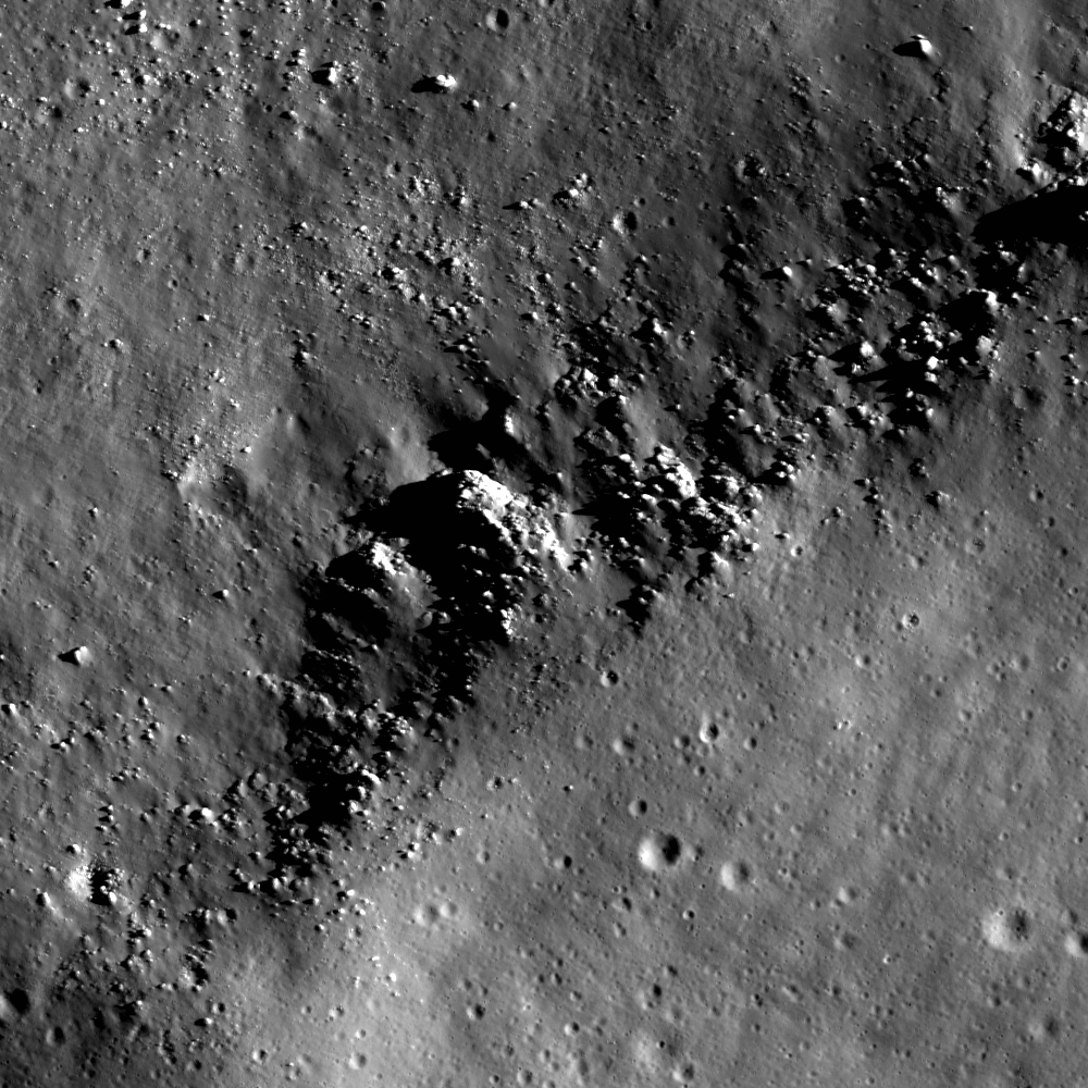
The crest of a linear floor fracture wall is intermittently covered by boulders and smoothed terrain. The largest boulders (lower part of image) are around 30 meters across. LROC Narrow Angle Camera (NAC) M159065590R, LRO orbit 8575, May 3, 2011; from top to bottom (north is to the right) field of view is 960 meters. See the full size LROC Featured Image HERE [NASA/GSFC/Arizona State University].

Lillian Ostrach
LROC News System

Boulders are found nearly everywhere on the Moon, and LROC NAC images allow scientists to study boulder populations. Why would anyone want to spend their time looking for boulders? Boulders represent erosional products on the Moon and can be used to help interpret geologic features and derive a geologic history for a region. Presently, erosion on the Moon largely occurs as a result of micrometeorite bombardment (for a short discussion, check out the Relative Age Relationships Featured Image). For example, the presence of boulders surrounding a 100 meter diameter crater in the mare suggests that when the crater formed, the impactor punched through the layer of regolith and excavated bedrock. Similarly, the boulders perched on wrinkle ridge crests and on the walls of sinuous rilles represent bedrock that is eroding out of these features over time. Perhaps the density or frequency of boulders on wrinkle ridge crests may be used to determine relative ages between features within a region. However, because erosion can be controlled by rock type and how fractured or deformed the rocks are, scientists need to carefully interpret their observations of boulder populations.

Today's Featured Image highlights boulders perched on the crest of a linear floor fracture wall within the central peak ring of Schrödinger basin (73.22°S, 133.82°E).Many of the boulders are around 5 to 10 meters across (although some are smaller), but near the lower edge of the image above the boulders are much larger, around 20to- 30 meters across. There are also more large boulders exposed downslope of the 20 - 30 m boulders compared to other boulder clusters. Why is there an apparent discrepancy?

To answer, we should consider several things. First, we must determine whether the boulders originate from the crest (in-situ) or are impact-derived (that is, they deposited by a nearby impact). Taking a look in the full Narrow Angle Camera frame, there is an approximately 7 kilometer in diameter Eratosthenian-Age crater about 30 kilometers north of the fractures. However, while there are boulders around 30 meters in size located in clusters surrounding the crater the continuous ejecta blanket (for a crater generally) is confined to one crater diameter. Since the fractures are much farther than 7 km from the crater the boulders on the fracture wall crest are probably not derived from that crater.

What about other nearby craters? While there are several craters nearby (check out the LROC WAC context below), none of them are particularly fresh nor bouldery. Based on these observations, the boulders probably orignated in-situ as a result of erosion. Thus, the apparent discrepancy in boulder sizes along the crest may be related to the deformation of the rock during fracture formation and mare flooding of Schrödinger. Right now, though, we do not have a definitive answer; however, to examine this topic further, we would need to complete a survey of boulder sizes and distributions along the length of the fractures. Even then, we may not be able to explain why some boulder groupings contain larger sized boulders.

LROC Wide Angle Camera (WAC) monochrome mosaic showing and area located slightly north of the center of Schrödinger basin with the northern portion of the central peak ring near the top of the image. (Asterisk notes the location of today's Featured Image image.) View the full size LROC WAC context mosaic showing the deep interior of Schrödinger basin HERE [NASA/GSFC/Arizona State University].
Now that we found evidence to suggest that the boulders are probably related to the erosion of the crest of the fracture wall we need to try to explain the smoothed portions of the crest.

In the opening image, there are boulder clusters separated by smoothed areas. What is this smooth stuff? Regolith, the lunar soil, is generated by impacts - big and small - and over time accumulates on the lunar surface. When a surface is covered entirely by regolith, it looks smooth and sometimes has a textured appearance. So, these smooth regions are accumulations of regolith on the wall crest and also along the fracture walls. But then why isn't the crest all smooth, or all bouldery? The illumination and where the shadows lie across the ridge crest may be a clue; these smooth areas have shadows that are not in-line with the bouldery portions of the crest and look like they may be lower topographically than the bouldery parts or may be less steeply sloped than the parts of the crest where boulders are. Again, taking a look at the full NAC frame may help, too, because in the full image there are other smooth regions that are associated with obvious changes in topography and slope along the crest. If we then assume that the smoother regions have a shallower slope at the crest, we may have an answer: boulders are more likely to form along steep slopes of crests where the slope break is steepest (here along the fracture wall crest, or along wrinkle ridges). This is only one explanation based on visual explanation, but we really should take some time to measure slopes in a NAC-derived Digital Terrain Model (DTM) to be certain that we are on the right track.

Wednesday, October 5, 2011

LROC: Scar in the Farside Highlands

A curvilinear valley calls attention to itself by virtue of its apparent isolation from the surrounding terrain. LROC Narrow Angle Camera (NAC) observation M153632648L, LRO orbit 7775, March 3, 2011; north is up, Sun is from the southwest, incidence angle 33° and the image field of view is roughly 302 meters. View the full size LROC Featured Image HERE [NASA/GSFC/Arizona State University].
James Ashley
LROC News System

With such an abrupt beginning and end, and no obvious connection to typical geologic flow, fault or scour processes, what could have caused this curious arcuate, negative-relief landform in the lunar highland regolith (24.3°N, 245.0°E)? 

Sometimes it helps to step back for a wider look.


The featured scar is to the lower right (white box) in this wider field, which shows it as only one of several similar features. LROC NAC M153632648L, image width is ~2.3 km, see the LROC 1.5 km context image HERE [NASA/GSFC/Arizona State University].
Compare the NAC frame above with the segment taken from a LROC Wide Angle Camera (WAC) mosaic below.

In our slow zoom out, we see that several similar features, appearing as blind valleys with abrupt endings, are aligned in a north-northwest to south-southeast direction, but are still somewhat isolated from anything that might have caused them in the nearby vicinity.

The WAC mosaic shows the full length of the scar (white arrow); View the full size LROC 97 km-wide field of view HERE [NASA/GSFC/Arizona State University].
Sometimes, however ... it helps to step WAY back!

WAC mosaic showing Mare Orientale and portions of its spectacular rayed ejecta pattern. Arrow in upper left quadrant overlays scar feature in the Comrie crater group; image field of view is 1,500 km from top to bottom. See the full resolution LROC WAC context image HERE and compare the mosaic with the hemisphere-wide LOLA topography in the image below [NASA/GSFC/Arizona State University].
Notice the arrow in the northwest corner of this WAC mosaic, which overlays and parallels the linear trend of the featured scar. It points toward the center of Mare Orientale, a 900 km-diameter impact feature. Several crater chains are visible to the southwest of the arrow at this scale that similarly radiate from the Orientale basin. The violence of the basin-forming event was so great that it hurled prodigious volumes of target rock hundreds of kilometers across the lunar surface. The orientation and location of the featured scar pattern makes the Orientale impact a plausible cause for what we see there. In addition to rocky projectiles, ground-hugging and/or ballistically emplaced ejecta deposits are a common accompaniment to large impact features on the Moon. From their morphology and occurrence, they seem to have behaved in a very fluid-like way, and can morph and merge as they flow across the surface until losing energy and coming to rest as dunes or lobes. Today's Featured Image appears to be a place where advancing dunes merged and "healed over."

In addition to the orientation of this linear form, what other clues would help determine if this feature is indeed associated with the Orientale impact, or part of some other debris source? What other clues are visible in the full NAC frame?

Additional examples of fluidized ejecta can be found in the Lavish Lobes of Necho R, and in King Crater Ejecta Deposits. The Orientale Basin is featured in the LROC PDS Release 5 post, and the Farside! and All the Way Around post.

LOLA Altimetry adds global context to the LROC WAC image, third following from the top of the post, and shows the stark dichotomy between lunar Nearside (right) and Farside. The technical meridian need hardly be designated but begins at the lunar north through the equator (270° East). The Moon's highest regions (orange) are 13 kilometers higher than the deep and wide impact basins familiar to it's Earth-facing hemisphere. The area within the LROC Featured Image released October 4, 2011 lies roughly 1400 kms away from the center of the Mare Orientale basin at lower center [NASA/GSFC/LOLA/LMMP].

Friday, September 16, 2011

It's the Moon's fault


Linear rille in Mare Tranquillitatis, the result of extensional stresses. What caused the offset in the rille on the east wall? LROC Narrow Angle Camera (NAC) observation M146858595LE, LRO orbit 6776, December 13, 2010, field of view 700 meters. See the full size LROC Featured Image HERE [NASA/GSFC/Arizona State University].

Drew Enns
LROC News System

Linear rilles are so named because of their nearly-straight morphology and surface expression. Unlike sinuous rilles, which are volcanic, linear rilles are tectonic in nature. Similar features on Earth are termed graben, and are created when two normal faults border a block of rock which has been depressed, producing a valley.

Since normal faults are understood to be the products of extensional stresses (see yesterday's Featured Image post), we can assume this region of the Moon was "pulled apart" - creating these normal faults, dropping the middle blocks, and producing the linear rilles. So a linear rille is the lunar analog of a graben on Earth!


Full two kilometer width segment of LROC NAC frame M146858595LE, showing the approximate location of the LROC Featured Image, September 15, 2011 [NASA/GSFC/Arizona State University].


LROC Wide Angle Camera (WAC) context images of the Rimae Sosigenes extensional linear rille system in the northeast Mare Tranquillitatis, between the Arago domes (out of view, to the south and east) and the craters Sosigenes and its smaller namesake Sosigenes A. one rille is cross-cut with a close-grouped and prominent secondary crater chain, well-known to well-equipped telescopic observers when the morning terminator passes over five days following a New Moon. WAC monochrome (566 nm) mosaic from orbits 4515-4517, June 18, 2010. See the original LROC WAC context image HERE [NASA/GSFC/Arizona State University].

In today's featured image, two normal faults appear to be offset.

What are we seeing here?


Is Mare Tranquillitatis really an impact basin? Looks can be deceiving, when comparing two familiar and neighboring basins, each flooded multiple times with volcanic flows. Dark and optically-mature regolith covers both Mare Serenitatis (top center) and Tranquillitatis (below - the area of interest is indicated with the yellow area), though the differences in color of each are obvious even in black and white photographs. But In this false-color LOLA elevation map, the nature of Mare Tranquillitatis is less obvious, until one examines more closely and sees how the weight of material infilling the Tranquillitatis plain may have led to finer features like wrinkle ridges and extensional rilles [NASA/GSFC/LOLA/MSFC/LMMP].

It is probably an en echelon step between the two normal faults making up the east wall of the rille. When two faults are near to each other, they can interact and create an en echelon step that helps to even out the displacement and forces that created the faults. En echelon steps are common, and are seen in other tectonic features on the Moon.

Can you find any more faults in the full NAC frame?

Related Posts:
Rima Bürg
Rima Ariadaeus - A Linear Rille

Wednesday, August 31, 2011

LROC: Stratigraphic layers exposed by Hadley Rille


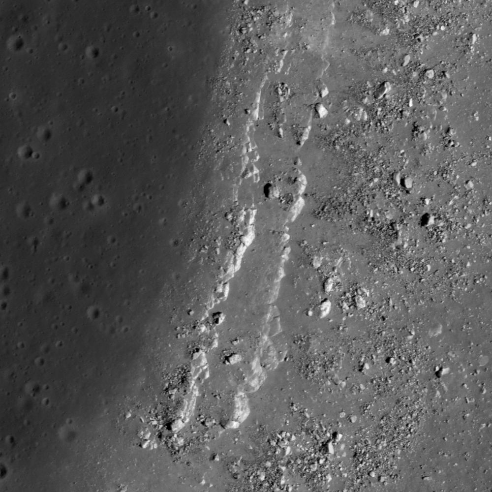
West side edges of Hadley Rille, 45 kilometers southwest of the 1971 Apollo 15 landing zone. LROC Narrow Angle Camera observation M113941548L, LRO orbit 1925, November 27, 2009; resolution is 50 cm/pixel, field of view 500 meters with a solar illumination incidence angle 59° from the southeast. View the full size LROC Featured Image HERE [NASA/GSFC/Arizona State University].

Hiroyuki Sato
LROC News System

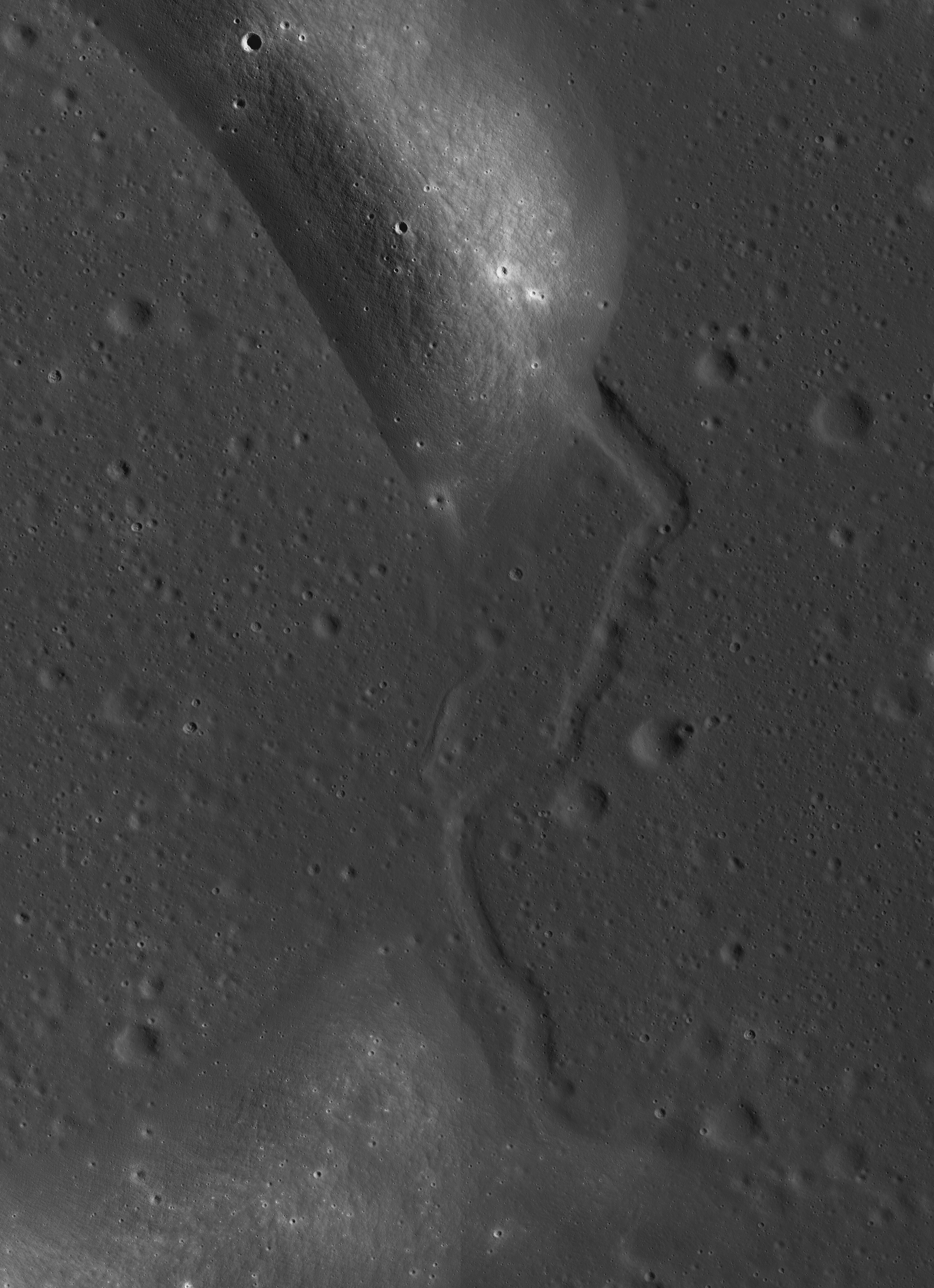
Today's Featured Image are bedrock outcrops at the western edge of Hadley Rille, in an area located about 50 km southwest from the Apollo 15 landing site. Two parallel lines of high-reflectance rocks extend in a north-south direction on the western rim of the Rille. The right side of the image is the downward slope of the rille, where you can see multiple boulders that have likely fallen from the outcrops in the center in the billions of years since the great rille was carved into the mare by flowing lava.


For context, the layers of extrusive volcanism that formed the surface of Palus Putredinis and the Hadley Rille Delta and later exposed in the formation of Hadley Rille are seen in the full width 300 by 4oo meter crop from NAC frame M113941548L [NASA/GSFC/Arizona State University].

These two layer outcrops can be almost continuously observed along the flank of Hadley Rille for about 2.5 km length, which suggesting that these layers have relatively wide area coverage and an almost uniform thickness.


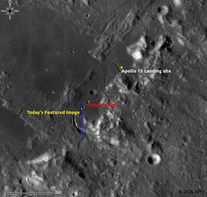
A late afternoon LROC Wide Angle Camera (WAC) 604 nm band mosaic shows the Hadley Rille Delta and Palus Putredinis between the Apollo 15 landing zone (red square) and the strategraphic area of interest 45.3 km to the southwest pinpointed in the LROC Featured Image released August 30, 2011. LROC WAC mosaic stitched from observations made during LRO orbits 7313-7315, January 24, 2011 [NASA/GSFC/Arizona State University].

Detailed topographic assessments using the Lunar Orbital Laser Altimeter Digital Terrain Model or possibly even NAC stereophotogrammetry will enable lunar scientists to obtain accurate thickness measurements for these two rock layers, as well as derive estimates for the thickness of the overlaying regolith layer in this area. This information will be very useful to lunar scientists who are currently trying to understand the geologic processes involved with mare volcanism. If we assume that these layers correspond to mare basalt flows, then determining the thickness and the spacial extent of these flows will be important information for calculating the viscosity and eruption volume of lava at one event. Research efforts like this one are helping lunar scientists define key questions that will be answered by future human lunar exploration!


LROC WAC monochrome mosaic 100 m/pixel around Hadley Rille. Image center is latitude 25.52°, longitude 3.11°. Blue box and white star indicate the locations of NAC frame and LROC Featured Image, August 30, 2011. View the larger version HERE [NASA/GSFC/Arizona State University].

Explore the parallel bedrock outcrops at Hadley Rille in the full NAC frame!

Related posts:
Layering in Euler Crater
Dark surface materials surrounding Rima Marius
Lava Flows Exposed in Bessel Crater
Dark streaks in Diophantus crater
Linné Crater