Showing posts with label Orientale Basin. Show all posts

Tuesday, June 10, 2014

Ready-made excavations near Lucretius C

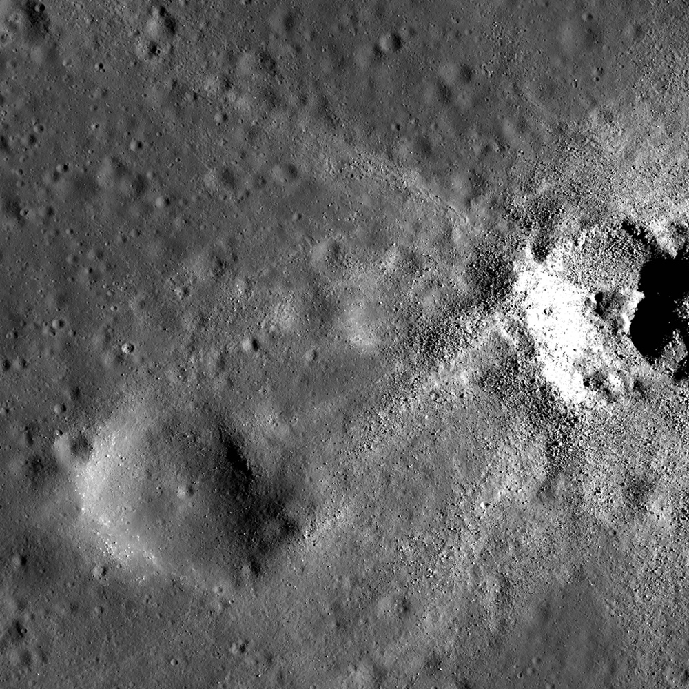
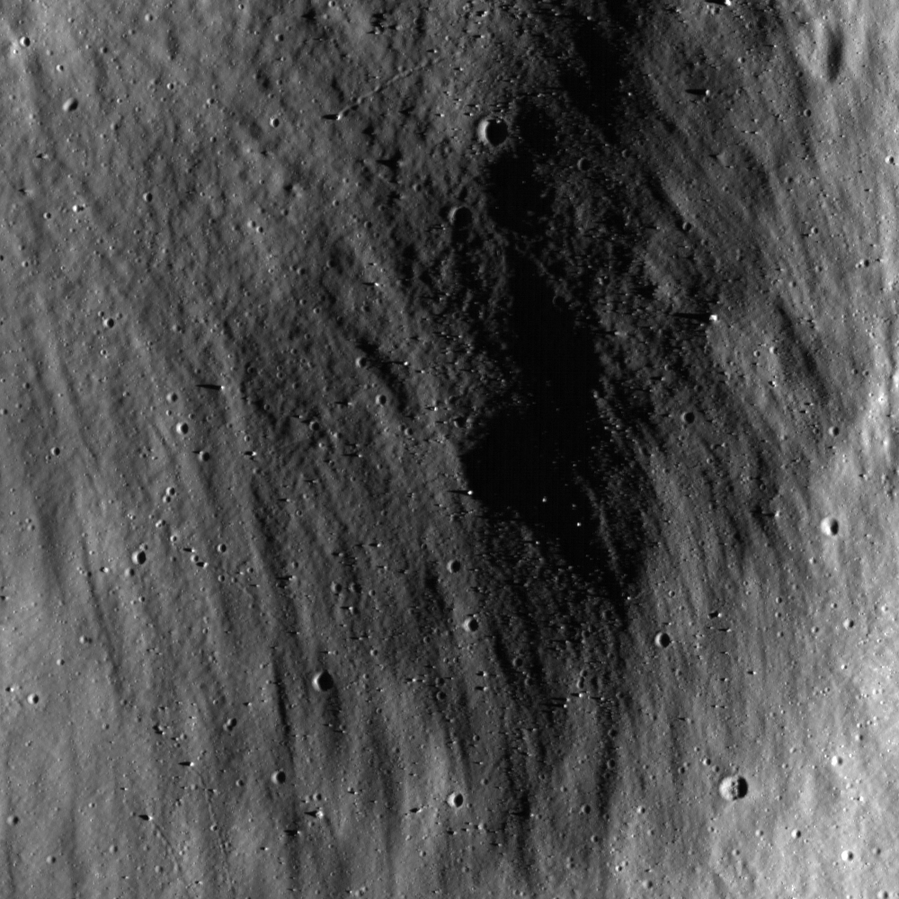
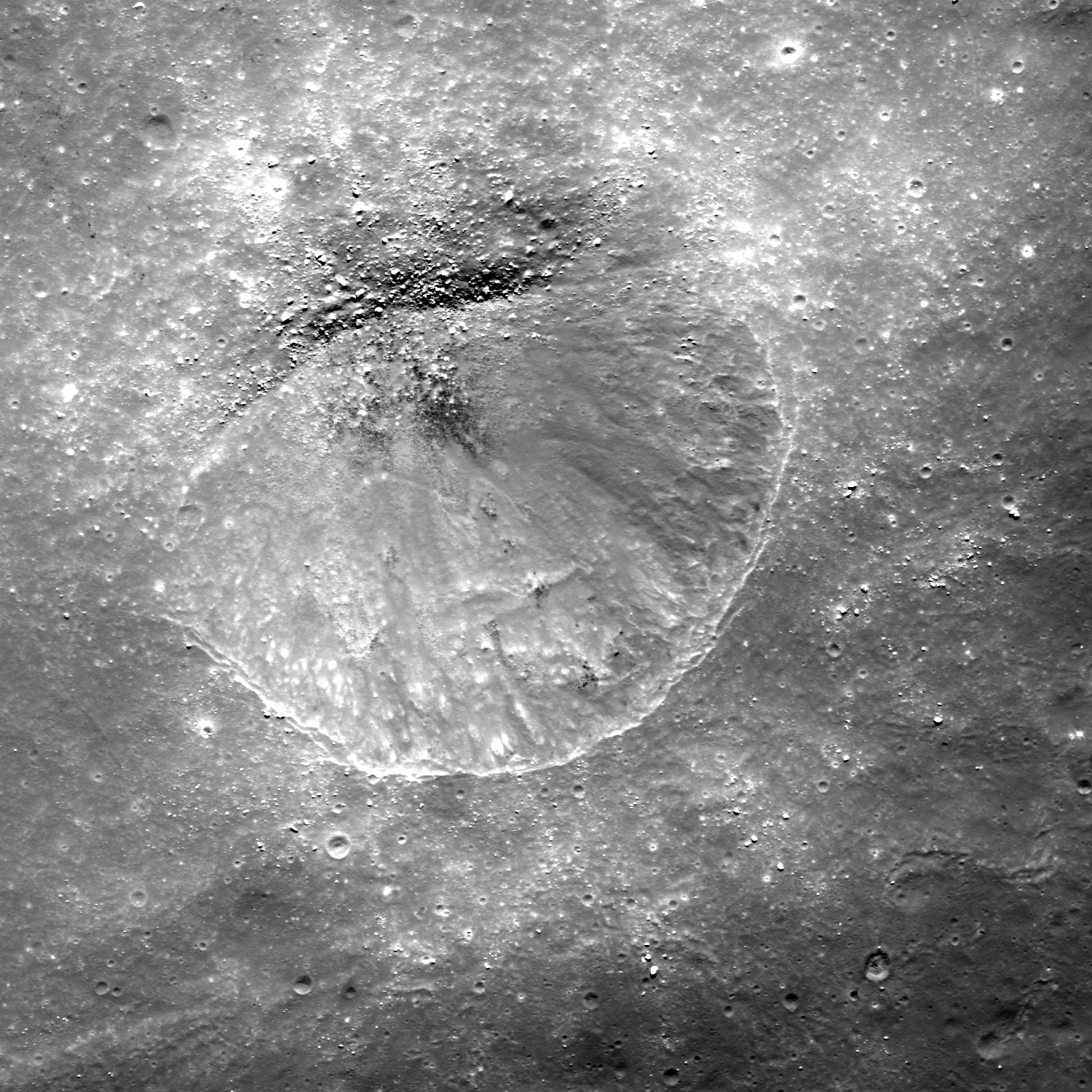
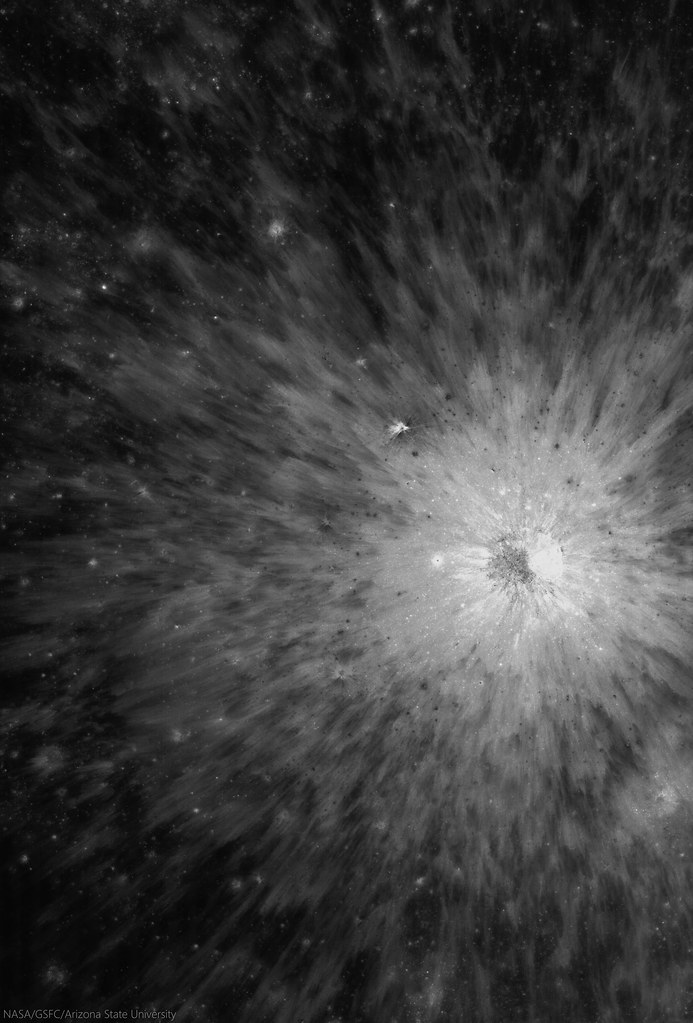
Self-secondary of a bright, relatively fresh crater northwest of Mare Orientale, in the wider highlands greatly affected by that basin-forming impact. The unnamed primary crater (between Lucretius C and Grachev craters, see below) is visible from a great altitude because of its relative low optical maturity. Full-resolution, 530 meter-wide field of view from LROC NAC observation M1132582647R, LRO orbit 19028, August 31, 2013; 9.47° incidence angle, resolution 92 cm, from 106.13 km over 3.09°S, 246.92°E [NASA/GSFC/Arizona State University].
Hiroyuki Sato
LROC News System

Today's Featured Image highlights the spectacular fresh ejecta from an unnamed crater (1.05 km; 3.06°S, 297°E), approximately 750 km northwest of Mare Orientale.

Subsequent impacts (possibly including self-secondaries) excavate through the ejecta sheet, leaving small craters, mostly less than 50 meters in diameter, and tiny ejecta splashes.

Some are lower and others are higher in reflectance than their surroundings, resulting in a variety of contrasts against the bright, optically immature ejecta field of the primary crater. 

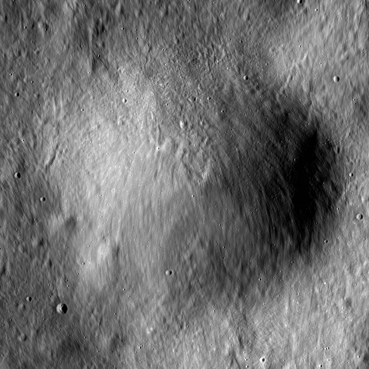
Bright, relatively fresh primary to highlighted secondary crater at upper left northwest of Orientale basin, between Lucretius C and Grachev. 4.54 km-wide field of view from full-width of LROC NAC observation M1132582647R, visible HERE. [NASA/GSFC/Arizona State University].
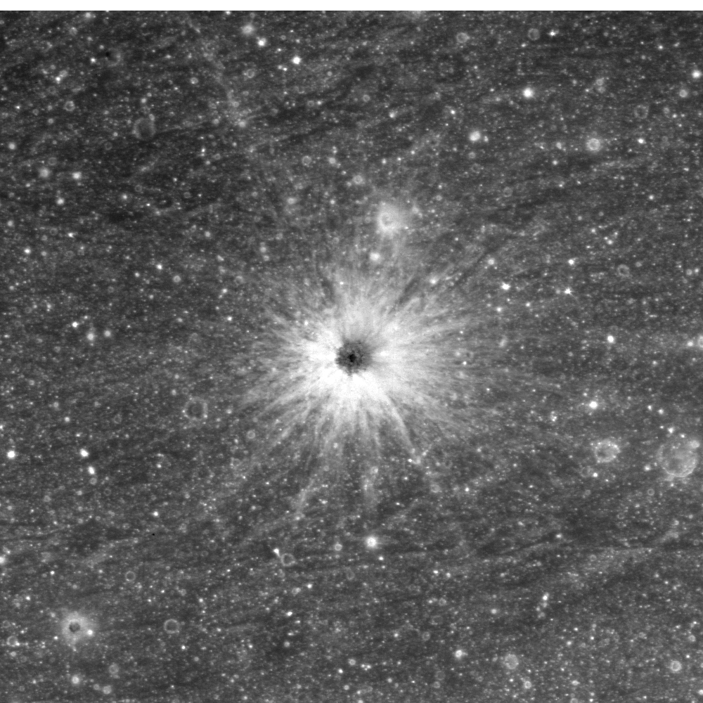
In the opening image, many small high reflectance craters (~10 m) are clustered at the lower right side of the image, while nearby mid-sized craters (~50 m) are darker than their surroundings. The largest crater's ejecta (center-left in this image) is composed of two layers, the brighter layer on top of the darker layer.

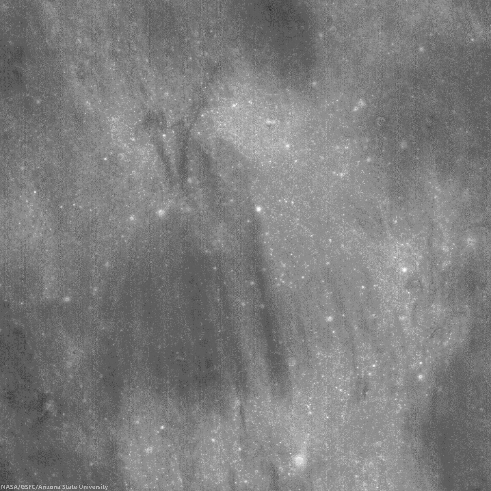
Full-width mosaic, 13.357 km-wide field of view from a mosaic of both the left and right frames of LROC observation M1132582647.   Larger reproductions are available HERE [NASA/GSFC/Arizona State University].
These reflectance variations are likely due to the different excavation depths into the low and high reflectance surface and subsurface deposits. The mid-sized craters probably reached the original low reflectance materials below the upper higher reflectance ejecta sheet (from the unnamed ~1km diameter crater). The largest crater likely excavated high reflectance substrate that is also exposed on the unnamed crater's wall. 
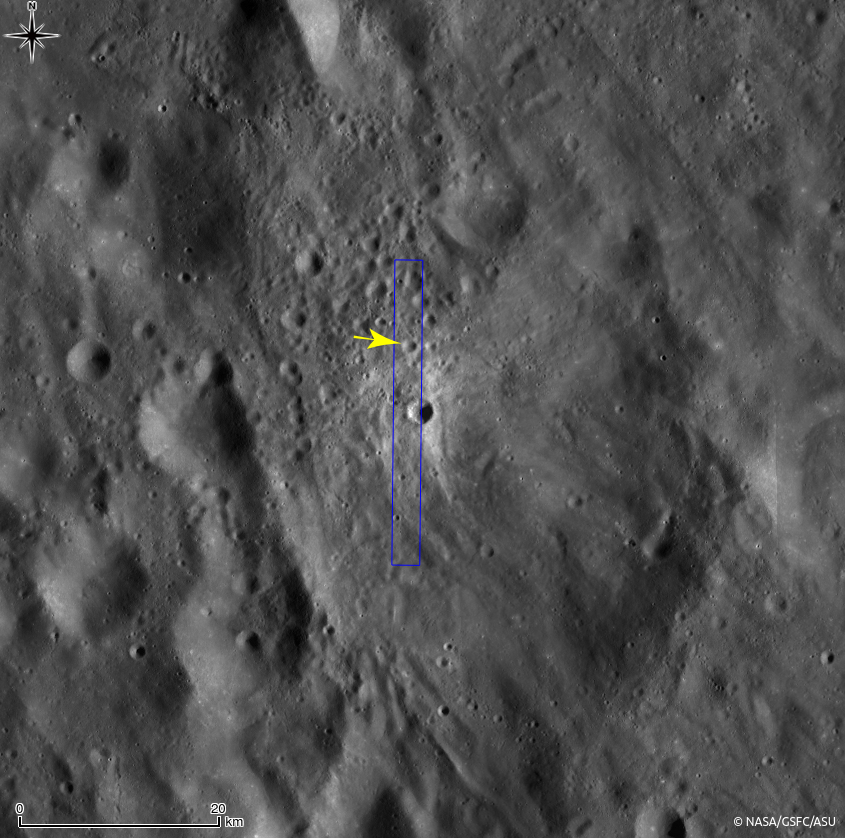
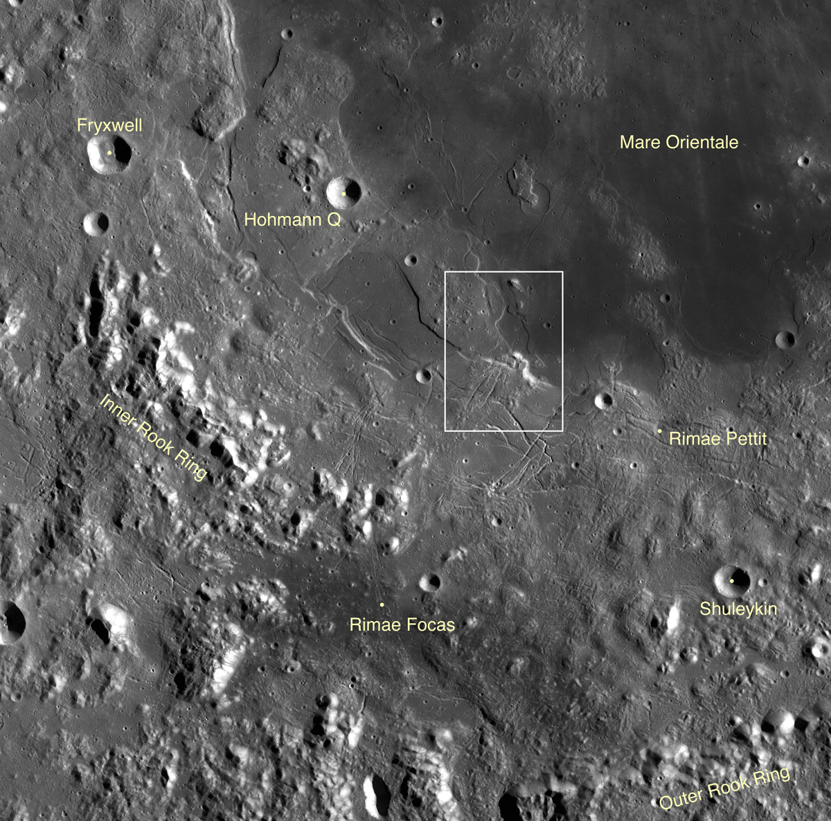
250 meter resolution view shows the high visibility of the small crater of interest (1.05 km; 3.03°S, 297°E), against the ancient highlands, deeply scared by the energy of the Orientale basin-forming-impact. LROC Quickman WAC natural color beta over 100 meter global mosaic [NASA/GSFC/Arizona State University].
Context for high resolution LROC NAC view of bright fresh 1.05 km crater (3.06°S, 297°E) northwest of Mare Orientale [NASA/GSFC/SVS/Arizona State University].
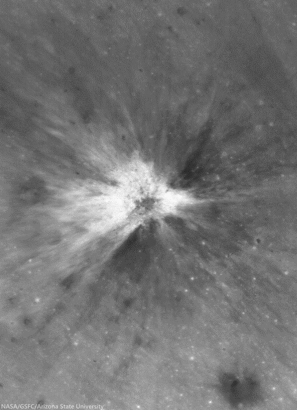
Impacts serve as a natural excavation process which helps us to glimpse into the otherwise unreachable geological layers on the Moon. 

View full-width mosaic, HERE.

Related Posts

Friday, March 21, 2014

Lacus Autumni

Fresh and not-so-fresh craters on the basalt plain of Lacus Autumni, a pool of volcanic material solidified between the concentric rings of Orientale basin. Field of view from a mosaic of the left and right frames of LROC NAC observation M114498609, LRO orbit 2007, December 3, 2009; resolution 51 cm per pixel, incidence 62.57° from 48.44 km [NASA/GSFC/Arizona State University].
H. Meyer
LROC News System

This exquisite crater formed when an impactor crashed into the mare pond called Lacus Autumni. Angular blocks, which erode over time and gradually disappear, littering the terrain both within the crater and outside of it.

Though the margins of the crater are crisp and distinct, it has a lumpy appearance that is probably due to the coherence of the target material.

The ejecta of the crater has a slightly higher reflectance relative to the mare in which it is found. High-reflectance ejecta can represent recently exposed material that has not been affected by space weathering processes, called maturity rays, or material that is compositionally distinct from its surroundings, called compositional rays. Due to its crisp appearance and the predominance of blocks, we interpret this as a young, fresh crater, so the rays are likely maturity rays.

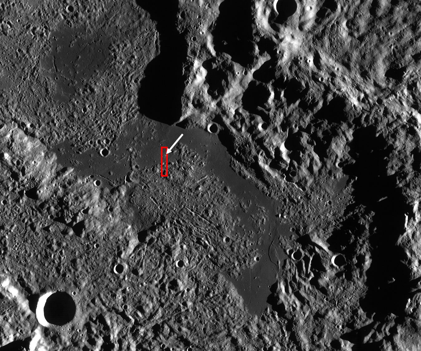
LROC WAC mosaic of Lacus Autumni, context for the LROC Featured Image. Red box outlines the the full LROC NAC field of view from LROC observation M114498609, orbit 2007, December 3, 2009. The white arrows points to the location of the fresh crater. Field of view above approximately 160 km across [NASA/GSFC/Arizona State University].
Lacus Autumni (or "Autumn Lake"), along with Lacus Veris and Mare Orientale, is a mare pond located in the northeast portion of the Orientale Basin. It lies between the Orientale inner ring (Montes Rook) and outer ring (Montes Cordillera). When craters form in thin mare sometimes high-reflectance highlands material is excavated from depth, which makes it difficult to differentiate between maturity rays and compositional rays. To resolve this issue, we can look at the composition of the material that was excavated, looking specifically at both iron and titanium maps.

Nestled in a valley between the inner and outer Orientale impact basin rings, Lacus Autumni is seen here at high relief of sunset shadows. Mosaic of LROC WAC observations from orbits 4786 through 4791, July 9, 2010; Uncropped field of view (very roughly) 205 km across, at an average resolution 68 meters, incidence 80° from 49 km. View the full-size original HERE [NASA/GSFC/Arizona State University].
If the rays are indistinguishable from the mare in which the crater formed, then we can conclude that they are highly reflective because they are young and unweathered. If the rays are composed of highlands material, the rays are likely compositional rays.

If the crater excavated highlands material from beneath the mare, then we can estimate the thickness of the mare deposit and determine just how much lava was extruded onto the surface when the mare formed. In the case of compositional rays, the morphology of the crater, such as a crisp rim or peak, is an indicator of the age of the crater.

The crater rays in this LROC Featured Image are indistinguishable from the mare in which they are found, so these are indeed maturity rays.

Explore more of Lacus Autumni, HERE.

Related Posts:
Fresh Bench Crater in Oceanus Procellarum
A Gathering in Lacus Mortis
Shield Volcanoes in Lacus Veris
Unnamed Fresh Crater Northeast of Arago (DTM)
New Crater!

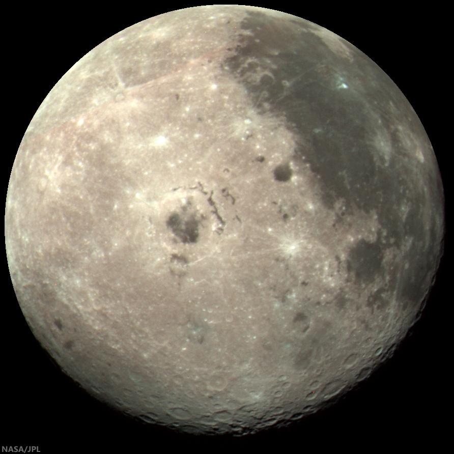
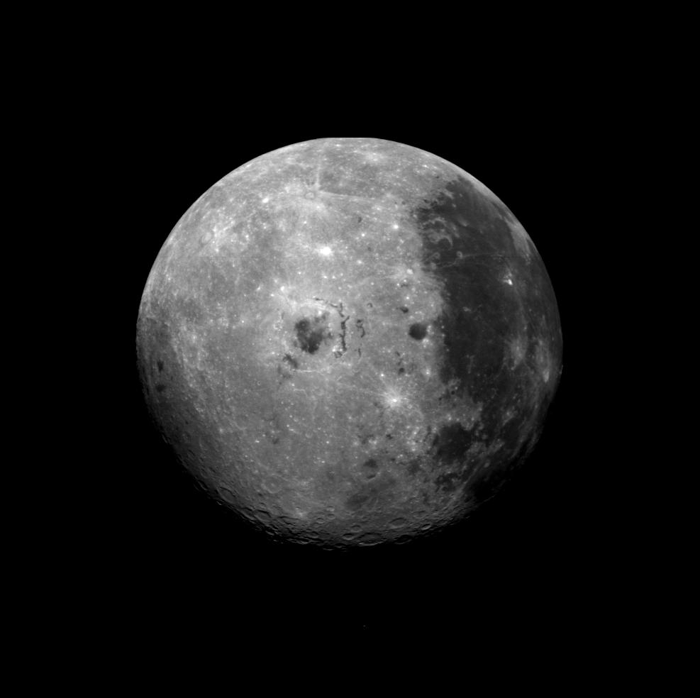
A well-known composite color image of the Moon's western hemisphere centered just below Lacus Autumni, northeast of Mare Orientale, captured by the Galileo spacecraft while maneuvering out of the inner solar system on its way to Jupiter, at 1735 UT  December 9, 1990, from roughly 560,000 km away. The color composite was stacked from monochrome images taken through violet, red, and near-infrared filters. The Moon's nearside is to the right, the far side to the left [NASA/JPL].

Thursday, November 21, 2013

On the chronology of lunar formation and evolution

The Moon about 3 billion years shy of it's most familiar cratering, more or less as it appeared after the basin-forming-impact that created Mare Orientale. From the Goddard / Science Visualization Studio video 'Evolution of the Moon' (2012) [NASA/GSFC/SVS].
A newly published chronology of the Moon's four and a half billion year history, among other things, addresses why certain of its oldest and most familiar nearside basins did not originate from a 'basin-forming-impact.'

Johannes Geiss, Angelo Pio Rossi
The Astronomy & Astrophysics Review   

An origin of the Moon by a Giant Impact is presently the most widely accepted theory of lunar origin. It is consistent with the major lunar observations: its exceptionally large size relative to the host planet, the high angular momentum of the Earth–Moon system, the extreme depletion of volatile elements, and the delayed accretion, quickly followed by the formation of a global crust and mantle.

According to this theory, an impact on Earth of a Mars-sized body set the initial conditions for the formation and evolution of the Moon. The impact produced a protolunar cloud. Fast accretion of the Moon from the dense cloud ensured an effective transformation of gravitational energy into heat and widespread melting. A “Magma Ocean” of global dimensions formed, and upon cooling, an anorthositic crust and a mafic mantle were created by gravitational separation.

Simulation of a Moon-forming impact [Harvard University].
Several 100 million years after lunar accretion, long-lived isotopes of potassium, uranium and thorium had produced enough additional heat for inducing partial melting in the mantle; lava extruded into large basins and solidified as titanium-rich mare basalt. This delayed era of extrusive rock formation began about 3.9 billion years ago and may have lasted nearly 3 billions years.

A relative crater count timescale was established and calibrated by radiometric dating (i.e., dating by use of radioactive decay) of rocks returned from six Apollo landing regions and three Luna landing spots. Fairly well calibrated are the periods from 4 billion to about 3 billion years before present, 800 million years ago to the present. Crater counting and orbital chemistry (derived from remote sensing in spectral domains ranging from gamma and x-rays to the infrared) have identified mare basalt surfaces in Oceanus Procellarum that appear to be nearly as young as 1 billion years.

Samples returned from this area are needed for narrowing the gap of 2 billion years in the calibrated timescale. The lunar timescale is not only used for reconstructing lunar evolution but serves also as a standard for chronologies of the terrestrial planets, including Mars and possibly early Earth.

Head / Brown 2010 crater count
James W. Head of Brown University performed a global census 5,185 lunar craters less than 20 km in diameter (2010). Not surprisingly, a thinner population of such craters are found in and around familiar near side basins, reconfirming conclusions from long ago that the huge plains represent younger surfaces [NASA/GSFC/LOLA/Brown/SVS].
The Moon holds a historic record of Galactic cosmic-ray intensity, solar wind composition and fluxes and composition of solids of any size in the region of the terrestrial planets. Some of this record has been deciphered. Secular mixing of the Sun was constrained by determining the ratio of helium-3 to helium-4 of solar wind helium stored in lunar fines and ancient breccias. For checking the presumed constancy of the impact rate over the past (roughly) 3.1 billion years, samples of the youngest mare basalts would be needed for determining their radiometric ages.

Radiometric dating and stratigraphy has revealed that many of the large basins on the near side of the Moon were created by impacts about 4.1 to 3.8 billion years ago. The apparent clustering of ages called “Late Heavy Bombardment (LHB)” is thought to result from migration of planets several 100 million years after their accretion.

The bombardment, unexpectedly late in solar system history, must have had a devastating effect on the atmosphere, hydrosphere and habitability on Earth during and following this epoch, but direct traces of this bombardment have been eradicated on our planet by plate tectonics. Indirect evidence about the course of bombardment during this epoch on Earth must therefore come from the lunar record, especially from additional data on the terminal phase of the LHB. For this purpose, documented samples are required for measuring precise radiometric ages of the Orientale basin and the Nectaris and/or Fecunditatis basins in order to compare these ages with the time of the earliest traces of life on Earth.

A crater count chronology is presently being built up for planet Mars and its surface features. The chronology is based on the established lunar chronology whereby differences between the impact rates for Moon and Mars are derived from local fluxes and impact energies of projectiles. Direct calibration of the Martian chronology will have to come from radiometric ages and cosmic-ray exposure ages measured in samples returned from the planet.

The full science paper is behind Springer's paywall, HERE.

Related Posts:
Earth and Moon share primal water source (May 10, 2013)
Thin Crust Moon (April 24, 2013)
Making the Moon: Two New Models (October 25, 2012)
Water from the Sun (October 17, 2012)
Hit-and-Run Science, Paul Spudis (September 30, 2012)
A Sawtooth-like timeline for the first billion years of lunar bombardment (August 28, 2012)
A new 'hit and run' Giant Impact scenario (July 28, 2012)
"Our view of the Moon has turned upside down" (April 26, 2012)
Ti paternity test fingers Earth as Moon's parent (March 28, 2012)
NLSI team sheds light on 'late heavy bombardment' (February 28, 2012)
Cataclysmic Conundrum, Paul Spudis (February 14, 2012)
'Significant change' in bombardment timing (January 6, 2012)
LOLA data improves the crater count (September 19, 2010)

Thursday, October 24, 2013

Ground hugging ejecta, northwest of Mare Orientale

LROC Featured Image 24 Oct 2013
Ejecta deposit of an unnamed crater  approximately 2.7 km in diameter 5 km south of this 567 meter-wide field of view centered on 9.80°N, 250.06°E. LROC Narrow Angle Camera (NAC) observation M130008764R, LRO orbit 4293, June 1, 2013; 57 cm per pixel resolution from 54.75 km, camera and spacecraft slewed 5.43° from nadir [NASA/GSFC/Arizona State University].
Hiroyuki Sato
LROC News System

Today's Featured Image highlights the northern portion of the ejecta deposit splashed from an unnamed crater (~2.7 km in diameter, about 5 km south of this image) located in the highlands ~800 km northwest of Mare Orientale. The curved stripes from the bottom toward the upper-left of this image represent the flow direction of ground hugging ejecta deposits.

As shown in the classic impact cratering model, the ejecta is ballistically sprayed out of the impact center forming an ejecta curtain. After the ejecta curtain impacts the outside of the crater, it flows in a ground hugging horizontal motion until its kinetic energy is completely dissipated. The ejecta direction depends on flow speed and the local topographic slopes or undulations.

M130008764R_context2-1200
Wider 1.8 km field of view from LROC NAC M130008764R, highlighting ejecta deposits gushed into an bowl shaped topographic low [NASA/GSFC/Arizona State University].
M186606026LR-NSJ-1106-1700
Nearly the same field of view with the Sun overhead results in an image that puts the emphasis on albedo over topography (see the wide context in the image below), LROC NAC M18660602LR, LRO orbit 12574, March 17, 2012; angle of incidence 8.05° at 1 meter per pixel resolution, from 120 km [NASA/GSFC/Arizona State University].
M186606026LR-NSJ-1106-58b-16p-1325x1828
8280 meter-wide field of view from LROC NAC M186606026LR puts the highlighted topographical low in context with the source of the ejecta blanket from the fresh crater 5 km south [NASA/GSFC/Arizona State University].
M130008764R_context-580x800
Further context on the unnamed crater and surrounding ejecta from a LROC Wide Angle Camera (WAC) monochrome mosaic (100 meters per pixel) centered on 9.34°N, 250.08°E. The LROC NAC M130008764R footprint and location of the field of view shown at high resolution in the LROC Featured Image are designated [NASA/GSFC/Arizona State University].
As seen in this second image, the flow direction of ejecta curved along a bowl shaped topographic low (probably a degraded old crater). These characteristic flow lines following the local topography allows scientists to estimate the actual flow speed. In turn, these estimates elucidate detailed mechanisms of ejecta emplacement on the Moon and by comparison other airless bodies, such as asteroids and the planet Mercury

VMA-GHEj20131024-58b-723x995
Much wider context from LROC WAC (GLD100) mosaic puts the are of interest well within the secondary bombardment ejecta originating from the basin forming impact that created Mare Orientale [NASA/GSFC/Arizona State University].
Explore these illuminating ejecta flow patterns in full NAC frame, HERE.

Related Posts:
Dynamic Textures
Ejecta Patterns
Lassell D Ejecta
In the Wake of Giordano Bruno
Scalelike Impact Melts
Delicate patterns in Giordano Bruno ejecta
Swarm of Secondaries
Swept Surface

Friday, October 4, 2013

Orientalis fall out at Inghirami C?

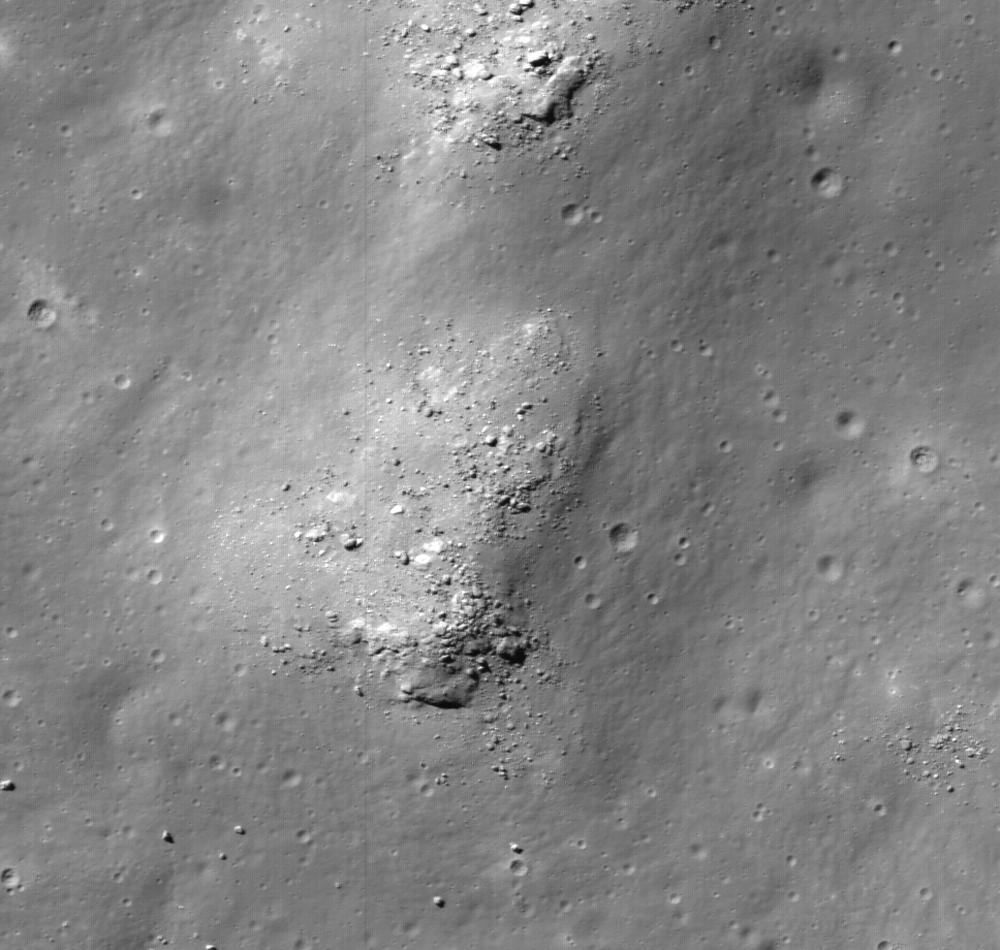
Boulders scattered across mounds on the floor of Inghirami C may be ejecta nested in melt that originated with the basin-forming-impact that created Mare Orientalis and it's extensive basin 3.1 billion years ago. LROC Narrow Angle Camera (NAC) observation M1114645692L, LRO orbit 16501, February 4, 2013, full 64 cm per pixel resolution crop centered at 44.167°S, 285.309°E. LROC Featured Image field of view roughly 500 meters across, 54.74° angle of incidence [NASA/GSFC/Arizona State University].
H. Meyer
LROC News System

The floor of Inghirami C is littered with boulders that are commonly perched atop closely spaced mounds, some of which are as large as 700 meters by 1000 meters. The presence of these mounds and boulders gives the floor of the crater a lumpy appearance. If simple craters are supposed to be bowl-shaped, where did the material come from to form the mounds? Inghirami C is located southeast of Orientale basin and is adorned with spectacular patterns of ejecta during the basin forming event. Could the lumps and boulders be material from Orientale?

Full 3.2 km-wide field of view of LROC NAC M11144569LE, with the area highlighted at high resolution above outlined in yellow. While amorphous mounds and melt mixtures are common features covering floors of larger craters, like Copernican age Tycho, these features appear more cohesive with no intermediate stages of mixture with their surroundings and mass wasting characteristic of far flung boulders [NASA/GSFC/Arizona State University].
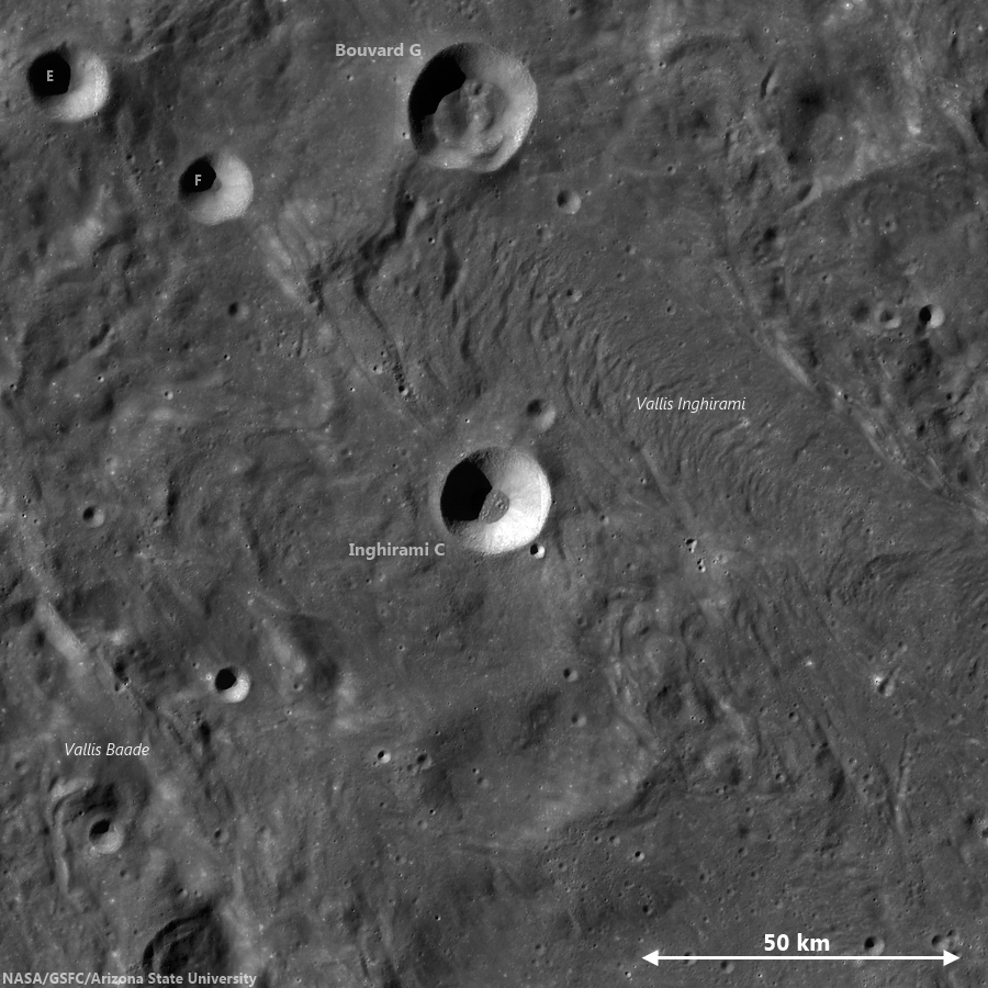
A medium resolution, low illumination angle view of Inghirami C shows the hint of an ejecta blanket from the 19 km crater and its blocky floor, in context with immediate surroundings deeply grooved by forces radiant from the Orientalis basin. Chang'e-2 global photographic [CNSA/CLEP].
In the Wide Angle Camera (WAC) context image (below), the walls of Inghirami C are intact. There are no breaches in the walls to suggest that ejecta from Orientale flowed directly into the crater. If you look closely, you can see a hint of an ejecta blanket outside the rim of Inghirami C. The presence of this ejecta blanket (from Inghirami C) and the lack of breaches suggest that Inghirami C formed on top of the Orientale ejecta.

Inghirami C
LROC GLD100 mosaic showing Inghirami C nested in the midst of a wide area of terrain grooved and infilled by eject from the Orientalis basin-forming-impact. The same influence, radiant from Orientalis, continues far to the southwest and may explain the atypical fill in and around other craters in the Schickard crater group at even greater distances, including Wargentin [NASA/GSFC/Arizona State University].
Using basic stratigraphic principles, this means Inghirami C formed after the Orientale ejecta formed the ridged terrain (seen just outside the rim of Inghirami C in the context image). If the material in the floor didn't come from Orientale or any other large crater nearby, then it must be native to Inghirami C. It turns out that not all simple craters are bowl-shaped with smooth floors -- and in fact many display textured floors covered in combinations of breccias, impact melt, and ejected blocks that can form mounds. Over time, the mounds erode, leaving the boulders seen in today's Featured Image.

Back to the question: Could the lumps and boulders be material from Orientale? Not directly as established above, but perhaps the irregular forms are due to an impact into a chaotic, unconsolidated massive ejecta flow from the Orientale event! The lunar surface is incredibly complex - everywhere you look there is something new, waiting to be explored!

Check out the rest of this exquisite terrain HERE.

Read more about impact excavation:
Excavating Deposits
Polka-dot Ejecta
Off-centered deposits
Forked Impact Melt

Monday, August 19, 2013

Oblique look deep into the heart of Lowell crater

Lowell (LROC oblique)
Oblique LROC Narrow Angle Camera (NAC) mosaic of Lowell crater (62.65 km - 12.96°S, 256.58°E), super-positioned (or is it?) on the northeast quadrant of the Orientale basin. LROC NAC observations M1108918822R & L, spacecraft orbit 15696, November 30, 2012; angle of incidence 80.52° averaging 3 meters per pixel resolution (spacecraft and camera slew -62.35° from 91.55 km over 12.81°S, 262.88°) [NASA/GSFC/Arizona State University].

Named for the one and only Percival Lawrence Lowell (March 13, 1855 – November 12, 1916), popularizer of Mars lore in the late 19th century, and celebrated in part also by Clyde Tombaugh when he chose a name for "Pluto" in 1930, in the first two letters of that now "former planet's" Olympian moniker.
ILIADS-Lowell-2-1159x1611
Looking north over Lowell and the northwest Orientale basin. LROC Wide Angle Camera (WAC) global mosaic draped on LOLA laser altimetry using NASA ILIADS application [NASA/GSFC/MSFC/ASU].
Related Posts:
Oblique views of Moon's highest and lowest places (October 3, 2012)
Impact melt lobes (April 12, 2012)

Tuesday, July 30, 2013

Orientale Sculpture

An oblique view of ejecta over 400 km south of the Orientale basin rim, a scene approximately 5 km across, centered at 51.8°S, 264.8°E, LROC Narrow Angle Camera (NAC) mosaic M1127819355LR, LRO orbit 18355, July 7, 2013; native resolution 1.9 meters per pixel [NASA/GSFC/Arizona State University].
Brett Denevi
LROC News System

Today's featured image is located near the center of the ancient 600-km Mendel-Rydberg basin. Its degraded state means Mendel-Rydberg's presence is not obvious in the WAC context image below (in fact, its existence was only confirmed with Clementine (1994) topography data), but its western rim is near the crater Mendel, and Rydberg and Guthnick craters are near the center of the basin.

However, it was not the Mendel-Rydberg impact that was responsible for the ups and downs in the hummocky deposits seen in today's Featured Image, but the Orientale impact event, hundreds of kilometers away to the north.

Ejecta from impact basins is both erosional, gouging out long valleys and leaving strings of large secondary craters (along the arrows in the image below), and depositional, blanketing even distant terrain with material excavated from the impact site. Basin ejecta plays such a large role shaping the lunar surface that these ups and downs are often referred to as "basin sculpture," and the ejecta from Orientale certainly sculpted the terrain in today's image.

LROC Wide Angle Camera (WAC) mosaic context views of the southern Orientale region. The blue box in the image at bottom shows the field of view at top, where a yellow box shows the approximate field of view shown in the LROC Featured Image. Click to enlarge [NASA/GSFC/Arizona State University].
The hummocky deposits that cover low-lying areas in the top image, and the image below, are likely ejecta from the Orientale basin. These low-lying regions may have once been exposures of smooth mare basalt, some of which is still exposed on the surface in nearby regions, but are now hidden under a blanket of debris from Orientale. Buried volcanic deposits such as these are known as "cryptomare" and tracking down the locations of these ancient sites of volcanic activity is key for understanding the extent of early volcanism on the Moon.

A wider (and reduced-resolution) view of the LROC NAC mosaic from which the LROC Featured Image within the Mendel-Rydberg basin was cropped. LROC NAC M1127819355LR [NASA/GSFC/Arizona State University].
You may also note that the hills in the southern portion (right side) of the image above have a lumpy texture, also visible in the WAC context image. This is also likely due to Orientale's influence - the result of a massive ground hugging flow of ejecta that piled up on the sloped terrain. This oblique view of the region gives a great perspective on its complex history that would have been compelling enough with just the ancient Mendel-Rydberg basin and early lunar volcanism, but the spectacular basin ejecta flows captured here are just icing on the cake (so to speak).

Click HERE to see the full-resolution view.

Related LROC Featured Images:
Amazing Orientale Peaks and Valleys
Regolith Patterns in Mendel-Rydberg
Window to the Farside Mantle
Two-toned Impact Crater in Balmer Basin: A reflection of the Target?
Dark Craters on a Bright Ejecta Blanket

Tuesday, July 16, 2013

Amazing peaks and valleys in new Orientale NAC oblique

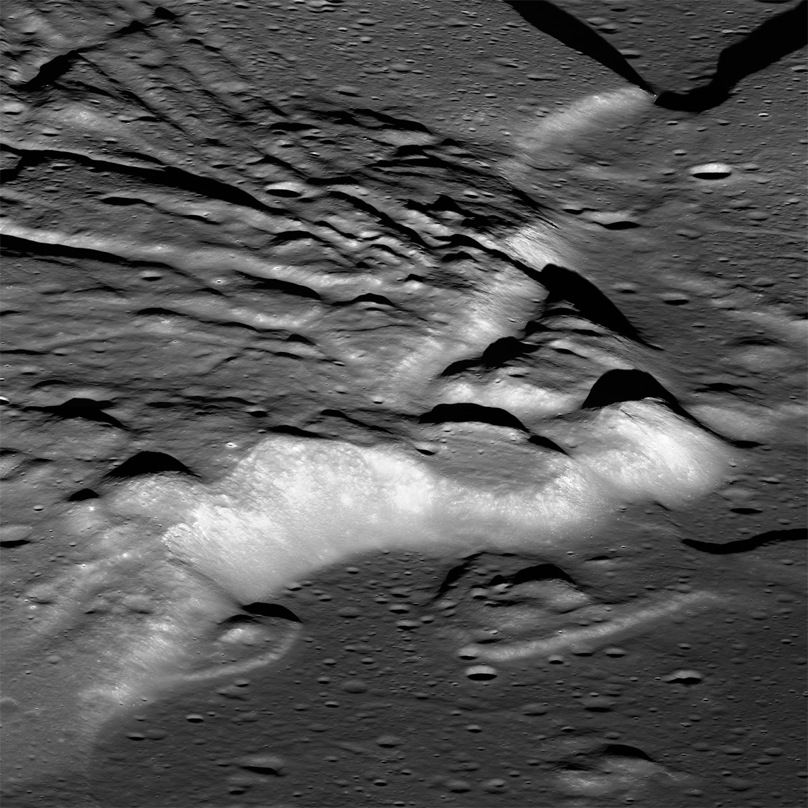
Spectacular oblique view of the interior of the Orientale basin. LROC Narrow Angle Camera (NAC) mosaic M1124173129LR, LRO orbit 17842, May 26, 2013, centered at 24.23°S, 264.30°E. The scene cropped above shows a field of view approximately 16 km across, and the cliffs at center rise almost 2 km over the southwestern interior edge of the basin floor. Native resolution 2.59 meters per pixel [NASA/GSFC/Arizona State University].
Brett Denevi
LROC News System

With an estimated age of around 3.8 billion years, and a diameter of over 900 km, the Orientale basin is the youngest of the large lunar impact basins.

Its interior is relatively well preserved and its floor has not been completely buried under mare basalts, making it one of the most studied basins on the lunar surface in the hopes of unraveling the mechanics of multi-ring basin formation and the relationships of volcanic infilling to large basins.

Today's featured image highlights some of the more bizarre and complex features inside the southwestern portion of the basin, where primary features related to the basin itself meet the later-forming mare basalts in the basin floor.

Miniature (view the 1280x720 animation HERE) composition of five frames of HDTV captured by Japan's lunar orbiter Kaguya (SELENE-1) in November 2007.  In polar orbit more than 100 km over Mare Orientale Kaguya moves north. Beginning far to the south the slideshow begins with the inner mountain ring like a wide plateau looming on the horizon and minutes later the inner basin and lava-flooded basin floor comes prominently into view, including the area shown at high resolution in the LROC NAC oblique mosaic. Afterward, the final frames linger a moment over prominent Maunder crater and the high mountainous rings and valleys of north Orientale. Widespread terrain disruption by the basin-forming impact is uninterrupted throughout the entire sequence [JAXA/NHK/SELENE].
View the Kaguya Image Gallery HERE

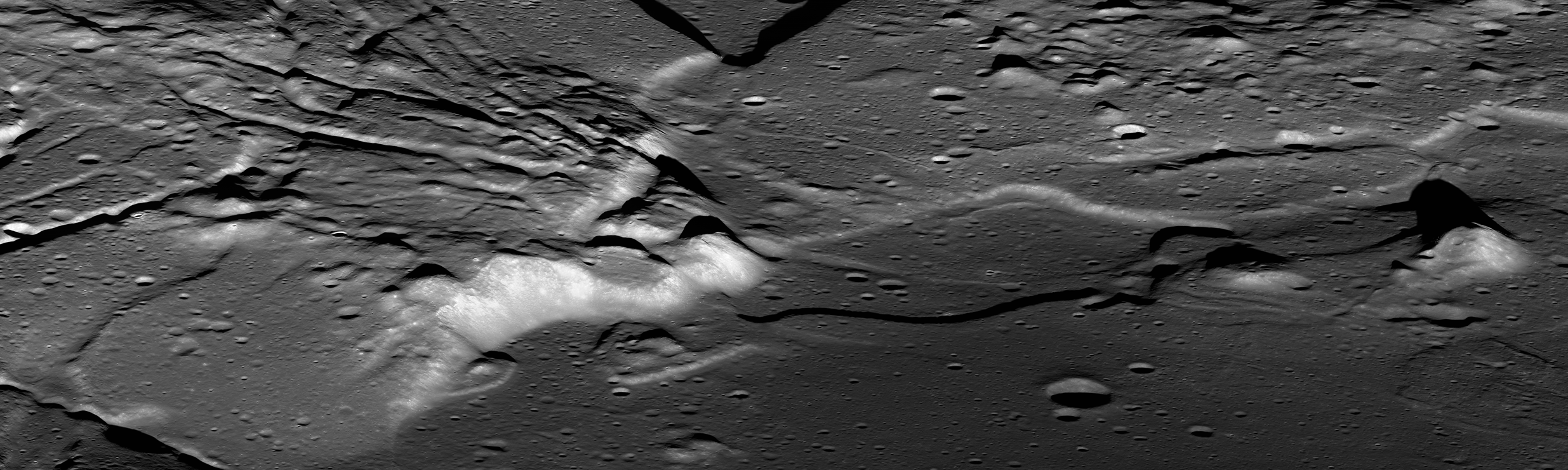
A reduced-resolution version of the oblique NAC mosaic of the Orientale interior. The thumbnail above links to a 2470 by 740 reproduction HERE, while the zoomable, full-resolution view is viewable HERE [NASA/GSFC/Arizona State University].
The striking linear features seen in the top image are portions of a series of cracks that are near-radial to the basin and are unlike typical lunar graben. This portion of the interior is thought to have a high proportion of material that was melted by the extreme shock pressures of the impact event that crated the Orientale basin, and the cracks may have formed as the hot material, draped over underlying topography, cooled and shrank. It is hard to picture the effects of an impact so large it would have obliterated the state of Texas, but here you can almost see the molten and shifting terrain settling and cracking.

LROC Wide Angle Camera (WAC) context view of a portion of southwestern Orientale basin featuring the approximate area shown in NAC mosaic (white box) M1124173129LR [NASA/GSFC/Arizona State University].
You can also get a sense of how basaltic lavas, the lower-reflectance deposits seen at bottom right, poured in later, flooding low areas, lapping up against the higher-standing terrain, and leaving kipukas of original basin material exposed in some spots. These lavas are estimated to have erupted on the order of 100 million years after the formation of the Orientale basin, but were not as voluminous as the basalts that bury all but the rims of other lunar multi-ring basins, such as Serenitatis and Imbrium. The WAC image mosaic of the region, seen below, helps put these features into context. Here you can see the Orientale mare deposits lie largely within the innermost ring of the basin, the Inner Rook mountains. (The other rings are named the Outer Rook mountains, also seen below, and the Cordillera mountains, which lie outside of the context image.)

Why did these basalts fill regions largely contained within only the innermost ring of Orientale, whereas other basins were totally flooded? Orientale may have formed in a region of thicker crust, making it harder for basalts to erupt from the mantle to the surface anywhere but the center of the basin, where the crust was thinned the most. The composition of Orientale's basalts is also known to be different from the major nearside maria, with a lower concentration of radioactive heat-producing elements (known as KREEP), so there may have been less heat available to melt the mantle to produce basalts.


GRAIL MoonKAM video stills sequenced into nadir and off-nadir low-orbit HD views of Mare Orientale (2:00). The area of interest is visible between 1:05 and 1:15 [NASA/JPL-Caltech/Sally Ride Science].

This interplay of spectacular, complex features related to basin formation and later volcanic eruptions means Orientale is a high-priority target for exploration. Samples would pin down the exact age of the basin, important for answering questions about chronology across the Solar System, as well as answer a host of other questions about basin formation and evolution. And what a beautiful view you'd have, standing at the base of Orientale's cliffs!

View the full-resolution NAC mosaic of beautiful Orientale HERE.

Related LROC Featured Images:
Sinuous Cracks
Geologically recent debris flow at Couder
Orientale Basin
A digital terrain model of the Orientale Basin
Chain of secondary craters in Mare Orientale
Dark halo crater in Orientale!

Sunday, March 31, 2013

Off-center impact on the wall of Guthnick

A small 600 meter crater inside the rim of Guthnick, a Copernican impact integral to the Mendlel-Rydberg basin immediately south of Mare Orientalis. This small impact crater exhibits boulders clustered off center, along with a poorly defined rim. Drew Enns asks, "what could be the cause of these distinctive features?" - Crop from LROC Narrow Angle Camera (NAC) M1117124706L, spacecraft orbit 16850, March 5, 2013; 0.60 meters per pixel resolution, above field of view 3 km [NASA/GSFC/Arizona State University].
Drew Enns
LROC News System

Small impact craters are normally bowl-shaped depressions in a planetary surface. Because of this, boulders and impact melt will also fill in the center of the crater. Yet this is not what we observe in today's Featured Image. Why does this small crater have boulders that are off center? Why is the northern portion of the rim undefined? Is it some sort of dynamical fluke? Probably not. It is more likely that there is some uneven terrain influencing the crater. We can zoom out for a larger view.

Asymmetric craters tend to form when the impact angle is greater than 15° The LROC WAC context mosaic helps a lot! We now see that our small crater formed on the wall of the much larger Guthnick crater.

LROC Wide Angle Camera (WAC) context for the small crater (arrow) on the wall of Guthnick crater at 48.27°S, 266.157°E. Though Guthnick is not the subject of this post, the 36 km crater has been identified as one of two that satisfy requirements for sampling intact basin melt sheets. (Science Concept 2: "The structure and composition of the lunar interior provide fundamental information on the evolution of a differentiated planetary body;" CLSE, 2012, pg 115) - LROC WAC observation M112231731CE (604nm), spacecraft orbit 1673, November 7, 2009; resolution 74.25 meters per pixel from 52.51 km [NASA/GSFC/Arizona State University].
The slope of the Guthnick crater's wall had a big effect on the morphology of this simple crater. During the impact event the steep slope resulted in collapse of the downhill portion of the crater, thus the asymmetric shape and collection of boulders on the downhill side.

Still image taken from HDTV feed from Japan's SELENE-1 (Kaguya) orbiting north over the Moon's west limb. The edge of Mare Orientalis has just appeared on the horizon and long chains of impact craters radiate from is central basin. Guthnick, on the right of the two largest craters at the center probably impacted upon one of the long chains, as much as two billion years after the Orientalis event [JAXA/NHK/SELENE]..
The wide-spread and lasting influence of the Orientale basin-forming-impact event can more easily be seen in this LROC WAC digital elevation model. Perhaps at one time the Mendel-Ryder basin, home of Guthnick (white arrow, lower right) though smaller, had an influence nearly as wide spread, wiped away - on the surface at least - 3.1 billion years ago [NASA/GSFC/Arizona State University/DLR].
Explore more of the Guthnick crater interior in a full resolution reproduction of the original LROC NAC, HERE.

Related Posts:
A Tiny Glancing Blow
Clam Shell
Not Your Average Crater

Figure 2.43 (A Global Lunar Landing Site Study to Provide the Scientific Context for Exploration of the Moon, 2012) Topographic profile of Guthnick. Black arrows indicate the transition from upper crater wall to slumped material, as shown by an inflection in the slope. The map uses a polar projection centered on 48°N, 266°E, and the vertical projection of the elevation profile is about 2:1 [CLSE/NLSI/LPI].

Friday, March 29, 2013

Bright small crater ejecta - with a black eye

Fifty meter crater with bright ejecta extending several crater radii. The dark deep interior of the crater could be the disk of of an impact melt pond Field of view 1000 meters across from LROC Narrow Angle Camera (NAC) observation M1117189620R, LRO orbit 16860, March 6, 2013; 0.9 meters resolution [NASA/GSFC/Arizona State University].
Drew Enns
LROC News System

Our impressions (and interpretations) of surface features on planetary bodies are affected by the way they interact with sunlight when we image them.

For instance, the shape of a crater is brought out by shadows in large incidence angles (Sun near the horizon) images.

In today’s Featured Image, we are observing a crater with the Sun nearly directly above the surface. This type of image (small incidence angle) helps scientists understand the physical properties of the surface. Why might the ejecta blanket of the crater be highly reflective? Why is the interior have a much lower reflectance? Two different surface properties could be affecting what we see. First, 'fresh' material should be brighter than surrounding material. And second, the composition of materials affects how they reflect light (see albedo).

A similar, somewhat larger crater for comparison - one also considered to be relatively fresh - in Oceanus Procellarum, northeast of the central eye of the Reiner Gamma albedo swirl. The explicit central melt floor, or disk, may resemble the less clearly resolved fresh crater spot-lighted in this post. You can read the feature story about this comparable crater HERE. LROC NAC observation M111972680L [NASA/GSFC/Arizona State University].
LROC Wide Angle Camera (WAC) context of the region around the small crater highlighted in the LROC Featured Image, located near the red cross (3.022°N, 258.698°E). Image field of view roughly 85 km [NASA/GSFC/Arizona State University].
In the case of today's Featured Image, the crater looks very young. We have some stratigraphic evidence for this as the crater is sitting on top of a larger flesh unnamed crater's ejecta deposit (see context image below).

A quickly put-together crop from the Chang'E-2 (CNSA/CLEP) global medium resolution mosaic, highly emphasizing albedo over the relief made visible by long shadows. Even old and deep craters in this 170 km-wide field of view north of Mare Orientalis seem to disappear under the low solar incidence. If the ejecta blanket from the unnamed crater near center were just a little further east and clearly on the Moon's nearside it would rival the similarly bright ejecta from Tycho, Copernicus or Brygius A. The small crater, clearly overwhelmed in this crop, is marked by a small "X" on he theouter slope of Lents (Lenz) C.
Therefore the brightness of the ejecta blanket is likely due to the young nature of the crater! But that doesn't solve the problem of the crater's interior. The interior could have been mantled by a thin veneer of impact melt which then pooled in the center. We know from many examples that impact melt rock reflects less light than its source material.

The small crater (arrow), situated on the ejecta blanket of a fresh crater further east which, in turn, sits on the wide outer reaches of the Mare Orientalis impact basin. View toward the south, [NASA/ILIADS/LMMP].
The impact melt hypothesis is not certain, though a follow up image at a larger incidence angle to help us understand morphology and could certainly help test this hypothesis!

Explore more ejecta in full the NAC frame, HERE.

Related Posts:
Ejecta Starburst
Swept Surface
Symmetric Ejecta
Shades of Grey