Showing posts with label Aristarchus. Show all posts

Thursday, May 22, 2014

Kink in Rima Krieger

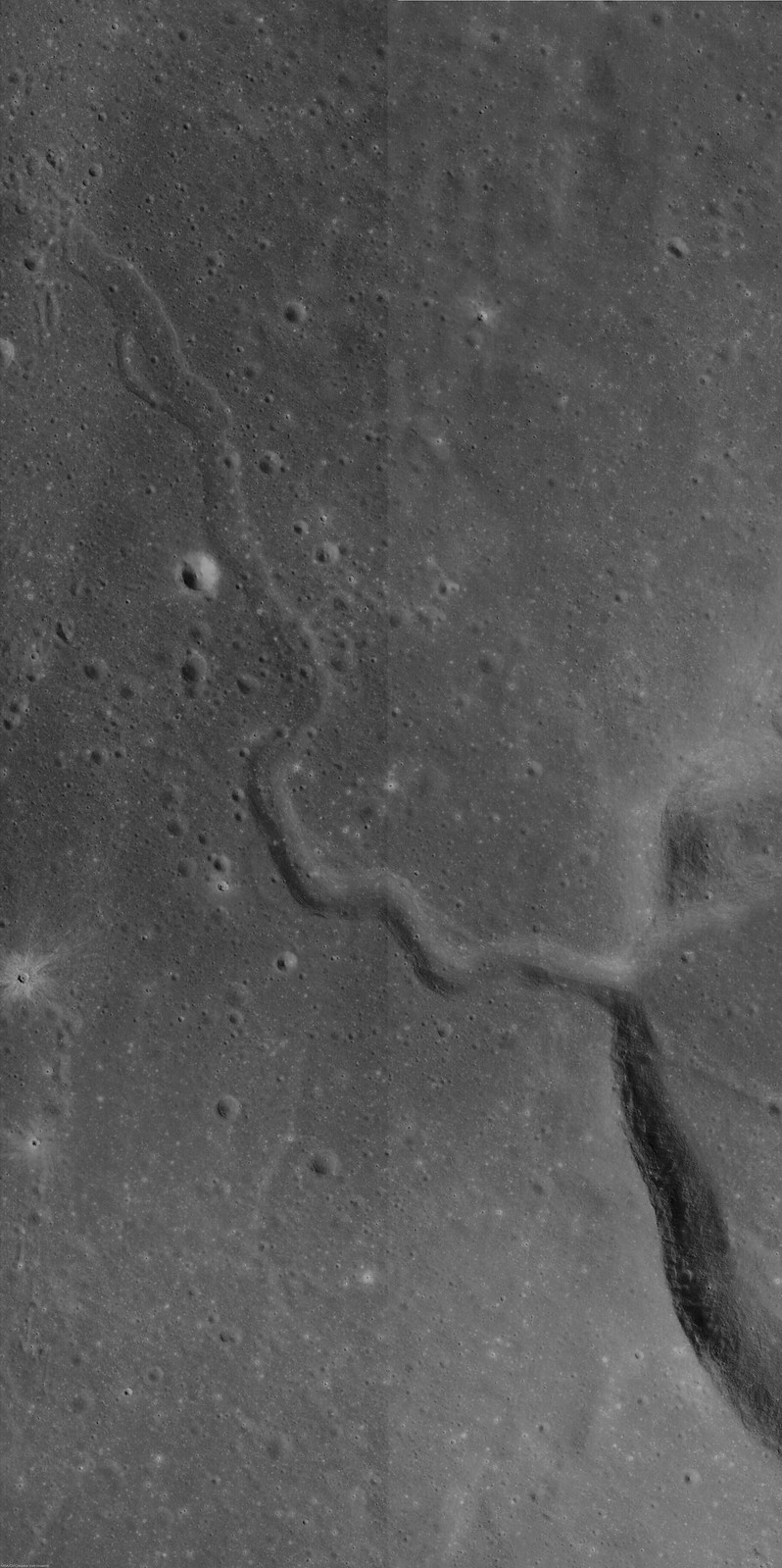
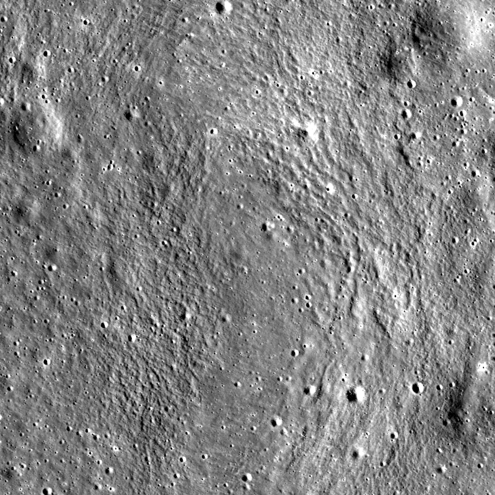
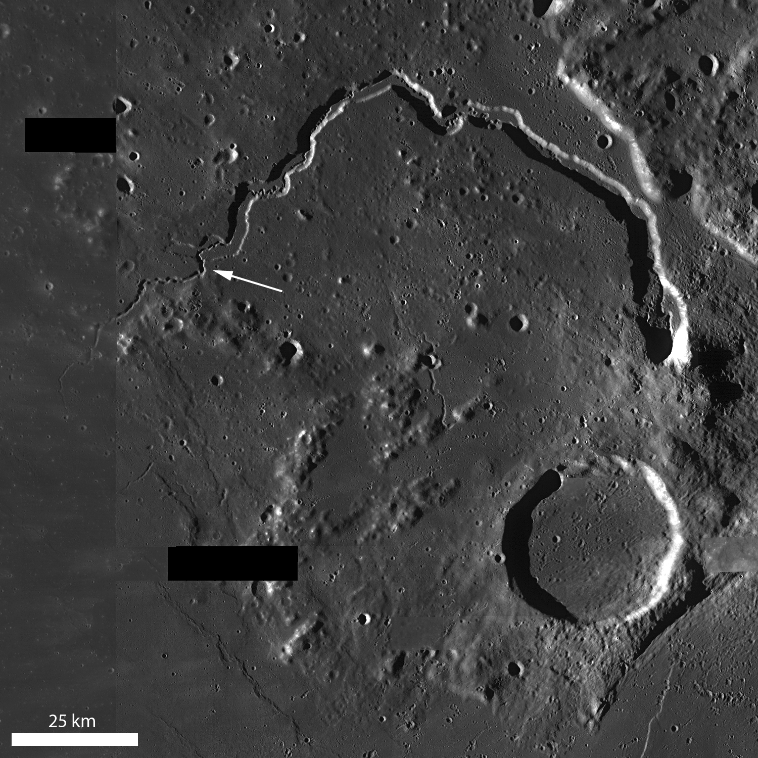
Rima Krieger winds its way through Oceanus Procellarum. Image width is ~ 3.5 km. Taken from LROC NAC observation M1152172510R, LRO orbit 21780, 50.29° incidence angle, resolution 1.35 meters, from 134.64 km over 29.19°N, 313.9°E [NASA/GSFC/Arizona State University].
H. Meyer
LROC News System

Rima Krieger is located in central eastern Oceanus Procellarum. "Rima", which means "fissure", refers to lunar rilles, a common feature on the lunar surface.

Rilles located in mare deposits can form by two mechanisms, channelized lava flow or lava tube collapse, often combined with tectonic stresses. They display three major morphologies: linear, arcuate, and sinuous.

Rima Krieger is a sinuous rille, meaning that its twists and turns resemble meandering rivers on Earth.  Sinuous rilles are thought to have formed as lava became channelized on top of a thick lava flow, as seen at Vallis Schröteri, or as lava flowed across the surface and carved into the substrate.

A roll through four modern orthographic perspectives of Krieger (with 10 km Van Bisbroeck crater superpositioned on its south rim) and the narrow pass through the crater's west wall, where Rima Krieger begins. The region is dominated by its proximity to young Aristarchus crater to the southwest. A 42 km field of view with data contributed by the Lunar Orbiter series, Clementine and LRO [NASA/GSFC/Arizona State University].
In the case of Rima Krieger, some of the meanders occur at nearly right angles, suggesting that the flow was controlled to some degree by underlying structure. These sharp turns appear just outside the rim of Krieger. It's possible that the lava flow was diverted by structure resulting from the impact itself.

LROC NAC mosaic M1145106645R, LRO orbit 20787, January 23, 2014; 48.1° incidence, resolution 1.34 meters from 134.41 km over 29.9°N, 313.87°E. The original, full-size reproduction of this mosaic can be viewed HERE [NASA/GSFC/Arizona State University].
The rille and impact in Today's Featured Image are only a few of the fascinating formations in this region. Rima Krieger is located in one of the most geologically diverse regions of the Moon. To its west, the Aristarchus Plateau stands above the surrounding mare. On the Aristarchus Plateau, we see mare basalts juxtaposed with anorthositic materials excavated by the Aristarchus impact and a dark mantle of pyroclastics over much of the plateau.

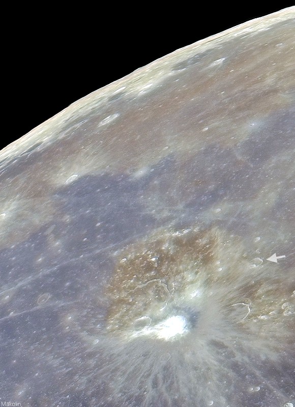
Telescopic mosaic from Earth at full Moon, stretched for color contrast, shows some of the wide variety of basalt in north Procellarum, and just how Krieger (arrow) overpowered by its young neighbor, bright Copernican age Aristarchus and its excavation of Aristarchus plateau.
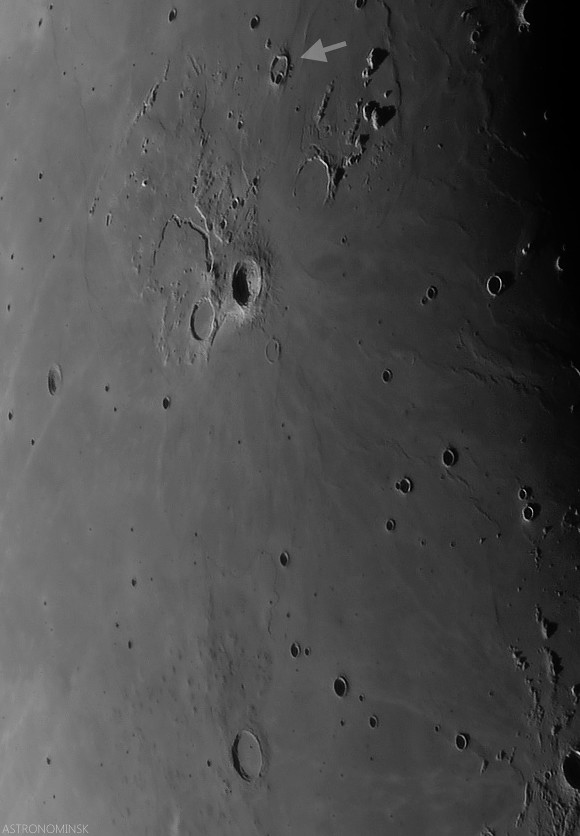
Local evening view de-emphasizes albedo and emphasizes terrain relief in this telescopic look at a 630 km field of view from Krieger (arrow, north) and Marius. (note the Marius Hills as their low profiles come into view on their namesake's north-northwest. Even the long Marius sinuous rille can be seen winding through the plain just north of those Hills. Krieger's morphology is still dominated by Aristarchus. Late crescent Moon mosaic by Astronominsk, September 25, 2008.
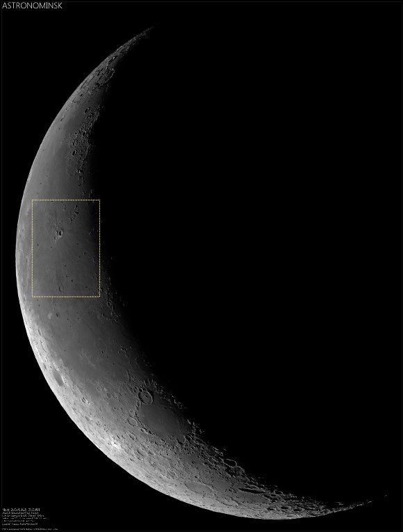
Very reduced view of the full-size ASTRONOMINSK late crescent Moon mosaic of 22 images, showing the field of view immediately above in context (inset). Note the differing perspectives on the Aristarchus Plateau, seen from Earth under a high and low Sun due to libration. The full mosaic can be viewed at the ASTRONOMINSK website, HERE.
To the east of Rima Krieger, we cross the contact between Oceanus Procellarum and Mare Imbrium (passing many kipukas along the way) and run northeast into the Gruithuisen Domes. To the south, the Rimae Prinze Region displays its many sinuous rilles, flooded craters, and massifs. To explore the entire region in more detail, check it out through the LROC QuickMap, HERE.

Related Posts:

Monday, April 1, 2013

Unassuming volcanic vent north of Aristarchus Plateau

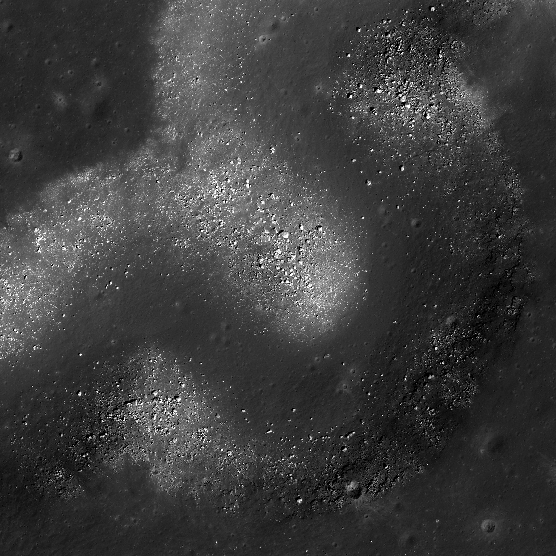
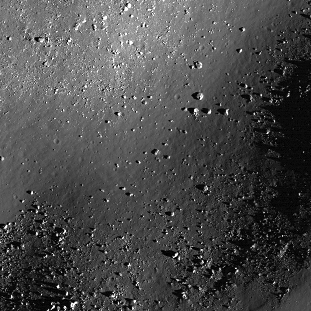
This unassuming textured surface surrounding a smooth tongue of material is likely a volcanic vent. Field of view 1500 meters, from LROC Narrow Angle Camera (NAC) observation M181495512L, spacecraft orbit 11859, January 18, 2011; angle of incidence 66.53° and 1.46 meters resolution from 147.24 km altitude [NASA/GSFC/Arizona State University].
Drew Enns
LROC News System

Igneous rocks are common on the Moon, basalt makes up the darker mare, and anorthosite makes up the lighter highlands. Less common are the volcanic structures that might have produced the mare. But in today's Featured Image we might have one such structure!

The area highlighted looks similar to vents (the source point of lava) on terrestrial volcanoes. How strong a case can we make for this being volcanic in origin? Maybe a larger view will help give context.

UPDATE: The "unassuming extrusive dome" from the east, in an oblique LROC NAC observation (camera and spacecraft slew -67° from nadir), M177927436LR mosaic, orbit 11357, December 7, 2011; roughly 3.2 meters per pixel resolution from 41.93 km over 30.98°N, 314.73°E (more than 140 km from target) [NASA/GSFC/Arizona State University].
LROC Wide Angle Camera mosaic providing context for the area highlighted within the LROC NAC Featured Image released April 1, 2013 (red asterisk). South lay the volcanic shield Aristarchus Plateau complex Field of view 58 v 80 kilometers [NASA/GSFC/Arizona State University].
The small channel in the Featured Image does not have much depth, so it is difficult to make out. But in the high incidence angle (nearly 80°) context mosaic we see that a shallow channel superposes the center of a low relief pancake-like mound. This pancake feature is very similar to shallow shield volcanoes on Earth. These types of volcanoes have very low slopes and additionally, Aristarchus Plateau is just to the south with a number of volcanic features (rilles, flat floored craters, and massifs). Taken together these observations present a strong case that the smooth area in today's Featured Image is the vent for a shield volcano!

Explore more of the area in the full LROC NAC, HERE.

Related Posts:
New views of the Hollows of Rimae Sosigenes

Sunday, January 13, 2013

Activity on the Moon: Transient Lunar Phenomena

At local sunrise Aristarchus (r) and the southern boundary ridge of its namesake plateau catch the advancing terminator long before the surrounding plain of Oceanus Procellarum. The Copernican-age crater, its bright interior and ejecta, much younger than its ancient companion Herodotus (l), is the number one location for reports of Transient Lunar Phenomena (TLP). At the same time, the basalt plains immediately south of the plateau, are estimated to be the youngest mare segment on the entire Moon [NASA/GSFC/Arizona State University].
Cruz Roa & Andr es Felipe
University of Tolima
Astronomy Group Urania Scorpius
Ibague, Tolima, Colombia


Transient Lunar Phenomena (TLP) observed on the surface of the moon, are of high rarity, low repetition rate and very short observation times, resulting in that there is little information about this topic. This necessitates the importance of studying them in detail. They have been observed as very bright clouds of gases of past geological lunar activity. According its duration, there have been registered in di erent colors (yellow, orange, red). Its size can vary from a few to hundreds of kilometers. The TLP Usually occur in certain locations as in some craters (Aristarchus, Plato, Kepler, etc.) and at the edges of lunar maria (Sea of Fecundity, Alps hills area, etc.). The exposure time of a TLP can vary from a few seconds to a little more than one hour.

In this paper, a literature review of the TLP is made to build a theory from the existing reports and scienti c hypotheses, trying to unify and synthesize data and concepts that are scattered by di erent lunar research lines. The TLP need to be explained from celestial mechanics and planetary astrophysics to explain the possible causes from phenomena such as outgassing moon, moonquakes and the gravitational interaction. Extrapolating these hypothetical physical knowledge, arguments are exposed for Lunar degassing theory showing this as the most consistent. It's build also a the theory of how to observe, describe, explain and predict the TLP.

Read the research paper (pdf), HERE.

Wednesday, December 26, 2012

Aristarchus follow-up

Aristarchus in one sweep, an orbital swath ultimately stitched into a four-orbit mosaic, shows one of the most photographed of the complex lunar craters in unusually muted tones. Because Aristarchus is unusually bright, the reason it is most often cited as the reported location of Transitory Lunar Phenomena, fast LROC low-orbit photography allows an unwashed-out appreciation of its topographic detail. Full-width strip of LROC Wide Angle Camera (WAC) observation M162622850CE, (604nm), LRO orbit 9099, June 13, 2011; resolution 56.85 meters at a morning angle of incidence of 79° from 40.77 km [NASA/GSFC/Arizona State University].
Strip from the four sequential LROC WAC orbital observations mosaic shows young Aristarchus nested on the southeastern heights of Aristarchus plateau, together with the Cobra Head and much older, mare-flooded companion Herodotus to the west. The youngest mare surface on the Moon yet identified, estimated to be a mere 1.1 billion years old, is situated at the southern end of this field of view. Despite it's relative youth, that surface is older than Copernican-age Aristarchus, so the crater cannot be its source [NASA/GSFC/Arizona State University].
A full-resolution crop from a full-disk 33 image mosaic of the Moon, September 25, 2008, shows Aristarchus and its plateau at local late afternoon [Astronominsk].
Southside, Aristarchus crater (December 25, 2012)
Oblique Narrow Angle on Aristarchus Cobra Head (October 9, 2012)
Debris Channels (August 8, 2012)

Tuesday, December 25, 2012

Southside, Aristarchus Crater

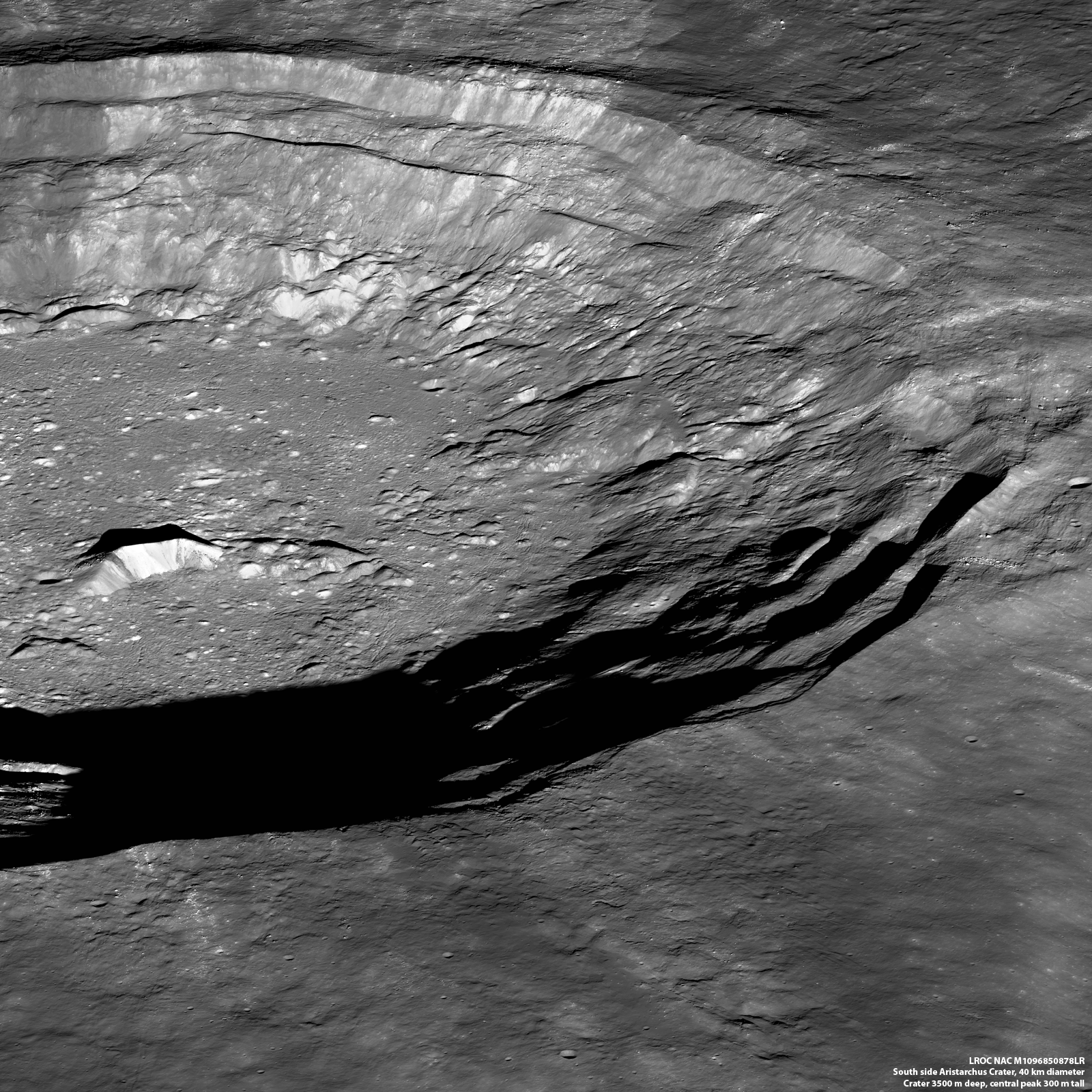
Southeast Aristarchus crater, obliquely from an altitude of 135 km over the west by northwest. LROC Narrow Angle Camera observation M1096850878LR, LRO orbit 14007, July 13, 2012 [NASA/GSFC/Arizona State University].
Mark Robinson
Principal Investigator
Lunar Reconnaissance Orbiter Camera
Arizona State University

Aristarchus crater, one of many fascinating exploration destinations on the Moon: young, highly reflective, rugged, and colorful! Look at the shades of grey in the small central peak, an inviting tapestry of geologic diversity!

Looking up and over to the east, on the steep walls of the crater, observe the streaks marking ejecta leaving the crater. The shades of grey in the streaks likely trace back to the diverse stratigraphy seen in the central peak. Imagine a future lunar explorer traversing around the base of the 300 meter tall central peak while collecting samples. There are at least three different distinct shades of grey seen on the steep slopes, perhaps more? Though climbing to the top and walking the ridge would afford a magnificent view, simply collecting rocks along the base would suffice from a geologic viewpoint.

Aristarchus crater central peak (23.693°N, 312.487°E), shades of gray in talus signal compositional difference. The central peak is about 4.5 km wide from this perspective [NASA/GSFC/Arizona State University].
The next logical step is to collect samples along the east and southeast wall of the crater. Do the distinct rays seen trace back to the layers seen in the central peak? What about the enigmatic reddish brown material just on the southeast flank? The geology of the Moon is rich and complicated!

LROC Wide Angle Camera (WAC) regional view of Aristarchus plateau and crater. The arrow shows direction of view from LRO for the oblique NAC observation [NASA/GSFC/Arizona State University].
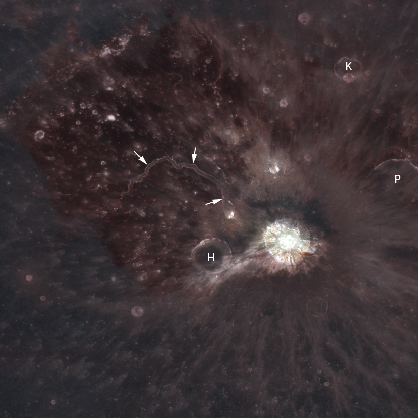
From LROC WAC color images you can see that the gray streaks show up as distinct color anomalies, color due to variations in rock type. The area has long been known to be among the reddest spots on the Moon - meaning its reflectance strongly increases from short to long wavelengths. In the WAC color image below, you can see the distinct red-hued region, which is largely blanketed by the glass-rich products of explosive volcanic eruptions. This area is surrounded by bluer terrain, which formed when titanium-rich (at least it is thought that titanium is in these rocks) lava flowed across the surface and flooded the area, forming a portion of Oceanus Procellarum. In both of the WAC context images, you can see Vallis Schröteri, a canyon-like feature known as a sinuous rille, through which the lava once flowed.

Aristarchus area UVVIS (UV and visible wavelength stack) WAC color composite of Aristrachus plateau and crater; red is 689 nm, green 415 nm, and blue 315 nm. Note the brownish-red splash of color on and immediately outside the southeastern rim (H-Herodotus crater,  K-Krieger & P-Prinz craters) [NASA/GSFC/Arizona State University].
At the intersection of this amazingly diverse region, the Aristarchus impact event gives us a three-dimensional look into the plateau. The central peak of Aristarchus, which uplifted material from great depth, is thought to in part sample the anorthositic material that makes up the lunar highlands, and portions of the southeastern wall and rim, which are seen in today's oblique NAC view of the crater, are thought to be rich in olivine.

The bounty of geologic processes that came together to produce this complex region makes it a high-priority target for future exploration. The geologic interest is not the end of the story. Pyroclastic deposits there may contain valuable resources to be mined by future explorers.

Explore the full NAC oblique, HERE.

Aristarchus crater in previous LROC Featured Images:
Oblique Narrow Angle view of Schröter Valley Cobra Head (October 9, 2012)
Aristarchus Spectacular (December 26, 2011)
Striated Blocks in Aristarchus Crater (February 16, 2011)
Aristarchus, Up from the Depths (July 20, 2010)
Aristarchus Plateau Pyroclastics (January 21, 2010)
Geologic Diversity of the Aristarchus Plateau (January 19, 2010)

Explore the incredible new and improved
LROC WMS lunar image exploration tool,
HERE.

Tuesday, October 9, 2012

Oblique Narrow Angle on Aristarchus Cobra Head

Oblique (-67.03° off nadir) view of sunrise within the deep interior of the famous Cobra Head of Schröter Valley on the Aristarchus Plateau. Field of view from a mosaic of both left and right frames of LROC Narrow Angle Camera (NAC) observation M177927543, LRO orbit 11357, December 7, 2011. The scene is centered near 25.2°N, 310.7°E (49.3°W)  [NASA/GSFC/Arizona State University].
A wider field of view from the same LROC NAC mosaic (the area outlined by the white rectangle is shown at full resolution in the opening image), the widest, deepest channel of Schröter Valley. Near the lower right corner of the rectangle is Tier 1 Constellation Region of Interest (ROI) Aristarchus 1 (24.56°N, 48.95°W) [NASA/GSFC/Arizona State University].
Full scope (small scale) rendition of the LROC NAC mosaic of the left and right frames of LROC NAC observation M177927543 [NASA/GSFC/Arizona State University].
The Cobras Head of Schröter Valley, with bright streaks of ejecta blown northwest from the Copernican Age impact that formed Aristarchus crater superimposed on a landscape at 3.1 billion years old. LROC Wide Angle Camera monochrome (643nm) observation M144944945C, spacecraft orbit 6494, November 21, 2010; angle of incidence 56.45° at 62.25 meters resolution, from 44.54 km [NASA/GSFC/Arizona State University].
The Cobra Head of Aristarchus Plateau in full sunlight, from the Hubble Space Telescope in Earth orbit, a 2005 release, "part of a larger examination of the links between lunar albedo and the geologic composition of the Moon's surface." [NASA, ESA and J. Garvin (NASA/GSFC)]
Dynamics of an apparently unusual oblique LROC NAC observation, captured as LRO was in low lunar orbit sailing 41 km over a point (24.84°N, 314.84°), about 120 km east of the area in the opening image field of view. Slewed to the west, the twin LROC Narrow Angle Cameras simultaneously imaged the areas outlined in blue, on the highest elevations of the Aristarchus Plateau [Google Earth/NASA/GSFC/USGS/JAXA/ASU].
Related Posts:
Aristarchus Spectacular! (December 26, 2011)
Old Man River (of Lava) (July 5, 2011)
Secrets of Schröteri (December 2, 2010)
The Colorful Moon (July 24, 2010)
Aristarchus - Up from the Depths (July 20, 2010)
LOLA's Aristarchus Plateau (April 2, 2010)
LROC: The Cobra Head (January 20, 2010)
LRO captures Aristarchus rille (August 18, 2009)
One more, for the road, 2007 HDTV still from 100 km over Oceanus Procellarum shows Aristarchus Plateau at an oblique angle, with the Cobra Head at full resolution seen in the inset, from SELENE-1 (Kaguya) [JAXA/SELENE].

Monday, December 26, 2011

LROC: Aristarchus Spectacular!

West wall of Aristarchus crater seen obliquely by the LROC Narrow Angle Cameras from an altitude of only 26 kilometers. Scene is about 12 kilometers wide at the base, NAC observation M175569775, LRO orbit 11008, November 10, 2011. View the full resolution west wall panoramic image HERE  [NASA/GSFC/Arizona State University].
Mark Robinson
Principal Investigator
Lunar Reconnaissance Orbiter Camera
Arizona State University


The Aristarchus plateau is one of the most geologically diverse places on the Moon: a mysterious raised flat plateau, a giant rille carved by enormous outpourings of lava, fields of explosive volcanic ash, and all surrounded by massive flood basalts. A relatively recent asteroid (or comet) slammed into this geologic wonderland, blowing a giant hole in the ground revealing a cross section of over 3000 meters (9800 ft) of geology. No wonder planners for the Apollo missions put this plateau high on its list of targets for human exploration. This amazing image was acquired on 10 November 2011 as LRO passed north-to-south about 70 km east of the crater's center while it was slewed 70° to the west. The spacecraft was only 26 km (16.2 miles) above the surface; about two times lower than normal. For a sense of scale, that altitude is only a little over twice as high as a commercial jets fly above the Earth!

Full panoramic view of the west wall of Aristarchus crater revealing impact melt deposits, exposures of high reflectance, anorthosite, streamers of pyroclastic ash and blocks up to 100 meters in size. Full width of panorama is about 25 km, M175569775 [NASA/GSFC/Arizona State University].
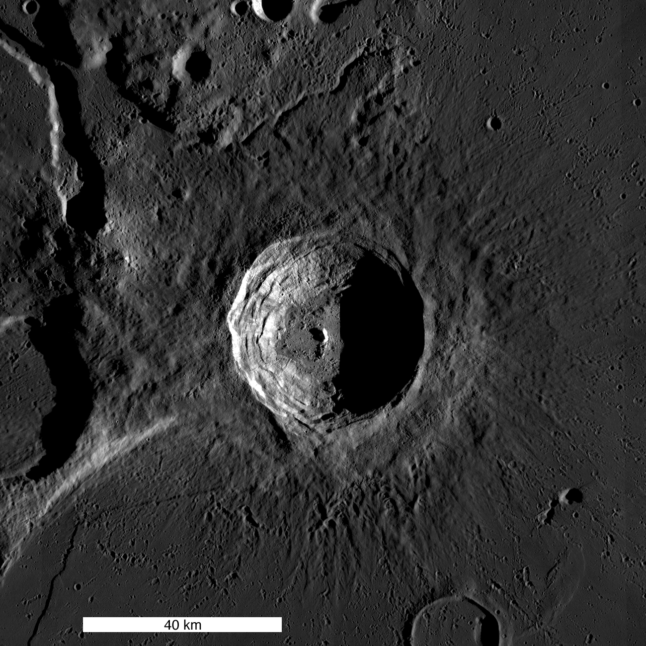
Aristarchus crater is located on the southeast edge of the Aristarchus Plateau. This gaping crater is 40 km wide and 3.5 km deep. The ledges forming the wall of the crater, which look a lot like those of a strip mine, are actually blocks of pre-impact crustal and surficial rocks that slumped into the crater during the late stages of its formation. The impact that formed this crater occurred on a mare-highland boundary and thus excavates a variety of rock types.

The LROC NAC footprint for observation M168516102, from which the following six oblique views were cropped, all of them from the right frame and spotlighting areas within the northwest rim of bright Aristarchus. The view above simulates an oblique view of the area, most if which is also found within the LROC Featured Image released December 25, 2011, from a point well south of Aristarchus Plateau 25 kilometers in altitude [NASA/GSFC/Arizona State University].
 
Six sections, reluctantly reduced from their original 40 centimeter-per-pixel resolution, lifted from LROC Narrow Angle Camera observation M168516102R, LRO orbit 9968, August 20, 2011 (when the LRO orbit was briefly lowered to an average 25 kilometer high perilune, are unparalleled examples of the west-northwestern Aristarchus crater wall's variety of textures. Solar illumination incidence angle was 42.43° centered on 24.36°N, 312.18°E from 25.05 km altitude [NASA/GSFC/Arizona State University].
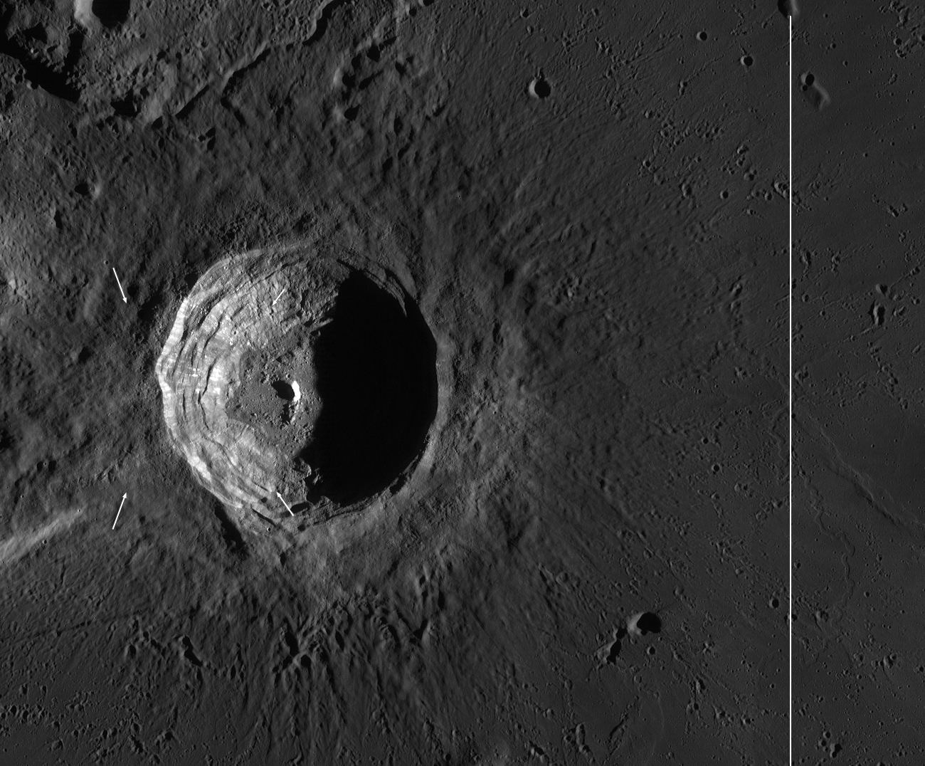
Dawn View of Aristarchus: Sunrise lighting enhances surface texture on Aristarchus crater (40 km diameter). Northwest (upper left) of the crater is the mysterious Aristarchus plateau, to the east, southeast, and south lies the edge of the vast mare Oceanus Procellarum. Small white arrows indicate approximate corners of the NAC panorama, In the full size LROC context image, a vertical line on the right shows the LRO orbit ground track when the Featured Image NAC panorama was acquired. (LROC WAC mosaic) [NASA/GSFC/Arizona State University].
The ledges forming the crater wall, which have a scalloped appearance, are sagging blocks of the pre-impact lunar crust. Bright and dark materials are exposed in patches along the walls. Dark streaks of impact melt and debris cover some of these materials (dark region from top-to-bottom just left of center). Pyroclastic beads (volcanic glasses formed during fire-fountain style eruptions similar to those of Stromboli or the Hawaiian Islands) that blanket the area around the crater have slid down parts of the walls in dark streaks and clumps (visible as small dark streamers across the top of the crater in the center of the panorama). These pyroclastic deposits represent one of the largest, most accessible exploration-enabling resource deposits on the nearside of the Moon. Despite the blanket of dark glassy materials, Aristarchus crater is still one of the most highly reflective areas on the Moon. Much of this high reflectance is due to the excavation of rocks from deep in the crust. These deep rocks may be anorthositic like the highlands, or they may be a more silicic rock like granite (or both). Although granites have been found in Apollo rock samples, the formation of granite on the Moon is not well understood at this time - another reason why we need to get samples from this region!

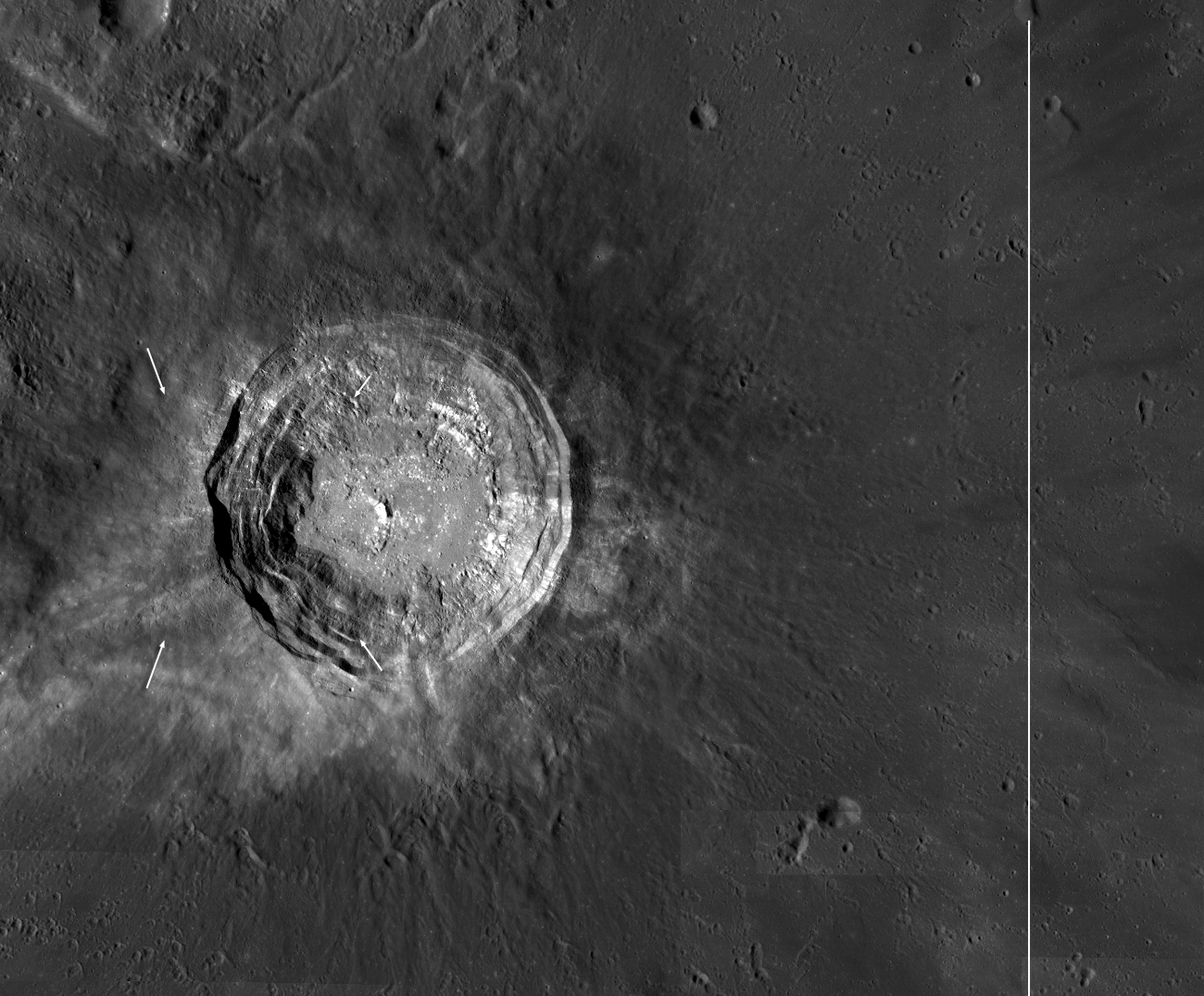
Early afternoon Aristarchus: Early afternoon WAC mosaic of Aristarchus crater to compare with the sunrise mosaic above. Again, small white arrows indicate the approximate corners of the Featured Image NAC panorama, and in the original context image a vertical line on the right (beyond the field of view of this crop from the original) shows LRO orbit ground track [NASA/GSFC/Arizona State University].
Look closely at the early afternoon lighting WAC mosaic; you can clearly see that some of the Aristarchus ejecta has high reflectance, and some has low reflectance. This contrast reflects the compositional difference between the target rock. The northwest portion was mostly basalt and ash, while the south-southeast was predominantly crustal rocks (anorthosite and/or granite).

The floor of Aristarchus crater provides explorers a unique opportunity to study a wide variety of lunar rocks and geologic processes, possibly including how lunar granite forms. Diverse materials such as dark, multilayered mare basalts in the walls, bright crustal rocks in the central peak, impact melt, and even regional pyroclastic materials blanketing the crater are brought to the floor and accumulated through mass wasting, creating a bountiful trove of
geologic materials.

Jump to the full resolution west wall panoramic image, and view our flyover video on Youtube.


Previous LROC Aristarchus Featured Images:
Geologic Diversity of the Aristarchus Plateau
Striated Blocks in Aristarchus Crater
Aristarchus Plateau Pyroclastics
Central peak of Aristarchus (with fly-over)

Tuesday, July 5, 2011

Old Man River (of Lava)


A tight turn in the sinuous rille running through Vallis Schröteri on the Aristarchus Plateau. Could you drive a SUV-sized rover through it? Probably, it's flat on the bottom. Just watch out for those house-sized boulders. A new close-up, LROC Narrow Angle Camera (NAC) observation M157934151L, LRO orbit 8409, April 20, 2011; illumination incidence angle 35°, field of view 1.75 km across. View the spectacular full-sized LROC Featured Image HERE [NASA/GSFC/Arizona State University].

Sarah Braden
LROC News System

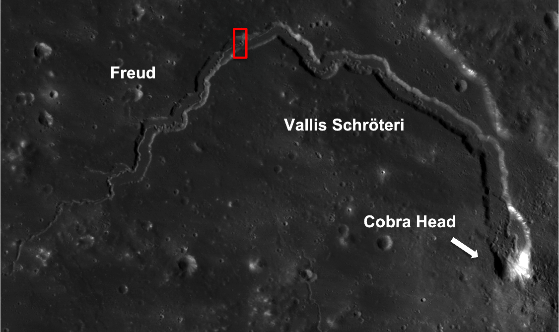
This sinuous rille is a small part of Vallis Schröteri, which is the largest rille on the Moon, and actually contains two rilles! The larger rille (155 km long) cuts through the Aristarchus Plateau, and the smaller, curvier inner rille (204 km long) cuts through the floor of the larger rille. These two rilles may have formed during two different volcanic events, or they could represent a change in volume from a single event over time. The larger rille formed when the flow of lava was higher in volume. The inner rille subsequently cut through the floor of the larger rille after the eruption volume waned.

Geologists ask questions such as why did the inner rille flow farther than the larger rille? Did the magma flow faster in the case of the smaller rille? Scientists do not fully understand how rilles formed on the lunar surface, but there are two main theories. In general, rilles form when large volumes of very fluid (low viscosity) magma erupt and flow rapidly. The molten lava may carve a channel into the lunar surface through the erosive power of the flow of magma that then drains away, leaving only the empty lava river behind. An alternative theory proposes that the lava initially forms levees on the edges of the flow, which then confine the flow to just one channel, creating the river-like rille instead of spreading out over a large surface like a mare.


LROC Wide Angle Camera 100m mosaic of Vallis Schröteri, the red box marking the region of the rille seen close-up in the Featured Image, June 28, 2011. View the full-sized, 1140 pixel-wide context image HERE [NASA/GSFC/Arizona State University].

Vallis Schröteri starts at a 6 km diameter crater to the north of Herodotus. Some people call the start of the rille the "Cobra's Head" since it resembles a snake. The rille has a maximum width of about 10 km. For a scale comparison, consider that the Grand Canyon on Earth (formed by water) has a width that ranges from about 6.4 to 29 km.


Look in the full NAC frame for more twists and turns!

Related Posts:
Rille within a rille!
Sinuous Chain of Depressions
Hadley-Apennine: the Apollo 15 Landing Site
Secrets of Vallis Schröteri
The Colorful Moon

From Lunar Pioneer Album 5 -
From one of the varied, excellently detailed full-disk lunar mosaics by Astronominsk, the Aristarchus Plateau shield and Vallis Schröteri as photographed from Earth [Astronominsk].

Wednesday, February 16, 2011

Striated blocks in Aristarchus crater


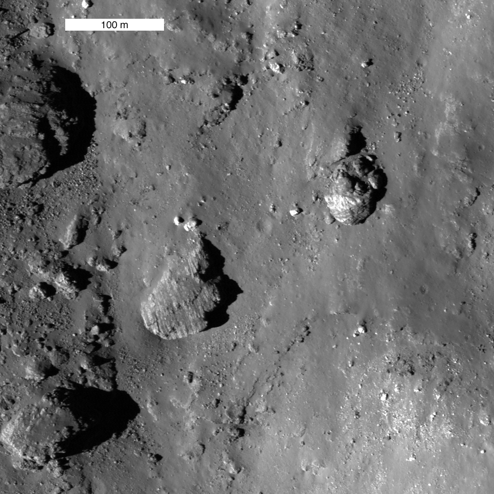
Field of striated boulders on the wall of Aristarchus - uphill is towards top of the field of view. LROC Narrow Angle Camera (NAC) observation M120161915, LRO orbit 2842, February 7, 2010. View the full-sized image release HERE [NASA/GSFC/Arizona State University].

Mike Zanetti
LROC News System

Aristarchus crater is located on the edge of the Aristarchus Plateau, one of the most geologically interesting regions of the Moon. It is a 40 km wide, 3.5 km deep, complex impact crater, which probably formed about 175 million years ago. The impact straddled the boundary of the plateau and the surrounding mare, thus excavating both very different rock types, as well as underlying crustal rocks. Previous posts have highlighted features of the Aristarchus Plateau, including Valles Schröteri and the pyroclastic deposits that blanket the plateau. Compositional differences within the central peak of the crater have also been noted, and highlight the importance of studying the geology of this crater.


LROC Wide Angle Camera (WAC) mosaic of 40 km diameter Aristarchus (23.7°N, 312.6°E). Stratified blocks are presently only observed in the northeast portion of the crater. View the full-sized image release HERE [NASA/GSFC/Arizona State University].

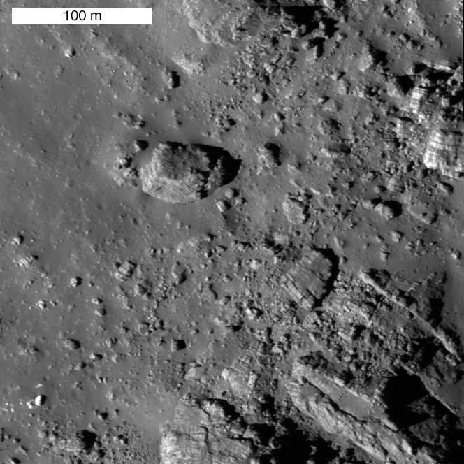
On the northeastern slopes of Aristarchus, there are numerous large, stratified blocks of ejected material. These blocks are banded with alternating layers of light and dark material. Dark layers are typically less than 1 meter thick, and bright layers range between 1 and 10 meters thick. The boulders are randomly oriented, so they are not in their original position but rather appear to have tumbled down the wall of the crater from above. Unfortunately, no clear layers of rock are observed in the crater wall because it has been covered by impact melt and debris. Luckily, however, some stratified blocks are observed outside of the crater, and would be accessible for any future astronauts to sample.


Close-up view of a second block field with prominent banding. Note the layering is also seen in blocks of many sizes, LROC NAC M120161915L [NASA/GSFC/Arizona State University].

At the present time, the blocks are only seen on the mare side of the original surface. Because of their low viscosity and ability to spread out, mare deposits may contain sequences of many thin (meters thick) layers, potentially representing pulses of magma that built up the mare. Because of their location in the crater, it may be that the layers seen in the blocks represent a successive deposition of lava flows. The difference in albedo of the layers (bright versus dark) is still being investigated, but could be due to such layering of lava (thick, bright layers) capped by layers of pyroclastic material (dark layers) erupted from vents on the nearby plateau. It more likely that the thin dark layers are vesiculated, glassy lava crusts that were quenched as the upper surfaces of the lava flows were exposed to the vacuum of space.

Compare the striated blocks with layers seen at Hadley Rille by astronauts Dave Scott and Jim Irwin on Apollo 15.

Striated ejecta blocks were also recently observed on the lunar farside, compare them with those seen at Aristarchus Crater. Layers are also seen in the walls of pit craters.

Explore the full resolution image, and look for more examples of striated blocks!

Thursday, December 2, 2010

Secrets of Schröteri


Vallis Schröteri is a magnificent sinuous rille and of particular interest is its inner rille, which diverges from the primary rille near the arrow. This nested form indicates that multiple eruptive events occurred or there was a large change in the volume of a single eruption over time. LROC WAC mosaic, 100 m/pixel [NASA/GSFC/Arizona State University].


LROC NAC close-up of a bend in the inner rille of Vallis Schröteri; the rille walls are visible in the upper left and lower right corners of this image. The arrow in the LROC WAC mosaic denotes the location of this image; field of view is 600 meters [NASA/GSFC/Arizona State University].

Lillian Ostrach

LROC News System

Explore the largest rille on the Moon in the LROC WAC mosaic and the LROC NAC full image! Compare the sinuous nature of these rilles to yesterday's Featured Image of Rimae Posidonius - what features are similar and what is different?


Backing off from the LROC Narrow Angle Camera close-up slicing through Vallis Schröteri, geologically fascinating because not only is it the largest lunar sinuous rille, it is also composed of a primary rille and a smaller, inner rille. Full LROC Image field of view is 1.5 km [NASA/GSFC/Arizona State University].


Three views of the Aristarchus Plateau "chevron," lording over the vast Oceanus Procellarum. At bottom, from 2008, a 200 kilometer-wide (at bottom) SELENE-1 (Kaguya) HDTV view of the Aristarchus Plateau that is close to it's true optical appearance from orbit, according to those who have actually been there. The subtleties of the variety of actual color variation here are difficult to detect at first glance, though they are definitely present [JAXA/NHK/SELENE].

No matter how often the Aristarchus Plateau is imaged, and we have presented a wide variety of such images here, as seen in different wavelengths and bands from Earth and from lunar orbit, every new opportunity seems to show a new face to this feature, unique in our star system. Above the Kaguya HDTV still shows two perspectives of the LROC Wide Angle Camera mosaic attached to the digital elevation model of the Moon available in Google Earth. Besides the valley, where details are obscured in these greatly reduced images, is the crater Herodotus, the far older sister of Aristarchus.


Related posts:
Aristarchus Plateau 1: Amazing Geologic Diversity
Rille within a rille!
The Great Wall of Aristarchus
The colorful Moon
LROC: Aristarchus - Up from the Depths
LOLA's Aristarchus Plateau