Showing posts with label Virtual Moon Atlas. Show all posts

Thursday, March 6, 2014

Squarish Lavoisier A of Oceanus Procellarum

Squarish Lavoisier A
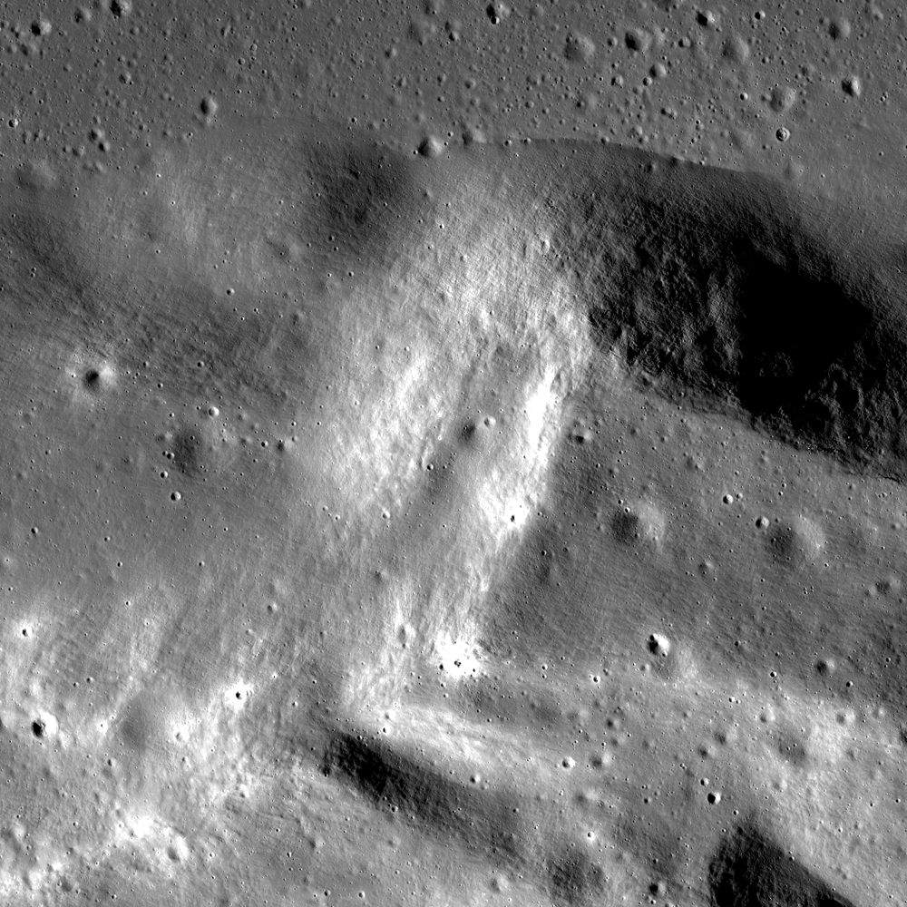
The square corner along the north-most rim of Lavoisier A (28.5 km, 36.972°N, 286.74°E), evidence of pre-impact fracturing. LROC NAC observation M112759713L, spacecraft orbit 18324, July 4, 2014; field of view approximately 7 km, resolution 1.41 meters per pixel. LROC Featured Image, released March 6, 2014 [NASA/GSFC/Arizona State University].
Raquel Nuno
LROC News System

Why are most craters circular (even craters found on Earth)? By hurtling objects together at many miles per second in large laboratories, scientists have shown that only the most oblique impacts (less than 10° from the horizon) produce elliptical craters.

The kinetic energy of an impactor behaves much like the energy from a nuclear bomb. The energy is transferred to the target material by a shock wave, and shock waves produced by an impact, whether oblique or head-on, propagate hemispherically. This shape means that energy is being delivered equally in all directions; resulting in a hemispherical void and thus circular craters. However, conditions in nature do not always mirror the laboratory. In fact some craters are nearly square! A portion of the rim of Lavoisier A crater tells a story of the geology before impact. Lavoisier A is a squareish crater with a diameter of 28.5 km in the northwestern portion of Oceanus Procellarum.

Levoisier A from Chang'e-2
High-reflectance, low-angle illumination incidence view of 28.5 km-wide Lavoisier A from the Chang'e-2 global mosaic, with real color added from the Clementine survey (1994) [Virtual Moon Atlas 5].
Much of Lavoisier A's shape is thought to be due to preexisting joints or faults in the target rock. These discontinuities create zones of weakness, affecting how the shock wave travels through the material. We find square craters on other planetary bodies such as on the asteroid Eros and here on Earth. An example of a square crater that has been thoroughly studied is Meteor Crater in Arizona.

Levoisier A (Astronominsk)
Among the better views of Lavoisier A possible from Earth, situated as it is on the northwest limb of the Moon's nearside, in northwest Oceanus Procellarum, at the direct center of this image from a mosaic by Yuri Goryachko, Mikhail Abgarian and Konstantin Morozov, the Astronominsk team of Minsk, Belarus, sectioned from a full-disk observation photographed September 4, 2012 (below) [Astronominsk].
Levoisier A (Astronominsk)
Lavoisier A is marked with an arrow in the full-disk, 4300 by 4900 mosaic of the waning Moon, September 4, 2012 [Astronominsk].
This crater formed on layers of sedimentary rocks that have orthogonal vertical joints running below where the crater formed. The joints disrupted the shock wave flow in certain directions, preventing the formation of a circular crater. Another indication of weaknesses within the target layers is the appearance of the northeastern portion of the crater rim. It appears as if a layer of rock has been peeled back.

Can you find the evidence of pre-impact fracturing (square boundaries) in the full resolution NAC, HERE?

Related Posts:
Squished Crater
Four of a Kind in Catena Davy

Thursday, February 14, 2013

Numerov's Graben

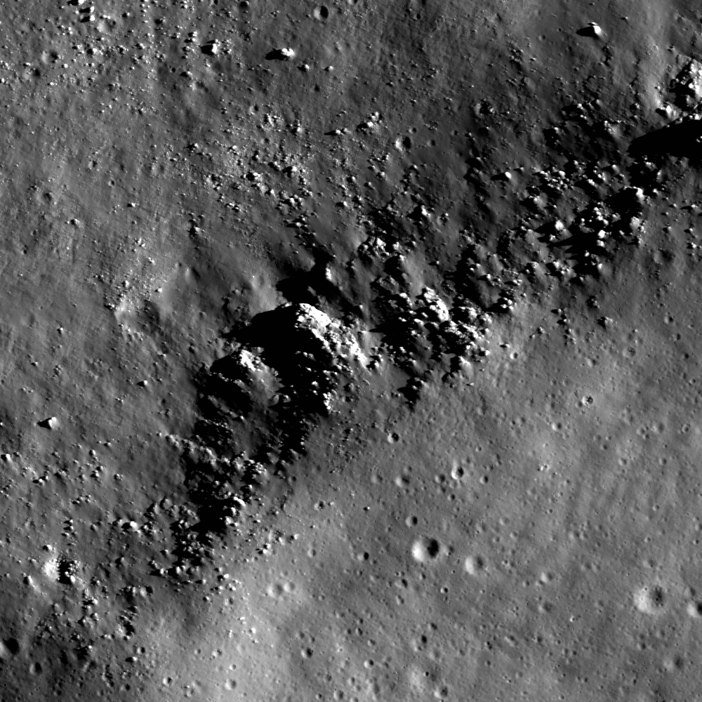
Normal faults in regolith formed remarkably small graben in Nectarian age Numerov crater (70.7°S, 160.7°W). Only a handful of small craters superpose the faults, indicating a young age. LROC NAC M171619370RE, image width is 600 m [NASA/GSFC/Arizona State University].
Drew Enns
LROC News System

Graben on the Moon come in a variety of sizes. Some of the larger rilles in the maria stretch for several tens of kilometers and can be a few kilometers in width. These linear rilles are thought to be the result of extensional stresses near the edges of the maria and are thus graben.

Since the mare basalts are dense, they weigh down the crust in the center of the deposit, pulling rock near the margins inward.

However, the Featured Image today shows much smaller graben that span only hundreds of meters in length and tens of meters in width. To complicate matters, these graben are not in mare basalts, they are inside a crater!

Context image for today's Featured Image. The graben are pointed to by the arrow. A nearby lobate scarp extends from A to A', its low relief enhanced by the low Sun mosaic. Image width is 100 km [NASA/GSFC/Arizona State University].
The LROC Wide Angle Camera (WAC) context image (above) helps us decipher the origin of these graben, as a nearby lobate scarp can be seen at this scale. Lobate scarps form in compressional stress environments as layers of rock or regolith fold and thrust upwards. The thrusting might cause nearby crust or regolith to uplift and bend.

The graben and scarp are only hundreds of meters apart which argues for a compressional interpretation.Thus the interplay between compressional and extensional stresses is reflected in the distribution of tectonic features within Numerov crater. The end result is that we see small graben situated very near to lunar lobate scarps!

Numerov show its great Nectarian age at minimal shadowing in this LROC QuickMap 125 meter resolution orthographic projection assembled from LROC WAC photography and the LROC WAC-based digital terrain model (DTM). By contrast, its larger neighbor shouldered against it's western edge is Antoniadi, an uncharacteristically youthful (Upper Imbrium) impact crater for this part of the lunar surface, deep within South Pole-Aitken basin, and home of the Moon's deepest elevation. The smaller stress affects discussed in the post by Drew Enns are not as apparent at this scale, though other stress affects, scarps in particular, are easier to pick out [NASA/GSFC/ASU/DLR].
Explore more of the lobate scarp and graben in the full LROC NAC, HERE.

Related Posts:
Watch That First Step!
Its the Moon's Fault
Pull Apart - Grabens

LROC WAC mosaic presented using the Virtual Moon Atlas 6 shows Numerov in context with Antoniadi and Minnaert, a triple astrobleme that is easy to spot on maps of the farside and South Pole-Aitken basin [NASA/GSFC/ASU/VMA6].

Tuesday, December 18, 2012

LROC: Petavius

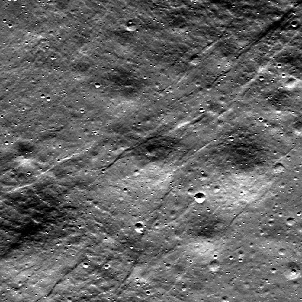
An outcrop exposed in the central peak of Petavius crater revealed in large fracture. From LROC Narrow Angle Camera (NAC) observation M1107889912LE, captured at 0.84 meters per pixel in LRO orbit 15552, November 18, 2012; field of view approximately 840 meters across [NASA/GSFC/Arizona State University].
Drew Enns
LROC News System

Petavius crater, a 177 km crater located at 25.28°S, 60.63°E, is one of an uncommon class of craters that have been modified by post-impact processes. What process could have produced the system of fractures that cut the floor, known as Rimae Petavius? Volcanism is the likely cause. Small patches of mare basalt exist in the north and south extents of the crater floor, which help cement this hypothesis. But unlike other mare filled craters, Petavius crater has only small patches of basalt.

Why did Petavius crater end up with such an extensive fracture system?

Context the LROC Featured Image, 100 km-wide field of view includes the cluster of the Petavius central peaks, composed of material tossed up from great depth when the crater formed in the lower Imbrium age, 3.9 billion years ago. Some darker basaltic material is in the northeast and southeast corners of this image, likely opportunistic intrusions of molten material that "seeped" to the surface following some global event, like the basin forming impact that formed Mare Orientale [NASA/GSFC/Arizona State University].

One hypothesis is that the fractures occurred as a result of volcanic modification. Uplift of the crater floor would occur as magma intruded beneath the floor and fracturing developed as the floor was pushed up. Because Petavius crater was not flooded completely, the fractures were never covered by basalt. The harder question is why is Petavius crater not flooded with basalt?

Wider still context LROC Wide Angle Camera (WAC) mosaic, showing the slumped walls of Petavius. Mosaic stitched from eight sequential observations during orbits 11232 through 11259, November 30, 2011; resolution averaged 70 meters at 68° angle of incidence, from 51 kilometers [NASA/GSFC/Arizona State University].

It is possible Petavius crater did not witness the same style of eruption as elsewhere on the Moon. Or maybe the magma underneath Petavius crater was not buoyant enough to completely flood the surface. Finally, it may simply be that the magma source region was relatively small, and thus only a modest amount of basalt was erupted.

Explore more of Petavius crater in the full LROC NAC observation HERE.

Related Posts:
Rock slide in Rima Hyginus
Pyroclastics and Vent
Archimedes - Mare Flooded Crater!

Petavius is a familiar telescopic landmark from Earth, after the Moon is 3 days old (or 2 days after a Full Moon), though fresher, rougher and less optically mature bright ejecta from smaller neighboring craters like Stevinus and Petavius B tend to overwhelm the scene as the region approaches mid-day. The simulated phase above shows the location of Petavius in relation to the Moon's appearance tonight. Virtual Moon Atlas v.6 using LROC WAC 100 meter textures [VMA].

Saturday, August 27, 2011

LROC: Atlas


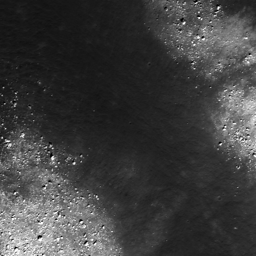
The interior of a crater-floor fracture within landmark nearside crater Atlas. LROC Narrow Angle Camera (NAC) observation M157303976L, LRO orbit 8316, April 13, 2011; incidence angle 47°, resolution 0.5 meters per pixel. View the full size LROC Featured Image HERE [NASA/GSFC/Arizona State University].

Sarah Braden
LROC News System

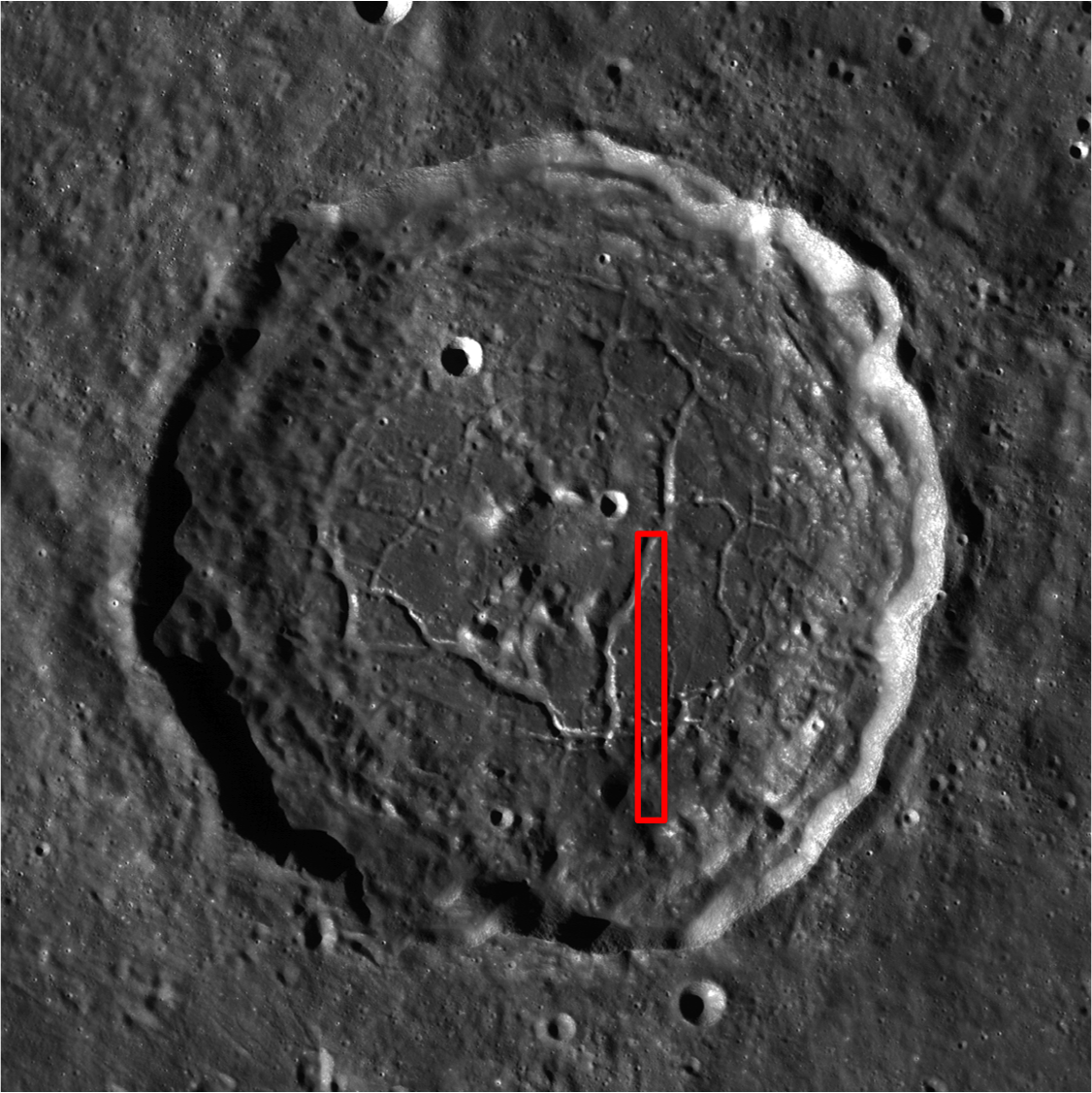
Floor-fractured Atlas crater (46.7°N, 44.4°E) is 87 km in diameter. The cause of the fractures that cut the crater's floor is not well understood. It is thought that the fractures have wide, flat floors, like a trough (or graben) and that they record a period of uplift of the crater floor. The question is, what caused the uplift? Floor-fractured craters have been a known lunar feature since the days of the Lunar Orbiters, but with LROC images, geologists are working to better understand how they formed. LROC NAC frames allow for a look at the interiors of the fractures, and with stereo images we can measure their shapes.


A roughly 2 by 4 kilometer section of LROC NAC frame M157303976L, from which the field of view (red box) within the LROC Featured Image released August 26, 2011 can be found [NASA/GSFC/Arizona State University].


And, in turn, the field of view within the image above is seen in this small section of a much larger LROC Wide Angle Camera (WAC) 643 nm band mosaic gathered during LRO orbits 2750 through 2757, January 31, 2010. The field of view is roughly 50 x 100 kilometers [NASA/GSFC/Arizona State University].

After the impact that created Atlas, the floor of the crater was molten. As it cooled, the solid floor formed. In the case of Atlas, eventually uplift caused the floor to break and pull apart, forming the graben, or fractures. There are two theories for the cause of the uplift. One possibility is the slow readjustment of the crust after the crater-forming impact. During an impact, the energy released compresses the crust. However, over time the crust can rebound to its original, pre-impact position. This rebound would supply the uplift that forms the fractures on the floor of Atlas crater. A second possibility is that the fractures may be due to an intrusion of magma into the crust below the crater, which uplifted and disrupted the crater floor as it rose. When investigating floor-fractured craters, geologists often look for signs of volcanic activity related to an intrusion of magma. Unraveling the origin of lunar features like this one is a primary focus of LROC science.


One hundred meter per pixel WAC context view of Atlas, showing the field of view of the entire LROC NAC frame M157303976L View the full size LROC WAC context image HERE[NASA/GSFC/Arizona State University].

Explore the entire NAC frame!

Related Images:
Mapping the Moon with Wide Angle Camera
The fractured floor of Compton
Gassendi's Fractures
Alphonsus crater mantled floor fracture


From an Earth-bound perspective Atlas (upper right) is the constant companion of it's neighbor to its west, 71 km-wide Hercules, seen in this oblique view captured when the Moon was Full, January 10, 2009, by Mario Weigand [LPOD/SkyTrip.de/VMA].