Showing posts with label Jeffrey Plescia. Show all posts

Thursday, October 31, 2013

Dark ejecta, clue to cryptomare

M1115555142L_1k
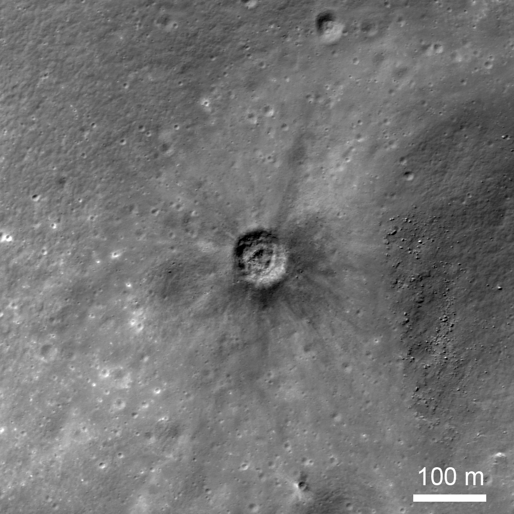
A 78 meter diameter crater with distinct dark ejecta surrounding its rim, in the farside southern  highlands (31.131°S, 147.536°E) north of Jules Verne. LROC Narrow Angle Camera (NAC) frame M1115555142L, LRO orbit 16629, February 16, 2013; 40.36° angle of incidence, 74 cm per pixel resolution from 71.92 km [NASA/GSFC/Arizona State University].
Jeffrey Plescia
LROC News System

Impact crater ejecta is typically brighter than the surrounding material because it is fine-grained and immature (unweathered); even on the dark mare, fresh craters usually have bright ejecta. Craters with distinctly dark ejecta do occur, but they are rare (e.g., Shorty Crater at the Apollo 17 landing site). When craters have dark ejecta, the interpretation is that a layer of low reflectance rock or soil at depth was excavated and distributed around the margin of the crater. In the case of Shorty Crater, the conclusion is that a layer of dark pyroclastics was hidden just beneath the surface; in other cases, dark halo craters are interpreted to indicate mare material at depth (cryptomare). Several of the craters formed by the impact of spacecraft hardware, such as the Apollo 13 S-IVB, into the surface also have dark ejecta rays, and this observation is not yet well understood.

Details of the crater morphology can be seen in this expanded view from LROC NAC M1115555142L [NASA/GSFC/Arizona State University].
Our dark halo crater (31.131°S, 147.536°E) has a diameter of about 78 m, although it is slightly elongate in the north-south direction. Rays of dark ejecta extend for almost 200 m from the crater rim. Morphologically, the crater is not the normal simple bowl shape for a crater of this size. Rather, a depression on the crater floor in the center is surrounded by a low ridge about 33 m in diameter; beyond that annular ridge to the crater wall the floor appears to be flat. Boulders are scattered on the crater floor and on the ejecta to the east; the largest boulders on the east side are as large as 6 m across.
dark_ejecta_reg_sm
Regional view of the dark ejecta crater. Note the crater formed on the western flank of an older, larger crater. Relatively low albedo, smooth plains spread out immediately to the south. These plains (see next image) may be mare material and may underlie the area of the small impact. LRO NAC frame M167241339R (spacecraft orbit 9780, August 6, 2011; 55.96° angle of incidence, 65 cm per pixel resolution from 62.95 km)  [NASA/GSFC/Arizona State University].
LROC Wide Angle Camera (GLD100) context, at 64 meters per pixel resolution, shows the location of the crater of interest in relation to the arc of exposed mare material to the south and west [NASA/GSFC/Arizona State University].
This crater formed on the outer flank of a larger older, degraded 635 m crater. Highlands ejecta (higher reflectance than mare) from this larger crater buried the mare. Later the impact that formed the younger dark halo crater punched through the bright highland ejecta and brought up mare from 10 meters or more depth.

Explore this region of the Moon in the full NAC image, HERE.

Related Posts:
Bright and Dark Ejecta (September 11, 2013)
Excavating Dark Deposits (September 3, 2013)
Dark haloed crater in Mare Humorum (June 7, 2011)
Dark Halo Crater in Orientale (March 4, 2011)
Dark craters on a bright ejecta blanket (November 17, 2009)

Tuesday, March 19, 2013

Graves of the GRAIL twins

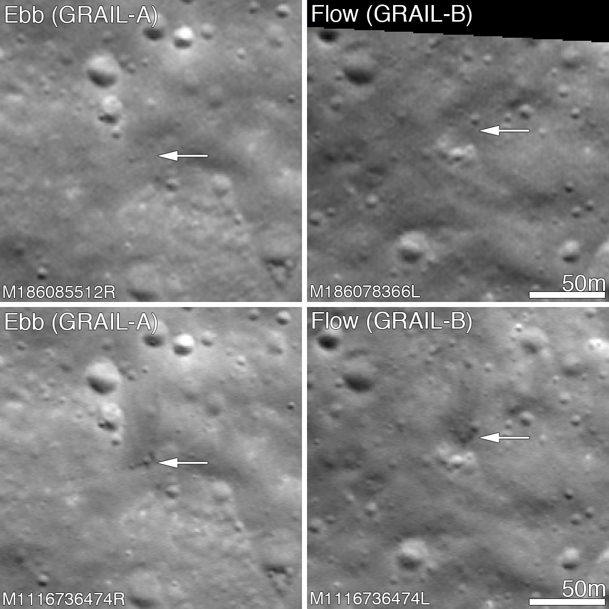
Before and after the GRAIL twins impacts on the Moon December 17, 2012. The LROC Narrow Angle Camera (NAC) directors were able to resolve the impact sites on February 28, 2013, revealing both to be about 5 meters in diameter. Upper panels show the area before the impact; lower panels after the impact. Arrows point to crater locations. LROC NAC observations M186085512R, M186078336L, M1116736474R and M1116736474L. Full size Featured Image HERE  [NASA/GSFC/Arizona State University].
Jeffrey Plescia
LROC News System

The Gravity Recovery and Interior Laboratory (GRAIL) mission ended on 17 December 2012 at 14:28 PST (-8 hrs. relative to Universal Time) when the two spacecraft GRAIL A (Ebb) and GRAIL B (Flow) impacted the Moon.

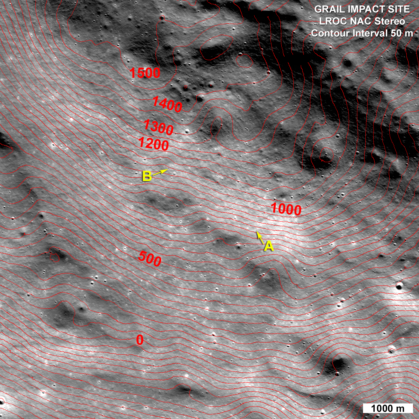
Both impact sites lie on the southern slope of an unnamed massif (mountain) that lies south of the crater Mouchez and northeast of the crater Philolaus.

The massif stands as much as 2500 m above the surrounding plains. The impact sites are at an elevation of about 750 and 1040 meter, respectively, about 460-750 m below the summit.

Artist conception of the orbital track of the two spacecraft just before impact. Both spacecraft were tracking north as their altitude continuously decreased until they impacted the south side of the massif [NASA/JPL].
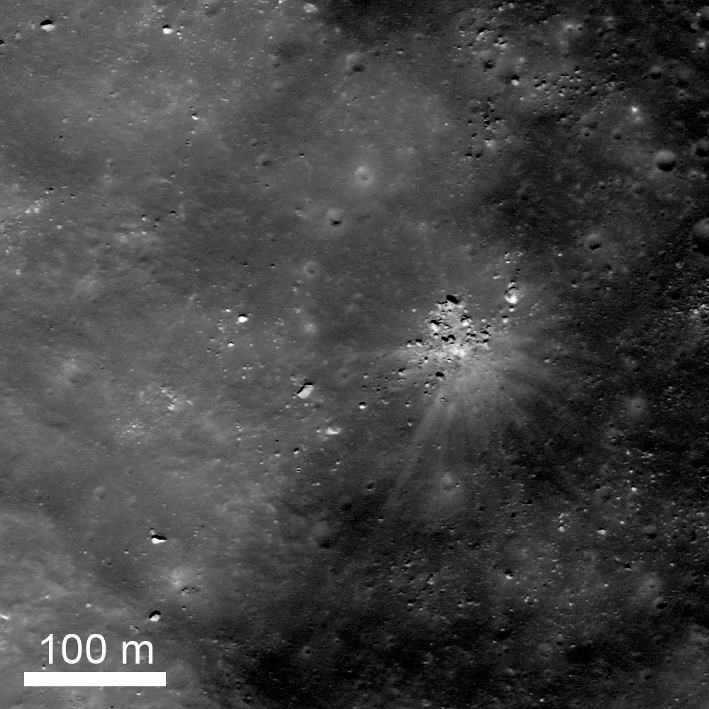
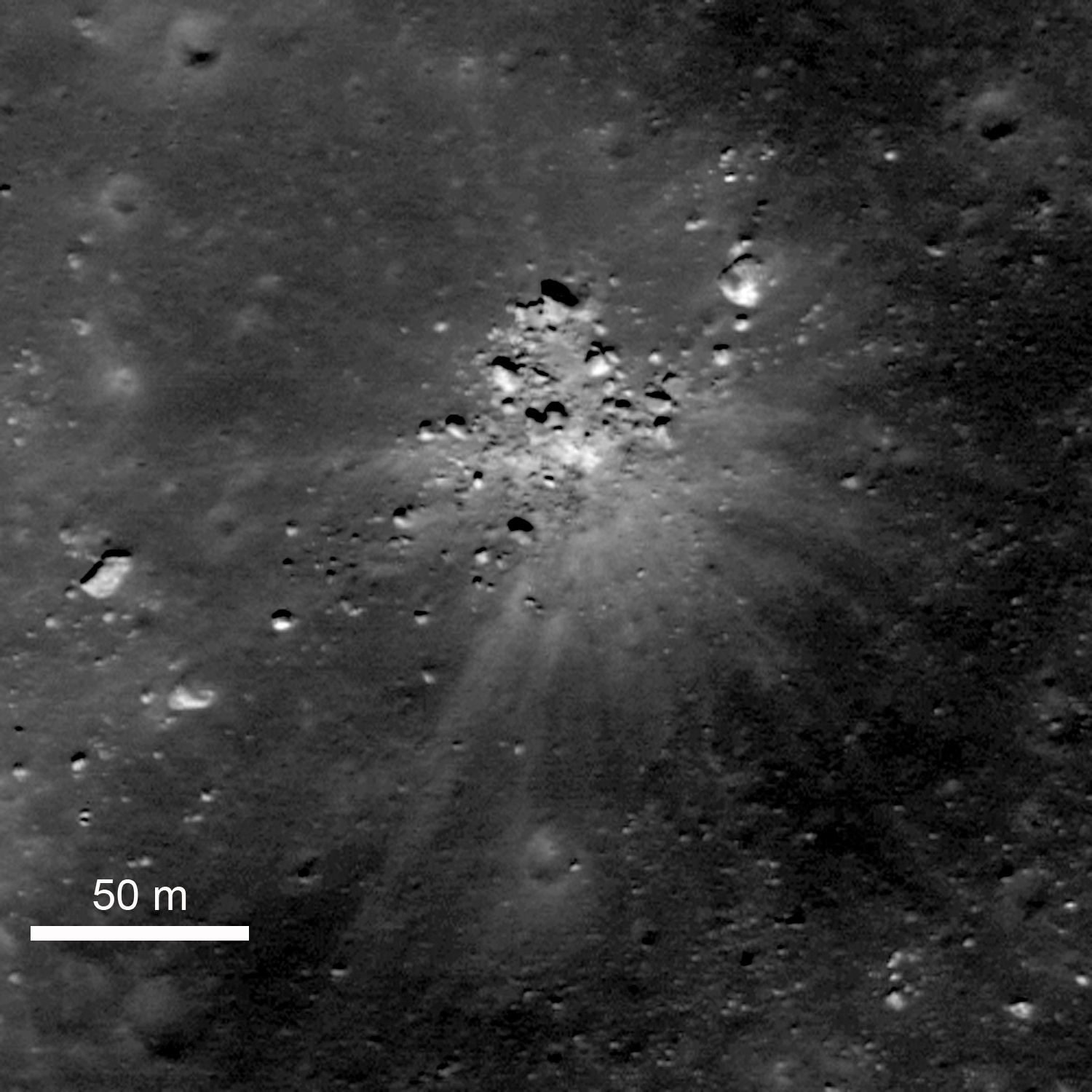
The two GRAIL spacecraft were relatively small - cubes about the size of a washing machine with a mass of about 200 kg (441 lbs) at the time of impact. When they arrived at the Moon their mass was closer to 278 kg (619 lbs), but about 78 kg (172 lbs) of that was fuel consumed during lunar operations. Both spacecraft impacted at very low angles (~2° to the horizontal) at about 1600 m/s (faster than a speeding bullet) into a fairly steep slope! LROC images reveal that both spacecraft formed craters about 5 m (15 ft) in diameter. Surprisingly, the ejecta around both craters is dark and irregularly distributed around the crater; there is little ejecta to the south - the direction from which the spacecraft were traveling.

GRAIL A site seen before and after the impact event. Crater center is located at 75.609°N, 333.407°E [NASA/GSFC/Arizona State University].
Typically ejecta from craters has a higher reflectance than the target material (think of the rays of Tycho). This normal contrast is due to the excavation of fresh (or immature) soil from beneath a more mature, weathered layer. As the lunar regolith is exposed to the vacuum of space, it suffers exposure to cosmic radiation, solar wind bombardment, and micrometeorite impacts. Slowly over time, these processes tend to darken the soil. Thus, if you dig down beneath the surface you will find higher reflectance soil.

GRAIL B site seen before and after impact event. Crater center is located at 75.651°N, 333.168°E [NASA/GSFC/Arizona State University].
So why do both GRAIL craters exhibit low reflectance rays? Perhaps we are seeing carbon from the spacecraft. The structure was made of a cyanate ester composite (carbon rich) and other materials also had carbon as primary compounds. Additionally, there was about 0.5 kg (1.1 lbs) of fuel remaining in each spacecraft. Due to the energy of impact, the carbon from these varied sources may have been released and mixed with and coated the ejecta. It takes only a very small amount of carbon to darken a material, recall in art class when you put just a few drops of black paint into a lighter color and it went all muddy. But right now we do not know for sure the cause of this interesting anomaly!

LRO Wide Angle Camera (WAC) image of the GRAIL impact area on the south side of the unnamed massif. LRO WAC M120020350 [NASA/GSFC/ASU].
On 28 February 2013 the LROC obtained a stereo pair for the impact area and from these images the LROC team produced a controlled preliminary topographic map. From the stereo model latitude, longitude and elevation were derived for each impact crater: GRAIL A 75.609°N, 333.407°E, 750 meters and for GRAIL B 75.651°N, 333.168°E, 1040 meters. The local slope of the mountain at the point of impact was 23° for GRAIL A and 19° for GRAIL B. As knowledge of the spacecraft position is refined the LROC team will update these coordinates. The two impact craters are about 2210 m apart; GRAIL B impacted about 20 seconds after GRAIL A at a site to the northwest of GRAIL A.

LROC NAC stereo derived topographic map of the GRAIL Impact area, map is 8400 meters wide, north is up [NASA/GSFC/Arizona State University].
Find the GRAIL impact craters in the full NAC image, HERE.

Related Posts:
Parting shots from Ebb MoonKAM prior to impact
Ebb and Flow Finale
Rocket Impacts Recorded by the Apollo Seismic Network
Apollo 14 S-IVB Impact Crater
Mountains of the Moon
LROC Coordinates of Robotic Spacecraft
Ejecta Sweeps the Surface

Thursday, February 7, 2013

Archimedes Rock Garden

A group of rocks, a small shallow crater, and rays of ejecta occur together up on one of the fault terraces of the crater nearside landmark crater Archimedes. Cropped from LROC Featured Image released February 7. 2012 - LRO Narrow Angle Camera (NAC) M109256375R, spacecraft orbit 1235, October 4, 2009; resolution 52 cm per pixel, 31.95° angle of incidence, from 52.35 km [NASA/GSFC/Arizona State University].
Jeffrey Plescia
LROC News System

A collection of rocks up to about 8 m across surround a small shallow crater, also about 8 m in diameter. A series of bright ejecta rays surround the area. The site lies on the edge of one of the northeast faulted terraces of Archimedes crater (83 km) at 30.154°N, 357.141°E.

Understanding the origin of this distinctive scene is not necessarily straight forward. At the center is a shallow crater about 8 m in diameter, and a series of bright rays extend away from the crater out to distances of about 150 m. Note that some of the blocks seem to block the rays. On the southwest side there is a large rock about 6 m across, bright lanes of ejecta extend past it on both sides but not behind the rock. To the north, a collection of rocks forms a semicircle; within that semicircle is bright ejecta, but not much beyond.

Zoomed in view of the area shown in the Featured Image. The rocks immediately around the impact site are on the surface. The large bright rock to the northeast and several of those to the southwest are buried by older regolith. LRO NAC M109256375R [NASA/GSFC/Arizona State University].
Not all of the rocks in the scene are related to this event. To the northeast there is a bright, partly buried rock about 12 m across, and the west-southwest an elongate rock 7 x 14 m rests of the surface.

The question is, what happened?

One possibility is that there was already a collection of rocks on the surface and a small meteor happened to hit in a small open area among them; then as the ejecta spread out, it was blocked by the rocks.

Another possibility is that there was a giant boulder at this location that just happened to get hit by a small meteor, shattering the boulder into the pieces that now surround the crater.

The third possibility is that a large boulder ejected during the impact of Archimedes (or from some other nearby impact) landed here and shattered upon impact making a small crater. If the boulder was from the Archimedes impact, it must have been launched into a high trajectory such that it hit the surface only after most the impact activity had ended.

An earlier LROC NAC survey of the terraces and northeast floor of Archimedes. The 'rock garden' is designated with the yellow arrow. A 1.29 meter resolution frame considerably resampled to view the full-width of a 6.46 km-wide field of view. LROC NAC M106898464R, orbit 894, September 6, 2009; 39.9° angle of incidence, from 160 km [NASA/GSFC/Arizona State University].
Archimedes under afternoon illumination. The small box on the northeast edge of the terraces in shown as an enlarged inset in the lower left, denoting the location of the rock garden and adding some context also to the image immediately preceding this one. LRO Wide Angle Camera (WAC) mosaic. [NASA/GSFC/Arizona State University].
The area of the rock garden lies on the edge of the Archimedes terraces.  Archimedes is 83 km diameter and lies on the eastern edge of Mare Imbrium.  It is filled with and surrounded by mare basalts on most sides. The crater floor lies a couple hundred meters below the surrounding mare.

Explore more of Archimedes in the full LROC NAC, HERE.

Related Posts:
Archimedes - Mare Flooded Crater!
Sunset Over Giordano Bruno
Necho's Terraces

Archimedes as viewed from the northest, high over Mare Imbrium through the HDTV camera of Japan's SELENE-1 (Kaguya). Further south are the Montes Archimedes and on the left, at the foot of the Appenines (arcing south beyond the horizon), is Palus Putredinus and Hadley Rille, landing site of Apollo 15 in 1971 [JAXA/NHK/SELENE].

Wednesday, February 6, 2013

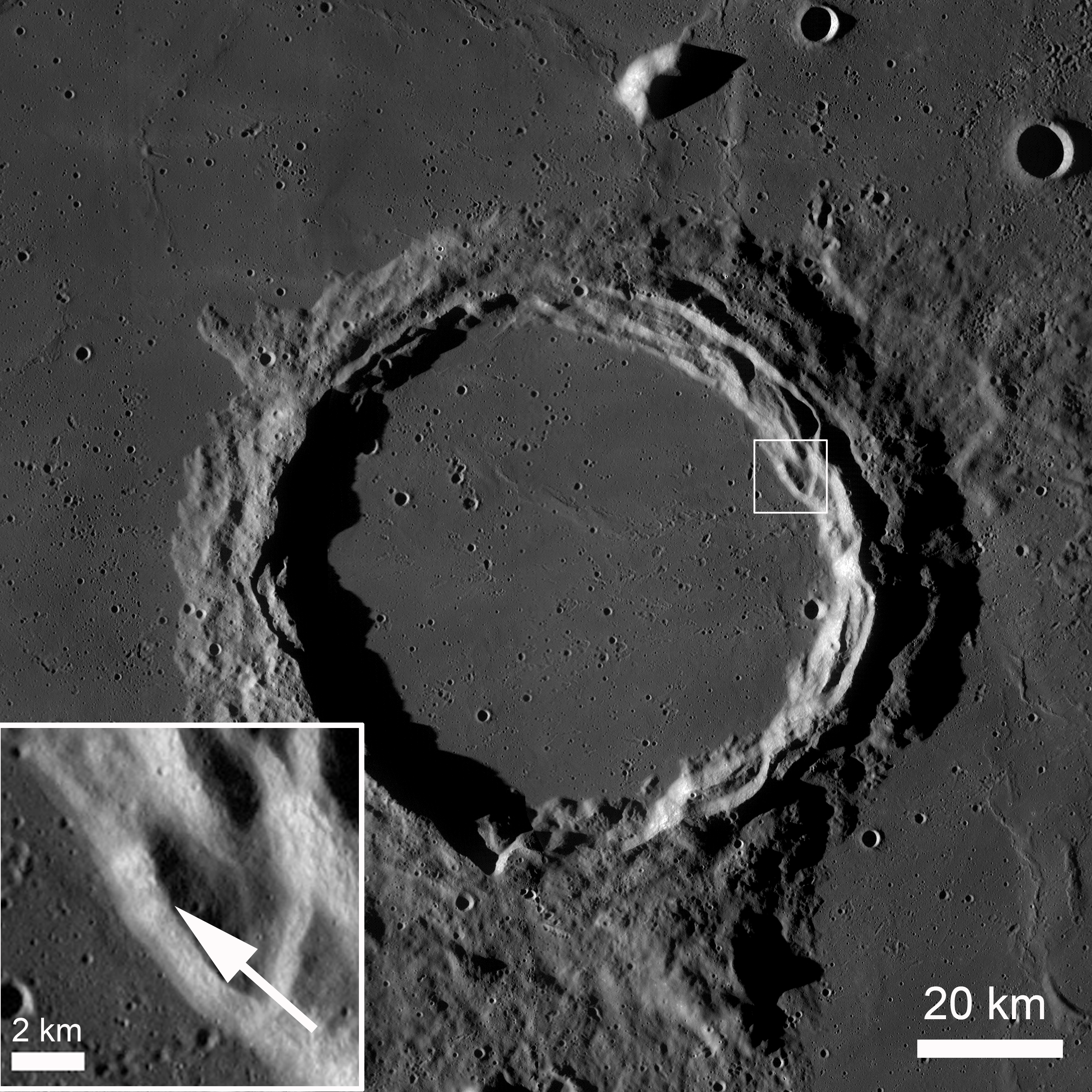
Debris Flows in Kepler Crater

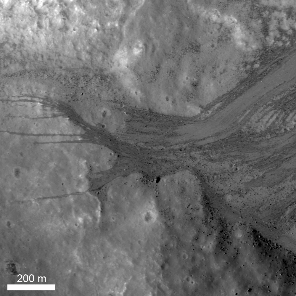
The lower part of the northeast wall of nearside landmark crater Kepler. Loose material is sliding down from near the rim crest (upper right) and ponding on a part of the crater floor. LROC Narrow Angle Camera (NAC) M104755664L, LRO orbit 595, August 12, 2009; resolution 1.27 meters from 119.86 km [NASA/GSFC/Arizona State University].
Jeffrey Plescia
LROC News System

The Featured Image shows the lower slopes of the northeast inner wall of the Kepler impact crater (8.1°N, 322.0°E, diameter 32 km). Loose material often moves down the steep slopes of impact craters, and there are many examples of lunar landslides. The observation that such landslides exist on the Moon were first made during the Apollo program using the images taken from the Command Module while it was in lunar orbit.

This landslide is composed of a range of particle sizes from well below the pixel scale (1.25 m/pixel) to boulders as large as 20 m. Debris slid down the walls and spread out across the crater floor being locally deflected by obstacles on the crater floor. The crater wall has a slope of about 33°.

Another similar pond at the bottom of a long granular debris flow, this one on the southeast wall and floor of Kepler but captured two years later, and at a high resolution opportunity afforded by spacecraft maneuvers in late summer 2011.  LROC NAC M168455361R, LRO orbit 9959, August 20, 2011; 29 cm per pixel, at 36.67° angle of incidence from 22.92 km [NASA/GSFC/Arizona State University].
In the center left of the (top) image, a coarse debris flow was diverted around local topography into several narrow (up to 12 meters wide) flows that extend an additional 400-500 m across the slope and crater floor. Boulders accumulated at the base of the debris flows after rolling all the way down the slope. Debris flows occurred numerous times in this location, as well as many other locations around the crater wall. The material acted as a fluid as it moved downslope flowing around and over obstacles and ponding behind obstructions despite the fact that there was no water present.

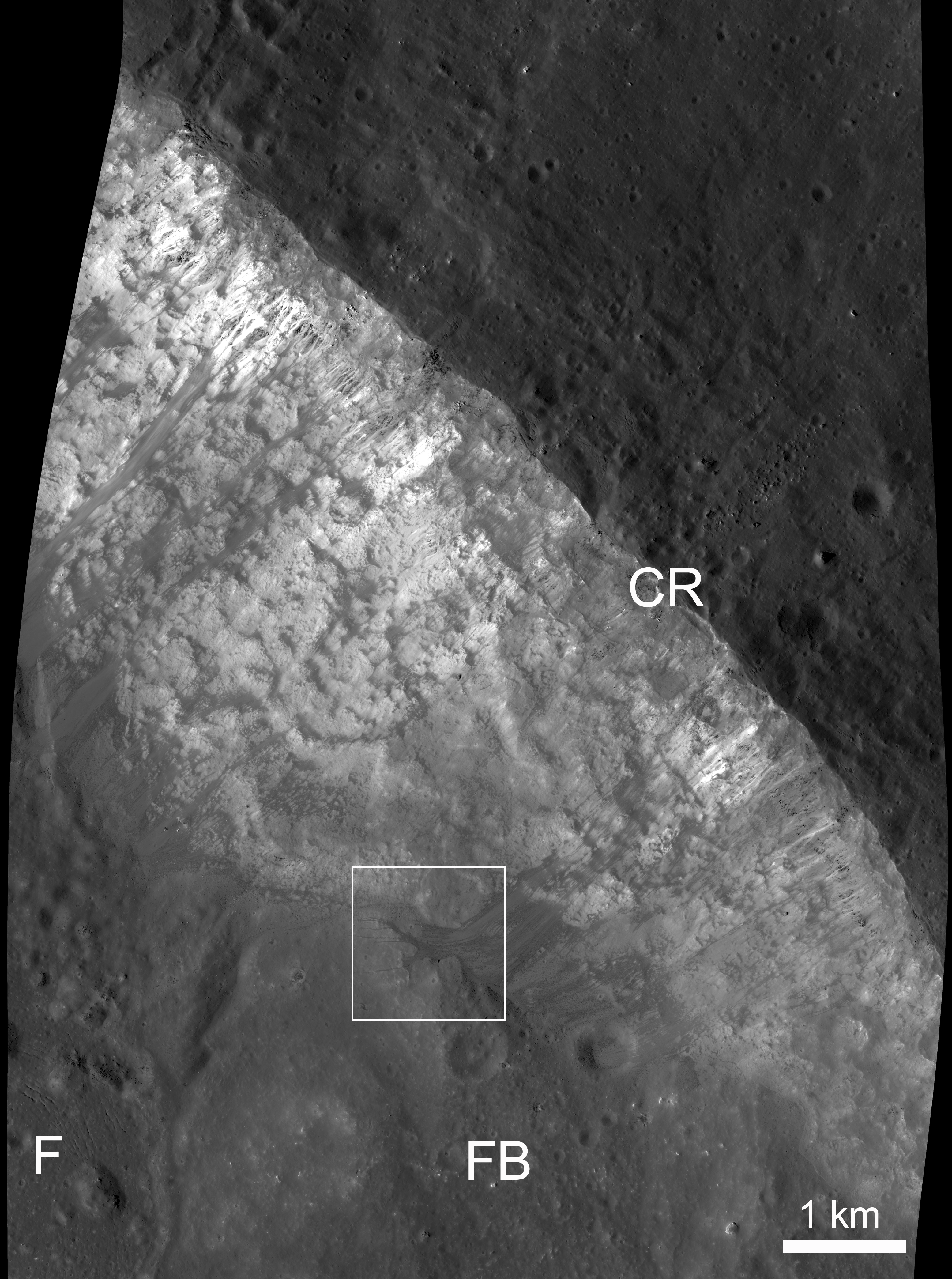
View of the northeast crater wall of Kepler, the field of view in the LROC Featured Image outlined by the white box. Legend: F: crater floor, FB: fault block which has slide down the crater wall, CR: crater rim. LROC NAC M104755664L [NASA/GSFC/Arizona State University].
Above is a reduced resolution version of a larger area around the image shown above (outlined by the white box). Several bright debris flows are observed along the inner crater wall. The area around Kepler crater is illustrated in the wide angle image below.

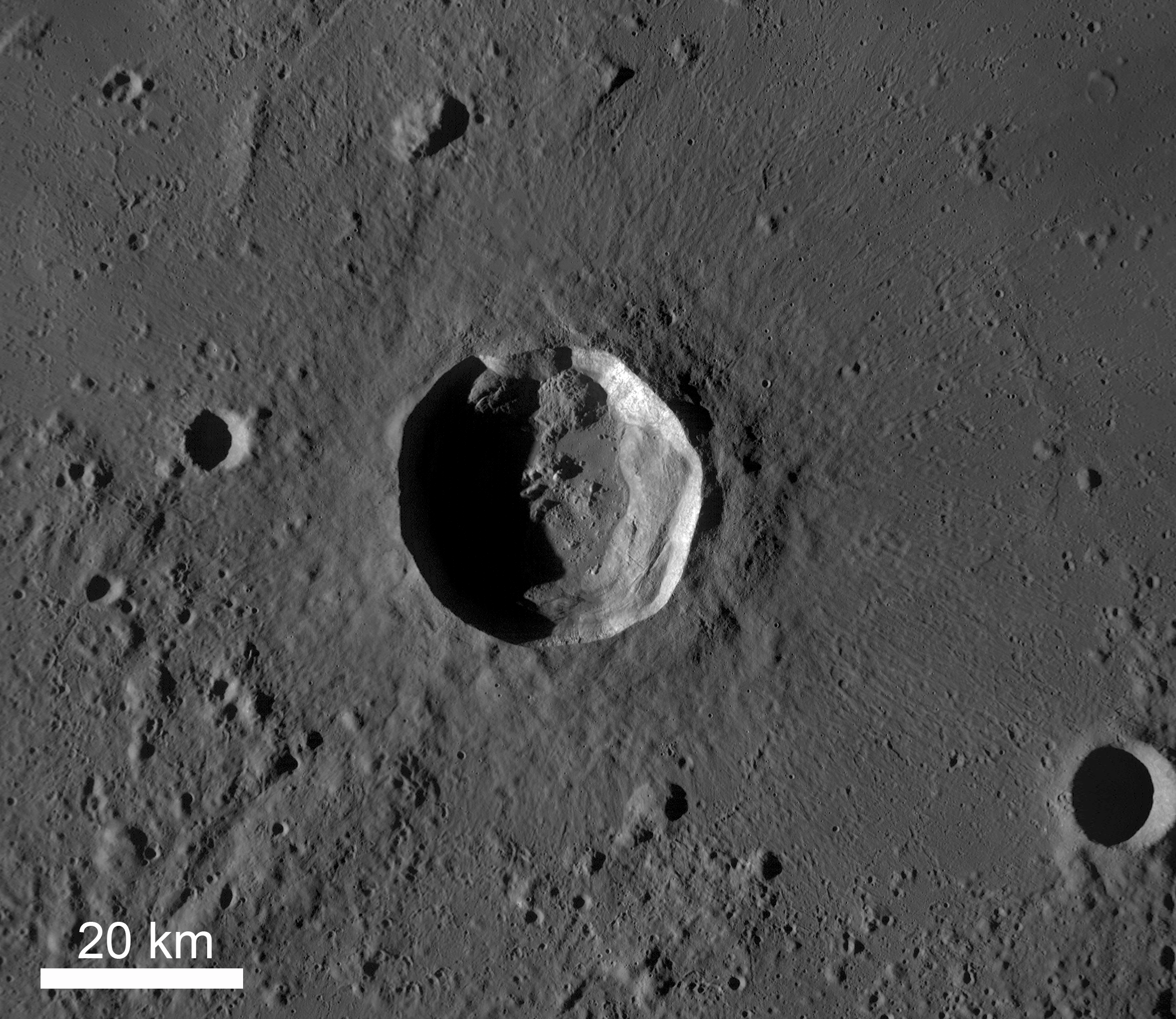
Kepler Crater (32 km diameter) and surrounding plains, afternoon lighting. LRO Wide Angle Camera (WAC) M117738837M. [NASA/GSFC/Arizona State University].
View the entire LROC NAC frame, HERE.

Oblique view of Kepler from on-board Apollo 12, November 1969; 70mm B/W, AS12-52-5547 [NASA/JSC/LPI].
In the shadow of Copernicus, Kepler's bright, widely distributed ejecta and rays would more easily stand out to the naked eye if the similarly youthful and larger crater to its east did not exist. From one of the incredible telescopic mosaics, this one of a Full Moon, by Yuri Goryachko and ASTRONOMINSK team, March 29, 2010.
 Related Posts:

How Recent?
Granular Flow
Dawes
Debris Channels
Kepler's Rim

Tuesday, February 5, 2013

Meanders in Posidonius

Small portion of a S-shaped meandering rille on the floor of Posidonius Crater (31.93°N, 29.85°E, 100 km diameter) - a floor-fractured crater. The curves in the rille are very tight. LROC Narrow Angle Camera (NAC) observation M1098658474R, LRO orbit 14260, August 3, 2012; 1.45 meters resolution, from 143.74 kilometers [NASA/GSFC/Arizona State University].
Jeffrey Plescia
LROC News System

Rilles (linear to meandering troughs) and floor-fractured craters are common on the Moon and on Mars. Lunar rilles occur primarily on the open mare (for example Hadley Rille at the Apollo 15 landing site); others are restricted to craters. Floor fractured craters are an unusual type of crater typically occurring in the highlands near the mare boundary. Posidonius crater lies in the highlands just beyond the northeast margin of Mare Serenitatis. Much of the floor of Posidonius crater is covered by smooth plains considered to be mare basalts. There are suggestions that the rilles are erosional in origin and formed as massive outpourings of lava carved (and melted) the floor. The rille crosses a distance or more than 100 km linear distance across the floor; the actual distance along the floor of the crater including all of the curves is much greater.

Regional view of the western floor of Posidonius crater (inset - full size view HERE) showing its meandering pattern across the crater floor. Toward the top of the frame there is a tributary rille. Wider field of view from LROC NAC M1098658474R [NASA/GSFC/Arizona State University].
The rille that crosses the floor of Posidonius crater extends west across margin of the northern crater floor and then turns south. Perhaps coincidentally (or not) the ridge runs south adjacent to pieces of the original crater floor poking through the crater-filling mare plains. Finally, the rille turns southwest to the southwest rim; it then continues along the base of the southwest crater rim. The rille is about 50 m deep. The wavelength of the meanders is about 1 km.

Oblique view (59° off nadir) of the same rille, LROC NAC photograph from well west of the area of interest. LROC NAC M1096379115LE, spacecraft orbit 13941, July 8, 2012; general resolution 4 meters from 145.49 km over Mare Serenitatis [NASA/GSFC/Arizona State University].
Mosaic of both the left and right frames of LROC NAC oblique observation M1096379115 captures a vast portion of Posidonius in high, late afternoon relief. The rectangle represents the field of view in the image at full resolution immediately above [NASA/GSFC/Arizona State University]
The overall geology of Posidonius crater can be seen in the WAC image below. The image clearly shows the smooth plains that form the floor on the north and west side in which the rille occurs and the tilted fractured floor on the eastern side of the crater.

Posidonius crater captured in afternoon lighting. The crater is embayed by younger mare to the west, though the floor of the crater is about 300 meters higher in elevation. LROC WAC M1096283231C [NASA/GSFC/Arizona State University].
Explore more of Posidonius crater in the entire LROC NAC frame, HERE.

Related LROC Featured Images:
Posidonius Y
Pattern of dark deposits
Petavius Crater

Friday, January 4, 2013

Tres Amicis

Three similar and relatively small impact craters (125-180 meters in diameter) in the nearside southern highlands may have formed in a contemporaneous impact event. LROC Narrow Angle Camera (NAC) observation M106827539L, LRO orbit 884, September 5, 2009; angle of incidence 27.64° at 1.09 meters resolution; field of view 995 meters wide, from 106.57 km [NASA/GSFC/Arizona State University].

Jeffrey Plescia
LROC News System

These three craters, located at 9.665°S, 7.646°E, appear to have formed more or less at the same time, certainly within a few minutes of each other. The southwest crater is 180 m diameter; the center crater is 150 m; and the northeast crater is 125 m across. 

From the northeast crater center to the southwest crater centers, they cover about 450 m. 

The projectiles were traveling from the east-northeast (the right side of the frame) and probably struck the surface at a relatively low angle, as indicated by the asymmetric ejecta patterns and the orientation of the ejecta rays. Bright ejecta extends as much as 1 km from the crater center.

Zoomed out view to include a larger area around the craters so that the long, thin bright ejecta rays are visible. Note that the ejecta is directed to the west (left side); little of it has gone to the east (right). NAC image M106827539L [NASA/GSFC/Arizona State University].
The morphology of the craters suggests that the southwest crater formed first, followed by the other two. The southwest crater may only have formed a few seconds or a few minutes before the other two; the timing is indicated by the ejecta from the middle crater that partly covers the southwest crater. The morphology of the two northeast craters (the low northwest-trending ridge between the craters) suggests that the projectiles hit the surface at the same time such that the excavation process of the two craters interacted, forming the ridge.

Same scene as above in afternoon lighting (angle of incidence 79.38°). The low Sun accentuates the subtle topography associated with the impact craters. LROC NAC observation M102107709R, spacecraft orbit 225, July 13, 2009; field of view 711 meters at 1.01 meters resolution from 98.73km [NASA/GSFC/Arizona State University].
This same crater morphology was created in laboratory experiments where multiple projectiles were simultaneously fired from a high velocity gun. One of the distinctive features of the simultaneous impact is the presence of a ridge (or septum) of material between the craters.

Experimental double simultaneous impact crater in the Ames Vertical Gun, from Oberbeck et al. (1972) Apollo 16 Preliminary Science Report, Fig 29-71, "Impact Craters Produced Simultaneously" [NASA/ALSJ].
Explore the entire LROC NAC frame, HERE.

Related Images:

Thursday, January 3, 2013

Up and Down, Back and Forth

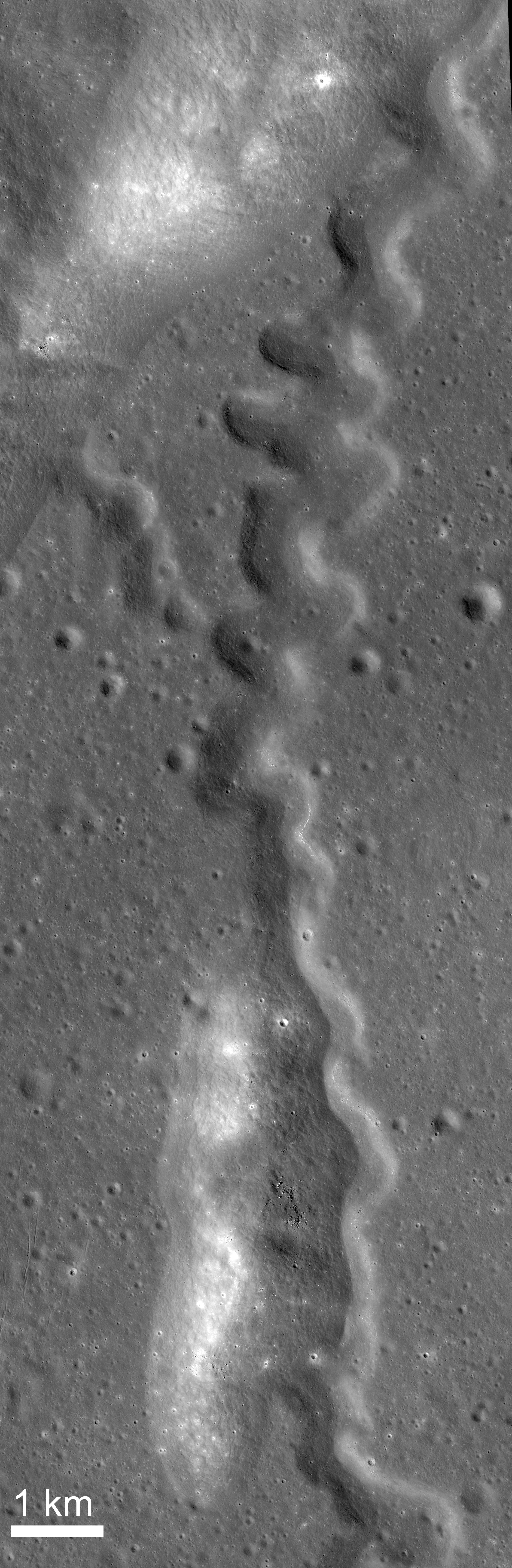
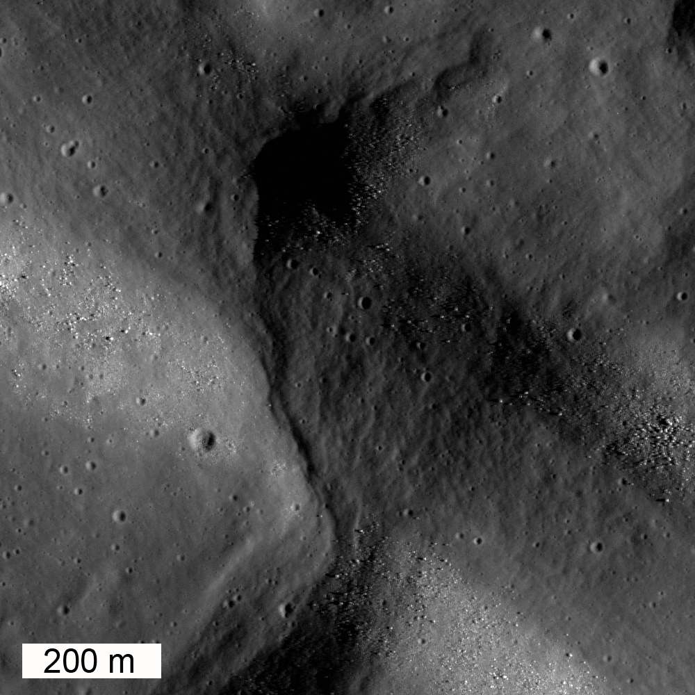
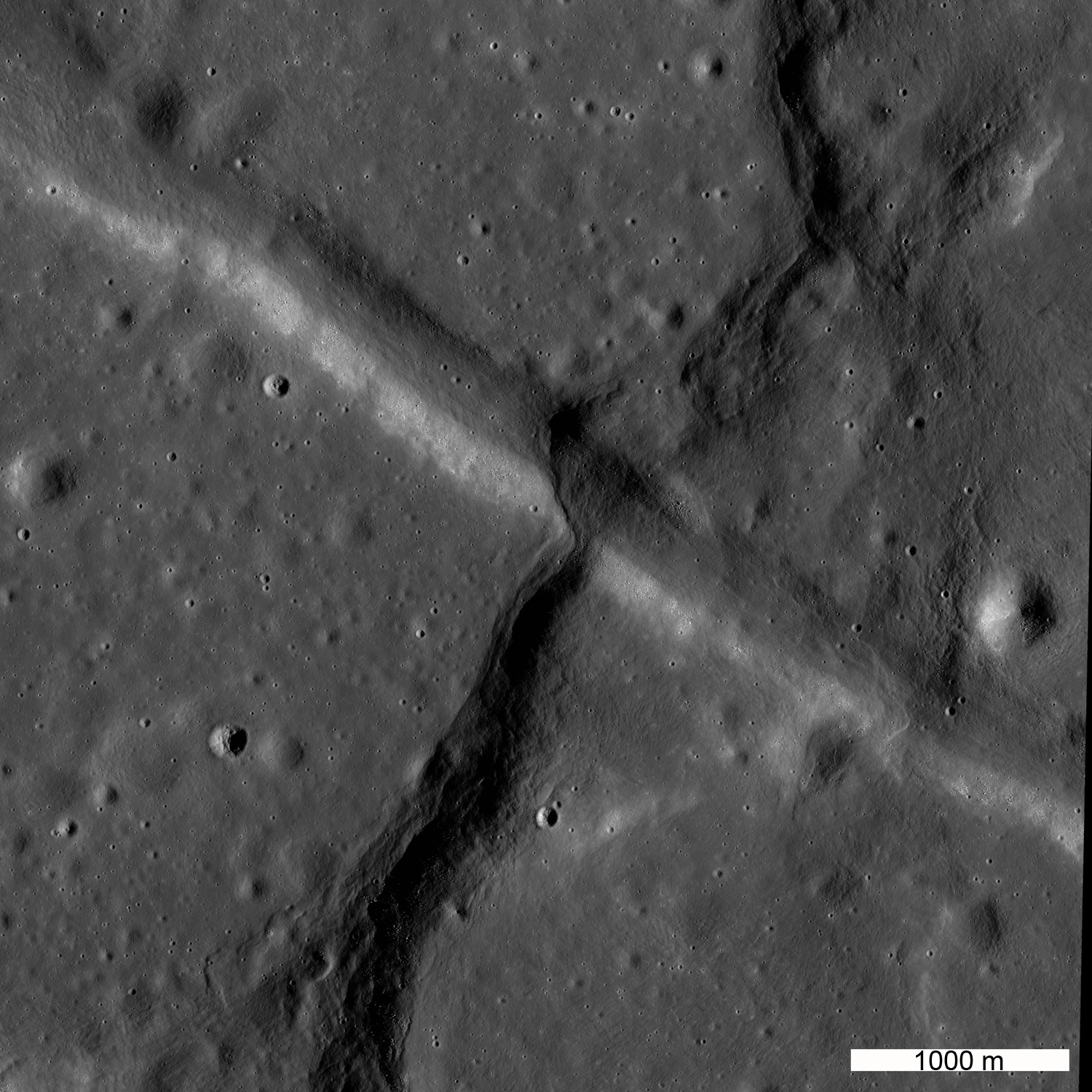
Compression and extension in Mare Tranquillitatis. A northeast-trending wrinkle ridge has overridden a northwest-trending graben. LROC Narrow Angle Camera (NAC) image M192774961L, LRO spacecraft orbit 13437, May 27, 2012; angle of incidence 69.44° at 0.96 meters resolution from 115.91 km [NASA/GSFC/Arizona State University].
Jeffrey Plescia
LROC News System

Today's Featured Image shows the amazing intersection of a northeast-trending wrinkle ridge and a northwest-trending graben, both found in Mare Tranquillitatis (intersection is located at 9.2°N, 27.66°E).

This juxtaposition of structures indicates that the area was extended in a NE-SW direction pulling the surface apart and forming the graben. Later, it was compressed along a NW-SE direction pushing the surface together and forming the wrinkle ridge.

Structural stresses in the crust are not always simple! Another large scale example of this type of intersecting compression and extension environments exists in eastern Mare Tranquillitatis at Cauchy rupes and rimae.

Larger view of the area in the Featured Image. The wrinkle ridge extends to the northeast and southwest changing morphology from narrow to wide. Sun is coming from the east (right). LROC NAC image M192774961L [NASA/GSFC/Arizona State University].
The width of the ridge varies from about 700 m to more than 2500 m, it is about 120-150 m high adjacent to the graben. Large variation in the width of wrinkle ridges is common.  In this case, the thrust fault that formed the ridge is interpreted to dip to the southeast, based on the asymmetry of the topography (the northwest side of the ridge has a steep slope and the southeast side has a gentle slope).

The lunar surface exhibits a variety of tectonic features that are produced when the stresses in the crust exceed the strength of the rock and the rocks break.  Depending upon the magnitude of the stress, the strength of the rock, and the orientation of the stress different types of tectonic features are produced. The two most common on the Moon are graben and wrinkle ridges. Graben are narrow blocks of the crust that have been down-dropped between two normal faults. Wrinkle ridges are thrust faults in which a part of the shallow crust has been thrust over the adjacent area; the upper part of the crust has been folded like an anticline into the wrinkle.

LROC Wide Angle Camera context, the graben -wrinkle ridge intersection below left center in a composite of three sequential orbital WAC observations collected December 12, 2010 (orbits 6767-6769), averaging 73° angle of incidence, 62 meters per pixel resolution from 45 km [NASA/GSFC/Arizona State University].
In this particular location the type of stress reversed over time. First there was an northeast-southwest directed extension that produced the graben, which is about 500-700 m wide and extends for more than 50 km to the northwest. Later, the crust was compressed along a northwest-southeast direction that resulted in the wrinkle ridge.  This ridge is part of a system of wrinkle ridges that extend southwest from a ridge of exposed older highlands material ~30 km to the northeast.

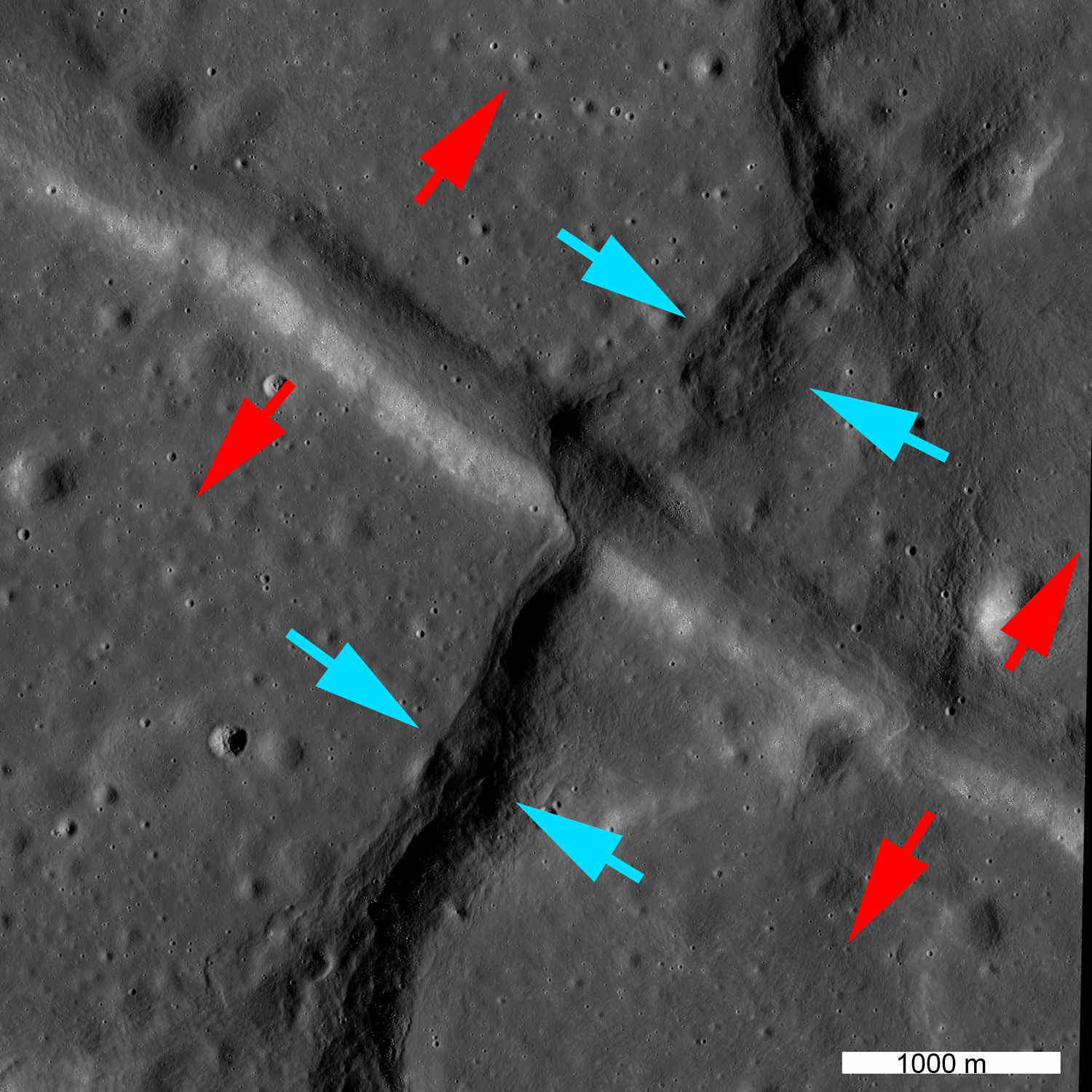
The annotated image below shows the stress directions associated with the graben and the wrinkle ridge.  Red arrows denote the tensional stresses that produced the graben; blue arrows denote the compressional stresses that resulted in the formation of the wrinkle ridge. What happened to cause this reversal, and when did it happen?

Blue arrows denote direction of compression producing the wrinkle ridge; red arrows denote direction of extension producing the graben [NASA/GSFC/Arizona State University].
Explore the entire tectonic feature in the full LROC NAC image, HERE.

Related LROC Featured Images:
Watch That First Step!
Tectonics in Mare Frigoris
Pull Apart - Grabens
It's the Moon's Fault
Linear Graben

Tuesday, August 14, 2012

LROC: Giant flow of Tycho impact melt

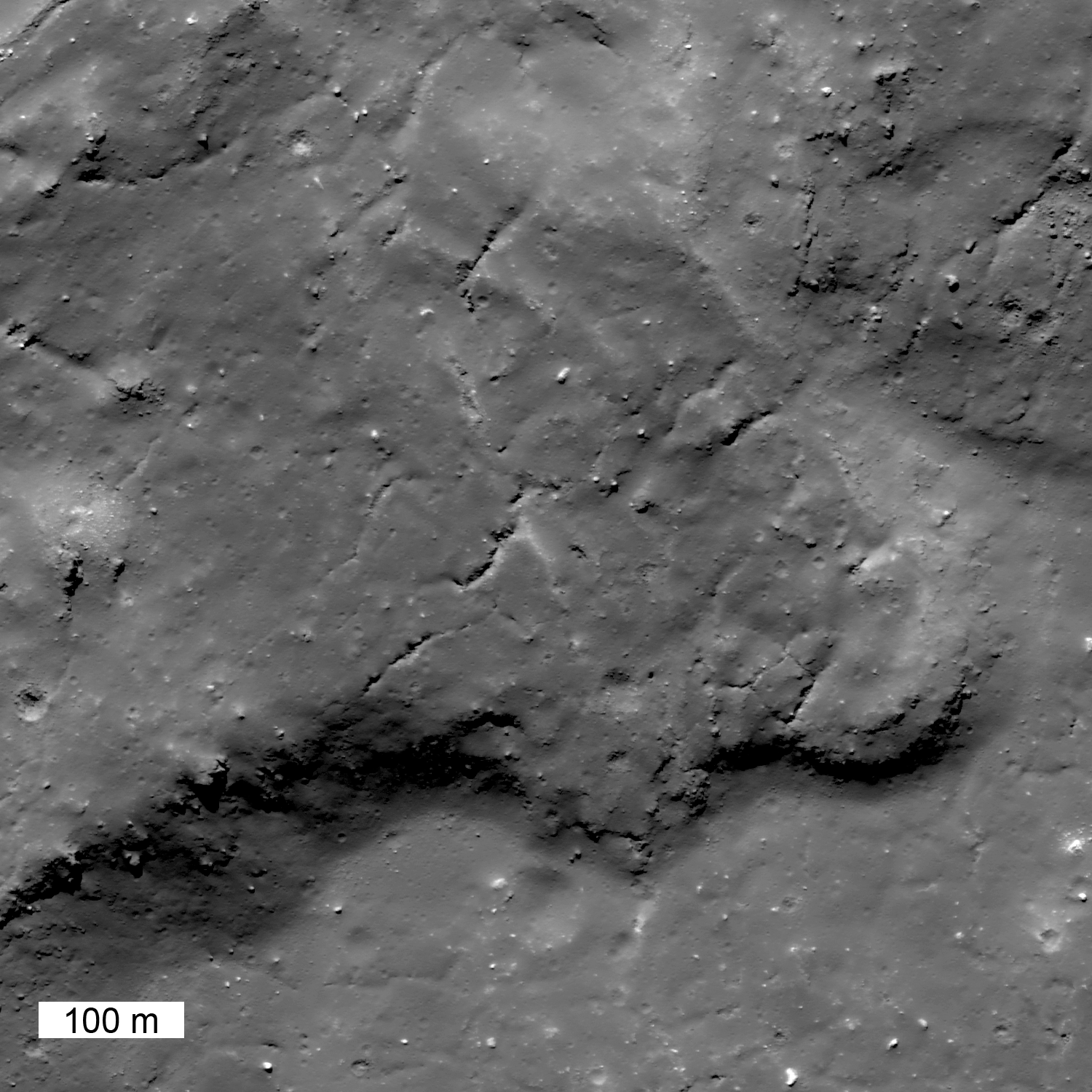
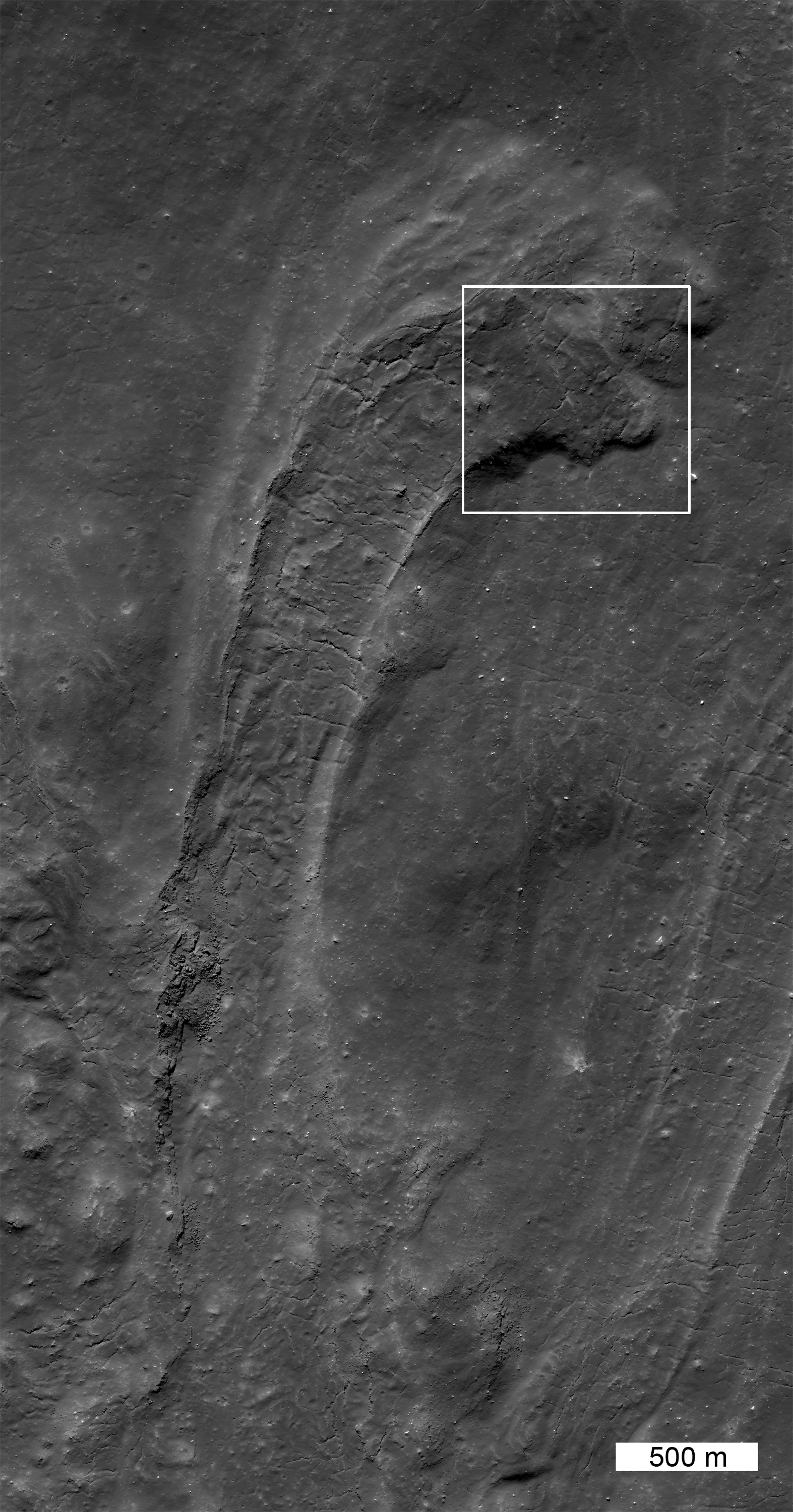
This giant fossilized glacier of impact melt extends north from a much larger mass of impact melt of the north rim of Tycho. This single section of the flow is more than 10 kilometers long. LROC Narrow Angle Camera (NAC) observation M185954551R, LRO orbit 12482, March 9, 2012; resolution is 0.6 meter per pixel of a 43.53° angle of incidence, from 64.8 kilometers altitude. View the larger LROC Featured Image HERE  [NASA/GSFC/Arizona State University].
Jeffrey Plescia
LROC News System

Impact melt is formed during the crater excavation process due to the intense heating of the target rocks. Some of the melt is ejected from the crater and deposited on the rim. In this case, on the north rim of Tycho, not far from the Surveyor 7 landing site, a large amount of melt was deposited, pooled and then flowed downslope away from the crater. This flow (41.162°S, 348.605°E) is about 21 km from the northern rim. Upslope, toward the rim, there are also numerous smaller pools of impact melt (now frozen to solid rock). Contrast this flow with the River of Rock on the southeast side of Tycho crater.

From a half-sized reduction of the original LROC context image (HERE), this expanded view of the full LROC frame (NAC M185954551R) shows more of the flow anatomy, extending north from Tycho. The white box shows the field of view included in the featured image above [NASA/GSFC/Arizona State University].
This giant frozen flow is more than 10 km long! When the flow emerged onto the plains it was about 1.3 km wide; at the terminus it spread out about twice as wide (2.7 km). Along the center of the flow is a channel with levees; the channel is about 1 km wide. In the levee walls and on the flanks of the flow are layers which formed when surges of melt spilled over onto the side of the flow. The morphology of the end of the flow, with lobes stepping to the right, indicates that with each surge, the end of the flow was directed eastward. The surface within the channel shows tension cracks that are perpendicular to the flow direction and formed as the solidified crust fractured. There are several other flows of impact melt on the northern flank, although this is the most dramatic. Impact melt also fills much of the crater floor.

Northern flank of Tycho, its wall, rim painted with flows and pools of ejecta; the arrows points to the flow highlighted above, the blue cross marks the landing site of America's last unmanned lunar lander Surveyor VII, highlighted below. LROC Wide Angle Camera (WAC) 604nm observation M152952485C, spacecraft orbit 7644, February 21, 2011; angle of incidence 57.41° at 63.7 meters resolution from 46.5 kilometers overhead [NASA/GSFC/Arizona State University].
Explore this giant impact melt flow in the full NAC image, HERE.

Ejecta on Tycho floor

The very successful and daring Surveyor 7 was successfully landed right in the middle of the complex Tycho impact melt fields, north of the crater, about 10 km away from the field of view included in the LROC Featured Image. Less than a kilometer, beyond view of the spacecraft's cameras, is s substantial melt pool, where Surveyor might easily have landed instead. LROC NAC M152952815R, LRO orbit 7674, February 21, 2011, resampled from the original resolution of 0.5 meters from 44.7 kilometers [NASA/GSFC/Arizona State University].

Wednesday, July 25, 2012

LROC: 'Bulls-Eye' or Volcanic Vent?


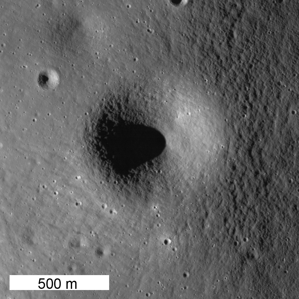
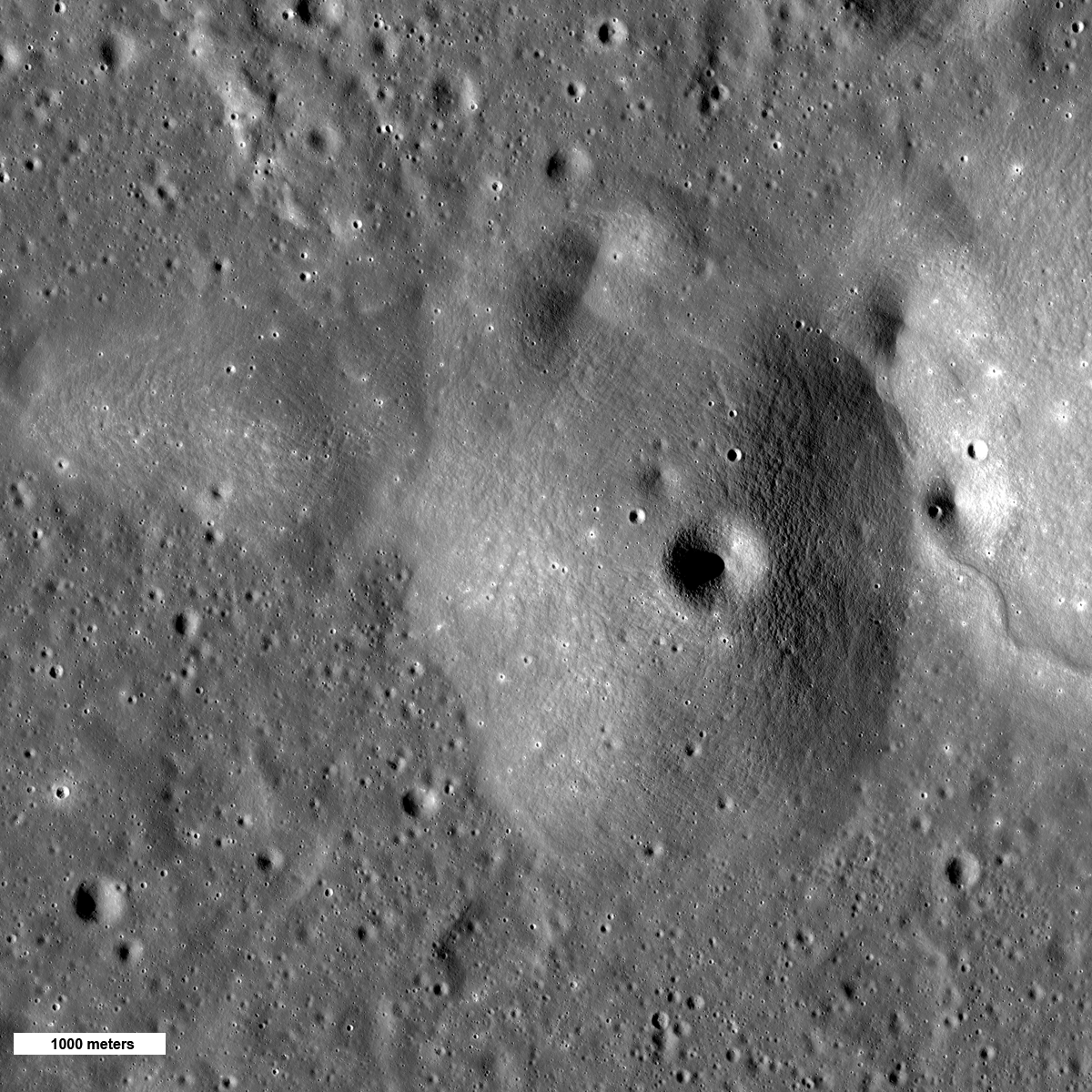
A circular depression (700 m diameter) sits atop of a circular mound 3.7 km in diameter. It is either a perfectly placed impact crater on the hill's summit, or a volcanic vent. Mosaic of LROC Narrow Angle Camera (NAC) observations M181173832L & R, LRO orbit 11,814, June 22, 2012; native resolution 1.5 meters per pixel. View the cropped field of view (1000 px) framed and released as the LROC Featured Image, July 27, 2012, HERE [NASA/GSFC/Arizona State University].
Jeffrey Plescia
The origin of many features within the mare remain ambiguous. 

Crater or vent? Flow or tectonic feature? 

Since the mare are generally older than 3 billion years, small features are worn down and rounded from meteorite bombardment. 

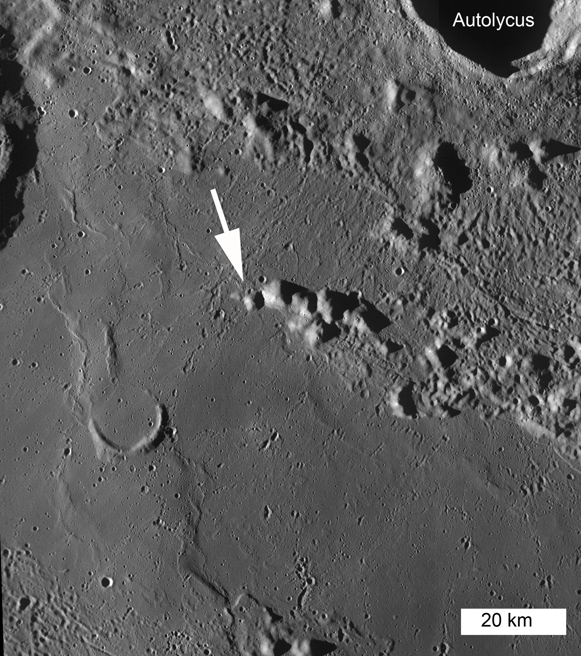
Thus their true mode of origin is not easy to discern. To the south are the mare units of Palus Putredinis, and to the north is the ejecta from the crater Autolycus.

Broad view of the hill in question and the adjacent plains. Mosaic of LROC Narrow Angle Camera (NAC) observations M181173832L & R, LRO orbit 11,814, June 22, 2012; native resolution 1.5 meters per pixel. (1200 px - reduced by a factor of 4) HERE [NASA/GSFC/Arizona State University].
The fact that the crater is centered on the summit, the symmetry of the topography and the presence of a crater on the east side that appears to have dark ejecta suggest the feature might be a volcanic cone. The hill stands about 250 m above the surrounding plains and has a slope of about 8°. The slope is steeper than expected for a low basaltic shield, more consistent with a cinder cone.

Regional view of the hills. The arrow shows the feature in the NAC images above. Mosaic of LROC Wide Angle Camera (WAC) observations swept up in sequential orbital opportunities around M117488146ME, LRO orbit 2448, January 7, 2010; angle of incidence 82.64° averaging 56 meters resolution from 39.85 kilometers. View the 2200 px context mosaic accompanying the Featured Image HERE [NASA/GSFC/Arizona State University].
The grouping of hills seen in the WAC mosaic was originally mapped as Fra Mauro Formation (basin ejecta) and crater rim material by Hackmann (1966). Looking around the area south of Autolycus, there are several hills that have craters near their summit or are symmetric in shape, both attributes that might suggest a volcanic origin. Elsewhere on the Moon, there are fields of volcanic vents that look similar to these. This may be a volcanic complex that has not yet been recognized.

Map the entire NAC mosaic at full resolution HERE.
Try and decide for yourself: basin ejecta or volcanic?

Related Featured Images:
Marius Hills

An out of the ordinary view looking east by southeast over the 132 kilometers of Palus Putredinis from the subject (crater or vent) detailed in the LROC Featured Image released July 25, 2012 and the landing zone and area along Hadley Rille explored by the Apollo 15 expedition in 1971. LROC Global 100 meter mosaic over LOLA elevation model using NASA's ILIADS LMMP application [NASA/GSFC/LMMP/Arizona State University].