
 |
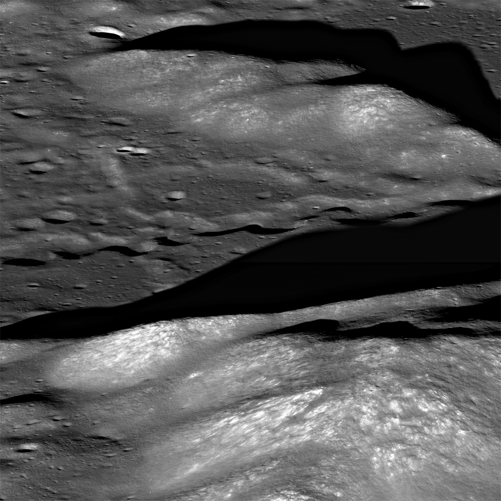
| A portion from LROC Narrow Angle Camera oblique mosaic M177602135LR, and a rille, seen in the center of this image, running northwest to southeast through the Montes Alpes northwest of Mare Imbrium. Field of view approximately 15 km (north to the right). Spacecraft orbit 11309, December 4, 2011; average resolution 3.12 meters per pixel from 41.6 km over 49.86°N, 4.3°E [NASA/GSFC/Arizona State University]. |

LROC News System
Rilles are common on the Moon and are considered one of the most fascinating volcanic features due to their wide range of scales (100's of meters to over 100 kilometers in length) and morphologies they present (linear, arcuate, or sinuous).
Rilles commonly form when lava flows erode into the existing surface through melting of the substrate, mechanical stripping away of material, or a combination of both thermal and mechanical processes. However, some rilles may have been lava tubes that underwent roof collapse since their formation.
 |
| An uncorrected full resolution stitch of LROC NAC mosaic M177602135LR, allowing a false perspective on the rille of interest, west of the spacecraft's orbital track [NASA/GSFC/Arizona State University]. |
 |
| A lower resolution, corrected view of the full LROC NAC oblique. The rille discussed in LROC Featured Image released November 15, 2013 indicated by white arrows [NASA/GSFC/Arizona State University]. |
 |
| LROC WAC image of Montes Alpes; field of view approximately 500 km across, centered at 49.397°N, 358.731°E. LROC Featured Image area outlined by the red rectangle [NASA/GSFC/Arizona State University]. |
Explore Montes Alpes and the rille for yourself HERE.
Related Posts:
Discontinuous Rilles
Old Man River (of Lava!)
Montes Pyrenaeus meets Mare Nectaris
No comments:
Post a Comment