Showing posts with label NAC. Show all posts

Saturday, September 29, 2012

Taurus Littrow Oblique

An oblique perspective on the Taurus Littrow Valley and the landing site of Apollo 17 (20.1911°N, 30.7722°E) from more than 270 kilometers away. The granularity captured is remarkable testimony to the power of the LROC Narrow Angle Camera. LROC NAC frame M192703697R, orbit 13427, May 26, 2012; spacecraft and camera slewed 56.09° from nadir, resolution 2.79 meters, from a point 131.29 km over 20.01°N, 38.78°E [NASA/GSFC/Arizona State University].
Joel Raupe
Lunar Pioneer

The eleventh, and most recent, release of Lunar Reconnaissance Orbiter Camera (LROC) photography to the Planetary Data System (PDS) might have passed unnoticed. The spacecraft, after all, has been orbiting the Moon for more than three years, presently at more than 100 km, as it has since the beginning of 2012, and a year has passed since the spacecraft's dramatic 22 kilometer barnstorming passes over the surface in late 2011. 

The nominal mission orbiting altitude of 40 to 60 kilometers could not be sustained forever, though certainly none have come closer to mastering the Moon's 'lumpy' gravity well than LRO's flight directors.

Results from this mission-conserving, more apparently sedate higher-altitude phase in the LRO extended science mission would not very dramatic, still covering the same ground, over and over, presently from a greater distance. But, as all who regularly observe the Moon from Earth already know, the Moon never seems to present the same face twice, and it always seems to deliver up to patient, alert and modestly equipped observers a new face each and every time they pause to take a look. Remarkably, this axiom is proving as true for LRO in polar orbit as it is for Earth-bound observers 400,000 km away.

For the moment, 'barnstorming' has been left to the GRAIL twins. Together with LRO and the ingeniously recycled ARTEMIS probes, the feast of having five U.S. space vehicles in lunar orbit simultaneously cannot compete with Curiosity on Mars, or Dawn and its departure from Vesta for Ceres.  Even after four decades of near-neglect, as happened in the Apollo era, even hardened lunatic fanatic followers of LRO, quite naturally, have a more difficult time sustaining their sheer awe of the stunning, long overdue mission.

When properly scaled, the now-distinctive, albeit brief, trace of human activity on the floor of Taurus Littrow Valley is just barely visible at the center of this frame, pushed to 200 percent. Though the Apollo 17 lunar module descent stage cannot be seen, the darker material once just below the surface around that artifact, as well as the path to and from the ALSEP and LRV sites, turned over by the feet of Gene Cernan and Jack Schmitt nearly 40 years ago, is definitely a part of this landscape, photographed from an incredible distance last May [NASA/GSFC/Arizona State University].
Though the announcement of this eleventh PDS release seemed slightly delayed observations collected by LRO cameras from mid-March through mid-June was already available, right on time, through Arizona State University's LROC PDS interface. You had to have coordinates of a chose piece of the Moon's surface enumerated, longitude and latitude of its meets and bounds, unless patient or idle enough to scroll through sequential, lossy thumbnails.

Soon after the formal announcement, however, updated and detailed LROC NAC and WAC observation footprints became available to users of Google Earth, and as a layer on the web-based LROC QuickMap. The latter publication allowed the lay-public to experience something of the kind of serendipity only selected scientists experience when they comb through its latest pictures.

At around 30 percent full resolution, the breadth of Taurus Littrow can be seen, the rectangle tracing the outline of the narrow field of view shown at 100 percent resolution in the opening image, further above. Almost the entire area, the now-familiar landmarks, explored by Cernan and Schmitt can be seen. LROC NAC M192703697R [NASA/GSFC/Arizona State University].
Not long after these releases, every 90 days, someone who deserves a distinguished medal uploads to the Washington University (St. Louis) web-servers carefully updated Google Earth Keyhole Markup Language (KMZ) LRO-derived NAC and WAC footprint files. 

And though the lunar map available using Google Earth is increasingly outdated, after loading selected, updated KMZ files users can sift large areas of the lunar surface with LROC NAC and WAC observational fields of view embedded, and with an adjustable sliding time scale. It's a great way to get a quick look at areas available at high-resolution and during a particular phase of the mission, each with different illumination angles, especially any newly available observations of a particular area of personal interest.

Another demonstration of LROC NAC capabilities. The footprints, the 'fields of view.' of LROC NAC observations M192703697R and M192703697L, set up much as an imaginary passenger on board the Lunar Reconnaissance Orbiter might have seen the Target of Opportunity with the naked eye, in polar orbit 133 kilometers over a point on the Moon about 245 km east of the Apollo 17 landing site in Taurus Littrow Valley. Both field of view are well within the Apollo corridor, and the Apollo metric camera interferometry elevation model, integrated into the Google Earth virtual Moon [NASA/GSFC/USGS/JAXA/ASU].
It's also a way to allow the eye to "pick a crooked stick out from a pile of straight ones," because the occasional oblique observation shows up quite naturally as a highly elongated footprint that stands out sharply from the regular course of straight north-south footprints that follow the LRO polar orbit.

A highly-reduced copy of a 9240x7930 pixel mosaic of nearly the entirety of both the left and right frames of LROC NAC observation M192703697. Unfortunately, the original image file weighs in at around 66Mb, probably too hefty for most people's immediate resources. It's unfortunate because so very much spectacular detail and "knowledge to be gained," some of it important to our improving picture of lunar morphology, can be seen in the jaw-dropping original. You can, if you have the bandwidth, download the unofficial mosaic HERE [NASA/GSFC/Arizona State University].
Just a quick survey, one of many routes into the wealth of data that is still being swept-up by the LROC cameras, uncovered a new oblique observation of Taurus Littrow (sampled in this post).

Though the landing site of Apollo 17 has been explored at high-resolution by LRO many times, is readily identified through modest telescopes, and has even been surveyed by Hubble, even up close the Moon deliveres on a well-earned reputation for new glory with even simple changes in camera perspective, as most recently at even medium resolution from LRO last May.

Even the distinct trace of human activity, from December 1972, can be picked out, together with the enduring Sculptured Hills, the bright dusting of material blown off South Massif by the impact that formed distant Tycho, and so forth. But is this latest really a unique perspective, or the first time Taurus Littrow has been photographed from the east?

The full-resolution M192793697LR mosaic (warning: 66mg) may be available, HERE.

Certainly the last time Taurus Littrow was photographed from the east before the arrival of Apollo 17.  On December 11, 1972, after separating from Ron Evans and the Command Module America (visible at center), in their 12 orbit and just prior to final descent, Gene Cernan shot a short series of pictures of the destination from his left window of the lunar module Challenger. At full resolution, comparing AS17-147-22465 with the M192703697LR mosaic reveals how little the landscape has changed.
Not quite. But, though hand-held camera shots by Gene Cernan were captured from much closer and from lower altitude, the LROC NAC mosaic seen in miniature above, under similar lighting conditions, shows advances in photography in four decades, much of it a direct result of manned and unmanned space exploration.

In time, its possible that a small impact may have left behind a large enough trace to show when comparisons are made between the LROC NAC mosaic and frames from Apollo 17 Magazine 147. Its even possible, perhaps, that a change in perspective will eventually allow us to discover the final resting place of the Apollo 17 lunar module ascent stage itself, which was intentionally impacted near South Massif after being jettisoned, just before the last Apollo lunar mission broke orbit and returned to Earth.

Related Posts:
LRO LAMP sharpens Apollo surface helium data (July 17, 2012)
Toxicity of Lunar Dust (July 2, 2012)
39 Years (and counting) (December 14, 2011)
Just another crater? (December 13, 2011)
Apollo metric camera maps completed (November 21, 2011)
Too brief an expedition to a lobate scarp (August 24, 2010)
Moon geologically active, cooling and shrinking (August 19, 2010)
Return to Moon, Schmitt says, important for protection of liberty (June 17, 2010)
Dr. Jack Schmitt salutes LROC's Mark Robinson and the LRO
camera team at Arizona State
(November 10, 2009)
Apollo 17 from 50 kilometers (October 28, 2009)

Thursday, July 19, 2012

New tool for exploring LROC NAC Images

23 high-resolution views of the Apollo 12 (and Surveyor III) landing site, in a clickable catalog, together with a solar-illumination slide-scale for viewing the images at all available illumination angles of incidence. Featured Sites, a "New tool" LROC invites users to "Explore the Apollo landing sites using LROC images [NASA/ASU/Arizona State University].
Mark Robinson
Principal Investigator
Lunar Reconnaissance Orbiter Camera (LROC)
Arizona State University
 
The LROC team just released a new webpage to help lunar explorers interact with spectacular LROC images of engaging features on the Moon. The new webpage is designed, with what we hope is an intuitive and easy-to-use interface, to help you find specific features amongst the hundreds of thousands of NAC images now in the archive! First out in our new webpage are some of the most historic places in our Solar System: the Apollo Landing sites where human beings took their first steps into the larger Universe, starting with Apollo 11, 43 years ago tomorrow. Explore these amazing locations on the beta version of the new LROC Featured Sites webpage. Over the next several weeks wrinkles will be ironed out of the new page, and then we will add more content. So keep checking back.

8 of 22 high-resolution LROC NAC observations of the Apollo landing site (July 20, 1969) already available in the new Featured Sites catalog [NASA/GSFC/Arizona State University].
Screen capture of LROC NAC Landing Site Flip Book, Apollo 12 example [NASA/GSFC/Arizona State University].
Have fun dragging the Sun and seeing how the surface changes!

Tuesday, June 26, 2012

LROC: Giordano Bruno, The Big Picture

Mosaic of eight LROC NAC images provides this spectacular view of the interior of Giordano Bruno crater (21 km diameter). Resolution was reduced by 10 times to fit this Featured Image format, M185212646LR, M185219795LR, M185226944LR, M185234092LR. View the spectacular 1215 x 1215 px LROC Featured Image HERE [NASA/GSFC/Arizona State University].
Mark Robinson
Principal Investigator
Lunar Reconnaissance Orbiter Camera
Arizona State University
 
To conserve fuel, LRO was moved from its 50-km circular orbit into an elliptical orbit on 11 December 2012. As a result the spacecraft's altitude is now significantly higher in the northern hemisphere; the low point of the orbit is ~30 km over the south pole and 200 km over the north pole. This new orbit provides fantastic opportunities to acquire large area mosaics with nearly identical lighting across numerous orbits. For this Giordano Bruno crater mosaic, LROC acquired four NAC pairs (8 NAC images), from 4 orbits in a row, over a six hour period on 1 March 2012. Since LRO's polar orbits progress from east to west, the first image pair was acquired by slewing the spacecraft 6° to the west, on the next orbit only 1° to the west, on the third orbit LRO slewed 4° to the east, and the last orbit 9° to the east. The pixel scale of the images was about 1.6 to 1.8 meters, so the the images were reprojected to 1.8 meters.

How did Giordano Bruno (35.92°N, 102.74°E) crater form, how big is it, and when did it form? The first question is easy: it formed as the result of a hypervelocity impact of a comet or asteroid into the Moon. The crater is irregularly shaped, so its diameter ranges from about 20.9 km to 21.6 km (13.0 miles to 13.4 miles). Its walls are very steep and the floor is a mix of jagged boulders and pooled impact melt rock. Since LROC has an ability to collect stereo observations, we now have a high-resolution topographic map of the whole crater made from images acquired when LRO was in its lower orbit (50 cm resolution).

Northeast corner of Giordano Bruno crater with LROC NAC topographic contours (at 100 meter intervals) overlain. Explore the contour map of all of Giordano Bruno crater HERE and see the 900 px context image HERE [NASA/GSFC/Arizona State University].
The NAC topography reveals that the walls everywhere have over 2000 meters of relief, and the northwest side of the crater has more than 2800 meters of relief. Everywhere the wall slopes exceed 30°, which is very near the angle of repose. However, in the upper portions of the walls the slopes are 40° or more. Slopes this steep can only be supported by solid material, not loose debris. Over time smaller impacts will erode the upper walls, and all slopes will be at or less than the angle of repose as the walls literally crumble. In the topographic map (above) you can also see a large bench that represents a block of wall material that slumped into the crater, but stopped about two thirds of the way down. That bench used to be at the same level as the rim, some 1500 meters up the wall!

Impact melt flow on south flank. View the original field of view HERE [NASA/GSFC/Arizona State University].
How old is this beautiful crater? The answer is very young, but how young? We won't know the answer for sure until we obtain a sample of impact melt and can make precise radiometric age dates. The sharp, well preserved nature of the melt forms on the crater floor and flanks (above) and the sparsity of superposed craters show us that the crater is young. Scientists have counted the number of craters to estimate an age of 10 million years, or less. However with craters this young we do not know how many of the few craters that we can see were actually formed as self-secondaries: late stage material ejected from the event that formed the crater and fell back on the newly formed ejecta. These self-secondary craters, if they exist in abundance, would lead to an estimated age that is older than the true age, if not accounted for in the crater statistics.

Enigmatic dark ejecta on north flank. View the wider field of view, HERE [NASA/GSFC/Arizona State University].
Many fascinating details are revealed both inside and outside the crater in the NAC images. What is the dark rubbly material that occurs in discrete patches on the rim (above)? Could it be material from basaltic dikes excavated from depth and ejected up onto the rim? Or perhaps impact melt glass? This question may remain outstanding until astronauts traverse the rim of this spectacular crater. Imagine standing and looking across a 2500 meter (8200 feet) deep crater to the far wall some 21 km (13 miles) distant. For comparison the Grand Canyon is only 1800 meters (6000 feet) deep, but is a bit wider at 29 km (18 miles). Which would be more impressive? I am not certain, but I would certainly like to find out!

Examine this full resolution (1.8-meter per pixel scale) mosaic of Giordano Bruno HERE.

Giordano Bruno mosaic with NAC stereo derived contour lines, HERE.

Previous LROC Giordano Bruno Featured Images
Outside of Giordano Bruno
Fragmented Impact Melt
Delicate Patterns in Giordano Bruno Ejecta
Impact Melt Flows on Giordano Bruno
Young Giordano Bruno 

LROC Wide Angle Camera (WAC) Observation M121539469C (604nm), LRO orbit 3045, February 23, 2010; Angle of incidence 49.62° at 76.2 meters per pixel resolution, from 54 kilometers [NASA/GSFC/Arizona State University].

Tuesday, June 19, 2012

Welcome new medium resolution views from LRO

Rich detail and context is seen in this "medium resolution" image of a familiar part of the complex Aristarchus Plateau from the Lunar Reconnaissance Orbiter (LRO). Prior to a recent mission-conserving transfer to higher orbit, capturing the entire width of the 165 kilometer-long Vallis Schroteri in a single Narrow Angle Camera (NAC) frame was not possible. The maneuver should add some years to the record-smashing mission following three years in an energy-taxing low lunar orbit, and welcome perspectives like this one in a 'middle range' between the best of the orbiter's narrow and wide angle camera catalogs.  LROC NAC frame M183861408R, LRO orbit 12190, February 14, 2012; angle of incidence 41.03° at 1.39 meters resolution from 140 kilometers [NASA/GSFC/Arizona State University].
Other nations can rightly boast of recent accomplishments in low Earth and lunar orbit, and its easy to lament the embarrassing length of time since America sent six manned expeditions to the lunar surface. It might seem a small thing in comparison, and easy to forget, but the United States presently has five vehicles in lunar orbit. Queen among them is the under-rated Lunar Reconnaissance Orbiter.

The LRO will soon celebrate three years in lunar orbit, far longer than any spacecraft in history, and by all accounts the vehicle is healthy and still shy of middle age. It's no small accomplishment maintaining close-lunar orbit precisely for the very reason the twin GRAIL gravity probes, "Ebb" and "Flo," were designed and subsequently dispatched to spy out. The Moon is "lumpy," with mass concentrations putting uneven drag on objects in orbit, and it also dances through a realm of space overwhelmed by the influences of Earth and Sun. To remain in lunar orbit requires skill and fuel, even over robust design.

After more than two years surveying the lunar surface from within 40 kilometers, close enough to photograph the forty year-old footprints of the Apollo astronauts and allowing more than half the Moon to be imaged at high resolution, in 2011 flight directors included two periods when LRO was swept through the 20 kilometer range. It was a last slow dance before the spacecraft was brought up above 100 kilometers. 

Eventually, planning requires LRO to be wound down tightly for more unprecedented close-ups before what is hoped will be a controlled impact, good to the last thruster fire. In the meantime, since late last year scientists have been enjoying a "medium range" perspective using the LROC Narrow Angle Camera from a higher altitude.

It difficult to disparage the quality of this LROC NAC frame of Rima Galilaei and the exposed layering of the surrounding floor of Oceanus Procellarum. This image is a full-resolution crop from LROC NAC M181552312R, orbit 11867, January 18, 2012; angle of incidence 62.51° at 1.25 meters resolution, from 125.4 kilometers altitude. For comparison, from 24.16 kilometers in orbit 9978 the previous August 21, two insets from LROC NAC frame M168584181R show half-meters resolution fields of view of the same region [NASA/GSFC/Arizona State University].
Soon after LRO arrived in lunar orbit and the first of Arizona State University's LROC Narrow Angle Camera images began arriving back on Earth, Charles Wood, who is the steadfast lunar observer and architect of the Lunar Picture of the Day (LPOD) website, was quick to point out the level of detail and small fields of view seen in those images seemed almost overwhelming. He looked forward to the time, still several months off, when LROC's Wide Angle Camera (WAC) catalog premiered on the Planetary Data System (PDS). He wasn't disappointed. That wider context showed familiar landmarks Wood had long witnessed under every available illumination and focus in ways that were truly new.

These are still high-resolution images, even at less than half their previous detail. A new range of medium resolution photography from the LROC NAC offers a welcome opportunity to continue the long process of digesting the incredible volume of data that's been returned to Earth from what may already be the most cost-effective deep space mission in history.

Wednesday, May 2, 2012

LROC NAC DTM: Copernican crater in 3D

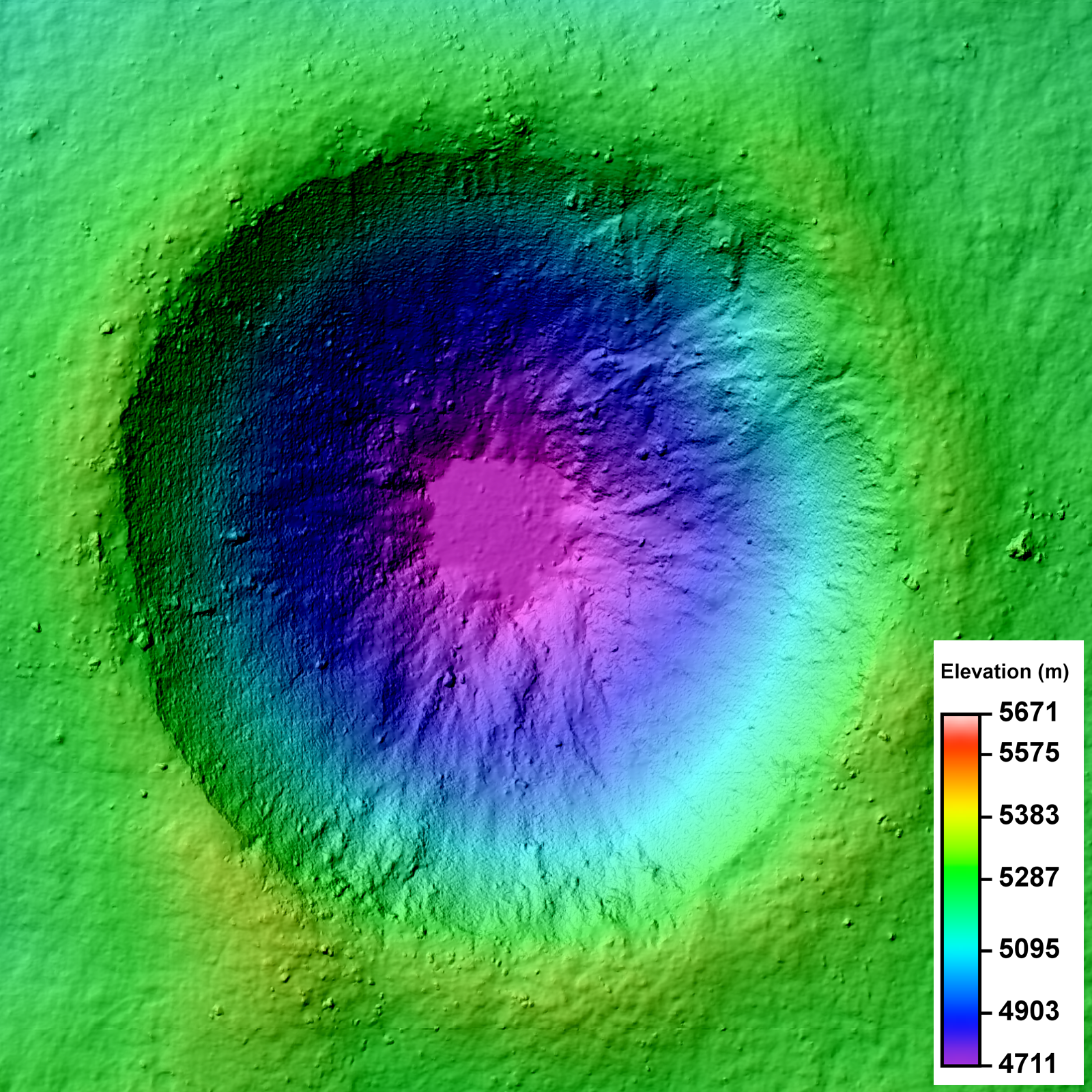
LROC Narrow Angle Camera (NAC) Digital Terrain Model (DTM) of an unnamed crater in the farside lunar highlands. Image field of view 3.2 km across. See the much larger (1600px) LROC Featured Image HERE [NASA/GSFC/Arizona State University].
Lillian Ostrach
LROC News System

LROC Featured Images show off the incredible variety of stunning lunar geology imaged by the LROC NACs. While these beautiful images allow scientists to study the surface of the Moon with respect to morphologic detail and albedo variations at 0.5 meters per pixel, repeat - or stereo - images of the same location on the surface at similar illuminations but different viewing geometries provide scientists the chance to create a 3D topographic model. Why all the fuss? Well, these Digital Terrain Models, or DTMs, are critical to scientific investigations where topographic information about the lunar surface aids is necessary. Today's Featured Image is a DTM of a 2.3 km diameter unnamed impact crater (17.682°S, 144.408°E) west of Isaev crater. This impact crater is very young, evidenced by its high-reflectance ejecta blanket, and is of scientific interest because the interior crater morphology is complex (see image below).

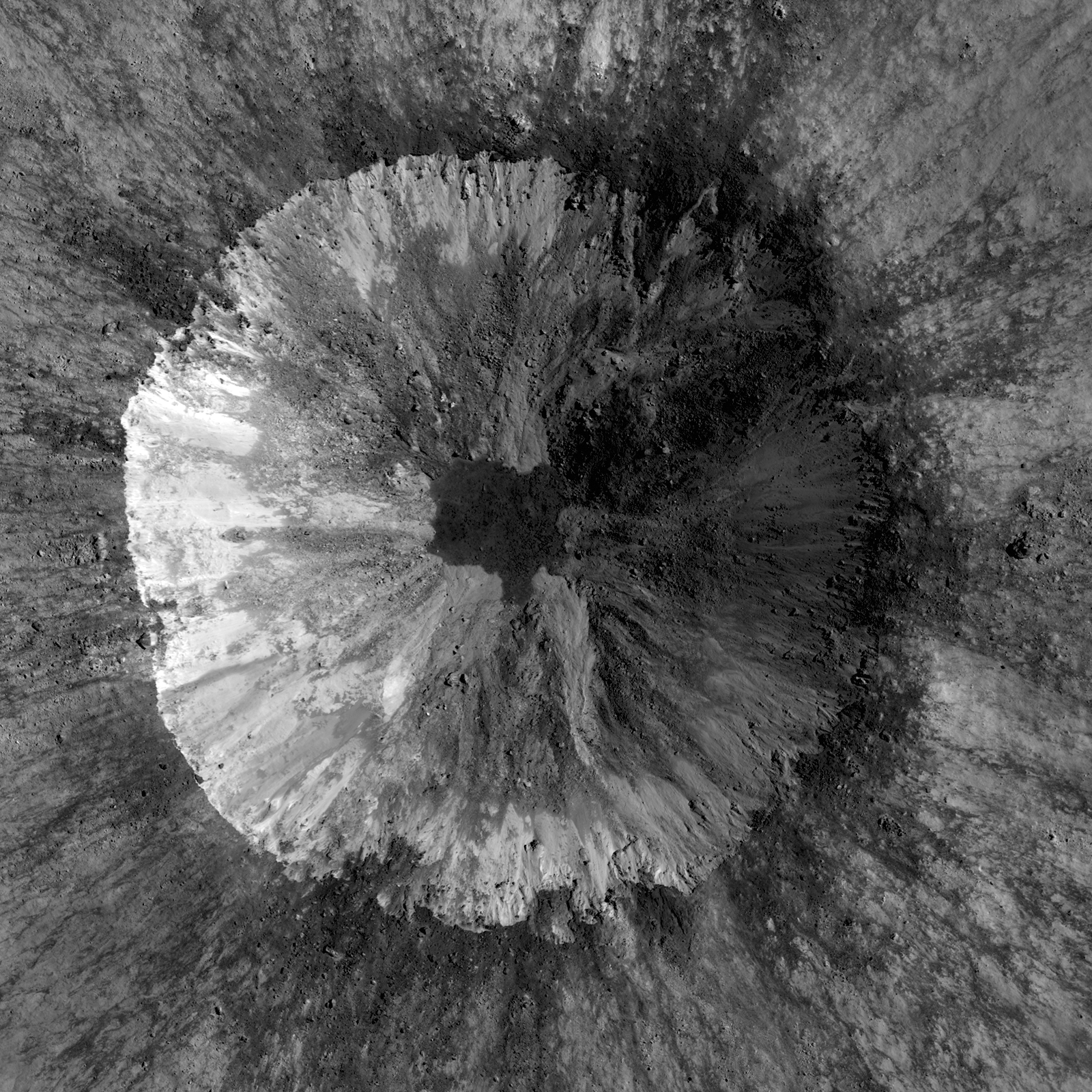
LROC Narrow Angle Camera (NAC) mosaic of an unnamed 2.3 km diameter crater, one of the two NAC stereo pairs used to create the DTM represented in the LROC Featured Image released May 2, 2012. While your brain knows the crater is concave, a depression, because of illumination and shadowing, the NAC mosaic alone can't be used to determine the elevation change from rim to floor. Image from LROC the left and right coincident frames of LROC NAC observation M143683729, resampled to 2 meters per pixel resolution for the DTM, field of view is 3.2 km across. LRO orbit 6308, November 6, 2010; from 61 kilometers. View the larger LROC complementary image HERE [NASA/GSFC/Arizona State University].
The NAC mosaic above probably looks somewhat familiar because most Copernican-aged craters have crisp crater rims, prominent ejecta blankets, mass-wasting observed on the crater walls, and often times impact melt in pools on the crater floor or dark streamers superposed on the ejecta blanket. Over time, material from the rim and crater walls slumped toward the crater floor. Some of these slumps are composed of rockier, blockier material, while others do not have entrained rubble.

Full resolution (62.58 meters per pixel) detail from LROC Wide Angle Camera (WAC) observation M176690527C (604nm) shows the subject crater under mid-afternoon illumination (incidence 64.28°), LRO orbit 11174, November 23, 2011 from 48.8 kilometers. When comparing with the LROC QuickMap 6 x 6km topography at lower right we can see the 400 meter rise in elevation, from the crater floor to the selected area's terminus just to the northeast, witnessing how the complexity of terrain's elevation is not easily visible from overhead [NASA/GSFC/Arizona State University]
There is a low-reflectance impact melt deposit on the crater floor with irregular contacts with the crater wall materials. Impact melt ponds often exhibit a relatively smooth surface because as the liquid melt cools, it seeks an equipotential surface, which is flat. But how does a scientist quantify "smooth"? Looking at the NAC, there are some debris entrained in the melt, but overall the surface looks flat. However, simply because something "looks" a certain way does not mean it is!

Simulated oblique view west from 150 kilometers over the LROC Wide Angle Camera (WAC) monochrome 100 meter Global Mosaic spread upon LOLA altimetry (ILIADS Application, Lunar Mapping and Modeling Project). The Copernican Age crater highlighted in the LROC Featured Image released May 2, 2012 is the small crater with a bright ejecta blanket at bottom center. in the farside highlands - 450 kilometers east of the central peaks of mare-filled Tsiolkovskiy crater, visible at top center [NASA/GSFC/LMMP/Arizona State University].

DTMs derived from LROC NAC stereo images are extremely useful because DTMs provide quantitative measures to complement qualitative descriptions. For the case of determining the smoothness of the impact melt pond, the slope of the crater walls and floor deposit can be calculated using the DTM. At the scale shown above, 2 m/pixel, the impact melt deposit surface is all at the same elevation and can thus be considered to be smooth. Furthermore, DTMs sometimes reveal unexpected observations! In the full frame of the LROC NAC DTM, there is a region of lower elevation to the north of the unnamed crater and a region of higher elevation to the south; these regions are not easily discerned in the LROC NAC mosaic.

Take a look at the full LROC mosaics - (DTM and NAC) - and see how the morphology you observe in the NAC image is linked with the elevation you see in the DTM.

Discover the Moon using DTMs in the DTM RDR Archive, HERE.

Direct link to today's Featured Image DTM in the RDR Archive.

Related Posts:
Barnstorming Linné crater
A Digital Terrain Model of the Orientale Basin
Precise 3D Measurements of Objects at Apollo 14Landing Site from LROC NAC Stereo Images

Tuesday, March 27, 2012

1000 Day Anniversary of LROC Imaging

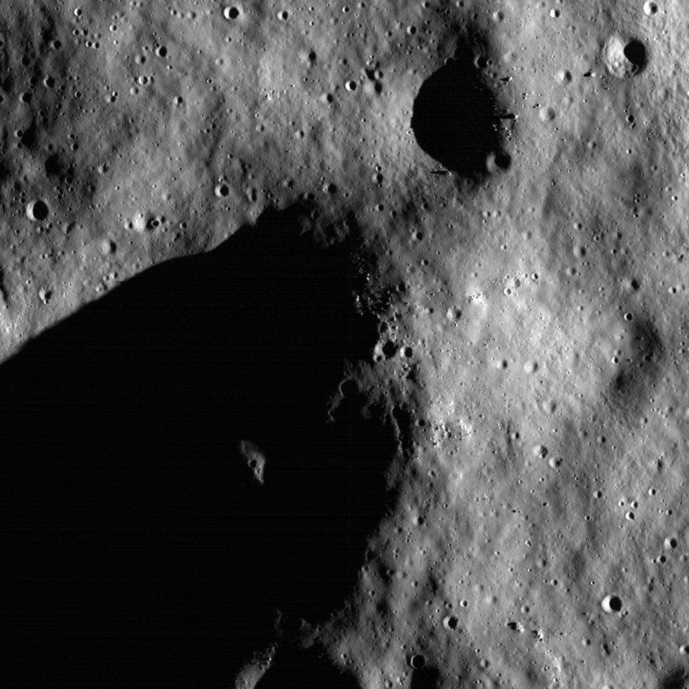
Rim of Shackleton crater near the lunar South Pole as seen in the first LROC Narrow Angle Camera (NAC) image of the Moon, acquired on June 30, 2009. Image field of view is 850 meters across, NAC frame M101013931, orbit 72, resolution 99 centimeters per pixel from 42.96 kilometers. View the full size Featured Image HERE [NASA/GSFC/Arizona State University].
Samuel Lawrence
LROC News System

Today marks the one thousand day anniversary of LROC imaging from lunar orbit. Since 30 June 2009, LROC has acquired a total of 750,000 images: of these, 140,000 are WAC images and 440,000 are NAC images of the illuminated Moon (the remainder are night or space calibration images). So far the NACs have imaged about 40% of the Moon. NAC and WAC images will play a key role defining where human and robotic explorers will go to unravel many remaining mysteries of the Moon and inner Solar System.

A look back - After the launch of LRO on 18 June 2009, Science Operations Center (SOC) operations at ASU commenced immediately, with the SOC monitoring the status of the instrument as our personnel supporting launch operations at the Cape Canaveral Air Force Station flew back to Phoenix. The first images we collected with the LROC system a few weeks later were actually engineering test images to ascertain hardware functionality, and most importantly, show how well the focusing of the NACs was proceeding. Why? Because the Narrow Angle Cameras (NAC) telescope structures were built out of carbon fiber, they absorbed atmospheric water vapor, which caused the carbon-fiber to expand. In effect, the NACs were built out-of-focus in the laboratory, with the knowledge that the water vapor would be driven out of the structure in space and thus shrink. Careful engineering by Malin Space Science Systems (MSSS) ensured that the shrinkage was just enough that the optical elements would move into position and the cameras would be in focus. Exposure to the vacuum of space and decontamination heaters built into the camera drove the moisture from the carbon fiber, thus bringing the cameras into focus in about two weeks.

The first LROC images were collected on 30 June. We started to commission the LROC instruments over the Fourth of July weekend in 2009. I think I can speak for the entire LROC team at ASU when I say that there is no better way to celebrate the Fourth of July than by commissioning an American spacecraft in lunar orbit. Working for any NASA spaceflight mission, especially one that is leading the way towards returning Americans to their rightful place on the lunar surface, is and always will be a special honor and a privilege for those fortunate enough to get the opportunity to contribute.

Lunar South Pole, on the rim of Shackleton Crater, with it's permanently shadowed interior at upper left. Press release image, September 2009 [NASA/GSFC/Arizona State University].
We were pleasantly surprised when our pre-launch estimates turned out to be a bit conservative, and our first pictures were completely in focus. I will always remember the thrill of seeing that first image come up on the screen, proving that everything we had been working on for several years was functioning. The LROC team promptly released many pictures of the lunar surface in the following few days. Today's Featured Image is a look back at our very first image of the Moon, which appropriately enough shows the rim of Shackleton crater, one of the current highest-priority sites for human exploration. Why is Shackleton so interesting? Small portions of its rim are nearly continuously illuminated while its interior is perpetually in darkness. The dark areas harbor a treasure trove of volatiles (water) that can be harvested to support future lunar explorers, provide important clues to the history of volatile materials in our Solar System, and enable voyages to Mars and beyond.

Lunar South Pole, low resolution version of first NAC pair overlaid and outlined on a WAC basemap. Note that the WAC mosaic was built up over a month, and during that time the sun azimuth reversed, resulting in an interior to exterior illumination discontinuity on the rim of Shackleton crater [NASA/GSFC/Arizona State University].
The Adventure Continues - We have since acquired other images of not only Shackleton, but many other sites on the Moon, providing the data that NASA and other space organizations worldwide require to facilitate scientific discovery, safe landing site selection, and resource assessment. In fact, we have mapped more than 40% of the lunar surface with the NACs since launch. The LRO mission is showing no signs of slowing down and LROC continues to enable new science results that are redefining our knowledge of the Moon. After entering the stable frozen orbit several months ago, LRO has enough fuel for at least another five years of operations, and our overriding goal on the LROC team is to map the whole Moon with the NACs before the end of the mission. We have mapped the Moon globally with the LROC WAC over 28 times. Each WAC global map was acquired with different lighting, thus providing a powerful multi-temporal tool to unravel the physics of light interactions with planetary surfaces.

LROC data have thus far enabled major advances in our understanding of lunar volcanism, impact processes, lunar tectonics, and the lunar environment, and the discoveries have just begun. The lunar science and exploration communities will be analyzing LROC data for decades to come.

The LROC team is proud of the work we have accomplished thus far, excited for the discoveries yet to be made, and feel privileged to contribute to America's first steps on the road back to the Moon. The LROC team at ASU is eager to make the next 1000 days of LROC operations as rewarding, exciting, and productive as the first 1000 days have been. The Moon, with its incredible bounty of exploitable resources, stunningly beautiful vistas, and incredibly compelling scientific questions, continues to beckon us towards the next horizon.

Take a look at the full frame of the first LROC NAC image of the Moon, HERE.

Saturday, December 31, 2011

LROC NAC August Close-Ups, Part 3

This reproduction of a roughly 188 meter wide segment (between lines 18602 and 19053) of LROC Narrow Angle Camera (NAC) observation M168000580R may not be the best view of the Apollo 17 lunar module descent stage or the rover tracks and foot prints left behind by Cernan & Schmitt in 1972, still it was collected from an altitude of only 22.41 kilometers on August 14, 2011; LRO orbit 9892, official resolution 0.41 meters per pixel with an incidence angle of 45.17° [NASA/GSFC/Arizona State University].
Joel Raupe
Lunar Pioneer

Since the latest release of Lunar Reconnaissance Orbiter Camera (LROC) images on December 15 we've been able to get a better idea of what flight directors were up to last August. As advertised, the record-breaking spacecraft's roughly 50 kilometer high circular polar orbit was briefly lowered to allow a narrow window for very low altitude photography.  The lowest perigee (or perilune) appears to have been engineered into orbits 9838 through 9973, between August 10 and August 21, 2011. At least that's the period where LRO Narrow Angle Camera (NAC) frames from last summer are available at resolutions higher than 40 centimeters per pixel.

The area covered, moving westward with the Moon's easterly rotation under the LRO orbit, begin near the nearside's east limb at the 85th meridian traveling short of the 60th meridian west (near 310° east). That period in LRO's August close-up maneuver featured perilunes as low as 22 kilometers over the nearside equator with apogee back up near the Nominal and Science Mission altitude higher than 40 kilometers while over the Moon's farside. Put another way, the very highest resolution LROC NAC frames were captured last August between Mare Marginis west to Aristarchus and the Marius Hills.

Our continued, now more extensive tour, of the LROC August low-altitude close-ups has uncovered many extensive fields of boulders and their trails. The largest boulder seen above on the floor of the Vera (26.32°N, 316.28°E) rille formation, directly adjacent to the Prinz ghost crater and head of a long and deep sinuous rille in Oceanus Procellarum, is roughly 22 by 22 meters in size. Many of these August perilune NAC observations appear fore-shortened in this raw first look. A description of the full-width NAC frame which included the detail above is reproduced below [NASA/GSFC/Arizona State University].

Vera-Prinz.  The full width of LROC NAC observation M168488930L, orbit 9964, August 20, 2011; 0.41 meters per pixel with an illumination incidence angle of 43.82° from 26.43 kilometers. The wider image does not provide the context of a Wide Angle Camera image but at least it shows where the boulders further above originated. Is "Vera" is not a crater but a caldera, the "cobra head" of a long and winding rille. The whole scene rests high above the Procellarum basin floor, on the still exposed northeastern ejecta blanket of the almost completely buried ghost crater Prinz. Still, Vera is a deep formation. The lowest elevation inside Vera above is about 550 meters below the surrounding terrain (which only looks flat) [NASA/GSFC/Arizona State University].
The primary purpose of the low altitude maneuvers last August was to allow a last, very close look at three of the six Apollo landing sites, but LROC's targeting team took advantage of the 11 day window to gather hundreds of observations. In addition, the period allowing for greater than 0.4 meter per pixel NAC resolutions was bracketed by a slow, probably energy conserving re-circularizing of the LRO orbit back to within 50 km. There are far more observations among those images between June 15 and September 14 released in December with resolutions higher than the mission average of half a meter per pixel.

There will undoubtedly be thousands more NAC observations captured through December (scheduled for release in mid-March). Though LRO will be placed at an extended mission altitude of greater than 100 km in January it's likely more than half of the Moon's surface will soon be mapped at high resolution, a very successful legacy indeed.

Not every feature on the lunar surface is billions of years old. On edge of the floor of the crater Milichius (9.86°N,329.75°E), seen above, a six meter boulder clearly rolled down the steep wall and came to rest before one of several subsequent dry flows covered the end of its trail, without moving or covering the boulder. The full width of the frame is detailed immediately below [NASA/GSFC/Arizona State University].
As context for the previous full resolution field of view (white rectangle), the full width of LROC NAC frame M168401046L, orbit 9951, August 19, 2011; resolution 0.395 meters per pixel with an illumination incidence angle of 37.62° from 23.08 kilometers. A 64 meter per pixel Wide Angle Camera LROC QuickMap mosaic of the vicinity is available HERE [NASA/GSFC/Arizona State University].
A full resolution frame from a very high resolution LROC NAC observation of a cross-section of landmark nearside crater Bessel (21.73°N, 17.92°E), prominent in the southeastern Mare Serenitatis. This dry flow is composed of material shed from the crater's southwestern wall that did not (or hasn't yet) reached the crater floor. The full width of the NAC frame is reproduced for context in the next image [NASA/GSFC/Arizona State University].
A full width view of LROC NAC frame M168088745L, a breathtaking north-south cross-section of the crater Bessel, August 15, 2011; orbit 9905, resolution 0.395 meters per pixel with an illumination incidence angle of 45.41° from 23.07 kilometers. In this slightly foreshortened view the most prominent feature is the 1325 meter plunge down the southwestern wall of Bessel, from rim to the wall's contact zone with the crater floor [NASA/GSFC/Arizona State University].

Sunday, June 19, 2011

Tycho's chaotic crater floor


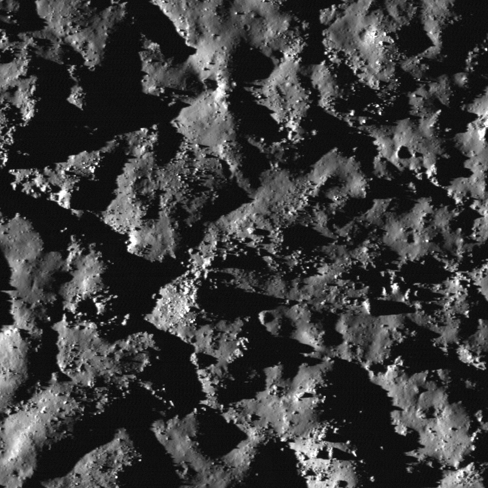
The floor of Tycho crater is covered in many places by a chaotic surface of impact melt forms. Image scale is 0.5 m/pixel, image width is 500m. Incidence angle 84°, LROC Narrow Angle Camera (NAC) observation M117568330R, LRO orbit 2459, January 9, 2010. View the full-size LROC Featured Image HERE [NASA/GSFC/Arizona State University].

Hiroyuki Sato
LROC News System

The interior floor of Tycho is covered by blocks, boulders and impact melt textures. The impact melt deposits often show networks of fractures visible at the LROC Wide Angle Camera pixel scale of 100 meters.

At Narrow Angle Camera resolution with very illumination incidence angles (illuminated almost along the horizon), the extremely complicated and chaotic nature of the surface is striking.


Simulated view of Tycho's chaotic interior floor from high upon the craters sharp central peaks looking toward the southwestern rim beyond, from a still lifted from the magnificent Kaguya Terrain Camera panorama video, offering an breathtaking tour of Tycho's anatomy, released May 27, 2009 [JAXA/SELENE].

Impact melts have extremely complicated thermal histories. When the impacting meteoroid's kinetic energy is large enough, the initial temperature of an impact melt can be much higher than that of normal magma, which is driven by volcanic activity. The melts are mixed together with ejecta debris, flow down slopes and puddle; loosing heat and increasing in viscosity with time. Once settled in the crater floor, solidification starts at the top and the bottom (chilled margins), and continues little by little to the melt volume interior. Any kind of deformation during this time (for example, the isostatic rebound of the crater floor, uneven thermal contraction, or late flows pushing pre-existing melts) will disturb the solidifying melt surfaces to make the chaotic patterns and sometimes cause local "eruptions" of melt onto the newly solid layer.


LROC Wide Angle Camera (WAC) 100 meter/pixel mosaic of Tycho impact crater cavity, overlayed by WAC color Digital Terrain Model (DTM) 500 meter/pixel (DLR, Germany). Image center is about 43.32°S, 348.89°E. Blue rectangle and yellow star indicate the locations of the NAC M117568330R frame and the LROC Featured Image, June 15, 2011. See the full-sized context image HERE [NASA/GSFC/Arizona State University].

Explore the extremely chaotic melt surface in the full NAC frame!

The topographic color was produced as a by-product of stereo analysis of the WAC global dataset. Producing the global Digital Elevation Model (DEM) is a big job being led by LROC team members at the German Aerospace Center (DLR; English version) in Berlin.


Yuri Goryachko and friends at Astronominsk are among the premier lunar (and planetary) photographers on Earth. The image above, from a mosaic captured April 6, 2009, offers an enhanced color view of Tycho, the crater who's wide-ranging ray system dominates the Moon's southern hemisphere and beyond as seen with the naked eye. Tycho is not an unusual crater by any standard. It's rays and rough hewn appearance are indicative of its relative youth, only 109 million years old - and not yet "optically darkened" by the relentless bombardment of meteors, micrometerors and hard radiation that gardens and changes the composition of the Moon's immediate surface (and albedo) every 2 million years or so [ASTONOMINSK].

Related posts:
Rubble Pile on Fresh Crater Floor
Mounds in a melt pond
Impact melt features in Tycho crater's floor
More Impact Melt!

Saturday, April 16, 2011

LROC Quick Map

Still a beta version, the LROC Team is asking for your comments, suggestions and feedback on the Lunar Reconnaissance Orbiter Camera LROC :: ACT-REACT Quick Map.


Interior of largest crater within Antoniadi, LROC Narrow Angle Camera observation accessed through Equidistant Cylindrical projection of the LROC Quick-Map; resolution 2 meters per meter, corrected for foreshortening.


Likely the same NAC image of crater interior, very near or at the Moon's lowest elevation (over 9 kilometers below global mean) using the LROC Quick-Map southern Polar orthographic projection; resolution 1 meter per pixel.

Joel Raupe
Lunar Pioneer, LLP

Among the many places on the Moon we're patiently waiting to see through the unprecedented array on-board LRO, including a high-resolution LROC Narrow Angle Camera (NAC) glance into the depths of the crater within Antoniadi now confidently believed to be the lowest point on the Moon (very near 70.38°S, 187.2°E), over 9,000 meters below global mean elevation.

In of itself we've never expected to see anything unremarkable at that location, and there are other sites we're hoping to see that are still not in the admittedly enormous amount of LROC data already cataloged and available online.

LROC principal investigator Mark Robinson and his team at Arizona State University has, however, recently given the world's planetary science enthusiasts another new tool.

Every three months, with the publishing of another the newest big volume of LROC photographs to the Planetary Data System, we a handful of sites, a few of them already well-surveyed, and many not given the attention we anticipate, to see what's new.

That job may become much easier with the Quick Map, which, like the Lunar Orbiter and Clementine imagery available through Map-A-Planet interface maintained by the Astrogeology section of the United States Geologic Survey (USGS), begins with a equidistant cylindrical map of the Moon. Clicking your way toward a feature, and seeing many NAC observation frames layered over the LROC WAC monochrome mosaic pulls the user in from far above the Moon to full resolution.

After the release of LRO's Lunar Orbital Laser Altimeter (LOLA) Featured Image of Antoniadi Crater, after already using the nearly-as-new LROC Global WAC Viewer to get a closer look at the obscure but still very discernible outlines of Mare Australe, we used that same Viewer also to examine close-up Antoniadi through the LROC WAC Mosaic Viewer, hoping to compare the detail with what had, not long ago, also been photographed by Japan's Kaguya, using that vehicle's instruments.

We weren't disappointed at all, and yet the really deep spot in Antoniadi is now reliably measured at the bottom of the unnamed largest crater (diameter 11.2 km) within Antoniadi we've long informally been referring to as "Antoniadi A."


Antoniadi - seen through the High-Definition Television camera on-board Japan's SELENE-1 orbiter "Kaguya" in 2007. The informally-named 11 kilometer-wide simple crater inside the southern interior is Antoniadi A, confirmed now as host of the deepest elevations on the lunar surface [JAXA/NHK/SELENE].

Unfortunately, the deepest parts of Antoniadi A's interior, usually stay in deep shade. Antoniadi is almost a southern circumpolar feature, where shadows are always long and enduring. It's a long way from any permanently shadowed region, which makes capturing its deep spots particularly difficult. LRO would have to be engaged in capturing "Targets of Opportunity" while flying over Antoniadi at local High Noon, and then, because of the low latitude, the north interior would still be in shadow.

Is this the bottom, or at least half the bottom interior of "Antoniadi A," the lowest place on the lunar surface? Other data seem to show, hardly unusual for lunar craters, that the very bottom of "Antoniadi A" is not evenly distributed. But it's certainly one of the lowest spots, if not "the lowest." Elephant Skin mottling in the distribution of dust that some think is indicative of "grades" as opposed to even elevation seems to come to a halt close to the ends of boulder trails.


Antoniadi in a monochrome image assembled from data collected using Kaguya's Terrain Camera. See the image at its original resolution, HERE [JAXA/SELENE].

The only improvement in this phenomenal Quick Map one might ask for, at this point, is a non-obtrusive lable naming the NAC observation, making it possible to cross-reference the particulars of the meets and bounds of the observation's fundamentals. But, no matter.

This new tool may not give you access to the entire catalog yet, but we're definitely not complaining. No one's gotten this close to the lunar surface since Cernan & Schmitt in 1972.

The first image was collected from the ACT-REACT Quick Map Equidistant Cylindrical projection, and is slightly corrected for the foreshortening; the second from the Orthographic Map of the South Pole region also available through what should be an "award-winning" new feature made available by the conscientious LROC team.

Saturday, March 19, 2011

Quickmap of a real "Super Moon"


The beginnings of public access to the developing "Quickmap" service, linking LROC Narrow and Wide Angle Camera photography is astounding and immediately useful. It was possible to identify excellent candidates for artifacts not yet publicized, like the impact crater of the Apollo 17 lunar module ascent stage "Challenger" and possibly Luna 9, for example [NASA/GSFC/Arizona State University].

Mark Robinson
Principal Investigator
Lunar Reconnaissance Orbiter Camera
Arizona State University


Try out the new LROC browse interface - Quickmap.

Its a lot of fun! Start at reduced WAC resolution and end up on the surface at full NAC resolution. Quickmap is brand new (and not 100% refined). But, it's ready for testing!

Give it a try and watch it improve over the next several months.

We hope you like it!


It was immediately possible to focus in on regular NAC observations of Tranquility Base and the rich context of its vicinity in southwestern Mare Tranquillitatis, picking the high glint off the Apollo 11 lunar module descent stage at a resolution of only 64 meters per pixel [NASA/GSFC/Arizona State University].