Showing posts with label far side. Show all posts

Tuesday, October 23, 2012

Beautiful Young Crater in Icarus

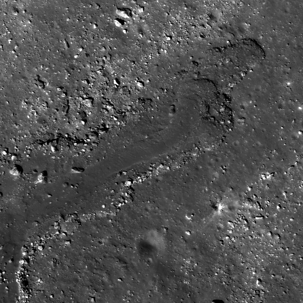
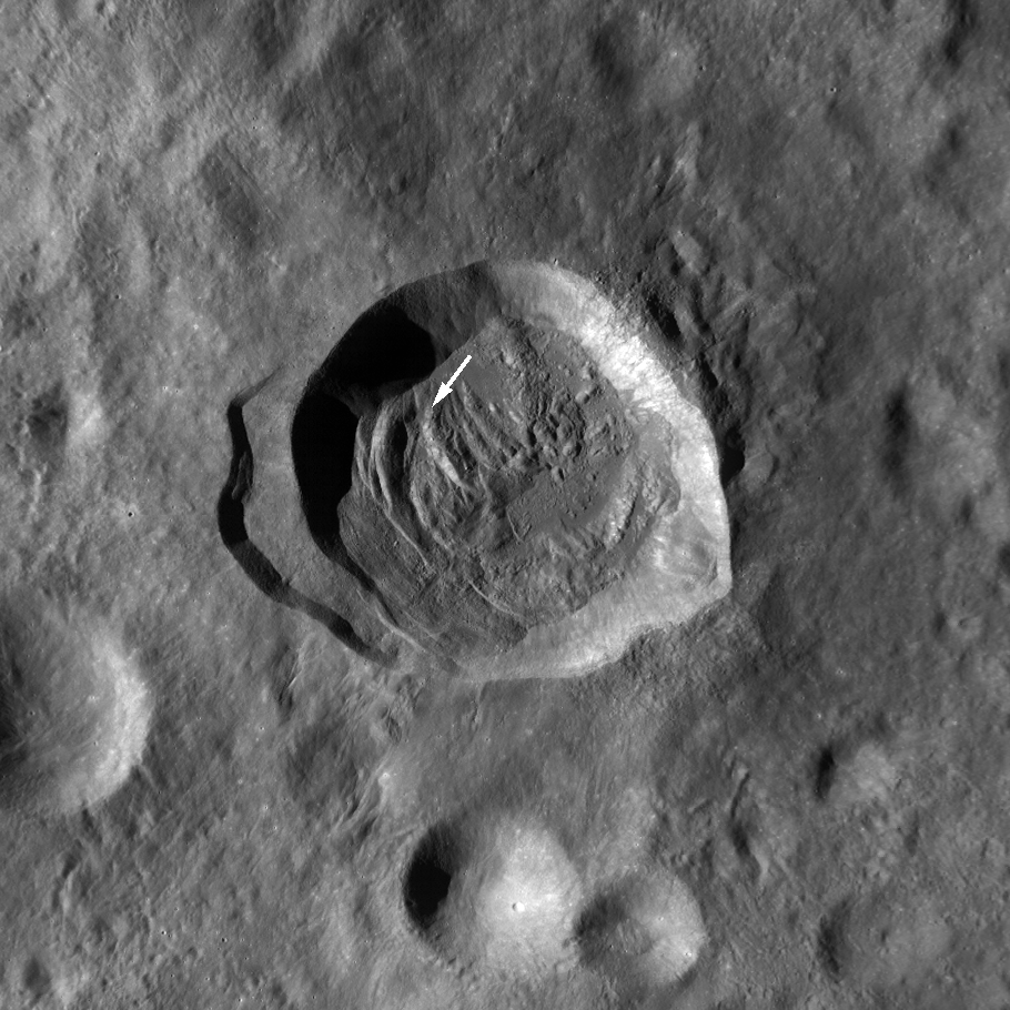
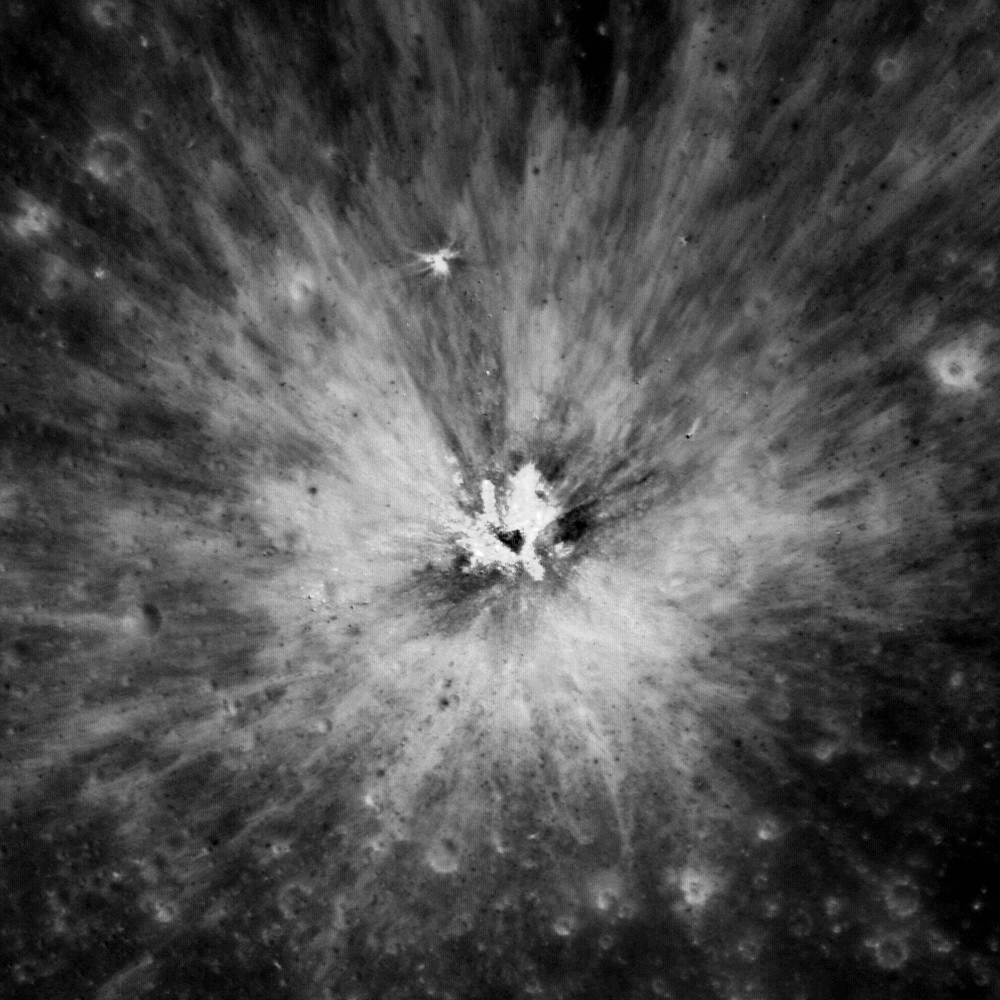
A beautiful, young crater inside of the complex crater Icarus. Field of view 550 meters from LROC Narrow Angle Camera (NAC) observation M156367058L, LRO orbit 8177, April 2, 2011; 0.6 meters resolution over an angle of incidence 10.53° from 58.61 kilometers [NASA/GSFC/Arizona State University].
Sarah Braden
LROC News System

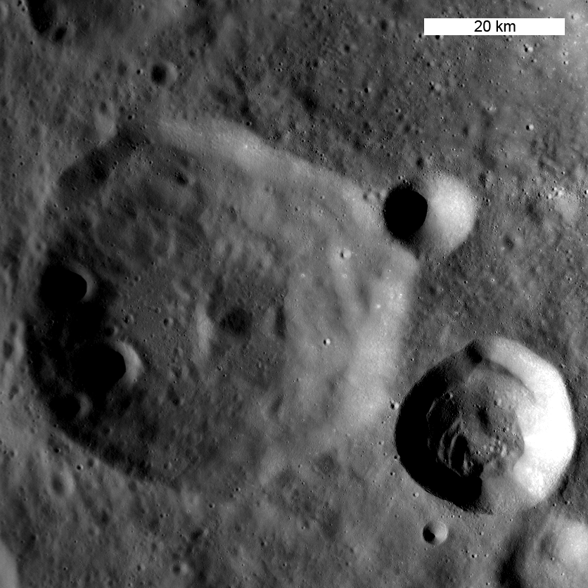
Icarus is a large, complex crater (diameter 93.7 km) with a central peak, located at 5.584°S, 186.998°E. Icarus is named after the mythical Greek flyer. The Featured Image shows a young, fresh crater (located at 5.929°S, 187.696°E) superposed on the older terraces of Icarus. The ejecta of the impact is higher in reflectance compared to the surroundings since the newly excavated material has been exposed to space weathering for a relatively short time. Over time space weathering causes the reflectance of fresh regolith to decrease. The ejecta of the crater in the Featured Image will fade over hundreds of millions of years, until it can no longer be distinguished from the rest of Icarus crater.

While the rim and terraces of Icarus are heavily degraded by subsequent impacts, the crater's central peak is still quite tall. The central peak rises about 4475 meters above the crater floor! Compared to other craters of similar diameter, this is quite a tall central peak! Consider many of the other complex craters with central peaks featured in the LROC images: Moretus, Hayn, Aristarchus, Theophilus, Bullialdus, Langrenus, Copernicus, and Tsiolkovskiy. For example, Tycho (~82 km in diameter) crater's central peak is 2 km above the crater floor.
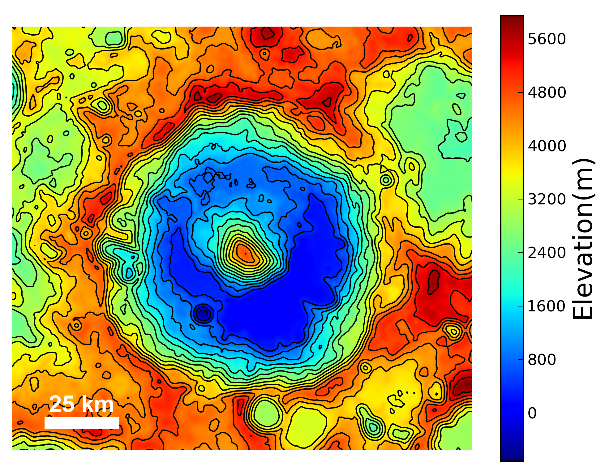
Topography of Icarus crater. The northeast edge of the rim is partially destroyed [NASA/GFSC/Arizona State University].
All of these complex craters have a few common characteristics. First, the impact has to be large enough to cause a complex crater. Relatively smaller impacts create simple craters, which are bowl-shaped and have no central peak or terraces. After the excavation phase of the impact, the transient cavity collapses. This collapse is driven by gravity, which causes the uplift of the central peak as well as the collapse of the rim inward, which forms terraces along the interior wall. Some times an impact is so large that it creates a ring of peaks instead of just one central peak.

LROC Wide Angle Camera (WAC) context image of Icarus, the white asterisk marks the location of the fresh crater in the Featured Image [NASA/GSFC/Arizona State University].
Explore more of the interior of Icarus with this LROC NAC, HERE.

Related Images:
Lunar Topography - As Never Seen Before!
Copernicus Central Peak From The West
View From The Other Side

Wednesday, February 29, 2012

LROC: Dense Fractures

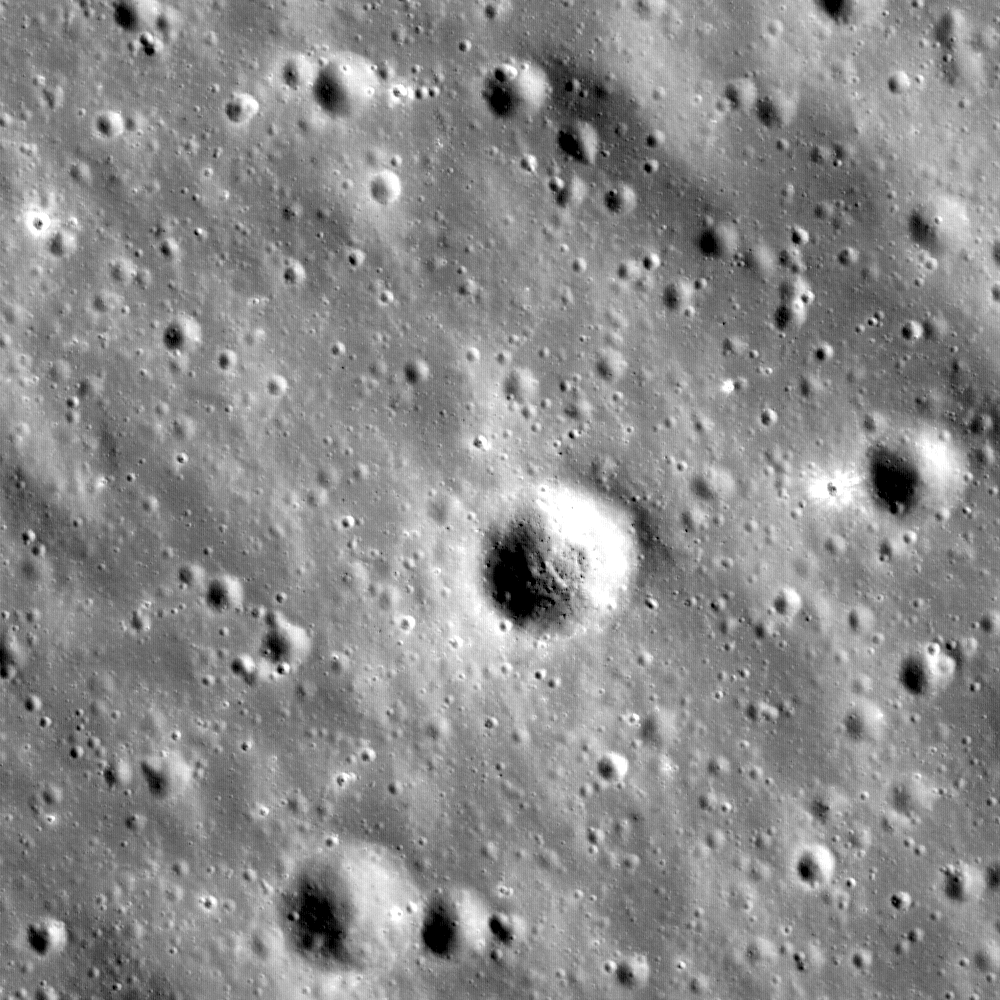
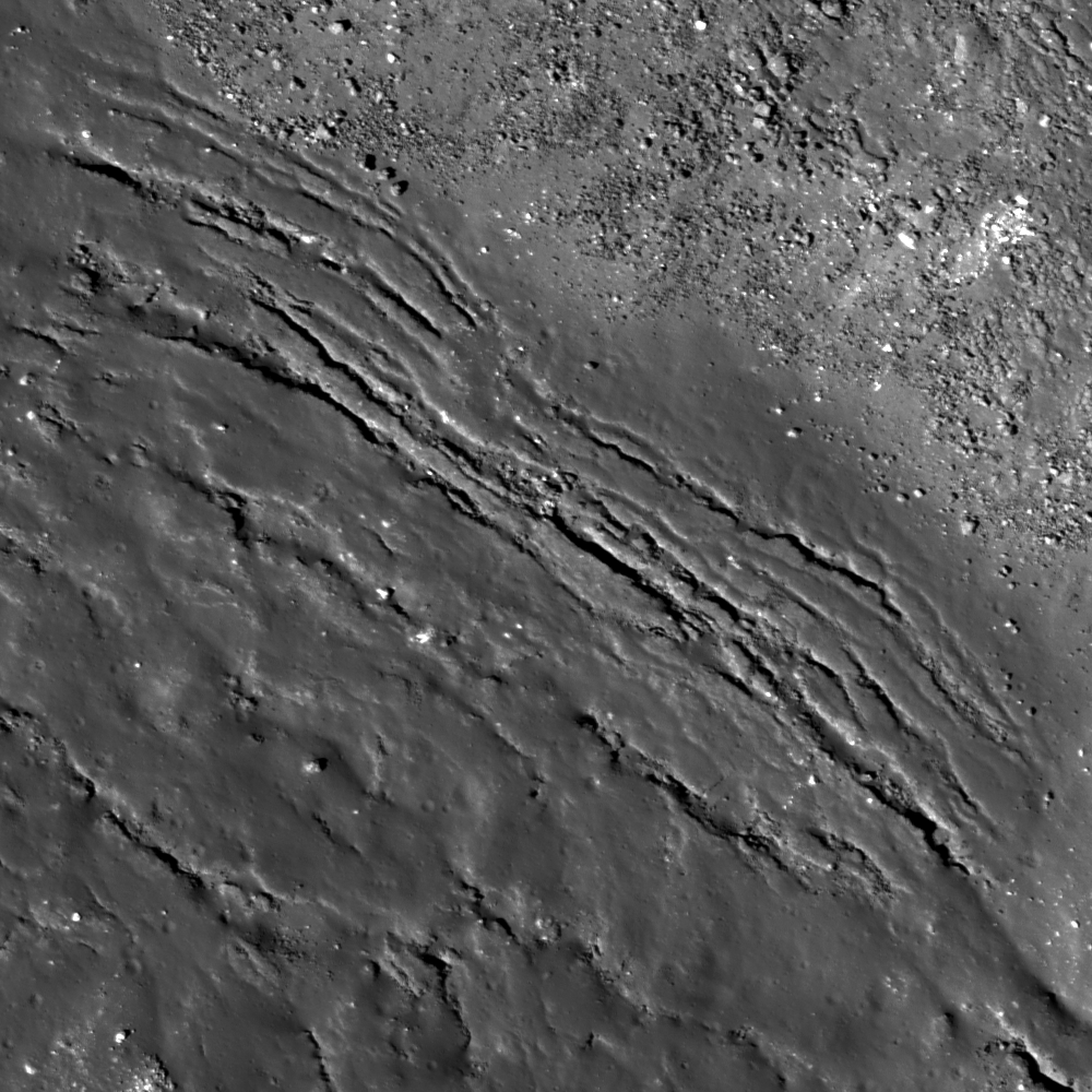
Fractures at the edge of an impact melt pool within the crater Larmor Q. Field of view 312 meters across from the LROC Featured Image, February 29, 2012 (540 meters), LROC Narrow Angle Camera (NAC) observation M151726155R, orbit 7494, February 7, 2011; 0.57 meters per pixel from 54.8 kilometers altitude [NASA/GSFC/Arizona State University].
Sarah Braden
LROC News System

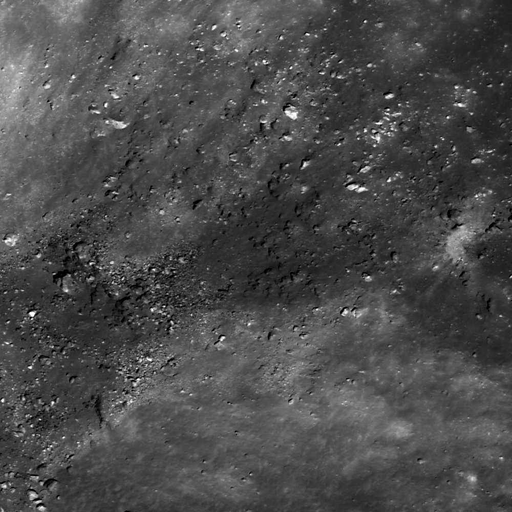
The crater Larmor Q, located at 28.630°N, 176.240°E, is 18.3 km in diameter, has slumped walls, and impact melt in its floor. The Featured Image show fractures within this impact melt at the boundary of boulder-rich slumped material and the impact melt pool itself. The fractures may have formed two ways: from post-impact modification of the crater floor, or from a volume change associated with the cooling of the impact melt. Post-impact modification means that the shape of the crater changed, due to slumping walls, or changes in the crater floor topography caused by strain due to the redistribution of material during the impact itself.

The fractures are closer together (denser) near the edge of the impact melt. This may be where the impact melt is the thinnest, depending on the topography of the crater floor. Imagine an empty bowl (the crater) and then fill the bottom 5% of the bowl with ketchup (impact melt). The ketchup will be shallowest closest to the sides of the bowl. Often impact melt pools are not of uniform thickness due to variations in the shape of the crater's floor. Also, within the same crater there may be multiple impact melt pools of different overall depths since the emplacement of melt is not symmetric with respect to the crater.

When a lava (or impact melt) cools, it reduces in volume, which may have formed these cracks. Or, the thinnest part of the impact melt might be expected fracture more in the case of changes in the floor topography. Lunar scientists will have to study fractures in impact melt pools to determine which of these answers is correct. Perhaps it is a combination of the two causes of fractures, or something not yet considered.

LROC Wide Angle Camera (WAC) image of the 18.3 km diameter crater Larmor Q. Slumping of the crater walls has not yet covered all the impact melt on its floor. From LROC WAC observation M136389155 (604nm), orbit 5233, August 14, 2010; angle of incidence 54.83° with a resolution 82.1 meters per pixel from 58.4 kilometers  [NASA/GSFC/Arizona State University].

Find other areas in Larmor Q where fractures are denser towards the edge of the impact melt in the full NAC frame!

Related Posts:
More Impact Melt!
Fractured Impact Melt
Melt Fractures in Jackson Crater
Fractures in Ohm's Melt

Sunday, June 26, 2011

Das crater


An impact melt pool (lower right) within Das crater. Nearby boulders are the result of fractured impact melt which have migrated downslope and formed talus (upper left). Uphill direction is to the top left. LROC Narrow Angle Camera (NAC) observation M136091866, LRO orbit 5189, August 10, 2010; field of view is 240 meters. See the 600 meter-wide, full resolution LROC Featured Image HERE [NASA/GSFC/Arizona State University].

Drew Enns
LROC News System

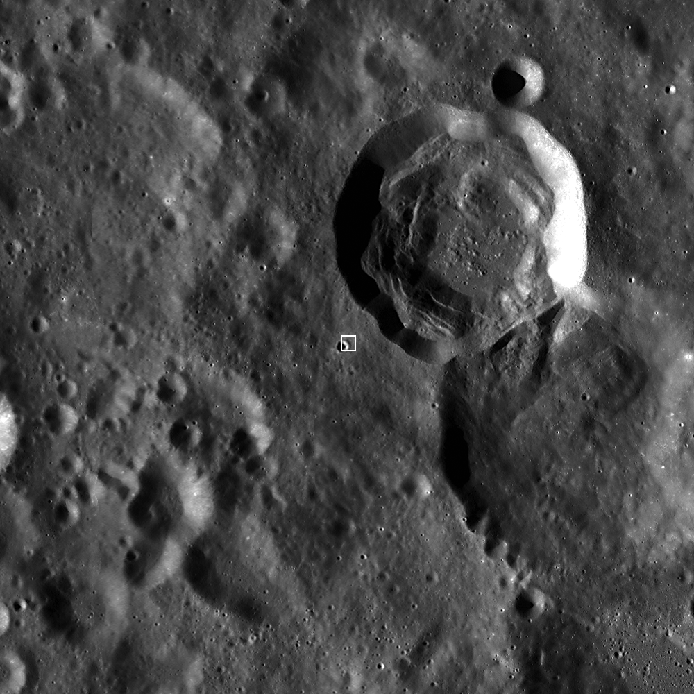
Das crater (35 km diameter) is located just northeast of the South Pole-Aitken Basin. The portion of the floor in the opening image is a smooth and flat pool of impact melt. A large amount of energy is created and absorbed by both the bolide and the target during an impact event. The bolide is very nearly vaporized, and a large portion of the target is melted, fractured, and redeposited elsewhere as ejecta. Impact melt, unlike most ejecta, stays primarily within its parent crater, forming intricate patterns as the melt flows downslope and gathers in large pools. Occasionally, impact melt will also spill out of the crater, forming exterior melt deposits.


Context images of Das crater (26.6°S, 223.2°E). On the high northeast rim of 4 billion-year old South Pole Aitken basin, 280 km northeast of some of the deepest excavations within the Apollo impact basin just inside SPA [NASA/GSFC/Arizona State University].


But how do scientists know that this pond within Das crater is in fact impact melt? Solving this puzzle requires the geologic context of this small pond within the crater. As discussed in yesterday's Featured Image, the volume and texture of the pond help piece together the puzzle. Das' crater floor in the context image is not smooth or flat and is made up of several pools of ponded material. This is unlike Jenner's singular flat crater floor. The distribution of these ponded materials gives us our next clue! The ponds are at separate elevations within the crater and flow downslope! This is not what we expect to see in a mare flooded crater when a massive amount of lava is sourced from a low elevation. These observations all point to impact melt as the best explanation for this pooled material.

Look for more impact melt within the full LROC NAC frame!

Related Posts:
King Crater's Unusual Melt Pond
Out of the Shadows Impact Melt Flow at Byrgius A Crater
Forked Impact Melt Flows at Farside Crater

Thursday, June 2, 2011

Look at that flow!


Spectacular rubbley impact melt, flowing away from its parent crater. Across the widest part of the terminal lobe, the flow is ~115 meters. LROC Narrow Angle Camera (NAC) observation M153863408R, LRO orbit 7809, March 4, 2011; image field of view is 500 meters. See the full-size LROC Featured Image HERE [NASA/GSFC/Arizona State University].

Lillian Ostrach
LROC News System

Yesterday's Featured Image highlighted boulders eroding out of a hill in the Anaxagoras crater impact melt pond. The opening image above highlights an impact melt flow located on the lunar far side at 23.99°N, 209.94°E.

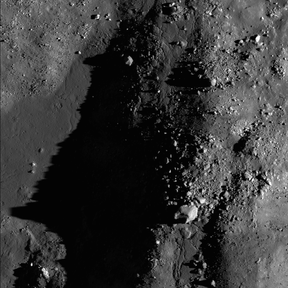
The impact melt flowed from its source crater through rubbley ejecta before it cooled. There are several lobes at the terminus of the flow; perhaps these lobes "broke out" when the surface of the flow cooled but the interior of the flow remained hot and could still flow. The farthest-reaching lobe extends for about 95 m past the large lobe. There are some small boulders, around 10 meters across, that are entrained in the impact melt, but most of blocks close by seem pushed or maneuvered there by the flow, much like a levee formed during a volcanic flow.


Simulated perspective of the flow, looking west [LROC NAC M153863408LE - NASA/GSFC/Arizona State University].


LROC Wide Angle Camera (WAC) monochrome mosaic context view of the impact melt flow. Asterisk notes the flow, which is located in a relatively typical far side highland area (lots of large, old craters, few large fresh craters, and no mare) See the full-size WAC context image HERE [NASA/GSFC/Arizona State University].

How much of the flow do you observe in the full LROC NAC image, and can you trace its path across the image?


Relatively fresh flow of impact melt from its parent crater in this crop of the 2.5 km-wide full-width LROC Narrow Angle Camera observation [NASA/GSFC/Arizona State University].

Related Posts:
Out of the Shadows: Impact Melt at Byrgius A
Forked Impact Melt Flows at Farside Crater
Impact Melt Flows on Giordano Bruno
Epigenes A

Thursday, May 19, 2011

Dark landslide near van Gent


A landslide within a small crater near 43 kilometer, far side crater van Gent (15.4°N, 160.4 °E). The crater rim is at the and the crater floor is at bottom left. The landslide has exposed many boulder within the crater wall. LROC Narrow Angle Camera (NAC) observation M156550640RE, LRO orbit 8205, April 4, 2011; image field of view is 600 meters. See the full-size LROC Featured Image HERE [NASA/GSFC/Arizona State University].

Drew Enns
LROC News System

Landslides are a common form of mass wasting on both the Moon and on Earth. This process exposes fresh material, and results in high albedo features in planetary images. Impact craters perform a similar process, with fresh craters creating high albedo features on planets.

This landslide is lower albedo than the crater walls of the crater it occurs in, implying the landslide is more mature than the crater. How can this be? It is probably that the landslide surface is not exposing fresh material, but is instead mature highlands material that has fallen back into the crater.


Crop of the LROC Wide Angle Camera monochrome mosaic context image for the LROC Featured Image, May 18, 2011, situated in the white box. Field of view is 40 kilometers. See the full context image HERE [NASA/GSFC/Arizona State University].

Look for more landslides in the entire LROC NAC!

Related Posts:
Post impact modification of Klute W
Landslides in Marius Crater
Dark streaks in Diophantus

Thursday, September 2, 2010

The jumbled floor of Necho


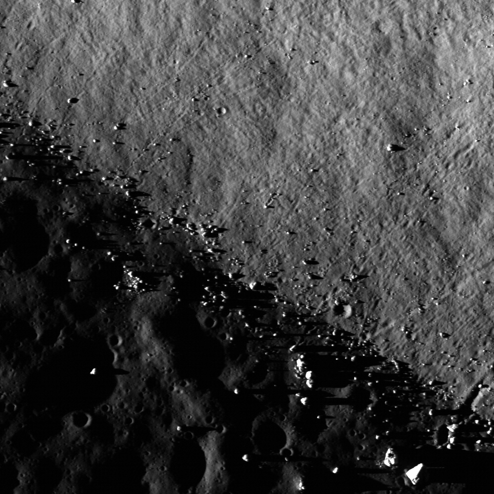
The chaotic floor of Necho crater attests to a dynamic environment immediately after the impact event. LROC Narrow Angle Camera (NAC) observation M115502787RE, LRO orbit 2155, December 15, 2009; alt. 59.85 km, resolution = 0.96, field of view width = 960 meters [NASA/GSFC/Arizona State University].

Brett Denevi
LROC News System


Wide Angle Camera monochrome full image of the 30 km far side crater Necho, 490 km northeast of Tsiolkovskiy (5°N, 123.1°E); arrow indicates approximate location of NAC detail above. LROC WAC observation M119048299ME; LRO orbit 2677, January 25, 2010; alt. 56.44 km [NASA/GSFC/Arizona State University].

Curious as to what's in the shadows? A more drastic stretch of the image can help.


A look into the shadows - close-up of the same NAC scene above, but "harshly stretched" to highlight shadowed terrain where boulders litter a dark slope in shadow, salvaging light scattered by the surrounding crater interior [NASA/GSFC/Arizona State University].

Browse the full-resolution image of Necho's interior here!


Stepping back to view the full width of the NAC frame, shows the interior of Necho exhibits a rich geologically-complex morphology, debris and melt deposits with substantial ponding. (NAC M115502787RE; field of view width = 2.4 km) [NASA/GSFC/Arizona State University].

Related posts:
Impact Melt at Necho Crater
September 1, 2010
Necho's terraces
August 31, 2010
A molten flood
July 29, 2010

Thursday, August 26, 2010

More of Tsiolkovskiy's boulders and boundaries


The central peak of Tsiolkovskiy crater is surrounded with mare basalt. This Narrow Angle Camera frame shows where boulders have rolled down the sides of the steep central peak onto the Sea floor (boulder trails abound). The central peaks of larger lunar craters like Tsiolkovskiy are of particular interest because they expose rock uplifted from great depth, rebounding during the impact event. This image is 890 meters wide, with a sunset solar incidence angle of 88° [NASA/GSFC/Arizona State University].


Pulling back, to the full 4.25 km-wide field of view of the LROC observation, boulders abound, shedding from the peak. The LROC Featured Image further up is indicated by the arrow. LROC NAC M101313293LE was gathered very early in LRO mission, on July 4, 2009. Orbit 114 was still relatively eccentric when compared to the nearly circular 50 km Nominal Mission orbit where LRO presently operates. It's altitude above was 84.95 km, and the image resolution is about 90 cm per pixel [NASA/GSFC/Arizona State University].

Browse the full NAC image, from top to bottom, HERE, and it's companion half, HERE.


Five LRO NAC observations, representing widely varying illumination angles and altitudes, are seen here superimposed on Clementine (1994) albedo studies [NASA/GSFC/Arizona State University].


Even though far more bright highland terrain exists on the Moon than mare-inundated basins, you wouldn't know by looking at the near side from Earth alone. In the hemisphere centered on Tsiolkovskiy, none of the spectacular basins and other features we now know exist in this field of view stands out as clearly as this most obvious feature of the far side.


Now ready for LROC close-ups, Tsiolkovskiy, with rest of the far side, is tidally locked beyond line of sight from Earth. The Soviet Union's probe Luna 3 caught humanity's first photographic look in 1959. The surprising differences between the Moon's near and far sides, with an origin still being debated, was obvious even in these first photographs. The relatively small, heart-shaped Sea of Tsiolkovskiy, with it's lofty central peak, stood out clearly from the bright highland that surround it [RAS/USSR].

Sunday, July 11, 2010

LOLA's Jackson Crater


Bright rays streak for hundreds of kilometers across the lunar surface, originating from a large (70 km-diameter, or ~43 mile-diameter) impact crater in the far side's northern hemisphere. Jackson crater's rays are prominent in visible images, as the rays are made from brighter (or higher-albedo) material than the darker lunar regolith that they overlie. Because they are very thin, they do not appear in LOLA's topography data. What you can see in the elevation data is the morphology, or shape, of Jackson's main crater. The bright reds in along the southeast rim highlight the section with the greatest elevation; the western half of the crater rim is much more subdued.


Looking south from the interior of Jackson crater, looking due south toward the lofty south rim, over the blocky central peak complex; aspects of Jackson properly photographed at last, early in the Commissioning of the Lunar Reconnaissance Orbiter mission. LROC Narrow Angle Camera observation M103223791, from 141.66 km in LRO orbit 381, July 26, 2009 [NASA/USGS/JAXA/GSFC/ASU].

The highest portion of Jackson crater's rim reaches 3.3 km, 2.8 km above the lowest elevation on the crater floor. Terraces step downwards into the crater's interior. One place this is particularly evident in this image is in the west - try tracing along the highest portion of the rim (in the orange color), and then find another series of peaks that outline a terrace ridge (in the green color) just inside the crater. The northwest and eastern sections of the rim are somewhat unusual, as they are relatively straight.

Jackson crater is named after the Scottish astronomer John Jackson (February 11, 1887-December 9, 1958).

+ View Image | + High Resolution

Wednesday, April 21, 2010

LROC: Dante - Constellation ROI


Highlands terrain inside the Dante Crater Constellation Site. A portion of LROC NAC image M121044107E, 580 meters across. [NASA/GSFC/Arizona State University]

In Situ Resource Utilization
& an unobstructed view of the Cosmos

Ross Beyer
LROC News System

Only a handful of humans have ever seen the far side of the Moon. In the future, human explorers near Dante crater in the far side highlands will be searching for samples of the Moon's most ancient, primordial crust (anorthosites like the famous Apollo sample 15415). There was a time after the Moon's formation when the entire surface was covered by an ocean of magma; the upper layer of this magma ocean crystallized to form a global layer of anorthosite.

Since that time, impacts and other geological processes have broken and churned the surface, but this area may posses significant amounts of these original rocks.

Pristine lunar anorthosites are relatively rare in the Apollo sample collections; with enough samples we could learn when the primordial crust started to form and when it was complete. Scientists would also like to learn the rate of cratering during this early period in the Moon's formation. The ancient regolith contains rocks that formed from impact melt, which can be dated to learn when the impact even that created them occurred. Did the large impacts form across a broad range of time - or in one large spike? Collecting samples from this ancient highland area would help use better understand this early period in Solar System development, with profound implications for understanding the early history of Earth.


Portion of LROC WAC image M118668951M, which covers Dante Crater itself. The region of M121044107E (above) is to the west of this scene. [NASA/GSFC/Arizona State University]

The Dante region has abundant aluminum and calcium-rich regolith that is available for in situ resource utilization, allowing explorers to extend their stay in this region by processing the local materials to produce oxygen and fuel while building habitats and other structures.

Explorers at this location would never see the Earth. They would instead see the unobstructed vista of the Milky Way above them. The Sun would rise and set once a month, but all communications back to Earth would have to be via orbiting relay satellites. However, with the bulk of the Moon shielding this location from the bright lights and radio waves of the Earth, the central farside highlands are an optimal location for astronomy, especially observations of the low-frequency radio sky.

Explore the Dante crater constellation region of interest for yourself.

Tuesday, December 29, 2009

Big Ohm Boulder


In LRO's 336th orbit, still early during the commissioning phase, at 140 km in altitude (90 km higher than the present first year survey), LROC's Narrow Angle Camera took an excellent look at the complex interior of 64 km-km wide farside crater Ohm (246.5°E, 18.4°N). The structures of Ohm's interior reminds me of it's 20 percent larger, younger nearside sister Tycho, high intact walls with slumped terraced interior, very similar melt fill further in with a less distinct central peak. The 74 km long & 7.1 km wide stereo NAC strip is a rich cross section. Because it's central peak failed to coalesce as well as did Tycho's, on the rebound from what was likely a more oblique impact, Ohm's interior is filled with massive boulders, part of a mix of deep materials that may be part of the island crust that originally formed over the Moon's primeval magma ocean. The boulder above is among the most massive of the chunks, casting a over a quarter kilometer of shadow in the low sunset [NASA/GSFC/Arizona State University].

Like Tycho, Ohm has a respectable radiant ray system which would likely be quite distinctive if it's locus were visible from Earth. Its rays form the apex of a kind of chevron when seen in small scale from a great distance over the Moon's western hemisphere. Ohm's rays remind one more of those that formed when the progenitor of Proclus slammed into the western wall of Mare Crisium. Also likely to have been an oblique impact, the rays of Proclus spread east over Crisium in a fan whose sides projected north and southeast, less than 180 degress apart.


Heading North over the Far Side Japan's Kaguya took this full sun HDTV shot of Ohm in 2008. The bright sides of the north and eastward fan of the bulk of Ohm's rays system can be seen, along with the other differing aspects of Tycho's smaller and probably older sister. The central "peak" is more a system of parts of a peak. A comparison showing how the ray system of Ohm and Proclus are similar appears below [JAXA/NHK/SELENE].


There's a world of difference, literally, half a Moon apart, between Ohm (above) and the more familiar Proclus, the bright jewel of Crisium and the rugged Palis Somni and the sparkling marker of the young crescent Moons of Earthside evenings. Both impacts lose their distinctive shine when seen only in the context of blind topography. But in albedo, in this case as mapped by Clementine in 1994, each has left a mark more telling of their youth and optical immaturity, perhaps, then any permanent etching apparent to the human eye [NASA/DOD/USGS].

Sunday, December 20, 2009

Far Side Delights

Moon Sheep. Huge boulders seem to have been herded together on the rim of a small and very weathered crater near the northeastern rim of Far Side Hertzsprung basin, south of a line stretched between craters Weyl and Fersman. It's a small far-flung corner in one of 786 images released to the Planetary Data System (PDS) on Friday. Part of an informal test by the Lunar Reconnaissance Orbiter Camera (LROC) team that includes data from images taken during the commissioning of the Narrow-Angle Camera (NAC) survey, Orbits 318 - 354 [NASA/GSFC/Arizona State University].


Square Peg - Another small corner from one of two images among the raw 786 LROC PDS test shots that is unambiguously taken from the deep interior of Mare Orientale. This one, from Orbit 318, is of the chaotic transition between the huge volume of slumped landslide material from the interior basin walls and the basalt-filled middle interior; very near the western side of Hohmann (~264.82E°-17.65°S; Sunrise to the left, f=74.3°) [NASA/GSFC/Arizona State University].
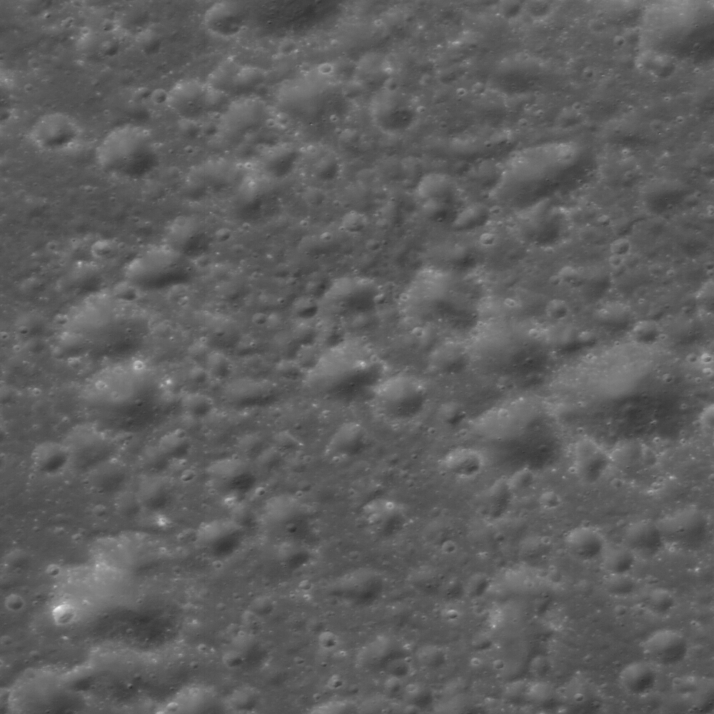

Little House on the Prairie? (Not) - It's the anomalies that catch the eye on first glance. Since the Sun was from the right (f=72.29°) when LRO's NAC shot sequence M102951844R not far from Comstock and well on the Moon's Far Side (~239°E, 20°N) the odd feature is concave rather than convex, indicating an ancient slump of upper material collapsing into a fault of indeterminate scope and origin [NASA/GSFC/Arizona State University].

Tuesday, November 24, 2009

Cluster of farside secondary craters


Cluster of secondary craters help geologists determine the relative ages of features, even when they are separated by great distances. Image width = 630 meters. From an uncalibrated Lunar Reconnaissance Orbiter (LROC) Narrow Angle Camera frame showing the floor of a small 14 kilometer diameter crater on the lunar farside,~68 km east of Jackson. Note the small, secondary craters that cover the floor of this crater [NASA/GSFC/Arizona State University].

Samuel Lawrence
LROC News System

When people envision a "moonscape" it probably looks something like this -- craters, craters everywhere.

There are two types of impact craters on the Moon: primary and secondary. Primary craters form as the result of an asteroid or comet (or spacecraft) impacting the Moon. Secondary impact craters formed from the impact of ejecta expelled during primary crater formation. Secondary impact craters dominate this scene, possibly from the impact event that created nearby Jackson crater (70 km diameter), a fresh crater 68 km to the west.

Geologists use small secondary craters to help unravel the stratigraphy of the lunar surface. These secondary craters reside on the floor of a 14 km diameter crater. What is the age of this host crater? Assuming our postulation about these secondary craters originating from the Jackson event is correct, then it is a fair bet that the Jackson impact postdates the formation of this crater. If you look at the bottom of this NAC frame in the LROC Image Gallery, you can see that this crater also has a very subdued rim, in contrast to Jackson's well-defined rim, providing more evidence that this crater predates the Jackson impact. What do you think?

But how can we figure this out for sure? Nothing replaces the utility of samples and in-situ exploration. For example, when human explorers collect samples both from the regolith near this cluster of secondary craters and Jackson crater, then the impact melts can be radiometrically age-dated in a laboratory to provide absolute formation ages. If the ages determined for the regolith samples obtained from this crater cluster match the age dates determined for the Jackson impact, then they probably originated from the same impact event.

Jackson, Lunar Far Side [Virtual Moon Atlas v.4]

Wednesday, October 14, 2009

Chandrayaan lunar laser ranging results


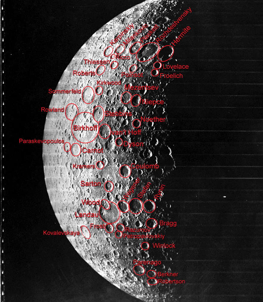
From Lunar Orbiter V, a look at 92 kilometer-wide far side crater van'T Hoff (62.1°N,228.2°E) from 2,652 kilometers, over 59.72°N,248.5°W in 1968. Generally far from the orbital paths (also usually in darkness) during Apollo missions, until recently our only other best view of van'T Hoff was a single high-resolution image, also from Lunar Orbiter V (V-025-H2) spoiled in transmission or while being robotically developed. Perhaps the miracle-workers at LOIRP will one day salvage the image [V-025-M, NASA/JPL/LPI].


Forty years later, in 2008, while opening what may one day be called a new, second and international era of lunar exploration, Japan's Kaguya (SELENE-1) swept up van'T Hoff with its on-board HDTV camera [hdtv-002-5, JAXA/SELENE].


While it's mission ended with heat rather than a controlled crash, results from the Lunar Laser Ranging instrument on-board India's Chandrayaan lunar orbiter have recently been released. Along with details of van'T Hoff, profiles of enormous Bailly and Clavius have been posted together with Stebbins and small-scale results of surveys of both the northern and southern polar regions of the Moon [ISRO/Chandrayaan/LLRI].