Showing posts with label Anaxagoras. Show all posts

Thursday, January 17, 2013

Channels and fractures at Anaxagoras

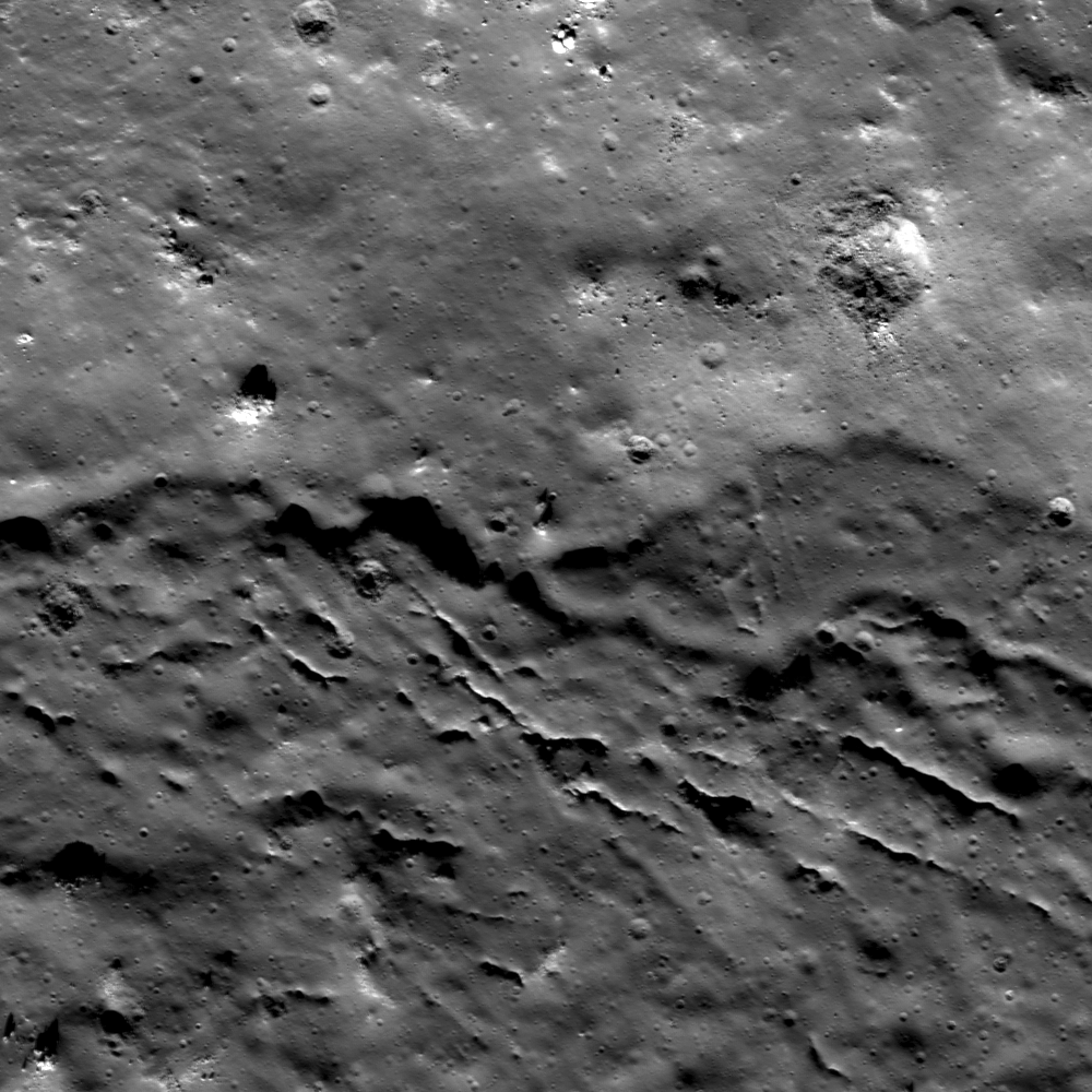
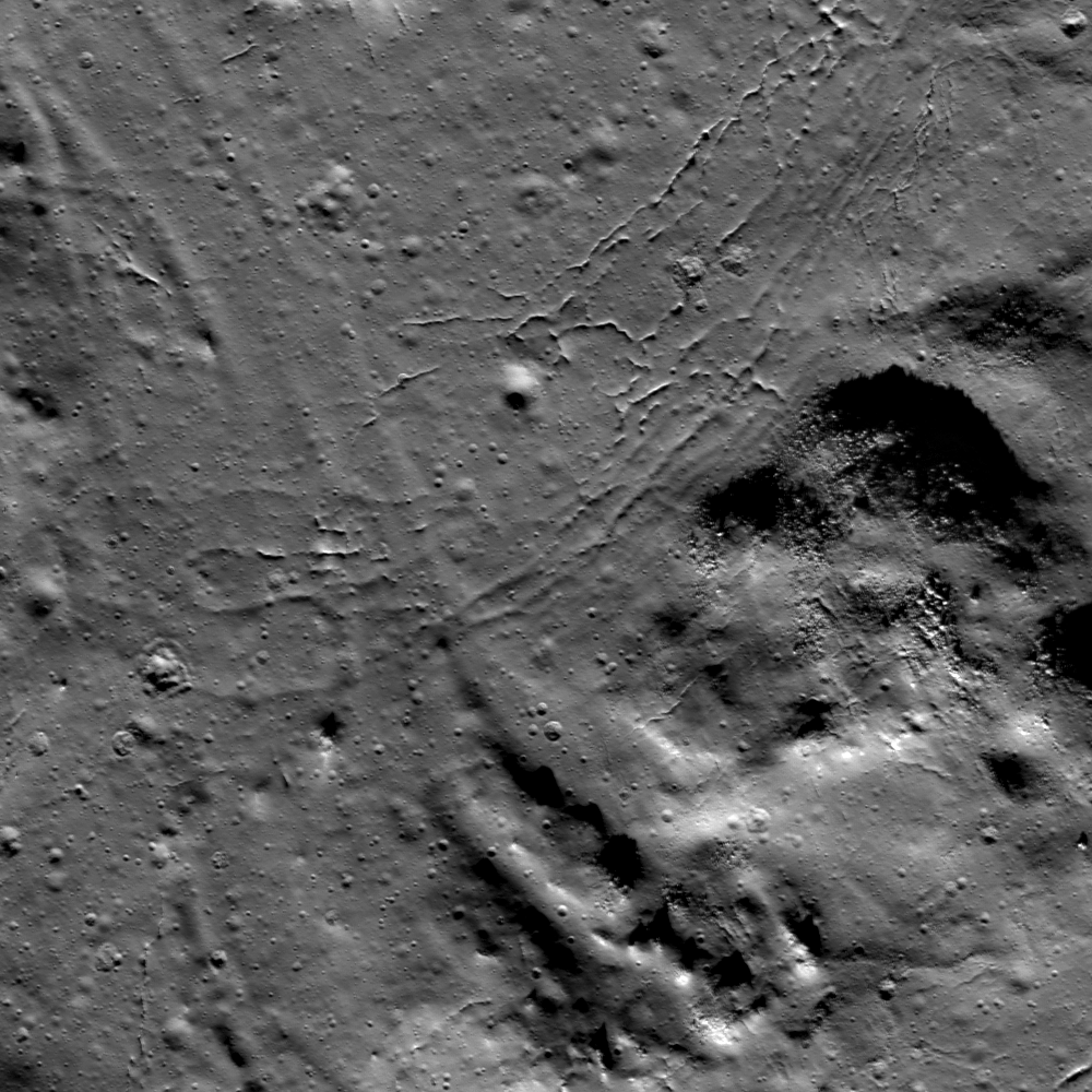
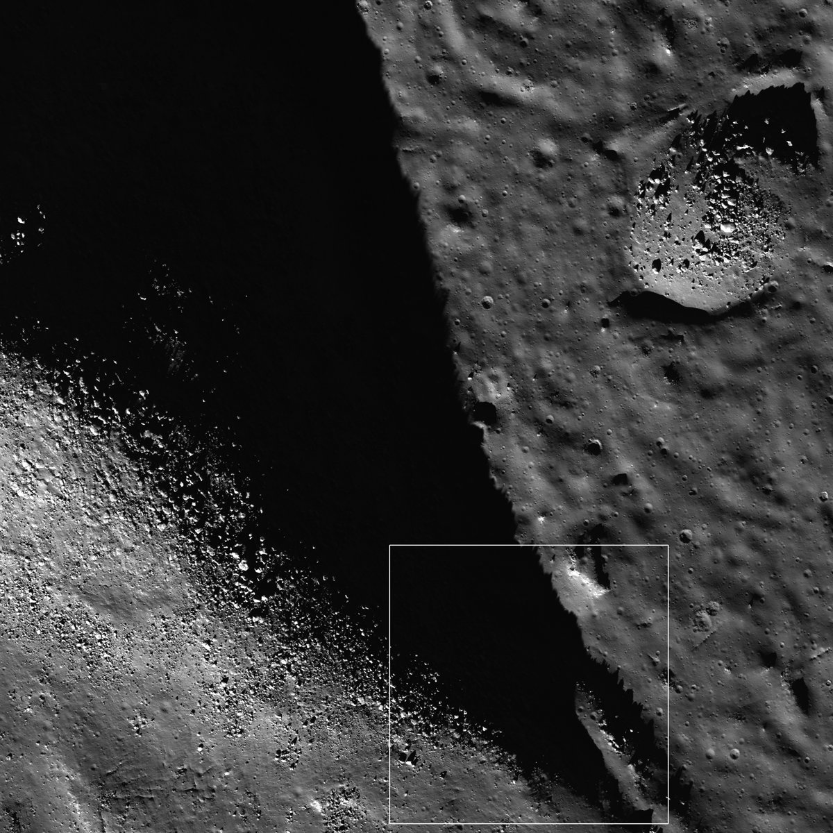
Stratigraphic relationships within impact melt deposits may be discovered with diligent observation. LROC Narrow Angle Camera (NAC) observation M185971152L, LRO orbit 12485, March 9, 2012, Field of view roughly 1.8 km, angle of incidence 73.05° at 1.75 meters resolution from 179.28 km [NASA/GSFC/Arizona State University].
Lillian Ostrach
LROC News System

Stratigraphic relationships in impact melt deposits are not always easy to find, but careful observations of the LROC NAC images provide the perfect opportunity to search! Yesterday's Featured Image presented overlapping distal margins of melt and "bathtub rings" on the northern wall of Anaxagoras crater. Today's Featured Image highlights another stratigraphic relationship in the southwestern portion of the melt pool in Anaxagoras (73.271°N, 349.033°E). Along with the typical fractures near the melt boundary interpreted to be the result of cooling and contraction, there is an impact melt-covered mound (opening image, right) with boulders eroding out from the steepest slopes. At the bottom of the image, there are two parallel troughs that cut through pre-existing material. These troughs probably represent impact melt-carved channels, where melt flowed from higher elevation to lower elevation and carved out a pathway.

But which way did the melt flow? Looking carefully, there are faint linear depressions extending from the top of the image to the channels, suggesting that flow progressed from the bottom right of the image toward the top left. These linear channels are very shallow, barely visible compared to the visible fractures. The shallowness of these channels possibly result from later movement of melt. The fractures cross-cut the shallow channels, indicating that the channels are older than the fractures.

LROC WAC monochrome mosaic of the rubbled interior of Anaxagoras crater (73.458°N, 349.934°E, - 52 km diameter). Location of the area shown at high resolution in the LROC Featured Image released January 17, 2013 noted by the yellow arrow [NASA/GSFC/Arizona State University].
However, note the sharpness of the fractures. The fractures that curve toward the mound and closest to the deeply carved channel troughs have a smoothed appearance when compared to the fractures closer to the top center of the image. Thus, there are two families of fractures, suggesting that perhaps the channels flowed into this area on top of a lightly-crusted pond (reasoning for shallow channels remaining) that then continued to cool, forming the first set of fractures. As the melt cooled more, maybe the second set of fractures formed if the second set is related to cooling.

Perhaps the second set of fractures formed as an internal plumbing system failed, or maybe an injection of hotter melt into this area (beyond the opening image frame) occurred that inflated the crust of the cooling melt and shallowed both the channels and first set of fractures. Without additional detailed observations, including NAC-derived topography, the stratigraphic story of melt movement and cooling concludes with at least two (three?) endings. However, the presence of small pits in the youngest fractures may provide supporting evidence for the plumbing or inflation story, because pits and fractures in the pond interior (away from the melt boundaries) are probably related to a lava tube-like underground melt plumbing system, a hypothesis supported by many NAC images at many different locations on the Moon.

What do you think? After studying the full LROC NAC image, HERE, do you have supporting evidence for the conclusion to the stratigraphic story of melt in this portion of Anaxagoras?

Related Posts:

Wednesday, January 16, 2013

Melt overlap at Anaxagoras

Two lobes of impact melt marking the boundary of the floor of Anaxagoras crater overlapped before solidifying against the crater wall. LROC Narrow Angle Camera (NAC) observation M185964003L, LRO orbit 12484, March 9, 2012; image field of view near 1.8 km, angle of incidence at this high latitude 73.06° with a resolution of 1.76 meters from 179.53 km [NASA/GSFC/Arizona State University].
Lillian Ostrach
LROC News System

Although impact crater formation is a nearly instantaneous event, impact melt cooling is not. For large craters such as Tycho, Copernicus, and Anaxagoras, so much impact melt was created during the impact process that the crater floors were, in effect, flooded by molten seas of melt. The melt pooled in topographic lows, flowed around the central peaks, and became mixed with loose ejecta blocks to create a hummocky texture on the crater floor.

Cooling cracks and collapse pits are prevalent; subparallel groupings of cracks are common near melt boundaries and in regions with entrained blocks.

LROC WAC monochrome mosaic of Anaxagoras crater (73.458°N, 349.934°E, 52 km diameter). Location of the field of view shown at high resolution in the LROC Featured Image released January 16, 2013 noted by arrow [NASA/GSFC/Arizona State University].
Like volcanic lava, impact melt may remain molten for an appreciable amount of time - days, weeks, and years in some cases. The floor melt pond in Anaxagoras was molten for a while, and mobile enough to splash onto the crater walls to form "bathtub rings" (upper right corner in the opening image, also beautifully visible in more detail in the full NAC image). The splashing probably occurred as large blocks of wall material slumped into the ponded melt causing a tsunami of melt!

Today's Featured Image focuses on the boundary of the floor melt pond with the northern crater wall where two lobes of melt overlapped (73.830°N, 350.368°E). Looking to the left of the image, you can trace the melt contact with the crater wall and follow it toward the right side of the image. A moat-like boundary at the edge of the flow of this top layer of melt distinguishes it from the layer beneath. The stratigraphically lower layer of melt is first visible in the center of the image and extends toward the image right.

What may have happened was that this section of the melt splashed up the crater wall to form the first bathtub ring (barely visible in the opening image top right) and flowed back down the wall. Then the melt flowed up the wall again where some melt stuck to the wall because it had sufficiently cooled and a crust had formed, and the melt stuck up on the wall (lobe on the right side of the opening image). Perhaps the melt near the center of this sub-pond remained quite warm and mobile and the melt flowed again toward the wall. The melt then onlapped and superposed the cooled, frozen section of melt near the wall but the melt boundary with the wall cooled sufficiently to stick and totally freeze, thus preserving multiple splashes and slurps of melt on the crater wall. But that is only one possible story - topographic data, melt cooling models, and observations at other craters would be helpful in discovering the history of melt cooling at Anaxagoras.

Check it out! Take a look at the full LROC NAC image HERE - how many impact melt "bathtub rings" and overlapping melt lobes can you find?

Related Posts:
Impact melt in Anaxagoras crater
More Impact Melt!

UPDATE: There are LROC NAC observations of the interior melt overlap at Anaxagoras at higher resolution, more than there are of equatorial targets on average, for example, LRO revolves around the Moon in a polar orbit, and, like lines of longitude, the vehicle’s orbital path traced out on the surface below converge at the poles. Targets like Anaxagora, at relatively high latitude, have, thus far, received overlapping attention.

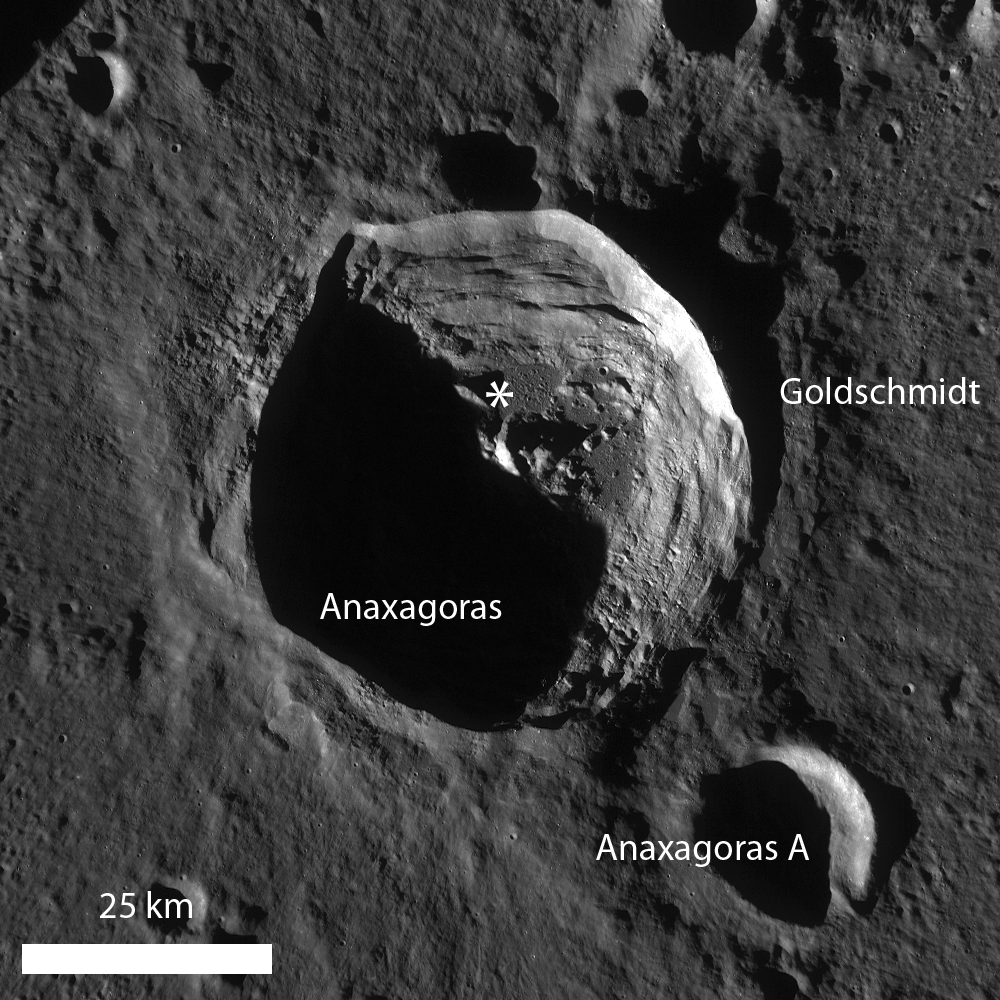
The Copernican age crater get more attention because its relatively new, as well, less beaten down and gardened by space weather and micrometeorites. It takes up a considerable volume of the interior of the larger, and considerably older Goldschmidt crater, where the Cassini spacecraft, on its way to Saturn, appears to have detected water or hydroxyl molecules in broad daylight.

One particularly close observation in addition to the one at the top of this post is highlighted below, showing three distinctive “bathtub rings,” a steady surf that came to a halt before the energy that created it played out. In fact, that same energy is still present. Can these observations allow scientists to measure the time between the melt formation and its frozen state? 

A 2460 meter-wide field of view overlapping the same area shown in the LROC Featured Image, released January 16, 2013, with the three areas shown at full resolution in the images that follow outlined in rectangles. LROC NAC observation M124628200R, spacecraft orbit 3500, March 30, 2010; angle of incidence 72.08° at an original resolution of 49 cm per pixel from 43.61 km [NASA/GSFC/Arizona State University].
The highest, northern most ‘slosh’ in the field of view appears to have been energetic or directed enough, or both, to have moved a considerable amount of debris [NASA/GSFC/Arizona State University].
This slosh appears to have been retreating, even as the a wave further south was gaining and over lapping it, leaving debris like sea shells in a scene witnessed in motion by anyone who has walked along a terrestrial beach [NASA/GSFC/Arizona State University].
Was this later wave really of a greater magnitude than the others? Did the surface lose its viscosity suddenly? Did material heap up behind or below? Was this process really slow or sudden? [NASA/GSFC/Arizona State University].

Tuesday, October 16, 2012

Winding Channel of Melt

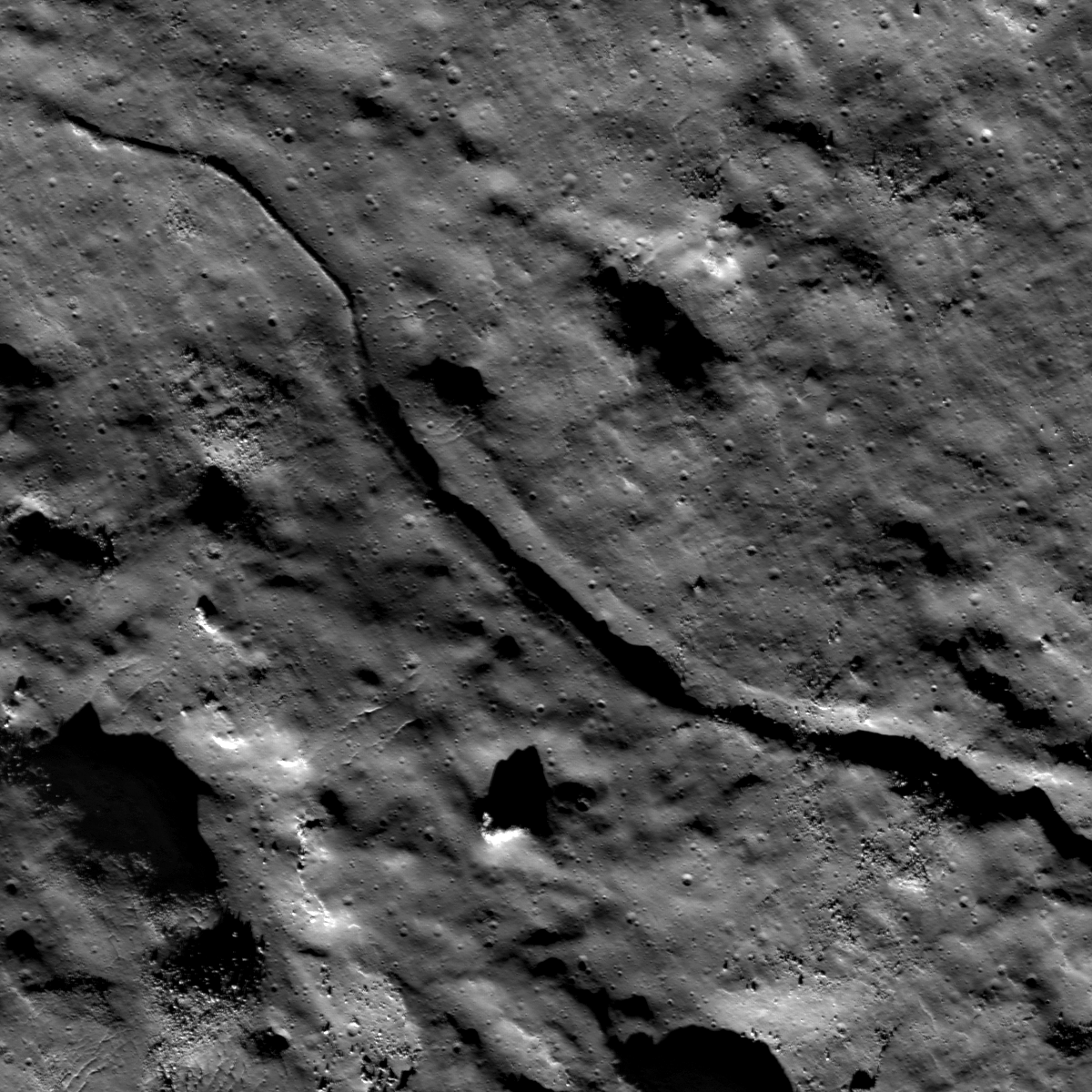
Impact melt channel winding its way down Anaxagoras crater wall, on its descent to the floor. LROC Narrow Angle Camera (NAC) frame M185956855L, LRO orbit 12484, March 9, 2012' image field of view 2.2 km (downslope to upper left), angle of incidence 73.06° at 1.76 meters resolution, from 179.79 kilometers [NASA/GSFC/Arizona State University].
Lillian Ostrach
LROC News System

Anaxagoras crater (73.458°N, 349.934°E, ~52 km diameter) is a complex crater with terraced walls, central peak, and substantial impact melt deposits. After impact melt is created during the impact event, significant portions are often ejected from the crater in much the same way as the unconsolidated excavated rock that forms the typical ejecta blanket. However, most melt does not contain sufficient energy to escape the crater interior and is instead splashed onto the crater walls. If the melt remains hot enough, the splashes and globs of melt on the walls may coalesce and descend toward the crater floor under the influence of gravity.

Sometimes, the flowing impact melt creates channels by eroding the substrate or building up levees. In today's Featured Image, an impact melt channel formed in the lower section of crater wall terraces, near the last major break in slope close to the crater floor (73.286°N, 351.500°E). Many small, channel-like features occur in this area of the crater wall, and the channel origin is difficult to discern and may actually be located upslope to the lower left, outside the view of the Featured Image. Often, channels form in a path of least resistance, that is, where preexisting fractures and weakness occur - and crater wall terraces are prime locations for heavily fractured target rock. This channel ranges from ~95 m to 160 m across and has clearly defined walls until the upper right of the image, when part of the channel disappears. Why the disappearing act?


LROC WAC monochrome (604nm) mosaic of Anaxagoras stitched from 10 passes March 21, 2011, or a bit less than a full year prior to the opening NAC observation. The arrow indicates the location of NAC Featured Image field of view [NASA/GSFC/Arizona State University].
Flowing impact melt has a specific lifetime and when the melt cools enough, it stops flowing. There are a couple of plausible explanations for the disappearance of one of the channel walls. First, some melt may have traveled down the channel until it cooled enough solidify near the tail end of the channel, thus clogging the channel pipeline. Alternatively, a relatively thick veneer of melt may have been splashed onto the wall at a late stage, thus obscuring and erasing the channel wall. Another possibility is that there is a change in slope that influenced the melt to breach the channel wall and instead flow toward the top of the image, an explanation perhaps supported by the change in concavity in the channel from concave up (somewhat U-shape) to concave down (upside-down U-shape). However, additional observations, including the use of a NAC derived topographic maps, are crucial to determine which hypothesis (or another!) is the best explanation.

How many impact melt channels can you find in the full LROC NAC image, HERE.

Related Posts:
Anaxagoras Exterior Melt
On the Floor of Thales
Lichtenberg B Flow
Impact melt channel

Wednesday, September 12, 2012

Anaxagoras exterior melt

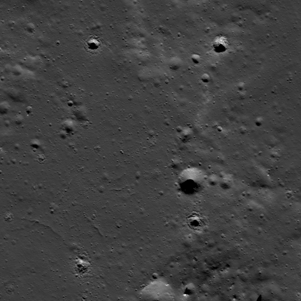
Exterior impact melt ponded to the east of high-latitude Anaxagoras crater. A roughly 1.8 km-wide field of view from LROC Narrow Angle Camera (NAC) M185949707L, LRO orbit 12482, March 9, 2012; angle of incidence 73.08° at 1.76 meters resolution from 180 kilometers. View the 1000 x 1000 pixel original LROC Featured Image HERE [NASA/GSFC/Arizona State University].
Lillian Ostrach
LROC News System

Impact melt drastically altered the landscape in and surrounding Anaxagoras crater (73.458°N, 349.934°E, ~52 km diameter). Previous Featured Images focused on the interior melt pond and melt-covered mounds, but the exterior ponds are important, too. Impact crater formation is violent: all of the energy associated with a moving bolide is imparted to the target immediately upon impact. Some of the energy may vaporize the impactor, while a substantial amount of the energy is responsible for excavating the crater cavity. In many cases, some of the target rocks are heated to their melting temperatures (~1300°C for basalt, ~1500°C for anorthosite) to form impact melt. Once formed, impact melt may be excavated in a similar manner to unconsolidated ejecta. Some melt remains in the crater interior, pooled on the crater floor and terraces and forming a veneer on the crater walls, while some melt is emplaced on or near the crater rim. Similar to the crater interior, the immediate exterior of the crater may be veneered with impact melt and exhibit melt channels and flows, as well as exterior melt ponds.

LROC WAC monochrome (604 nm) mosaic, stitched from 10 sequential passes on March 21, 2011, shows a roughly 80 km-wide view of Anaxagoras and vicinity, itself situated on the rim of Goldschmidt to the east. Image center is 72.4°N, 350.0°E. The the location of the area detailed in the LROC Featured Image released September 12, 2012 is indicated by the yellow arrow [NASA/GSFC/Arizona State University].
The opening image by itself might be mistaken for a smooth mare region because there was enough impact melt to coalesce into a pond and evenly bury the underlying surface, but the WAC context image (above) shows this not to be the case everywhere. On the flanks of the eastern rim of Anaxagoras, the melt pond is very smooth in some areas (opening image, left) while relatively rougher elsewhere (opening image, right), which may indicate that this melt pond did not have enough volume to completely obscure the preexisting surface. In the very smooth portion, there are some fractures similar to those observed in other melt ponds. There are also several impact craters with irregular morphologies. These craters, all less than 100 m in diameter, may have these different morphologies for several reasons related to target properties. The 94 m diameter crater in the upper right may be irregular because the crater punched through a thin resistant layer of impact melt rock to the looser unconsolidated preexisting surface. Other nearby craters may have formed in partially molten melt or may have formed much later, after a thin layer of regolith was generated by micrometeorites. Additional study of superposed crater morphology on impact melt, paired with analog laboratory experiments, may help distinguish the difference between impacts into a partially molten material and those into a layered target (previously studied in depth by Drs. Oberbeck and Quaide, among others).

What do you think?  Take some time to examine the exterior impact melt ponds in the full LROC NAC image, HERE.

Breached Levee

A closer look, at more than twice the resolution, we see one of the more prominent features on the impact melt pond in LROC NAC frame M185949707L, subject of the LROC Featured Image released September 12, 2012. LROC NAC M122252864L, spacecraft orbit 3150, March 3, 2010. The resolution available from only 43 km above during this earlier fly-over was 48 cm per pixel [NASA/GSFC/Arizona State University].

Friday, February 17, 2012

LROC: Cracked mound at Anaxagoras

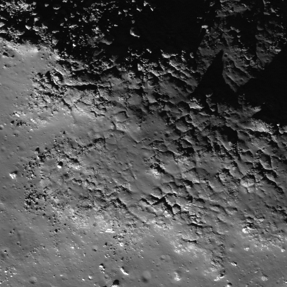
Top of a mound with fractured impact melt on the floor of Anaxagoras (75.46°N, 349.94°E). Image field of view 600 meters with sunlight from the south-by-southwest viewed at an incidence angle of 73.78° (nearly as high above the horizon as the Sun gets at such northerly latitudes. LROC Narrow Angle Camera (NAC) observation M122273232L, orbit 3153, March 3, 2010; resolution 0.49 meters per pixel from an altitude of 42.18 kilometers. View the larger (1100 x 1100) original LROC Featured Image HERE [NASA/GSFC/Arizona State University].
Hiroyuki Sato
LROC News System

The irregularly fractured surface in today's Featured Image is on top of a north-western oriented slightly elongated mound on the floor of crater Anaxagoras (image center is 73.748°N, 349.522°E). Anaxagoras (diameter ~ 50 km) is located about 700 km north of Mare Imbrium. The floor of Anaxagoras has an irregularly-shaped central peak. Other portions of the floor are filled with debris and impact melts.

The cracked surface covers only the top portion of the mound. The northern flank of this mound (see figure below) is almost completely covered by boulders, and southern flank is smooth with only a few boulders (as seen in the left hand image below). Why did the cracking happen only at the top of the mound?

One possibility is that the cracked portion is a splashed remnant of impact melt. A solid crust formed where the melt was thickest, and then later, as melt drained downslope, the cracks formed as the crust collapsed.

Context from the larger (LRO NAC M122273232L) frame showing the vicinity the Featured Image field of view (blue box).  A conventional stretch is above; below, the same image stretched to enhance details in the shadowed area. Each FOV width is slightly less than 2000 meters [NASA/GSFC/Arizona State University].
LROC WAC monochrome (604 nm) mosaic stitched from 10 sequential orbital passes March 21, 2011, showing a roughly 80 km-wide view of Anaxagoras an vicinity, situated on the rim of Goldschmidt on the east. Image center is 72.4°N, 350.0°E. The the location of the area detailed in the LROC Featured Image is indicated by the yellow arrow [NASA/GSFC/Arizona State University].
The interior of Anaxagoras crater was a Constellation program Region of Interest. With so many exciting features like this one, Anaxagoras crater is an excellent place for humans to explore!

Explore this irregularly cracked ridge and lots of other spectacular impact melt morphologies NAC frame HERE.

Related Posts:
Craggy Peak, Impact Melts
Splash and flow
Chaotic crater floor in Tycho
Polygonal fractures on Tycho ejecta deposits
Impact melt in Anaxagoras crater
Exposed Fractured Bedrock in the Central Peak of Anaxagoras Crater

This low-altitude (31 km) oblique view south from Japan's lunar orbiter SELENE-1 (Kaguya) is an excellent illustration of the difficulty in gauging scale in lunar photography. Anaxagoras could be a backyard brick barbeque pit in disrepair, or an astronaut's few foot steps away. Instead the crater is 50 kilometers wide and hundreds of kilometers away in this HDTV frame from 2009. View the release-size image HERE [JAXA/NHK/SELENE].

Tuesday, May 31, 2011

Impact melt in Anaxagoras crater


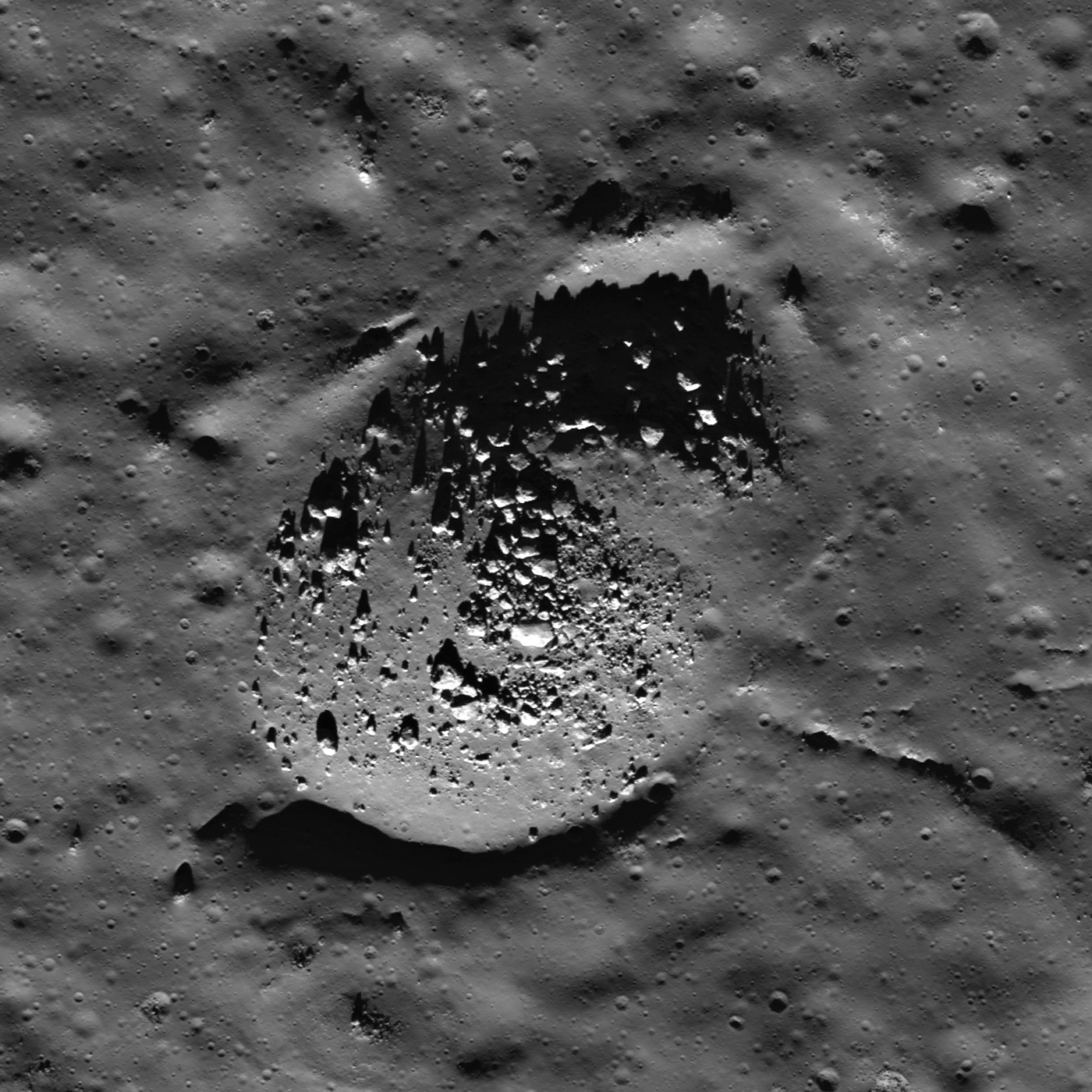
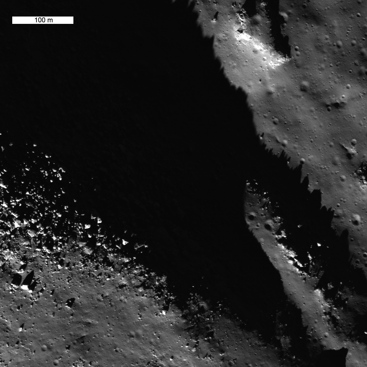
Boulders clustered on a positive relief bulge in an impact melt deposit on the floor of Anaxagoras crater (73.5°S, 349.7°E); most of the boulders are 10 - 30 meters across. LROC NAC M155309869R, LRO orbit 8022, March 21, 2011; image field of view is 800 meters (see the full-size LROC Featured Image HERE [NASA/GSFC/Arizona State University].

Lillian Ostrach
LROC News System

Anaxagoras, 50 km diameter, is a Copernican-aged crater located on the lunar far side.

A previous post examined exposed bedrock in its central peak and mentioned the impact melt-covered floor. Impact melts are exciting to lunar geologists not just because the melt ponds and flows are beautiful, but because samples of impact melts can provide a specific and accurate age of crater formation through radiometric dating.


LROC WAC monochrome mosaic context of Anaxagoras crater. The floor of Anaxagoras is covered in impact melt that is riddled with cracks that probably formed during cooling [NASA/GSFC/Arizona State University].

Much of the impact melt on the floor of Anaxagoras is smooth, but there are some places with cracks or negative-relief features. These cracks and pit-like features probably formed during cooling of the melt as the material fractured, similar to the way scientists think the natural bridge in the King crater melt sheet formed. We simply do not know for certain. Additionally, there are several hills and bulges that are covered with clusters of boulders. There are no impacts in the melt sheet that might account for the boulder clusters, thus a possible explanation is that the boulders are eroding out of the impact melt that covers these hills. These boulders look similar to boulder clusters eroding out of wrinkle ridges in the mare; are they the result of a similar process? This observation suggests that perhaps erosion proceeds preferentially on the steeper slopes of bulges in the melt sheet and ridge crests of wrinkle ridges to produce boulder clusters. But why are boulders only eroding from these bulges? There are other steep slopes nearby, but these slopes do not have boulders. There may be a simple explanation for the presence or absence of boulders in the Anaxagoras melt sheet and along wrinkle ridge crests, but further observations and analyses are required. Certainly, this is another mystery waiting for future lunar explorers!

Discover the beauty of the Anaxagoras impact melt sheet for yourself in the full LROC NAC image!

Related Posts:
Anaxagoras A at Sunrise
Fragmented Impact Melt
Impact melt at Necho crater
A molten flood
More Impact Melt!
Fractured Impact Melt


Anaxagoras as viewed through the high-definition television camera on-board Japan's lunar orbiter SELENE-1 (Kaguya) in 2009 [JAXA/NHK/SELENE].

Thursday, April 15, 2010

Fractured bedrock exposed at Anaxagoras


LROC featured image of the Anaxagoras crater floor, including a portion of the crater's anorthositic central uplift. The boulders perched on ridges are eroding out of densely fractured bedrock. (LROC NAC M122273232R) [NASA/GSFC/Arizona State University].

Veronica Bray

LROC News System

The lunar highlands are thought to have formed as a result of a global melting event early in the Moon’s history, during which plagioclase floated to the top of the ocean and solidified as an upper layer of anorthosite. The study of anorthosite occurrence is thus important for investigating the global magma ocean concept and the evolution/development of the lunar crust.

Anaxagoras is a 50 km diameter Copernican-Age crater (73.4°N, 349.9°E) with an extensive ray system (reaching over 900 km from the crater rim, in some directions) and a central peak of pure anorthosite, the material typical of the lunar highlands and believed to be the Moon's original global crust.

The central peak and the material ejected and deposited onto the floor of Goldschmidt crater to the east, indicates that the Anaxagoras crater-forming impact excavated pure anorthosite. Consequently it is one of the NASA Constellation Program regions of interest targeted by LROC to provide data that supports future human and robotic exploration of the Moon.


Figure 2: LROC Wide-Angle Camera (WAC) image of Anaxagoras. The arrow indicates location of the LROC News System's Featured Image, April 14, 2010. Anaxagoras is approximately 50 kilometers in diameter (LROC WAC M19911591ME, north is up).

Figure 3 (below) shows a section of the Anaxagoras crater floor, including a section of the anorthositic central peak complex. The crater floor is covered in relatively smooth impact melt; the melt in this image has degraded over time and is now covered by an upper regolith layer and displays numerous younger small impact craters. Sections of the central uplift protrude above the crater floor melt and are covered with large boulders.


Figure 3: The boulders on the central peak ridge cast distinct shadows due to the low Sun angle. Image is ~1.8 km across and is re-sampled to 1.5 m/pixel for this posting. The white box shows the the location of today's main featured image. Image number M122273232RE [NASA/GSFC/Arizona State University].

The smaller mound, in the right of Figure 2, is covered with large boulders, up to 30 meters (90 feet) across. Since the boulders cluster on top of topographic highs and are rare on the surrounding flat surfaces, they most likely were not thrown in from afar but rather are eroding out of the substrate.

Figure 4 (below) details boulders on top of the central uplift. Beneath these loose boulders are more large blocks, most likely fractured bedrock outcrops. The full image (here) is 425 meters wide, LROC NAC M122273232RE [NASA/GSFC/Arizona State University].


Figure 4 shows a close up of the ridge (Figure 2, above), revealing a great spot for future explorers to sample. The best sampling for scientific study come from outcrops or rubble traced back to its original position. Understanding the geologic context of a sample allows scientists to place a rock in its stratigraphic position and to better trace the processes and forces that formed the original rock later its later history. Sampling the central peak is scientifically important because it represents anorthositic rock formed as part of the original lunar crust. Lunar geologists would like to sample a variety of these ancient rocks from throughout the whole Moon to understand variations in lunar chemistry and help bring together the story of the Moon's formation. The impact melts seen on the floor of Anaxagoras also presents valuable samples -- opportunities for age- dating their time of formation allows us to know exactly when the crater was formed.


Figure 5 details areas within the shadow in Figure 3, above. Light scattered off nearby surfaces dimly illuminates the shadowed region and by applying a hard stretch to the image, even geology inside the shadows can be mapped. Zoom in and explore the floor of Anaxagoras, HERE.


Japan's lunar orbiter "Kaguya," SELENE-1, captured this HDTV still during a late-mission flyover of Anaxagoras, looking south. As mentioned in the narrative Anaxagoras overlaps the western wall of 124 kilometer-wide Goldschmidt (left), location of significant daylight water and hydroxyl signatures detected by instruments on board both Cassini, on its way to Saturn, and the Moon Minerology Mapper (M3) on India's Chandrayaan-1 [JAXA/SELENE/NHK].