Showing posts with label crater pit. Show all posts

Friday, November 7, 2014

Exploring the lunar subsurface

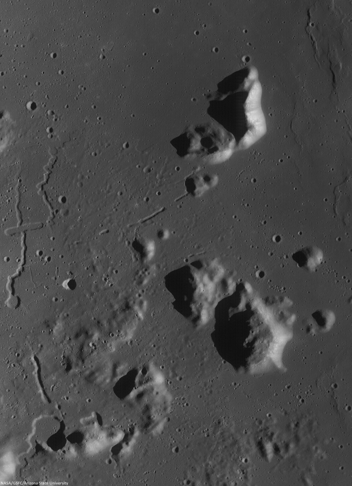
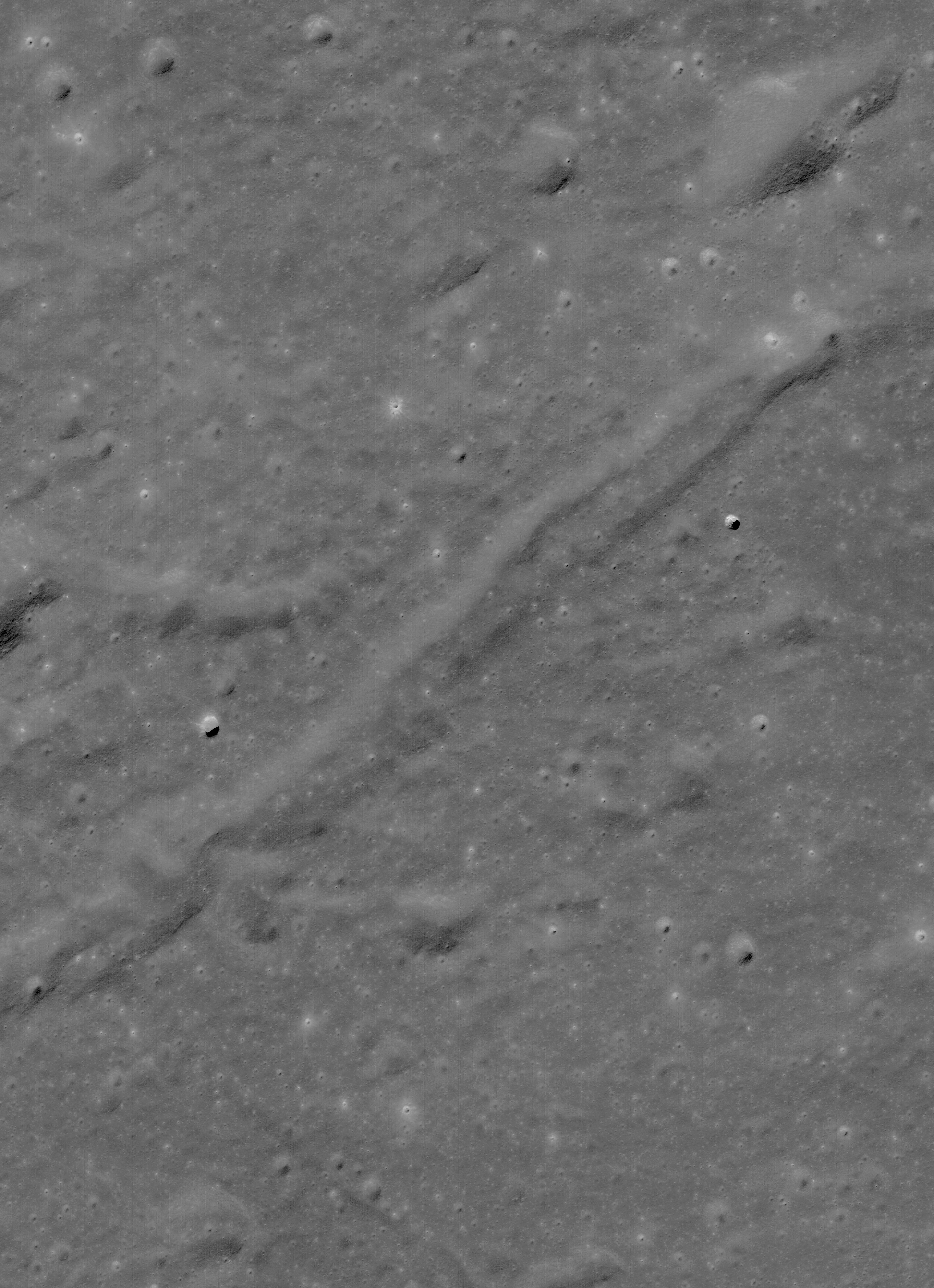
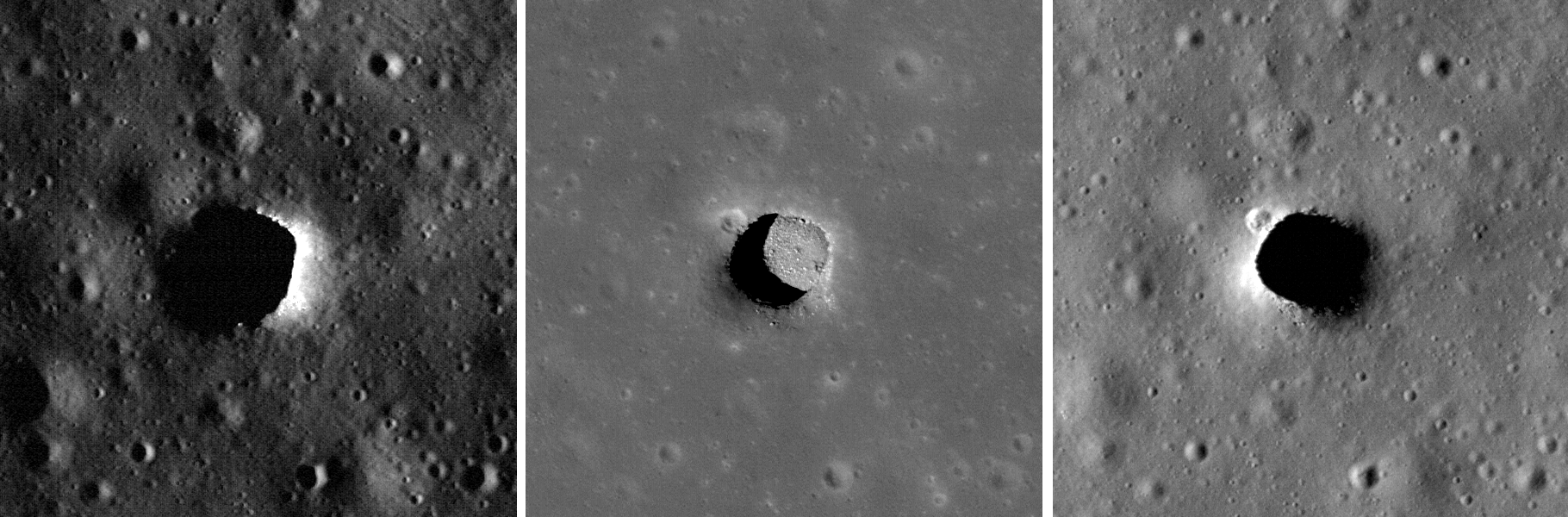
Two collapsed segments of a lava tube run from the southwest to the northeast, in the Rimae Prinz-Harbinger mountain region of Oceanus Procellarum (27.46°N, 318.33°E). These collapsed segments may provide access to the subsurface, which has never been directly sampled. The average width of the collapsed segments is ~650 meters. The lava tube is ~50 meters deep, seen in this 7 km-wide field of view from a mosaic of unreleased 2014 LROC NAC observation M1165080128 (L&R) [NASA/GSFC/Arizona State University].
H. Meyer
LROC News System

A lava tube is a volcanic conduit through which lava travels beneath the hardened crust of a lava flow. The presence of lava tubes on the Moon and beyond are inferred based on observations of terrestrial lava tubes, such as those found in Hawaii. Oftentimes, a rille suddenly disappears only to reappear a short distance away.

These are called discontinuous rilles and are thought to be areas where a lava tube collapsed. Collapsed lava tube segments may provide access to the subsurface, which is exciting as a possible site to collect rock samples that remain unaltered due to surface weathering (radiation, thermal cycling, micrometeorite bombardment).

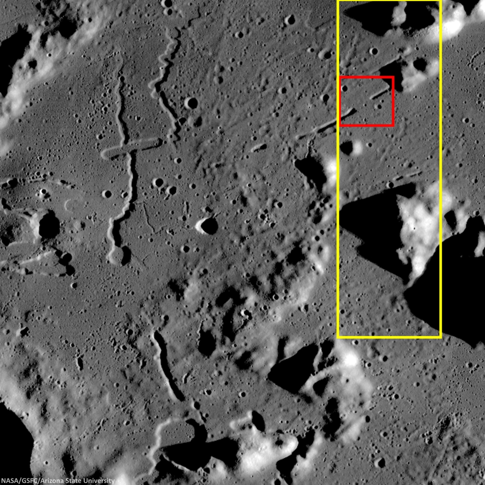
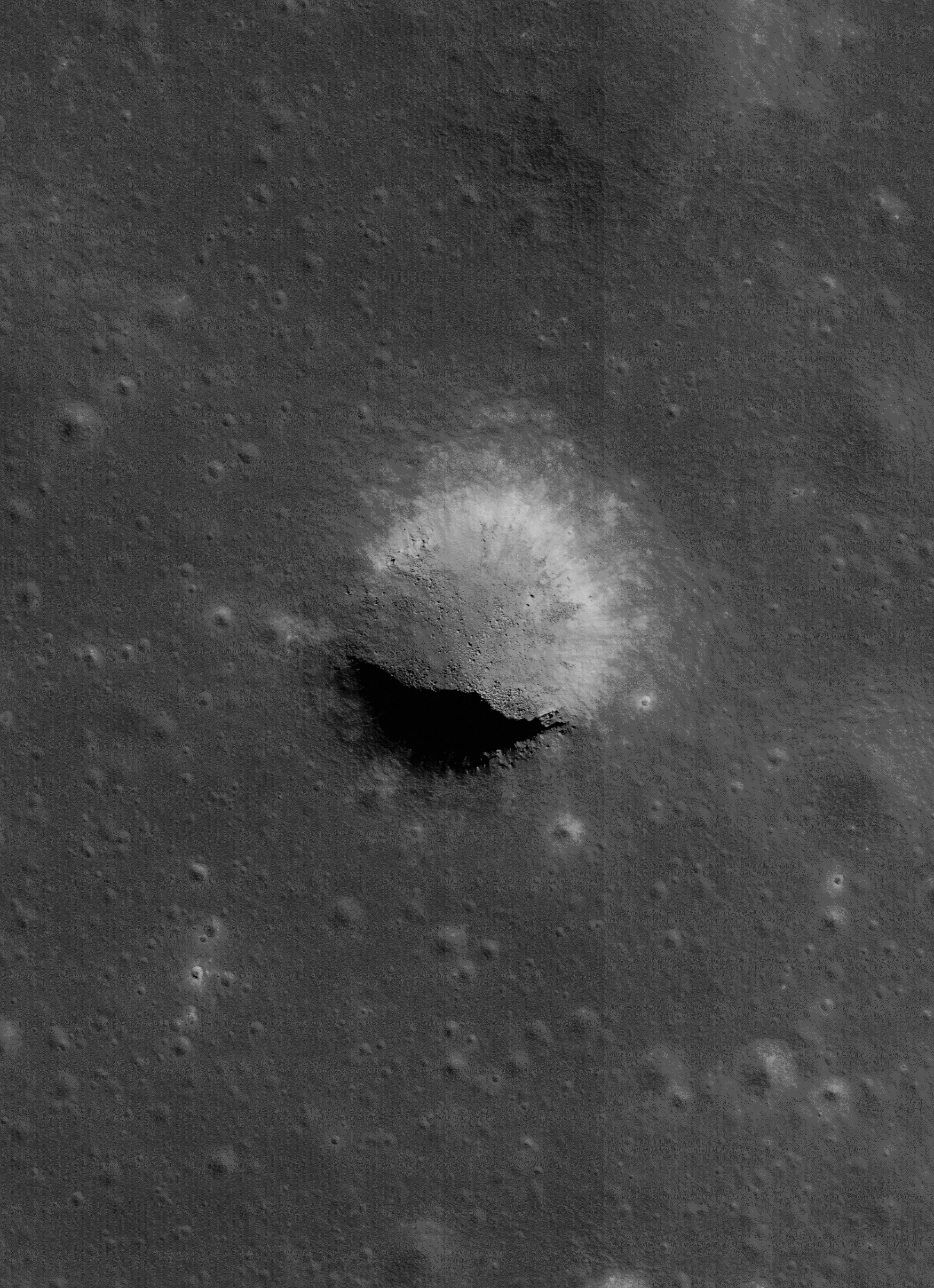
Slightly differing, slightly lower resolution, 11.5 x 15.9 km field of view of the area of interest from a mosaic of LROC Narrow Angle Camera (NAC) observation M1152143995RL, LRO orbit 21776, April 14, 2014; resolution averages 1.33 meters per pixel, incidence angle 48.9° from 132.14 km over 26.86°N, 318.11°E. View the original 8706 x 12008 and an assortment of other sizes HERE [NASA/GSFC/Arizona State University].
Sunrise over Mons Harbinger. 65 km-wide field of view from mosaic of three LROC Wide Angle Camera (WAC) monochrome (604 nm) observations, swept up during three sequential orbital passes, December 7, 2011,  from 43 km; resolution 58 meters per pixel, incidence 77° [NASA/GSFC/Arizona State University].
Context for LROC Featured Image released November 6, 2014, field of view in red, full field swept up in LROC NAC observations M1152143995R & L in yellow. LROC WAC mosaic [NASA/GSFC/Arizona State University].
The lava tube from the LROC Featured Image released November 5, 2014 is located to the west of Montes Harbinger, a large kipuka in Oceanus Procellarum, and to the east of the Rimae Prinz region.

The Rimae Prinz region displays exquisite sinuous rilles as well as other elongate depressions, indicating that there could be other lava tubes in the area.
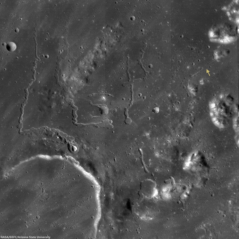
The Prinz, Rimae Prinz and Vera vent region, east of Aristarchus Plateau. The area of interest is marked with a yellow arrow, upper right in this roughly 120 km square field of view from the LROC WAC 100m global mosaic. the Vera vent 'cobra head' of Rima Prinz I rille (on the north-northeast rim of basalt-inundated Prinz crater, at lower left), is the subject of intense study (see HERE). [NASA/GSFC/Arizona State University].
The entire region, pictured above, is of interest for exploration for several reasons. The diversity of volcanic landforms in the area can tell scientists much about the volcanic history of the Moon. By collecting samples from the surface and subsurface in this region and by careful mapping on-site, scientists can better characterize the diverse basaltic lava flows in terms of both age and composition, which also helps us understand the timing and evolution of lunar volcanism and possible heterogeneities in the lunar mantle. Any time a sample is taken from a site on the Moon and age-dated, it can also be used to calibrate crater densities that are currently used to remotely age-date surfaces in the absence of direct sampling (both on the Moon and other planets).

Lava tubes are of particular interest in terms of human exploration because they are not only scientifically valuable, but they might also provide shielding from the radiation that poses a hazard to future explorers. Furthermore, the region surrounding the lava tube from this Featured Image also hosts large pyroclastic deposits, which are a potential in situ resource that will be critical to sustaining a human presence on the Moon.

Scientists and engineers are looking into the possibility of using the natural structure of the lava tube and associated resources (ISRU) to our advantage to construct habitats for explorers.

Explore the full NAC mosaic here! How many features of interest do you see?

Rimae Prinze Region - Constellation ROI
Discontiguous Rilles
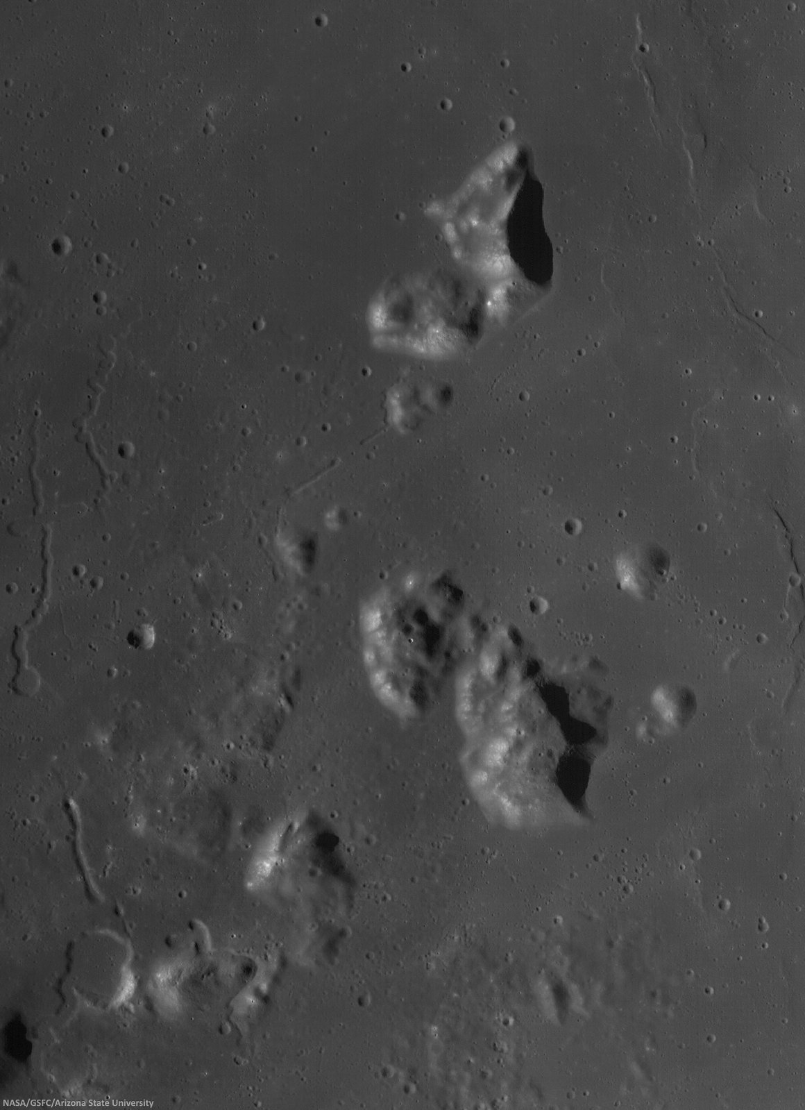
Addendum: Under mid to late afternoon sunlight, another LROC WAC mosaic, swept up under conditions remarkably similar in scale with the third image from above, from the same period of low altitude opportunities the LRO mission afforded during orbital maneuvers in the second half of 2011. Differing sun-moon-spacecraft phase angles allows for an excellent comparison. This particular mosaic was also assembled from LROC WAC observations, but five months earlier, and from three sequential orbital passes, at 43 km altitude. The resolution is 59 meters, incidence angle 64° [NASA/GSFC/Arizona State University].

Wednesday, August 27, 2014

Pit craters in NAC DTM topography

The crisp morphology of the central Mare Fecunditatis pit (white arrow) stands out in elevation data and suggests a relatively young age. This pit is about 200-m in length and 45 m deep. Image width is 5 km; north is up. Color shaded-relief created from NAC DTM FecundPit; higher elevations shown in red and lower elevations in blue and purple [NASA/GSFC/Arizona State University].
J. Stopar
LROC News System

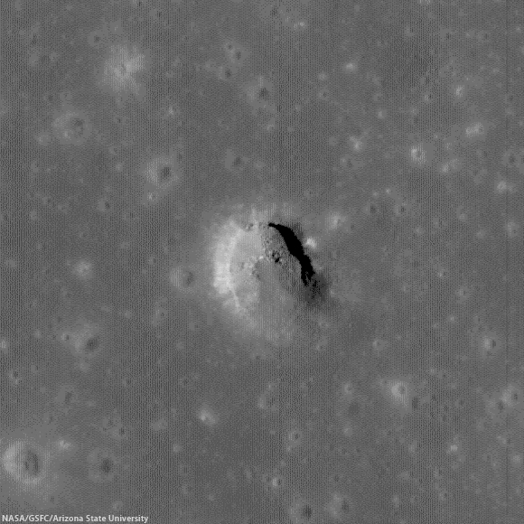
Eight mare pits have been discovered so far on the Moon, five of which preserve void spaces (sublunarean voids) beneath overhanging mare layers. The pit featured above, located in central Mare Fecunditatis (0.917°S, 48.66°E), however, does not have an obvious void space. The pit is almost 200 m wide and about 45 m deep.

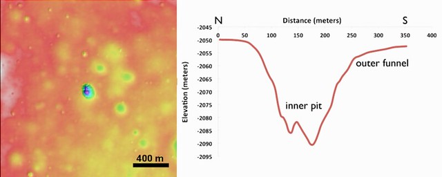
The central Mare Fecunditatis pit has a concave shape, with gentler slopes (outer funnel) near the upper mare surface, and a steeper-walled inner pit (see image below). Variations in wall slopes are consistent with a fine-grained, particulate layer (regolith) overlying more coherent mare layers. The steep inner pit suggests collapse into a small void space. The debris in the pit floor consists of both regolith and mare blocks from the upper layers.

Pit crater (0.92°S, 48.66°E) near Messier B, now generally designated the Central Fecunditatis pit crater to distinguish it for a more recently discovered skylight in southwest Fecunditatis. LRO's longevity has enabled repeated narrow angle photography of selected areas on the Moon, allowing for the team at Arizona State University to build up very high-resolution, NAC-based digital terrain models. 540 meter field of view from LROC NAC observation M1105602888R, LRO orbit 15232, October 23, 2012; 35.18° incidence angle, resolution 93 cm from 108.28 km over 0.92°S, 49°E [NASA/GSFC/Arizona State University]
Left: color shaded-relief of NAC-derived elevation data. Reds are higher elevations, purple lower elevations. Right: elevation profile of a north-to-south cross-section through the pit. The inner pit has steep walls, while slopes near the mare surface (outer funnel) are more gentle [NASA/GSFC/Arizona State University].
The lack of raised rim or ejecta around the pit, indicates that it most likely formed through collapse, rather than as an impact event. While this pit is not located near any obvious tectonic features or volcanic constructs, the collapse may have occurred into part of an old lava tube. The crispness of the pit morphology, suggests that the collapse occurred relatively recently (geologically speaking, at least), perhaps much less than 1 billion years ago. Pits are among some of the youngest landforms on the Moon, and are similar in age to many fresh craters (such as Tycho, Copernicus, or Aristarchus).

More recently identified pit crater in southwest Mare Fecunditatis (6.752°S, 42.76°E), discovered during Wagner and Robinson survey. A 325 meter-wide field of view from LROC NAC M167926438R, LRO orbit 9881, August 14, 2011; 42.25° incidence angle, resolution 56 cm from 26.73 km over 6.71°S, 42.72°E [NASA/GSFC/Arizona State University].
Read More About Lunar Pits:  Lunar pits were recently featured in the news and the focus of a scientific publication ("Distribution, formation mechanisms, and significance of lunar pits," Robert V. Wagner and Mark S. Robinson, Icarus, July 2014; pg. 52-60).

The pits are of particular interest to lunar scientists because they could offer access to subsurface materials, making them important targets for further research and exploration.

Explore the pit in the full-resolution LROC NAC observation HERE.

More Pits:

Sunday, July 7, 2013

Twin mare pit craters in the Lake of Death

Layers of terrain, the foundation under the heavily gardened upper surface of Lacus Mortis, "the Lake of Death," hints this feature, averaging 228 meters across, was, or is, a "pit crater," closely related to similar structures (discovered in the 21st century) near the Marius Hills, in Mare Tranquillitatis, Mare Ingenii and elsewhere. Though the east wall collapsed there may yet be an opening below a ledge. LROC Narrow Angle Camera (NAC) observation M126759036L, orbit 3814, April 24, 2010; 49.4° angle of incidence, resolution 0.5 meters from 45.56 km [NASA/GSFC/Arizona State University].
Joel Raupe
Lunar Pioneer

It was something of a sensation just a few years ago when Kaguya (SELENE-1) images unveiled a "pit crater," an honest to goodness opening into a sublunarean world.

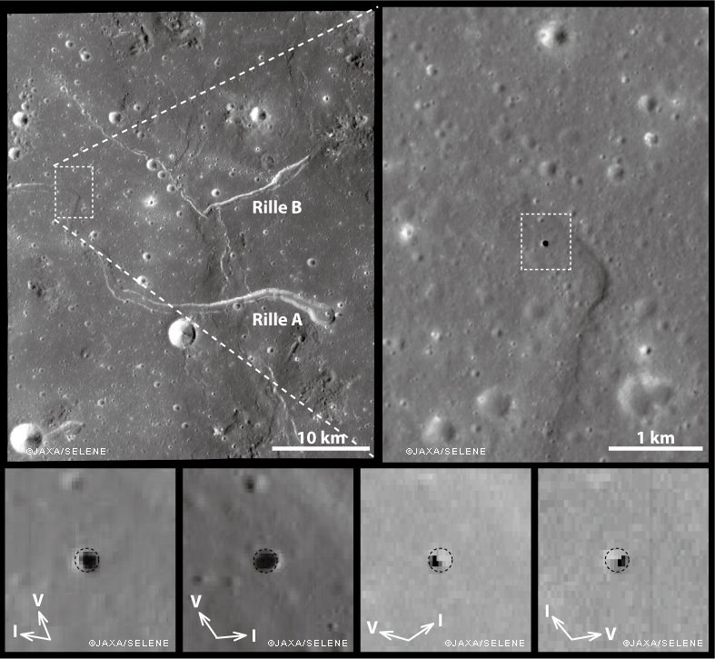
Ant this new feature was found right in the middle of the long-observed and studied channel of the unofficially named "Sinuous Rille A," in the Marius Hills of Oceanus Procellarum. What a difference, many thought, high resolution photography would make of our knowledge of the lunar surface.

And they were not disappointed. Most of what we now know of the lunar surface is entirely a product of the 21st century, largely a pay off from "precursor" missions vital to the success of a now-scrubbed program ahead of a return to the surface of "extended human activity" later this decade.

Junichi Haruyama and his colleagues reported their findings in Geophysical Research Letters in 2009, having captured the Marius Hills Pit at resolutions as high as 6 meters per pixel using the Kaguya Terrain Camera and Multiband Imager, as discussed by LROC principle investigator Marc Robinson, March 1, 2010.

The same partially collapsed, or filled-in, pit crater in the Rimae Burg region of Lacus Mortis (44.96°N, 25.62°E), from an oblique LROC NAC mosiac M1105701957LR, with spacecraft slewed -41.94° off nadir, orbit 15246, October 24, 2012; 59.78° incidence angle, 2 meters resolution from 155.54 km over 44.92°N, 25.52°E. Explore a full-resolution version HERE [NASA/GSFC/Arizona State University].
Not many months after the controlled impact of Kaguya the Lunar Reconnaissance Orbiter began its long and productive tour in lunar orbit.

Early in that still-ongoing mission the LROC team at Arizona State University released their own high-resolution NAC images of the Marius Hills Pit, and under a variety of lighting angles, while announcing the discovery of two additional, even larger and more distinctive "pits" in the western interior of Mare Ingenii and the well-preserved example near Sinas J, not far from the vent structures at the west terminus of Rupes Cauchy, in the middle of Mare Tranquillitatis.

These new images left little doubt that significant underground areas existed on the Moon, though how far these sublunarean areas stretched beyond their exposed "skylights," the true scope of the Moon's near-surface underground world, must remain a mystery for some time to come.

M122041942LR-NSJ-0503-58b-1986x2739
For a while mare pit craters seemed to be solitary creatures, all alone where they have now been extensively photographed. But the partially filled examples in Lacus Mortis might be near "twins." The 250 meter-wide pit crater above is only 9.7 km southwest of its neighbor (in the first image above - a 13 km walk) from 44.80857°N, 25.21157°E. The view above is from a kilometer-wide field of view from LROC NAC mosaic M122041942LR, orbit 3119, March 1, 2010; 0.5 meters resolution from 46.11 km. (Download the very large original mosaic HERE) [NASA/GSFC/Arizona State University].

These features seemed to be rare and solitary. Rough treatment of the lunar surface, aeons of steady and sometimes heavy bombardment seemed to leave very few of these openings intact. Perhaps the same may be true of extended "lava tubes," and other tantalizing, hoped-for discoveries.

Planetary scientists and geologists have studied the interior walls of these structures. The LROC team has released a high volume of imagery of the Tranquillitatis pit crater, for example, and attempts have been made to map the history of lava inundations recorded in the exposed layers.

Following discovery of three, widely dispersed pit craters at Marius, Tranquillitatis and Ingenii, at least two more smaller and much less distinct examples have turned up Mare Fecunditatis and Mare Smythii.

The unique Natural Bridge feature of King Y is a nearly unique example of the much more widespread family of collapse and channel remnants common to impact melts, both inside and outside relatively "recent" impacts, like the northeast quadrant of the interior of Copernicus, for example, and deep inside Messier A. To distinguish these from the Marius-Tranquillitatis-Ingenii family of openings, the latter are now referred to as mare pit craters.

Far from being as widespread as melt channels and collapse pit, the Mare Pit Craters seemed to be solitary, perhaps one to a plain, if any at all. As seems common to all deep space discoveries, however, of course there had to be an exception.

M1105701957R-NSJ-0407-58b-4747x6548
"Twin" Mare Pit Craters, roughly 10 km apart (as the LM ascent stage flies) on opposite sides of the primary channel in the Rimae Burg region, west-central Lacus Mortis. This field of view is 15.72 km across, from LROC MAC mosaic M1105701957LR [NASA/GSFC/Arizona State University].
In the west central interior of the rugged Lacus Mortis plain are two near-quarter kilometer-wide pits, though both are either partially or completely filled in. They are intriguingly situated on opposite sides of a main channel north of its junction with a distinctive faulting in the Rimae Burg vicinity, northeast of the volcanoes highlighted in an LROC Featured Image (Volcanoes in the Lake of Death), August 11, 2010.

Lacus Mortis, from the LROC web-based PDS search tool, showing the prior image field of view outlined by a white rectangle. Note the concurrence with a junction zone of the fault and channel constituents of Rimae Burg [NASA/GSFC/Arizona State University].
The interior walls of the northeastern twin, shown in the first two images above, retains the kind of layering seen in the Tranquillitatis and Ingenii pits, evidence of periodic lava flooding in the remote past. This bedrock under Lacus Mortis makes for a tough roof, but over what? Have any of these mare pit craters yet been found over the deeper basins?

The east-southeast wall of the northeast pit seems to have filled in, like a forgotten entrance to a pharaoh's tomb, though the south interior stays in hard shadow at this latitude. But the north wall offers up a shadow ring where the sun's angle should be well placed for illumination, hinting at an unseen and deeper interior perhaps.

The perspective from Earth, the area of interest marked by a bright asterisk in west central Lacus Mortis, an eyebrow for the "Man in the Moon" (yellow rectangle in inset). From a First Quarter Moon montage captured April 21, 2010. Photo by Yuri Goryachko, Mikhail Abgarian, Konstantin Mororzov - ASTRONOMINSK, Minsk, Belarus.
Sadly, the southeastern twin, though apparently the "real deal," appears very degraded. Exterior regolith, heavily pounded by the steady bombardment of the micrometeorites gardening the upper three centimeters of the lunar surface every two million years, has spilled over filled the interior. Its south wall, in high latitude shadow, stays invisible in shadow, but with little visible component leading to an indication of any difference with the rest of its fine-grained interior fill.

Did these two examples of mare pit craters, perhaps the only such "twins" on the Moon, degrade more quickly because of a greater age than their more noted cousins at Tranquillitatis or Ingenii? Did the arrival of the impact that formed Burg cave them in? Is this area more prone to Moonquakes?

Related Posts:
Pit Crater in Fecunditatis (May 23, 2013)
Copernicus Collapse Pit (March 5, 2013)
Layering in Messier A (July 22, 2011)
Sublunarean Void (February 8, 2011)
New views of lunar pits (September 14, 2010)
Natural Bridge on the Moon (September 7, 2010)
Depths of Mare Ingenii (June 16, 2010)
How common are mare pit craters? (July 15, 2010)
Paul Spudis: Caves on the Moon (October 28, 2009)

Thursday, May 23, 2013

Pit Crater in Fecunditatis

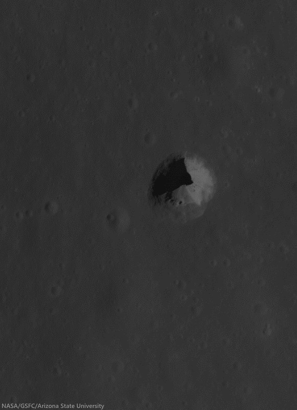
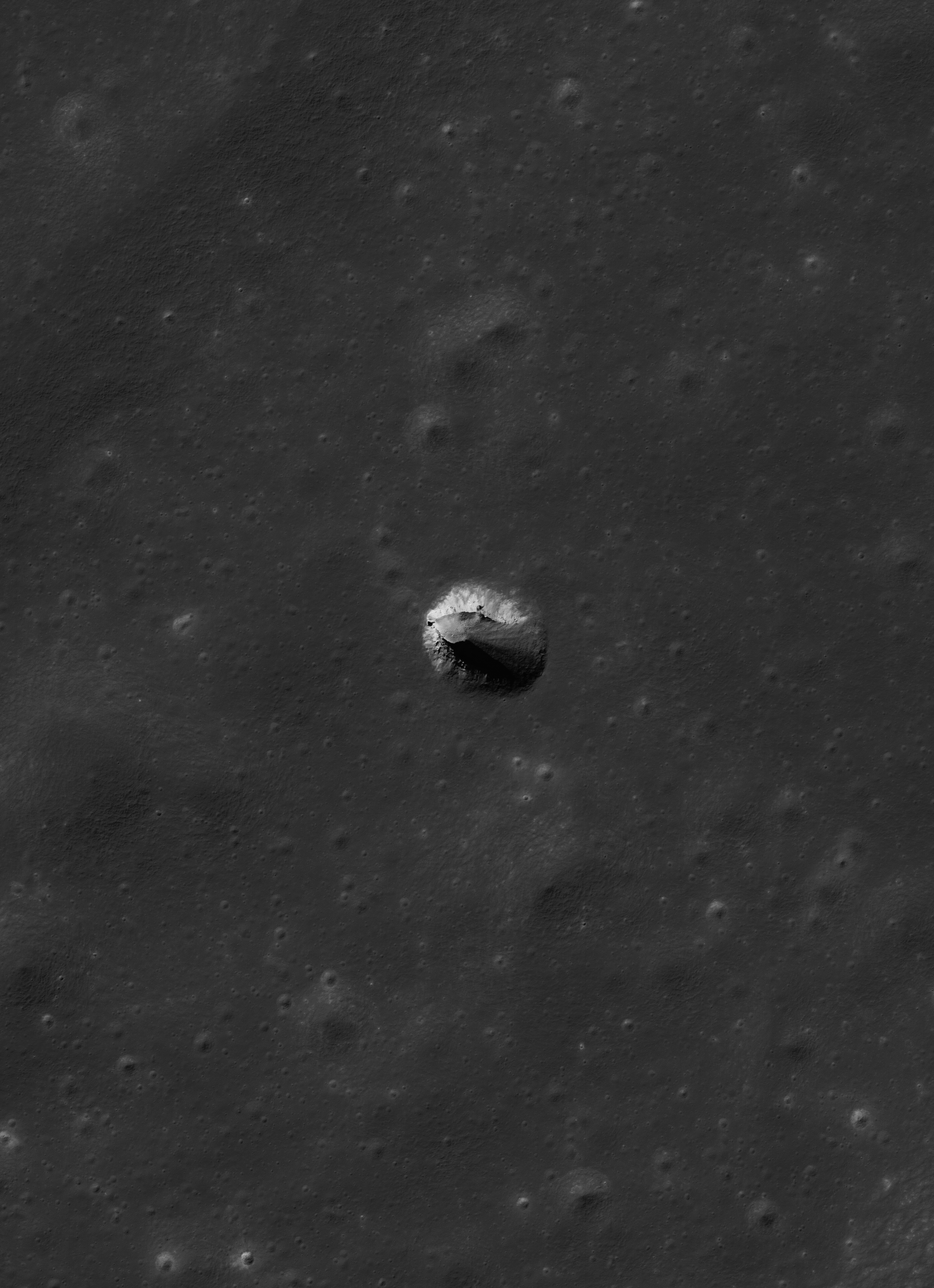
What may be a newly resolved "pit crater," similar to at least three other unique features found elsewhere on the Moon. This one is near the equator in Mare Fecunditatus (0.92°S, 48.66°E). The nearly circular 110 meter-wide opening may or may not narrow in diameter further into its interior. LROC Narrow Angle Camera (NAC) observation M1107960917R, (at 180%) LRO orbit 11562, November 19, 2012; angle of incidence 62.93° from 108 km [NASA/GSFC/Arizona State University].
Joel Raupe
Lunar Pioneer

It’s time to inventory the Moon’s “pit craters.” The first, the "Haruyama," or "Marius Hills pit crater" (14.065°N, 303.224°E) is in a sinuous rille immediately west of the famous shield volcano range in Oceanus Procellarum.

A second and third have now been found and photographed from many angles, in Mare Tranquilitatis (8.34°N, 33.22°E) and Mare Ingenii (35.95°S, 166.06°E), respectively.

It appears the LROC team at Arizona State University uncovered another, over the past year, out on the vast equatorial plains of Mare Fecunditatis (0.92°S, 48.66°E).

This is remarkable for a number of reasons, not least among them the mission’s elapsed time. As of this writing LRO has completed 17,801 orbits around the Moon. Without knowing the exact percentage of the lunar surface yet to be photographed by the LROC Narrow Angle Cameras – it’s remarkable a 110 meter wide target could have been missed until relatively recently.

That is it might seem remarkable, until we consider some basic “beta angles,” so to speak, some basic mission priorities and logistics.

Location of a possible pit crater in a 155 km-wide field of view of northwest Mare Fecunditatis. LROC QuickMap 250 meter per pixel resolution [NASA/GSFC/Arizona State University].
The target is within a single degree south of the equator. Obviously a spacecraft in polar orbit is going to see its orbital pathways and targeting opportunities converge directly over the poles, conversely those same opportunities will be at their greatest distance apart at the equator.

A closer look through one particularly fine set of LROC Wide Angle Camera passes over target (arrow), the feature is just visible in this imperfectly merged monochrome (604 nm) WAC mosaic swept up during three sequential orbital passes; from 47.4 km altitude. Resolution roughly 55 meters, 63° angle of incidence; field of view a little over 40 km, from west to east [NASA/GSFC/Arizona State University].
Secondly, this has got to be one of the Moon’s great “Rub’ al khali's,” an empty quarter, which must have seemed nearly void of inviting targets, with very inviting targets nearby, particularly to the west, where the fascinating Messier and Messier A craters reside. The east rim of Messier B is only a little over 20 kilometers directly to the west. The desire, even the need, to slew the spacecraft and camera’s off nadir to examine these and other nearby targets is reason enough for the pit to have been overlooked.

Then there’s the target itself, which brightens considerably between a 30° and 0° angle of incidence. Under the highest sun, near noon, and again, very near the equator, the target looks like what it may in fact be: an unusual but still rather commonplace nearly fresh crater.

It proves, yet again, that there are still great new discoveries yet to be made on the Moon.

Raw rendition of the LROC NAC observation which may have touched off further interest in a new "target of opportunity," in the months that followed. The pit crater in Mare Fecunditatis shows up on the very edge of this frame from orbit 13087, April 28, 2012. LROC NAC M190280022L, 62.93° angle of incidence, 1.09 meters resolution from 108.01 km [NASA/GSFC/Arizona State University].
Having to guess just what drew their interest, the target seems to have been photographed at high resolution April 28, 2012, in orbit 13087. Amazingly, the pit was nearly missed. You can see the north half of the target at the very top of LROC Observation M190280022L, HERE.

By last fall it seems the pit was directly targeted under three lighting conditions, the first, last September, must have seemed disappointing. With the Sun only five degrees from directly overhead what little topography might be seen on target and in the region may have seemed washed out in shadowless albedo contrasts. If this was a pit crater the “ledge,” if any, was not overshadowing.

First full close-up released to the PDS shows a brightly lit interior, and little to no depth. But the Sun was high, and the location less than a degree south of the equator. LROC NAC M1103245601L, orbit 14902, September 25, 2012, angle of incidence 7.765° at 0.94 meters resolution, from 108.88 km [NASA/GSFC/Arizona State University].
A month later the Sun was a little more favorable. LROC NAC M1105602888L, orbit 15232, October 23, 2012; angle of incidence 35.18° at 0.93 meters resolution from 108.28 km [NASA/GSFC/Arizona State University].
After yet another month, the mid-morning Sun is at an even greater angle. Shown at its original resolution, this is the image at the top of the post. LROC NAC M1107960917R, orbit 15562, November 19, 2012; angle of incidence 62.93° at 1.1 meters resolution, from 108.01 km [NASA/GSFC/Arizona State University].

Related Posts:
Impact melt collapse pit (March 2, 2012)
Failed Skylights of Copernicus (January 24, 2012)
New view of Sinas pit crater (November 11, 2011)
Sublunarean Void (February 7, 2011)
New views of lunar pits (September 14, 2010)
How common are mare pit craters? (July 15, 2010)

Tuesday, August 21, 2012

NASA awards funding for sub-surface exploration by Astrobotics, among 28 needed innovation studies

Close-ups of the Tranquillitatis pit crater (8.337°N, 33.219°E), LROC Narrow Angle Camera (NAC) observation M155016845R, LRO orbit 7979, March 17, 2011. The interior is seen under a high Sun (incidence angles around 10.58°) and at resolutions close to 47.4 centimeters per pixel, from 39.67 kilometers. LROC QuickMap link [NASA/GSFC/Arizona State University].
Astrobotic Technologies has announced a contract with NASA to develop technologies for exploring caves on the Moon, Mars, and beyond. Astrobotic was one of ten teams to be selected for phase II awards from NASA's Innovative Advanced Concepts (NIAC) program.

NASA also announced funding for 28 innovative programs under the NIAC label.

Planetary caverns and tunnels can provide shelter from micrometeorites, radiation, and thermal extremes for human and robotic explorers. They may be the best hope for habitation on the Moon. They could be the best place on Mars to find life. They can provide a window into a planet's past geology, climate, and even biology. Recently discovered skylights, formed by partial cave ceiling collapse, provide access to sub-surface voids. In a phase I study for NASA's NIAC program, Astrobotic developed several mission concepts and investigated key technologies for exploring these exciting planetary destinations.

In phase II, Astrobotic will detail a mission concept for entering a planetary cave through a skylight, and exploring and modeling the interior. "Skylights are gateways to wonders of exploration, science and resources that await beneath planetary surfaces", said Red Whittaker, Astrobotic CEO. "Robots are our access to those new worlds." Robotic technologies will be developed to explore the extreme terrains of skylights and caves. This is very different from surface exploration, as has been achieved on the Moon and Mars. Technologies will be developed to descend into the holes, negotiate the blocky floors, and thread into the tunnels. The company will also roadmap technology for future planetary cave exploration missions. Astrobotic will collaborate with experts in subterranean robotics at Carnegie Mellon University on this contract.

Saturday, May 5, 2012

The new Kaguya Terrain Camera tours

Still from the 16:9 spectacular Kaguya terrain camera video tour of the Reiner Gamma albedo swirl in Oceanus Procellarum. The presentation does an excellent job showing the apparent link between the swirl and the morphology of the Marius Hill to its northwest [JAXA/SELENE].
Japan's space agency JAXA recently published a handful of spectacular, new highly realistic 3D tours from Terrain Camera data returned from SELENE-1 (Kaguya 2007-2009). Since Kaguya met its end in a guided impact visible from Earth in 2009, sporadic updates to the Kaguya Image Gallery, where mission science, presentations and a sampling of HDTV are available, have been few. 

The Japanese language side of the gallery is always updated first, so it took a little intuition for us to find the useful link to the new products. These are also comparatively large video files (20Mps MPEG, ~100 mg). Unable to view the best of these new presentations following the Flash linkage, the stand-alone files can download for viewing locally . It's worth the effort. A user can "right hand click" the links below to save the video files directly.


If you don't want to bother with all that and still want a renewed taste of Kaguya's still-unique and valuable contributions - not the least their addition to the aesthetics and appreciation for the beauty of Earth's Moon - don't neglect the Kaguya YouTube videos, starting with the famous Earthrise from 2008.

While in the neighborhood, a new and improved Kaguya terrain camera tour of the wider vicinity of the Marius pit, situated within a sinuous rille winding through the heart of the Marius Hills, is also worth the time.

Tuesday, January 24, 2012

Failed skylights of Copernicus

More than mere melt fracture, a narrow skylight among myriad melt fractures in the chaotic interior of the familiar nearside landmark Copernicus, at a resolution of 40 centimeters per pixel from 25.4 kilometers, August 18, 2011. LROC Narrow Angle Camera observation M168333206L; illumination from the southwest (bottom left) of directly overhead, angle of incidence 38.23° [NASA/GSFC/Arizona State University].
Joel Raupe
Lunar Pioneer

The LROC targeting team had already extensively mapped the interior of Copernicus before the brief period last August when the low point in the LRO polar orbit was reduced by half, sometimes below 25 kilometers. Copernicus might be the most photographed lunar crater after Tycho. Both of these relatively young impact craters are difficult to miss in any view of a waxing Moon seen from Earth. Both craters center on extensive and bright ray systems, and Tycho's being the youngest of the two can be picked out with the naked eye.

Copernicus, though larger than Tycho, seems less intense, almost smudged, and, indeed, it is more faded a more along in years, nearly old enough for the inevitable effects of space weathering to have gardened its face with optical maturity.

The interior, slumped terraced walls, rim and some of the ejecta blanket of Copernicus as seen in one of the very first LROC Wide Angle Camera (WAC) mosaics released by Arizona State University in early 2010. At its roughly 800 million year age Copernicus, namesake of the "revolutionary" polish astronomer Nicolas Copernic (1473-1543), has lent its name to the Copernican Age on the lunar timescale, that relatively recent and relatively sparse period of bombardment. Its interior is flatter in the north than at the south and features three central peaks. A bifurcated pattern to its rays system and topography has led some to speculate at least two progenitors of nearly equal size were involved in this impact event [NASA/GSFC/Arizona State University].
As LROC team member James Ashley was spotlighting the melt fractures of Jackson crater earlier this month we were already performing a survey of the same features on the floor of Copernicus, particularly within the crater's north-central and "more featureless" interior. The melt fractures within Copernicus seem more extensively gardened, and may have formed in a somewhat different way than those at Jackson. At Copernicus there seems to have been, or still may be, voids under the impact melt, and some evidence of what may be bubbling, places that seem to be half-submerged solid rubble on the floor of Tycho, for example, may be place where gases were trapped for a time, escaping after the impact melt had rapidly cooled and solidified.

The north central floor of Copernicus only seems less distinctive than the jumbled topography of its surroundings. Barely visible in this LROC WAC monochrome (643 nm) image is a web of fractures and channels throughout the most level terrain above. A 35 km-wide field of view from LROC WAC observation M147109260C, orbit 6813, December 16, 2010; resolution 60.3 meters per pixel at an incidence angle of 78° from 43.13 kilometers [NASA/GSFC/Arizona State University].
Both the north and south ends of this 42 meter-wide exposed fracture on the floor of Copernicus are nearly buried or are not quite as wide as this section. While its tempting to see the western side as an overhang, and despite the apparent differences in the opposing edges, the exposed rift is likely only slightly deeper and more shadowed. There is evidence enough for voids under the floor of Copernicus but the more obvious clues have been pulverized by space weathering and moon quakes since the crater's formation. LROC NAC observation M157730473L, orbit 8379, April 18, 2011; angle of incidence 24.32° on a field of view 270 meters wide at a resolution of 0.47 meters from 37.85 kilometers [NASA/GSFC/Arizona State University].
Is this 300 meter-wide feature on the floor of Copernicus a crater, a void shaken to collapse or a little of both? Apparent layering in rapidly cooling impact melt may be a result of differing arrival times of the melt. LROC NAC M168333260L [NASA/GSFC/Arizona State University]. 
The area of interest on the floor of Copernicus is distinguished by its melt fractures, many obvious and others mysterious. The traces of these fractures are often marked with pits, their openings too shadowed or narrow to measure - even discovering whether any are really open at all and what may lay below awaiting future exploration. Between the two "pits" appears to be a spot long collapsed - but what if anything actually collapsed? Also from LROC NAC M168333206L [NASA/GSFC/Arizona State University].
Zoom in, out and around this area of interest in Copernicus using the LROC QuickMap, HERE, in views like the one below.


Tuesday, December 27, 2011

More LROC close-ups from August

LROC Narrow Angle Camera (NAC) "footprints"
narrowed to those unprecedentedly low (25 km)
altitude observations gathered last August, seen
here in Google Earth.
Joel Raupe
Lunar Pioneer

Since the 8th 'tri-monthly' Data Release by teams flying instruments on-board LRO on December 15 we've been rushing to sample the latest set of LROC Narrow Angle Camera (NAC) footprints to discover what's new.

After downloading the newly-updated NAC and WAC footprint KML's for viewing with the Google Earth program (through the Planetary Data System (PDS) the first temptation is to try to take it all in. But that's like examining every square nanometer of a basketball with a microscope. So we tried, once again, to begin instead by taking note of new NAC observations of our ever-growing list of favorite targets.

And yet, this latest release was more highly anticipated than any since the Commissioning became the Nominal LR mission in late 2009. Before being redeployed to a more fuel efficient higher orbit in January, last August flight directors reduced the spacecraft's orbital perilune to within 25 kilometers for a brief time. This made possible an even closer examination of three of the six Apollo landing sites, the subject of a NASA news conference in September.

What wasn't generally discussed at the time, however, was what else might have been photographed at 40 centimeters per pixel resolution and greater last August.

Most of the full width of LROC Narrow Angle Camera (NAC) observation M168570575R, orbit 9976, August 21, 2011; incidence angle 37.14° with an original resolution of 0.3994 meter per pixel from 23.98 kilometers. The white rectangle is the smaller field of view shown at the original resolution in the image immediately below. At this low altitude, where LRO was flown for only a brief time last August, it's necessary to step back quite a long way to appreciate the context, in this case a north-south 1000 meter-wide cross-section of the unofficially named "Sinuous Rille A" feature in the Marius Hills region of Oceanus Procellarum [NASA/GSFC/Arizona State University].
The boulder-shedding southern edge of "Sinuous Rille A" as viewed from only 24 kilometers above on August 21, 2011. The original layering of the the surrounding greater Procellarum basin as excavated by more "recent" flows from the Marius Domes is clearly exposed. The smallest features distinguishable are only 40 centimeters in size. The first of the "pit craters" discovered on the Moon here by Japan's Kaguya orbiter team in 2009 is located elsewhere on the floor of this rille. (Field of view only 230 meters) [NASA/GSFC/Arizona State University].
We've been pouring over those images, many of which can be seen using LROC web-based tools, since December 15. A first look seemed to show a rather haphazard, seemingly thin set of targets, taking advantage of a daylight perigee over the equator, in mid-August, with a few exceptions, like the Ina caldera, which stood out enough for us to have taken note of it in a post last week. Over Christmas weekend, as we began collecting notes about what stands out in these low altitude NAC frames from August, LROC principal investigator Mark Robinson posted "Aristarchus Spectacular," featuring a breathtaking mosaic of that landmark nearside crater's bright interior from late in the low altitude orbital maneuver. (We hastily added a few snips to our mirror post that we had already collected showing the same area in even higher resolution taken from an August close-up).

To appreciate the volume of data in dire need of crowd sourcing the basics are worth repeating: According to the December 22 announcement, by LROC investigator Ernest Bowman-Cisneros, "(t)he 8th LROC Planetary Data System (PDS) release includes images acquired between 16 Jun 2011 and 15 (Sept.) 2011" including "83,010 EDR images totaling 8.5 Tbytes and 83,010 CDR images totaling 17 Tbytes... To date, the LROC team has released a total of 586,217 images (EDR) totaling 64.7 Tbytes. The complete LROC PDS archive can be accessed via the URL http://lroc.sese.asu.edu/data/."

Context: Color LROC WAC Digital Terrain Model (DTM) 64, showing the location of a massif pictured below, just outside the central ring of mountains surrounding the deep interior basin of Mare Orientale. The area was imaged at unusually low altitude by both NAC and WAC LROC cameras last August, around the time of the now-seasoned orbiter's unprecedented 10,000th orbit around the Moon [NASA/GSFC/Arizona State University].
The LROC Wide Angle Camera (WAC) was along for the ride last August, when LRO's orbit was briefly lowered to within a 25 kilometer perigee. On August 21 LROC swept up this 4000 meter-high massif just beyond the northeastern interior of Mare Orientale (9.5°S, 91.64°W), seen here in a mosaic at 604 nm from three sequential passes averaging 33.4 kilometers above. The resolution averages around 48 meters per pixel [NASA/GSFC/Arizona State University].
A bit of cutting and pasting allowed the filling in of this LROC NAC footprint (M168808506L and R) in three dimensions. The area within the white square is detailed below [NASA/GSFC/Arizona State University].
The very steep slope of the unnamed massif blown up to 2 meter per pixel resolution does little justice to the original. LROC NAC M168808506R, orbit 10011, August 20, 2011; illumination incidence angle 32.96° with a raw resolution of 44.2 centimeters per pixel from 33.2 kilometers [NASA/GSFC/Arizona State University].
At full resolution, the boulder and it's interrupted trail down the south face of the massif show signs of space weathering. It's by no means the most spectacular feature in the August lower altitude NAC frames [NASA/GSFC/Arizona State University].
It's a lot of data to sort through, yet again breaking LRO's own already well-established record for having returned more data from deep space than all of mankind's probes sent beyond low Earth orbit put together.

There are boulder trails, to be sure, and though it may be only our imagination but there seems to be more than a random share of small, bright impact craters in the set. The best candidate for the impact crater formed by the Apollo 15 lunar module ascent stage, for example, was swept up yet again. As we begin to sort out our notes in greater order we look forward to posting better examples from this unique set. Like every other lunatic following LRO's steady progress we look forward to seeing and reading what Robinson's LROC team at Arizona State has uncovered in these frame also.

Now that's an interesting boulder trail! From only 23 kilometers overhead, a chunk of ring-bound upthrust the size of a passenger trail locomotive has rolled down and pitted this shallow incline near the dead center of Mare Serenitatis. The August "close-up window" enjoyed briefly by LROC's NAC system seems to have had its advantages centered on the nearside longitudes and just beyond either limb. LROC NAC M168081909R, LRO orbit 9904, August 15, 2011; incidence angle 46.74° with a resolution of 39 cm per pixel from 23.06 kilometers [NASA/GSFC/Arizona State University].
Related Posts:
LRO sweeps down for a closer look at Apollo sites
August 13, 2011
Low-altitude views of Apollo released
September 3, 2011
LRO Briefing: Latest close-ups of Apollo sites
September 6, 2011
Skimming the Moon
New views of Apollo 12
Apollo 14 at 25 cm per pixel
On the rim!
September 8, 2011