Showing posts with label mounds. Show all posts

Friday, July 11, 2014

"Donut Hole" structures on the floor of Harriot B

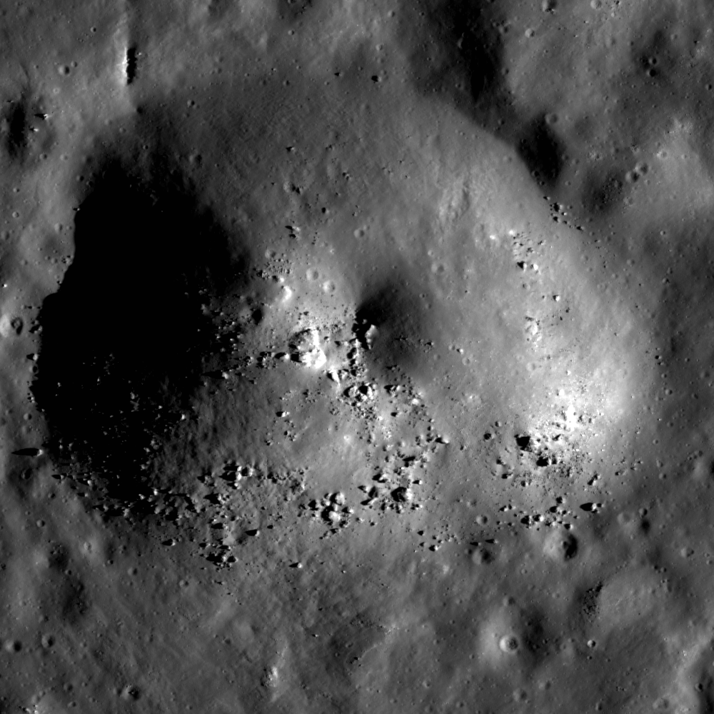
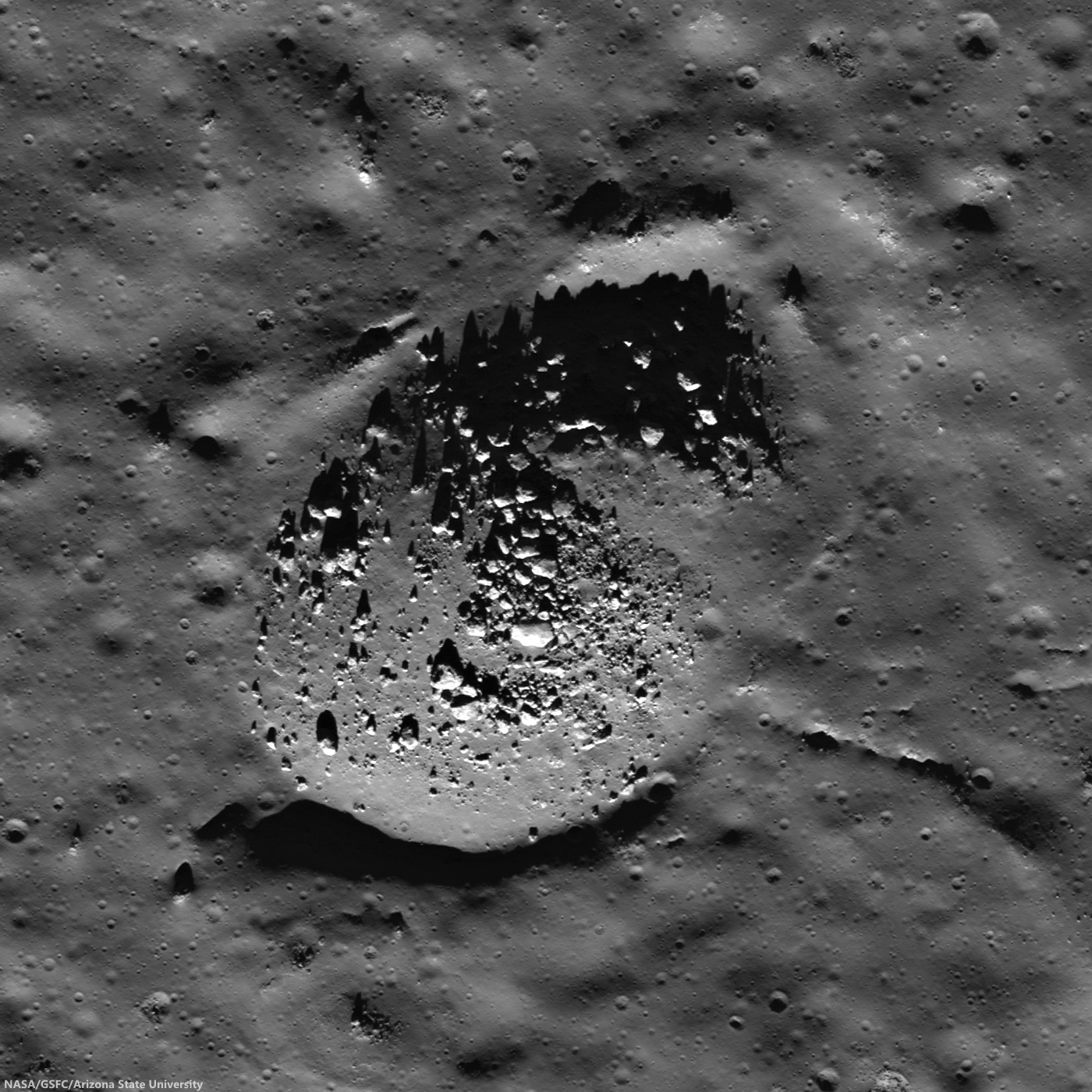
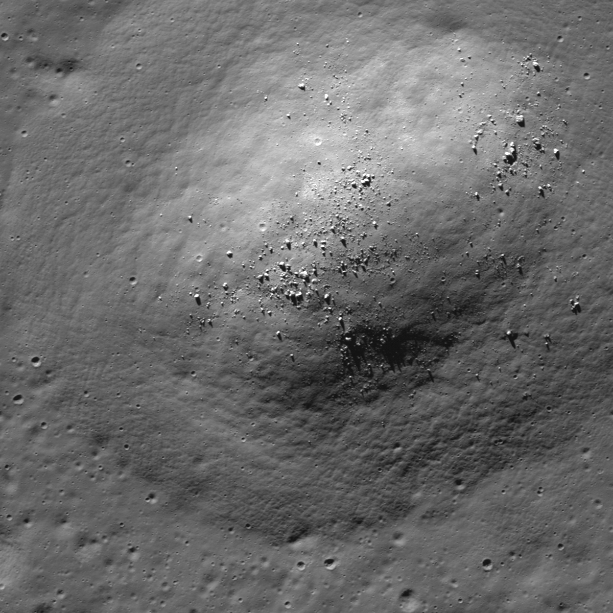
Some among kilometer-sized mounds on the floor of Harriot B (38.1 km; 33.356°N, 114.41°E), in the farside highlands. LROC NAC observation M180430508R, LRO orbit 11710, January 5, 2012; 78.76° incidence angle, resolution 1.57 meters from 159.56 km over 33.77°N, 114.38°E [NASA/GSFC/Arizona State University].
Raquel Nuno
LROC News System

The planets in the Solar System are continuously bombarded by space rocks. This violent process early on formed the planets by accretion, and impacts still shape the surface of terrestrial and icy bodies today.

Since the Moon lacks an atmosphere it preserves the impact history record of the inner Solar System. However, this record is less than complete; volcanic resurfacing and crater saturation of the surface erase part of the record. Ancient volcanic activity, resulted in massive outpourings of lava over parts of the Moon, filling in and covering old craters beneath layers of basalt. Crater saturation is a term used by scientists to describe a point after the planetary body has been completely covered with craters of a certain size such that every new crater of that size overlaps an older one, obliterating the evidence of the older craters' existence. 

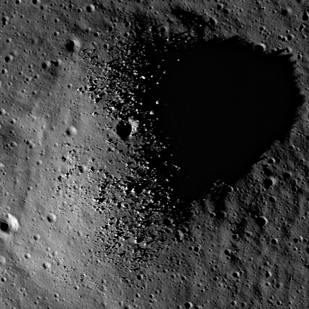
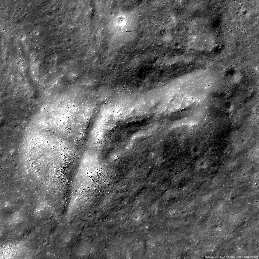
A full-width view of LROC NAC observation M180430508R [NASA/GSFC/Arizona State University].
Today’s featured image is a portion of the central mounds, ~1 km in diameter, found on the floor of crater Harriot B, a highland crater located at 33.356°N, 114.410°E.

These mounds are likely weathered central peak formations. Central peaks form by the gravitational collapse of the crater walls which pushes material into the center of the crater and from the rebound of the floor; both of these events occur at the time of crater formation during the modification stage of the crater.

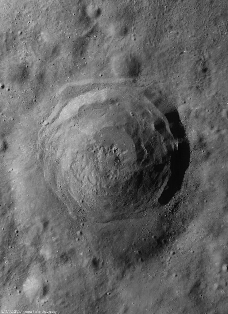
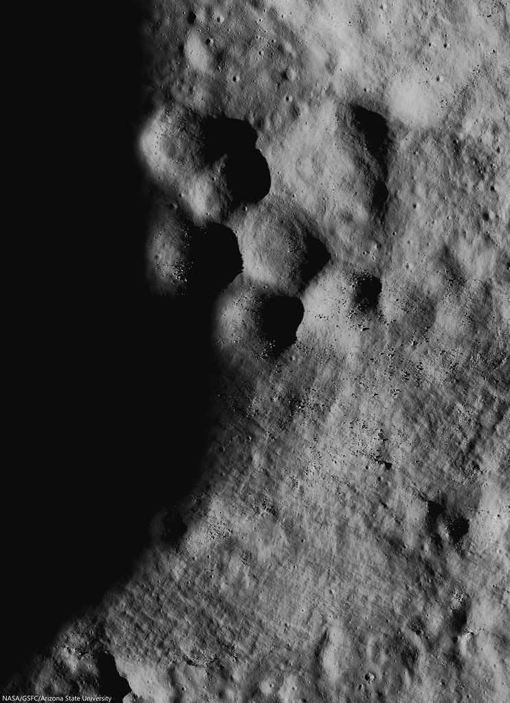
A more recent, lower incidence angle LROC NAC mosaic of the floor of Harriot B. LROC NAC mosaic M1159343420LR, LRO orbit 22787, July 7, 2014; 59.56° incidence angle, 1.4 meters resolution from 114.29 km over 33.39°N, 114.56°E [NASA/GSFC/Arizona State University].See the larger reproduction HERE. [NASA/GSFC/Arizona State University].
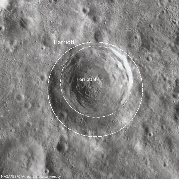
Harriot B crater formed, slightly off center, over the much older and degraded Harriot crater (see the WAC context image below). The older crater's walls have slumped down, resulting in a rounded rim, in contrast to Harriot B’s sharp rim. Since Harriot has a greater diameter than Harriot B, 53 km and 38 km respectively, we can assume the impactor that formed Harriot B had less energy (less mass, less velocity, or both) than the impactor that formed Harriot.

Superposition of Harriot by Harriot B. The inexorable erasure of the Moon's surface very often strikes more suddenly than the 3 cm every 2 million years "gardening" rate of micro-meteorite and superluminal bombardment, established in the Apollo era. The concentric and near concentric "hole in one" of "macro-bombardments" occurs more often than seems obvious at first glance. 97 km-wide field of view from LROC WAC-derived imagery shows how the formation of Harriot B fit nicely in the bounds of older Harriot, and the coincidence may have had some, as yet undetermined role in the morphology of mound "clusters" on the floor of the latter [NASA/GSFC/Arizona State University].
Succeeding impacts will ensure that the visible evidence of Harriot crater will cease to exist.  This becomes a problem when using crater counts to date planetary surfaces.  Once a surface reaches crater saturation, scientists can only estimate a lower bound for how young the surface is.

Wide angle view of Harriot B (33.356°N, 114.409°E), nested inside only slightly larger Harriot crater, in a stark demonstration of the principle of superposition in stratigraphy. LROC WAC mosaic from sequential 55.3 km passes over the area of interest in LRO orbits 11201 and 11202, November 25, 2011; incidence 67.6° at 55 meters resolution [NASA/GSFC/Arizona State University].
One day, Harriot B will suffer the same fate as Harriot.  A new impact will erase it, along with its central mounds that deliciously look like donut holes. The Moon’s surface is a dynamic place, because it seems static in human-appreciable timescales this is easily forgotten.  So, let’s enjoy Harriot B’s central formations while they’re still around, check out the full resolution NAC below:


Related Posts

Tuesday, April 8, 2014

One in a Million Mounds

Boulders, most 10 to 20 meters across, pepper the flanks of a cratered mound on the northern bifurcated floor of Copernicus crater. LROC NAC observation M1139037292R, field of view roughly 1100 meters across, LRO orbit 19933, November 14, 2013; resolution 1.12 meters per pixel at 67° illumination incidence from 119.38 km [NASA/GSFC/Arizona State University].
J. Stopar
LROC News System

A domical mound protrudes from the floor of Copernicus crater (see 10.332°N, 340.117°E), which is dominated by a solidified sea of impact melt rocks. 

These rocks host a variety of positive- and negative-relief features including collapse features, central peaks, and blocky cratered mounds like the one above. 

Mounds with craters near their peaks can superficially resemble volcanoes, which often have a summit crater. Previously, several examples of cratered mounds, usually located along the mare-highlands boundaries, were suggested as possible newly discovered volcanoes (Volcanoes in Lacus Mortis, Bull's Eye Crater or Volcanic Vent, Another Small Volcano).

Cratered and Boulder dome on northern bifurcated floor of Copernicus (small arrow, above center). The demarcation between the character of the western and eastern floor, north of the landmark twin central peaks of Copernicus are particularly striking in spectral analysis. LROC WAC observation M147109260CE (643 nm), spacecraft orbit 6813, December 16, 2010; angle of incidence 77.97° at 60 meters per pixel resolution from 43.13 km [NASA/GSFC/Arizona State University].
This mound remains unexplored, thus we don't know for sure how it formed. Below is a collection of lunar mounds that are similar in appearance. For each example, try to think about how (or why not) these features might shed light on the formation of the cratered mound in Copernicus.

1. Volcanic Dome?

The summit crater of a volcano is expected to lack a raised rim and is usually less circular than an impact crater. Some small domes at the Compton-Belkovich silicic volcanic complex have craters that are thought to be summit vents (Example 1).

Example 1: A cratered and blocky dome at the Compton-Belkovich silicic volcanic complex, in the farside highlands. 510 meter-wide field of view from LROC NAC mosaic M119198897LR, LRO orbit 2700, January 27, 2010; resolution 60 cm per pixel, incidence angle 76.56° from 54.09 km [NASA/GSFC/Arizona State University].
Low basaltic shield volcanoes like those in the Hortensius region also have summit craters (Example 2). The crater on the Copernicus mound lacks a prominent rim crest, but high-resolution NAC-derived topography would better help us differentiate between a degraded impact crater and a volcanic crater in this case.

Example 2: Mare domes of Hortensius, west by southwest of Copernicus, in Oceanus Procellarum. Low profile, basaltic shield volcanoes, from a dramatic LROC NAC oblique observation, about 16.6 km-wide field of view from a mosaic of the left and right frames from LROC NAC M1108418130, spacecraft and camera slewed 56.7° west of a descending nadir, LRO orbit 15626, November 24, 2012; illumination incidence angle 74.56° at an average resolution of 2.87 meters, from 112 km over 7.28°N, 332.85°E [NASA/GSFC/Arizona State University].
2. Cratered Impact Debris?

Impact debris often appears dome-shaped and sometimes lacks craters (Example 3), although these mounds are frequently cratered.

Example 3: Bouldery Mound in Anaxagoras. 910 meter-wide field of view from LROC NAC M155309869RE, LRO orbit 8022, March 21, 2011; incidence angle 72.1° and resolution 88 cm per pixel from 42.15 km [NASA/GSFC/Arizona State University].
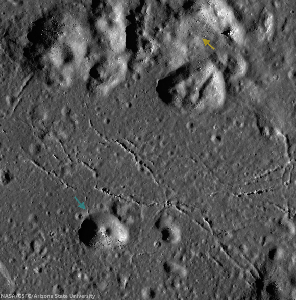
Larger mounds to the north of Today's Featured Image also exhibit craters near their peaks (Example 4). This type of cratered mound is fairly common on the floor of large impact craters.

Example 4: Similar debris and impact melt fallout mounds observed to the north (yellow arrow) of the bouldery mound (blue arrow) on the north floor of Copernicus. Both are comprised of impact debris and wall materials. Image is cropped portion of LROC NAC controlled mosaic COPERNICLOB [NASA/GSFC/Arizona State University].
3. Blocks as Remnants of Impact Melt that Once Draped the Mound?

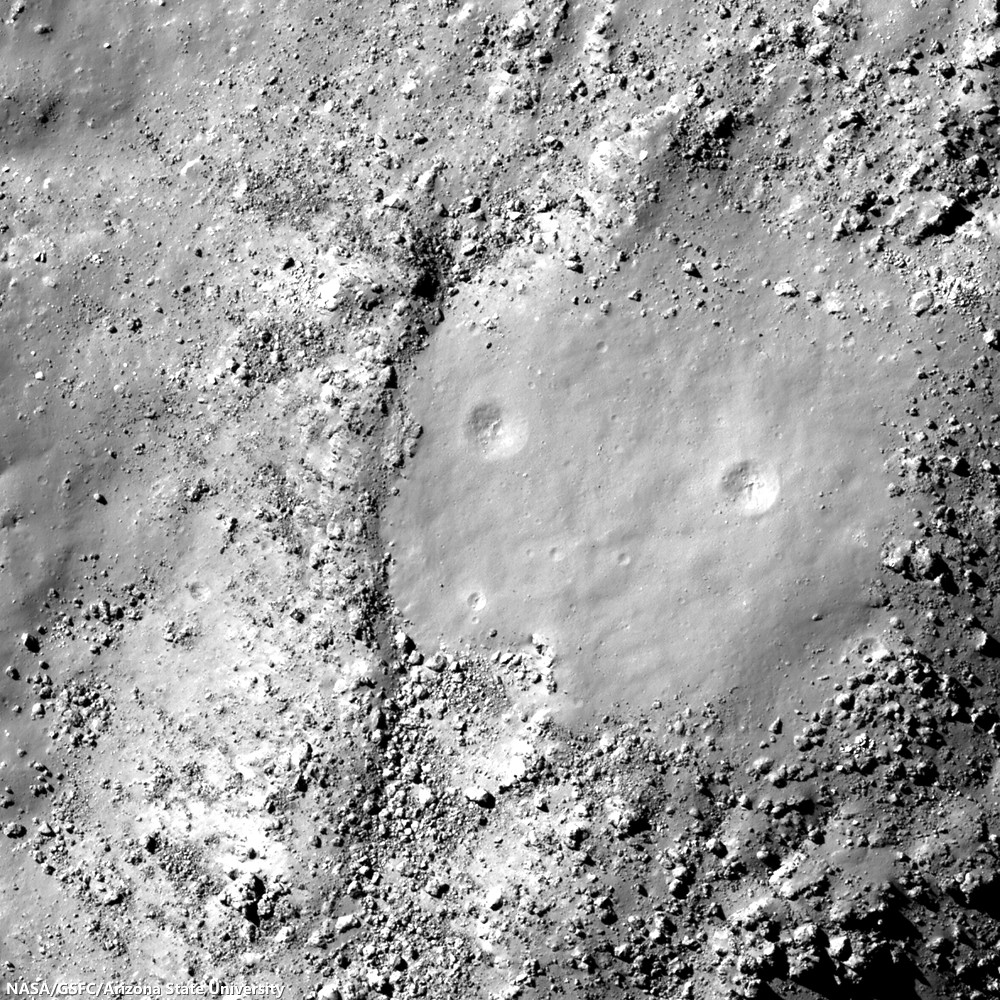
Lumpy mounds on the floor of Rutherfurd crater (Example 5) are littered with the broken fragments of impact melt rocks. These rocks formed as sheets of impact melt draped over the crater floor. Over time, this sheet of rock slowly breaks up and dis-aggregates.

Example 5: The Lumpy floor of Rutherfurd crater; 1050 meter wide field of view from LROC NAC observation M1123653329R, LRO orbit 17769, May 20, 2013; resolution 1.05 meters, incidence angle 81.13° from 50.43 km [NASA/GSFC/Arizona State University].
A cracked mound on the floor of Anaxagoras crater (Example 6) illustrates what this sheet of melt might look like before dispersion through mass wasting. The boulders on the Copernicus mound could represent degraded bits of draping impact melt rocks; however, there is little evidence for a coherent layer of solidified melt as in the Anaxagoras example.

Example 6: Cracked mound on the floor of Anaxagoras; 600 meter-wide field of view from LROC NAC M122273232L, LRO orbit 3153, March 3, 2010; resolution 49 cm per pixel, incidence 73.78° from 42.18 km [NASA/GSFC/Arizona State University].
4. Squeeze-ups of Impact Melt?

Squeeze-ups of molten rock are one possible form of pseudo-volcanism that might occur in a molten sea of impact melt (Example 7).

Example 7: A possible squeeze-up of impact melt in Tycho crater; field of view 730 meters,  LROC NAC observation M1144856403R, LRO orbit 20751, January 20, 2014; illumination incidence angle 57.92° at 72 cm per pixel resolution, from 59.2 km [NASA/GSFC/Arizona State University]. [NASA/GSFC/Arizona State University].
However, squeeze-ups tend to experience tensional stress across their peak (Example 8), but in the Copernicus example, we do not see any evidence of stress fracturing across the mound. Thus, when all the evidence is considered together, the cratered mound in Copernicus is most consistent with a block of impact debris with a small impact crater near its summit -- not volcanic at all!

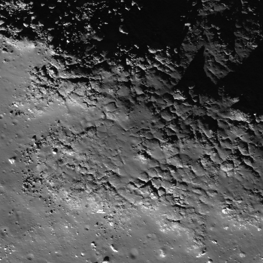
Example 8: Fractured mound in Stevinus crater; Structure is roughly 3 km across, LROC NAC observation M1131495601R, LRO orbit 18872, August 18, 2013; resolution 78 cm,  incidence 37.88° from 75.5 km [NASA/GSFC/Arizona State University].
Explore the entire NAC image HERE, and look for evidence of other explanations for this cratered mound.

Some Related Posts:
Shiny Mound, April 3, 2014
Hansteen α, January 15, 2014
Jackson's complexity, January 9, 2014
X marks the spot on the floor of Stevinus, January 7, 2014
Diversity of basaltic volcanism and the Marius Hills, November 5, 2013
Fall Out, October 3, 2013
That's a Relief, October 1, 2013
The Domes of Stevinus Crater, April 23, 2013
The Fourth Marian Dome, April 17, 2013
New oblique views of Gruithuisen Domes, March 4, 2013
Kagami-Mochi on the Moon, February 12, 2012
Morphology of lunar volcanic domes, February 22, 2011
Anomalous Mounds on the King Crater Floor, May 3, 2011
Constellation ROI at Hortensius Domes, April 2, 2010

Friday, February 17, 2012

LROC: Cracked mound at Anaxagoras

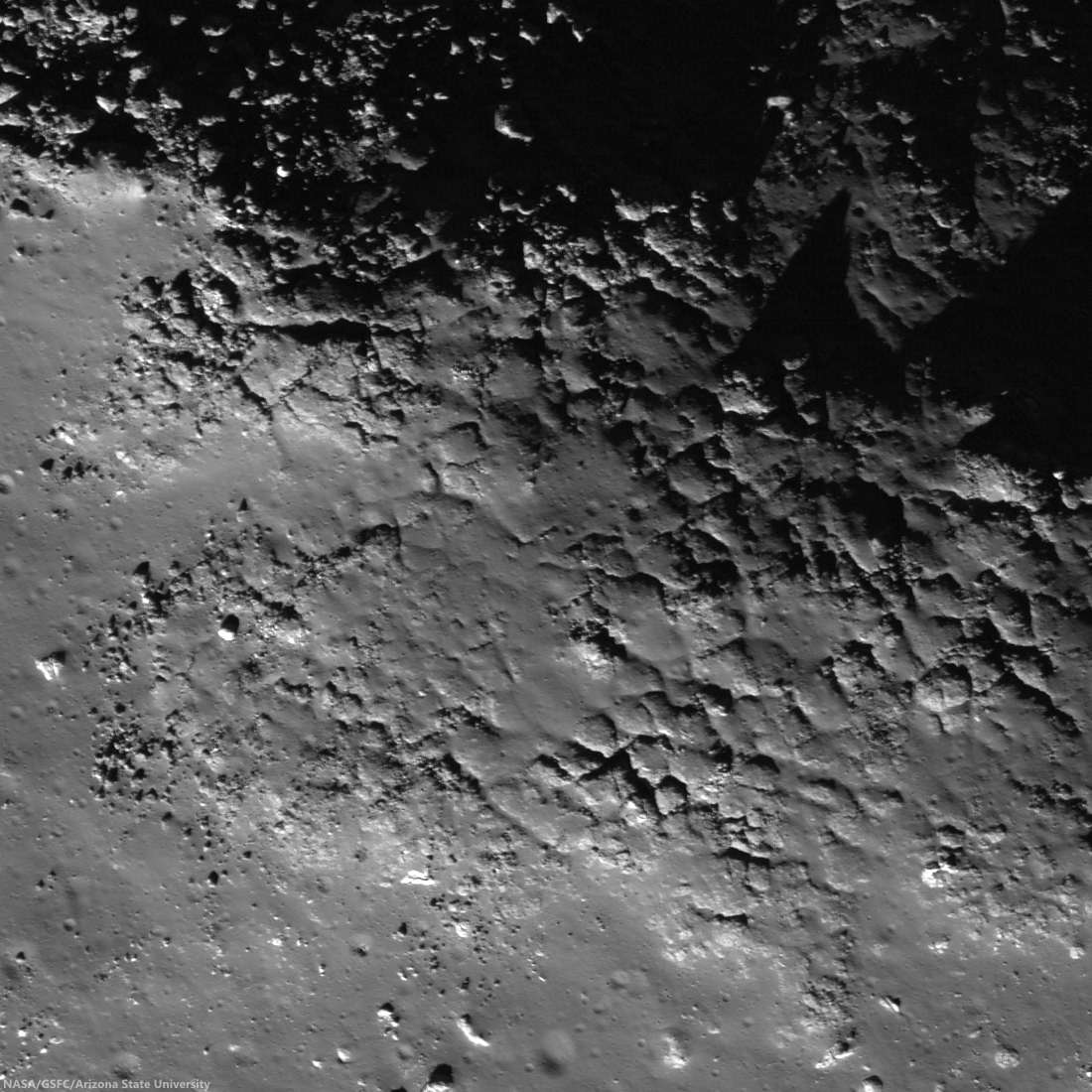
Top of a mound with fractured impact melt on the floor of Anaxagoras (75.46°N, 349.94°E). Image field of view 600 meters with sunlight from the south-by-southwest viewed at an incidence angle of 73.78° (nearly as high above the horizon as the Sun gets at such northerly latitudes. LROC Narrow Angle Camera (NAC) observation M122273232L, orbit 3153, March 3, 2010; resolution 0.49 meters per pixel from an altitude of 42.18 kilometers. View the larger (1100 x 1100) original LROC Featured Image HERE [NASA/GSFC/Arizona State University].
Hiroyuki Sato
LROC News System

The irregularly fractured surface in today's Featured Image is on top of a north-western oriented slightly elongated mound on the floor of crater Anaxagoras (image center is 73.748°N, 349.522°E). Anaxagoras (diameter ~ 50 km) is located about 700 km north of Mare Imbrium. The floor of Anaxagoras has an irregularly-shaped central peak. Other portions of the floor are filled with debris and impact melts.

The cracked surface covers only the top portion of the mound. The northern flank of this mound (see figure below) is almost completely covered by boulders, and southern flank is smooth with only a few boulders (as seen in the left hand image below). Why did the cracking happen only at the top of the mound?

One possibility is that the cracked portion is a splashed remnant of impact melt. A solid crust formed where the melt was thickest, and then later, as melt drained downslope, the cracks formed as the crust collapsed.

Context from the larger (LRO NAC M122273232L) frame showing the vicinity the Featured Image field of view (blue box).  A conventional stretch is above; below, the same image stretched to enhance details in the shadowed area. Each FOV width is slightly less than 2000 meters [NASA/GSFC/Arizona State University].
LROC WAC monochrome (604 nm) mosaic stitched from 10 sequential orbital passes March 21, 2011, showing a roughly 80 km-wide view of Anaxagoras an vicinity, situated on the rim of Goldschmidt on the east. Image center is 72.4°N, 350.0°E. The the location of the area detailed in the LROC Featured Image is indicated by the yellow arrow [NASA/GSFC/Arizona State University].
The interior of Anaxagoras crater was a Constellation program Region of Interest. With so many exciting features like this one, Anaxagoras crater is an excellent place for humans to explore!

Explore this irregularly cracked ridge and lots of other spectacular impact melt morphologies NAC frame HERE.

Related Posts:
Craggy Peak, Impact Melts
Splash and flow
Chaotic crater floor in Tycho
Polygonal fractures on Tycho ejecta deposits
Impact melt in Anaxagoras crater
Exposed Fractured Bedrock in the Central Peak of Anaxagoras Crater

This low-altitude (31 km) oblique view south from Japan's lunar orbiter SELENE-1 (Kaguya) is an excellent illustration of the difficulty in gauging scale in lunar photography. Anaxagoras could be a backyard brick barbeque pit in disrepair, or an astronaut's few foot steps away. Instead the crater is 50 kilometers wide and hundreds of kilometers away in this HDTV frame from 2009. View the release-size image HERE [JAXA/NHK/SELENE].

Wednesday, February 15, 2012

LROC Kagami-mochi on the Moon!

Eroded mound on the wide flat floor of Antoniadi, the crater that the Moon's lowest elevations. Field of view 1.03 kilometers, sunlight from the north over this farside site within the ancient South Pole-Aitken impact basin. LROC Narrow Angle Camera observation M154024477R, orbit 7832, March 6, 201; image center 69.380°S, 184.678°E, resolution 0.86 meters from an altitude of 54.6 kilometers. View the larger Featured Image HERE [NASA/GSFC/Arizona State University].
Hiroyuki Sato
LROC News System

Today's Featured Image highlights a circular mound with about 1.1 km in diameter, located on the floor of Antoniadi crater. Central portion, about 650 m across, consists of steeper hemispherical dome, and shallower outer skirt. This unusual feature looks like a flattened kagami-mochi (A Japanese new year decoration composed of two flat circled rice cakes, the smaller placed atop the larger). How did this  mound form?

Antoniadi crater is about 143 km in diameter, and is located in the south portion of South Pole-Aitken basin. The central circular portion of the crater floor, about 55 km across, is relatively flat and smooth, formed as a very fluid mare basalt flooded the floor and then hardened. The mound in today's Featured Image is found on this flat surface. Perhaps the mound started out as a small pyroclastic cone, and was covered by late stage lavas? How did the skirt form? There are still many mysteries on the Moon. As LRO collects more measurements the seemingly odd features, like this kagami-mochi mound, will become more familiar.

SELENE-1 (Kaguya) Terrain Camera (TC-044-3) view across the floor of Antoniadi. The faded and small yellow arrow designates the location of the mound in the LROC Featured Image. The crater a lower center is Antoniadi A, an otherwise normal crater for its roughly 11 km width and age, except its floor hosts the Moon's lowest elevation below global mean (-9094 meters). View an enlarged version HERE [JAXA/SELENE].
LROC Wide Angle Camera (WAC) mosaic with WAC-derived DTM false color (GLD100) elevation encoding showing Antoniadi and it's deep surroundings well within South Pole-Aitken impact basin. Crater center is 69.38°S, 186.47°E. [NASA/GSFC/DLR/Arizona State University].
Many similar shaped mounds are found on Antoniadi's smooth and flat floor, but are relatively rare on other mare surfaces. Why only in this particular crater? The reason might be due to the relatively young age, this mare basalt is younger than 2.6 billion years. Over time such small features will erode into the background due to the relentless effects of micro-meteorite impacts which work to equalize topographic features.

Find other kagami-mochi shaped mounds in the full NAC frame yourself!

Related Posts:
Shiny Mound
Pancakes in a melt pond
Anomalous mounds on the King crater floor
Farside Highlands Volcanism!

Friday, November 18, 2011

LROC: Shiny Mound

Northeastern edge of a high-reflectance mound within "driving distance" of the Apollo 15 landing site on the southeastern frontier of Mare Imbrium. Downslope is to the upper-right. (Field of view 1512 meters across). LROC Narrow Angle Camera (NAC) observation M106869873R, LRO orbit 890, September 6, 2009; resolution 1.26 meters per pixel, incidence angle 36.72° from an altitude of 153.64 kilometers. View the much larger, full size LROC Featured Image HERE [NASA/GSFC/Arizona State University].
Hiroyuki Sato
LROC News System

At the southeastern edge of Mare Imbrium, about 25 km west of Rima Hadley, there is a small shiny mound on a dark and flat mare basalt plain which looks like a white sand island in the middle of a black ocean. This mound is about 2.7 by 2.2 km across. 

Normally fresh slopes and fresh ejecta have high reflectance due to less space weathering but this mound is brightest at its highest elevations and not down the slopes, brighter than nearby ejecta implying the mound is composed of higher-reflectance materials than mare basalts. Then how was this shiny island was formed?

Whole view of high-reflectance mound centered at 25.482°N, 1.684°E (Field of view about 5.3 kilometers. See the original LROC context image HERE, also from LROC NAC frame M106869873R [NASA/GSFC/Arizona State University].
Most likely, the mound is a remnant of highlands sticking through the mare, a hummock of plagioclase-rich highlands materials was embayed by mare basalt volcanism, burying all except its summit. If so, mare basalt is overlapping the mound's skirt. 

Can you see the an overlap contact in today's Featured Image?

An oblique view from a simulated low altitude looking northeast over the LROC WAC 100 m monochrome Global Mosaic affixed to LOLA topography, using NASA's ILIADS program. The bright mound is near the center of the view, with the Hadley Rille Valley and the landing site of Apollo 15 in the background. Does the angle of this view seem familiar? [NASA/GSFC/Arizona State University].
Unfortunately, the contact is not clear or sharp. Over time such sharp contacts are blurred by micrometeorite bombardment. If we are lucky, in the future, a small impact may occur right at the contact once again revealing the sharp contact. Or perhaps a future explorer might take a shovel to this spot and settle the question!

Explore this shiny mound in the full NAC image!

Related posts:
Farside Highlands Volcanism!
Up from the depths
Hortensius Domes - Constellation ROI

Thursday, May 12, 2011

Pancakes in a melt pond


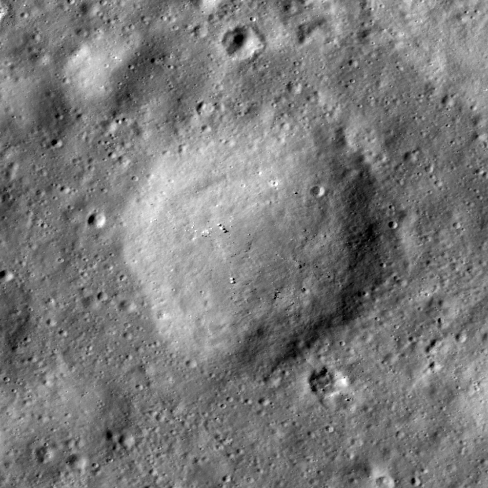
Pancake-like mound in Stevinus crater (33.03°S, 54.07°E). LROC Narrow Angle Camera observation M104162457R, LRO orbit 512, August 6, 2009; solar incidence 62°, field of view about 870 meters [NASA/GSFC/Arizona StLinkate University].

Hiroyuki Sato
LROC News System

The central peak of Stevinus crater is surrounded by a very flat and smooth floor. Small hummocks, fractures, and wrinkled textures all suggest that the flat and smooth floor is a frozen impact melt pond. However, small details in the floor show that the impact melt is not perfectly smooth. Just after the impact event, molten rocks and fragmented breccias were mixed together within the forming crater cavity. Think of a huge frying pan with this mix of molten and solid materials sloshing about. Slowly the melt solidified by surface cooling. If you look carefully you will find numerous pancake-like mounds on the smooth floor. What are they? Pancake mounds were likely created during the impact event, but the actual process is unknown. Did half solid, half molten rock lumps fall into the pond? Perhaps magma moving under the crust tried to push up and out of the crust as the crater floor readjusted? Or what if the pancake-like mounds were formed by slumping caused by small impacts over time?


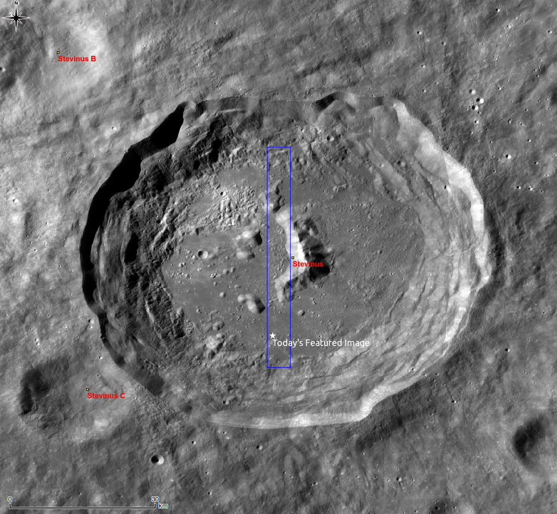
LROC Wide Angle Camera Global 100 meter resolution monochrome mosaic of 77 km Stevinus. The blue rectangle and star indicate the location of entire NAC frame and the LROC Featured Image released May 11, 2011, respectively. View the full-sized LROC WAC context image HERE [NASA/GSFC/Arizona State University].

Explore the boundary of mare basalts by viewing the full NAC frame!

Related posts:
Mounds in a melt pond
Impact melt features in Tycho crater's floor
Anomalous mounds on the King crater floor


Simulated view courtesy of Google Moon showing the view, looking north from near the location of the LROC Featured Image of the Pancake Mound, south of Stevinus central peak. The north inner wall beyond towers nearly 5 kilometers higher in elevation above the crater's floor, 50 kilometers away.