Showing posts with label basalt layering. Show all posts

Tuesday, December 30, 2014

The mystery of lunar layers

Close-up of Silver Spur (bottom) shows linear “bedding” coincident with topography, suggesting it is real. Its stratigraphic significance is still unknown. From panorama of photographs taken during the initial "Stand-Up" EVA, a 360° survey of the Hadley Rille Delta Apollo 15 landing site from the top hatch of the lunar module Falcon just after midnight (UT), July 31, 1971. Dave Scott's panorama included the layered component atop Mons Hadley Delta, whose slopes 5 km east he and Jim Irwin would later sample and explore [NASA/JSC].
Paul D. Spudis
The Daily Planet
Smithsonian Air & Space

In northern Arizona, a spectacular region of exposed, layered rocks over 6,000 feet thick was carved by the Colorado River. Aptly called the Grand Canyon, it represents over a billion years of Earth’s history. Geologists are able to study the history of past ages in exquisite detail by reading the historical record found in that well-known natural landform. No matter the planet, geologists are always searching for layered rocks. The study of rock layers (stratigraphy, from strata, meaning rock layers) allows scientists to reconstruct the geological history of a region and over time, an entire planet.

The nature of the Moon does not lend itself well to the display of rock layers, yet considerable effort has been expended searching for outcrops. Most layered rocks on the Earth are created from water-laid or wind-blown sediments, and neither of those processes occurs on the Moon. Still, the lunar surface has been built up piecemeal by the sequential deposition of blankets of ejecta—the ground-up rock thrown out radially from the center of impact craters and basins during formation. The overlap relationship of these ejecta deposits allows scientists to reconstruct the history of the Moon, i.e., younger impact craters overlie older ones. This simple methodology has allowed us to decipher the stratigraphy of the Moon.

Exposed layering in an outcrop from the rim of the west wall of Rima Hadley (Hadley Rille). A newly inter-laced Apollo 15 image from a panorama of 500 mm black and white photographs at a range of 1400 meters away, on the opposite rim, at Science Station 9a. Dave Scott, August 2, 1971. Features in this view were successfully compared with LROC NAC observations of the area from low lunar orbit [NASA/JSC].
Parallel bedrock outcrops 50 km southwest of the Apollo 15 landing site, from LRO in orbit 38 years later. (From "Layers near Apollo 15 landing site,") The orbital view shows distinct outcrops occurring at different topographic levels within the rille, strongly suggesting the presence of rock layers. The image of the western rille wall by Dave Scott (above) clearly shows a layered outcrop, about 15 meters thick. Several lines of evidence suggest these lavas are the oldest in the region, about 3.84 billion years old. LROC NAC observation M113941548LE, LRO orbit 1925, November 27, 2009; incidence 59.35° at 50 cm resolution, from 46.04 km over 24.65°N, 2.42°E [NASA/GSFC/Arizona State University].
Given that geologic history, one might expect that some evidence of rock layering was found in the abundant data returned from the Moon, but such evidence is limited and ambiguous. One of the most startling finds during the Apollo missions was a breathtaking view of Mt. Hadley, a lunar mountain north of the Apollo 15 landing site. Astronauts Dave Scott and Jim Irwin were startled to see evenly spaced, sub-horizontal lines in the mountain, similar in appearance to fine-scale layering present in some terrestrial strata. It looked as though the mountain was a single, gigantic crustal block, uplifted and overturned by the impact that created the nearby Imbrium basin. The layering described by the astronauts greatly intrigued the mission scientists, who were unable to clearly see it in real time in the TV pictures sent to Earth.

When the crew returned to Earth, images taken on the surface dramatically showed this layering (above, below). But this presented scientists with a puzzle. Because large impacts are highly energetic, chaotic events, how could they generate evenly spaced, regular layering? Some team members began to suspect that something else was going on. Ed Wolfe and Red Bailey of the U.S. Geological Survey made scale models of the mountain and dusted it with cement powder. They then photographed it under low, oblique illumination, similar to the lighting conditions of the landing site during the mission. Surprisingly, fine-scale linear features were evident in the laboratory “mountain” (above, right), suggesting that the “layering” seen by the astronauts on the Moon may have been an illusion, caused by the low-angle illumination of a particulate, granular surface.

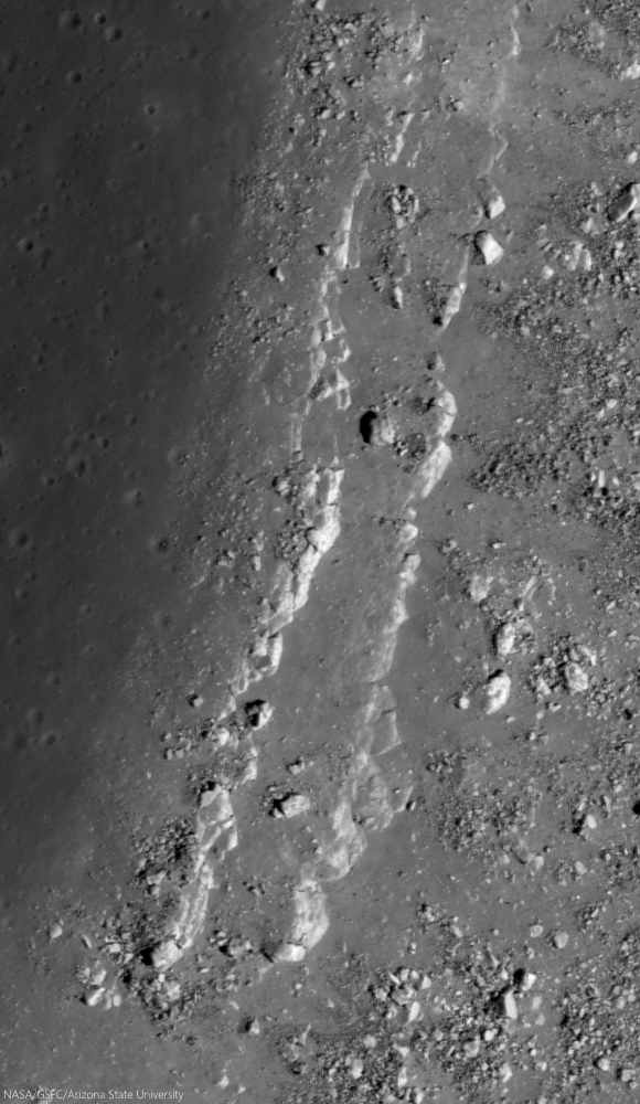
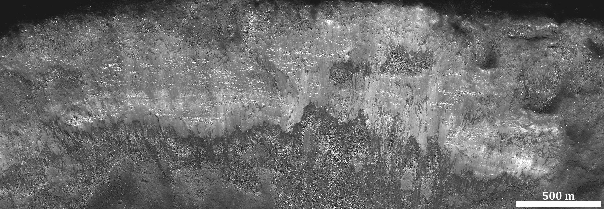
Stratified outcrops steadily shed house-sized boulders from the central peak of Hausen crater (163.24km; 65.111°S, 271.509°E) the formation of which may have excavated among the Moon deeper vertical columns (29 km), in part because of its location on the rim of South Pole-Aitken impact basin. The deepest materials brought to the surface here might include examples of the Moon's mantle, the original material between the Moon's crust and core; time capsules of the Moon's history before the formation of Hadley and the nearside basins. LROC NAC Commissioning observation M105100555LR, orbit 643, August 16, 2009; incidence 72.47° at 48 cm resolution, from 41.38 km over 64.94°S, 271.84°E [NASA/GSFC/Arizona State University].
Full-width mosaic from LROC NAC M105100555LR shows a roughly 1100 meter deep drop from the heights of Hausen's central peak to an intermediate slope of talus in a field of view 2.5 km across [NASA/GSFC/Arizona State University].
Other layered deposits at the Apollo 15 site were less amenable to explanation as an artifact of lighting. A ridge southeast of the landing site named Silver Spur displayed a set of topographic “benches” associated with its apparent layering (below). On Earth, the formation of a bench indicates differential erosion, with hard rocks making up the cliff-forming units and softer rocks being expressed as more gently sloping units. However, such an erosive pattern on the airless, waterless Moon is difficult to envision. To this day, we do not have a good explanation for the origin of Silver Spur. As an example of layering in the highlands, it remains problematical.

Clear and unequivocal layering was observed in the walls of Hadley Rille, a lava channel located near the landing site. In this case, it is easier to accept that we are looking at real layering—the rille cuts into a series of lava flows that cover the landing site (below). Lava flows make up layered deposits on Earth and there is no reason to assume that they wouldn’t do likewise on the Moon. In fact, the layering observed in the walls of Hadley Rille could be significant for another reason, one that may hold great scientific promise for future explorers.

The morphology of the "Aratus CA" collapse pit (24.55°N, 11.78°E) in Mare Serenitatis is unclear, but portions of its southwest rim include layered outcrop, perhaps including a long history of an early intermediate pre-Imbrium period and successive clues to the nature and timing of the catastrophes in our star system's early history called "the Grand Bombardment. 1.74 meter-wide field of view from LROC NAC Commissioning phase observations M104447576LR, LRO orbit 552, August 9, 2009; incidence 57.87° at 1.45 meters resolution, from 145.46 km over 25.15°N, 11.17°E [NASA/GSFC/Arizona State University].
A roughly 11 km-wide field of view from LROC NAC M104447576LR shows the outcrop in context with the larger Aratus CA feature in west central Mare Serenitatis, formed at early period and laid bare by relatively recent events that overburdened the Serenitatis interior [NASA/GSFC/Arizona State University].
After a lava flow is extruded on the Moon, it remains exposed to space. There, over millions of years, the impact bombardment of micrometeorites grinds the once solid lava into a powdery soil called regolith. Because the Moon has no atmosphere, this exposed soil layer contains a record of information about the Sun (gases called the solar wind implant atoms of hydrogen and other light elements in the dust grains) and the galaxy (from high-energy cosmic rays). When a layer is formed and then exposed to space for hundreds of millions of years and subsequently buried (like a time capsule) by another, younger lava flow, that earlier ancient regolith would contain information about the Sun and galaxy not as it is now, but as it was billions of years ago. The idea of an ancient, buried regolith (called a “paleo-regolith”) captured scientists’ imaginations—such a deposit would hold information from an interval of known position and duration in the past (determined by isotopically dating the lavas above and below the ancient regolith).

It appears that such an ancient, buried regolith exists in the walls of Hadley Rille. The lowest layers consist of ancient, relatively aluminous lavas called KREEP basalts. From the dating of Apollo 15 samples, we know that these rocks formed 3.84 billion years ago. Over this layered unit is a covered interval about 10-20 meters thick (a friable, slope-forming unit, like regolith). Above this slope-former are two massive rock layers, a thick massive unit and a thin, finely layered unit. These upper two units probably consist of mare basalt lavas of the two types found at the Apollo 15 site, both of which date to around 3.3 billion years. Thus, the regolith lying between these lava flows may hold the record of more than 500 million years of solar and galactic history, an interval from the distant early portion of Solar System evolution.
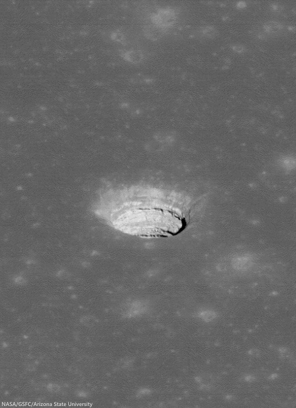
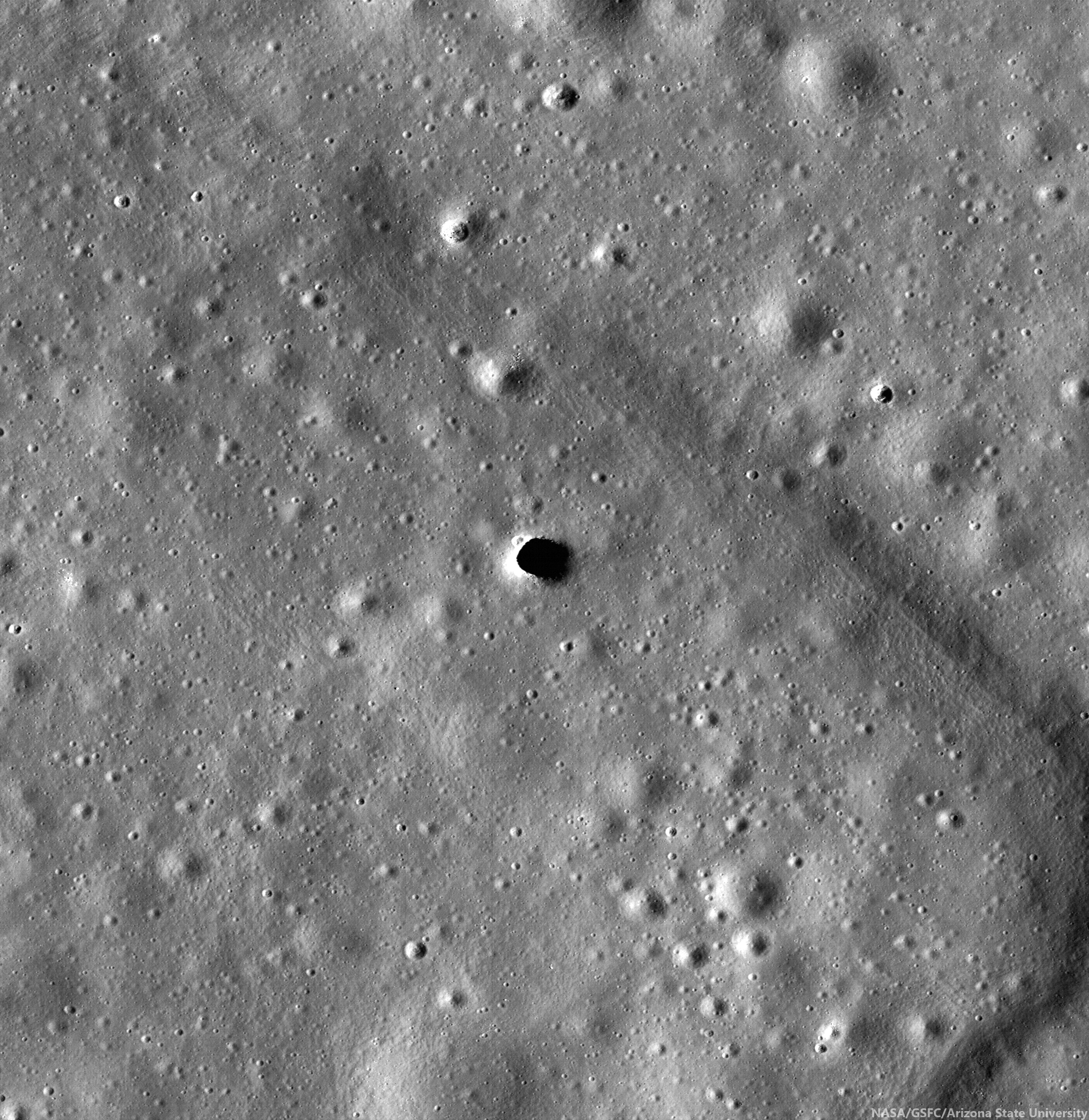
The now-notable original oblique view of the Tranquillitatis pit crater (8.34°N, 33.22°E), revealing, layer by layer the invaluable history of an area in the universe occupied by Earth. LROC NAC observation M144395745LE, LRO orbit 6413, November 14, 2010; spacecraft and camera slewed 50.46° from orbital nadir, incidence 47.91° at 81 cm resolution, from 44.23 km over 8.75°N, 35.02°E  [NASA/GSFC/Arizona State University].
In addition to the history of the Sun, this paleo-regolith would also contain fragments of impact-melted rocks and glasses from a distinct, bounded interval of lunar history. Such a sample would allow us to assess whether the impact flux on the Moon in this time period was comparable to or different from the current rate. Such information is relevant to understanding the impact history of the Earth, a factor that we know from lunar science to strongly influence the rate of evolutionary change. Astronauts descending into the rille could sample all of these units in turn, allowing scientists to reconstruct this ancient history in detail. In this sense, Hadley Rille would be analogous to Earth’s Grand Canyon—a slice into the deep time history of the Moon.

New high-resolution images of the Moon from NASA’s Lunar Reconnaissance Orbiter show that layered deposits, such as those seen in Hadley Rille, are common in the walls of rilles and impact craters occurring in the maria, where layered lava flows are expected. Finding layering in the highlands is more problematic, although some large ejecta blocks appear to consist of layered rocks, quarried out of the crust during impact. We seek such rock layering on the Moon for the same reasons that geologists look for them on the Earth—as time capsules to be carefully opened and read, giving us new insights into the complex history of the Moon.

Originally published as his Smithsonian Air & Space Daily Planet column, Dr. Spudis is a senior staff scientist at the Lunar and Planetary Institute. The opinions expressed are those of the author but are better informed than average.

Related Posts:

Friday, November 7, 2014

Exploring the lunar subsurface

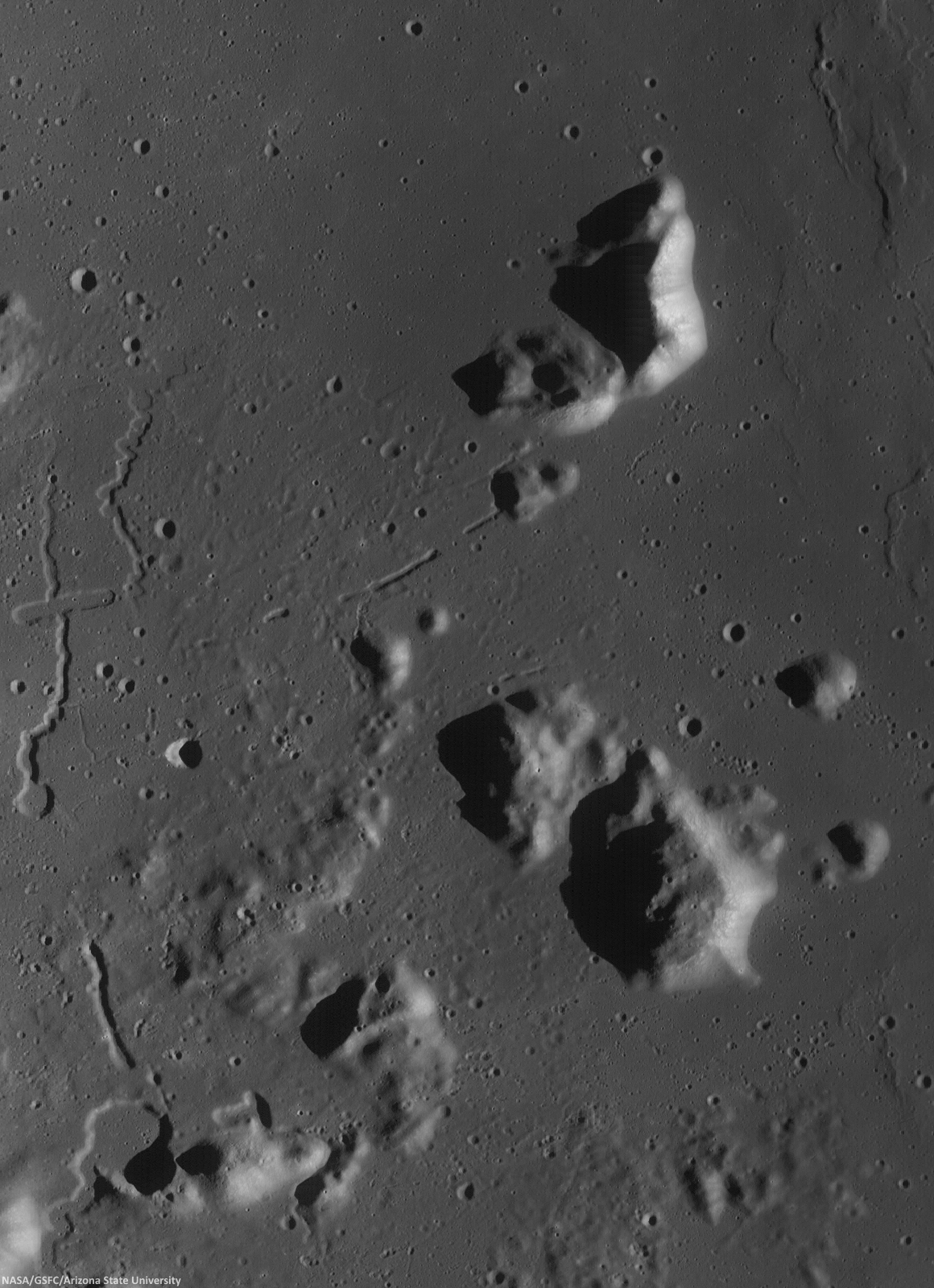
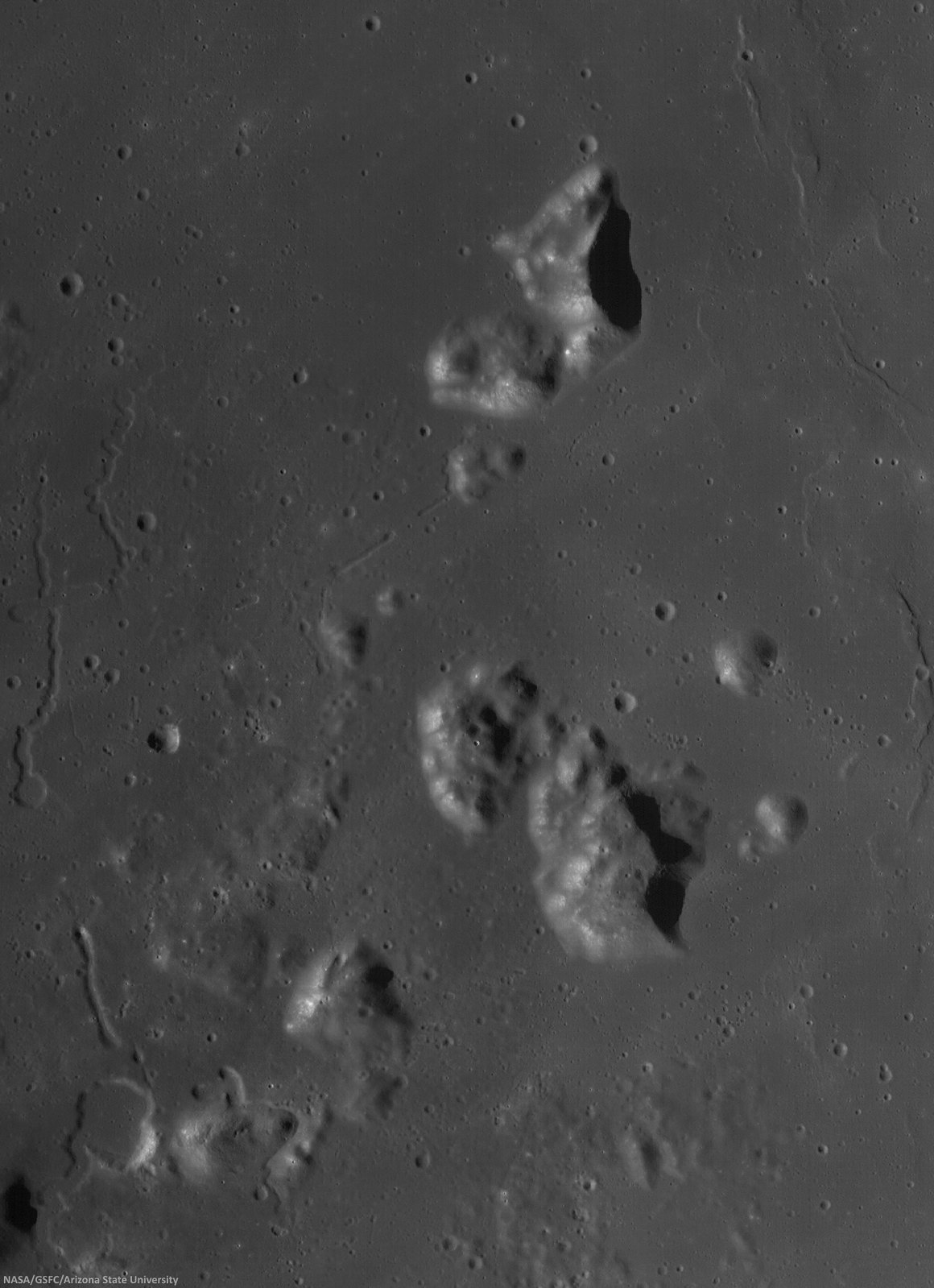
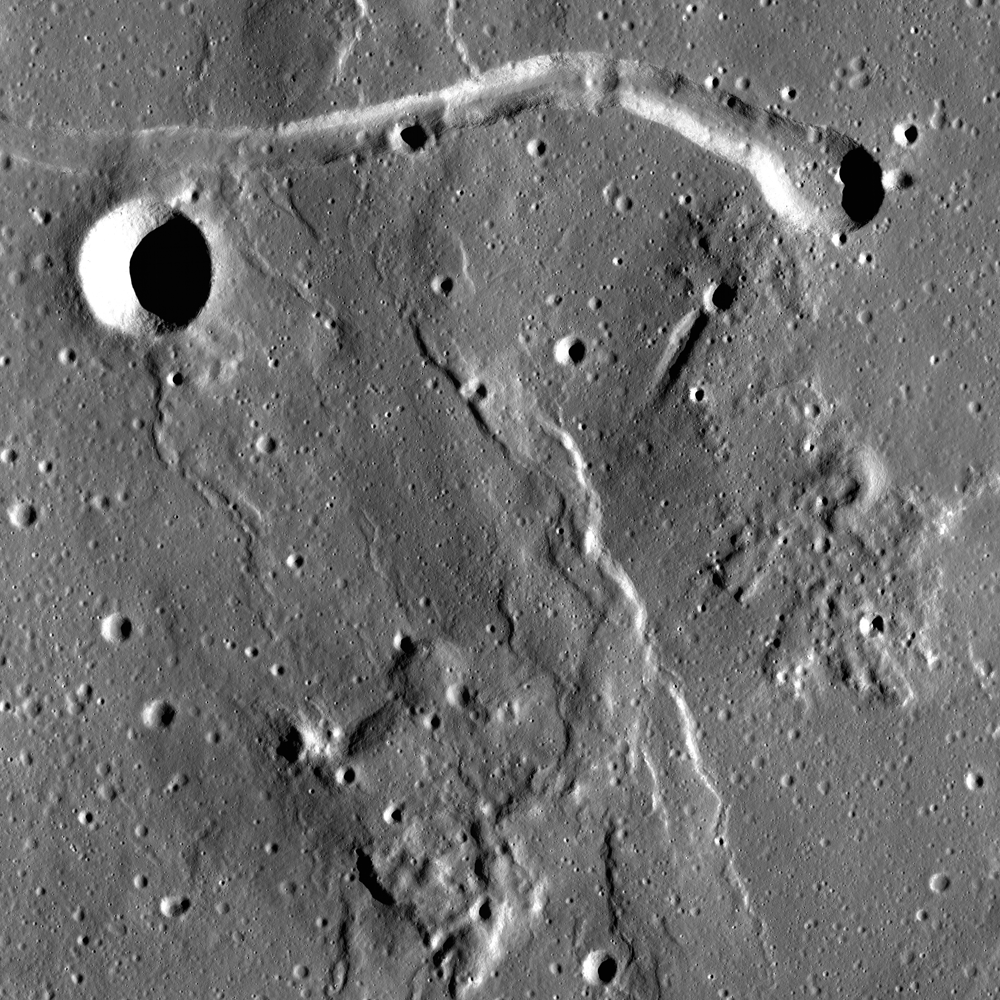
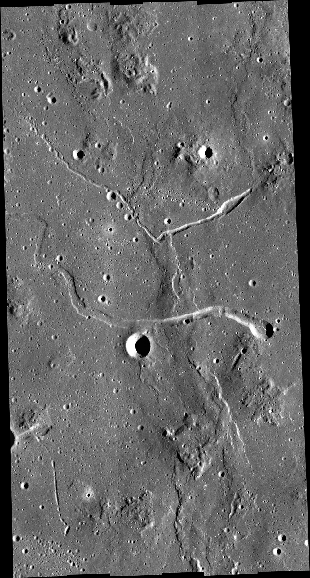
Two collapsed segments of a lava tube run from the southwest to the northeast, in the Rimae Prinz-Harbinger mountain region of Oceanus Procellarum (27.46°N, 318.33°E). These collapsed segments may provide access to the subsurface, which has never been directly sampled. The average width of the collapsed segments is ~650 meters. The lava tube is ~50 meters deep, seen in this 7 km-wide field of view from a mosaic of unreleased 2014 LROC NAC observation M1165080128 (L&R) [NASA/GSFC/Arizona State University].
H. Meyer
LROC News System

A lava tube is a volcanic conduit through which lava travels beneath the hardened crust of a lava flow. The presence of lava tubes on the Moon and beyond are inferred based on observations of terrestrial lava tubes, such as those found in Hawaii. Oftentimes, a rille suddenly disappears only to reappear a short distance away.

These are called discontinuous rilles and are thought to be areas where a lava tube collapsed. Collapsed lava tube segments may provide access to the subsurface, which is exciting as a possible site to collect rock samples that remain unaltered due to surface weathering (radiation, thermal cycling, micrometeorite bombardment).

Slightly differing, slightly lower resolution, 11.5 x 15.9 km field of view of the area of interest from a mosaic of LROC Narrow Angle Camera (NAC) observation M1152143995RL, LRO orbit 21776, April 14, 2014; resolution averages 1.33 meters per pixel, incidence angle 48.9° from 132.14 km over 26.86°N, 318.11°E. View the original 8706 x 12008 and an assortment of other sizes HERE [NASA/GSFC/Arizona State University].
Sunrise over Mons Harbinger. 65 km-wide field of view from mosaic of three LROC Wide Angle Camera (WAC) monochrome (604 nm) observations, swept up during three sequential orbital passes, December 7, 2011,  from 43 km; resolution 58 meters per pixel, incidence 77° [NASA/GSFC/Arizona State University].
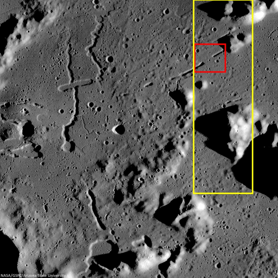
Context for LROC Featured Image released November 6, 2014, field of view in red, full field swept up in LROC NAC observations M1152143995R & L in yellow. LROC WAC mosaic [NASA/GSFC/Arizona State University].
The lava tube from the LROC Featured Image released November 5, 2014 is located to the west of Montes Harbinger, a large kipuka in Oceanus Procellarum, and to the east of the Rimae Prinz region.

The Rimae Prinz region displays exquisite sinuous rilles as well as other elongate depressions, indicating that there could be other lava tubes in the area.

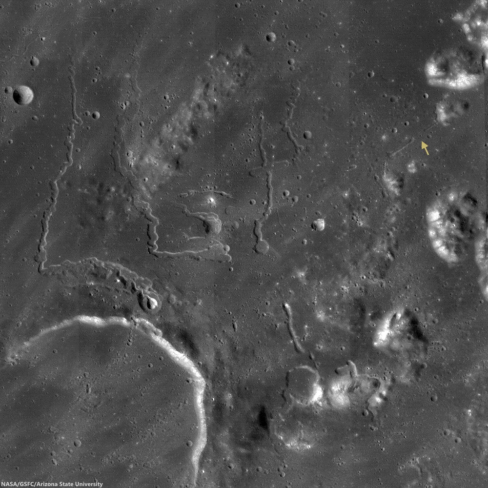
The Prinz, Rimae Prinz and Vera vent region, east of Aristarchus Plateau. The area of interest is marked with a yellow arrow, upper right in this roughly 120 km square field of view from the LROC WAC 100m global mosaic. the Vera vent 'cobra head' of Rima Prinz I rille (on the north-northeast rim of basalt-inundated Prinz crater, at lower left), is the subject of intense study (see HERE). [NASA/GSFC/Arizona State University].
The entire region, pictured above, is of interest for exploration for several reasons. The diversity of volcanic landforms in the area can tell scientists much about the volcanic history of the Moon. By collecting samples from the surface and subsurface in this region and by careful mapping on-site, scientists can better characterize the diverse basaltic lava flows in terms of both age and composition, which also helps us understand the timing and evolution of lunar volcanism and possible heterogeneities in the lunar mantle. Any time a sample is taken from a site on the Moon and age-dated, it can also be used to calibrate crater densities that are currently used to remotely age-date surfaces in the absence of direct sampling (both on the Moon and other planets).

Lava tubes are of particular interest in terms of human exploration because they are not only scientifically valuable, but they might also provide shielding from the radiation that poses a hazard to future explorers. Furthermore, the region surrounding the lava tube from this Featured Image also hosts large pyroclastic deposits, which are a potential in situ resource that will be critical to sustaining a human presence on the Moon.

Scientists and engineers are looking into the possibility of using the natural structure of the lava tube and associated resources (ISRU) to our advantage to construct habitats for explorers.

Explore the full NAC mosaic here! How many features of interest do you see?

Rimae Prinze Region - Constellation ROI
Discontiguous Rilles

Addendum: Under mid to late afternoon sunlight, another LROC WAC mosaic, swept up under conditions remarkably similar in scale with the third image from above, from the same period of low altitude opportunities the LRO mission afforded during orbital maneuvers in the second half of 2011. Differing sun-moon-spacecraft phase angles allows for an excellent comparison. This particular mosaic was also assembled from LROC WAC observations, but five months earlier, and from three sequential orbital passes, at 43 km altitude. The resolution is 59 meters, incidence angle 64° [NASA/GSFC/Arizona State University].

Tuesday, July 8, 2014

A rille to rover over near Rimae Hevelius

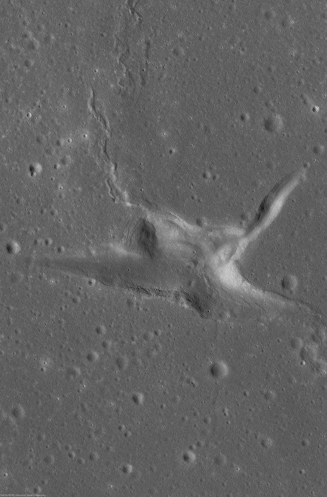
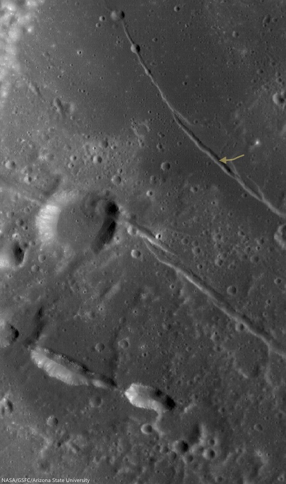
A rille found on the southwestern edge of Oceanus Procellarum, most likely formed from stress added to the surface as mare deposits were emplaced and cooled.  1200 meter-wide field of view from LROC NAC observation M1145219838R, LRO orbit 20802, January 24, 2014; 36.35° incidence, resolution 1.05 meters from 103.39 km over 0.5°N, 295.29°E [NASA/GSFC/Arizona State University].
Raquel Nuno
LROC News System

Remotely sensed data acquired by spacecraft allow scientists to study the geology of other worlds without ever setting foot there.

The investigation of image data is usually the first step in unraveling the origin of a planet’s observed landforms and their evolution -- this scientific study is called planetary geomorphology.

Characterizing geomorphologic features is of the utmost importance for planning both a safely landed mission as well as a rover's path – it would be unfortunate if a rover sent to the Moon got stuck because it was sent to a location it could not traverse. The curved depression in today's Feature Image, called an arcuate rille, is lined with boulders.  This is an example of a landing site that would be hazardous for a rover to land in without a very detailed look at the surroundings.

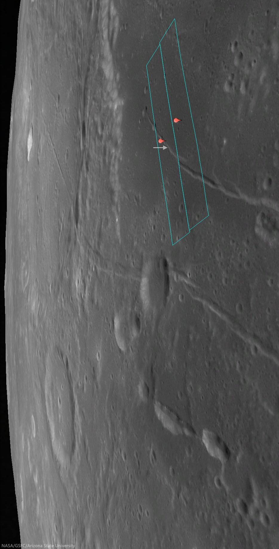
Location of the area viewed at high-resolution in the LROC NAC Featured Image (arrow) on the unnamed arcuate compression rille that runs almost parallel against Rima Hevelius I, longest of the Rimae Hevelius system and extending outward and beyond Hevelius crater, which is outside this 38 km-wide field of view; north of the pyroclastic vent structures near Lohrmann D. From LROC WAC observation M129716592C, LRO orbit 4249, May 28, 2010; 59.3° incidence angle, resolution 58.61 meters from 42.07 km [NASA/GSFC/Arizona State University].
This unnamed rille (0.141°N, 295.362°E), roughly 1 km across, is located on the edge of the southwestern region of Oceanus Procellarum.  As the mare deposits that formed Oceanus Procellarum cooled and contracted, fracture systems developed along the mare-highlands boundary. Near this boundary, loading of denser basalts (mare) over less dense crustal materials (highlands) results in tectonic stresses that can cause rock to pull apart along fractures, forming arcuate rilles.

The footprints of the left and right LROC NAC frames, from which the Featured Image was derived, installed on a digital elevation model and LROC Wide Angle Camera mosaic to offer a simulated 'real world' perspective, putting the the arcuate rille area of interest (arrow) in relation to Rimae Hevelius, inside and outside its namesake crater, and the other complexities of the Lohrmann and Hevelius pyroclastic area of the western equatorial border of Oceanus Procellarum [NASA/GSFC/Arizona State University].
The pattern of some of the complexities at the surface of west and southwest Oceanus Procellarum (and a lot of other areas on the Moon) were at least partially laid bare by the sensitive GRAIL A and GRAIL B gravity probes in 2012. Though the exact boundaries and morphology of the vast nearside basalt flood plain are still poorly understood, it's now clearer that the Moon once had its own "Ring of Fire," less dynamic than on Earth, but still a 'squarish' border in the form of deep volcanic rift structures partially surrounding an enormous plate. The inset shows how this system of rifts explains at least some of the surface faulting, the unique mountains and lateral pressures under the Hevelius, Rimae Hevelius, and the pyroclastic vents near Lohrmann D, and, indeed, much of the the western boundary of Oceanus Procellarum [NASA/GSFC/SVS].
The boulders on the floor of this rille are most likely material that has been eroding away from the walls. Some of the boulders reach diameters up to 12 meters. While an autonomous rover would likely require a lot of time to maneuver amongst the boulders, a human driver on the lunar surface might quickly and easily navigate a safe path around the boulders.

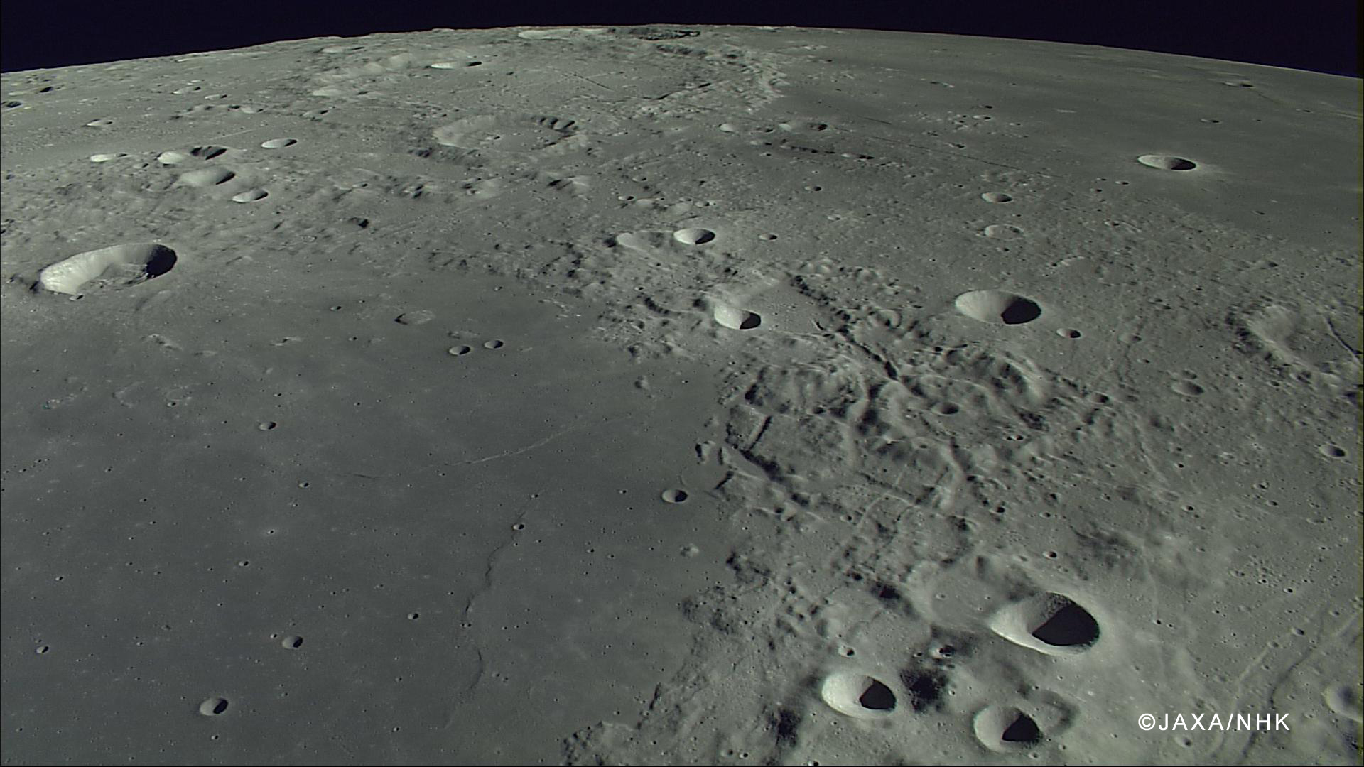
The compression rille is also visible, to the right of the upper center, east of Hevelius, north of the channel linking Grimaldi basin (lower left) with Procellarum (upper right), in this HDTV still captured by Japan's lunar orbiter Kaguya (SELENE-1) in 2007. See the full-size original image, HERE [JAXA/NHK/SELENE].
If you were an astronaut on the surface of the Moon, do you think you could find a safe path through this rille?  Trace your path on the full resolution LROC NAC below.

View full-window, HERE.

Related Posts:

Friday, May 30, 2014

Eroding crater walls at Maskelyne B

High reflectance material poured down the walls toward the floor of Maskelyne B crater, indicating interbedding of high reflectance with low reflectance layers in its walls. Image field of view is 2800 meters, vertical relief across this view is 1300 meters in depth. LROC NAC mosaic M137360167LR, LRO orbit 5376, August 25, 2010; 35.77° incidence angle, resolution 51 cm from 47.04 km [NASA/GSFC/Arizona State University].
Aaron Boyd
LROC News System

Maskelyne B (8.34 km; 1.97°N, 28.96°E) is a simple crater in southern Mare Tranquillitatis, about 1800 meters deep across only 8 km. The stratigraphy revealed in the walls of the Maskelyne B impact crater are clues to the volcanic history in Mare Tranquillitatis.

Perhaps there is older, higher reflectance anorthositic material beneath younger and darker basaltic lava flows. Layering also occurs by large impacts ejecting and emplacing older subsurface material on the local terrain. The most likely cause for the layers seen in Maskelyne B is from the erosion of large coherent blocks of unexposed mare basalt over mature space-weathered regolith. High resolution spectral imaging or samples of this area would resolve this ambiguity.

Maskelyne B (8.34 km; 1.97°N, 28.96°E) The region in Mare Tranquillitatis was a guidance landmark for the Apollo 11 expedition in 1969, and the terrain shares much with the sampled Tranquility Base only 170 km to the southwest by west. LROC WAC observation M129099228C (566 nm), LRO orbit 4158, May 21, 2010; 52.61° incidence angle, resolution 56.14 meters from 39.87 km [NASA/GSFC/Arizona State University].
The surface of Mare Tranquillitatis was built up over time by lava flows between 3.5 and 3.9 billion years ago creating stratigraphic units that are visible today. Maskelyne B formed long after the lava cooled. As the crater walls are eroded away by smaller impacts, the higher reflectance material is exposed and the surface is ground into boulders, cobbles, and dust.

High-resolution reproduction of the LROC NAC mosaic M137360167LR, and the northwest semicircle of Maskelyne B is available HERE [NASA/GSFC/Arizona State University].
The contrast between the light boulders and dark slopes draws the eye and piques curiosity to know what lies beneath the surface. See more of Maskelyne B and the surrounding area below.

Related Posts:

Tuesday, April 29, 2014

Jagged rim on the southwest limb

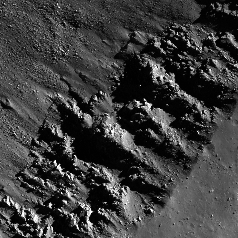
The upper southeastern rim of Piazzi H (8 km; 40.185°S, 294.237°E) 800 meter field of view from LROC NAC observation M1152277932L, LRO orbit 21794, April 16, 2014; 59.17° incidence angle, resolution 75 cm from 72.25 km [NASA/GSFC/Arizona State University].
Raquel Nuno
LROC News System

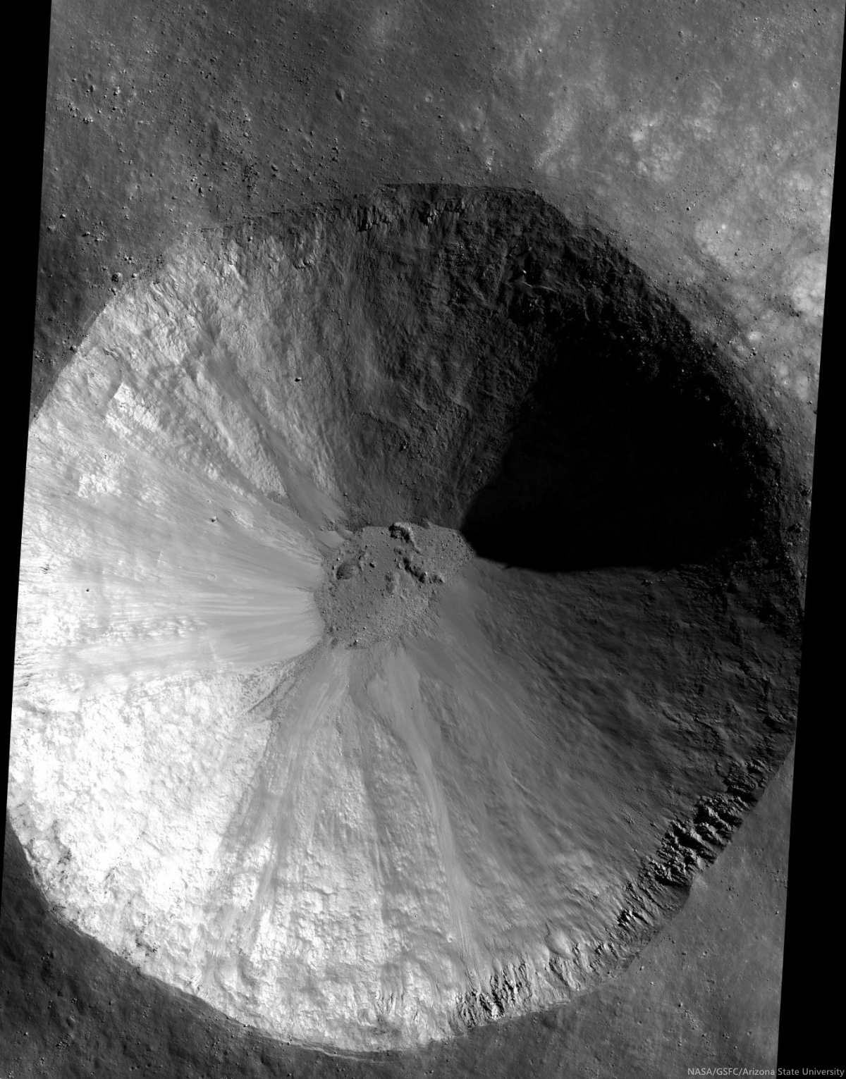
The rocks that form Piazzi H's (40.185°S, 294.237°E) beautifully textured upper crater wall hang precariously from near the crater rim. Under the action of gravity and time, material from crater walls continuously slough off. This fall to a lower gravitational potential is one of the reasons why old craters have a smoother appearance (the other reason is bombardment by micrometeorites which pulverize craters into fine grained dust). 

Why do these overhanging rocks not succumb to the force of gravity? Perhaps this is telling us that this crater is young, gravity has not had enough time to pull those rocks down. One way to determine if a crater is young is to look for high reflectance ejecta, and the WAC 643 nm normalized reflectance map allows us to do just that.

The image below, on the left, is the from a WAC 643 nm normalized reflectance mosaic showing the high reflectance ejecta of Piazzi H. We also see a similar pattern with from the nearby crater Lacroix B, implying they are of similar ages. But we don't find the same rock overhangs on the walls of Lacroix B.

The roughly 93 km distance between Piazzi H and LaCroix B craters is shown comparatively, using the LROC Quickmap application, rolling from LROC Wide Angle Camera (WAC)-derived 643 nm normalized reflectance through the LROC WAC digital elevation model, a very fast way to demonstrate how granularity can be overwhelmed or shown in stark relief, depending on the angle of illumination or the range of wavelengths presented [NASA/GSFC/Arizona State University].
One possibility is that the structure we are seeing are the ragged edges of a bedrock layer. A strong coherent layer might have enough resistance to stress to better support these overhangs. Lunar scientists use measurements of layered deposits (see image below) to understand ancient lava flows on the Moon.

Crater rim outcrops hang onto the southeastern rim and wall of Piazzi H (7.7 km; 40.185°S, 294.237°E), from a mosaic including the left and right frames of LROC NAC observation M1152277932 [NASA/GSFC/Arizona State University].
Even though this crater is located in the lunar highlands, what we may be seeing is uncovered cryptomare. A recent study on rock outcrops on lunar crater rims use measurements to understand the flow of material during crater excavation.

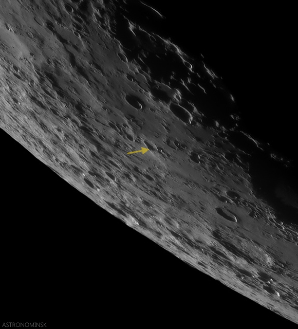
Piazzi H, on the west rim of a larger, previously unrecognized and far more ancient crater, can be seen from Earth after a Full Moon, or in relief about 5 days following. Here the crater is picked out from a full disk mosaic of 25 images captured before dawn, August 26, 2011. The entire dramatic crescent, by Yuri Goryachko, Mikhail Abgarian, Konstantin Morozov of Minsk, Belarus can be seen in their gallery HERE [Astronominsk].
Explore the full resolution NAC mosaic of crater Piazzi H, HERE. The shadows cast by the textured crater wall make this crater a particularly beautiful one.

Related Posts:
Layering in Euler Crater

Context for the inset shown at full resolution immediately above (yellow box), the late crescent mosaic of 25 images of a very late crescent Moon, photographed before dawn August 26, 2011. By Yuri Goryachko, Mikhail Abgarian, Konstantin Morozov, Minsk, Belarus [Astronominsk].

Tuesday, April 8, 2014

Swept Slopes of Herigonius

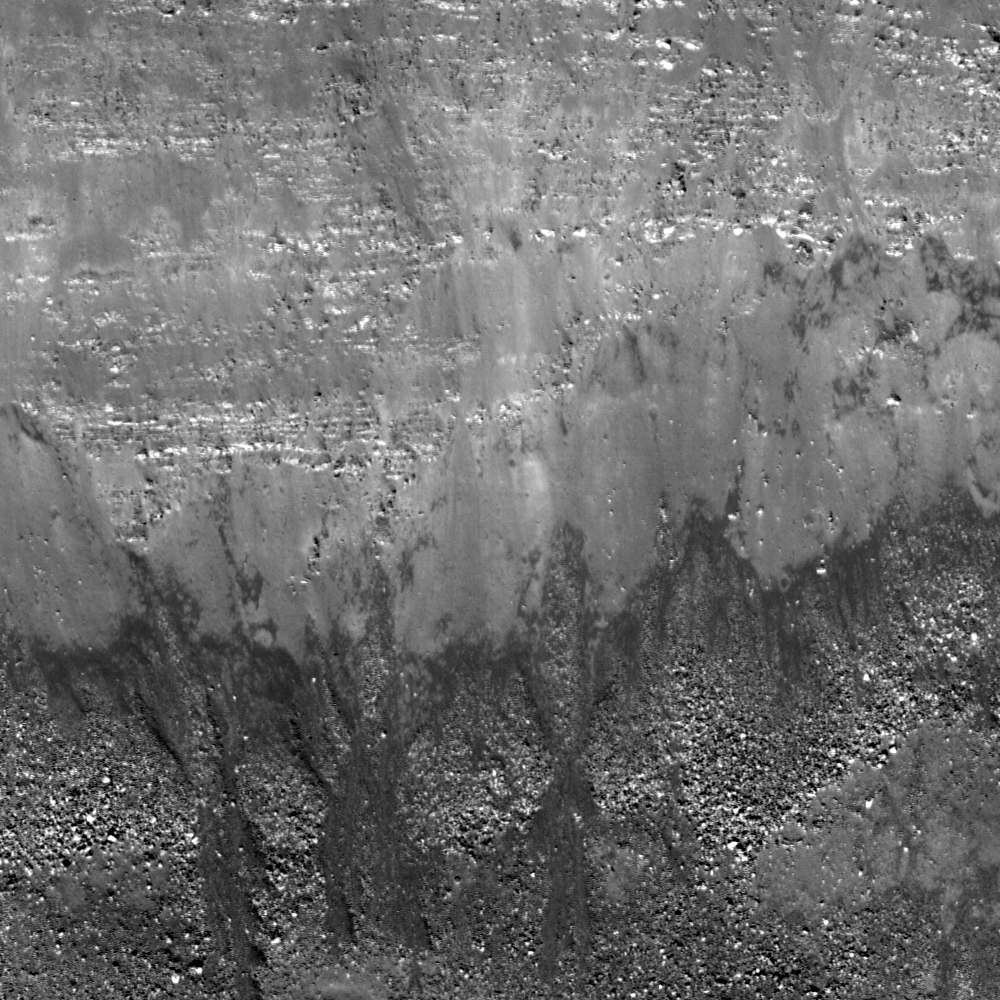
Banded layers of mare basalts uncovered by mass wasting in the eastern wall of Herigonius crater. The rim crest is outside the top of the image field of view (north is to the left). Debris and boulders accumulate downslope, below, toward the crater floor and center. 500 meter field of view from LROC NAC observation M150741485; LRO orbit 7348, January 27, 2011; incidence angle 60° at a half meter resolution from 46.46 km [NASA/GSFC/Arizona State University].
J. Stopar
LROC News System

Gravity, as well as seismic events, keep the upper slopes of the east of wall of Herigonius crater (14.86 km; 13.321°S, 326.029°E) swept clean by moving material downslope.

Herigonius is a large crater at the southernmost extent of Oceanus Procellarum.

Mass wasting reveals banded layers of mare basalt. Individual layers can be traced north to south across much of the wall of Herigonius, and as a whole, represent multiple broad, thin lava flows (see image of the east wall below).

East wall of Herigonius crater, rim crest at top of image, floor toward the bottom. Click on image to see how the layers of basalt are exposed in this part of the upper wall [NASA/GSFC/Arizona State University].
Blocky overhangs indicate areas more resistant to mass wasting and are comprised of the more coherent parts of the lava flows. However, layers of mare basalt are not exposed in all of the walls of Herigonius crater and are best observed in the eastern portion. The entire region is dominated by mare lava flows, but why are the layers so prominent in the eastern wall?

Elevation data derived from the LROC WAC instrument (GLD100) allows investigation of the topography and slopes of the Herigonius crater. The slope map (below), which is a measure of the average change in topography from pixel to pixel, shows that the eastern wall of Herigonius crater is one of the steepest parts of the crater. This steepness may help to continuously expose fresh new materials and basalt layers. Alternatively, the coherent layers of the prominent mare flows in this region are more resistant to downslope movements and can support steeper slopes that are, in turn, more resistant to the build up of debris.

Slope map (overlain on shaded-relief) of Herigonius crater, generated from the LROC WAC GLD100 product. Steeper slopes shown in red, lower angle slopes are purple and blue. Red areas, including the east wall, have slopes around 40° and correspond to outcrops of banded mare layers [NASA/GSFC/Arizona State University].
Explore the east wall in full resolution, HERE, and the entire crater, HERE.

Related Posts:
Layering in Messier A
Marius A
Dawes
Outcrops in Laplace A
Apollo Basin Mare in a Sea of Highlands

Tuesday, November 5, 2013

Diversity of basaltic volcanism and the Marius Hills

MARIUS Hills, Sinuous Rille A
A diverse range of volcanic morphologies: a sinuous rille, blocky lava flows and pyroclastic cones found in a portion of the controlled LROC NAC mosaic "NAC_ROI_MARIUS_ _LOC_E138N3037" centered on 13.476°N, 303.861°E, field of view approximately 21 kilometers wide [NASA/GFSC/Arizona State University].
J. Stopar
LROC News System

The Marius Hills region (located at 306.2°E 13.0°N) is known for its diverse and complex volcanic features: extensive mare basalt plains, small shield volcanoes, steep-sided cones possibly constructed from cinder or spatter, and sinuous rilles. One of these rilles has a small (approximately 50 m in diameter) pit in its floor, possibly a skylight opening into a lava tube. Today's featured image is a low-sun angle controlled mosaic of part of the Marius Hills region created by combining three LROC NAC left and right image pairs with similar lighting conditions (acquired on adjacent orbits). To create an accurate mosaic, a control network is used to tie the images together and correct for camera pointing and spacecraft position over the lunar surface (refer to the RDR description for more details). Today's featured mosaic illustrates all the major volcanic landforms found in the Marius Hills. 

The full mosaic can be downloaded HERE.

NAC_ROI_MARIUS__LOC_E138N3037_5M-1920x3574
Thumbnail of complete controlled NAC mosaic "NAC_ROI_MARIUS_ _LOC_E138N3037" (down-sampled for web browsing) shows a larger area of the western Marius Hills region and a broad sample of its volcanic morphologies [NASA/GSFC/Arizona State University].
Two large sinuous rilles nicknamed "A" (larger, more southern rille in mosaic above) and "B" (smaller, more northern rille in mosaic above) by Greeley (1971) each have a source at a localized volcanic center within the Marius Hills and are embayed (overlapped) by younger mare basalts to the west. Rille "A" contains the Marius Hills skylight feature that was previously discussed in Featured Images Marius Hills Pit and Sublunarean-void!. This pit or skylight is intriguing because it suggests that many other lunar rilles may also have lava tubes or might be formed through lava tube collapse.

M114328462R4-2880
Section of today's featured mosaic that shows the Marius Hills pit crater skylight (center). Try to find this feature in the full mosaic. (Hint: the skylight appears darker and more shadowed than normal impact craters in this mosaic) [NASA/GSFC/Arizona State University].
M137929856R_thumb-750
Oblique view of the Marius Hills pit crater, originally discovered by Japan's Kaguya lunar orbiter in 2007, LROC NAC imagery soon revealed others, most notably in Mare Tranquillitatis and Mare Ingenii. LROC NAC observation M137929856R [NASA/GSFC/Arizona State University].
The volcanic shields, which are sometimes called domes due to their steep and abrupt margins, are constructed from short and blocky lava flows, but are probably not true volcanic domes. Observations from Clementine and LRO indicate that the blocky lava flows are generally basaltic in composition (e.g., Weitz and Head 1998; Lawrence et al. 2013) even though they appear thicker and shorter than the mare-style volcanism that dominates the lunar nearside. The shorter and less voluminous blocky flows likely result from slower eruption rates and more viscous lava.

MHdome_crop_sm-2000x1000
Two examples of small shields that are primarily constructed from blocky lava flows. Try to find these features in today's featured mosaic [NASA/GSFC/Arizona State University].
The numerous volcanic cones found in the Marius Hills region are atypical for the Moon, though other examples do exist. The steep flank slopes (near 16°) and circular to elongate shapes in plan view (often C-shaped) suggest construction from pyroclastic materials, often called cinder and spatter, like similarly sized and shaped features on Earth. The Marius Hills cones range in size from a few kilometers to 500 meters in diameter. Many of the cones have blocky lava flows that appear to emanate from their central vent, resulting in a C-shaped cone.

MHcone_crop_sm-2704x1000
Examples of C-shaped and elongate volcanic cones, these cones are often found in association with blocky lava flows. Try to find these (and more) pyroclastic cones in today's featured mosaic [NASA/GSFC/Arizona State University].
M150877632LR-03-04-adjust-scld-1920x1203
LROC NAC high-resolution view of "the love seat" among the Marius domes, from an assembly of 28 LROC NAC cropped images and slideshow, HERE [NASA/GSFC/Arizona State University].
The diversity and complex spatial and stratigraphic relationships of rilles, cones, and shields in the Marius Hills region makes it difficult to determine if eruption conditions changed over time. But, in general, the small shield volcanoes, blocky lava flows, and pyroclastic cones were probably formed nearly synchronously. Later, floods of mare lava partially overprinted the region, leaving only the uppermost peaks for us to observe today.

A gif animation showing the junction of the Reiner Gamma swirl and the southwest Marius Hills region under a variety of illumination angles, highlighting topography and albedo [NASA/GSFC/Arizona State University].
Today's featured image presented only one of the many controlled mosaics collected and produced by the LROC Team! Explore the more than 80 other controlled mosaics of various lunar terrains currently available on the RDR Products website.

Related Posts:
Marius Hills Survey (Slideshow)
Rima Marius Layering (June 2, 2013)
Discontinuous Rilles (May 15, 2011)

Thursday, July 11, 2013

Lunar Kipuka

A ghost crater, breached and filled with the lavas of Mare Imbrium (31.364°N, 334.217°E), the 3.2 km field of view from LROC Narrow Angle Camera (NAC) observation M193132768L, LRO orbit 13487, May 31, 2012; 74.94° angle of incidence, resolution 1.46 meters from 147.07 km [NASA/GSFC/Arizona State University].
Brett Denevi
LROC News System

The lunar maria were once "seas" of highly fluid lava, and within their margins small islands and shorelines can be found. Today's featured image highlights a classic example of a partially flooded impact crater within Mare Imbrium. The western wall of the crater, a low point in the rim, was breached by the flowing lava, and the crater was filled nearly to its rim. What remains of the rim is known as a kipuka, the Hawaiian word describing an island of older land surrounded by younger lava flows.

The shoreline can be seen within the crater as a terrace-like ring just inside the crater rim, particularly on the eastern side. This terrace is akin to the high-water mark of a flood, and marks the high-lava point along the crater wall. As the lava cooled, it contracted and subsided to a somewhat lower level. Similar features are seen in areas like Bowditch, within Lacus Solitudinis.

The kipuka of interest, out on the vast plains of Mare Imbrium, in the 48 km-wide field of view of LROC Wide Angle Camera (WAC) monochrome (643 nm) observation M177798520C, spacecraft orbit 11338, December 6, 2011; 76.25° angle of incidence, resolution 60.03 meters from 43.97 km [NASA/GSFC/Arizona State University].
The flooded crater in today's image is approximately 2.7 km in diameter, and was likely originally around 500 m deep. That gives a maximum lava thickness of a little less than 500 meters in this spot, though that does not require a single 500-meter thick flow. Lava likely pooled in the low of the crater floor from multiple individual flows, rather than one massive influx of lava. Layering exposed within sinuous rilles,  mare pits, and impact craters suggests individual lava flows were much thinner (on the order of 10 meters).

LROC WAC context mosaic showing the location of the flooded crater (arrow) within an outline of the footprint of NAC M193132768L [NASA/GSFC/Arizona State University
Note the small (250 meters in diameter) high reflectance crater nearly in the center of this flooded crater. An astronaut could descend its interior and inspect a cross-section of about the top 25 meters of the basalts and determine the thickness and frequency of the lava flows that filled the host crater. The rim of this impact crater is the only kipuka preserved in the area, and is the last local remnant of the surface before it was drowned in the lavas of Mare Imbrium several billion years ago.

Browse the full-resolution NAC image HERE.

Related LROC Featured Images:
The Swirls of Mare Ingenii
Remnants of the Imbrium Impact

Thursday, June 27, 2013

Rima Marius Layering

Basalt layering, a slice through the floor of Oceanus Procellarum, is visible along the wall of this section of Rima Marius. LROC Narrow Angle Camera (NAC) Extended Science Mission observation M1103881010R, LRO orbit 14991, October 3, 2012; 21.88° angle of incidence over a 1.3 km-wide field of view, resolution 0.99 meters from 121.1 km  [NASA/GSFC/Arizona State University].
Sarah Braden
LROC News System

Mare basalt layering is visible in the walls of a number of impact craters such as Caroline Herschel Crater and Pytheas Crater. Layers were seen in the wall of Hadley Rille near the Apollo 15 landing site and Today's Featured Image shows a few layers of mare basalt along the top edge of the wall of Rima Marius.

Look closely at the Featured Image to see the individual layers.

Rima Marius is about 280 km long, sinuously slicing through large extents of mare basalt. The are seen in the Featured Image is centered at 14.986°N, 311.565°E.

LROC Wide Angle Camera context view of the southern leg of winding Rima Marius. The arrow marks the location of the field of view shown at high resolution in the LROC Featured Image. LROC WAC M166161047CE (604 nm) spacecraft orbit 9621, July 2, 2011, 63.53° angle of incidence, 58.9 meters resolution from 42.35 km [NASA/GSFC/Arizona State University].
Rilles form when large volumes of low viscosity magma erupt and flow turbulently. The erosive force of the turbulent flow carves a channel into the lunar surface and then drains away, leaving behind an empty groove in the Moon. Studying the thickness of mare basalt layers using areas like the Feature Image help scientists model the viscosity and eruption volume of single eruption events.

The 280 km length of Rima Marius and the LROC Featured Image field of view (arrow) as seen from Earth is more easily seen through telescopes from Earth with the lengthening shadows of local late afternoon illumination, a few days after a Full Moon. In this crop, from a high-resolution lunar mosaic captured by Yuri Goryachko and colleagues at Astronominsk in Belarus, September 25, 2008, shows vast context for Rima Marius within central Oceanus Procellarum, from the Aristarchus Plateau in the North to the Marius Hills, Marius crater and Reiner Gamma swirl albedo to the south [Astronominsk].
Explore the entire LROC NAC for more Rima Marius, HERE.

Related Images:
Dark surface materials surrounding Rima Marius
Discontinuous rilles
Hadley Rille and the Mountains of the Moon
Layers near Apollo 15 landing site