Showing posts with label PDS. Show all posts

Wednesday, February 4, 2015

Hydrogen retention on pole-facing slopes

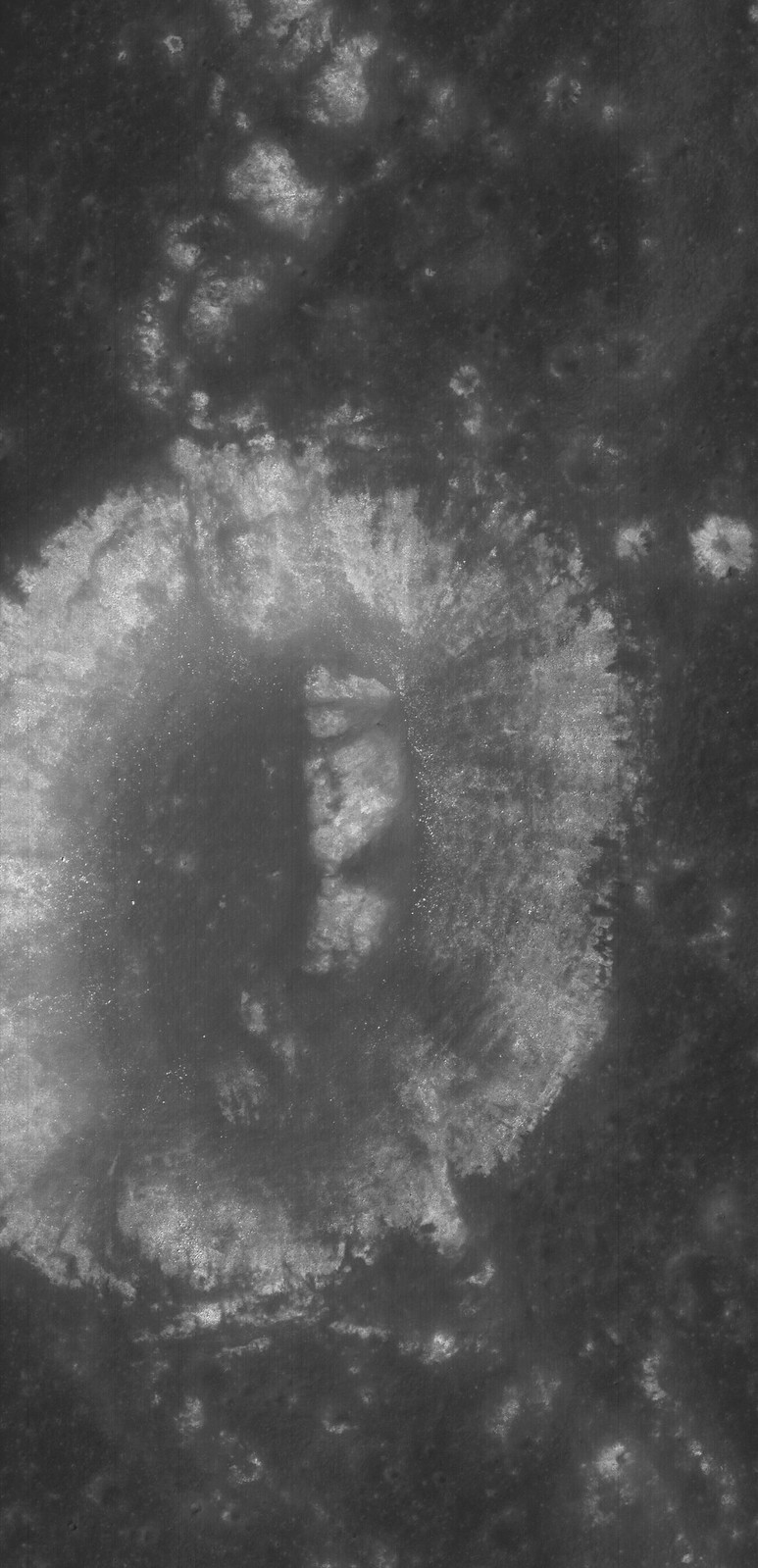
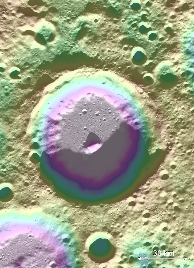
Lovelace (57.06 km; 82.08°N, 250.49°E) crater, of the Moon's far north, hosts a signature of volatiles within permanently shadowed regions (PSR) on the inside slope of its south wall. Long-term studies of the Moon's reserves of hydrogen and other volatiles, made possible by the extended science missions of the Lunar Reconnaissance Orbiter (LRO), show a diurnal cycle of hydrogen retention on pole-facing slopes, perhaps a result of neutral hydrogen from the Sun. [NASA/GSFC/ASU/LOLA/PDS].
Bill Steigerwald
Goddard Space Flight Center

Space travel is difficult and expensive – it would cost thousands of dollars to launch a bottle of water to the moon. The recent discovery of hydrogen-bearing molecules, possibly including water, on the Moon has explorers excited because these deposits could be mined if they are sufficiently abundant, sparing the considerable expense of bringing water from Earth.

Karnik
Lunar water could be used for drinking or its components – hydrogen and oxygen – could be used to manufacture important products on the surface that future visitors to the moon will need, like rocket fuel and breathable air.

Recent observations by NASA's Lunar Reconnaissance Orbiter (LRO) spacecraft indicate these deposits may be slightly more abundant on crater slopes in the southern hemisphere that face the lunar South Pole.

"There’s an average of about 23 parts-per-million-by-weight (ppmw) more hydrogen on Pole-Facing Slopes (PFS) than on Equator-Facing Slopes (EFS)," said Timothy McClanahan of NASA's Goddard Space Flight Center.

This is the first time a widespread geochemical difference in hydrogen abundance between PFS and EFS on the moon has been detected. It is equal to a one-percent difference in the neutron signal detected by LRO's Lunar Exploration Neutron Detector (LEND) instrument. McClanahan is lead author of a paper about this research published online October 19 in the journal Icarus.

The hydrogen-bearing material is volatile (easily vaporized), and may be in the form of water molecules (two hydrogen atoms bound to an oxygen atom) or hydroxyl molecules (an oxygen bound to a hydrogen) that are loosely bound to the lunar surface. The cause of the discrepancy between PFS and EFS may be similar to how the Sun mobilizes or redistributes frozen water from warmer to colder places on the surface of the Earth, according to McClanahan.

"Here in the northern hemisphere, if you go outside on a sunny day after a snowfall, you'll notice that there's more snow on north-facing slopes because they lose water at slower rates than the more sunlit south-facing slopes" said McClanahan. "We think a similar phenomenon is happening with the volatiles on the moon – PFS don't get as much sunlight as EFS, so this easily vaporized material stays longer and possibly accumulates to a greater extent on PFS."

The team observed the greater hydrogen abundance on PFS in the topography of the moon's southern hemisphere, beginning at between 50 and 60 degrees south latitude.

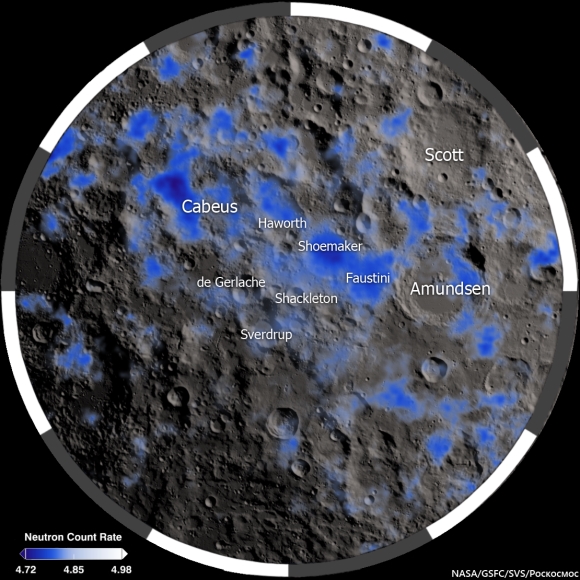
The Moon's polar south and its neutron suppression zpmes, indicative of the presence of hydrogen (inside and outside permanent shadow) mapped from data collected from the LRO LEND instrument over two and a half years [NASA/GSFC/SVS/Pockocmoc].
Slopes closer to the South Pole show a larger hydrogen concentration difference. Also, hydrogen was detected in greater concentrations on the larger PFS, about 45 ppmw near the poles. Spatially broader slopes provide more detectable signals than smaller slopes. The result indicates that PFS have greater hydrogen concentrations than their surrounding regions. Also, the LEND measurements over the larger EFS don't contrast with their surrounding regions, which indicates EFS have hydrogen concentrations that are equal to their surroundings, according to McClanahan. The team thinks more hydrogen may be found on PFS in northern hemisphere craters as well, but they are still gathering and analyzing LEND data for this region.
There are different possible sources for the hydrogen on the moon. Comets and some asteroids contain large amounts of water, and impacts by these objects may bring hydrogen to the moon. Hydrogen-bearing molecules could also be created on the lunar surface by interaction with the solar wind. The solar wind is a thin stream of gas that's constantly blown off the Sun. Most of it is hydrogen, and this hydrogen may interact with oxygen in silicate rock and dust on the moon to form hydroxyl and possibly water molecules. After these molecules arrive at the moon, it is thought they get energized by sunlight and then bounce across the lunar surface; and they get stuck, at least temporarily, in colder and more shadowy areas.

Since the 1960's scientists thought that only in permanently shadowed areas in craters near the lunar poles was it cold enough to accumulate this volatile material, but recent observations by a number of spacecraft, including LRO, suggest that hydrogen on the moon is more widespread.

It's uncertain if the hydrogen is abundant enough to economically mine. "The amounts we are detecting are still drier than the driest desert on Earth," said McClanahan. However, the resolution of the LEND instrument is greater than the size of most PFS, so smaller PFS slopes, perhaps approaching yards in size, may have significantly higher abundances, and indications are that the greatest hydrogen concentrations are within the permanently shaded regions, according to McClanahan.

The team made the observations using LRO's LEND instrument, which detects hydrogen by counting the number of subatomic particles called neutrons flying off the lunar surface. The neutrons are produced when the lunar surface gets bombarded by cosmic rays. Space is permeated by cosmic rays, which are high-speed particles produced by powerful events like flares on the Sun or exploding stars in deep space. Cosmic rays shatter atoms in material near the lunar surface, generating neutrons that bounce from atom to atom like a billiard ball. Some neutrons happen to bounce back into space where they can be counted by neutron detectors.

Neutrons from cosmic ray collisions have a wide range of speeds, and hydrogen atoms are most efficient at stopping neutrons in their medium speed range, called epithermal neutrons. Collisions with hydrogen atoms in the lunar regolith reduce the numbers of epithermal neutrons that fly into space. The more hydrogen present, the fewer epithermal neutrons the LEND detector will count.

Neutron suppression information in the Moon's polar north is, as yet, less granular than data mapped in greater detail over the far South. Here neutron suppression is overlaid on a LROC WAC mosaic with permanently shadowed regions (PSRs) outlined in black. Again, the occurrence of hydrogen is related to sunlight but not necessarily tied to its total absence.
The team interpreted a widespread decrease in the number of epithermal neutrons detected by LEND as a signal that hydrogen is present on PFS. They combined data from LEND with lunar topography and illumination maps derived from LRO's LOLA instrument (Lunar Orbiter Laser Altimeter), and temperature maps from LRO's Diviner instrument (Diviner Lunar Radiometer Experiment) to discover the greater hydrogen abundance and associated surface conditions on PFS.

In addition to seeing if the same pattern exists in the moon's northern hemisphere, the team wants to see if the hydrogen abundance changes with the transition from day to night. If so, it would substantiate existing evidence of a very active production and cycling of hydrogen on the lunar surface, according to McClanahan.

The research was funded by NASA's LRO mission. LEND was supplied by the Russian Federal Space Agency Roscosmos. Launched on June 18, 2009, LRO has collected a treasure trove of data with its seven powerful instruments, making an invaluable contribution to our knowledge about the moon. LRO is managed by NASA's Goddard Space Flight Center in Greenbelt, Maryland, for the Science Mission Directorate at NASA Headquarters in Washington.

Monday, February 2, 2015

LRO could remain in present orbit 7 or more years

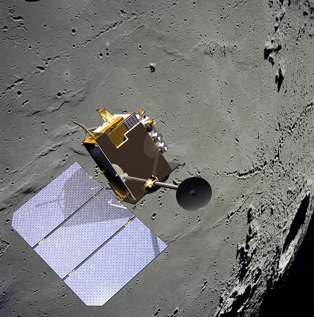
Because the Moon is lumpy and uneven, it's possible nothing has ever been in close-orbit around our companion planet as long as the Lunar Reconnaissance Orbiter. Certainly nothing built by humans. Few deep space missions have delivered as much return on their investment. The sheer volume of data returned by LRO exceeds all deep space missions ever launched combined, several times over [NASA/GSFC/SVS].


THE SECOND EXTENDED SCIENCE MISSION
FOR THE LUNAR RECONNAISSANCE ORBITER:
STATUS, SCIENCE GOALS, AND DATA DELIVERIES

Noah E. Petro and John W. Keller
NASA Goddard Space Flight Center
Solar System Exploration Division

The Lunar Reconnaissance Orbiter (LRO) has been orbiting the Moon for over five years. In that time, data from the seven instruments onboard the spacecraft have made significant advances in our understanding of the Moon and its environment. In September 2014 LRO completed its first Extended Science Mission (ESM) and began a second ESM (ESM2). 

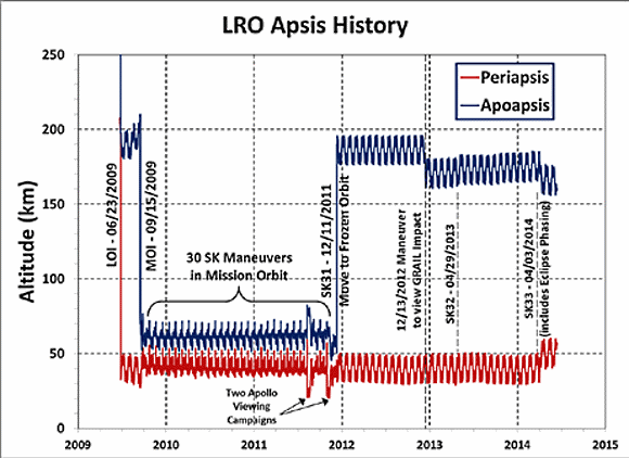
During the both ESM and ESM2, LRO has been in a quasi-stable, eccentric orbit of ~40 x 180 km with a periapse near the South Pole (Figure 1). This orbit enables high resolution measurements around the South Pole. 

The LRO Project is considering a maneuver in early 2015 to lower the periapse in order to further improve measurements over the South Pole, particularly by the LOLA instrument. Based on the current annual consumption of fuel, the spacecraft could remain in its current orbit for at least 7 more years.

FIGURE 1. Orbital history of LRO since arriving at the Moon in 2009. LRO now employs yearly station keeping (SK) maneuvers in order to maintain its orbit. There are also periodic momentum unload burns that use small quantities of fuel.
LRO Operations: As part of the approval for continued operations, LRO was directed by NASA HQ to terminate operations of the Mini-RF instrument. All of LRO’s remaining six instruments are operating nominally, and have experienced no significant degradation since beginning the ESM over two years ago.

During extended operations the LRO spacecraft has performed exceptionally well, with 98.4% uptime during the life of the mission. LRO retains sufficient fuel quantities so that its current orbit could be maintained for at least 8 years, if not longer.

LRO Science In ESM2: An overarching theme of ESM2 for LRO is that of change. A number of measurements have shown changes to the lunar surface and to its environment. LRO will focus on the five following themes that each build on prior observations from LRO, LADEE, GRAIL, and the Moon Mineralogy Mapper. Each theme has numerous questions that are address, an example few are given here.
  1. Transport of Volatiles. How are volatile elements and compounds distributed, transported, and sequestered?
  2. Contemporary Surface Change. What causes changes in the flux and intensities of meteoroid impacts onto terrestrial planets.
  3. Regolith Evolution. Characterize planetary surfaces to understand how they are modified by geologic processes.
  4. Probing the Interior from Observations of the Surface. Characterize planetary interiors to understand how they differentiate and evolve from their initial state
  5. Interactions with the Space Environment.  How is surface material modified exogenically? How do exospheres form, evolve, and interact with the space environment?
LRO Data: The LRO instrument teams will continue to deliver data to the PDS every three months. As of the beginning of 2015 over 575 Tb of data have been placed into the PDS [1]. This data volume contains a range of products, including higher level maps, mosaics, and derived products. The PDS has made available the Lunar Orbital Data Explorer [2], a mapbased tool to search for finding and downloading PDS science data of LRO as well as other recent lunar missions.

In addition to the PDS holdings, several of the LRO instrument teams have additional products and tools available on their websites (Table 1).

Several global map products have recently been added to the PDS, here we highlight a few that are new in the last year. The Mini-RF team has assembled a global mosaic of their monostatic measurements [3].

For the first time we have global radar data for the Moon, data that clearly shows variations in rock abundance and surface texture over both the near and farside (Figure 2).

FIGURE 2. Mini-RF global mosaic of the Circular Polarization Ratio (CPR), one of the number of Mini-RF mosaic products now available online.
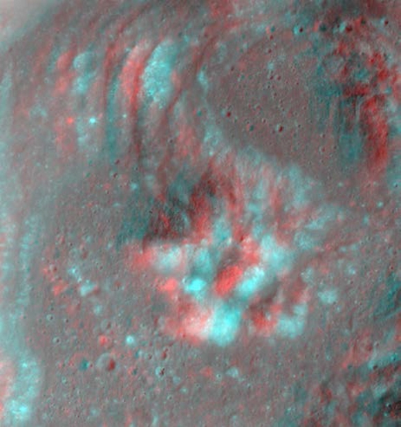
The LROC team regularly adds new products to the PDS via the team webpage (Table 1), including shapefiles, global mosaics, NAC-derived DEM’s, and NAC mosaics of selected targets. Recently the LROC team has made available a number of anaglyphs (Figure 3) showcasing the ability of the LRO spacecraft and the LROC team to precisely target the NACs.

FIGURE 3. Red-Blue anaglyph of the central peak of Euler crater.  The LROC team has made a number of anaglyphs available on their website (Table 1).
The LAMP team has a number of polar products available, including FUV ratio maps of both poles (Figure 4). These following maps are available at a resolution of 240 meters per pixel; Lyman-α (119.57–125.57 nm), Long (130–190 nm), On-band (130–155 nm), Off-band (155–190 nm), H2O Absorption Feature Depth Maps made by a Ratio map of on/off band.

FIGURE 4. LAMP Lyman-α map of the South Pole. LRO has focused on volatiles at the South Pole since arriving at the Moon 5+ years ago.
Table 1. LRO teams and their websites

LRO Project

Outreach

CRaTER

Diviner

LAMP

LEND

LOLA

LROC

Mini-RF

Use LRO Data!

The LRO Project has begun holding a series of data users workshops with the goal of helping the community work with the large volume of LRO data. Presentations given at the workshops are archived at the LRO website [4]. Questions regarding the access and use of LRO data can be directed to the authors of this abstract.

References:  [1] LRO PDS Archive, (http://pdsgeosciences.wustl.edu/missions/lro/).
[2] Lunar Orbital Data Explorer, (http://ode.rsl.wustl.edu/moon/).
[3] Cahill, J. T. S., et al., (2014) Icarus, 243, 173-190.
[4] LRO Data Resources, (http://lunar.gsfc.nasa.gov/resources.html).

Tuesday, December 16, 2014

20th Release of LRO data to the PDS

It's time in the Sun finally came, last September. Marius K (3.61 km; 9.4°N, 309.3°E), south of its namesake, southeast of Reiner Gamma in Oceanus Procellarum, was among the few places on the lunar surface not previously imaged at high-resolution by LROC cameras. The closer look came at the end of the observational period in the latest, 20th release to the Planetary Data System, December 15, covering roughly mid-June through mid-September 2014. LROC NAC observation M1165144506R, LRO orbit 23602, September 12, 2014; 17.25° incidence angle, resolution 1.07 meters from 105 km over 9.93°N, 309.4°E [NASA/GSFC/Arizona State University].See a larger reproduction HERE.
Teams operating sensors on-board the Lunar Reconnaissance Orbiter, including the Lunar Reconnaissance Orbiter Camera (LROC), are currently updating the Planetary Data System with another treasure trove of records covering the three months from mid-June through mid-September.

The will be the 20th such Release to the PDS of information gathered from the remarkable LRO which has been orbiting the Moon since June 2009.

Of course, it must be added, this isn't the first time Marius K, transected by Procellarum wrinkle ridges, has been imaged by the LROC Wide Angle Camera. By way of comparison, the small crater is seen here at center in this 34 km-wide field of view in a LROC WAC monochrome (566 nm) mosaic from two sequential passes on July 24, 2011; 63.3 incidence angle, resolution 58.7 meters from 42.16 km [NASA/GSFC/Arizona State University].
Release 20 of Lunar Reconnaissance Orbiter data is now online at the Geosciences Node. This release includes new data acquired between June 15 and September 14, 2014, for CRaTER, Diviner, LAMP, LEND, LOLA, and LROC. Data can be found on the Geosciences Node LRO page. The Lunar Orbital Data Explorer allows one reliable way of searching and downloading LRO data.

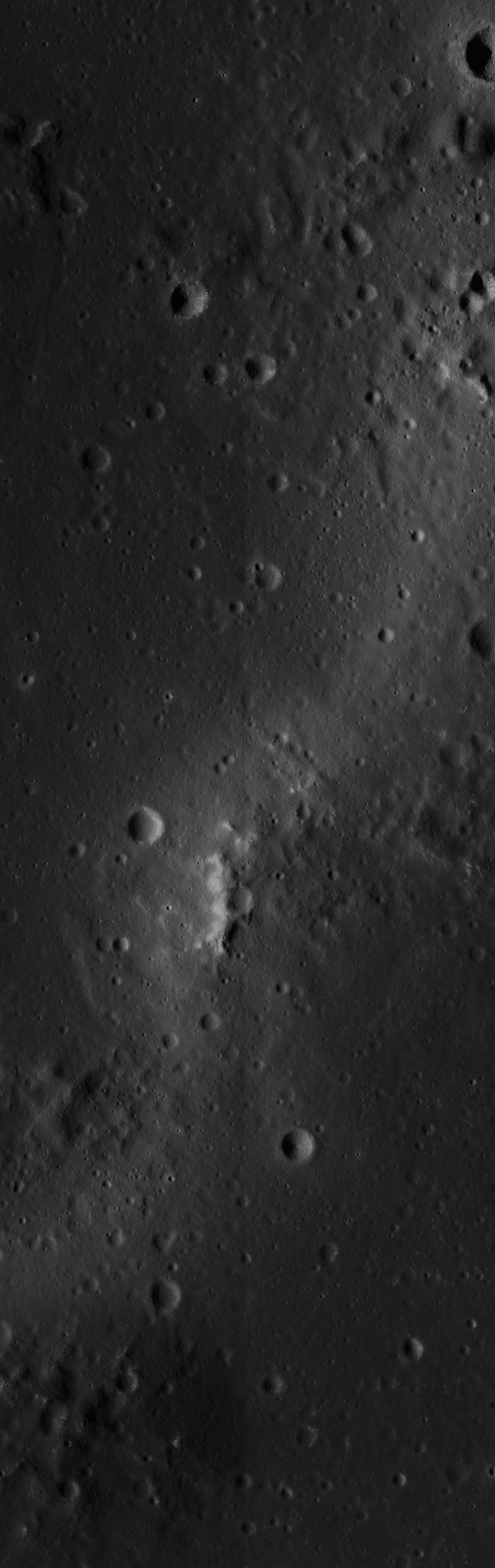
Another image really requiring the viewer to select a full-size option to appreciate its detail. A roughly ten kilometer-wide view of the Reiner Gamma contact zone with the Marius Hills, in Oceanus Procellarum. From 20th release of LROC data released to the Planetary Data System (PDS), December 15, 2014. LROC NAC mosaic M1158112330LR, LRO orbit 22614, June 22, 2014; 67.62° incidence angle, resolution 1.07 meters from 105.12 km over 10.32°N, 304.48°E [NASA/GSFC/Arizona State University].
Full resolution view from the mosaic immediately above, showing on of the out-lying Marius domes apparently subject to the same influences that keep the Reiner Gamma swirl optically immature. Those studying processes on the Moon highly anticipate the tri-monthly releases of LRO data to the PDS, and hasten to search out familiar locations for a fresh perspective, or a first high-resolution view, even more than five years after LRO began operations.
Updates and instructions, etc., are regularly posted to the PDS Lunar Node, HERE.

Thursday, January 9, 2014

The Sixteenth LRO PDS release

Rima Galilaei (Oceanus Procellarum)
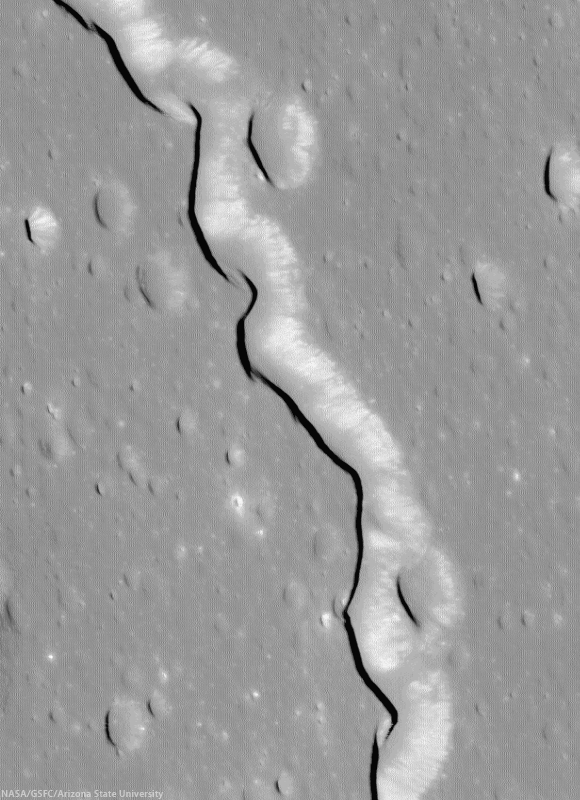
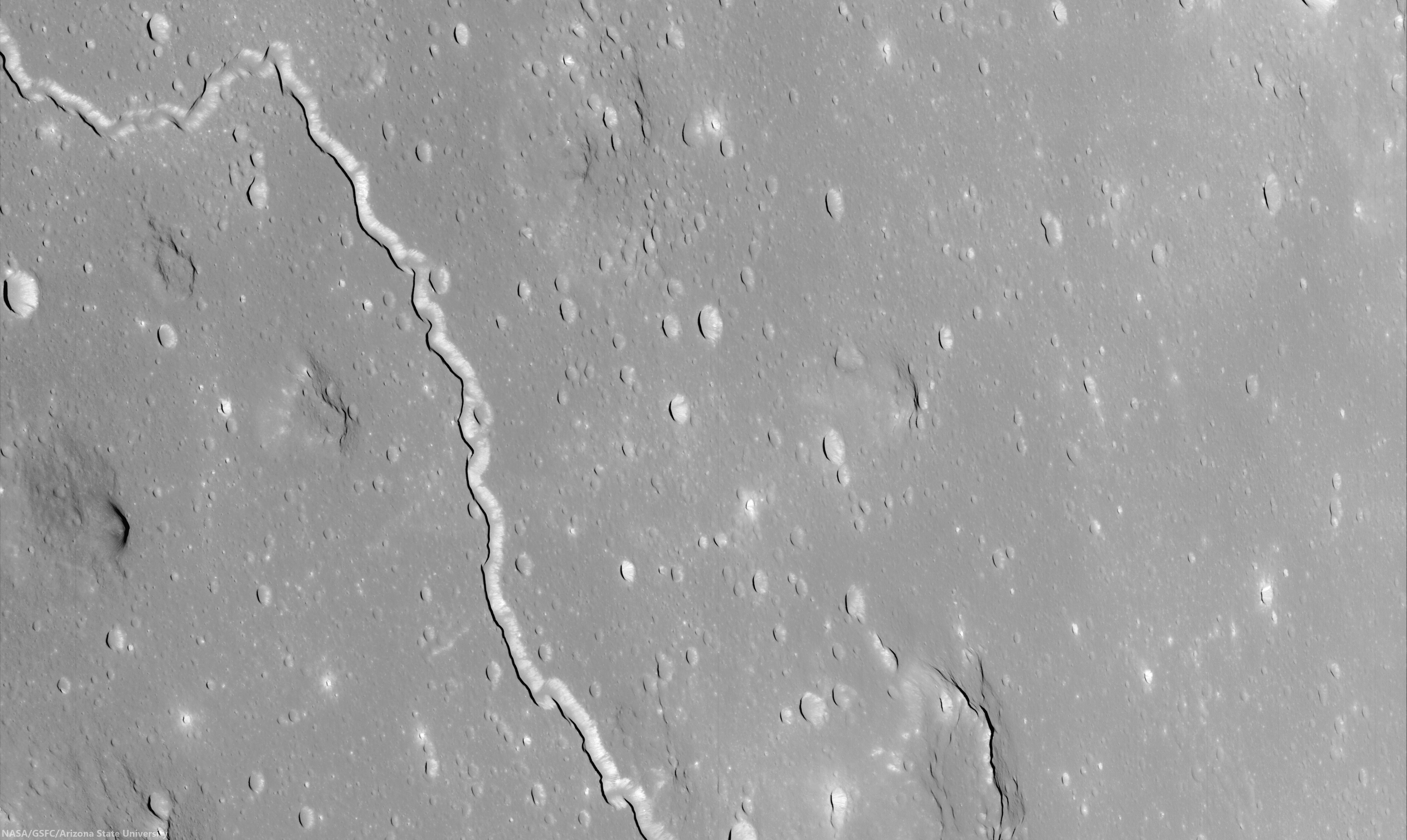
Immediately after sweeping up a splendid oblique view of Reiner Gamma, released previously, September 19, the narrow Rima Galilaei crossed into the LROC NAC view, creating a spectacular Target of Opportunity for the spacecraft and camera. LROC NAC M1127569198R, orbit 18320, July 4, 2013; slew 63° from nadir, averaging 3.9 meters resolution from 110.9 km over 11.85°N, 292.61°E [NASA/GSFC/Arizona State University].
Joel Raupe

The holidays and arrival of Chang'e-3 on the lunar surface delayed a number of posts here, before the New Year. China's first lunar landing and deployment of the Yutu rover at Mare Imbrium, for example, took place as LRO science teams delivered the latest and 16th trimonthly accumulation of data gathered from lunar orbit during three months, from the middle of June to September, last year.

Until today, however, we grievously failed to relay the only known announcement of the timely release to the Planetary Data System (PDS) of LRO observations, made by Ernest Bowman-Cisneros, on behalf of the Lunar Reconnaissance Orbiter Camera (LROC) team at Arizona State University.

Rima Galilaei (Oceanus Procellarum)
Rima Galilaei winds 186 km, gradually descending northwest from the Marius Hills, meandering through a relatively featureless expanse of Oceanus Procellarum. The full oblique view above shows a small segment of the sinuous rille with several outlying Marius domes in a roughly corrected mosaic stitched from the entirety of LROC NAC observation M1127569198LR, released December 15. The straight-line distance from where the rille enters and departs this foreshortened field of view is 30 km (full resolution available HERE) [NASA/GSFC/Arizona State University].
No one's done a better job cataloging, standardizing, and steadily providing both the science community and public with access to the incredibly deep LRO database than Mark Robinson's team at ASU. They don't quite "make it look easy." In fact, their yeoman's efforts tend to conceal the colossal volume LRO has returned from the Moon since June 2009.

Again, coinciding with news of the Chang'e-3 landing, Bowman-Cisneros wrote, "The 16th LROC Planetary Data System release includes images acquired between June 16 and September 15, 2013.

"This release contains 69,168 EDR images - totaling 7.9 TB, and 69,168 CDR images - totaling 16 TB. An additional 48 NAC Digital Terrain Models (DTMs) and 7 NAC Region Of Interest (ROI) mosaics were also released as part our this LROC RDR volume, rounding out a total 171 NAC DTMs and 100 NAC ROI mosaics released to date."

The rim and wall of bright Byrgius A
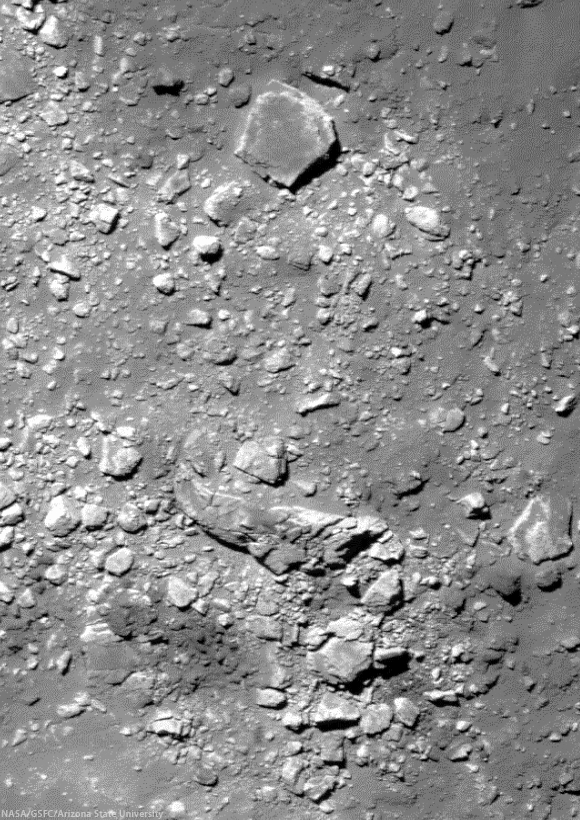
A 420 meter-wide full-resolution view of massive boulders in a field thrown up by the impact that created the bright crater Brygius A (18.45 km, 24.52°S, 63.81°W). The largest of the boulders in this view (at upper center, and visible as a reference in the wider field below) is about 75 meters across. LROC NAC M1132270283LR, orbit 18981, August 27, 2013; incidence 26.88° and 73 cm per pixel resolution from 69.7 km [NASA/GSFC/Arizona State University].
"As of December 15, 2013, EDR and CDR products for Volumes 1-5 were regenerated and released," Bowman-Cisneros announced, as he discussed the housekeeping work, standardizing and streamlining the record-breaking store of high resolution and wide-angle camera orbital images of of the Moon. "Additionally, EDR and CDR products for Volumes 6-12 were also regenerated and will be released by December 20, 2013."

The rim and wall of bright Byrgius A
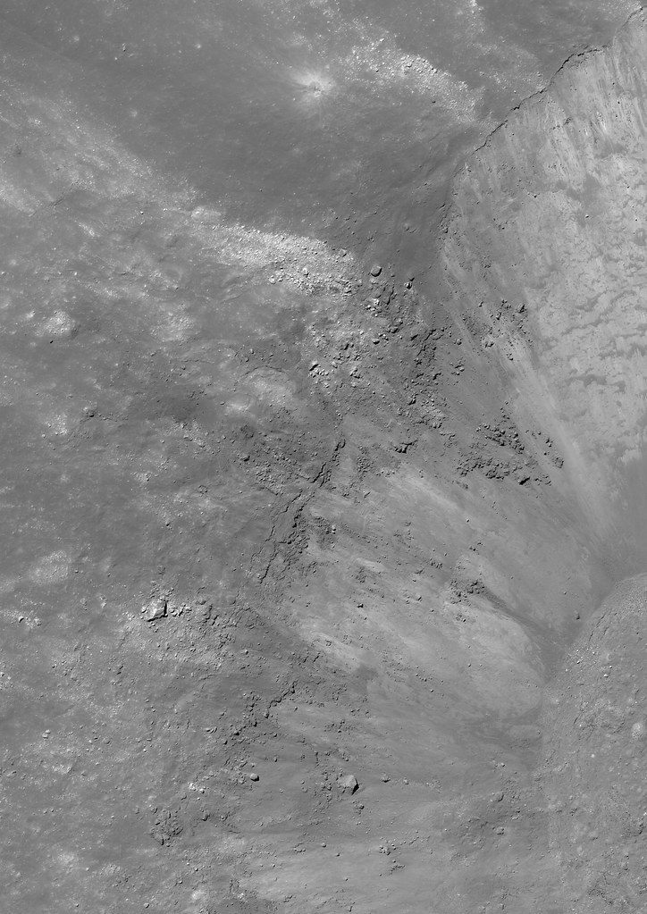
Full-width reduction of a 8925x12618 pixel mosaic showing a 6.5 km wide field of view, context for the rugged boulder field perched on the rim of Byrgius A, shown at full resolution further up. The boulders mark the beginning of one of among many very bright rays that contrast markedly with at least some darker material centered on Byrgius A. LROC NAC M1132270283LR. Wallpaper-aspect version HERE [NASA/GSFC/Arizona State University].
Byrgius A
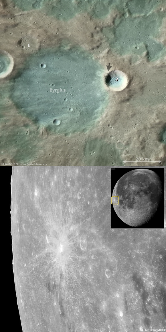
Bright ejecta of Brygius A obscures its more ancient namesake, whose rim it has excavated. The arrow in the upper image marks the boulder field. Sharp-eyed earthbound observers often spot the brilliant and widespread rays of the younger. much smaller crater with the naked eye. Above: LROC Quickmap at 250 meters resolution, and, Below: inset and full-resolution segment from a truly dramatic mosaic made up of 100 telescopic images of the Waning Moon, September 4, 2012, by Astronominsk (Yuri Goryachko, Mikhail Abgarian, Konstantin Morozov) of Minsk, Belarus. (Hat tips and flowers to Charles Wood and his Lunar Picture of the Day (LPOD).)
(If this goes on much longer, soon might know as much about our Moon as we do about Mars.)

Crater floor Pits Dollond E
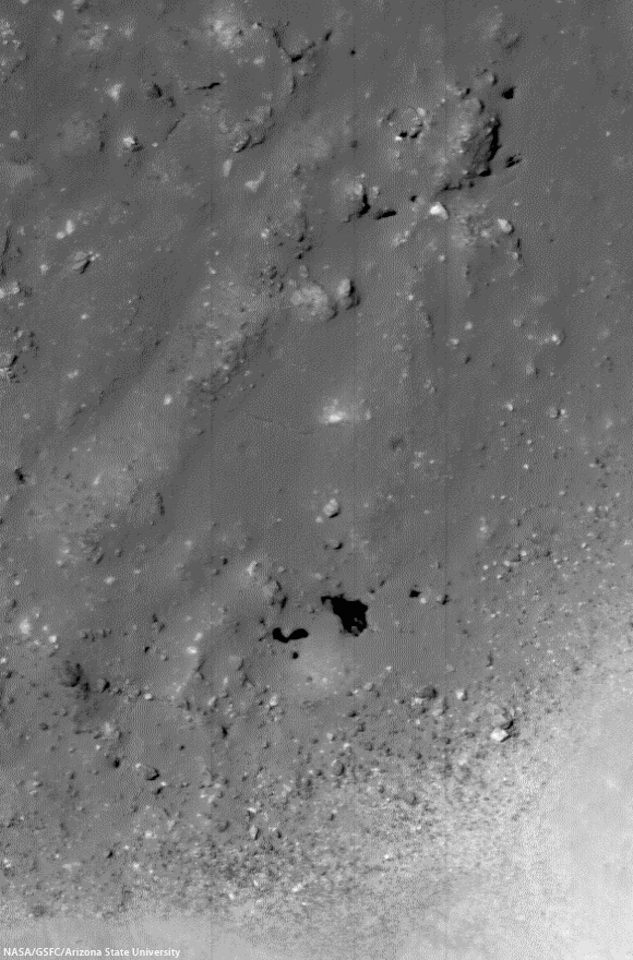
Apparent pits on the floor of Dollond E (5.22 km, 10.256°N, 15.7°E), a small and relatively fresh crater with a distinctive impact melt pooled. Dollond E is a natural excavation of the Descartes formation in the Southern Highlands, contiguous with the Stone Mountain area explored by Young and Duke of the Apollo 16 expedition and host for one of the Moon's most intense magnetic anomalies. A 400 meter-wide field of view from LROC NAC mosaic M1131744083LR, orbit 18907, August 21, 2013;  angle of incidence 21.49° at 70 cm per pixel resolution from 86.47 km [NASA/GSFC/Arizona State University].
Dollond E (Descartes formation)
All of Dollond E, in a reduced, full-width segment from LROC NAC M1131744083LR [NASA/GSFC/Arizona State University].
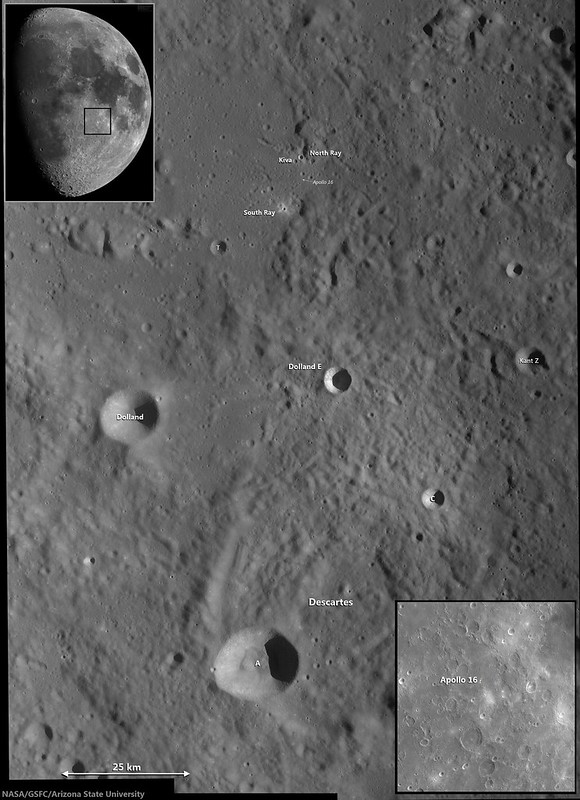
Another juxtaposition of Earth-bound and orbital views centered on Dollond E, with the nearby Apollo 16 landing site and the Descartes formation; context for the LROC NAC study. LROC Wide Angle Camera (WAC) mosaic from three sequential orbital passes in 2011 with telescopic inset by Astronominsk (Moon waxing Full on April 1, 2012) [NASA/GSFC/Arizona State University].
A newly-released stash of LROC data is always eagerly received. LRO's record-smashing time in polar orbit around the Moon has allowed nearly all the surface to be photographed at high-resolution, so each new PDS release offers first of a kind views and new angles, resolutions and angles of illumination for other areas. With so much offered, its hard to cast a theme characterizing any single release. As of last summer, the LRO's Extended Science Mission (ESM) has continued from a fuel saving high-side of low lunar orbit, collecting images in the 0.7 to 1.7 meters resolution range. This latest release, on first glance, features fewer dramatic oblique views and more of the kind of "value-added" high-resolution NAC DTM's which will continue to prove this spacecraft's value decades after its mission comes to a end a few years from now.

Dome of Agatharchides 1
The "Fireman's Helmet," Agartharchides 1, an intrusive volcanic dome, about 60 km across, and a relatively bright telescopic landmark of the southern Oceanus Procellarum. LROC NAC oblique mosaic M1127377730LR, LRO orbit 18292, July 2, 2013; angle of incidence 75.25° looking east with spacecraft and camera slewed 63.4° off nadir. Average resolution about 2.8 meters per pixel from 73.83 km over 16.58°S, 322.78°E. Click image or HERE to view at 40 percent full resolution [NASA/GSFC/Arizona State University].

Thursday, August 8, 2013

Another look at the effusive dome west of Rima Yangel

M1111791664RL-NSJ-0502-9626x18010
Effusive dome on the southern rim of a  ghost crater situated on the northern shore of Mare Vaporum, in a 11.48 km-wide field of view west of Rima Yangel. LROC NAC mosaic M1111791664LR, LRO orbit 16100, January 2, 2013; 71.03° angle of incidence, 1.19 meters per pixel resolution from 118.91 km [NASA/GSFC/Arizona State University].
Follow-up LROC Narrow Angle Camera (NAC) observation swept up by the orbiter in January and released to the Planetary Data System (PDS) in June. This effusive dome on the north bank of Mare Vaporum was the subject of two extensive posts in February and March.


The mosaic above can be viewed at full and at a variety of medium resolutions, HERE. The dome has bow been imaged from LRO from high and low altitudes, under a range of illumination angles, and many of those observations are referenced in the posts from earlier in the year, linked above.

Thursday, March 28, 2013

New Views of the Hollows of Rimae Sosigenes

The Rimae Sosigenes region of northwest Mare Tranquillitatis, from a mosaic of newly released LROC Narrow Angle Camera (NAC) oblique (slew -55°) observations M1108117962LR captured in orbit 15584, November 12, 2012. The field of view is roughly 43 km from west to east (left to right) and scaled up considerably from an original 2.5 meter resolution, imaged from 146 km distance (114.87 km over 8.63°N, 24.9°E, angle of incidence 70.37°).   The largest crater above, Sosigenes A at lower left, is 11.3 km in diameter [NASA/GSFC/Arizona State University].
Joel Raupe
Lunar Pioneer

Running behind this holiday week, we're still busy digging through the latest, 13th batch of Lunar Reconnaissance Orbiter (LRO) data uplinked to the Planetary Data System (PDS) last week. The latest 90 day batch covers September 15 - December 15, 2012, and we're still hopscotching through it like a bee in a springtime garden.

But I wanted to take a moment to talk about hollows. The subject came up at the just-completed 44th Lunar and Planetary Science Conference, last week, in formal discussions about hollows on Mars and Mercury, and that fact reminded me it's been almost exactly a year since the fascinating topic of "meniscus hollows" on the Moon was discussed here.

A new LROC NAC observation of the Rimae Sosigenes area, captured last November, stood out among the few newly-released side-glance, or "oblique," NAC footprints in the latest LROC PDS batch, providing a new perspective on lunar hollows that did not come up in the conversation last year.

Phil Stooke of Western Ontario University collected an excellent inventory of these apparent remnants of gaseous blow-outs and presented it to the 43rd LPSC, last year. He's come up with the designation 'meniscus hollows," as fine description as may be. Among those in his catalog is "No. 8," on the "floor of a depression." 

The new oblique LROC NAC observation assembled at the head of this post shows us how deep that depression really is. Like a necklace encircling the floor of that depression (which resembles a vent, as seen elsewhere on the Moon) where it joins the wall.

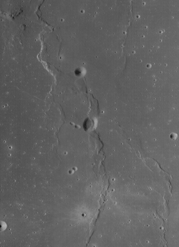
A closer look at what was once thought to be a 'chain of craterlets,' a minor catena, slicing perpendicularly through one of a system of parallel north to south rilles - likely faults, that run from Maclear to Sosigenes A. Closer examination in more recent surveys by the LROC Narrow Angle Camera seem to show this structure to be a vent, perhaps related to the faulting. The above is medium resolution sample from  LROC NAC  M1108117962LR [NASA/GSFC/Arizona State University].
Elsewhere we've seen these hollows as hints of relatively recent geological activity, on ancient plains or on small extrusive domes - yet here we seem to see hollows placed in context with a visible complexity of formations with which they may be related. Perhaps some of the other hollows, like those situated alone on the Tranquillitatis plains south of Ross crater and east of Sosigenes, north of Arago and its domes, are all related to conditions under the surface that will turn out at least as complex. 

We don't know enough about Mare Tranquillitatis. It's not clearly an impact basin, like Imbrium and neighboring Serenitatis. It should be interesting to eventually examine the finer detail of these formations in the deeper granularity of the GRAIL mission data.

At Sosigenes faults run south to north parallel with the northwest edge of the mare. Classified as linear rilles, a kilometer or more wide, one is bisected perpendicularly by an 18 km long "gash," hinting at the collapse or shifting under the surface. It is probably immensely old, though at some point the floor of the depression may have been intruded upon from below, perhaps by gases venting at what may have been a weak zone, where the steep 380 meter walls of the depression meet the floor.

In depressed zones east and west of the central "depression of interest," the contact zone joining wall and floor has been blurred by mass wasting. Perhaps in the central depression, however, the distinction was made by material being blown out around the central floor. If so, it's not readily apparent around the outer edge of the formation (which is not the same as saying it isn't there.) Where did it go?

This 580 by 800 pixel sample of the full resolution mosaic (LROC NAC M1108117962LR) shows the 380 meter depths of the elongated formation is punctuated by 'meniscus hollows' very similar to others found just to the east, at the surface of Mare Tranquillitatis south of Ross crater, and more famously at the Ina structure, much further west. Perhaps they most resemble 'hollows' on the floor of the central depression of Rima Hyginus. Found here at the contact zone between the structure's floor and walls, the primary surface seems characterized by a low crater count. Are these hollows points where gases have explosively uncovered the structure's original floor?  [NASA/GSFC/Arizona State University].
 Closer still, in the full-resolution close-up above, something stands out, much as it does at that most famous of the 'meniscus hollows,' Ina. You can make your own comparisons with another new LROC NAC oblique mosaic detailed further below.

In short, the material covering the central depression's floor at its interior, away from the encircling hollows, doesn't appear to share the saturation cratering superpositioned upon it that is more characteristic of the surrounding plain. In fact, like the beaded "frozen liquid' appearance of the material at Ina, it looks relatively new.

A look more or less straight down (and at much higher resolution) at the eastern interior of the 380 meter deep central depression, at its walls together with a small part of the surrounding Rimae Sosigenes plain. Under higher illumination angles the depths of the topography defies our intuition. It doesn't look as deep as it in the oblique view further above, illustrating once again how relief seems to disappear on the Moon in the absence of shadows. From earlier LROC NAC observation M152750200LR, orbit 7645, February 19, 2011; resampled from 0.47 cm per pixel resolution  - angle of incidence 35° - from 39.56 km [NASA/GSFC/Arizona State University].
And an even closer look at one of the hollows along the contact between floor and the steep walls of the central depression at Rimae Sosigenes. Small boulders - apparently - shed from the wall  (and a slope of collapsed talus is piled at right (easier to see in the oblique view above). This field of view, 335 meters wide, comes from LROC NAC observation M177508146LE, LRO orbit 11295, December 2, 2011; angle of incidence 69.92° (slew -14.8°) resolution 0.48 cm per pixel from 37.86 km [NASA/GSFC/Arizona State University].
Optical maturity is no help here, hinting that the newest material is either more than a billion years old or does not result from the kind of kinetic energies released by cratering. In the image above, at bottom center, runs another contact line between the slope of "older" debris from collapsed walls at bottom right and the "newer" material "beaded" at the depression's center.

Is there a difference in the crater count? The material on the slope at bottom right seems darker, but that is likely an illusion from shadow and the elephant skin on nearly every lunar sloped terrain. It hardly counts as a control sample for counting craters and their size and erosion, etc., but no obvious difference in ages stands out between the two zones - nor are there any boulders or trails on either patch of ground. Those seem almost exclusive to the interior of the "blown out" hollows.

Perhaps the best large scale comparison with the meniscus hollows of the Sosigenes depressions is the endlessly compelling Ina formation of Lacus Felicitatis. And that's as good a segue as any to another newly-released LROC NAC oblique observation of that much studied and barely understood feature just below.

A fresh LROC NAC oblique view the Ina formation and its surroundings, a challenge for telescopes on Earth. A closer look at this mosaic's rendition of Ina's distinctive "D" is shown immediately below. Note the apparent rising cone of Mount Agnes, to Ina's northwest. This mosaic is assembled from LROC NAC M1108203502LR, exposing a field of view also roughly 43 km across, with both spacecraft and camera slewed -53°), looking west from 127.29 km over 18.77°N, 11.64°E, Sulpicius Gallus and southern Mare Serenitatis were directly below LRO, outside this side-looking view [NASA/GSFC/Arizona State University].
Perhaps it's a toss-up whether Ina or the hollows on the floor of the central depression of Rima Hyginus more closely resemble the hollows at Rimae Sosigenes. Perhaps the latter is something in-between. 

The view of Ina at an oblique angle, above and below, captured more than 140 km away from the LROC cameras, is not our most detailed look at that formation. Some unscaled examples of the very closest views of Ina surfaced with the LROC PDS release in December 2011. There doesn't seem to be much in the way of a depression resulting from the forces that created Ina, though the beaded remnants or surfacing seems to closely resemble the floor of the Rimae Sosigenes depression.

A new angle on the Ina (3 km across, 18.65°N, 5.3°E) from the immediately preceding mosaic sampled at its full 2.6 meter per pixel resolution [NASA/GSFC/Arizona State University].
Over the next decade or so, when researchers have time to weave together data collected by LROC, Mini-RF and from the GRAIL twins, a better picture of these 'meniscus hollows' will likely emerge. In the end, the formations themselves may turn out to be the surface manifestation of something deeper that we can hardly imagine today.

Related Posts:
Inside Rima Hyginus (June 12, 2012)
Whale of a Hollow (March 20, 2012)
Ina of the Meniscus Hollows (March 21, 2012)
The closest of lunar close-ups (December 16, 2011)
It's a gas, man (October 8, 2011)
Spectral Properties of Ina (February 7, 2011)

Sunday, December 16, 2012

LRO teams deliver 12th quarterly release to PDS

The 8000 meter wide pyroclastic vent high on the second outer ring of Mare Orientale, at very high resolution, has nearly invariably been in shadow, or the LRO spacecraft has been at lower altitude and too close to catch this breathtaking view in one take. As it is, the full observation was repeated in sequential orbits, the makings of a spectacular stereo 3D anaglyph. From a mosaic including both the left and right frames of LROC Narrow Angle Camera (NAC) M1099502843, orbit 14378, August 13, 2012; resolution 0.75 meters from 72.12 km [NASA/GSFC/Arizona State University].
The Lunar Reconnaissance Orbiter Camera (LROC) team at Arizona State University, and investigation teams overseeing the other instruments on-board the robust LRO platform, are once again on time with their 12th quarterly release to the Planetary Data System (PDS). Its another impressive store, with more data gathered over three months than most deep space missions sweep up in an entire tour. All together, the LRO mission has again broken its own record, one unlikely to be surpassed for many years. LRO has returned more data than all present and past deep space missions combined.
 
To a widespread, devoted and grateful group unashamed to call themselves "lunatics," Christmas has arrived early once again this year.

Far to the northeast of the more familiar heart of the Reiner Gamma albedo swirl (and magnetic anomaly) in Oceanus Procellarum, the bright but thin layer of optically immature regolith meanders up into the Marius Hills. The higher altitude assumed by the LRO mission this year allowed the diffuse contact region to be photographed in one observation, under the same lighting conditions. The LROC Wide Angle Camera 100 meter global mosaic is used as context for that area, swept up in the NAC observation below [NASA/GSFC/Arizona State University]. 
Still at high resolution, the physical relationship at the surface between the Reiner Gamma swirl and the Marius Hills volcanism can be studied under similar lighting condition, and in one take, in this LROC NAC mosaic. LROC NAC M1099209032LR, orbit 14337, August 10, 2012; resolution in the original 0.98 meters from 118.85 km, angle of incidence 40.15° [NASA/GSFC/Arizona State University].
"The 12th LROC Planetary Data System release includes images acquired between June 16 to September 15," according to the announcement, posted by LROC team member Ernest Bowman-Cisneros.

This LROC release totals 16.54 TB, and includes ten more Narrow Angle Camera (NAC) Digital Terrain Models (DTM) and 6 NAC image mosaics of important Region of Interest (ROI).

"To date," Bowman-Cisneros writes, "the LROC Team has delivered 893,493 LROC images and over 8,653 derived (RDR) data products to the NASA Planetary Data System. The complete LROC PDS archive can be accessed via the URL http://lroc.sese.asu.edu/data or a search for specific images or mosaics can be made using the LROC WMS browser. Also be sure and try out QuickMap!"

The anatomical mix of dark and relatively bright featured tossed up by simple craters impacting the Marius Hills can also be examined from the unique perspective presented in the LROC NAC oblique images, this one being the first we stumbled across, a brief study of the shield volcano's interior. LROC NAC M1096851065LR, LRO orbit 14007, July 13, 2012 [NASA/GSFC/Arizona State University].

Thursday, September 27, 2012

LRO Release 11 to the Planetary Data System

The 'Cobra's Head' of the unofficially designated Sinuous Rille of the western Marius Hills volcanic shield formation of Oceanus Procellarum, in high relief (incidence angle 75.29°); LROC Narrow Angle Camera mosaic of left and right frames M193325282LR, spacecraft orbit 13514, June 3, 2012, resolution 1.26 meters per pixel from 125.78 kilometers altitude [NASA/GSFC/Arizona State University].
Ernest Bowman-Cisneros
LROC News System

The 10th LROC Planetary Data System release includes images acquired between 2011-03-16 to 2012-06-14. This release contains 76,715 EDR images totaling 9.4 TB and 76,715 CDR images totaling 20 TB. An additional 10 LROC NAC DTM and 3 NAC Region of Interest (ROI) products were also added to the LROC RDR Dataset.

To date, the LROC Team has delivered 817,358 LROC images and over 8,556 derived (RDR) data products to the NASA Planetary Data System. The complete LROC PDS archive can be accessed via the URL http://lroc.sese.asu.edu/data or one can search for specific images or mosaics using the LROC WMS browser

Also be sure and try out Quickmap!

Saturday, June 16, 2012

LROC: 10th Release to Planetary Data System

As it closes in on a full 3 years in lunar orbit, at midnight GMT, 16 June, 2012, the Lunar Reconnaissance Orbiter was completing it's 13,670th orbit of the Moon. 


Ernest Bowman-Cisneros
LROC News System

The 10th LROC Planetary Data System release includes images acquired between 2011-12-16 to 2012-03-15. This release contains 72,338 EDR images totaling 8.9 TB and 72,338 CDR images totaling 19 TB. An additional 11 LROC NAC DTM products were also added to the LROC RDR Dataset.

To date, the LROC Team has delivered 740,643 LROC images and over 8376 derived (RDR) data products to the NASA Planetary Data System. The complete LROC PDS archive can be accessed via the URL http://lroc.sese.asu.edu/data or o\ne can search for specific images or mosaics using the LROC WMS browser. Also be sure and try out Quickmap!

Thursday, March 15, 2012

LROC 9th PDS Release

A favorite telescopic target, casting a long shadow at local sunrise, the 12-km long Galilaei M dome, along side Rima Galilaei, in Oceanus Procellarum west of the similar myriad Marius hills and north Reiner Gamma. LROC Wide Angle Camera (WAC) observation M178008514C (604nm), orbit 11369, December 8, 2011; incidence angle 76.82° - resolution 56.38 meters per pixel from 40.16 km [NASA/GSFC/Arizona State University].
Ernest Bowman-Cisneros
LROC Announcements

The 9th LROC Planetary Data System release includes images acquired between September 16, 2011 to December 15, 2011.

This release contains 69,687 EDR images totaling 8.5 TB and 69,687 CDR images totaling 17.5 TB.

To date, the LROC Team has delivered over 655,904 LROC images to the NASA Planetary Data System. The complete archive can be accessed via the URL http://lroc.sese.asu.edu/data or searched using the URL http://wms.lroc.asu.edu/lroc.

Saturday, December 31, 2011

LROC NAC August Close-Ups, Part 3

This reproduction of a roughly 188 meter wide segment (between lines 18602 and 19053) of LROC Narrow Angle Camera (NAC) observation M168000580R may not be the best view of the Apollo 17 lunar module descent stage or the rover tracks and foot prints left behind by Cernan & Schmitt in 1972, still it was collected from an altitude of only 22.41 kilometers on August 14, 2011; LRO orbit 9892, official resolution 0.41 meters per pixel with an incidence angle of 45.17° [NASA/GSFC/Arizona State University].
Joel Raupe
Lunar Pioneer

Since the latest release of Lunar Reconnaissance Orbiter Camera (LROC) images on December 15 we've been able to get a better idea of what flight directors were up to last August. As advertised, the record-breaking spacecraft's roughly 50 kilometer high circular polar orbit was briefly lowered to allow a narrow window for very low altitude photography.  The lowest perigee (or perilune) appears to have been engineered into orbits 9838 through 9973, between August 10 and August 21, 2011. At least that's the period where LRO Narrow Angle Camera (NAC) frames from last summer are available at resolutions higher than 40 centimeters per pixel.

The area covered, moving westward with the Moon's easterly rotation under the LRO orbit, begin near the nearside's east limb at the 85th meridian traveling short of the 60th meridian west (near 310° east). That period in LRO's August close-up maneuver featured perilunes as low as 22 kilometers over the nearside equator with apogee back up near the Nominal and Science Mission altitude higher than 40 kilometers while over the Moon's farside. Put another way, the very highest resolution LROC NAC frames were captured last August between Mare Marginis west to Aristarchus and the Marius Hills.

Our continued, now more extensive tour, of the LROC August low-altitude close-ups has uncovered many extensive fields of boulders and their trails. The largest boulder seen above on the floor of the Vera (26.32°N, 316.28°E) rille formation, directly adjacent to the Prinz ghost crater and head of a long and deep sinuous rille in Oceanus Procellarum, is roughly 22 by 22 meters in size. Many of these August perilune NAC observations appear fore-shortened in this raw first look. A description of the full-width NAC frame which included the detail above is reproduced below [NASA/GSFC/Arizona State University].

Vera-Prinz.  The full width of LROC NAC observation M168488930L, orbit 9964, August 20, 2011; 0.41 meters per pixel with an illumination incidence angle of 43.82° from 26.43 kilometers. The wider image does not provide the context of a Wide Angle Camera image but at least it shows where the boulders further above originated. Is "Vera" is not a crater but a caldera, the "cobra head" of a long and winding rille. The whole scene rests high above the Procellarum basin floor, on the still exposed northeastern ejecta blanket of the almost completely buried ghost crater Prinz. Still, Vera is a deep formation. The lowest elevation inside Vera above is about 550 meters below the surrounding terrain (which only looks flat) [NASA/GSFC/Arizona State University].
The primary purpose of the low altitude maneuvers last August was to allow a last, very close look at three of the six Apollo landing sites, but LROC's targeting team took advantage of the 11 day window to gather hundreds of observations. In addition, the period allowing for greater than 0.4 meter per pixel NAC resolutions was bracketed by a slow, probably energy conserving re-circularizing of the LRO orbit back to within 50 km. There are far more observations among those images between June 15 and September 14 released in December with resolutions higher than the mission average of half a meter per pixel.

There will undoubtedly be thousands more NAC observations captured through December (scheduled for release in mid-March). Though LRO will be placed at an extended mission altitude of greater than 100 km in January it's likely more than half of the Moon's surface will soon be mapped at high resolution, a very successful legacy indeed.

Not every feature on the lunar surface is billions of years old. On edge of the floor of the crater Milichius (9.86°N,329.75°E), seen above, a six meter boulder clearly rolled down the steep wall and came to rest before one of several subsequent dry flows covered the end of its trail, without moving or covering the boulder. The full width of the frame is detailed immediately below [NASA/GSFC/Arizona State University].
As context for the previous full resolution field of view (white rectangle), the full width of LROC NAC frame M168401046L, orbit 9951, August 19, 2011; resolution 0.395 meters per pixel with an illumination incidence angle of 37.62° from 23.08 kilometers. A 64 meter per pixel Wide Angle Camera LROC QuickMap mosaic of the vicinity is available HERE [NASA/GSFC/Arizona State University].
A full resolution frame from a very high resolution LROC NAC observation of a cross-section of landmark nearside crater Bessel (21.73°N, 17.92°E), prominent in the southeastern Mare Serenitatis. This dry flow is composed of material shed from the crater's southwestern wall that did not (or hasn't yet) reached the crater floor. The full width of the NAC frame is reproduced for context in the next image [NASA/GSFC/Arizona State University].
A full width view of LROC NAC frame M168088745L, a breathtaking north-south cross-section of the crater Bessel, August 15, 2011; orbit 9905, resolution 0.395 meters per pixel with an illumination incidence angle of 45.41° from 23.07 kilometers. In this slightly foreshortened view the most prominent feature is the 1325 meter plunge down the southwestern wall of Bessel, from rim to the wall's contact zone with the crater floor [NASA/GSFC/Arizona State University].