
 |
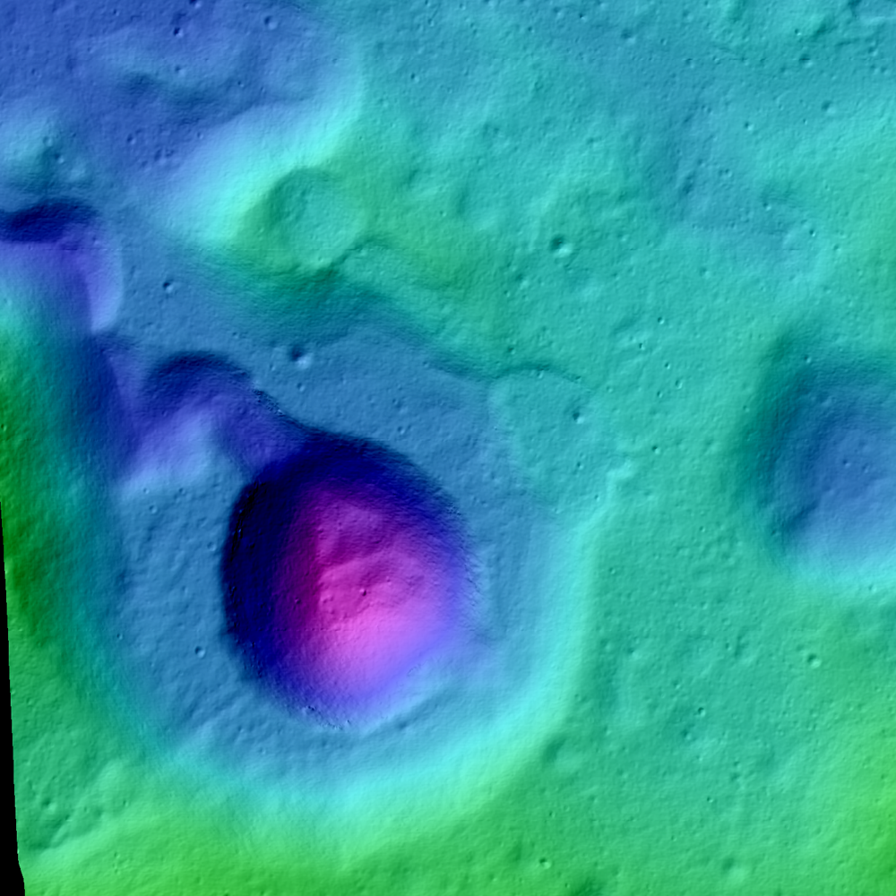
| Newly released LROC Narrow Angle Camera (NAC) Digital Terrain Model (DTM) of Rima Prinz I where it meets source crater Vera (~2 km in diameter). Field of view approximately 7 km across [NASA/GSFC/Arizona State University]. |

LROC News System
The Rimae Prinz Region displays a diverse array of features including sinuous rilles, massifs, and flooded craters. Today's Featured Image focuses on a Rima Prinz I, a sinuous rille just north of Prinz crater that originates from a cobra head-shaped depression named Vera.
This distinctive depression is probably the source for the mare materials extruded in Rima Prinz I. This particular rille likely formed during the emplacement of the mare that filled the crater Prinz and flowed around the rim of Prinz for approximately 25 km before taking a sharp turn to the north, perhaps occupying an existing topographic low.
 |
| In mid to late 2011, LRO was maneuvered in such a way to allow heretofore unprecedented extreme close-ups of the lunar surface, some from within 20 km. The Vera vent crater (26.48°N, 316.34°E) was among these well-positioned areas. This 1880 meter-wide field of view was cropped from a mosaic of both left and right camera frames of LROC NAC observation M168488930LR, orbit 9964, August 20, 2011; 43.79° angle of incidence, resolution 41 centimeters per pixel from 25.43 km [NASA/GSFC/Arizona State University]. |
 |
| Vera and Rima Prinz I, apparently spill over the north rim and wall of mare-filled Prinz crater, in a 14 km-wide field of view from LROC NAC mosaic M104805368LR, spacecraft orbit 602, August 13, 2009; resolution 1.47 meters per pixel from 147 km [NASA/GSFC/Arizona State University]. |
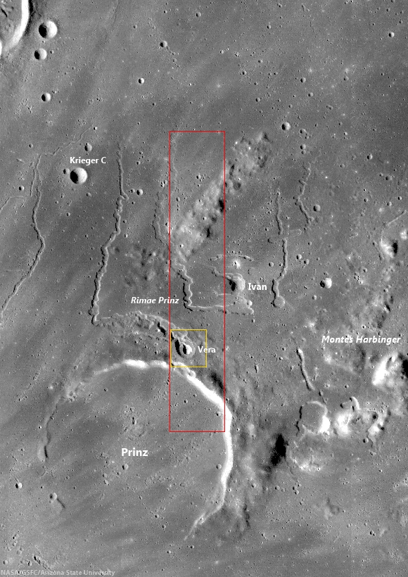 |
| LROC Wide Angle Camera (WAC) context image of the Rima Prinz region, highlighting the highly reflective rays of nearby Aristarchus crater, and showing local features in relation to Prinz (46.13 km, 28.49°N, 315.86°E). Red rectangle denotes area in a newly released NAC DTM, from which the LROC Featured Image released December 19, 2013 was taken, and the yellow box outlines the topography in that Featured Image [NASA/GSFC/Arizona State University]. |
Explore the newly released NAC DTM, HERE.
Related Posts:
Partially flooded crater rim near Rimae Prinz (August 15, 2013)
An observation post on the rim of Posidonius (July 19, 2013)
A Truncated Rille (May 30, 2013)
Meanders in Posidonius (February 5, 2013)
Old Man River (Of Lava) (July 5, 2011)
Rilles as far as the eye can see at Prinz (December 3, 2010)
Rimae Posidonius (December 1, 2010)
Rimae Prinz - Constellation Region of Interest (April 16, 2010)
No comments:
Post a Comment