Wednesday, June 25, 2014

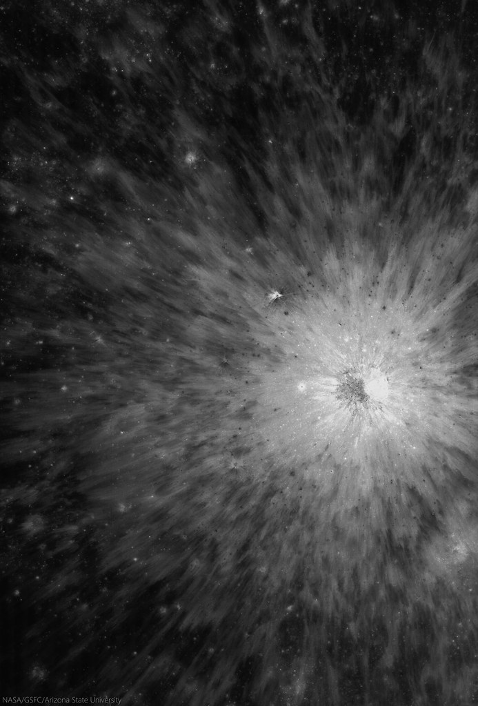
Fresh crater in Campbell, north of Mare Moscoviense

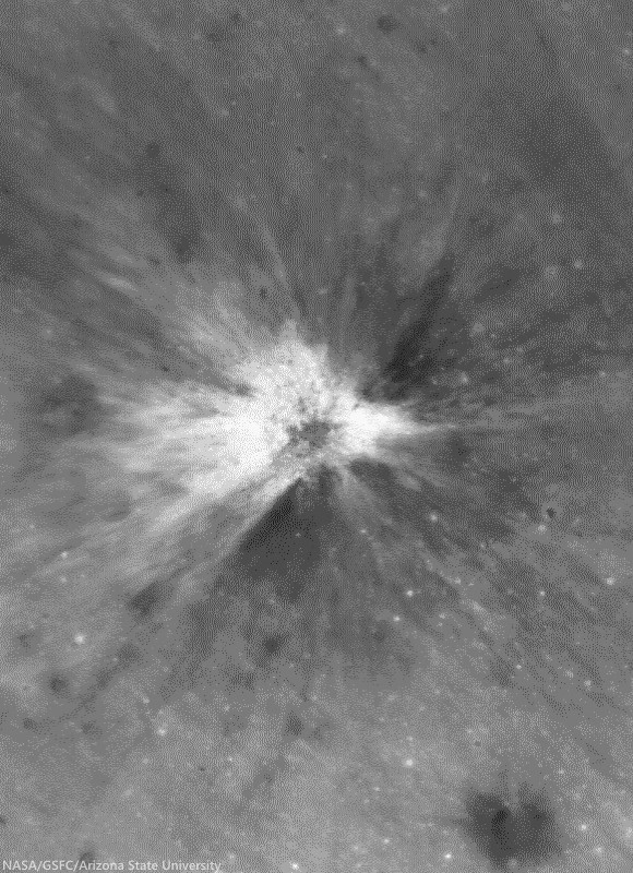
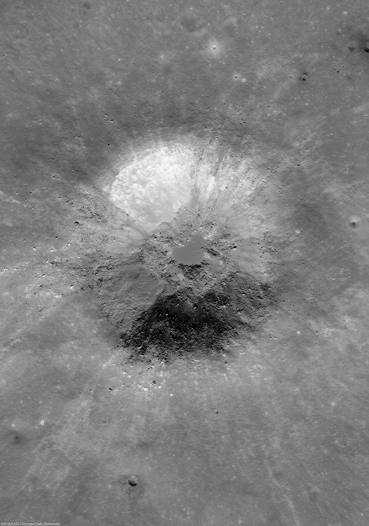
Very fresh roughly 4 km crater deep inside ancient, 222 km Campbell crater, north of Wiener F and Mare Moscoviense. Note the paucity of small craters on the melt disk on this young crater's floor, one of many clues to a recent origin.  LROC NAC mosaic M1133199962LR, LRO orbit 19112, September 7, 2013; 4.28° incidence, resolution 1.11 meters from 148.28 km over 46°N, 150.87°E [NASA/GSFC/Arizona State University].
H. Meyer
LROC News System

The longer a crater's ejecta is exposed to space weathering, the lower the albedo of the ejecta becomes.

Over time, gravity also takes effect, pulling material downslope and softening the appearance of the crater rim and the hummocky ejecta deposit.

Therefore, craters with highly textured, high albedo ejecta and crisp, well-defined rims are considered relatively fresh, like the crater above (46.188°N, 150.717°E), deep within the ancient farside crater Campbell.

In this case, the slightly asymmetric ejecta blanket is likely due to the fact that this crater formed on top of existing topographic highs, which appear to be the intersecting rims of partially flooded craters.
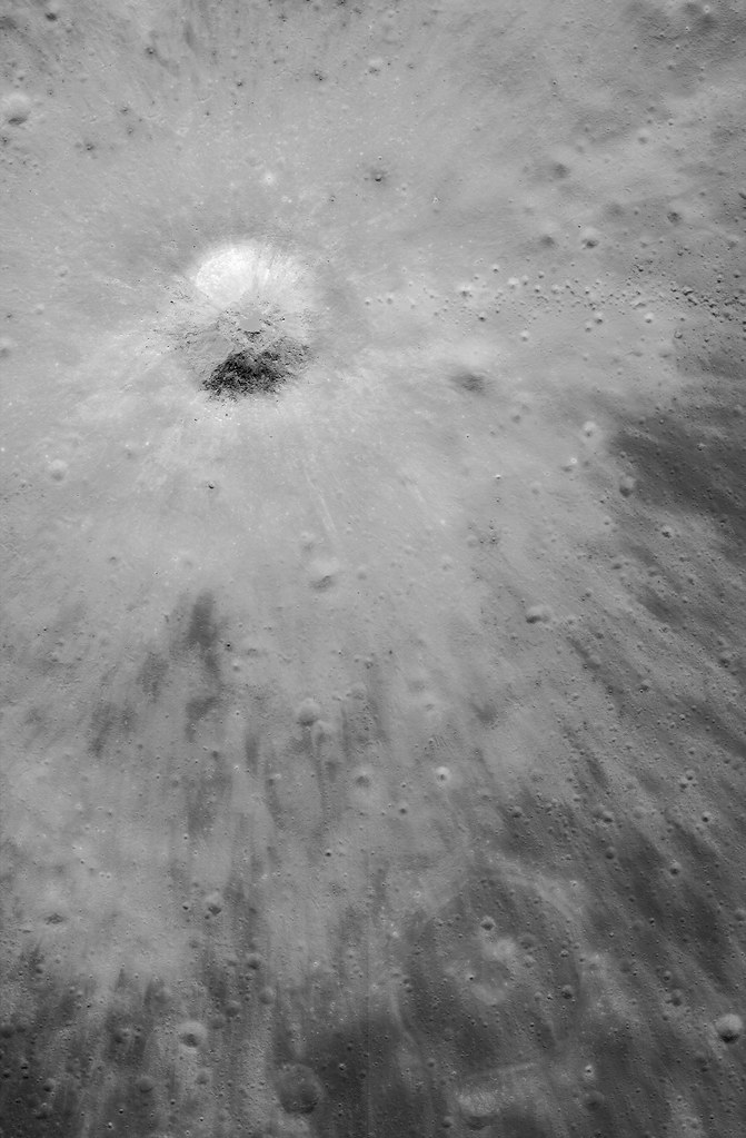
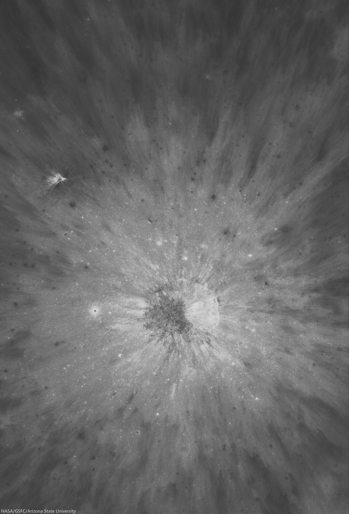
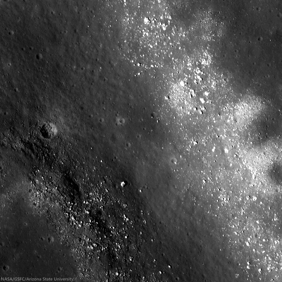
Bright, optically immature ejecta blanket, from the fresh crater is like a bright fan of farside anorthositic highlands terrain spread over an iron rich optically mature patch of mare deep inside ancient Campbell crater. Note the string of secondary crater east of the impact (and the nearly mare-inundated "ghost crater," on the edge of the ejecta blanket at bottom right). A larger 10.74 km-wide field of view, from the same, low incidence angle LROC NAC mosaic. [NASA/GSFC/Arizona State University].
The crater in the opening image is located in the floor of the much larger, much older crater Campbell (See WAC animation below). Campbell, named after two American astronomers, is an interesting study in its own right.

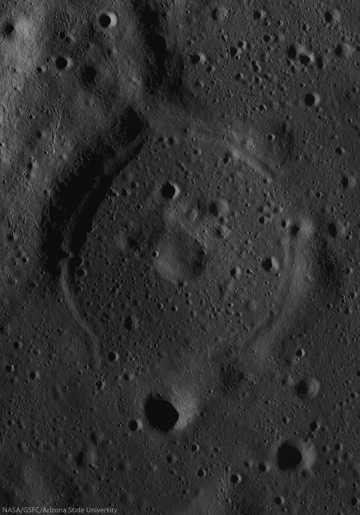
A portion of the floor of Campbell has been resurfaced by basaltic volcanism, an uncommon occurrence on the lunar farside. In this case, the volcanic activity did not produce sufficient lava to completely cover all of the craters in the floor, leaving traces of flooded craters like the one at lower right, on the edge of the ejecta blanket, in the NAC field of view above.
Campbell (222 km; 45.57° 152.9°E), in the farside highlands, almost disappears under certain conditions, because much of the wider region here has been relentlessly bombarded with predominantly iron nuclei, and "gardened" at a rate of 3 cm every two million years since the terrain first assumed its general shape. This animation shows the footprints of both LROC NAC observations used in this posting, above and below, of the fresh crater and immediate surroundings, near a boundary of basalt melt inside Campbell. From LROC WAC-derived 100-meter global mosaic, GLD100 elevation model and natural colors at normalized albedo, plus color-ratio analysis from Clementine (1994) [NASA/GSFC/Arizona State University].
Flooded craters are useful to scientists trying to determine the timing and sequence of events in areas that display multiple geologic processes in close proximity, such as impacts and volcanic activity.

An ephemeral ghost crater stands out in the depth of field resumed in long evening shadow, though the reflectivity of the ejecta from the fresh crater toward the north-northwest is still slightly traced out. A 5.77 km-wide field of view from M180187723LR, LRO orbit 11676, January 2, 2012; 81.93° evening incidence angle, 1.71 meters resolution from 176.17 km over 45.93°N, 151.34°E [NASA/GSFC/Arizona State University].
Because we can see partially flooded craters, we know that the crater Campbell must have existed long enough for new craters to form on its floor before volcanic activity began.

Understanding the Moon requires orbital photography at every angle of illumination. A full-width 16.47 km-wide field of view from M180187723LR  [NASA/GSFC/Arizona State University].
The fresh crater from Today's Featured Image adds another point of reference because its ejecta drapes the nearby mare deposit, making it the most recent addition to this region's geologic history.

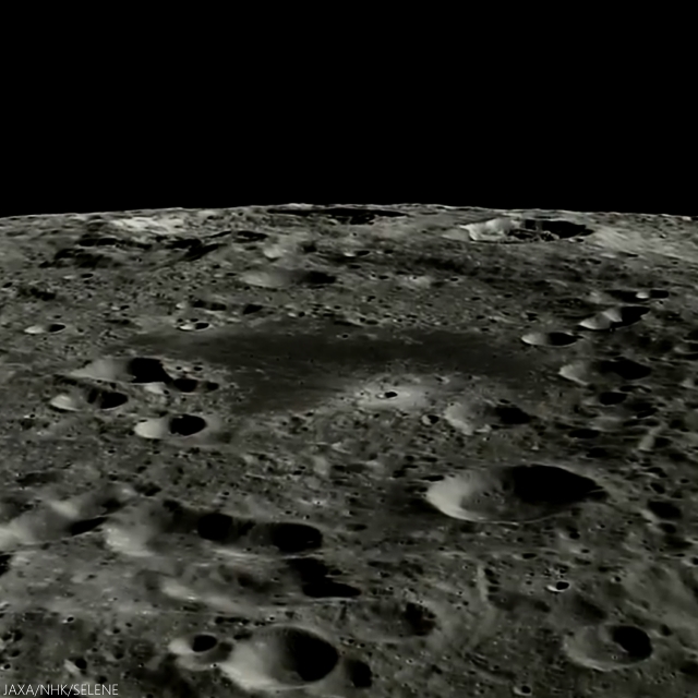
The western two-thirds of Campbell are more difficult to discern from polar orbit, but our bright fresh crater perched on the north of its small plain of mare basalt are easy to pick out, looking south from Japan's lunar orbiter Kaguya in 2008. This image is taken from just past the halfway point in the HDTV sequential still video below, from approximately 120 km overhead [JAXA/HKT/SELENE].

As noted in the YouTube video, presented by the Japan's space agency JAXA, Campbell is immediately north of Von Neumann and Wiener craters (on Campbell's southeast and southwest, respectively). Between these two craters, unnoted however, is Wiener F, with it's distinctive semi-circular bench of impact melt, discussed in more detail HERE.

Explore the full NAC mosaic, HERE.

Related Posts:

Tuesday, June 24, 2014

Breaking Down Walls

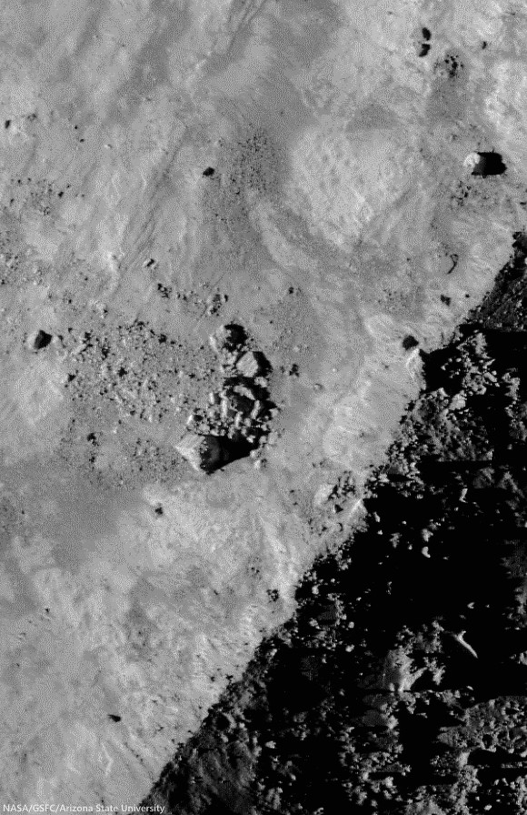
Gravity is winning as boulders erode and ultimately tumble down from the rim of Moore F (23.8 km; 37.29°N, 185.03°E), in the north farside highlands. 862 meter-wide field of view from LROC NAC mosaic M1156517189LR, LRO orbit 22390, May 18, 2013, spacecraft and camera slew 11.24° from nadir, 84.67° sunset incidence angle, resolution 1.49 meters from 146 km over 37.45°N, 186.59°E [NASA/GSFC/Arizona State University].
H. Meyer
LROC News System

Moore F is located in the highlands of the lunar farside. Its well-defined rim, steep walls, and the predominance of boulders suggest that it is quite young.

Over time, micrometeorite bombardment, the shock from more recent impacts, and other erosional processes break down the rock that composes the crater rim, walls, and floor.

The result will eventually be a smoother, more subdued appearance.  The many large blocks suggest that Moore F has only just begun to break down.

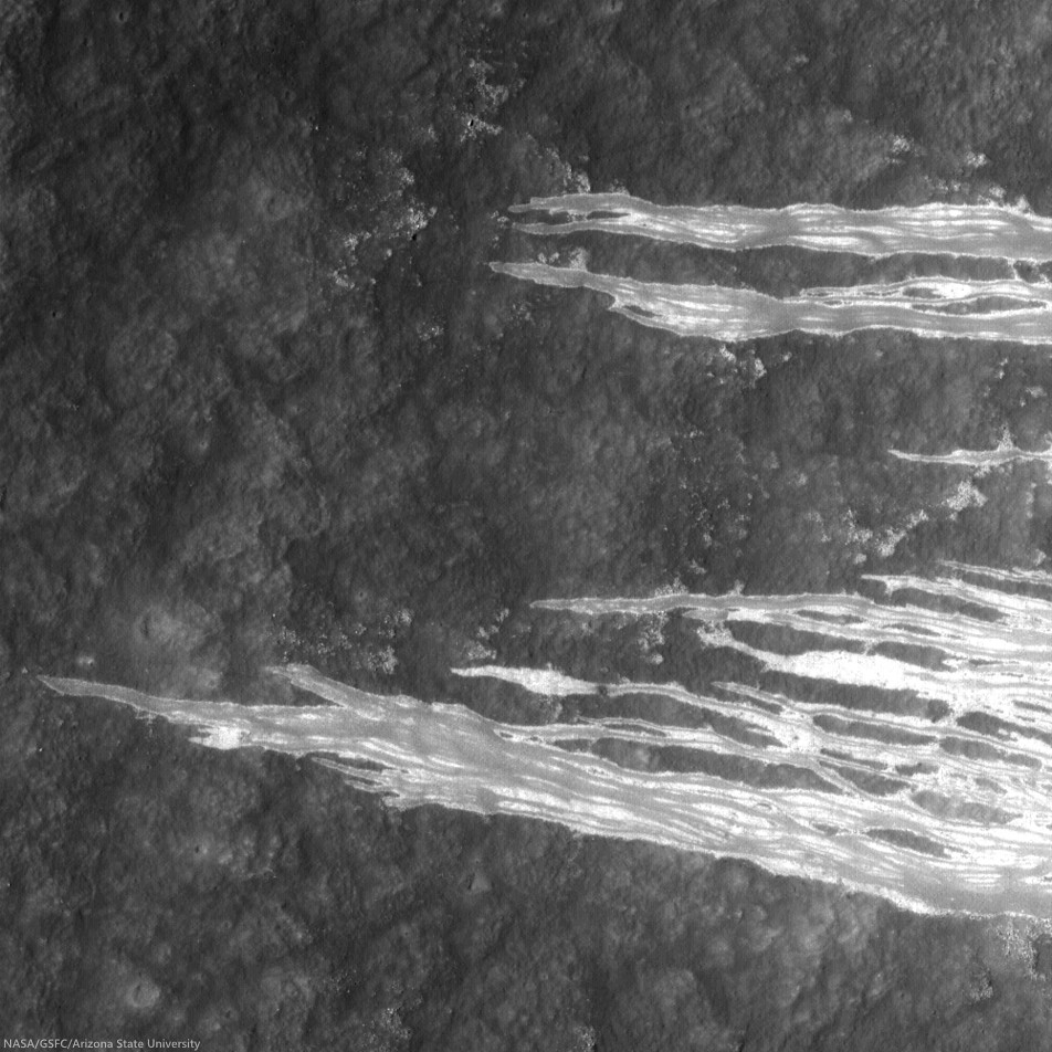
The impact process left Moore F with exquisite impact melt, abundant terracing, and a stunning central uplift, but a closer look reveals subsequent modification courtesy of gravity that has yielded even more entrancing beauty in the flows streaming down its walls, as in the NAC image below. 

LROC NAC image displaying granular flows in the wall of Moore F highlighted by the dramatic lighting of a low sun. Downhill is to the southeast (bottom left). Image width is approximately 8 km [NASA/GSFC/Arizona State University].
The streaks we see on the walls of Moore F in the image above are likely made of granular material that acted like a fluid as it slid downslope. But how do we know if the flows formed by the downslope movement of dry, fine-grained material?

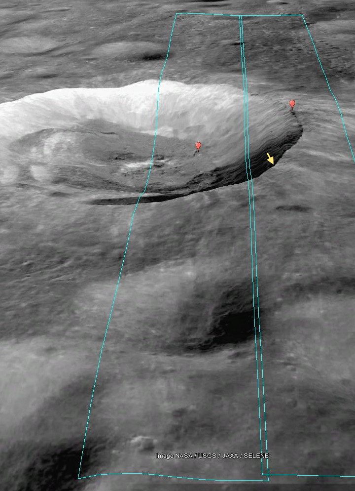
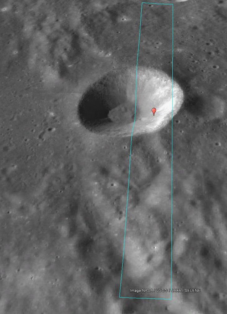
Footprint of LROC NAC observation M1156517189L & R, LRO orbit 22390, May 18, 2013 [PDS/Google Earth].
The sources of the flows can be traced to specific locations and outcrops along the rim of the crater, suggesting that this is material from the rim that was disturbed and flowed downslope. The slightly braided appearance suggests multiple depositional episodes. These episodes could have been triggered by collapsing material from the rim or wall, boulders (like those in the opening image) knocking material loose as they hurtle downhill, or by shockwaves from nearby impacts.

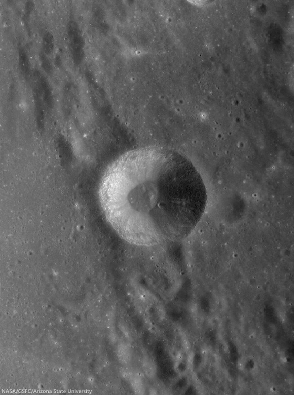
This "real color" false color LROC WAC-derived 155 km field of view, combining Normalized Reflectance with a touch of RGB beta natural coloring, shows the wide dispersal of bright ejecta from Moore F, overwhelming the topography of older, nearby larger craters in the farside highland terrain [NASA/GSFC/Arizona State University].
Investigate this incredible NAC mosaic HERE.

Related Posts:

Wednesday, June 18, 2014

Soaring over the Apennines

This is another LROC NAC mosaic viewers may really want to see using the "see all sizes" download option that accompany slideshow images in Flickr. An oblique view, looking west over the Apennine Mountains toward Hadley Rille (above -north is to the right).  The morning shadows are much as they were July 30, 1971, when Dave Scott and Jim Irwin flew on their backs over range at bottom, flipped forward and landed on the broad plain between those hills and Rima Hadley. Hadley Base, their landing site, and the descent stage of the Apollo 15 lunar module Falcon is right where they left it, just within the resolution of full scale reproductions of this image. 
Notable features in a thumbnail of LROC NAC oblique mosaic M1123519889LR, LRO orbit 17751, May 18, 2013; spacecraft and cameras slew 55.22° from orbital nadir, 76.87° incidence angle, average resolution 2.87 meters from 130.27 km over 26.11°N, 11.75°E [NASA/GSFC/Arizona State University].
J. Stopar
LROC News System

Apollo mission planners selected an adventurous landing site for Apollo 15 (26.132219°N, 3.633861°E), on a relatively small patch of lava plains (mare). 

This site is nestled between the towering Apennine mountains to the east, attaining heights of 3-5 km, and the 200 meter deep, v-shaped valley of Hadley Rille to the west.

The experience gained from the successful landings of the preceding Apollo missions afforded mission controllers confidence that a landing descending through a mountain range was possible, though it required a steeper descent angle (25° rather than 14°).

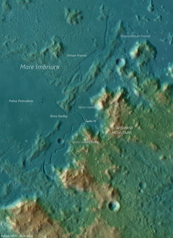
The landing site of Apollo 15 (direct center), on Hadley Rille Delta between the Apennine mountain range on the southeast periphery of Mare Imbrium and Rima Hadley, winding through the distinctly darker mare material of Palus Putredinis. LROC WAC GLD100 elevation overlain atop LROC 100 meter global mosaic. The peaks of the Apennine Mountains rise more than 5 km over the interior of the Imbrium basin [NASA/GSFC/Arizona State University].
A captioned video of the descent of Apollo 15 conveys the excitement of astronauts David Scott and James Irwin as they set down near Hadley Rille. The Hadley Rille landing site also presented an opportunity to test the capabilities of the new lunar roving vehicle (LRV).


"Down on the plain at Hadley." Newly realigned video (3:37) of the landing of Apollo 15, July 30, 1971. [LunarModule5].

The Apennine Mountain Range formed during the Imbrium basin-forming event, and it was hoped these mountains contained materials from very early in the Moon's history (which they did!). As astronauts Irwin and Scott descended over the Apennines, they reported a floating sensation that resulted from glimpsing mountain peaks passing by the windows of the Lunar Module (LM). The descent was a complete success, and the LM set down near the planned site! Although, the astronauts were a little surprised to land with one foot-pad in a small crater, placing the vehicle on a slant.

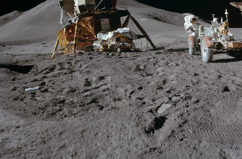
Cmdr. Dave Scott captured this view of the Apollo 15 lunar module Falcon where it came to rest tilting toward the Apennine mountains beyond, while Jim Irwin checked out the first of the three Apollo "J mission" lunar rovers. See full-size mosaic of two color images from the panorama (AS15-86-11600 and 11601) HERE [NASA/JSC/ALSJ].
Three EVAs (or traverses) were planned for Apollo 15 using the LRV, two of which allowed sampling part of the Apennine Mountain Range to the south and southeast and required long (multi-kilometer) traverses.

Thumbnail of a mosaic of black and white images from Science Station 6, during the second EVA of the Apollo 15 expedition, on the slopes of the "Apennine Front." In the full-size panorama, HERE, the lunar module Falcon is visible, several kilometers away, between Hadley rille on the far left and Mt. Hadley, dominating the center of this mosaic [AS15-85-11481-11492, NASA/JSC/ALSJ].
Astronauts Scott and Irwin were accomplished field geologists; listen HERE as Commander Scott recently reflected on his Apollo 15 experience, including the importance of field-geology training.

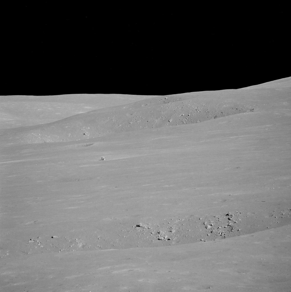
The tiny arrow marks the location of the LM, just barely within the resolution of the LROC NAC mosaic (at full-scale), while LRO orbited over a spot 130 km away. Of course, the landing zone has been documented with remarkable detail from LRO, from better vantages [NASA/GSFC/Arizona State University].
Related Posts:

Thursday, June 12, 2014

Study in superpositioning at Vavilov D

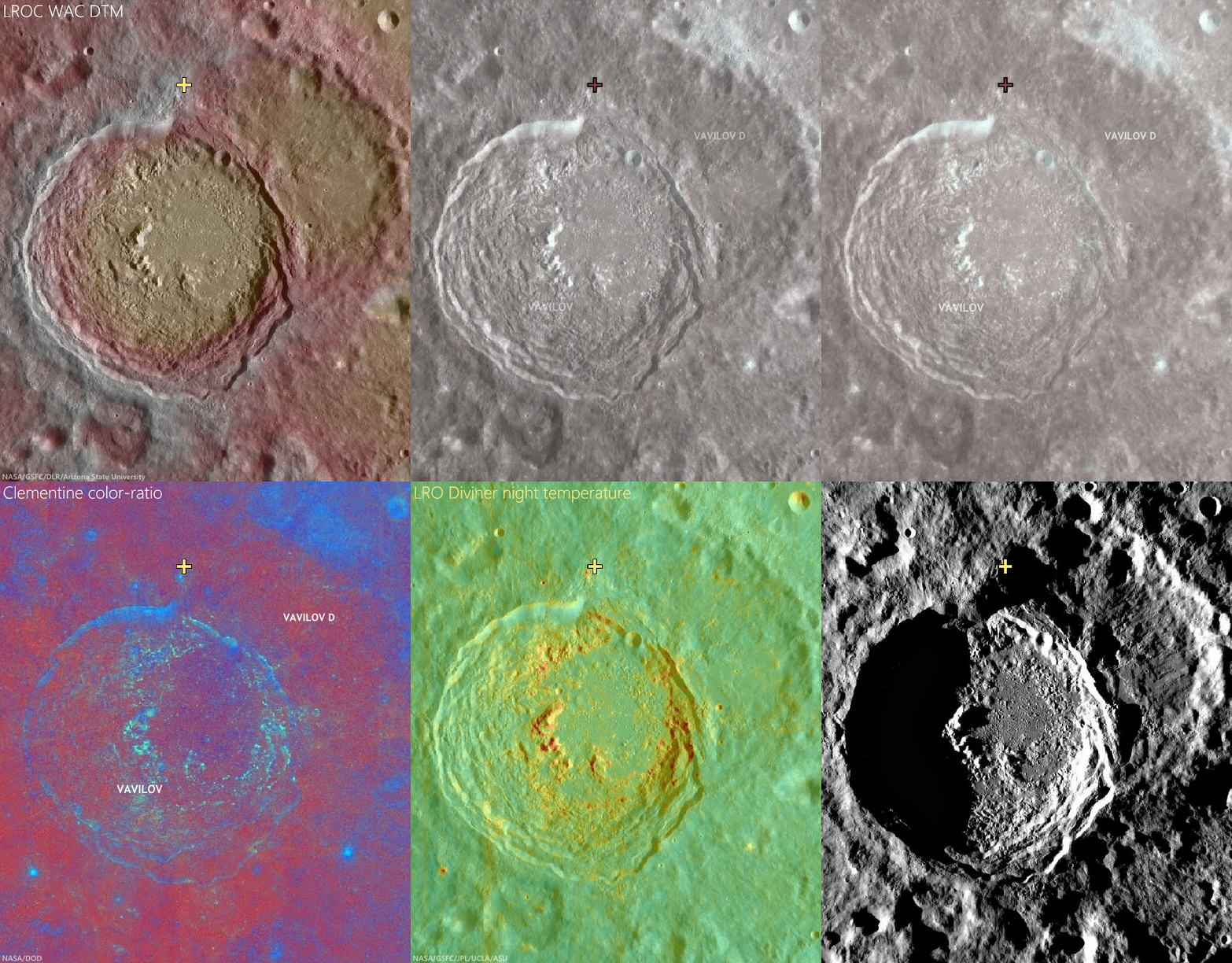
Sunrise, sunset. LROC NAC observations 10 months apart, one at local sunset and the other after local sunrise, both from nearly identical altitudes and resolutions, capture these views of double "dingleberries," drops of hot melt, very likely from the impact that created Vavilov crater, sit where they quickly flattened and cooled, just inside the steep slope of ancient Vavilov D. The Vavilov craters are a study in stratigraphy and superposition [NASA/GSFC/Arizona State University].
Immediately inside the northwest rim of highly degraded Vavilov D, twin disks of impact melt, likely from the formation of Vavilov, came to a standstill at the upper end of a contiguous slope of 5000 meters elevation, over about 40 km, into the complex floor of the latter Eratosthenian crater. This 1400 meter field of view (down slope is to the lower right, centered on 1.14°N, 221.536°E) from LROC NAC observation M1128031686L, LRO orbit 18385, July 9, 2013; 61° incidence angle, resolution 1.17 meters from 114.6 km [NASA/GSFC/Arizona State University]. 
Hiroyuki Sato
LROC News System

Vavilov D is an heavily degraded crater (96.1 km; 0.026°N, 220.93°E) sits between the Orientale basin and Jackson crater, both of which it may pre-date.

The later formation of the nearly identical, over-lapping Vavilov crater (98.2 km; 0.87°S, 221.23°E) eradicated the entire southwestern half of Vavilov D.

The second image above spotlights a spot on the northwestern curve of the wall of Vavilov D near where the Eratosthenian Vavilov erased the older crater's anatomy. The relatively smooth textured area in the upper left corresponds to the outside of Vavilov D, and the rest of rough/craggy surface is the interior crater wall's steep slope. 

The two degraded craters (~280 m in diameter) near the middle of the opening image exhibit fascinating overlying smooth features that may have formed as material flowed downslope (arrows).

View the full-resolution original HERE. The twin melt disks are located where the rim of Vavilov superseded that of Vavilov D, in the farside equatorial highlands,  where Vavilov is etched into terrain 8000 meters above the global mean elevation. It's possible an astronaut could walk from this location south into the interior of Vavilov. 5.6 km-wide field of view from LROC NAC observation M1128031686L [NASA/GSFC/Arizona State University].
Other morphologic pits/dents on this slope also have similar textures. What we are seeing here are most likely remnant impact melt that was thrown out of the Vavilov crater. Craggy sloped surfaces with patches of smooth material are often found associated with young impact craters -- formed as impact melt flowed over and around the newly formed crater.

The deepest material brought to the surface by impacts on the Moon is found on the resulting crater's rim. A fresh crater near our area of interest, on the rim of Vavilov D (cross), exposes material excavated by that ancient impact, and Vavilov D, in turn, is nested on the Hertzsprung basin. The larger region is also at the outside range of the majority of secondary craters from the Orientale basin-forming impact. LROC Quickmap mosaic [NASA/GSFC/Arizona State University].
Depth of field in lunar photography is a fleeting quality. With the LROC WAC-derived elevation model (GLD100), however, the super-positioning of Vavilov D (and an aeon or two later, Vavilov) on Hertzsprung is much easier to detect, along with some of the most extreme elevation ranges, some 9 km above the global mean [NASA/GSFC/DLR/Arizona State University].
Related Posts:

Wednesday, June 11, 2014

The original interplanetary mountaineers

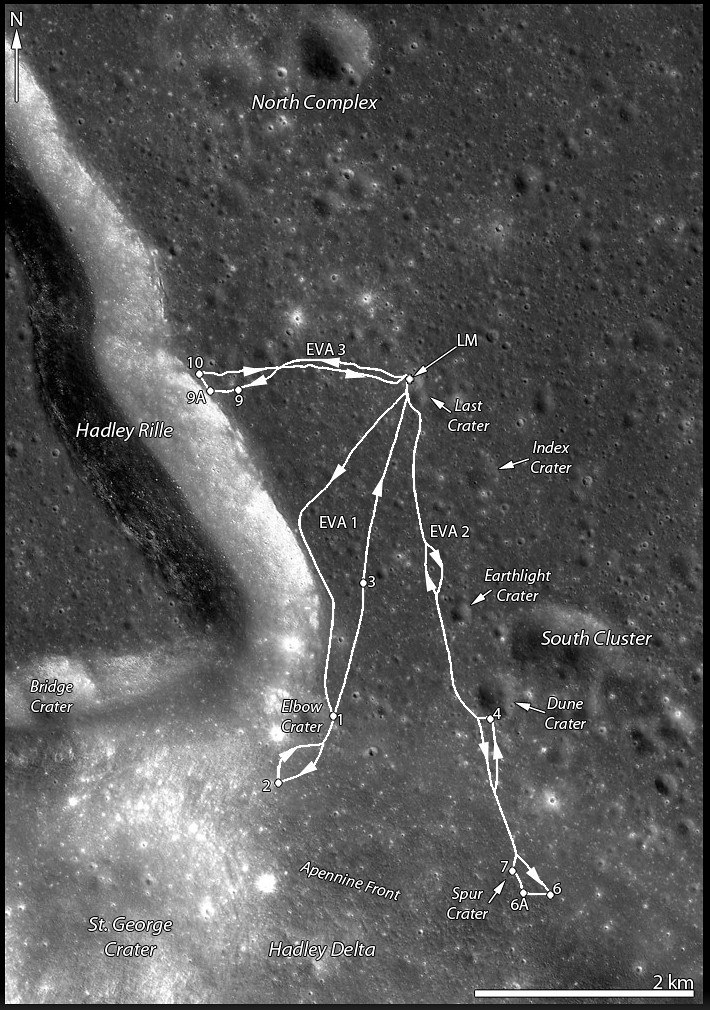
Traverse plots of Apollo 15 EVA 1 & 2 (August 1 and 2, respectively), the routes astronauts Dave Scott and Jim Irwin drove south to the lower slope of Mons Hadley Delta (from the "Elbow" bend in Rima Hadley, southward, toward the left). Elevations above that of the landing site (LM). For scale, the dogleg distance the astronauts travelled from the LM to Elbow crater along the edge of Hadley Rille over EVA 1 is roughly 4.5 km. Oblique LROC NAC mosaic M1123519889RL, LRO orbit 17751, May 18, 2013; spacecraft and camera slew 55.21° from orbital nadir, 76.87° angle of incidence, resolution 2.87 meters from 130.27 km over 26.11°N, 11.15°E  [NASA/GSFC/Arizona State University].
J. Stopar
LROC News System

The lofty Apennine Mountain Range has two prominent peaks near the Apollo 15 landing site: Mons) Hadley (relative height 4 km) to the northeast and Mons Hadley Delta (3.5 km) toward the south.

Between these two peaks lies the "Swann Range," named for Apollo 15 Geology Team Leader Gordon Swann.

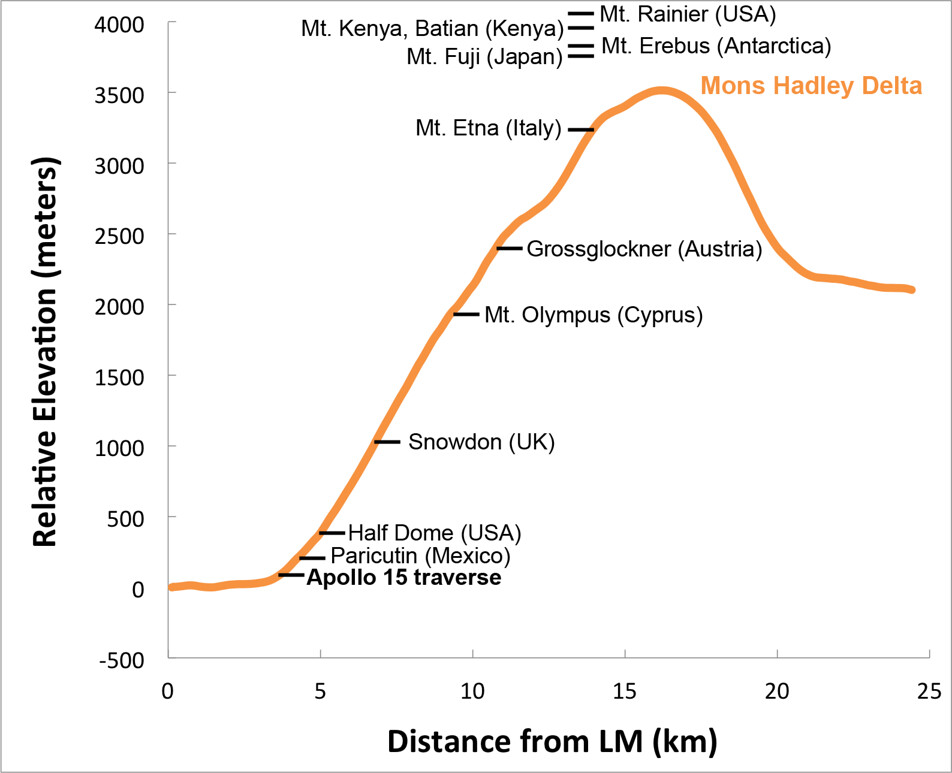
The Apennine Mountain Range contains some of the largest peaks on the Moon Mons Hadley rivals the prominences of notable terrestrial mountains like Mt. Rainier and Mt. Fuji, and Mt. Erebus in Antarctica when measured from base to summit.

Elevation profile of Mons Hadley Delta, measured from the Apollo 15 landing site (left) through the peak (right); data from the LROC WAC-derived GLD100 Digital Terrain Model (DTM), with relative heights of notable terrestrial mountains shown for scale. Mons Hadley Delta is not the largest peak in the Apennines, and Scott and Irwin scaled only a small portion of the mountain's contact zone with the Hadley Delta plain [NASA/GSFC/Arizona State University].
The first Apollo 15 EVA took astronauts David Scott and James Irving southward along the edge of Hadley Rille and to the base of Mt. Hadley Delta near St. George crater. This traverse took them to a height of just over 65 meters above the landing site on the mare plain. At this height, much of the surface material of the mountain comprises debris that, over eons, slid down the upper slopes through mass-wasting. Materials collected in this area primarily consist of regolith, as there are very few surface boulders.

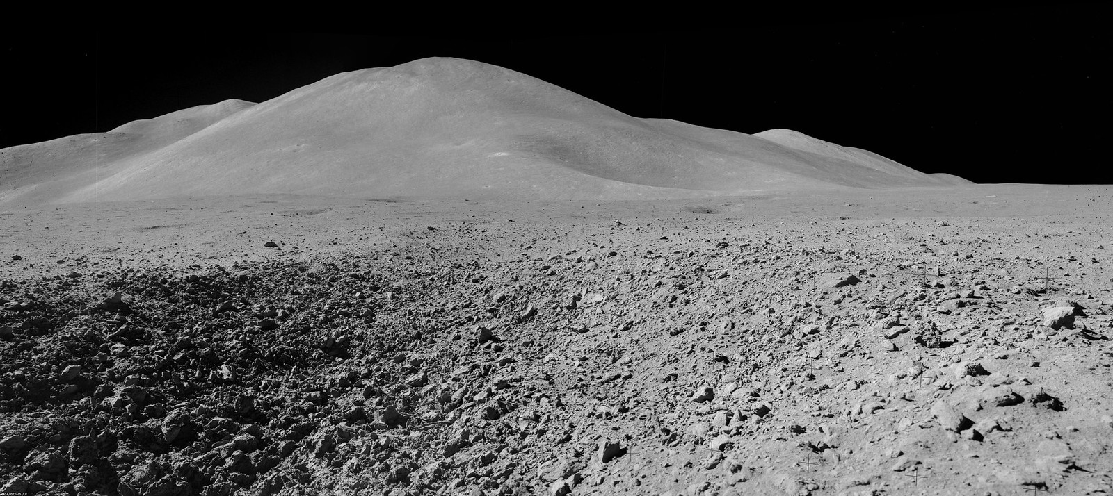
Mons Hadley Delta (high-resolution mosaics HERE); Mosaic of Dave Scott's Station 9 panorama (AS15-82-11084-88), from northeastern wall of the "Station 9 crater," a relatively fresh 15 meter-wide feature characterized by soft clod-like blocks of pressure-pressed regolith formed at small impact. Station 9 crater is about 240 meters immediately northeast of Rima Hadley; Apollo 15 (EVA 3), August 2, 1971 [Dave Scott/NASA/JSC/ALSJ].
The second EVA took the astronauts southeast to "South Cluster" and Spur craters. At Spur crater, a very old crystalline rock fragment was collected, containing evidence of geologic processes more than 4 billion years old and representing a piece of the original anorthositic crust of the Moon. They also discovered an unusual green material composed of volcanic glass.

This traverse ascended about 95 meters in elevation, up the base of Mons Hadley Delta. At times, the slope was steep enough (~ 18°) that the rover had difficulty getting traction, and the mountain peak loomed so high overhead, that the astronauts could not lean back far enough to get it in the frame of their cameras.

Apparent outcrops (arrows) may represent a high-lava mark approximately 85 meter up the south slope of Mons Hadley. AS15 magazine 84. View a more dramatic mosaic from this panorama HERE [NASA/JSC/Apollo 15 Lunar Surface Journal/Arizona State University].
During this traverse, the astronauts commented that they thought they could detect a high-mark where lava might once have filled the basin at the base of nearby Mt. Hadley around a height of 85 meters above the current mare plain.

LROC projection with traverse courses of Apollo 15 expedition to Hadley Delta, July 30-August 2, 1971 [NASA/GSFC/Arizona State University].
From Science Station 6. It definitely worthwhile to see a larger, high-resolution mosaic of this, reported to be Dave Scott's favorite photograph from the expedition (HERE). Through a 500-mm lens, from Science Station 6 up on the Apennine Front, the lunar module Falcon and ALSEP components are seen from 4.7 km, backdropped by the North Complex crater group and flank of Mons Hadley, on the plain's opposite bank [NASA/JSC].
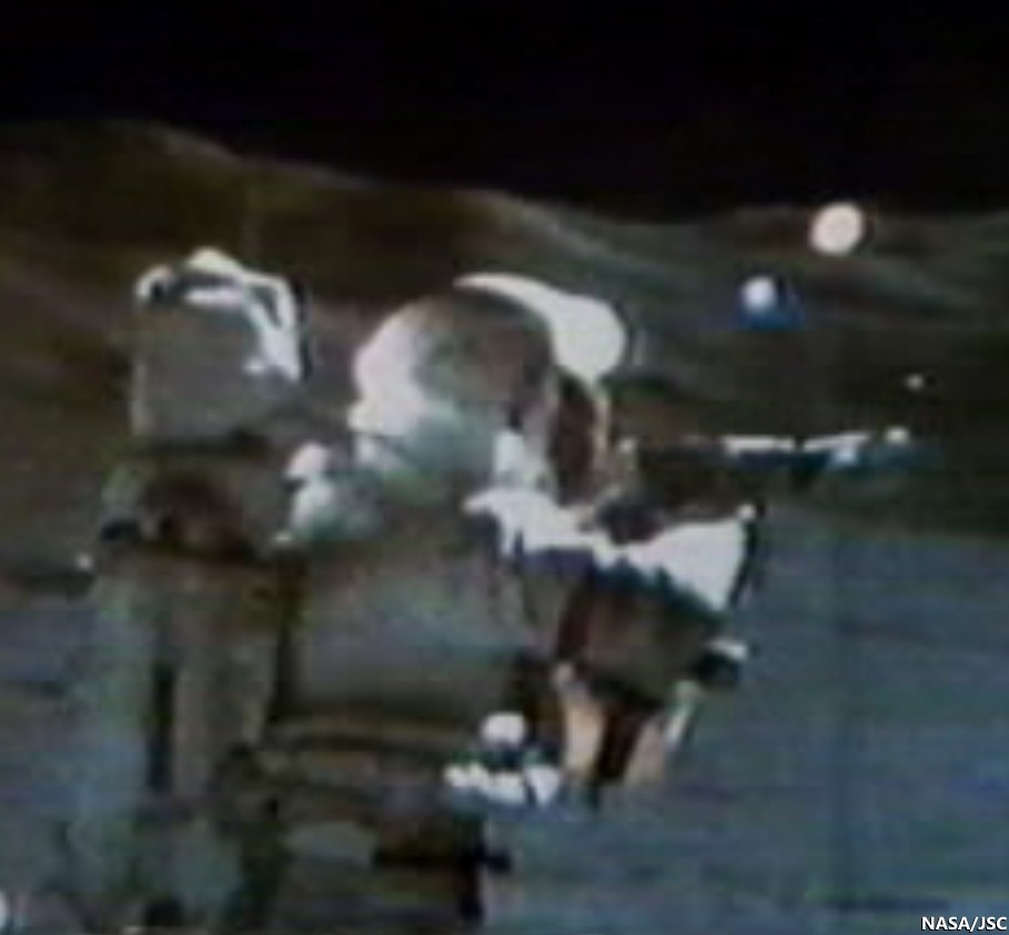
Apollo 15, Science Station 6, Spur Crater, on the Apennine Front, August 1, 1971. Dave Scott employs his 500 mm lens and black and white magazine 84 to capture the image immediately above, the Apollo 15 lunar module Falcon and North Complex crater group in context of the high mountains surrounding the Hadley Delta landing site. Still clipped from live video transmission relayed from remote-operated color TV camera on the lunar rover [NASA/JSC/ALSJ].
After capturing his black and white 500 mm panorama, Cmdr. Scott returned employed color magazine 86 and a less awkward smaller focal length. The reproduction here is too small to see the lunar module, but a much cleaner full resolution version is available HERE. Though it is not as detailed, and coherent backscatter is more problematic than the black and white at 500 mm, the full-resolution color image more closely matches the unaided human eye.  AS15-86-11618 [NASA/JSC/ALSJ].
While the Apollo 15 astronauts scarcely climbed the lower slopes of a lunar mountain, they made many important discoveries. What challenges, findings, and fun (like slope skiing) might future explorers experience on the powdery mountains of the Moon?

Explore the first two of the Apollo 15 traverses in more detail below by panning and zooming. The numbers indicate relative elevations of the paths travelled by the astronauts.

Related Posts:
Soaring Over Mighty Mt. Hadley
Apollo 15 departs Hadley Rille Delta
Water found in the Apollo 15 Genesis Rock
Follow the Tracks (Apollo 15)
Hadley Rille and the Mountains of the Moon
Retracing the Steps of Apollo 15 Constellation Region of Interest
Apollo 15 Laser Ranging Retroreflector: a Fundamental Point on the Moon
LROC's First Look at the Apollo Landing Sites
'Man's first wheels on the Moon' at 41 years
Bowditch Lava Terraces
Lunar Kipuka
Remnants of the Imbrium Impact
Hadley-Apennine: the Apollo 15 Landing Site
The Mighty Apennine Mountain Range
Layers near Apollo 15 Landing Site
LROC Explores Apollo 15 (YouTube video)
Kaguya captures Rima Hadley

Tuesday, June 10, 2014

Ready-made excavations near Lucretius C

Self-secondary of a bright, relatively fresh crater northwest of Mare Orientale, in the wider highlands greatly affected by that basin-forming impact. The unnamed primary crater (between Lucretius C and Grachev craters, see below) is visible from a great altitude because of its relative low optical maturity. Full-resolution, 530 meter-wide field of view from LROC NAC observation M1132582647R, LRO orbit 19028, August 31, 2013; 9.47° incidence angle, resolution 92 cm, from 106.13 km over 3.09°S, 246.92°E [NASA/GSFC/Arizona State University].
Hiroyuki Sato
LROC News System

Today's Featured Image highlights the spectacular fresh ejecta from an unnamed crater (1.05 km; 3.06°S, 297°E), approximately 750 km northwest of Mare Orientale.

Subsequent impacts (possibly including self-secondaries) excavate through the ejecta sheet, leaving small craters, mostly less than 50 meters in diameter, and tiny ejecta splashes.

Some are lower and others are higher in reflectance than their surroundings, resulting in a variety of contrasts against the bright, optically immature ejecta field of the primary crater. 

Bright, relatively fresh primary to highlighted secondary crater at upper left northwest of Orientale basin, between Lucretius C and Grachev. 4.54 km-wide field of view from full-width of LROC NAC observation M1132582647R, visible HERE. [NASA/GSFC/Arizona State University].
In the opening image, many small high reflectance craters (~10 m) are clustered at the lower right side of the image, while nearby mid-sized craters (~50 m) are darker than their surroundings. The largest crater's ejecta (center-left in this image) is composed of two layers, the brighter layer on top of the darker layer.

Full-width mosaic, 13.357 km-wide field of view from a mosaic of both the left and right frames of LROC observation M1132582647.   Larger reproductions are available HERE [NASA/GSFC/Arizona State University].
These reflectance variations are likely due to the different excavation depths into the low and high reflectance surface and subsurface deposits. The mid-sized craters probably reached the original low reflectance materials below the upper higher reflectance ejecta sheet (from the unnamed ~1km diameter crater). The largest crater likely excavated high reflectance substrate that is also exposed on the unnamed crater's wall. 

250 meter resolution view shows the high visibility of the small crater of interest (1.05 km; 3.03°S, 297°E), against the ancient highlands, deeply scared by the energy of the Orientale basin-forming-impact. LROC Quickman WAC natural color beta over 100 meter global mosaic [NASA/GSFC/Arizona State University].
Context for high resolution LROC NAC view of bright fresh 1.05 km crater (3.06°S, 297°E) northwest of Mare Orientale [NASA/GSFC/SVS/Arizona State University].
Impacts serve as a natural excavation process which helps us to glimpse into the otherwise unreachable geological layers on the Moon. 

View full-width mosaic, HERE.

Related Posts

Thursday, June 5, 2014

Rima Seuss, rough around the edges

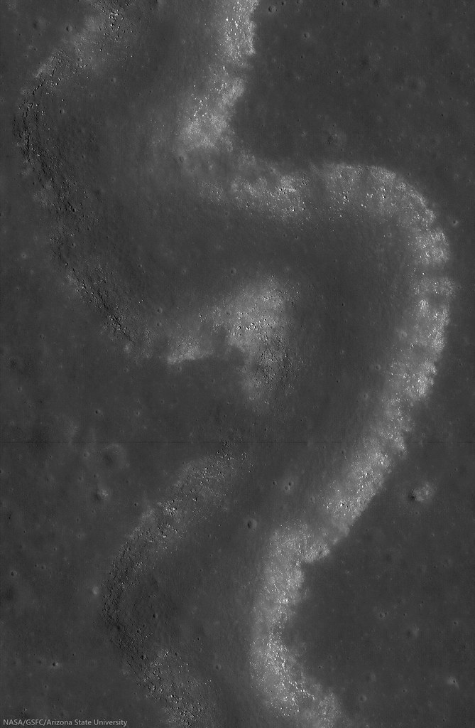
With peppered flanks, Rima Suess wanders over 150 km through Oceanus Procellarum. The rocks that rest on the walls of this sinuous rille are perhaps remnants of much larger boulders that have eroded down to meter sized rocks due to relentless micro and macro meteorite bombardment, "gardening" 3 centimeters into lunar dust every 2 million years or so. The pyroclastic flow that carved through the terrain was remarkably fast, considering the long scar left behind has lasted perhaps 3 billion years. From the extraordinary low altitude of only 23 km (see below), the 400 meter field of view above is cropped from LROC NAC observation M168516400R  [NASA/GSFC/Arizona State University].
Raquel Nuno
LROC News System

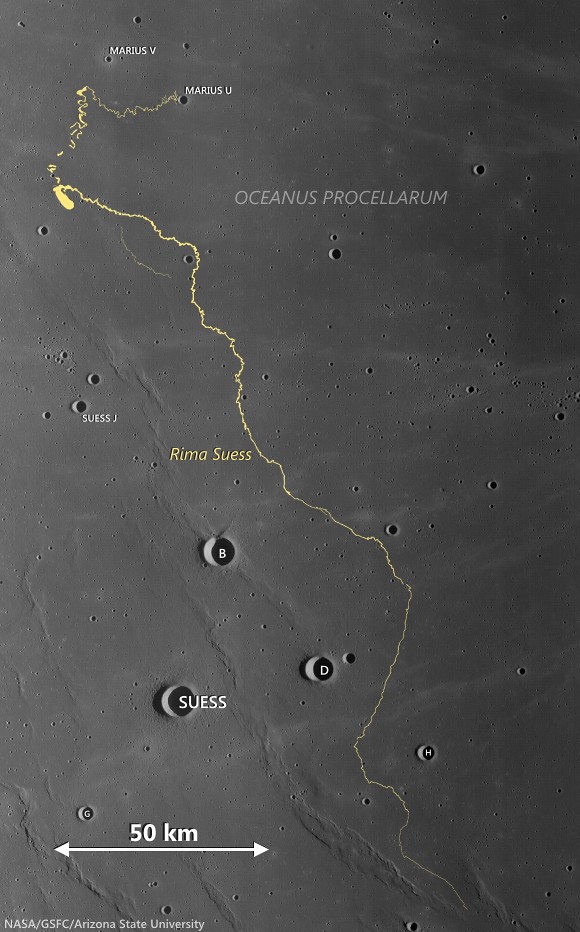
Rima Suess (7.81°N, 312.41°E), located in Oceanus Procellarum, is a long, meandering narrow depression called a sinuous rille.

Sinuous rilles, most commonly found in mare surfaces, are thought to have been carved by fast rivers of lava, which thermally and mechanically eroded the channels we see today.

About 3.1 billion years ago the Moon was much more volcanically active, pouring vast amounts of lava onto the surface. The large dark mare regions of the Moon were formed by massive eruptions of iron-rich basaltic lava during this time.

Very close-up on Rima Suess, the LROC NAC observation from which this and the LROC Featured Image were processed was from among one of the closest passes of the Lunar Reconnaissance Orbiter (LRO) over the Moon, during low-periapsis maneuvers in 2011. (Full resolution original image HERE.)  LROC NAC observation M168516400R, LRO orbit 9968, August 12, 2011; 36.11° incidence angle, resolution 39 cm from 22.92 km over 8.07°N, 312.38° [NASA/GSFC/Arizona State University].
The boulders along the walls of the rille probably were a coherent mass when the lava flows cooled, breaking up over billions of years of impacts into the boulders we see today. Gravity then pulled this material down the slope of the rille; this process is known as mass wasting. We see rock outcrops over the entire path of Rima Suess in the LROC NAC image M168516400R.

The very narrow, actually a 200 km-plus-long sinuous rille, apparently traced remarkably fast south from the Marius Hills "Yulu" double-volcano source nearly to Flamsteed P crater, through the bleak center of Oceanus Procellarum. Nearby Kepler crater (outside this view, to the right and east) added the bright ejecta rays. This view is distilled from a mosaic of LROC Wide Angle Camera (WAC) observations swept up over five sequential orbits during local early local morning, allowing long shadows to add some relief to this remarkably flat area of the lunar surface, all of it averaging below 2000 meters in elevation. LROC WAC mosaic from LRO orbits 6838 through 6842, December 18, 2010; 79° incidence angle, resolution 58 meters from 41.5 km [NASA/GSFC/Arizona State University].
Lunar rilles are exciting places for lunar scientists because they may cut through and expose the different layers of lava flows in the maria.  This gives scientists insight into the volcanic processes present during mare formation, and how they evolved with time.

Explore the winding path of this portion of Rima Seuss in the full resolution LROC NAC HERE.

Related Posts:
Rilles as far as the eye can see in Prinz!
Rille within a rille!
Collapsing Tube

Wednesday, June 4, 2014

The tender tendrils of Hipparchus G

Beautiful granular flows on the steep eastern wall of Hipparchus G crater (13.68 km; 5.03°S, 7.4°E) brought fresh debris from the rim down downslope to the left. Field of view about 1 km from LROC NAC observation M183474839L, LRO orbit 12135, February 10, 2010; 38.77° incidence angle, resolution 1.02 meters from 100.52 km [NASA/GSFC/Arizona State University].
Raquel Nuno
LROC News System

Hipparchus G (13.68 km; 5.03°S, 7.4°Eis a high reflectance crater formed on the rim of the much older and degraded Hipparchus crater, in the nearside Southern Highlands.

While these streamers may look like mudslides, they are actually dry solids that underwent fluidized flow; these features are called debris flows and are seen in many craters on the Moon.

Why do these flows look like tendrils? As the debris was flowing downhill, in some places it encountered obstacles, such as a rougher surface or large boulders. If the flow had enough energy it found its way around the obstacle, as seen by the curved path taken by these streams, if the obstacle was too large and the debris was too thin, it came to a halt.

Footprint of LROC NAC observation M183474839L, from 100 km, LRO orbit 12135, February 10, 2010, This PDS projection, even on the outdated lunar DEM available in Google Earth, show the true profile of Hipparchus G, not readily discerned from directly overhead. The higher east rim, nested in the rim of ancient Hipparchus, rises 3.2 km in elevation above the smaller crater floor, may have originally brought up a variety of materials of contrasting reflectance [NASA/JAXA/GSFC/USGS/Arizona State University].
Among the highest resolution LROC Wide Angle Camera observations of Hipparchus G yet available from LRO, actually a mosaic of two sequential passes on November 16, 2010; 47.35° incidence angle, resolution 61 meters from 44 km [NASA/GSFC/Arizona State University].
These flows really stand out from the rest of the crater wall material because they have a higher reflectance. Higher reflectance indicates that this material has been exposed to less space weathering than the crater wall, so this flow happened long after the formation of this crater.

Related Posts: