Showing posts with label Apennines. Show all posts

Wednesday, June 11, 2014

The original interplanetary mountaineers

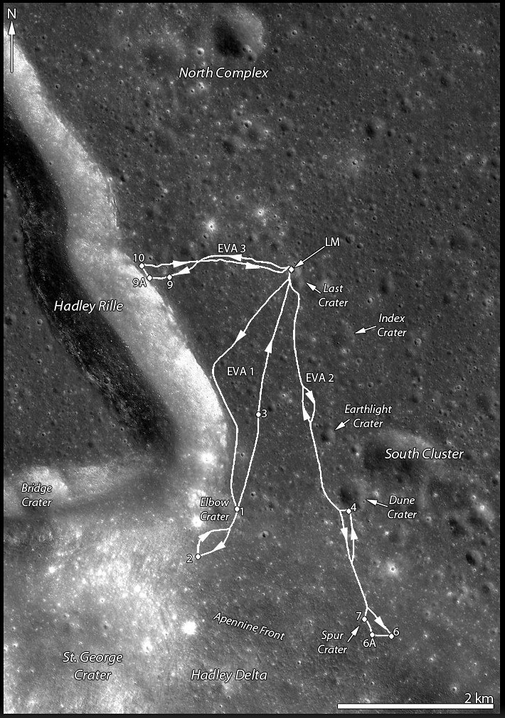
Traverse plots of Apollo 15 EVA 1 & 2 (August 1 and 2, respectively), the routes astronauts Dave Scott and Jim Irwin drove south to the lower slope of Mons Hadley Delta (from the "Elbow" bend in Rima Hadley, southward, toward the left). Elevations above that of the landing site (LM). For scale, the dogleg distance the astronauts travelled from the LM to Elbow crater along the edge of Hadley Rille over EVA 1 is roughly 4.5 km. Oblique LROC NAC mosaic M1123519889RL, LRO orbit 17751, May 18, 2013; spacecraft and camera slew 55.21° from orbital nadir, 76.87° angle of incidence, resolution 2.87 meters from 130.27 km over 26.11°N, 11.15°E  [NASA/GSFC/Arizona State University].
J. Stopar
LROC News System

The lofty Apennine Mountain Range has two prominent peaks near the Apollo 15 landing site: Mons) Hadley (relative height 4 km) to the northeast and Mons Hadley Delta (3.5 km) toward the south.

Between these two peaks lies the "Swann Range," named for Apollo 15 Geology Team Leader Gordon Swann.

The Apennine Mountain Range contains some of the largest peaks on the Moon Mons Hadley rivals the prominences of notable terrestrial mountains like Mt. Rainier and Mt. Fuji, and Mt. Erebus in Antarctica when measured from base to summit.
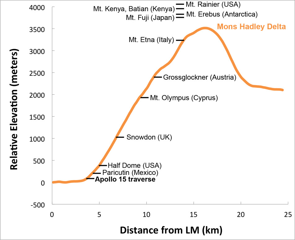
Elevation profile of Mons Hadley Delta, measured from the Apollo 15 landing site (left) through the peak (right); data from the LROC WAC-derived GLD100 Digital Terrain Model (DTM), with relative heights of notable terrestrial mountains shown for scale. Mons Hadley Delta is not the largest peak in the Apennines, and Scott and Irwin scaled only a small portion of the mountain's contact zone with the Hadley Delta plain [NASA/GSFC/Arizona State University].
The first Apollo 15 EVA took astronauts David Scott and James Irving southward along the edge of Hadley Rille and to the base of Mt. Hadley Delta near St. George crater. This traverse took them to a height of just over 65 meters above the landing site on the mare plain. At this height, much of the surface material of the mountain comprises debris that, over eons, slid down the upper slopes through mass-wasting. Materials collected in this area primarily consist of regolith, as there are very few surface boulders.

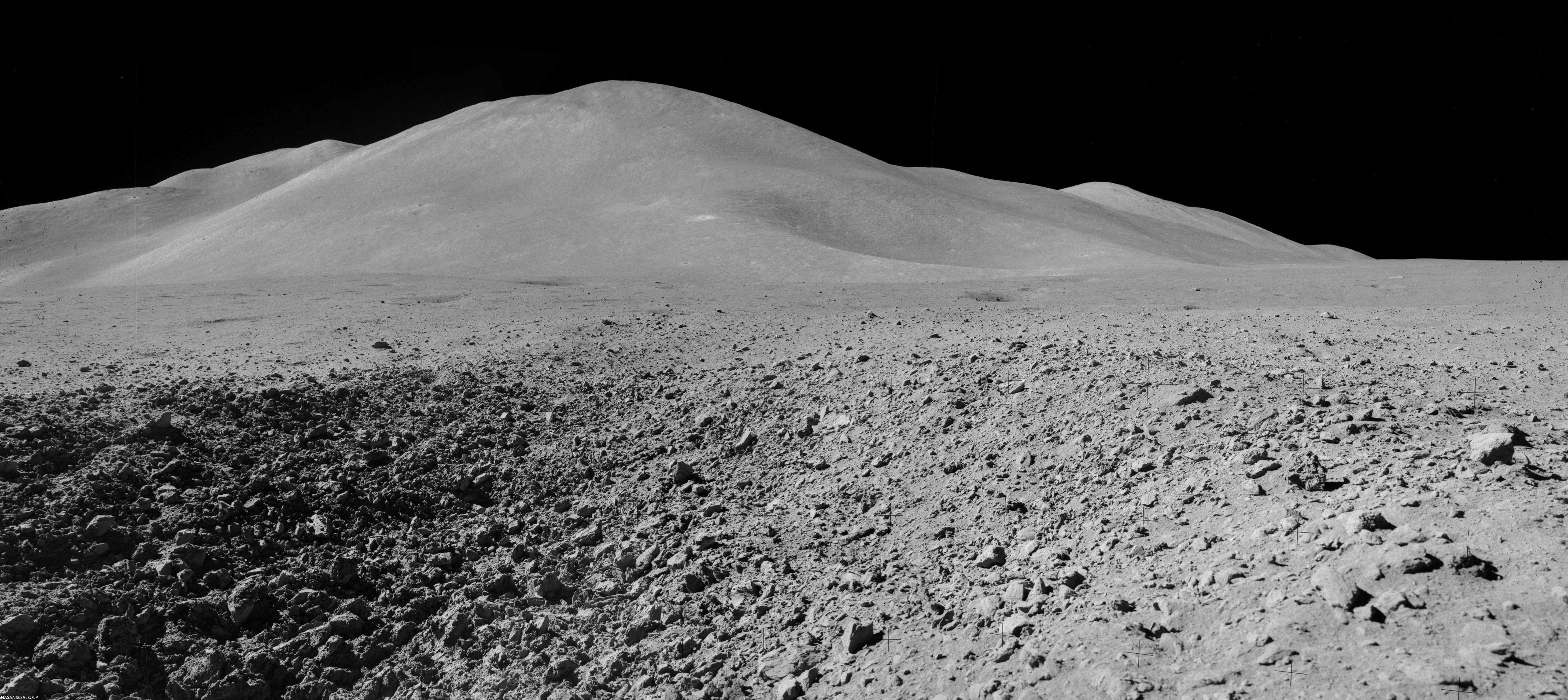
Mons Hadley Delta (high-resolution mosaics HERE); Mosaic of Dave Scott's Station 9 panorama (AS15-82-11084-88), from northeastern wall of the "Station 9 crater," a relatively fresh 15 meter-wide feature characterized by soft clod-like blocks of pressure-pressed regolith formed at small impact. Station 9 crater is about 240 meters immediately northeast of Rima Hadley; Apollo 15 (EVA 3), August 2, 1971 [Dave Scott/NASA/JSC/ALSJ].
The second EVA took the astronauts southeast to "South Cluster" and Spur craters. At Spur crater, a very old crystalline rock fragment was collected, containing evidence of geologic processes more than 4 billion years old and representing a piece of the original anorthositic crust of the Moon. They also discovered an unusual green material composed of volcanic glass.

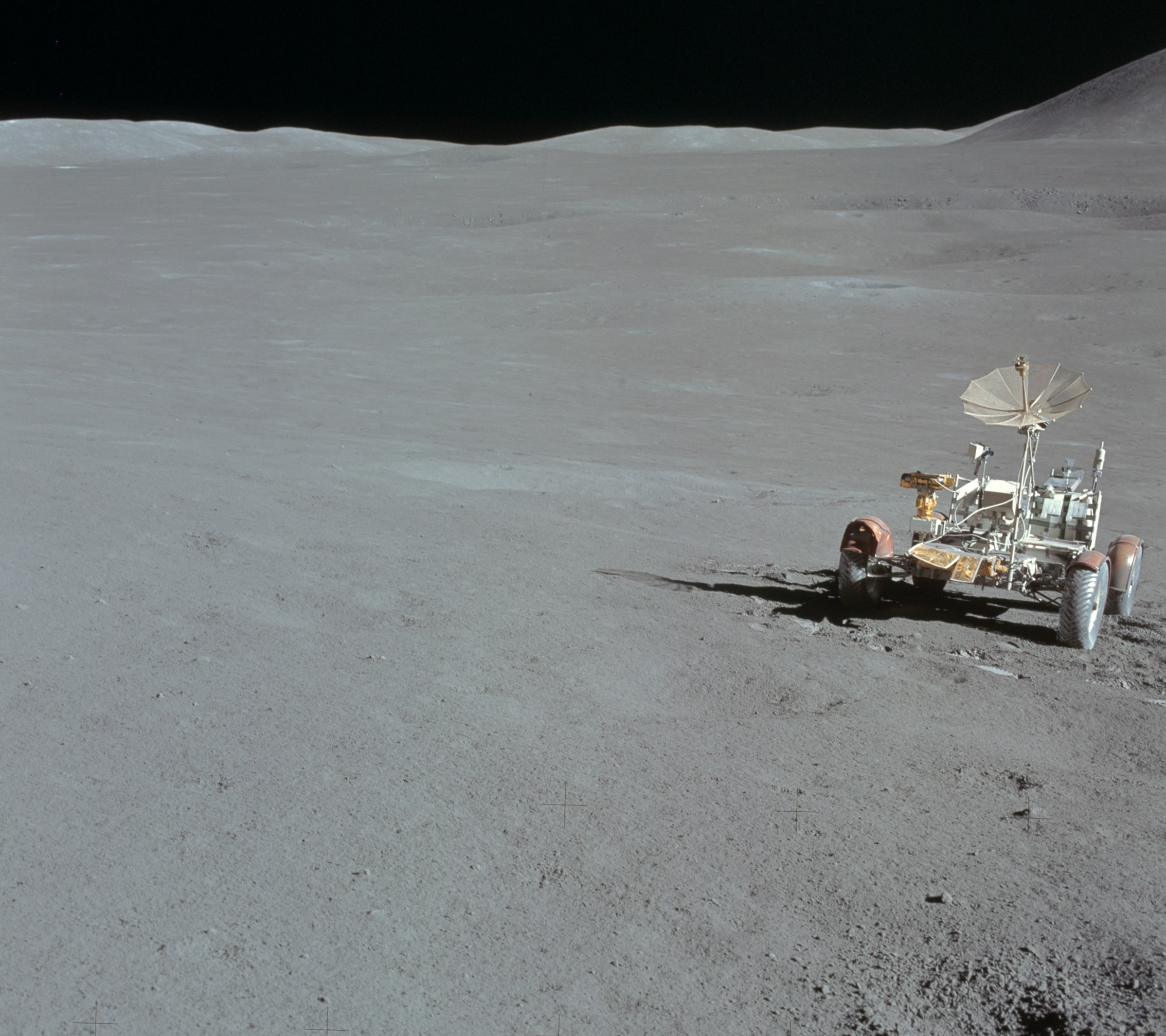
This traverse ascended about 95 meters in elevation, up the base of Mons Hadley Delta. At times, the slope was steep enough (~ 18°) that the rover had difficulty getting traction, and the mountain peak loomed so high overhead, that the astronauts could not lean back far enough to get it in the frame of their cameras.

Apparent outcrops (arrows) may represent a high-lava mark approximately 85 meter up the south slope of Mons Hadley. AS15 magazine 84. View a more dramatic mosaic from this panorama HERE [NASA/JSC/Apollo 15 Lunar Surface Journal/Arizona State University].
During this traverse, the astronauts commented that they thought they could detect a high-mark where lava might once have filled the basin at the base of nearby Mt. Hadley around a height of 85 meters above the current mare plain.

LROC projection with traverse courses of Apollo 15 expedition to Hadley Delta, July 30-August 2, 1971 [NASA/GSFC/Arizona State University].
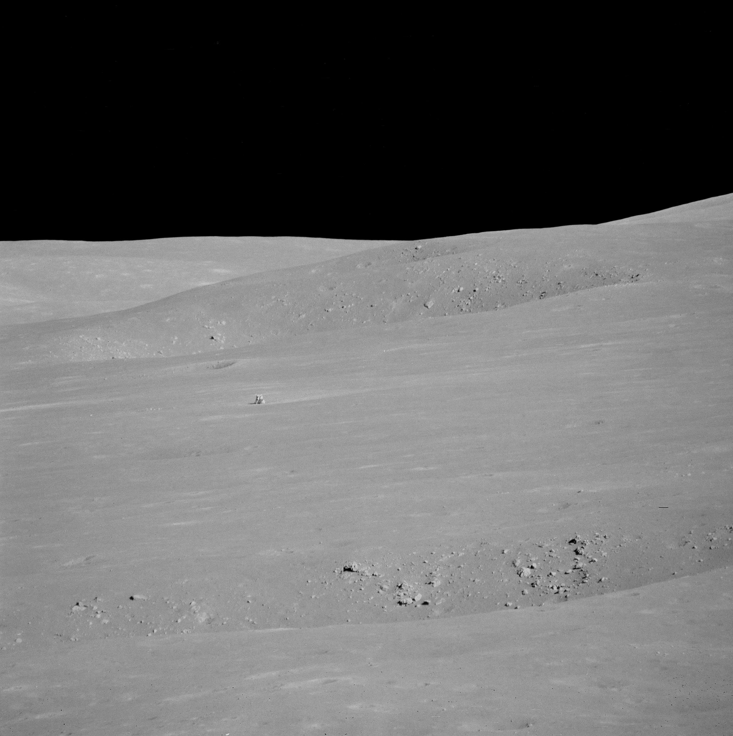
From Science Station 6. It definitely worthwhile to see a larger, high-resolution mosaic of this, reported to be Dave Scott's favorite photograph from the expedition (HERE). Through a 500-mm lens, from Science Station 6 up on the Apennine Front, the lunar module Falcon and ALSEP components are seen from 4.7 km, backdropped by the North Complex crater group and flank of Mons Hadley, on the plain's opposite bank [NASA/JSC].
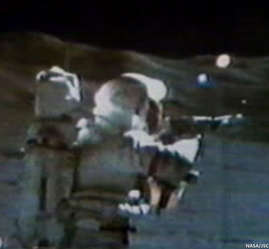
Apollo 15, Science Station 6, Spur Crater, on the Apennine Front, August 1, 1971. Dave Scott employs his 500 mm lens and black and white magazine 84 to capture the image immediately above, the Apollo 15 lunar module Falcon and North Complex crater group in context of the high mountains surrounding the Hadley Delta landing site. Still clipped from live video transmission relayed from remote-operated color TV camera on the lunar rover [NASA/JSC/ALSJ].
After capturing his black and white 500 mm panorama, Cmdr. Scott returned employed color magazine 86 and a less awkward smaller focal length. The reproduction here is too small to see the lunar module, but a much cleaner full resolution version is available HERE. Though it is not as detailed, and coherent backscatter is more problematic than the black and white at 500 mm, the full-resolution color image more closely matches the unaided human eye.  AS15-86-11618 [NASA/JSC/ALSJ].
While the Apollo 15 astronauts scarcely climbed the lower slopes of a lunar mountain, they made many important discoveries. What challenges, findings, and fun (like slope skiing) might future explorers experience on the powdery mountains of the Moon?

Explore the first two of the Apollo 15 traverses in more detail below by panning and zooming. The numbers indicate relative elevations of the paths travelled by the astronauts.

Related Posts:
Soaring Over Mighty Mt. Hadley
Apollo 15 departs Hadley Rille Delta
Water found in the Apollo 15 Genesis Rock
Follow the Tracks (Apollo 15)
Hadley Rille and the Mountains of the Moon
Retracing the Steps of Apollo 15 Constellation Region of Interest
Apollo 15 Laser Ranging Retroreflector: a Fundamental Point on the Moon
LROC's First Look at the Apollo Landing Sites
'Man's first wheels on the Moon' at 41 years
Bowditch Lava Terraces
Lunar Kipuka
Remnants of the Imbrium Impact
Hadley-Apennine: the Apollo 15 Landing Site
The Mighty Apennine Mountain Range
Layers near Apollo 15 Landing Site
LROC Explores Apollo 15 (YouTube video)
Kaguya captures Rima Hadley

Tuesday, November 8, 2011

Hadley Rille and the Mountains of the Moon

NASA Lunar Reconnaissance Orbiter (LRO) rolled to capture a dramatic oblique view of the Apollo 15 landing site 26.1°N, 0.25°E on the plains of Hadley Rille Delta. Hadley Rille, a great chasm in the lunar surface, carves through the center of this scene. Explore the full size LROC image HERE. LROC Narrow Angle Camera (NAC) observation M165842369, orbit 9574, July 20, 2011 [NASA/GSFC/Arizona State University].
Samuel Lawrence
LROC News System

On 20 July 2011 (coincidentally, the 42nd anniversary of the first steps humans took on another world) the NASA Lunar Reconnaissance Orbiter was commanded to roll to the east, allowing the Lunar Reconnaissance Orbiter Camera to obliquely observe Hadley rille and the Apollo 15 landing site. One of humanity's greatest voyages of exploration, the adventures of mission commander David Scott, lunar module pilot James Irwin, and command module pilot Al Worden transformed our understanding of the Moon and the Solar System. The shadow of the descent stage of the Lunar Module Falcon is visible, as is that of NASA's first lunar roving vehicle. Additionally, the sampling stations explored by the Apollo 15 astronauts are easy to pick out.

Full scope of the LROC NAC oblique frames detailed HERE. Hadley Rille is about 1.2 km wide. The whole scene is 28 kilometers from left-to-right [NASA/GSFC/Arizona State University].
Apollo 15 was the first of three long-duration “J-missions”; more would have flown had the Apollo program not been brought to a premature conclusion in 1972 after the Apollo 17 mission. The J-missions featured heavily instrumented command and service modules, improved spacesuits to promote crew agility, upgraded lunar landing vehicles, and the electric Lunar Roving Vehicles (or LRVs) to expand the crew's range on the surface. Prior to the mission, the Apollo 15 crew received extensive geoscience training, which (along with the increasingly capable hardware) resulted in an extraordinary bounty of scientific results. Apollo 15 was also the only lunar mission where all crewmembers were graduates of the University of Michigan and United States Air Force officers (the lunar module, Falcon, was named after the mascot of the United States Air Force Academy, and the Apollo 15 command module Endeavour is now on permanent display at the National Museum of the U. S. Air Force in Dayton, OH).

LROC NAC mosaic from M170538271, sampled at 2 meter pixel scale (from the original 0.5 m) showing area where lunar sample 15555, "Great Scott," was collected (Station 9A) west of the Apollo 15 landing site. View the larger original 2 meter image prepared for this essay HERE [NASA/GSFC/Arizona State University].
Astronauts Scott and Irwin spent almost three days exploring the Hadley-Apennine valley, traversed over 28 kilometers (17 miles) using the first lunar rover, and collected over 77 kilograms (170 pounds) of priceless lunar materials, including the famous “Genesis Rock”, a piece of the primordial lunar crust. While Scott and Irwin explored the surface, command module pilot Worden used the extensive instrument suite aboard the command module Endeavour to successfully complete a complex series of orbital observations. You can view digital scans of the original Apollo 15 flight films taken by Endeavour's Fairchild Mapping Camera at the Arizona State University Apollo Digital Image Archive! 

The geologically complex Apollo 15 site is a high priority target for future human lunar exploration, and consequently was one of the Constellation Regions of Interest that were a focus of LROC observations during the LRO Exploration Systems Mission Directorate mission (the 1st year of LRO operations). Thanks to the exploration of the Apollo 15 astronauts, we now have a well-defined set of scientific questions that can only be addressed through a future human sortie mission to the Hadley-Apennine region. In addition, recovering materials from the descent stage of Falcon would provide valuable information to present-day engineers about how materials survive on the lunar surface for long periods of time.

Edge of Hadley rille where lunar sample 15555 (Station 9A) was collected, August 2, 1971. The disturbed soil at 9A are the foot prints and LRV tracks left by Scott & Irwin, 40 years ago, testifying to the intensive study and sampling at this site. See the larger image prepared for this essay, from an observation not due for release until December, HERE [NASA/GSFC/Arizona State University].
On Saturday, November 5, as part of the School of Earth and Space Exploration's annual Earth and Space Exploration Day, Arizona State University unveiled a display featuring a piece of Apollo Lunar Sample (ALS) 15555, a mare basalt collected by Col. Scott about 12 meters from the rim of Hadley rille at Station 9A. This lunar rock is the largest and one of the most intensively studied samples collected by the Apollo 15 astronauts, and is predominantly composed of silicate minerals such as olivine, pyroxene, and plagioclase. The bulk composition of 15555 is thought to represent a primitive volcanic melt and has been used for experimental and theoretical studies related to the geologic origin of lunar basalts. Planetary scientists use information gleaned from such analyses to gain key insights into how terrestrial planets like the Moon and Earth form and evolve. Sample 15555 has also been used for critical tests designed to help perfect and calibrate methods of radiometric age dating employed by different laboratories around the world.

On their third EVA, before sampling 15555, Col. Scott took a picture of its location and immediately handed the camera to Jim Irwin, who then captured a series of shots for a standard panorama of Station 9a. The three legged gnomon was placed beside the sample so scientists could later determine its orientation of the rock on the surface [NASA, AS15-82-11164].
What is a mare basalt and what is its significance? The lunar mare basalts are very similar to terrestrial basalts. If you drove up to Sunset crater outside Flagstaff AZ, you can find basalt. If you go to Hawaii, Iceland, India, Ethiopoa and many other countries you can find basalt. The oceanic crust on the Earth is composed of basalt. If you visit Mars you will likely land on basalt or basalt derived sediments. If you land on Venus - same! The Dawn spacecraft is right now orbiting an asteroid, Vesta, that is composed of basalt. Basalt is common in the Solar System. The fascinating fact about basalts is that they represent a sample of the upper mantle. We can't get to the mantle directly, but nature provides us with samples of the deep interior (mantle) in the form of basalt. Volcanism is the delivery truck! Since the mantle makes up most of the mass of the Earth, Mars and the Moon we must have samples of the mantle to understand each body as a whole. You can think of 15555 as a piece of the Moon's interior, even though it was picked up on the surface.

Apollo Lunar Sample 15555 on display at the Lunar Reconnaissance Orbiter Camera Science Operations Center [E. Speyerer, Arizona State University].
A generous loan to Arizona State University from the NASA Lyndon B. Johnson Space Center, this 76 gram (2.7 ounces) piece of mare basalt will be displayed in the Lunar Reconnaissance Orbiter Camera Science Operations Center Visitor Gallery. This stunning and unique lunar sample display will enable visitors to view and learn about an amazing piece of our Moon, while just a few meters away, behind a glass partition, the LROC team is sending commands to LROC and receiving images in return that enable scientists and engineers to plan for future human and robotic exploration of the Moon.

We heartily encourage anyone interested in space exploration to come view this priceless American treasure and learn how lunar scientists around the world are pioneering your future in space. The work we do at LROC is tremendously exciting, but ultimately, it is the human passion for discovery that drives this enterprise.

Explore the complete NAC oblique image of the Hadley-Apennine valley!


Visit the LROC Science Operations Center

Read more about the Apollo 15 landing site
in previous LROC Team posts
:

Layers Near Apollo 15 Landing Site (30 August 2011)
Retracing the Steps of Apollo 15: Constellation Program Region of Interest (16 April 2010)
LROC's First Look at the Apollo Landing Sites (17 July 2009)
Lunar Highs and Lows (22 July 2008)
The Mighty Apennine Mountain Range (30 September 2008)
Hadley-Apennine: the Apollo 15 Landing Site (14 November 2007)

Further Related Posts:

40th Anniversary of Apollo 15 celebrated at Kennedy Space Center
Al Worden award with Moon Rock
Kaguya captures Hadley Rille

Hadley Rille Valley of Palus Putredinis on the Imbrium side of the Apenninus mountain ridge, 1971 landing site of the Apollo 15 expedition. LROC Wide Angle Camera (WAC) mosaic from 7313 and 7314, January 24, 2011; resolution 53 meters, incidence angle 65.77° from 36.36 kilometers [NASA/GSFC/Arizona State University].

Friday, February 11, 2011

LROC: Rima Bradley


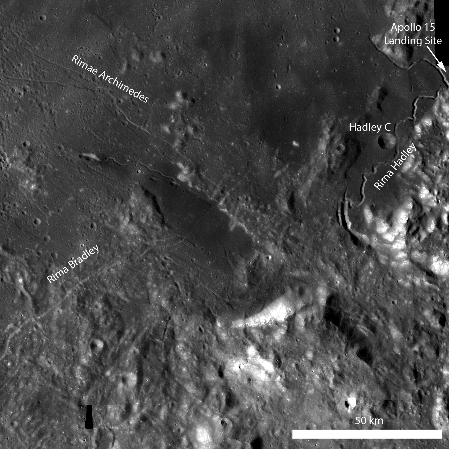
Rima Bradley is a 134 km northeast/southwest-trending linear rille at the foot of Montes Apenninus, between Mare Imbrium and Palus Putredinis, very close to the Hadley Rille Valley landing site of Apollo 15. Rima Bradley probably formed as a result of tectonic stresses in the Imbrium basin. Click here to view the full-sized annotated LROC WAC monochrome mosaic [NASA/GSFC/Arizona State University].


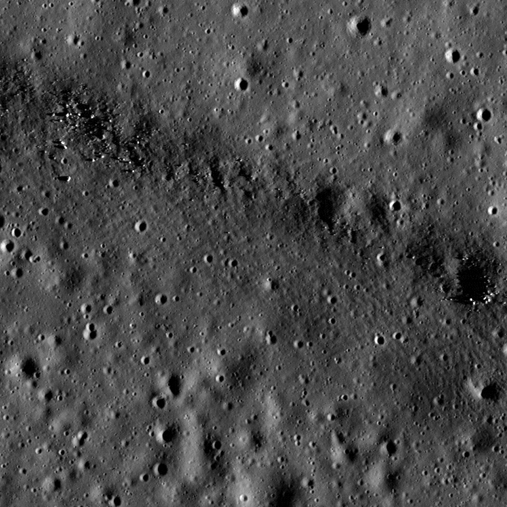
Rima Bradley primarily divides highland terrain, but in the portion captured by the LROC Narrow Angle Camera observation M146980324L, last December 14 the rille bisects a 15 km by 35 km mare pool (center of the first image above). The field of view from M146980324L is 700 meters wide with a resolution of 0.70 meters per pixel; illumination is from the east. Click here for the full-sized LROC Featured Image release [NASA/GSFC/Arizona State University].


The full 1800 width of a 36.5 kilometer-long field of view within LROC NAC M146980324L allows some context to the area of detail further above. This spur of Rima Bradley is a surface component of a inundated rift, a spur departing from the rille system's general run arcuate with nearby hills and jagged peaks pushed up around the rim of the Imbrium impact zone [NASA/GSFC/Arizona State University].

Lillian Ostrach
LROC News System

This region is geologically complex, featuring sinuous rilles, mare volcanism, highland mountain ranges, and of course impact craters.

Certainly future human missions are needed to explore this area in detail, but for now, explore the full-resolution LROC WAC monochrome mosaic and the full LROC NAC image!


A simulated perspective near LRO low-lunar orbital altitude, looking southeast over the central meridian. The LROC Wide Angle Camera mosaic is fixed to the lunar digital elevation model available in Google Earth (>v.5), with added detail from the Apollo Corridor, an area of the Moon photographed in detail during the Apollo 15 & 17 science missions, thus allowing for the highest quality lunar topographic models through the first decade of the 21st century. View the full-sized image here.

Related posts:
Linear Graben
Features of the Rimae Fresnel Area
Hadley-Apennine: Apollo 15
Rupes Recta


The same southeasterly view closer in, from 2.5 km over the 35 km length of the melt pool bisected by the main arc of Rima Bradley (across upper center). An addition of several 1.4 meter per pixel resolution frames from LROC NAC M104519138 show boulder-sized granularity around a sinuous rille and twin sinks that seem related to the featured "spur" joined perpendicular to the Bradley system at the north shore at upper left. The general run of the spur, and the melt pool itself, appears to be radial to the Imbrium impact. View the full-sized image here.


The shallow 1200 meter long sinks "Ann" (left, near 25.1°N, 0.07°W) and "Patricia" (r), seemingly related to both the Rima Vladimir and Rima Bradley systems, in the long inundated valley radial to Mare Imbrium. center. Mosaic of the left and right frames of LROC Narrow Angle Camera observation M104519138 from the Commissioning Phase of the LRO mission, orbit 562, August 10, 2009 [NASA/GSFC/Arizona State University].


North-south slice of the breathtaking LROC Wide Angle Camera monochrome mosaic, "stretched" in contrast and pushed to pull detail out of the melt pool, darker than the glare from Mons Bradley. [NASA/GSFC/Arizona State University].

Friday, October 1, 2010

The Far Shore of Palus Putredinis

Rima Bradley, surface manifestation of an apparently deep fault under the Apenninus piedmont (It's concentric with the Montes Apenninus front), and disappearing under Palus Putredinis. "Almost too much to take in," is the description frequently given to certain of the LROC Wide Angle Camera assemblies. This one is a 80 km-wide early morning look at a scene familiar to telescope observers on Earth, southwest of the Hadley Rille Valley and the Apollo 15 LZ. It is a mosaic of four monochrome (659nm) LROC WAC observations swept up in successive lunar orbits December 24, 2009.

Can you spot Putredinis 1, a 2 km wide pyroclastic vent, just off the southwest shore of Palus Putredinis? Is it yet another surface manifestation, the same stratigraphic source as Rima Bradley? [NASA/GSFC/Arizona State University].

Take a closer look at the WAC mosaic and find these two (of four) oblong "sinks" (Ann, left, near 25.1°N, 0.07°W, and Patricia, right; 800 to 1200 meters in length, respectively) tied into ancient Rima Vladimir, etched on a blasted plain pasted over a filled-in valley that radiates from Mare Imbrium's center. This image also is from a mosaic, left and right frames of LROC Narrow Angle Camera (NAC) observation M104519138; LRO orbit 562, August 10, 2009; alt. 145.98 km, res. 1.46 m, phase angle 55.94° [NASA/GSFC/Arizona State University].