Showing posts with label FHTa. Show all posts

Wednesday, June 25, 2014

Fresh crater in Campbell, north of Mare Moscoviense

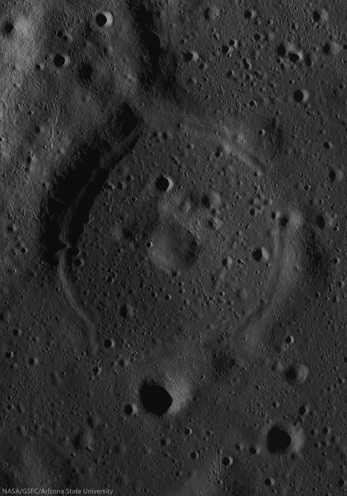
Very fresh roughly 4 km crater deep inside ancient, 222 km Campbell crater, north of Wiener F and Mare Moscoviense. Note the paucity of small craters on the melt disk on this young crater's floor, one of many clues to a recent origin.  LROC NAC mosaic M1133199962LR, LRO orbit 19112, September 7, 2013; 4.28° incidence, resolution 1.11 meters from 148.28 km over 46°N, 150.87°E [NASA/GSFC/Arizona State University].
H. Meyer
LROC News System

The longer a crater's ejecta is exposed to space weathering, the lower the albedo of the ejecta becomes.

Over time, gravity also takes effect, pulling material downslope and softening the appearance of the crater rim and the hummocky ejecta deposit.

Therefore, craters with highly textured, high albedo ejecta and crisp, well-defined rims are considered relatively fresh, like the crater above (46.188°N, 150.717°E), deep within the ancient farside crater Campbell.

In this case, the slightly asymmetric ejecta blanket is likely due to the fact that this crater formed on top of existing topographic highs, which appear to be the intersecting rims of partially flooded craters.
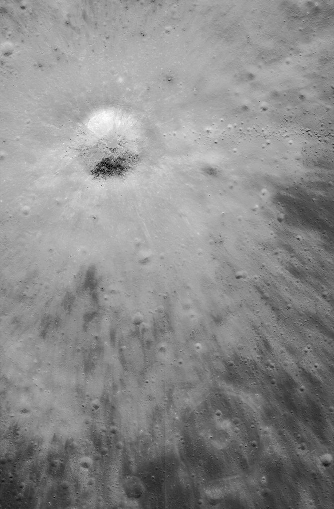
Bright, optically immature ejecta blanket, from the fresh crater is like a bright fan of farside anorthositic highlands terrain spread over an iron rich optically mature patch of mare deep inside ancient Campbell crater. Note the string of secondary crater east of the impact (and the nearly mare-inundated "ghost crater," on the edge of the ejecta blanket at bottom right). A larger 10.74 km-wide field of view, from the same, low incidence angle LROC NAC mosaic. [NASA/GSFC/Arizona State University].
The crater in the opening image is located in the floor of the much larger, much older crater Campbell (See WAC animation below). Campbell, named after two American astronomers, is an interesting study in its own right.

A portion of the floor of Campbell has been resurfaced by basaltic volcanism, an uncommon occurrence on the lunar farside. In this case, the volcanic activity did not produce sufficient lava to completely cover all of the craters in the floor, leaving traces of flooded craters like the one at lower right, on the edge of the ejecta blanket, in the NAC field of view above.

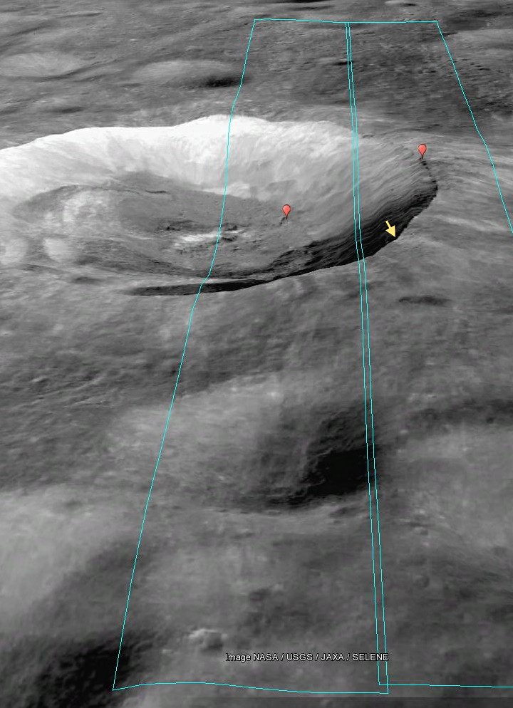
Campbell (222 km; 45.57° 152.9°E), in the farside highlands, almost disappears under certain conditions, because much of the wider region here has been relentlessly bombarded with predominantly iron nuclei, and "gardened" at a rate of 3 cm every two million years since the terrain first assumed its general shape. This animation shows the footprints of both LROC NAC observations used in this posting, above and below, of the fresh crater and immediate surroundings, near a boundary of basalt melt inside Campbell. From LROC WAC-derived 100-meter global mosaic, GLD100 elevation model and natural colors at normalized albedo, plus color-ratio analysis from Clementine (1994) [NASA/GSFC/Arizona State University].
Flooded craters are useful to scientists trying to determine the timing and sequence of events in areas that display multiple geologic processes in close proximity, such as impacts and volcanic activity.

An ephemeral ghost crater stands out in the depth of field resumed in long evening shadow, though the reflectivity of the ejecta from the fresh crater toward the north-northwest is still slightly traced out. A 5.77 km-wide field of view from M180187723LR, LRO orbit 11676, January 2, 2012; 81.93° evening incidence angle, 1.71 meters resolution from 176.17 km over 45.93°N, 151.34°E [NASA/GSFC/Arizona State University].
Because we can see partially flooded craters, we know that the crater Campbell must have existed long enough for new craters to form on its floor before volcanic activity began.

Understanding the Moon requires orbital photography at every angle of illumination. A full-width 16.47 km-wide field of view from M180187723LR  [NASA/GSFC/Arizona State University].
The fresh crater from Today's Featured Image adds another point of reference because its ejecta drapes the nearby mare deposit, making it the most recent addition to this region's geologic history.

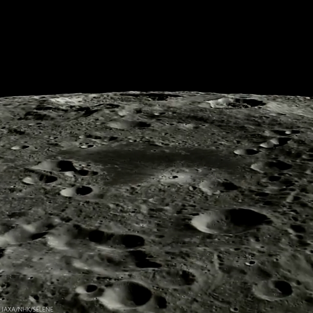
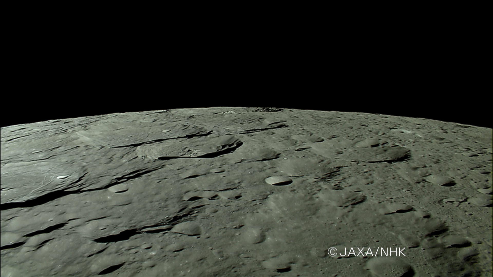
The western two-thirds of Campbell are more difficult to discern from polar orbit, but our bright fresh crater perched on the north of its small plain of mare basalt are easy to pick out, looking south from Japan's lunar orbiter Kaguya in 2008. This image is taken from just past the halfway point in the HDTV sequential still video below, from approximately 120 km overhead [JAXA/HKT/SELENE].

As noted in the YouTube video, presented by the Japan's space agency JAXA, Campbell is immediately north of Von Neumann and Wiener craters (on Campbell's southeast and southwest, respectively). Between these two craters, unnoted however, is Wiener F, with it's distinctive semi-circular bench of impact melt, discussed in more detail HERE.

Explore the full NAC mosaic, HERE.

Related Posts:

Tuesday, June 24, 2014

Breaking Down Walls

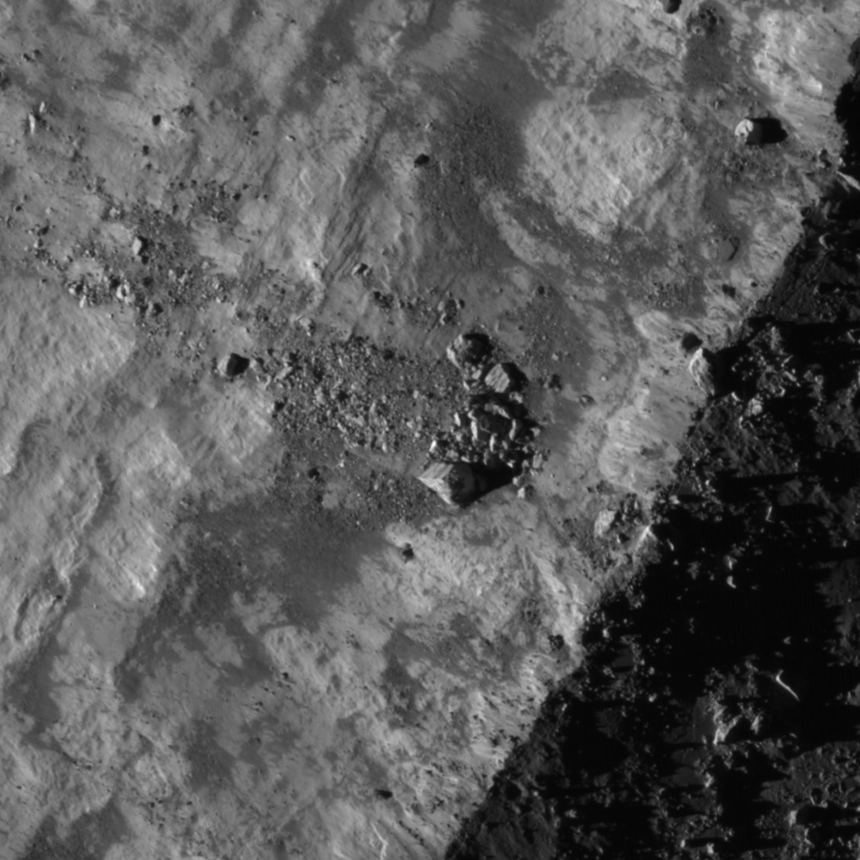
Gravity is winning as boulders erode and ultimately tumble down from the rim of Moore F (23.8 km; 37.29°N, 185.03°E), in the north farside highlands. 862 meter-wide field of view from LROC NAC mosaic M1156517189LR, LRO orbit 22390, May 18, 2013, spacecraft and camera slew 11.24° from nadir, 84.67° sunset incidence angle, resolution 1.49 meters from 146 km over 37.45°N, 186.59°E [NASA/GSFC/Arizona State University].
H. Meyer
LROC News System

Moore F is located in the highlands of the lunar farside. Its well-defined rim, steep walls, and the predominance of boulders suggest that it is quite young.

Over time, micrometeorite bombardment, the shock from more recent impacts, and other erosional processes break down the rock that composes the crater rim, walls, and floor.

The result will eventually be a smoother, more subdued appearance.  The many large blocks suggest that Moore F has only just begun to break down.

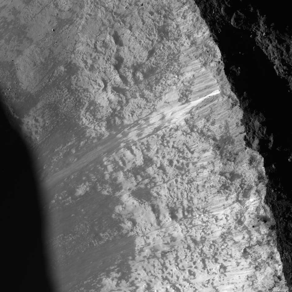
The impact process left Moore F with exquisite impact melt, abundant terracing, and a stunning central uplift, but a closer look reveals subsequent modification courtesy of gravity that has yielded even more entrancing beauty in the flows streaming down its walls, as in the NAC image below. 

LROC NAC image displaying granular flows in the wall of Moore F highlighted by the dramatic lighting of a low sun. Downhill is to the southeast (bottom left). Image width is approximately 8 km [NASA/GSFC/Arizona State University].
The streaks we see on the walls of Moore F in the image above are likely made of granular material that acted like a fluid as it slid downslope. But how do we know if the flows formed by the downslope movement of dry, fine-grained material?

Footprint of LROC NAC observation M1156517189L & R, LRO orbit 22390, May 18, 2013 [PDS/Google Earth].
The sources of the flows can be traced to specific locations and outcrops along the rim of the crater, suggesting that this is material from the rim that was disturbed and flowed downslope. The slightly braided appearance suggests multiple depositional episodes. These episodes could have been triggered by collapsing material from the rim or wall, boulders (like those in the opening image) knocking material loose as they hurtle downhill, or by shockwaves from nearby impacts.

This "real color" false color LROC WAC-derived 155 km field of view, combining Normalized Reflectance with a touch of RGB beta natural coloring, shows the wide dispersal of bright ejecta from Moore F, overwhelming the topography of older, nearby larger craters in the farside highland terrain [NASA/GSFC/Arizona State University].
Investigate this incredible NAC mosaic HERE.

Related Posts:

Tuesday, August 20, 2013

Karpinskiy, superpositioned on the farside north

Karpinskiy WACGLD 100m
LROC Wide Angle Camera (WAC) mosaic overlaid with WAC and NAC-derived GLD100 color-coded digital elevation model. Karpinskiy crater is approximately 90 kilometers across and nested within the remains of an even larger and more ancient crater [NASA/GSFC/Arizona State University].
Raquel Nuno
LROC News System


Karpinskiy crater, at 72.609°N, 166.801°E and (officially 91.403 km) in diameter, rests within a larger and far older unnamed crater. How do we know which crater is older? Stratigraphic studies, or the study of superposition of rock layers (or in this case, craters), will help determine the relative ages of craters here. Geologists derive relative ages between geological features by observing how they overlap - young formations will always overlie older formations, and on airless bodies, such as the Moon and Mercury, this method becomes particularly useful. Without wind to erode its surface, only four factors affect the lunar surface: space weathering, impacts, tectonism, and volcanic resurfacing. With respect to today’s Featured Image, the Moon accumulates impact craters over time. From the cratering record we can investigate not only stratigraphic relationships (which crater formed first), but we can also derive a quantifiable measure, or crater density, to determine relative ages on the Moon.

Karpinskiy passes under Kaguya
The HDTV camera onboard Japan's lunar orbiter Kaguya (SELENE-1) anticipates a rising Earth in 2007, looking north toward the Moon's north pole as it passes ancient craters of the Farside Highlands Terrain, including Karpinskiy, nested in a much older crater, passing out of view at left, followed by Milankovic and Plaskett. View the full-size image HERE [JAXA/NHK/SELENE].
Today’s Featured Image is a great example for stratigraphic studies. The LROC WAC mosaic of Karpinskiy crater overlaid with the GLD100 color topography presents a clearer outline of the older crater (WAC mosaic below). The top portion of the image is black because the GLD100 product does not have coverage at that latitude (>79°N). Karpinskiy crater is located inside a much older, degraded crater that does not have a well-defined rim and is somewhat difficult to see in the WAC mosaic. Karpinskiy is younger because it superposes, or formed on top, of the unnamed older crater. There are younger craters superposed on the floor of Karpinskiy, that must have formed later and are therefore younger based on the relative age relationships. Thus, using stratigraphic relations we are able to derive a relative age for Karpinskiy, but what if we want to determine the absolute age? The number of craters that formed on Karpinskiy can be used to estimate its absolute age, however with such a small area the crater size frequency distribution absolute age estimate has a large uncertainty. To accurately determine the absolute age of Karpinskiy crater we have to go there and acquire samples of impact melt rock that we can radiometrically date!

Karpinskiy WAC superposition context
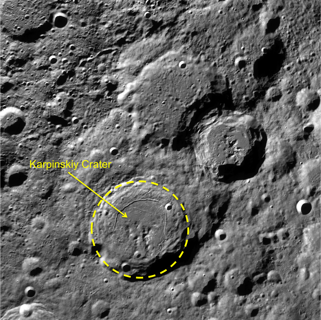
LROC WAC context image. Karpinskiy crater outlined in yellow, with the two neighboring craters to the north and east are Ricco, Milankovic and Milankovic E[NASA/GSFC/Arizona State University].
Explore the full image, HERE.

Related Posts:
Absolute Time
Copernicus Crater and The Lunar Timescale
Dating an Impact

Thursday, May 16, 2013

Dynamic Textures in the Farside Highland Terrain

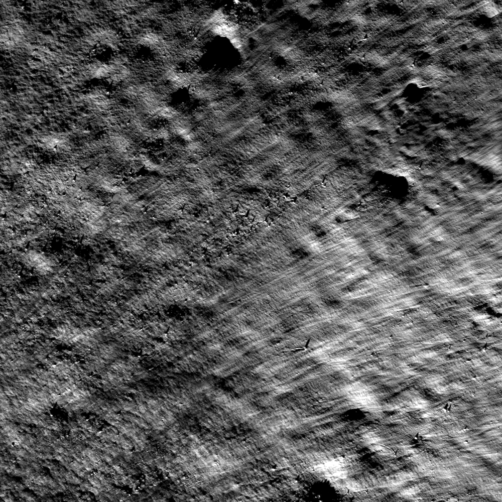
Northeastern portion of unnamed crater ejecta, above 77°N latitude, in the farside north. LROC Narrow Angle Camera (NAC) M138600267R, LRO orbit 5559, September 8, 2010; sunlight angle of incidence 80.3° over a field of view 1080 meters across, resolution 1.08 meters per pixel, from 51.96 km. Image center 77.086°N, 200.336°E, incidence angle is 80.3° [NASA/GSFC/Arizona State University].
Hiroyuki Sato
LROC News System

This far side high latitude (just above 77°N) fresh crater (roughly 1.1 kilometers in diameter) presents striking linear patterns in its ejecta.

Due to the high latitudes, the incidence angle is always very high in this area (including in this image), which enhances subtle topographic features.

The ejecta source crater is toward bottom left (outside the image field of view), thus the ejecta landed with the velocity component in upper right (northeast) direction, consistent with linear stripes dominating this whole area of this Featured Image.

LROC Wide Angle Camera (WAC) observation shows the whole crater of interest, at the center of this 46.2 km-wide field of view captured at 79.7 meters per pixel. North a smaller fresh crater almost immediately to the south-southeast. Both these crater's fresh, bright and optically immature ejecta fields are visible in the HDTV stills from Japan's SELENE-1 orbiter Kaguya, below. LROC WAC M173944659C (643 nm), spacecraft orbit 10768, October 22, 2011 [NASA/GSFC/Arizona State University].
Context for the LROC NAC frame outlined in this crop from LROC WAC monochrome mosaic (100 meters per pixel) of the unnamed crater and surrounding vicinity, centered near 77.46°N, 200.83°E, image width is about 142 km. NAC footprint (blue box) and the location of today's Featured Image (white arrow) are indicated here [NASA/GSFC/Arizona State University].
Interestingly, the lower left (closest to the rim) and upper left corners of this image show a craggy, rough surface, while the right portion shows only the striped pattern. What causes such texture differences within the same ejecta blanket?

Demonstration of just how far north the crater of interest resides in this three-HDTV frame animation, showing an Earthrise over Plaskett crater in the Moon's far north as captured from Japan's lunar orbiter SELENE-1 ('Kaguya') in 2007. The crater later photographed from overhead from LRO is designated with an arrow in the final frame. A large reproduction of the final still can be viewed HERE [JAXA/NHK/SELENE].
One possibility is the impact melt content was enriched near the rim, increasing the cohesion among the rock fragments and decelerating the flow inducing multiple pressure ridges perpendicular to the flow direction. Perhaps variations in roughness of the pre-existing surface controlled the final look of the ejecta. What else?

Explore this fascinating ejecta morphology in full NAC frame (HERE), and find your own hypothesis and answers!

Related Posts:
Ejecta sweeps the surface
Action Shot
Polka-dot Ejecta
Smooth Ejecta
In the Wake of Giordano Bruno
Scours and Ejecta Near Jules Verne Y
Lassell D Ejecta
Swept Surface
Ejecta Patterns

Wednesday, April 10, 2013

Rim Slumping inside pre-Nectarian Gamov

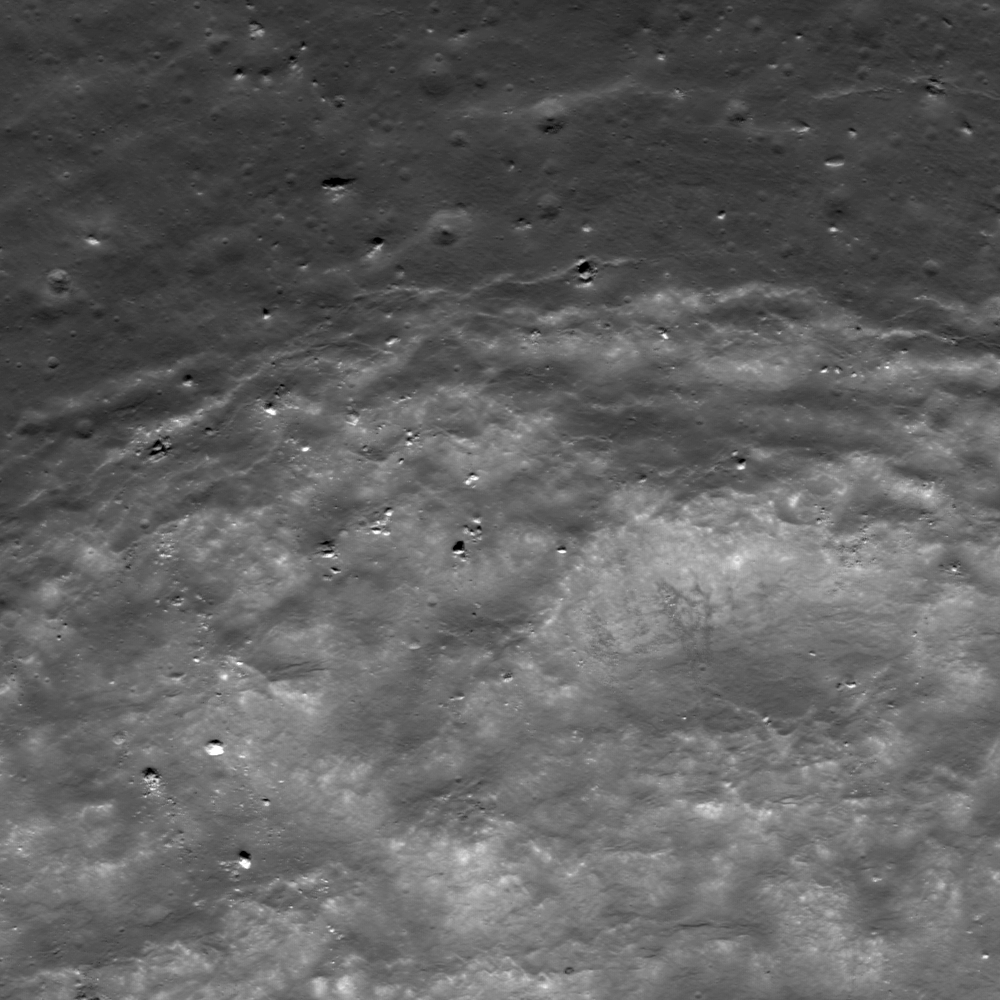
Faulting of a crater rim. Downhill to lower right, LROC Narrow Angle Camera (NAC) M187307653L & R, LRO orbit 12672, March 25, 2012; field of view approximately 1.9 km across, resolution 1.79 meters per pixel from 189.55 km [NASA/GSFC/Arizona State University].
Lillian Ostrach
LROC News System

Post-impact modification is frequently observed in LROC NAC images, because post-impact modification begins as soon as the impact crater has formed and ejecta emplaced. Impact crater formation is a violent process, so it should be no surprise that the target rock surrounding the impact site may be fractured and faulted, especially near the crater rim.

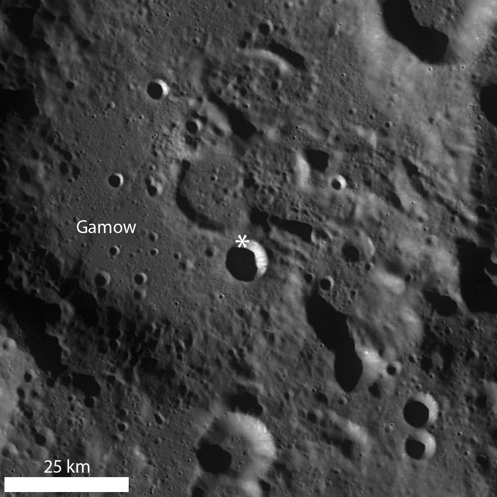
Today's Featured Image of the northern rim of an unnamed about 8.5 km diameter crater (64.754°N, 145.546°E) focuses on the faulted nature of the crater rim and evidence for mass wasting.

12.2 km wide field of view from the LROC NAC mosaic showing the entirety of the left and right frames of observation M187307653. The area highlighted in the LROC Featured Image further up is outlined by the white square [NASA/GSFC/Arizona State University].
The upper portion of the opening image is the outer flank of the crater, the fractures represent the crater rim "edge" (the lower portion of the image is the steep interior wall). As time passes and materials (blocks, fine-grained material) are dislodged from the rim and crater wall, the crater rim erodes and degrades, expanding outward (the diameter of the crater actually increases, while its depth decreases).

LROC Wide Angle Camera (WAC) monochrome mosaic highlighting a bowl-shaped crater superposed in pre-Nectarian Gamow crater. An asterisk denotes location of the area seen at high resolution in opening image [NASA/GSFC/Arizona State University].
Some examples of this "slope retreat" of the crater rim are very obvious, whereas others, like today's example, are less so. Today's example shows small-scale slumping of the crater wall as opposed to larger-scale slumping of massive portions of rim material. Perhaps the smaller size of this crater compared to other examples is the reason the slope retreat does not appear well-developed, or maybe the failure of rim faults is less pronounced due to pre-existing target properties (e.g., highly fractured nature of the highlands, impact into floor material of a larger crater, etc.).

Explore this farside simple crater for yourself in the full LROC NAC image, HERE.

Related Posts:
Top of the Landslide
On the Edge
Posidonius Y

Thursday, December 6, 2012

'Minty Fresh' Farside Highlands crater

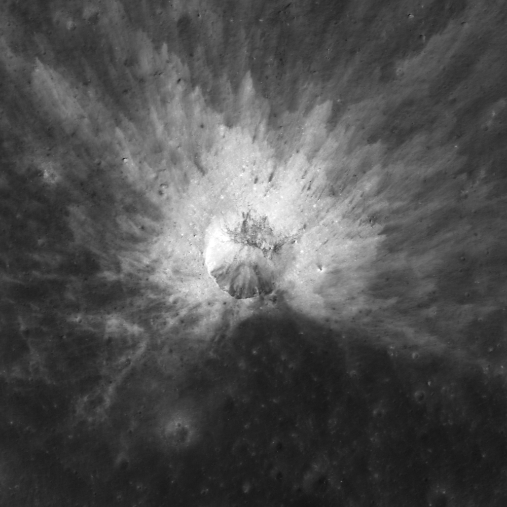
A fresh young (Copernican) 330 meter-wide impact refreshed the otherwise optically mature Farside Highlands Terrain (FHT), from LROC Narrow Angle Camera (NAC) observation M1104423389L, LRO orbit 15067, October 9, 2012 [NASA/GSFC/Arizona State University].
Sarah Braden
LROC News System

This Copernican-aged crater is located in the highlands at 41.571°N, 227.129°E. While the crater diameter is ~330 meters, the rays of high reflectance ejecta extend more than two crater diameters from the rim in all directions. The material in the ejecta is higher in reflectance compared to the surrounding material because it was recently exposed to the surface. Recently exposed material is called fresh since it is relatively unaffected by space weathering processes.

The layers of ejecta are thicker closer to the crater rim, and become progressively thinner with distance from the crater rim. Also the rays of ejecta furthest from the crater rim mix more with the surrounding material. The overall effect causes higher reflectance near the rim of the crater and lower reflectance of the ejecta as you get further away from the rim.

LROC Wide Angle Camera (WAC) 100 meter monochrome Global Mosaic provide at least some context for an area of the Moon being explored at high resolution in the 21st century [NASA/GSFC/Arizona State University].
Explore the entire NAC frame, HERE.

Related Images:

Wednesday, December 5, 2012

A Tiny, Glancing Blow

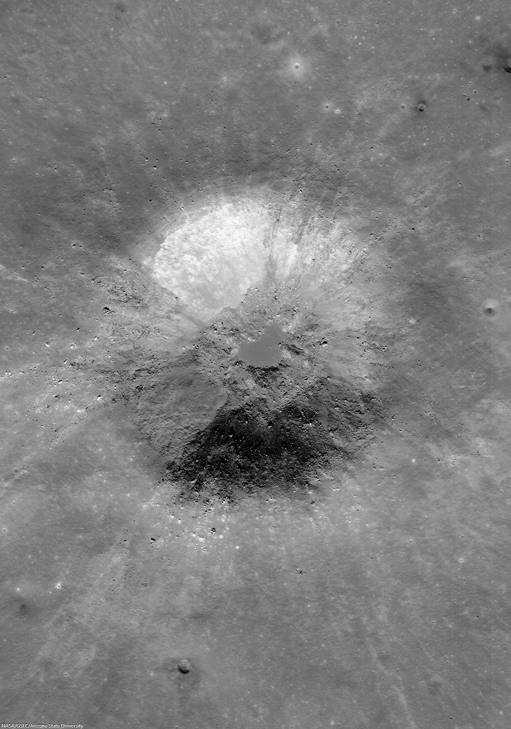
An oblique impact created a beautiful asymmetrical ejecta pattern on the farside highlands, photographed from LRO October 10. LROC Narrow Angle Camera (NAC) observation M1104509842L, spacecraft orbit 15079, resolution 1.2 meters per pixel over a field of view 696 meters wide. With the Sun high, sheer reflectance, hinting at rough and fresh terrain, is emphasized. In an earlier, closer observation below reflectance gives way to topography under a high angle of incidence [NASA/GSFC/Arizona State University].
Sarah Braden
LROC News System

The ~220 meter diameter impact crater, located at 6.258°N, 215.101°E , just east of the unnamed crater highlighted in yesterday's Featured Image, was caused by an obliquely impacting asteroid or comet.

What is an oblique impact, and how do we know that this crater was formed by an oblique strike? 

The term oblique impact implies an impact angle of 15 degrees or less. The impact angle is the angle between the surface and the vector that represents the direction of travel of the impactor. 

A slightly closer look, under a greater angle of incidence (71.25°), at the rough ejecta and pressure wave pattern immediately beyond the north rim of the small glancing impact, from an earlier LROC NAC observation that unfortunately only overlaps the Featured Image at these points. The smaller grooves overlap those from the unnamed crater to the west (upper left). LROC NAC M118444752L , orbit 2589, January 18, 2010; resolution 1.09 meters from 52.43 kilometers [NASA/GSFC/Arizona State University].
The greater than 15 degree impact angle results in a number of diagnostic features including asymmetric ejecta and non-circular crater shapes. In the Featured Image, it is clear that this impact has asymmetric ejecta since the area immediately to the south of the crater is "missing" its high reflectance ejecta. 

The asymmetry of the small impact, its missing south half, are clearly seen in this LROC Wide Angle Camera (WAC) mosaic of sequential LROC WAC observations in orbits 11104 and 11105, November 18, 2011; 62 meters resolution over a roughly 30 km-wide field of view [NASA/GSFC/Arizona State University].
The small crater's location, high amidst the highest elevations on the Moon, in the Farside Highlands Terrain (FHT), is indicated by the arrow at center, that also shows slope angles throughout the region are not as level as they might seem in close photography. LROC WAC Digital Terrain Model (DTM) hemispheric orthographic projection centered on 240° E (below) [NASA/GSFC/DLR/Arizona State University].
The region in hemispheric context, orthographic projection centered on 0°N, 240°E [NASA/GSFC/DLR/Arizona State University].
Due to the low angle of impact, the ejecta has more momentum in the direction of travel of the impact, which causes the asymmetric ejecta patterns. The area with the least ejecta is sometimes called the "zone of avoidance," and it indicates the impactor flight direction. In this case, the impactor was traveling from the south to the north when it hit the lunar surface (north is up in the Featured Image).

Explore the entire NAC frame HERE for more impact features.

Related Images:
Slice of Mare
How did I form?
Asymmetric Ejecta