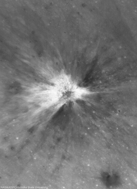
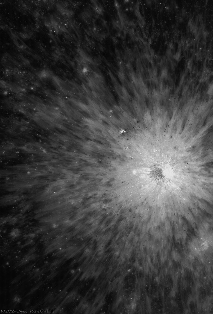
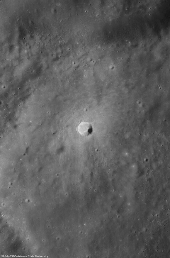
Showing posts with label fresh crater. Show all posts

Wednesday, February 18, 2015

Hell Q

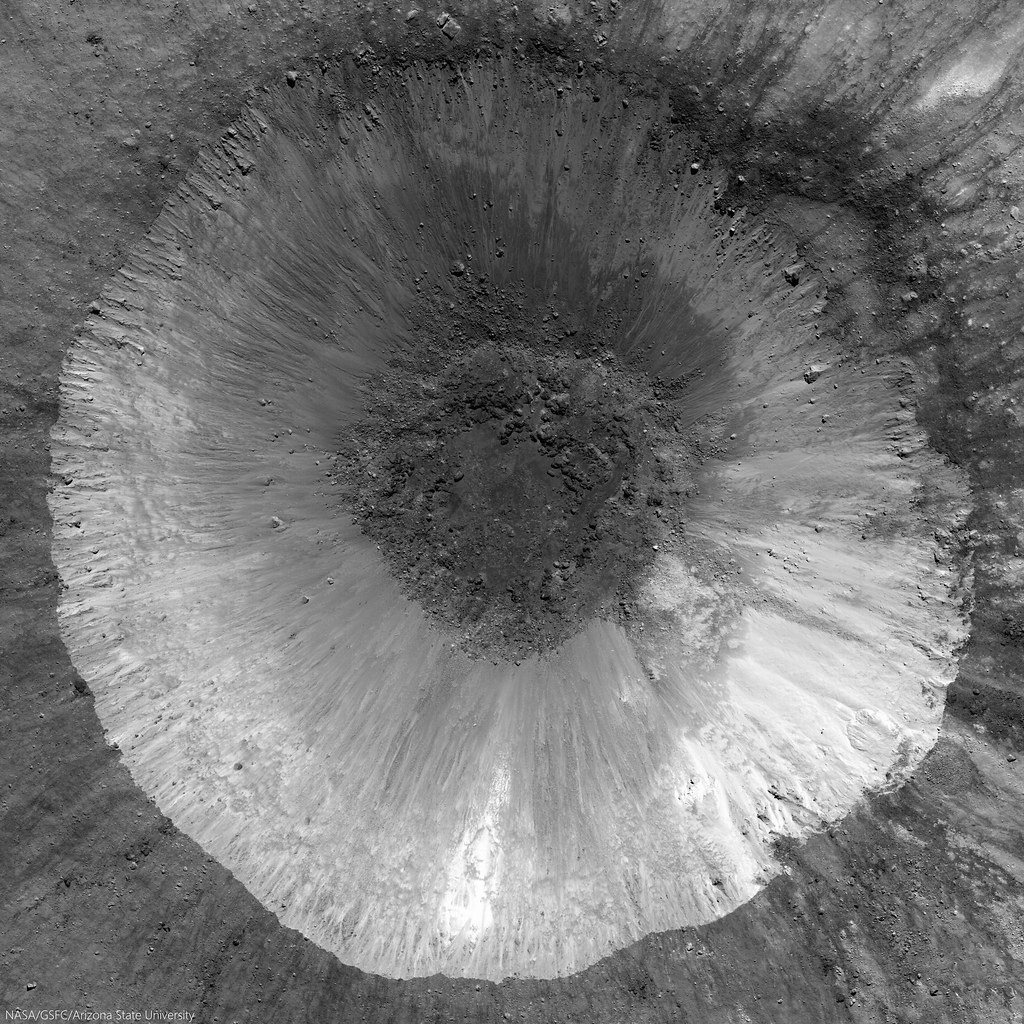
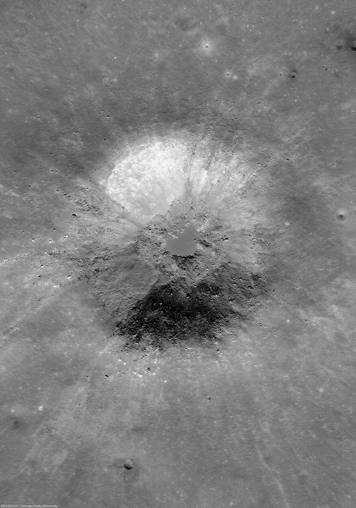
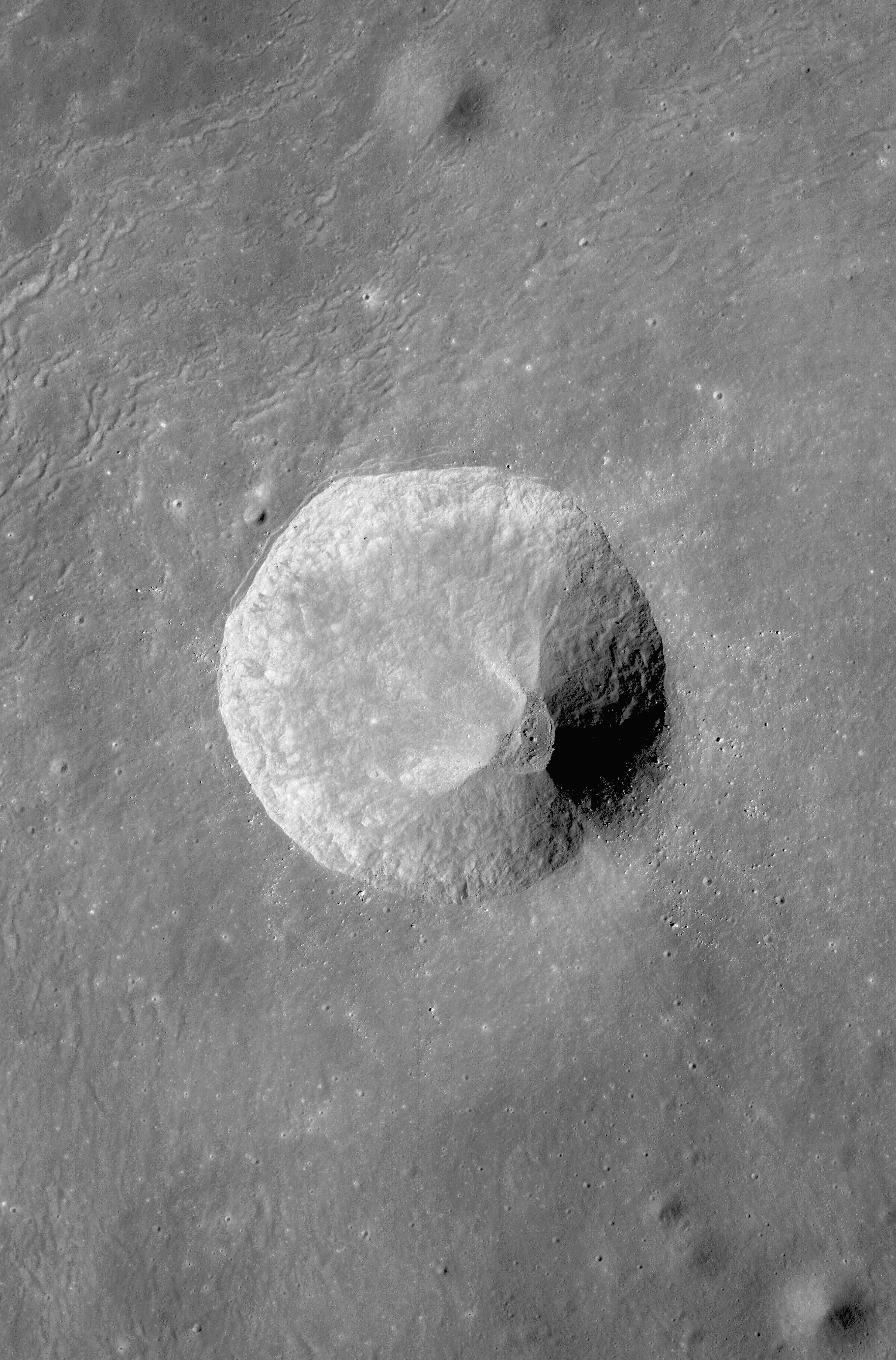
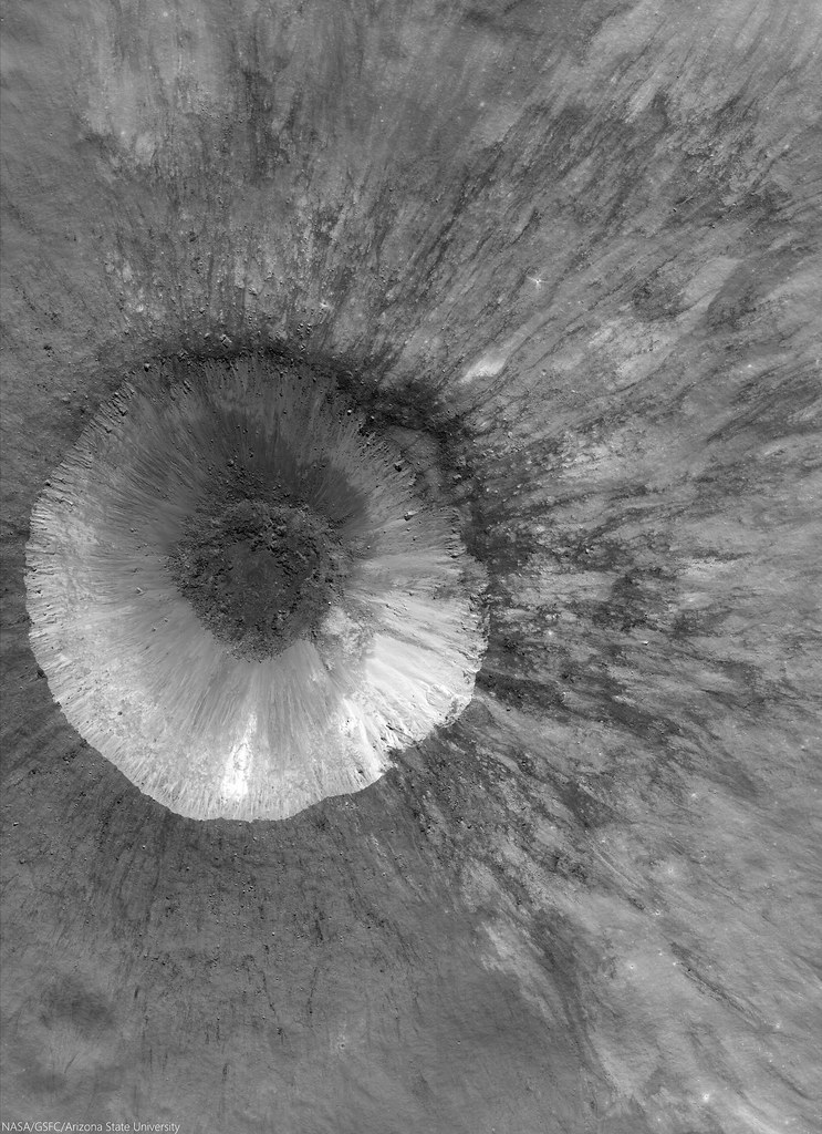
LROC NAC mosaic M1164853645RL, LRO orbit 23561, September 8, 2014; spacecraft and cameras slewed 3° from nadir, 33.17° angle of incidence, 71 cm resolution from 68.29 km over 33.07°S, 355.72°E [NASA/GSFC/Arizona State University].
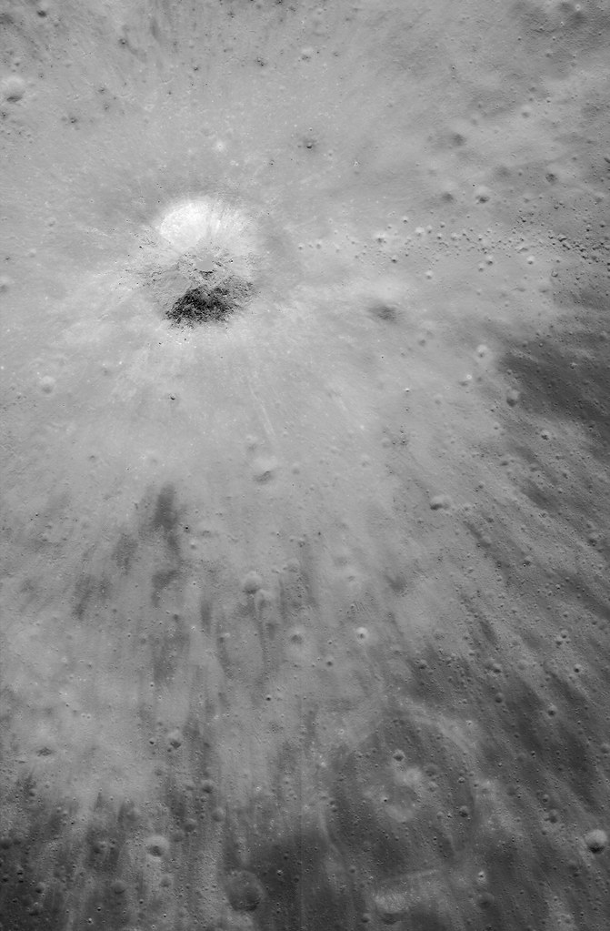
Hell Q (3.75 km; 33°S, 355.53°E) seems younger than Tycho, standing out as it does in the nearside Southern Highlands northeast of the more famous astrobleme. 

There seems little doubt the effect of the larger, far more widespread blast zone from Tycho changed the face of this contemporary but pre-existing smaller crater. The chevron effect left grooves untouched down stream and tore away a chunk of the northeast rim, morphologies apparently perpendicular to a straight line drawn southwest to the more spectacular, 109 million year-old Tycho.

View full resolution views, of a variety of sizes, HERE.

Sunday, February 1, 2015

LROC detects 26000 changes to lunar surface since '09

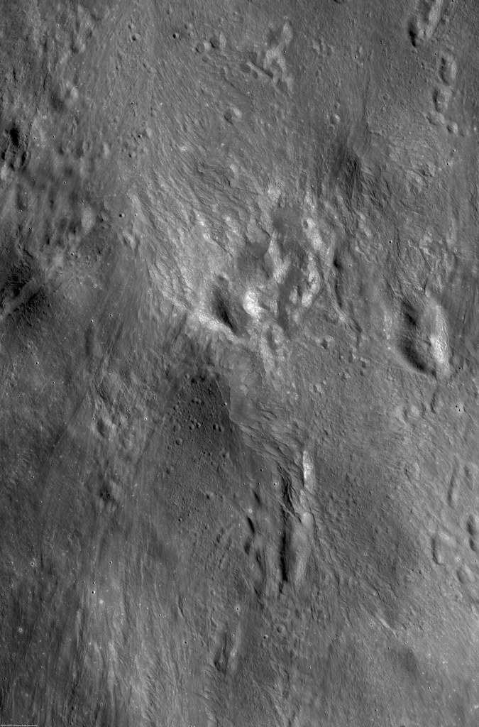
Close look at south wall of the Copernican age crater Fetchner T (14.33 km; 58.74°S, 122.82°E), a 2.3 km-wide field of view from LROC NAC observation M113148900R, LRO orbit 1808, November 18, 2009; incidence 67.98° at 64 cm resolution, from 61.71 km above 58.84°S, 122.02°E. Polar orbital tracks converge nearer together, allowing more frequent re-imaging  and opportunities to detect changes to the landscape [NASA/GSFC/Arizona State University]. 
DYNAMIC MOON REVEALED WITH HIGH RESOLUTION TEMPORAL IMAGING

46th Lunar and Planetary Science Conference, #2325
Speyerer and Robinson, Povilaitis and Wagner
School of Earth and Space Exploration
Arizona State University

Introduction: The Lunar Reconnaissance Orbiter Camera (LROC) began systematically mapping the Moon in the summer of 2009 with the goal of acquiring an image dataset to facilitate future exploration [1]. With the aid of the extended science mission, we have discovered hundreds of new impact craters, thousands of smaller probable secondaries, and evidence of recent crater modification using repeat observations with the high resolution Narrow Angle Camera (NAC) and a custom change detection program.

Temporal Dataset: As of 1 January 2015, LROC has acquired nearly a million NAC images of illuminated terrain. From this total, nearly 10,000 are images acquired of regions of the Moon where previous NAC observations with similar lighting and observational geometry exist (i.e. incidence angle difference more than 3°, incidence angle greater than 50°, and nadir pointing).

These before and after image pairs, called temporal pairs, enable the search for a range of surface changes, including new impact craters, formed between the time the first and second image were acquired; individual temporal pairs currently span between 176 to 1241 Earth days.

Change Detection: Since a single NAC temporal pair can contain up to 1.09 billion pixels, manual scanning of thousands of temporal pairs is impractical. However, 131 images were manually scanned and 657 surface changes were identified [2] providing a baseline for the automated change detection algorithm.

We developed an automated change detection program that identifies and crops out suspected changes from each temporal pair. Thumbnails of these candidate areas are extracted and manually classified using a custom web interface. Of the 46,057 automatically identified surface changes recorded to date, manual inspection confirmed that over half (56%) are indeed changes to the surface.

This semi-automated procedure reduces the human time required to inspect a temporal pair by over a factor of 200.

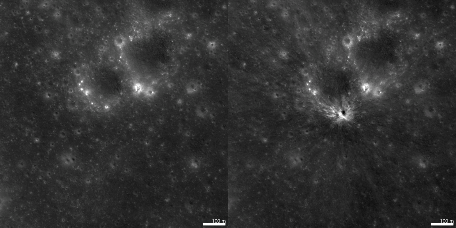
New Impact Craters and Secondaries: From the temporal pairs scanned to date (1 January 2015), we identified 225 new resolved impact craters (e.g. Fig. 1). These craters range in diameter from 1.5 meters to 43 meters and are distributed across the surface over a variety of terrain types (Fig. 2; red dots). In addition, targeted NAC observations imaged 18 and 34 meter diameter craters where impact flashes were observed on 17 March 2013 and 11 September 2013 respectively (Fig. 2; blue dots).

Fig. 1: Before (left) and after (right) images of a new 18 meter impact crater discovered by automatically scanning NAC temporal pairs.
We also identified nearly 26,000 other surface changes that do not exhibit visible crater rims but only a change in surface reflectance. These include high reflectance changes (i.e. increase in surface reflectance), low reflectance changes, as well as mixed reflectance changes (Fig. 3).

Fig. 2: Location of new impact craters overlaid on a LROC Wide Angle Camera basemap (Latitude Range: 55°N to 55°S, Longitude Range 180°E to 180°E). The red dots indicate the location of the 225 new impact craters discovered to date with NAC temporal pairs and the blue dots show the location of the two craters located with the help of Earthbased impact flash observations [3,4].
These changes are thought to be the result of small primary events in which the resulting impact crater is smaller than the resolution limit of the temporal pair or by a secondary disturbance caused by a nearby primary event. In several cases, these surface changes show clear directional indicators pointing back to a larger primary crater [3] confirming their origin as secondary craters.

Fig. 3: Example of low (left column) and high (right column) reflectance changes identified with NAC temporal pairs. The top row consists of a pair of before images, the middle row is a pair of after images, and the bottom row is a ratio of the after/before observation. Each image field of view is 250 meters across.
Crater Modification: Temporal pairs also revealed seven new landslide events inside Copernican age impact craters (Fig. 4). Several of these landslides are the result of small impact events occurring on steep (slopes over 30°) crater walls.

These landslides typically show boulder trails extending from the new impact crater and tracing a path toward the crater floor and occasionally growing in width as a result of the falling block dislodging material along the steep surface. One such event caused material to travel over 4 km to the floor of the larger parent crater.

In addition, we discovered new landslides that lack any indicator of emanating from a new impact crater. These landslides exhibit a much broader surface change (greater than 100 meters wide flows instead of narrow boulder tracks witnessed with the previously described landslides). We speculate that these may be the result of a seismic event such as a Moonquake or a large distant meteor impact disrupting regolith poised near the angle of repose and causing the loosened regolith to cascade down to the crater floor.

Fig. 4: Example of two temporal ratio images (after/before) showing recent landslide events. The image on the left shows a 250 meter-wide field of view, boulder trails extending down slope from a new impact crater. At right is 600 meter-wide view showing a larger landslide with no indication it results from an impact on the wall of the parent crater. In each example, the elevation depicted decreases from the top to the bottom.
Summary: As of 1 January 2015, we have scanned and classified changes in 8300 NAC temporal pairs using our automated change detection tool leading to the discovery of 225 impact craters ranging in size from 1.5 to 43 m. In addition, we also identified thousands of other surface changes, including:

- 23,458 low reflectance changes
- 1,911 high reflectance changes
- 468 mixed reflectance changes
- 1 Chinese lander/rover

Throughout the second extended science mission, the LROC team will continue to acquire and scan high resolution temporal pairs. From this new dataset we plan to refine estimates on the flux of small (less than 0.5 meter) bolides in the inner solar system as well as quantify secondary impact-related hazards on the Moon, which is not only an important scientific finding but a key engineering design concern for future long duration surface assets.

References: [1] Robinson M.S. et al. Space Science Reviews, 150, 1-4, 81-124 (2010); [2] Thompson S.D. et al., Recent impacts on the Moon, 45th Lunar and Planetary Science Conference (2014), #2769; [3] New crater on the Moon and a field of secondaries, Robinson M.S. et al. 45th LPSC, (2014) #2164; [4] http://lroc.sese.asu.edu/posts/810.

Monday, September 15, 2014

Watching craters "as they happen"

A new crater on the Moon, "found among so many." The bright flash of formation for this approximately 34 meter diameter crater was captured simultaneously by two Earthbound telescopes in Spain on September 11, 2013. From LRO, before-image LROC NAC observation M1119014742L, orbit 17116, March 27, 2013; incidence 23.66° resolution 82 cm from 84.41 km, After-image LROC NAC M1149637354L, LRO orbit 21423, March 16, 2014; incidence 23.18° resolution 91 cm from 89.12 km  [NASA/GSFC/Arizona State University].
Mark Robinson
Principal Investigator
Lunar Reconnaissance Orbiter Camera (LROC)
Arizona State University

On 11 September 2013 the "Moon Impacts Detection and Analysis System" (MIDAS) camera captured a bright 8-second long flash on the central nearside of the Moon.

This was the brightest event captured so far by the MIDAS team, and they estimated that the crater should be between 46 and 56 meters in diameter.

The LROC team targeted the reported coordinates (17.2°S, 339.5°E) of the flash and acquired several images over a few months until the crater was found in images acquired on 16 March 2014 and 13 April 2014.

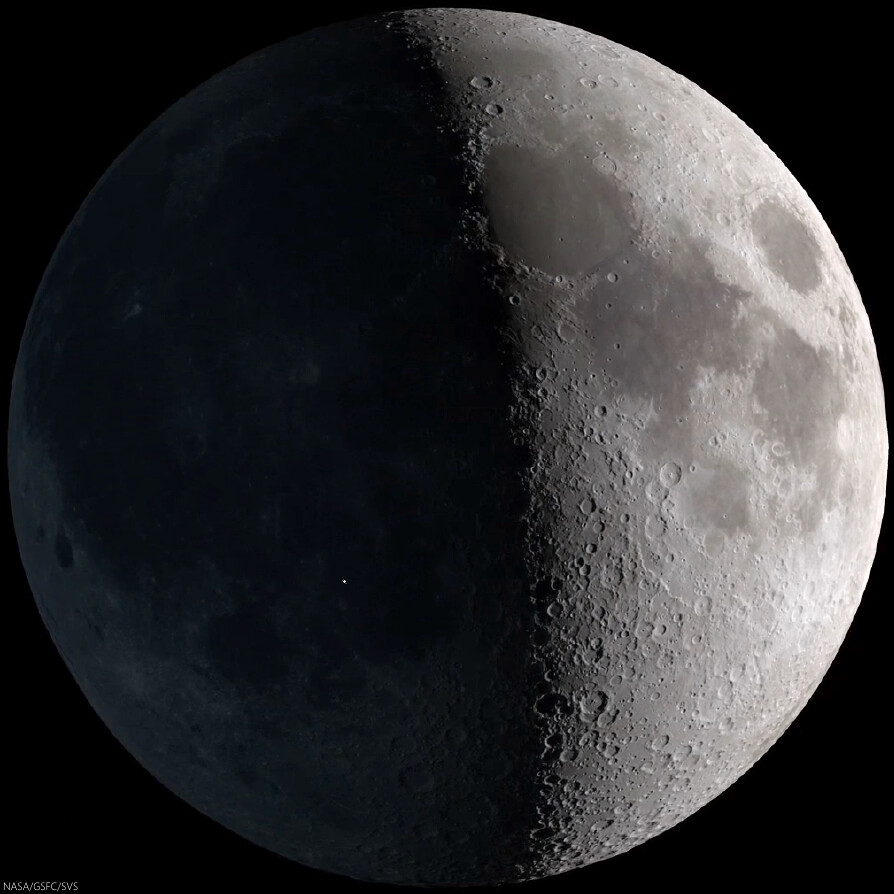
Strictly speaking, the 11 Sept. 2013 event was visible to the naked eye, though at nearly First Quarter the idealized reproduction above fails to account for the discriminating human eye. The illuminated east hemisphere would tend to have washed out Earthshine for all but those with the steadiest eyes. Fortunately, for at least ten years the unlit portion of the Nearside "visible" at night has been carefully monitored systematically, improving our understanding of hazards in the Near-Earth environment [NASA/GSFC/SVS].
Video sequence recording impact on the Moon's nearside in Mare Nubium. The magnitude of the explosion is estimated to have been roughly equal to that of Polaris, the North Star, and the recorded light curve following after lasted a remarkable eight seconds. Madiedo, et al. (2014) [IAA-CSIC/Universidad de Huelva].

Fortunately there was a NAC image of the target area acquired before the impact, so finding the new crater was relatively easy once an "after" image with comparable lighting to the "before" image was acquired.

As it turns out the new crater is ~34 meters (112 feet) in diameter and is located at 17.167°S, 339.599°E, only 2 kilometers (1.2 miles) from the original telescope-based prediction. In the before-after animation you can see ejecta effects from the crater extend out more than 500 meters in all directions!

See also LROC NAC image M1149637354L (16 March 2014).


Impact flash recorded on the unlit Nearside by Prof. Jose M. Madiedo, 11 Sept. 2013. North is to the right (note the visibility of Grimaldi, top center - the 173 km-wide walled plain is often the last recognizable feature on portion of the Nearside lit by Earthshine as the Moon waxes Full). The Moon was shy of First Quarter. This video was produced on the occasion of the publication (in Feb. 2014) in Monthly Notices of the Royal Astronomical Society (MNRAS) of the paper entitled "A large lunar impact blast on 2013 September 11," by J.M. Madiedo, J.L. Ortiz, N. Morales and J. Cabrera-Caño.

A longer, more instructive version was uploaded by the authors HERE

Wide Angle Camera morphology basemap overlaid with color-coded LROC GLD100 topography centered on the 11 September 2013 impact crater. The large crater just visible in the lower left is 60 kilometer diameter crater Bullialdus [NASA/GSFC/Arizona State University].
Revisit the LROC NAC image of new crater formed on 17 March 2013, HERE.

Read the paper describing the 11 September 2013 observation (Madiedo et al., 2014)

Wednesday, August 20, 2014

Frozen motion at Harbhebi J

The scoured floor of Harkhebi J (43.1 km; 37.418°N, 103.356°E), near the young crater Giordano Bruno. Ejecta from Giordano Bruno flowed across the surface, leaving a record for us today. A 1570 meter-wide field of view from LROC NAC observation M1128791817L, LRO orbit 18492, July 18, 2013; incidence 60.58° resolution 1.35 meters, from 103.62 km over 37.52°N, 103.7°E [NASA/GSFC/Arizona State University].
Aaron Boyd
LROC News System

Giordano Bruno, the 22 km crater whose ejecta drapes Harkhebi J, is at most 10 million years old. Because these features are so young, they are preserved almost as though the ejecta ray landed here yesterday.

The Featured Image location is approximately 5 crater radii (55 km) away from the impact center, but the effects of the original impact are clearly visible; the momentum from the ejecta is visible as striations in the western half of the image.

The ejecta  was traveling upwards of 600 km/hr when it began to etch the surface, and when the materials finally came to rest, the evidence of the original motion was frozen in time.

Scaled and corrected 4.912 km-wide field of view from LROC NAC observation M1128791817L, July 18, 2013. View the full-resolution mosaic HERE [NASA/GSFC/Arizona State University].
Many patterns in ejecta from Giordano Bruno crater can be seen throughout the full NAC frame. These varied beautiful patterns relate to ejecta velocity and angle, as well as the material properties of the target.

Context for the LROC Featured Image released August 20, 2014. Footprint of LROC NAC observation M1128791817L. LROC WAC observation M121532675C, LRO orbit 3044, February 23, 2010; incidence 49.3° at 76 meters resolution, from 54 km [NASA/GSFC/Arizona State University].
What would blocky ejecta look like? What would fine granular ejecta look like? The blocky ejecta would pepper the ground with secondary craters, while the granular ejecta would blast the existing surface smooth and flow like an avalanche

View full-resolution LROC NAC mosaic, HERE.

Related Posts:

Monday, July 21, 2014

Ballistic boulder at Hecataeus N

A house-sized boulder left a clear impression, immediately beyond the east rim of a young 1.6-km crater (rim crest to the left), all in a full-sized reproduction, 988 meter-wide field of view from LROC NAC observation M182995612R, LRO orbit 12068, February 4, 2012; 48.59° incidence, resolution 85 cm from 83.56 km over 20.98°S, 80.74°E [NASA/GSFC/Arizona State University].
J. Stopar
LROC News System

The boulder above (21.085°S, 80.777°E) in the opening image is likely debris ejected during the violent excavation of the 1.6-km diameter crater immediately to the west (left).

The boulder was deposited ballistically; the distance it travelled and its time of flight are related to its ejection angle and velocity.

For the boulder, was this flight a "small step" or a "giant leap?"

Looking at the image above, we can deduce that the boulder was deposited with enough force to make a noticeable impression in the ground. However, a more forceful landing would have highly fragmented the boulder.

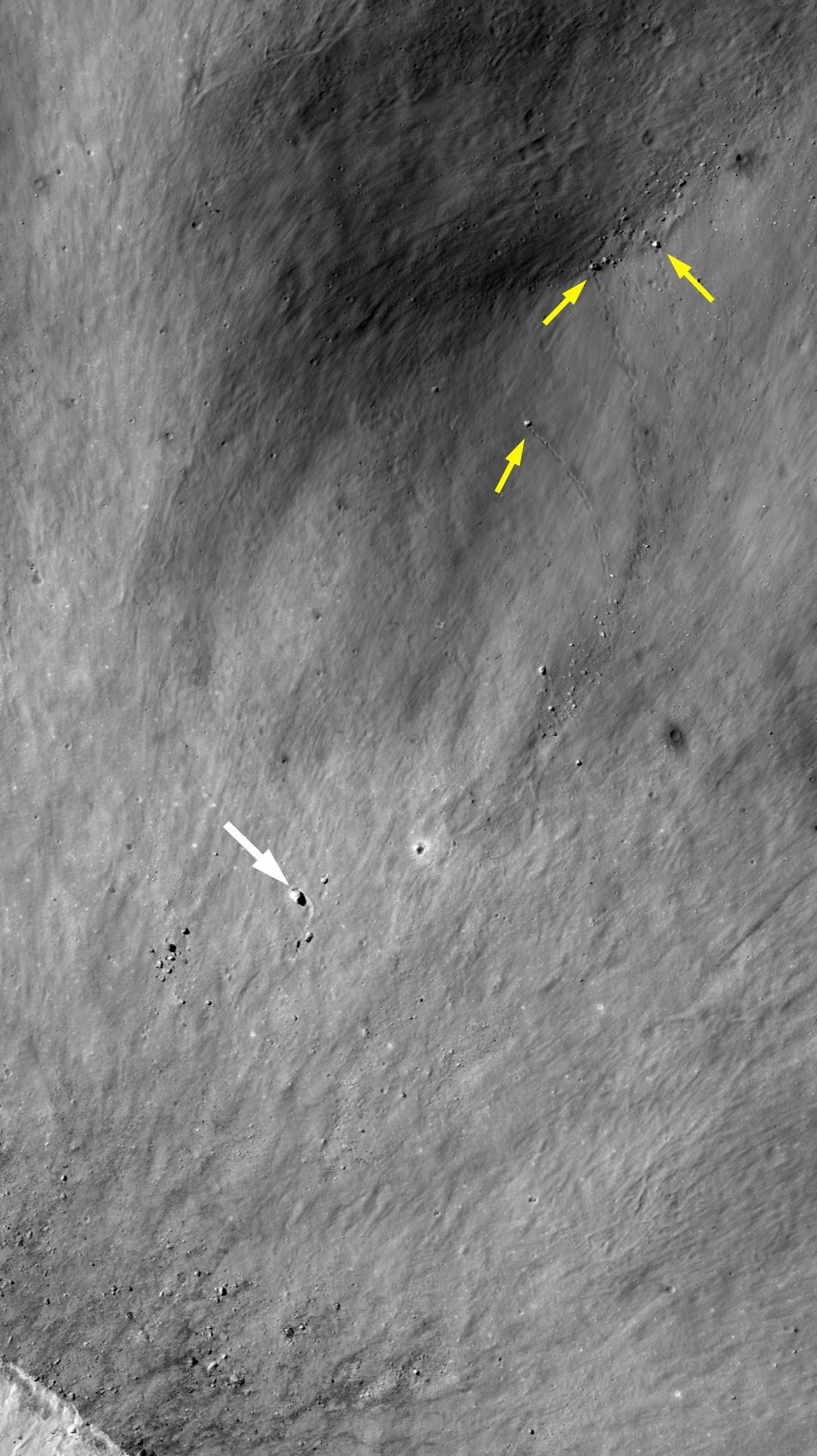
More examples of surface impressions formed by ballistic boulders from the fresh impact near Hecataeus N. Spotty trails mark where boulders rolled into a pre-existing crater (small yellow arrows). Another larger, boulder (25 meters in diameter, large white arrow) was thrown out of the crater to the southwest and carved a furrow in the ejecta blanket, coming to rest when it intersected a pre-existing crater rim (topographic high) [NASA/GSFC/Arizona State University].
The boulder is located about 500 meters east of the crater rim crest, which is only about a third of the crater diameter. Thus, this boulder did not travel very far or very fast.

Explore the entire crater and its ejecta below:

Fresh impact on the west flank of Hecataeus N 4.3 km field of view from LROC NAC mosaic M182995612LR, LRO orbit 12068, February 4, 2012; 48.59° incidence, resolution 85 cm from 83.56 km over 20.98°S, 80.74°E [NASA/GSFC/Arizona State University].
View full-window HERE.

The house-sized boulder (yellow arrow), which left its impression just beyond the east rim of the unnamed young 1.6-km crater that, in turn, sits on the west flank of Hecataeus N, shown in the context of a 7.86 km-wide field of view from LROC NAC mosaic M182995612LR, LRO orbit 12068, February 4, 2012; 48.59° incidence, resolution 85 cm from 83.56 km over 20.98°S, 80.74°E [NASA/GSFC/Arizona State University].
The fresh crater (center) on the southwest slope of Hecataeus N (10.82 km; 20.91°S, 80.944°E) excavates the deepest material originally turned up by "N" while both, in turn, sampled the very ancient Hecataeus interior (southwestern half of this 40-km wide field of view) and, even further, material turned out by Humboldt, to the south (see below), a powerful impact that significantly filled in and covered over the floor of Hecataeus. This is an example of something planners look when making good landing site choices, ones likely to efficiently utilize precious resources. LROC WAC observation M177109146C (604 nm), LRO orbit 11236, November 28, 2011; 68.1° incidence, resolution 58.91 meters from 43.76 km [NASA/GSFC/Arizona State University].
A general schematic map of geological types, representing the relative stratigraphy of the lunar surface affected by Hecataeus and Humboldt, in the south equatorial latitudes of the far eastern hemisphere, where the farside highlands begin, The fresh crater on the west flank of Hecataeus N is marked by an arrow.
The grooves carved by boulders ejected at relatively low velocities are in many ways similar to the spotty tracks etched by boulders sliding, rolling, and bouncing down steep slopes. Also, boulder tracks (like these) often resemble the astronauts' footprints on the lunar surface, since both have relatively recently disturbed the soil in narrow paths. 

In honor of the 45th anniversary of the Apollo 11 lunar landing (July 20, 1969), revisit some of our previous posts about large boulders visited by astronauts:


Finally, revisit some of the best LROC images of the Apollo 11 landing site and see if you can find any large boulders. You should find very few large boulders, as the mission planners sought a low-risk site for the first Moon landing:

Thursday, July 3, 2014

Sun angles, over fresh ejecta, east of Buisson V

Overlapping views of the same 1 km-wide area of the lunar surface, immediately southwest of a fresh impact crater near Buisson V; 68° morning shadow and 8° mid-day albedo, respectfully. LROC NAC observations M146255155R (LRO orbit 6687, December 6, 2010; incidence 67.86° at 62 cm resolution from 60.47 km) and M187520776L (orbit 12701, March 27, 2012; 8.35° incidence, resolution 97 cm from 116.95 km) [NASA/GSFC/Arizona State University].
Hiroyuki Sato
LROC News System

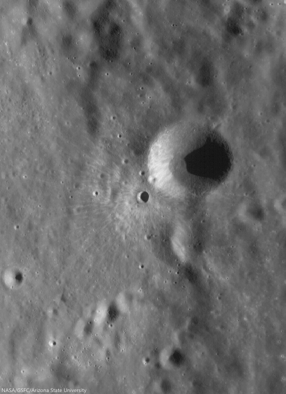
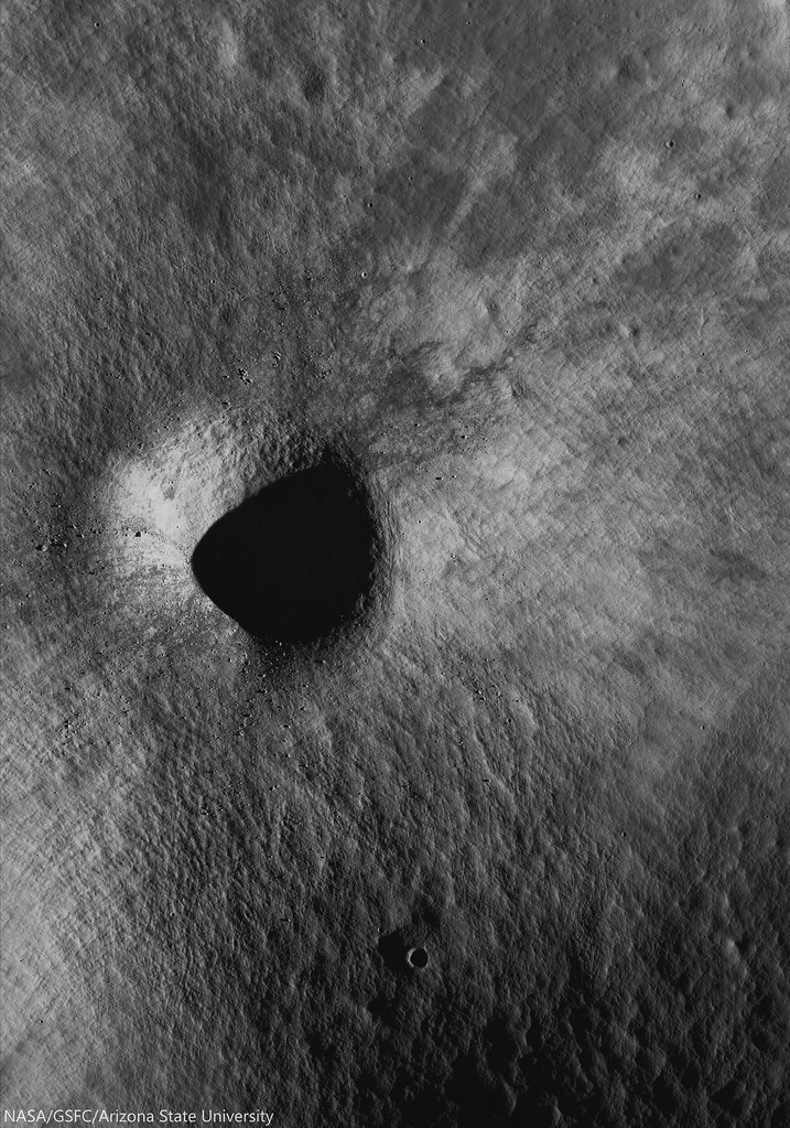
Today's Featured Image highlights differences in how the surface appears as the Sun angle changes. As seen in the opening image, the two images show the exact same area, but their appearances are remarkably different. Both images show the southern portion of the ejecta from an unnamed fresh 1 km crater (0.4933°S, 110.7156°E, 9.8 km west by northwest of Buisson V, an ancient equatorial crater just beyond the east limb.

The darker image, highlighting the granularity and elephant skin texture of the surface, was acquired when the Sun was low on the horizon (incidence angle = 68°), and the image characterized by bright swaths of ejecta was acquired when the Sun was nearly overhead (incidence angle = 8°).  Both were acquired with the cameras looking straight down. The small crater (about 27 meters in diameter) in the upper-middle each segment is a good landmark to confirm both images show the same location. 

Context view of ejecta blanket, source unnamed fresh crater (0.4933°S, 110.7156°E) 9.8 km west by northwest of Buisson V. LROC NAC footprint fields of view designated, area shown at high resolution indicated with an arrow. 46.1 km-wide field of view from LROC WAC monochrome (604 nm) observation M176905846C, LRO orbit 11206, November 26, 2011; 62.67° incidence, resolution 58.44 meters from 43.14 km [NASA/GSFC/Arizona State University].
When the Sun is high no resolvable shadows are cast, and surface brightness (albedo) variations stand out. The low Sun image has sharp shadows, highlighting the surface texture. Due to these drastic changes caused by the Sun angle scientists use NAC images at specific lighting conditions for different studies, of morphology, composition, optical and molecular maturity, topographic mapping, etc).

Granularity, at the expense of albedo, becomes visible at relatively low sun (high incidence angles). See the image at higher resolution HERE.
Related Posts:
LROC Coordinates of Robotic Spacecraft - 2013 Update
Polka-dot Ejecta
Ejecta sweeps the surface
Dynamic Textures
Action Shot
Peary Crater: Greetings from the North Pole of the Moon

Wednesday, June 25, 2014

Fresh crater in Campbell, north of Mare Moscoviense

Very fresh roughly 4 km crater deep inside ancient, 222 km Campbell crater, north of Wiener F and Mare Moscoviense. Note the paucity of small craters on the melt disk on this young crater's floor, one of many clues to a recent origin.  LROC NAC mosaic M1133199962LR, LRO orbit 19112, September 7, 2013; 4.28° incidence, resolution 1.11 meters from 148.28 km over 46°N, 150.87°E [NASA/GSFC/Arizona State University].
H. Meyer
LROC News System

The longer a crater's ejecta is exposed to space weathering, the lower the albedo of the ejecta becomes.

Over time, gravity also takes effect, pulling material downslope and softening the appearance of the crater rim and the hummocky ejecta deposit.

Therefore, craters with highly textured, high albedo ejecta and crisp, well-defined rims are considered relatively fresh, like the crater above (46.188°N, 150.717°E), deep within the ancient farside crater Campbell.

In this case, the slightly asymmetric ejecta blanket is likely due to the fact that this crater formed on top of existing topographic highs, which appear to be the intersecting rims of partially flooded craters.

Bright, optically immature ejecta blanket, from the fresh crater is like a bright fan of farside anorthositic highlands terrain spread over an iron rich optically mature patch of mare deep inside ancient Campbell crater. Note the string of secondary crater east of the impact (and the nearly mare-inundated "ghost crater," on the edge of the ejecta blanket at bottom right). A larger 10.74 km-wide field of view, from the same, low incidence angle LROC NAC mosaic. [NASA/GSFC/Arizona State University].
The crater in the opening image is located in the floor of the much larger, much older crater Campbell (See WAC animation below). Campbell, named after two American astronomers, is an interesting study in its own right.

A portion of the floor of Campbell has been resurfaced by basaltic volcanism, an uncommon occurrence on the lunar farside. In this case, the volcanic activity did not produce sufficient lava to completely cover all of the craters in the floor, leaving traces of flooded craters like the one at lower right, on the edge of the ejecta blanket, in the NAC field of view above.

Campbell (222 km; 45.57° 152.9°E), in the farside highlands, almost disappears under certain conditions, because much of the wider region here has been relentlessly bombarded with predominantly iron nuclei, and "gardened" at a rate of 3 cm every two million years since the terrain first assumed its general shape. This animation shows the footprints of both LROC NAC observations used in this posting, above and below, of the fresh crater and immediate surroundings, near a boundary of basalt melt inside Campbell. From LROC WAC-derived 100-meter global mosaic, GLD100 elevation model and natural colors at normalized albedo, plus color-ratio analysis from Clementine (1994) [NASA/GSFC/Arizona State University].
Flooded craters are useful to scientists trying to determine the timing and sequence of events in areas that display multiple geologic processes in close proximity, such as impacts and volcanic activity.

An ephemeral ghost crater stands out in the depth of field resumed in long evening shadow, though the reflectivity of the ejecta from the fresh crater toward the north-northwest is still slightly traced out. A 5.77 km-wide field of view from M180187723LR, LRO orbit 11676, January 2, 2012; 81.93° evening incidence angle, 1.71 meters resolution from 176.17 km over 45.93°N, 151.34°E [NASA/GSFC/Arizona State University].
Because we can see partially flooded craters, we know that the crater Campbell must have existed long enough for new craters to form on its floor before volcanic activity began.

Understanding the Moon requires orbital photography at every angle of illumination. A full-width 16.47 km-wide field of view from M180187723LR  [NASA/GSFC/Arizona State University].
The fresh crater from Today's Featured Image adds another point of reference because its ejecta drapes the nearby mare deposit, making it the most recent addition to this region's geologic history.

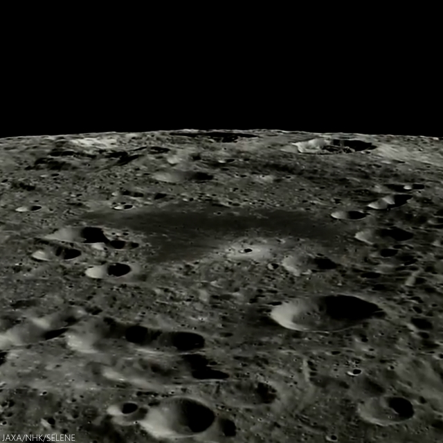
The western two-thirds of Campbell are more difficult to discern from polar orbit, but our bright fresh crater perched on the north of its small plain of mare basalt are easy to pick out, looking south from Japan's lunar orbiter Kaguya in 2008. This image is taken from just past the halfway point in the HDTV sequential still video below, from approximately 120 km overhead [JAXA/HKT/SELENE].

As noted in the YouTube video, presented by the Japan's space agency JAXA, Campbell is immediately north of Von Neumann and Wiener craters (on Campbell's southeast and southwest, respectively). Between these two craters, unnoted however, is Wiener F, with it's distinctive semi-circular bench of impact melt, discussed in more detail HERE.

Explore the full NAC mosaic, HERE.

Related Posts:

Tuesday, June 10, 2014

Ready-made excavations near Lucretius C

Self-secondary of a bright, relatively fresh crater northwest of Mare Orientale, in the wider highlands greatly affected by that basin-forming impact. The unnamed primary crater (between Lucretius C and Grachev craters, see below) is visible from a great altitude because of its relative low optical maturity. Full-resolution, 530 meter-wide field of view from LROC NAC observation M1132582647R, LRO orbit 19028, August 31, 2013; 9.47° incidence angle, resolution 92 cm, from 106.13 km over 3.09°S, 246.92°E [NASA/GSFC/Arizona State University].
Hiroyuki Sato
LROC News System

Today's Featured Image highlights the spectacular fresh ejecta from an unnamed crater (1.05 km; 3.06°S, 297°E), approximately 750 km northwest of Mare Orientale.

Subsequent impacts (possibly including self-secondaries) excavate through the ejecta sheet, leaving small craters, mostly less than 50 meters in diameter, and tiny ejecta splashes.

Some are lower and others are higher in reflectance than their surroundings, resulting in a variety of contrasts against the bright, optically immature ejecta field of the primary crater. 

Bright, relatively fresh primary to highlighted secondary crater at upper left northwest of Orientale basin, between Lucretius C and Grachev. 4.54 km-wide field of view from full-width of LROC NAC observation M1132582647R, visible HERE. [NASA/GSFC/Arizona State University].
In the opening image, many small high reflectance craters (~10 m) are clustered at the lower right side of the image, while nearby mid-sized craters (~50 m) are darker than their surroundings. The largest crater's ejecta (center-left in this image) is composed of two layers, the brighter layer on top of the darker layer.

Full-width mosaic, 13.357 km-wide field of view from a mosaic of both the left and right frames of LROC observation M1132582647.   Larger reproductions are available HERE [NASA/GSFC/Arizona State University].
These reflectance variations are likely due to the different excavation depths into the low and high reflectance surface and subsurface deposits. The mid-sized craters probably reached the original low reflectance materials below the upper higher reflectance ejecta sheet (from the unnamed ~1km diameter crater). The largest crater likely excavated high reflectance substrate that is also exposed on the unnamed crater's wall. 

250 meter resolution view shows the high visibility of the small crater of interest (1.05 km; 3.03°S, 297°E), against the ancient highlands, deeply scared by the energy of the Orientale basin-forming-impact. LROC Quickman WAC natural color beta over 100 meter global mosaic [NASA/GSFC/Arizona State University].
Context for high resolution LROC NAC view of bright fresh 1.05 km crater (3.06°S, 297°E) northwest of Mare Orientale [NASA/GSFC/SVS/Arizona State University].
Impacts serve as a natural excavation process which helps us to glimpse into the otherwise unreachable geological layers on the Moon. 

View full-width mosaic, HERE.

Related Posts

Tuesday, April 22, 2014

Impact on an old and steep slope

Unnamed crater ejecta, within Dante C, field of view 1728 meters, centered on 28.463°N, 182.491°E, downslope is to the lower-right.  From LROC NAC observation M1137707212L, LRO orbit 19746, October 29, 2013; angle of incidence 57.33° resolution 1.44 meters from 143.84 km [NASA/GSFC/Arizona State University].
Hiroyuki Sato
LROC News System

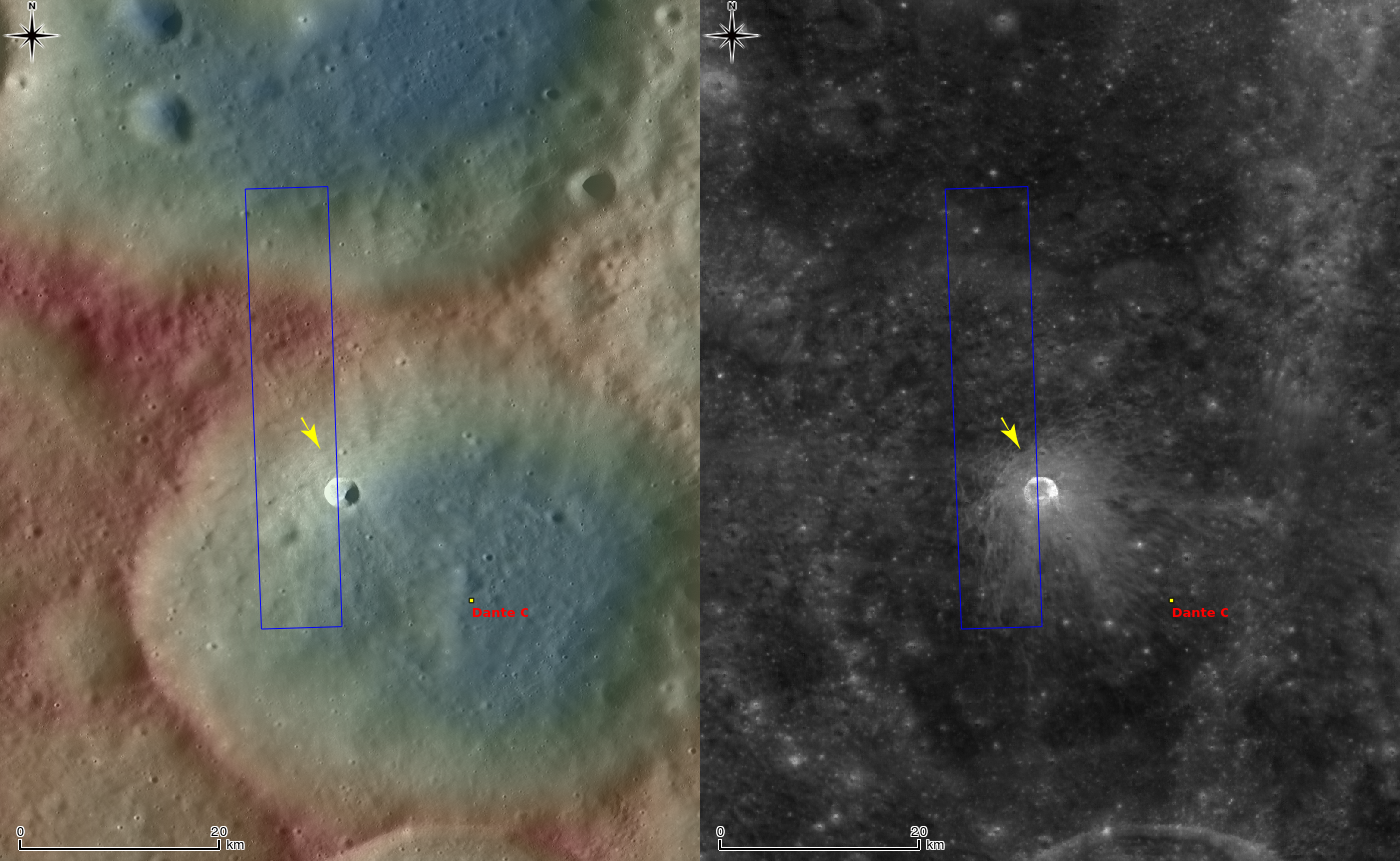
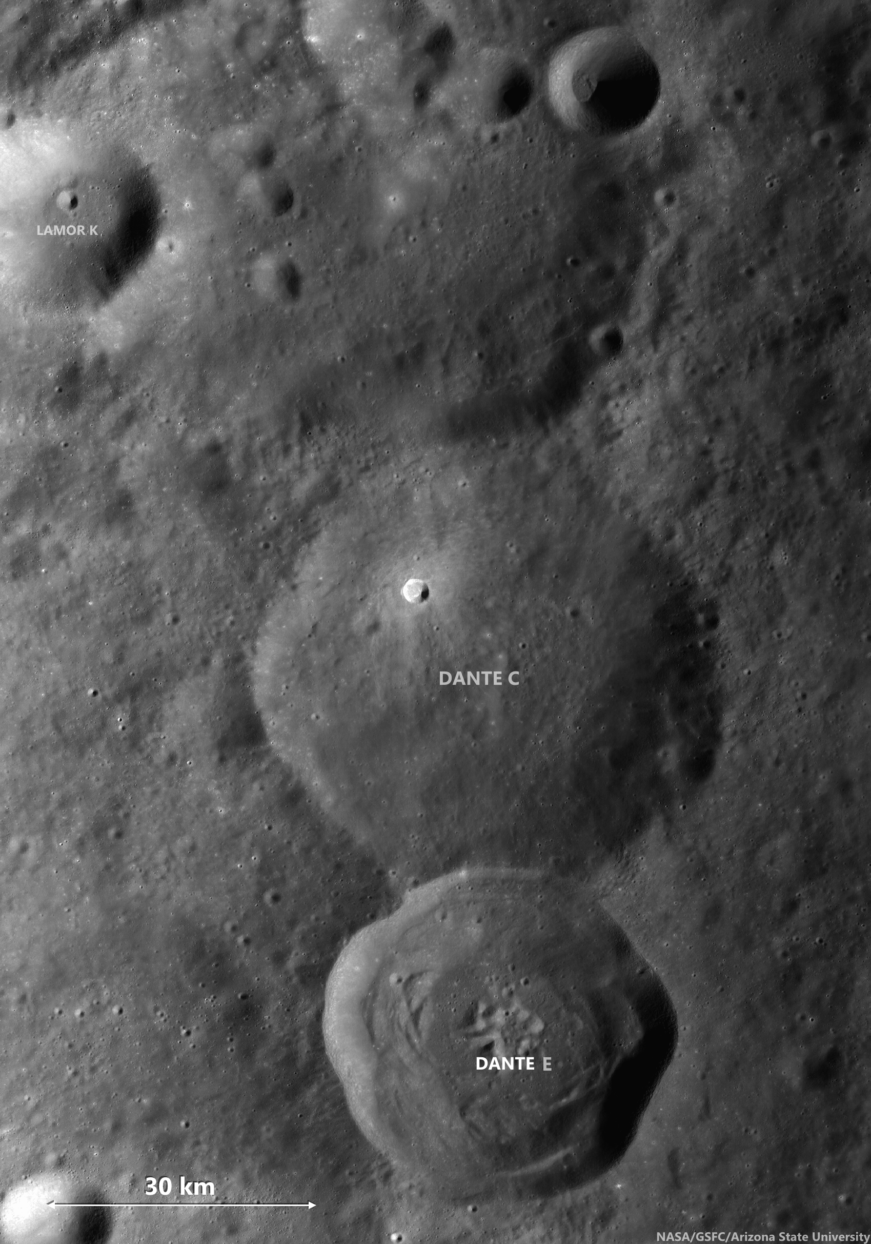
Dante C is a ~54 km diameter crater, located in the central farside highlands. In the northwestern portion of the crater floor, there is an unnamed crater (about 3 km in diameter) with a spectacular diffuse asymmetric ejecta pattern (see next WAC no-shadow context view, right side).
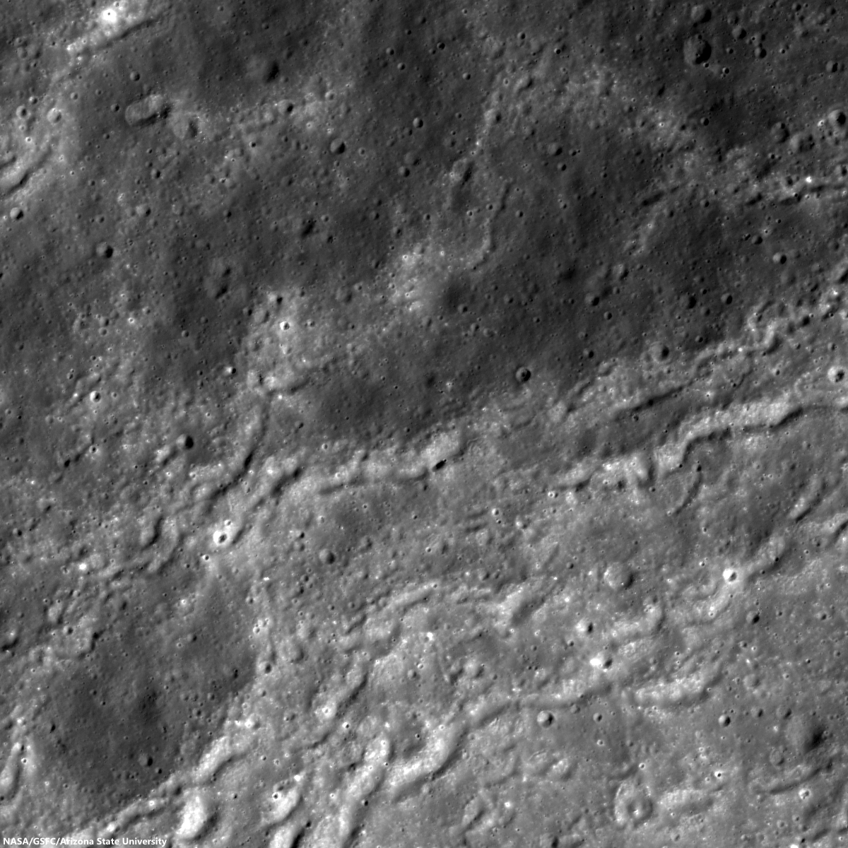
The uphill side (upper-left) shows a distinctive wavy pattern of ridges and grooves (seen in the opening picture) within about 3 km of the rim.

Probably due to the background slope (Dante C crater wall, downslope is to the lower-right), the ejecta hit the ground and stopped in a shorter distance than on the downhill side, leaving partially wrinkled edges in the ejecta deposits.

Wider, 6.14 km-wide field of view, context for area of interest at far upper center, left, from LROC NAC mosaic M1153033874RL, LRO orbit 21901, April 25, 2014; incidence angle 58.14° resolution 1.45 meters from 146.22 km over 29.17°N, 182.54°E [NASA/GSFC/Arizona State University].
33.1 km-wide field of view from LROC Wide Angle Camera monochrome [604 nm] mosaic, swept up over three sequential orbital passes, LRO orbits 11135-11137, November 20, 2011; average incidence angle 60° at 57 meters resolution, from 43.84 km [NASA/GSFC/Arizona State University].
Context view of Dante C crater and surroundings, LROC WAC monochrome mosaic overlayed with DTM with GLD100 at left, and WAC normalized reflectance at right (100 m/pix). Image centered on 28.57014°N, 182.63728°E, field of view 62 km. The location of area shown at high-resolution in LROC Featured Image released April 22, 2014 designated with arrow [NASA/GSFC/Arizona State University].
97 km-wide field of view from the same LROC Wide Angle Camera monochrome [604 nm] mosaic, swept up over three sequential orbital passes, LRO orbits 11135-11137, November 20, 2011 [NASA/GSFC/Arizona State University].
The downhill side shows a smooth surface without the wavy pattern, implying that the thin layer of ejecta spread out homogeneously on the downslope. Also, the thickness of the ejecta itself might have been asymmetric due to the local slope. The uphill slope can interrupt ejecta's lateral motion, leaving unique ridges and grooves, another example of the range of crater forms found on the Moon.

Craters like Dante C disappear under low-angle sunlight. Fresh rays from much younger craters, like Jackson, and even a young crater on its northwest interior, outshine such a very ancient crater. View the full size 1000 px original gif file, HERE [NASA/GSFC/Arizona State University].
Explore the asymmetric ejecta with clear wave patterns in full NAC frame, HERE and in LROC QuickMap, HERE.

Related Posts:
Impact Art
Bright and Dark Ejecta
Dynamic Textures
Ejecta Patterns
Lassell D Ejecta
In the Wake of Giordano Bruno
Ground Hugging Ejecta

Thursday, March 27, 2014

Distal Edges in the South Pole-Aitken basin

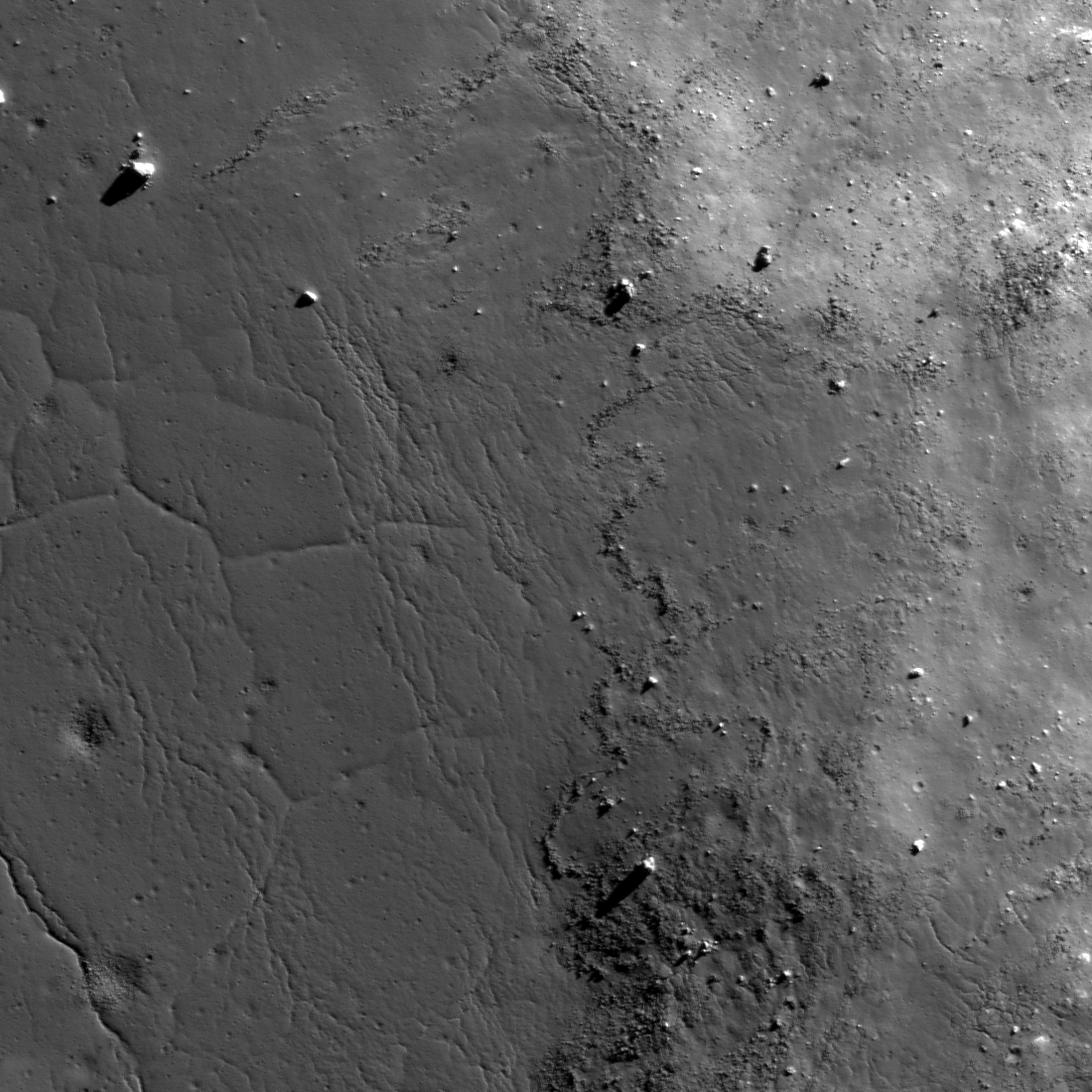
Blocky fences, like debris on a beach marking high water, border impact melt pools on the rim of an unnamed fresh crater on the vast floor of the ancient South Pole-Aitken impact basin, in jumbled terrain between Antoniadi and Schrödinger basin. 816 meter-wide field of view from LROC NAC observation M112884286R, LRO orbit 1759, November 15, 2009; resolution 66 cm per pixel, far south illumination incidence angle 75.9° from 63.93 km. The long axis of the large boulder at upper right is approximately 120 meters in length [NASA/GSFC/Arizona State University].
Hiroyuki Sato
LROC News System

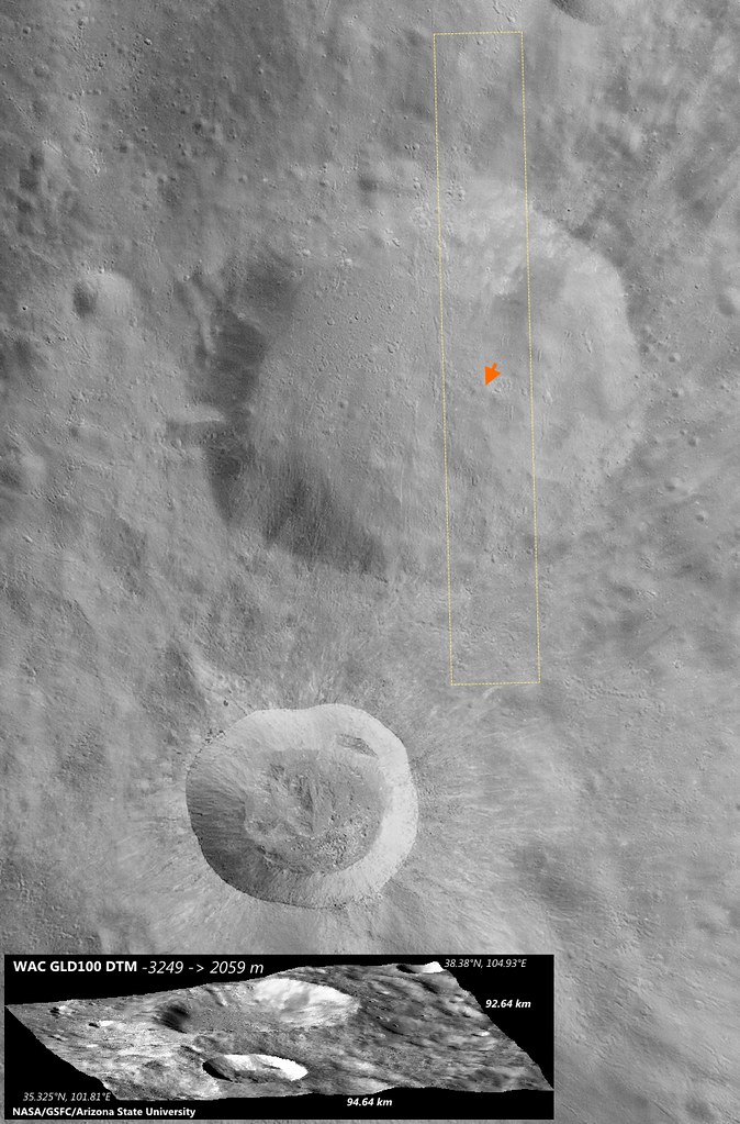
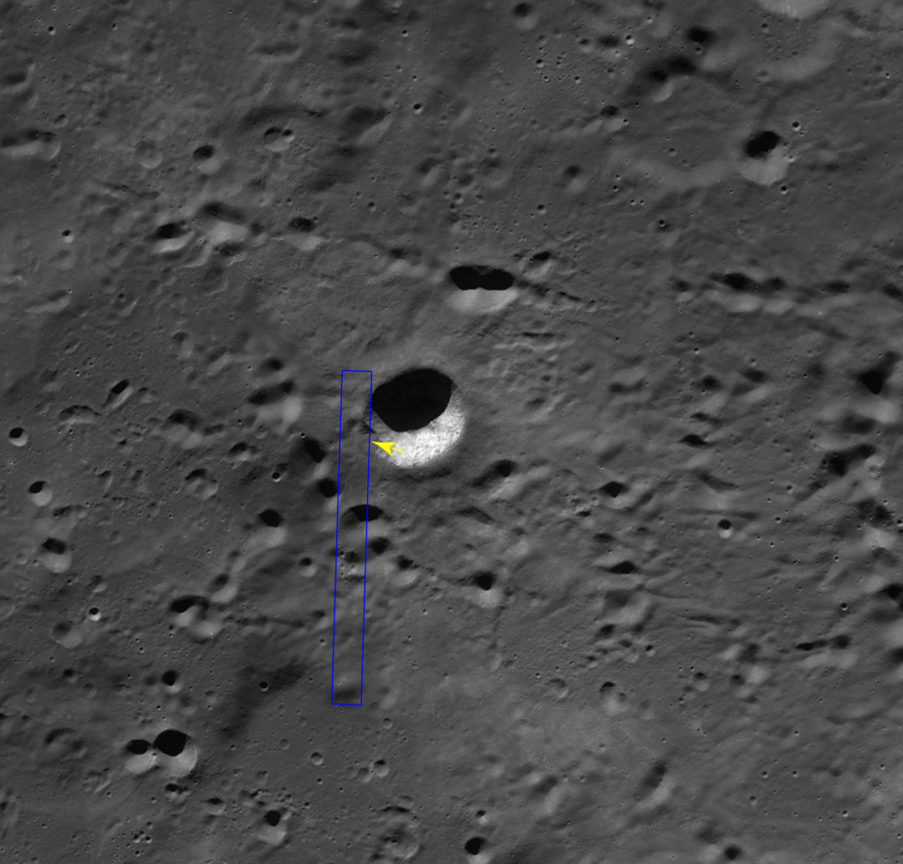
Today's Featured Image highlights striking forms on the outside rim of an unnamed young crater (~11 km in diameter; image center 71.425°S, 161.88°E; incidence angle is 75.9°) located 140 km east of Schrödinger basin.

The western flank of this small crater is dappled with multiple impact melt ponds (now solidified into rock) inhabiting local topographic depressions.

The surfaces of the ponds show polygonal patterns of fractures that likely formed as the melt cooled and solidified (and thus shrank). The organized pattern of boulders (looking somewhat fence like) formed along a flow front.

Since these lines of boulders rest on top of impact melt rocks they show that melt was splashed out at least two times during the crater forming event.

Context view of the unnamed 11 km-wide crater and vicinity. LROC WAC 100 meter monochrome mosaic, centered on 71.36°S, 162.91°E; field of view roughly 45 km. LROC NAC M112884286R footprint outlined in blue, location of the area of interest shown at high resolution, in LROC Featured Image released March 27, 2014 marked by arrow NASA/GSFC/Arizona State University].
The later splashes barely made it out of the crater and flowed only a short distance. What caused this last splashing of melt? Perhaps a large landslide on the interior wall fell into a lake of melt at the bottom of the crater and caused a big splash.

Short melt flows are common around lunar craters -- they tell a tale of the incredible forces unleashed during cosmic collisions. These same events happen as often on the Earth as the Moon. But why do we see so few impact craters on the Earth? Earth has a lot of resurfacing (erosion, weathering, volcanism, plate tectonics), and weathering or resurfacing on the Moon is a lot slower. Thus, more craters and melt deposits are preserved on the Moon.

The unnamed fresh crater between the deep crater Antoniadi and the Moon's youngest impact basin Schrödinger (edge at extreme lower left), on the vast floor of South Pole-Aitken basin, features terraced pools of impact melt more typical of much better known and studied craters, like Tycho, in the mid-latitudes of the nearside [NASA/GSFC/Arizona State University].
Enjoy the fascinating impact melt features around this young crater in full NAC frame, HERE.

Related Posts:
Tycho's flash-frozen inferno
Breached Levee
Splash Mark
Scalelike Impact Melts
Impact Melt Lobes
Herigonius K Impact Melt Flow
Waves

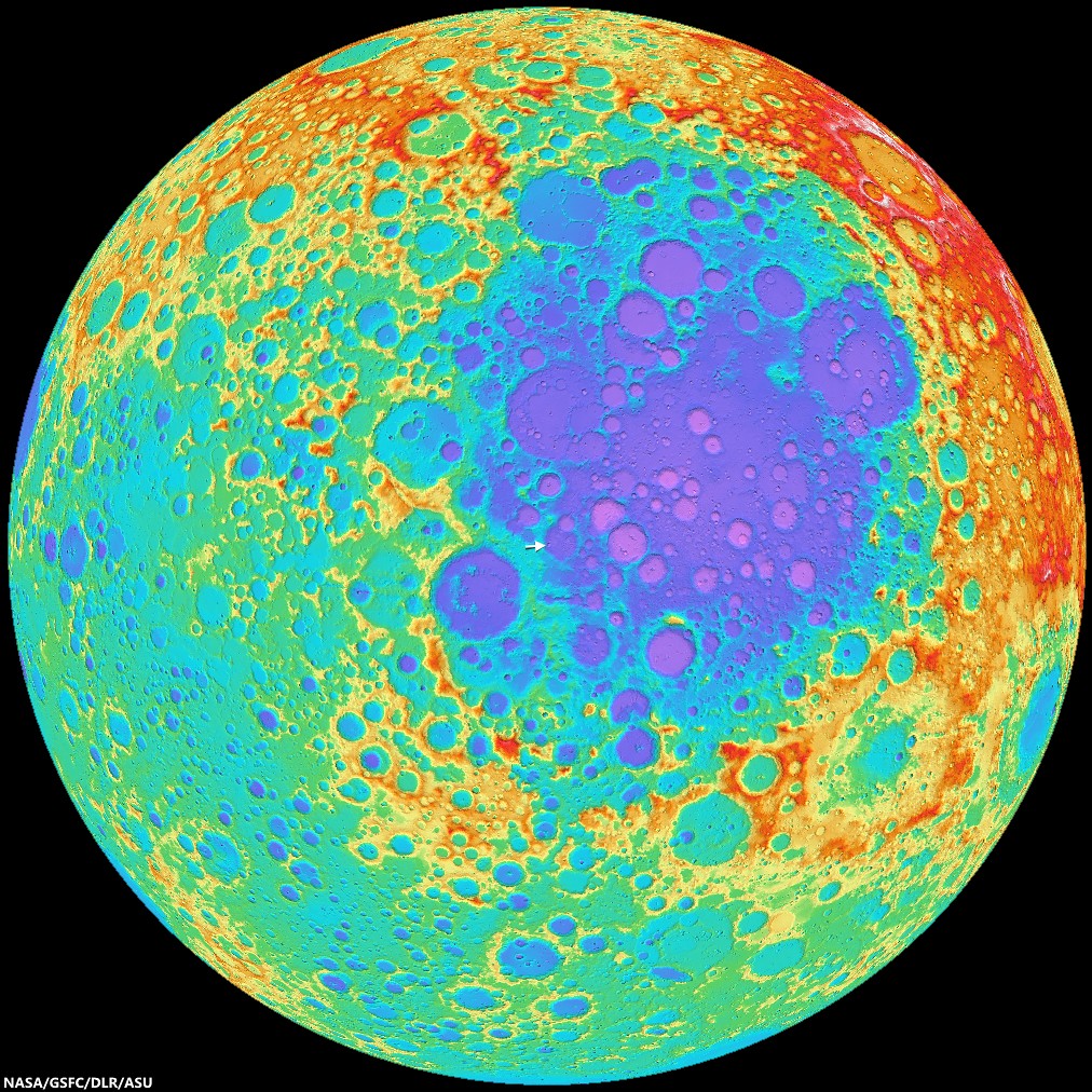
Situated between Antoniadi, home to a crater with the lowest elevation on the Moon, and Schrödinger basin, the fresh crater of interest is of an age and size (like similarly-sized and situated Shackleton) is generally more typical of mid-latitudes, a feature of the Moon's history of bombardment (and, thus, of the the Solar System) that's evidence of diminishing size and frequency of impacts over time, and more originating from the direction of the ecliptic. Exploration of the crater may afford an opportunity to sample deeper history. Hemispheric projection of LROC WAC-DTM topography centered on the area of interest [NASA/GSFC/DLR/ASU].