|
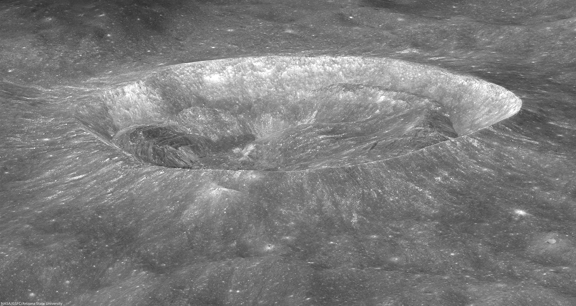
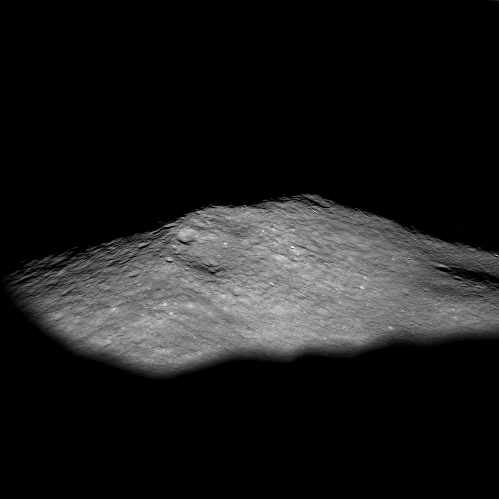
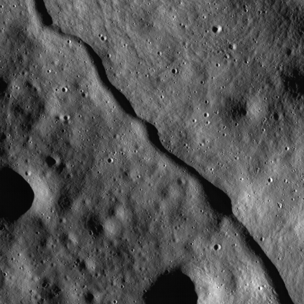
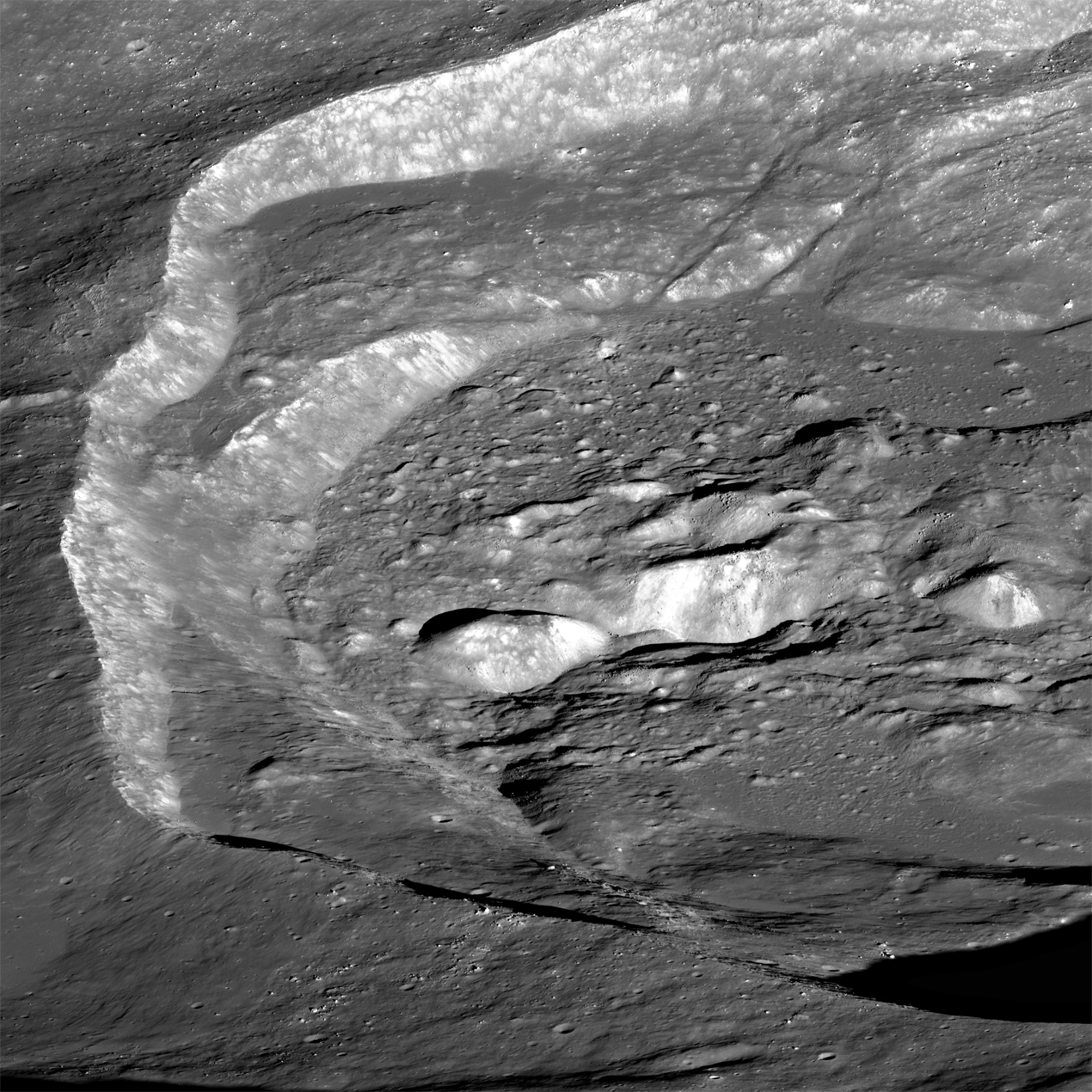
| An early morning view looking east-to-west from an altitude of 86 km across the southern portion of the Lassell Massif, an irregularly shaped series of hills and steep-walled depressions. North is to the right in this LROC NAC oblique mosaic M1108311369LR, LRO orbit 15611, November 23, 2012; 71.73° incidence angle, spacecraft and camera slew 56.64° from orbital nadir, resolution above 2 meters from 85.65 km over 14.63°S, 355.69°E [NASA/GSFC/Arizona State University]. |
LROC News System
The
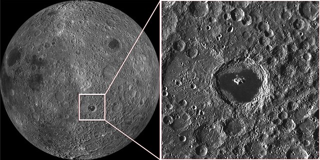
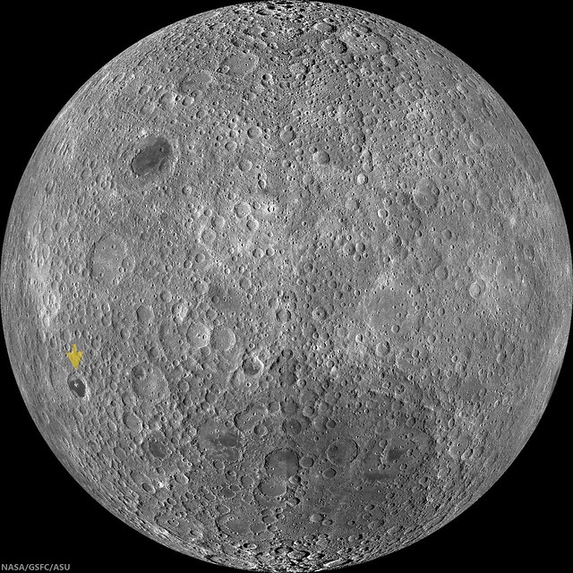
Lassell Massif is a complex area of rugged terrain located in northeastern Mare Nubium (
14.7°S, 351.0°E). This undulating terrain of hills and steep-walled depressions is 45 km across from north to south and 25 km across from east to west.
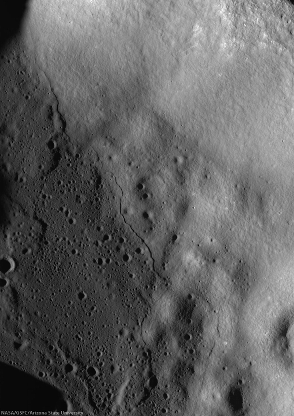
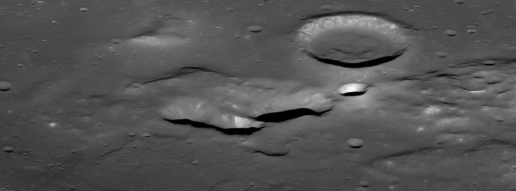
The southern portion of the massif comprises several prominent elongate depressions (like Lassell K and Lassell G, seen below) that are clustered together.
 |
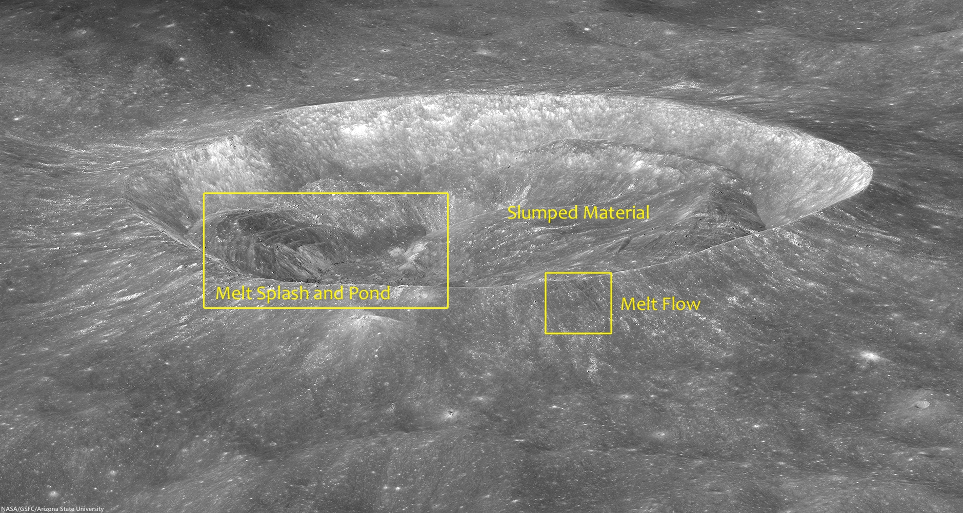
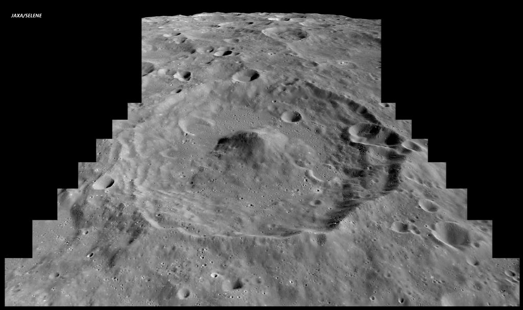
| The Lassell Massif in Mare Nubium; north is to the right. Prominent features of the Lassell Massif region include Lassell C, K, and G [NASA/GSFC/Arizona State University]. |
The clustering and irregular shape of these negative-relief features is reminiscent of
volcanic calderas on Earth and other terrestrial planets,
including Mars. Calderas generally form through collapse as magma retreats from the vent area. Overlapping collapse features suggest multiple episodes of magma advance and retreat over time. Lassell K and G may be part of a volcanic caldera!
Lassell K and G could, however, instead represent a series of
clustered impact craters, which are relatively common on the Moon.
 |
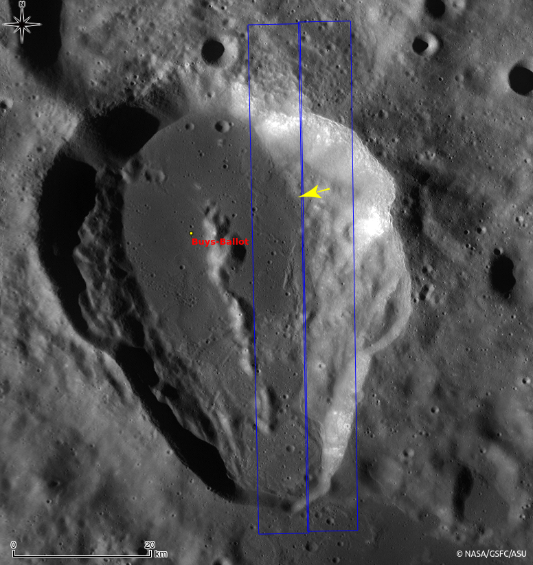
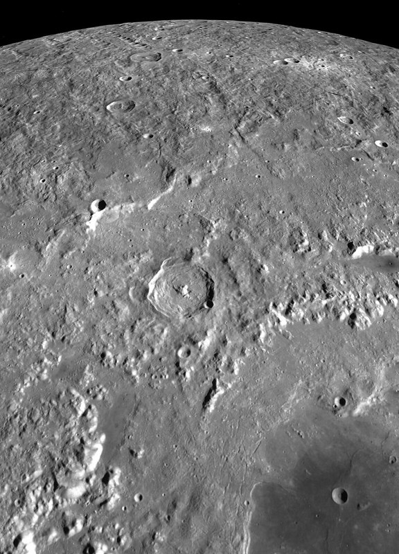
| Remote sensing data displayed in eight diverse views of the 1000 meter-high profile of Lassell massif, collected by four spacecraft (all of them post-Apollo) presented in an overlapping 40.2 km-wide field of view, visible throughout both day and night. The largest crater at center-left is Lassell C (8.74 km; 14.67°S, 350.64°E) [Clementine, LRO, Chandrayaan-1 and Chang'e-2]. |
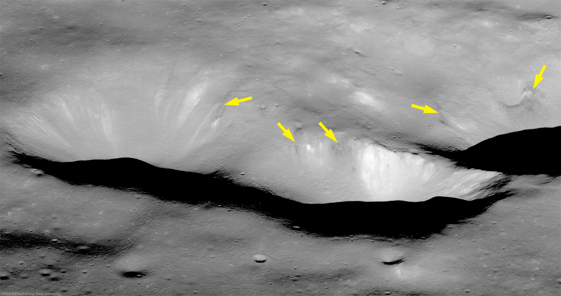 |
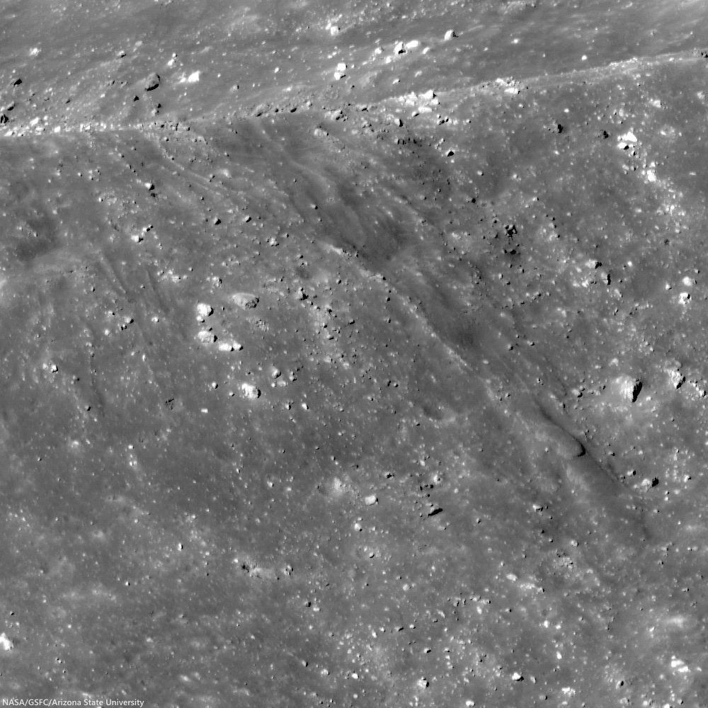
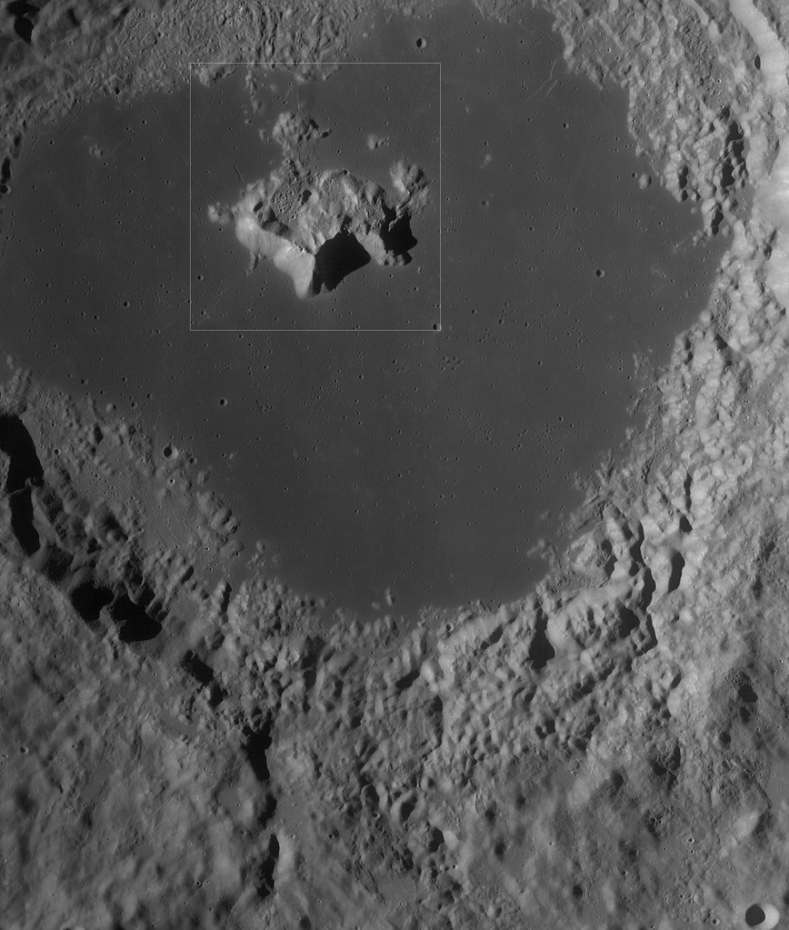
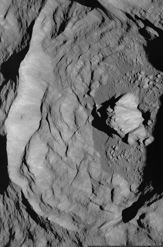
| Lassell K (left) and portion of Lassell G (right). The upper walls of these steep-walled depressions have dark, low-reflectance, boulders and downslope streamers (arrows), where a thin layer of dark material, possibly pyroclastic, has eroded out of the wall [NASA/GSFC/Arizona State University]. |
Looking closely at this region, we see other features that are typical of volcanic eruptions including: dark mantling layers interpreted as possible
pyroclastics, a subdued or
mantled terrain, and even a possible
volcanic cone.
Taken together, these features suggest a complex volcanic history for this region. If the Lassell Massif is constructed from a series of volcanic extrusions, it may represent an unusual type of silicic volcanism on the Moon (perhaps similar in composition to rhyolite).
The full oblique image (below) along with other images and compositional data sets may reveal more clues to the timing and nature of volcanism in the Lassell region. However, returning rock samples to Earth and exploring the slopes of this structure from the surface may be the only way to confirm its origins.
 |
| View assorted sizes of an unlabeled sample of a mosaic from the LROC observation above, HERE. |
View oblique in full-window, HERE.
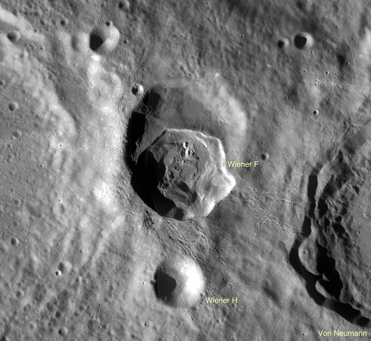
Related LROC Featured Images: