Showing posts with label crater morphology. Show all posts

Monday, September 15, 2014

Watching craters "as they happen"

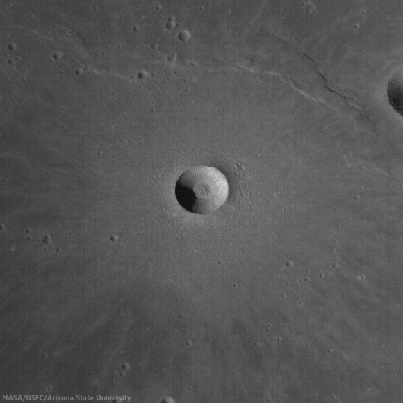
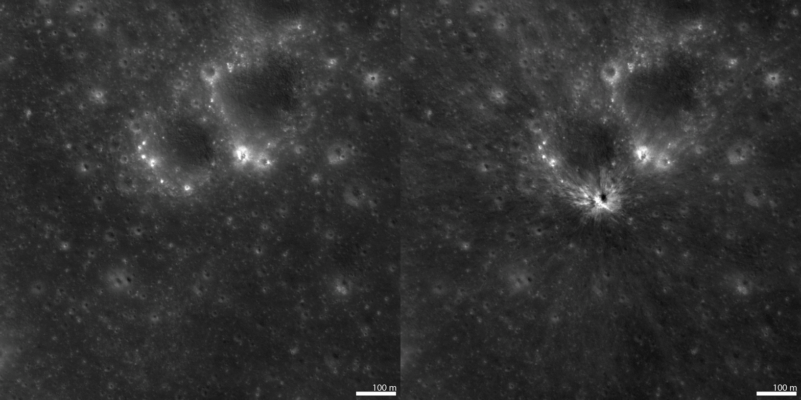
A new crater on the Moon, "found among so many." The bright flash of formation for this approximately 34 meter diameter crater was captured simultaneously by two Earthbound telescopes in Spain on September 11, 2013. From LRO, before-image LROC NAC observation M1119014742L, orbit 17116, March 27, 2013; incidence 23.66° resolution 82 cm from 84.41 km, After-image LROC NAC M1149637354L, LRO orbit 21423, March 16, 2014; incidence 23.18° resolution 91 cm from 89.12 km  [NASA/GSFC/Arizona State University].
Mark Robinson
Principal Investigator
Lunar Reconnaissance Orbiter Camera (LROC)
Arizona State University

On 11 September 2013 the "Moon Impacts Detection and Analysis System" (MIDAS) camera captured a bright 8-second long flash on the central nearside of the Moon.

This was the brightest event captured so far by the MIDAS team, and they estimated that the crater should be between 46 and 56 meters in diameter.

The LROC team targeted the reported coordinates (17.2°S, 339.5°E) of the flash and acquired several images over a few months until the crater was found in images acquired on 16 March 2014 and 13 April 2014.
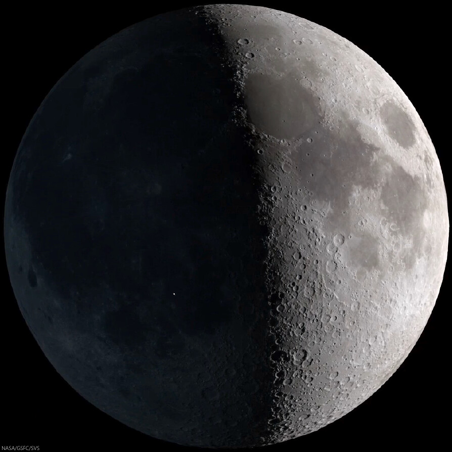
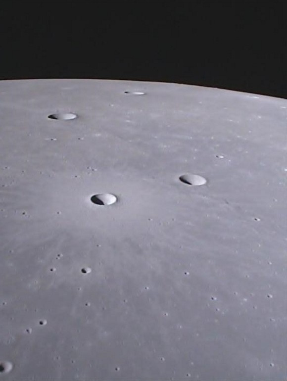
Strictly speaking, the 11 Sept. 2013 event was visible to the naked eye, though at nearly First Quarter the idealized reproduction above fails to account for the discriminating human eye. The illuminated east hemisphere would tend to have washed out Earthshine for all but those with the steadiest eyes. Fortunately, for at least ten years the unlit portion of the Nearside "visible" at night has been carefully monitored systematically, improving our understanding of hazards in the Near-Earth environment [NASA/GSFC/SVS].
Video sequence recording impact on the Moon's nearside in Mare Nubium. The magnitude of the explosion is estimated to have been roughly equal to that of Polaris, the North Star, and the recorded light curve following after lasted a remarkable eight seconds. Madiedo, et al. (2014) [IAA-CSIC/Universidad de Huelva].

Fortunately there was a NAC image of the target area acquired before the impact, so finding the new crater was relatively easy once an "after" image with comparable lighting to the "before" image was acquired.

As it turns out the new crater is ~34 meters (112 feet) in diameter and is located at 17.167°S, 339.599°E, only 2 kilometers (1.2 miles) from the original telescope-based prediction. In the before-after animation you can see ejecta effects from the crater extend out more than 500 meters in all directions!

See also LROC NAC image M1149637354L (16 March 2014).


Impact flash recorded on the unlit Nearside by Prof. Jose M. Madiedo, 11 Sept. 2013. North is to the right (note the visibility of Grimaldi, top center - the 173 km-wide walled plain is often the last recognizable feature on portion of the Nearside lit by Earthshine as the Moon waxes Full). The Moon was shy of First Quarter. This video was produced on the occasion of the publication (in Feb. 2014) in Monthly Notices of the Royal Astronomical Society (MNRAS) of the paper entitled "A large lunar impact blast on 2013 September 11," by J.M. Madiedo, J.L. Ortiz, N. Morales and J. Cabrera-Caño.

A longer, more instructive version was uploaded by the authors HERE. 

Wide Angle Camera morphology basemap overlaid with color-coded LROC GLD100 topography centered on the 11 September 2013 impact crater. The large crater just visible in the lower left is 60 kilometer diameter crater Bullialdus [NASA/GSFC/Arizona State University].
Revisit the LROC NAC image of new crater formed on 17 March 2013, HERE.

Read the paper describing the 11 September 2013 observation (Madiedo et al., 2014)

Wednesday, September 3, 2014

Lovely Lichtenberg B

Lichtenberg B (4.86 km; 33.253°N, 298.48°) is a beautifully preserved young impact crater. Rock outcrops in the upper portion of the crater wall are due to the successive thin lava flows that filled Oceanus Procellarum more than 3 billion years ago. LROC NAC mosaic M1162852913LR, LRO orbit 23280, August 16, 2014; incidence angle 35.4° at 1.31 meters resolution, from 129.2 km over 32.46°N, 298.45°E [NASA/GSFC/Arizona State University].
H. Meyer
LROC News System

The lack of atmosphere on the Moon can have its benefits. For example, without an atmosphere, there are few processes to degrade landforms.

On Earth, rain and wind are major causes of erosion, but on the Moon, those causes are absent. Erosion on the Moon is due to impacts that cause shaking and can demolish other craters during formation and to gravity pulling material downslope.

In the case of Lichtenberg B, gravity has not yet rendered the crater smooth and subdued, and there are few impacts nearby, much less any that could have affected the morphology of the crater, as Lichtenberg B appears younger than its neighbors.

Extreme close-up of the wall and rim of Lichtenberg B wall and rim, just east of south center, where impact melt flowed and formed a channel, pushing boulders aside in the process. This 430 meter field of view illustrated "Lichtenberg B Flow," released December 2, 2011. LROC NAC observation M120257109R, February 8, 2010 [NASA/GSFC/Arizona State University].
On the downside, the lack of atmosphere means that space weathering is more efficient on the Moon, and fresh, highly reflective crater ejecta darkens over time. Because Lichtenberg B's ejecta deposit is still bright, it is quite young.

Lichtenberg B and about 56 km-field of view of its surroundings shows an ejecta blanket still highly visible, most than half-way through its long process of optical maturity. LROC monochrome (643 nm) observation M120256944CE, LRO orbit 2856, February 8, 2010; 54.76° incidence angle, 57.42 meters resolution, from 40.39 km [NASA/GSFC/Arizona State University].
Crisp morphology and a highly reflective ejecta deposit make Lichtenberg B stand out from many of the nearby impact craters. This exquisitely preserved crater is located to the northwest of Aristarchus Plateau in Oceanus Procellarum, a vast mare unit littered with impact craters and wrinkle ridges. The ejecta deposit is particularly interesting because it displays a wrinkled texture with structures that resemble dunes.

High-angle (late afternoon) incidence view draws some depth of field to the plains impacted by Lichtenberg B. LROC WAC monochrome (604 nm) mosaic of four observations from sequential passes December 8, 2011; 77° incidence, 56.5 meters resolution from 40 km [NASA/GSFC/Arizona State University].
How do these structures form? What makes Lichtenberg B's ejecta deposit different from other craters that lack these dune-like structures? It turns out that Lichtenberg B is not alone. Scientists have observed these same features at Linné Crater and are in the process of determining how they formed.

Forward view (north) from GRAIL-A gravity probe Ebb MoonKAM in May 2012, over northwest central Oceanus Procellarum. The maturing ejecta blanket from Lichtenberg B, Dorsum Scilla and Naumann G are in mid-foreground, with Naumann further beyond, and Naumann B (10.72 km; 37.46°N, 299.3°E) is nearer the horizon. ( MoonKAM image 133655 ) [NASA/JPL/SRSC/UCSD].
Check out the full NAC mosaic HERE.

Related Posts:

Thursday, July 24, 2014

Banded Slump in Berzelius W

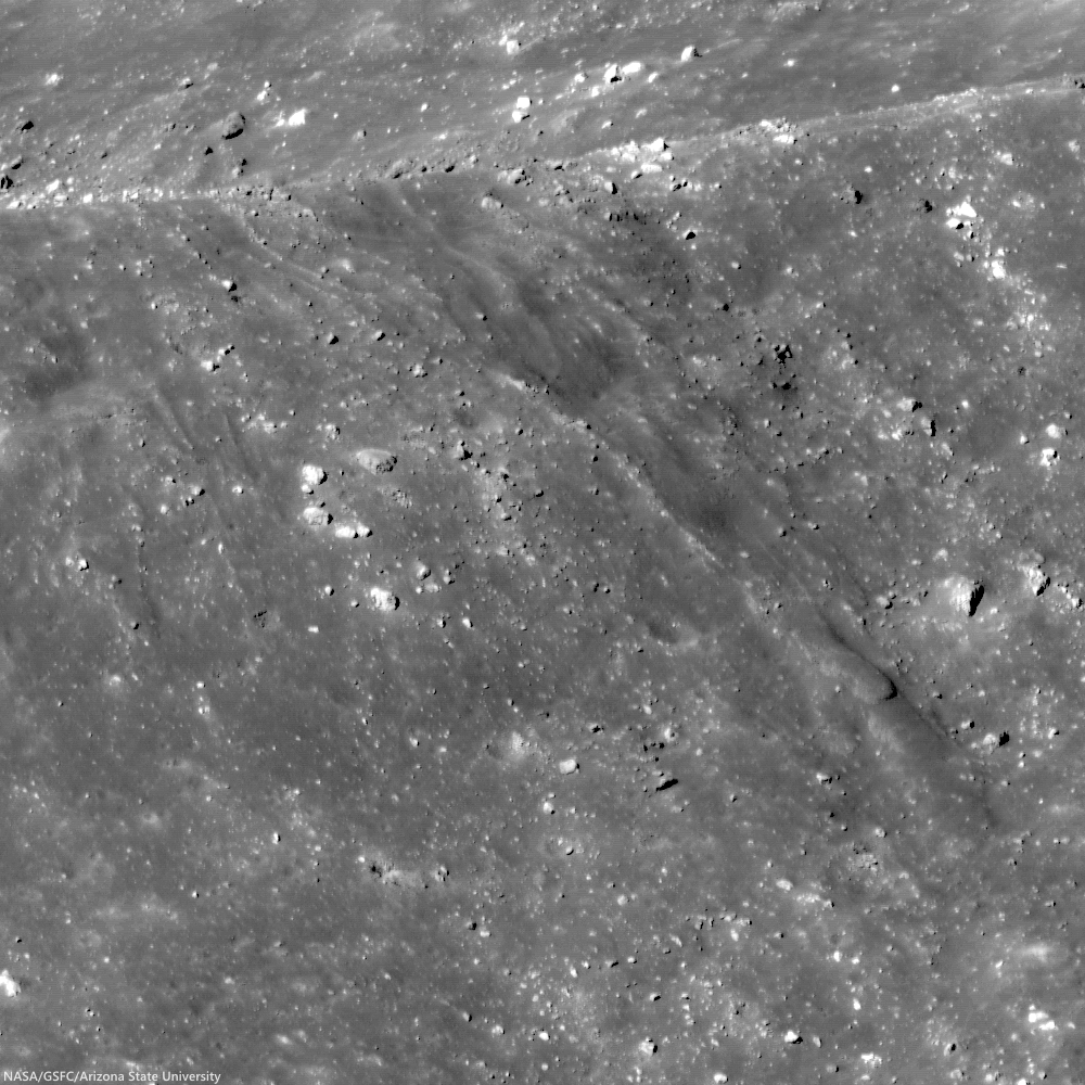
A complex interplay of slumping and slides in the northwest wall of Berzelius W result in banding patterns; downslope is toward the bottom right in this 230 meter-wide field of view from LROC NAC observation M174921824R, LRO orbit 10912, November 3, 2011; 53.59° incidence angle, resolution 40 cm from 23.87 km over 38.06°N, 53.02°E [NASA/GSFC/Arizona State University].
J. Stopar
LROC News System

Berzelius W (7.17 km; 38.137°N, 53.103°E), on the northeast limb of the Moon (as seen from the Earth), exhibits abundant evidence for mass wasting.

Materials of varying albedo create intricate patterns on the walls of the crater, including the banding patterns featured in the opening image. 

This particular portion of the wall includes a block of slumped material, as indicated by the characteristic arcuate faults near the crater's rim crest (see image below). The slumped material is overprinted by finger-like flows of finer particles that moved as slides of dry debris.

Arrow indicates the arcuate faults at the head of the slumped material in the wall of Berzelius W. This slumping may have triggered the associated narrower and finger-like landslides of lower albedo (darker) boulders and debris; 600 meter field of view [NASA/GSFC/Arizona State University].
When did these mass-wasting events occur? Did they occur during the impact event, shortly after while the landscape was still ringing from the shock of impact, or millennia later? The lack of high albedo (bright) ejecta around the crater and the subdued appearance of the rim crest indicate that this crater did not form particularly recently; perhaps it is between 1 and 2 billion years old. 

Berzelius W (7.17 km; 38.137°N, 53.103°E) in 35.7 km-wide field of view from LROC WAC monochrome (604 nm) mosaic of M161965061C and M161971828C, LRO orbit 9003 and 9004, June 6, 2011; 73.5° incidence at 61.5 meters resolution from 44.9 km [NASA/GSFC/Arizona State University].
The crisp edges of the debris flows and arcuate scarps in the walls, however, suggest that they are much younger than the crater. So, while this landslide probably did not form yesterday, it is likely significantly younger than the crater itself, probably less than half its age. However, without more data, it is impossible to know precisely when these events occurred. Repeated imaging over many decades may provide more insight into how crater walls age with time. Alternatively, samples returned from crater walls may provide a method to age-date mass-wasting events. 

Try to find at least three other examples of mass-wasting features in the western half of this crater below. Pan and zoom to find examples of landslides, talus deposits, and boulder tracks:

Full 850 meter-wide field of view from remarkably high resolution LROC NAC observation M174921824R [NASA/GSFC/Arizona State University].
View full-window HERE.

Related Features:

Friday, July 11, 2014

"Donut Hole" structures on the floor of Harriot B

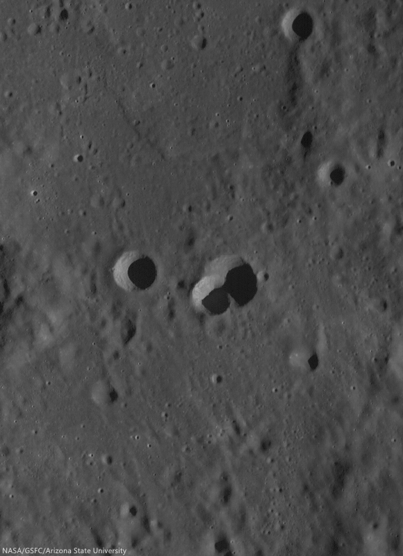
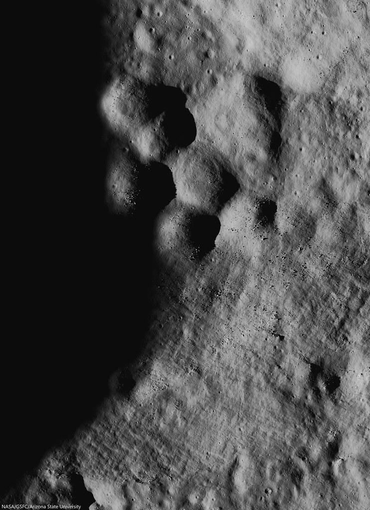
Some among kilometer-sized mounds on the floor of Harriot B (38.1 km; 33.356°N, 114.41°E), in the farside highlands. LROC NAC observation M180430508R, LRO orbit 11710, January 5, 2012; 78.76° incidence angle, resolution 1.57 meters from 159.56 km over 33.77°N, 114.38°E [NASA/GSFC/Arizona State University].
Raquel Nuno
LROC News System

The planets in the Solar System are continuously bombarded by space rocks. This violent process early on formed the planets by accretion, and impacts still shape the surface of terrestrial and icy bodies today.

Since the Moon lacks an atmosphere it preserves the impact history record of the inner Solar System. However, this record is less than complete; volcanic resurfacing and crater saturation of the surface erase part of the record. Ancient volcanic activity, resulted in massive outpourings of lava over parts of the Moon, filling in and covering old craters beneath layers of basalt. Crater saturation is a term used by scientists to describe a point after the planetary body has been completely covered with craters of a certain size such that every new crater of that size overlaps an older one, obliterating the evidence of the older craters' existence. 

A full-width view of LROC NAC observation M180430508R [NASA/GSFC/Arizona State University].
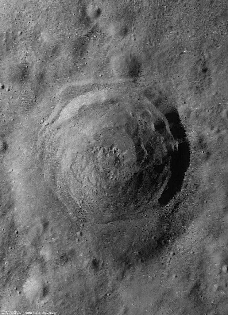
Today’s featured image is a portion of the central mounds, ~1 km in diameter, found on the floor of crater Harriot B, a highland crater located at 33.356°N, 114.410°E.

These mounds are likely weathered central peak formations. Central peaks form by the gravitational collapse of the crater walls which pushes material into the center of the crater and from the rebound of the floor; both of these events occur at the time of crater formation during the modification stage of the crater.

A more recent, lower incidence angle LROC NAC mosaic of the floor of Harriot B. LROC NAC mosaic M1159343420LR, LRO orbit 22787, July 7, 2014; 59.56° incidence angle, 1.4 meters resolution from 114.29 km over 33.39°N, 114.56°E [NASA/GSFC/Arizona State University].See the larger reproduction HERE. [NASA/GSFC/Arizona State University].
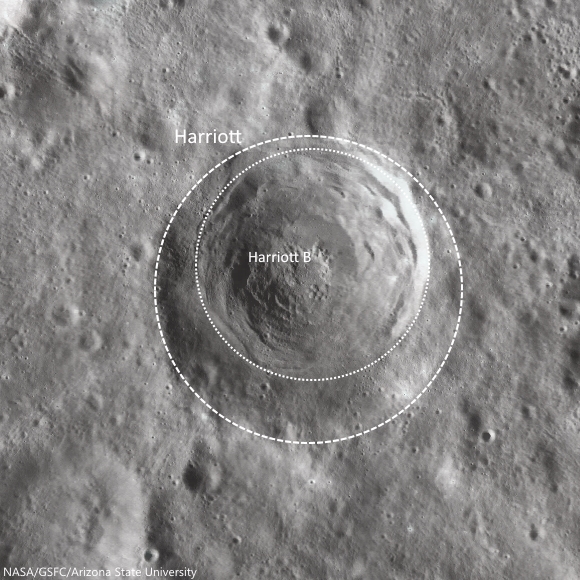
Harriot B crater formed, slightly off center, over the much older and degraded Harriot crater (see the WAC context image below). The older crater's walls have slumped down, resulting in a rounded rim, in contrast to Harriot B’s sharp rim. Since Harriot has a greater diameter than Harriot B, 53 km and 38 km respectively, we can assume the impactor that formed Harriot B had less energy (less mass, less velocity, or both) than the impactor that formed Harriot.

Superposition of Harriot by Harriot B. The inexorable erasure of the Moon's surface very often strikes more suddenly than the 3 cm every 2 million years "gardening" rate of micro-meteorite and superluminal bombardment, established in the Apollo era. The concentric and near concentric "hole in one" of "macro-bombardments" occurs more often than seems obvious at first glance. 97 km-wide field of view from LROC WAC-derived imagery shows how the formation of Harriot B fit nicely in the bounds of older Harriot, and the coincidence may have had some, as yet undetermined role in the morphology of mound "clusters" on the floor of the latter [NASA/GSFC/Arizona State University].
Succeeding impacts will ensure that the visible evidence of Harriot crater will cease to exist.  This becomes a problem when using crater counts to date planetary surfaces.  Once a surface reaches crater saturation, scientists can only estimate a lower bound for how young the surface is.

Wide angle view of Harriot B (33.356°N, 114.409°E), nested inside only slightly larger Harriot crater, in a stark demonstration of the principle of superposition in stratigraphy. LROC WAC mosaic from sequential 55.3 km passes over the area of interest in LRO orbits 11201 and 11202, November 25, 2011; incidence 67.6° at 55 meters resolution [NASA/GSFC/Arizona State University].
One day, Harriot B will suffer the same fate as Harriot.  A new impact will erase it, along with its central mounds that deliciously look like donut holes. The Moon’s surface is a dynamic place, because it seems static in human-appreciable timescales this is easily forgotten.  So, let’s enjoy Harriot B’s central formations while they’re still around, check out the full resolution NAC below:


Related Posts

Friday, May 23, 2014

Punching through Abel C

Excavation on the floor of Abel C. A bench crater in the pyroclastic deposit mantling the floor of Abel C. The impactor appears to have punched through multiple layers, giving the 100 meter crater an irregular, stepped appearance. LROC NAC observation M1153673248R, LRO orbit 21990, May 2, 2014; 68.8° incidence angle, resolution 75 cm from 72.53 km [NASA/GSFC/Arizona State University].
H. Meyer
LROC News System

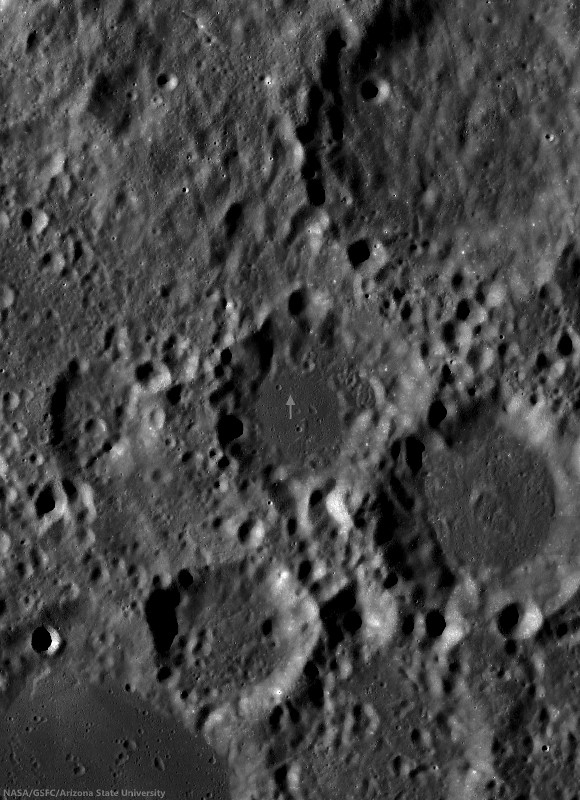
Lunar craters less than between approximately 15-20 km in size are usually bowl-shaped, so the crater above, excavating the floor of Abel C (41.5 km; 36.72°S, 82.5°E) has a somewhat irregular morphology relative to most craters of its size (about 100 meters).

This crater is characterized by its block-strewn, hummocky floor and low-relief rim. The step-like or benched appearance most evident in the northeastern portion of the wall is due to a strength discontinuity. Such discontinuity indicates that the impact penetrated through two materials of different strengths. Lab experiments have shown that the bench crater morphology forms when the surface layer is composed of thin and poorly consolidated regolith and the subsurface is composed of harder, more coherent material.

Small relatively fresh excavation, the 100 meter crater right of center shown in context of the full, 3.6 km-wide field of view swept up in LROC NAC observation M1153673248R, May 2, 2014 [NASA/GSFC/Arizona State University].
In some cases, the underlying material is bedrock, evidenced by an abundance of boulders. So, what did the impactor punch through at the surface? Usually regolith is the culprit, but further investigation of the floor of Abel C suggests that it may not be regolith alone.

Ancient Abel C (41.5 km; 36.72°S, 82.5°E), on the northwest frontier of Mare Australe, has a smooth floor of relatively low reflectance, compared with it's equally eroded neighbors. Arrow marks the location of the 100 meter crater presented at high resolution above. LROC 100 meter Wide Angle Camera (WAC) global mosaic [NASA/GSFC/Arizona State University].
Abel C is a 36 km diameter crater on the southeastern limb of the Moon, just off the northwest edge of Mare Australe, a large region dominated by volcanic activity. Clementine (1994) color ratio images are extremely useful in identifying nonmare deposits since non basaltic compositions tend to stick out when Clementine images are placed in the proper color space. Three bands (415 nm, 750 nm, and 1000 nm) from the Clementine UVVIS camera were used to create the false-color image below.

Clementine (1994) false color image of the Mare Australe region with Abel C off the western edge. The floor of Abel C appears more red than the surrounding highlands, along with a clear indication of similar pyroclastic exposure like the multiple indications within Mare Australe   [NASA/GSFC/Arizona State University].
The three bands were ratioed to control the colors of the false-color image. The 750/415 ratio controls the red component, which is an indication of low titanium or high glass content as found in mature lunar regolith and to a greater degree pyroclastic deposits. The 750/1000 ratio controls the green component and is an indicator of the amount of iron on the surface. The 415/750 ratio controls the blue component and indicates high titanium or bright slopes and albedos. In the Clementine false-color image, Abel C stands out  from the highlands and more closely resembles the nearby mare. The strong red component, combined with the low-reflectance, mantled floor seen in Abel C is indicative of a pyroclastic deposit.

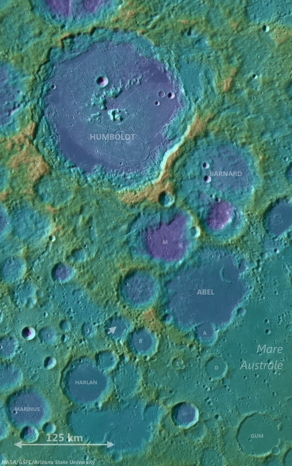
Abel C is shown in relation to the terrain of the Moon's southeastern limb, between Humboldt crater and Mare Australe. LROC WAC-derived digital elevation model and 100 meter global mosaic data [NASA/GSFC/Arizona State University].
This pyroclastic deposit encompasses approximately 190 km2 and has been identified in studies of pyroclastic deposits across the Moon (Compositional analyses of lunar pyroclastic deposits by Gaddis et al. 2003). Because pyroclastic deposits have a mantled appearance,  they must be relatively thin. It's possible that the thin upper layer the impactor penetrated was partially composed of pyroclastics.

Related Posts:

Tuesday, May 13, 2014

A splendid oblique view of Larmor Q

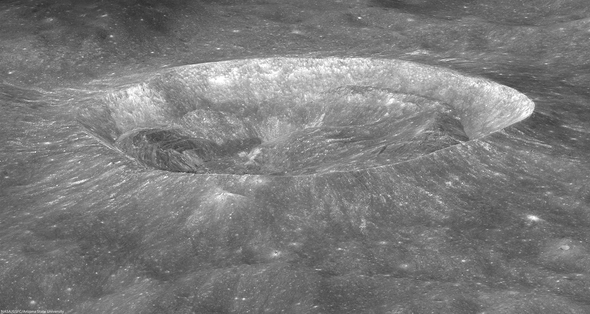
LROC NAC view of the south wall and rim of splendiferous Larmor Q crater, looking obliquely east-to-west; LROC NAC oblique mosaic M174081337LR, LRO orbit 10788, October 24, 2011; 44.93° incidence angle, resolution roughly 2.3 meters, spacecraft and camera suite slewed 67° from orbital nadir, 59.44 km over 28.84°N, 211.72°E [NASA/GSFC/Arizona State University].
J. Stopar
LROC News System

Larmor Q (28.674°N, 176.32°E) is sub-circular crater, whose  23 km diameter is measured north to south and 19 km measured east to west.

But Larmor Q is not just another stunning crater; it is also scientifically interesting.  Oblique images, like the one below, provide a unique vantage point that can help with geologic interpretation.

Oblique view (reduced for web-browsing) of Larmor Q crater, looking east-to-west. The crater is wider in the north-south direction than in the east-west direction. Click for larger image [NASA/GSFC/Arizona State University].
One of the most obvious features of Larmor Q is the large accumulation of slumped wall materials inside the crater. This crater is a transitional morphology between smaller simple craters like this one, HERE, and larger, complex craters like Tycho or Copernicus.

The crater Giordano Bruno (21 km in diameter) is another example of a transitional crater. Wall slumping in transitional craters affects the final crater shape. When the northern wall of Larmor Q failed, the northern rim crest of the crater moved outward, contributing to the larger crater diameter in the north-south direction.

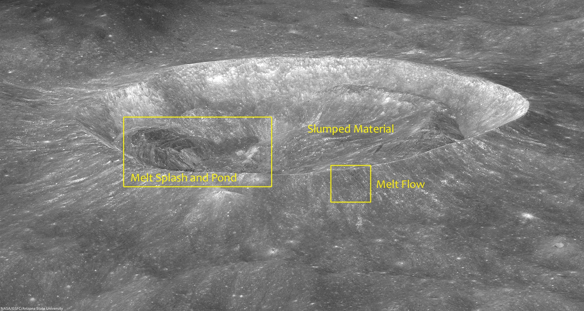
Prominent features of Larmor Q include slumped wall material and impact melt deposits; located at 176.313°E, 28.634°N [NASA/GSFC/Arizona State University].
This oblique image of Larmor Q is also useful for studying the distribution of impact melt, which, in turn, can tell us how impact melt is generated and interacts with the forming crater. In Larmor Q, most of the impact melt rock is located inside the crater opposite the largest slumped materials.

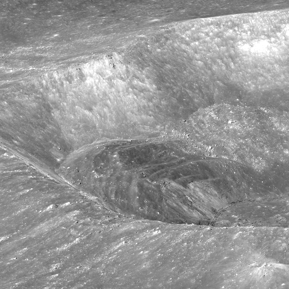
View of impact melt deposits inside Larmor Q. The melt has splashed up the southern wall (left) and ponded in the floor of the crater (center of image)[NASA/GSFC/Arizona State University].
Flows of impact melt on the rim of Larmor Q crater now solidified into lobate deposits [NASA/GSFC/Arizona State University].
There are also several relatively small deposits (flows) of impact melt rock on the crater rim. Because the largest concentration of impact melt occurs opposite the largest slumped materials, we infer that the melt “splashed” up on the southern wall primarily as a result of the slumped material impinging on the crater floor.

LROC Wide Angle Camera (WAC) image of the 18.3 km diameter crater Larmor Q. Slumping of the crater walls has not yet covered all the impact melt on its floor. LROC WAC monochrome (604 nm) observation M136389155C, LRO orbit 5233, August 14, 2010; 54.83° angle of incidence, resolution 82 meters from 58.4 km [NASA/GSFC/Arizona State University].
NASA ILIADS application simulated orbital view (not too dissimilar to the oblique perspective of the LROC Featured Image released May 13, 2014) shows the region of the lunar farside highland terrain between Larmor Q (23 x 19 km; 28.674°N, 176.32°E, bottom center) and Mare Moscoviense (275 km; 27.28°N, 148.1°E), perhaps the most immediately eye-catching feature of the Moon's opposing hemisphere, 750 km away and 1000 meters higher in average elevation above global mean. LROC WAC 100 meter global mosaic imagery applied to LRO LOLA laser altimeter-based digital elevation model [NASA/MSFC].
The full resolution oblique view of Larmor Q crater contains more fascinating clues of the impact cratering process, HERE.

Related LROC Featured Images:

Thursday, May 1, 2014

Elongated crater in west Tranquillitatis

Wall and Rim of Arago E: Full resolution sample from and unusually low-altitude, LROC Narrow Angle Camera (NAC) observation from only 40 km altitude. The sample above shows detail of the northeast wall and floor of Arago E, an excavation of the complex Arago area of western Mare Tranquillitatis. The floor is peppered with boulders that have tumbled down the crater wall. This roughly 800 meter sq. field of view was cropped from LROC NAC M155084711R, LRO orbit 7989, March 18, 2011; resolution 47 cm per pixel, angle of incidence 10° from 40.02 km [NASA/GSFC/Arizona State University].
Raquel Nuno
LROC News System

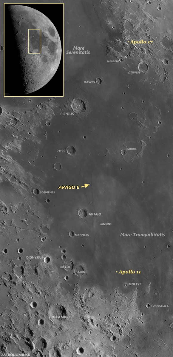
Arago E (8.5°N ,22.71E°) is an elongated crater located in Mare Tranquillitatis, north of the July 1969 landing site of Apollo 11.

An unusually shaped crater, Arago E is nestled between two wrinkle ridges (see Wide Angle Camera context image below), tectonic features formed by the deformation of the basaltic rocks that make up the lunar maria.

Massive maria lavas placed an extra load on the surface, and these deformations are adjustments of the surface due to the unrelenting force of gravity buckling the rock.

Mosaic from the left and right LROC NAC cameras, LROC NAC observation M155084711R and L, allowing a wider look at the 3.7 km c 6.7 km interior of Arago E. View the original (1000 x 1710) reproduction HERE [NASA/GSFC/Arizona State University].
Elongated Arago E and the ruffled surface of west Tranquillitatis: High angle, early morning illumination highlights the undulations of the Tranquillitatis terrain between 25.5 km Arago, at lower left (6.15°N, 21.43°E) and the elongated, still partially shadowed interior of Arago E at upper center in this roughly 75 km-wide field of view from a mosaic made from two sequential LROC Wide Angle Camera passes, in orbits 6772 and 6773, December 13, 2010. 60 meters per pixel resolution, angle of incidence 74° from 44 km. View the original reproduction (1223 x 1951) HERE [NASA/GSFC/Arizona State University].
This crater's elongated shape is perhaps due to an oblique impact, which impart excess horizontal momentum into the surface leaving an elongated shape. However, for this to happen it's thought a progenitor projectile had to have been arriving from less than 30° above the horizon.

Volcanic vents can also display elongated shapes but don't exhibit raised rims and usually lack a flat floor from pooled impact melt, and both features are seen in Arago E.

Earthview context for Arago E: Arago and Arago E are familiar landmarks in telescopic views from Earth. With only a little practice, even amateurs, using modest telescopes can pick them out and, in their mind's eye at least, also pick out the relatively nearby landing sites of Apollo 11 and Apollo 17, the first and the last Apollo surface expeditions. The full-scale mosaic (inset) was "stacked" from ten frames April 21, 2010 by Yuri Goryachko, Mikhail Abgarian & Konstantin Morozov of Belarus [Astronominsk].
A picture of this crater was taken from orbit during the Apollo 15 mission. (You can see it HERE.) How does the LROC NAC observation, at full resolution HERE, compare?

Related Posts:
A Stark Beauty All Its Own
Constellation Region of Interest at Mare Tranquillitatis
Wrinkle Ridges in Aitken Crater
Wrinkle Ridge vs. Impact Crater
Not Your Average Crater

Tuesday, March 25, 2014

Young Crater Walls (at the Schrödinger Antipode)

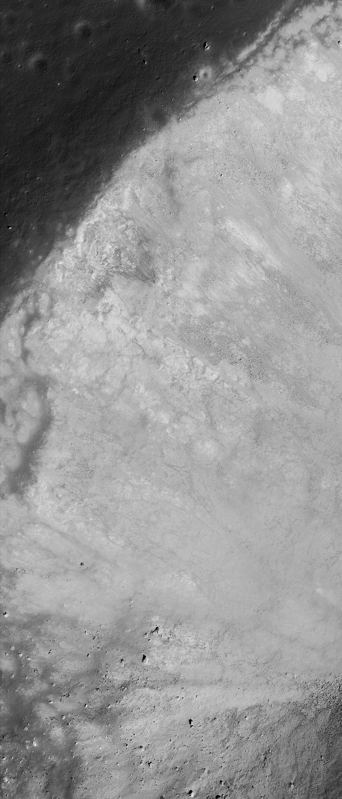
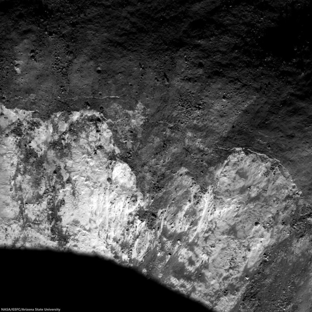
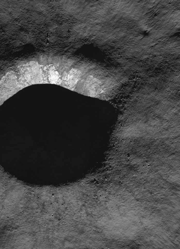
Northern rim of an unnamed young crater near 80°N, 278.9°E, north of Catena Sylvester, on the far north nearside and nested within crustal magnetism that may be related to the Moon's youngest impact basin (Schrödinger) on the direct opposite side of the Moon. 1243 meter-wide field of view, sampled from LROC Narrow Angle Camera observation M125130801R, LRO orbit 3574, April 5, 2010; 78.42° incidence, 1.09 meters resolution from 53 km [NASA/GSFC/Arizona State University].].
Hiroyuki Sato
LROC News System

After the unimaginably violent processes of excavation and ejecta emplacement, impact craters gradually change their shapes with time by various processes, such as the isostatic rebound, mass wasting, subsequent impacts, and space weathering.

Today's Featured Image highlights such a post-impact degradation process.

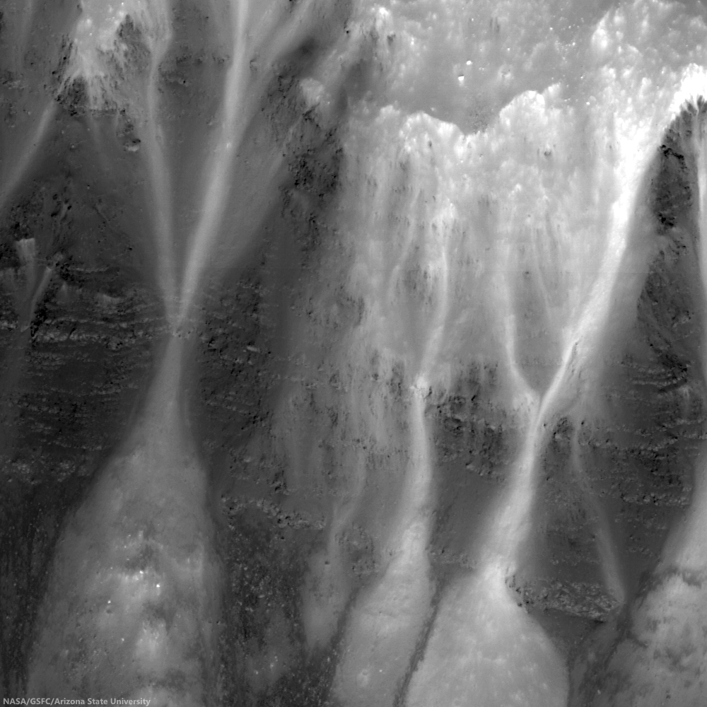
Full-width mosaic of the LROC NAC observation from orbit 3574. The full-sized (4581 x 6319) original can be viewed HERE. Though the high-angle of illumination at this high latitude favors outlines of topography over intrinsic brightness and color,  relatively darker and lighter materials radiate over great distances, aiding studies of how younger materials interact with anomalous local magnetism [NASA/GSFC/Arizona State University].
The lower half of this image (relatively high reflectance) is the crater wall, downslope is to the bottom. The bottom-left dark area is the shadow of southern crater rim. Upper half of the image with a low reflectance surface is the crater rim and the rim slope out of the cavity, mostly covered with impact melt. The low reflectance area at the image center just above the steep wall has multiple horizontal cracks showing where the hardened impact melt has cracked as the steep walls slowly fail and slide into the crater bit-by-bit. These slope failures continuously refresh the crater walls, removing the melt coatings and exposing subsurface materials.

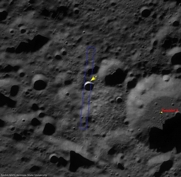
Context image of the unnamed crater and the surrounding area in LROC WAC monochrome mosaic (100 m/pix). Image center is 79.97°N, 278.87°E; image width is about 66 km. The NAC footprint and the location of the opening image are illustrated [NASA/GSFC/Arizona State University].
Most of the fresh craters that we observe have suffered these slides, leaving the commonly observed rootless melt flow features on the rim slopes. Just after the impact occurred, much of the crater interior was covered by impact melt, but these rock veneers are quickly removed from steep slopes leaving fresh outcrops of the target (regolith and, in the case of mare, bedrock).

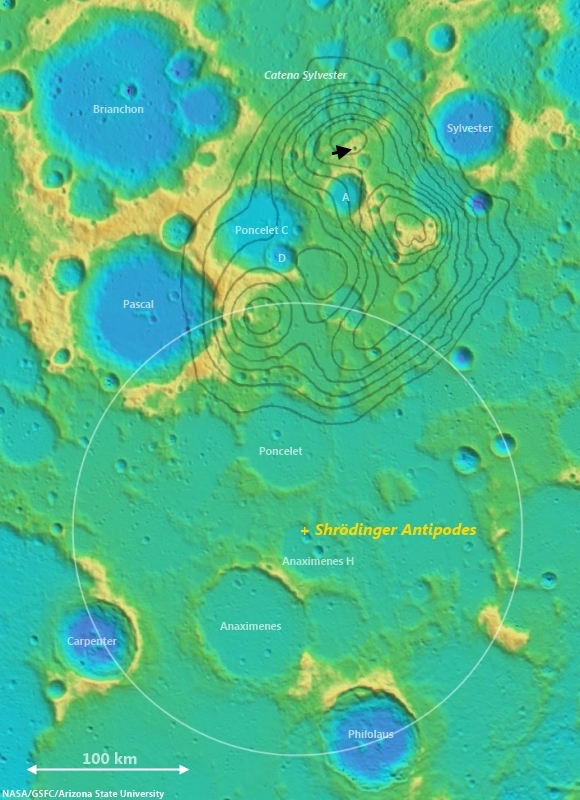
Arrow marks the young crater highlighted in the LROC Featured Image, released March 25, 2014, west of Poncelet C. The white circle is an approximate reflection of the parameters of the Schrödinger impact basin, the Moon's youngest, centered on a point on the diametrically opposite (antipodal) side of the Moon from the center of Schrödinger, in the far south. Grey lines outline nodes of anomalous crustal magnetism teased from Lunar Prospector (1998-99) data. Noted planetary scientists Lon Hood and Paul Spudis use the excavation caused by the smaller impact to aid in determining how local topography may have been disrupted, as they have suggested, by the force of the Schrödinger basin-forming impact. One challenge will be to determine how much the comparatively weak crustal magnetism interacts with migrating dust and fresh impact debris to create albedo swirl features [NASA/GSFC/Arizona State University]. 
Explore the resurfaced fresh crater walls in full NAC frame yourself, HERE.

Related Posts:
The Moon's antipodal magnetism mystery
Lunar swirl phenomena from LRO
Slope failure near Aratus crater
Sinuous Cracks
Slope Resurfacing
Stratified Ejecta Blocks
Dark Impact Melt Sheet
Thin Dark Layer

Thursday, March 13, 2014

Stratification in a Tranquil Sea

Bright talus winds downslope through crags and crannies in the banded scarps exposed in the east wall of Dionysius crater. Horizontal lineations result from differential mass wasting of stratified rock in Mare Tranquillitatis; High (35.12°) incidence Narrow Angle Camera (NAC) mosaic, from both left and right frames, from LROC observation M137434784, orbit 5387, August 26, 2010; east is up in this 450 meter field of view, 49 cm per pixel resolution [NASA/GSFC/Arizona State University].
J. Stopar
LROC News System

Dionysius crater (2.766°N, 17.297°E) is situated on the western edge of Mare Tranquillitatis (the Sea of Tranquility) and excavates both highlands (bright, high reflectance) and mare (dark, low reflectance) materials. Dark banded layers of mare peek out of the eastern wall, where mare material was disturbed by the impact that formed Dionysius crater. Bright talus trails wind downslope through crags and crannies in the dark mare scarps.

Looking closely, the mare appears banded or striated, indicating a non-uniform material. In general, mare are thought to form from large volumes of fluid lavas, much like the Columbia River Basalts in the Pacific Northwest of North America. The stratifications in the lunar mare may represent a series of lava flows in the region.

Blocky overhangs indicate areas more resistant to mass wasting and are interpreted as more coherent basaltic (mare) materials. The thinner, more finely grained layers might represent boundaries between individual lava flows or they may indicate changes in physical properties within a single flow unit. Some of the fine grained layers may even consist of paleoregoliths, ancient regolith surfaces exposed to the vacuum of space in between volcanic eruptions.

LRO Wide Angle Camera (WAC) mosaic of Dionysius and vicinity at local sunrise (featured area, on east wall, remains in deep shadow). Embedded on the southeast 'shore' of Mare Tranquillitatis, the high angle illumination on the surface during this observation opportunity revealed local topography over material brightness, though dark rays, beyond the bright ejecta blanket, can already be seen superpositioned on higher elevations to the west and much lower elevations to the east. 604 nm wavelength view stitched from observations during three sequential orbital passes December 13, 2010; resolution ~60 meters per pixel from 44 km [NASA/GSFC/Arizona State University].
In any case, craters such as Dionysius provide windows into the subsurface structure of the lunar mare. With further study, the total thickness of the mare, as well as the structure and flow mechanics of individual mare flows may be intuited from this and other mare exposures in the walls of impact craters.

Explore the full NAC image, HERE.

Visit these other craters with layered mare exposures:
Lava Flows Exposed in Bessel Crater
Layering in Messier A
Layering in Euler Crater
Layers in Lucian Crater
Marius A
Galilaei's Layered Wall
Dawes
Dionysius Detour

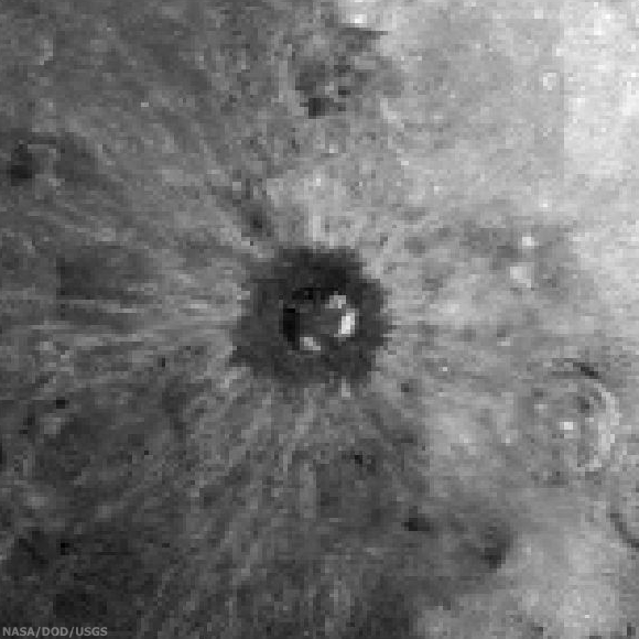
Roughly 150 x 150 km sample of the lunar surface captured from the 1994 Clementine mission. Centered on Dionysius, the data is filtered for Iron Oxide (FeO), a bright constituent of the Mare Tranquillitatis southwest and considered an indication of titanium and a reliable proxy for helium-3, shows how the relatively recent impact that created Dionysius excavated and mixed the sea boundary highlands to the west and ancient basalt plain to the east. Both bright and dark materials radiate more than 100 km from the crater center and beyond the dark ejecta blanket, darker here (though bright in radar and optical data), that dark doughnut is likely a 'false negative' resulting from the spacecraft's low resolution, at this wavelength, of small and fine blocky materials. The bright talus of exposed and very ancient mare basalt layers sifting down the craters walls (particularly on the east) is prominent however, matching the the spectral data of the basin on the east. (Note how older craters, gardened by longer exposure to space weathering, are far more faded into the background [NASA/DOD/USGS].