Showing posts with label space weathering. Show all posts

Wednesday, September 3, 2014

Lovely Lichtenberg B

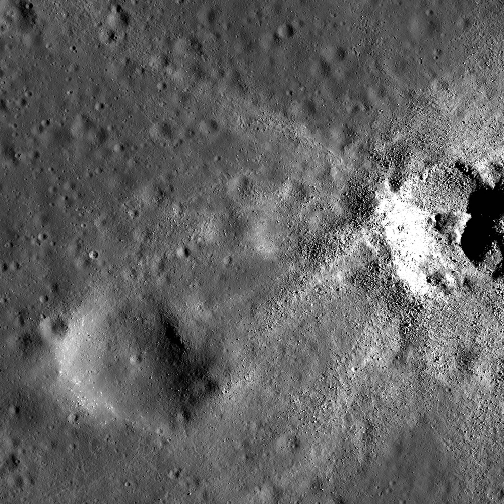
Lichtenberg B (4.86 km; 33.253°N, 298.48°) is a beautifully preserved young impact crater. Rock outcrops in the upper portion of the crater wall are due to the successive thin lava flows that filled Oceanus Procellarum more than 3 billion years ago. LROC NAC mosaic M1162852913LR, LRO orbit 23280, August 16, 2014; incidence angle 35.4° at 1.31 meters resolution, from 129.2 km over 32.46°N, 298.45°E [NASA/GSFC/Arizona State University].
H. Meyer
LROC News System

The lack of atmosphere on the Moon can have its benefits. For example, without an atmosphere, there are few processes to degrade landforms.

On Earth, rain and wind are major causes of erosion, but on the Moon, those causes are absent. Erosion on the Moon is due to impacts that cause shaking and can demolish other craters during formation and to gravity pulling material downslope.

In the case of Lichtenberg B, gravity has not yet rendered the crater smooth and subdued, and there are few impacts nearby, much less any that could have affected the morphology of the crater, as Lichtenberg B appears younger than its neighbors.

Extreme close-up of the wall and rim of Lichtenberg B wall and rim, just east of south center, where impact melt flowed and formed a channel, pushing boulders aside in the process. This 430 meter field of view illustrated "Lichtenberg B Flow," released December 2, 2011. LROC NAC observation M120257109R, February 8, 2010 [NASA/GSFC/Arizona State University].
On the downside, the lack of atmosphere means that space weathering is more efficient on the Moon, and fresh, highly reflective crater ejecta darkens over time. Because Lichtenberg B's ejecta deposit is still bright, it is quite young.

Lichtenberg B and about 56 km-field of view of its surroundings shows an ejecta blanket still highly visible, most than half-way through its long process of optical maturity. LROC monochrome (643 nm) observation M120256944CE, LRO orbit 2856, February 8, 2010; 54.76° incidence angle, 57.42 meters resolution, from 40.39 km [NASA/GSFC/Arizona State University].
Crisp morphology and a highly reflective ejecta deposit make Lichtenberg B stand out from many of the nearby impact craters. This exquisitely preserved crater is located to the northwest of Aristarchus Plateau in Oceanus Procellarum, a vast mare unit littered with impact craters and wrinkle ridges. The ejecta deposit is particularly interesting because it displays a wrinkled texture with structures that resemble dunes.

High-angle (late afternoon) incidence view draws some depth of field to the plains impacted by Lichtenberg B. LROC WAC monochrome (604 nm) mosaic of four observations from sequential passes December 8, 2011; 77° incidence, 56.5 meters resolution from 40 km [NASA/GSFC/Arizona State University].
How do these structures form? What makes Lichtenberg B's ejecta deposit different from other craters that lack these dune-like structures? It turns out that Lichtenberg B is not alone. Scientists have observed these same features at Linné Crater and are in the process of determining how they formed.

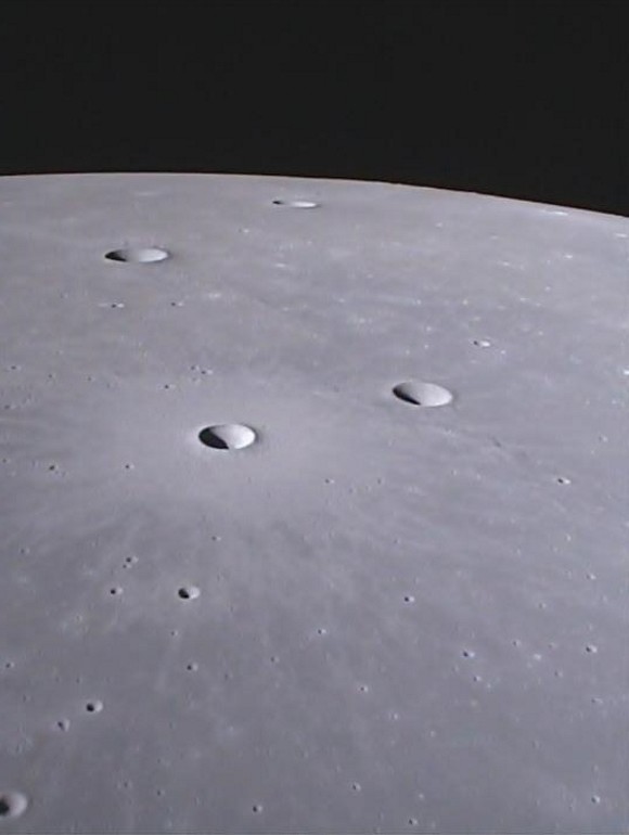
Forward view (north) from GRAIL-A gravity probe Ebb MoonKAM in May 2012, over northwest central Oceanus Procellarum. The maturing ejecta blanket from Lichtenberg B, Dorsum Scilla and Naumann G are in mid-foreground, with Naumann further beyond, and Naumann B (10.72 km; 37.46°N, 299.3°E) is nearer the horizon. ( MoonKAM image 133655 ) [NASA/JPL/SRSC/UCSD].
Check out the full NAC mosaic HERE.

Related Posts:

Monday, August 25, 2014

Add 'sparking' in PSRs to the space weathering zoo

University of New Hampshire (UNH) scientists propose the addition of "sparking"  to cosmic rays and micrometeor bombardment as part of the relentless space weather gardening always underway within the Moon's permanently shadowed regions. This illustration shows a PSR undergoing subsurface sparking, to a depth of about 1mm, which ejects vaporized material [UNH/SVS].
Durham (NH) –- The Moon appears to be a tranquil place, but modeling done by University of New Hampshire and NASA scientists suggests that, over the eons, periodic storms of solar energetic particles may have significantly altered the properties of regolith in the Moon’s coldest craters through the process of "sparking" —a finding that could change our understanding of the evolution of planetary surfaces in the solar system.

The study, published recently in the Journal of Geophysical Research-Planets, proposes that high-energy particles from uncommon, large solar storms penetrate the Moon’s frigid, polar regions and electrically charges the regolith. The charging may create sparking, or an electrostatic breakdown, and this “breakdown weathering” process has possibly changed the nature of the Moon’s regolith within its permanently shadowed regions, or "PSR's," which may be more active than previously thought.

“Decoding the history recorded within these cold, dark craters requires understanding what processes affect their regolith,” says Andrew Jordan of the UNH Institute for the Study of Earth, Oceans, and Space, lead author of the paper. 

“To that end, we built a computer model to estimate how high-energy particles detected by the CRaTER (Cosmic Ray Telescope for the Effects of Radiation) instrument, on board LRO can create significant electric fields in the top layer of lunar regolith,” Jordan wrote.

The scientists also used data from the Electron, Proton, and Alpha Monitor (EPAM) on the Advanced Composition Explorer (ACE).

CRaTER, which is led by scientists from UNH, and EPAM both detect high-energy particles, including solar energetic particles (SEPs). SEPs, after being created by solar storms, stream through space and bombard the Moon. These particles can build up electric charges faster than the regolith can dissipate them and may cause sparking, particularly in the polar cold of permanently shadowed regions—unique lunar sites as cold as minus 240 degrees Celsius and known to contain water ice. 

The record cold at Hermite (108 km; 86.16°N, 266.68°E), straddling the 85 parallel and 270th meridian, host significant zones in permanent shadow, including permanently shadowed regions (PSRs) along it's southern wall and floor (left) the host the lowest temperatures yet recorded in the solar system, 24°K. LROC Quickmap, 250 meter resolution, orthographic projection of the Moon's north pole and vicinity [NASA/GSFC/Arizona State University].
Says Jordan, “Sparking is a process in which electrons, released from the regolith grains by strong electric fields, race through the material so quickly that they vaporize little channels.” Repeated sparking with each large solar storm could gradually grow these channels large enough to fragment the grains, disintegrating the regolith into smaller particles of distinct minerals, Jordan and colleagues hypothesize.

The next phase of this research will involve investigating whether other instruments aboard LRO could detect evidence for sparking in lunar regolith, as well as improving the model to better understand the process and its consequences.

“If breakdown weathering occurs on the moon, then it has important implications for our understanding of the evolution of planetary surfaces in the solar system, especially in extremely cold regions that are exposed to harsh radiation from space,” says coauthor Timothy Stubbs of the NASA Goddard Space Flight Center.

Tuesday, August 12, 2014

Complimentary craters, south of Maclear

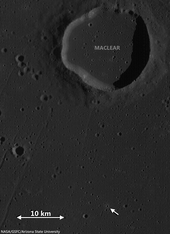
South of Maclear in northwest Mare Tranquillitatis, two complimentary craters of very similar location, size and origin, but additionally of widely different ages. The relentless bombardment of small debris "gardens" the lunar surface at an average rate of 3 mm every 2 million years. In addition to the nearly billion year long cycle of cosmic ray dark-reddening, "space weathering" ages, or "optically matures" the lunar surface at a predictable rate, adding to crater counts and super-positioning another useful tool to the craft of dating lunar features from a distance. LROC NAC observation M131515002R, LRO orbit 4515, June 18, 2010; 79.75° sunrise incidence angle, resolution 85 cm from 40.68 km over 9.09°N, 20.14°E [NASA/GSFC/Arizona State University].
Raquel Nuno
LROC News System

There are several distinguishing properties of craters that help lunar scientists determine their ages. As craters get older their appearance changes through exposure to solar wind bombardment and other impacts (collectively called space weathering), and even gravity has an effect.

Effects of the solar wind lower the reflectance of the surface; so regolith (soil) that was excavated by recent impacts has higher reflectance than the background surface, this is why small young craters have visible crater rays. New impacts pulverize rocks that were ejected during the formation of an older crater and disturb the shape by causing moonquakes. Also, gravity works to alter the shape of a crater by pulling material down its walls in a process called slumping, this causes craters to have a smoother appearance.

1.69 km field of view from LROC NAC Commissioning observation M106748283R, LRO orbit 873, September 5, 2009; 29.84 low-angle incidence, resolution 1.17 meters from 133.64 km over 9.82°N, 20.15°E [NASA/GSFC/Arizona State University].
Today's Featured Image showcases two similarly sized adjacent craters (each ~500 m in diameter) located in Mare Tranquillitatis (see WAC context image below) with very different appearances. The area surrounding the top crater is littered with boulders in all directions. Wheras the more southerly crater has only a few rocks near its rim. Where did the boulders come from in the first place? And did the lower crater originally have boulders?

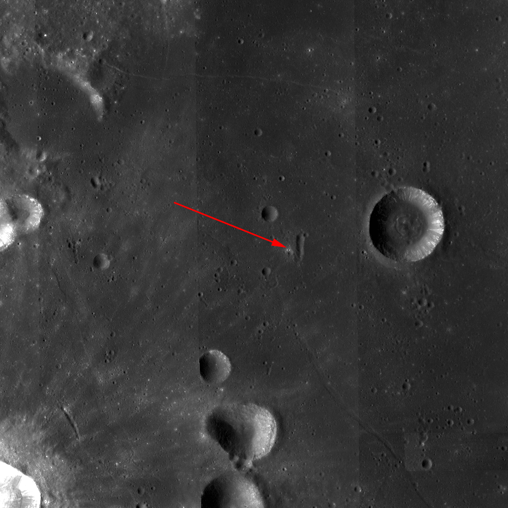
Locating two co-located 500 meter "complimentary craters" (arrow) good for comparing rates of general space weathering, in west-northwest Mare Tranquillitatis. LROC Wide Angle Camera (WAC) monochrome (566 nm) observation M131514941C, captured simultaneous with the NAC observation opportunity shown in the Featured Image at the top of this post. LRO orbit 4515, June 18, 2010; 79.75° incidence, resolution 57.7 meters from 40.72 km over 10.17°N, 20.14°E [NASA/GSFC/Arizona State University].
Since the mare basalt formed from layers of lava that hardened into solid rock, it is likely the boulders are coherent fragments of those thick layers (a few to tens of meters thick) that were broken up and ejected during the impact event. Since these two craters are so close and both formed in the mare it is very likely that the lower crater also had a large grouping of boulders in its ejecta field. The dissimilarity between these two craters is most likely due to age difference. Over time (perhaps a couple of billion years) the original boulders around the lower crater were slowly ground down by micro-meteorite bombardment - think of this process as cosmic sand-blasting! The boulders around the younger crater (top) have not had time to be pulverized by other impacts, but stick around for a billion years and you can watch these boulders slowly disappear!

Explore the full resolution NAC HERE.

Related Posts:

Friday, March 21, 2014

Lacus Autumni

Fresh and not-so-fresh craters on the basalt plain of Lacus Autumni, a pool of volcanic material solidified between the concentric rings of Orientale basin. Field of view from a mosaic of the left and right frames of LROC NAC observation M114498609, LRO orbit 2007, December 3, 2009; resolution 51 cm per pixel, incidence 62.57° from 48.44 km [NASA/GSFC/Arizona State University].
H. Meyer
LROC News System

This exquisite crater formed when an impactor crashed into the mare pond called Lacus Autumni. Angular blocks, which erode over time and gradually disappear, littering the terrain both within the crater and outside of it.

Though the margins of the crater are crisp and distinct, it has a lumpy appearance that is probably due to the coherence of the target material.

The ejecta of the crater has a slightly higher reflectance relative to the mare in which it is found. High-reflectance ejecta can represent recently exposed material that has not been affected by space weathering processes, called maturity rays, or material that is compositionally distinct from its surroundings, called compositional rays. Due to its crisp appearance and the predominance of blocks, we interpret this as a young, fresh crater, so the rays are likely maturity rays.

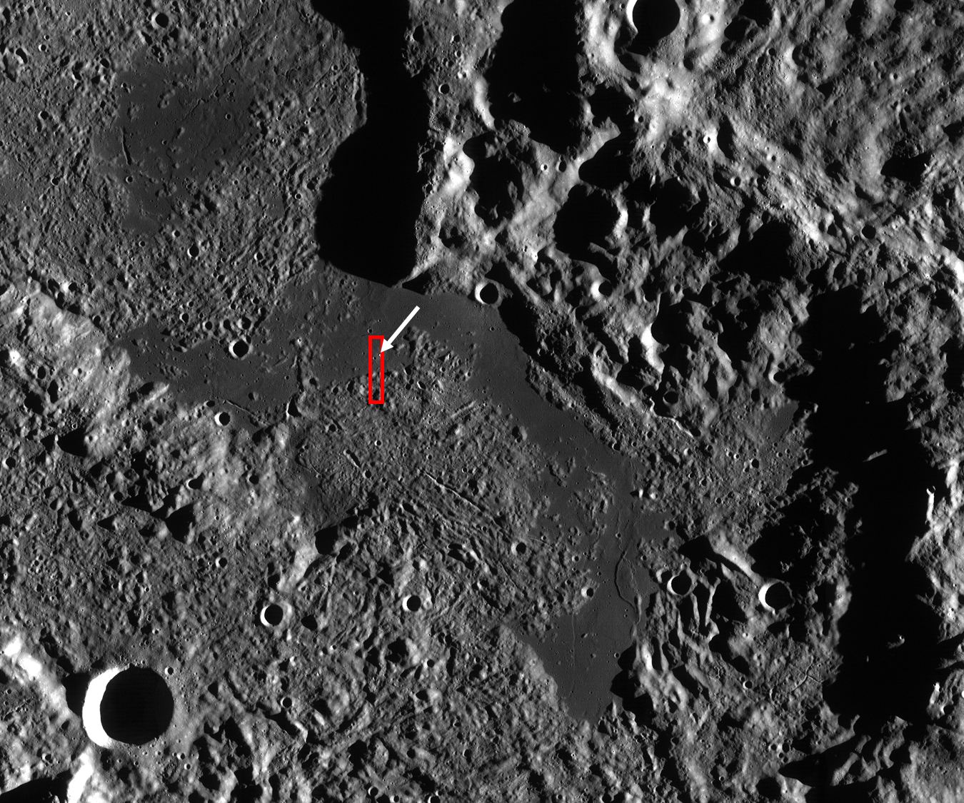
LROC WAC mosaic of Lacus Autumni, context for the LROC Featured Image. Red box outlines the the full LROC NAC field of view from LROC observation M114498609, orbit 2007, December 3, 2009. The white arrows points to the location of the fresh crater. Field of view above approximately 160 km across [NASA/GSFC/Arizona State University].
Lacus Autumni (or "Autumn Lake"), along with Lacus Veris and Mare Orientale, is a mare pond located in the northeast portion of the Orientale Basin. It lies between the Orientale inner ring (Montes Rook) and outer ring (Montes Cordillera). When craters form in thin mare sometimes high-reflectance highlands material is excavated from depth, which makes it difficult to differentiate between maturity rays and compositional rays. To resolve this issue, we can look at the composition of the material that was excavated, looking specifically at both iron and titanium maps.

Nestled in a valley between the inner and outer Orientale impact basin rings, Lacus Autumni is seen here at high relief of sunset shadows. Mosaic of LROC WAC observations from orbits 4786 through 4791, July 9, 2010; Uncropped field of view (very roughly) 205 km across, at an average resolution 68 meters, incidence 80° from 49 km. View the full-size original HERE [NASA/GSFC/Arizona State University].
If the rays are indistinguishable from the mare in which the crater formed, then we can conclude that they are highly reflective because they are young and unweathered. If the rays are composed of highlands material, the rays are likely compositional rays.

If the crater excavated highlands material from beneath the mare, then we can estimate the thickness of the mare deposit and determine just how much lava was extruded onto the surface when the mare formed. In the case of compositional rays, the morphology of the crater, such as a crisp rim or peak, is an indicator of the age of the crater.

The crater rays in this LROC Featured Image are indistinguishable from the mare in which they are found, so these are indeed maturity rays.

Explore more of Lacus Autumni, HERE.

Related Posts:
Fresh Bench Crater in Oceanus Procellarum
A Gathering in Lacus Mortis
Shield Volcanoes in Lacus Veris
Unnamed Fresh Crater Northeast of Arago (DTM)
New Crater!

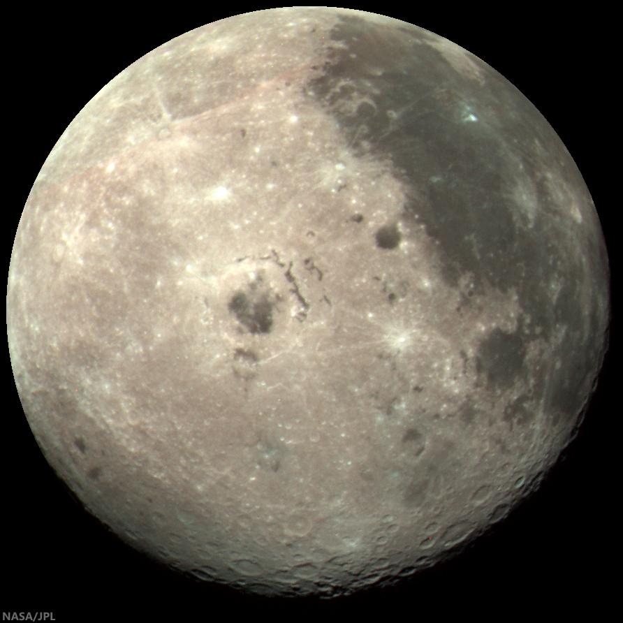
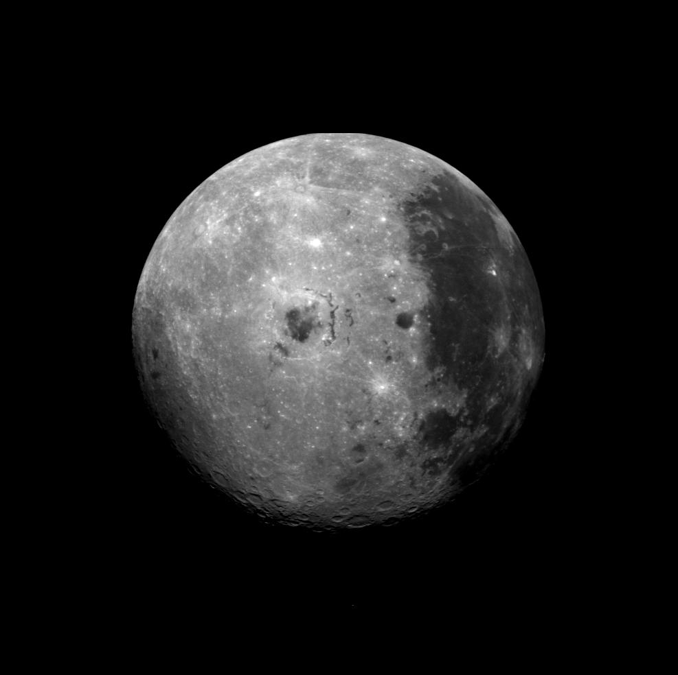
A well-known composite color image of the Moon's western hemisphere centered just below Lacus Autumni, northeast of Mare Orientale, captured by the Galileo spacecraft while maneuvering out of the inner solar system on its way to Jupiter, at 1735 UT  December 9, 1990, from roughly 560,000 km away. The color composite was stacked from monochrome images taken through violet, red, and near-infrared filters. The Moon's nearside is to the right, the far side to the left [NASA/JPL].

Wednesday, September 11, 2013

Bright and Dark Ejecta

LROC Featured Image, September 10, 2013 (M139782204LE)
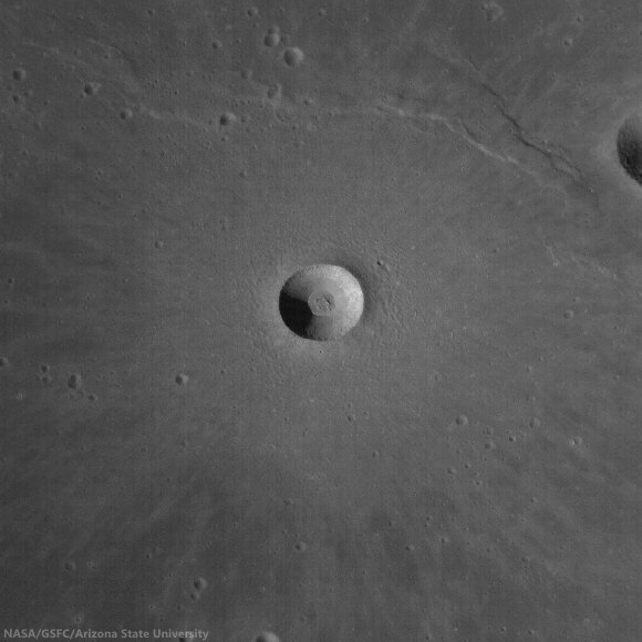
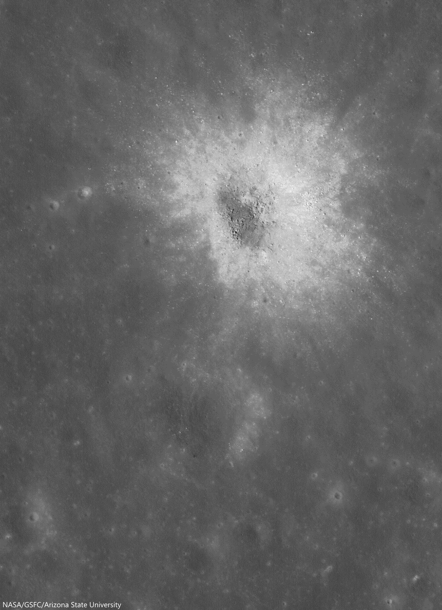
A relatively recent impact event distributed bright, reflective ejecta across the lunar surface in southeast Mare Tranquillitatis. Smaller craters punch through the ejecta to reveal darker substrate, a contrast easier to see under a high Sun, and thus a lower illumination angle of incidence. A 500 meter-wide field of view from LROC Narrow Angle Camera (NAC) observation M139782204LE, spacecraft orbit 5733, September 22, 2010; a 10.11° angle of incidence, resolution 49 cm per pixel from 44.54 km over 4.37°N, 19.29°E [NASA/GSFC/Arizona State University].
Drew Enns
LROC New System

Fresh (young) impacts on the Moon often display magnificent ejecta blankets (so called because they "blanket" the surrounding terrain). Ejecta is unevenly distributed, which gives rise to its interfingered appearance.

Since space weathering tends to lower the albedo of material on an airless planet, the relative brightness of this ejecta blanket speaks to the young age of the parent crater.

In this case, the parent crater is just to the south of the opening image, and can be seen in the context image.

M162181924L-NSJ-1110-58b92-2252x3572
The same small, relatively fresh crater at local sunrise, when shadows under a higher illumination angle of incidence exaggerate variations in topography over albedo. Even so, the brighter surface rays are as distinct as striations channeled into the terrain by the blast. An 1875 meter-wide field of view from LROC NAC frame M162181924L, LRO orbit 9035, June 8, 2011; 73.88° angle of incidence, resolution 0.83 meters per pixel from 39.7 km [NASA/GSFC/Arizona State University].
But what is providing the small circular patches of dark material? Were the patches formed as part of the impact that formed the ejecta blanket, or later? Was the material excavated from below the bright ejecta? Most likely secondary craters (late stage ejecta) from the initial impact, hit and dug up dark mare material (original surface) from below the thin ejecta blanket. Can we test this idea? How dark is dark? In a more precise sense - do the albedos of the small low reflectance spots match that of the surrounding mare?

LROCqm250-sabine-rittter-manners
LROC Wide Angle Camera (WAC) context for the LROC Featured Image released September 10, 2013, showing the field of view located at located at 4.408 N, 19.230 E (marked by the cross). Nearby linear depressions (one smaller, closer depression is visible in the preceding image) may have provided the darker substrate discussed [NASA/GSFC/Arizona State University].
Your eye could be fooled by all the changes in reflectance. The small dark patches have a higher albedo than the mare (0.07 vs 0.06), which would be consistent with mare material mixing with the brighter (0.09 to 0.11) ejecta blanket. This observation is consistent with the secondary crater interpretation (the underlying mare is mixed with a small amount of the bright immature ejecta). If the reflectance of the dark patches was lower than that of the mare, then something else would have to be at work.

Can you think of other explanations while browsing the full LROC NAC frame, HERE?

Related Posts:
Beautiful Ejecta Patterns
DMD Excavations
Symmetric Ejecta

Tuesday, August 20, 2013

Karpinskiy, superpositioned on the farside north

Karpinskiy WACGLD 100m
LROC Wide Angle Camera (WAC) mosaic overlaid with WAC and NAC-derived GLD100 color-coded digital elevation model. Karpinskiy crater is approximately 90 kilometers across and nested within the remains of an even larger and more ancient crater [NASA/GSFC/Arizona State University].
Raquel Nuno
LROC News System


Karpinskiy crater, at 72.609°N, 166.801°E and (officially 91.403 km) in diameter, rests within a larger and far older unnamed crater. How do we know which crater is older? Stratigraphic studies, or the study of superposition of rock layers (or in this case, craters), will help determine the relative ages of craters here. Geologists derive relative ages between geological features by observing how they overlap - young formations will always overlie older formations, and on airless bodies, such as the Moon and Mercury, this method becomes particularly useful. Without wind to erode its surface, only four factors affect the lunar surface: space weathering, impacts, tectonism, and volcanic resurfacing. With respect to today’s Featured Image, the Moon accumulates impact craters over time. From the cratering record we can investigate not only stratigraphic relationships (which crater formed first), but we can also derive a quantifiable measure, or crater density, to determine relative ages on the Moon.

Karpinskiy passes under Kaguya
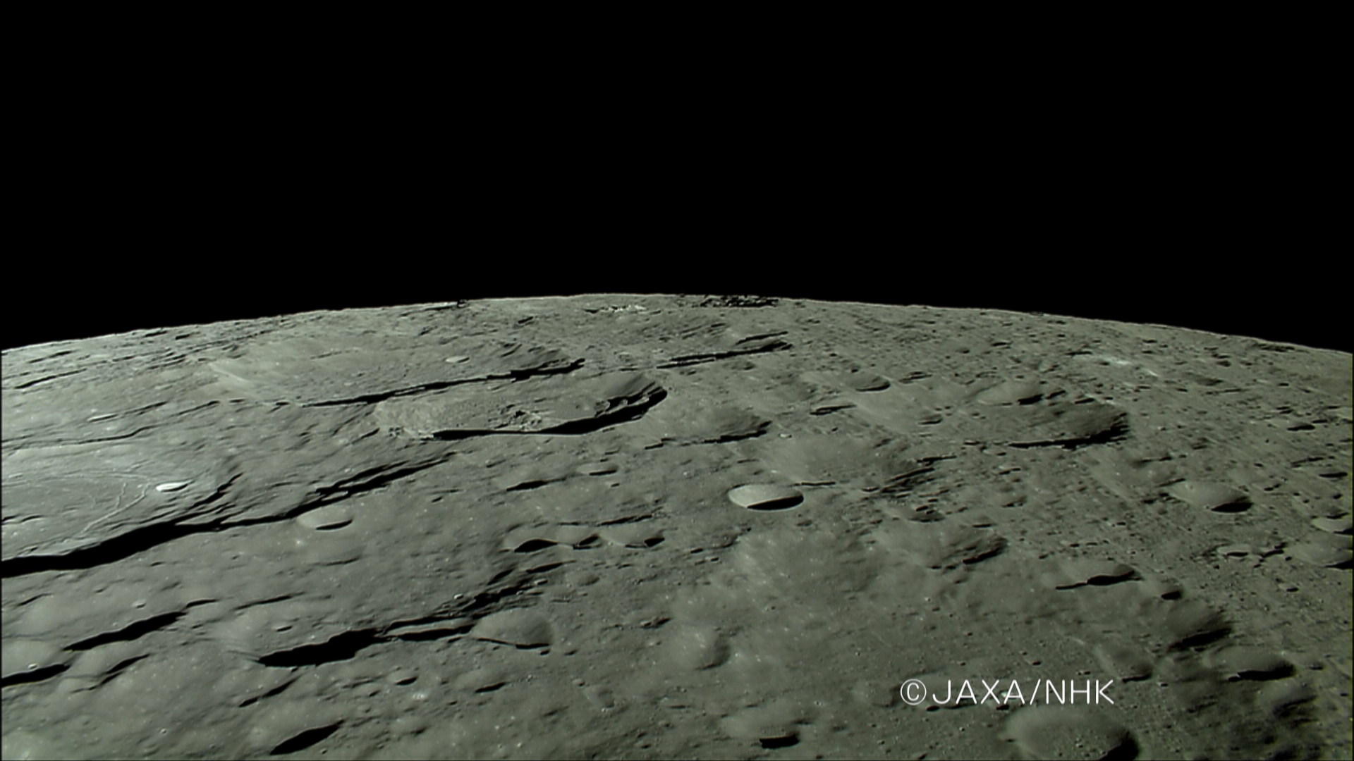
The HDTV camera onboard Japan's lunar orbiter Kaguya (SELENE-1) anticipates a rising Earth in 2007, looking north toward the Moon's north pole as it passes ancient craters of the Farside Highlands Terrain, including Karpinskiy, nested in a much older crater, passing out of view at left, followed by Milankovic and Plaskett. View the full-size image HERE [JAXA/NHK/SELENE].
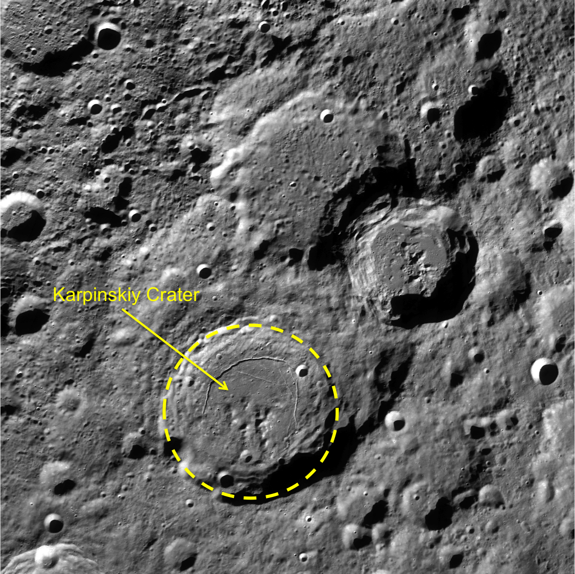
Today’s Featured Image is a great example for stratigraphic studies. The LROC WAC mosaic of Karpinskiy crater overlaid with the GLD100 color topography presents a clearer outline of the older crater (WAC mosaic below). The top portion of the image is black because the GLD100 product does not have coverage at that latitude (>79°N). Karpinskiy crater is located inside a much older, degraded crater that does not have a well-defined rim and is somewhat difficult to see in the WAC mosaic. Karpinskiy is younger because it superposes, or formed on top, of the unnamed older crater. There are younger craters superposed on the floor of Karpinskiy, that must have formed later and are therefore younger based on the relative age relationships. Thus, using stratigraphic relations we are able to derive a relative age for Karpinskiy, but what if we want to determine the absolute age? The number of craters that formed on Karpinskiy can be used to estimate its absolute age, however with such a small area the crater size frequency distribution absolute age estimate has a large uncertainty. To accurately determine the absolute age of Karpinskiy crater we have to go there and acquire samples of impact melt rock that we can radiometrically date!

Karpinskiy WAC superposition context
LROC WAC context image. Karpinskiy crater outlined in yellow, with the two neighboring craters to the north and east are Ricco, Milankovic and Milankovic E[NASA/GSFC/Arizona State University].
Explore the full image, HERE.

Related Posts:
Absolute Time
Copernicus Crater and The Lunar Timescale
Dating an Impact

Wednesday, March 20, 2013

Landing Site at Tycho North (Science Concept 7)

A Ready-Made Landing Site?   One among many 'flash-frozen' impact melt ponds, a flow over the rugged ejecta immediately north of Tycho crater halted in place 109 million years ago. This one is 800 meters long along its north-south axis, and apparently level, nested about half the distance between the 1968 unmanned Surveyor 7 lander and a geologically interesting breach on Tycho's rim. LROC Narrow Angle Camera (NAC) observation M111668133RE, LRO orbit 1590, October 31, 2009; resolution 51 cm per pixel, angle of incidence 47.88° photographed from 49.39 km [NASA/GSFC/Arizona State University].
Second in a series of posts highlighting newly-proposed lunar landing sites selected to address high-priority science goals - from a remarkable landing site study published by the Center for Lunar Science and Exploration (CLSE):

Another image, less close-up, of the proposed 'Tycho North' landing zone, at slightly less granular resolution (0.65 meters per pixel), the nominally level melt pond is visible in greater context, nested in the rough and debris-strewn Tycho ejecta. The local slope runs from east to west but, overall, lower north and away from 86.2 km Tycho. From a mosaic, LROC NAC M106950070LR, spacecraft orbit 901, September 7, 2009; from 63.18 km altitude, angle of incidence 45.55° [NASA/GSFC/Arizona State University].
Joel Raupe
Lunar Pioneer

On February 5 we discussed a proposed landing site in Amundsen crater selected to support "Science Concept 4" as outlined in the commissioned National Research Council (NRC) study The Scientific Context for the Exploration of the Moon (2007).

In this second of a planned series we move to an area north of Tycho visited by Surveyor 7 in 1968. Material from the region was also very likely sampled by Apollo 17 in 1972, as Eugene Cernan and Harrison Schmidt explored Tortilla Flats in Taurus Littrow Valley, 2200 kilometers away.

While working with those same samples at the Johnson Space Center's Lunar Sample Laboratory Facility, Jack Schmidt soon helped estimate the age of samples collected at the base of South Massif directly opposite from Tycho at 109 million years. When the Tycho event happened, only 44 millions years remained before a similar impact ended the long reign of dinosaurs on nearby Earth. When offered as an example of the Moon's young craters the immense differences between terrestrial and lunar timescales and surface preservation rates are made stark. Such differences make it easy to forget that Earth and Moon have essentially shared the same location in the inner Solar System for 4.5 billion years (with Earth being a larger target and deeper gravity well). A study of the impact history and space weathering environment preserved on the Moon is a study of a much better preserved record of Earth's history.

This landing zone was proposed to address "Science Concept 7," a site that first presented to the Lunar and Planetary Science Conference in 2012 (Abstract #1387), from work produced by the Lunar & Planetary Institute Summer Intern Program the previous year. More detail emerged in the final CLSE landing site study of each of the NRC's 2007 lunar science goals, last fall. The LPSC 2012 abstract and contribution to the final CLSE study are credited to director David A. Kring and LPI 2011 interns Sarah Crites, Agata Przepiórka, Stephanie Quintana, Claudia Santiago and Tiziana Trabucchi.

"Science Concept 7" outlined in the National Research Council's NASA-commissioned Scientific Context for the Exploration of the Moon (2007). The Center for Lunar Science and Exploration (CLSE) released "A Global Lunar Landing Site Study to Provide the Scientific Context for the Exploration of the Moon" in late 2012, an exhaustive study of possible landing sites selected to address NRC 2007 lunar science concepts and goals [CLSE/LPI/NLSI].
The sites appearing in the new CLSE study might be broadly separated into two sets, ranked lists of many possible landing sites picked to fulfill all or overlapping part of the goals under the Science Concepts or individual targets picked in hopes of addressing all goals within one Science Concept and possibly overlapping with one or more of the other Concepts.

In other words, the ranks of possible landing sites in the new study range from those picked to accomplish much within practical, logistical and budget constraints over the next two decades to a long list of sites that may require 50 to 100 years to directly sample, along with a few lists falling somewhere in between. This might be a reflection of the political changes occurring over the years since the study began, when renewed exploration and establishing an extended human presence on the Moon went from being National Space Policy to falling by the wayside.

The new study is highly useful, regardless. Along with the Lunar Impact Crater Database, an even more detailed picture of the origins, ages and compositions of the Moon's complex features has been coming into focus, reflecting the astounding range of detailed information about the Moon collected in recent years.

Another full resolution LROC NAC view of the proposed landing zone, from a mosaic of the left and right frames of LROC NAC observation M111668133LR, LRO orbit 1590, October 31, 2009; incidence angle 47.82° from 49.39 km [NASA/GSFC/Arizona State University].
Since the goal is to establish definitive baselines, the actual ground truth of the upper few centimeters of the Moon's surface, why land near Tycho, the 86.2 km-wide astrobleme (41.49°S, 348.23°E) that is so much younger than its counterparts from earlier eras that have long faded into the albedo background? As it turns out, it's precisely because of such notably pristine.conditions, a comparatively youthful impact upon a region older than Mare Imbrium, that led Kring and his colleagues to seek this place out - along with proximity with Surveyor 7.

Understanding the dynamics of the upper few centimeters of the Moon's surface, most of which is turned-over, or "gardened" every couple of million years - involves more than dust mitigation or the charging and levitation of sub-micron dust as it interacts with radiation from the Sun and deep space or the Moon's nested crustal magnetic fields. Researcher will need a better understanding of this blasted layer of fine particles on wildly different timescales.

A really outstanding oblique view shows the proposed Tycho North Landing Zone from up over a spot 100 km west of Tycho, offerring even more perspective on the complex terrain surrounding the target melt pond (near center). Inset (see rectangle below) from an oblique (59° east of nadir) LROC NAC mosaic of from LROC NAC M1101317790, LRO orbit 14632, September 3, 2012 [NASA/GSFC/Arizona State University].
Thumbnail of the entire LROC NAC M1101317790RLR mosaic shows the area of the target melt terrace (the field of view in the immediately preceding full-resolution crop is framed by the yellow rectangle) in relation with Surveyor 7 and the rim of Tycho, 20 km south (to the right). Incredibly - at full resolution - the Surveyor 7 lander is actually visible in the full image. A proposed science station on the rim of Tycho is just outside this view at lower right [NASA/GSFC/Arizona State University].
Up, over and just beyond Tycho's 1200 meter high rim, the proposed LZ pictured above sits roughly at 620 meters elevation above the lunar geode (near 41.49°S, 348.233°E), the Moon's mean elevation, just out of sight from the sharp 800 meter drop down the crater wall (check this). The familiar crater's complex ejecta blanket extends 110 km from the central peaks, and its famous rays, visible to the naked eye, extend past 2000 km.

Beyond the debris piled high on the Tycho rim, the area of interest north by northwest of the crater, is characterized by slopes from 4.5 to 6° - safe for manned and unmanned landers. The specific Landing Zone is approximately 20 km from the rim fall off, where ancient pre-impact regolith appears to be exposed in layers visible in LROC NAC photography.

Because Tycho excavated pre-Imbrium nearside Southern Highlands, "any paleoregolith layers in Tycho's walls will also have a pre-Imbrium age," Kring and his colleagues note.

"Tycho's crater walls are the best target for sampling," though the upper reaches of the mountainous rim between the landing zone and the crater wall retain slopes greater than 25° "a navigable route to access layered deposits can probably be found."


Clementine multi-spectral mosaic color-coding overlaid on LROC Wide Angle Camera (WAC) 100 meter global mosaic shows the Science Concept 7 proposed landing site (arrow) is near the border between two widely different surface compositions [NASA/GSFC/DOD/ASU].
"The site provides access to regolith produced from substrates of different compositions (see image above)," from the coherent melt pond of the landing site itself to "rubbly ejecta... in a highlands area far from" the unique Procellarum, Potassium and Rare Earth (PKT, or 'Procellarum KREEP') terrain, covering so much of the nearside's west quarter.

Because the Tortilla Flats formation, sampled by Apollo 17, and nearby Surveyor 7 sampled materials related to the Tycho impact event "we can leverage these previous missions to compare properties of regolith of the same age formed from different types of ejecta."

Fifty km-wide LROC WAC field of view barely hints at the complexity of the terrain around the rim of Tycho. The suggested "Science Concept 7" landing site is an equidistant 10 km 'walk-back' distance (as the orbiter flies) from the 1968 landing site of Surveyor 7 (the last unmanned U.S. lander) and a suggested science station, a rare, dramatic breech in the sharp wall of the 'young' 109 million year old crater. The peninsula of melt piled into a comma below and to the right of Surveyor, was shown at very high resolution in "Giant Flow of Tycho Impact Melt," LROC Featured Image released August 14, 2012. LROC WAC (M168272917-9335CE) monochrome (643nm) mosaic   [NASA/GSFC/Arizona State University].
One of the best all-around LROC NAC images of Surveyor 7 (below left, arrow, and at full-resolution in the inset), from M150598504L, LRO orbit 7327, January 25, 2011; spacecraft and camera slew -15.17° from nadir, resolution 0.52 meters per pixel, angle of incidence 69° from 45 km. This roughly 300 meter wide field of view also includes another Tycho melt pond, the landing site Surveyor project manager Gene Shoemaker had hoped for as eventual landing site for this last vehicle of the program. The tripod lander's square sail, atop a supporting mast, casts a distinctive shadow [NASA/GSFC/Arizona State University].
Nearby Tycho's Rim - A possible breech in Tycho's high rim - within walking distance of the proposed Landing Zone, in the opposite direction from Surveyor 7 - may provide sampling access to the layered regolith visible above center-right. This angled corner on the north-northwest rim of Tycho was clearly modified very soon after the crater formed. Whether the slope below is too great to allow men and machines invaluable direct access to Tycho's equally interesting interior is still uncertain. LROC NAC mosaic M160029952LR   [NASA/GSFC/Arizona State University].
Some perspective to the proposed Science Concept 7 science station, on Tycho's rim (arrow) and the crater rim, wall and floor. Melt ponds dot the region. (In this oblique view, the landing zone and Surveyor 7 locations are outside this frame.) Still from video prepared from JAXA photography and data collected by the SELENE-1 (Kaguya) [JAXA/SELENE].
Establishing the rate and manner space weathering leads to the optical maturing (OMAT) of the Moon's surface will help researchers understand processes ranging from the interaction of reactive dust with crustal magnetism - the age and deposition rates of the Moon's swirl phenomena - the deposition of lunar volatiles and tighter estimates of the age of craters between one and two billion years old, past the time needed for optical maturity to do its work. 

Tycho, a recent rich excavation of the Moon's nearside Southern Highlands, and sights along a potentially valuable ingress to the crater's interior demonstrating the potential value of a single rather multiple expeditions. LROC WAC mosaic stitched from four sequential orbital overflights  LROC WAC (M168272917-9335CE) monochrome (643nm) mosaic   [NASA/GSFC/Arizona State University].
Remote sensing maturity maps hint the proposed landing site is characterized "by both very immature and intermediately mature soils," according to Kring and colleagues, "providing an opportunity to see the evolution of space weathering processes."
 
Proximity with Surveyor 7, about 20 km away, in the opposite direction from Tycho's rim, allows study of a known surface, and for a known amount of time (since 0600 UT, 7 January 1968), a stated goal in the NRC's 2007 commissioned report.
 
It's hoped the 20 km distance from the proposed landing site will prevent Surveyor 7, as a valuable 'long-duration exposure facility," from being undermined like Surveyor 3, ultimately swept clean by the descent of Apollo 12 only 183 meters away in 1969.Surveyor 7 may provide a "more pristine" baseline for measuring short-term space weathering.
 
The Tycho North landing site clear of any known crustal magnetism, free of space weathering processes both accelerated and slowed, as they appear to have been at Reiner Gamma, for example. Samples should therefore be "better representative of the lunar highlands."
 
The rate of solar-wind production of volatiles "can also be nicely calibrated here," Kring and his colleagues have noted, since "the exposure age is known and the orbital relationship between the Moon and the Sun is unlikely to have changed significantly over that period."
 
Chemical traces of the object that created Tycho Crater may be be found in the melt-rich rocks at the landing site, along with the shattered pieces of more distant and much older events in the 'recently' exposed paleoregolith uplifted in layers at Tycho's rim.

Some Related Posts:
Amundsen crater and the CLSE Landing Site Study (February 5, 2013)
Rippled Pond on Tycho's Wall (September 13, 2012)
Breached Levee at Tycho (September 11, 2012)
Giant Flow of Impact Melt (August 14, 2012)
River of Rock (June 20, 2012)
View from the Other Side (May 21, 2012)
Impact Melt Fingers (May 8, 2012)
Melt on a Rim (May 3, 2012)
Tycho Central Peak Spectacular (July 5, 2011)
Chaotic crater floor in Tycho (June 19, 2011)
Polygonal fractures on Tycho ejecta deposits (June 15, 2011)
Ejecta on slumped wall of Tycho (December 9, 2010)

When the Moon is full, Tycho's bright ray system is among the few lunar features visible to the naked eye. A testimony to its youth, a low degree of steady space weathering when compared to hundreds of similar but older crater,s from before the time when dinosaurs ruled the earth. The "miracle boys of Minsk" (Astronominsk) captured this local late morning image of Tycho, part of a full disk monochrome mosaic, captured from Belarus, September 20, 2010.  One of their fabulous color images of Тихо can be viewed HERE [Astronominsk].

Wednesday, November 28, 2012

Lassell D Ejecta

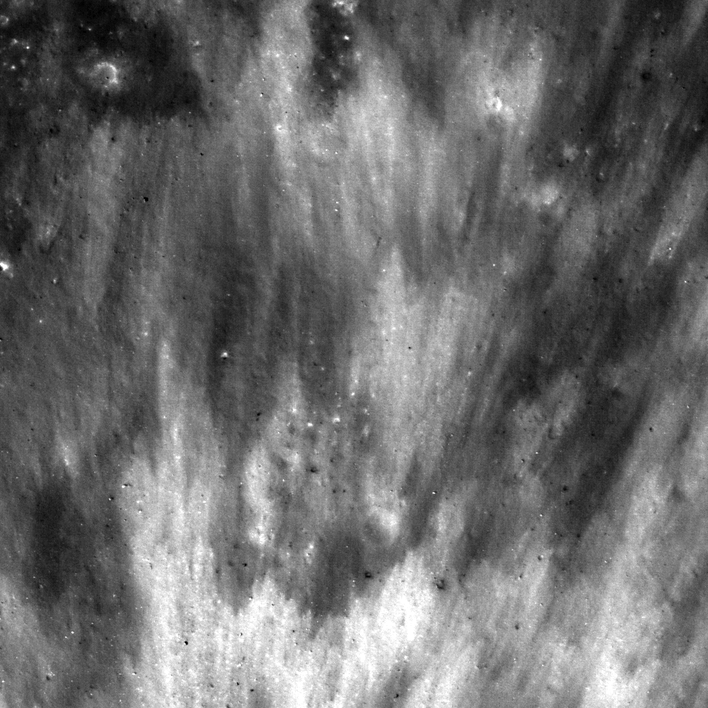
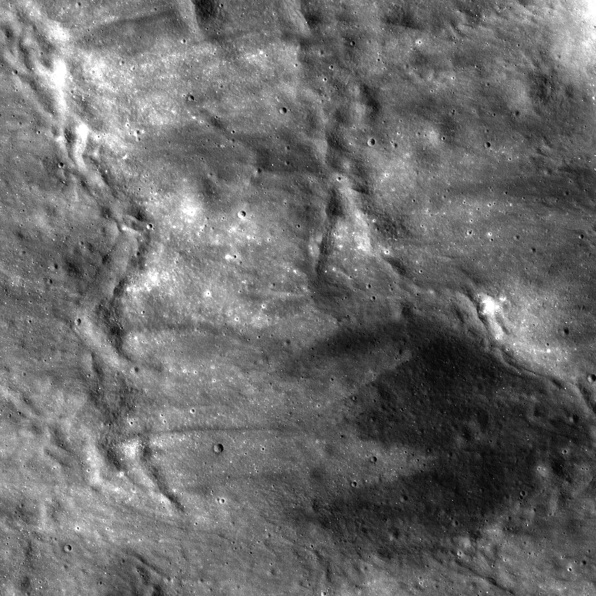
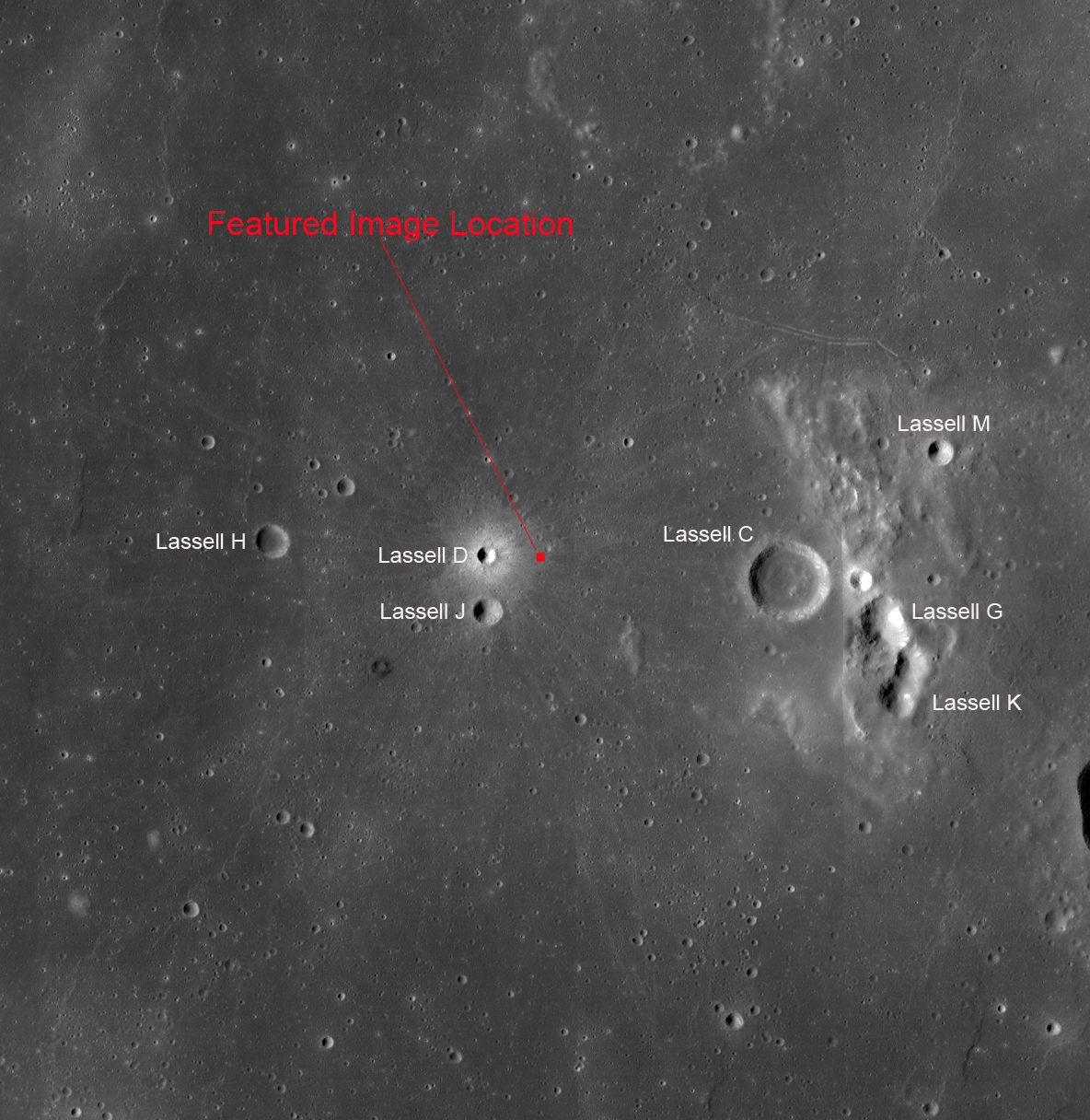
A variety of effects are still visible from this recent impact in Mare Nubium (14.60°S; 10.26°W). LROC Narrow Angle Camera (NAC) frame M111660844L, LRO orbit 1589, October 31, 2009; illumination from the east, north is up, from full field of view, approximately 1 kilometer wide, 51 cm per pixel resolution from 49.13 km altitude [NASA/GSFC/Arizona State University].
James Ashley
LROC News System

The complex geologic process of impact cratering often results in a diverse medley of landforms and other surface features. The more nuanced of these are best observed in fresh craters because the subtlest attributes of impacts are those most easily removed by space weathering. Lassell D crater (2 km diameter) has been described as "one of the freshest craters on the Moon" (Muller, et al., 1986). 

In the proximal (nearby) ejecta blanket we see a hummocky, streaked surface with dune-like forms, ribbon-shaped lobes, and an eye-catching admixture of low- and high-reflectance soils. Immediately following the high-energy of impact, advancing walls of ejecta hugged the ground and moved like a dry tsunami across this region.

The west interior and ejecta blanket of Lassell D. The area detailed in the LROC Featured Image is on the crater's eastern flank, outside the field of view above, capturing the rough, young crater's sharp features on an earlier pass. The 5 km field of view above is from a mosaic of the left and right frames of LROC NAC M135257059, spacecraft orbit 5066, July 31, 2010; incidence angle 59.64° at 50 cm resolution from 46.63 km [NASA/GSFC/Arizona State University].
The crenulations are the result of mechanical interactions of the moving debris with pre-existing topography. As the wave of rock and dust is arrested by this resistance, some portions of the debris continue flowing while others slow and stop moving. The result is a wavy landform, a cross-section of which might reveal how the lobes partially rode up and over each other, hence the descriptive term "imbricated deceleration lobes."

LROC Wide Angle Camera (WAC) mosaic as context, from original image 118 km-wide field of view, resampled with added contrast to, perhaps unnecessarily, bring out from the background the subtle fresh and widespread ray system of Lassell D [NASA/GSFC/Arizona State University].
As regolith redevelops and matures over the tens of millions of years to come, these features will gradually diminish. Which features would disappear first and why? Examine the full NAC frame HERE. Additional examples of fresh impact features can be found in Kamarov, Icarus, and The Lavish Lobes of Necho R.

Lassell D's affect on the Lassell Massif (above and below), to the east. The massif and crater group, a spectral "Red Spot," is speculated to be intrusions of silicate-rich lava characterized by a higher viscosity than the Moon's far more common pyroclastic domes. The feature shows a much lower iron-oxide concentration than the surrounding basalt plains and marks the southwest border of a high thorium signature. LROC WAC observation M129350040C (604nm) [NASA/GSFC/Arizona State University].
From a 2010 demonstration, animation of separate LROC WAC observations of the geologically interesting Lassell Massif and crater group east of Lassell D, showing the latter's fresh ray system intruding from the west. This is more easily discerned under a high Sun while topography is easier to view under a mid-morning Sun in the east-northeast. The bright, widespread ejecta streamers from Lassell D alternates with a visible chevron affect by the Lassell D pressure front [NASA/GSFC/Arizona State University].