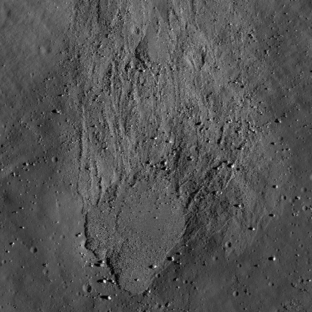
Friday, April 12, 2013

Bigelow, NASA rumored contracted for the Moon

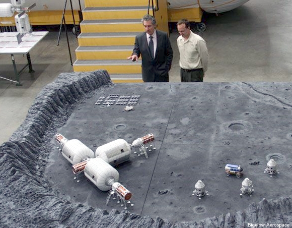
Robert Bigelow explains his moon base concept. Photograph by Bigelow Aerospace. HT: Astronwright ("Chronicles of someone trying to get off this rock.")
George Knapp
Las Vegas City Life

Business deals don’t get much bigger than this one. Have you ever read a contract that gives a governmental green light to a program to “place a base on the surface of the moon?” Ever see an agreement signed by the U.S. government that declares a specific goal “to extend and sustain human activities across the solar system?” Me, either.

Yet that is essence of an adventurous deal already reached between NASA and Las Vegas space entrepreneur Robert Bigelow. An official announcement is still a few days away and will likely happen during a news conference at NASA headquarters. In the meantime, I have a draft copy of what could be an historic contract, one that reads like a Kubrick screenplay or an Arthur C. Clarke story. It is flat-out otherworldly.

Bigelow made his fortune building apartment buildings and weekly-rental hotel rooms in Las Vegas. In 1999, he launched what must have seemed a pipe dream at the time — his own private space program. But within a few short years he stunned the aerospace world by launching two of his own locally built spacecraft, both of which still circle the Earth (and one of which contains my weightless, floating business card). The focus of Bigelow Aerospace is an expandable module, small and light enough to make for less expensive launches but so strong and durable when expanded to full size that it accomplishes what NASA has been unable to do on its own: It puts more space in space, that is, more room for companies and governments to work, live and conduct research.

Back in January, NASA bigwigs came to Bigelow’s main plant to announce a landmark deal that calls for one of Bigelow’s modules to be attached to the International Space Station (ISS) within two years. Bigelow used that occasion to let slip some even bigger news — the fact that he is spending $250 million of his own money to build a private space station, larger than the ISS, and that he plans to have it in low-Earth orbit by 2016. What few knew at the time was that he was secretly negotiating an even bigger deal with NASA, one that represents a fundamental, across-the-board change in our approach to space.

Read the full article HERE.

Bipartisan legislation sets NASA's focus on the Moon

George M. Cecala
Office of Representative Bill Posey
Cannon House Office Bldg.
U.S. House of Representatives

U.S. Representatives Bill Posey (R-FL), Sheila Jackson Lee (D-TX), Chairman Frank Wolf (R-VA), Robert Aderholt (R-AL), John Culberson (R-TX), Steve Stockman (R-TX), Pete Olson (R-TX), Rob Bishop (R-UT) and Ted Poe (R-TX) have once again reintroduced bipartisan legislation directing NASA to develop a plan for returning to the Moon and establishing a human presence there. The RE-asserting American Leadership in Space Act, or REAL Space Act (HR 1641), sets a clear course for NASA toward human space flight while keeping within current budgetary constraints.

“The Moon is our nearest celestial body, taking only a matter of days to reach,” said Rep. Bill Posey, who as a young man worked on the Apollo Program at the Kennedy Space Center. “In order to explore deeper into space—to Mars and beyond—a moon presence offers us the ability to develop and test technologies to cope with the realities of operating on an extraterrestrial surface.”

“Space is the world’s ultimate high ground, returning to the Moon and reinvigorating our human space flight program is a matter of national security. Returning to the moon would allow NASA to continue to develop technologies that have not only enhanced our exploration programs but have been applied across all disciplines of science,” said Rep. Sheila Jackson Lee.

“Last year, the National Research Council committee charged with reviewing NASA’s strategic direction found that there was no support within NASA or from our international partners for the administration’s proposed asteroid mission. However, there is broad support for NASA to lead a return to the Moon. So the U.S. can either lead that effort, or another country will step up and lead that effort in our absence -- which would be very unfortunate,” said Rep. Frank Wolf, Chairman of the House Commerce-Justice-Science Appropriations Subcommittee.

“Moon missions, both human and robotic, offer the United States true international cooperation, while ensuring that we lead from the front. Other nations, private industry, and government experts all regard the Moon as the right place for NASA to direct its resources. The time to reassert the United States as the leader in space is now and the REAL Space Act is the next step,” said Rep. Robert Aderholt.

“Congress should be committed to NASA and to expanding the frontiers of scientific progress. This bill is the correct path forward to get Americans to the Moon and expand human knowledge,” said Rep. Steve Stockman who represents the Johnson Space Center in Houston, Texas. “With a real destination and a realistic timetable, we can achieve our greatest dreams. Without it, we risk seeing our future plans perpetually delayed or cancelled, and only watching as other nations seize the lead in space exploration—and reap the benefits in jobs, inventions, investments, national pride and international respect. I urge my fellow Members of Congress to cosponsor this vital legislation, and I urge space advocates and organizations to join together in support of this bill and in support of the Moon being the stepping stone to Mars.”

Rep. Pete Olson said, “The REAL Space Act clarifies NASA's mission, something it has been lacking in recent years. Human space exploration is critically important to America's global future. President Kennedy understood that the real benefit of exploration to our nation was not landing men on the moon, but what it would take to get there — the technology, the initiative and the will to do it. He knew, as we know, that space exploration is both a scientific and national security priority. This legislation sets clear and achievable goals that will ensure America maintains global preeminence in both space exploration and scientific discovery.”

Rep. Rob Bishop said, “This legislation is not just about landing another human on the Moon. It is about restoring our nation’s now defunct human space flight program and setting clear and achievable goals that will lead to advancements in science and technology. If we are to be leaders in the exploration of the cosmos, to the Moon and beyond, we must have our own innovative resources to get there. It’s going to be next to impossible to maintain our preeminence in the exploration of space if we are having to hitch rides from other countries. Going back to the moon has always been an essential stepping stone for technology development for manned exploration to other parts of the galaxy. This legislation restores and clarifies NASA’s role in human space flight and sets the U.S. back on course to lead exploration of the cosmos.”

Specifically, the REAL Space Act directs NASA to plan to return to the Moon by 2022 and develop a sustained human presence there as a stepping stone for the future exploration of Mars and other destinations within our solar system. The legislation also emphasizes the importance of maintaining the United States’ preeminence in space, and underscores the necessity of preserving America’s independent access to space.

Returning to the Moon presents many scientific, technological and economic benefits for the United States and the world at large. The economic contribution of NASA’s space program is in the tens of billions of dollars. The technologies developed through and transferred from our nation's program have created advancements across all disciplines of science and advances in healthcare in particular have saved and enriched countless lives.

Aside from providing a training ground for space faring enabling technologies, humans still have much to learn from exploring the Moon. To date, twelve Americans have explored a section of our Moon smaller than the National Mall. There are many minerals, isotopes, and other natural resources that can be gleaned from the Moon’s surface such as ice deposits, which can be used to sustain an outpost or produce rocket propellant for deep space exploration.

Setting the Moon as the goal will reengage the public’s interest in the space program and inspire a new generation of American students to study science, technology, engineering, and mathematics (STEM) where they currently lag behind students in competitor nations.

Related:
General Bolden on the Moon (April 10, 2013)

Thursday, April 11, 2013

Squished Crater

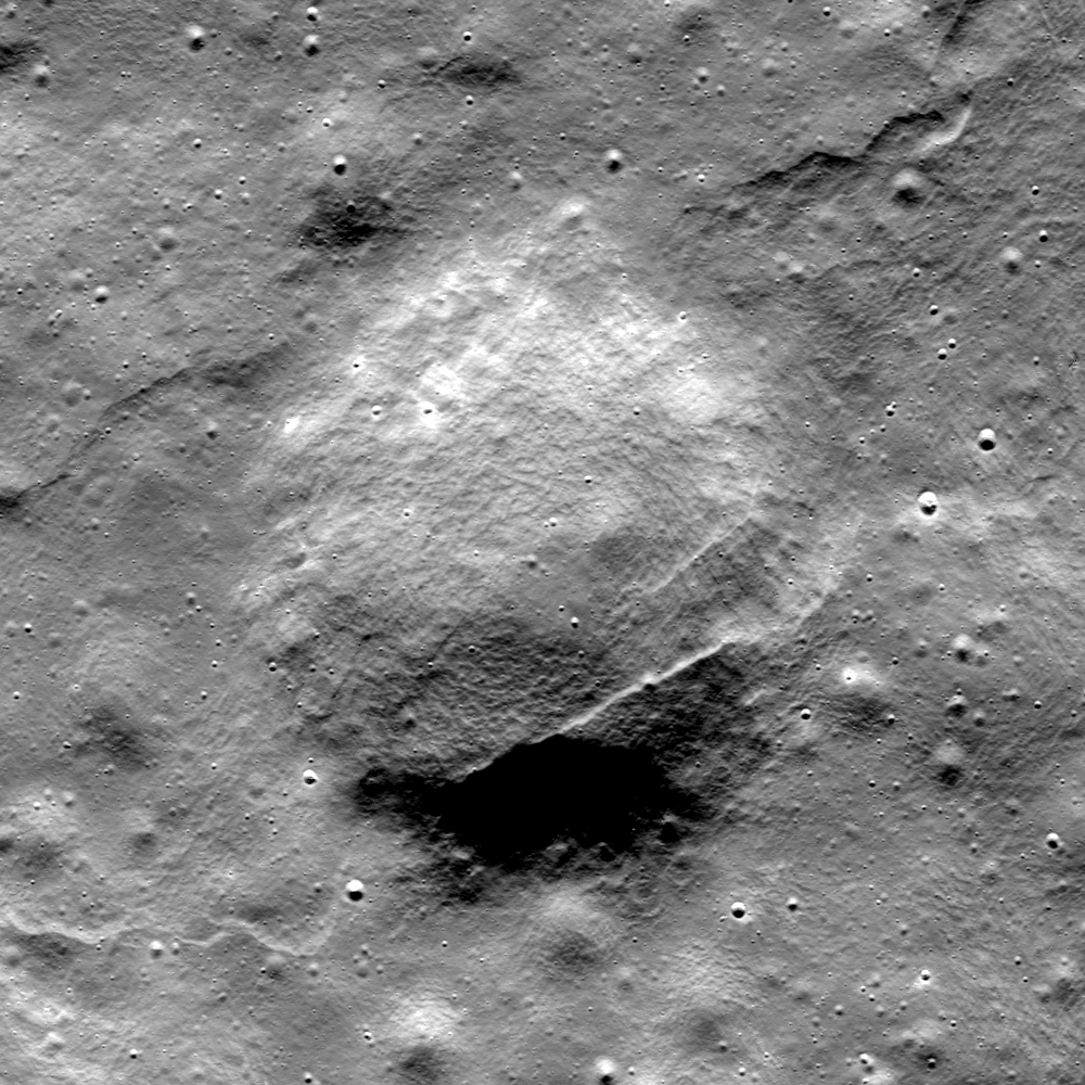
A lobate scarp cuts across and deforms an ancient impact scar on the floor of Seares crater in the far north of the farside highlands terrain. From a mosaic of LROC Narrow Angle Camera (NAC) frame M187315000L an R, field of view 1.95 km, angle of incidence 81.38° at 2.95 meters resolution from 143.54 kilometers [NASA/GSFC/Arizona State University].
Lillian Ostrach
LROC News System

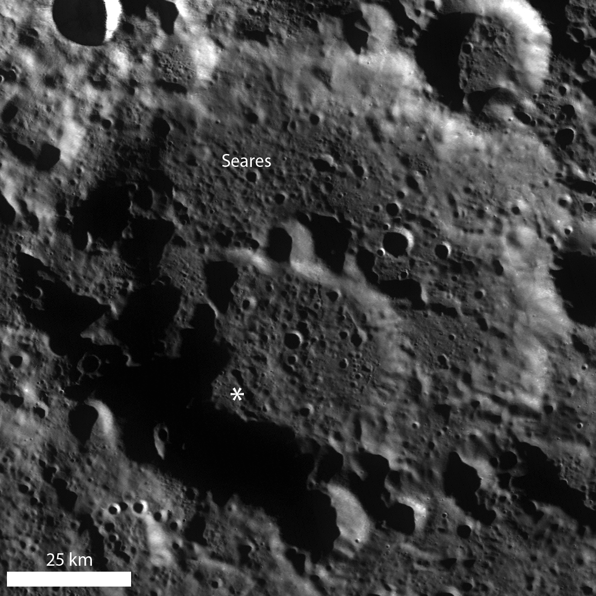
Lobate scarps, found almost only in the highlands, represent the surface expression of thrust faulting within the lunar crust. In the opening image, several segments of a lobate scarp deformed the Seares crater (75.529°N, 146.385°E, approximately 105 kilometers in diameter) floor material, including an unnamed 1.1 km crater (72.964°N, 144.897°E).

Based on the northeast/southwest trend of the lobate scarp segments, this area was probably under compression in the approximate northwest to southeast direction (squeezed from top left toward bottom right), creating bulges on the surface and squishing the crater.

LROC WAC monochrome mosaic of Seares crater. An asterisk notes the location of the opening image's field of view [NASA/GSFC/Arizona State University].
The squished crater is degraded, without a well-defined sharp rim, and it is difficult to determine with a quick glance just how much deformation occurred. Drawing a best-fit circle around the probable rim of the crater to use as a guide for many measurements of crater diameter is one way to estimate the amount of crater deformation. Using this method, the crater diameter is ~1.06 km if the measurement is based on a circle fitting the rim in the east-west direction, while a fit based on the north-south direction provides a diameter of ~1.13 km. Furthermore, the crater shape is somewhat square, which may indicate that this region was affected by ancient episodes of faulting - perhaps resulting from the Seares crater impact formation - that affected today's crater formation, similar to the structural influences that influenced the formation of Meteor Crater.

Put your eyes to the test! Can you find other cross cutting relationships involving the lobate scarp segments in the full NAC image, HERE?

Related Posts:
Scarps in Schrödinger
Relative age relationships
Simpelius Scarp
Offset Crater, Active Moon

Wednesday, April 10, 2013

Rim Slumping inside pre-Nectarian Gamov

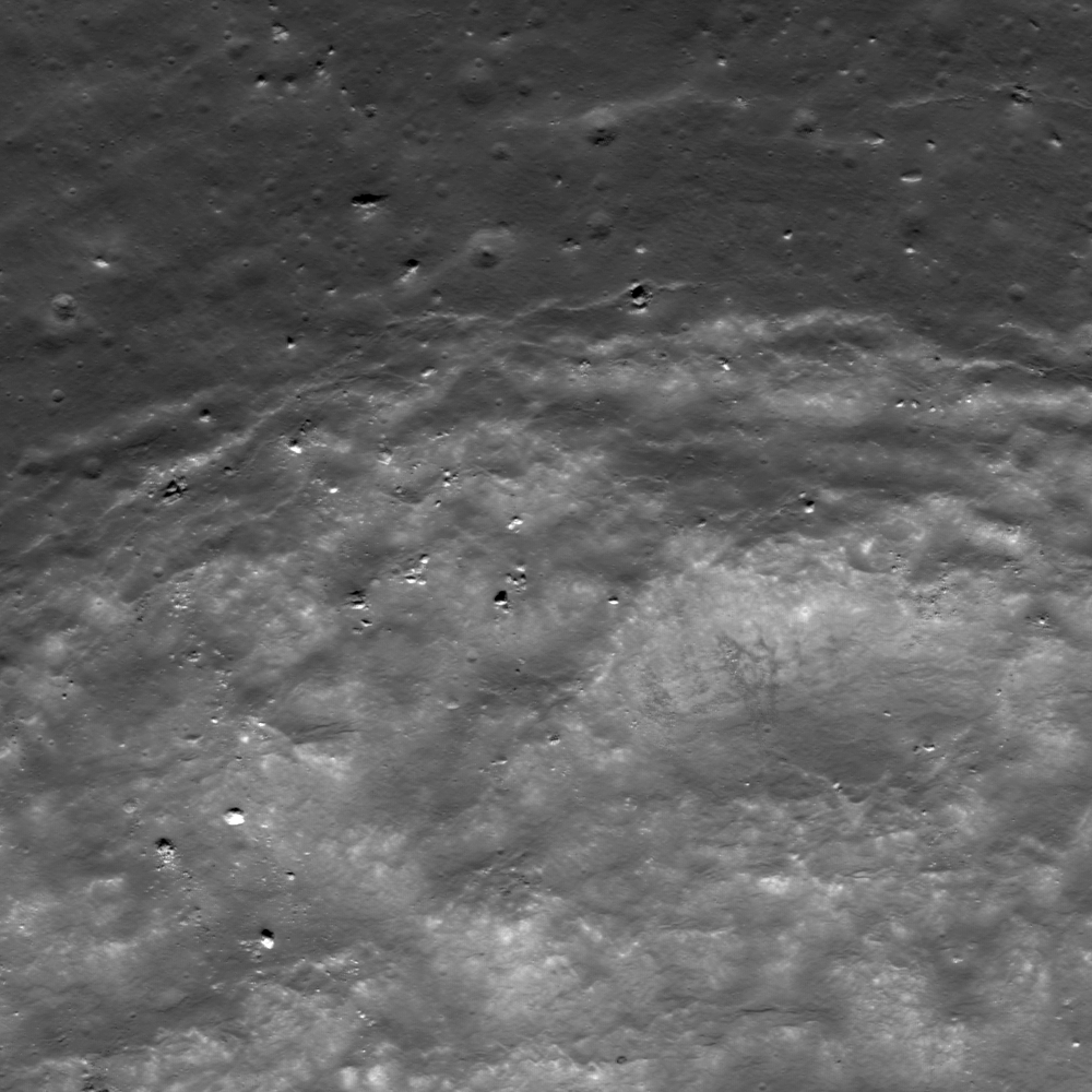
Faulting of a crater rim. Downhill to lower right, LROC Narrow Angle Camera (NAC) M187307653L & R, LRO orbit 12672, March 25, 2012; field of view approximately 1.9 km across, resolution 1.79 meters per pixel from 189.55 km [NASA/GSFC/Arizona State University].
Lillian Ostrach
LROC News System

Post-impact modification is frequently observed in LROC NAC images, because post-impact modification begins as soon as the impact crater has formed and ejecta emplaced. Impact crater formation is a violent process, so it should be no surprise that the target rock surrounding the impact site may be fractured and faulted, especially near the crater rim.

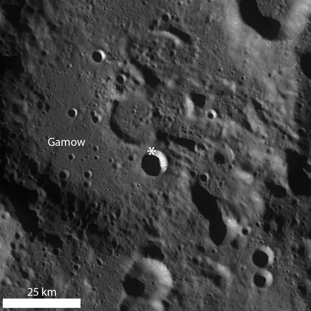
Today's Featured Image of the northern rim of an unnamed about 8.5 km diameter crater (64.754°N, 145.546°E) focuses on the faulted nature of the crater rim and evidence for mass wasting.

12.2 km wide field of view from the LROC NAC mosaic showing the entirety of the left and right frames of observation M187307653. The area highlighted in the LROC Featured Image further up is outlined by the white square [NASA/GSFC/Arizona State University].
The upper portion of the opening image is the outer flank of the crater, the fractures represent the crater rim "edge" (the lower portion of the image is the steep interior wall). As time passes and materials (blocks, fine-grained material) are dislodged from the rim and crater wall, the crater rim erodes and degrades, expanding outward (the diameter of the crater actually increases, while its depth decreases).

LROC Wide Angle Camera (WAC) monochrome mosaic highlighting a bowl-shaped crater superposed in pre-Nectarian Gamow crater. An asterisk denotes location of the area seen at high resolution in opening image [NASA/GSFC/Arizona State University].
Some examples of this "slope retreat" of the crater rim are very obvious, whereas others, like today's example, are less so. Today's example shows small-scale slumping of the crater wall as opposed to larger-scale slumping of massive portions of rim material. Perhaps the smaller size of this crater compared to other examples is the reason the slope retreat does not appear well-developed, or maybe the failure of rim faults is less pronounced due to pre-existing target properties (e.g., highly fractured nature of the highlands, impact into floor material of a larger crater, etc.).

Explore this farside simple crater for yourself in the full LROC NAC image, HERE.

Related Posts:
Top of the Landslide
On the Edge
Posidonius Y

General Bolden on the Moon

EDITORIAL : The Space Community experienced a minor brush fire late last week, set accidentally perhaps, by NASA administrator Charles Bolden and his reaction to the National Research Council's congressional-commissioned review of NASA’s "strategic vision."

It’s a sad fact of American politics that the release of the NRC report might have passed largely unnoticed had Bolden been as cryptic about the Moon’s place in NASA’s future as the rest of the administration has been from is beginning.

Instead he confirmed for us one line of reasoning into the administration’s actual rationale for erasing the Moon from National Space Policy, three years ago.

“I don’t know how to say it any more plainly,” Bolden said. “NASA does not have a human lunar mission in its portfolio, and we are not planning for one.”

He warned the next administration not to change course “again” back to the Moon. That would mean, he said, the U.S. would “never again see Americans on the Moon, on Mars, near an asteroid, or anywhere. We cannot continue to change the course of human exploration.”

“NASA will not take the lead on a human lunar mission,” Bolden said. “NASA is not going to the Moon with a human as a primary project probably in my lifetime,” because “we can only do so many things, and NASA’s focus will remain on human missions to asteroids and Mars.”

“All that was 'a given,' three years ago,” Apollo 17 commander Gene Cernan said afterward on Tuesday, perhaps forgetting along with General Bolden, that "going to the Moon as a primary project" has not been a goal of the American government since 1969, and this was never "a primary project" of the Vision for Space Exploration in 2004 or of those who recognize the Moon's strategic and scientific value and who still support restoring the Moon back into scientific context today.

On the surface there did seem little that was new in Bolden’s protests. All the superficial reasons for dropping the Moon as an intermediate objective on the way to Mars spread abroad by the administration and its supporters still make little sense. No one who seriously supported a return to the Moon as an essential objective on the way to Mars ever hoped simply to recreate Apollo. 

And if it’s asteroids you want, the Moon has been an asteroid magnet for about 4.575 billion years.

Aside from the glaring hole left by having had the Moon erased from National Space Policy, three years after the cancellation of Constellation, America's deep space efforts are really little different from what they were at the end of the Bush administration, with little actual progress having been made not already set in motion before President Obama's Inauguration.. 

Aside from the missing Altair lander, and the R&D required to build it, together with a simple recognition of the Moon’s clear strategic value in overcoming tremendous technological challenges facing any manned mission to Mars, very little has actually changed.

The end goal of landing astronauts on Mars, someday, some way, in budgetary “out years,” is still the same, as was retiring the Space Shuttle and planned development and use of commercial transportation to ISS. These were integral to the Vision for Space Exploration introduced in 2004. Though some seem determined to credit the administration with having dreamed up subsidized commercial space, and certainly for popularizing the idea, that too was integral to the VSE and as far as presidents go the initiative dates back to Ronald Reagan.

From a political perspective, with unwitting help from General Bolden, we no longer have to simply make educated guessed as to why the Moon was edited out of NASA’s strategy. As it turns out, it was not the “been there, done that” argument offered by the President, after all..

Bolden has finally confirmed for us one line of investigation into the mysterious missing Moon by simply telling us that the Obama administration just does not want the American governmentto take the leadon any manned return to the Moon.

Thus, it was a political decision, dressed up and oversold with some of the tired arguments originally heard forty years ago.

That's not a crime, of course. Thankfully Bolden has also communicated that the administration is not opposed to "leading from behind" on a manned mission to the Moon, perhaps lead by a different nation, nor does he rule out robotic exploration, though the nation has so far committed only to finishing or fulfilling the precursor robotic lunar missions that were either already underway or already long in the pipeline.

We are genuinely grateful the administration appears unwilling to stand in the way of any commercial manned or unmanned landings in the Moon.

But why this passionate and now very specfic opposition to America leading while exploring and using the Moon as a stepping stone to Mars and as a Rosetta Stone for the rest of the Solar System?

In light of all the other alterations made to the President's 'asteroid initiative' over the past three years, was the administration's unyielding position the original and still primary reason the whole Constellation program was cancelled?

The Moon, and those of us still urging policy makers to take another look at its advantages over manned asteroids exploration, are apparently occasionally being heard in the White House. In the past three years the administration has occasionally floated tantalizing trial balloons, future efforts involving the Moon, but specifically without any  human landing.

One thing is different in the past three years. The small flotilla of remote sensing spacecraft, from Japan, China and India, as well as the U.S. sent to the Moon, and inspired by the lead America had taken with in 2004, after a long national drought five American spacecraft in lunar orbit simultaneously for most of this past year, and planetary scientists have learned more about the Moon since 2004 than in the two decades previous.

This new look at the Moon has by now strongly confirmed the Moon's strategic importance and its usefulness to science, and as a logical support for future manned missions to Mars.
"Just after it has been relegated to a “been there, done that” status, the Moon again shows us we have a lot to learn about its history, physical state and the potential value of its resources. We must take the initiative to learn more as the Moon is crucial in developing and advancing a sustainable space faring infrastructure." -   Paul D. Spudis

Why then, like Arthur C. Clarke’s Europa, are American astronauts to “attempt no landing there?” If we are taking the lead going to Mars, our role in a return to the Moon along that path would seem to be irrelevant.

This much is clear. Leaving the Moon out as an intermediate goal, as a place where America already has a momentary and essential lead, is a stubbornly held position dear to the administration.From Bolden’s statements late last week one might think someone had suggested NASA’s strategy for building a path to Mars should be renamed back to “Constellation.”

Though only occasionally experienced, if America’s history and the nation's storied history of manned space exploration has succeeded in teaching us anything it has taught history has a very tight turning radius.

John Moore's "Watered Moon"


John Moore has a new video quite different than what we've posted of his work previously. About the video above he recommends:
"Several theories abound as to the Moon's formation. One in particular is 'The Giant Impact Theory', which suggests a Mars-sized object struck our proto-Earth, and ejected vast amounts of material that later accreted to form the Moon. The two worlds developed quite differently over time -- one sustaining [life as we know it], the other a barren landscape completely indifferent to our natural needs. Central to formation of life on Earth was water, which fueled the diversity of life at every level. For the Moon, however, it wasn't to be so. But what if the conditions were just right, and water could sustain on the lunar surface, what then would have been the outcome? Let's see..."
Without unnecessary delay, we'll include the following additional work by John, though it deserves its own post with explanatory illustrations. It deserves its own Poster. As it is, we include links to earlier related posts since these two extremities of lunar elevation, first identified by Japan's Kaguya investigators and refined by American teams using data from LRO, have been of particular interest here.


Related Posts:
Oblique views of the Moon's highest and lowest places (October 3, 2012)
View from Vavilov (January 31, 2012)
DLR: Flying over the three-dimensional Moon (December 1, 2011)
LROC's new Global Lunar Topography (November 16, 2011)
LOLA's deep Antoniadi (April 16, 2011)
LRO's unprecedented topography of the Moon (December 17, 2010)
Highest point on the Moon (October 26, 2010)
The deepest spot on the Moon nearly wasn't (September 17, 2010)
Lunar superlatives from LROC WAC (September 6, 2010)
The Moon's lowest of the  low (November 24, 2009)
Accurate topographic map of the Moon (June 13, 2009)
Spectacular refinements to Kaguya laser altimetry (May 28, 2009)
Best lunar topography derived from Kaguya (February 12, 2009)

Monday, April 8, 2013

The Mystery of Shackleton Crater

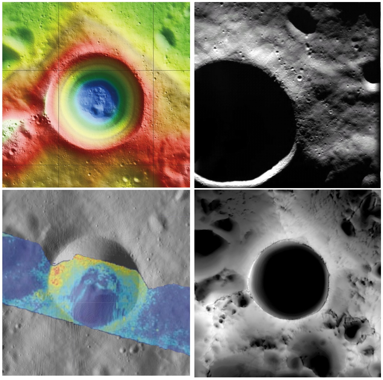
Shackleton crater, Earth's Moon. Clockwise from top left: topography from (LOLA) laser altimetry, photography from ESA SMART-1 mission, lighting map (relative isolation - brighter indicates longer periods of illumination) from LROC data, Mini-RF Circular Polarization Ratio (CPR) image draped over shaded relief. The crater is about 20 km across.
Paul D. Spudis
The Once and Future Moon
Smithsonian Air & Space


Though unremarkable in appearance compared to the roughly 4,000 craters on the Moon in its size range, the 20 km diameter crater Shackleton has been the source of relentless scientific controversy for the past 20 years.  Shackleton is located at the south pole of the Moon; indeed, its near side rim is the precise location of the geographic pole itself.   Its location makes observation by Earth-based telescopes difficult and it was not well photographed by the Lunar Orbiter series (our principal source of lunar images) of the 1960s.  That all changed in 1994 with the flight of the joint DoD-NASA mission to the Moon, Clementine.

Clementine carried cameras that globally imaged the Moon in eleven visible and near-infrared wavelengths.  In addition, it mapped the surface and lighting of the poles of the Moon at uniform resolution over the course of almost three lunar days (74 Earth days).  When the Science Team first saw the south polar mosaic, the extent of darkness in the map was striking.  Because the Moon’s spin axis is close to perpendicular to the ecliptic plane, the Sun is always at the horizon at the lunar poles.  Instead of rising and setting, the Sun circles around the poles at or near the horizon.  Because of this grazing incidence, an area in a topographic depression may be in permanent shadow.  And so it appeared for Shackleton crater in the Clementine data, setting off bells in the heads of the Science Team.

Intuitive selection from HDTV still frame captured by Japan's lunar orbiter SELENE-1 (Kaguya) in 2008 shows Shackleton, with the Moon's south pole on its rim (upper left) in relation to Earth and Malapert Massif, part of the nearside rim of the ancient South Pole-Aitken impact basin, along the line of sight. Shackleton's interior and the craters between it and Malapert, are permanently shadowed interiors (PSR), unmapped before the 21st century [JAXA/NHK/SELENE].
A key controversy of the post-Apollo era was whether the lunar poles might contain water or not.  Although the Apollo samples had been studied and found to be “bone-dry,” we had not been to the poles on any Apollo mission.  We knew that any shadowed areas had to be extremely cold as well as permanently dark.  As water-bearing debris in the form of asteroids and comets constantly strike the Moon, it was thought that some of that water might get into a polar “cold trap” and would be kept there (essentially) forever – billions of years of impacting cosmic “debris” can add up.

Clementine was not configured to measure the presence of water, but a cleverly improvised experiment used the spacecraft’s data transmitter to beam radio waves into the dark regions near the poles and listen to their reflected echoes on the enormous (70 m) dish antenna of NASA’s Deep Space Network.  Interestingly, the reflections indicated an enhancement of “same sense” polarization within the (very large) resolution cell that contained Shackleton crater.  A collect of data from a nearby sunlit area (taken as an experimental control) did not show this peak.  The Clementine team interpreted the RF peak as evidence for the presence of a few percent water ice within the dark, cold interior of Shackleton crater.  The media quickly spread the startling news about water on our “bone-dry” Moon.

Shackleton, as seen in a joint 70 mm radar experiment collected by radio telescopes at Greenbank and Arecebo during a favorable libration opportunity in 2006.
Such a controversial conclusion did not go unchallenged.  Some in the radar community argued that abundant wavelength-sized rocks on the surface were the source of the enhanced same sense reflection.  Since the lunar surface is indeed rocky, this interpretation could not be ruled out.

Then a few years later, the Lunar Prospector (LP) mission found an enhancement of hydrogen concentration at both poles of the Moon; as hydrogen is a major constituent of water, the idea ice exists in the dark areas gained credence and has lead to a decade-long scientific search (using a variety of techniques) for lunar polar ice.  Though many areas near the poles were studied in detail, attention continued to be drawn back to Shackleton and the area near the south pole.

From studying Clementine images, we discovered that part of the rim crest of Shackleton is one of the most sunlit areas on the Moon.  Now we had a double-attraction: constant sunlight with water ice nearby.  At a press briefing in 1996, I called this area of water and sunlight “the most valuable piece of real estate in the Solar System.” Nothing found subsequently has changed my mind on that judgment.

So what have we learned about Shackleton lately?  Many different, new sensors have flown to the Moon in the last few years, including radar, ultraviolet (UV) imaging, laser reflections, and low-light level imaging.  And yet again, Shackleton crater continues to confound us with contradictory evidence, both for and against the presence of water ice in its interior.

In 2009, the question regarding the presence of water ice somewhere near the lunar south pole was answered when the LCROSS impactor threw up a cloud of water vapor and ice particles during its collision with the floor of the nearby crater Cabaeus.  Spectral mapping instruments on three different spacecraft (Chandrayaan-1, Cassini, and EPOXI) documented the presence of adsorbed water on the lunar surface, increasing in concentration with latitude toward both poles.  A small impact probe flown by India (MIP) passed through a water vapor zone in the exosphere just above the lunar south pole.  And radar images from Mini-RF, our radar imaging experiment on both Chandrayaan-1 and Lunar Reconnaissance Orbiter (LRO), found evidence of high same sense reflections (just as Clementine had suggested in 1994) within the interior of Shackleton crater.
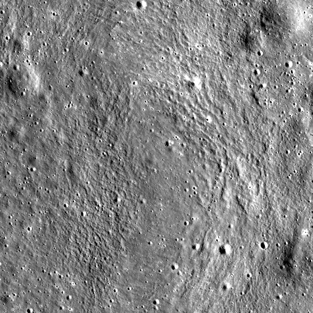
LRO Mini-RF instrument radar data indicate the walls of Shackleton crater may, indeed, hold ice, confirming exacting measurements of laser altimeter (LOLA) point brightness studies revealed in June. Actual observations (CPR) are compared to calculated radar values for 0.5% to 10% ice. Illustration to post "Mini-RF adds to evidence of ice on Shackleton walls," September 1, 2012 [NASA ].
These new lines of supporting evidence were countered by Japanese researchers, whose Kaguya spacecraft imaged the interior of the crater and found morphology similar to other lunar craters in the same size-class.  But no one had ever claimed that the interior of Shackleton was a skating rink of pure ice – the lunar polar ice is partly covered by waterless dust and mixed with an unknown amount of dry regolith.

Interpretation of the new data continues to vex us.  The LOLA (laser altimeter) team on LRO recently published a paper that documents the high reflectivity (at 1 micron wavelength) of the walls of Shackleton.  Although the team’s favored interpretation is that this is caused by a constant exposure of fresh material on a steep slope, they also note that it is consistent with the presence of water ice on the walls of the crater.

In addition, a team analyzing neutron spectrometer data from both LP and LRO found evidence in the fast neutron data (never before analyzed) that water in the interior of Shackleton is a possible explanation for its signal.  Detailed analysis of the Mini-RF data for Shackleton corrected for its steep wall slopes and found that the presence of 5-10 wt.% water there provides the best model fit to the observed data.  Newly obtained UV images from LRO show the existence of water frost in the interiors of the craters Haworth and Shackleton, and the neutron detector on LRO shows enhanced hydrogen within both Shoemaker and Shackleton craters.  The Japanese team from Kaguya continue to insist that the no-ice interpretation is the correct one.

So we are left with a mystery.  Some evidence is pro-ice and some is contra-ice.  I find it interesting that for most of the investigators, new data does not necessarily change any minds, but tends to be interpreted in a way most favorable to their previously published ideas.  This should not be terribly surprising; the people who have argued for some specific interpretation presumably did so for good reasons and desire hard and clear-cut evidence to the contrary before abandoning a previously held position, one no doubt reached after much thought and soul-searching.

Less so, but still-mysterious Shackleton, "twice as deep as the Grand Canyon," from "Tour of the Moon," a 2:30 video prepared by the Science Visualization Studio (SVS) at Goddard Space Flight Center in 2012 [NASA/GSFC/SVS].
The way to unravel the water-ice mystery is to go to the surface of the lunar south pole (or both poles) and measure the composition of the surfaces in question.  Getting a definitive answer about the nature of lunar water would be game changing.   Some say the bigger mystery is:  Why hasn’t the United States sent a rover to the south pole of the Moon to take a closer look?

Originally published April 8, 2013 at his Smithsonian Air & Space blog The Once and Future Moon, Dr. Spudis is a senior staff scientist at the Lunar and Planetary Institute. The opinions expressed are those of the author but are better informed than average.

Related Posts:
Mini-RF adds to evidence of ice on Shackleton walls (September 1, 2012)
Shackleton harbors ice after all (June 12, 2012)
1000 Day Anniversary of LROC Imaging (March 27, 2012)
Shackleton on a Summer's Day (March 26, 2012)
Shadowed fluffy lunar frost detected in starlight (January 14, 2012)
Shackleton: Out of the Shadows (September 17, 2009)

Saturday, April 6, 2013

Do large impacts always erase surface mineralogy?

Our present all-encompassing view of the nearside landmark lunar crater Copernicus seems only a little different than the best photography from Earth. Only 20 degrees west and less than 10 degrees north of the 'center' of the Moon's tidally-locked hemisphere, the round rim appears only slightly oblong from angle seen from our backyards. Its general brightness, both inside and out, wash out much of the detail seen in this LROC Wide Angle Camera (WAC) monochrome (649 nm) montage made up of observations in six orbital passes in January 2010. Long recognized differences can easily be confirmed between the northwest quadrant and the remaining three-quarters of the crater floor may be more extraordinary than previously believed possible [NASA/GSFC/Arizona State University].
EDITORIAL NOTE: One of a handful of features on the Moon's nearside detectible to the naked eye, it's amazing what there is still to be learned about the majestic crater Copernicus. Not as young and bright as Tycho, with rays streaming over an entire hemisphere, it's rays are impressive enough and the larger Copernicus is distinctive enough be the namesake for an entire lunar Age, the "Copernican," the Moon's most modern period, encompassing features less than about 1.1 billion years old.

This has made the Copernican family of excavations very valuable to planetary scientists who utilize Earth's Moon as the Rosetta Stone of the Solar System (and, increasingly, our Earth - the planet with which it has shared precisely the same space in the universe for approximately 4.575 billion years.

Most likely mapped first by Galileo, the 93 kilometer impact crater has since his time been drawn and redrawn with with increasing precision and appreciation. Since the 19th century, and definitely since the latter half of the 20th century, Copernicus may be the lunar crater most individually photographed from Earth. A highly oblique orbital image captured from Lunar Orbiter 2, November 24, 1966, is one of only a handful of images popularly celebrated as a "Photograph of the Century." 

Detail (highly resampled) from Lunar Orbiter 2-162, oblique view from 26 km over the lunar surface south of Copernicus crater, November 24, 1966 [Moonviews].
That delicate telemetry was recovered and reprocessed by the phenomenal Lunar Orbiter Image Recovery Project (LOIRP) in 2009. Without question, we have learned a great deal about the Moon since 1957, but, until recently, not very much more about Copernicus crater than might have been inferred using a decent telescope here on Earth. It's complexity and subtle albedo has defied definitive understanding.

We have known for some, for example, it has at least two (or three) central peaks, and mulled over tantalizing indications of a twin set of widespread rays - hinting at a near simultaneous double impact. High-resolution analysis of its wide interior achieved greatest progress in study of the continued arrival of unambiguously remote sensing from India's Chandrayaan-1 and the U.S. Lunar Reconnaissance Orbiter (LRO) after beginning its on-going mission in close polar orbit in 2009. 

Hints that the northwest quadrant of its interior floor is very distinct from the remaining three-fourths slowly have finally come into focus, hopefully to stay.

The demarcation between the character of the western and eastern north floor of Copernicus has just become more obvious as images from LRO continued to improve. Those differences are particularly striking in spectral analysis, by the Clementine orbiter in 1994, for example. LROC WAC observation M147109260CE (643 nm), spacecraft orbit 6813, December 16, 2010; angle of incidence 77.97° at 60 meters per pixel resolution, from 43.13 km [NASA/GSFC/Arizona State University].
Now the distinguished lunar and planetary scientist Carle Pieters and a team at Brown University have added another set of clues to sharp lines from remote sensing of the northwest quarter of the floor of Copernicus that might have everyone refining or completely revising set theories about what happens in those fantastic and brief hours immediately following a highly energetic crater-forming impact.

Pre-existing mineral deposits on the Moon (sinuous melt, above) have survived impacts powerful enough to melt rock. Not detectable in the crater image (inset), deposits are visible only in light at certain wavelengths [NASA/Deepak Dhingra].
Brown University — April 2 — Despite the unimaginable energy produced during large impacts on the Moon, those impacts may not wipe the mineralogical slate clean, according to new research led by Brown University geoscientists.

The researchers have discovered a rock body with a distinct mineralogy snaking for (28.9 km) across the floor of Copernicus crater, a 60-mile-wide hole on the Moon’s near side. The sinuous feature appears to bear the mineralogical signature of rocks that were present before the impact that made the crater.

The deposit is interesting because it is part of a sheet of impact melt, the cooled remains of rocks melted during an impact. Geologists had long assumed that melt deposits would retain little pre-impact mineralogical diversity.

Large impacts produce giant cauldrons of impact melt that eventually cool and reform into solid rock. The assumption was that the impact energy would stir that cauldron thoroughly during the liquid phase, mixing all the rock types together into an indistinguishable mass. Identifying any pre-impact mineral variation would be a bit like dumping four-course meal into a blender and then trying to pick out the potatoes.

But this distinct feature found at Copernicus suggests that pre-existing mineralogy isn’t always blended away by the impact process.

“The takeaway here is that impact melt deposits aren’t bland,” said Deepak Dhingra, a Brown graduate student who led the research. “The implication is that we don’t understand the impact cratering process quite as well as we thought.”

Close up view of the feature marked with light green, designated "Surrounding Melt (Fe-Ca rich Pyroxene)" in the study illustration immediately above. LROC Narrow Angle Camera (NAC) observation M175408129R, spacecraft orbit 10984, November 8, 2011; resolution 41 cm per pixel from 26.06 kilometers [NASA/GSFC/Arizona State University].
The findings are published in online early view in the journal Geophysical Research Letters .

Copernicus is one of the best-studied craters on the Moon, yet this deposit went unnoticed for decades. It was imaging in 83 wavelengths of light in the visible and near-infrared region by the Moon Mineralogy Mapper — M3 — that made the deposit stand out like a sore thumb.

M3 orbited the Moon for 10 months during 2008-09 aboard India’s Chandrayaan-1 spacecraft and mapped nearly the whole lunar surface. Different minerals reflect light in different wavelengths at variable intensities. So by looking at the variation at those wavelengths, it’s possible to identify minerals.

In the M3 imaging of Copernicus, the new feature appeared as an area that reflects less light at wavelengths around 900 and 2,000 nanometers, an indicator of minerals rich in magnesium pyroxenes. In the rest of the crater floor, there was a dominant dip beyond 950 nm and 2400 nm, indicating minerals rich in iron and calcium pyroxenes. “That means there are at least two different mineral compositions within the impact melt, something previously not known for impact melt on the Moon,” Dhingra said.

It is not clear exactly how or why this feature formed the way it did, the researchers say. That’s an area for future study. But the fact that impact melt isn’t always homogenous changes the way geologists look at lunar impact craters.

“These features have preserved signatures of the original target material, providing ‘pointers’ that lead back to the source region inside the crater,” said James W. Head III, the Scherck Distinguished Professor of Geological Sciences and one of the authors of the study. “Deepak’s findings have provided new insight into the fundamentals of how the cratering process works. These results will now permit a more rigorous reconstruction of the cratering process to be undertaken.”

Carle Pieters, a professor of geological sciences at Brown and the principal investigator of the M3 experiment, was one of the co-authors on the paper, with Peter Isaacson of the University of Hawaii.

Thursday, April 4, 2013

Downhill creep or flow on the floor of Vitello?

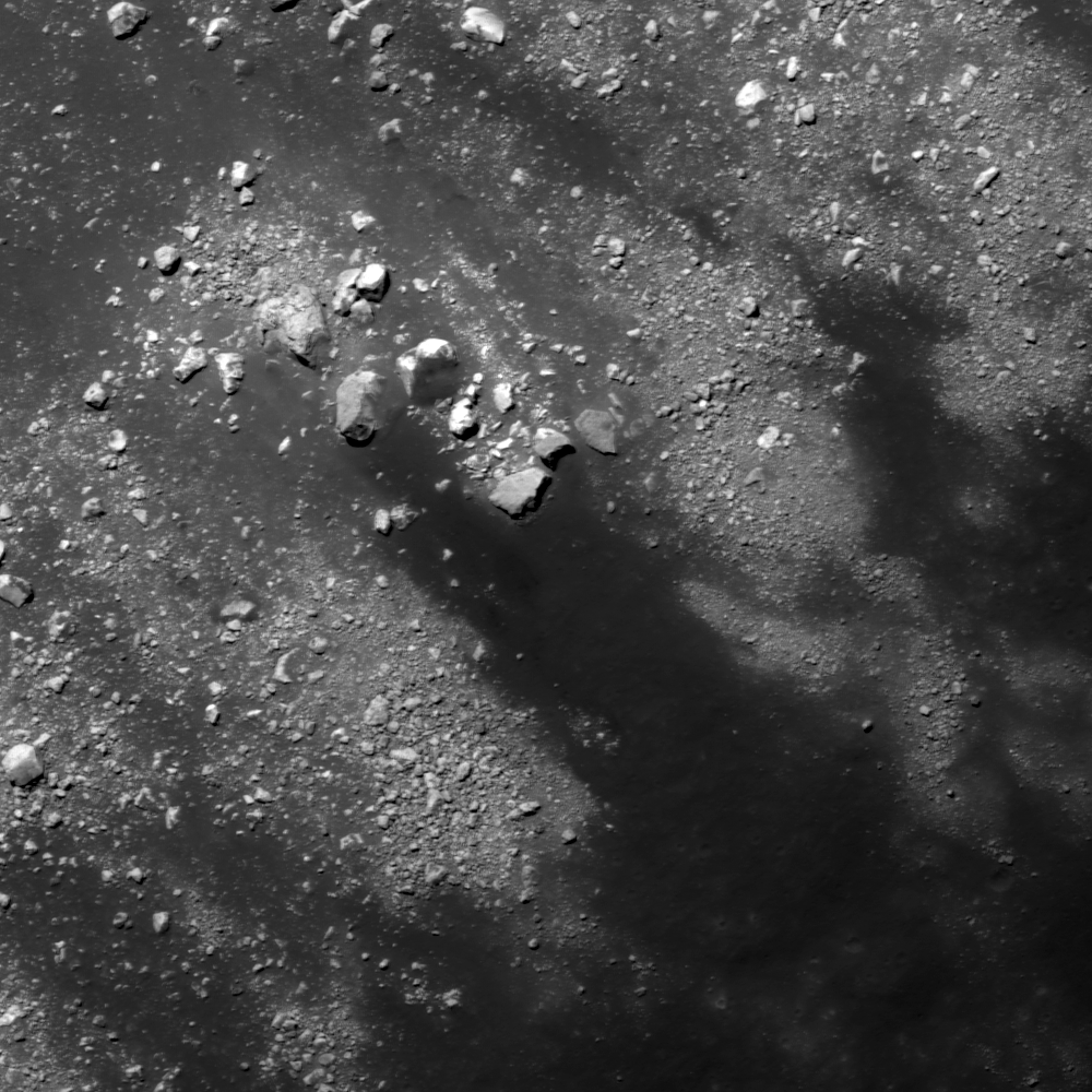
Southern slope of a fracture developed in the floor of Vitello crater, on the south side of Mare Humorum. Downward slope is toward upper left in a 640 meter wide field of view centered on 30.214°S, 322.352°E, LROC NAC M1101460425L, LRO orbit 14652, September 5, 2012; angle of incidence 31.65° over 0.64 meters resolution, from 61.86 km  [NASA/GSFC/Arizona State University].
Hiroyuki Sato
LROC News System

Vitello crater is a floor-fractured crater (42.5 km in diameter), located at the south edge of Mare Humorum.

As seen in the LROC Wide Angle Camera (WAC) context view further down, there is a circular network of fractures, with numerous branches, throughout the crater floor.

The opening images (above and immediately below) highlights a portion of north facing slopes inside one of these fractures (yellow box and arrow).

Full with of LROC NAC M1101460425L, from the corrected exploration link at the bottom of this post. The yellow square encompasses the area within the LROC Featured Image, released April 4, 2013 [NASA/GSFC/Arizona State University].
The dark materials on the floor of the crater partially cover the upper part of this fracture. The dark materials extend from the bottom right to upper left and are detoured around of a large boulder (30 by 20 meters) at the center of opening image, indicating that these materials flowed down the slope. With occasional events of slope failures or meteorite impacts, they might have flowed at once or little by little over a long period of time. But of what is this dark material composed?

The origin of floor-fractured craters on the Moon is still under discussion, but volcanic intrusions are suspected, and some of the fractures are associated with Dark Mantle Deposits (DMD), that are likely pyroclastic in origin. In Vitello crater, no clear DMD have been documented. But since the circular cracks are well developed in this crater, pyroclastics or any low reflectance materials of volcanic origin might have covered the fractured floor surface, supplying the dark materials flowing into the open cracks as seen in the opening image. 

Vitello crater and surrounding areas in LROC WAC monochrome (604nm) mosaic (70 meters per pixel) centered on 30.393°S, 322.43°E, stitched from three LROC WAC observations, from three sequential orbital passes, February 6, 2010, from just above 50 km altitude. The locations of area  in the LROC Featured Image (yellow arrow) is indicated once again [NASA/GSFC/Arizona State University].
Explore the slopes of the floor-fractured crater on the Moon in full NAC frame yourself, HERE.

Related Posts:
Rimae Posidonius
DMD Excavations
Pyroclastics and Vent
Pyroclastic Excavation
Pattern of dark deposits
Alphonsus crater mantled floor fracture
Low Reflectance Deposits on the Lassell Massif

Beautiful ejecta patterns from a very young crater

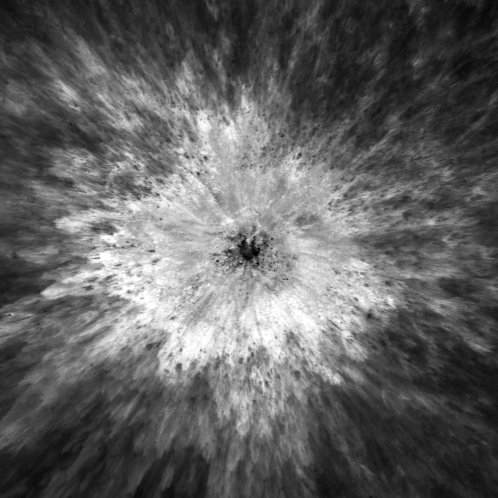
Unnamed, very fresh crater on the north side of Mare Fecunditatis, near 3.637°N, 48.93°E and a field of view about 1400 meters across; under a high Sun (illumination incidence angle 13.5° - LROC Narrow Angle Camera (NAC) M187921190LR, LRO orbit 12758, April 1, 2012; native resolution 0.93 meters per pixel from 108.16 kilometers [NASA/GSFC/Arizona State University].
Hiroyuki Sato
LROC News System

Today's Featured Image highlights an unnamed small crater (roughly 180 meters in diameter) at the northern edge of Mare Fecunditatis, near the Catena Taruntis.

The strong reflectance contrast between the ejecta deposit and the surrounding background in the opening image suggests that this crater is still very flesh and young.

The low reflectance materials in the center of this crater are probably impact melts or a different rock type in the subsurface that was excavated by the impact. The numerous dark dots intermixed with the high reflectance ejecta might be same dark materials as the one on the crater floor, or more likely secondary craters excavating the background mature material.

A step backward to reveal a roughly 4 km field of view from the same mosaic of the left and right frames of LROC NAC observation M187921190, showing the delicate widespread bright field of rough ejecta - against the very optically mature surface of Fecunditatis
This beautiful ejecta field consists of numerous lobes systematically piled on the top of adjacent outer lobes, resulting in a view like a stop motion picture of the impact event. Apparently, ejecta that landed far away from the impact center settled on the ground earlier than the portion that traveled a shorter distance. High resolution images of these very fresh craters supply key information about impact cratering, which improves our knowledge of the craters and helps to reveal the history of any airless planetary bodies in our solar system. 

Footprint of LROC NAC M187821190L (on the right) and R (on the left). An LROC Wide Angle Camera montage assembled using the new LROC Lunaserv online application [NASA/GSFC/Arizona State University].
Explore this beautiful fresh crater on Mare Fecunditatis in full NAC frame yourself, HERE.

Tuesday, April 2, 2013

Melt or Rubble in Carrel Crater?

Debris pile at the bottom of north wall of Carrel crater (downslope toward bottom). Image center near 10.846°N, 26.653°E, field of view 500 meters, incidence angle is about 69° LROC Narrow Angle Camera (NAC) observation M177460712L, spacecraft orbit 11288, December 2, 2011; native resolution 47 cm per pixel from 38.78 km [NASA/GSFC/Arizona State University].
Hiroyuki Sato
LROC News System

Carrel crater (15.6 km in diameter) is located near the center of Mare Tranquillitatis.

On the north wall of this crater you can find several eye-catching flow features, starting from near the top of the wall, merged together on the way down to the bottom and finally deposited in a local topographic depression.

 The opening image highlights the infilled depression.

Is this fill composed of solidified impact melt, or simply a granular flow that originated by a slope failure? Which do you think?

The 4640 meter full width of the left and right frames of LROC NAC M177460712, from the newly-revised LROC QuickMap, zeroed in on Carrel crater. The feature highlighted in above and another, similar phenomena are designated with arrows [NASA/GSFC/Arizona State University].
The large incidence angle (69°, measured from vertical) of this image shows distinct relief of these flow features. The materials dumped in the depression show a flat surface where half is covered by gravel or rubble. The shadows along the left edge of this deposit give depth and imply a certain thickness, and no cracks or ridges are recognizable on the deposit surface. Typically impact melt flows exhibit viscous flow features (e.g. round distal edges, pressure ridges and levees as seen in Necho Crater, Channels And Fractures, Lichtenberg B Flow) and surface cracks. Not all these features are found in today's Featured Image.

Carrel crater and vicinity in LROC Wide Angle Camera (WAC) monochrome mosaic (100 m/pix), centered near 10.65°N, 26.71°E. The locations of full NAC frame (blue box) and the featured highlighted in the LROC Featured Image, released April 2, 2013 (yellow arrow) are shown [NASA/GSFC/Arizona State University].
Granular flows normally spread out in the final deposit, making thin distal edges as seen in Detour!, Debris Flows in Kepler Crater, Pytheas. But like these examples (Granular Flow, Outside of Giordano Bruno, How Recent?), sometimes they form thick round shapes or have levees along the flow path.

Carrel, a landmark crater of a First Quarter Moon, almost exactly between the landing site of Apollo 11, northwest of Moltke at bottom center and Apollo 17 in Taurus Littrow valley, just west of top center. Astronominsk April 21, 2010.
Those are rather similar to the features observed in the opening image, implying that these flows and the deposit might be formed by granular flows, but it is not easy to conclude due to its enigmatic shape. 

Explore these beautiful and enigmatic flow features in full NAC frame yourself, HERE.

Related Posts:
Debris Flows in Kepler Crater
How Recent?
Meandering
Pytheas
Detour!
Outside of Giordano Bruno
Dichotomy
Dry debris or liquid flow?
Granular Flow
Rock avalanche in Robinson crater

Apollo Command Module ephemeris

Google Earth lunar Digital Elevation Model (DEM) assembled from Apollo J mission (15, 16 and 17) metric orbital photography. The recovered J mission Command Module ephemeris is now posted on the Apollo Scan Project webpage at Arizona State University. The J mission orbital mapping cameras were confined to equatorial latitudes. The belt confined over the south on the nearside was represents photography from Apollo 16, in service to its landing site near the Descartes formation in the southern highlands.
Mark Robinson
Arizona State University

The Apollo Command Module ephemeris were originally recorded to paper, and then later transferred to microfilm. The National Space Science Data Center (NSSDC) scanned the microfilm records containing the state vector data and these files were received by Arizona State University (ASU). 

An in-house custom Optical Character Recognition (OCR) algorithm converted the raster images of the microfilm scans to text format. Manual methods were implemented to read and record values that failed OCR conversion. The final values of the OCR conversion, manual efforts, and subsequent validation are stored in spreadsheets and converted to the NASA SPICE kernel format. Please note that the newly posted data are "first-run" files, and new improved versions will likely be uploaded in the future.

Monday, April 1, 2013

Unassuming volcanic vent north of Aristarchus Plateau

This unassuming textured surface surrounding a smooth tongue of material is likely a volcanic vent. Field of view 1500 meters, from LROC Narrow Angle Camera (NAC) observation M181495512L, spacecraft orbit 11859, January 18, 2011; angle of incidence 66.53° and 1.46 meters resolution from 147.24 km altitude [NASA/GSFC/Arizona State University].
Drew Enns
LROC News System

Igneous rocks are common on the Moon, basalt makes up the darker mare, and anorthosite makes up the lighter highlands. Less common are the volcanic structures that might have produced the mare. But in today's Featured Image we might have one such structure!

The area highlighted looks similar to vents (the source point of lava) on terrestrial volcanoes. How strong a case can we make for this being volcanic in origin? Maybe a larger view will help give context.

UPDATE: The "unassuming extrusive dome" from the east, in an oblique LROC NAC observation (camera and spacecraft slew -67° from nadir), M177927436LR mosaic, orbit 11357, December 7, 2011; roughly 3.2 meters per pixel resolution from 41.93 km over 30.98°N, 314.73°E (more than 140 km from target) [NASA/GSFC/Arizona State University].
LROC Wide Angle Camera mosaic providing context for the area highlighted within the LROC NAC Featured Image released April 1, 2013 (red asterisk). South lay the volcanic shield Aristarchus Plateau complex Field of view 58 v 80 kilometers [NASA/GSFC/Arizona State University].
The small channel in the Featured Image does not have much depth, so it is difficult to make out. But in the high incidence angle (nearly 80°) context mosaic we see that a shallow channel superposes the center of a low relief pancake-like mound. This pancake feature is very similar to shallow shield volcanoes on Earth. These types of volcanoes have very low slopes and additionally, Aristarchus Plateau is just to the south with a number of volcanic features (rilles, flat floored craters, and massifs). Taken together these observations present a strong case that the smooth area in today's Featured Image is the vent for a shield volcano!

Explore more of the area in the full LROC NAC, HERE.

Related Posts:
New views of the Hollows of Rimae Sosigenes