Showing posts with label slump. Show all posts

Thursday, July 24, 2014

Banded Slump in Berzelius W

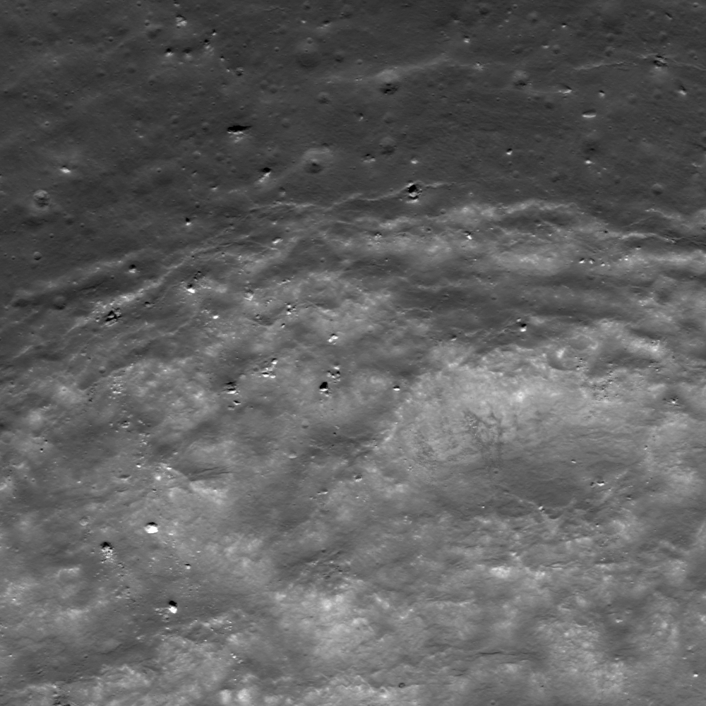
A complex interplay of slumping and slides in the northwest wall of Berzelius W result in banding patterns; downslope is toward the bottom right in this 230 meter-wide field of view from LROC NAC observation M174921824R, LRO orbit 10912, November 3, 2011; 53.59° incidence angle, resolution 40 cm from 23.87 km over 38.06°N, 53.02°E [NASA/GSFC/Arizona State University].
J. Stopar
LROC News System

Berzelius W (7.17 km; 38.137°N, 53.103°E), on the northeast limb of the Moon (as seen from the Earth), exhibits abundant evidence for mass wasting.

Materials of varying albedo create intricate patterns on the walls of the crater, including the banding patterns featured in the opening image. 

This particular portion of the wall includes a block of slumped material, as indicated by the characteristic arcuate faults near the crater's rim crest (see image below). The slumped material is overprinted by finger-like flows of finer particles that moved as slides of dry debris.

Arrow indicates the arcuate faults at the head of the slumped material in the wall of Berzelius W. This slumping may have triggered the associated narrower and finger-like landslides of lower albedo (darker) boulders and debris; 600 meter field of view [NASA/GSFC/Arizona State University].
When did these mass-wasting events occur? Did they occur during the impact event, shortly after while the landscape was still ringing from the shock of impact, or millennia later? The lack of high albedo (bright) ejecta around the crater and the subdued appearance of the rim crest indicate that this crater did not form particularly recently; perhaps it is between 1 and 2 billion years old. 

Berzelius W (7.17 km; 38.137°N, 53.103°E) in 35.7 km-wide field of view from LROC WAC monochrome (604 nm) mosaic of M161965061C and M161971828C, LRO orbit 9003 and 9004, June 6, 2011; 73.5° incidence at 61.5 meters resolution from 44.9 km [NASA/GSFC/Arizona State University].
The crisp edges of the debris flows and arcuate scarps in the walls, however, suggest that they are much younger than the crater. So, while this landslide probably did not form yesterday, it is likely significantly younger than the crater itself, probably less than half its age. However, without more data, it is impossible to know precisely when these events occurred. Repeated imaging over many decades may provide more insight into how crater walls age with time. Alternatively, samples returned from crater walls may provide a method to age-date mass-wasting events. 

Try to find at least three other examples of mass-wasting features in the western half of this crater below. Pan and zoom to find examples of landslides, talus deposits, and boulder tracks:
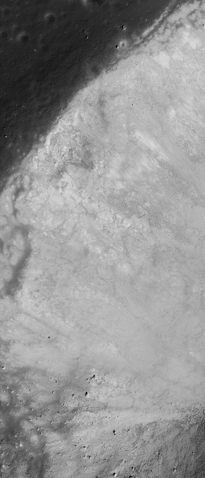
Full 850 meter-wide field of view from remarkably high resolution LROC NAC observation M174921824R [NASA/GSFC/Arizona State University].
View full-window HERE.

Related Features:

Wednesday, April 10, 2013

Rim Slumping inside pre-Nectarian Gamov

Faulting of a crater rim. Downhill to lower right, LROC Narrow Angle Camera (NAC) M187307653L & R, LRO orbit 12672, March 25, 2012; field of view approximately 1.9 km across, resolution 1.79 meters per pixel from 189.55 km [NASA/GSFC/Arizona State University].
Lillian Ostrach
LROC News System

Post-impact modification is frequently observed in LROC NAC images, because post-impact modification begins as soon as the impact crater has formed and ejecta emplaced. Impact crater formation is a violent process, so it should be no surprise that the target rock surrounding the impact site may be fractured and faulted, especially near the crater rim.

Today's Featured Image of the northern rim of an unnamed about 8.5 km diameter crater (64.754°N, 145.546°E) focuses on the faulted nature of the crater rim and evidence for mass wasting.

12.2 km wide field of view from the LROC NAC mosaic showing the entirety of the left and right frames of observation M187307653. The area highlighted in the LROC Featured Image further up is outlined by the white square [NASA/GSFC/Arizona State University].
The upper portion of the opening image is the outer flank of the crater, the fractures represent the crater rim "edge" (the lower portion of the image is the steep interior wall). As time passes and materials (blocks, fine-grained material) are dislodged from the rim and crater wall, the crater rim erodes and degrades, expanding outward (the diameter of the crater actually increases, while its depth decreases).

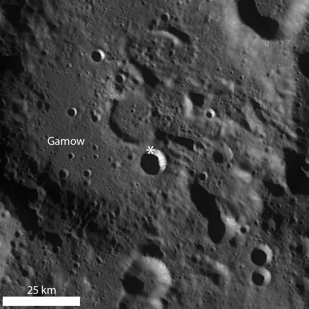
LROC Wide Angle Camera (WAC) monochrome mosaic highlighting a bowl-shaped crater superposed in pre-Nectarian Gamow crater. An asterisk denotes location of the area seen at high resolution in opening image [NASA/GSFC/Arizona State University].
Some examples of this "slope retreat" of the crater rim are very obvious, whereas others, like today's example, are less so. Today's example shows small-scale slumping of the crater wall as opposed to larger-scale slumping of massive portions of rim material. Perhaps the smaller size of this crater compared to other examples is the reason the slope retreat does not appear well-developed, or maybe the failure of rim faults is less pronounced due to pre-existing target properties (e.g., highly fractured nature of the highlands, impact into floor material of a larger crater, etc.).

Explore this farside simple crater for yourself in the full LROC NAC image, HERE.

Related Posts:
Top of the Landslide
On the Edge
Posidonius Y

Tuesday, January 10, 2012

Regolith on Basalt

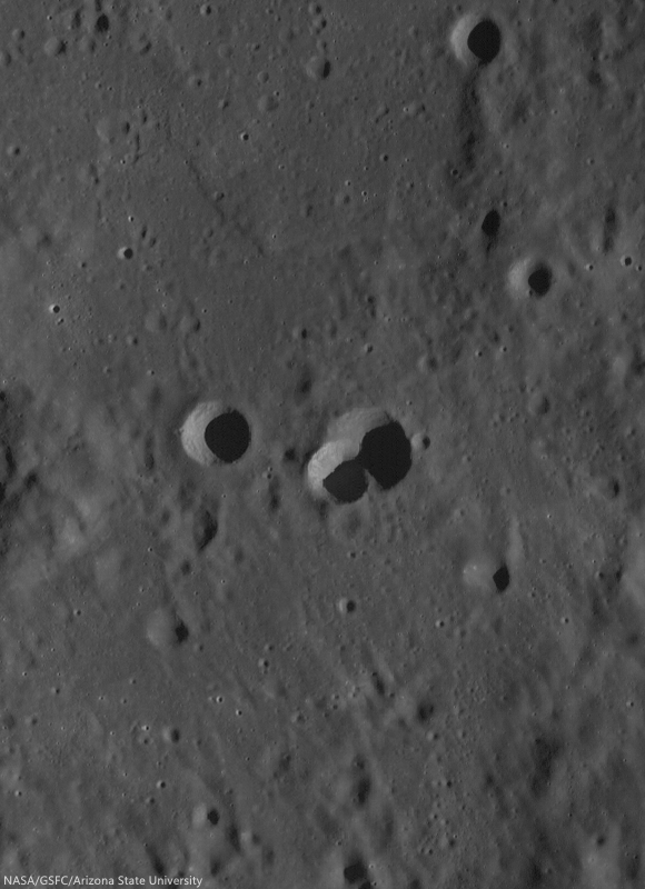
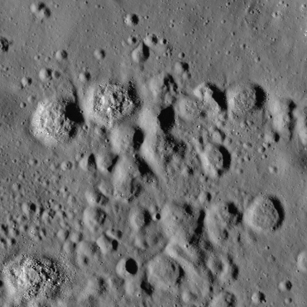
Clusters of possible secondary craters on the north edge of the mare deposits inside Tsiolkovskiy crater. LROC Narrow Angle Camera (NAC) observation M161475783R, LRO orbit 8930, May 31, 2011; incidence angle 67.51° with a resolution of 0.61 meters per pixel from 58.99 km. Image field of view is 610 meters. View the larger LROC Featured Image HERE [NASA/GSFC/Arizona State University].

Hiroyuki Sato
LROC News System

Tsiolkovskiy is a large and spectacular crater on the farside of the Moon (diameter is 180 km). Some time after the impact event that created Tsiolkovskiy, low viscosity lava erupted and flooded the bottom portion of the crater; forming the dark, flat, smooth plain that stands against the bright background of anorthositic highlands.

The age of this mare is estimated, through crater-counting techniques, to be about 3.5 billion years old. The initial solid surface of the solidified lava sheet has slowly been dug up and churned by small impact events. These small impacts build up a layer of loose, crushed rock, similar to a soil on the Earth. On the Moon this layer is called regolth. Today's Featured Image highlights a cluster of relatively young and small craters on the Tsiolkovsiky mare (formed in the regolith). These small craters are probably secondary craters formed as material was thrown out of a nearby primary impact. Did you notice that some of these craters have unusual shapes? Instead of the usual bowl shape of small craters, these examples have very flat floors. Why?

Context for the full LROC NAC frame (rectangle) under the polar orbit of LRO, superimposed on the USG/JAXA digital elevation model and the recently completed Apollo J mission orbital camera survey mosaic in Google Earth [NASA/USGS/JAXA/GSFC/ASU/Google].
Secondary impacts hit the Moon with much lower velocities than primary impacts, so there is less energy (for the same size impactor) available to excavate a crater. Also there is a strength difference between the regolith and the still solid bedrock that it covers. The upper layer is unconsolidated (loose), which is easily excavated and swept out. The lower layer is more solid, and requires more energy to excavate. The flat floor is thus thought to represent the boundary between the regolith and the still solid basalt. By measuring the depth of the flat floor craters, scientists can estimate the depth of the regolith.

LROC Wide Angle Camera (WAC) monochrome 100 meter per pixel mosaic with false-color DLR elevation data (LROC QuickMap) centered over Tsiolkovskiy. The crater's central peak (20.32°S, 128.68°E), at nearly a kilometer above the Moon's mean elevation, rises more than 2000 meters over the mare covered crater floor. [NASA/GSFC/Arizona State University].

Explore these odd craters in the full NAC frame!

Related Posts:
Terraced Craters in Aitken Crater
Fresh Bench Crater in Oceanus Procellarum
Just Another Crater?
Bench Crater in Plato