Showing posts sorted by date for query copernicus. Sort by relevance Show all posts

Saturday, February 6, 2016

Edgar Mitchell (1930-2016)

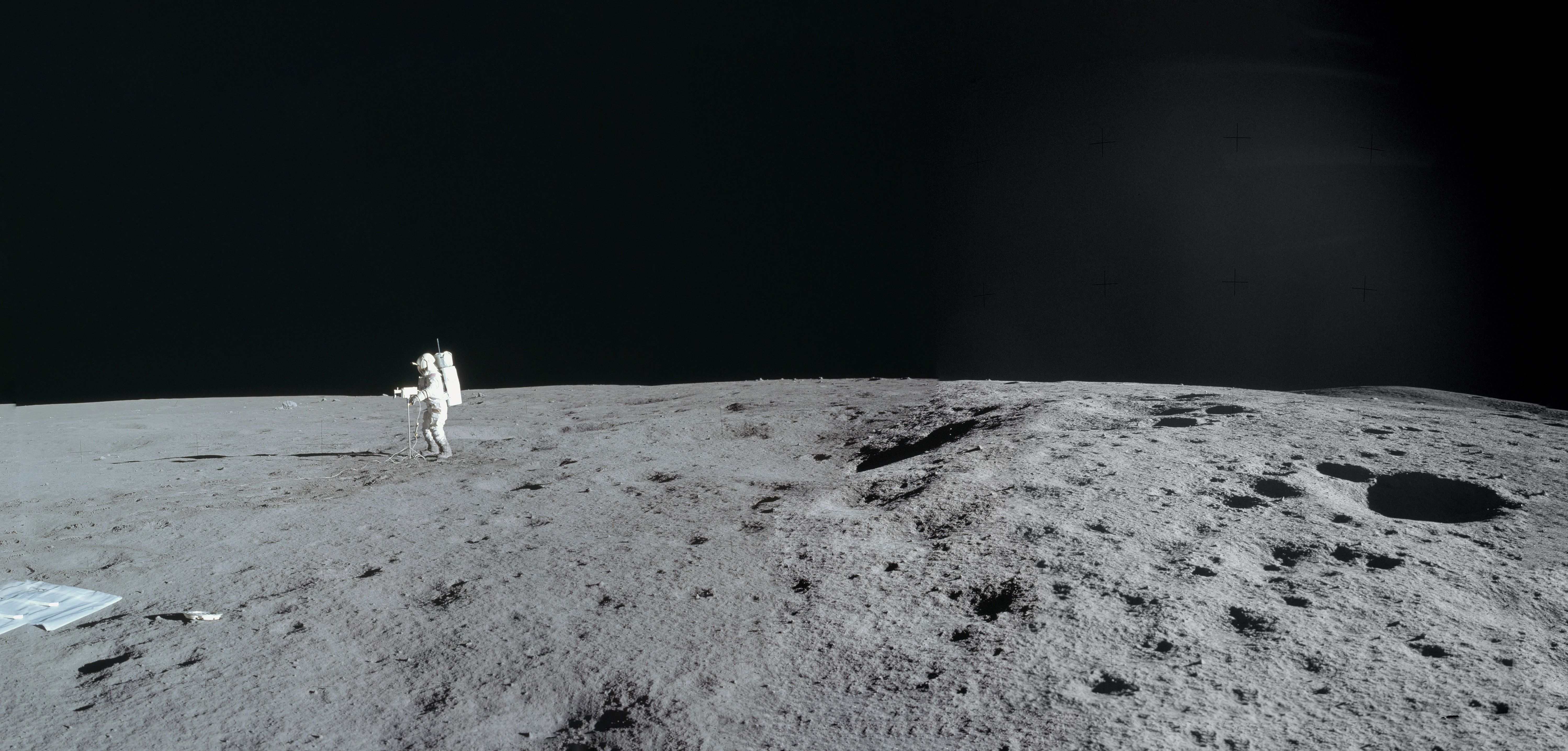
Edgar Mitchell, sixth human to visit the lunar surface, takes a live panorama of the close horizon using the first color television camera successfully operated on the Moon; at Fra Mauro, south of Copernicus, February 1971. Photograph by Apollo 14 commander Alan Shepard [NASA/JSC].
Astronaut Edgar Mitchell, lunar module pilot on Apollo 14, passed away Thursday in West Palm Beach, Florida,  and on the eve of the 45th anniversary of his lunar expedition in 1971.

Mitchell joined Apollo 14 commander Alan Shephard, Jr., the first American in space, in the lunar module Antares, which touched down February 5, 1971, in the Fra Mauro highlands. Shepard and Mitchell were assigned to traverse the lunar surface to deploy scientific instruments and perform a communications test on the surface, as well as photograph the lunar surface and any deep space phenomena. It was Mitchell’s only spaceflight.

Mitchell and Shephard set mission records for the time of the longest distance traversed on the lunar surface; the largest payload returned from lunar surface; and the longest lunar stay time (33 hours). They were also the first to transmit color TV from the lunar surface. Mitchell helped collect 94 pounds of lunar rock and soil samples that were distributed across 187 scientific teams in the United States and 14 other countries for analysis.

Read the full NASA release HERE.

Wednesday, February 25, 2015

Lunar Orbiter Image Restoration Project: Last Mile

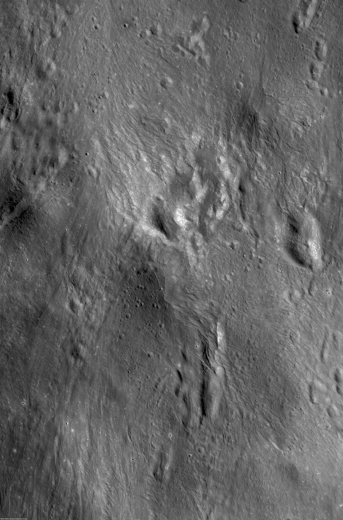
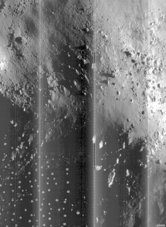
Until the original tapes were found, stored in an abandoned McDonalds Restaurant on site at Ames Research Center, and subsequently read and remastered using totally unavailable equipment built from scratch, this represents our best view of of the rugged slopes of the central peaks of Copernicus crater, a facsimile of a photograph developed in lunar orbit and radioed back to Earth from Lunar Orbiter V, August 17, 1967. For comparison, see the photographs that follow below [USGS]. 
From moonandback video, May 2010
Dennis Wingo

The Lunar Orbiter Image Recovery Project (LOIRP) is a public/private project to recover, from the original master tapes, the image data from the five spacecraft NASA sent to the moon in the 1960’s and provide it to the scientific community and the public.  The first is done through a peer review process and then the data is provided to the National Space Science Data Center (NSSDC) for archiving.  We also have a public website through NASA at the Solar System Exploration Research Virtual Institute (SSERVI) at the NASA Ames Research Center.  This missive is to explain the background of the mission, the character of the data, and why it is important to our scientific and national history.

At this time we have completed over 90% of the work necessary to archive and publish these images.  However, sometimes that last 10% is the hardest and we have in the dozens of terabytes of data to complete the processing of our image captures.  Why doesn't NASA pay for this?  They have paid for the vast majority of our work.  NASA’s Space Science Mission Directorate, NASA Ames, and and SSERVI have been magnificent in support of our work.  However, NASA’s budget is severely constrained, and for legacy projects like this, it is our work in technoarchaeology (literally the archaeology of technology) that is saving this data for posterity.
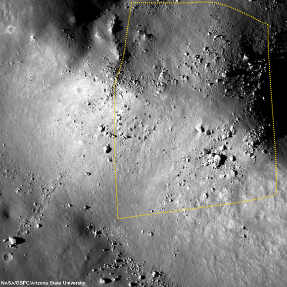
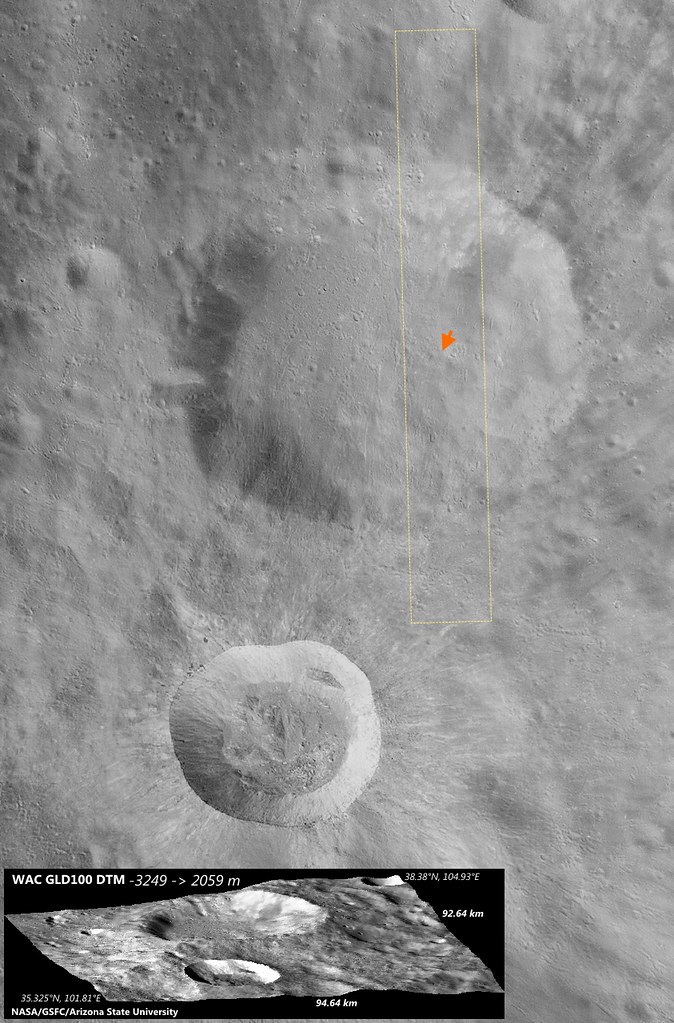
Field of view captured in by Lunar Orbiter V in 1967, shown in the image further above, outlined on a more recent photographic survey by the Lunar Reconnaissance Orbiter (LRO), LROC M181302109R, spacecraft orbit 11832, January 15, 2012 [NASA/GSFC/Arizona State University].
When we started this project, it was only to save the images of Lunar Orbiter’s II and III.  However, in 2011 NASA asked us how much it would cost to complete all five orbiters.  We estimated $400,000.  NASA provided $300,000 of this, leaving a gap of $100,000.  This is why we ask for your support in our crowdfunding effort, to complete this task.  These images, provided on the SSERVI website, will be free to the public with no copyright.  The American taxpayer paid for this effort and even though our company has also contributed materially to the effort and we are extending this through your generous donations through crowdfunding, we want this to be provided free of charge, or any intellectual property right restrictions.

Detail from LOIRP Lunar Orbiter V (Image 151-H1 -Copernicus Central Uplift) The LOIRP Image was derived from the original analog tapes from the LO ground stations and has 4x the dynamic range of the LO film archive. This image with a resolution of about 2 meters, taken on August 16, 1967 from 103 km. This version of the LO-V-151-H image is from the original ground station tape from the Woomera ground station in Australia (tape W5-58).
NASA had stored these original analog data tapes for over four decades, but if it were not for our project and former NASA archivist Nancy Evan’s preservation of the tape drives in her barn, this archive at its best quality would be lost to history.  Following is a description of the Lunar Orbiters, their camera, the images and what we are doing to preserve this legacy of the early Apollo program.

Background on the Lunar Orbiter

In 1966-67 NASA sent five spacecraft to the Moon to do a high resolution photo reconnaissance of the surface in preparation for the manned Apollo lunar landings.  This was the first time in human history, other than a few closeups before impact from the Ranger spacecraft, that the moon had been seen up close and personal.

Enjoy the full post from Dennis Wingo, HERE.

Related Posts:
The LOIRP time machine looks back 43 years (June 3, 2010)
New releases from Lunar Orbiter II (1966) - (May 7, 2010)
Boulders of Copernicus (December 11, 2009)
LOIRP: Boulder Trails on the Moon (December 10, 2009)
Lunar Orbiter's originals vs. LOIRP restorations (December 9, 2009)
New restored detail from Lunar Orbiter II (December 8, 2009)
LOIRP configures second FR-900 tape drive (November 12, 2009)
The importance of lunar water (September 28, 2009)
LOIRP remasters the Moon's South Pole (August 14, 2009)
Lockheed Martin donates Clean-Room to LOIRP (August 12, 2009)
LOIRP astounds again, re-release of LO-II0162 (1967)
with each of three high-res sub-frames
 (August 10, 2009)
Full Earth, as seen by Orbiter V (August 7, 2009)
Lunar Orbiter III-154-H2 (June 16, 2009)
LOIRP recovers Lunar Orbiter IV lunar South Pole image from 1967 (June 16, 2009)
LOIRP recovers detail of Fra Mauro and future landing site of Apollo 14 (June 11, 2009)
New LOIRP high res Lunar Orbiter image of western Oceanus Procellarum (June 10, 2009)
LOIRP recovers image of Ranger 8 impact (June 9, 2009)
LOIRP's "Pictures of the Century" (March 23, 2009)
More astounding new detail from LOIRP (February 26, 2009)
Breakthrough in Lunar Orbiter photograph remastering (February 20, 2009)

Sunday, November 23, 2014

Dark splotches over high albedo, under a high sun

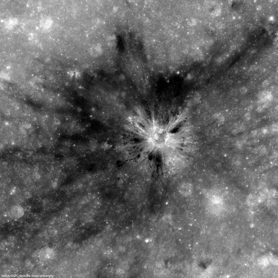
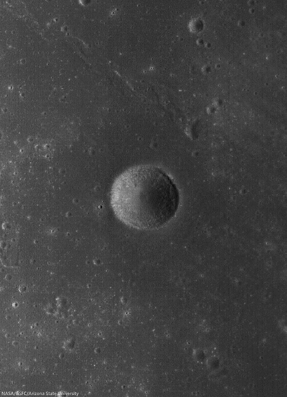
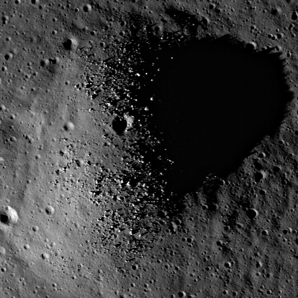
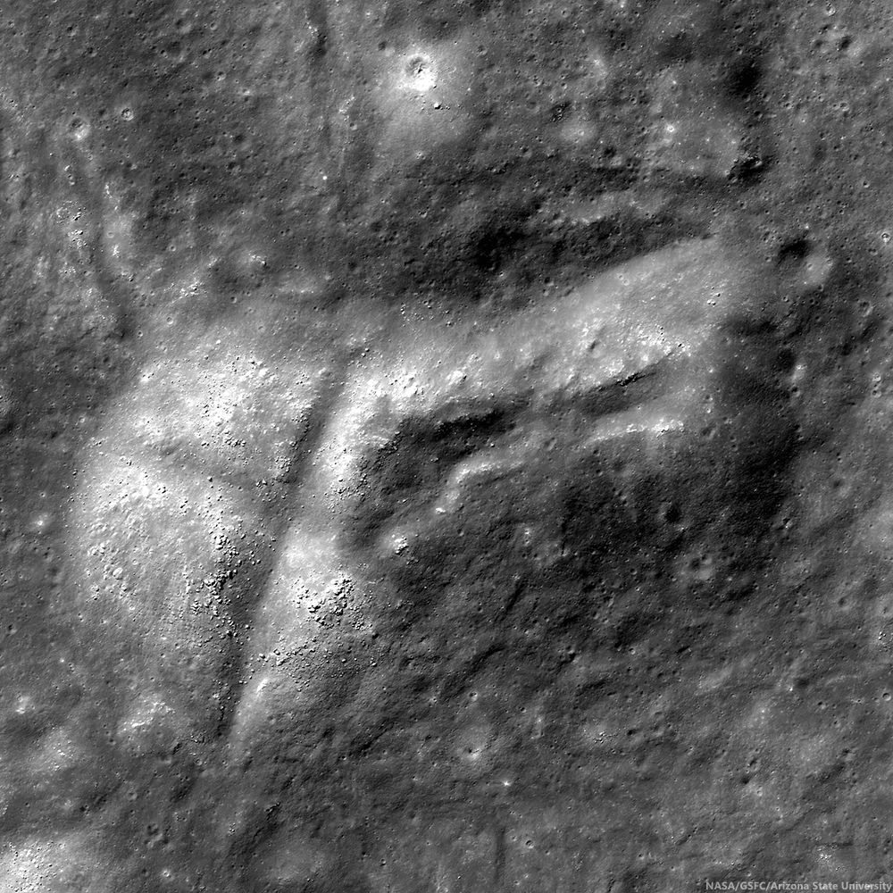
Unnamed crater (2.2784°N, 116.2125°E) southwest of King, presenting a unique albedo variation in 1.8 km-wide field of view from LROC NAC observation M123812230R, LRO orbit 3380, March 21, 2010; 8.3° incidence angle, resolution 57 cm from 55.36 km over 2.25°N, 116.16°E [NASA/GSFC/Arizona State University].
Hiroyuki Sato
LROC News System

Impact craters routinely excavate subsurface materials, exposing them in crater walls and in ejecta. The Featured Image highlights an unnamed fresh crater (480 meters in diameter) with numerous dark splotches.

Inside the crater cavity, dark splotches (low reflectance materials) occur from the middle to the trim of the crater and spread outward beyond the rim crest.

Several small craters (less than 100 meters in diameter) with similar dark splotches also occur in this region (outside the area shown above, see next image), suggesting that the dark materials were likely excavated from an extensive subsurface layer. The distribution of the dark halo craters informs us about the horizontal extent of these subsurface materials.

Small craters a few thousand meters north of the dark halo crater (DHC) of interest, above, from the same LROC NAC frame M123812230R. Note the crater right of center bottom may be superposed on the rim of a more ancient depression [NASA/GSFC/Arizona State University].
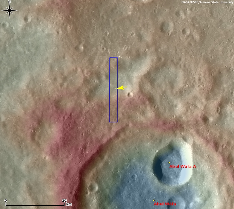
The crater in the opening image is found 116 km from the southwestern rim of King crater (76.2 km; 4.96°N, 120.49°E), located in the farside highlands. Unlike in the mare, pyroclastic deposits are unlikely to be the low-reflectance material (seen in the opening image) here in the middle of the highlands with no indication of volcanic activity near here. So, what is this low reflectance layer?

Context view of the location of today's Featured Image in WAC monochrome mosaic (100 m/pix) overlayed by WAC stereo DTM (GLD100, Scholten et al., 2012). The NAC footprint (blue box) and the exact location of the opening image (yellow arrow) are indicated [NASA/GSFC/Arizona State University]. 
The rays of Necho crater (36.87 km; 5.25°S, 123.24°E) extend out around 680 kilometers (see image below) crossing over King crater and the area in today's Featured Image. Since the area of opening image is crossed by the Necho ray deposits the excavated dark layer might be the original mature surface (now covered by Necho's high reflectance rays).  

Context view of the area of interest in an orthographic LROC WAC mosaic of low-angle observations of the surrounding hemisphere. Arrow points to the location of the crater of interest, within range of ejecta from King, Necho or perhaps, less likely, Giordano Bruno or Goddard A craters, (not unlike the magnetic anomaly east of Firsov) [NASA/GSFC/Arizona State University]. 
Due to the lack of atmosphere on the Moon, the photometric effect is very strong. Thus, it is hard to identify the relationships between the different layers using low-Sun images (images with large incidence angles, near sunrise or sunset); however, high-Sun images (those with low incidence angles, near noon) display clearly the relationships between units, which helps us reconstruct the resurfacing history of this area.

View full-size view of the LROC NAC frame, HERE.

Related Posts:

Wednesday, August 27, 2014

Pit craters in NAC DTM topography

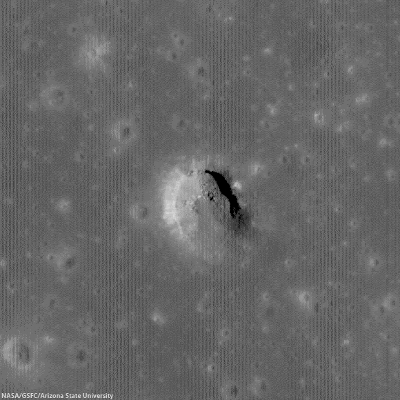
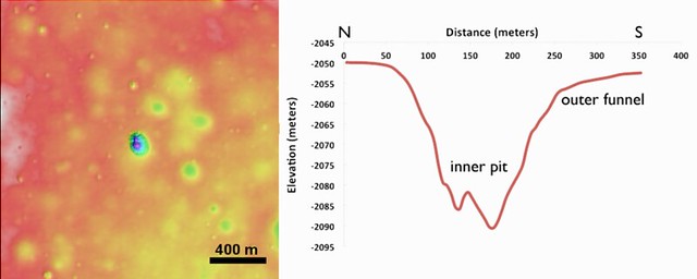
The crisp morphology of the central Mare Fecunditatis pit (white arrow) stands out in elevation data and suggests a relatively young age. This pit is about 200-m in length and 45 m deep. Image width is 5 km; north is up. Color shaded-relief created from NAC DTM FecundPit; higher elevations shown in red and lower elevations in blue and purple [NASA/GSFC/Arizona State University].
J. Stopar
LROC News System

Eight mare pits have been discovered so far on the Moon, five of which preserve void spaces (sublunarean voids) beneath overhanging mare layers. The pit featured above, located in central Mare Fecunditatis (0.917°S, 48.66°E), however, does not have an obvious void space. The pit is almost 200 m wide and about 45 m deep.

The central Mare Fecunditatis pit has a concave shape, with gentler slopes (outer funnel) near the upper mare surface, and a steeper-walled inner pit (see image below). Variations in wall slopes are consistent with a fine-grained, particulate layer (regolith) overlying more coherent mare layers. The steep inner pit suggests collapse into a small void space. The debris in the pit floor consists of both regolith and mare blocks from the upper layers.

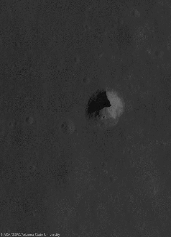
Pit crater (0.92°S, 48.66°E) near Messier B, now generally designated the Central Fecunditatis pit crater to distinguish it for a more recently discovered skylight in southwest Fecunditatis. LRO's longevity has enabled repeated narrow angle photography of selected areas on the Moon, allowing for the team at Arizona State University to build up very high-resolution, NAC-based digital terrain models. 540 meter field of view from LROC NAC observation M1105602888R, LRO orbit 15232, October 23, 2012; 35.18° incidence angle, resolution 93 cm from 108.28 km over 0.92°S, 49°E [NASA/GSFC/Arizona State University]
Left: color shaded-relief of NAC-derived elevation data. Reds are higher elevations, purple lower elevations. Right: elevation profile of a north-to-south cross-section through the pit. The inner pit has steep walls, while slopes near the mare surface (outer funnel) are more gentle [NASA/GSFC/Arizona State University].
The lack of raised rim or ejecta around the pit, indicates that it most likely formed through collapse, rather than as an impact event. While this pit is not located near any obvious tectonic features or volcanic constructs, the collapse may have occurred into part of an old lava tube. The crispness of the pit morphology, suggests that the collapse occurred relatively recently (geologically speaking, at least), perhaps much less than 1 billion years ago. Pits are among some of the youngest landforms on the Moon, and are similar in age to many fresh craters (such as Tycho, Copernicus, or Aristarchus).

More recently identified pit crater in southwest Mare Fecunditatis (6.752°S, 42.76°E), discovered during Wagner and Robinson survey. A 325 meter-wide field of view from LROC NAC M167926438R, LRO orbit 9881, August 14, 2011; 42.25° incidence angle, resolution 56 cm from 26.73 km over 6.71°S, 42.72°E [NASA/GSFC/Arizona State University].
Read More About Lunar Pits:  Lunar pits were recently featured in the news and the focus of a scientific publication ("Distribution, formation mechanisms, and significance of lunar pits," Robert V. Wagner and Mark S. Robinson, Icarus, July 2014; pg. 52-60).

The pits are of particular interest to lunar scientists because they could offer access to subsurface materials, making them important targets for further research and exploration.

Explore the pit in the full-resolution LROC NAC observation HERE.

More Pits:

Monday, August 25, 2014

Striped pyroclastic vent in Sinus Aestuum

Dark mantle deposits decorate a crater wall. Slowly pulled downhill by gravity, the volcanic glasses that compose these stripes where formed during explosive volcanic eruptions on the Moon. 1130 meter-wide field of view from LROC NAC observation M1101259688L, LRO orbit 14524, September 2, 2012; low incidence 17.83° angle, 97 cm resolution from 117.17 km over 8.26°N 352.18°E [NASA/GSFC/Arizona State University].
Aaron Boyd
LROC News System

Today's Featured Image location is in southern Sinus Aestuum.

Low reflectance pyroclastic material flowed downslope (NE) due to mass wasting in this crater, and high reflectance fresh ray material from small young craters dot the streaks.

The high reflectance material from small craters on top of the pyroclastics indicate that the pyroclastic deposit is relatively thin, because the excavated material is from a maximum of about 0.2 crater radii below the surface.

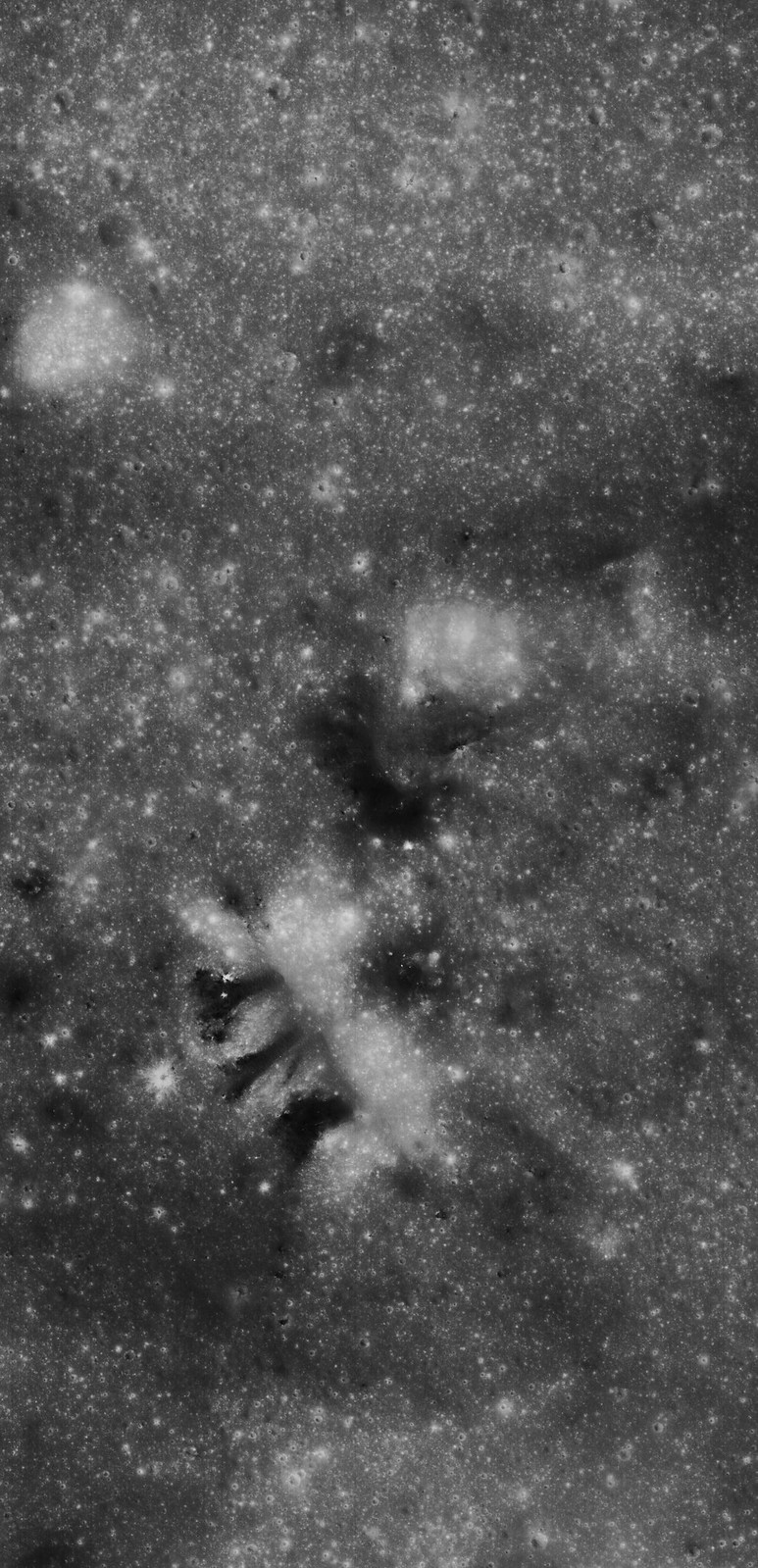
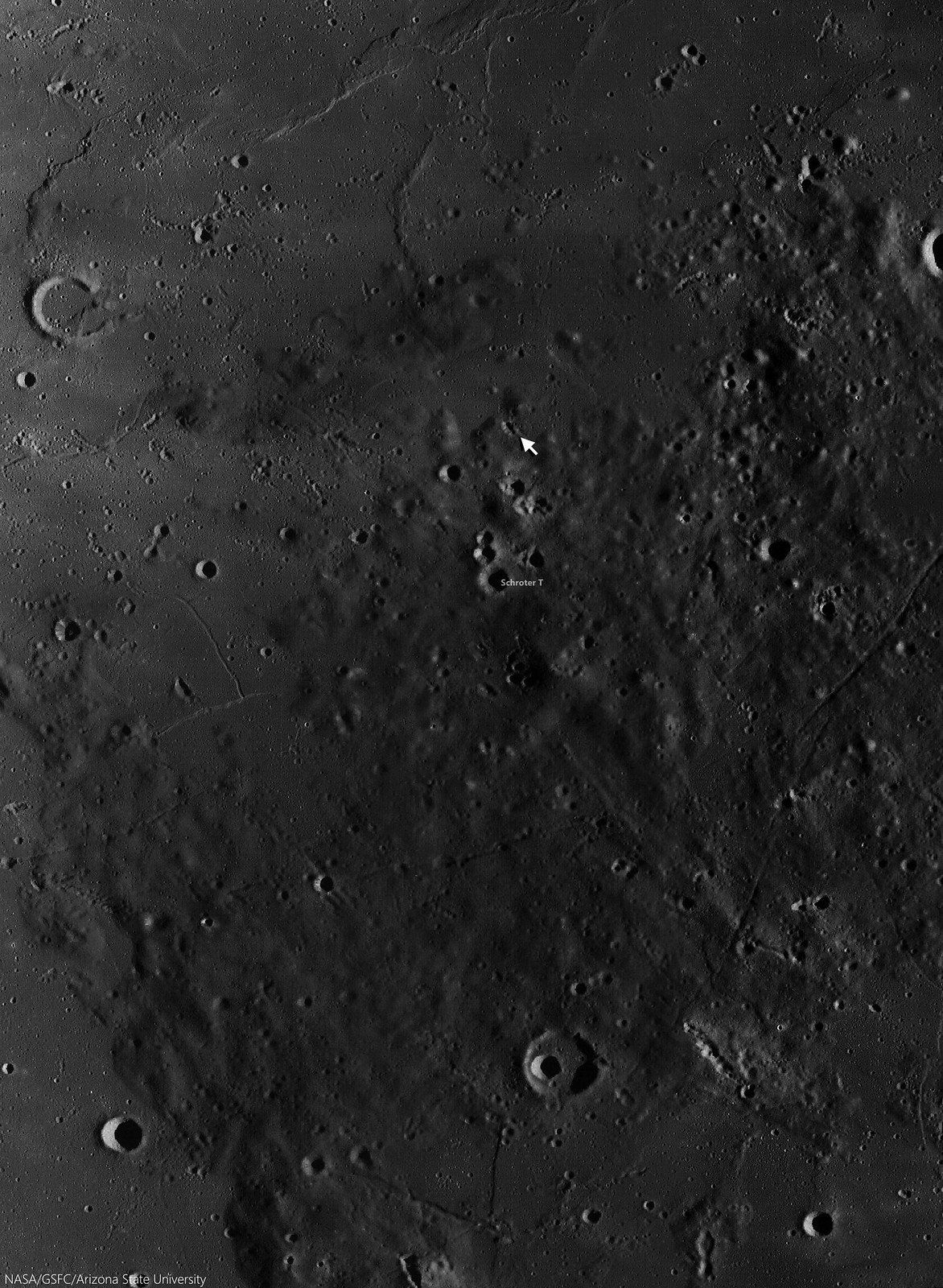
Striped slides of pyroclastic-sourced granular flow, darker material eroding back into its likely source, a "striped crater," a vent north of Schroter T in Sinus Aestuum, east of Copernicus. A 4675 meter-wide-wide field of view from LROC NAC observation M1101259688L, LRO orbit 14524, September 2, 2012; low incidence 17.83° angle, 97 cm resolution from 117.17 km over 8.26°N 352.18°E [NASA/GSFC/Arizona State University].
In addition to the thickness of the deposit, scientists can also tell that this deposit is most likely discontinuous by observing the streaks in the larger crater. If there was a continuous blanket of material on the surface, the dark mantle material would not form streaks, but a sheet of dark material as it is eroded away.

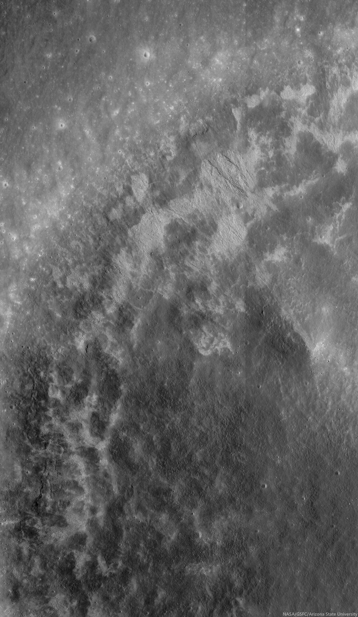
Schroter T (3.96 km; 7.03°N, 352°E) is the largest of the triplet craters in a "snowman" formation at lower center in this 37 km field of view centered near 7.72°N, 352°E. The energetic creation of Copernicus nearby left its mark on the pyroclastic material, Some high places seem to have been sheered off, leaving dark chevrons pointing away from that direction.  LROC Wide Angle Camera (WAC) monochrome (604 nm) observation M160003304CE, LRO orbit 9713, May 14, 2011; 48.97° incidence, 54.53 meters resolution from 38.89 km [NASA/GSFC/Arizona State University].
Dark mantle deposits (DMDs) on the Moon are composed of red, green, orange, and black glasses and crystals that were formed during strombolian or vulcanian eruptions. Sinus Aestuum is littered with dark mantle deposits, showing there were many different vents that were sending magma aloft.

The striped walls of the pyroclastic vent (arrow, 7.716°N, 352.062°E), in the dark terrains east-southeast of Copernicus, disappear into the long shadows of a complex topography, in the light of sunrise. A roughly 120 km-wide field of view from a distilled LROC WAC mosaic of sequential monochrome  (643 nm) observations swept up December 15, 2010; 77° incidence, resolution 63.3 meters from 45 km [NASA/GSFC/Arizona State University]. 
The crater in which we see the dark streaks in the Featured Image could have been the source for the streaks; a piece of evidence for the crater being a vent is its irregular shape, but without further surface investigation (perhaps by humans one day) that question can not be answered for certain.

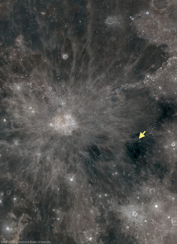
The small vent in Sinus Aestuum (arrow), 370 km east-southeast of the central peaks of Copernicus, is part of the pyroclastic fields highly visible even in modest binoculars, because of their relative low reflectivity. The area more to the southeast bear Gambart is the site of the Moon's highest concentration of radioactive isotopes, of thorium and less common uranium for example. A roughly 900 km-wide view from the LROC Lunaserv web-mapping program, Test RGB overlay (See "Resolved Hapke Parameter Maps") LROC WAC global mosaic [NASA/GSFC/Arizona State University].
See how many dark mantle deposits you can find in the full NAC frame HERE.

Related Posts:

Wednesday, August 20, 2014

Frozen motion at Harbhebi J

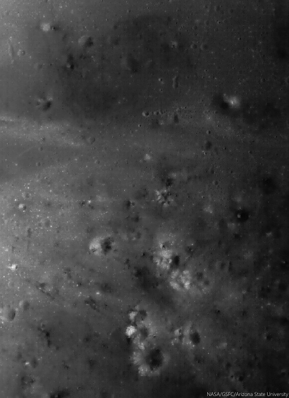
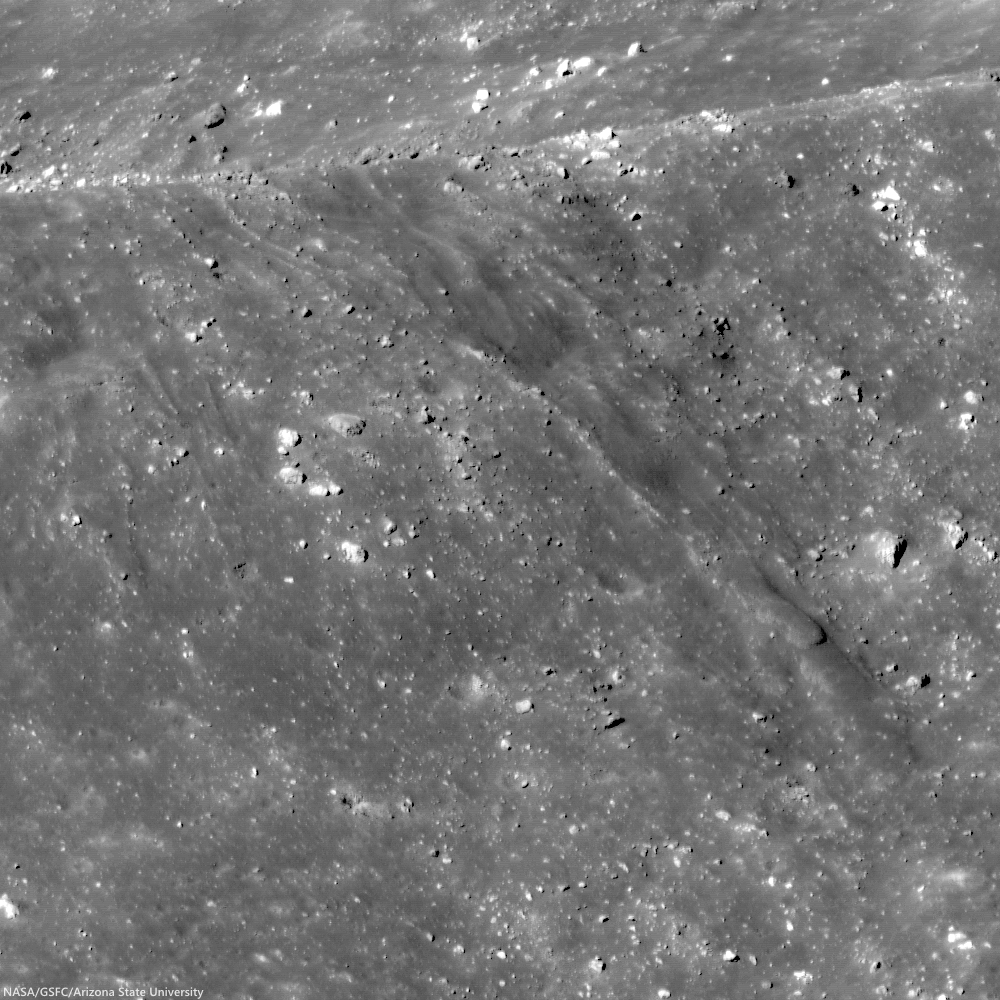
The scoured floor of Harkhebi J (43.1 km; 37.418°N, 103.356°E), near the young crater Giordano Bruno. Ejecta from Giordano Bruno flowed across the surface, leaving a record for us today. A 1570 meter-wide field of view from LROC NAC observation M1128791817L, LRO orbit 18492, July 18, 2013; incidence 60.58° resolution 1.35 meters, from 103.62 km over 37.52°N, 103.7°E [NASA/GSFC/Arizona State University].
Aaron Boyd
LROC News System

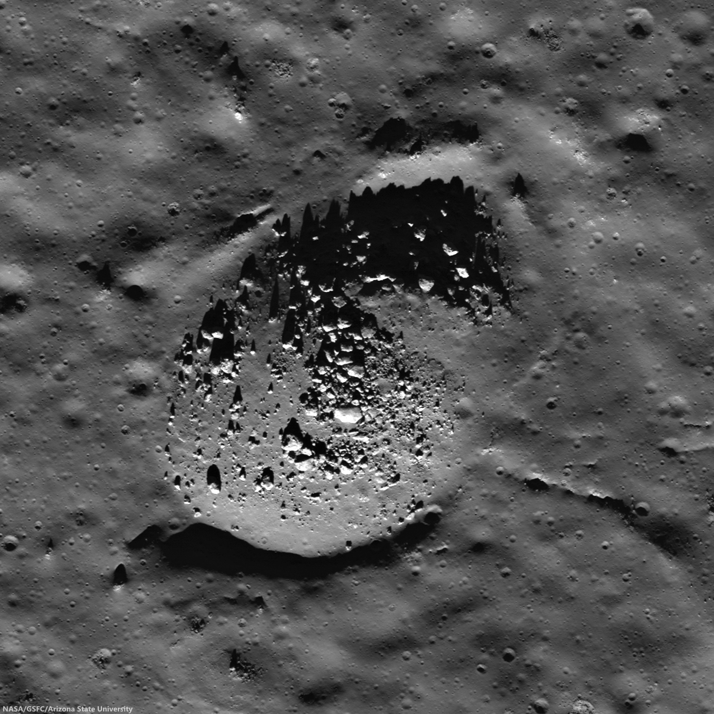
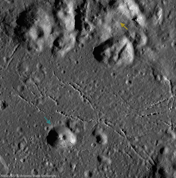
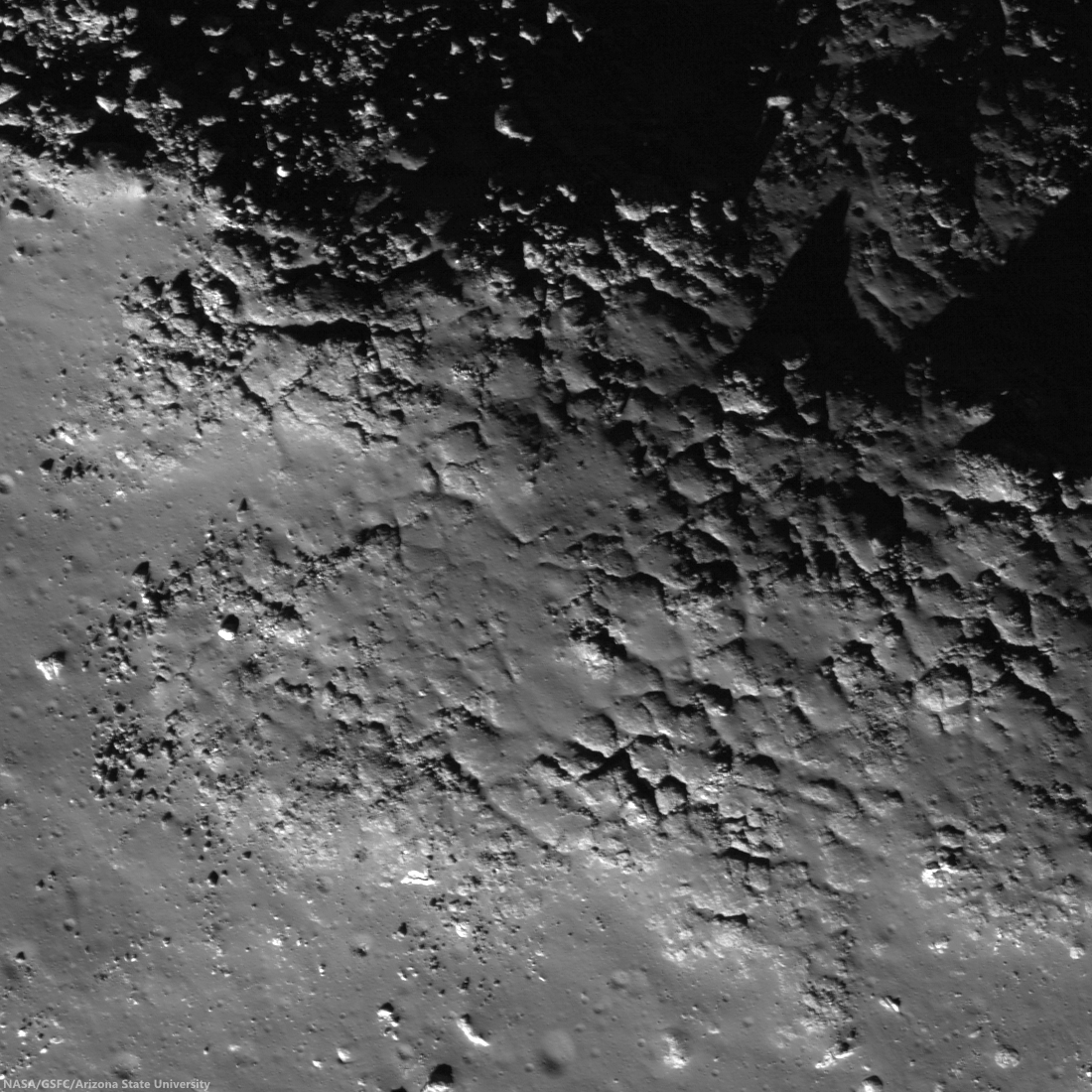
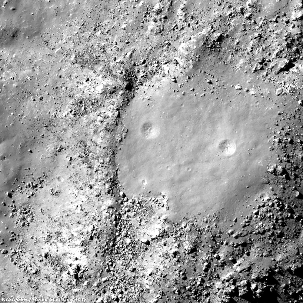
Giordano Bruno, the 22 km crater whose ejecta drapes Harkhebi J, is at most 10 million years old. Because these features are so young, they are preserved almost as though the ejecta ray landed here yesterday.

The Featured Image location is approximately 5 crater radii (55 km) away from the impact center, but the effects of the original impact are clearly visible; the momentum from the ejecta is visible as striations in the western half of the image.

The ejecta  was traveling upwards of 600 km/hr when it began to etch the surface, and when the materials finally came to rest, the evidence of the original motion was frozen in time.

Scaled and corrected 4.912 km-wide field of view from LROC NAC observation M1128791817L, July 18, 2013. View the full-resolution mosaic HERE [NASA/GSFC/Arizona State University].
Many patterns in ejecta from Giordano Bruno crater can be seen throughout the full NAC frame. These varied beautiful patterns relate to ejecta velocity and angle, as well as the material properties of the target.

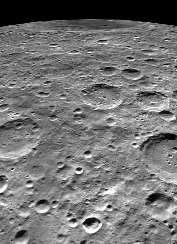
Context for the LROC Featured Image released August 20, 2014. Footprint of LROC NAC observation M1128791817L. LROC WAC observation M121532675C, LRO orbit 3044, February 23, 2010; incidence 49.3° at 76 meters resolution, from 54 km [NASA/GSFC/Arizona State University].
What would blocky ejecta look like? What would fine granular ejecta look like? The blocky ejecta would pepper the ground with secondary craters, while the granular ejecta would blast the existing surface smooth and flow like an avalanche. 

View full-resolution LROC NAC mosaic, HERE.

Related Posts:

Tuesday, July 8, 2014

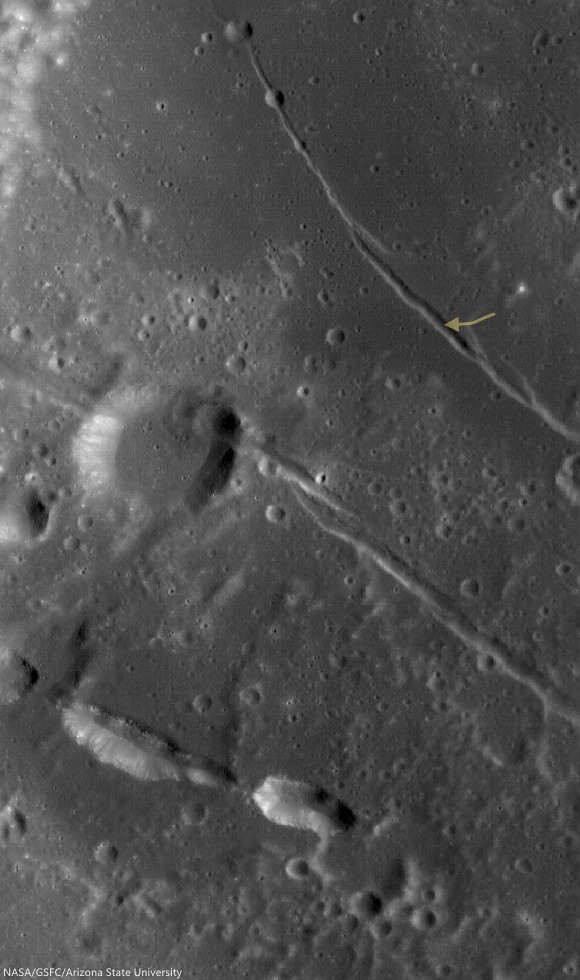
A rille to rover over near Rimae Hevelius

A rille found on the southwestern edge of Oceanus Procellarum, most likely formed from stress added to the surface as mare deposits were emplaced and cooled.  1200 meter-wide field of view from LROC NAC observation M1145219838R, LRO orbit 20802, January 24, 2014; 36.35° incidence, resolution 1.05 meters from 103.39 km over 0.5°N, 295.29°E [NASA/GSFC/Arizona State University].
Raquel Nuno
LROC News System

Remotely sensed data acquired by spacecraft allow scientists to study the geology of other worlds without ever setting foot there.

The investigation of image data is usually the first step in unraveling the origin of a planet’s observed landforms and their evolution -- this scientific study is called planetary geomorphology.

Characterizing geomorphologic features is of the utmost importance for planning both a safely landed mission as well as a rover's path – it would be unfortunate if a rover sent to the Moon got stuck because it was sent to a location it could not traverse. The curved depression in today's Feature Image, called an arcuate rille, is lined with boulders.  This is an example of a landing site that would be hazardous for a rover to land in without a very detailed look at the surroundings.

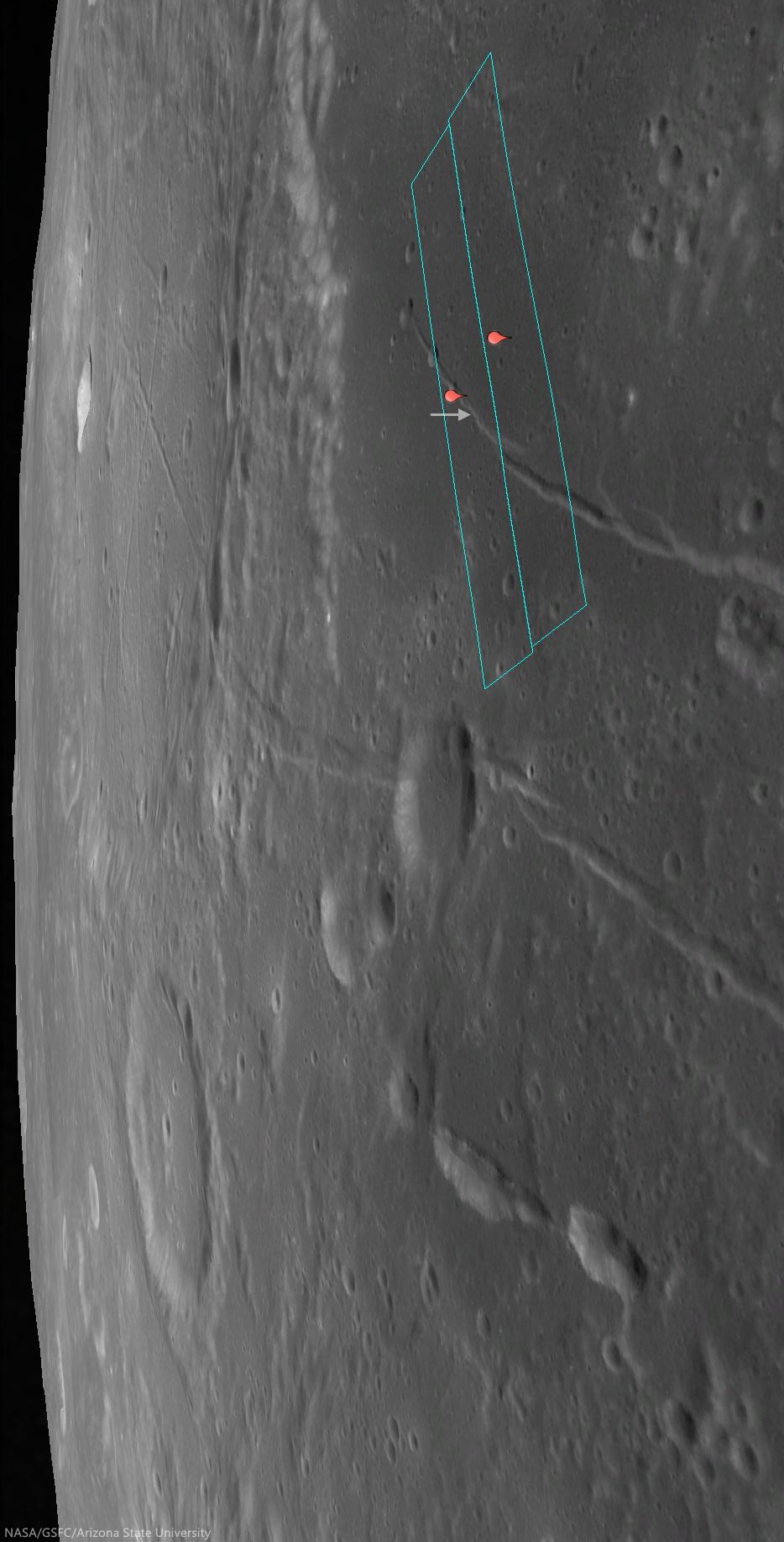
Location of the area viewed at high-resolution in the LROC NAC Featured Image (arrow) on the unnamed arcuate compression rille that runs almost parallel against Rima Hevelius I, longest of the Rimae Hevelius system and extending outward and beyond Hevelius crater, which is outside this 38 km-wide field of view; north of the pyroclastic vent structures near Lohrmann D. From LROC WAC observation M129716592C, LRO orbit 4249, May 28, 2010; 59.3° incidence angle, resolution 58.61 meters from 42.07 km [NASA/GSFC/Arizona State University].
This unnamed rille (0.141°N, 295.362°E), roughly 1 km across, is located on the edge of the southwestern region of Oceanus Procellarum.  As the mare deposits that formed Oceanus Procellarum cooled and contracted, fracture systems developed along the mare-highlands boundary. Near this boundary, loading of denser basalts (mare) over less dense crustal materials (highlands) results in tectonic stresses that can cause rock to pull apart along fractures, forming arcuate rilles.

The footprints of the left and right LROC NAC frames, from which the Featured Image was derived, installed on a digital elevation model and LROC Wide Angle Camera mosaic to offer a simulated 'real world' perspective, putting the the arcuate rille area of interest (arrow) in relation to Rimae Hevelius, inside and outside its namesake crater, and the other complexities of the Lohrmann and Hevelius pyroclastic area of the western equatorial border of Oceanus Procellarum [NASA/GSFC/Arizona State University].
The pattern of some of the complexities at the surface of west and southwest Oceanus Procellarum (and a lot of other areas on the Moon) were at least partially laid bare by the sensitive GRAIL A and GRAIL B gravity probes in 2012. Though the exact boundaries and morphology of the vast nearside basalt flood plain are still poorly understood, it's now clearer that the Moon once had its own "Ring of Fire," less dynamic than on Earth, but still a 'squarish' border in the form of deep volcanic rift structures partially surrounding an enormous plate. The inset shows how this system of rifts explains at least some of the surface faulting, the unique mountains and lateral pressures under the Hevelius, Rimae Hevelius, and the pyroclastic vents near Lohrmann D, and, indeed, much of the the western boundary of Oceanus Procellarum [NASA/GSFC/SVS].
The boulders on the floor of this rille are most likely material that has been eroding away from the walls. Some of the boulders reach diameters up to 12 meters. While an autonomous rover would likely require a lot of time to maneuver amongst the boulders, a human driver on the lunar surface might quickly and easily navigate a safe path around the boulders.

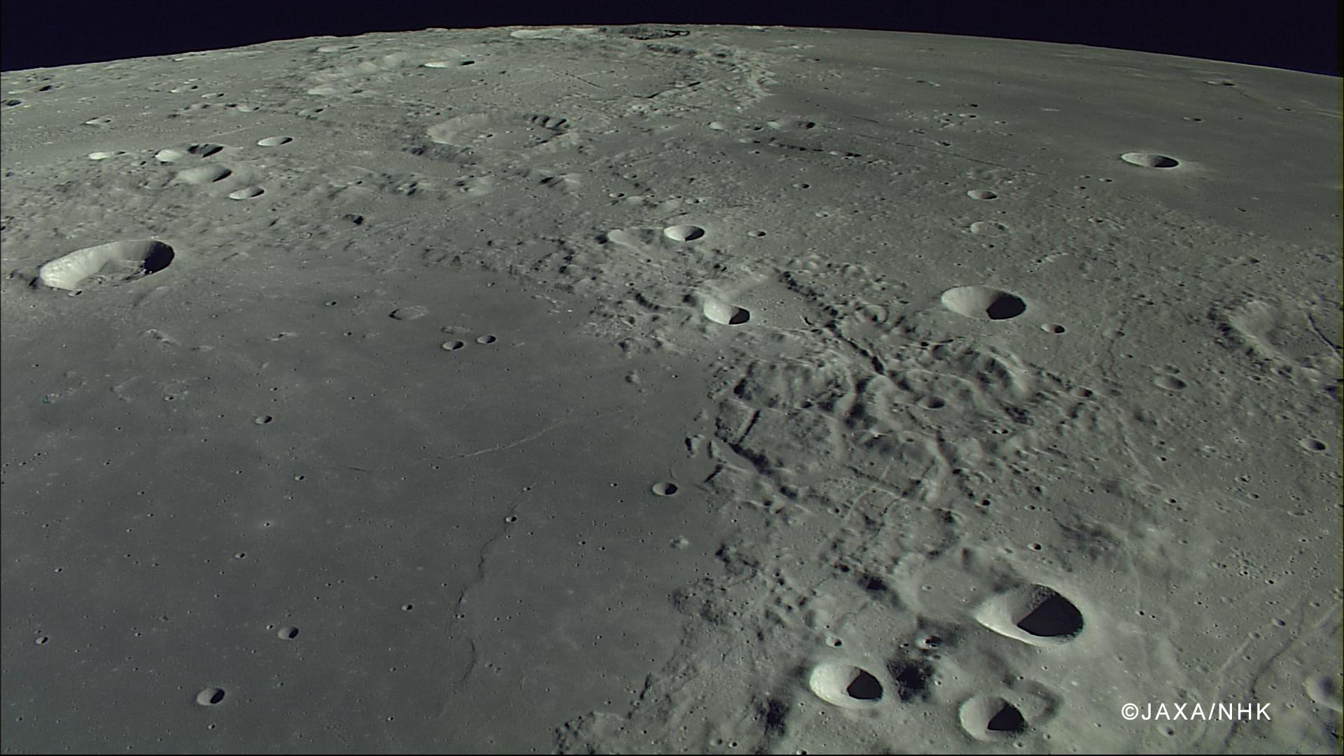
The compression rille is also visible, to the right of the upper center, east of Hevelius, north of the channel linking Grimaldi basin (lower left) with Procellarum (upper right), in this HDTV still captured by Japan's lunar orbiter Kaguya (SELENE-1) in 2007. See the full-size original image, HERE [JAXA/NHK/SELENE].
If you were an astronaut on the surface of the Moon, do you think you could find a safe path through this rille?  Trace your path on the full resolution LROC NAC below.

View full-window, HERE.

Related Posts:

Friday, May 30, 2014

Eroding crater walls at Maskelyne B

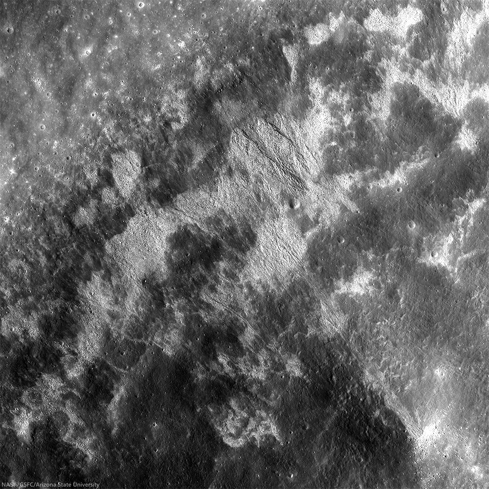
High reflectance material poured down the walls toward the floor of Maskelyne B crater, indicating interbedding of high reflectance with low reflectance layers in its walls. Image field of view is 2800 meters, vertical relief across this view is 1300 meters in depth. LROC NAC mosaic M137360167LR, LRO orbit 5376, August 25, 2010; 35.77° incidence angle, resolution 51 cm from 47.04 km [NASA/GSFC/Arizona State University].
Aaron Boyd
LROC News System

Maskelyne B (8.34 km; 1.97°N, 28.96°E) is a simple crater in southern Mare Tranquillitatis, about 1800 meters deep across only 8 km. The stratigraphy revealed in the walls of the Maskelyne B impact crater are clues to the volcanic history in Mare Tranquillitatis.

Perhaps there is older, higher reflectance anorthositic material beneath younger and darker basaltic lava flows. Layering also occurs by large impacts ejecting and emplacing older subsurface material on the local terrain. The most likely cause for the layers seen in Maskelyne B is from the erosion of large coherent blocks of unexposed mare basalt over mature space-weathered regolith. High resolution spectral imaging or samples of this area would resolve this ambiguity.

Maskelyne B (8.34 km; 1.97°N, 28.96°E) The region in Mare Tranquillitatis was a guidance landmark for the Apollo 11 expedition in 1969, and the terrain shares much with the sampled Tranquility Base only 170 km to the southwest by west. LROC WAC observation M129099228C (566 nm), LRO orbit 4158, May 21, 2010; 52.61° incidence angle, resolution 56.14 meters from 39.87 km [NASA/GSFC/Arizona State University].
The surface of Mare Tranquillitatis was built up over time by lava flows between 3.5 and 3.9 billion years ago creating stratigraphic units that are visible today. Maskelyne B formed long after the lava cooled. As the crater walls are eroded away by smaller impacts, the higher reflectance material is exposed and the surface is ground into boulders, cobbles, and dust.

High-resolution reproduction of the LROC NAC mosaic M137360167LR, and the northwest semicircle of Maskelyne B is available HERE [NASA/GSFC/Arizona State University].
The contrast between the light boulders and dark slopes draws the eye and piques curiosity to know what lies beneath the surface. See more of Maskelyne B and the surrounding area below.

Related Posts:

Tuesday, May 13, 2014

A splendid oblique view of Larmor Q

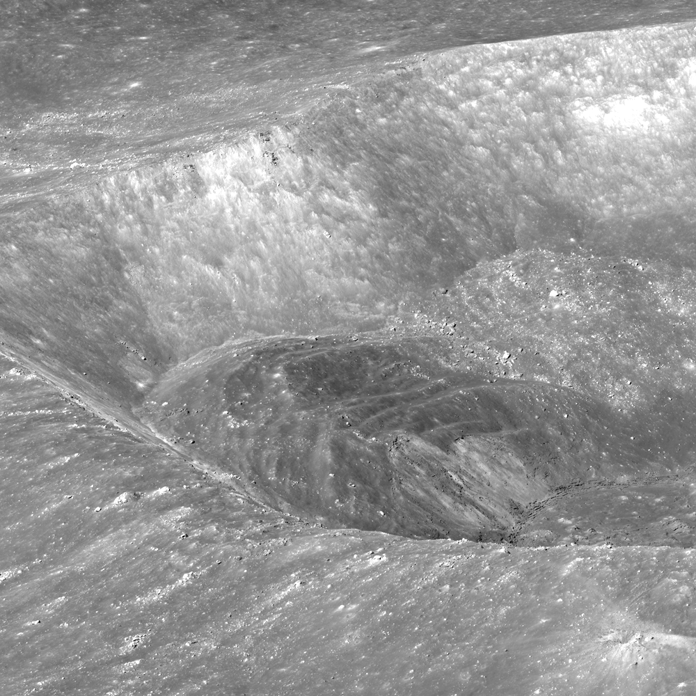
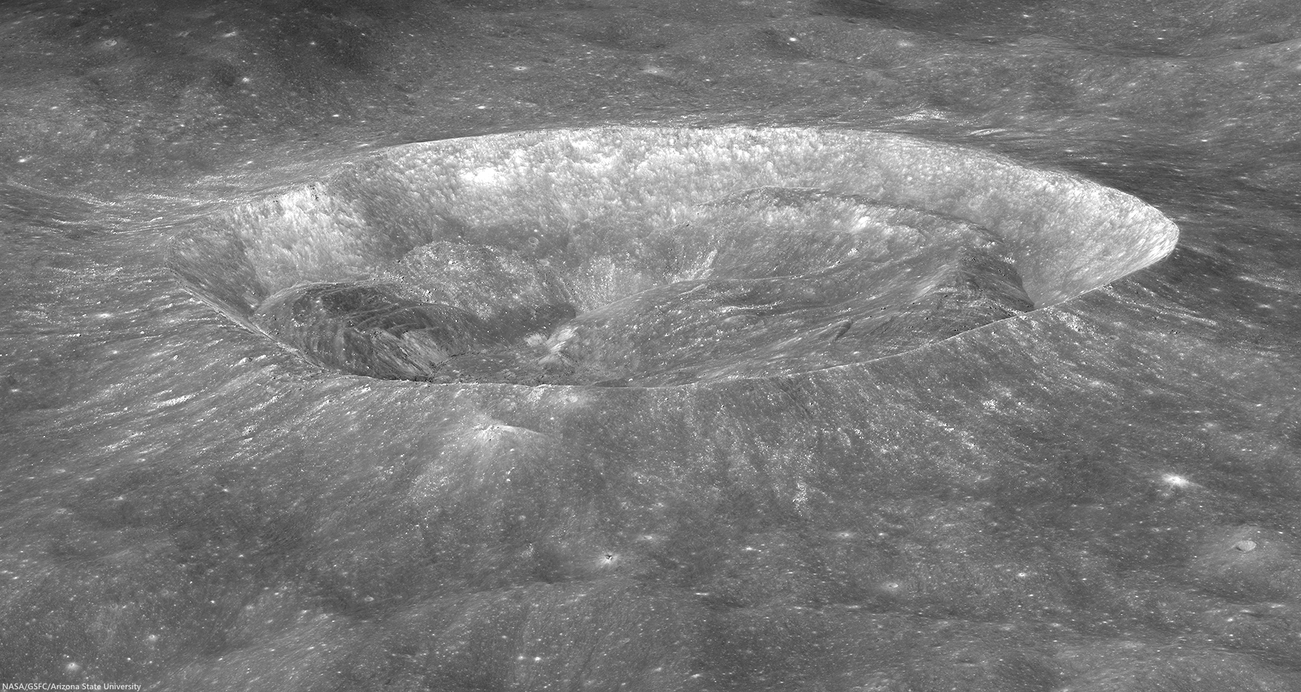
LROC NAC view of the south wall and rim of splendiferous Larmor Q crater, looking obliquely east-to-west; LROC NAC oblique mosaic M174081337LR, LRO orbit 10788, October 24, 2011; 44.93° incidence angle, resolution roughly 2.3 meters, spacecraft and camera suite slewed 67° from orbital nadir, 59.44 km over 28.84°N, 211.72°E [NASA/GSFC/Arizona State University].
J. Stopar
LROC News System

Larmor Q (28.674°N, 176.32°E) is sub-circular crater, whose  23 km diameter is measured north to south and 19 km measured east to west.

But Larmor Q is not just another stunning crater; it is also scientifically interesting.  Oblique images, like the one below, provide a unique vantage point that can help with geologic interpretation.

Oblique view (reduced for web-browsing) of Larmor Q crater, looking east-to-west. The crater is wider in the north-south direction than in the east-west direction. Click for larger image [NASA/GSFC/Arizona State University].
One of the most obvious features of Larmor Q is the large accumulation of slumped wall materials inside the crater. This crater is a transitional morphology between smaller simple craters like this one, HERE, and larger, complex craters like Tycho or Copernicus.

The crater Giordano Bruno (21 km in diameter) is another example of a transitional crater. Wall slumping in transitional craters affects the final crater shape. When the northern wall of Larmor Q failed, the northern rim crest of the crater moved outward, contributing to the larger crater diameter in the north-south direction.

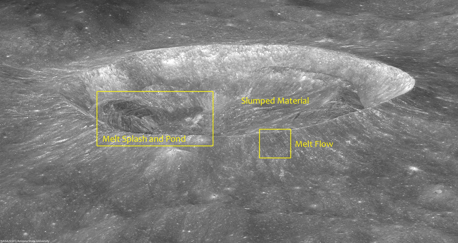
Prominent features of Larmor Q include slumped wall material and impact melt deposits; located at 176.313°E, 28.634°N [NASA/GSFC/Arizona State University].
This oblique image of Larmor Q is also useful for studying the distribution of impact melt, which, in turn, can tell us how impact melt is generated and interacts with the forming crater. In Larmor Q, most of the impact melt rock is located inside the crater opposite the largest slumped materials.

View of impact melt deposits inside Larmor Q. The melt has splashed up the southern wall (left) and ponded in the floor of the crater (center of image)[NASA/GSFC/Arizona State University].
Flows of impact melt on the rim of Larmor Q crater now solidified into lobate deposits [NASA/GSFC/Arizona State University].
There are also several relatively small deposits (flows) of impact melt rock on the crater rim. Because the largest concentration of impact melt occurs opposite the largest slumped materials, we infer that the melt “splashed” up on the southern wall primarily as a result of the slumped material impinging on the crater floor.

LROC Wide Angle Camera (WAC) image of the 18.3 km diameter crater Larmor Q. Slumping of the crater walls has not yet covered all the impact melt on its floor. LROC WAC monochrome (604 nm) observation M136389155C, LRO orbit 5233, August 14, 2010; 54.83° angle of incidence, resolution 82 meters from 58.4 km [NASA/GSFC/Arizona State University].
NASA ILIADS application simulated orbital view (not too dissimilar to the oblique perspective of the LROC Featured Image released May 13, 2014) shows the region of the lunar farside highland terrain between Larmor Q (23 x 19 km; 28.674°N, 176.32°E, bottom center) and Mare Moscoviense (275 km; 27.28°N, 148.1°E), perhaps the most immediately eye-catching feature of the Moon's opposing hemisphere, 750 km away and 1000 meters higher in average elevation above global mean. LROC WAC 100 meter global mosaic imagery applied to LRO LOLA laser altimeter-based digital elevation model [NASA/MSFC].
The full resolution oblique view of Larmor Q crater contains more fascinating clues of the impact cratering process, HERE.

Related LROC Featured Images:

Tuesday, April 8, 2014

One in a Million Mounds

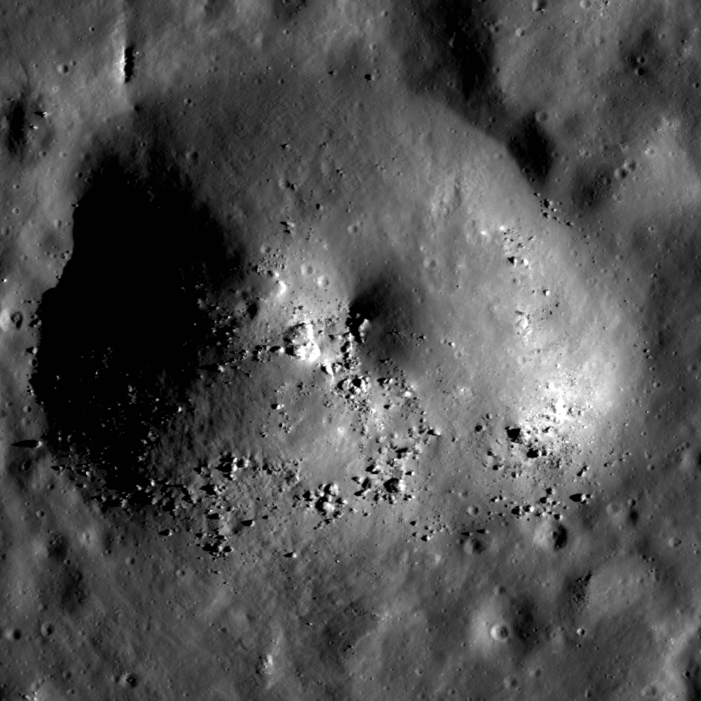
Boulders, most 10 to 20 meters across, pepper the flanks of a cratered mound on the northern bifurcated floor of Copernicus crater. LROC NAC observation M1139037292R, field of view roughly 1100 meters across, LRO orbit 19933, November 14, 2013; resolution 1.12 meters per pixel at 67° illumination incidence from 119.38 km [NASA/GSFC/Arizona State University].
J. Stopar
LROC News System

A domical mound protrudes from the floor of Copernicus crater (see 10.332°N, 340.117°E), which is dominated by a solidified sea of impact melt rocks. 

These rocks host a variety of positive- and negative-relief features including collapse features, central peaks, and blocky cratered mounds like the one above. 

Mounds with craters near their peaks can superficially resemble volcanoes, which often have a summit crater. Previously, several examples of cratered mounds, usually located along the mare-highlands boundaries, were suggested as possible newly discovered volcanoes (Volcanoes in Lacus Mortis, Bull's Eye Crater or Volcanic Vent, Another Small Volcano).

Cratered and Boulder dome on northern bifurcated floor of Copernicus (small arrow, above center). The demarcation between the character of the western and eastern floor, north of the landmark twin central peaks of Copernicus are particularly striking in spectral analysis. LROC WAC observation M147109260CE (643 nm), spacecraft orbit 6813, December 16, 2010; angle of incidence 77.97° at 60 meters per pixel resolution from 43.13 km [NASA/GSFC/Arizona State University].
This mound remains unexplored, thus we don't know for sure how it formed. Below is a collection of lunar mounds that are similar in appearance. For each example, try to think about how (or why not) these features might shed light on the formation of the cratered mound in Copernicus.

1. Volcanic Dome?

The summit crater of a volcano is expected to lack a raised rim and is usually less circular than an impact crater. Some small domes at the Compton-Belkovich silicic volcanic complex have craters that are thought to be summit vents (Example 1).

Example 1: A cratered and blocky dome at the Compton-Belkovich silicic volcanic complex, in the farside highlands. 510 meter-wide field of view from LROC NAC mosaic M119198897LR, LRO orbit 2700, January 27, 2010; resolution 60 cm per pixel, incidence angle 76.56° from 54.09 km [NASA/GSFC/Arizona State University].
Low basaltic shield volcanoes like those in the Hortensius region also have summit craters (Example 2). The crater on the Copernicus mound lacks a prominent rim crest, but high-resolution NAC-derived topography would better help us differentiate between a degraded impact crater and a volcanic crater in this case.

Example 2: Mare domes of Hortensius, west by southwest of Copernicus, in Oceanus Procellarum. Low profile, basaltic shield volcanoes, from a dramatic LROC NAC oblique observation, about 16.6 km-wide field of view from a mosaic of the left and right frames from LROC NAC M1108418130, spacecraft and camera slewed 56.7° west of a descending nadir, LRO orbit 15626, November 24, 2012; illumination incidence angle 74.56° at an average resolution of 2.87 meters, from 112 km over 7.28°N, 332.85°E [NASA/GSFC/Arizona State University].
2. Cratered Impact Debris?

Impact debris often appears dome-shaped and sometimes lacks craters (Example 3), although these mounds are frequently cratered.

Example 3: Bouldery Mound in Anaxagoras. 910 meter-wide field of view from LROC NAC M155309869RE, LRO orbit 8022, March 21, 2011; incidence angle 72.1° and resolution 88 cm per pixel from 42.15 km [NASA/GSFC/Arizona State University].
Larger mounds to the north of Today's Featured Image also exhibit craters near their peaks (Example 4). This type of cratered mound is fairly common on the floor of large impact craters.

Example 4: Similar debris and impact melt fallout mounds observed to the north (yellow arrow) of the bouldery mound (blue arrow) on the north floor of Copernicus. Both are comprised of impact debris and wall materials. Image is cropped portion of LROC NAC controlled mosaic COPERNICLOB [NASA/GSFC/Arizona State University].
3. Blocks as Remnants of Impact Melt that Once Draped the Mound?

Lumpy mounds on the floor of Rutherfurd crater (Example 5) are littered with the broken fragments of impact melt rocks. These rocks formed as sheets of impact melt draped over the crater floor. Over time, this sheet of rock slowly breaks up and dis-aggregates.

Example 5: The Lumpy floor of Rutherfurd crater; 1050 meter wide field of view from LROC NAC observation M1123653329R, LRO orbit 17769, May 20, 2013; resolution 1.05 meters, incidence angle 81.13° from 50.43 km [NASA/GSFC/Arizona State University].
A cracked mound on the floor of Anaxagoras crater (Example 6) illustrates what this sheet of melt might look like before dispersion through mass wasting. The boulders on the Copernicus mound could represent degraded bits of draping impact melt rocks; however, there is little evidence for a coherent layer of solidified melt as in the Anaxagoras example.

Example 6: Cracked mound on the floor of Anaxagoras; 600 meter-wide field of view from LROC NAC M122273232L, LRO orbit 3153, March 3, 2010; resolution 49 cm per pixel, incidence 73.78° from 42.18 km [NASA/GSFC/Arizona State University].
4. Squeeze-ups of Impact Melt?

Squeeze-ups of molten rock are one possible form of pseudo-volcanism that might occur in a molten sea of impact melt (Example 7).

Example 7: A possible squeeze-up of impact melt in Tycho crater; field of view 730 meters,  LROC NAC observation M1144856403R, LRO orbit 20751, January 20, 2014; illumination incidence angle 57.92° at 72 cm per pixel resolution, from 59.2 km [NASA/GSFC/Arizona State University]. [NASA/GSFC/Arizona State University].
However, squeeze-ups tend to experience tensional stress across their peak (Example 8), but in the Copernicus example, we do not see any evidence of stress fracturing across the mound. Thus, when all the evidence is considered together, the cratered mound in Copernicus is most consistent with a block of impact debris with a small impact crater near its summit -- not volcanic at all!

Example 8: Fractured mound in Stevinus crater; Structure is roughly 3 km across, LROC NAC observation M1131495601R, LRO orbit 18872, August 18, 2013; resolution 78 cm,  incidence 37.88° from 75.5 km [NASA/GSFC/Arizona State University].
Explore the entire NAC image HERE, and look for evidence of other explanations for this cratered mound.

Some Related Posts:
Shiny Mound, April 3, 2014
Hansteen α, January 15, 2014
Jackson's complexity, January 9, 2014
X marks the spot on the floor of Stevinus, January 7, 2014
Diversity of basaltic volcanism and the Marius Hills, November 5, 2013
Fall Out, October 3, 2013
That's a Relief, October 1, 2013
The Domes of Stevinus Crater, April 23, 2013
The Fourth Marian Dome, April 17, 2013
New oblique views of Gruithuisen Domes, March 4, 2013
Kagami-Mochi on the Moon, February 12, 2012
Morphology of lunar volcanic domes, February 22, 2011
Anomalous Mounds on the King Crater Floor, May 3, 2011
Constellation ROI at Hortensius Domes, April 2, 2010