Showing posts with label NASA Ames. Show all posts

Friday, June 26, 2015

LADEE analysis maps lopsided meteoric dust cloud

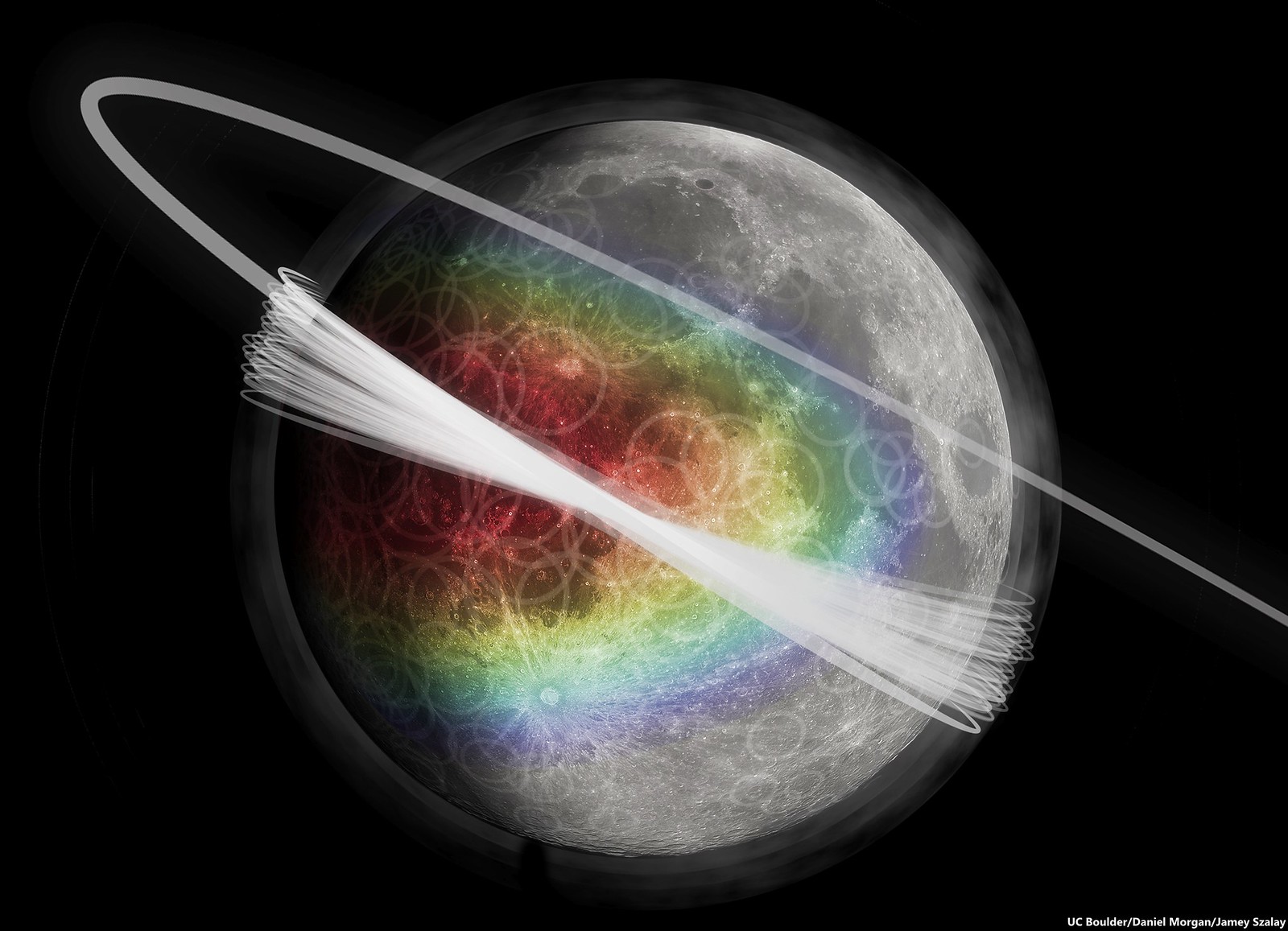
Artist's conception of the lunar dust exosphere surrounding the moon. The color represents the amount of material ejected from the surface, showing a peak in the apex direction. A haze of dust is shown around the moon. Gray faded circles are overlaid on the lunar surface to represent the random nature of the primary impactors. An artist's conception of the LADEE orbital inclination is also shown [UC Boulder/Daniel Morgan/Jamey Szalay].
Darryl Waller
Sharon Lozano
NASA Ames

New science results from NASA’s LADEE mission (Lunar Atmosphere and Dust Environment Explorer) indicate the Moon is regularly engulfed in a permanent, but lopsided and transitory, dust cloud increasing in density during encounters with cometary debris, like those producing the Geminids, according to a new study led by University of Colorado Boulder.

"Knowledge about the dusty environments in space has practical applications," said CU-Boulder physics Professor Mihály Horányi. "Knowing where the dust is and where it is headed in the solar system could help mitigate hazards for future human exploration, including dust particles damaging spacecraft or harming astronauts."

The cloud was discovered using data from a detector on board LADEE called the Lunar Dust Experiment (LDEX) designed and built by CU-Boulder. LDEX charted more than 140,000 impacts during the six-month survey launched in September 2013. NASA’s Ames Research Center in Moffett Field, California was responsible for spacecraft design, development, testing and mission operations.

“The LDEX team has been painstakingly analyzing their data since the LADEE mission ended on April 18, 2014,” said LADEE project scientist at Ames, Rick Elphic. “Their results answer one of the big LADEE science questions: is there a dust component to the tenuous lunar atmosphere?  And if so, why is it there?” 

According to Horányi, the cloud is primarily made up of tiny dust grains kicked up from the moon’s surface by the impact of high-speed, interplanetary dust particles. A single dust particle from a comet striking the moon’s surface lofts thousands of smaller dust specks into the airless environment, and the lunar cloud is maintained by this sometimes predictable process of regolith "gardening."

“Identifying this permanent dust cloud engulfing the moon was a nice gift from this mission,” said Horányi, the principal investigator for the LDEX instrument and lead author of the study. “We can carry these findings over to studies of other airless bodies, like the moons of other planets and the asteroids.”
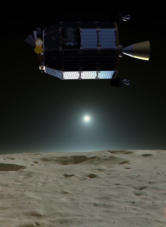
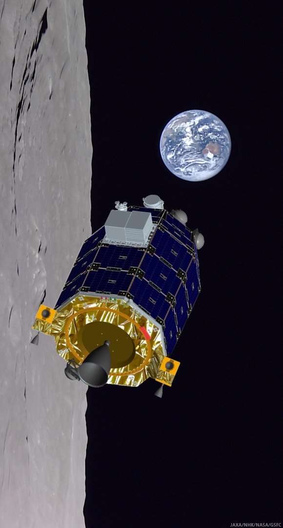
Artist's composite showing LADEE spacecraft in close orbit [NASA/JAXA/LP].
A paper on the subject appears in the June 17 issue of Nature. Co-authors Jamey Szalay, Sascha Kempf, Eberhard Grun and Zoltan Sternovsky from CU-Boulder, Juergen Schmidt from the University Oulu in Finland, and Ralf Srama from the University of Stuttgart in Germany.

The first hints of a cloud of dust around the moon came in the late 1960s when cameras functioning overnight aboard the unmanned moon lander Surveyor 7 captured bright glow hours ahead of lunar sunrise. Not long after astronauts in lunar orbit described a significant glow above the lunar surface when approaching sunrise, phenomenon brighter than the sun by itself should have been able to produce over a body with only a trace, essentially non-existent, atmosphere.

Because these new findings do not square with the Apollo reports of a thicker, higher dust cloud, conditions back then may have been somewhat different. The dust on the moon -- which is dark and sticky and regularly dirtied the suits of moonwalking astronauts -- was created over several billion years as interplanetary dust particles incessantly pounded the rocky lunar surface.

Apollo 17 commander Gene Cernan's sketches and description of horizon glow and streamers observed in lunar orbit in December 1972 [NASA].
Many of the cometary dust particles impacting lunar surface are traveling at thousands of miles per hour in a retrograde, or counterclockwise orbit around the sun, the opposite orbital direction of the solar system’s planets. This causes high-speed, near head-on collisions with the dust particles and the moon’s leading surface as the Earth-moon system travel together around the sun.

Related LADEE Posts:
LADEE impact crater found (October 29, 2014)
First Science from LADEE (45th LPSC, March 18 2014)
LADEE's (star tracker) images of the Moon (February 14, 2014)
LADEE economy adds 28 days to mission (February 5, 2014)
LROC captures LADEE from 9,000 meters (January 30, 2014)
Red Moon, Blue Moon Dwayne DayThe Space Review (December 3, 2013)
LADEE begins collecting data (November 22, 2013)
LADEE transitioning out of commissioning phase (November 6, 2013)
Apollo 12 ALSEP first to measure dust accumulation (November 21, 2013)
Chang'e-3 & LADEE: The Role of Serendipity (October 31, 2013)
LADEE LLCD sets new data record (October 25, 2013)
Measuring almost nothing, looking for the almost invisible (October 16, 2013)
LADEE legacies (September 7, 2013)
LADEE Prelaunch Mission Briefing (September 6, 2013)
ESA prepares for LADEE (July 31, 2013)
LADEE arrives at Wallops Island (June 5, 2013)
LADEE ready to baseline dusty lunar exosphere (June 5, 2013)
First laser comm system ready for launch on LADEE (March 16, 2013)
LADEE project manager update (February 6, 2013)
The Mona Lisa test for LADEE communications (January 21, 2013)
Toxicity of lunar dust (July 2, 2012)
Expectations for the LADEE LDEX (March 23, 2012)
The Dust Management Project (August 9, 2010)
LADEE architecture and mission design (July 6, 2010)
DesertRatS testing electrodynamic dust shield (July 5, 2010)
Dust transport and its importance in the origin of lunar swirls (February 21, 2010)
Dust accumulation on Apollo laser reflectors may indicate a surprisingly fast and
more dynamic lunar exosphere
 (February 16, 2010)
NASA applies low cost lessons to LADEE (January 18, 2010)
Nanotech advances in lunar dust mitigation (August 19, 2009)
Moon dust hazard influenced by Sun's elevation (April 17, 2009)
LADEE launch by Orbital from Wallops Island (April 14, 2009)
Understanding the activation and solution properties of lunar dust
for future lunar habitation
 (March 2, 2009)
Respiratory toxicity of lunar highland dust (January 19, 2009)
Toxicological effects of moon dust (June 25, 2008)
Moon dust and duct tape (April 22, 2008)

Wednesday, February 25, 2015

Lunar Orbiter Image Restoration Project: Last Mile

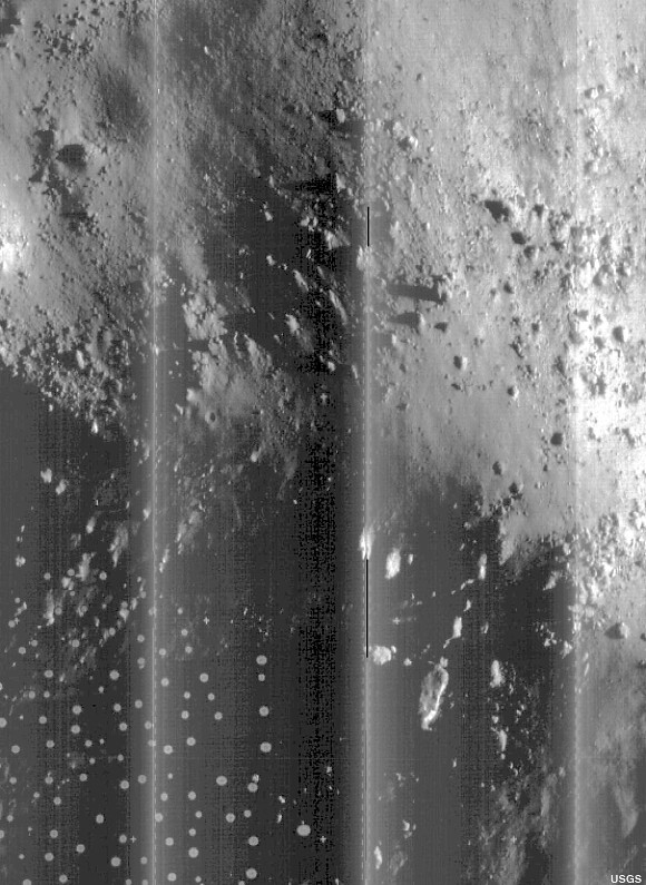
Until the original tapes were found, stored in an abandoned McDonalds Restaurant on site at Ames Research Center, and subsequently read and remastered using totally unavailable equipment built from scratch, this represents our best view of of the rugged slopes of the central peaks of Copernicus crater, a facsimile of a photograph developed in lunar orbit and radioed back to Earth from Lunar Orbiter V, August 17, 1967. For comparison, see the photographs that follow below [USGS]. 
From moonandback video, May 2010
Dennis Wingo

The Lunar Orbiter Image Recovery Project (LOIRP) is a public/private project to recover, from the original master tapes, the image data from the five spacecraft NASA sent to the moon in the 1960’s and provide it to the scientific community and the public.  The first is done through a peer review process and then the data is provided to the National Space Science Data Center (NSSDC) for archiving.  We also have a public website through NASA at the Solar System Exploration Research Virtual Institute (SSERVI) at the NASA Ames Research Center.  This missive is to explain the background of the mission, the character of the data, and why it is important to our scientific and national history.

At this time we have completed over 90% of the work necessary to archive and publish these images.  However, sometimes that last 10% is the hardest and we have in the dozens of terabytes of data to complete the processing of our image captures.  Why doesn't NASA pay for this?  They have paid for the vast majority of our work.  NASA’s Space Science Mission Directorate, NASA Ames, and and SSERVI have been magnificent in support of our work.  However, NASA’s budget is severely constrained, and for legacy projects like this, it is our work in technoarchaeology (literally the archaeology of technology) that is saving this data for posterity.

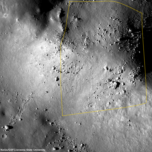
Field of view captured in by Lunar Orbiter V in 1967, shown in the image further above, outlined on a more recent photographic survey by the Lunar Reconnaissance Orbiter (LRO), LROC M181302109R, spacecraft orbit 11832, January 15, 2012 [NASA/GSFC/Arizona State University].
When we started this project, it was only to save the images of Lunar Orbiter’s II and III.  However, in 2011 NASA asked us how much it would cost to complete all five orbiters.  We estimated $400,000.  NASA provided $300,000 of this, leaving a gap of $100,000.  This is why we ask for your support in our crowdfunding effort, to complete this task.  These images, provided on the SSERVI website, will be free to the public with no copyright.  The American taxpayer paid for this effort and even though our company has also contributed materially to the effort and we are extending this through your generous donations through crowdfunding, we want this to be provided free of charge, or any intellectual property right restrictions.

Detail from LOIRP Lunar Orbiter V (Image 151-H1 -Copernicus Central Uplift) The LOIRP Image was derived from the original analog tapes from the LO ground stations and has 4x the dynamic range of the LO film archive. This image with a resolution of about 2 meters, taken on August 16, 1967 from 103 km. This version of the LO-V-151-H image is from the original ground station tape from the Woomera ground station in Australia (tape W5-58).
NASA had stored these original analog data tapes for over four decades, but if it were not for our project and former NASA archivist Nancy Evan’s preservation of the tape drives in her barn, this archive at its best quality would be lost to history.  Following is a description of the Lunar Orbiters, their camera, the images and what we are doing to preserve this legacy of the early Apollo program.

Background on the Lunar Orbiter

In 1966-67 NASA sent five spacecraft to the Moon to do a high resolution photo reconnaissance of the surface in preparation for the manned Apollo lunar landings.  This was the first time in human history, other than a few closeups before impact from the Ranger spacecraft, that the moon had been seen up close and personal.

Enjoy the full post from Dennis Wingo, HERE.

Related Posts:
The LOIRP time machine looks back 43 years (June 3, 2010)
New releases from Lunar Orbiter II (1966) - (May 7, 2010)
Boulders of Copernicus (December 11, 2009)
LOIRP: Boulder Trails on the Moon (December 10, 2009)
Lunar Orbiter's originals vs. LOIRP restorations (December 9, 2009)
New restored detail from Lunar Orbiter II (December 8, 2009)
LOIRP configures second FR-900 tape drive (November 12, 2009)
The importance of lunar water (September 28, 2009)
LOIRP remasters the Moon's South Pole (August 14, 2009)
Lockheed Martin donates Clean-Room to LOIRP (August 12, 2009)
LOIRP astounds again, re-release of LO-II0162 (1967)
with each of three high-res sub-frames
 (August 10, 2009)
Full Earth, as seen by Orbiter V (August 7, 2009)
Lunar Orbiter III-154-H2 (June 16, 2009)
LOIRP recovers Lunar Orbiter IV lunar South Pole image from 1967 (June 16, 2009)
LOIRP recovers detail of Fra Mauro and future landing site of Apollo 14 (June 11, 2009)
New LOIRP high res Lunar Orbiter image of western Oceanus Procellarum (June 10, 2009)
LOIRP recovers image of Ranger 8 impact (June 9, 2009)
LOIRP's "Pictures of the Century" (March 23, 2009)
More astounding new detail from LOIRP (February 26, 2009)
Breakthrough in Lunar Orbiter photograph remastering (February 20, 2009)

Wednesday, February 5, 2014

LADEE economy adds 28 days to mission

NASA's LADEE, last of the unmanned Constellation precursor missions, in retrograde orbit "baselines" the dusty fallout of the Moon's tenuous exosphere ahead of lunar sunrise [NASA/ARC/JAXA/Dana Berry].
Rachel Hoover
NASA Ames Research Center

NASA's Lunar Atmosphere and Dust Environment Explorer (LADEE) has been approved for a 28-day mission extension. The spacecraft is now expected to impact the lunar surface on or around April 21, 2014, depending on the final trajectory.

The extension provides an opportunity for the satellite to gather an additional full lunar cycle worth of very low-altitude data to help scientists unravel the mysteries of the moon’s atmosphere.

"The launch vehicle performance and orbit capture burns using LADEE's onboard engines were extremely accurate, so the spacecraft had significant propellant remaining to enable extra science," said Butler Hine, LADEE project manager at NASA’s Ames Research Center in Moffett Field, California, where the mission was designed, built, tested, and its day-to-day operations are managed. "This extension represents a tremendous increase in the amount of science data returned from the mission."

The small, car-sized robotic probe launched Sept. 6, 2013, from NASA's Wallops Flight Facility on Wallops Island, Virginia, and has been orbiting the moon since October 6.

On November 10, LADEE began gathering science data and on November 20, the spacecraft entered its science orbit around the moon's equator at an altitude between 12 to 60 kilometers; a unique position that allows the spacecraft to frequently pass from lunar day to lunar night, approximately every two hours. This vantage provides data about the full scope of changes and processes occurring within the moon's tenuous atmosphere.

"The science team has already established a baseline of data for the tenuous lunar atmosphere, or exosphere, and dust impacts," said Rick Elphic LADEE project scientist at Ames. "One cool thing about this extension is that we plan to fly LADEE at only a few kilometers above the lunar surface. This will be much lower than we’ve been before."

Using a set of three instruments, scientists are able to measure the chemical composition of the atmosphere, collect and analyze samples of lunar dust particles in the atmosphere and hope to address a long-standing question: Was lunar dust, electrically charged by sunlight, responsible for the pre-sunrise glow above the lunar horizon detected during several Apollo missions?

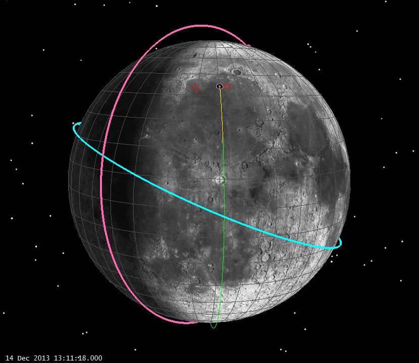
Relative orbital positions of LRO (red), LADEE (blue) and Chang'e-3 only minutes prior to the latter's landing in Mare Imbrium, December 14 ["Post-Landing look at Chang'e trajectory," The Astrogator's League (astrogatorsleague.com)].
Specifically, the Neutral Mass Spectrometer (NSM) operates while pointing in different directions to look for atoms and molecules in the lunar atmosphere from a variety of sources, and has measured helium, neon, and argon-40; three noble gases. The Ultraviolet-Visible Spectrometer (UVS) has peered over the lunar horizon to look for the glow of atoms, molecules and dust in the lunar atmosphere and has made measurements of atmospheric sodium and potassium at lunar sunset, sunrise and noon. The Lunar Dust Experiment (LDEX) recorded dust impacts as soon as its cover opened and has measured the dust tossed up by a fairly steady "rain" of meteoroids on the lunar surface. LDEX occasionally sees an increase in dust impacts due to meteoroid showers, such as the Geminids, and "dust bursts" that may be due to LADEE flying through plumes kicked up from nearby meteoroid impacts.

Detailed information about the structure and composition of the thin lunar atmosphere and whether dust is being lofted into the lunar sky will help researchers understand other bodies in the solar system, such as large asteroids, Mercury and the moons of outer planets.

LADEE was built using an Ames-developed Modular Common Spacecraft Bus architecture, a general purpose spacecraft design that allows NASA to develop, assemble and test multiple modules at the same time. The LADEE bus structure is made of a lightweight carbon composite with an unfueled mass of 547.2 pounds.

NASA's Science Mission Directorate in Washington funds the LADEE mission. Ames manages the overall mission and serves as a base for mission operations and real-time control of the probe. NASA's Goddard Space Flight Center in Greenbelt, Maryland, catalogues and distributes data to a science team located across the country and manages the science instruments. NASA's Marshall Space Flight Center in Huntsville, Alabama manages LADEE within the Lunar Quest Program Office.

Related Recent Posts:
LROC captures LADEE from 9,000 meters (January 30, 2014)
Red Moon, Blue Moon Dwayne Day, The Space Review (December 3, 2013)
LADEE begins collecting data (November 22, 2013)
LADEE transitioning out of commissioning phase (November 6, 2013)
Apollo 12 ALSEP first to measure dust accumulation (November 21, 2013)
Chang'e-3 & LADEE: The Role of Serendipity (October 31, 2013)
LADEE LLCD sets new data record (October 25, 2013)
Measuring almost nothing, looking for the almost invisible (October 16, 2013)
LADEE legacies (September 7, 2013)

Thursday, January 30, 2014

LROC captures LADEE at 9 km

LADEE 9 km from LRO (LROC NAC)
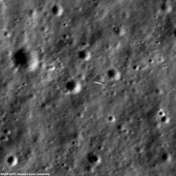
NASA's Lunar Atmosphere and Dust Environment Explorer (LADEE) caught zooming 9-km below LRO, all the more amazing since the spacecraft orbit the Moon in orbits perpendicularly to one another, or 90° out of phase. LROC NAC M1144387511LR  [NASA/GSFC/Arizona State University].
Mark Robinson
Principal Investigator
Lunar Reconnaissance Orbiter Camera (LROC)
Arizona State University

Teamwork! Imaging NASA's Lunar Atmosphere and Dust Environment Explorer (LADEE) spacecraft with LROC required extremely precise timing, worked out by the LADEE, LROC, and LRO operations teams. LADEE is in an equatorial orbit (east-to-west) while LRO is in a polar orbit (south-to-north).

By happenstance the two spacecraft are occasionally very close - on 15 January the two came within 9 km of each other. Since LROC is a pushbroom imager, it builds up an image one line at a time, thus catching a target as small and fast as LADEE is tricky! Both spacecraft are orbiting the Moon with velocities near 1600 meters per second (3600 mph), so timing and pointing of LRO needs to be nearly perfect to capture LADEE in an LROC image.

LADEE 9 km from LRO (LROC NAC)
LADEE smeared out against the lunar background. Image expanded 4x, lunar scene 81 meters wide, LADEE about 2 meters in the long direction [NASA/GSFC/Arizona State University].
LADEE passed directly beneath the LRO orbit plane a few seconds before LRO crossed the LADEE orbit plane, meaning a straight down LROC image would have just missed LADEE. Now is where the careful planning came into play. The LADEE and LRO teams worked out the solution: simply have LRO roll 34° to the west so the LROC detector (one line) would be in the right place as LADEE passed beneath.

As planned at 8:10:51.693 PM EST on 14 January 2014 LADEE entered the NAC field of view for 1.35 milliseconds and a smeared image of the intrepid spacecraft was snapped. LADEE appears in four lines of the LROC NAC-R, and is distorted right-to-left. What can we see in the LADEE pixels in the NAC image?

Geometrically corrected image of LADEE, 4x enlargement[NASA/GSFC/Arizona State University].
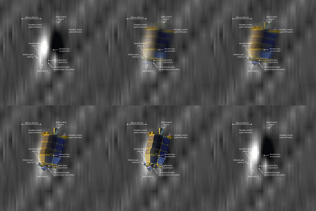
Step one is to minimize the geometric distortion in the smeared lines that show the spacecraft. However, in doing so the background lunar landscape becomes distorted and unrecognizable (see above). The scale (dimension) of the NAC pixels recording LADEE is 9 cm (3.5 in), however, since the spacecraft were both moving about 1600 meters per second the image is blurred in both directions by around 50 cm. So the actual pixel scale lies somewhere between 9 cm and 50 cm, thus even with geometric correction LADEE is a bit blurry. Despite the blur it is possible to find details of the spacecraft, which is about 1 meter wide and 2 meters long. You can see the engine nozzle, bright solar panel, and perhaps a star tracker camera (especially if you have a correctly oriented schematic diagram of LADEE for comparison).

Computer generated image of LADEE oriented and illuminated as
it was during the close pass with LRO
[NASA ARC/LADEE].
LADEE was designed to study the Moon's thin exosphere and the lunar dust environment. An “exosphere” is an atmosphere that is so thin that molecules do not collide with each other. This exosphere is so tenuous that the number of molecules in a given volume at the Moon is less than the number of molecules in the same volume of space outside the International Space Station..

Dissolve animation with NAC image of LADEE and labeled LADEE graphic
degraded to match NAC resolution
[NASA/GSFC/ARC/Arizona State University].
LADEE is still early in its mission. One of the more exciting moments so far was observing how the lunar exosphere changed as the Chinese lander Chang'e 3 set down on the Moon on 14 December 2013. There was concern that the exhaust plume might spread out and mix with native molecules causing a contamination problem for the LADEE measurements, but so far no problem.

Find LADEE in the NAC left/right mosaic, the irregular shape of the image is due to topography and the off-nadir slew (hint: LADEE coordinates sample 9514, line 19827), HERE.

Related LROC Featured Images:
Impact!
Mountains of the Moon

Tuesday, August 27, 2013

More water at lunar equator, hints of water below

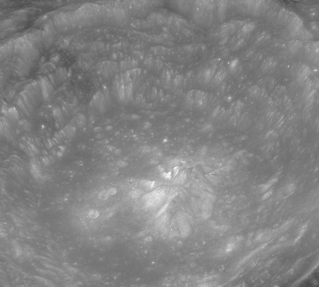
Bullialdus Interior Oblique
Investigations of the central peaks (where the deepest material these kinds of craters excavate is deposited) of nearside equatorial crater Bullialdus (60.7 km, 20.7°S, 337.8°E) have detected rocks composed of magmatic water of a kind collected by Apollo using the NASA M3 radar instrument aboard the ISRO orbiter Chandrayaan-1. LROC Narrow Angle Camera (NAC) oblique observation M1099038207LR, spacecraft orbit 14313, August 8, 2012; overall resolution 2.4 meters, angle of incidence 48.8° with spacecraft and camera slewed 63.4° west of nadir, 73.65 kilometers over 20.96°S, 331.93°E [NASA/GSFC/Arizona State University].
NASA-funded lunar research has yielded evidence of water locked in mineral grains on the surface of the moon from an unknown source deep beneath the surface.

Using data from NASA's Moon Mineralogy Mapper (M3) instrument aboard the Indian Space Research Organization (ISRO) Chandrayaan-1 spacecraft, scientists remotely detected magmatic water, or water that originates from deep within the moon's interior, on the surface of the moon.

The findings, published by letter, August 25, in Nature Geoscience, represent the first detection of this form of water from lunar orbit. Earlier studies had shown the existence of magmatic water in lunar samples returned during the Apollo program.

M3 imaged the lunar impact crater Bullialdus, which lies near the lunar equator. Scientists were interested in studying this area because they could better quantify the amount of water inside the rocks due to the crater's location and the type of rocks it held. The central peak of the crater is made up of a type of rock that forms deep within the lunar crust and mantle when magma is trapped underground.

"This rock, which normally resides deep beneath the surface, was excavated from the lunar depths by the impact that formed Bullialdus crater," said Rachel Klima, a planetary geologist at the Johns Hopkins University Applied Physics Laboratory (APL) in Laurel, Maryland.

"Compared to its surroundings, we found that the central portion of this crater contains a significant amount of hydroxyl - a molecule consisting of one oxygen atom and one hydrogen atom -- which is evidence that the rocks in this crater contain water that originated beneath the lunar surface," Klima said.

LROC Wide Angle Camera (WAC) 100 meter per pixel mosaic of Bullialdus, an illustration for the post "Bullialdus Central Peak Oblique," January 23, 2013 [NASA/GSFC/Arizona State University].
In 2009, M3 provided the first mineralogical map of the lunar surface and discovered water molecules in the polar regions of the moon. This water is thought to be a thin layer formed from solar wind hitting the moon's surface. Bullialdus crater is in a region with an unfavorable environment for solar wind to produce significant amounts of water on the surface.

"NASA missions like Lunar Prospector and LCROSS (the Lunar Crater Observation and Sensing Satellite) and instruments like M3 have gathered crucial data that fundamentally changed our understanding of whether water exists on the surface of the moon," said S. Pete Worden, center director at NASA's Ames Research Center in Moffett Field, Calif. "Similarly, we hope that upcoming NASA missions such as the Lunar Atmosphere and Dust Environment Explorer, or LADEE, will change our understanding of the lunar sky."

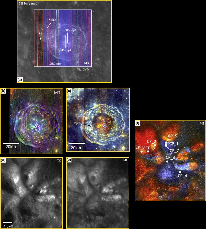
Combined data for the Bullialdus area
Figure 5 from "One Moon, Many Measurements 3: Spectral reflectance," Science Direct (Icarus, Vol 226, #1, Sept.-Oct. 2013) Combined data for the Bullialdus area. (a) Location of available datasets of the Bullialdus region: gray scale base map, MI; red dots, SP traverses; blue shading, M3 scene width; light-blue dots, SIR-2 traverses. SP/M3/SIR-2 datasets within the white box are presented in this figure. The white box corresponds to the area shown in (b) and (c). TC data cover the entire area. Data included in Table 2 for SP are indicated in yellow, and those for SIR-2 are solid light blue. (b) M3 color-composite image. Band assignments are integrated band depth at 1 μm (red), integrated band depth at 2 μm (green), and 1.5 μm albedo (blue). A manual shadow mask has been applied, primarily on the west (left) crater wall. (c) MI color-composite image. Red denotes the continuum-removed absorption depth of 0.95 μm, green denotes that of 1.05 μm, and blue denotes that of 1.25 μm. (d) TC image of the central part of the Bullialdus central peak. (e) MI 750 nm-band image after photometric correction using local topographic information. (f) MI color-composite image of the center of the Bullialdus central peak. (For interpretation of the references to color in this figure legend, the reader is referred to the web version of this article.)

The detection of internal water from orbit means scientists can begin to test some of the findings from sample studies in a broader context, including in regions that are far from where the Apollo sites are clustered on the near side of the moon. For many years, researchers believed that the rocks from the moon were bone-dry and any water detected in the Apollo samples had to be contamination from Earth.

"Now that we have detected water that is likely from the interior of the moon, we can start to compare this water with other characteristics of the lunar surface," said Klima. "This internal magmatic water also provides clues about the moon's volcanic processes and internal composition, which helps us address questions about how the moon formed, and how magmatic processes changed as it cooled."

APL is a not-for-profit division of Johns Hopkins University. Joshua Cahill and David Lawrence of APL and Justin Hagerty of the U.S. Geological Survey's Astrogeology Science Center in Flagstaff, Arizona co-authored the paper.

NASA's Lunar Advanced Science and Engineering Program, the NASA Lunar Science Institute (NLSI) at Ames and the NASA Planetary Mission Data Analysis Program supported the research. NLSI is a virtual organization jointly funded by NASA's Science Mission Directorate and NASA's Human Exploration and Operations Mission Directorate in Washington, to enable collaborative, interdisciplinary research in support of NASA lunar science programs.

Tuesday, June 11, 2013

Lunar Orbiter images last seen 47 years ago

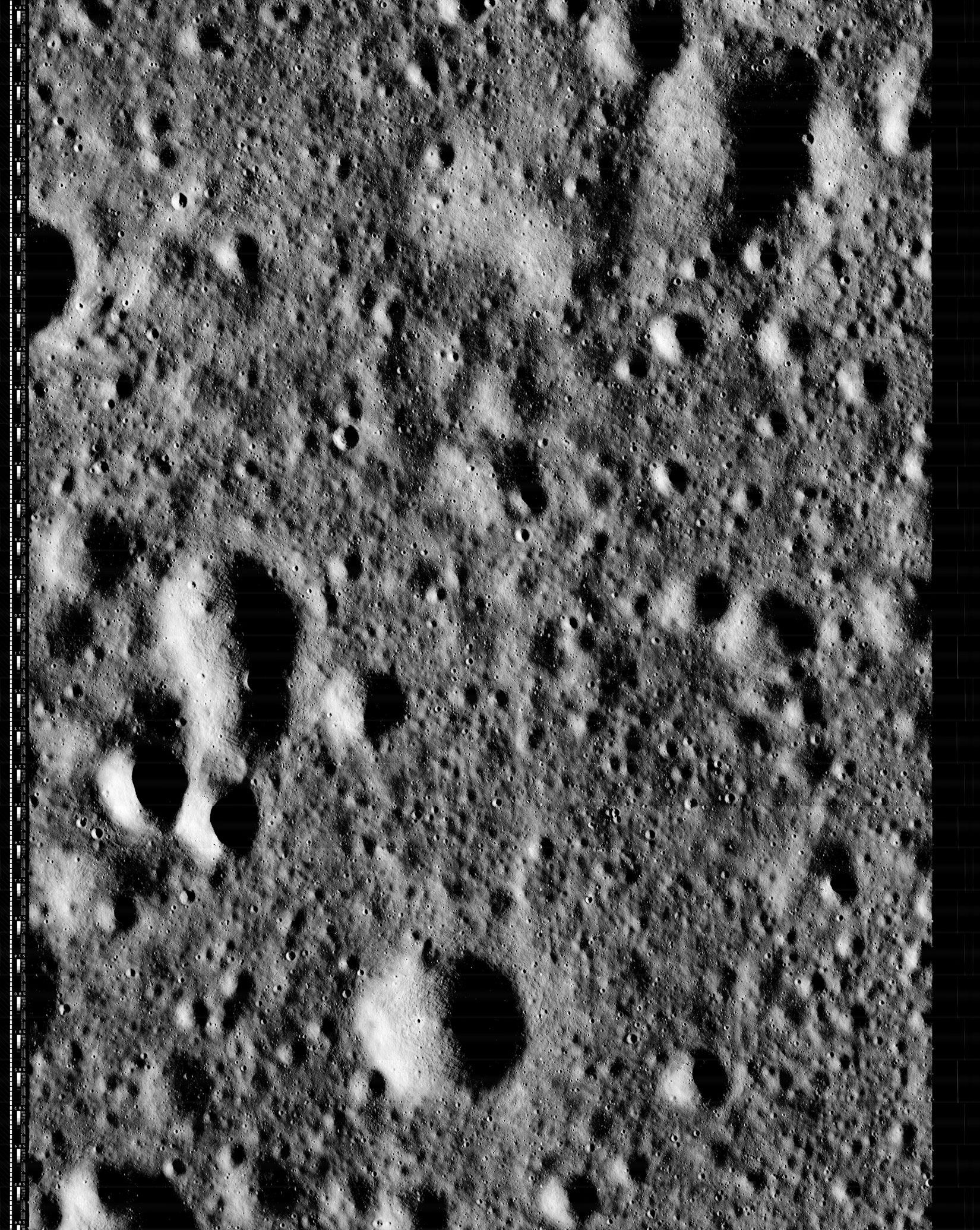
Lunar Orbiter 2 frame 159 (H2), an approximately 4.5 by 6 kilometers stretch of lunar mare 250 km southwest of Copernicus. One of three high-resolution photographs swept up, developed, scanned and radioed back to Earth in 1966. The fully-restored, previously incomplete session has been restored by the Lunar Orbiter Image Restoration Project (LOIRP).
Keith Cowing
LOIRP

After being forgotten for nearly 47 years, three high resolution images taken by the Lunar Orbiter II spacecraft have been rediscovered by the Lunar Orbiter Image Recovery Project (LOIRP).

It is unlikely that anyone has seen these images since they were sent back to Earth. Indeed, it is unlikely that very many people saw them at that time either.

The three high resolution images were taken along with a medium resolution image on 23 November 1996 at 17:05:39 GMT. The center point of the images was 26.94 West Longitude, 3.196 degrees North Latitude. The images were taken at an altitude of 43.6 km and the image resolution is 0.93 meters.

Thumbnail of the medium resolution image, from the Lunar and Planetary Institute catalog. The area captured at high resolution in November 1966 is outlined at center. The area seen in "H2" above is outlined in yellow. This region is characterized by ejecta and secondary craters, primarily radiant from the Copernicus impact from 250 km northeast.
We recently came across these three images (#2159) and noticed that they do not appear online at the LPI Lunar Orbiter database. Only the medium resolution image gets mentioned at LPI.

These three images were retrieved from original Lunar Orbiter program analog data tapes yet they appear nowhere in NASA's publications. They do appear on microfilm archives at LOIRP and are mentioned in a simple data log online at LPI. LOIRP has a more extensive computer printout of this data that shows more detail about the images - but not the images themselves.

Among the highest resolution Wide Angle Camera images of the region, among LROC images thus far released to the Planetary Data System (PDS), the area of interest is smaller than a postage stamp, above the right (east) central edge of this 32.4 km-wide field of view from LROC Wide Angle Camera (WAC) observation M166025782C (604 nm), LRO orbit 9601, July 23, 2011; 62.86° angle of incidence, resolution 55.85 meters per pixel from 40.64 km [NASA/GSFC/Arizona State University].
Unless someone happened to be looking through this microfilm collection (LOIRP has the only extant copy) then it is pretty safe to assume that no one has actually seen these images since a technician saw them on a TV monitor in 1966.

Read the full article, catch up on the Lunar Orbiter Image Restoration Project,
and discover how you can help
, HERE.

Saturday, March 16, 2013

First laser comm system ready for launch on LADEE

Lunar Laser Communication Demonstration (LLCD) components integrated onto the Lunar Atmosphere and Dust Environment Explorer (LADEE) spacecraft [NASA].
Dewayne Washington
Goddard Space Flight Center

A new NASA-developed, laser-based space communication system will enable higher rates of satellite communications similar in capability to high-speed fiber optic networks on Earth.

The space terminal for the Lunar Laser Communication Demonstration (LLCD), NASA's first high-data-rate laser communication system, was recently integrated onto the Lunar Atmosphere and Dust Environment Explorer (LADEE) spacecraft at NASA's Ames Research Center, Moffett Field, California. LLCD will demonstrate laser communications from lunar orbit to Earth at six times the rate of the best modern-day advanced radio communication systems.

"The successful testing and integration of LLCD to LADEE is a major accomplishment," said Donald Cornwell, LLCD mission manager at NASA's Goddard Space Flight Center in Greenbelt, Maryland. "It demonstrates that this new technology is robust and ready for space. This is the first time NASA has had such a communication system pass all its tests and be certified flight ready."

The LLCD mission will use a highly reliable infrared laser, similar to those used to bring high-speed data over fiber optic cables into our workplaces and homes. Data, sent in the form of hundreds of millions of short pulses of light every second, will be sent by the LADEE spacecraft to any one of three ground telescopes in New Mexico, California and Spain.

S-band communications aboard the LADEE spacecraft would take 639 hours to download an average-length HD movie. Using LLCD technology that time would be reduced to less than eight minutes.

The real challenge of LLCD will be to point its very narrow laser beam accurately to ground stations across a distance of approximately 238,900 miles while moving. Failure to do so would cause a dropped signal or loss of communication.

"This pointing challenge is the equivalent of a golfer hitting a ‘hole-in-one' from a distance of almost five miles," said Cornwell. "Developers at the Massachusetts Institute of Technology's (MIT) Lincoln Laboratory have designed a sophisticated system to cancel out the slightest spacecraft vibrations. This is in addition to dealing with other challenges of pointing and tracking the system from such a distance. We are excited about these advancements."

The LLCD mission will also serve as a pathfinder for the 2017 launch of NASA's Laser Communication Relay Demonstration (LCRD). That mission will demonstrate the long-term viability of laser communication from a geostationary relay satellite to Earth. In a geostationary orbit the spacecraft orbits at the same speed as Earth, which allows it to maintain the same position in the sky.

Engineers believe that future space missions will be able to use laser communication technology with its low mass and power requirements, to provide increased data quantity for real-time communication and 3-D high-definition video. For example, using S-band communications aboard the LADEE spacecraft would take 639 hours to download an average-length HD movie. Using LLCD technology that time would be reduced to less than eight minutes.

Prior to shipment from MIT, the LLCD spaceflight hardware was subjected to a rigorous set of flight test simulations such as the strong vibrations expected from a Minotaur V rocket, the launch vehicle for the LADEE mission. The LLCD hardware also had to withstand simulated extreme temperatures and other conditions it will experience within the harsh environment of space. Throughout this stringent battery of tests, LLCD maintained its critical alignment and stable pointing accuracy.

Flight and ground station hardware for LLCD was designed and built at Lincoln Laboratory in Lexington, Mass. NASA's Jet Propulsion Laboratory in Pasadena, Calif., and the European Space Agency are developing the ground stations in California and Spain, respectively.

"This is an exciting time for space communications," said Cornwell. "We are about to make a leap in communications ability that is unmatched in NASA's history."

The LLCD mission management team resides at Goddard under the sponsorship of the Space Communications and Navigation (SCaN) Program at NASA Headquarters in Washington. The LADEE mission is managed by Ames under the sponsorship of NASA's Planetary Science Division within the Science Mission Directorate at NASA Headquarters.

NASA's Science Mission Directorate in Washington funds LADEE, a cooperative effort led by Ames, which is responsible for managing the mission, building the spacecraft and performing mission operations. In addition to managing the LLCD payload, Goddard is responsible for managing the science instruments and the science operations center. NASA Wallops Flight Facility has the responsibility for launch vehicle integration, launch services and launch range operations. NASA's Marshall Space Flight Center, Huntsville, Alabama, manages LADEE within the Lunar Quest Program Office.

The LADEE mission, on which LLCD is a hosted payload, is scheduled to launch in August.

Related Posts:
LADEE project manager update (February 6, 2013)
The Mona Lisa test for LADEE communications (January 21, 2013)
Expectations for the LADEE LDEX (March 23, 2012)
LADEE architecture and mission design (July 6, 2010)
NASA applies low cost lessons to LADEE (January 18, 2010)
LADEE launch by Orbital from Wallops Island (April 14, 2009)

Monday, February 11, 2013

NASA Lunar Science Forum, July 16-18, 2013

When NASA's Lunar Science Institute was commissioned in 2008, the goal of establishing extended human activity on the Moon as a foundation for exploring Mars and beyond, was still official U.S. policy. The Vision for Space Exploration, borne out of the aftermath of the Columbia accident, was scrapped but much of the momentum set into motion a decade ago continues to pay huge dividends [Frassanito/NASA].
The NASA Lunar Science Institute has formally announced the 6th Annual NASA Lunar Science Forum will be held July 16-18, 2013 at NASA Ames Research Center, Moffett Field, CA.  This year's forum will feature sessions on in-depth scientific results from Lunar Reconnaissance Orbiter (LRO), Acceleration, Reconnection, Turbulence and Electrodynamics of the Moon’s Interaction with the Sun (ARTEMIS), and Gravity Recovery And Interior Laboratory (GRAIL), as well as a status update on the Lunar Atmosphere and Dust Environment Explorer (LADEE) mission scheduled for launch in August 2013.  

Dedicated side-conferences for graduate students and young lunar professionals (LunGradCon and Next Generation Lunar Scientists and Engineers, NGLSE) will precede the LSF on July 13 and 14. Science sessions will focus on recent mission results and in-depth analyses of lunar science and exploration studies.  Education and Public Outreach (E/PO) program results will be interwoven among science topics as well.

Multiple meetings result in unfortunate overlaps, and this year’s LSF is occurring over the same time frame as the Eighth International Mars Conference in Pasadena.  Given the scientific and exploration synergies between the Moon and Mars, we recognize there may be individuals who would like to attend both meetings.  SOC chairs from both meetings will consult with this in mind, attempting to minimize the overlap in time of subjects that pertain to both the Moon and Mars. 

Additionally, the LSF will be broadcast in real time and archived on the lunarscience.nasa.gov website.

Abstracts will be accepted February 25 through midnight PDT April 26, 2013 HERE.

NLSI Forum 2013 logistical concerns will be addressed in the next formal announcement in March.

Wednesday, February 6, 2013

LADEE Project Manager Update

LADEE is mounted on the vibration table prior to the start of testing as technicians place accelerometers at various spots to gauge the response of the spacecraft [NASA/ARC].
Butler Hine
LADEE Project Manager

Engineers at NASA’s Ames Research Center, Moffett Field, CA, have completed all mechanical tests of NASA's Lunar Atmosphere and Dust Environment Explorer (LADEE). Engineers next will complete preparations to transport the spacecraft back to Ames from the National Technical Systems mechanical testing facility in Santa Clarita, CA.

LADEE will orbit the moon to gather detailed information about the lunar exosphere, conditions near the lunar surface and environmental influences on lunar dust.

The mechanical testing phase simulates the loud shaking conditions LADEE must face during its launch, and includes acoustic, vibration, and shock. During the acoustic testing, which took place first, a large horn blasted intense sound at the observatory to simulate the roar of the rocket at launch. The second test involved shaking the observatory at different frequencies and accelerations on a large platform, to simulate the vibration of the rocket as it climbs to space. The third test simulated the shock that occurs when LADEE separates from the upper stage of the rocket and begins its journey to the moon.

After returning to Ames, LADEE was placed back in the cleanroom. Engineers then replaced some components used during mechanical testing, including mass models of the transponder and two of the Lunar Laser Communication Demonstration modules. Most of the accelerometers used to record data during the mechanical testing were replaced with temperature sensors to be used during the thermal-vacuum tests, the next major test phase scheduled in the spring.

During thermal-vacuum testing, the spacecraft will be placed inside a heater cage inside a chamber. The atmosphere will be pumped down to create a vacuum and cooled to simulate the environment of space. The heater cage is turned on and off during the testing to simulate the heating of the sun and moon during different phases of the mission.

Thursday, July 12, 2012

The Spirit of the Lunar Orbiters lives in LOIRP

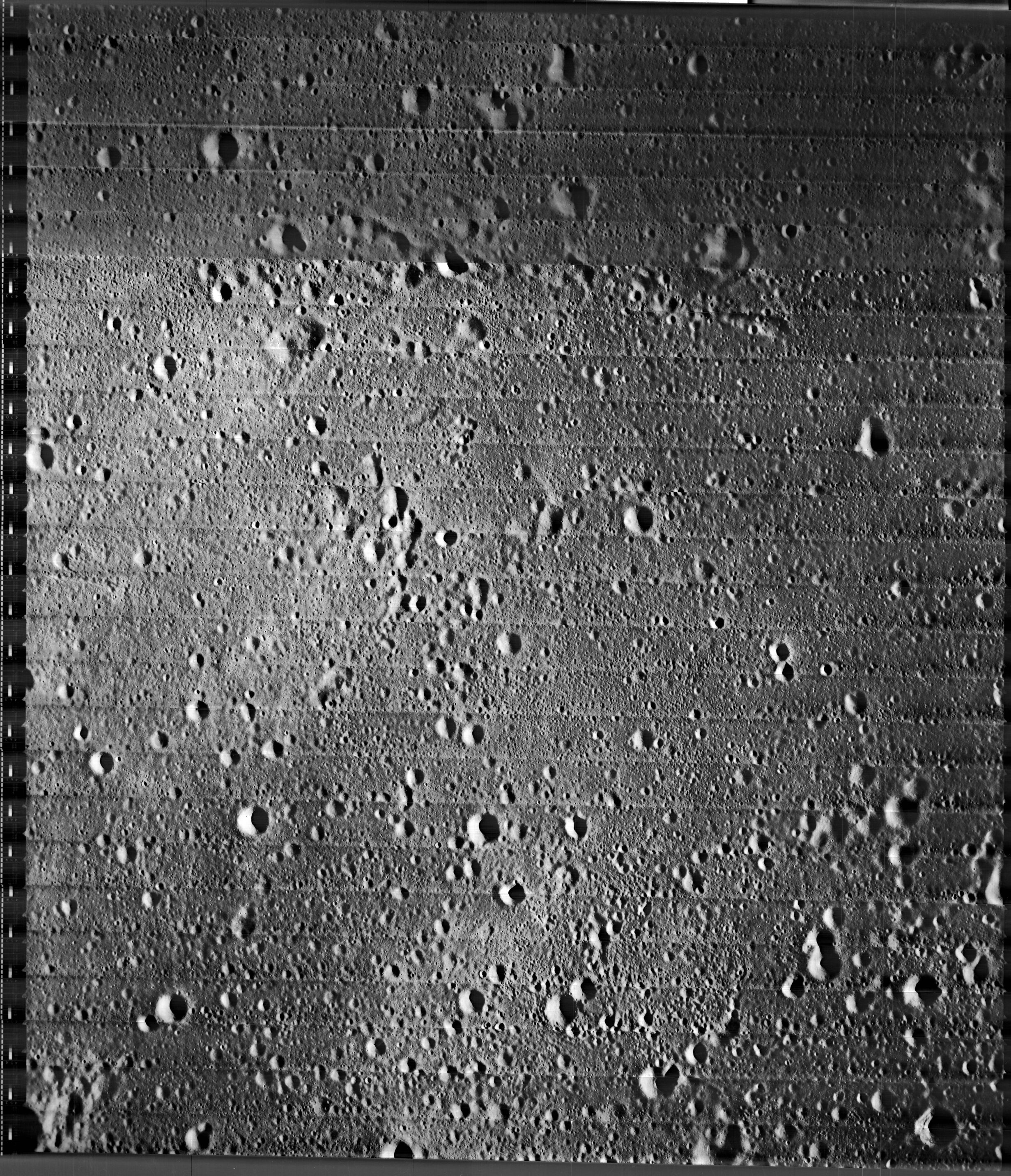
Newly retrieved high-resolution frame (Lunar Orbiter II-13-H2) showing a roughly 4 km-wide area in  south Mare Tranquillitatis, originally photographed, processed and radioed back to Earth by the Lunar Orbiter spacecraft November 18, 1966. It is the center (h2) of three sequential high-res frames captured simultaneous to the imaging of medium resolution Lunar Orbiter observation 2-013. It has been remastered and just released by the remarkable Lunar Orbiter Image Restoration Project (LOIRP) working on the campus of NASA's Ames Research Center in California [Moonviews].
Joel Raupe
Lunar Pioneer

In addition to the five spacecraft the United States presently has in lunar orbit, the legacies left behind by the five Lunar Orbiter spacecraft dispatched in 1966 and 1967, ahead of the manned Apollo landings, collectively amount to a sixth mission, still active and present in more than spirit. Because of the vision and resourcefulness of a special group of engineers and scientists the original tapes containing the raw radio signal returned by the Lunar Orbiters is methodically being processed, essentially for the first time, almost fifty years later. The most recent release of frames originally photographed by Lunar Orbiter II late in 1966 provide us with an easy demonstration of where this growing new library of half-century-old observations fits into our 21st century understanding of the Moon.

Any new craters? On December 21, 2009 the Lunar Reconnaissance Orbiter Camera team swept up much of the territory photographed at high resolution by Lunar Orbiter II in November 1966. The field of view in L2013-H2 is here outlined in yellow. LROC Narrow Angle Camera (NAC) observations M116072806L & R, orbit 2239; angle of incidence 80.6° at 0.96 meters resolution, from 46.3 km [NASA/GSFC/Arizona State University].
Much of the area in the three Lunar Orbiter II high-resolution photographs was surveyed at least once, under a high angle of illumination (80.7°) at slightly better than 1 meter resolution, December 21, 2009. The upper right hand portion of Lunar Orbiter frame 2013 (h2) is also available in the body of Lunar Reconnaissance Orbiter Camera high-resolution Narrow Angle Camera (NAC) observations presently released to the Planetary Data System.
Newly retrieved by the Lunar Orbiter Image Restoration Project (LOIRP), the medium resolution Lunar Orbiter frame 2011 (M) shows a roughly 45 km-wide area in south central Mare Tranquillitatis originally photographed by Lunar Orbiter II, November 18, 1966 (1525 UT). Of the three high-resolution frames of the area, engineered to be captured at the same opportunity, the center frame, h2, is thinly outlined in very pale yellow at the direct center, and is detailed above [Moonviews].
A 3200 square kilometer field of view showing the immediate area of southeast Mare Tranquillitatis visible in a set of two medium and three high-resolution Lunar Orbiter photographs newly retrieved and just released by the Lunar Orbiter Image Restoration Project (LOIRP). The white rectangle outlines cover the area of the lunar surface in two LROC NAC observations overlapping the high-resolution Lunar Orbiter II frames. Fields of view in the Lunar Orbiter high-resolution frames were re-surveyed at high-resolution by the Lunar Reconnaissance Orbiter, 45 years later. LROC QuickMap at 64 meters resolution, LROC WAC Global 100 meter monochrome mosaic [NASA/GSFC/Arizona State University].
LROC QuickMap 4000 meter resolution context view showing the 3200 square km area of the southeast Sea of Tranquility framed in the image immediately above. This part of the Tranquillitatis basin averages out at a bit higher elevation than elsewhere, and is populated by ancient inundated ghost crater rims with the coherent spatter of secondary craters. As our understanding of lunar morphology deepens it has become less clear whether Mare Tranquillitatis constitutes a true basin. Regardless, however, episodic re-floodings by molten material has left behind some of the Moon's deepest mare strata, even if Tranquility is not as clearly defined, horizontally and vertically, as the Serenitatis, Crisium, Nectaris or Imbrium basins nearby [NASA/GSFC/Arizona State University].

The story behind the recovery and retrieval of Lunar Orbiter photography is pretty amazing. The precision design of the spacecraft and their cameras - designed to shoot simultaneous images on film, to then develop that film and televised the result back to Earth - through to the 21st century story labor of love behind how unique and original tapes were housed in a former McDonalds and the nearly extinct drives and software needed even to begin reading those rediscovered tapes were brought online reads like a detective story. The result has been  to retrieve images at a quality better than any that had been available for decades, and a virtual sixth mission to complement the present-day 21st century flotilla now in orbit (after a very long drought).

The "older" photography can be used for a variety of important purposes, but in the context of the robust LRO photographic survey, now beginning an unprecedented third year in lunar orbit, no price can be placed on the opportunity to search out the rate of new impacts among the slow changes in the lunar landscape over five decades. And despite its clear strengths as a marvel of engineering and on-time, on budget performance, even the LRO will not be capable of surveying the entire lunar surface at high-resolution (though, so far, the LROC team surveyed much more than half). The release of newly retrieved Lunar Orbiter images. like these "fresh" from 1966, fills some of those gaps nicely, and also provides the opportunity to see the same area of the Moon at high resolution under different lighting conditions.

Meanwhile, the LROC Wide Angle Camera has been able to survey the entire visible lunar surface under a variety of lighting conditions at an extraordinary "medium" resolution.

The original and latter history of the Lunar Orbiter legacy amounts to a heroic story, one made possible by forward-thinking scientists like Gene Shoemaker, and thoughtful people who might have tossed the tapes but instead carefully packed them. Their rediscovery and the dedicated people who rebuilt the capacity to read those tapes makes for interesting reading as well. It also provides us with a lesson about the transitory nature of magnetic and digital media.

Today's Blue-Ray may be tomorrow's Eight-Track tape!

Some earlier posts and background on LOIRP (Moonviews.com):
The LOIRP time machine looks back 43 years (June 3, 2010)
New releases from Lunar Orbiter II (1966) - (May 7, 2010)
Boulders of Copernicus (December 11, 2009)
LOIRP: Boulder Trails on the Moon (December 10, 2009)
Lunar Orbiter's originals vs. LOIRP restorations (December 9, 2009)
New restored detail from Lunar Orbiter II (December 8, 2009)
LOIRP configures second FR-900 tape drive (November 12, 2009)
LOIRP remasters the Moon's South Pole (August 14, 2009)
Lockheed Martin donates Clean-Room to LOIRP (August 12, 2009)
LOIRP astounds again, re-release of LO-II0162 (1967)
with each of three high-res sub-frames
(August 10, 2009)
Full Earth, as seen by Orbiter V (August 7, 2009)
Lunar Orbiter III-154-H2 (June 16, 2009)
LOIRP recovers Lunar Orbiter IV lunar South Pole image from 1967 (June 16, 2009)
LOIRP recovers detail of Fra Mauro and future landing site of Apollo 14 (June 11, 2009)
New LOIRP high res Lunar Orbiter image of western Oceanus Procellarum (June 10, 2009)
LOIRP recovers image of Ranger 8 impact (June 9, 2009)
LOIRP's "Pictures of the Century" (March 23, 2009)
More astounding new detail from LOIRP (February 26, 2009)
Breakthrough in Lunar Orbiter photograph remastering (February 20, 2009)

Inside the Lunar Orbiter Image Recovery Project

The "McMoon" facility on the campus of Ames Research Center [Moonviews].
Maggie Koerth-Baker
boingboing

If these photos of NASA's Lunar Orbiter Image Recovery Project look suspiciously like they might actually have been taken inside an abandoned McDonalds ... well, that's very observant of you. All of those film canisters you see in the first image are actually spools of 70mm magnetic tape containing the analog originals of images taken by the Lunar Orbiter spacecraft in 1966 and 1967. After sitting in storage for decades—most notably in a barn in California—the tapes were brought to the NASA Ames Research Center in 2007. Since then, some of the originals have been digitized and preserved. (There's a good chance you saw a few in 2008, when the first preserved images were released.) Others are still in process. There's not much funding for this type of work, and it can get expensive, as it involves maintaining extremely rare FR-900 tape drives.

Read the entire post at boingboing.net

Thursday, May 24, 2012

Re-release of Iconic Copernicus 'Image of the Century'

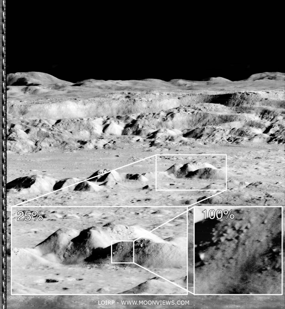
Newly processed high-resolution detail from an unprecedented oblique view of the interior of Copernicus captured by Lunar Orbiter 2, from the "Image of the Century" photographed November 24, 1966. Higher and full resolution images are linked to the Moonviews (LOIRP) announcement, HERE [LOIRP].
Keith Cowing
Lunar Orbiter Image Recovery Project
moonviews.com
NASAWatch.com


Today an iconic image from the initial exploration of the Moon is being re-released showing detail that could not have been seen using technology available at the time the photo was taken. This image features a dramatic view inside the majestic crater Copernicus - a view that left millions in awe when it was first released.

This image was announced at the First Global Space Exploration Conference, co-sponsored by the AIAA and IAF, in Washington, DC.

Between 1966 and 1967 NASA sent five Lunar Orbiter spacecraft to the Moon. Their job was to survey the surface to help determine landing sites for the upcoming Apollo missions. In addition to their recon role, these spacecraft also contributed to the nascent scientific understanding of the Moon. But every once in a while these spacecraft also served as artists, snapping photos of this nearby world in a way that human eyes had never been able to see before.

New magnification possible using the 21st century techniques employed by LOIRP. Higher and full resolution images are linked to the Moonviews (LOIRP) announcement, HERE [LOIRP].
Once such image was taken of crater Copernicus on 24 November 1966 by the Lunar Orbiter 2 spacecraft. What made this photo so unique was the oblique angle it was taken at as well the close proximity of the spacecraft to its target. The image was taken at an altitude of 45 km (27.1 miles) at a distance of approximately 207.7 km (~125 miles) from the center of the crater. Instead of looking down, the spacecraft looked sideways at the Moon.

The bouldered area of the central peaks of Copernicus seen newly sampled at "100 percent" in the image further up were swept up by the Lunar Reconnaissance Orbiter Camera in orbit 909, September 9, 2009; LROC Narrow Angle Camera (NAC) observation M107006443R; resolution 1.15 meters (shown here at 4 meters per pixel) from an altitude of 130.11 kilometers [NASA/GSFC/Arizona State University].
For the first time people saw the Moon as a world with mountains and boulders and other features (some of them strange) that were not apparent from photos where the view was looking straight down. So taken were people at the time that Life Magazine took to calling the photo "The Picture of the Century"

Read about the full details in the original article, HERE.