Showing posts with label ASU. Show all posts

Thursday, August 8, 2013

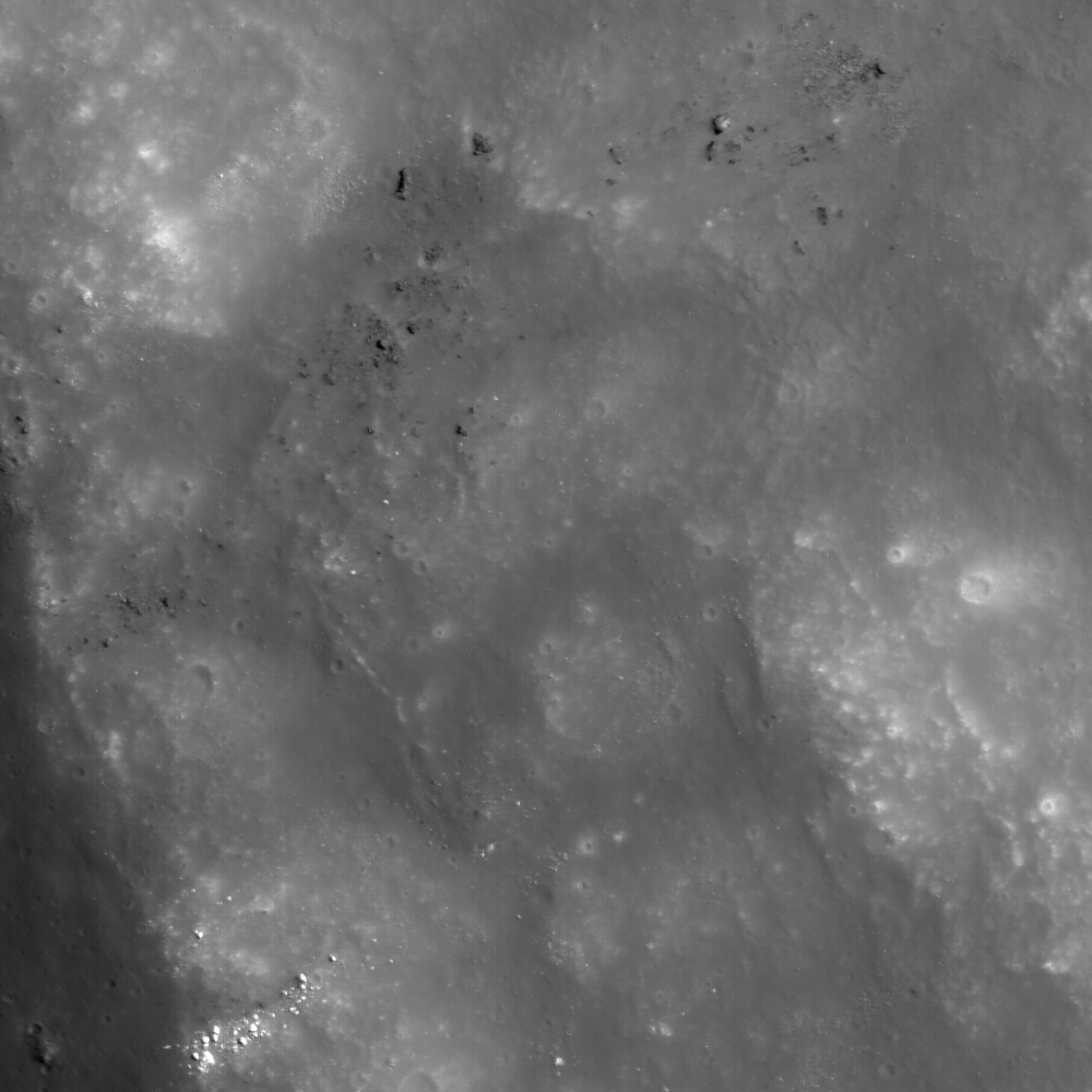
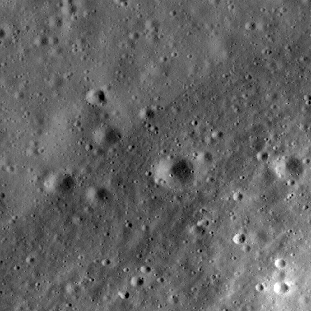
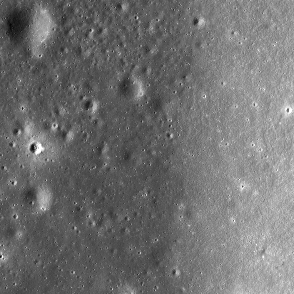
Another look at the effusive dome west of Rima Yangel

M1111791664RL-NSJ-0502-9626x18010
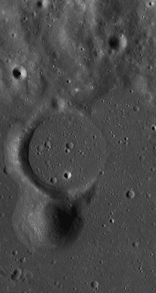
Effusive dome on the southern rim of a  ghost crater situated on the northern shore of Mare Vaporum, in a 11.48 km-wide field of view west of Rima Yangel. LROC NAC mosaic M1111791664LR, LRO orbit 16100, January 2, 2013; 71.03° angle of incidence, 1.19 meters per pixel resolution from 118.91 km [NASA/GSFC/Arizona State University].
Follow-up LROC Narrow Angle Camera (NAC) observation swept up by the orbiter in January and released to the Planetary Data System (PDS) in June. This effusive dome on the north bank of Mare Vaporum was the subject of two extensive posts in February and March.


The mosaic above can be viewed at full and at a variety of medium resolutions, HERE. The dome has bow been imaged from LRO from high and low altitudes, under a range of illumination angles, and many of those observations are referenced in the posts from earlier in the year, linked above.

Wednesday, August 4, 2010

Remnants of the Imbrium impact event


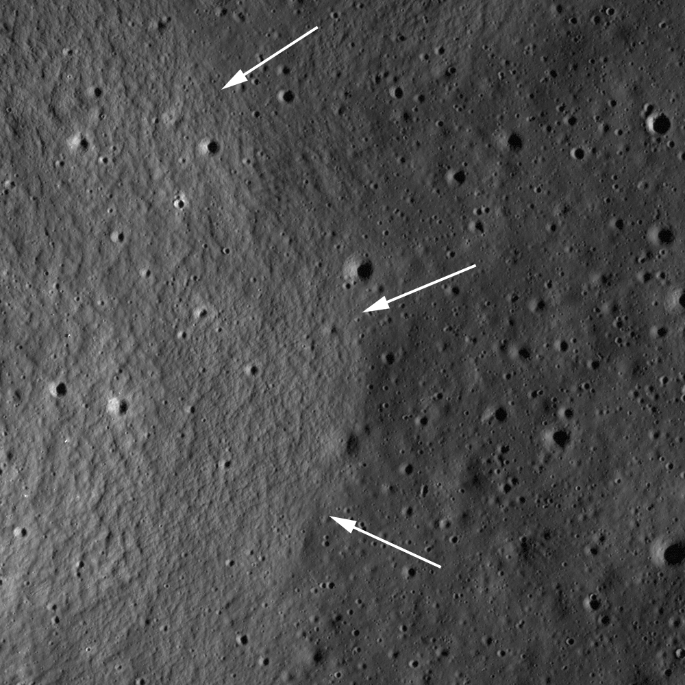
Mare basalts embayed ejecta structures formed by the massive Imbrium impact in this sub-scene of LROC Narrow Angle Camera (NAC) observation M131501983RE (2.2 km higher above, 902 meters in the LROC Featured Image field of view [full image HERE], immediately above). Arrows denote the contact between younger mare basalts and older Imbrium ejecta, image [NASA/GSFC/Arizona State University].

Lillian Ostrach
LROC News System

Mare basalts fill most of the large impact basins on the Moon, and in many cases the pre-existing topography was buried by the huge outpourings of lava. However, sometimes pre-existing topography is not completely buried by the mare basalts. When lava flows around a topographic high and does not bury it completely, the resulting landform is called a kipuka, and may be used to tell scientists about the region before the lavas flowed across the landscape. In the case of today's Featured Image, this kipuka in southwestern Lacus Somniorum is probably ejecta from the impact that formed the Imbrium basin. When looking at a regional view, this knob and others form relatively linear chains which can be traced back to the Imbrium basin.


Preliminary Lunar Reconnaissance Orbiter (LRO) laser altimetry (LOLA) data showing Imbrium as seen from Earth, the most predominant, clearly identifiable feature on the near side seen with the naked eye from Earth. Imbrium is central to most of the Moon's mare phenomena and it's highest diversity of compounds. [NASA/GSFC].

Since the mare basalts are embaying this feature, the basalts postdate the formation of the Imbrium basin. Using remotely-sensed data to establish this kind of geologic relationship on the lunar surface helps to clarify the geologic history of the Moon, an important consideration for planning future lunar exploration.

LROC Wide Angle Camera view of southwestern Lacus Somniorum; arrow points to location of today's Featured Image. Subset of LROC WAC monochrome M117339055M [NASA/GSFC/Arizona State University].

Explore the landscape of Lacus Somniorum
for yourself, HERE.

Saturday, July 24, 2010

The colorful Moon


Following up on Dr. Mark Robinson's LROC Featured Image, "Aristarchus - Up from the Depths," from July 20 presented the opportunity to add some color to create a value-added product. Above, at its heart, is a new three-dimensional glimpse north from high over the southern rim of the dazzling and brilliant Copernican-age crater Aristarchus, possible by superposition of LROC Narrow-Angle Camera (NAC) observation M122523410 onto a low-resolution digital elevation model of Aristarchus Plateau available through the Google Earth application. A touch of color has been added, previously available only to the most diligent operators of telescopes, Clementine data and, most recently, LRO's fast-developing Wide Angle Camera catalog. The ultimate potential of such recombinations boggle the mind.


From 2008, a 200 kilometer-wide (at bottom) SELENE-1 (Kaguya) HDTV view of Aristarchus Plateau, very close to it's true optical appearance from orbit. Subtleties of actual color variation are difficult to detect, though they are definitely present [JAXA/NHK/SELENE].


Aristarchus (July 25, 2008, 02:33UT) composed by "The Boys from Minsk," aka Astronominsk (Goryachko, Abgarian & Morozov), who were not the first to demonstrate the availability of color in lunar photography, even from 400,000 km away. This image of Aristarchus was featured by Charles Wood as Lunar Picture of the Day (LPOD), August 5, 2008. [Maksutov-Cassegrain Santel (D=230mm, F=3000mm), barlow 2x, CCD mono camera Unibrain-702 (1388x1040), Astronomik RGB TYP II filters. "Seeing" = 6/10, Trans 5/5].

Friday, March 19, 2010

Surveyor 5?

Updated Saturday, March 20, 2010 0245 UT
Is this Surveyor 5? We won't stake any reputations on it, but it fits the profile as recorded in post-mission reports. The high-sun image of the official location, barely more than 20,000 meters north-northwest of Apollo 11, makes a dicey identification. At 1.4 degrees north of the equator, little if any shadow is cast and the resolution of this commission-phase LROC image is around 1.2 meters per pixel, leaving little detail. Later images, with twice the resolution, all fell just beyond this official location. This Surveyor might be an interesting future landmark for missions to study the landing site Apollo 11 without disturbing that area, though even a landing here would have some impact on the "pristine" conditions at Tranquility Base [NASA/GSFC/Arizona State University].

Editor's note. Knowing full well the full cycle of the Surveyor saga, we earlier erroneously labeled this posting as a speculation concerning a possible sighting of Surveyor 7, and the last in the series, which of course landed north of the rim of Tycho. It was Surveyor 5 that landed 23.9 kilometers northwest of what would eventually become the landing sight of Apollo 11, 22 months and 9 days later (September 11, 1967). We're just glad no one had to point out the error to us.

Tuesday, March 16, 2010

LROC: The Soviet lunar sampling missions


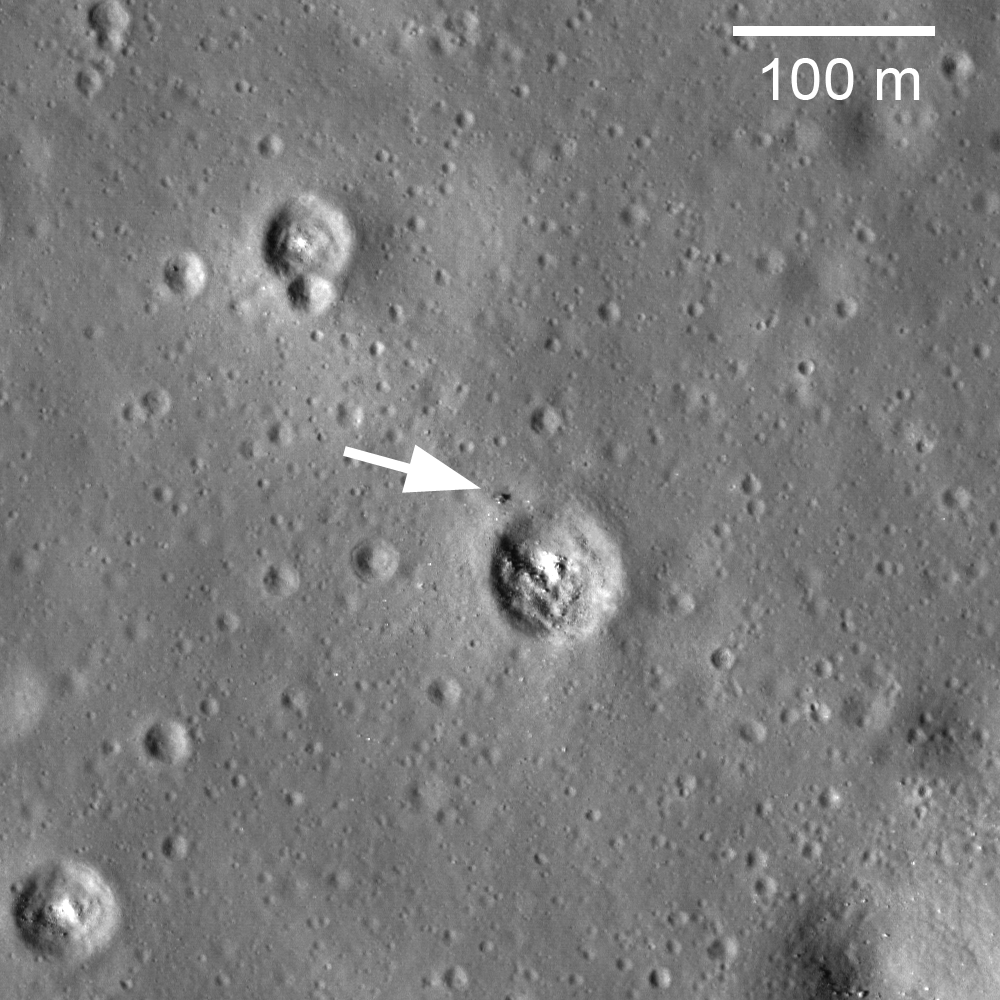
On February 21, 1972, Luna 20 soft landed in the rugged highlands between Mare Fecunditatis and Mare Crisium. The next day a sample return capsule blasted off carrying 55 grams of lunar soil. The Luna 20 descent stage is clearly visible in LROC Narrow-Angle Camera image M119482862RE [NASA/GSFC/Arizona State University].

Mark Robinson
LROC News System

The Soviet Union successfully executed three robotic sample return missions as part of the Cold War competition with the United States. The first mission, Luna 16, returned a small sample (101 grams) from Mare Fecunditatis in September of 1970, a time between the US Apollo 12 and 14 manned landings. A year and half later (February 1972) Luna 20 returned 55 grams of soil from the Apollonius highlands region. Explore the Luna 20 landing site.

Luna 16 and 20 were very similar in design and sampling method. A drill at the end of the sampling arm collected soil from a few tens of cm below the surface. The arm then placed the sample into the return capsule on top of the vehicle. The distinctive shadow seen in the LROC image of Luna 20 is most likely that of the sampling arm. The Luna 20 sample contained minerals similar to those sampled by the US Apollo 16 astronauts two months later from the Cayley plains (8°58"S, 15°30"E).

In October of 1974 Luna 23 set down on Mare Crisium, however technical difficulties prevented it from successfully acquiring a sample. Undeterred, the Soviets tried again in August of 1976, this time with much better luck. Luna 24 was designed to auger over 2 meters into the lunar soil thus collecting a better section and a larger sample, 170 grams. The positions of Luna 23 and 24 were not well constrained and are reported as within several hundred meters of each other. From the new NAC images we can accurately measure the distance between the two landers to be about 2400 meters. However the absolute position of the landers is only know to about 500 meters accuracy. As the LRO mission ephemeris improves, the Luna absolute positions should be known to better than 100 meters. Scroll around in a mosaic of two NAC high Sun images (M111185087L,R) and find Luna 23 and Luna 24. Look for a few very bright pixels near Luna 24; they may be small pieces of material blown off the descent stage as the ascent staged blasted off towards Earth.

The successful Soviet Luna sample return missions returned small, but important, samples from three locations on the Moon. In this new era of lunar exploration several countries plan to soft land on the Moon in the near future, the first soft-landed spacecraft since Luna 24. India and Russia plan to launch a lander and rover called Chandrayaan 2 in 2013. The Chinese Chang'e lunar exploration program also plans a soft landing in 2013. Though NASA currently has no firm plans for a future lunar landing (robotic or crewed), it is considering a sample return mission from the lunar far side as a part of its New Frontiers program.

Friday, March 12, 2010

LROC: Crisium Constellation ROI

Updated March 12, 2009, 1530 UT
Rocky boulders on a wrinkle ridge contiguous to Dorsum Termier, within south-southwestern Mare Crisium, may help us understand the rich morphology of this Constellation region of interest. The scene depicted above is 184 meters from the 460 meter field Featured Image headlined by the Lunar Reconnaissance Orbiter Camera (LROC) News System, March 11, 2010 [NASA/GSFC/Arizona State University].

Brett Denevi
LROC News System

The Constellation program region of interest located in Mare Crisium is a compelling Exploration site for many reasons. First, this site was visited by several Soviet landers - Luna 23 and Luna 24 both touched down in Crisium. Luna 24 succeeded in returning a 170 gram sample in 1976. Though the amount was small, it provided a wealth of information and an interesting mystery. The Luna 24 basalt has a titanium dioxide content of about 1%, placing it among the lowest abundances of any lunar basalt sampled. The titanium content of basalts on the Moon varies widely, from almost none up to nearly 15%; a much wider range than typically seen on Earth. Because samples were only returned from a few limited locations on the Moon, we use remote sensing data to fill in the gaps of our knowledge (read this PSRD article for more details).

Basalts that are rich in titanium absorb more light in ultraviolet and visible wavelengths than those with less titanium, and many people have used this relationship to estimate titanium contents for mare basalts across the Moon. However, in the case of Mare Crisium, the remote sensing estimates put the titanium abundance at two to four times higher than what is seen in the Luna 24 samples. Plus, the way the light is reflected from the samples (the reflectance spectrum) looks different from what spacecraft observe for Mare Crisium. Other landing sites for which we have samples and that we have observed with spacecraft do not show this difference. So what is happening in Mare Crisium, and why should we care?


Lunar Pioneer was late posting the latest Featured Image released by Arizona State's LROC team on Thursday, March 11. We were stunned with an embarrassment of riches. The wide-angle camera context for a truly remarkable narrow-angle (49 cm pp resolution) image release happened to be of an area about which we have a strong interest. Coincidentally, the area happens also to be one among 50 Constellation Regions of Interest (ROI's), in the southwestern Crisium basin. So we took more time to boot up both images together in the lunar map available to users of Google Earth. Additionally, the ROI and LROC Featured Images are also within the eastern extreme of the highest resolution topography of the Apollo orbital corridor Digital Elevation Model. We have a lot more to say about this area shortly, including an expression of our heart-felt appreciation for the recent addition of a newer Moon-wide higher resolution DEM beyond the confines just of the corridor. For the present, a taste of these LROC images are presented here in three dimensions.

As you can see, within minutes after a LROC image availability, it is now possible to quickly present something not unlike what a future crew might see out the port-side view after landing at the SW Crisium Constellation ROI landing site, flawed though it may be in terms of overall illumination.

Scientists love a good mystery, but it's also important because titanium is both a valuable resource that could be utilized when people return to the Moon, and titanium abundances can tell us about the lunar interior. Basalts formed by partially melting the lunar mantle billions of years ago, and the wide range in titanium contents can tell us about the wide range of compositions and processes in the lunar mantle. Most of the high titanium basalts appear to be concentrated on the lunar nearside. But why? A straightforward interpretation of the lunar magma ocean theory, where the Moon was partially or completely molten just after its formation, suggests that titanium should be globally distributed, but that's clearly not the case. Human exploration of this region will produce valuable sampling and fieldwork to address this question.

The geology of this site is also compelling. The Constellation site is located near the rim of the Crisium impact basin (see image below), and samples and field work would give insight into the processes that occurred during the formation of the basin, as well as the age of the basin. Was this impact basin part of the so-called lunar cataclysm? This site also contains beautiful wrinkle ridges, sites of compressive stresses that resulted in faulting and wrinkling of the mare basalt surface. In the image below, you can even see a wrinkle-ridge ring, where a buried crater localized the stresses.


LROC Wide-Angle Camera (WAC) monochrome image centered on the Crisium Constellation region of interest (ROI). The highlands area in the south is the rim of the Crisium impact basin (nearly four kilometers in elevation above the "sea floor" below) and wrinkle ridges and the rim of one of at least three nearly submerged craters in the vicinity is apparent. The arrow points to the location of the center of the Narrow Angle Camera Featured Image and the WAC field is 62 km across [LROC WAC M117107778ME - NASA/GSFC/Arizona State University].

In the WAC monochrome image above, the arrow indicates the location of the NAC frame at the beginning of this post, which shows a very small portion of a wrinkle ridge. A fascinating feature of this ridge, when seen in high resolution, is a surface strewn with boulders. Perhaps these were generated by the breakup of the mare basalt, visible now because of the faulting and folding that created this ridge. (Judge for yourself exploring the full-resolution NAC frame here.)

Lunar scientists (not engineers) love boulders because they usually come from below the surficial regolith layer and can indicate buried rock units of different compositions. Some have suggested Luna 24 sampled a basalt unit that was buried by a subsequent lava flow of a different composition and only exposed where impact craters excavated material from a depth. This scenario would explain why spacecraft don't see the sampled material widespread on the surface. Visiting the Crisium region of interest could help scientists unravel this interesting puzzle.

Below: A very small part of the original LROC NAC image (M119468420LE) - 460 meter-square field reduced from the original here as context for the first image at the top of this post, and yet another demonstration of how scale can be a very difficult thing to grasp in lunar photography. In the Second Image from the TOP, the same area below is shown as the slightly darker gray square at bottom center, rendering the 460 meter field from a slightly different perspective and within the whole NAC frame strip from which it was taken - and subsequently within the larger WAC image release discussed her - all reproduced in Google Earth. (Click on image below for the 1000 pixel original).


Below: In Google Earth, looking west, the whole of the ROI can be seen, though admittedly very poorly constrained to this 400 pixel-wide column. The scene below is also an unfortunate confusion of solar illuminations, with the LROC WAC image of the Region Of Interest highlighted by long evening shadow and the Apollo 15 metric imagery below and beyond when the area was under a late morning sun in late July 1971. Additionally, the very dark band of the LROC NAC Featured Image (visible in lighter gray in the Second image from TOP) traces out LRO polar orbit (#2740) of January 30, 2010.

Tuesday, March 2, 2010

LROC: Haruyama Cavern in the Marius Hills


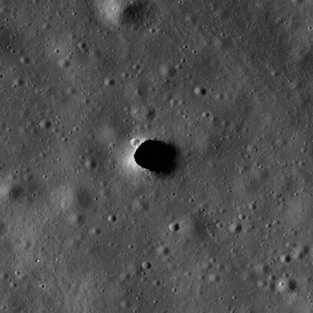
Enlargement of the Marius Hills Hole
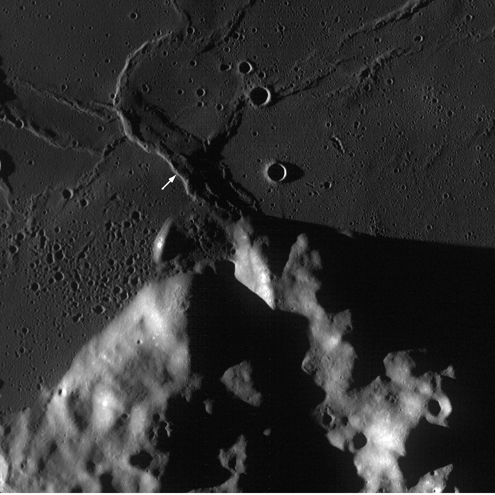
, or MHH, thought to be a collapsed roof and entrance to "Haruyama Cavern," unofficially nicknamed for the Japanese SELENE Terrain Camera investigation team leader who discovered it within the Marius Domes formation of Oceanus Procellarum. This new and closest look ever by NASA's LROC narrow angle camera reveals a small crater on the northwestern edge and small boulders on the southern lip of the hole, which is only around 65 meters in diameter. [LROC NAC M114328462R-NASA/GSFC/Arizona State University].


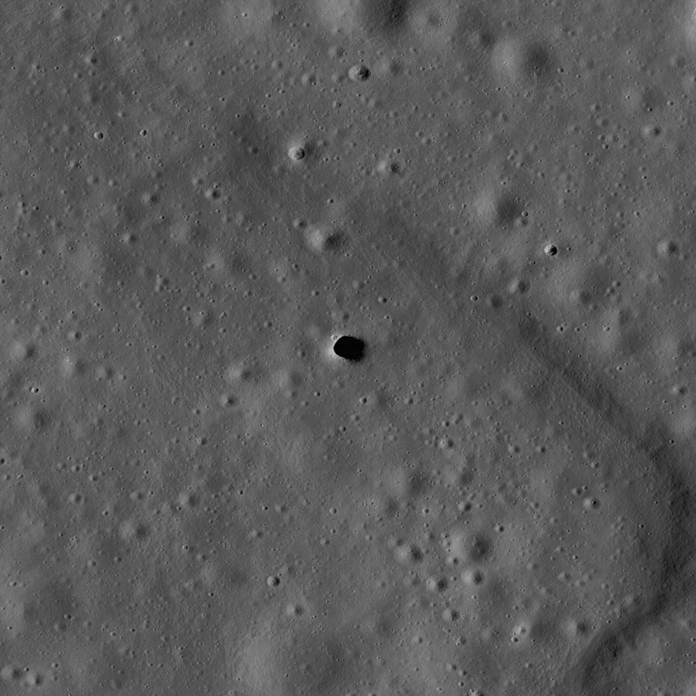
The Marius Hills Hole may access answers to morphological mysteries, revealing a new layer of this ancient volcanic region of the Moon called the Marius Hills, a formation familiar to observers of the Moon each time the long shadows of the terminator reveal many roughly 300 meter high domes named for the crater Marius to the east. Aristarchus Plateau is not far away to the north and Reiner Gamma swirl with its magnetic anomaly with its familiar bright complexity has a terminus here and meanders far to the southwest. The full LROC image was swept up December 1, 2009 during LRO orbit 1982, and has a resolution of one-half meter per pixel. The 2.5 kilometer width of M114328463R centers on 13.92°N, 303.21°E and shows a section of a sinuous rille with MHH opening into an underlying lava tube [NASA/GSFC/Arizona State University].

Carolyn van der Bogert
LROC News System

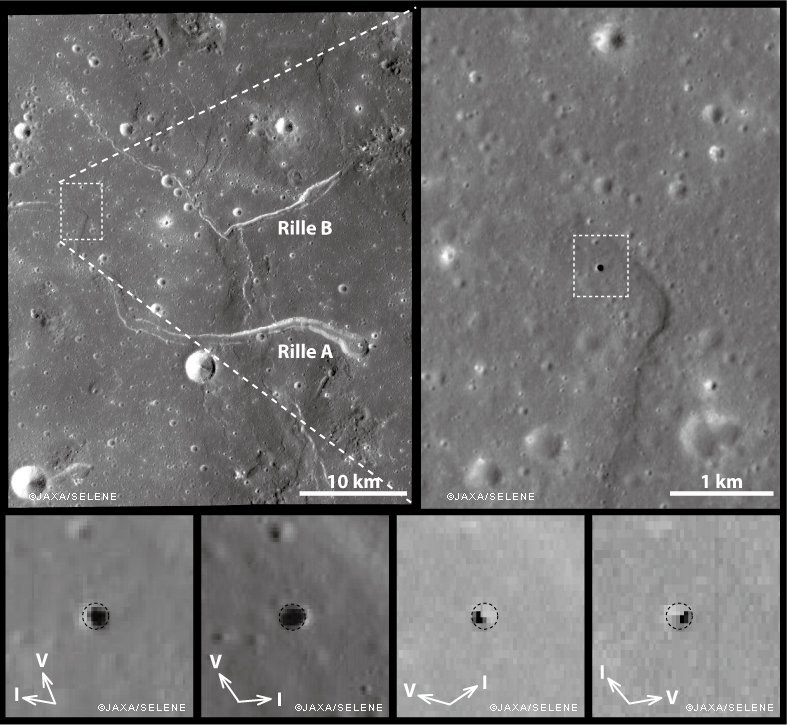
The Marius Hills hole was discovered in data from the Japanese SELENE/Kaguya Terrain Camera and Multiband Imager, and reported in Geophysical Research Letters. The Japanese team, led by Junichi Haruyama, made multiple observations of the hole using both the Terrain Camera and the Multiband Imager at resolutions as high as 6 meters/pixel (see below). The LROC image presented here (above), at 0.5 meters/pixel, is the highest resolution image of the Marius Hills hole to date! (The SELENE/Kaguya Terrain Camera team also made a fly-over movie of the hole, which is available on the JAXA website.)


Images of the Marius Hills Hole as observed under different solar illumination conditions by the SELENE/Kaguya Terrain Camera and Multiband Imager [JAXA/SELENE].

How did the Marius Hills hole form? The Marius Hills region was quite volcanically active in the past, and contains numerous volcanic features, including sinuous rilles. Sinuous rilles are long meandering channel features, like those labeled Rilles A and B in the above figure. Before the Apollo missions, sinuous rilles were thought to be formed by running water on the surface of the Moon! However, today we know that sinuous rilles form in two different ways: as open lava channels and/or as lava tubes, many of which subsequently collapse. Because the Marius Hills hole is in the middle of a sinuous rille, it likely represents a hole in the roof of a lava tube. The hole itself may have been caused by an impact that punched through the lava tube roof.

Lava tubes might be useful as locations for lunar bases (see a report by Fred Hörz of JSC here). The interiors of lava tubes could protect human explorers from different aspects of the lunar environment, including cosmic rays, meteorite impacts, and the extreme temperature differences between the lunar day and night. Just like caves on the Earth, lunar caves, including lava tubes, have temperatures that are constant.

Browse the entire LROC NAC image to explore the intriguing Marius Hills hole and its surroundings.

Thursday, February 18, 2010

LRO first releases promise years of study


As Charles Wood of Lunar Picture of the Day (LPOD) has wisely pointed out, the full-scale half-meter per pixel resolution of the Lunar Reconnaissance Orbiter narrow-angle camera (LROC NAC) is so powerful much of the necessary context telling us what we are seeing is lost to casual observation. NAC Scan M102780913, for example, covers a very diverse but thin strip of the interesting southern extremes of Mare Orientale. In the sample, roughly 200 x 400 meter view above we see an optically mature, small middle-aged crater and an assortment of human-sized boulders. Upon stepping back a little from the scene below, and the same location can be understood better as mostly of debris gathered at the bottom of an ancient trench. In a still-larger context, a map or image, and that trench could be seen as part of a criss-crossing network of cracks and fault lines that are a long-known feature characteristic of southwest Orientale's impact zone near the pyroclastic vent zone on the Mare's southwestern flanks. To many, LRO's camera products, with a lot of notable exceptions, lacks the drama we have become used to in standard lunar photography. To the those with even a passing interest in lunar morphology, however, the long-anticipated full range of LRO's data presents a deeply satisfying, nutritious full-course meal that will take decades to digest [NASA/GSFC/Arizona State University].


Joel Raupe
Lunar Pioneer

We were caught a little flatfooted earlier this week by a happenstance glance over at the LRO node on the Planetary Data System (PDS). In fact today, February 18*, is currently listed there as the date for the first public releases of data from most of the experiments orbiting the Moon, only six months into the planned two year mission of NASA's Lunar Reconnaissance Orbiter. With very little discernment it's become clear that several monasteries and hundreds of monks could happily spend entire lifetimes pouring over what is already many libraries of data.

Even then, they probably wouldn't see "the big picture."

Even a humble mission like Lunar Prospector (1998), after all, was still presenting investigators with new discoveries gathered from data that was still being studied a decade after it was deorbited near the lunar South Pole in 1999. And long after LRO shares that same fate investigators will be referencing LRO's datasets as a definitive new atlas of the Moon.

No one human or single team will be able to take it all in. Tomorrow comes but ten days before the beginning of March, the long advertised time for the appearance of what is expected to be a tsunami of data.

Mark Robinson's LROC team at Arizona State University has already released two preliminary sets of "pre-release" image datasets, mostly gathered during the commissioning phase of LRO's mission prior to last September and covering the lunar poles, Orientale and under-explored areas of the farside west to the 180th meridian.

Unfortunately, during our delayed attempts to examine the second of LROC's pre-releases this past weekend we encountered persistent problems hooking up with Arizona State University's deep storage servers where it is stored. By this past Monday, all the LROC assets became unavailable on the web, testifying of some major hassles for the only one of LROC's many experiment teams that has, so far, presented a friendly face to average hard-working taxpayers.

It's unfortunate, but with Robinson's LROC team we're bound to be patient.

Of each of LRO's science teams, LROC has easily been the most accommodating to the public, beginning with the release after last summer's First Light of the vehicle's first looks at each of the Apollo landing sights. Since then they have gone to what has to have been a lot of trouble to release at least one full Narrow Angle Camera scan, with good scientific context, on average about twice per week.

That effort has probably gone a long way toward placating thousands of us who have been anxiously awaiting for one of LRO's unique and remarkable close looks at a favorite target, and that's a long "wish list."

Putting together the full atlas of LRO's range of data for the whole Moon, or even for a single target, will require years. We can hope a that even a preliminary LROC wide-angle camera atlas of the Moon might become available soon, among other things. Aside from those breathtaking Apollo landing sites, relocating Surveyor 1 or the fresh impact baseline presented to us by the first image of the Apollo 14's Saturn third stage strike zone, our aforementioned, highly recommended patience makes us hesitate to mention other long sought answers to questions we already suspect the LROC to have nailed.

One challenge, perhaps even for LRO, will be to definitively locate Luna 9, on the western edge of Oceanus Procellarum; site of the first soft landing on the Moon by the Soviets forty-four years ago this month. Russian scientists are prepared for LRO's first look at the less mysterious Lunokhods, so far the only unmanned lunar rovers to be teleoperated on the lunar surface.

Abdrakhimov & Basilevsky of the Vernadsky Institute have digitized the panoramas gathered using the rovers during their the many-kilometer-long tours on the edges of Serenitatis and Imbrium. They are presenting their paper in absentia to the 41st Lunar and Planetary Science Conference at The Woodlands, Texas, March 1 - 5.

* UPDATE: Five hours after this posting, "Release 1 of" data from each of the seven LRO experiments to be featured on the Planetary Data System Geosciences Node were individually noted "scheduled for February 18, 2010." However, at the top of the overall LRO hierarchy the following note had by then appeared, "Release 1 of LRO data is scheduled for March 15, 2010." Alas for the mixed messages presently seen there, those who intend on making any use of data from LRO would be wise to bone up on the overall LRO archive plan found at the PDS and that of each of the seven experiments linked there.

Friday, February 12, 2010

LROC: Constellation Region of Interest - Crater wall in Van de Graaff


Wall of crater Van de Graaff C
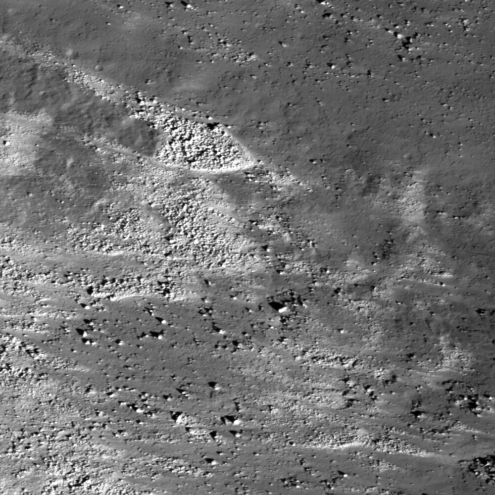
, where brighter material is exposed by more active processes associated with steeper slopes, recent small craters, and even individual rolling boulders. LRO Narrow-Angle Camera image M112822306L, image width 0.68 km [NASA/GSFC/Arizona State University].


Peter Thomas
LROC News System

Wall and rim of a ~20 km diameter crater within the ~240 km diameter Van de Graaff crater, which is one of the Constellation regions of interest. Located on the lunar far side, Van de Graaff crater is south of Aitken crater on the outer edge of the South-Pole Aitken basin. Van de Graaff exhibits an unusual figure-eight shape, ~240 x 140 km, in a region with "swirls", magnetic anomalies, and geochemical anomalies. Swirls on the Moon are high-reflectance, irregularly-shaped markings with gradational boundaries, and they are associated with poorly understood magnetic anomalies (weak by terrestrial magnetism standards).

Magnetic fields like the one near Van de Graaff are relatively unusual for the Moon, because the Moon does not currently have a global magnetic field like the Earth does. Orbital geochemistry measurements show that Van de Graaff and the surrounding terrain have slightly higher concentrations of thorium, which suggests the presence of a geochemically important thorium-rich lunar material called KREEP. Van de Graaff is on the opposite side of the Moon from the massive Imbrium basin, suggesting that perhaps the magnetic and geochemical anomalies are related to the gigantic Imbrium impact event. Or, on the other hand, the anomalies could represent the products of local geologic events. Lunar scientists won't know for sure until we can send human explorers to investigate the region.

Also of particular note in the steep crater walls are higher-reflectance areas. The elevated reflectance is the result of disturbing the regolith (soil) through geologic mechanisms including recent impacts, mass wasting, and by rolling boulders that leave trails. During these events, material from rocks from beneath the surface are exposed. The lunar regolith is typically very fine-grained and is profoundly affected by exposure to the vacuum of space. Over time, radiation and micrometeorite bombardment lower the reflectivity and alter the chemistry of the surface. The high-reflectance, unaltered material exposed at the surface stands out in contrast to the lower-reflectance, older, altered surface.

Explore this fascinating Constellation region of interest for yourself, and check out an Apollo metric orbital photograph of the region!


Apollo 15 Science Mapping camera image 0075 (1971) unveils the north (right) wall of Van De Graaff at sunset, the beginning of the first orbital opportunity. The wispy, relatively bright material on the darkened, optically mature crater floor is associated with one of the Moon's crustal magnetic fields. The same dynamic processes that mature and darken the lunar surface over periods as long as 900 million years, gardening the surface and creating submicron-sized dust, also continuously keep newly exposed, low optically mature material at the surface [Apollo 15/LPI].

Friday, February 5, 2010

Riccioli: bombardment, volcanism and tectonics-all in one


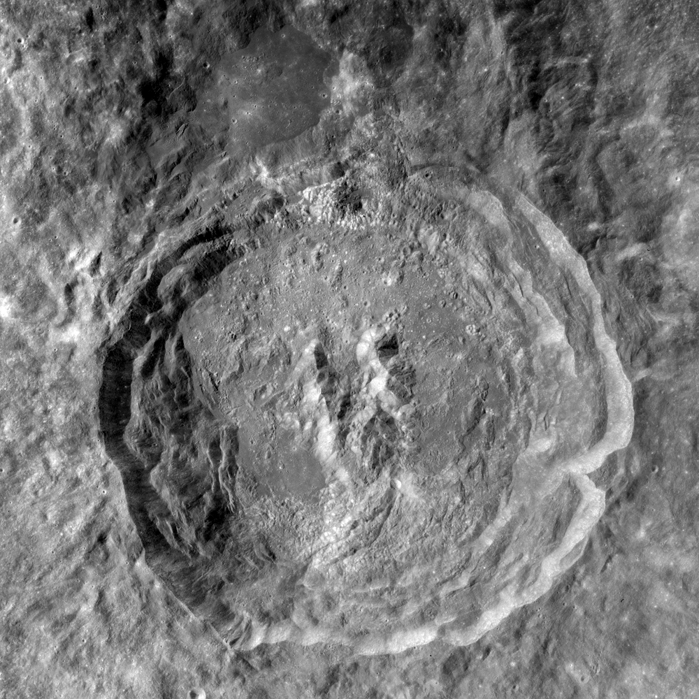
Align CenterHigh-resolution LROC view of part of the floor of Riccioli Crater, near the center of the Constellation region of interest. The view is centered on the boundary between a spur of the crater's central peak materials (lower right half of the image) and volcanic lava flow deposits (upper left half). The central peak materials are rougher and show a faint pattern of lines running NE-SW, suggesting that this terrain, like much of the rest of the crater, was scoured by ejecta from the younger Orientale impact basin to the southwest. Part of NAC frame M114444141LE, image width is 500 m and north is up [NASA/GSFC/Arizona State University].

Jim Bell
LROC News System

Riccioli Crater is named after Italian astronomer and Jesuit priest Giovanni Battista Ricciolo (1598-1671) who, along with colleague Francesco Maria Grimaldi, named and catalogued many of the Moon's larger craters, including the prominent crater Copernicus. Riccioli had a diverse career in astronomy, physics, geography, and of course, religious studies. Thus it is fitting that the crater bearing his name exhibits such a rich diversity of landforms and processes.

From Lunar Pioneer
Riccioli Crater, the large circular feature filling most of this image, is an approximately 140 km diameter impact crater just south of the equator along the Moon's western limb. The crater has been selected as one 50 special regions of interest for possible future human and robotic exploration of the Moon. This LROC WAC mosaic from frames M117976140ME and M11798970ME shows most of the crater's floor and rim. North is up and the width of this mosaic is 125 km [NASA/GSFC/Arizona State University].

The floor, rim, and ejecta blanket of Riccioli Crater exhibit steep tectonic fractures, dark volcanic lava flows and rilles (lava-carved channels), and numerous highland-mare contacts. In addition, much of the region in and around Riccioli appears to have been "sculpted" into long linear patterns. This northeast-to-southwest trending series of linear markings are part of what lunar geologists call the Hevelius Formation, which was formed by rocks and other impact debris ejected by the younger, giant Orientale impact basin (centered some 750 km to the southwest) draping and scouring the surface. As ejected debris from Orientale buried and flowed over older terrain like the rocks here in Riccioli and encountered obstacles like the crater rim and central peak, it sometimes changed direction or stalled and bunched up, causing many of the beautiful textural patterns seen in the LROC images and mosaics. In this regard, Riccioli would be a fascinating laboratory to study in detail the ways that giant impacts can effect a planetary surface over great distances.


Riccioli has also been flagged as a potentially good site for astronomical observations. For example, most of the sky would be visible from telescopes placed at an outpost so close to the lunar equator. Because the region is near the limb of the Moon as seen from Earth, the Earth is always low on the horizon and thus would not be a major impediment to astronomical observations. In fact, having the humans home planet still in direct line-of-sight could be advantageous for communications and operations.

Explore the Riccioli crater Constellation region of interest for yourself and look at previously released images showing spectacular views of Orientale Basin and another example of a floor-fractured crater.

Wednesday, February 3, 2010

Improved context for LRO views of Constellation Region of Interest east of Plato


Another, far closer look at Kaguya HDTV-006-2, this time centered on the Constellation Region of Interest east of Plato. More precisely, Kaguya was traveling south over the northern Near Side. It is, therefore, "upside down" when related to the context maps and LROC wide and narrow angle camera images immediately below. A hint how to find the area of interest would be to find the prominent bend in the rille three-quarters of the way down, below the middle of the Kaguya image. The Constellation region of interest is at the center, half way between the rille bend and the bottom of the image, east (to the left) of the two craters on a five o'clock line from the bend. The Kaguya still covers the full resolution LROC NAC strip referenced at the end of the story below [HDTV-006-2l JAXA/NHK/SELENE].

When the featured image of the Constellation Region of Interest east of Plato was released by the LROC team at Arizona State University yesterday (See Below), the photomap image immediately above refused to "render." Not too many hours later the image finally became accessible, hinting at what may eventually be revealed as a new global LRO wide-angle camera color image of the entire Moon. The region of interest northwest of Plato crater exhibits a wide variety of geologic features. LROC WAC frame M109269483CE; 695 nm in red, 567 nm in green, 415 nm in blue [NASA/GSFC/Arizona State University].

Sunday, January 31, 2010

Second LROC NAC EDR Pre-Release

Mark Robinson
Principal Investigator
Lunar Reconnaissance Orbiter Camera
Arizona State University


LROC News System - The first Planetary Data System (PDS) LRO data release will occur in mid-March 2010. To help interested users familiarize themselves with LROC data before the official release date, the LROC team has made a second informal release of PDS Narrow Angle Camera Experiment Data Records (EDRs).

There are now over 350 Gbytes of raw data available.

Drafts of the PDS Software Data Product SIS and Archive Volume SIS are also available to help users understand the data. Please keep in mind that the labels and/or SIS documents may be updated before the official release next March. The directory structure mimics that of the final release including reduced resolution browse images, histograms, and other ancillary information.

Over 1400 NAC frames in PDS EDR format are now available for download:

Pre-Release Image Directory

Pre-Release Extras Directory

Pre-Release Extras Directory (HISTOGRAM)

PDS Software Data Product SIS (Adobe Reader)

PDS Archive Volume SIS (Adobe Reader)

CSV file with image support information

Saturday, January 30, 2010

LROC: Precise 3D Measurements of Objects at the Apollo 14 landing site using LRO's Narrow-Angle Camera stereo images


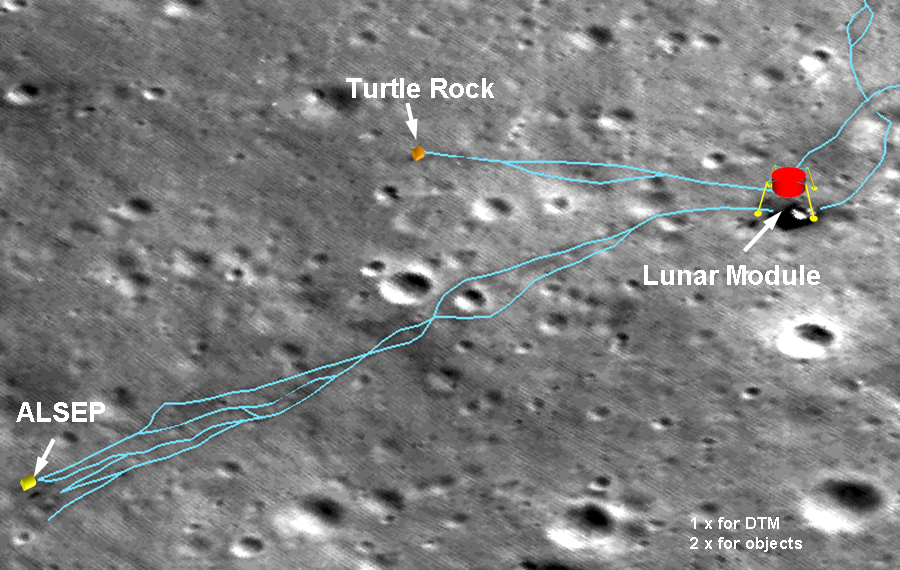
Traverse map of Apollo 14 landing site. [NASA/GSFC/ASU/OSU] (Full Size HERE.)


Jordan Lawyer

LROC News System

In the zoomed image (HERE), the lunar module can be identified by its deck (red points) and distinctive shadow (green lines). These points are measured in the two stereo images and their corresponding 3D ground coordinates are computed. Note that the shadow analysis uses different times and sun angles of the two images for computation. In addition, the nearby terrain is measured at the selected points on the ground (green points) as a reference. From these measurements, we can compute the height and diameter of the lunar module. As the result, the height of the lunar module (descent stage) is estimated as 3.0 m, compared to the design specification of 3.2 m. On the other hand, the shadow analysis resulted in a height of the lunar module of 3.2 m. Furthermore, using a least squares fitting to a circle the diameter of the lunar module is computed as 4.4 m, compared to the design data of 4.2 m.

Read the detailed story, HERE.


Apollo 14 at the beginning of Edgar Mitchell and Alan Shepard's first EVA in February, 1971. Erik van Meijgaarden has combined A14-9254 and 9255 as a 4 o'clock portrait of the Lunar Module, now a feature of the Apollo 14 section of the Apollo Surface Journal.

Thursday, January 28, 2010

Montes Pyrenaeus meets Mare Nectaris


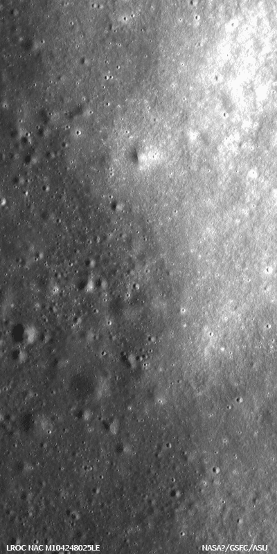
A contact between the dark basalt (left) of Mare Nectaris and the lighter anorthosite highlands (right) of Montes Pyrenaeus runs through the Constellation Program region of interest on the western rim of the Nectaris impact basin. Image width is 2.5 km, raw image resolution is 1m/pixel, NAC frame M104248025LE - click on image to enlarge this subset sample [NASA/GSFC/Arizona State University].

Veronica Bray
LROC News System

The Montes Pyrenaeus (15.6°S 41.2°E) mountain range borders the eastern edge of Mare Nectaris, on the rim of the Nectaris basin (330km diameter), which formed by the impact of an asteroid or comet about 3.9 billion years ago. This basin is easily visible in the lower right corner (western limb) of the Moon's disk as seen from Earth (Figure 1).


Figure 1: Mare Nectaris is boxed in red; a close up of this boxed area can be seen in Figure 2.


During the Nectaris basin-forming impact, the lunar crust uplifted and overturned to create the highland mountains of Montes Pyrenaeus; the remaining lunar crust beneath the basin was fractured to great depths. Much later, basaltic magmas rose to the surface through these fractures and erupted, covering the basin floor to form the dark basaltic plains of Mare Nectaris that we see today.


Figure 2. The Nectaris impact basin on the lunar near-side. The basin is 330 km across and filled with dark mare material. Montes Pyrenaeus is the light material to the right of the basin. The arrow locates the region featured in Figure 3 [From Moon Mosaic 80 Light by Mike Deegan].


This region in the Montes Pyrenaeus is one of the fifty NASA Constellation Program Regions of Interest targeted by LROC to provide data that supports future human and robotic exploration of the Moon. Since Montes Pyrenaeus and the mare deposits within the Nectaris basin are both very old, the contact between these two terrains is no longer sharp, but can still be distinguished through albedo contrast (Figure 3).


Figure 3. The contact between the dark basalt of Mare Nectaris and the lighter highlands of Montes Pyrenaeus, highlighted with red arrows. Image width is 2.5km, part of NAC frame M104248025L [NASA/GSFC/Arizona State University].


Older surfaces on the Moon were hit more frequently by comets and asteroids and thus should have more impact craters on them. However, there are a large number of small impact craters on the young mare material compared to the older highland material (Figure 3). This discrepancy is the result of heavily fractured anorthosite regolith of the highlands, which is weaker and steeper than the younger basaltic mare. These two factors make it easier to erode and erase small craters during moonquakes and shaking from nearby meteorite impacts. So here is a case where fewer impact craters indicate an older age!

Human explorers at this site would gain key geologic insights about the timing and formation of the Nectaris basin, sample Nectaris mare basalts, and access resources that lie hidden in the mare regolith.

Have a look at other places where the light highlands and dark lowlands meet. Are the contacts between the highlands and lowlands sharp or smooth? Are there always fewer small craters in the highlands?

For more information on LROC's observation campaign for the Constellation Program Regions of Interest read this Lunar and Planetary Science Conference abstract, and visit the LRO Science Targeting Meeting website (look for the baseball card summary sheets for each site: part 1, part 2).

Explore the Nectaris Constellation Region of Interest.

Wednesday, January 27, 2010

King Crater's unusual melt pond


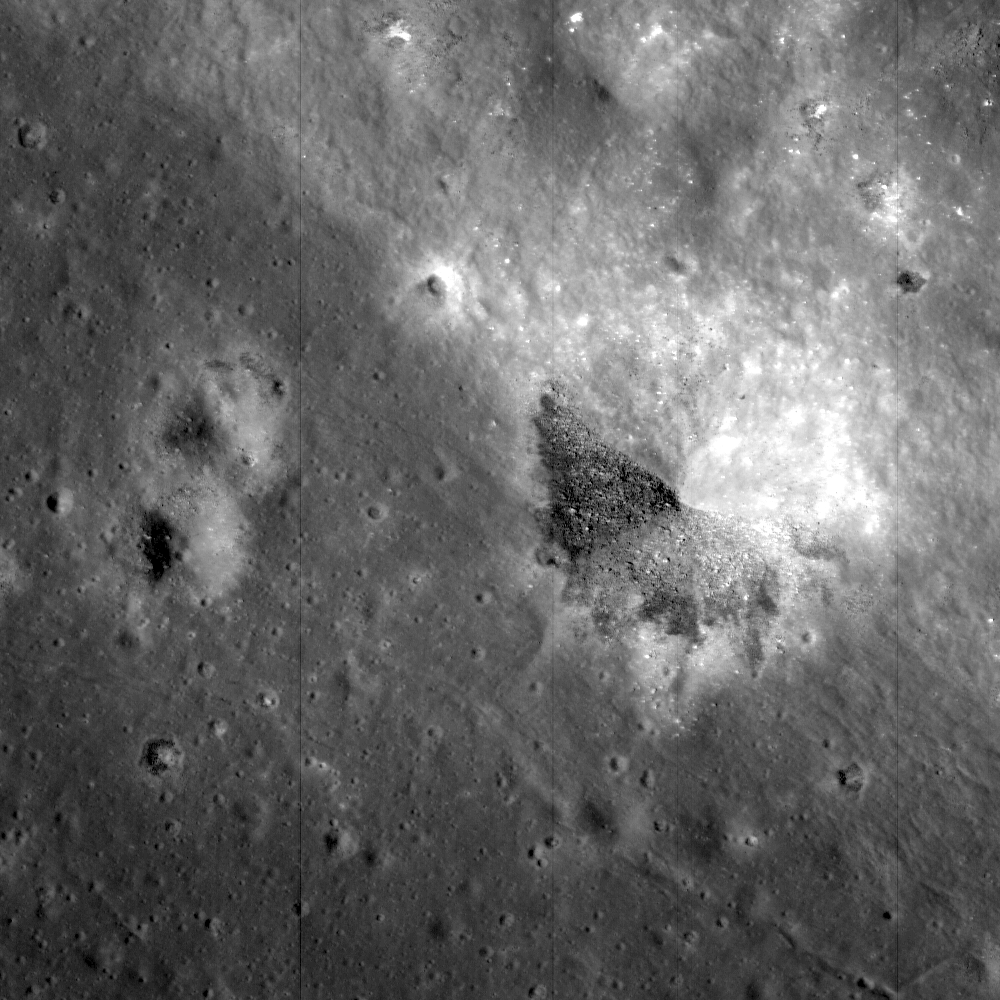
A Constellation Program Region of Interest near the northeast edge of the unusually large melt pond adjacent to the lunar far side crater King. The boundary between the dark, coherent impact melt rock at the lower left of the image and the bright, pulverized ejecta blanket to the upper right is clearly visible in the floor of a smaller crater that formed at the boundary between these two units. Image width is 1.3 km, pixel width is 1.29 m. Subset of NAC frame M106088433R [NASA/GSFC/Arizona State University].


Carolyn van der Bogert
LROC News Service

The lunar far side crater King is about 77 km in diameter and 5 km deep. King Crater is one of the youngest craters on the far side. It is an excellent example of a Copernican-aged complex impact crater. Simple impact craters are bowl shaped, whereas complex craters have central peaks, and sometimes even concentric rings. King is known particularly for its remarkable claw-shaped central peak and an unusually large ~20 km diameter, ca. 225 km3 melt pond. The melt pond, which lies to the northwest of King, has a relatively flat, smooth surface that is a potentially safe landing site for both robotic and human lunar exploration. (see the Apollo 16 Metric camera image taken in 1972 below, or browse this image in the ASU Apollo Digital Image Archive.) Scientific questions that can be answered by sending astronauts to explore this site include: How old is King Crater? What is the origin of the melt pond? What is the nature of the regolith in the lunar highlands?


Apollo 16 Metric Camera image of King Crater. Explore Apollo 16 orbital Metric Image AS16-M-0891 HERE [NASA/JSC/Arizona State University].


Questions about the origin of the melt pond were raised in the 1970's, after King was photographed by Apollo 16. Is the melt pond composed of impact-related melt? Or does it have a volcanic origin? A volcanic origin is supported by the large size of the melt pond, and the fact that there are few small impact melt ponds evenly distributed around the entire crater. However, there is no apparent volcanic source for the melt, rather the melt drapes the surrounding area and exhibits flow features that indicate that it flowed into and accumulated in the topographic low of an old crater. One possible explanation as to why there is little impact melt distributed around the entire crater, which could also explain the unusual central peak complex, is that King Crater may have been formed by an oblique impact. During an oblique impact, impact melt would be preferentially deposited along the direction of the incoming projectile, not evenly around the margin of the crater. Samples of the melt pond and surrounding impact debris, collected either robotically or by humans, can answer the questions about the melt pond's origin. In addition, new information about impact craters on the Moon helps us understand how terrestrial impact craters form on the Earth, where erosion and other geological processes often destroy valuable scientific evidence.

NAC image M106088433R, centered at 6.91° N, 119.93° E, extends from the northern rim of King, across the large melt pond, and into the ejecta blanket of King. The image was taken at a solar illumination angle of 35 degrees, which means that the Sun was relatively high in the sky. Such imaging conditions are useful for seeing subtle color differences between different areas within the image. For example, the impact melt pond is darker in color than the ejecta blanket. The brightest spots in the image are boulders of anorthositic (highlands) material that lie on top of the ejecta blanket. Such albedo differences also offer clues to how long materials have been exposed to the solar wind, cosmic radiation, and micrometeorite impacts, processes collectively called space weathering.

For more information on LROC's observation campaign for the Constellation Program Regions of Interest read this Lunar and Planetary Science Conference abstract, and visit the LRO Science Targeting Meeting website (look for the baseball card summary sheets for each site: part 1, part 2).

Browse the entire NAC image to explore the unusual melt pond and ejecta blanket of King Crater.


Detail from Lunar Reconnaissance Orbiter Narrow-Angle Camera image M106088433R (Orbit 781, 28 August 2009) centered 6.91 N, 119.93 E. Full image extends from the northern rim of King crater across a large melt pond, into King's ejecta blanket. From the latter portion of LRO's commissioning phase, the image resolution is approximately 1.29 meters per pixel [NASA/GSFC/Arizona State University].

Friday, January 22, 2010

LROC: Pyroclastic Deposit


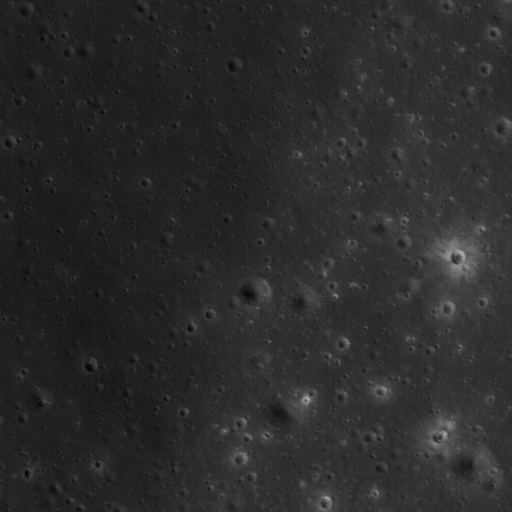
NAC Frame M111945148R. Part of the vast pyroclastic deposit near a Constellation Program Region of Interest located on the Aristarchus plateau is visible in this image. View is 537 m across [NASA/GSFC/Arizona State University].

Constellation Areas of Interest -
Aristarchus (2)

Lisa Gaddis
LROC News System

A typical view of the lunar surface? Hardly! This NAC frame (537 m across) reveals a dark, fine-grained pyroclastic deposit that has mantled older units, including flat mare deposits (at left) and nearby knobs of highland materials (at right). This site (Aristarchus 2) is located in the northwest region of the Aristarchus Plateau, within the most extensive deposit of pyroclastic materials on the Moon. The Constellation objectives here (Aristarchus 2) are more focused on resource potential, whereas Aristarchus 1 was selected more on the basis of geologic diversity.

At Aristarchus 2, some areas of the mantling deposit are estimated to be 10 to 20 meters in thickness. In the small area shown in the above image, the deposit is much thinner (likely only a meter or two deep). The bright-rayed crater at right-center (15 m diameter) has penetrated the mantle and exposed fresh, light-colored rocks typical of the lunar highlands. Many of the craters at left, although similar in size to the bright-rayed crater, have uncovered only dark materials that are slightly lighter in color than the pyroclastic mantle. Such exposures of rock by fresh craters provide some of the best clues to the composition and distribution of covered units and help to reconstruct the history of events that created the deposits we see.

Lunar pyroclastic deposits are formed by explosive eruption of basaltic magma and are thought to be associated with early stages of eruption of the mare deposits that fill impact basins across the near side. The deposits appear fine-grained and often very dark, and they have been called "mantling deposits" because they drape over and obscure underlying terrain. This mantling effect is similar to what you see after a deep snow: normally sharp edges of tables, chairs, and cars are now smoothed and subdued. The same effect happens under a blanket of fine ash.

Pyroclastic mantling deposits were sampled by the Apollo astronauts at several sites on the Moon, and in particular a deposit of submillimeter-sized orange glass and crystallized beads was discovered near Shorty Crater by Astronaut Harrison "Jack" Schmitt in the Taurus-Littrow Valley during the Apollo 17 mission. The beads at Apollo 17 formed from magma that originated ~400 km deep within the Moon and erupted more than 3.6 billion years ago.

Pyroclastic deposits are fascinating to lunar scientists because of the possible economic and engineering value of the volatile and metallic elements identified on and within their component beads. The beads have trapped solar wind hydrogen and Helium-3, and enrichments of volatile elements such as sulfur, lead, fluorine and zinc have been measured on their surfaces. Pyroclastic deposits are typically rich in iron oxides and also have widely varying amounts of titanium oxide, commonly present as the mineral ilmenite. Areas with pyroclastic deposits are likely to feature prominently among future exploration sites on the Moon and are a key enabler for large-scale human lunar habitation. Thus, it is important that we learn as much as we can about them. Where are they, how thick are they, and do compositions vary within a deposit and from deposit to deposit?

For more information on LROC's observation campaign for the Constellation Program regions of interest read this Lunar and Planetary Science Conference abstract, and visit the LRO Science Targeting Meeting website (look for the baseball card summary sheets for each site: part 1, part 2).

Explore the rich resources of the Aristarchus plateau for yourself!

Digital Terrain Model of Orientale Basin

From Proclus impact survey debris survey using Google Moon

Does this coelis, south of Proclus, really exist? Or is it more likely an error in the Digital Elevation Model? A casual census of available LRO Narrow-Angle Camera adds evidence to both arguments for and against such features elsewhere, though not yet this particular 800 meters tall and 1200 meter wide, at the base, formation which seems to be just barely within the resolution of the Apollo 15 high-sun metric camera photography. Whether this particular anomalous feature really exists or not, before 2010 is over it is likely many such features will be discovered that were beyond earlier orbital surveys.

The Lunar Reconnaissance Orbiter Camera (LROC) team at Arizona State University is owed a huge debt of gratitude for going above and beyond, literally, in sharing at least some of what has been discovered in unprecidented detail on the Moon by the LRO's narrow-angle camera (NAC).

LROC principal investigator Mark Robinson deserves some sort of Webby Award for sharing subsets of commission-phase LRO NAC imagery, particularly of the poles and eastern far side, hemisphere through the planetary data system. This test release has lunatics like us anxiously anticipating the Lunar and Planetary Conference in early March and the scheduled larger release of LRO data later that month.

It's hoped by that time the interested public and lunar science community will then be able to get a very long anticipated closer look at certain features on the Moon that have always been tantalizingly beyond the best resolutions.

Recently the LROC News System at Arizona State has begun sharing more of the Wide-Angle Camera (WAC) images, after redesigning their website, and this past week the team released something unexpected.

It appears the Laser Altimeter detail that will also soon be available from LRO will be complimented greatly by additional digital terrain modeling made possible by the LROC WAC. It's stunning, certainly, but still just hints at how our understanding of the Moon should soon match the true state of the art.


A Digital Terrain Model ("DTM") of the large Orientale Basin (1100 km diameter), located on the western hemisphere of the Moon, produced from stereo images obtained by LROC's Wide-Angle Camera. The image shows the hill-shaded, color-coded DTM with heights varying from approx. -4,700 meters to 9,400 meters. The small white boxes are areas without WAC coverage [NASA/GSFC/Arizona State University/ DLR].

Juergen Oberst
LROC News System

How was the Terrain Model created?

LROC's wide angle camera (WAC) has a ground resolution of approximately 100 m/pixel from LRO's nominal orbit altitude of 65 km and is taking image swaths 70 km wide along LRO's ground-track. Therefore, images from adjacent orbits show substantial overlap and strong stereo effects in the overlapping images.

Image overlap amounts to approximately 50% near the equator. Using sophisticated so-called "photogrammetric" techniques and computer software, a terrain model can be computed. Several hundred WAC images were combined to form this model. It is a subset of an almost global model, which is currently under construction and which will consist of more than 10,000 WAC images. This particular terrain model was produced using a software system that was originally developed by the German Aerospace Center (DLR; English version) for the High Resolution Stereo Camera (HRSC) on the European Mars Express Mission.

Read the rest of the release HERE.

Wednesday, January 20, 2010

LROC: The Cobra Head


Eastern slope (right to left is downhill) of the Vallis Schröteri, "Cobra Head". This feature is located in the western portion of a Constellation Program region of interest on the Aristarchus plateau. The slopes of the Cobra Head are boulder-rich and display albedo variations - bright to dark. The patterns of debris and flows on the slopes are evidence for mass-wasting and landslides that expose a variety of rocks. Image width is 3.7 km, pixel width is 0.51 meters, from NAC frame M111918050R [NASA/GSFC/Arizona State University].

Constellation Areas of Interest -
Aristarchus (1)

J. Stopar
LROC News System

The Aristarchus plateau has fascinated lunar observers since before the space age. Its odd shape and low and high albedo extremes immediately draw your attention. Superimposed on the plateau is a spectacular channel (or rille), and the very young Aristarchus crater (regional overview). Aristarchus crater is the largest impact crater on the plateau and is one of the highest reflectance (in fact, it is blindingly bright in a telescope) features on the Moon. The plateau itself is surrounded by the lava flows of Oceanus Procellarum, and the whole region has a high concentration of sinuous rilles.

The largest of these is Vallis Schröteri, which is also the largest sinuous rille on the Moon. Finally, the plateau is almost completely covered by one of the largest lunar regional pyroclastic deposits. Large pyroclastic deposits are a potential resource for useful elements like hydrogen, oxygen, iron and titanium. Thus, due to its geologic complexity and resource potential, the Aristarchus region is naturally of interest to the Constellation Program and future lunar missions.

The head of Vallis Schröteri, a feature also known as the "Cobra Head", consists of a deep pit, which is of great interest to scientists. The Cobra Head is thought to be the source vent of a tremendous outflowing of lava that flowed across the plateau and formed the rille. Exposed in this vent are lava flows, pyroclastic material, and small bits of white rocks. The white rocks are pieces of the underlying crust most likely composed of anorthositic (highland) rocks. Much of this material was excavated by the impact that formed Aristarchus Crater and was brought to the surface from great depths.

These white rocks may be of a unique crustal composition representing late-stage subterranean magmatic activity. Rocks that form last from a magma body often have rare compositions enriched in incompatible elements. The elements are labeled incompatible because they do not easily combine with other elements and thus concentrate in the last remaining melt. Therefore, the last rocks to freeze out of a magma have high levels of these incompatible elements. Sampling such rocks will provide insights into lunar magmatic evolution and the bulk composition of the mantle.


The Cobra Head of Aristarchus Plateau in full sunlight as seen by Hubble- part of a larger examination of the links between lunar albedo and the geologic composition of the Moon's surface completed from Earth orbit using the Hubble Space Telescope. One of the many reasons Aristarchus is the most reported location of transitory phenomena is the blinding reflection from relatively fresh materials uncovered by the impact that created nearby Aristarchis crater, by far the brightest part of the larger, rectangular Aristarchus formation [NASA, ESA and J. Garvin (NASA/GSFC)]


LROC Wide-Angle Camera (WAC) mosaic centered on the Aristarchus Plateau; the Cobra Head is indicated with white arrow, a small portion of the rim of Aristarchus crater is just visible on the lower right, "H" indicates center of Herodotus crater (35 km diameter). M111918011CE, 605 nm in red, 567 nm in green, 415 nm in blue, image width ~55 km, north is up.

NAC image M111918050R, centered at 24.82N, -49.12E, shows a portion of the eastern wall of the Cobra Head. These slopes are covered with boulders and debris that slid down the walls. The patterns on the slopes are evidence for downslope movement (landslides and/or creep). "Flow" is from right to left, with boulders accumulating in local "bars" such as the one in the center of the image. The slope is scoured by the movement of boulders. The rocks exposed in the rille exhibit large brightness contrasts, some being very dark
and others very bright.

What is the origin of the bright material? Some of the brightness is a function of steep boulder faces oriented towards the Sun. Even dark rocks such as basalt can exhibit bright Sun-facing facets. Most of the local material here is basaltic, having originated in the huge Cobra Head vent at the head of the 140-km long Vallis Schröteri. To the east (right) of this image is the Aristarchus Crater, which has some of the brightest ejecta of any crater on the Moon. Some of that bright ejecta material is among the boulders that have moved down this slope as the steep rim gradually collapsed over time.

Explore the Aristarchus (1) Constellation Program region of interest for yourself, and imagine what it would be like to look out over Vallis Schröteri, the Lunar Grand Canyon.