Showing posts with label Surveyor. Show all posts

Friday, September 7, 2012

LROC: America's last unmanned lunar lander

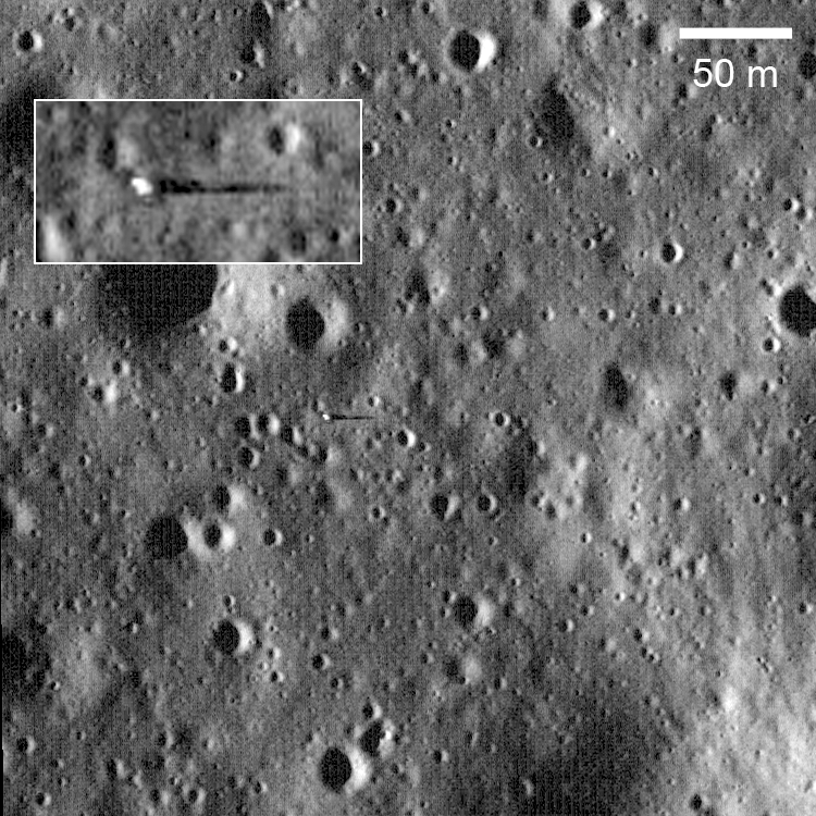
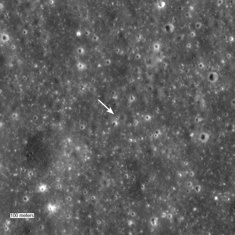
Surveyor 7, on the ejecta blanket of Tycho, the last of the Surveyor spacecraft (1967-1968), and the only one of the series to land in the lunar highlands. LROC Narrow Angle Camera NAC frame M175355093L, LRO orbit 10976, November 8, 2011; field of view is 500 meters across, viewed at the original scaled 43 cm per pixel resolution at an illumination incidence angle of 56.22° Inset, from the LROC Featured Image released September 7, 2012, is enlarged 4x [NASA/GSFC/Arizona State University].
Ryan Clegg
LROC News System

Surveyor 7 landed in the lunar highlands (40.980°S, 348.486°E) on 10 January 1968, on an impact-melt coated ejecta blanket 46.6 km (29 miles) north of the rim of Tycho Crater. The last spacecraft of the Surveyor series, it was sent to an area far from the mare in the southern highlands, in order to sample and analyze materials different from those of the other Surveyor missions. Surveyor 7 was the only Surveyor spacecraft to be sent to a region solely for scientific interest, rather than to obtain more data for the upcoming Apollo program, since program managers had decided that the previous Surveyor missions had already provided sufficient data to enable a safe Apollo landing. Results from the spacecraft’s alpha scattering detector showed that the highland crust is poorer in iron than the maria analyzed by the other Surveyors.

Landing site of Surveyor 7 captured at a higher angle of incidence (83.96°) and altitude (44.94 km),  in context with the prominent impact melt pond to the northeast, its intended landing site. LROC NAC observation M131724362L, spacecraft orbit 4545, June 21, 2010; resolution 50 cm [NASA/GSFC/Arizona State University].
Panorama of the Surveyor 7 landing site, taken by Surveyor 7 [NSSDC].

A total of 21,091 pictures were transmitted to Earth by Surveyor 7. One of the most stunning image sets is a photomosaic panorama of the landing site, which shows the rim of the 82-km diameter Tycho Crater on the horizon. On the surface of the Moon, as on Earth and elsewhere, impact craters are typically hidden from sight until you are standing right up on the rim. The Apollo 14 astronauts encountered this problem as well, when taking samples during a radial traverse of Cone crater. They lost sight of the crater rim during their traverse and eventually had to turn back before catching a glimpse of the interior of the crater in order to save enough oxygen for the journey back to the Lunar Module. LROC images (February 4, 2011, August 19, 2009) later confirmed that the crew came within 30 yards of the crater rim.

Surveyor 7 could only just make out the rim of Tycho Crater from its landing site. However, from an orbit of 50 km above the surface the panoramic view of the stunningly well preserved impact crater and its majestic central peaks is spectacular.

Simulated view from several kilometers above a point north of the Surveyor 7 (blue square) shows it's proximity with Tycho [NASA/LMMP/GSFC/Arizona State University].
The Surveyor missions not only provided critical engineering data that helped enable the safe Apollo landings that followed, but also showed that powered descent to the lunar surface was feasible and straightforward. Robotic precursor missions (such as automated sample return missions and in-situ resource utilization demonstrations) will undoubtedly play a similarly important role as we prepare for the seventh human lunar landing and beyond.

Be sure to explore the entire NAC frame (M175355093L) HERE. covering the Surveyor 7 site, and check out the central peaks of Tycho in the June 29, 2011 and May 21, 2012 Featured Images.

WAC context image of Tycho and the Surveyor 7 landing site [NASA/GSFC/Arizona State University].

Previous Posts Related to Surveyor 7:
LROC: Giant flow of Tycho impact melt (August 14, 2012)
Polygonal fractures on Tycho ejecta (June 15, 2011)
Surveyor 7 (February 12, 2011)
Surveyor 7: Our fragile lunar LDEF (October 27, 2010)
LOLA's Tycho and the Apollo era (March 28, 2010)

Related LROC Posts:
New View of Apollo 14
Trail of Discovery at Fra Mauro
Tycho Central Peak Spectacular!
View From The Other Side
Surveyor 1
Surveyor 3 and Apollo 12
Surveyor 5
Surveyor 6

Monday, April 30, 2012

Will China deploy the first lunar rover since 1976?

China's third unmanned lunar spacecraft Chang'e-3 deploys only the thrid teleoperated lunar rover on the Moon, the first in 37 years, in 2013 [CNTV/CLEP].
The United States scrubbed plans to land a robotic lunar rover on the Moon as unnecessary, originally an extension of the successful Surveyor program (1966-1968), in favor of concentrating all effort on carrying out the Apollo missions. Between 1968 and 1972 a total 24 Americans left Earth orbit to visit the Moon's vicinity (three of these went the distance twice), and 12 astronauts explored the lunar surface. Though the U.S. deployed three Mars rovers, with a fourth on the way, Russia alone holds the distinction of having landed and operated the only robotic rovers on the Moon.

Though many U.S. and international teams are competing for the Google Lunar X-Prize, and the U.S. presently has a total of five sophisticated probes in lunar orbit, it now seems almost certain that China will become the first nation to soft land anything on the Moon since the Soviet sampler Luna 24 came to rest in the far eastern Mare Crisium in 1976.

The U.S. has no hard commitment to land a vehicle on the Moon at present, though the International Lunar Network and a South Pole-Aitken basin farside sampling mission continue in the planning stages. Internal challenges in both Russia and India have caused delays to ambitious plans for lunar surface missions set alone and in tandem with one another. Japan's SELENE program, which at one time called for lunar rover, continues to muddle through severe budget challenges.

Though China admits to being somewhat behind on the timeline it has set for building its third lunar mission, Chang'e-3, intended as a rover deployed following a soft landing on the Moon, the PRC does not express concern over plans to carry out that mission in 2013. Articles about Chang'e-3 published by China's state-owned media continue to surface regularly.


Xin Dingding
China Daily

Only 12 Americans have so far walked on the moon. The next person to do so could be from China. 

According to a white paper, China's Space Activities in 2011, released in December, preliminary research on a manned moon landing will be carried out in the next five years, along with research on a heavy-thrust carrier rocket, vital for launching manned spacecraft to the moon.

Scientists expect a manned moon landing could be achieved by China in 20 years, though there is no fixed timetable yet.

Experts, however, say that before taking the giant step, China needs to complete its robotic lunar exploration program, as it will lay the platform for successful moon landings.

The chief scientist for the lunar exploration program, Ou-yang Ziyuan, has already indicated that China has the ability to launch men to moon, but it's "a single-trip ticket", meaning the nation does not have the capability to ensure that astronauts can return to Earth.

"The three steps set in the unmanned lunar exploration program are something China must undertake before commencing the plan to send men to the moon," he says.

China adopted the robotic lunar exploration program in 2004, which includes three steps - circling the moon, landing on the moon and returning with a sample.

China has completed the first step by launching the Chang'e-1 probe in 2007 to orbit around the moon, thereby becoming the fifth country in the world to independently launch lunar orbiters.

It is now in the second phase of achieving a soft landing on the moon. Chang'e-2, the backup satellite for Chang'e-1, was modified and launched in 2010 to test some key technologies for soft landing.

"Next year, the country's third lunar probe, Chang'e-3, is expected to be launched as planned and will conduct a soft landing on the moon," says Ye Peijian, chief designer of Chang'e-1 and chief commander of the satellite system of the Chang'e-2 and Chang'e-3 missions.

The orbiter will carry a lunar rover and other instruments for territory survey, assessment of living conditions and space observations.

"Chang'e-3 will be the first spacecraft with the first-ever China-designed 'legs' The lunar rover is also the first of its kind to be tested in the harsh environment on the moon," he says.

Preparations have also been advanced for the third phase, which aims to bring soil samples back to Earth before 2020.

Both the United States and the former Soviet Union have already sent spacecraft to the moon, but in two different ways. Hu Hao, chief designer of the program's third step, says that scientists have finally decided on how to achieve the goal of returning soil samples from the moon.

According to Hu, China will carry out a "Lunar Orbit Rendezvous" - the mode used by the Apollo Programs - to collect as many samples as possible.

Under the plan, a rocket will be launched from Earth that will put four modules into the lunar orbit. Two modules will land on the moon, while one will scoop up soil. The soil sample will be placed into the ascending module that will blast off from the lunar surface and dock with the orbiting module. The sample will then be transferred from this module to another one that will be jettisoned for Earth re-entry.

Though the US has done this kind of exercise more than four decades ago, the Chinese aerospace scientists have no one to count on, but rely on themselves to solve the major technical problems, Hu says.

China plans to scoop up as much as 2 kilograms of soil samples, but how to do it could also be a tricky problem.

The Automatic Lunar Surface Exploring Vehicle, China's planned Chang'e-3 lunar rover, "a solar powered vehicle designed and built by the China Academy of Space Technology (CAST). The six-wheeled rover has a designed life of 90 days to explore three square kilometers, a total mass of 120 kg (with a 20kg payload capacity) designed to travel up to 10 kilometers."

"The vehicle is capable of autonomously navigating around obstacles, selecting optimal routes and areas of interest. On-board equipment includes subsurface radar and an optical telescope. An on-board camera can capture images of the lunar surface and a mechanical arm, designed by Hong Kong Polytechnic University, will allow the vehicle to collect samples for analysis. The vehicle can transmit image and data back to the Earth in real-time and all on-board equipment are capable of operating normally during the 14 day-long lunar night."

The former Soviet Union's three missions collected just over 300 grams of lunar soil. The US had better success and returned 381.7 kg of rocks and other material from the moon, thanks to astronauts' participation.

"China's mission is also a robotic one. The probe could land on an unknown spot that could be rocky, and drills could fail to deeply penetrate the lunar surface, just like a mission by the former Soviet Union," he says.

The difficulties also include how to launch the ascending module from the lunar surface and how to conduct rendezvous and docking operations in the lunar orbit.

"China conducted its first spacecraft rendezvous and docking operation in the low-Earth orbit successfully last year. But how to do it in a lunar orbit more than 300,000 km away from Earth is a new challenge," he says.

The space docking last year relied on the global positioning system, which, however, will not be of much use during a lunar orbit rendezvous. The docking ports on the ascending module and the orbiting module need to be redesigned and tested, as the modules are much smaller in size.

Finally, scientists also have to solve the problem to have the probe re-enter the Earth atmosphere safely.

China also lacks experience in how to make the sample-carrying capsule re-enter the Earth atmosphere safely, he says.

While previous re-entries of unmanned and manned spacecraft were made at 7.9 km per second, the return capsule with the lunar soil sample will be hurtling to Earth at, or close to, speeds of 11.2 km per second.

He says that the third phase will launch two orbiters to achieve the goals before 2020. Earlier reports said that the first of these is likely to be launched around 2017.

"We are under pressure as only a short time is left," he says.

Scientists are also stressed due to the public's unrealistic high expectations for success, he says. In recent years, consecutive successes in the space sector have buoyed expectations for more missions.

"People now tend to underestimate risks in space activities. They think it is easy and have little tolerance for failure. But even space powers like the US and Russia have had several failures," he says, adding that more tolerance is essential for the healthy development of China's aerospace industry.

Related Posts, HERE

Wednesday, March 7, 2012

LROC: Pinpoint Landing on the Moon (Apollo 12)


Descent and landing of Apollo 12 in Oceanus Procellarum, November 1969.

The Apollo 12 landing site (3.0119°S, 336.585°E) in Oceanus Procellarum, imaged during the second LRO low-altitude campaign, orbit 10,987, November 11, 2011. Field of view width = 225 meters, LROC Narrow Angle Camera (NAC) observation M175428601R  View the full size LROC Featured Image HERE [NASA/GSFC/Arizona State University].

Samuel Lawrence
LROC News System

The LRO mission continues to collect observations that are enabling ground-breaking new scientific discoveries about the Moon. As geologists, whenever we look at remotely sensed data collected from another planet, in a sense we are staring back in time. But this is the “deep time” of geology, where we are trying to understand natural processes that (at least on the Moon, anyway) could have happened billions of years ago. But the LRO mission is unique because we can also see human history. Not just any history, either, but one of humanity's greatest accomplishments, our first steps on another world. Twelve astronauts explored the lunar surface, directly seeing things with their own eyes, making observations, and collecting samples with their own hands. These samples and observations revolutionized our understanding of our solar system.

This “snapshot in time” effect is especially evident at the Apollo 12 landing site in Oceanus Procellarum, now known as Statio Cognitum. Here, you can see the remnants of not one, but two missions to the Moon. Astronauts Pete Conrad and Alan Bean demonstrated that a precision lunar landing with the Apollo system was possible, enabling all of the targeted landings that followed. Bean and Conrad collected rock samples and made field observations, which resulted in key discoveries about lunar geology. They also collected and returned components from the nearby US Surveyor 3 spacecraft, which landed at this site almost two and half years previously, providing important information to engineers about the how materials survive in the lunar environment.
Annotated low altitude LROC NAC image of the Apollo 12 landing site (view the glorious 2438 x 2109 image HERE). The informal names of craters visited by the astronauts, the positions of the ALSEP, Intrepid descent stage, and Surveyor 3 spacecraft are highlighted. LROC NAC M175428601R [NASA/GSFC/Arizona State University].
In the image above, you can see the remnants of the scientific experiments the astronauts set up on the surface, the first long-term Apollo Lunar Surface Experiments Package (ALSEP).  Powered by a Radioisotope Thermoelectric Generator (RTG), the ALSEP included a seismometer to record "moonquakes" and several experiments designed to make measurements of the lunar environment, including a Solar Wind Spectrometer, a Cold Cathode Ion Gauge, and a Suprathermal Ion Detector (see if you can find each piece of hardware). The Apollo 12 ALSEP returned data and measurements to Earth for over seven years following the mission and was turned off in September 1977. From the lower altitude you can pick out the shadow of the still standing flag, the High Gain Antenna (HGA), and the discarded Portable Life Support System (PLSS) backpacks.

Apollo 12 photograph of the ALSEP central station, with Intrepid and S-band High Gain Antenna (HGA) in the background. The ribbon cables in this image are clearly visible in the first low-altitude LROC image of the Apollo 12 landing site, below [NASA high-resolution photograph AS12-47-6928].
After deploying the ALSEP, the astronauts moved to the northwest, eventually stopping to take a series of photographs of the crater dubbed “Middle Crescent”. The boulders the astronauts observed on the surface are visible in the LROC image above.

Apollo 12 photograph of the interior of Middle Crescent crater, taken during the first Apollo 12 EVA [NASA high-resolution photograph AS12-46-6838].
During the second EVA, the astronauts performed a geologic traverse on foot covering almost 1.5 km. In today’s image, you can clearly follow the path they took edging around Head crater, proceeding to Bench and Sharp craters with a brief stop at Halo crater, visiting the Surveyor spacecraft, and then returning to the Lunar Module.

Apollo 12 photograph of the interior of Sharp crater taken by astronaut Pete Conrad, whose shadow you can see in the lower right [NASA high-resolution photograph AS12-49-7271].
One of the most common questions prior to the launch of LRO was: will you be able to see the American flags that were left on the Moon by the astronauts? The flags themselves are too small to be seen by the NACs, even with the small pixel scales enabled by the low-altitude orbit.  However you can see the shadow being cast by the flag. This is especially evident in this movie [15 MB Quicktime file] of LROC images of a complete lunar day, shown sequentially from dawn to dusk. Watch the rotation of the shadows carefully, and you can see the shadow cast by the flag! Question answered, yes you can find the flag - but what does it look like? Have the stars and stripes faded? That question will remain for a future landed spacecraft.

LRO was placed in low periapse orbits during two months last year: 8 August 2011 to 6 September 2011 and 31 October to 27 November 2011. In each month, LROC was able to obtain low altitude images of the Apollo 12 site. For comparison, the first low-altitude image is shown below. When this image was acquired, the Sun was 54° above the horizon (early-afternoon) and in today's Featured Image the Sun was 45° above the horizon (mid-morning). Incredibly, you can even see the ribbon cables connecting the ALSEP instruments to the central station in this first low-altitude Apollo 12 image (below). The cables appear as bright, straight lines leading from the SIDE and LSM, and are visible because, despite being narrower than the 25-cm pixel scale, they are highly reflective.

First NAC low altitude image of Apollo 12 site, larger area version linked below [NASA/GSFC/Arizona State University].
Forty-two years ago, using technologies that many people today would probably (and erroneously) find hopelessly antiquated, the crew of Apollo 12 executed a flawless precision landing  on another world. Imagine how much more today’s astronauts will accomplish when we return to the Moon with 21st century technology!

Explore the Ocean of Storms in our newest NAC observation, and be sure to check out this YouTube video showing the Apollo 12 landing site:


Other LROC Images of the Apollo 12 Landing Site:
First Look: Apollo 12 and Surveyor 3
Apollo 12 Second Look: Midday on the Ocean of Storms
First Low Altitude Apollo 12 NAC Image

Wednesday, June 15, 2011

Polygonal fractures on Tycho ejecta

Along with a new close-up of Surveyor 7


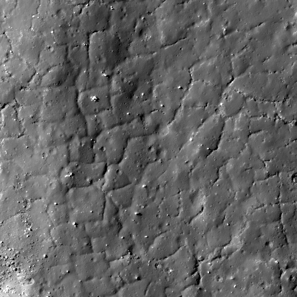
Polygonal fractures on a flow lobe of impact melt splashed out of Tycho crater about 109 million years ago. Image scale 0.52 meters/pixel, incidence angle is 69.1°, LROC Narrow Angle Camera (NAC) observation M150598504R, LRO orbit 7327, January 25, 2011. See the full-size LROC Featured Image HERE [NASA/GSFC/Arizona State University].

Hiroyuki Sato
LROC News System

Tycho is a young and prominent rayed crater on the lunar nearside. During the impact that formed Tycho crater a large mass of impact melt was thrown out on its north side that resulted in a series of beautiful flow patterns. The melt ponded in several topographic lows, and as they cooled their upper crusts fractured, often in polygonal patterns.

Today's Featured Image shows a set of crisply preserved polygonal fractures. Small chains of pit chains are also seen in conjunction with the fractures. Are these pits nascent fractures that never fully developed? Or perhaps partially collapsed tubes that melt flowed through? If the latter, might there be open passages that astronauts could venture into and explore?


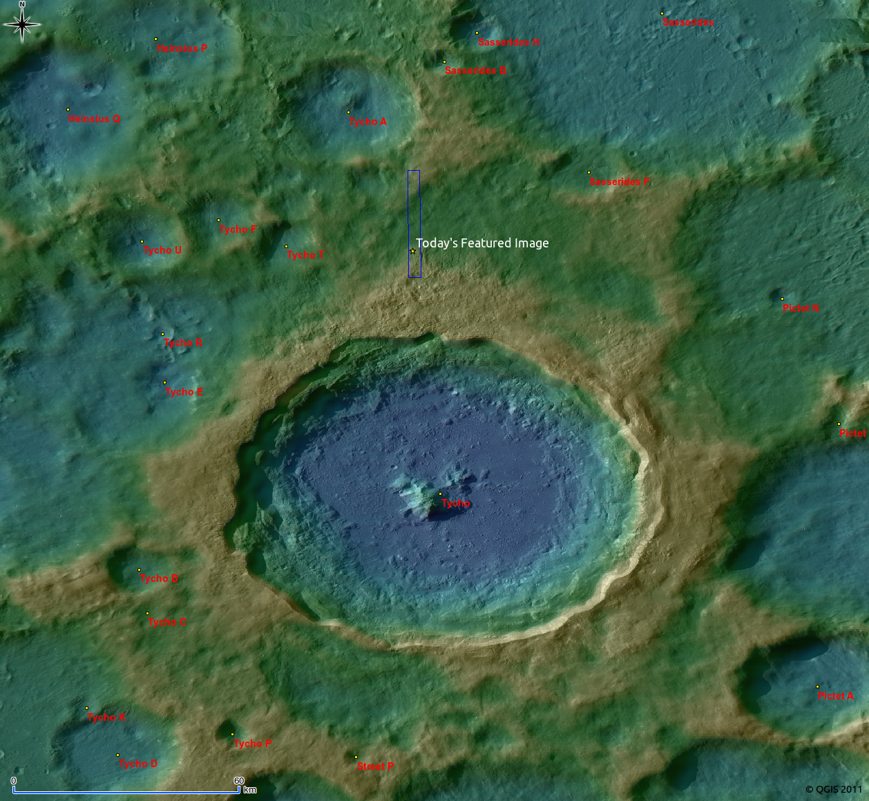
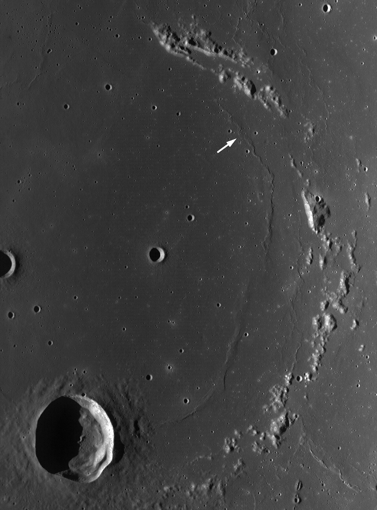
LROC WAC 100m/pixel mosaic around Tycho crater over-lain by WAC color coded DTM 500m/pixel (DLR, Germany). Image center is 43.3°S latitude, 348.6°W longitude. Blue box and yellow star indicate the locations of today's full Featured Image. See the full-size LROC Wide Angle Camera/DEM mosaic HERE [NASA/GSFC/Arizona State University].


In January 1968, Surveyor VII (arrow) landed only a kilometer from the impact melt pond immediately to its northeast, caught once again by LROC's NAC, almost exactly forty-three years later. The plucky vehicle's distinctive square solar panel and profile can easily be seen in its long shadow (see full-resolution crop below) near the center of the full LROC NAC frame from which the LROC Featured Image above was snipped [NASA?GSFC/Arizona State University].


Surveyor VII - A very successful lander, the last U.S. unmanned lunar lander and last of an outstanding program is caught standing sentinel awaiting a valuable examination of the effects of nearly 575 two-week long blistering hot lunar days and an equal number of two-week long numbingly cold lunar nights [NASA/GSFC/Arizona State University].

Explore the polygonal fractures (and find Surveyor 7) north of Tycho by viewing the full NAC image!

The topographic color was produced as a by-product of stereo analysis of the WAC global dataset. Producing the global Digital Elevation Model (DEM) is a big job being led by LROC team members at the German Aerospace Center (DLR; English version) in Berlin.

Related posts:
Look at that flow!
Fractured Impact Melt
Fragmented Impact Melt
Natural Bridge on the Moon!
The Floor of Tycho - Constellation ROI
Surveyor 7: our fragile lunar LDEF
LOLA's Tycho and the Apollo era

Thursday, April 7, 2011

Interior Rim of Flamsteed P


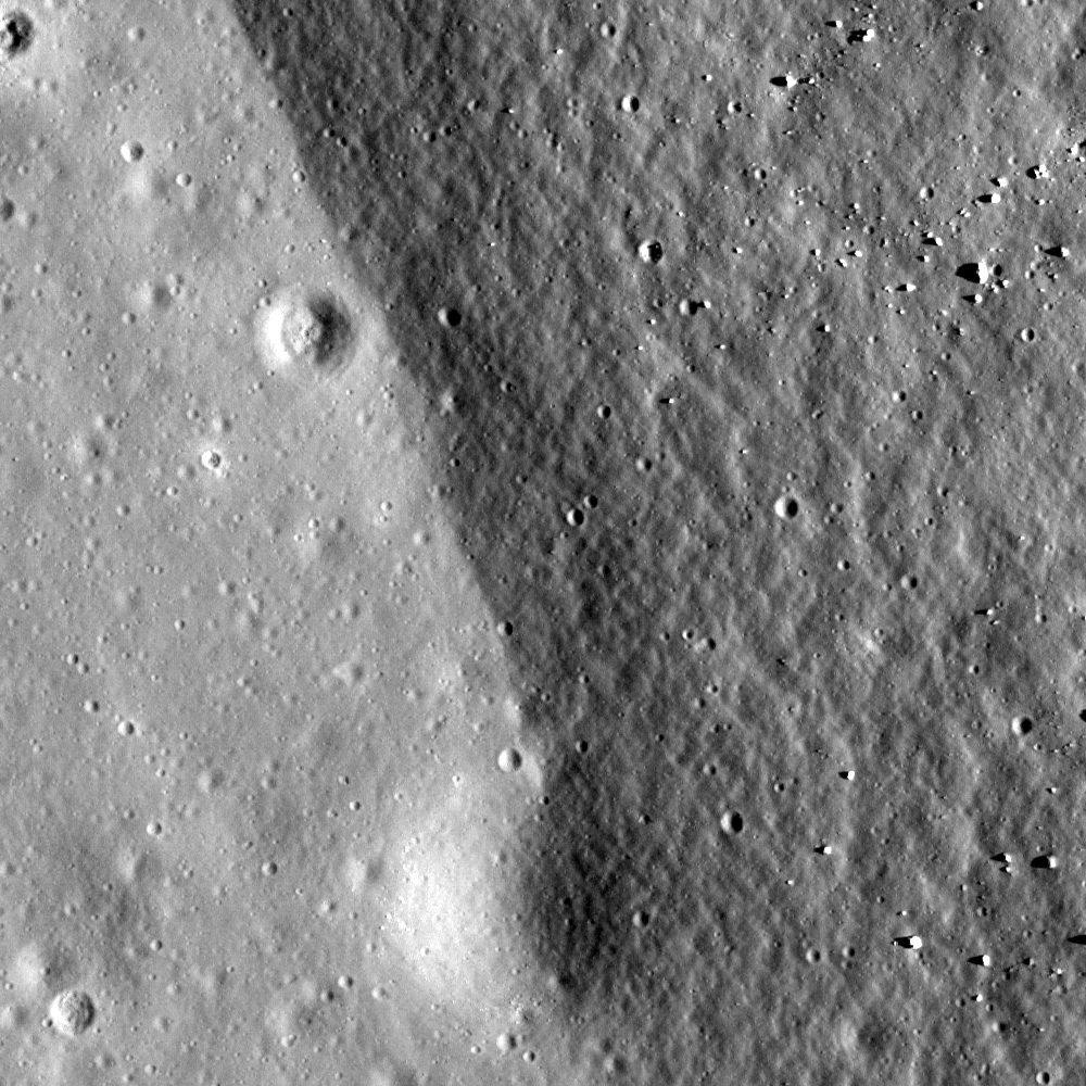
Boundary of buried crater rim and mare basalt at Flamsteed P, Illumination is from west at an angle of 60°, field of view is 500 meters; from LROC Narrow Angle Camera (NAC) observation M114233793R, LRO orbit 1968, November 30, 2009. View the full-size Featured Image, HERE. [NASA/GSFC/Arizona State University].

Hiroyuki Sato
LROC News System

Today's Featured Image displays a portion of eastern rim of Flamsteed P crater, located in southern Oceanus Procellarum. The rough and darker right side corresponds to the rim slope, and the brighter and smoother area to the left is the younger mare basalt. Flamsteed P's interior was mostly filled by mare basalts and all that remains are portions of its rim showing as discontinuous ridges (see WAC context image below).

In terms of local timeline of events (geochronology), following the formation of Flamsteed P, mare basalt flooded its interior and exterior. Later a small crater (110 m diameter) formed just at the boundary between the mare and crater rim (bottom of today's Featured Image). This small crater is half covered by the older rim unit. Does this make sense? Even though the small crater is much younger than the Flamsteed P rim it is buried by rim materials that slid downhill after the crater formed. What cause the regolith to move? Perhaps moonquakes generated by internal stresses or nearby impact events. Or perhaps a slower process of downhil creep caused by thermal cycling of the regolith (soil). We have much to learn about the Moon - the next frontier!


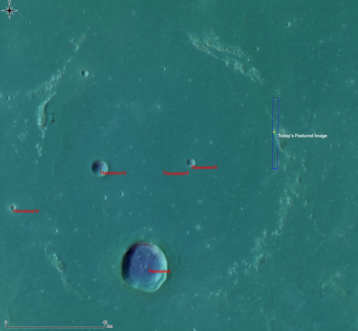
Whole of Flamsteed P, yellow cross and blue rectangle indicate the locations of the April 6, 2011 LROC Featured Image and the NAC frame from which is was taken. False color image from the Digital Terrain Model (DTM) centered at 3.15°S, 315.96°E. A LROC Wide Angle Camera (WAC) mosaic at 100 meters per pixel resolution is overlaid by LROC WAC DTM at 500 meters per pixel. View the full-size context image HERE [NASA/GSFC/Arizona State University/DLR].

The topographic color was produced as a by-product of stereo analysis of the WAC global dataset. Producing the global Digital Elevation Model (DEM) is a big job being led by LROC team members at the German Aerospace Center (DLR; English version) in Berlin.


Flamsteed P also hosts the first United States spacecraft to soft-land on another world, on June 2, 1966. The sentinel Surveyor 1, visible in this illusion of a 500 meters high "flyover" of LROC NAC images of the spacecraft's shadow on the ancient mare-inundated crater's interior. The northern rim of Flamsteed P is just apparent on the horizon [Google Earth/NASA/USGS/GSFC/Arizona State University].

Explore the boundary of mare basalts by viewing the full NAC frame!

Related posts:
Archimedes - Mare Flooded Crater
Wrinkle Ridges in Aitken Crater
Volcanoes in Lacus Mortis
Relative Timing of Geologic Events in Mare Frigoris
Surveyor 1 - America's first soft lunar landing


This 15 percent reproduction of a 6100 x 8200 mosaic from 43 individual images from Astronominsk hardly does it justice. You own it to yourself to see the original, captured in August 2010, just to see if you can locate Flamsteed P, a familiar target for even modestly-equipped amateurs [Goryachko, Abgarian & Morozov, Minsk, Belarus].


And here's the line-of-sight view of Flamsteed P as seen from Earth, not close-up but at full-resolution from the Astronominsk. The contact zone between the eastern rim of the nearly buried 100 kilometer-wide crater, discussed in the LROC Featured Image, can be spotted with little effort [Goryachko, Abgarian & Morozov, Minsk, Belarus].

Wednesday, October 27, 2010

Surveyor 7: Our fragile lunar LDEF

From Lunar Pioneer Album 2 -
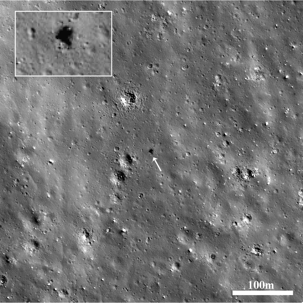
Surveyor 7 (center) - last of the unmanned series, and landed furthest from the equator, north of Tycho (40.980°S, 348.491°E), January 1968. LROC Narrow Angle Camera observation M119936760LE, LRO orbit 2808, February 4, 2010, from 46.32 km. The distinctive square solar panel and mast casts a long shadow. Resolution 53 cm per pixel, spacecraft and camera skew toward target was nearly 20 degrees [NASA/GSFC/Arizona State University].

Can you located the "seemingly" big rock and craggy crater in the television mosaic returned by Surveyor 7 in the 2010 picture above? Can you see the shadow cast by the square solar panel standing on a mast above the Surveyor tripod landing platform?


Thanks to Sam Lawrence of Mark Robinson's LROC team at Arizona State University for maintaining an excellent, definitive list of human artifacts they have managed to locate on the lunar surface, using the Narrow Angle Camera (NAC) on-board LRO. By the time the scene above was imaged, on February 4, 2010 (zipping overhead at around 1.6 km per second, from an altitude of only 46.32 km), Surveyor 7 had been sitting on the Moon here, north of the Tycho for 42 years, 25 days, 14 hours, 25 minutes and 57 seconds. That means Surveyor 7 has been patiently sitting here through 568 blistering hot lunar days and super-cold nights, exposed to virtual vacuum and continuously bombarded by cosmic rays, solar wind and micrometeorites.

Because we have a documented record of the spacecraft's condition, up until losing contact with it 65 hours after its arrival here, and especially prior to its launch, chance are good Surveyor 7 (like other human artifacts on the Moon, located in a variety of places that may experience slightly different conditions, holds a pretty valuable record as a Long Duration Exposure Facility, something worth preserving for very close examination. Though this same situation - on a much shorter time scale - went into the decision to land Apollo 12 at the earlier landing site of Surveyor 3, this was secondary to testing Apollo's ability to land at a pre-determined target, and not just somewhere close. This test was a phenomenal success, vital to later missions that would land in tight spots, after negotiating their way over mountain ranges. When Conrad & Bean retrieved the television camera and robotic arm from Surveyor 3, they were examined with microscopic precision, over the course of nine months.

The report (large .pdf) proved to be a cautionary tale for future missions with the purpose of preserving these priceless baseline records of decades of exposure, some likely to be very delicate. Whether there was any accumulation of dust from the dynamic lunar exosphere on Surveyor 3 was impossible to discover, though that might also have been lost in handling anyway. Though, again, the value of Surveyor 3 as a LDEF was secondary to the Apollo 12 mission, it was eventually found that what minor pitting and paint blistering found on these parts were probably a result of the high velocity dust and debris kicked up by the descent and landing of Apollo 12. Even if Conrad & Bean had landed even closer to their intended target, a little shorter of the shallow crater where Surveyor 3 had been for thirty months, a similar contamination was inevitable.

Because of what has been since been surmised about the likely dynamism of the lunar exosphere, the migration of charged dust, and also because of a far more lengthy record of all the other conditions experienced by Surveyor 7 and the other artifacts - particularly those soft-landed - it's now considered important that future missions arrive from what once would have been considered a very great distance. Approaching these valuable "LDEF's" slowly, low to the ground is mandatory. It's also accepted that the infamous dust and debris fans kicked up by the arrival of manned and unmanned landings accelerated many particles to orbital, even escape velocity. Even arrivals at a modest distance, just over the horizon, is now considered certain to complicate a record waiting to teach us about the conditions on the Moon over an appreciable period.

As an aside, on March 21, 2010, I speculated the following image might also be of Surveyor 7. But, after a close examination it's clear I was mistaken. And after taking a look at the entire frame from which Sam Lawrence's definitive identification above was cropped, there are natural objects in the vicinity that, under the right illumination, might look a lot like the still-strange (to me) looking "thing" found in M111668133LE.

Wednesday, April 7, 2010

LROC: Each crater tells a story


The unusual shapes of craters at the Flamsteed Constellation Region of Interest provide information about the thickness of the lunar regolith in this region. Image M111877836LE; scene width is 200 meters (LROC Featured Image, April 7, 2010, depicts 500x500 (0.5 m/p) meters, here) [NASA/GSFC/Arizona State University].

Brett Denevi
LROC News System

Browsing around the Flamsteed Constellation Region of Interest (ROI), you might notice that a lot of the craters here have odd features, including flat floors, raised floors, or rings that look like one crater nested within another. In the image above, the crater in the middle top displays a ring within its main (degraded) rim, and the crater just below it has a flat floor, compared to the typical bowl-shaped craters in the surroundings. These type of features occur when a crater forms partly in rocky material and partly in regolith. The term regolith refers to all of the fragmental material - dust and rocks of all sizes - that covers the Moon's surface and is created by impact events which continually pulverize the bedrock. When planning for lunar surface activities, engineers were concerned that this dusty, sandy surface wouldn't be stable for the spacecraft and Apollo astronauts that were to land there, so scientists worked out methods to estimate the thickness of the regolith ahead of time. Using images from Lunar Orbiter and laboratory experiments with a high-velocity vertical gun, a relationship between regolith thickness and the shape of a crater was developed. If the regolith is thin compared to the depth of the crater, the crater forms an inner ring. If the regolith is a little thicker, the crater develops a flat floor, and if thicker still then the crater is bowl-shaped.


WAC monochrome observation of the Flamsteed Constellation Region of Interest. Arrow indicates location of NAC image above and Flamsteed crater (20 km in diameter) is at the lower left. Scene width is 87 km; image M117779352ME [NASA/GSFC/Arizona State University].

The crater shapes in the Flamsteed Constellation Region of Interest demonstrate that the regolith is very thin (on average just a couple meters thick). This is because this is the site of some of the youngest volcanism on the Moon, and since the surface is younger, it hasn't had as much time to get beat up by impacts. Visiting this site with human explorers would provide a good opportunity to sample the bedrock beneath this thin regolith, and could give insight into the duration of volcanic activity on the Moon, and the evolution of lunar volcanism as the Moon aged and cooled.

Astronauts could also visit the nearby Surveyor 1 site and check on the condition of America's first soft lander.

Explore the Flamsteed Constellation region of interest for yourself!


A medium range glance at this latest LROC release of the Wide-Angle Camera (WAC) image M117779352ME detailing the Constellation Region of Interest within the "ghost-ring" of Flamsteed P, demonstrates the proposed Landing Zone (arrow) is only 9.87 km northeast of Surveyor 1, site of America's first soft-landing on the Moon (2.5°S, 316.8°E), June 2, 1966. As mentioned above, the LROC team first posted a close-up Narrow-Angle Camera (NAC) image of the Surveyor 1 spacecraft, as their Featured Image last September 30, HERE [NASA/GSFC/Arizona State University/Google Earth v.3].

Monday, March 22, 2010

Surveyor 6 on the plains of Sinus Medii


Surveyor 6 casting 18-meter long shadow with Sun just 8° above the horizon, LROC NAC image M117501284L [NASA/GSFC/Arizona State University].

Mark Robinson
LROC News System

The Surveyor spacecraft (1966-1968) were designed to characterize lunar surface properties to help engineers design the systems astronauts would use exploring the Moon. Seven Surveyors were launched to the Moon and five succeeded in landing and returning useful data. Surveyor 1 landed in May 1966 and Surveyor 7, the final mission in the series, landed in January 1968.

Surveyor 6 Landed November 10, 1967 in Sinus Medii (0.5°N latitude, 358.6°E longitude), almost dead center on the near side of the Moon. One of its key experiments was measuring the surface chemistry with an alpha scattering detector, which showed the landing area to be basalt, similar to the surface measured by Surveyor 5. Surveyor 6 completed the data acquisition that the Apollo program needed and thus allowed Surveyor 7 to be sent to a site that was of higher scientific interest.

(Surveyor 4 was only 150 seconds from landing at the future landing site of Surveyor 6 the previous July when all contact was lost with the spacecraft during the terminal descent firing of its retro-rockets. Although it is believed Surveyor 4 exploded at that moment its official impact point, and a possible candidate for a LROC search for wreckage, is within 4 kilometers of Surveyor 6.)

The Surveyor 6 spacecraft survived one two week lunar night, but no significant data were returned after contact was reestablished on December 14, 1967.

Surveyor 6 panoramic view looking across a nearby boulder strewn crater rim.

A second panoramic view obtained by Surveyor 6.

Near the end of the nominal two week mission NASA engineers commanded the Surveyor 6 engine to fire for a few seconds. The spacecraft rose about 4 m above the surface and landed about 2.5 m from its original landing spot. This was the first successful liftoff from the lunar surface. And perhaps the only spacecraft to land twice on the Moon.

Diagram of the 6.5 second flight, or hop (diagram from the Boeing Company)

A quick note on lighting conditions.

Due to the Moon's slow rotation, the solar incidence angle is always changing at a a given site as LRO passes over. With time LROC can image a feature under varying lighting (from dawn to noon to dusk) thus providing a powerful tool for confidently identifying small features, such as the Surveyors, and fully understanding the subtleties of the local geology.

Surveyor 1 imaged by LROC under two very different lighting conditions. The background image (M122495769LE) was acquired with the Sun 67° above the horizon - the Surveyor is indicated with arrow and enlarged in the top inset. The lower inset shows the same Surveyor imaged with the Sun 14° from the horizon (M102443995LE) [NASA/GSFC/Arizona State University].

Images taken towards noon emphasize subtle differences in albedo (apparent reflectance or brightness) while images taken with the Sun low to the horizon bring out topography. From the high Sun images we see at all landing sites (Apollo, Surveyor, Luna) that the blast from the descent engines locally changed the surface albedo to varying degrees. This effect is mostly likely due to the engine plume rearranging dust particles of different sizes. The magnitude of the effect may be different in the highlands vs the mare.

LROC Images of Surveyor 1, LROC Image of Surveyor 3 and Apollo 12 & LROC Image of Surveyor 5.

Sunday, March 21, 2010

Surveyor 5: A hole-in-one


Surveyor 5 (At least we found the right image), swept up by the LROC narrow-angle camera on-board LRO during orbit 870, September 4, 2009, from 122.38 km over the southeastern Sea of Tranquility. (Three cheers to the LROC team for not leaving us hanging out on a limb for very long, also for superior patience and eyesight). The JPL-operated robotic lander built by Hughes Aircraft sits silently within the rim of a 10 meter crater (1.41°N 23.18°E) ~24 km northwest of Tranquility Base. (LROC NAC M106726943LE, resolution 1.24 m/p, width ~480 meters [NASA/GSFC/Arizona State University].

Mark Robinson
LROC News System

Surveyor 5 landed on Mare Tranquillitatis on September 11, 1967, in what must have been a harrowing touchdown. As pictures arrived on the ground it became apparent that the spacecraft had landed on the steep slopes of a small impact crater. After careful analysis of the images, including star field pictures, the Surveyor team was able to determine that the local slope was 19.7°!

Surveyor 5, area of LROC NAC image M106726943LE enlarged 4x [NASA/GSFC/Arizona State University].

The spacecraft performed all its assigned tasks, returning thousands of detailed pictures and measuring the chemistry of the soil. Less than two years after Surveyor 5 landed Neil Armstrong and Buzz Aldrin set down Apollo 11 Lunar Module Eagle less than 30 kilometers away, and gathered samples with chemistry similar to those measured by the Surveyor.

Find Surveyor 5 for yourself in the full resolution NAC image M106726943LE.

LROC Image of Surveyor 1; LROC Image of Surveyor 3 and Apollo 12; LROC Image of Surveyor 6.

Friday, March 19, 2010

Surveyor 5?

Updated Saturday, March 20, 2010 0245 UT
Is this Surveyor 5? We won't stake any reputations on it, but it fits the profile as recorded in post-mission reports. The high-sun image of the official location, barely more than 20,000 meters north-northwest of Apollo 11, makes a dicey identification. At 1.4 degrees north of the equator, little if any shadow is cast and the resolution of this commission-phase LROC image is around 1.2 meters per pixel, leaving little detail. Later images, with twice the resolution, all fell just beyond this official location. This Surveyor might be an interesting future landmark for missions to study the landing site Apollo 11 without disturbing that area, though even a landing here would have some impact on the "pristine" conditions at Tranquility Base [NASA/GSFC/Arizona State University].

Editor's note. Knowing full well the full cycle of the Surveyor saga, we earlier erroneously labeled this posting as a speculation concerning a possible sighting of Surveyor 7, and the last in the series, which of course landed north of the rim of Tycho. It was Surveyor 5 that landed 23.9 kilometers northwest of what would eventually become the landing sight of Apollo 11, 22 months and 9 days later (September 11, 1967). We're just glad no one had to point out the error to us.

Thursday, October 1, 2009

Lonely Sentinel Abides


Surveyor 1
- Compare this inset, lifted from an image swept up by the Narrow Angle Camera (NAC) on-board the Lunar Reconnaissance Orbiter (LRO) over Oceanus Procellarum (M102443995L - Orbit 272, 17 July 2009) last Summer, with the image from Lunar Orbiter III (III-194-H3 - miraculously restored by the Lunar Orbiter Image Restoration Project (LOIRP) and released 11 Sept.) photographed originally on 22 Feb. 1967.

LOIRP's restored image from Orbiter III was just referenced here two days ago ("Lonely Sentinel," 07:28, 29 Sept. 2009).

Forty-three years after landing on the Moon America's first lunar lander seems none the worse for wear though it might (or might not) seem a little "dusty." That's likely an illusion since the Sun's rays on the landing site were arriving from a direction opposite that seen by LO III back in February 1967.

It's important to find out if it is even a little dusty, though. Because, unlike Mars, there is no native wind to blow dust around on the Moon. For it's finest sub-micron sized silica shavings, though, there is something else. Charge particles from the Sun, mostly, along with cosmic rays, and a warp and woof of magnetic fields from Earth's magnetotail, the Sun's interplanetary field and, here and there, lunar magnetic anomalies in the crust of the Moon, some strong enough to shield the surface within them from solar wind and fallout, all of whom may interact with those tiny particles. Appearances aside though, the Moon's incredible and enduring history of bombardment (conveniently, perhaps, at precisely the same place in the solar system occupied by Earth) is faithfully recorded in billion-year units.

It's been estimated that it takes a mere two million years for the top few millimeters of the lunar surface to be reworked, or "gardened," by micrometeorites. Forty-three years on the Moon shouldn't change things very much, as borne out by forensics done on artifacts removed from Surveyor 3 by Conrad and Bean (Apollo 12) in 1969.

This little squat, three-legged aluminum vehicle built by Hughes Aircraft and operated by the Jet Propulsion Laboratory, once handled by Eugene Shoemaker, is not just an interesting relic of "cultural" significance.

It's important to remember Surveyor 1 is, by rough calculation, currently rotating into its 580th two-week-long blistering lunar day. This would also include 1,158 five-hundred degree thermal swings in and out of 579 equally-long and very cold lunar nights since its soft landing 26.2 km south of the north ghost ring of 100 kilometer wide Flamsteed P crater, on 2 June 1966.

I doubt Surveyor 1 carries much, if any, in the way of a patina of dust but even a very little would merit close examination. Even if it were hardly visible, it would take very little in the way of human activity to inadvertantly wipe such a tenuous record away, and that's the ironic thing. What is needed to gain such a close examination of that record is almost certain to wipe it away.

If even the most thin kind of dusty evidence of such a record existed it might explain a great many things, as Larry Scott and I suggested in 2008, for example. Native lunar magnetic anomalies repelling around electrically-charged dust as precipitation might explain an apparent slowing of predicted "optical maturity," so-called albedo Swirl phenomena, for example, at Descartes, Reiner Gamma, Goddard, Mare Ingenni, Gerasimovich, etc. It would solve the mystery of how certain areas of the Moon retain their youthful appearance superficially long after the 900 million year maximum period these surficial magnetic fields could protect the surface nearby from the darkenning caused by solar wind.

Over a very, very long period of time, such a predictable pattern of sub-micron-sized dust levitation and regular fallout might also explain those elephant-skin pattern we can see criss-crossing so much of the lunar surface.

Be that as it may, that would be too easy, would it not?

This week, two more teams threw their hats into the ring and made for an even twenty groups in total competing for the Google Lunar X-Prize, while in the same period two images taken from lunar orbit, 42 years apart, have been released showing Surveyor 1 standing guard over Oceanus Procellarum.

Then, to top things off, in recent days evidence from the EPOXI probe has added weight to mounting evidence of minerally-bound water "widespread" on the Moon, as uncovered by NASA's M3 radar flying on India's Chandrayaan orbiter. And this evidence from EPOXI shows this Moon water involved in some process directly related to the position of the Sun, a dynamic process that ebbs and flows with the Sunlight.

The reason for NASA's LADEE lunar probe, now scheduled for launch in 2012, is to seek out and help us understand, once and for all, whether lunar dust, which is continously created by the hammer of that 2 million-year long cycle of micrometeorite "gardening," really levitates off of the surface and eventually falls out all over the Moon.

Perhaps Surveyor 1 really is blanketed with dust, and water must be considered to be part of the mix now, also. All of which leads me to another more practical point raised by Scott & Raupe (2008). Because Surveyor 1 soft-landed on the Moon it presents scientists with what might be the best "Long-Duration Exposure Facility" on the lunar surface, not a lot different than those swaths of material regularly deployed outside the International Space Station, or the legendary LDEF satellite deployed from the Space Shuttle in the 1980's.

I should add that the Soviets soft-landed on the Moon first, placing Luna 9 down in the western Oceanus Procellarum a full five months before Surveyor 1. But there remains some doubt as to where exactly it sits because the spare TV stills returned from the petal-type lander don't show some prominent parts of the landscape many believe should have been visible where the Soviets said that it was landed. LRO 's NAC will likely solve that mystery once and for all, before long, and Luna 9 should be afforded the same value recommended here for the first Surveyor.

We know with great precision the materials and methods used to build, launch and land Surveyor 1. It's therefore a very precious artifact waiting to answer questions we know more than even need answering. It can tell us what's been happening on the mare-flooded basin floor near the Moon's equator for nearly half-a century.

We know Conrad and Bean retrieved the TV camera and scoop from Surveyor 3 after the latter had only been sitting in the huge expanse of Oceanus Procellarum 600 kilometers to the east of Surveyor 1 after only 31 months of exposure to the lunar exosphere, a period that began with its landing 20 April 1967 (UT) and ran until Apollo 12 came to a rest only 150 meters away nearly 40 years ago, 19 November 1969.

LRO has already taken a very respectable image of that LZ showing Conrad & Bean's boot tracks to the older lander and around the crater where Surveyor 3 came to rest.

Their precision landing was intentional, of course, and an important goal for Apollo 12. So was retrieval of the Surveyor 3 TV camera and scoop. Unfortunately their landing of the Intrepid precisely on target took a higher precedent over preserving the integrity of the Surveyor 3 artifacts.

The 1971 forensic analysis of the Surveyor 3 artifacts by Hughes Aircraft, Inc. , which is still available on-line via NASA's National Space Science Data Center (NSSDC), is fascinating reading carrying with it a stern lesson for Google Lunar X-Prize teams hoping to land near an artifact of 20th Century lunar exploration for the sheer fun, skill and interest this would generate and to win an extra $10 million as a bonus prize offered through the competition.

The thorough examination of the parts from Surveyor 3 retrieved by Apollo 12 showed surprisingly little weathering, and only a single pit, a dot-sized ding on the TV camera as evidence it had ever left Earth at all.

That ding was eventually traced to a micro-fine "sand blast" delivered by the Descent Stage of Apollo 12's Lunar Module as it hovered and Conrad steered to what he hoped would be a point well away from the Surveyor. The damage was done regardless, and investigators eventually concluded whatever might have once laid dormant on the Surveyor was dispatched by the thrust of Apollo 12 arriving from the east.

Perhaps more fascinating was a brushed steel blemish on the TV camera that amounted to little more than a "discoloration." Though investigators tried to find a natural cause, including exposure to the merciless Sun, that too was traced to the arrival of Apollo 12.

So the lesson for those not wanting to spoil the science possibly made available through a careful approach and an eventual complete modern examination of the long-duration exposure experiment we know as Surveyor 1 (or Apollo 11 or 12, for that matter) is to "arrive at a distance and approach from the ground."

When Apollo 11 left the lunar surface a few frames of grainy film appears to validate what Buzz Aldrin says he witnessed in stark contrast as he watched out of the same window. He has no doubts, anyway, that the first flag of the United States on the Moon, erected over the Helium-3 rich regolith of Mare Tranquillitatis only briefly withstood the initial blast from the Lunar Module Ascent Stage before it was blown to the west of the landing site at great speed.

It has since been admitted that the thrust from any landing vehicle at the Moon, given what we now know to be true about the nature of lunar dust, must propell at least some of the surface dust to escape velocity, with slightly more actually reaching orbit or entering ballistic paths with apogees as high or higher than the Command Module orbit, in the case of Apollo.

Given what we learned in that era a high percentage of the science to be gained from an examination of Surveyor 1 may be of a very delicate nature and highly valuable. This is just as likely for all those artifacts with the most recognizably preserved profiles, the most intact of the seventy-plus artifacts waiting patiently on the Moon to finally offer a report of their destinies.

Finding a way to land even a small lunar lander anywhere near these highly valuable artifacts without wrecking what may be an accumulated valuable record will require some thoughtful planning.